Planning a Plantation: Jobson’s 1589 Map of Munster Part 2

As I said in Part 1, this map was made to provide information for the purposes of plantation – that is, colonisation – of Munster, and in particular of those lands forfeited by the Desmonds after their ill-fated rebellions. Jobson, the cartographer who signed this was, according to Andrews, an enthusiastic map-maker who was unusually determined that his maps would survive. Accordingly, he made copies and presented them to likely future employers – hence this one, inscribed to Lord Burleigh, faithful and long-serving eminence grise to Elizabeth 1. That’s herself, below. (Full citation for the map is at the end of the post.)
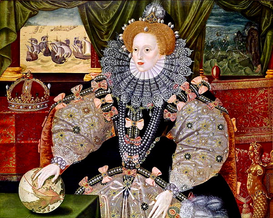
Andrews says of Jobson:

He also showed unusual zeal in presenting duplicates to likely patrons: no one was going to deprive posterity of a Jobson map by “borrowing” the only copy. Other features of his complex cartographic persona were more distinctly Irish, such as his deceptively slapdash-looking style and his apparent ignorance of earlier Anglo-Irish cartography.

Colonial Cartography in a European Setting:The Case of Tudor Ireland
J. H. Andrews

Much of the ‘slapdash’ nature of the map can be explained when we realise that this map, in fact, was a reduction to small scale of detailed townlands surveys that he, Jobson, and others had carried out, and that he obviously had not been able to make all his observations ‘on the ground’ for whatever reasons. The map was studied in the late nineteenth century, along with a host of other evidence by W H Hardinge. He starts his paper, read to the Royal Irish Academy in 1891, by giving the background to the maps: 

So soon, however, as the Queen and her Council decided upon establishing, under certain conditions and limitations, a plantation of her English subjects upon these forfeited territories; and for that purpose determined to grant them out to undertakers, in scopes of twelve, ten, eight thousand, and a lesser number of English acres, it became indispensable to the interests of the crown, as well as to equity in the distribution of the lands amongst the undertakers, to have the area of each town accurately measured, ascertained, and laid down upon a plot or map. Accordingly, I find a commission to that end, bearing date the 19th June, in the twenty-sixth year of the reign of Queen Elizabeth [1584], accompanied by minute instructions from the ministers and lords of Her Majesty’s Privy Council in England addressed to Sir Henry Wallop, Knt., under-treasurer of Ireland, and to other commissioners there, of whom the auditor-general, and the surveyor and escheator-general were two; authorizing and requiring them to make special inquiry in relation to said forfeitures, to measure the demesnes, and to reduce acres to plow lands, according to the custom of the country, and to value the acres rateably according to perches. The survey was completed in the year 1586, and must have been returned into England, as ” The Plot from England for inhabiting and peopling Munster” was soon afterwards sent to the lord deputy. And, further, a very large proportion of the principal plantation grants were passed under the great seal of England almost simultaneously, based upon that survey, and which could not have been so passed unless the guiding information enabling the distribution had been on the spot.


On Mapped Surveys of Ireland Author(s): W. H. Hardinge and Ths. Ridgeway
Proceedings of the Royal Irish Academy (1836-1869) , 1861 – 1864, Vol. 8 (1861 – 1864), pp. 39-55 Available here

Hardinge then goes on to comment on Jobson’s Map of Munster:

In a long and expressive marginal note, Jobson sets out his services, stating “that he was three years in her majesty’s service, surveying and measuring part of the lands escheated to the crown in Munster ;” and further, “that Arthur Robinson and Lawson were employed on same survey.” The map in question is genuine, and clearly a reduction by Jobson from the townland surveys, made in pursuance of the pre-recited commission, as a gift likely to be acceptable to Lord Burleigh. 

From such accumulated evidence, I concluded that there must have been mapped surveys accompanying the inquisitions and books of survey; and that nothing less could satisfy the exigencies of the plantation – a work that was to be guided by a measure of land up to that time unknown in Ireland, and by a scale of crown rent imposition of three-pence per English arable acre. 

In a further note, he cites the cost of the survey as £2,900 – this translates to about £700,000 in today’s money.

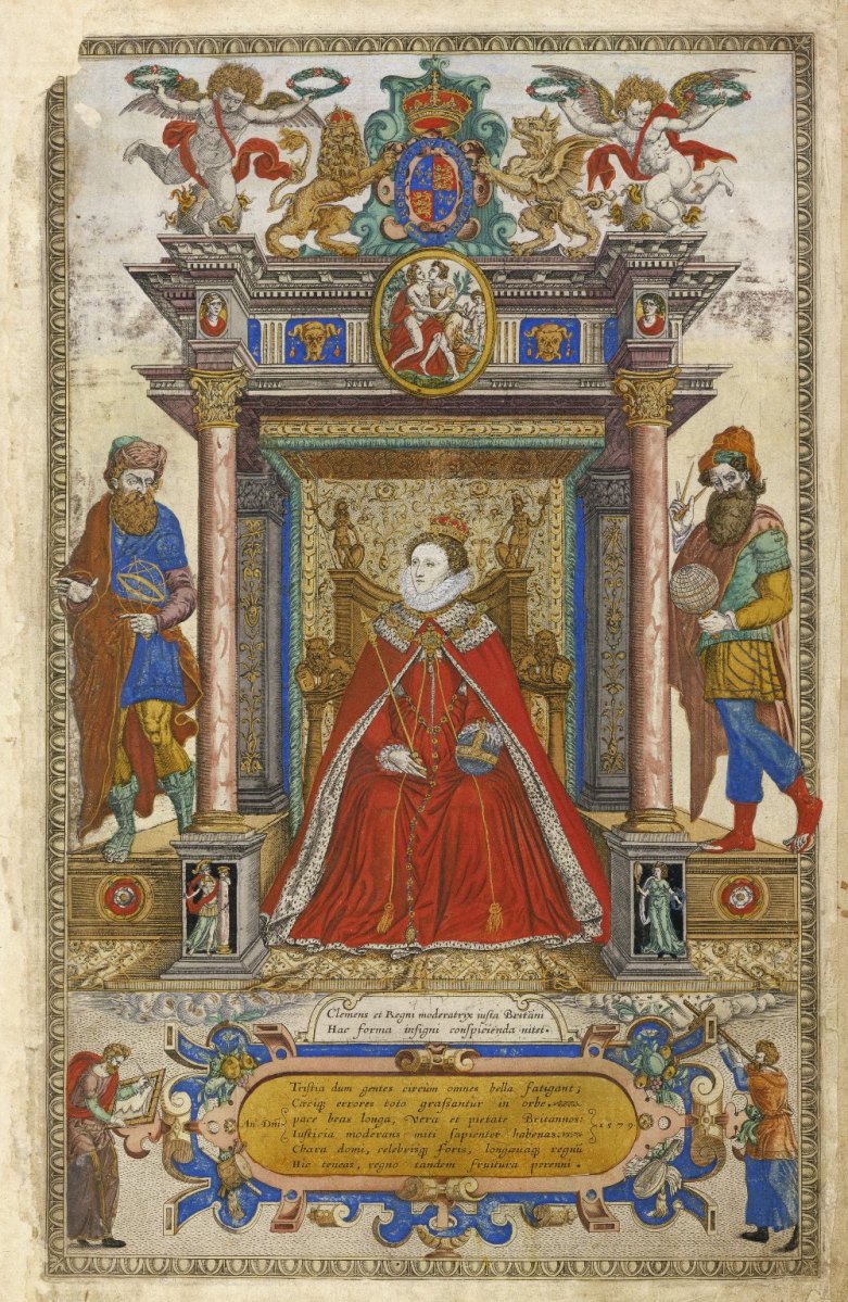
This is the frontispiece to Saxton’s Atlas of the Countries of England and Wales. Christopher Saxton was one of the premier Elizabethan cartographers and in this glorious illustration he is showing how indispensable maps and map-makers are to Elizabeth and to the world. Source Wikimedia Commons

Munster in this map refers to the counties of Waterford, Cork, Kerry and Limerick, rather than the present-day province which also includes Tipperary and Clare. Let’s take a closer look now at some more elements of the map, starting with the section on the counties of Cork and Kerry. Two peninsulas (yes – only two!) are clearly delineated, surrounded by galleons. Note the two crests, one with a harp and the other with the English cross of St George, both bearing the regal motto of Honi Soit Qui Mal Y Pense.

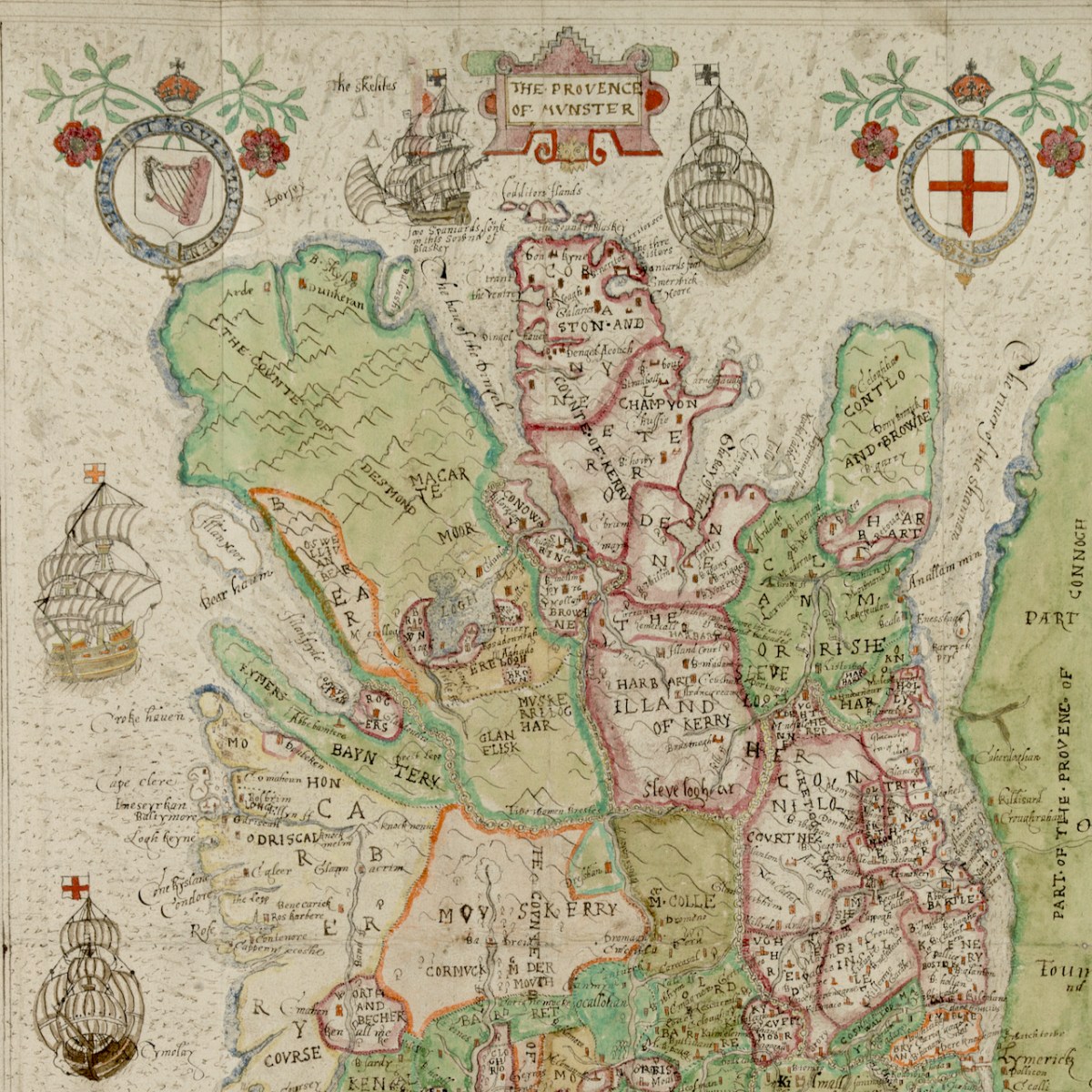
Honing in to take a closer look at the green area (below) labelled the Counte (County) of Desmond we see that the principal families names are Macarte Moor (McCarthy Mór)), who were the overlords of West Cork, and O’Swellivan Bear (O’Sullivan Bear) on the south coast. Below is Donal Cam O’Sullivan Beare – the very man named on the map – read more about him in An Excursion to Dunboy.

Bere Island is Illan Moor (Illaun Mór, which is its traditional name – Large Island – as it is, in fact, Ireland’s largest island). Whiddy Island is called Illanfoyde, and is assigned to the O’Sullivans. All around Bantry is assigned to Rogers, a completely unfamiliar name, although one of our commentators last week noted that there is a strand there called Roger’s Strand!

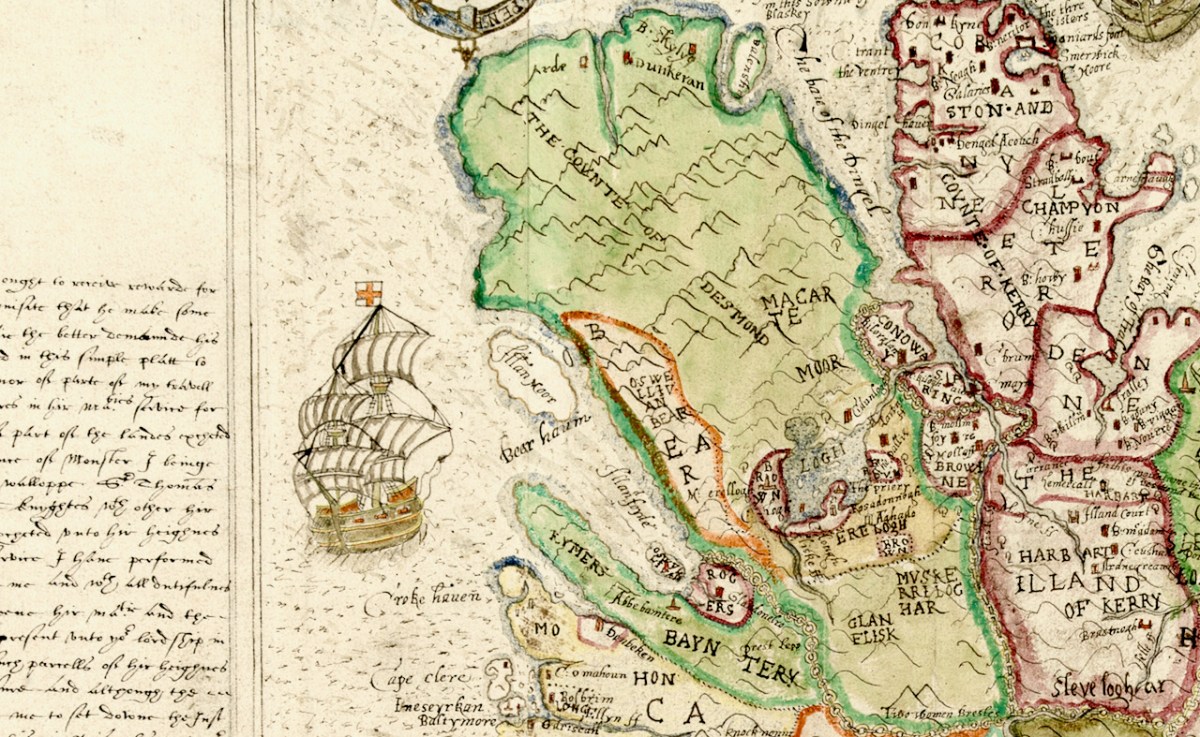
That whole green area is odd, though, isn’t it? In fact, the Beara and Iveragh Peninsulas are shown as one large landmass, with the Beara marked off by an orange line. Here is the surest evidence we have that this map was not drawn on the ground (or by sea) using actual observations and measurements. The coasts and hinterland of both these peninsulas must have presented formidable obstacles to cartography and reminds us that mapping was a dangerous profession in Elizabethan Ireland.

The dangers are starkly revealed in an account by the Attorney General who related that Richard Bartlett, ablest of all the Queen’s Anglo-Irish cartographers, was beheaded in Donegal in 1609 “because they would not have their country discovered”.

And if it wasn’t the natives, then it was the arduous work of surveying these wild lands that challenged the map makers. This was highlighted by the story of Robert Lythe, an English military engineer who almost went blind and lame while serving in Ireland from 1567 to 1571.

how ireland was mapped By Rose Mitchell Map Specialist, The National Archives

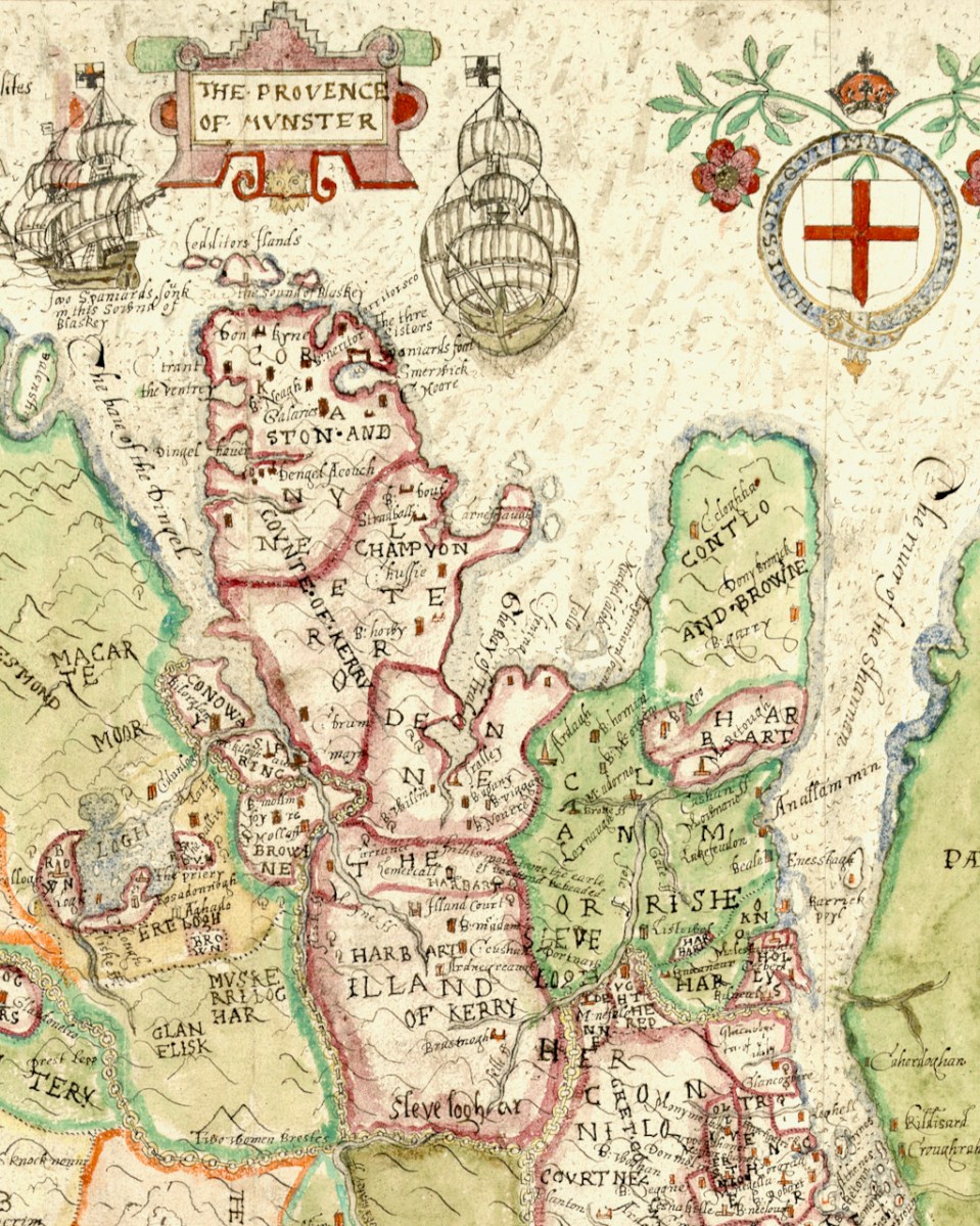
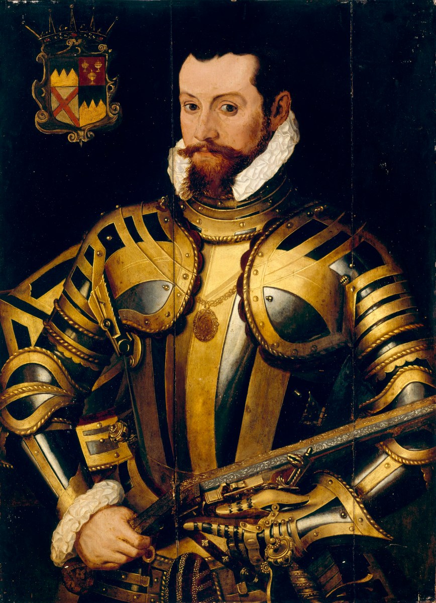
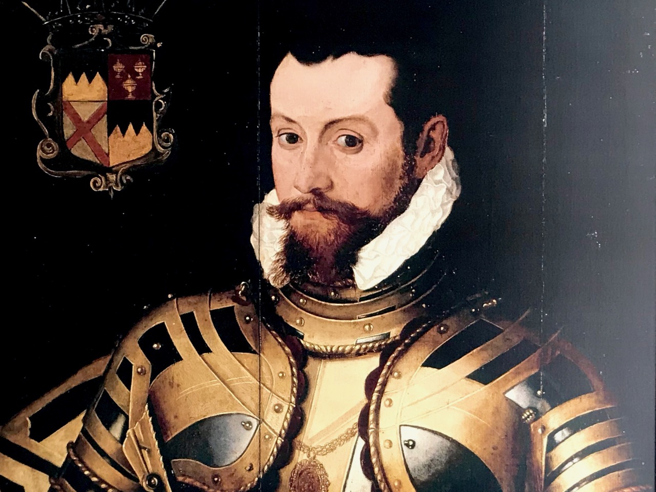
Dingle (in red), however, is a different matter – it has assumed outsize proportions, probably an indication of its importance in the Desmond Rebellions. There are many more place names on it than there are on the green mass. Ventry and Smerwick Harbours are indicated since both were important sites of resistance in the Desmond Rebellions – the barbarous massacre of Spanish and Italian allies at Smerwick was one of the decisive acts in the war, and involved such luminaries on the British side as Black Tom Butler, Earl of Ormond (below), Walter Raleigh and Edmund Spenser. Ventry was where the English troops entered the peninsula.

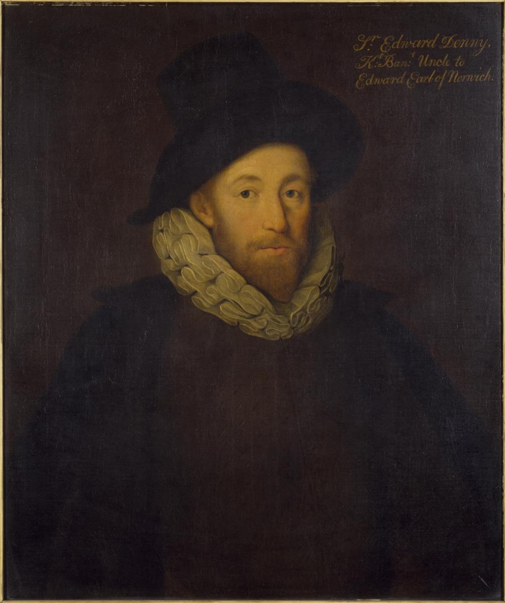
The Bay of Tralee is noted and the area around it is labelled DENE – this refers to the lands granted to Sir Edward Denny (below). I have written about the extraordinary story of the Dennys and their tenure in Tralee – a story that culminated in Ireland’s Newest Stained Glass Window. And by the way – can you see Sliabh Luacra at the bottom of this section – the home of a distinctive tradition in Irish music.

Whew – better end there for today. As you can see. we have barely scratched the surface of what can be gleaned from this map. Perhaps we will revisit it in a future post – but for now I leave you with the tip of the Dingle Peninsula, slightly expanded from the lead image, so you can try your own hand at making out what an Elizabethan planter might have been vitally interested in.

I am grateful indeed to Michelle Agar, Cataloguer, Digital Collections, at the Library of Trinity College Dublin, who gave permission to feature the map from the Hardiman collection in this blog. Also to the kind office of Dr Áine Madden, Communications and Engagement Coordinator with the Digital Repository of Ireland at the Royal Irish Academy. The complete citation for the map is as follows: Jobson, Francis, & Manuscripts & Archives Research Library, Trinity College Dublin. (2021) The Province of Munster, Digital Repository of Ireland [Distributor], Trinity College Dublin, the University of Dublin [Depositing Institution], https://doi.org/10.7486/DRI.rb69b272p

Back to Clonfert

Clonfert is only a couple of counties over from us: we just have to skip through a bit of Cork and Tipperary and there we are in Galway – a tiny corner of it that is shaped by the River Shannon. So, on a Thursday afternoon at the beginning of June, we found ourselves tripping along dead straight boreens – narrow for the most part – taking us through lush dairy lands – on a quest to revisit Clonfert’s medieval Cathedral, and its associations with one of Ireland’s most famous saints: Brendan the Navigator.

As we approached the little settlement of Clonfert, our empty road ahead was interrupted by a small white car, which seemed to travel erratically from one side of the lane to the other, and our arrival made little difference to its progress. As we got near, we realised that there was a wiry Jack Russell ambling along the road in front of the car: it was clear that the terrier was having its daily walk, with the owner driving along protectively behind it, regardless of where its fancy might take it. Ah, sure – we were in no hurry, so we joined the procession and waited as the dog sniffed and shuffled its way back home: eventually, dog, car and owner vanished through a gate, and we had the road to ourselves once again . . . This is life in Ireland, and it’s good!

Clonfert’s grandly styled ‘Cathedral’ is so important historically, yet it could hardly be more remotely situated. From the east (upper picture above) it looks like many another Church of Ireland building, maybe not worth a second glance – unless, like us, you can’t resist examining every unturned stone because there is invariably something unexpected to be found under it. Just turn the corner and have a look at the west entrance door:

That doorway, with its exquisite decoration dating probably from the 12th century, has been described as ‘the supreme expression of Romanesque decoration in Ireland’. The carvings, although suffering from hundreds of years of wear and tear from the Irish elements, still display an extraordinary richness and variety: we can only wonder at the inspiration, skill and knowledge of the carver, who must have been deeply immersed in both lore and craft. Tadhg O’Keeffe, current Professor of Archaeology at University College Dublin, suggests a date of c1180 for this doorway. Records state that the church was burnt during a Viking raid in 1179, the same year in which a synod was held there by St Laurence O’Toole; installation of this imposing entrance may be connected with these events. Finola’s post today also explores Romanesque carvings not too far away, at Clonmacnoise. She has also written on Clonfert’s architecture in her Irish Romanesque series.

St Brendan lived from 484 to 577. We saw his birthplace in Fenit, Co Kerry, a few years ago. He founded many monasteries in Ireland but arranged for his body to be taken secretly to Clonfert Cathedral for burial as he didn’t want his remains to be disinterred by relic hunters. His grave is a stone slab just outside the great west door. On it are said to be the marks of cats’ paws – interestingly linked, according to folklore, with the many carvings of cats’ heads on the doorway arches.

When we first visited Clonfert, many years ago, the cathedral itself was closed and we went away with the impression that we had seen all the wonders that the place had to offer by our explorations of the outside of the building and its setting. We were wrong: on this occasion the door was unlocked and there were unexpected treats hidden for us in the interior.

Further carvings decorate the church walls: they vary in date and style, but all are fascinating. Here is a selection – notice the seemingly random arrangement of heads and animal features on the great 15th century chancel arch, above.

Angels, cross-slabs, a wyvern and, astonishingly, this fine mermaid complete with comb and mirror. I have found very little information to identify why these various carvings are found here in the Cathedral, apart from general legends which suggests links with Saint Brendan.

The carved stone head was found ‘in the ceiling’ when restoration work was carried out in 1985. It is said to date from around 1500, while the ancient and beautiful font is attributed to the thirteenth century. We could linger and feast on further treasures inside the church, but we need to look at the surroundings, which reveal yet more history.

This extract from the 25″ OS map – late nineteenth century – shows the cathedral and some of the landscape features associated with it. We came here a few years ago, when we were researching Ireland’s waterways, following in the footsteps of English writer L T C Rolt. In his book ‘Green & Silver’ we read of his admiration for Saint Brendan, and his determination to find the grave at Clonfert, which he did in 1946. His book is illustrated with photographs taken by his wife Angela, and the one picture from Clonfert which is used in the book is this one of the ‘Yew Walk’ which was laid out as part of the gardens of the Bishop’s Palace, which you can see marked on the map.

Our own photo of the Yew Walk at Clonfert was taken a few days ago. You can see that it survives, although neglected today. Some of the yew trees are said to be up to 500 years old. From the map you can also see that the Yew Walk connected the Cathedral to the 16th century ‘Clonfert Palace’, and was set out as an ornamental cruciform route, suggesting the path that might have been taken by the monks a thousand years ago. When we explored previously, we discovered the ruins of the Palace at the end of the Yew Walk, and wondered why it has been left in this state (since 1954, as we subsequently learned). The answer to that is fascinating, and I urge you to read my full account from that first visit, here. Below is a photo dating from c1950, showing the Palace at that time (with thanks to Dr Christy Cunniffe). My own photos from this week’s visit follow.

Clonfert might have been a very different place today if Queen Elizabeth had been listened to:

 . . . We are desirous that a college should be erected in the nature of a university in some convenient place in Irelande, for instruction and education of youth in learning. And we conceive the town of Clonfert within the province of Connaught to be aptlie seated both for helth and comodity of ryver Shenen running by it . . .

Queen Elizabeth, Letter to the Bishop Of Clonfert, 1579

The Queen’s advice was not taken up, and Trinity College Dublin was established instead – in 1592 – becoming Ireland’s first University.

The site at Clonfert is so interesting – and covers so many periods in Ireland’s history – right up to the 20th century. It was well worth revisiting – and will merit further visits in the future, too. I’ll leave you with one aspect that probably impressed us most this time around. It’s the Bishop’s Throne which is hidden in the shadows of the Cathedral chancel. Carved from oak, most likely in the 19th century, it is a wonderful representation of Saint Brendan himself, surrounded by the Four Evangelists, crafted in the style of the Book of Kells. Look at him, also, on the header. Here is the Irish saint who set sail out on a voyage into the unknown – seeking Paradise – and discovered the World!

Off the M8: Ormond Castle – Fit for a Queen!

It will add an hour to your journey (plus whatever time you spend exploring) if you are on the M8 between Cork and Dublin. Well worth it to visit Ireland’s most splendid Tudor manor house. If you are coming from Cork, leave the M8 at Cahir and go straight across to Carrick-on-Suir. From there you can rejoin the motorway by going north to Urlingford. Vice-versa, of course, if your journey is in the other direction.

Thomas Butler, 10th Earl of Ormonde, 3rd Earl of Ossory, Viscount Thurles is the key player in our story. He grew up with Elizabeth, daughter of Ann Boleyn, whose paternal grandmother was of the Ormond dynasty in Ireland. It’s a bit confusing when researching Ormond history, as the ‘e’ on the end seems to have been added after 1628. Cousins Thomas and Elizabeth had a close friendship: some say that they were lovers. It’s certainly the case that In 1588 the Queen bestowed on Ormond what a poet described as áirdchéim Ridireacht Gáirtéir, ainm nár ghnáth é ar Éirionnach (“the high honour of the Knighthood of the Garter, a title unusual for an Irishman”). And Thomas built his new Tudor styled house on his estates at Carrick-on-Suir, Co Tipperary, as a gift for the Queen: a place for her to be royally entertained when she visited Ireland. (For more on the Butlers in Ireland, read this)

The evolution of a castle – 1. In 1328 the Ormond family stronghold was a fortified house and bawn accessed from the river via a watergate – seen in the foreground (and shown in the model, below, although from a later period). Note the walled garden and estate cottages, town walls and gate tower beyond.

The evolution of a castle – 2. By 1450 the castle has been extended with the addition of two large tower houses, the ruins of which are evident today (below).

The evolution of a castle – 3. This sketch shows more or less what you will see today: Thomas Butler’s 16th century Tudor mansion has been built in front of the tower houses, creating a courtyard behind. Fragments of the earlier structures remain on the river elevation (below).

The Tudor house was magnificent (and continues to be impressive in its partially restored state, maintained by the OPW). It was unlike anything else that had been seen in Ireland previously. Notable features include plaster ceilings and cornices, which are being faithfully restored over time. Because of the delicate nature of the fabric, photography is not permitted within the house at present. The view below is of the museum section, which contains some early features and artefacts.

These photographs (from the museum) show the house in its dilapidated condition prior to being taken over by the Office of Public Works in 1947. Full restoration is an ongoing ‘work in progress’. Although that progress might seem slow, it is being carried out to the highest standards, and the castle is a great historical asset for Ireland.

Another early archive photograph, showing the house prior to restoration

In fact the story behind Ormond Castle is a poignant one. Thomas Butler’s admiration for his childhood companion who became his Queen could well have been unrequited passion. Elizabeth planned to visit Thomas at Carrick-on-Suir on several occasions, but each time affairs of state detained her. She died in March 1603, having never visited Ireland, but leaving in her wake the dreadful effect of generations of martial law and embittered feelings which continued into modern times.

In the hallway of Ormond Castle the depictions of Thomas Ormond and Queen Elizabeth hang facing each other – what should we read into the symbolism of this? Perhaps the model in the museum (below) depicts the imagined meeting that Thomas had always hoped for?

An Irish Shakespeare?

rea druid

Marty Rea giving a stunning performance in Skibbereen as Richard II in Druid Theatre Company’s tour of Shakespeare’s ‘History Plays’

This week we commemorate the 400th anniversary of Shakespeare’s death which occurred on his birthday, 23rd April, in 1616. He was 52. At least, that’s the received wisdom. It’s quite convenient that the two most important events in his life have the same date – we only have the one to remember – and it’s very apposite that this date should also be St George’s Day: St George is thought of as patron saint of England, and Shakespeare is thought of as the greatest writer in the English language – and partly responsible for the flowering of the Elizabethan Age of Enlightenment.

elizabeth

Queen of England and Ireland – the ‘Armada Portrait’ 1588. This painting of Elizabeth I, sometimes attributed to George Gower, is full of symbolism which Shakespeare would have recognised: pearls imply purity, the pomegranate prosperity, the mermaid  ‘the potential destructive nature of females’, and the ruff is shown as a sun halo to depict the ‘Sun Queen’. The paintings show the power of the Navy and its defeat of the Spanish Armada

But isn’t all this a little too convenient? If we believe the history books Shakespeare was a simple soul who was born in rural Warwickshire, the son of a glover who had fallen on hard times. Shakespeare attended the local grammar school, where he would have had a limited classical education. At 18 he married Anne Hathaway, 8 years his senior, and their daughter Susanna was born shortly afterwards. Then he disappeared from the records, re-emerging in London in 1592 where he was described in a pamphlet by Robert Greene as an ‘upstart crow’ flapping his poetic wings. Thereafter he was known as an actor, playwright and theatre promoter, returning to his birthplace to retire and leaving us with the legacy of 38 plays and 154 sonnets. His will bequeathed his ‘second best bed’ to his wife and his estate to his children.

second best bed

Was William Shakespeare a real person? Probably – there are quite a few records of his professional life: but the rumour mill is full of suggestions that he was not the author of his plays! As Ireland is a renowned land of poets and bards, I felt sure that, somewhere, I would find a notion that this particular ‘bard’ had Irish connections… I was right!

meath chronicle

Elizabeth Hickey (1917 – 1999) was a well-known Meath historian and author who lived at Skryne Castle near Tara. Her most famous work is The Green Cockatrice, originally published in 1978 under the pseudonym Basil Iske. In this she traces the career of William Nugent, Baron of Skryne, who lived from 1550 to 1625. According to Hickey Nugent is a very likely candidate for the authorship of Shakespeare’s plays as he ‘…led a life which gave him insights into the kind of political, religious, military, legal and international diplomatic intrigues that populate Shakespeare’s works. For example, he was imprisoned by the state for opposing the cess in Ireland in the 1570s, and he rebelled in 1581, losing a number of supporters to the hangman’s noose and causing him to flee into exile, first into Scotland, then France and Italy – locations which are prominent in Shakespeare’s works. During his exile he met most of the great European leaders, including the Pope, the kings of Spain, France and Scotland, and was involved in Europe-wide planning for an invasion of England…’

Other scholars have suggested that the language use by Shakespeare is, at times, more akin to the English spoken in Ireland in Elizabethan times. One quotes Shakespeare’s character Puck as deriving from the Irish Púca, although the name is also said to have an old English origin. Similarly, Queen Mab  (fairy queen in Romeo and Juliet) is said to derive from Queen Maeve, spelt in Old Irish script as ‘Mab’.

1920px-Joseph_Noel_Paton_-_Puck_and_Fairies,_from_-A_Midsummer_Night's_Dream-_-_Google_Art_Project

Puck and Fairies, from A Midsummer Night’s Dream, Joseph Noel Paton, c1850

I was intrigued to come across a tradition that Shakespeare composed Hamlet while visiting his friend John Dowland at Dalkey near Dublin, and that the account of the shore of Elsinore is actually based on Coliemore Harbour in Dalkey. There is even a house called ‘Elsinore’ in Dalkey: it dates from 1840. There is also in Dalkey a mosaic plaque to Dowland designed by Sarah Purser.

ColiemoreColiemore Harbour in Dalkey – does it look like Elsinore?

If you have an hour or so to spare you might have a go at reading Shakespeare was Irish – I kid you not… in Indymedia Ireland – it’s tongue in cheek but very comprehensive. Tempting though it is to pursue the idea that the man himself might have been Irish, it may be best to move on to consider Shakespeare’s influence today in Ireland. There can’t be a professional theatre company here that hasn’t put on some of the plays at various times. Many productions have received international acclaim: we were fortunate to attend the marathon staging of the ‘History Plays’ by the Druid Company from Galway in Skibbereen last year – four plays in seven hours, including a break for supper. After Skibbereen the tour went to New York where it received rave reviews. We were pleased to hear that the production ‘stole the show’ in the Irish Times Theatre Awards this year, wining in five categories. Later, we chanced to meet Thomas Conway, the dramaturg for the production: he told us it had taken eight years to craft the performance!

purser dowland

Happy Birthday from West Cork, William…