Fort of Gold 2: The Castle

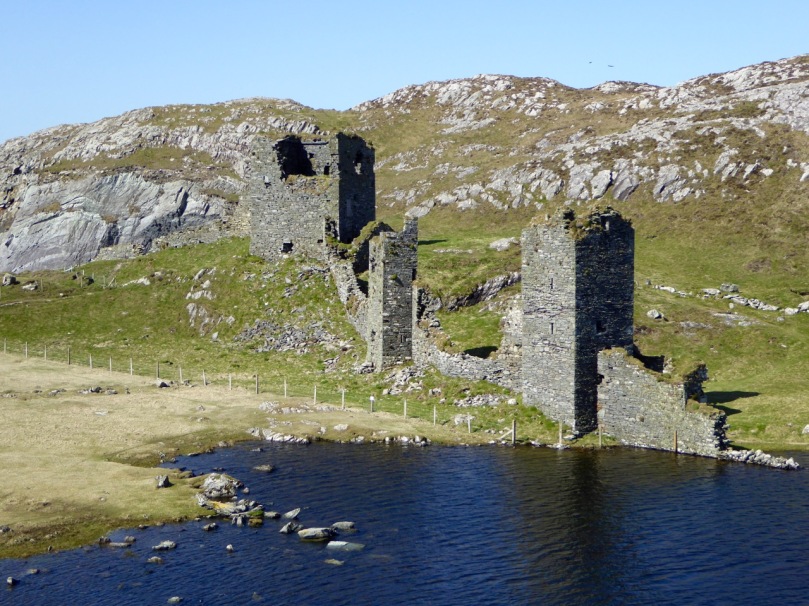
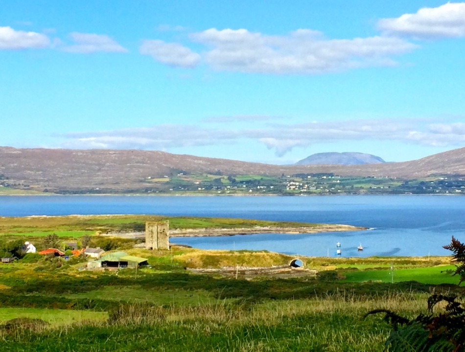
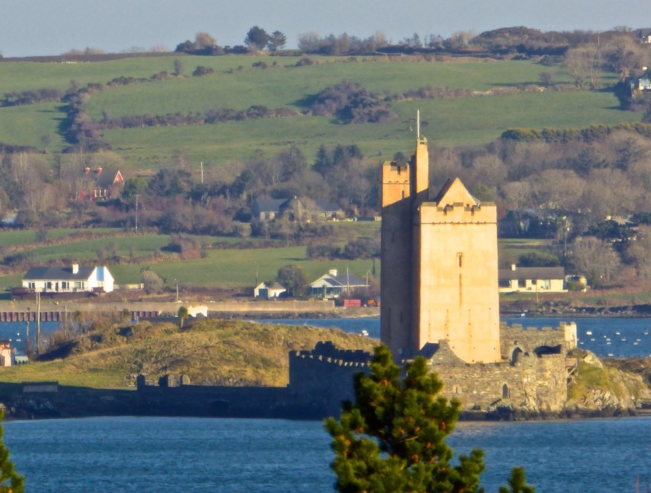
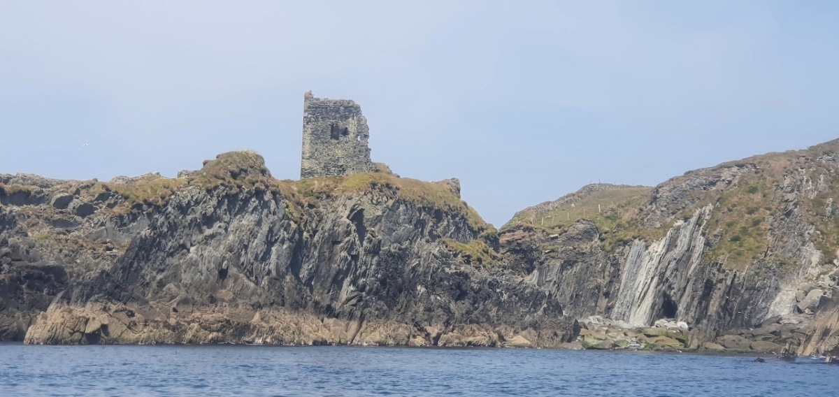
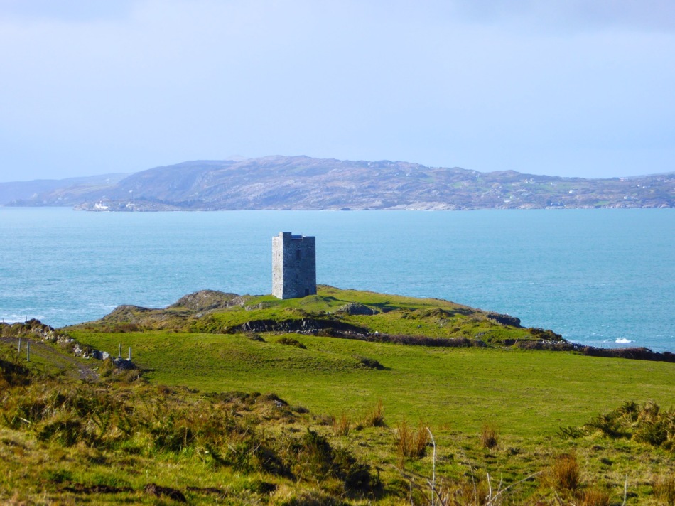
This post will be about the castle itself, as a follow-up to Part 1 about the promontory and historical background. I received some very interesting comments on the name, Dún an Óir, which I interpret as Fort of Gold, and I will write more about that at the end of this post. If you are not familiar with castle architecture, before you start, you might want to browse my castles page and pay attention to how they were built and what the castles of Ivaha generally looked like. Unless otherwise identified, all the photographs in this post were kindly sent to me by Tash, one of our readers. In this one, taken from the sea, the impregnable siting of the castle can be appreciated.

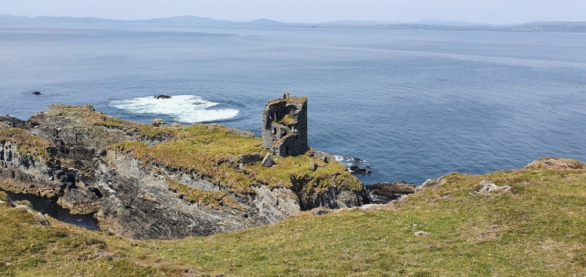
The castle was surrounded by a bawn wall, clearly visible still. Three floors (ground, first and second) were surmounted by a ‘partial vault’, above which was the principle chamber or solar – the private domain of the castle owner and his family but also where visitors were entertained.  Above that was a mezzanine floor and above that again was a wall walk, accessed via a spiral staircase from the main chamber. 
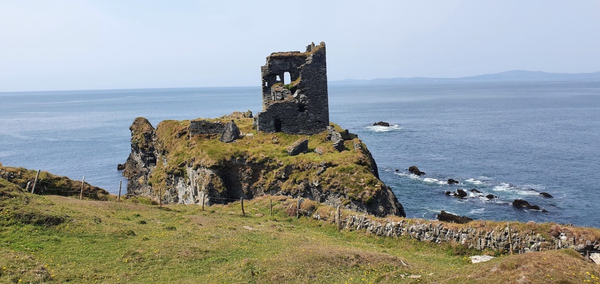
In her paper on this castle*, Sarah Kerr points out that it is, in fact, unlike the other O’Driscoll Castles of Dún na Séad and Dún na Long, and indeed other West Cork Castles, in that it only had one entry, at the ground-floor level. It is possible, she says, that the tower was so well defended naturally by its position, that a raised entry (an additional line of defence) was unnecessary. She also points out that a raised entry functioned as a status symbol, since it was the entry used by the chief to access the private rather than the public spaces within the tower. Perhaps Dún an Óir was therefore a lower-status castle, occupied by a garrison rather than by a chieftain. She provides this plan

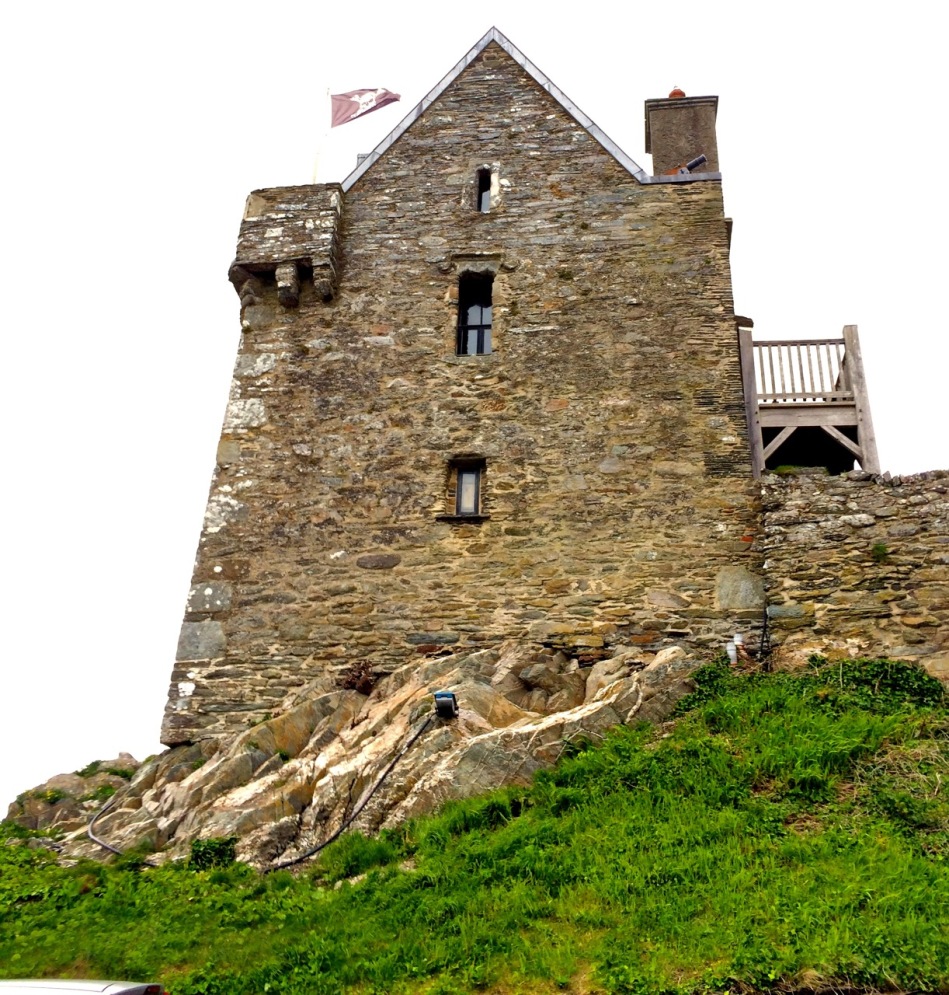
Another unusual feature is the small projecting tower that contained the garderobes. You can see that projecting addition in the plan, above, and in the photograph, below. The entry led up, via a mural staircase to a door giving admittance to the first floor, and carrying on to entries at the second and third floor levels. From there, another stairs led up to the wall walk.
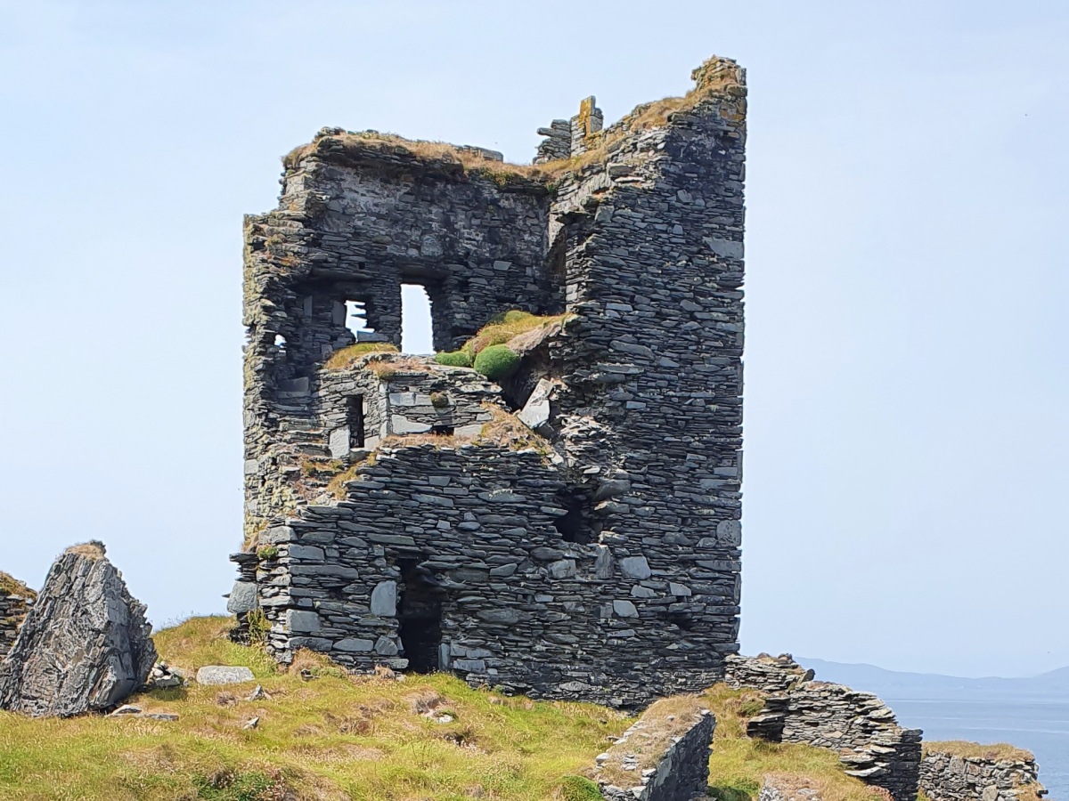
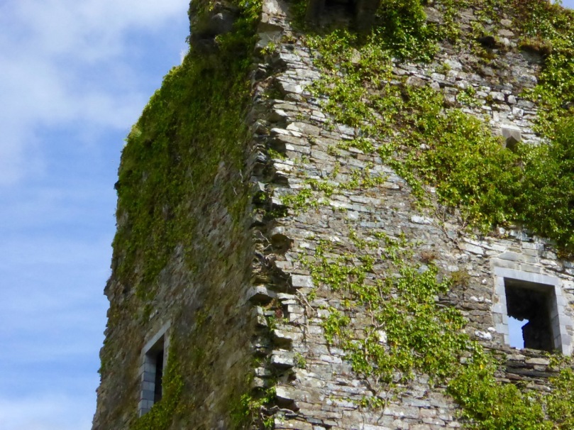
Flat slabs were used to dress the outside of the walls, the same construction method as at Dunlough, although not as finely built. 

Instead of a complete vault, such as we see at Dunmanus or Rincolisky, there is a ‘partial vault’, described by Samuel:

Two free arches resembling ‘slices’ of a barrel vault were built. The gaps between the arches and the walls created were lintelled over with large overlapping slabs. This ‘economy’ vaulting was much lighter than a complete vault. 

The Tower Houses of West Cork by Mark Samuel

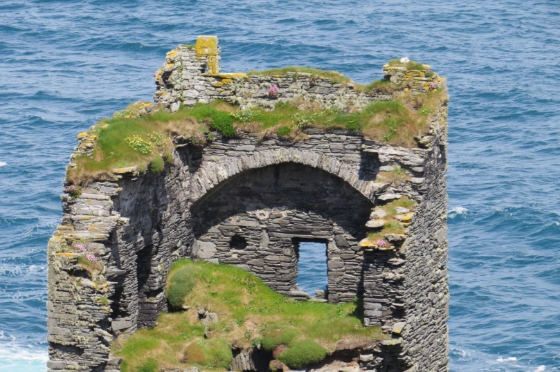
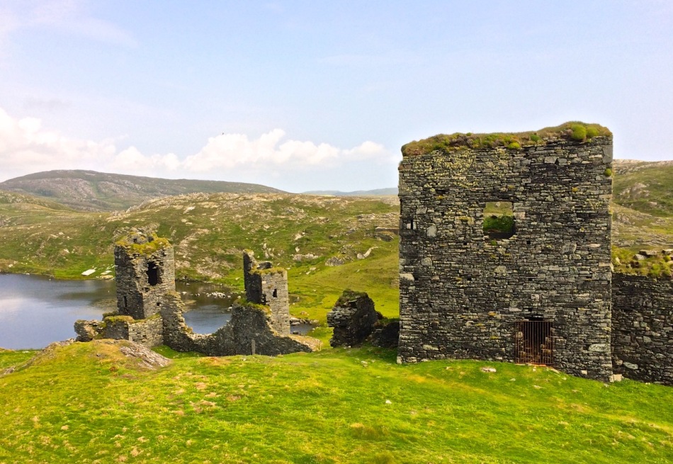
In fact, this type of internal vaulting is not that unusual in West Cork – we saw it at Dunlough and in the small tower at Dunworley. At Dunlough, we can still see many of the large slabs of slate that once bridged the gaps between the arches of the partial vaulting, while at Dunworley the roof is still intact. In Tash’s photograph below you can see the double arches and the full extent of the three floors below them, as well as the chamber above which would have had a pitched wooden roof..
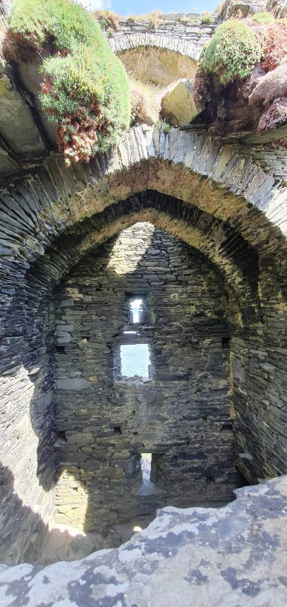
The top room, or chamber, was very high with a pitched roof supported at each end with an archway. The archway also allowed the top of the wall to be kept clear to form a wall walk. A conjectural reconstruction drawing at Ballinacarriga conveys the idea, although Dún an Óir only had one arch, not two.

The battlements have disappeared – they were likely Irish crenellations consisting of stepped merlins and crenels (see here) – but the wall walk can still be discerned. As you can see below, the steps can still be climbed by those brave enough.

Quite a bit of the bawn wall survives, although of course it would have been much higher (possibly as described here). If the sheer cliffs were not enough to deter any thought of attack, the walls would have provided an additional barrier. Unfortunately, they were not able to withstand cannon fire, let alone the passage of hundreds of years. Sarah Kerr has an interesting take on this wall:

Bawns are often considered an additional defensive feature, or at least deterrent. Dún an Óir’s in this regard is somewhat excessive as anyone who could scale the rocky façade of the promontory would likely not be deterred by additional few metres of wall. The bawn, however, would have provided the inhabitants a layer of safety against accidental falls and protection from some of the inclement weather, such as high winds and storm waves from which Roaringwater Bay gets its name. These humdrum practicalities of the medieval lived experience have often been overlooked in castleology or castle-adjacent buildings archaeology, however, it is this very granularity which deepens our understanding of how these buildings worked.


Networked Control: Tower Houses in Ireland by Sarah Kerr
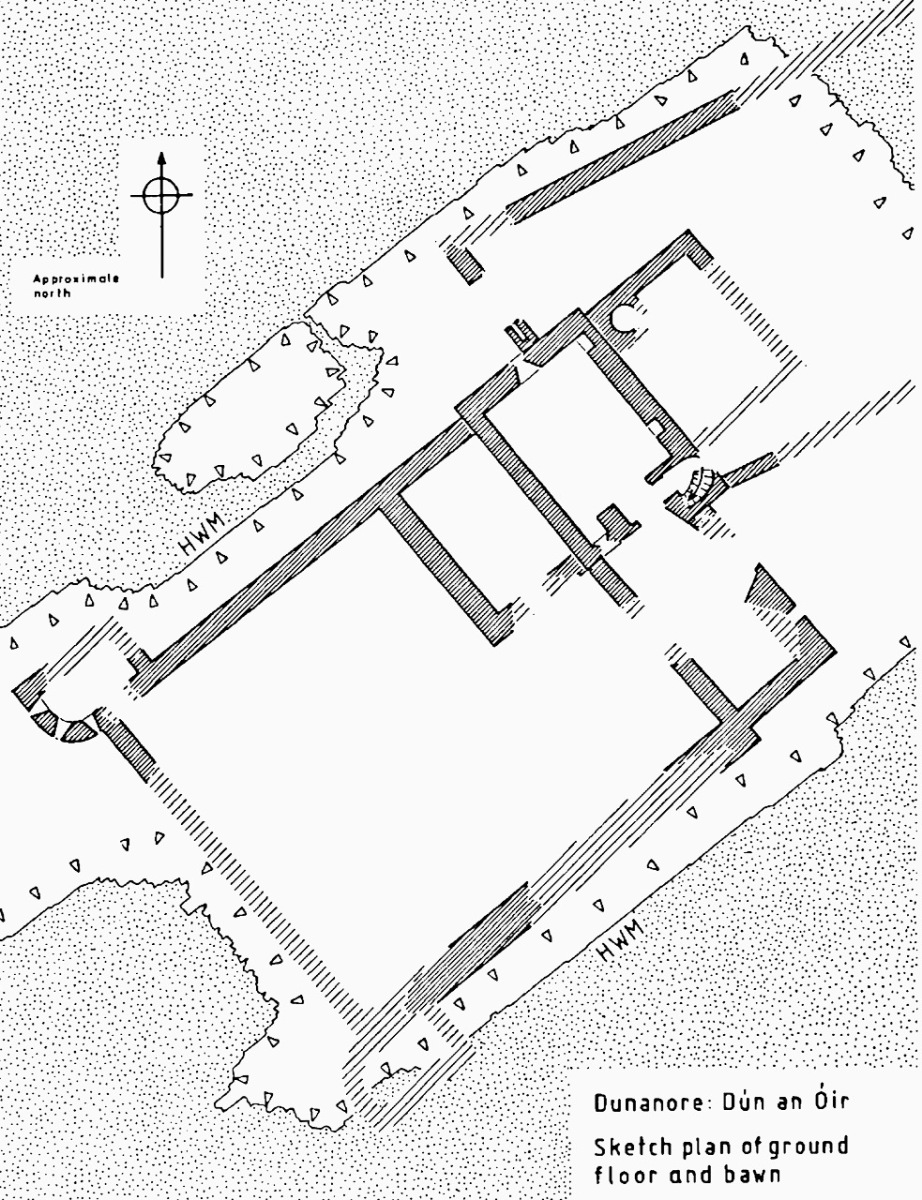
The bawn, in Samuel’s estimation, (that’s his plan above) was big enough to accommodate quite a large herd of cattle. An interesting feature is that of an outside kitchen with an oven, reminding me of what was uncovered at Rincolisky, another O’Driscoll castle, in recent excavations. In the plan above the oven is the circular feature at the north corner of the tower. Other buildings stood inside the bawn, although their purpose is not clear. There may have been a gatehouse, and the ‘possible wall embrasure’ in Kerr’s plan is viewed by Samuel as a corner turret. Samuel lays out what he can interpret of the various walls that surround the castle:

The continuous and well-preserved north wall of the bawn terminates to the west with a return that runs a short distance north before being broken away. This is the inner face, a turret with gunloops which defended the bawn. The curved outer wall enfiladed the mainland with three widely splayed gunloops.

The interpretation of the ruins east of the tower house is more difficult. Erosion has removed the eastermost part of the defences. Two separate walls on the east side of the tower diverge from its orientation; running approximately due east they seem to have formed the north and south walls of a smaller enclosure containing another building. At the west end, the north wall meets a wall (the junction is destroyed) with a gate which abuts the north face of the tower. The robbed jambs of a large gate survive on the east face of the wall and indicates that the gate swung inwards to the west where another enclosure presumably existed. A deep drawbeam is visible in the south jamb. This gate now leads almost directly into a deep ravine. A fair-weather landing stage may have once existed on this side of the island but it would have rarely have been safe to use.


The Tower Houses of West Cork by Mark Samuel

Sarah Kerr positions Dún an Óir in a network of O’Driscoll castles that together worked to control the resources of Roaringwater Bay, to levy fishery dues, monitor trade, and defend territory when necessary. Within this network, the highest status tower, and probably centre of administration was Dún na Séad (Baltimore). The highly visible nature of all these castles, some on promontories and all visible from the sea, were ‘manifestations of authority, wealth and status.’ She posits that: 

Due to Dún an Óir’s lack of a slipway, natural harbour or rock-cut steps, it is unlikely that manging the fish produce was a primary role at this dwelling, particularly as Dún na Long and Dún na Séad were more suited to such tasks. Instead Dún an Óir probably managed the victualing and collection of fees from passing ships, indicating that the tower houses worked in unison. It appears that each tower house had a specific role which complemented one another, as such they were unique actors that performed as a network

Networked Control: Tower Houses in Ireland by Sarah Kerr

It’s surprising how much we can tell from the remains of this once prominent symbol of power. It will never be on a tourist trail and I would not advise anyone to try to access it – but as you can see, Tash and his group managed it.
In response to my first post I had several suggestions for alternate titles on Facebook. Ruamann Ua Ríagáin proposed an alternate interpretation as Dún an Ár, or Fort of the Slaughter. There are no indications that there was any tradition of cattle-slaughtering at this site, nor any record of a massacre. However, it remains a possible interpretation. Another reader, Tom Driscoll found another Dún an Óir which was assumed to come from Dún an Ochair, meaning Fort on the Brink/ Cliff Edge. Certainly apt for this location. Finally, note the long comment on Part 1 by OVERSEASGREATGRANNY who is trying to trace similarly named forts and relate them to Irish history – quite fascinating.

When the storms rage over Roaringwater Bay it is natural to wonder how long this castle can last, isolated on its spit of land and open to the full force of nature. But it is also a comfort to know that the castle builders built it so well that it has lasted now since it was built around 1450 and battered in 1601. Here’s to another few hundred years!
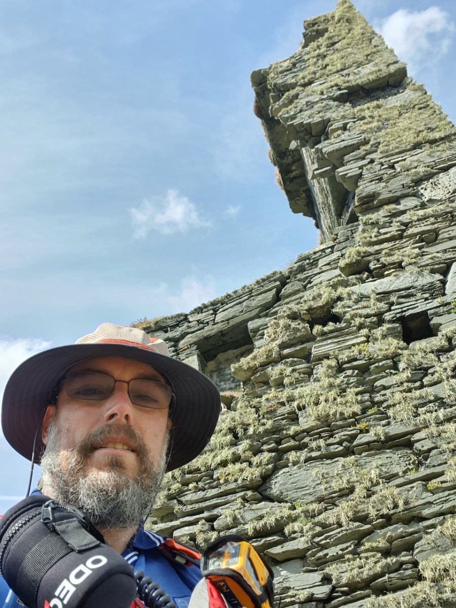
Thanks again for the superb photos, Tash!
Sarah Kerr of UCC has kindly shared with me her draft paper, Networked Control: Tower Houses in Ireland. I thank her sincerely for permission to quote from this unpublished paper.

Fort of Gold 1: The Promontory Fort

I have been gifted with a marvellous set of photographs of Dunanore, or Dún an Óir – an O’Driscoll Castle on Cape Clear. The gift came from one of our readers, Tash, and I am very grateful indeed. Regular readers know that I like to use my own photos, and I do have some that I took from the sea (like the one below) but I have none of Dún an Óir from the land, let alone from the castle itself! 

And that’s because, as you can see from the drawing by Jack Roberts at the top of this post, this castle is situated in a very perilous location, on the edge of a cliff, on a small island, essentially, making access a hazardous scramble up from a rocky beach. It was once connected to the rest of Cape Clear by a narrow causeway but this has long collapsed. It was still there in the 1770s when Charles Smith visited. In his The Ancient and Present State of the city of Cork Vol 1, he wrote:

And this brings us to the name – Dún an Óir. It means, of course, Fort of Gold, and some of the old legends about this place talk about the name coming from stories of buried treasure. But in fact, this has been the name of this fort since the first maps of this area were made in the fifteen hundreds and it speaks to the wealth of the O’Driscoll clan who built it. Remember, their other stronghold, now called Baltimore, was Dún na Séad, or Fort of Jewels (on at least one map given as Castle of Perles). On Sherkin, their castle was Dúnalong – or the Fort of the Ships – that’s it as it is now, below.

There are many accounts of their fleets of ships, and the battles they waged against the Waterfordmen in which they came out the worst for wear when Dunalong was attacked. The scene below, from an information sign on Sherkin, shows the Battle of the Wine Barrels, 1537, with both Dunalong and the Friary on Sherkin in flames

Dún means ‘fort’ but seems to be especially applied to promontory forts in the southwest. Before the castle was built, therefore, it is likely that the O’Driscolls fortified the headland, which may date well back to the Early Medieval period (400-1200) or even to the Iron Age (500BC to 400AD, or 500BCE to 400BC for those who prefer the secular version). The Illustration below is taken with permission from Dún an Óir Castle: an uncertain future, by Dr Sarah Kerr, and shows the present state of the castle, marooned on what was once a promontory connected to the Island.

Our Promontory Fort man is Thomas Westropp (see here and here), and he wrote about Dún an Óir in his 1914-16 paper for the Royal Irish Academy, Fortified Headlands and Castles in Western County Cork. Part I. From Cape Clear to Dunmanus Bay. He visited the site, but like many a good explorer before and after him, did not venture out onto the promontory, but satisfied himself with what he could see from the high ground above it. That included the promontory and ruined castle, the rather ominously named Tonelunga (The sea-bed of the Ships), the end of the promontory called Caenroan (quay of the Seals), the inlet between the promontory and the cliffs, Coosadoona (the Little Harbour of the Fort) and the high cliffs behind the fort, Foilacuslaun (Cliffs of the Castle). All of these are marked on the 19th century twenty-five inch map.

Westropp writes about Dún an Óir as one of three Promontory forts on Cape Clear Island, although in fact there are more than that, as identified by the National Monuments Record – each yellow dot below is one.

Here’s one of them (below), Lios Ó Móine (the Fort of the Meadow – lios is usually used to designate an earthen ring fort): the description and then the photo are by National Monuments Service (NMS). In the photo you can see the narrow neck of land leading out to the promontory. This is likely what the spit leading out to Dún an Óir may have looked like.

Description: In rough pasture, at the foot of a steep N-facing slope on Stuckaunfoilnabena, a headland on the NW coast of Clear Island. A narrow eroding neck of land (Wth 3m; L 15m) leads to the roughly anvil-shaped headland. Across this neck of land are the remains of three earthen banks and the shallow remains of three fosses. Further examination of the remains was not possible for safety reasons.

Curiously, the NMS does NOT identify Dún an Óir as a promontory fort – here is what it says: 

Description: The location of the tower house ‘Doonanore Castle’ (CO153-015002-) on a promontory, on the NW shore of Clear Island, suggested that it may have been built on the site of a promontory fort. However, there are no visible surface traces of an earlier defences across the promontory. The promontory is now isolated at high tide but was connected to mainland by causeway until 1831.

However, it has this to say about the earthwork identified on the high ground: 

In pasture, on a steep N-facing slope to the E of the tower house known as Doonanore Castle . . . An earthen bank . . .extends upslope in a S to SW direction from a modern E-W field boundary wall on the cliff-top at N and ends at a large outcropping rock on the edge of another cliff. This bank appears to have formed part of the defences on the land approach to the castle from the E. The bank has three contiguous linear stretches [and] there is an entrance near the N end. There is a possible hut site near the centre of the enclosed area. The short promontory on which Doonanore Castle stands is a possible coastal promontory fort.

So, as you can see, although the NMS declines to label it a promontory fort because there are no longer any signs of banks or walls, it does concede that it is possible. It also extends the defences of that fort to the higher ground above it.

Back to Westropp – He quotes:

the poem of O Huidhrin, before 1418, tells how “0 hEidersceoil assumed possession of the Harbour of Cler.” It was of some importance to the foreign traders in wine and spices, and so figures in all the early portolan maps. Angelino Dulcert, in 1339, calls it Cap de Clar ; the subsequent portolans, Cauo de Clara, 1375 and 1426 ; Clarros, 1436 ; C. d’Clara or Claro, 1450 and 1552, and, to give no more, Cauo de Chlaram, in 1490. The 0 Driscolls’ Castle probably dates between 1450 and the last date. It was probably on an earlier headland fort, as it is called Dunanore. In 1602 it surrendered without resistance to the English, who burned it.

Westropp goes on to say

Dr. O’Donovan, in his ” Sketches of Carbery,” gives a few notes on the later history. He says there was a garrison at the Castle in Queen Anne’s time, and mentions the huge iron ring-bolt, set in the rock, to which the O Driscolls formerly moored their galleys in the creek. The last is improbable, even to impossibility: no one could moor galleys in the dangerous wave-trap, open to the most stormy and unsheltered points. The islanders regard the ruin as haunted, and tell of the singing of ships’ crews in its vaults. One “Croohoor” (Conor) O’Careavaun (Heremon’s grandson) lived as a hermit there in the eighteenth century. Another legend tells how, in 1798, the inhabitants painted the Farbreag Rocks and pillars so as to resemble soldiers in uniform to keep away the French ! If any truth underlies this, it is probably based on the idle act of some revenue or other officers, in the endless leisure of their island station.

In the map above, of the southwest end of the Island, you can just make out the name Firbreaga, almost covered by the O of OSI. Fir Bréaga means The Lying Men, an apt translation given Westropp’s story. No doubt the name is older than 1798, and may refer to the cliffs at that end seeming to be less dangerous from the sea than they actually were. Note also the two yellow dots for two more promontory forts- Doonthomas (Thomas’s Fort) and Coosfoilaskehaun (the Small Harbour of the Knife-Edge Cliff).

Westropp’s description of the promontory upon which Dun an Óir sits is poetic:

The path runs up a very slight ledge, flaking away and high above the creek, along the face of a cliff of polished silvery slate. The low neck joined it to the mainland, and the nearly perpendicular strata make the dock-like creek of Coosadoona, fort-cove, to the south Beside this cove, opposite to the castle, an enormous precipice rises high above the tower top. In the other direction is a noble view across the wide, porpoise-haunted bay, and its low islands to the blue, many-channelled Mount Gabriel, and on to Mizen Head. 

In fact, very little is known about the history of Dún an Óir before the Battle of Kinsale in 1601. We can deduce from its strategic location that the O’Driscolls used it to keep an eye on every ship that sailed in and out of Roaringwater Bay, to exact fishing dues before the rival O’Mahonys could get to the incoming vessels, to curb the power of those O’Mahonys, and to establish their dominance over the land of Cape Clear Island. (See this post for more on the map above.) Because the castle would have been rendered, probably in some shade of white or near-white, it would have been visible from all around Roaringwater Bay, and have represented a potent statement of supremacy.

After the Battle of Kinsale the Castle was seized by Captain Harvey, as described in Pacata Hibernia:

‘While these things were on doing, Captain Roger Harvy sent a party of men to Cape Clear, the castle whereof being guarded by Captain Tirrell’s men, which they could not gain, but they pillaged the island and brought thence three boats; and the second day following the rebels not liking the neighbourhood of the English, quitted the castle, wherein Captain Harvy placed a guard. At this time Sir Finnin O’Driscoll came to Captain Harvy and submitted himself.’

This illustration, from Pacata Hibernia, is of the siege of Dunboy Castle, the stronghold of O’Sullivan Beare, on Beara Peninsula. The destruction of Dún an Óir is described by James Burke in his article Cape Clear Island in the Journal of the Cork Historical and Archaeological Society Journal of 1908. Rather than Harvey simply taking over the castle, Burke relates the following:

Its central arch and the steps leading to its upper portion remain; but the huge pieces of its eastern wall now lying about show how severely it has suffered from the havoc of war. This wholesale destruction occurred when Dunanore Castle, together with the island, was captured on the 22nd of March, 1601, by Captain Roger Harvey, following on the defeat of the Spaniards at Kinsale. By means of the artillery he planted on the high ground adjoining it, he battered down the eastern wall and compelled the garrison to surrender, for which and other services (as Dr Donovan writes in his “Sketches of Carbery”) he was granted at the time a commission by Lord Deputy Mountjoy as Governor of Carbery.

It is far more likely that the ruined state of the castle is a result of the natural passage of time than the ‘havoc of war.’ For one thing, it would have been a monumental task to deploy artillery overland on Cape Clear. Any cannon fire would have come more naturally from the English warships we know were in use during this period and therefore, the damage would have been to the seaward side of the castle – but this side is actually intact.

A romantic view of the ruins of Dún an Óir above, by W Willes.* Next week we will look at what is left of the castle and what we can tell from that. I’ll be using the marvellous photos from Tash in that post.

*From: Picturesque Ireland : a literary and artistic delineation of the natural scenery, remarkable places, historical antiquities, public buildings, ancient abbeys, towers, castles, and other romantic and attractive features of Ireland, by John Savage, 1885.

Tower House Tutorial, Part 1

Ross Castle, Killarney

Ross Castle, Killarney

Can you distinguish between a crenellation and a machicolation? How about a bartizan and a barbican? By the end of this tutorial on the architecture of tower houses you will amaze your friends at dinner parties by casually dropping such terms into the conversation. (Of course you might also be labelled as a hopeless nerd.)

Rincolisky or White Hall Castle in West Cork - a good example of a basic tower house

Rincolisky or White Hall Castle in West Cork – a good example of a basic tower house

Start by reading, or re-reading, When is a Castle..? It goes over the basics of how the tower houses of West Cork were constructed and lived in. Essentially tall, square stone dwellings, they were built more for defence than comfort. Let’s look more closely at how exactly Medieval architecture coped with making such massive structures stable and workable. We’ll start with the outward appearance – walls, windows, roof and bawn. (In Part 2 we’ll go inside.)

Like many West Cork Castles, Castle Donovan is built on a rock outcrop

Like many West Cork Castles, Castle Donovan is built on a rocky outcrop

In West Cork, there’s a noticeable preference for building tower houses on rock outcrops. Since these are massive, heavy structures, building on rock is a good idea. The downside of that has been well expressed by Peter Somerville-Large in The Coast of West Cork: “Contrary to what may be written in Holy Scripture, buildings on rock have little in the way of foundation, and when they fall down or are swept away there is nothing left of them except a memory.” Somerville-Large reminds us that there were once castles at Ballydevlin, Castlemehigan and Crookhaven of which no trace now remains.

Ballinacarriga Castle. Note the splayed base batter and the unusual second floor bartizans

Ballinacarriga Castle. Note the splayed base batter and the unusual second floor bartizans

To support the tall walls, the lowest level was the thickest, splayed outwards in what is termed a base batterThe walls were constructed of stone and mortar. The mortar was lime-based – it wasn’t totally impermeable so these tower houses were damp places. Generally speaking, the cut stones were reserved for the outer and inner facings of the walls in fine castles, and in more basic ones they were reserved for quoins – the stones that were used in the angles or corners.  

A vestige of a tower house at Abbeymahon, near Courtmacsherry, shows the best cut stones reserved for the quoins

A vestige of a tower house at Abbeymahon, near Courtmacsherry, shows the best cut stones reserved for the quoins

Where walls have collapsed it is often obvious that the interior of the wall could be filled with rubble, with the best stones with the flattest faces, or the cut stones, being reserved for the outside. Cut stones were, of course, prized and many have disappeared over the intervening years, adding to the potential instability of some tower houses.

At Carriganass Castle most of the quoins have disappeared

At Carriganass Castle most of the quoins have disappeared

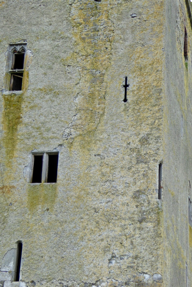
The walls were rendered with plaster on the outside. They could be whitewashed, which made them visible from afar. One of our local castles is known as White Castle, another as White Hall – perhaps these were originally whitewashed. The plaster could also be tinted to produce various colours – Kilcoe Castle is a good example of a tinted render based on research into this practice.

Glashare Castle in Kilkenny still shows the rendering on the outside. Note the unusual corner arrow loop

Glashare Castle in Kilkenny still shows the rendering on the outside. Note the unusual corner and cross-shaped arrow loops

The walls were pierced at various points with opes – a technical term that simply means an opening of any kind. Opes came in three varieties: doors, windows and loops. We talked about doors (raised entrances) and windows (smallest at the lowest levels, largest at the top) in When is a Castle..? Loops, arrow loops or musket loops, were always small from the outside, presenting a tiny target to attackers and preventing anyone from squeezing through (think about the origin of the word ‘loophole’). Muskets had totally replaced longbows and crossbows by the end of the 16th century so any castle built after that time had gun loops, and some even had larger cannon loops.

Carriganass Castle has many loops - the tiny one in this pictures seems to small to be useful

Carriganass Castle has many loops – the tiny one in this pictures seems too small to be useful

Inside, the loops were deeply splayed to allow the head and shoulders of the archer/shooter into the space, or embrasure. Loops could appear in the walls of the castle, or of the bawn.

A deeply splayed gun embrasure at Carriganass

A deeply splayed gun embrasure at Carriganass

At the top of the tower was the roof and the battlements. The roof was made of various materials – slate, wood or even thatch. Between the roof and the outside wall was a wall walk, protected by a parapet.

Dún an Óir, or the Fort of Gold, on Cape Clear Island. The wall walk can be clearly seen

Dún an Óir, or the Fort of Gold, on Cape Clear Island. The wall walk can be clearly seen*

In Ireland, this parapet most often took the form of what became known as Irish Crenellations. These were stepped or ‘toothed’ battlements, with tall parts (merlons) behind which defenders could take cover and shorter parts (crenels) for shooting from.

A good example of Irish crenellations from Kells Priory in Kilkenny

A good example of Irish crenellations from Kells Priory in Kilkenny

Another defensive feature was a platform that projected away from the walls, called a machicolation.  Defenders used the opening between the wall of the machicolation and the castle wall to hurl things down on attackers. Machicolations are often located above doorways, but also at corners which afford a view of two sides. When they are on corners they are called bartizans.

Corner machicolation, or bartizan, at Tocher Castle, north of Dunmanway

Corner machicolation, or bartizan, at Togher Castle, north of Dunmanway

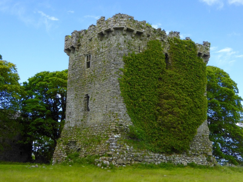
The machicolation was supported by corbels which could be simple triangles or carved stone elements.

Shrule Castle in Mayo has decorative corbels. Note also the rounded corners of the castle which did away with the need for quoins

Shrule Castle in Mayo has decorative carved corbels. Note also the rounded corners of the castle which did away with the need for quoins

The bawn is the courtyard immediately surrounding the tower. Bawns could be restricted in size – little more than the immediate courtyard of the castle – or extensive. They are sometimes known as wards. The bawn wall was often fortified with loops and a wall walk.

The bawn wall of Carriganass Castle at Kealkill hovers picturesquely over the river

The bawn wall of Carriganass Castle at Kealkill hovers picturesquely over the river

Bawn walls are often called curtain walls, but this term is also appropriate when the wall does not actually enclose a bawn, as at Dunlough Castle at Three Castle Head. Because the towers are situated between the lake and an impregnable cliff the curtain wall provides a barrier behind which defenders can shelter.

Dunlough, or Three Castles. The curtain wall presented a formidable barrier to attackers

Dunlough, or Three Castles: the curtain wall presented a formidable barrier to attackers

In the next tutorial we will cover the inside of the tower house. Meanwhile, here’s a pop quiz. Take a look at this photo of Ross Castle and see how many features you can identify. 

Ross Castle, in Killarney, is also built on an outcropping rock base

So – how did you do?

*Thanks to Lisa Scarff for the Dún an Óir photograph.

When is a castle..?

Leamcon Castle

Leamcon Castle (Black Castle)

…not a castle?

Answer: When it’s a Tower House. Maybe.

Harold Leask first published his classic Irish Castles in 1941, and it was subsequently revised and reprinted several times. My own copy was bought in the late 60s and accompanied me to Canada and back. Leask’s book was the first comprehensive work on the subject – a work of erudition but thoroughly readable with charming pen-and-ink illustrations. 

Leask insisted on the use of the term tower houses for small simple castles and described them thus:

They are simple oblongs with four walls, subtly battered, rising sheerly from a bold base-batter, to parapets which are crenellated in the Irish fashion. A small turret, at one corner, generally above the staircase, rises to a greater height than the rest of the building, while within the parapets are the two gables of the roof. Very often a small machicolation projects from the parapet and commands the entrance doorway below…

Ardintenant Castle

Ardintenant Castle (White Castle). It sits on top of an earlier ring fort.

In researching for this post the other main source I consulted was a doctoral thesis by Mark Wycliffe Samuel, The Tower Houses of West Cork. More recent (1998), it concentrated on the castles of this area and is packed with detail about the ones we see around us here in Roaringwater Bay and on the Mizen Peninsula, from Baltimore (Dún na Séad) in the east, to Cape Clear Island (Dún an Óir) to the south and Three Castle Head (Dunlough) to the west.

Dunlough Castle, known as Three Castle Head

Dunlough Castle, at Three Castle Head

These simple towers were quite different from the enormous and elaborate military castles that cemented Anglo-Norman power all over Ireland after the invasion of 1169, such as Trim in County Meath, or Cahir in Tipperary. Tower houses were built in what Leask calls a ‘great building revival’ from about 1440 into the 1600s. In what may be the forerunner of the European Grants system, Leask says many of the earliest ones were built as ‘£10 Castles’. A statute of 1429 offered every liege man of our Lord the King…who chooses to build a castle or tower sufficiently embattled or fortified..to wit twenty feet in length sixteen feet in width and forty feet in height or more, that the Commons of the said counties shall pay to the said person to build the said castle or tower ten pounds by way of subsidy. Although this statute seems to have been applicable only in certain counties (mainly around the Pale) it established a pattern for tower building which was adopted, with variations, all over Ireland.

Dunmanus Castle

Dunmanus Castle

The Roaringwater Bay and Mizen towers fit this pattern very well. They were not, however, built by the Anglo-Normans – West Cork was too remote and beyond their reach. They were built by the great Irish chiefs of the O’Mahoney, the McCarthy and the O’Driscoll clans and probably replaced earlier strongholds such as promontory forts (as at Dunlough), large ring forts (Ardintenant) and stone forts/cashels (such as the one at Knockdrum). These chiefs became wealthy through their control of the fisheries, through piracy, and through tribute exacted from those who occupied their traditional territory. At least one of them (Rossbrin) became famous as a centre of learning and scholarship during this time. Of the ones I will describe in this post, all are situated at the sea. or close to it, with commanding views over their territory and sometimes within sight of each other.

Leamcon, known as Black Castle

Leamcon, known as Black Castle. Notice the base-batter in this picture and the first one below.  The lowest level is the widest (battered) with the walls sloping in above this base

The power of these great Irish households lasted until the 1601 battle of Kinsale when the Irish forces under Hugh O’Donnel and Hugh O’Neill (with Spanish help) were defeated and an enormous re-conquest and re-colonisation began under Elizabeth and continued unabated under the Stuarts and, most disastrously, under Cromwell.

Each tower in this area was built in the same manner, which Samuel refers to as the Raised Entrance type of tower. There were two entrances, one on the ground floor and one on the first floor. The ground floor room was for cattle and the doorway was therefore as wide as would admit a cow.

A glimpse inside the raised entrance at Ardintenant

A glimpse inside the raised entrance at Ardintenant

The raised entrance (directly above it, or staggered to the left or right) was only wide enough to admit one person at a time – a defensive feature. This entrance either led into the first floor room or (since the ground floor room could have a lofty ceiling) onto a landing where a staircase led up to this room and then continued up through the wall (usually the thickest wall of the tower) to the upper floors. The first floor room was mainly used for storage and had either no windows or very small slits.

Dunmanus, with its additional turret. The top windows were always the largest.

Dunmanus, with its base-batter and additional turret. The top windows were always the largest

The second floor room was often the principle chamber, where all the main activities of the family took place – living, eating, meeting, administrating, celebrating (music and poetry were highly prized by these chieftains). If there was a third floor it contained the solar, or private chambers for the women of the household.

Barrel vaulted ground floor room at Dunmanus. Note access to stairwell.

Barrel vaulted ground floor room at Dunmanus. Note access to stairwell.

Construction techniques varied – some were superbly constructed of cut stone while others used a lot of rubble to build up the insides of walls. Putlogs, or holes where scaffolding timbers were insert, are clearly visible in several of the towers. The lowest floors were of course the thickest – the base-batter provided a solid foundation and the walls sloped inwards from it. The top of the tower allowed for thinner walls, and therefore also bigger windows (although none were large).

A garderobe (toilet) was a feature of the top two floors, with a chute out to the outer walls. In towers with additional turrets (Kilcoe, Dunmanus, Leamcon) the garderobe and sleeping chambers were sometimes contained in that turret, or the spiral stairs wound up through it. While most towers had stone spiral or straight staircase, some appeared to access each floor by means of ladders – there is no evidence for permanent wooden staircases.

The ground floor room (the byre) was often vaulted and this feature is still clearly visible in the most intact towers. Above that, the floors were of timber, sometimes with trapdoors for lifting up supplies. Presses (cupboards) consisting of niches in the walls may have contained lanterns or have been used to store valuable items.

There were no fireplaces in these towers. Fires were lit on flagstones laid on the wooden floors and the smoke rose to the tall ceilings and escaped out the small windows. In addition to this level of discomfort there is a contemporary account (quoted by Leask) which describe the primitive living arrangements in some of the towers: They have little furniture, and cover their rooms with rushes, of which they make their beds in summer and straw in winter. They put rushes a foot deep on their floors and on their windows [embrasure floors?], and many of them ornament their ceilings with branches.

But not all chieftains lived in a primitive way. Samuel uses the available evidence to construct a picture of life at Togher, one of the towers he studied, and it’s not hard to picture Fineen O’Mahoney, Scholar Prince of Rossbrin, in such a setting.

We can form a picture of the principal chamber in use: Tadhg an dúna or Togher’s principal chamber was probably furnished with imported furniture, pewter plate and cutlery and was panelled with ornately carved timber. His family, his bard, …clerk, lawyer, priest and physician, as well as members of the derbfine [extended clan] such as cavalrymen could eat there. They could sit with the chieftain to one side of the principal salt cellar, while others sat ‘below’ it… Servants prepared food out of sight ‘below stairs’. Bardic musicians, soothsayers, gamblers and others would be admitted as honoured guests, but the household ward and servants ate in the kitchen/ward room.

Although its name means Fort of Gold, today Dún an Óir on Cape Clear Island looks remote and forbidding

Although its name means Fort of Gold, today Dún an Óir on Cape Clear Island looks remote and forbidding

Similarly, Dún na Séad (Fort of the Jewels) Castle in Baltimore, seat of the wealthy O’Driscolls (they also had Dún an Óir (Fort of Gold) on Cape Clear Island), was

a centre of administration for trading activities and collection of taxes from foreign traders frequenting the port. In the middle and later-middle ages therefore, the O’Driscolls enjoyed a prosperous lifestyle. Lavish gatherings took place in the ‘great hall’ of Dún na Séad castle and a well-documented feast in 1413 is said to be one of the earliest records of people dancing in Ireland. This documentary evidence is supported by archaeological finds from recent excavations of the Dún na Séad site, which reveal the presence of late twelfth to fourteenth century pottery from the Saintonge region of France, and reflect the lucrative trade links between Baltimore and Europe at this time.

Dún na Séad Castle, Baltimore

Dún na Séad Castle, Baltimore. Note corner machicolation.

Defensive features were built into all the towers. Besides raised and restricted doorways and hard-to-manoeuvre narrow or spiral staircases, all had a roof ‘wall walk’. Three of the towers (Dún an Oir, Kilcoe and Leamcon) are either inaccessible or accessible by a bridge and there is evidence that connecting ground was deliberately demolished to accomplish this. Windows were small and could be boarded up. Projecting machicolations, especially above entrances or at corners were used, as can be seen at Dún na Séad Castle in Baltimore. Crenellations (notched or serrated ramparts) look like our traditional ideas of battlements. At Kilcoe they may have helped that castle withstand over a year of attack and siege after the Battle of Kinsale.

Kilcoe Castle. Note crenellated battlements and pitched roof.

Kilcoe Castle. Note crenellated battlements and pitched roof

So, should we call them Tower House, or Castles? How about £10 Castles? Archaeologists and historians prefer the more exact phrase tower houses, but castles they are on the maps and in our everyday speech. And if, like us, you are lucky enough to have one in your view, castles they are in our hearts and minds.

Our view to Rossbrin Castle

Our view to Rossbrin Castle