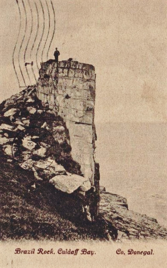
Fort of Gold 1: The Promontory Fort

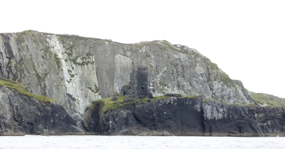
I have been gifted with a marvellous set of photographs of Dunanore, or Dún an Óir – an O’Driscoll Castle on Cape Clear. The gift came from one of our readers, Tash, and I am very grateful indeed. Regular readers know that I like to use my own photos, and I do have some that I took from the sea (like the one below) but I have none of Dún an Óir from the land, let alone from the castle itself! 
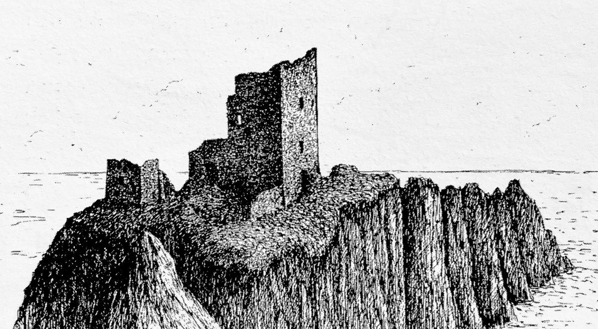
And that’s because, as you can see from the drawing by Jack Roberts at the top of this post, this castle is situated in a very perilous location, on the edge of a cliff, on a small island, essentially, making access a hazardous scramble up from a rocky beach. It was once connected to the rest of Cape Clear by a narrow causeway but this has long collapsed. It was still there in the 1770s when Charles Smith visited. In his The Ancient and Present State of the city of Cork Vol 1, he wrote:
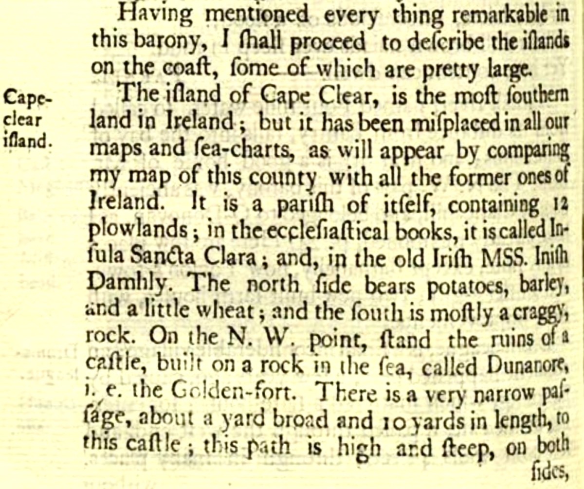
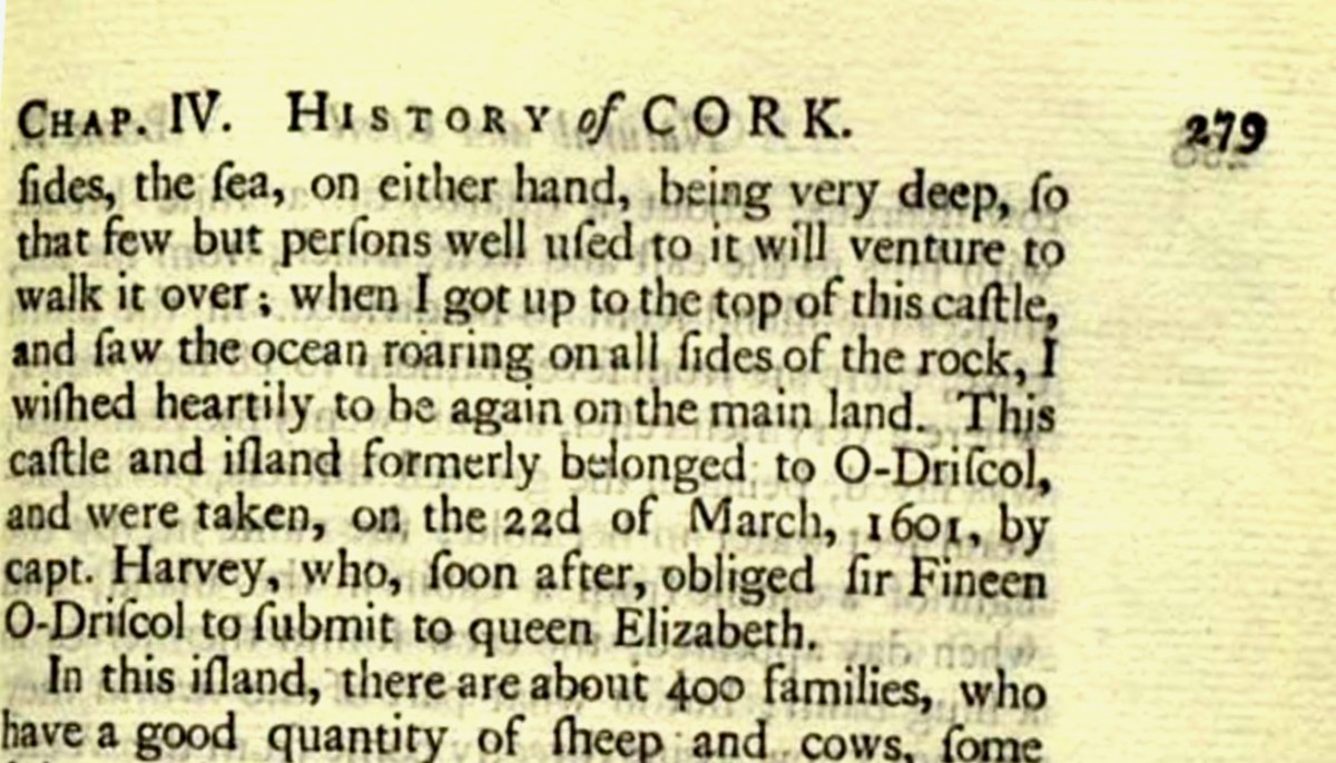
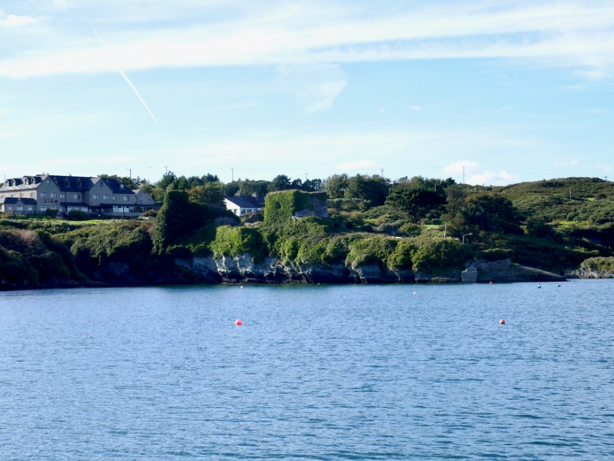
And this brings us to the name – Dún an Óir. It means, of course, Fort of Gold, and some of the old legends about this place talk about the name coming from stories of buried treasure. But in fact, this has been the name of this fort since the first maps of this area were made in the fifteen hundreds and it speaks to the wealth of the O’Driscoll clan who built it. Remember, their other stronghold, now called Baltimore, was Dún na Séad, or Fort of Jewels (on at least one map given as Castle of Perles). On Sherkin, their castle was Dúnalong – or the Fort of the Ships – that’s it as it is now, below.
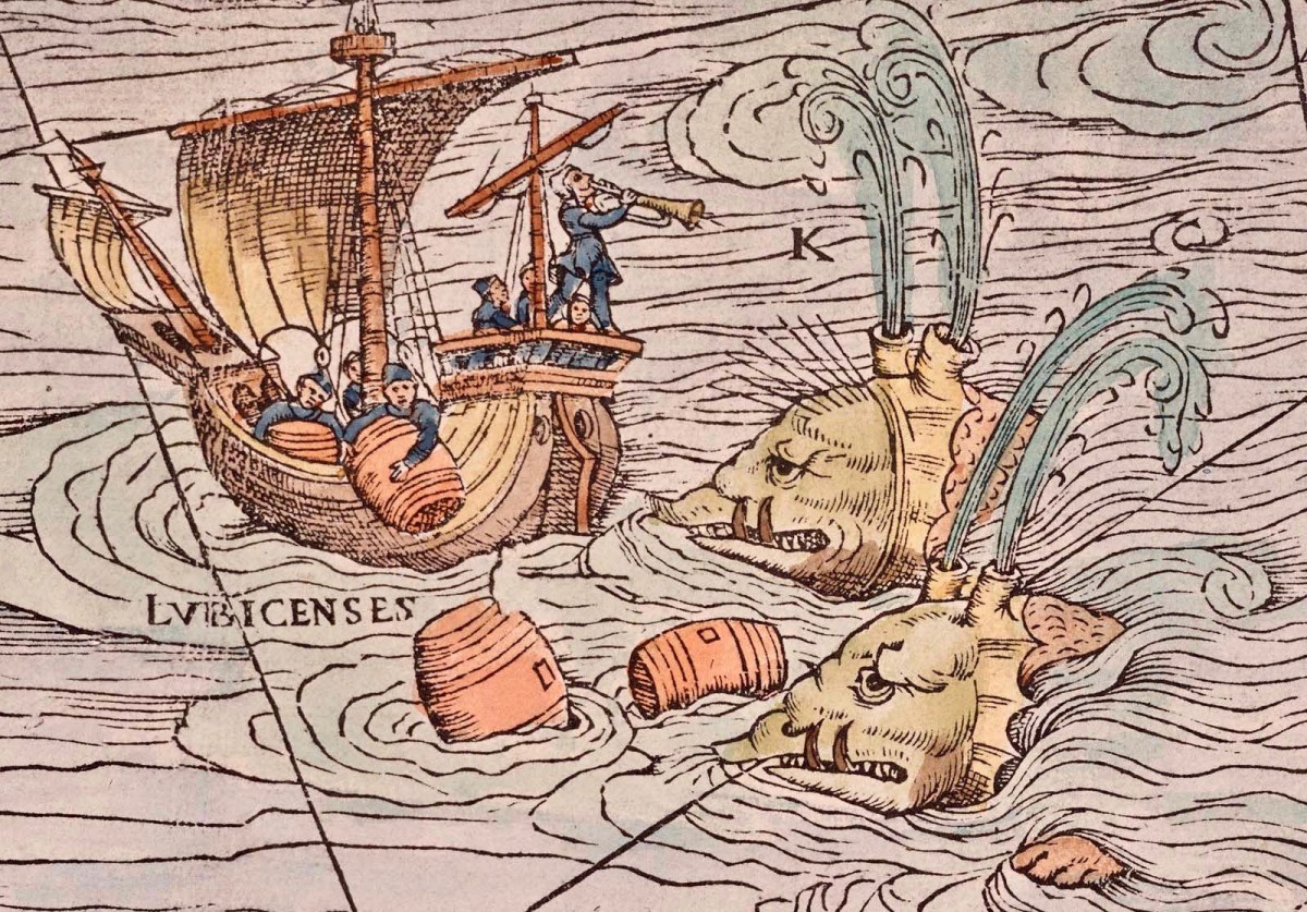
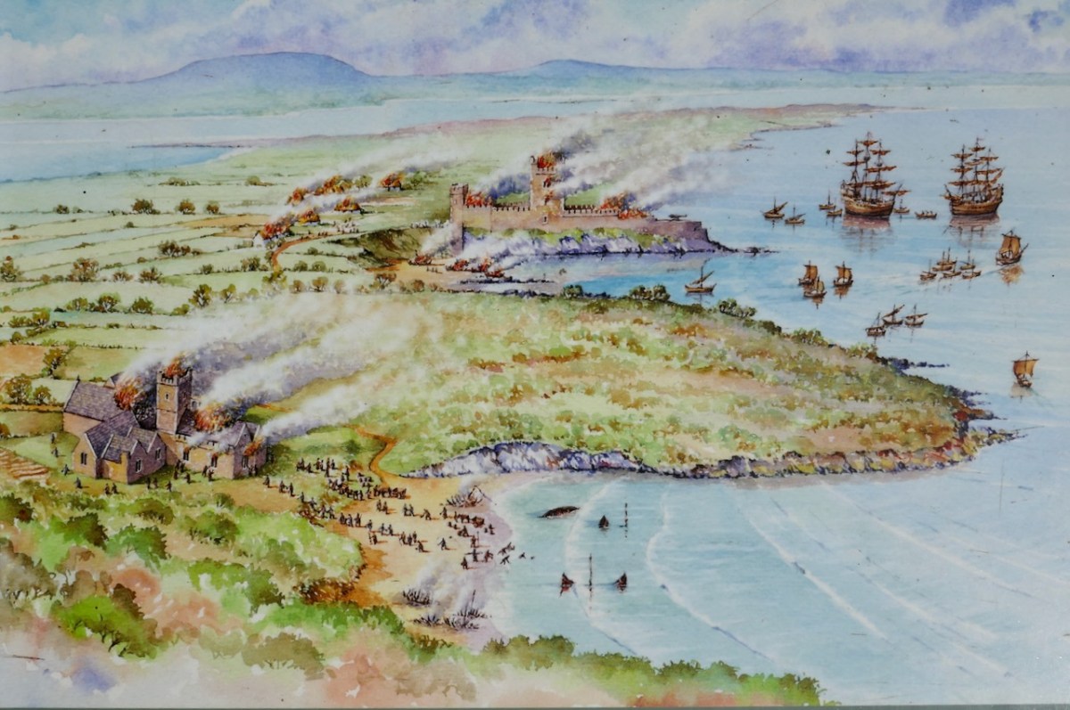
There are many accounts of their fleets of ships, and the battles they waged against the Waterfordmen in which they came out the worst for wear when Dunalong was attacked. The scene below, from an information sign on Sherkin, shows the Battle of the Wine Barrels, 1537, with both Dunalong and the Friary on Sherkin in flames
Dún means ‘fort’ but seems to be especially applied to promontory forts in the southwest. Before the castle was built, therefore, it is likely that the O’Driscolls fortified the headland, which may date well back to the Early Medieval period (400-1200) or even to the Iron Age (500BC to 400AD, or 500BCE to 400BC for those who prefer the secular version). The Illustration below is taken with permission from Dún an Óir Castle: an uncertain future, by Dr Sarah Kerr, and shows the present state of the castle, marooned on what was once a promontory connected to the Island.
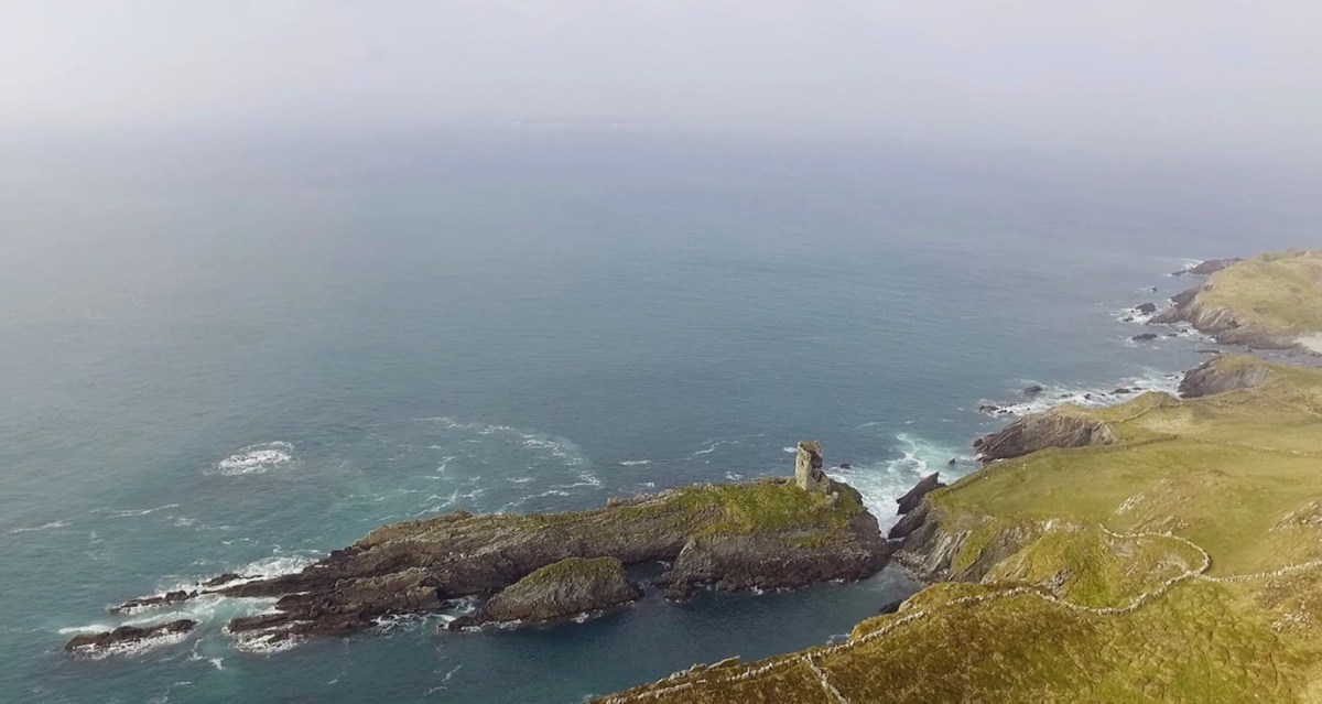
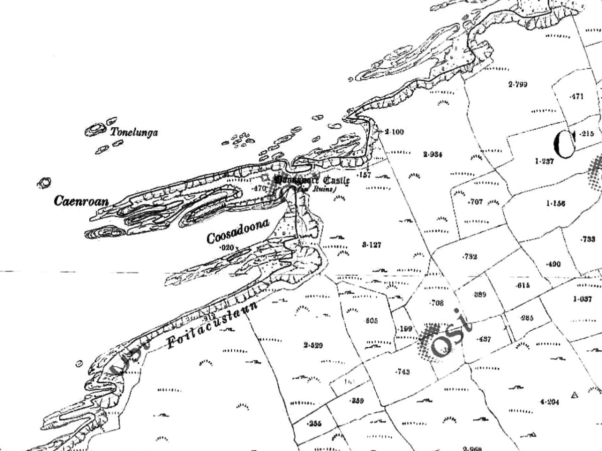
Our Promontory Fort man is Thomas Westropp (see here and here), and he wrote about Dún an Óir in his 1914-16 paper for the Royal Irish Academy, Fortified Headlands and Castles in Western County Cork. Part I. From Cape Clear to Dunmanus Bay. He visited the site, but like many a good explorer before and after him, did not venture out onto the promontory, but satisfied himself with what he could see from the high ground above it. That included the promontory and ruined castle, the rather ominously named Tonelunga (The sea-bed of the Ships), the end of the promontory called Caenroan (quay of the Seals), the inlet between the promontory and the cliffs, Coosadoona (the Little Harbour of the Fort) and the high cliffs behind the fort, Foilacuslaun (Cliffs of the Castle). All of these are marked on the 19th century twenty-five inch map.
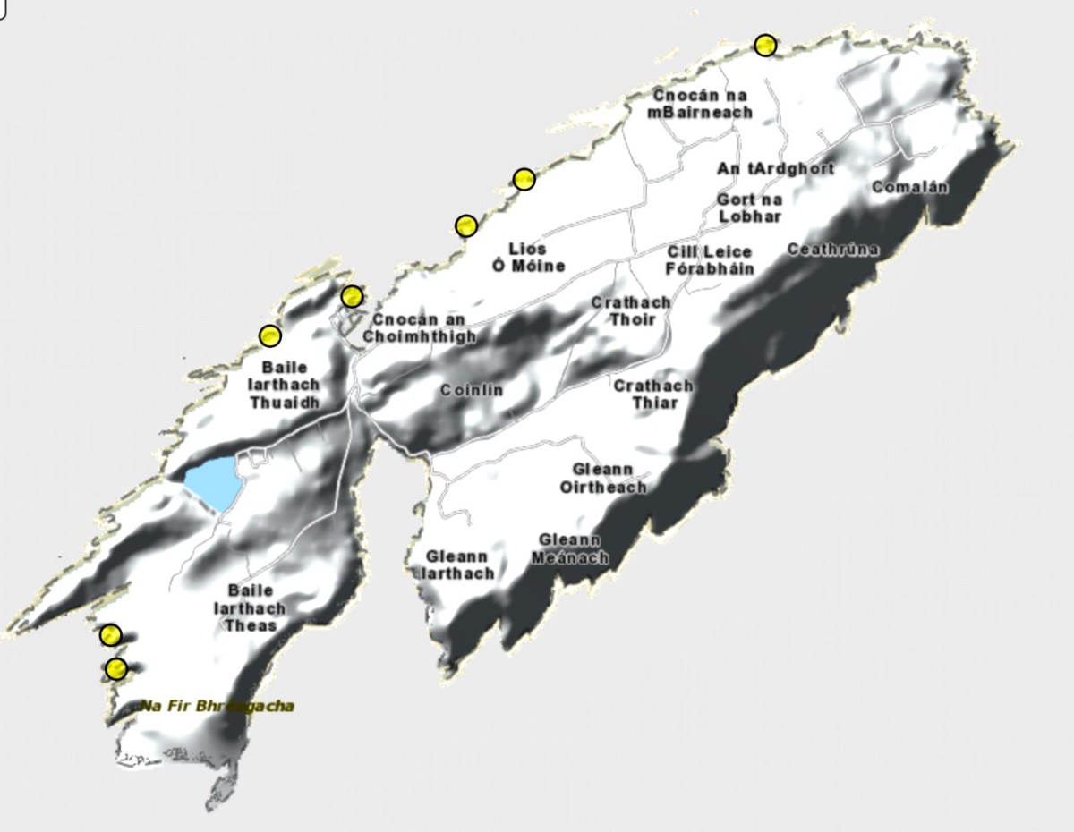
Westropp writes about Dún an Óir as one of three Promontory forts on Cape Clear Island, although in fact there are more than that, as identified by the National Monuments Record – each yellow dot below is one.
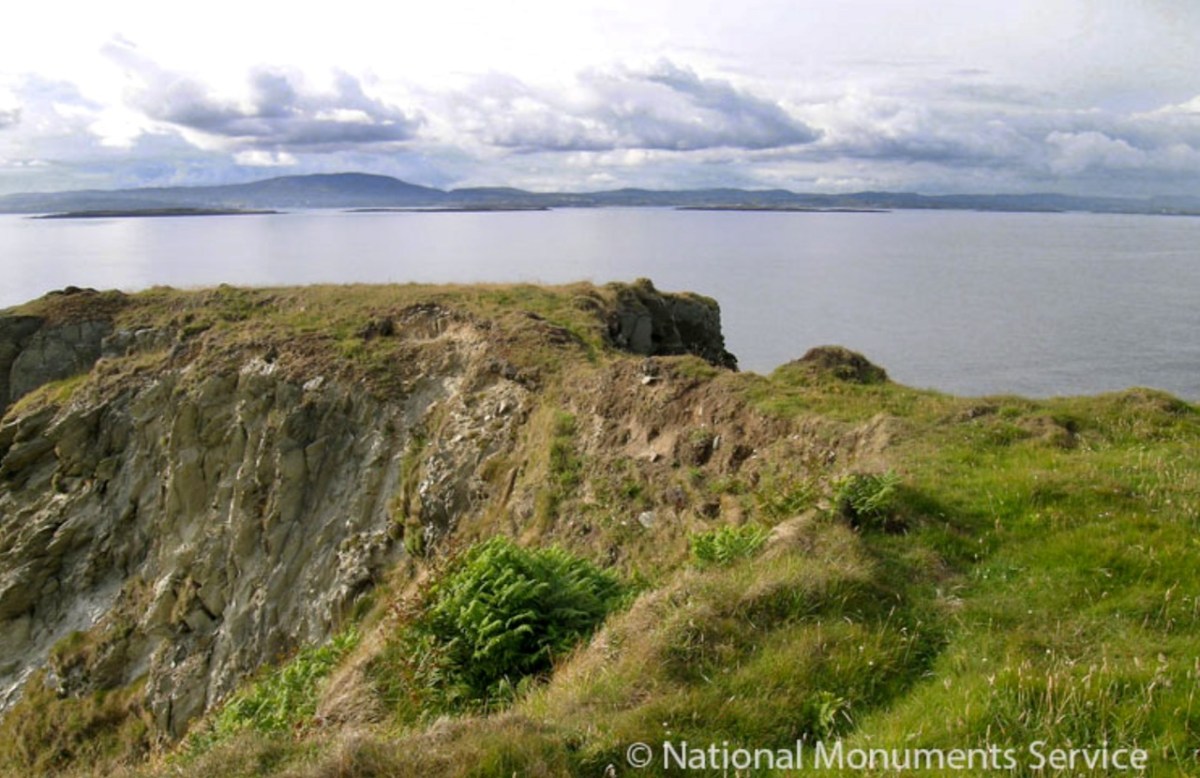
Here’s one of them (below), Lios Ó Móine (the Fort of the Meadow – lios is usually used to designate an earthen ring fort): the description and then the photo are by National Monuments Service (NMS). In the photo you can see the narrow neck of land leading out to the promontory. This is likely what the spit leading out to Dún an Óir may have looked like.

Description: In rough pasture, at the foot of a steep N-facing slope on Stuckaunfoilnabena, a headland on the NW coast of Clear Island. A narrow eroding neck of land (Wth 3m; L 15m) leads to the roughly anvil-shaped headland. Across this neck of land are the remains of three earthen banks and the shallow remains of three fosses. Further examination of the remains was not possible for safety reasons.
Curiously, the NMS does NOT identify Dún an Óir as a promontory fort – here is what it says: 

Description: The location of the tower house ‘Doonanore Castle’ (CO153-015002-) on a promontory, on the NW shore of Clear Island, suggested that it may have been built on the site of a promontory fort. However, there are no visible surface traces of an earlier defences across the promontory. The promontory is now isolated at high tide but was connected to mainland by causeway until 1831.

However, it has this to say about the earthwork identified on the high ground: 

In pasture, on a steep N-facing slope to the E of the tower house known as Doonanore Castle . . . An earthen bank . . .extends upslope in a S to SW direction from a modern E-W field boundary wall on the cliff-top at N and ends at a large outcropping rock on the edge of another cliff. This bank appears to have formed part of the defences on the land approach to the castle from the E. The bank has three contiguous linear stretches [and] there is an entrance near the N end. There is a possible hut site near the centre of the enclosed area. The short promontory on which Doonanore Castle stands is a possible coastal promontory fort.

So, as you can see, although the NMS declines to label it a promontory fort because there are no longer any signs of banks or walls, it does concede that it is possible. It also extends the defences of that fort to the higher ground above it.

Back to Westropp – He quotes:

the poem of O Huidhrin, before 1418, tells how “0 hEidersceoil assumed possession of the Harbour of Cler.” It was of some importance to the foreign traders in wine and spices, and so figures in all the early portolan maps. Angelino Dulcert, in 1339, calls it Cap de Clar ; the subsequent portolans, Cauo de Clara, 1375 and 1426 ; Clarros, 1436 ; C. d’Clara or Claro, 1450 and 1552, and, to give no more, Cauo de Chlaram, in 1490. The 0 Driscolls’ Castle probably dates between 1450 and the last date. It was probably on an earlier headland fort, as it is called Dunanore. In 1602 it surrendered without resistance to the English, who burned it.

Westropp goes on to say

Dr. O’Donovan, in his ” Sketches of Carbery,” gives a few notes on the later history. He says there was a garrison at the Castle in Queen Anne’s time, and mentions the huge iron ring-bolt, set in the rock, to which the O Driscolls formerly moored their galleys in the creek. The last is improbable, even to impossibility: no one could moor galleys in the dangerous wave-trap, open to the most stormy and unsheltered points. The islanders regard the ruin as haunted, and tell of the singing of ships’ crews in its vaults. One “Croohoor” (Conor) O’Careavaun (Heremon’s grandson) lived as a hermit there in the eighteenth century. Another legend tells how, in 1798, the inhabitants painted the Farbreag Rocks and pillars so as to resemble soldiers in uniform to keep away the French ! If any truth underlies this, it is probably based on the idle act of some revenue or other officers, in the endless leisure of their island station.
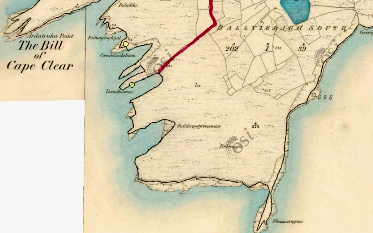
In the map above, of the southwest end of the Island, you can just make out the name Firbreaga, almost covered by the O of OSI. Fir Bréaga means The Lying Men, an apt translation given Westropp’s story. No doubt the name is older than 1798, and may refer to the cliffs at that end seeming to be less dangerous from the sea than they actually were. Note also the two yellow dots for two more promontory forts- Doonthomas (Thomas’s Fort) and Coosfoilaskehaun (the Small Harbour of the Knife-Edge Cliff).

Westropp’s description of the promontory upon which Dun an Óir sits is poetic:

The path runs up a very slight ledge, flaking away and high above the creek, along the face of a cliff of polished silvery slate. The low neck joined it to the mainland, and the nearly perpendicular strata make the dock-like creek of Coosadoona, fort-cove, to the south Beside this cove, opposite to the castle, an enormous precipice rises high above the tower top. In the other direction is a noble view across the wide, porpoise-haunted bay, and its low islands to the blue, many-channelled Mount Gabriel, and on to Mizen Head. 
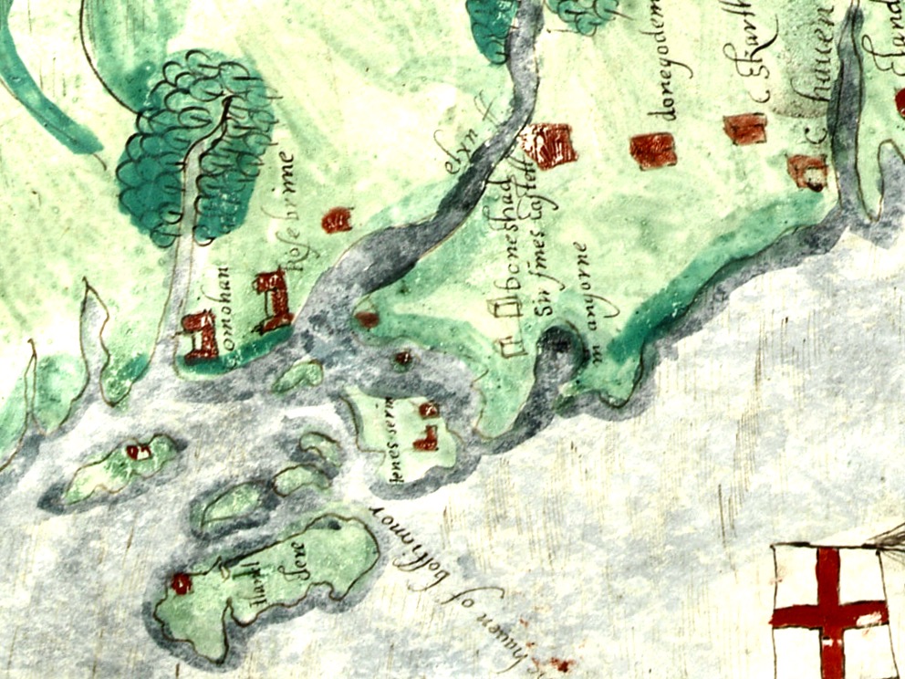
In fact, very little is known about the history of Dún an Óir before the Battle of Kinsale in 1601. We can deduce from its strategic location that the O’Driscolls used it to keep an eye on every ship that sailed in and out of Roaringwater Bay, to exact fishing dues before the rival O’Mahonys could get to the incoming vessels, to curb the power of those O’Mahonys, and to establish their dominance over the land of Cape Clear Island. (See this post for more on the map above.) Because the castle would have been rendered, probably in some shade of white or near-white, it would have been visible from all around Roaringwater Bay, and have represented a potent statement of supremacy.

After the Battle of Kinsale the Castle was seized by Captain Harvey, as described in Pacata Hibernia:

‘While these things were on doing, Captain Roger Harvy sent a party of men to Cape Clear, the castle whereof being guarded by Captain Tirrell’s men, which they could not gain, but they pillaged the island and brought thence three boats; and the second day following the rebels not liking the neighbourhood of the English, quitted the castle, wherein Captain Harvy placed a guard. At this time Sir Finnin O’Driscoll came to Captain Harvy and submitted himself.’
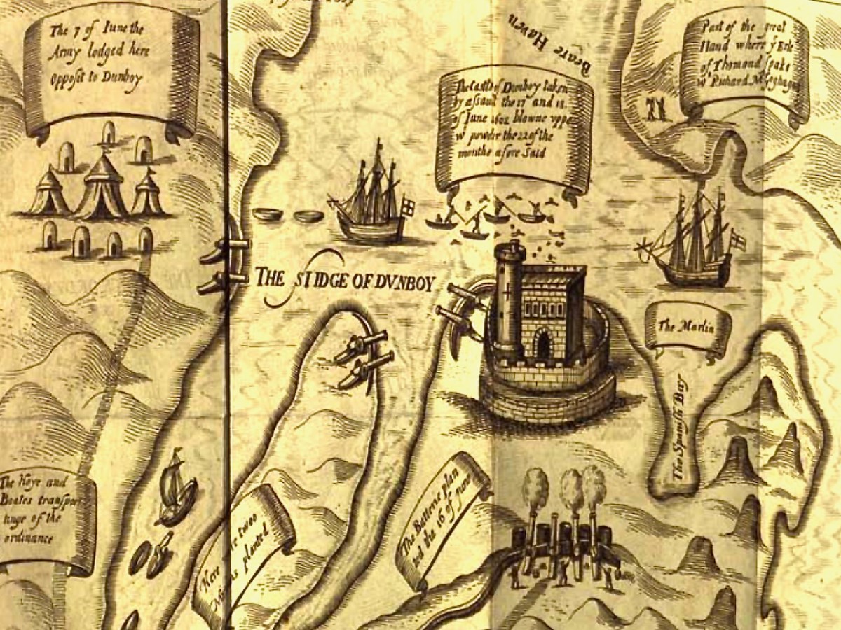
This illustration, from Pacata Hibernia, is of the siege of Dunboy Castle, the stronghold of O’Sullivan Beare, on Beara Peninsula. The destruction of Dún an Óir is described by James Burke in his article Cape Clear Island in the Journal of the Cork Historical and Archaeological Society Journal of 1908. Rather than Harvey simply taking over the castle, Burke relates the following:

Its central arch and the steps leading to its upper portion remain; but the huge pieces of its eastern wall now lying about show how severely it has suffered from the havoc of war. This wholesale destruction occurred when Dunanore Castle, together with the island, was captured on the 22nd of March, 1601, by Captain Roger Harvey, following on the defeat of the Spaniards at Kinsale. By means of the artillery he planted on the high ground adjoining it, he battered down the eastern wall and compelled the garrison to surrender, for which and other services (as Dr Donovan writes in his “Sketches of Carbery”) he was granted at the time a commission by Lord Deputy Mountjoy as Governor of Carbery.

It is far more likely that the ruined state of the castle is a result of the natural passage of time than the ‘havoc of war.’ For one thing, it would have been a monumental task to deploy artillery overland on Cape Clear. Any cannon fire would have come more naturally from the English warships we know were in use during this period and therefore, the damage would have been to the seaward side of the castle – but this side is actually intact.
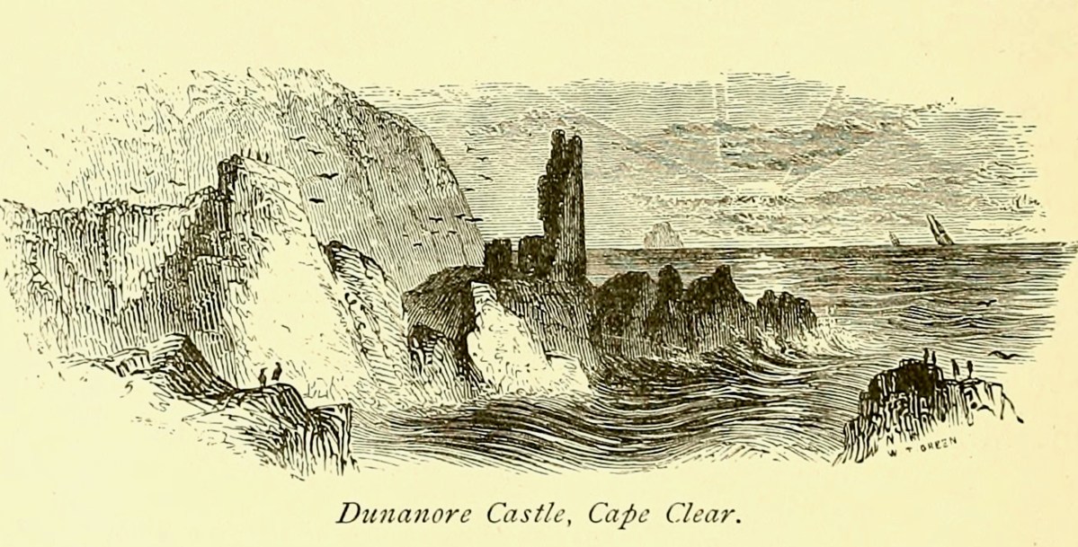
A romantic view of the ruins of Dún an Óir above, by W Willes.* Next week we will look at what is left of the castle and what we can tell from that. I’ll be using the marvellous photos from Tash in that post.

*From: Picturesque Ireland : a literary and artistic delineation of the natural scenery, remarkable places, historical antiquities, public buildings, ancient abbeys, towers, castles, and other romantic and attractive features of Ireland, by John Savage, 1885.

Mythical Isles of the West

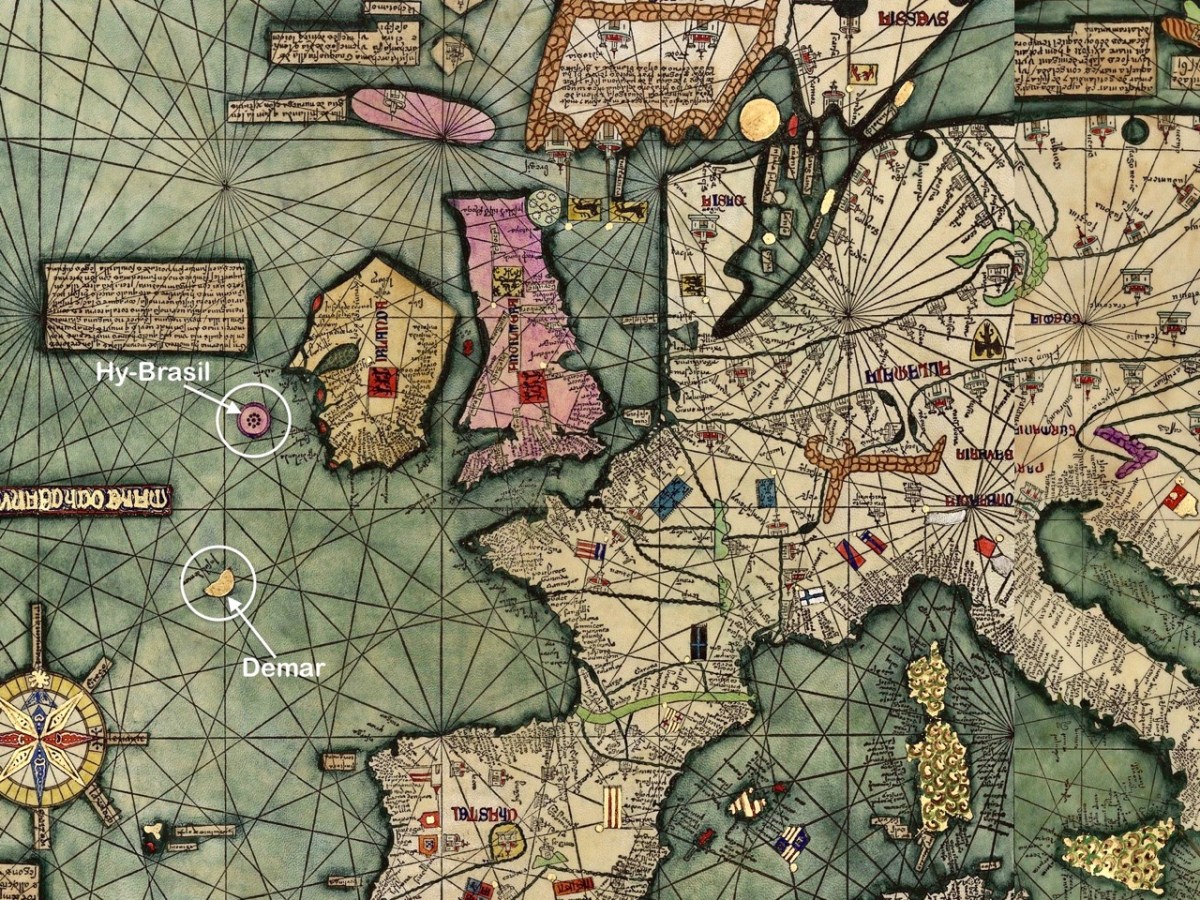
The fine map, above, was drawn in 1375 and is attributed to Abraham Cresques (courtesy  Library of Congress, Geography and Map Division). it is known generally as the Atlas Catalan. What interests us is that it depicts two islands off the west and south-west coasts of Ireland (see detail below): Hy-Brasil and Demar. These landfalls are shown on maps since then through the centuries, the last depiction being in 1865.

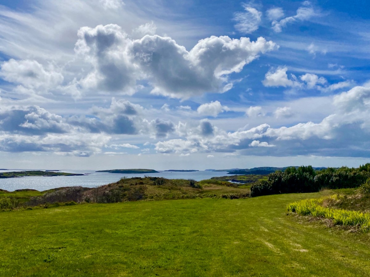
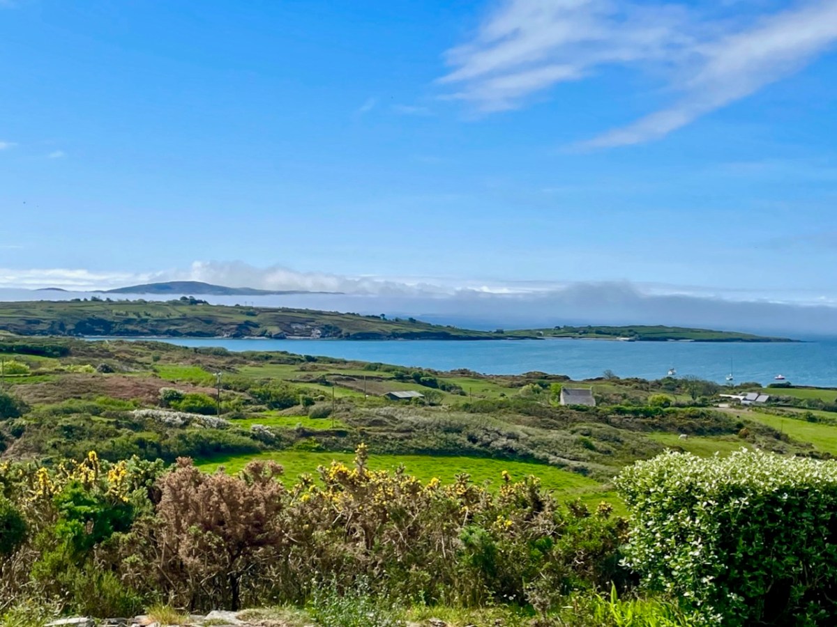
We look out to the hundred Carbery Islands in Roaringwater bay. The view (above) is always changing as sun, rain and wind stir up the surface of the sea and the sky and clouds create wonderful panoramas. But, generally, the view is predictable: we know that Horse island will be across from us, and Cape Clear will always be on the distant horizon, while the smaller islets break up the surface of the ocean in-between, and help calm down its wildness when the storms come.

But, suppose it wasn’t always predictable? What if those islands changed, moved around or appeared and disappeared? It seems that such things do happen, here in Ireland. At least, they do according to some of the recorded evidence. ‘Mythical Islands’ have been mentioned by mariners and storytellers through the centuries.

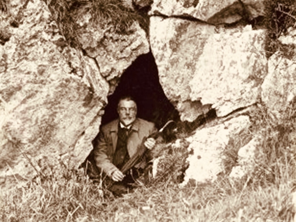
Our best source of information for Ireland’s ‘transcendent’ islands is our old friend Thomas Westropp (above, kitted out for an expedition) who was an archaeologist and folklorist living between 1860 and 1922. He was active in Counties Clare and Limerick and wrote a paper for The Royal Academy in 1912 – Brasil and the Legendary Islands of the North Atlantic: Their History and Fable. This comprehensive paper includes a list of evanescent islands, a new map drawn by Westropp, and a summary of historic maps which have located them:

Westropp’s exploration of the subject is remarkably comprehensive. Here are some extracts:

. . . Bran son of Febal, sleeping near his fort, hears sweet music, and awakes to seize a magic apple branch. An unknown woman sings of “a glorious island round which sea-horses glisten – a fair course against the white swelling surge.” In it dwells no wailing, treachery, death, or sickness; it glows many-coloured in incomparable haze, with snowy cliff’s and strands of dragon-stones and crystals. She vanishes, and Bran, with twenty-seven followers, embarks. They meet the sea-god Mananann mac Lir in his chariot, visit Magh Mell, the Isle of Laughter, and the Isle of Women, whose queen draws Bran to it by a magic clue. Entranced by love, the visitors do not note the flight of time; in apparently undiminished youth and strength they return to Ireland; it is only when the first to step ashore falls to ashes, as if centuries dead, that they know the truth. The survivors tell their tale without landing, and sail out into the deep, never to be seen again . . .

Thomas WESTROPP – Brasil and the Legendary Islands of the North Atlantic, 1912

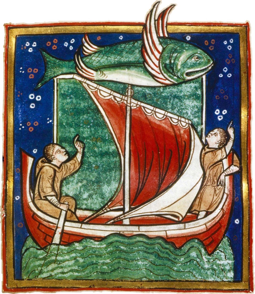
Image above courtesy of the Worksop Bestiary.

. . . The Sunken Land. I found no name for this in north Mayo save when it was confused with Manister Ladra. Belief in it prevailed in north Erris and Tirawley from Dunminulla to Downpatrick. In 1839 it was said to extend from near Teelin to the Stags of Broadhaven and thence half way to America. A boatman knew a woman named Lavelle who saw from the shore (when gathering Carrigeen moss) a delightful country of hills and valleys, with sheep browsing on the slopes, cattle in green pastures, and clothes drying on the hedges. A Ballycastle boatman, a native of Co. Sligo, corroborated this, adding that he had seen it twice at intervals of seven years, and if he lived to see it a third time he would be able to disenchant it. He could talk of nothing else, became idle and useless, and died, worn out and miserable, on the very eve of the expected third appearance . . .

Thomas WESTROPP – Brasil and the Legendary Islands of the North Atlantic, 1912

. . . Owen Gallagher, Lieutenant Henri’s servant, heard of one Biddy Took, who, when gathering dillish (seaweed), asked some passing boatmen to put her out to an islet and fetch her back on their return : amused by her talk they brought her fishing, and soon got a ” tremendous bite.” They landed a green, fishy-looking child, quite human in shape, and in their fright let him escape and dive. The man who hooked him died suddenly within a year. Gallagher also said that he had fired at and wounded a seal; soon after, when far out to sea in his currach, he got lost in a fog-bank and reached an unknown island. An old man, moaning, with one eye blinded, stood on the shore and proved to be the seal. With more than human forgiveness, he warned his enemy to fly from the land of the seal men, lest his (the seal’s) sons and friends should avenge the cruelty . . .

Thomas WESTROPP – Brasil and the Legendary Islands of the North Atlantic, 1912

Image Carta Marina (1539) courtesy Bone + Sickle

. . . The Aran people now believe that Brasil is seen only once in seven years. They call it the Great Land. In Clare, I have heard from several fishermen at Kilkee and elsewhere that they had seen it ; they also told legends of people lost when trying to reach it. I myself have seen the illusion some three times in my boyhood, and even made a rough coloured sketch after the last event, in the summer of 1872. It was a clear evening, with a fine golden sunset, when, just as the sun went down, a dark island suddenly appeared far out to sea, but not on the horizon. It had two hills, one wooded ; between these, from a low plain, rose towers and curls of smoke. My mother, brother, Ralph Hugh Westropp, and several friends saw it at the same time; one person cried that he could “see New York ” ! With such realistic appearance (and I have since seen apparent islands in 1887 in Clare, and in 1910 in Mayo), it is not wonderful that the belief should have been so strong, probably from the time when Neolithic man first looked across the Atlantic from our western coast. It coloured Irish thought ; stood for the pagan Elysium and the Christian Paradise of the Saints ; affected the early map-makers ; and sent Columbus over the trackless deep to see wonders greater than Maelduin and Brendan were fabled to have seen, till Antilha, Verde, and Brazil became replaced by real islands and countries ; and the birds, flowers, and fruit of the Imrama by those of the gorgeous forests of the Amazon in the real Brazil. ” Admiration is the first step leading up to knowledge, for he that wondereth shall reign.” . . .

Thomas WESTROPP – Brasil and the Legendary Islands of the North Atlantic, 1912

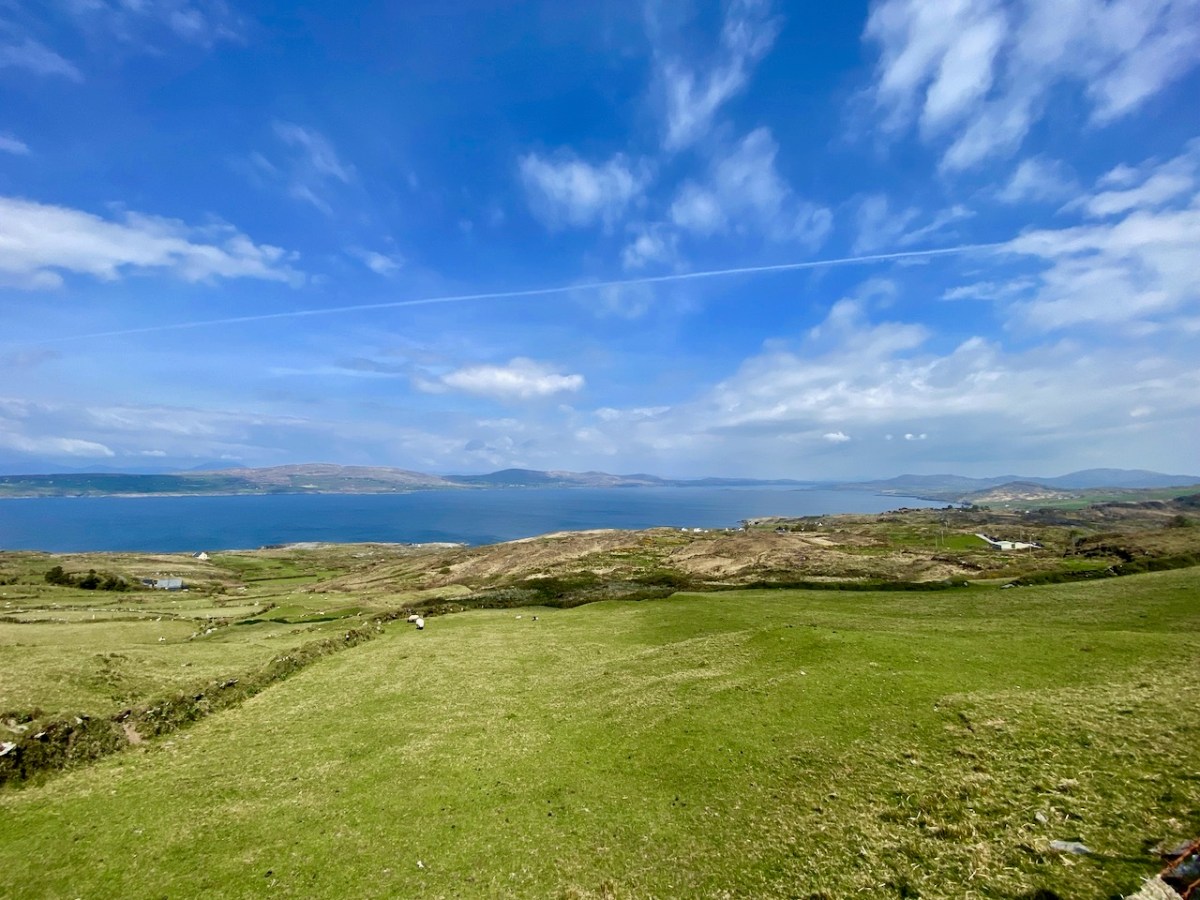
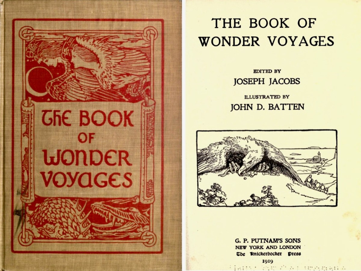
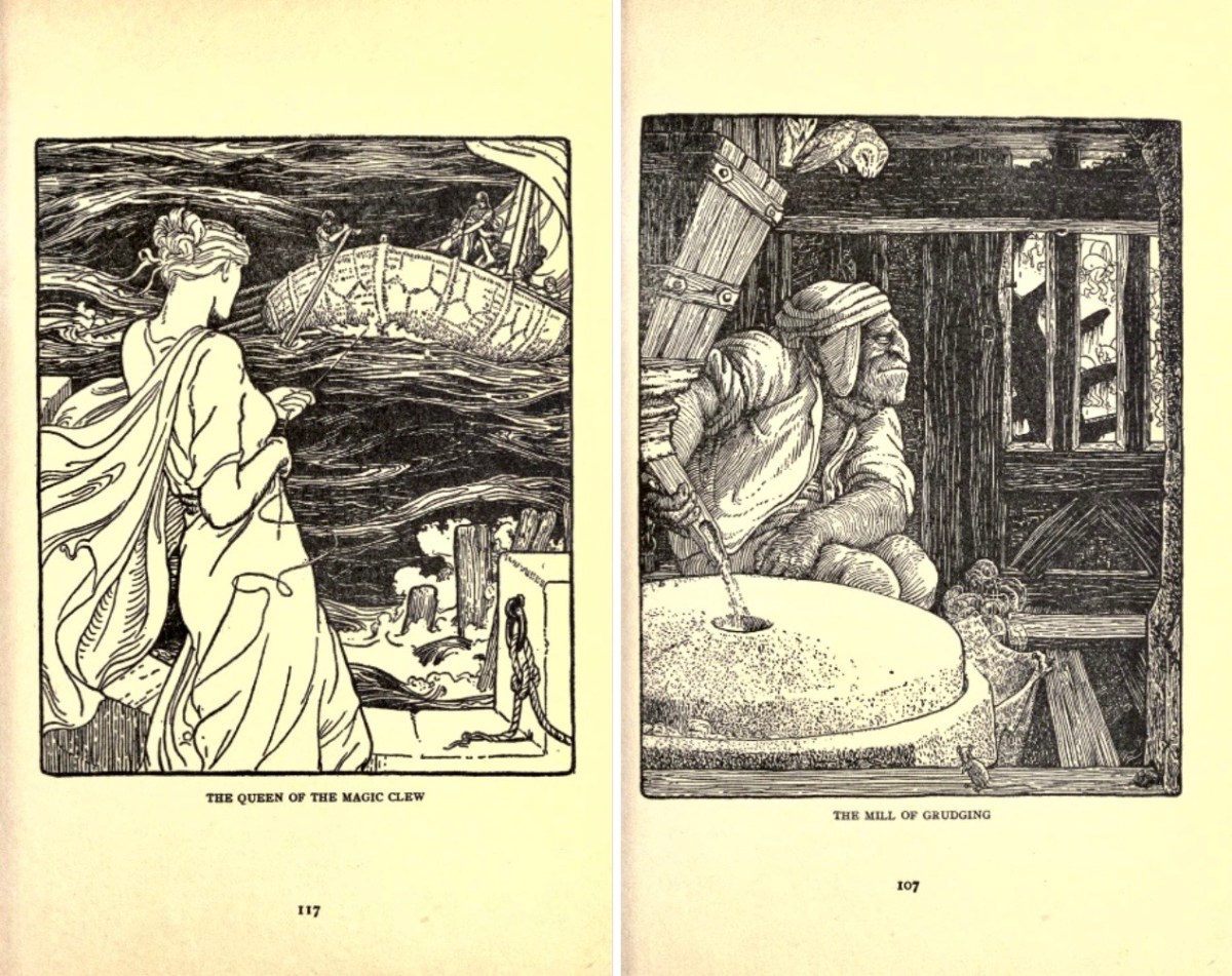
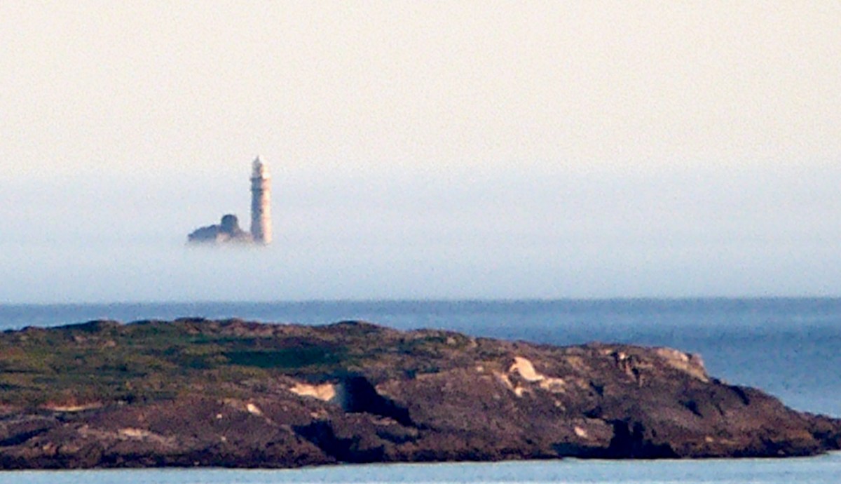
Above is the view from our house – Nead an Iolair – a day or two ago, when a strong sea mist was coming across from the south-west, enveloping Cape Clear and making it float ethereally like one of the mythical islands. Other writers have tackled the subject of the vanishing lands, including Joseph Jacobs, who put together a collection of stories in 1919. The subject is ‘Wonder Voyages’, and the book (available online here) covers some of Ireland’s adventurers, including Máel Dúin – a predecessor of Brendan the Voyager.

Máel Dúin sets out ‘into the limitless ocean’, suggesting that ‘God will bring the boat where it needs to go’. He and his crew encounter a large number of strange islands, including:

The island of ants, from which the men flee because the ants’ intention is to eat their boat

The island of tame birds

The island of the horse-like beast who pelts the crew with the beach

The island of horses and demons

The island of salmon, where they find an empty house filled with a feast and they all eat, drink, and give thanks to Almighty God.

The island with the branch of an apple tree, where they are fed with apples for 40 nights

The island of the “Revolving Beast”, a creature that would shift its form by manipulating its bones, muscles, and loose skin; it casts stones at the escaping crew and one pierces the keel of the boat

The island where animals bite each other and blood is everywhere

The island of apples, pigs, and birds

The island with the great fort/pillars/cats where one of the foster brothers steals a necklet and is burned to ashes by the cat

The island of black and white sheep, where sheep change colours as they cross the fence; the crewmen do not go aboard this island for fear of changing colour

The island of the swineherd, which contained an acidic river and hornless oxen

The island of the ugly mill and miller, who was “wrinkled, rude, and bareheaded”

The island of lamenting men and wailing sorrows, where they had to retrieve a crewman who entered the island and became one of the lamenting men; they saved him by grabbing him while holding their breath

The island with maidens and intoxicating drink

The island with forts and the crystal bridge, where there is a maiden who is propositioned to sleep with Máel Dúin

The island of colourful birds singing like psalms

The island with the psalm-singing old man with noble monastic words

The island with the golden wall around it

The island of angry smiths

The crew voyaged on and came across a sea like a green crystal. Here, there were no monsters but only rocks. They continued on and came to a sea of clouds with underwater fortresses and monsters.

The island with a woman pelting them with nuts

The island with a river sky that was raining salmon

The island on a pedestal

The island with eternal youth/women (17 maidens)

The island with red fruits that were made as a sleeping elixir

The island with monks of Brendan Birr, where they were blessed

The island with eternal laughter, where they lost a crewman

The island of the fire people

The island of cattle, oxen, and sheep

The most well-known voyager of all – in Irish tradition – is Saint Brendan. The image above is from the Finola Window, which was crafted by George Walsh. We all know that Brendan was a real character, who discovered America back in the sixth century. On the way he also encountered many islands – which we cannot locate today (that doesn’t mean they are not there) – and had hair-raising adventures on them. This post will take you through some of his journeyings.

It’s clear that, in the shared Irish psyche, we are aware of places that we can’t always see, or visit. it’s all part of a folk knowledge that’s largely hidden away, except in the memories of older generations, that relates to the sea, and the idea that there are races of people who live on ‘lost’ islands – or even in the sea. In some of the stories about the islands it is suggested that, when they vanish, it’s because they have submerged under the ocean – perhaps temporarily.

There’s a great collection of stories readily available in a series of podcasts known as Blúiríní Béaloidis / Folklore Fragments. Look out for the one titled Blúiríní Béaloidis 16 – Otherworld Islands In Folk Tradition. I have transcribed one of my favourite pieces from this podcast, and will finish this post with it. It summarises, very neatly, the tradition that other worlds are out there, and – at times – our world and theirs meet, providing solid evidence for there being human life under the sea! The tale was collected by Dr McCarthy of Kerry.

. . . People from Dingle Harbour used to sail to Kilrush in Limerick long ago. There was a boat leaving the harbour to Limerick one day with a load of salt. There were 8 men in the boat. They had prepared the boat. There was no quay in Dingle in those days, just a slipway. A fine, strapping young man approached them carrying a pot and a pot-hook, The pot-hook looked as if it had come straight from the forge. He addressed the boat’s captain. Are you going to Limerick, my good man? I am, said the captain, we are just about to leave. Would you mind terribly, said the young man, taking me some of the way? I don’t mind, said the captain, if you wish to come all of the way. He placed his pot and pot-hook in the boat, and got in himself. They rowed away and raised the sail at the mouth of the harbour. They were halfway when the man with the pot and pot-hook roused himself. I’ll be leaving you now, he said to the captain, and I’m very grateful to you. He took hold of his pot and his pot-hook and he leapt into the sea. They never saw him again . . .


Blúiríní Béaloidis

There’s a rather nice postscript to this story:

. . . Some time later, a man with a line and hook was fishing in the sea in the same place, and a boiled potato came up on his hook . . .

Blúiríní Béaloidis