Even Cromwell Spared the Graveyards

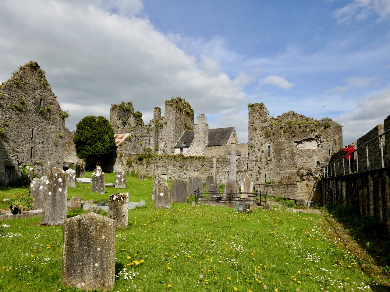
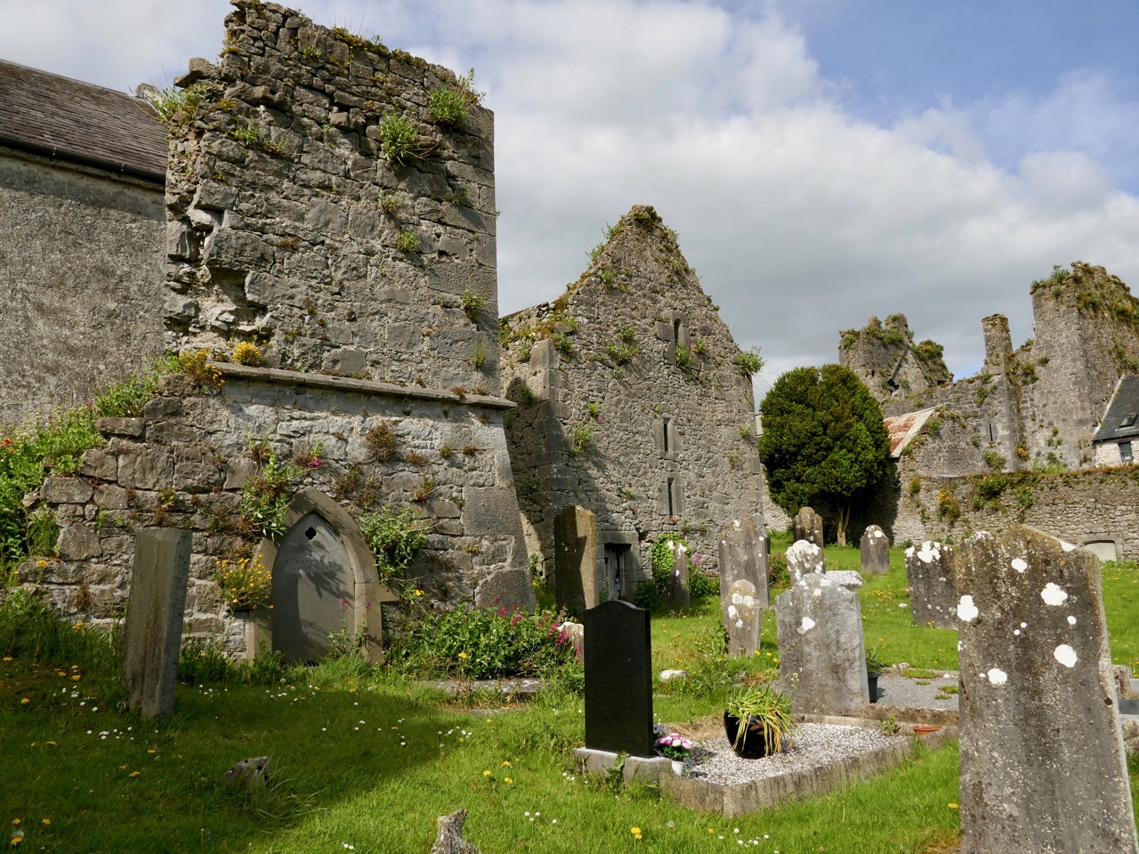
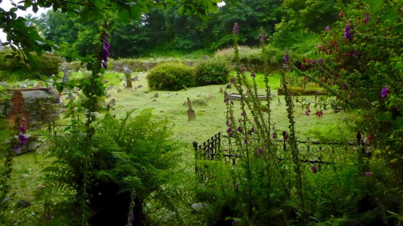
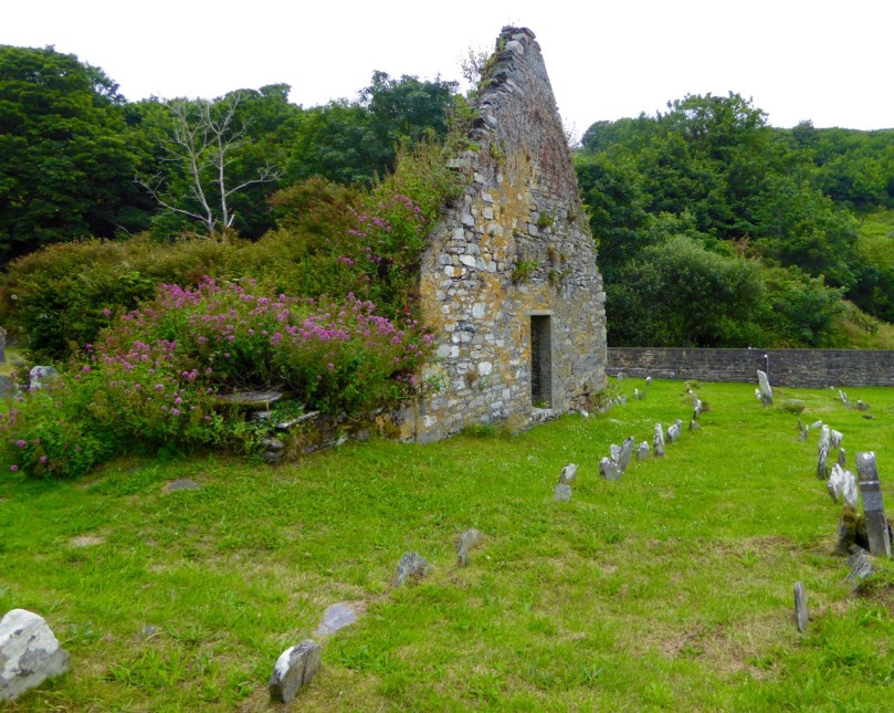
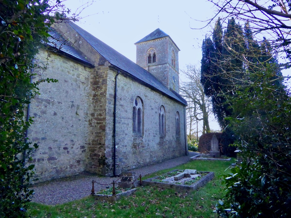
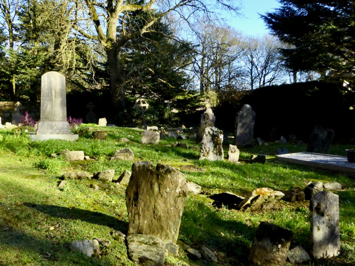
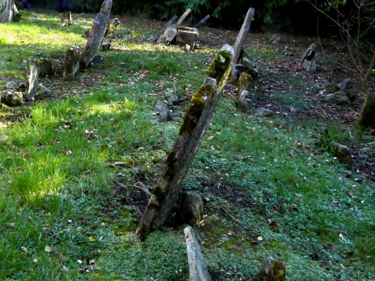
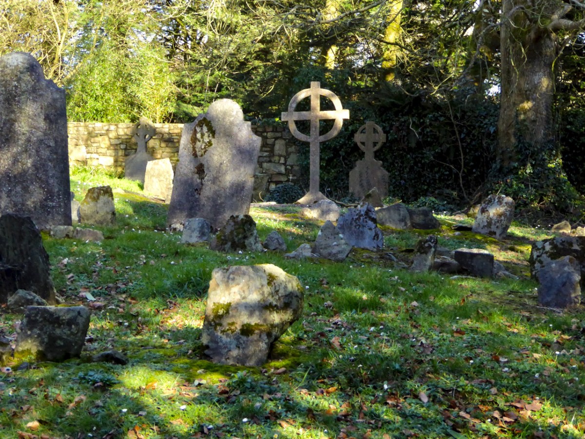
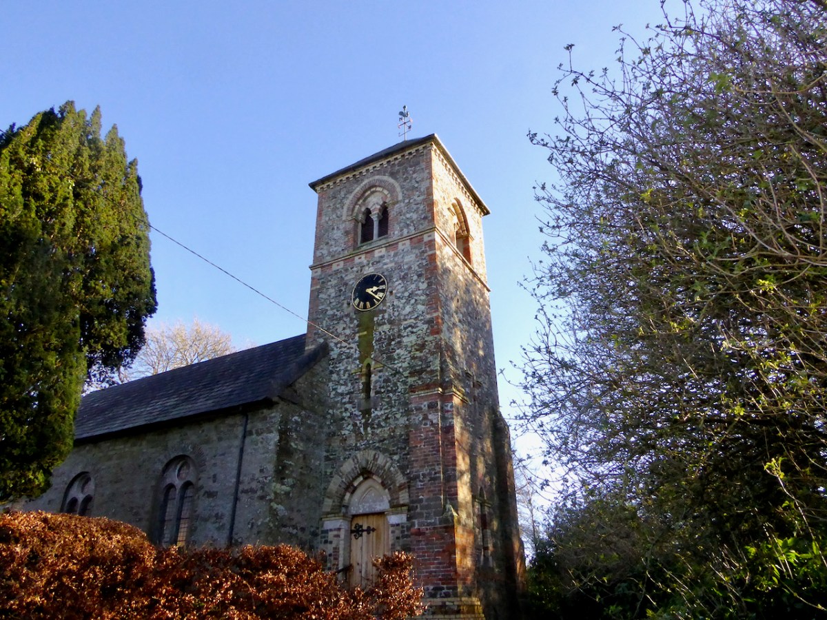
There’s a lovely old Church of Ireland church in Rathclaren, between Timoleague and Kilbrittain in West Cork, surrounded by a graveyard. Nowadays, little disturbs the tranquil space, and it’s hard to imagine that a proposal to close this graveyard for reasons of sanitation and overcrowding once created an enormous controversy that pitched Catholics against Protestants, neighbour against neighbour. My attention was caught when the marvellous West Cork History posted about this recently – a huge thank you to Pat!

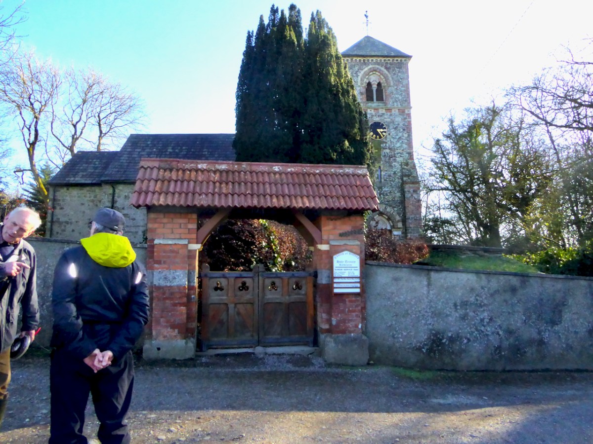
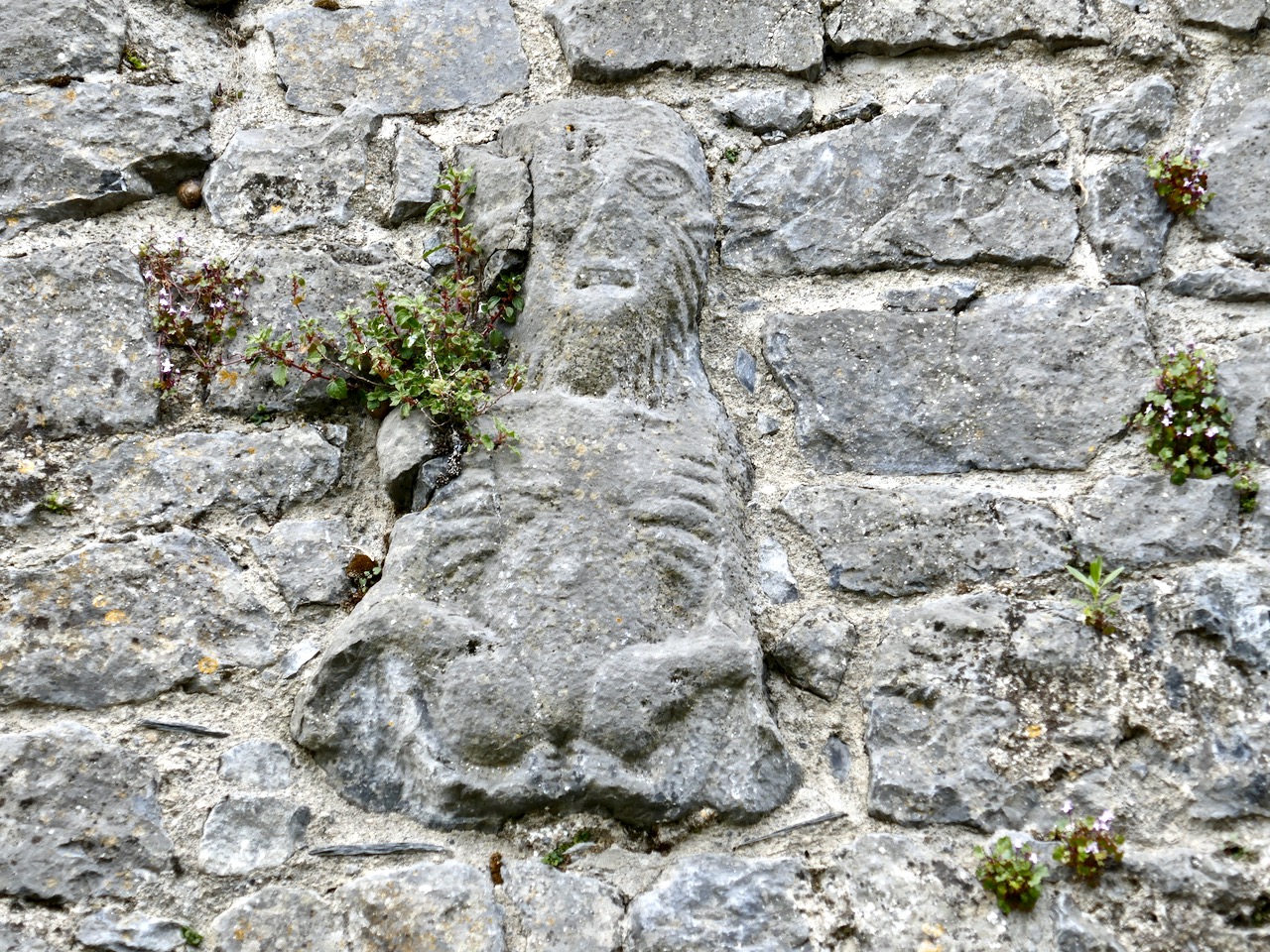
The lych-gate at the entry to the church is an unusual feature in Ireland, but adds to its overall picturesque appearance

It was all reported with gusto in the Examiner and the Southern Star (which I accessed through that indispensable resource, the Irish Newspaper Archives). The facts of the matter were that Canon Powell, the Church of Ireland Rector, wished to close the graveyard to further burials, claiming that there was a putrid smell and that people came and buried their deceased family members ‘willy nilly’ with little regard for the depth of the grave or the previous occupants.  He was supported by Dr Shorten, a medical man and one of his parishioners, who conducted an inspection. 

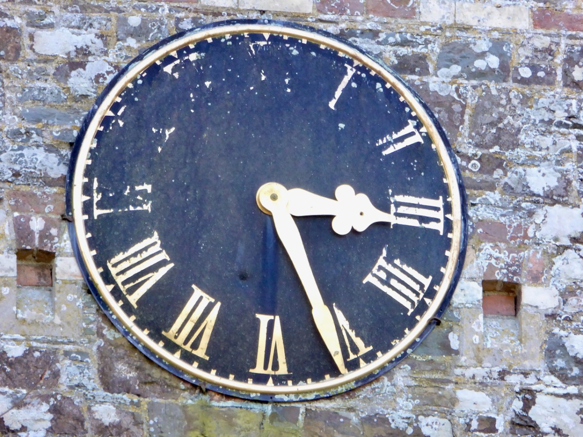
The clock face has an indent – we were told by a local resident that there was an IRA ambush here during the War of Independence and that this is a bullet hole

Now if there’s one thing we know in Ireland it’s that there is a reverence for graves and burial places. This is not new and when word reached the Catholics who had rights of burial in the graveyard, or whose family members were buried in it, there was uproar. 

A little background – the graveyard was owned and managed by the Church of Ireland, as were many old graveyards in Ireland. When the Church of Ireland was established, after the Reformation, all church property passed into the hands of the Protestants, to be administered by the local Rector. Everyone, Protestant or Catholic, had to apply for approval for a grave to be dug. Catholics resented this hugely – these had been their churches and their sacred sites, and the memory of their loss and the outlawing of their religion was long and bitter.

The turn of the twentieth century, when the Rathclaren row erupted, was a time of growing nationalistic confidence. Speeches stoking long-held resentments were common. Having been downtrodden for centuries, many Catholics were now fervently embracing aspirations to Home Rule, flocking to Irish language classes, and reading stories of their glorious past as a Land of Saints and Scholars, as well as studying the long history of suppression and colonisation. Somehow, the threat to close Rathclaren graveyard encapsulated for them all that was wrong with the Ireland of 1899. 

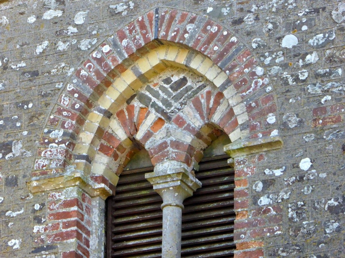
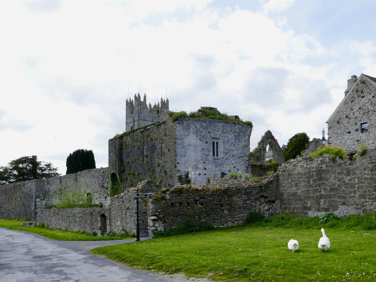
The church is hundreds of years old but was reconstructed several times. The attractive red brick detail was added in the mid nineteenth century

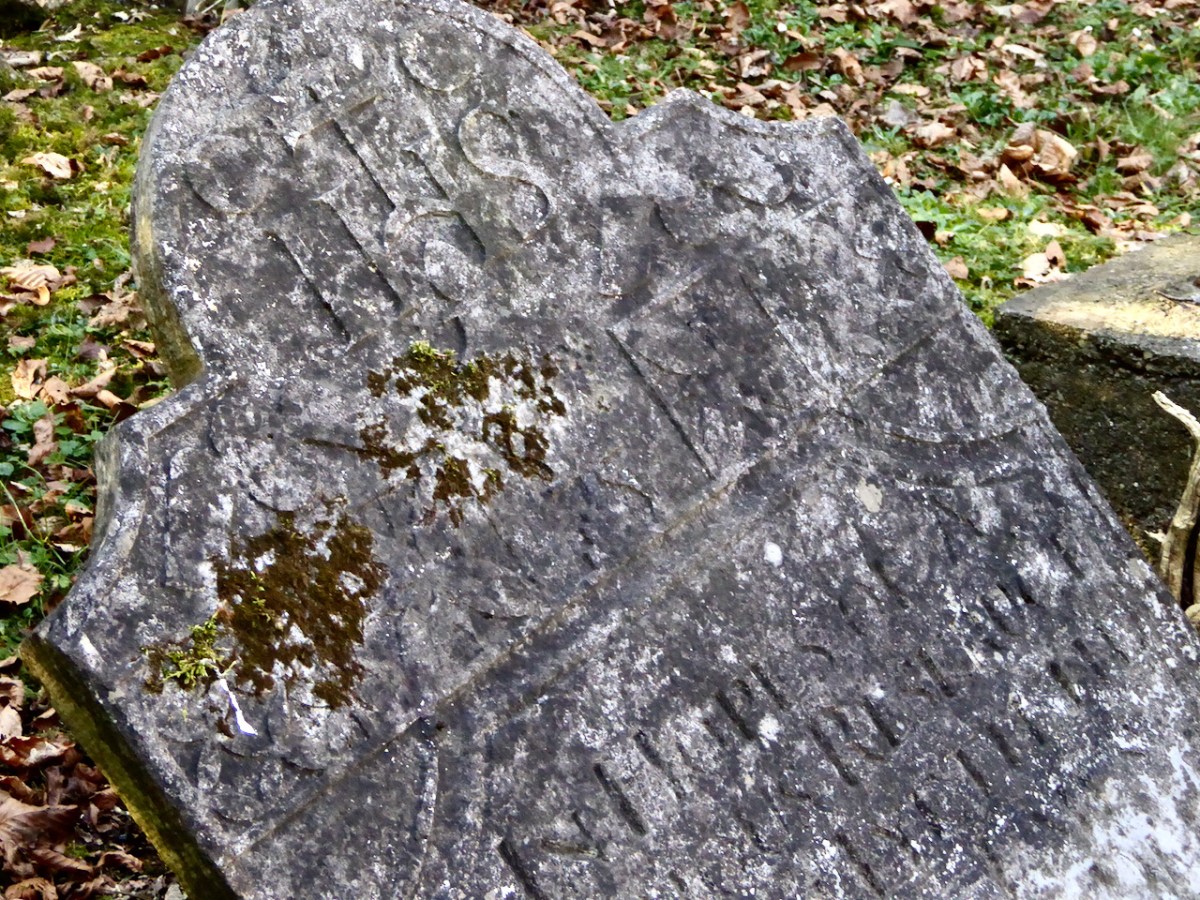
There were claims and counter claims, all gleefully reported by the newspapers: that the graveyard was full – that there was still lots of room in it; that it was unsanitary and smelly – that the smell was coming from a drain in the Canon’s garden outside the walls; that Catholics dug up old graves with scant regard for public health – that the Canon allowed Protestant burials but denied Catholic interments.

I want to give you a flavour, using select quotes, of a huge public meeting held at the Graveyard on July 31, 1900. The Irish Examiner reported it in full under the title Indignation Meeting. The crowd enthusiastically cheered all the speakers, but ‘groaned’ loudly when Canon Powell drove by in his trap.

The Chairman, who was received with cheers, said although their forefathers met for many a serious purpose they never had to meet for such a purpose as they were assembled there that day for (hear, hear). Although their forefathers were hunted and persecuted, yet the enemy never interfered with their burying places, as they were doing now. It was for the people gathered there to say that that ancient burial ground would not be closed without an effort being made to prevent it: and it would be kept open as long as they had power in their arms to do so (loud cheers). If their forefathers lived they would never allow it to be closed; they would see their own blood run down that hill first (cheers). There were good and true men yet, and they would show by their actions in connection with this matter that there were no unworthy descendants of these sires. There was no use in one or two trying to fight this cause: all the people should stand together. He was sure they would do their part, and they would not be beaten without a hard struggle (cheers).

He could make no better comparison between the state of the graveyard than the comparison between the populous and depopulated parts of the country. Travel through the country, and part of it would be found thickly inhabited, but again there would be found parts of it deserted, turned into cattle ranches and sheep walks, parts where the people had been driven forth to make room for the sheep and the bullocks (groans for the evictor). They would find in the Ireland of the past places where the people had been banished – places in which they had drawn the milk from a fond mother’s breast, and had been bred and reared; in those places, too, could be seen the ruins of the homesteads.

In the days of the past, when the people were oppressed, and when the country was ruined and depopulated; when the people were subject to the most cruel laws and torturous persecutions that any people could be subject to. . . when the people lived continuously in the midst of gloom and tyrannical rulers, it was not known that those who interfered with the land of the living had ever interfered with the land of the dead (loud cheers). The only consolation our fathers had in those oppressed times was that they could claim one spot, at all events, just as much as the biggest man in the land, and that was the spot where their friends and ancestors were buried in the graveyards of Ireland (cheers). If we went further back, when this country was put to the sword by Cromwell, and the people were driven from the four provinces. . .When the people were driven to hell or Connaught. . .but I am sure there are few of the Irish race who were driven into Connaught now in hell but I am not going to say what became of Cromwell (cheers). At any rate, we don’t hear at all that Cromwell ever interfered with the graves of the dead in Ireland.

Though Cromwell spared the graveyards of Ireland, as did other tyrants who oppressed the people, I say here to-day that they dare not face the people possessed of life – the living Irish. 

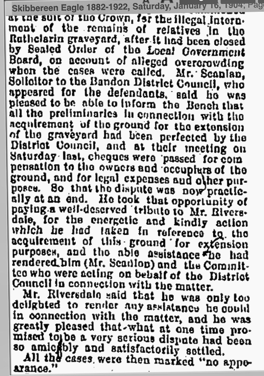
There was much more in this vein at the meeting. Eventually there was a board of inquiry, a proposal was made to buy extra land for an extension of the graveyard and after some missteps this was eventually accomplished. In the meantime, local people carried on burying their dead in defiance of the court order not to, but the police seemed happy to drop charges if they could – see this report from as late as 1904, when the matter was finally declared resolved.

Besides the post on West Cork History, a friend has just now gifted us a set of old OS maps for this area (thank you Noel!). They are large scale and date from 1900 – and here is Rathclaren, clearly showing the church and graveyard as of that date.

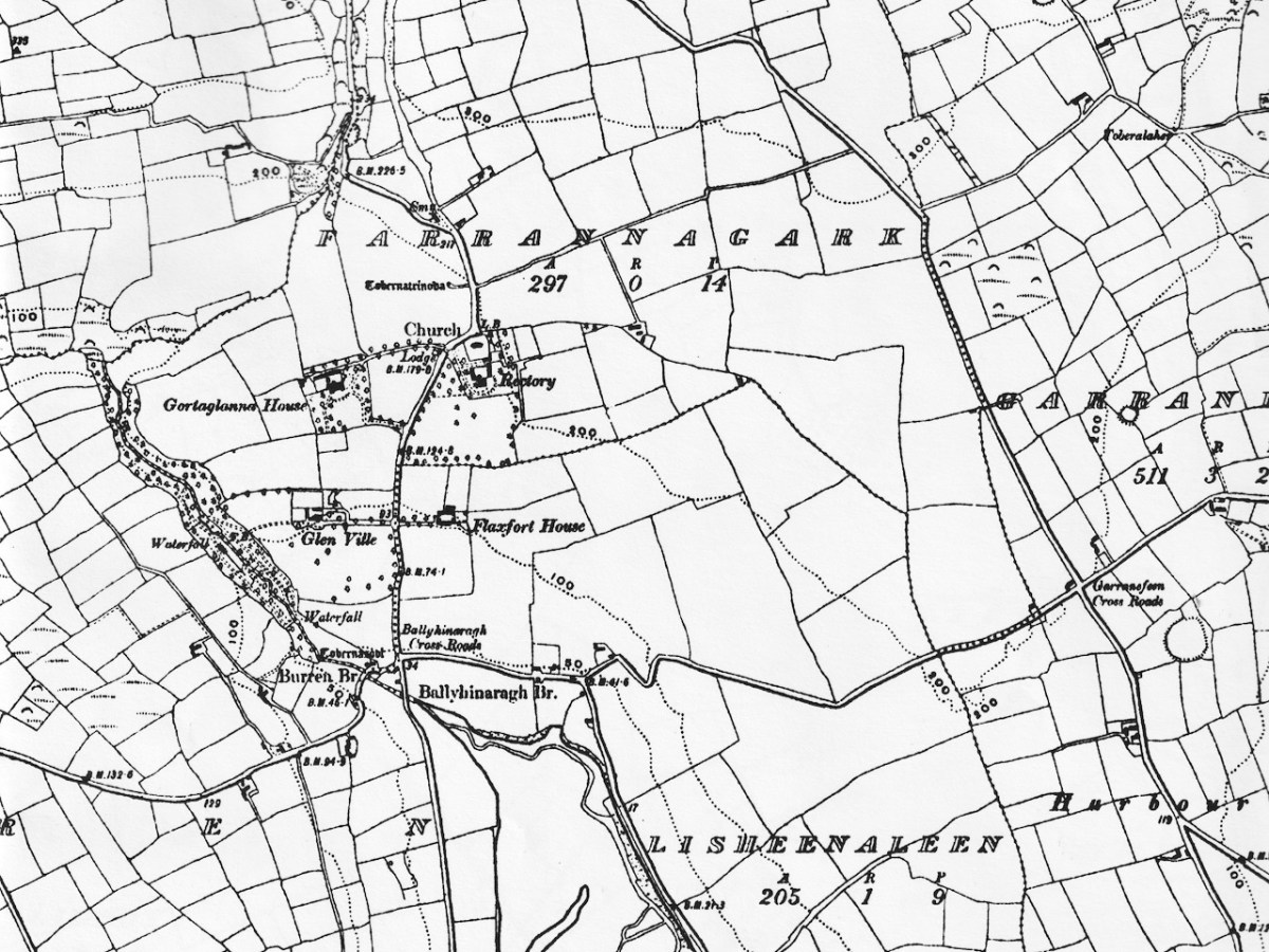
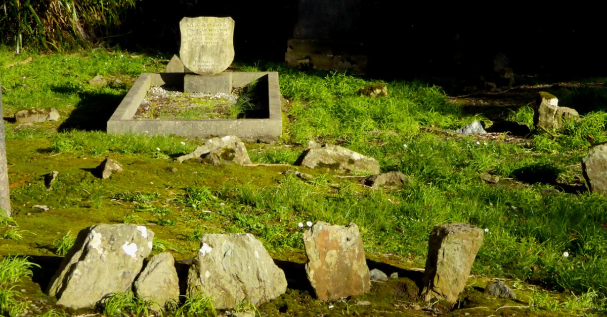
However, today there is an addition to the map in the form of a new ‘cemetery’ just to the north of the church. On the Ordnance Survey and the Archaeological maps of Ireland the term ‘Graveyard is defined thus: The burial area around a church. These date from the medieval period (5th-16th centuries) onwards. However, the terms ‘Burial Ground’ and ‘Cemetery” are reserved for An area of ground, set apart for the burial of the dead, not associated with a church. In this case the word cemetery is used to denote a modern burial area which was not originally associated with the church.

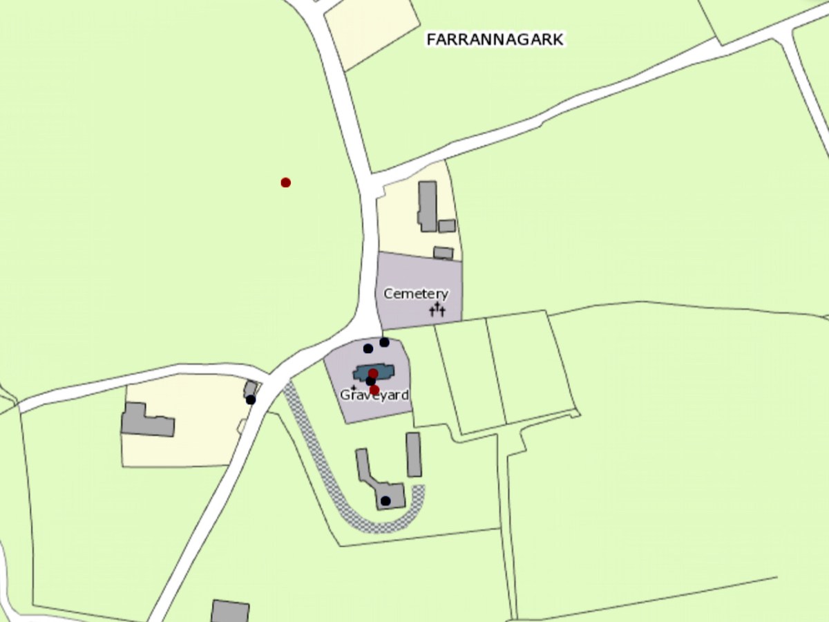
Today, this peaceful and beautiful spot seems as if it could never have witnessed any kind of upheaval. Along the road stands the Trinity Holy Well (below, labelled as Tobarnatrinoda on the historic map), still cared for by the community. Both the graveyard and the cemetery are visited by those for whom the history of tumultuous resistance to ‘the oppressor’ has faded and indeed has been mostly forgotten. On the whole, that’s a good thing.

Off the M8: Fethard Walled Town

Fethard is nestled snugly in Tipperary’s Golden Vale, famously rich agricultural land, and is nowadays well-known for raising legendary race horses. But it also happens to be the town in Ireland with the most intact set of medieval walls. The map above (taken from Fethard’s Conservation and Management Plan) shows how the town would have looked in the 1850s when George Victor du Noyer came through.

We drive the M8 often and we’re always looking for ways to vary the journey, so this post is part of our ‘Off the M8’ series. Fethard is an easy detour: if you’re heading north, leave the M8 at Exit 10 just after Cahir and re-join it at Horse and Jockey or at Urlingford. You’ll be travelling along lovely quiet roads parallel to the motorway and depending on how much time you spend in Fethard, the whole detour should add a couple of hours (or maybe three) to your journey.

Fethard also happens to have some lovely old shop fronts. This one dates to 1770

We started off at the visitor centre in the old Tholsel, or Town Hall. It’s been nicely restored and features an excellent audio-visual presentation, and upstairs many colourful explanatory panels. The staff was friendly and very informative, with an obvious passion for their town and its history.

From the Tholsel Visitor Centre, you look down over Trinity Church and the walls

The town was founded around 1200, and walled soon after, when Edward I granted the right to raise money through what was known as ‘murage grants’. This continued over the next couple of centuries, in fact most of the walls were built (or rebuilt) in the 15th century. We tend to think of town walls as primarily for defensive purposes, and indeed the town was attacked on more than one occasions. But walls were also important demarcations of commerce. The market was held within the walls and according to Tadhg O’Keefe (in the Irish Historic Towns Atlas):

The walls were a barrier through which those wishing to trade in Fethard had to enter, so they articulated, especially with guarded gateways, the differences of privilege and opportunity between those who lived within and those who entered from without.

There is only one gate left, the North Gate, which we actually didn’t see. But when our old friend Du Noyer came through in the 1850s there was still a gate at the west end of the town (below). It guarded the entrance at the bridge known as Madam’s Bridge and had what O’Keefe describes as a rare type of Gate incorporating a three story fifteenth century tower house.

Despite the walls, the town was attacked and burned on several occasion – but not (unlike so many Irish towns) by Cromwell! In fact, the town surrendered, under terms, and was spared the violent destruction that the Parliamentary army visited on so many other Irish towns. This doesn’t exactly make Cromwell popular in Fethard, in fact there is still a tradition in the town that ‘people will not go out the way that Cromwell came in’ so that funerals, for example, take a circuitous route to the cemetery to avoid retracing his tracks.

Like Youghal, the other Irish town with a significant extent of wall, there were tower houses along the wall, and within the town there were fortified town houses. Some are obvious and some are hidden behind more modern facades. Court Castle is one of the obvious ones, but the house next to it, known as the Watergate House, has a base batter that marks it out as fifteenth century (both images, below).

Within the walls and behind the Tholsel is Trinity Church. Because there is so much going on in and around it, I will quote the Buildings of Ireland summary in full:

Like the Town Hall and the Augustinian Abbey, the medieval parish church is a multi-period building of outstanding architectural, archaeological and historical importance. The church stands at the heart of the medieval walled town and the focus for the extraordinary number of late medieval structures arranged around the sides of the graveyard with rear entrances allowing direct access to the graveyard. The size and design of the church reflect Fethard’s prosperity in the medieval and early modern periods, the different types of windows, from different eras, emphasise the continuity of use. The impressive tower, that is highly visible for a considerable distance, is a particularly important and dramatic example of fifteenth-century craftsmanship, and is especially evocative of the medieval era as it stands picturesquely and appropriately inside the almost entirely intact medieval town wall and close to a impressively rare grouping of late medieval houses and almshouses. The interior has a finely crafted timber screen to the vestibule, and at the east end a stained-glass window with Eucharistic motifs, both highly decorative, and showing care and attention in the design as well as the execution. The recently timber roof to the nave, recently dated to of c.1489, is of exceptional importance as it is one of a small number of medieval roofs surviving in Ireland and is almost entirely intact.

Trinity, the graveyard and medieval church remains on the left and the town walls on the right

Unfortunately, the church itself was closed when we were there. It’s still very much in use, though, and there was some tidying up taking place in the graveyard. I’d like to go back for another poke around sometime.

Down by the Watergate we came across one of Fethard’s two Sheela-na-gigs. (See this post for more about the Sheelas). This one is typical – a female figure displaying her genitalia, but unusual in her emaciated form with ribs clearly shown, staring eyes and a grimace. We didn’t have time to see the other one, which means a) you (yes, you, Dear Reader) have to, and let us know and b) we have to go back.

We also met Fethard’s famous geese down here too, along with their owner. They are pets, he told us, but don’t go too near the male as he is guarding the female carefully at the moment as she is just taking a little break from sitting on eggs.

The walls are extensive, with long stretches very much intact. Edmund’s Castle and a mural tower known as Fethard Castle punctuate the wall on the river side.

I was fascinated by the flowers growing all over the walls. I expected Ivy-leaved Toadflax and Wallflowers, but it was fun to see Fairy Foxglove also: it’s an alpine plant and so it likes high rocky places. The only other place I have seen it here is on the Martello Tower at Illnacullen/Garnish Island, off Glengarriff.

Upper: Fethard Tower, with Trinity Church bell tower behind the wall. Lower: Fairy Foxglove growing high on the wall

Because it also happens to be the end wall of people’s gardens, the wall is breached here and there by entries to residences – not something I was expecting to see, and probably not something that would be allowed nowadays.

The wall is part of a living town, so it has not always been considered untouchable

We rounded out our visit with an excellent lunch at Emily’s Tea Room before resuming our journey. Fethard was a surprise – an amazingly intact slice of medieval history!

nnnn

Castle Haven

The entrance to Castle Haven. Horse Island is separated from the mainland by the charmingly named Flea Channel.

The entrance to Castle Haven. Horse Island is separated from the mainland by the charmingly named Flea Channel

South West of Skibbereen lies a deeply indented section of the coast known as Castle Haven. It is perhaps best known for the town that clings to the steep hill on its west side – Castletownshend. We have written much about Castletownshend itself, about Edith Somerviille and about the lovely St Barrahane’s Church and its Harry Clarke windows. But the whole inlet is an explorer’s paradise, yielding up its treasure to us on successive visits so this post will be about other things to see around the Haven.

Castle Haven

Catle Haven on a misty day. The inlet was guarded by two castles: this one at Raheen and another at the entrance to the Haven

The Haven is shallow at its top end, but up to the spit of land that runs across it near Reen Pier, it provides a deep and sheltered harbour for boats, and a popular sailing ground. We like to drive down the road that runs above the eastern side of the Haven. It’s twisty and a bit treacherous but at a certain point it presents a view of the whole inlet, dominated by Raheen Castle.

Raheen Castle

This was a castle of the O’Donovan clan, built in the late 16th or early 17th century. It didn’t last long – it was attacked by Cromwellian forces in 1649 and the collapsed upper stories may be the result of cannonball damage.

Raheen Corner machicolation

Continuing to the end of the east side brings you past Reen to the wonderful harbours of Myross and Squince, but that’s a post for another day. Now we’ll return to the west side of the inlet and visit two spectacular archaeological sites, Knockdrum Fort and the Gurranes Stone Row, before proceeding down into Castletownshend.

Knockdrum interior and views to north

The interior of Knockdrum Stone Fort, with square hut site in the middle. The fort commands panoramic views across the countryside and out to sea

To get to Knockdrum Fort, you have to park at the large church about 2km before the village. Walk downhill about half a kilometre until you get to the signposted green road to the fort. A pleasant trudge brings you to a set of steps and these lead up to the site. This is an excellent example of an early medieval stone fort – the kind of fortified homestead that marked the residence of a family of high status before the Normans taught us how to build tower houses.  From this site there are striking views across Castle Haven.

Entrance to Knockdrum

The entrance to Knockdrum Fort, looking towards the entrance to Castle Haven. Outisde the entrance is this large rock, covered in cup-and-ring art

But there’s more to this place than just the fort. There’s an early Medieval cross slab just inside the entrance, and a fine example of 4000 or 5000 year old rock art just outside it. There’s another piece, a cupmarked stone, inside the fort, lying on the ground. All three are here thanks to the activities of Boyle Somerville, a keen amateur archaeologist and brother of Edith Somerville who lived in Drishane House, just below the fort. Farmers who found such items would bring them to him and he placed them here for safekeeping. Also inside the fort you will see evidence of a souterrain – an underground passage used for storage when the fort was active.

Knockdrum cross slab

If you look north across the valley once at Knockdrum you will see a stone row on a nearby hill. These are the Garranes ‘Fingers’. (They are on private land so you should seek permission to visit and make sure there are no bulls in the fields.) The best way to access them is to tramp through the fields across the road from the entrance to Knockdrum. It’s well worth the effort – once you get up to them you will see that more uprights are now lying on the ground. This was originally an alignment of at least five stones, unusually tall and thin, positioned so that they would be visible on the skyline from many directions.

Gurranes Fingers

Drive down towards the village now, until you get to the entrance to Drishane House. To the right of the gate is a bench dedicated to Boyle Somerville. In 1936 he was shot dead by the IRA, who claimed he was recruiting local young men for the British Navy. He was liked and respected locally and, outraged by the deed, the people of Castletownshend raised money for this memorial. If the house is open (there will be a sign) this is a wonderful place to visit. For a small charge you can wander around the extensive grounds and visit the Edith Somerville Museum. We love to go in spring, when the bluebells provide a vivid carpet and a photographer’s paradise.

Drishane house driveway in spring

Drishane House driveway in the spring, with the giant macrocarpa (a Californian cypress tree)

Down to the village now and up to the church. But this time, instead of heading inside to see the Clarke windows, or behind the church to view the graves of Somerville and Ross, cross the graveyard until you find a gate at the far side and head east along the edge of the field towards the water. There you will find the remains of a structure labelled as a star-shaped fort on the OS map. Nowhere near as enormous as the massive star-shaped Charles Fort in Kinsale, nevertheless it is a reminder of a time when the sleepy village was not as peaceful as it is now. Dating to the 1650s, not a lot remains, just enough to confirm that this was a structure built for defence. Along the way you might also see a ruined square tower, known as Swift’s Tower. This was built as a belvedere, (a place to admire the view) and legend has it that Dean Swift visited and liked to write there.

Left is the remains of a bastioned fort, labelled as a ‘Star-Shaped Fort’ on the OS map. Right is the belvedere, where Swift is said to have written

Drive back out of town now and take the left turn after the entrance to Drishane House. Follow this road for about a kilometre to a sharp left turn, just before a small crossroads and turn left down a narrow road that ends at the sea. A tower house used to guard this part of the Haven but nothing remains of it now except a stump covered in ivy and brambles. But wander around the graveyard and admire the picturesque siting of the old church, already in ruins by the mid-1600s. This is a good example of a classic West Cork graveyard. Most graves are marked by simple stones at the head and foot, with no inscriptions. 

Castlehaven Graveyard atmosphere

There are some family plots and some more elaborate memorials, including one for Ellen Buckley, second wife of O’Donovan Rossa (although his name, interestingly, does not appear on the headstone).

Castlehave graveyard, old church

To the immediate left of the graveyard you will find a stile leading to a green path. Take this path and walk up though the luxuriant woods past a rushing stream until you come to a little wooden bridge.

Path by the stream

On the other side is a holy well, cut into the hillside and decorated with ribbons and fishing floats. Make a wish, or say a prayer – this is a special place and still visited and maintained by local people.

Take OS Discovery Map 89 with you. Most of the sites I describe are actually marked on it. But if you get lost, have fun, and let us know what you discovered!

Path through woods