‘This is Our History’: The Abbey Graveyard Project in Bantry

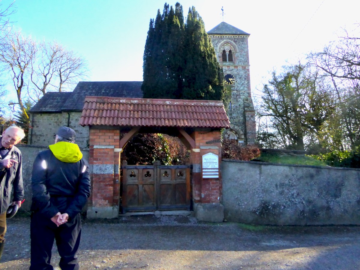
All over Ireland there are local history heroes working to recover the heritage represented in the numerous historic graveyards that dot the country. Few groups have taken on as daunting or as important a task as the Abbey Graveyard Project Team in Bantry.

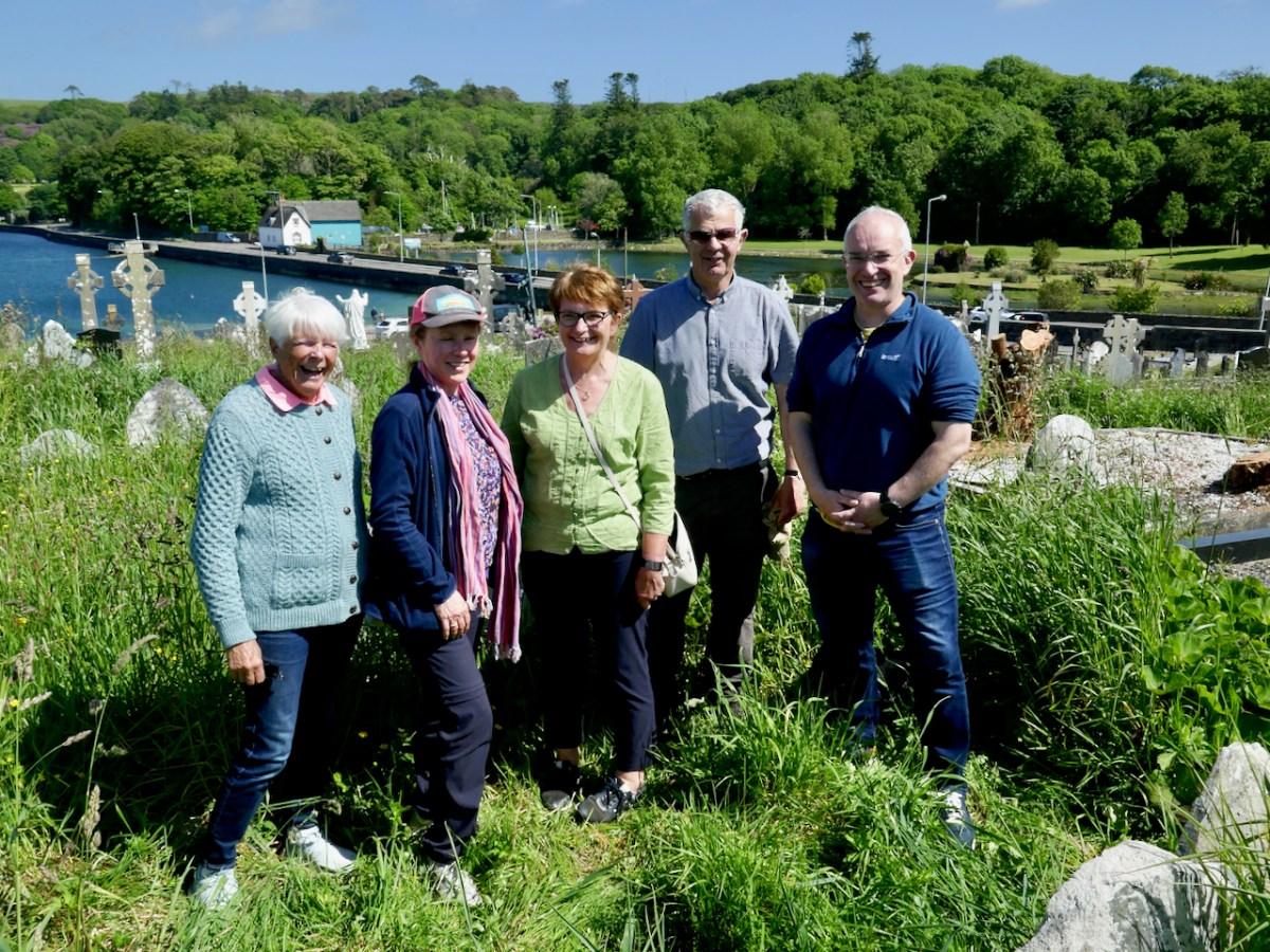
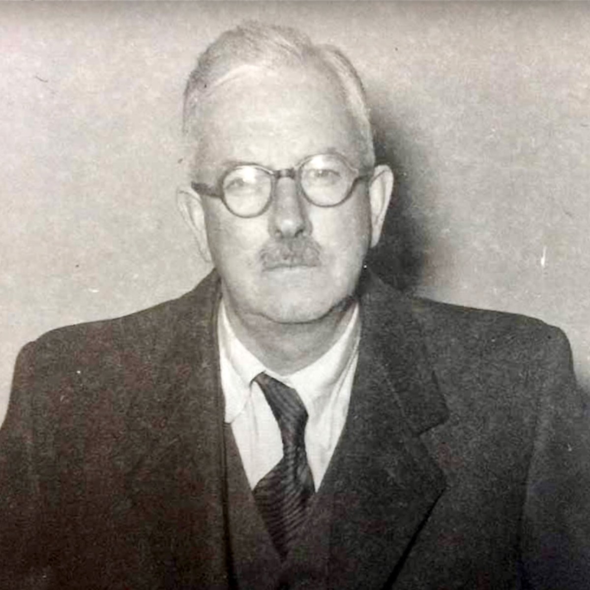
Team members Dorann Cafaro, Teresa Moran, Geraldine Mullins, Bernard O’Leary and Seamus O’Shea

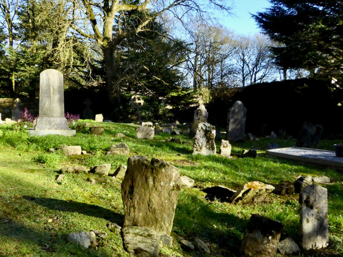
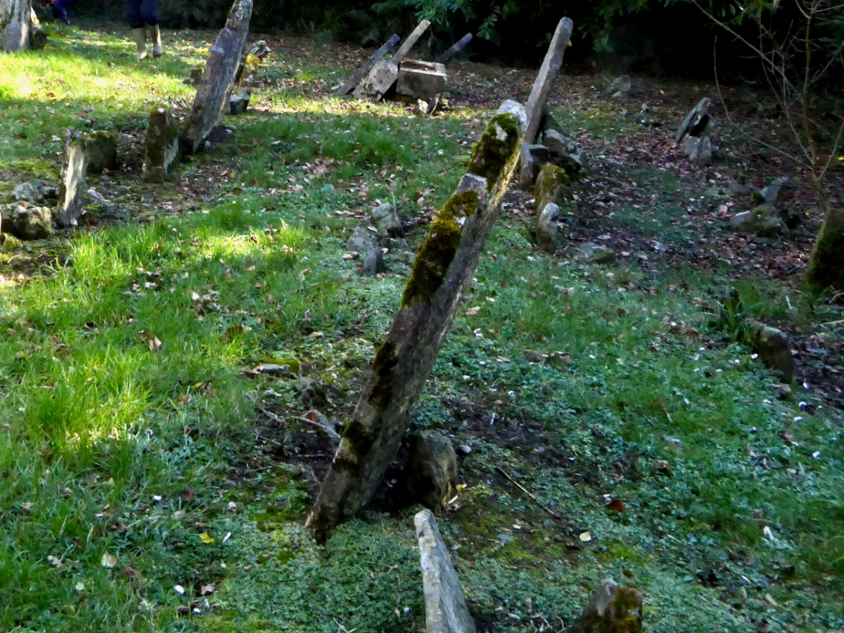
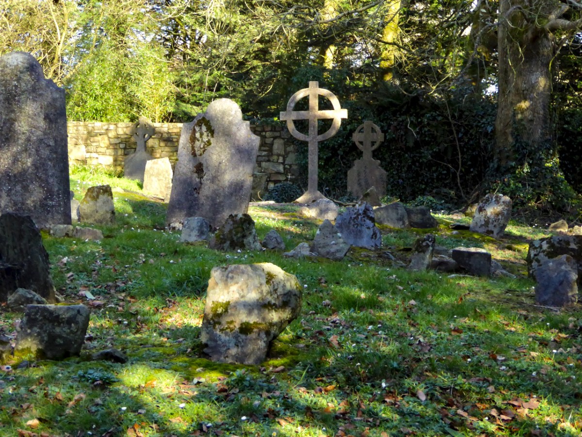
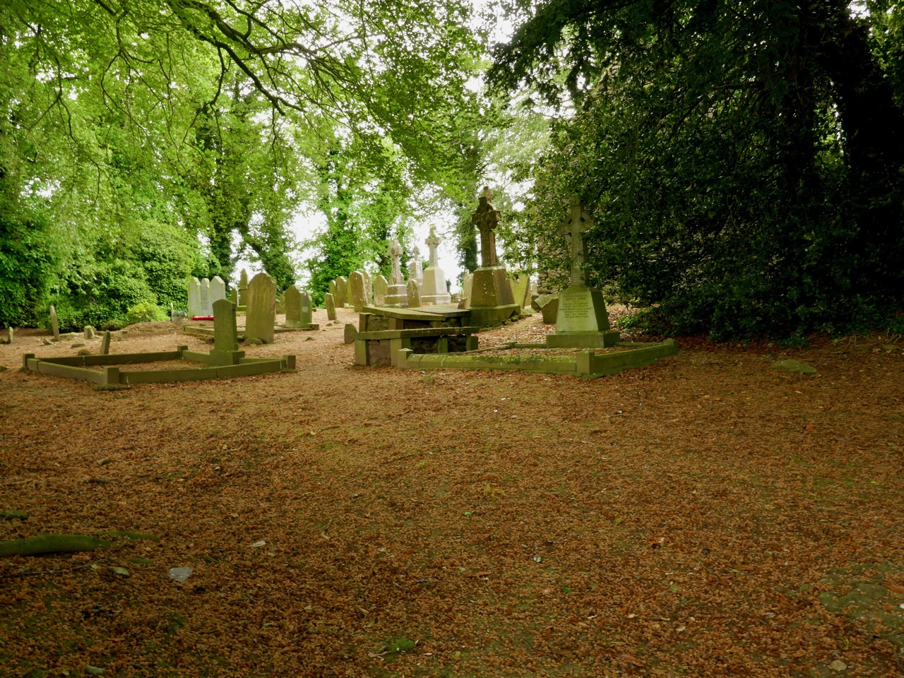
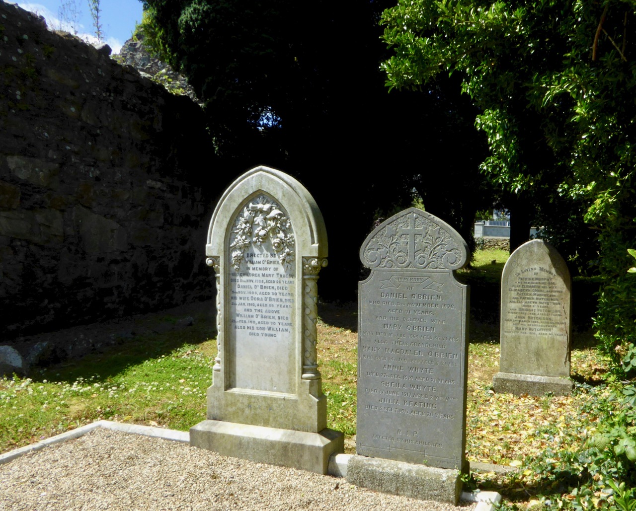
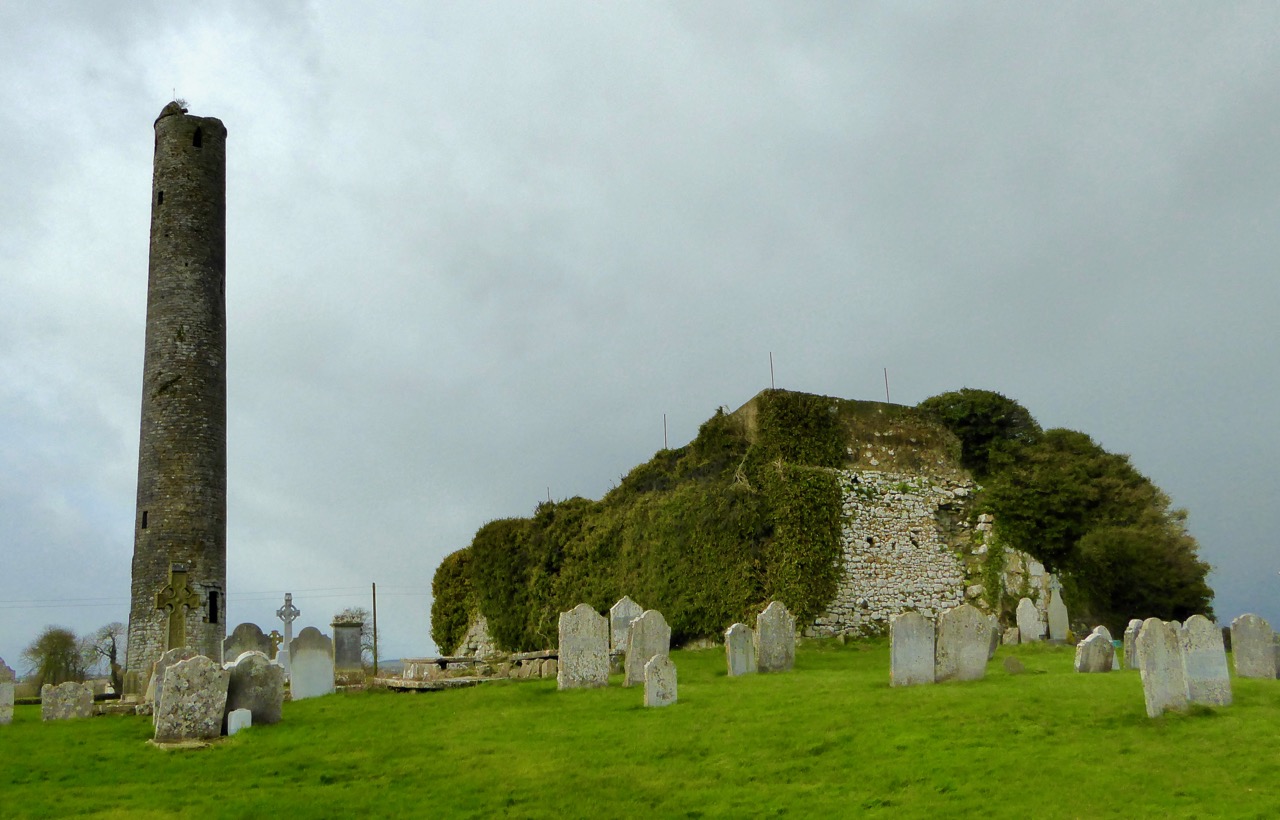
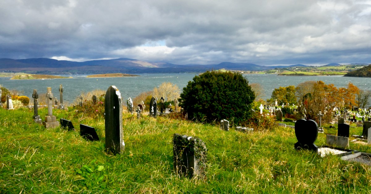
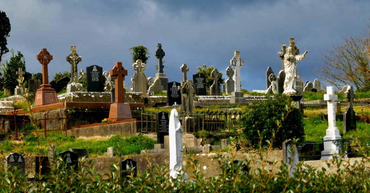
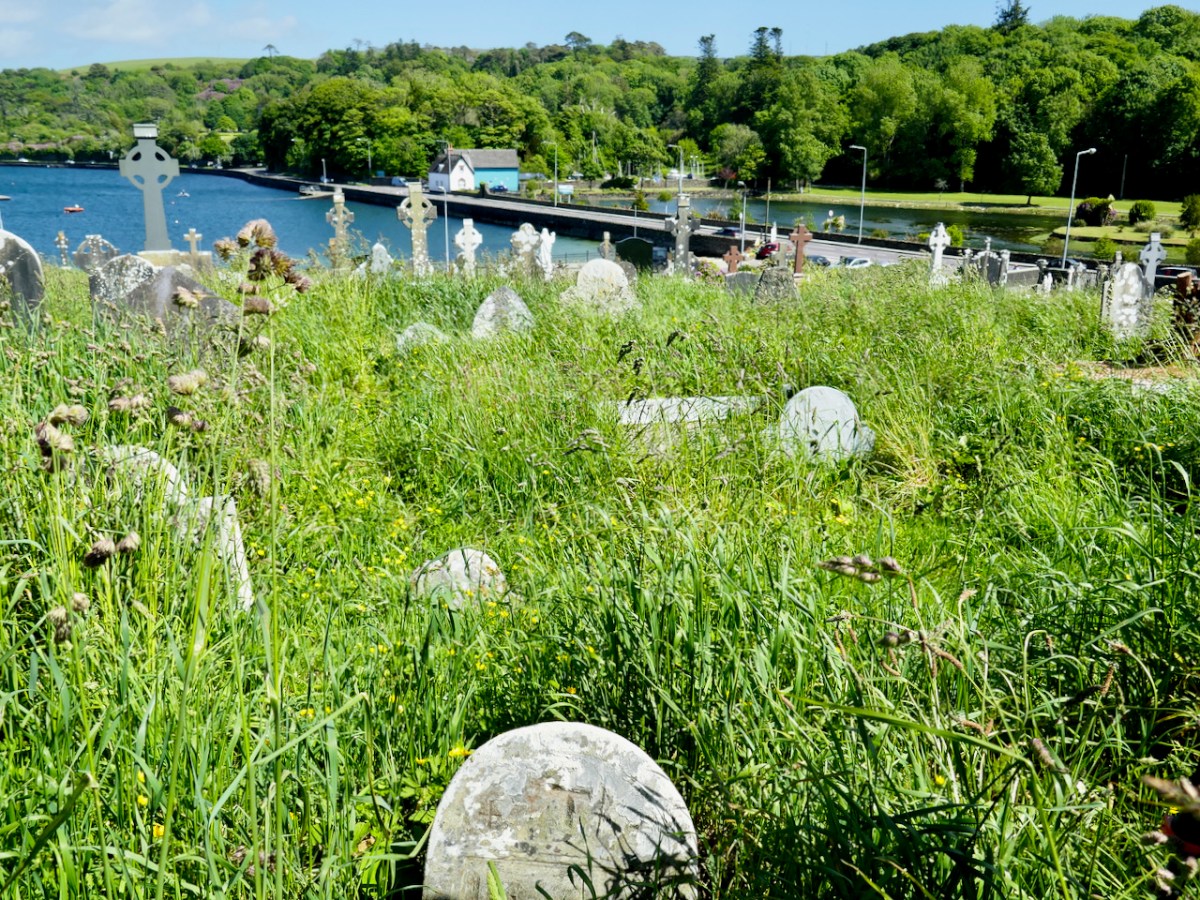
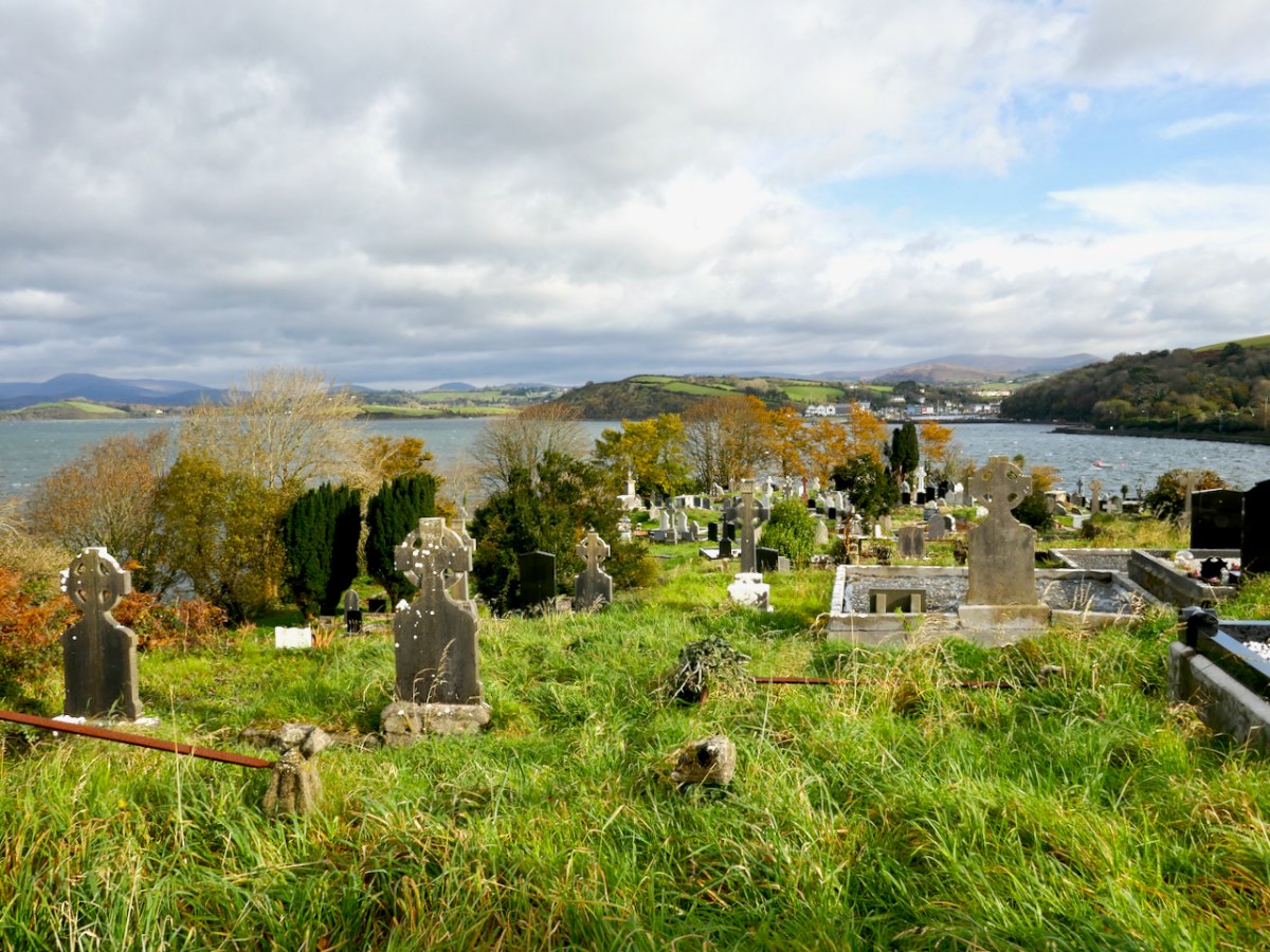
First of all, this graveyard is enormous, stretching over several acres, and secondly, the ‘old’ section has been largely untended over the centuries and so is characterised by long grass, lichen growth and tumble-down headstones. While this is understandable, as the families of those buried here have themselves passed or moved away, it makes for a very challenging environment. It also provides a startling contrast to the ‘new’ sections, where all is order and neatness, for the most part. In the image below the ‘old’ section is at the back.

The team, however, is undaunted! If anything, they seem energised by the task ahead of them. After all, as Teresa Moran said in the Zoom presentation on the projectthis is our history. 

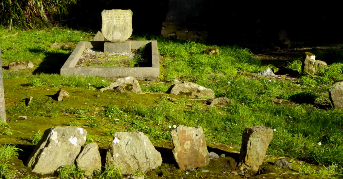
More recent history – this is the moving and beautiful memorial to those who died in the Whiddy Island Disaster of 1979

I was privileged to spend some time with them recently, on the invitation of the project team. Besides an extraordinary level of commitment, the group has a wide variety of skills between them, something that is key to a project like this – historians, computer folk, genealogy experts, keen-eyed decipherers of faint inscriptions. 

In the background is Pat Crowley, the indefatigable researcher behind the Durrus History/West Cork History website – following up on clues and names and records in his own inimitable way.

This is a project that is being done properly – that is, using best practice as developed by Eachtra, an archaeological consulting company that provides training on this type of survey and which maintains the site Historic Graves.

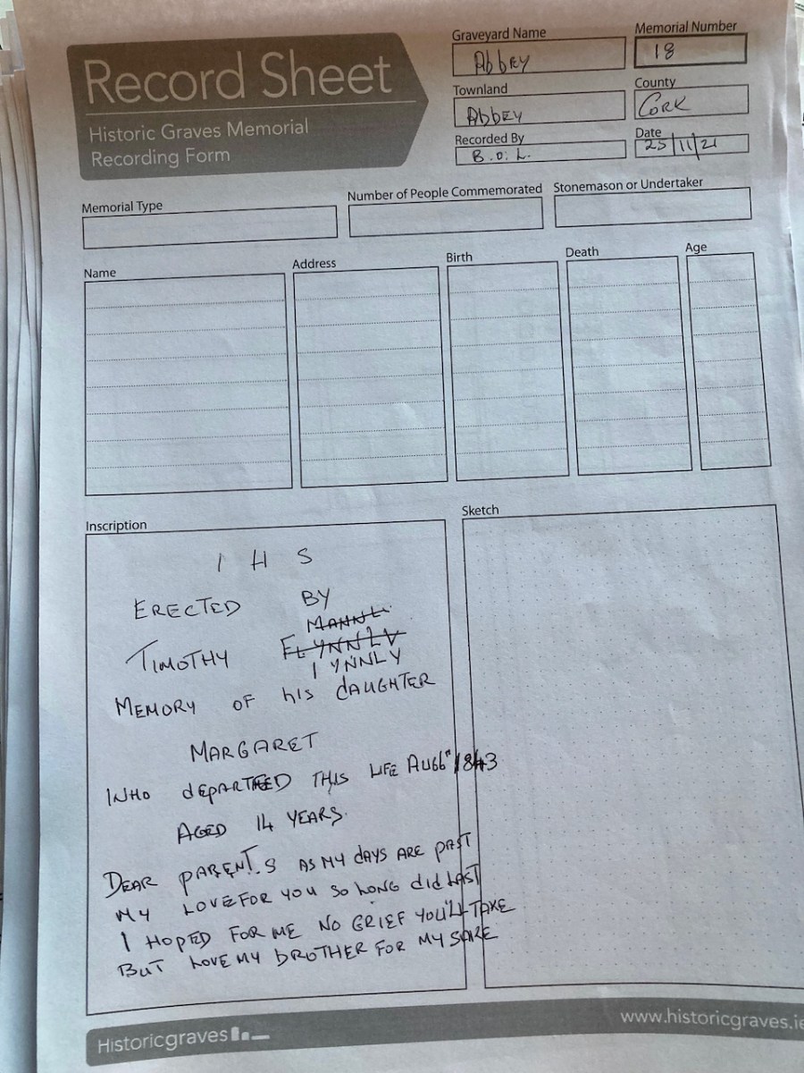
An example of a recording sheet

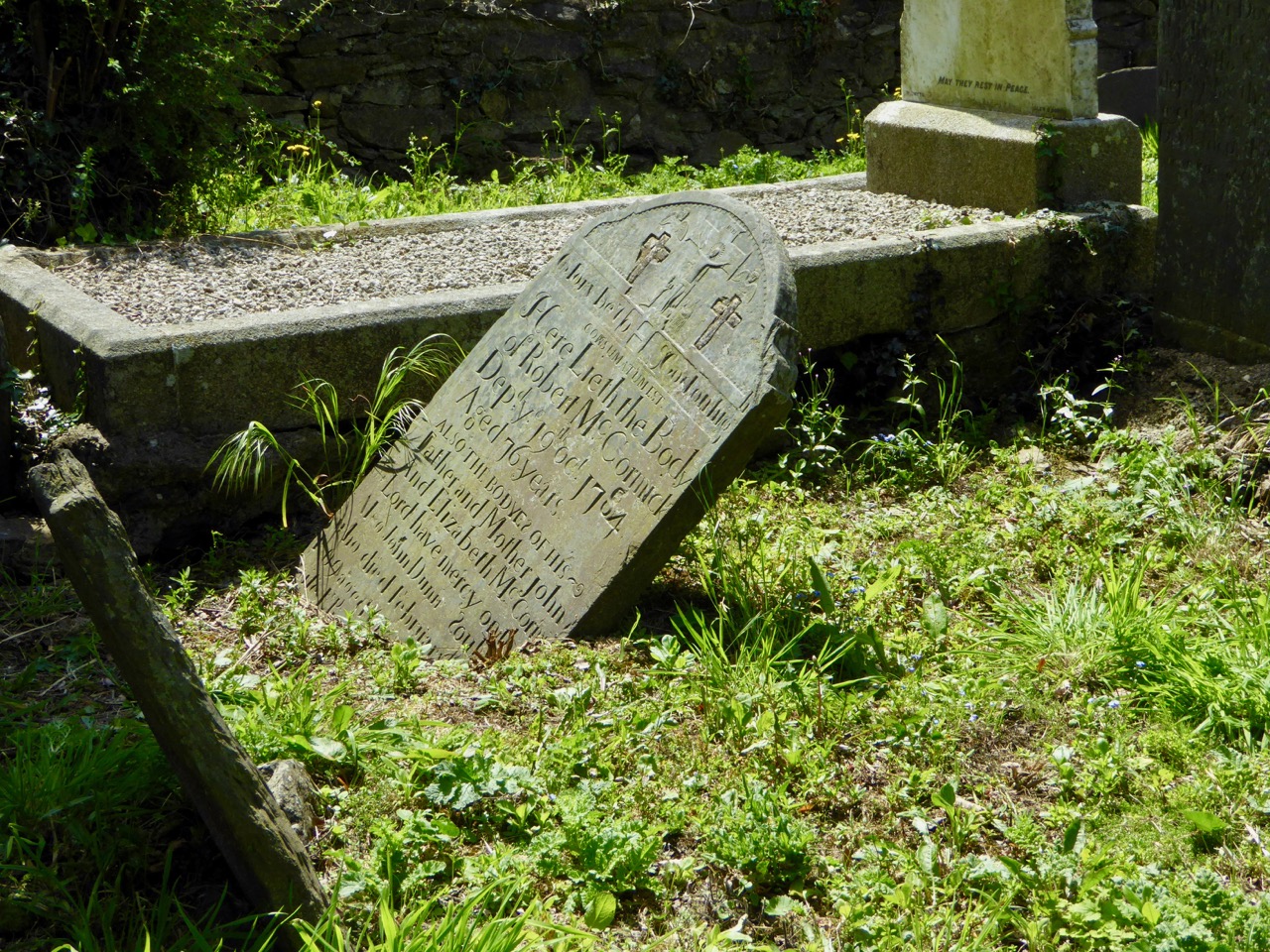
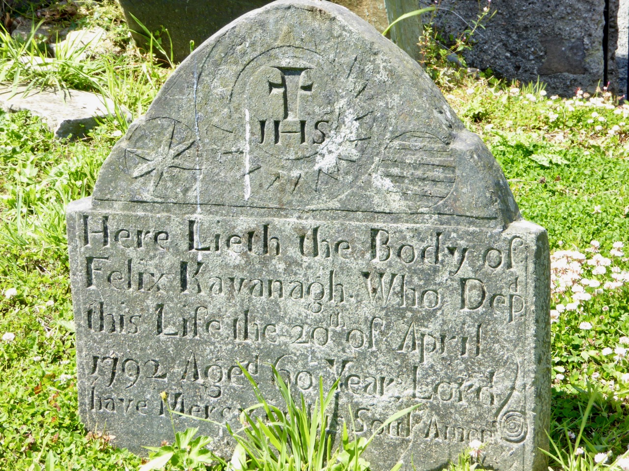
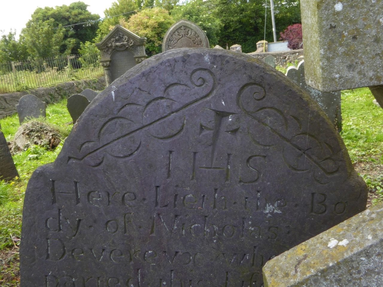
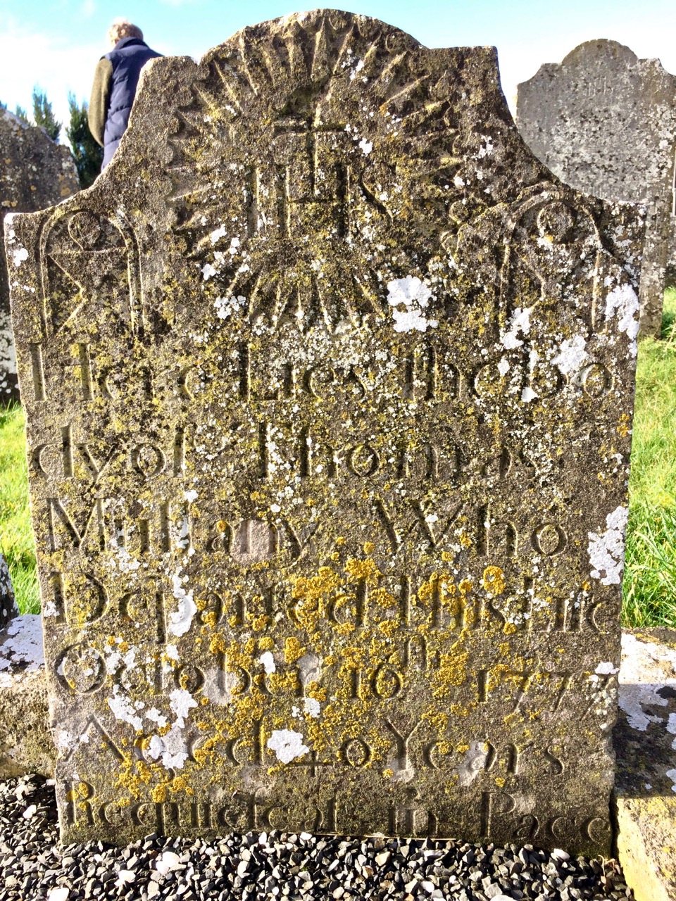
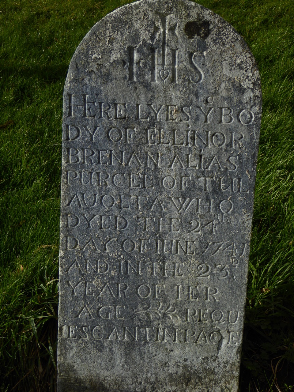
On this website, take a look, for example at Grave 31 from the Abbey Graveyard – photographed, numbered, geo-located on the map. It’s the headstone of Cornelius Leary Senior, who died in 1797 aged 88. The script is beautifully incised – the work of a master carver. Such a headstone is a real treasure, both for the information it contains and as evidence of the craftsmanship that went into a memorial like this for those who could afford it.

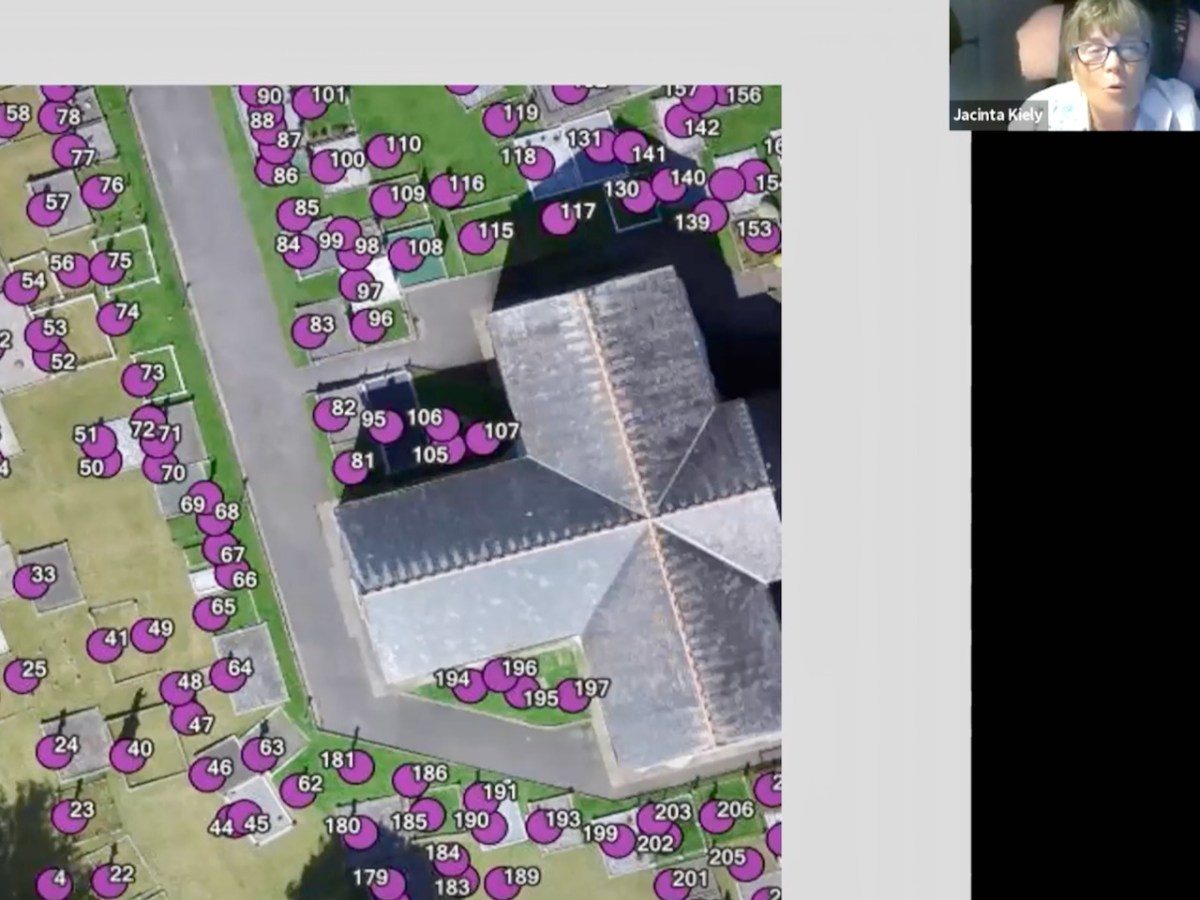
In this still from the Zoom presentation, Jacinta shows how a Drone Survey, using geo-tagging technology, can assist in providing a super-accurate map of a graveyard. Drone surveys are expensive, but the Bantry Team successfully raised the funds to commission one.

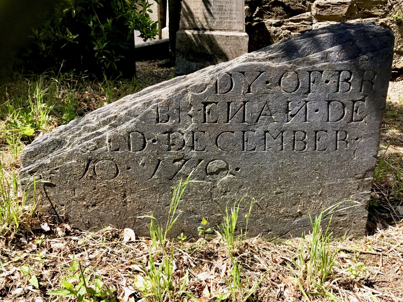
Sadly, many of those buried in the Abbey Graveyard, and in similar graveyards across the country, lie under stones with no inscription. But that does not mean that that is always impossible to identify them. Amazingly, in some areas, the knowledge of who lies under what stone is held by the elders of the area, who remember the size and shape of a field stone, especially chosen for a burial plot. That’s one of the reasons this kind of project is so vital to undertake before those memories disappear forever.

Dorann Cafaro takes the recording exercise  one step further and uploads all the records into the massive international website Find a Grave. This is particularly helpful for the descendants of emigrants who are searching for family and cannot access the information any other way. So many people now are becoming expert in genealogy and this is one of the major tools that the advent of the internet has provided for them. It’s an enormous undertaking though, to upload all those records – we are all grateful for people like Dorann!

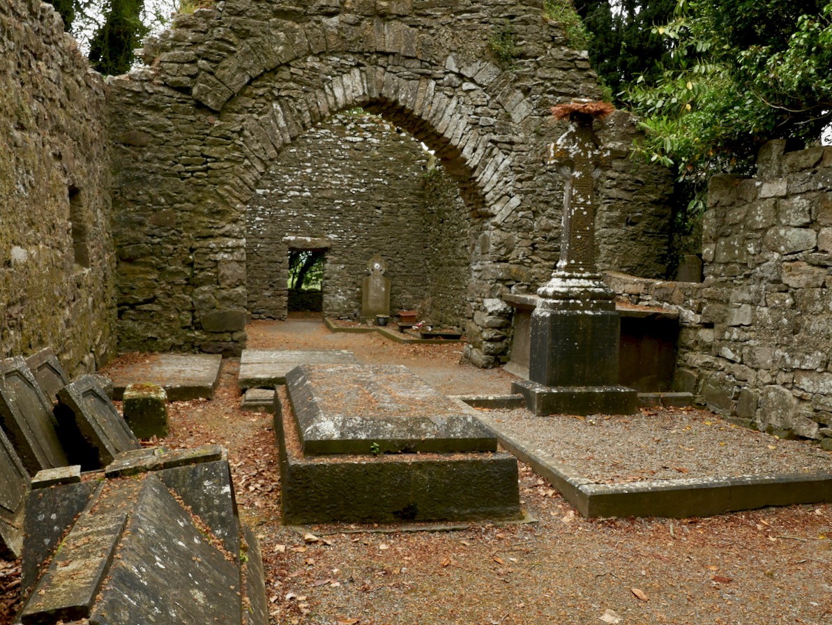
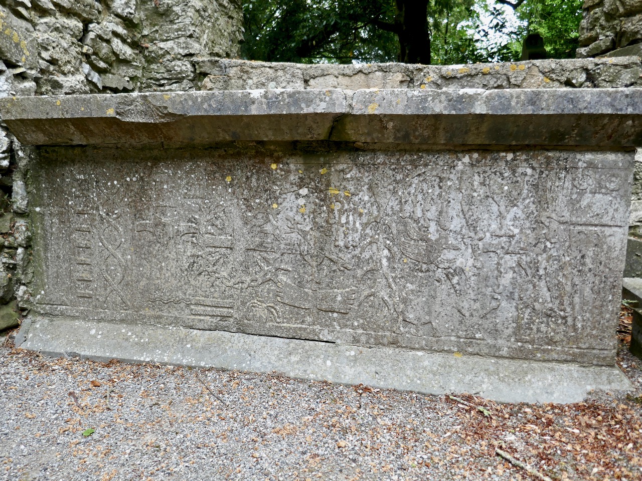
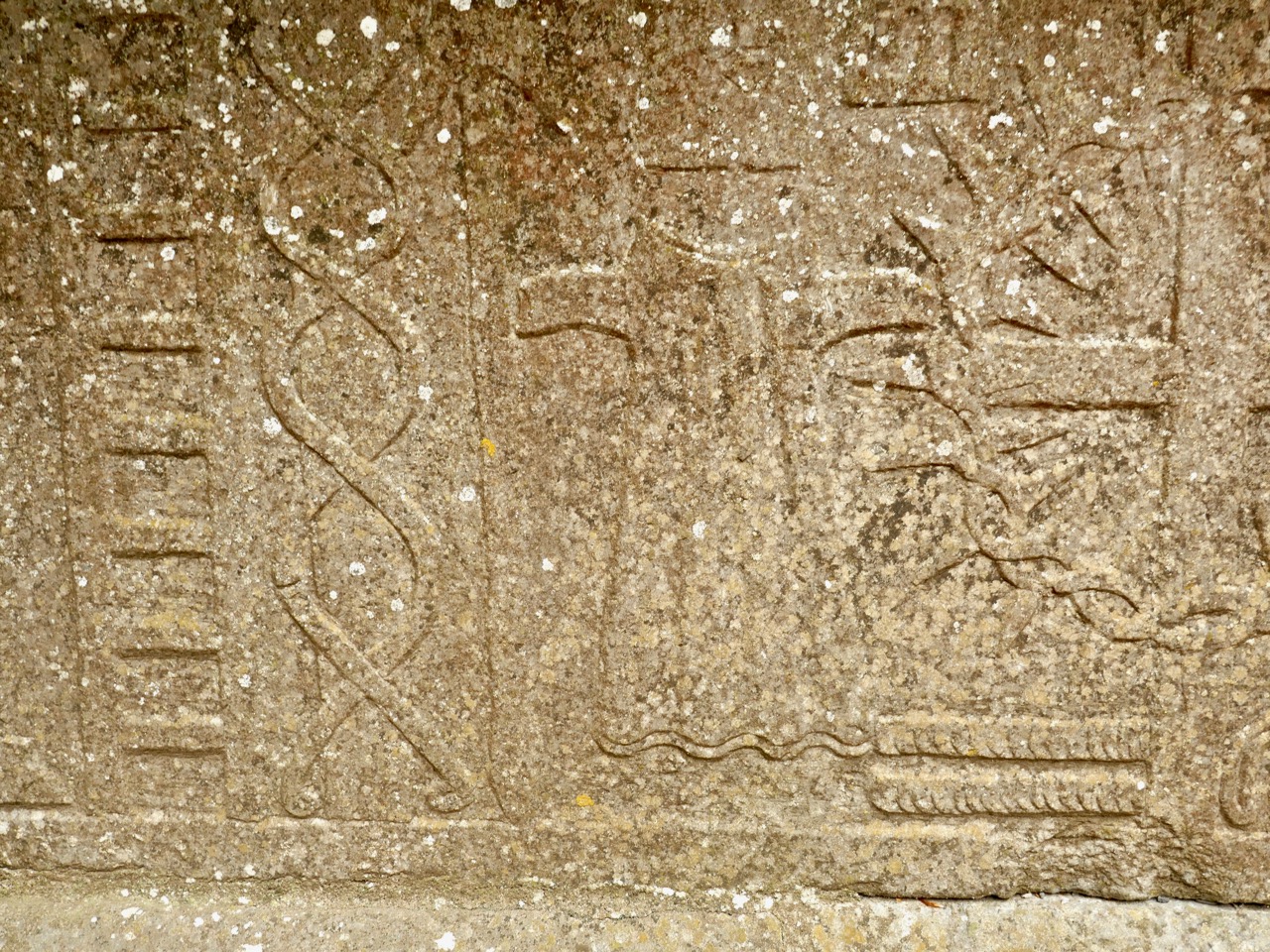
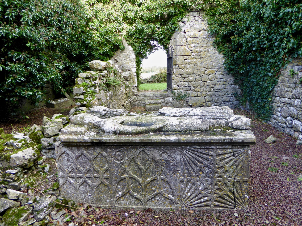
This chest tomb is the grave of Honoria O’Sullivan, sister of Daniel O’Connell

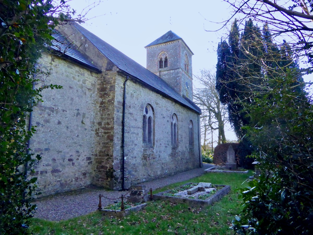
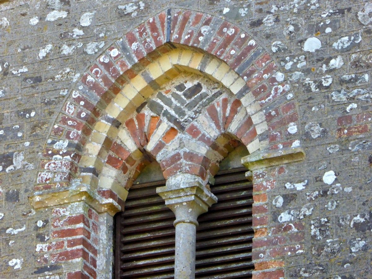
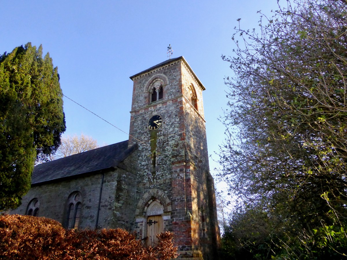
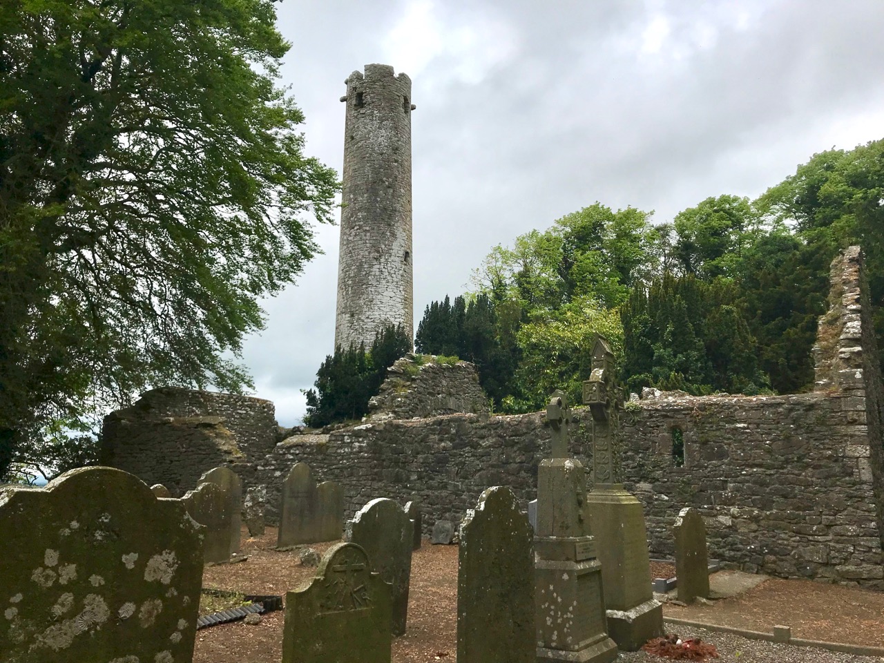
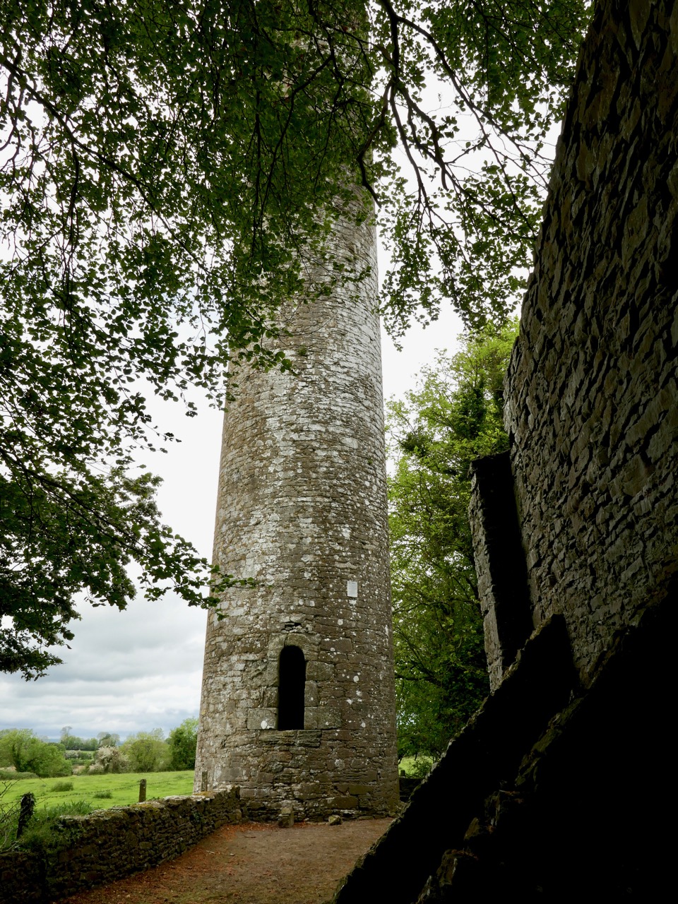
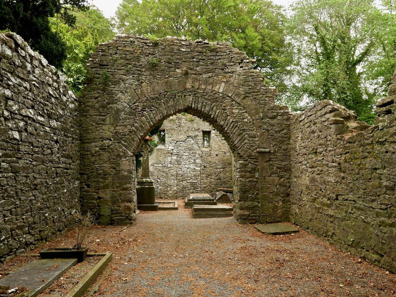
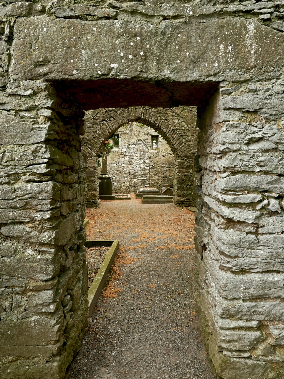
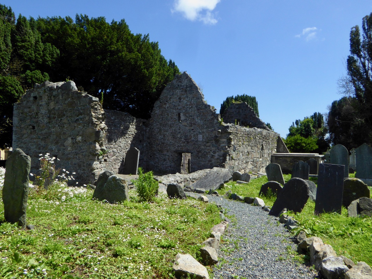
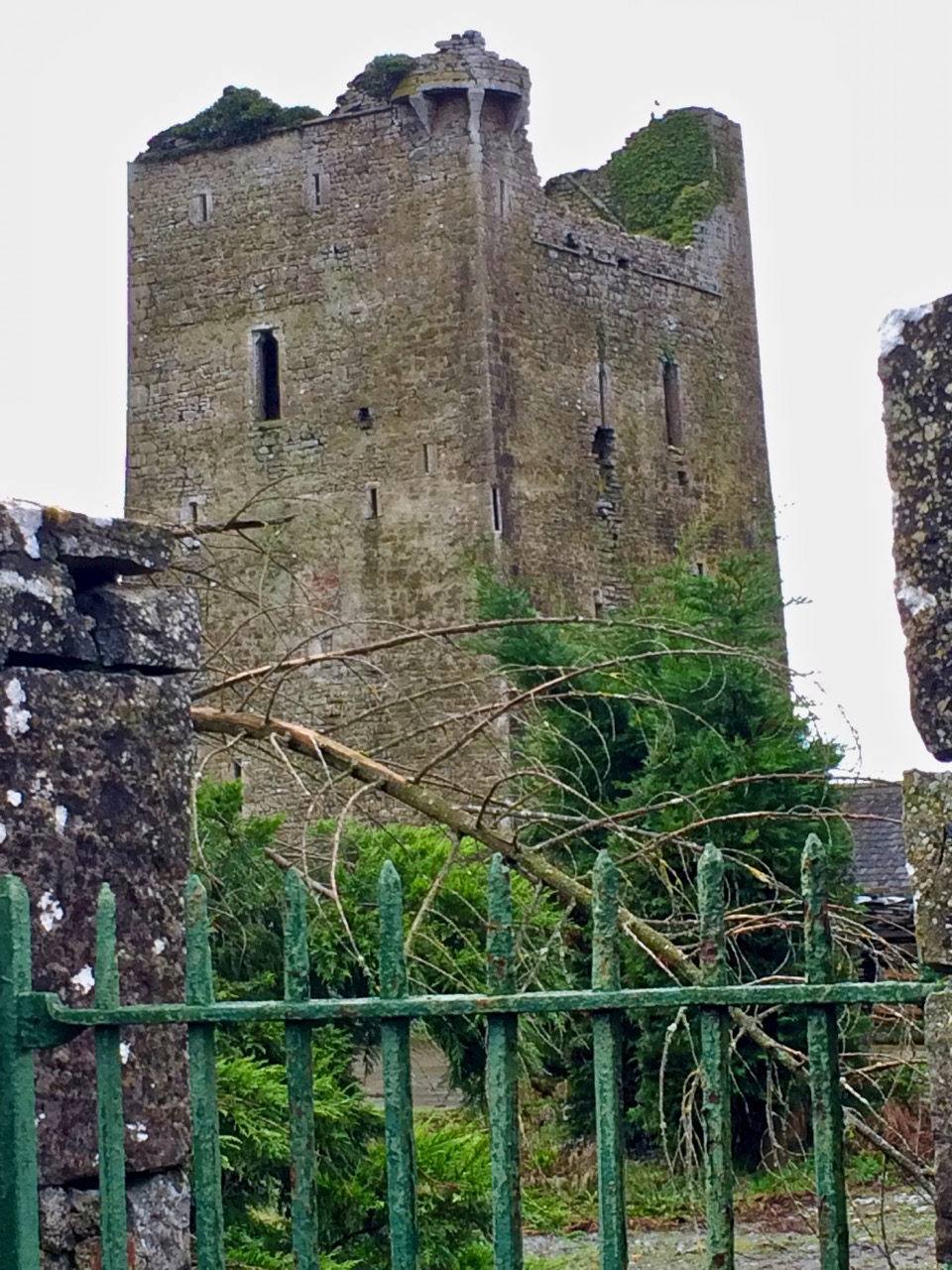
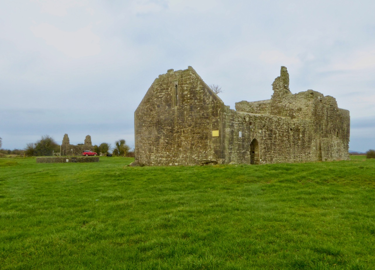
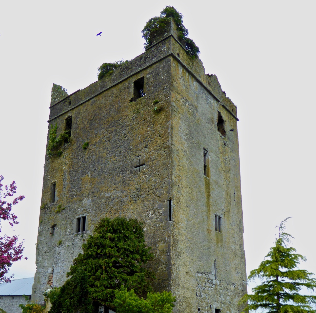
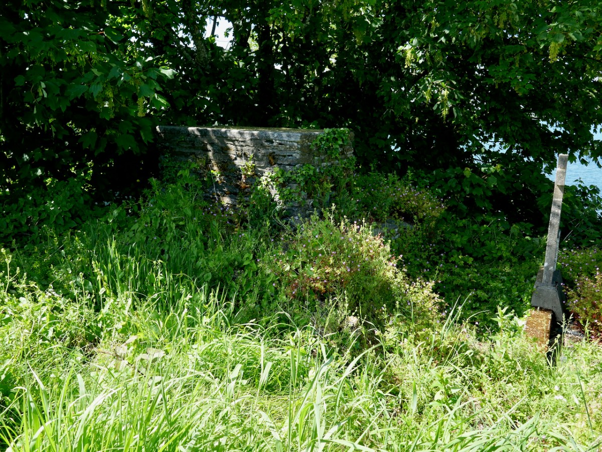
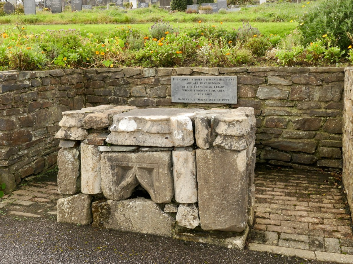
The Abbey Graveyard, as its name suggests, began as a burial ground surrounding a Franciscan Abbey, built in 1460 by Dermot O’Sullivan and demolished in 1602 by his descendant, the tragic Donal Cam O’Sullivan Beare, in order to prevent the Earl of Thomond from taking it over. Only a few random stone remain, now incorporated into an altar.

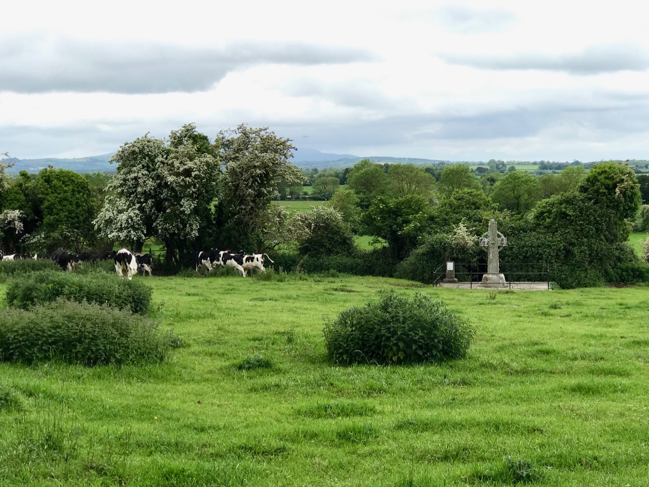
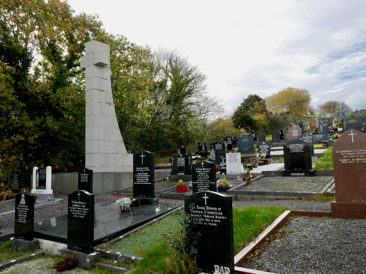
This area was one of the epicentres of the Famine – a period rigorously researched and chronicled by Geraldine Powell in her new book A Want of Inhabitants. Bodies from the workhouse – 3,000 in all, most of whom died of infectious diseases between 1847 and 1850 – lie buried in the Famine Pits, and were unmarked until Tim Healy caused a Celtic Cross to be erected in 1899 (below). However, as one of the team members, Bernard O’Leary reminds us, there were other horrendous period when large numbers of people died – of cholera in the 1820s, yet another mini-famine on the 1880s, and of TB, which was still killing thousands of people every year in Ireland up to the 1950s.

Paddy O’Keefe, noted Bantry historian, conducted the first survey of the graveyard in the 1950s and the project team has mined the database he created. This has been particularly useful, since it was done 70 years ago and some headstones that have since eroded were readable then.

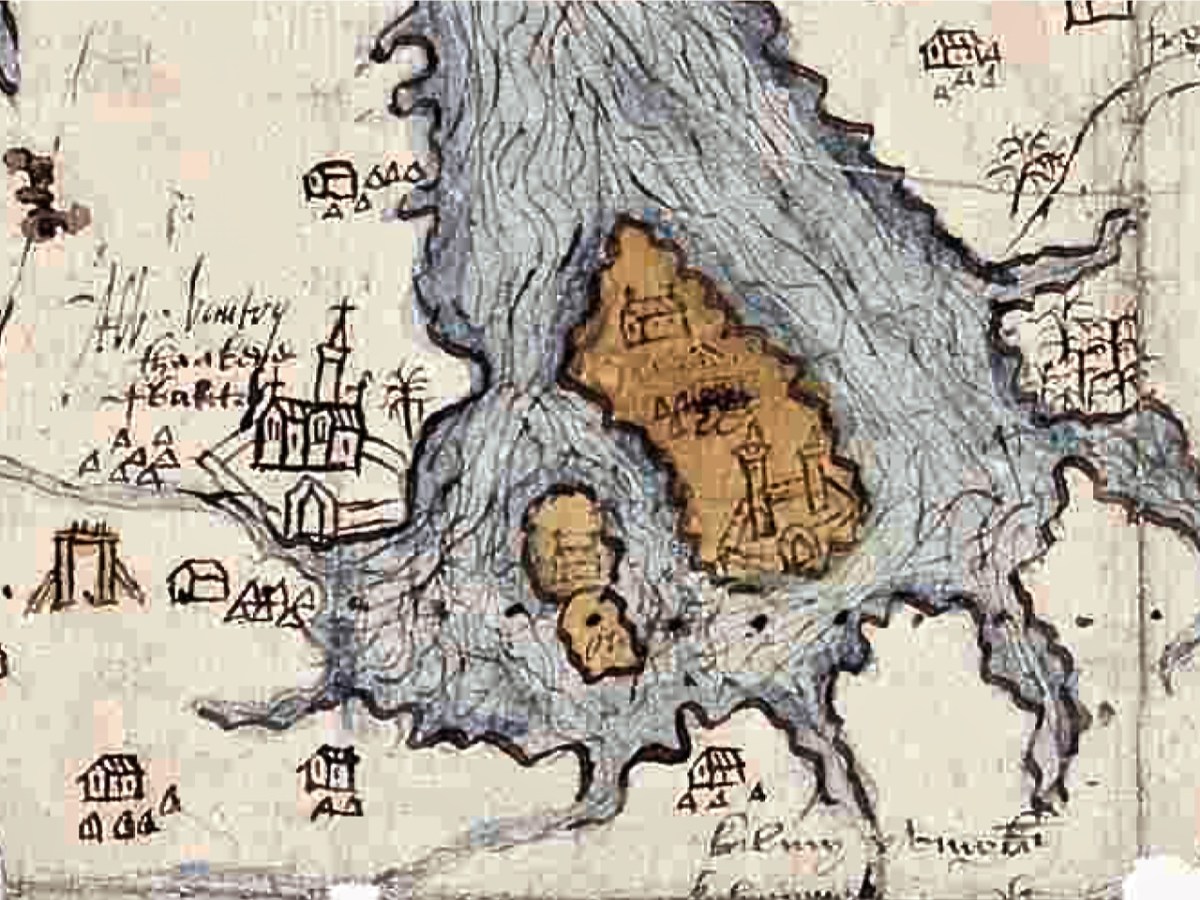
Paddy also wrote about the early map of Bantry and Beare (see my post Elizabethan Map of a Turbulant West Cork and Elizabethan Map of a Turbulent West Cork 2: The Story) on which the Franciscan Friary is clearly shown (below).

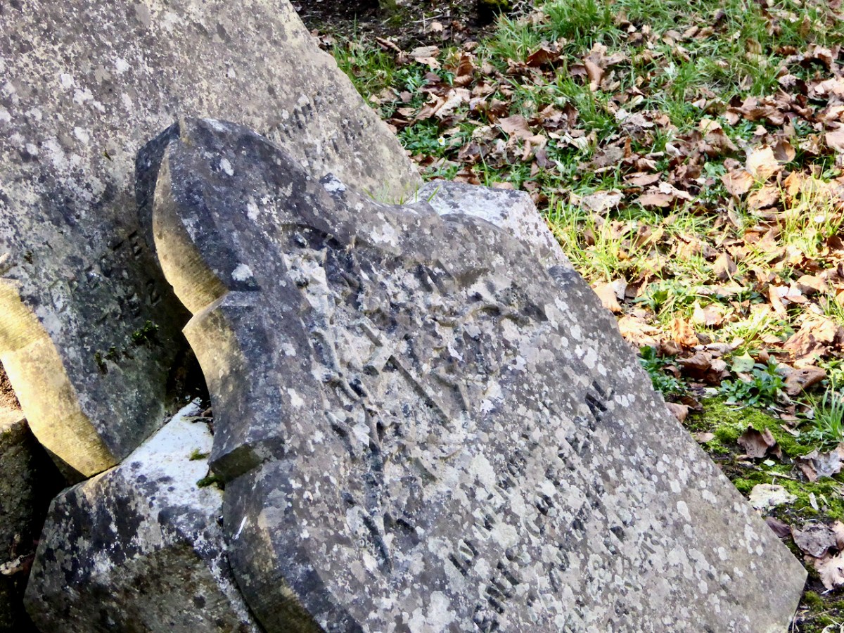
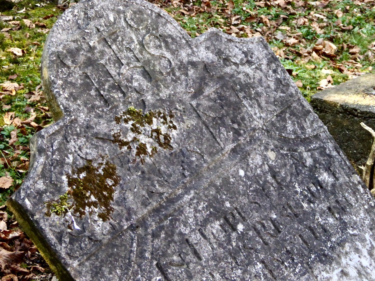
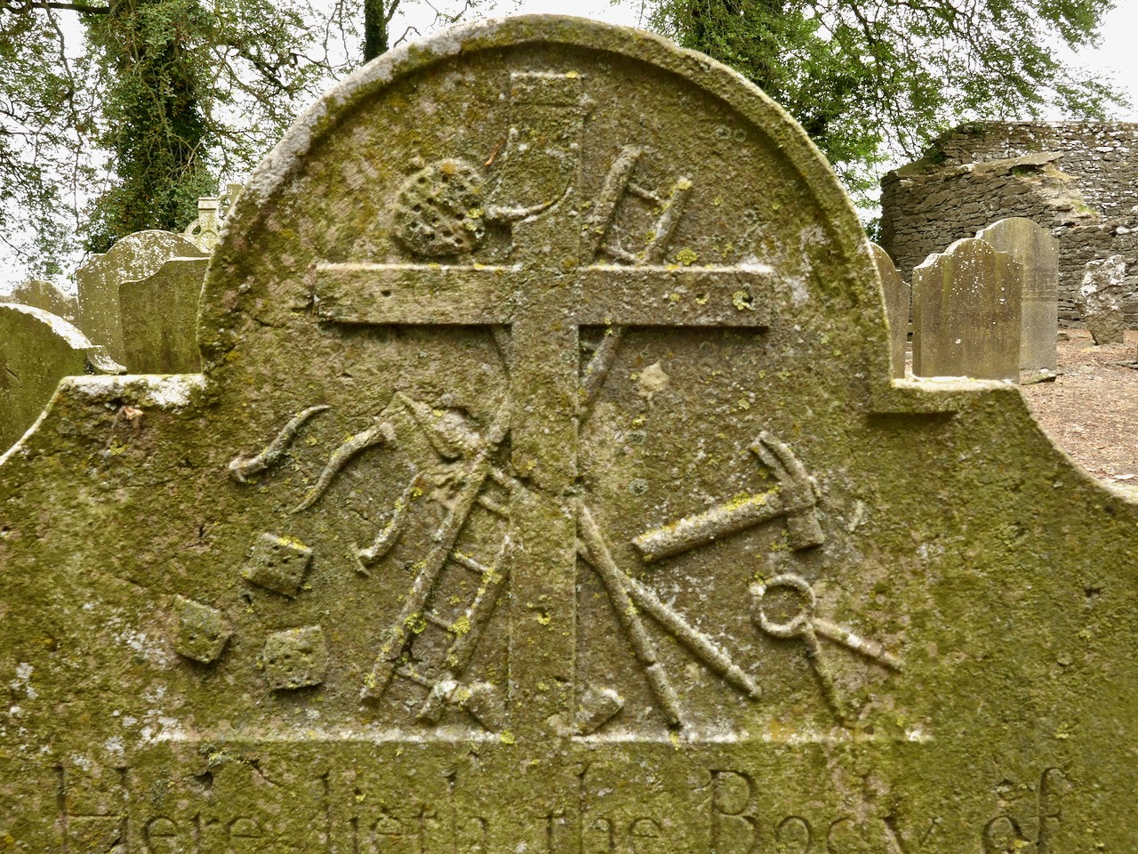
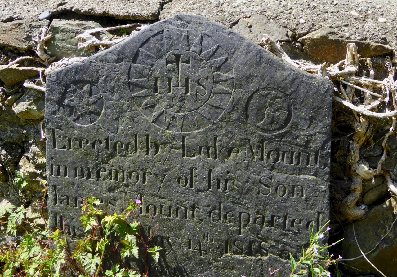
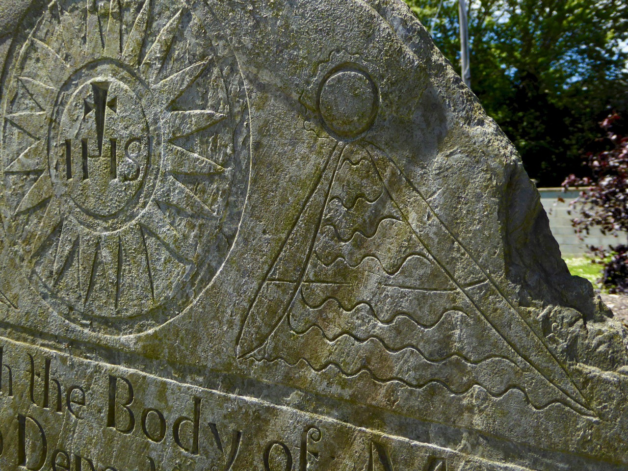
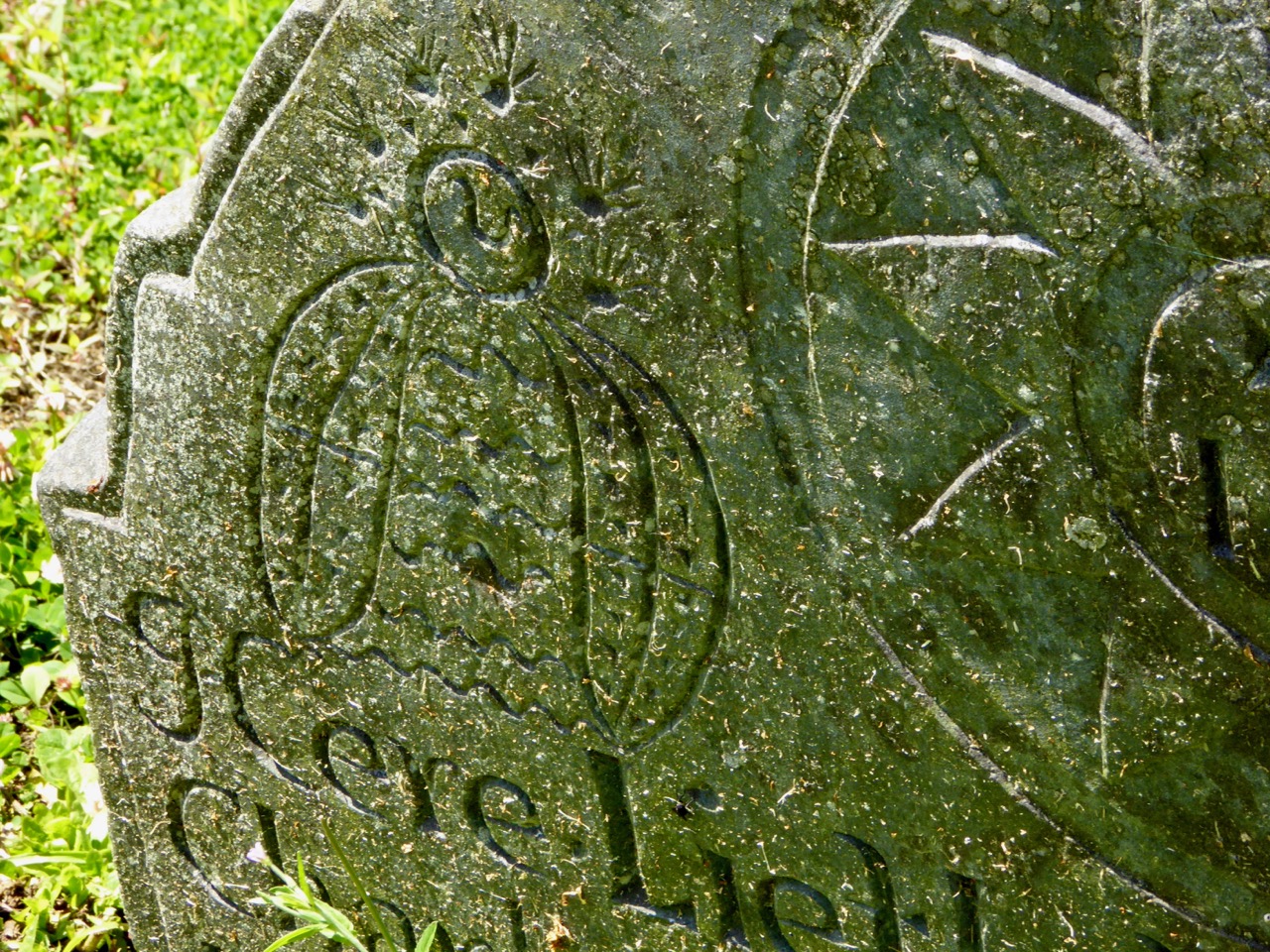
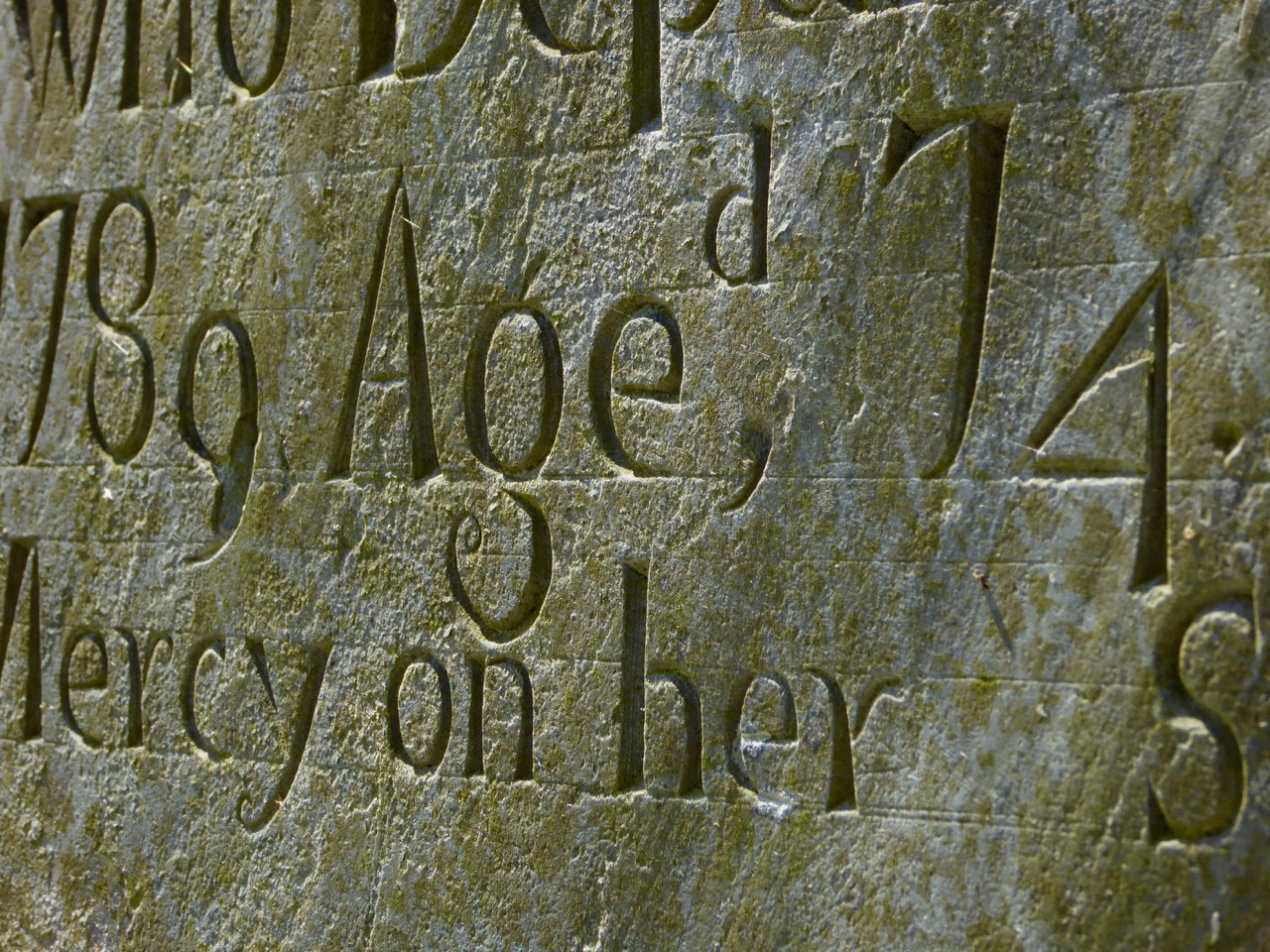
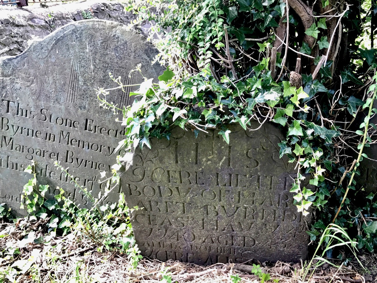
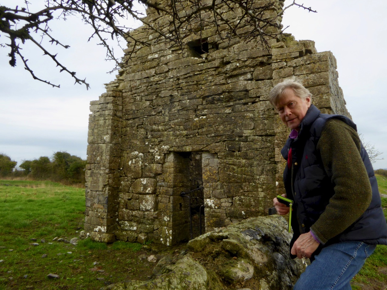
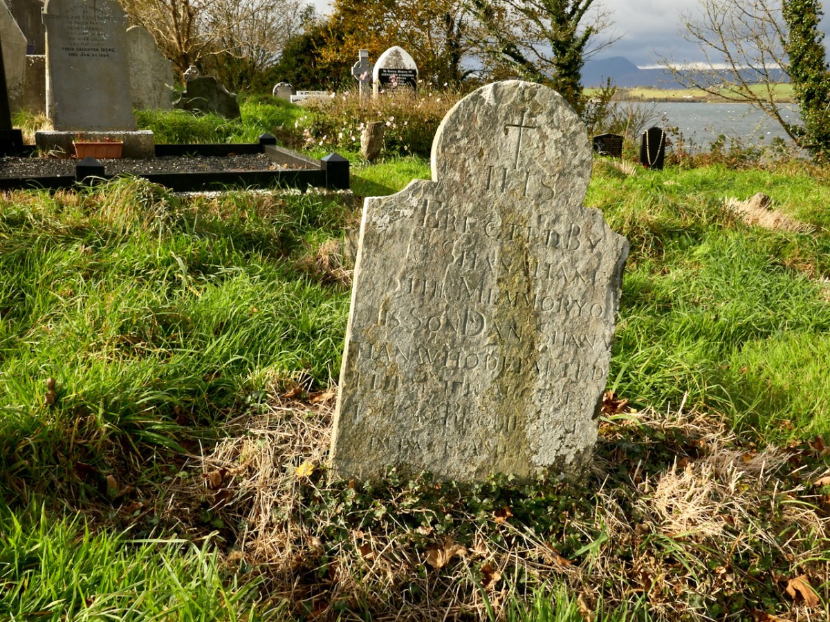
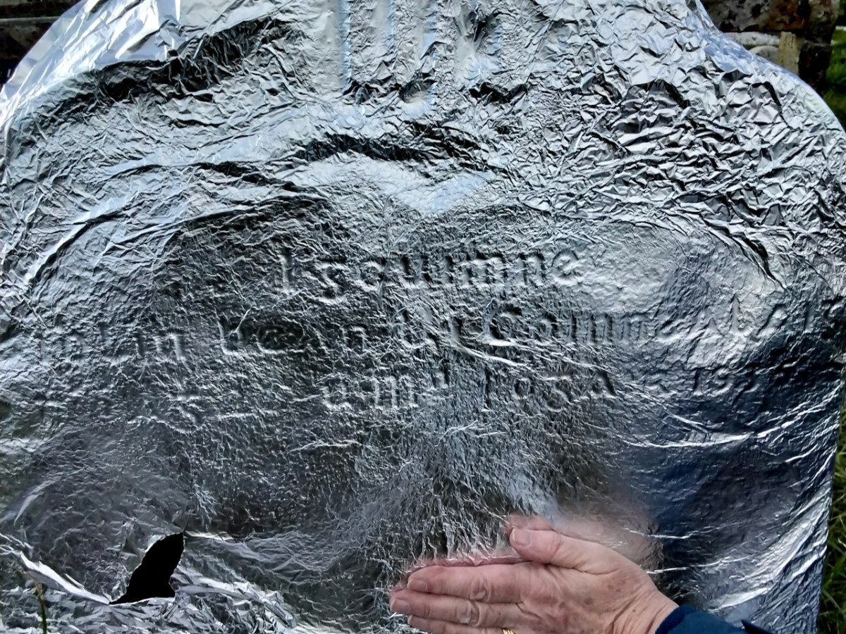
Deciphering a headstone can be a real head-scratcher, especially if it’s badly weathered or covered in lichen. Geraldine Mullins showed me several where she had figured out the inscription – she has been developing a real eye for it. Lighting becomes important – strong slanting sunlight does wonders, or a bright torch shining from the side. One particular example only became clear under tinfoil! As with best archaeological practice, the team do not advocate the use of rubbing, chalking or cleaning with stiff brushes or chemicals, all of which can promote further deterioration of a headstone in the long run.

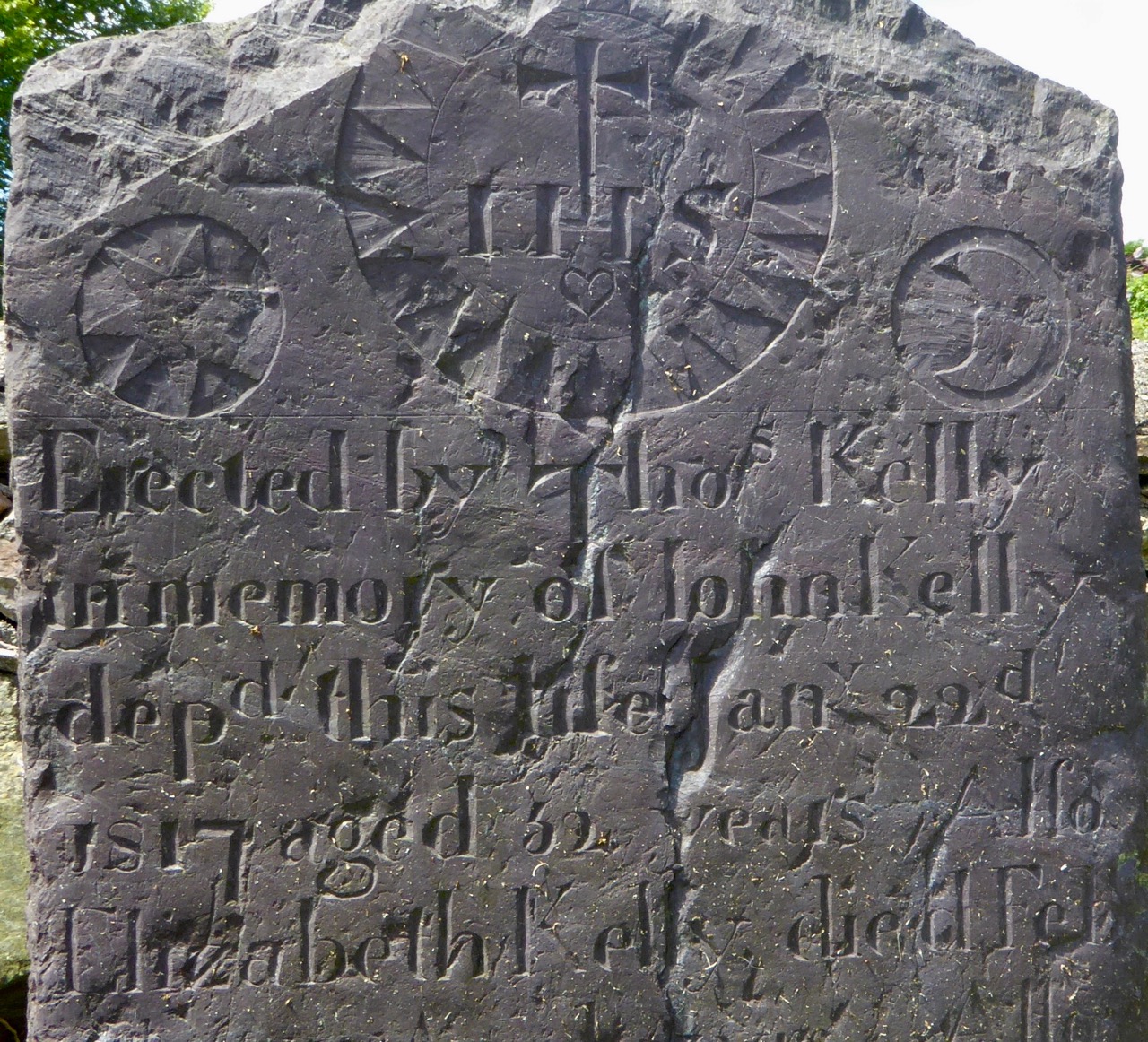
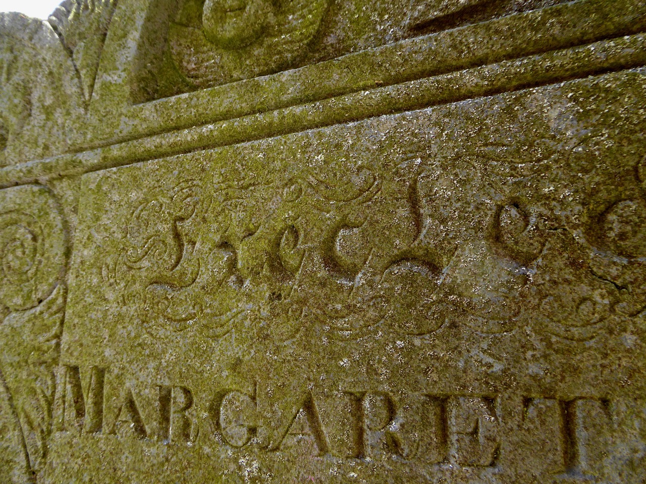
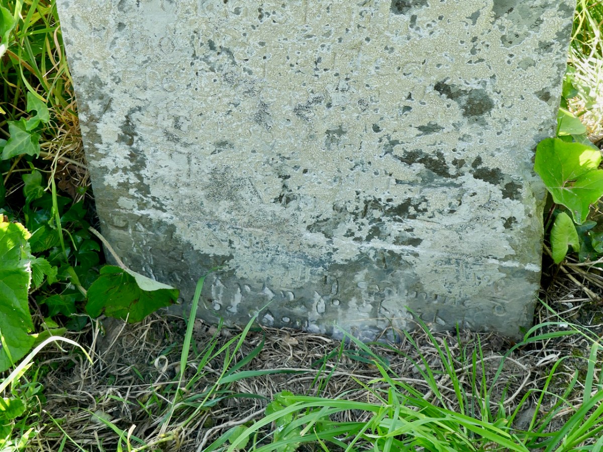
One of the exciting finds has been that of a headstone with an inscription in Irish – highly unusual! This might seem strange, since Irish was the language of most of the people buried in this graveyard, but it has to be viewed within the context of the colonial administration. Headstones were considered an official record, and the official language, under British rule, was English. After the foundation of the State, of course, Irish inscription became much more common. Geraldine has sent me the text and translation and I append it at the end of this post. As you can see (below) it took real study to make out this inscription!

Have a look at the Zoom Seminar on the Bantry Historical Society’s website, and browse what’s been uploaded so far to the Historic Graves website. It’s very much a work in progress. And if you have any information at all that might help the committee, do get in touch with them through the Bantry Historical Society contact page.

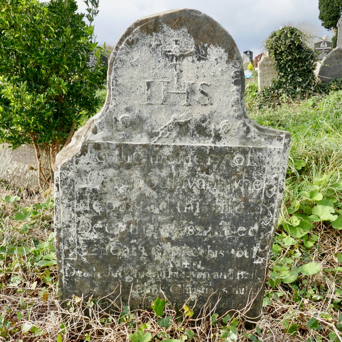
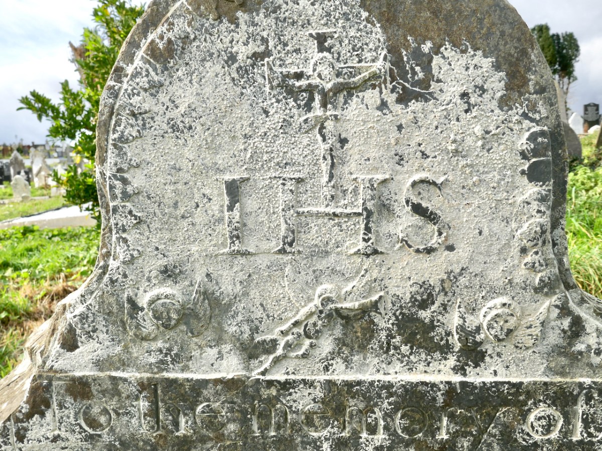
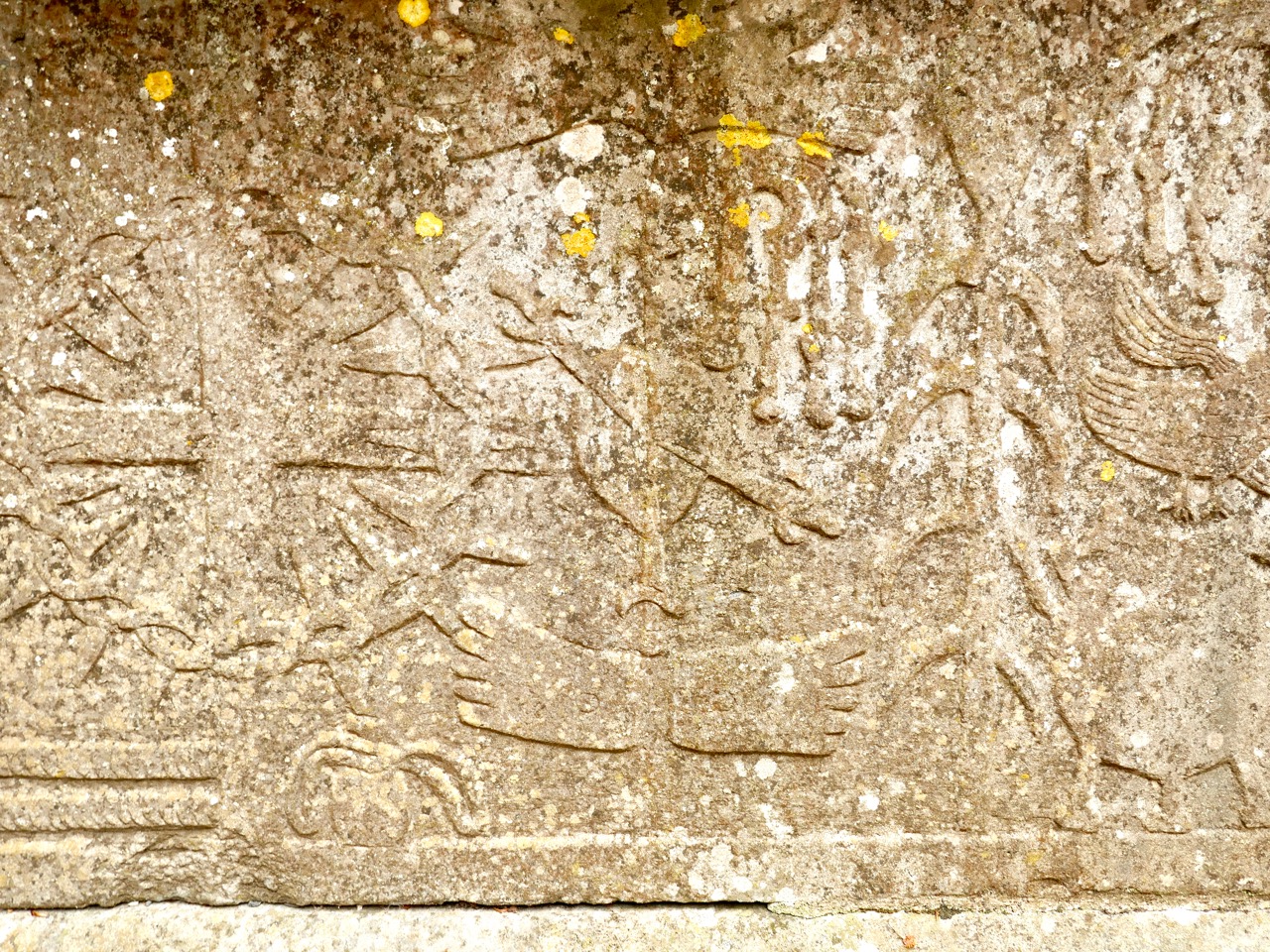
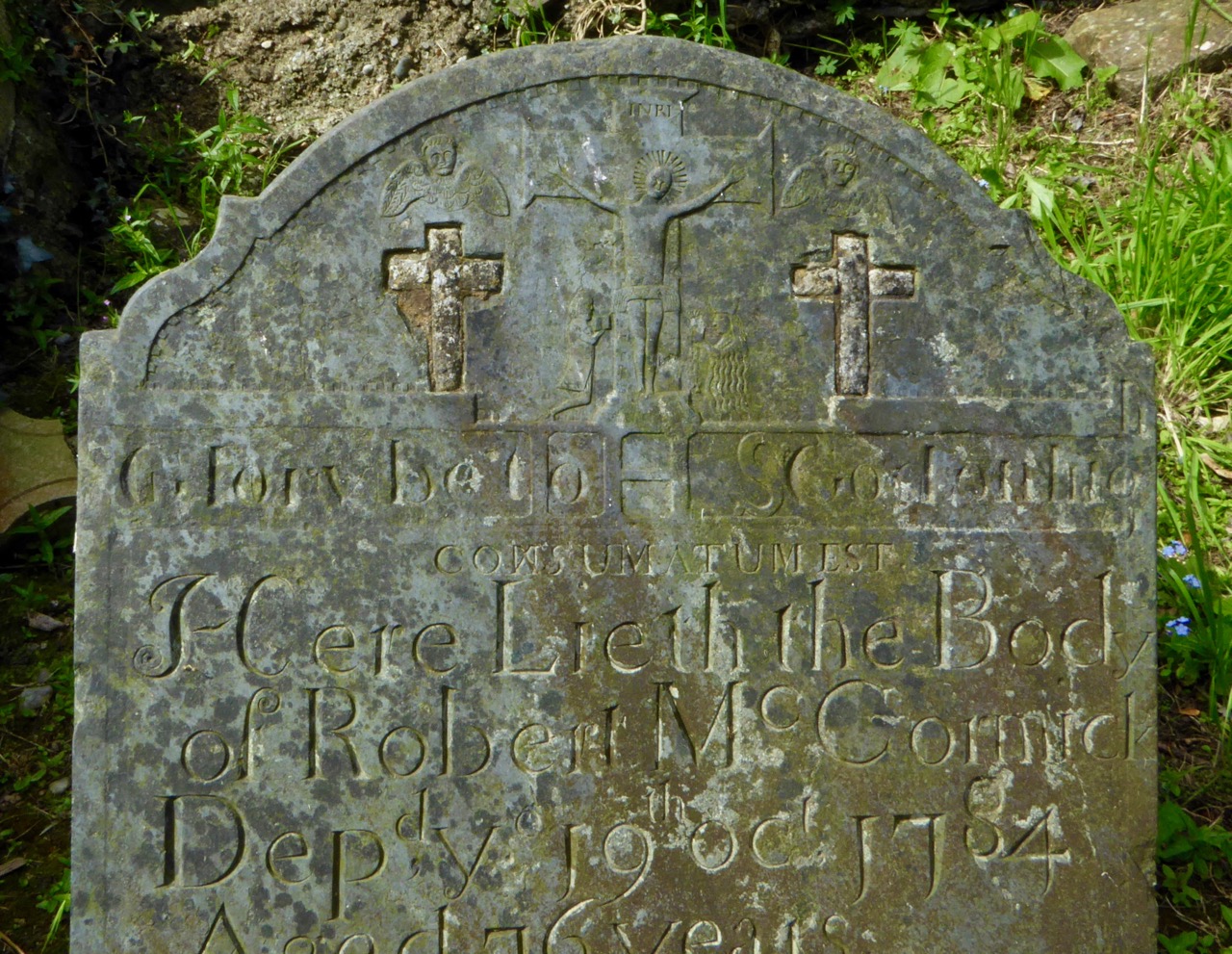
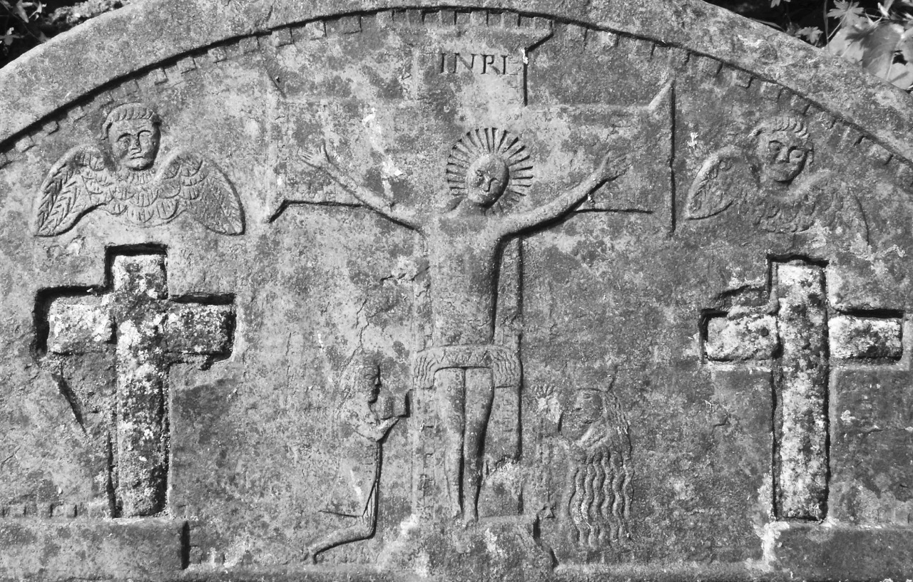
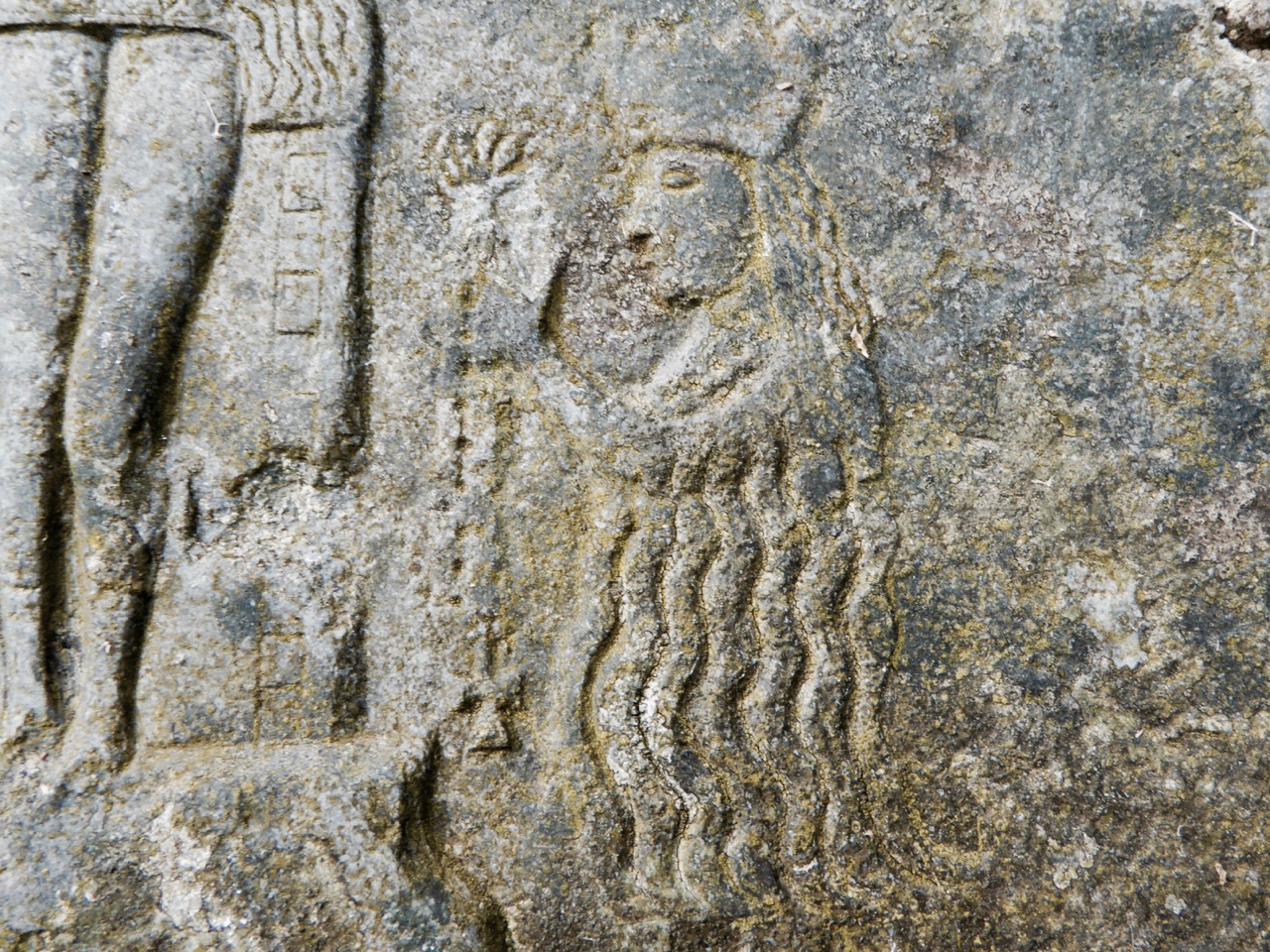
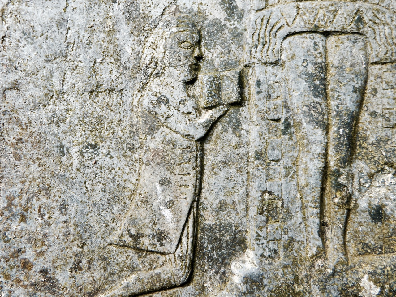
Headstone of Owen O’Sullivan, who died in 1822 has a carved top section featuring a crucifixion, two winged heads and an angel blowing a trumpet

Or better yet, take a wander through the graveyard itself and see what you can find.

Many thanks to Geraldine Mullins for sharing resources used in this post, and to all the committee members for so graciously spending time with me and answering questions.

Text and Translation of Irish Inscription

Gac naon do calam liocht /  

cathuil ui neill is cuimhine d/  

leifis an rann so g[e above]arrtha an /  

gaoghalge caoin le cheile an tathair /  

an mac 7 an naomh spriod /  

[g]uidheach do rai[.]h Dia trochurac /  

air anom do bhi ansa corp so /  

ata fan liag Amen 

Everyone of the noble, warlike line of Ó Néill and Conn, who will read this verse inscribed in beautiful Irish, pray to the Father, Son and Holy Spirit together, that God may be merciful to the soul that was in the body that is beneath this stone. Amen. 

Even Cromwell Spared the Graveyards

There’s a lovely old Church of Ireland church in Rathclaren, between Timoleague and Kilbrittain in West Cork, surrounded by a graveyard. Nowadays, little disturbs the tranquil space, and it’s hard to imagine that a proposal to close this graveyard for reasons of sanitation and overcrowding once created an enormous controversy that pitched Catholics against Protestants, neighbour against neighbour. My attention was caught when the marvellous West Cork History posted about this recently – a huge thank you to Pat!

The lych-gate at the entry to the church is an unusual feature in Ireland, but adds to its overall picturesque appearance

It was all reported with gusto in the Examiner and the Southern Star (which I accessed through that indispensable resource, the Irish Newspaper Archives). The facts of the matter were that Canon Powell, the Church of Ireland Rector, wished to close the graveyard to further burials, claiming that there was a putrid smell and that people came and buried their deceased family members ‘willy nilly’ with little regard for the depth of the grave or the previous occupants.  He was supported by Dr Shorten, a medical man and one of his parishioners, who conducted an inspection. 

The clock face has an indent – we were told by a local resident that there was an IRA ambush here during the War of Independence and that this is a bullet hole

Now if there’s one thing we know in Ireland it’s that there is a reverence for graves and burial places. This is not new and when word reached the Catholics who had rights of burial in the graveyard, or whose family members were buried in it, there was uproar. 

A little background – the graveyard was owned and managed by the Church of Ireland, as were many old graveyards in Ireland. When the Church of Ireland was established, after the Reformation, all church property passed into the hands of the Protestants, to be administered by the local Rector. Everyone, Protestant or Catholic, had to apply for approval for a grave to be dug. Catholics resented this hugely – these had been their churches and their sacred sites, and the memory of their loss and the outlawing of their religion was long and bitter.

The turn of the twentieth century, when the Rathclaren row erupted, was a time of growing nationalistic confidence. Speeches stoking long-held resentments were common. Having been downtrodden for centuries, many Catholics were now fervently embracing aspirations to Home Rule, flocking to Irish language classes, and reading stories of their glorious past as a Land of Saints and Scholars, as well as studying the long history of suppression and colonisation. Somehow, the threat to close Rathclaren graveyard encapsulated for them all that was wrong with the Ireland of 1899. 

The church is hundreds of years old but was reconstructed several times. The attractive red brick detail was added in the mid nineteenth century

There were claims and counter claims, all gleefully reported by the newspapers: that the graveyard was full – that there was still lots of room in it; that it was unsanitary and smelly – that the smell was coming from a drain in the Canon’s garden outside the walls; that Catholics dug up old graves with scant regard for public health – that the Canon allowed Protestant burials but denied Catholic interments.

I want to give you a flavour, using select quotes, of a huge public meeting held at the Graveyard on July 31, 1900. The Irish Examiner reported it in full under the title Indignation Meeting. The crowd enthusiastically cheered all the speakers, but ‘groaned’ loudly when Canon Powell drove by in his trap.

The Chairman, who was received with cheers, said although their forefathers met for many a serious purpose they never had to meet for such a purpose as they were assembled there that day for (hear, hear). Although their forefathers were hunted and persecuted, yet the enemy never interfered with their burying places, as they were doing now. It was for the people gathered there to say that that ancient burial ground would not be closed without an effort being made to prevent it: and it would be kept open as long as they had power in their arms to do so (loud cheers). If their forefathers lived they would never allow it to be closed; they would see their own blood run down that hill first (cheers). There were good and true men yet, and they would show by their actions in connection with this matter that there were no unworthy descendants of these sires. There was no use in one or two trying to fight this cause: all the people should stand together. He was sure they would do their part, and they would not be beaten without a hard struggle (cheers).

He could make no better comparison between the state of the graveyard than the comparison between the populous and depopulated parts of the country. Travel through the country, and part of it would be found thickly inhabited, but again there would be found parts of it deserted, turned into cattle ranches and sheep walks, parts where the people had been driven forth to make room for the sheep and the bullocks (groans for the evictor). They would find in the Ireland of the past places where the people had been banished – places in which they had drawn the milk from a fond mother’s breast, and had been bred and reared; in those places, too, could be seen the ruins of the homesteads.

In the days of the past, when the people were oppressed, and when the country was ruined and depopulated; when the people were subject to the most cruel laws and torturous persecutions that any people could be subject to. . . when the people lived continuously in the midst of gloom and tyrannical rulers, it was not known that those who interfered with the land of the living had ever interfered with the land of the dead (loud cheers). The only consolation our fathers had in those oppressed times was that they could claim one spot, at all events, just as much as the biggest man in the land, and that was the spot where their friends and ancestors were buried in the graveyards of Ireland (cheers). If we went further back, when this country was put to the sword by Cromwell, and the people were driven from the four provinces. . .When the people were driven to hell or Connaught. . .but I am sure there are few of the Irish race who were driven into Connaught now in hell but I am not going to say what became of Cromwell (cheers). At any rate, we don’t hear at all that Cromwell ever interfered with the graves of the dead in Ireland.

Though Cromwell spared the graveyards of Ireland, as did other tyrants who oppressed the people, I say here to-day that they dare not face the people possessed of life – the living Irish. 

There was much more in this vein at the meeting. Eventually there was a board of inquiry, a proposal was made to buy extra land for an extension of the graveyard and after some missteps this was eventually accomplished. In the meantime, local people carried on burying their dead in defiance of the court order not to, but the police seemed happy to drop charges if they could – see this report from as late as 1904, when the matter was finally declared resolved.

Besides the post on West Cork History, a friend has just now gifted us a set of old OS maps for this area (thank you Noel!). They are large scale and date from 1900 – and here is Rathclaren, clearly showing the church and graveyard as of that date.

However, today there is an addition to the map in the form of a new ‘cemetery’ just to the north of the church. On the Ordnance Survey and the Archaeological maps of Ireland the term ‘Graveyard is defined thus: The burial area around a church. These date from the medieval period (5th-16th centuries) onwards. However, the terms ‘Burial Ground’ and ‘Cemetery” are reserved for An area of ground, set apart for the burial of the dead, not associated with a church. In this case the word cemetery is used to denote a modern burial area which was not originally associated with the church.

Today, this peaceful and beautiful spot seems as if it could never have witnessed any kind of upheaval. Along the road stands the Trinity Holy Well (below, labelled as Tobarnatrinoda on the historic map), still cared for by the community. Both the graveyard and the cemetery are visited by those for whom the history of tumultuous resistance to ‘the oppressor’ has faded and indeed has been mostly forgotten. On the whole, that’s a good thing.

Off the M8 – Kilree Monastic Site

Kilree is possibly the most perfectly contained and atmospheric site you will visit in Ireland. I defy you not to be enchanted with its leafy depths, its air of antiquity, and evidence of continued use. (I would also vote for Monaincha in Tipperary, a site that deserves its own post one of these days).

When you’re travelling from Cork to Dublin it’s easy to leave the M8 at Cahir and travel cross-country to join the M9. There are numerous sites to visit if you take this option: most recently we have written about Fethard and its Medieval Walls, but we also did a post about Kells Priory a long time ago (The Hallowed Fortress) and it remains one of our favourite sites and one of the most impressive monastic sites in Ireland. And don’t go without your copy of Ireland’s Ancient East by Neil Jackman – it’s our constant companion and a great resource. It’s available on Amazon but why not patronise your favourite bookstore?

Kells Priory, just up the road from Kilree and one of Ireland’s most impressive religious complexes

It’s a great contrast to Kilree. If you haven’t been to Kells Priory yet, try to take them both in, in the same day. What you will see is a typical example of an Early Medieval Irish monastic site (Kilree) and an excellent example of a large 12th to fifteenth century Augustinian Priory built to withstand the turbulent history of Kilkenny in those centuries. The monks in Kilree were living the life of Irish monastics in a pattern set down in the 6th century, while the Augustinians were mainstream European clerics invited over by the Normans.

Inside Kells Priory

The other things about Kilree is that it’s unspoiled (except for one thing – I’ll get to that later) and in Ireland, that means that the farmer who owns the land is using it. There’s a Bull sign on the gate and indeed there he was, with all his frisky bullock friends. We thought our chances of crossing the field were slim, but two friendly ladies on horseback offered to draw the attention of the cattle away from us so off we dashed while they were distracted, not giving much thought to how we might get back again.

Having charged off down the field after the horses (which were on the other side of the hedge) the bullocks, followed at a dignified pace by the bull) ended up beside the high cross so we decided to leave well enough alone and not venture over to that quarter. A distant shot will have to suffice for this post, but you can see excellent images of this cross at the Irish High Crosses website, and we thank them for that since this is the closest we will get for the moment.

But there was so much to see within the monastic enclosure. First, the round tower – it is missing its conical cap but apart from that it’s complete and in good shape. Brian Lalor, in his book The Irish Round Tower, assigns it an 11th century date based partly on the simple doorway. The arch, he points out, has been cut from the soffit of a monolithic lintel which is now cracked.

Crenellations were added to the top in later medieval times (you can see them in the first image) – the tower must have been renovated for some kind of defensive purpose at that time. When the Ordnance Survey folks came around in 1839 it was possible to climb to the top by means of rope ladders. There is no access now, apart from by the rooks and crows who have left evidence of their prodigious nest-building.

Lalor also points out that the round tower is perched on the circular boundary wall of an old churchyard which probably represents the position of the inner rampart of the monastic enclosure. What did such a monastic enclosure look like? I’ve used an illustration from a marvellous book called The Modern Traveller to the Early Irish Church, by Kathleen Hughes and Ann Hamlin (second edition, Four Courts Press, 1997). The site illustrated (Nendrum, County Down) was enclosed by three circular walls, a not-unusual configuration although one and two enclosing walls are also found. There is no real evidence left at Kilree for a second or third wall, but the location of the high cross indicates the likelihood of an outer wall.

The church is of an early form, rectangular, with antae at either end. To understand how this fits in with the architecture of the period, see my post Irish Romanesque – an Introduction. The nave, or main part of the church probably dates to the 10th or 11th century, but a chancel was added later, probably in the 12th century, by means of an inexpert Romanesque arch, which eventually had to be shored up with an even more awkward-looking inner arch.

Upper: East wall with buttresses added in 1945; Lower: The earlier Romanesque arch is clearly visible above the later one

The whole place was repaired by the Office of Public Works in the 1940s and it was they who built the buttresses which have successfully kept the east wall from falling down.

Upper: Looking through the linteled doorway into the nave and the chancel beyond; Lower: Looking towards the nave from the chancel. The chest tomb is on the right

There are several thirteenth to fifteenth century cross slabs within the church but the seventeenth century chest tomb just inside the chancel is the most interesting.

It’s hard to decipher as it’s faded and covered in lichen, but here is the description of it taken from the National Monuments listing:

Latin inscription, in a margin around the edge of the upper slab, was transcribed by Carrigan as, ‘Hic jacet Dns. Richardus Comerford quondam de Danginmore qui obit [date left uncut] et Dna Joanna St. Leger uxor eis pia hospitalis et admodum in omnes misericors matron quae obit 4 die October A. 1622’ and translated as, ’Here lie Mr. Richard Comerford, formerly of Danganmore, who died [left blank] and Johanna St. Leger, his wife, a matron pious, hospitable, and charitable to all, who died Oct 4th, 1622’. The front slab. . . is decorated with the symbols of the Passion flanked with stylised fluted pillars which taper towards the base. The symbols from dexter to sinister include a ladder, entwined ropes, a spear, dice and a seamless garment, 30 pieces of silver and beside them a bag with two straps, a cross ringed with a crown of thorns, a heart pierced with nails and pierced hands and feet above and below this, a scourge on either side of a plant, a cock on a three-legged pot, a sword, a chalice, a hammer, and pincer holding 3 nails and two sheaves of wheat. 

Can you recognise the details from the NM description?

Outside the church, the graveyard is quiet and picturesque, but I couldn’t help noticing the absence of vegetation of any sort. Older photographs I have seen show a covering of grass, and I suspect that somebody has been in here with the Roundup – I told you I would get to the one problem I have with this site, and this is it. It may be historically and archaeologically fascinating and important, but the ground itself is a dead zone – no biodiversity here. And that’s a pity because there was a swarm of bees about to settle in one of the trees. They will have to look outside the site for pollen.

We saw many old gravestones, dating from the early eighteenth century and into the current day. But the one that caught my eye was this one – all the instruments of the passion clearly carved for John Brenan, who died in 1772. Can you recognise and name them all?

I know you’re wondering how we made it back across the field. Well fortunately, the cattle stayed over by the hight cross and we sneaked back across without attracting their attention. I can’t decide whether their presence added to the experience or not, but it certainly made it more exciting, even though we didn’t get to see the high cross up close. Kilrea is a very special place, I think. I am hoping that next time we go back the grass will have been allowed to grow again.

Headstones or Folk Carvings?

This week we stumbled upon one of the finest collections of 18th century gravestones we have ever seen, in the ancient Kilcoole Church yard. We’ve been visiting friends in Wicklow and enjoying ourselves very much.

The church itself is very old, mostly 12th century. Although un-ornamented, the arches and windows are Romanesque in design, and the church originally had a stone roof, like the one we wrote about in Kilmalkedar. It’s kept locked but the key is easy to obtain, although it only opened the outer gate, so we were unable to see inside the church.

The graveyard, however, turned out to be a treasure trove! In West Cork we do see the occasional eighteenth century gravestone, but they are often heavily weather and lichened and impossible to read. However they manage it, these gravestones were as fresh and readable as the day they were carved.

This 1792 headstone for Felix Kavanagh has the IHS symbol surmounted by a cross and surrounded by a sunburst. On either side is a six-pointed star and a barred circle – we are unsure of the meaning of this motif

In our post Memento Mori we introduced you to the joys of graveyard headstones, and explained what symbols were common and what they represented. The crucifixion is a favourite, of course, and that was beautifully represented in Kilcoole by a gravestone for Robert McCormick by Dennis Cullen, dating from 1784.

Dennis Cullen is recognised as one of Ireland’s finest folk sculptors. There are 105 known Cullen headstones, most dating from 1765 to 1785, many in Glendalough, and most depicting passion scenes. He was born in Monaseed and his carving technique was accomplished. He often signed his work, unusual for the day. This is a good example of a Cullen crucifixion scene, except that it was altered later by the addition of two marble crosses.

Cullen executed his work in delicate and accurate detail. Christ on the cross is flanked by the Virgin with a crown and beads and St John with a bible. Cullen’s habit was to carve figures in the costume of the 18th century. The Virgin’s flowing hair is, in fact, a long lace veil – common mourning dress of the time. John is wearing a dress coat.

Several of the headstones feature a sunburst as well as sun, star and moon motifs. Powerful symbols of the soul and of immortality, as well as rebirth, these motifs were very popular in the eighteenth century. The IHS symbol (explained in Memento Mori) usually adorned the top of the headstone.

Angels – the soul’s guide to heaven – are found on several of the Kilcoole headstones and we were  delighted at the the variety of ways in which they were depicted.

Because the carvings are so visible and well-preserved in Kilcoole, it’s possible to see not only the detail of the lettering, but also the guidelines used to keep them straight.

Most of the lettering is deeply carved and exhibits, here and there, that idiosyncratic and random placement of letters where the carver may have run out of room, or perhaps was anxious to balance a line.

The lettering styles are fairly plain, although some fancier initial words crop up.

The graveyard has suffered damage both from vandals and from the ravages of time. We were intrigued by the number of fragmentary inscriptions and broken headstones dotting the place.

A local style seemed to be the use of a floral or vine pattern across the top of the stone. There were several examples of this – perhaps the hallmark of a particular carver.

There were some fine later nineteenth century headstone in the graveyard too. Although we recognised that they were beautifully executed, it’s harder to get excited by them: they lack the naive exuberance of the eighteenth century examples and the symbols used are more restrained and limited.

There are several graveyards in Wicklow with similar collections of headstones and we hope to visit more in the future. Meanwhile, to learn more, order a copy of Chistiaan Corlett’s excellent book Here Lyeth about the eighteenth century gravestone of Wicklow

Off The M8 and into Medieval Ireland

Twomileborris Castle

The drive from Cork to Dublin used to take four hours; now it takes two and a half on a speedy motorway. As you drive along, tantalising glimpses are offered of castles, a round tower, those brown signs that point to ancient monuments. If you’re not in a mad hurry, why not do some exploring? This post is about one stretch of the old road, running parallel to the motorway, where you can have a medieval experience, great coffee and cake, and rejoin the motorway when you’ve sated your curiosity. You can take a few hours and do everything on this list on one day, or you can do one or two each time you travel.

Twomileborris Gravslab and Castle

The castle and old graveyard at Twomileborris offer lots of opportunities for exploration. Above, the castle looms over the graveyard, but note the white gravemarker with the head above a stylised fleur de lys – similar to many such markers set into the floor of St Canice’s Cathedral. It’s much earlier than anything around it

I am assuming you are coming from Cork and are dying for a coffee about the time you see that turn-off for Horse and Jockey. The busiest spot in all Ireland, nevertheless we always find a corner on a comfy couch and relax with a coffee and goody before we continue. But don’t go back to the motorway – The Horse and Jockey Hotel is right on the old Cork to Dublin Road, now called the R639, so head north on it and go exploring. I’ll provide directions but a good map will come in handy, as will stout shoes for some of the sites.

Two Mile Borris 1777 gravestone

A 1777 gravestone in the Twomileborris graveyard

First off – Twomileborris. You’ll see the sign just after Littleton and you’ll spot the castle as soon as you approach the village. Park just beyond the castle and take the path to the old graveyard – it affords good views of the castle, which is on private land. Head for the old part of the graveyard and have a good wander – you will find fine examples of gravestone that date back to the 18th century. As you leave, take a good look at the top of the castle and observe all the architectural features I’ve been telling you about in the Tower House posts. For this one, have a quick read of Tower House Tutorial Part 1.

Liathmore churches

The churches at Liathmore. The round feature is a modern wall built around the stump of the round tower

Proceed through the village and you will rejoin the R639. Turn left and less than a kilometre down the road look for the National Monuments brown sign to Liathmore Churches and follow the signs to the site. This a complex site with early and later churches. The first, right beside the track, is one of those early-medieval churches with the projecting antae that Robert wrote about in Molaga of the Bees. It probably dates to the same period as the round tower – unfortunately there’s not much of this left, just a stump that was found during excavations.

Liathmore Early Medieval Church

The Early Medieval church (8th to 11th century) at Liathmore

But as you head over to the later church look around the field at all the bumps and hollows and enclosures – you are looking at what was probably a medieval settlement, long deserted. The second church was built and modified and re-modified over several centuries. It has an intact vaulted chancel – the plaster work is extensive and still bears the marks of the wicker scaffolding that was used to build it. Here and there, inside and outside, carved pieces of stone have been inserted into doors, windows and walls. You can easily miss these so let your eye rest on each section of the building. The Sile na Gig is sideways in the door nearest the round tower.

At some time in the past, pieces of carved stone were inserted into walls and doorways. Here are two examples – the one on the left has a carved creature and the one on the right is a síle-na-gig. Below I have turned the photographs to facilitate viewing of the figures

Back on to the R639 now and continue north, though Urlingford and Johnstown and about a kilometre out of Johnstown take the left turn at the first crossroads. You’ll go across the M8, turn right and another kilometre or two will bring you to Grangefertagh Round Tower. It is clearly visible in the landscape so if you miss it just follow your nose until you get there.

Grangefertagh round tower and church

Grangefertagh site is visible from the M8 – haven’t you always wanted to stop off and find it? Take a look at the church – what’s that modern-looking wall doing on top of it?

Once again, this is a site with multiple periods of occupation. You can’t climb the round tower, as you can in Kildare and Kilkenny but it’s nice to be able to get up close to one. Robert has a post on round towers, High Drama!, so have a quick read on your phone if you don’t already know all about them. Two aspects of this site are especially intriguing. The first is that, at some point in the past, the medieval church was turned into a handball alley! Hard to fathom how this could have happened, but no doubt the handball players who did it had great bad luck and never won a tournament.

Grangefertagh church and handball alley

The interior wall of the church has been rendered and old gravestones have been used to create a flatter wall. Outdoor handball alleys were once common but most are now disused and crumbling

The second is the effigy tomb – these are relatively rare in Ireland this is a nice one, although the figures are weathered and lichen-covered. The tomb commemorates John Macgillapatrick, Brian his son and Honora, Brian’s wife and is dated to about 1537.

Grangefertagh effigy tomb

Right – we’re going to finish with a couple of castles, so turn right now and it will lead you back under the motorway to the R639 where you turn north again. After another kilometre or so you will see an imposing tower house on the right. You can drive up to the farm and observe this more closely. Since it’s on private property you must ask permission to go beyond the farm gate, but you’ll get a very good view from outside.

Glashare Tower House

Glashare Castle

It’s remarkably intact and from your browsing of the Tower House Tutorial Part 1 you will be able to admire the loops – unusual corner loops in this one, as well as cross shaped loops. This castle has render on the outside, but how old the render is, or what material, I have not been able to ascertain.

Glashare Tower House windows and arrow slits and render

An amazing variety of opes – windows and loops

The final stop of this tour is Cullahill Castle – turn right at the small village of Cullahill, which is 4 or 5 km beyond Glashare. This one you can wander around. It was reputedly destroyed by Cromwellian cannon, and so you get a wonderful cross-section view of the interior. Tower House Tutorial, Part 2, will tell you exactly what you are looking at, or have a read of Illustrating the Tower House to see how JG O’Donoghue shows us exactly how the interior of a tower house would have been constructed and used.  You can rejoin the M8 by proceeding to Durrow and following the signs from there.

Cullohill later fireplace

Cullahill Castle – a unique opportunity to look at a cross-section of a tower house

For those of us who travel the M8 regularly it’s great to know that we can take a break along the way and catch up on our history and archaeology at the same time. Let us know if you deviate from the M8 to visit any of these sites, or if you have your own favourites along the motorway. 

Grangefertagh 1741 graveslab

A gravestone from Grangefertagh