Boyle Somerville: Ireland’s First Archaeoastronomer

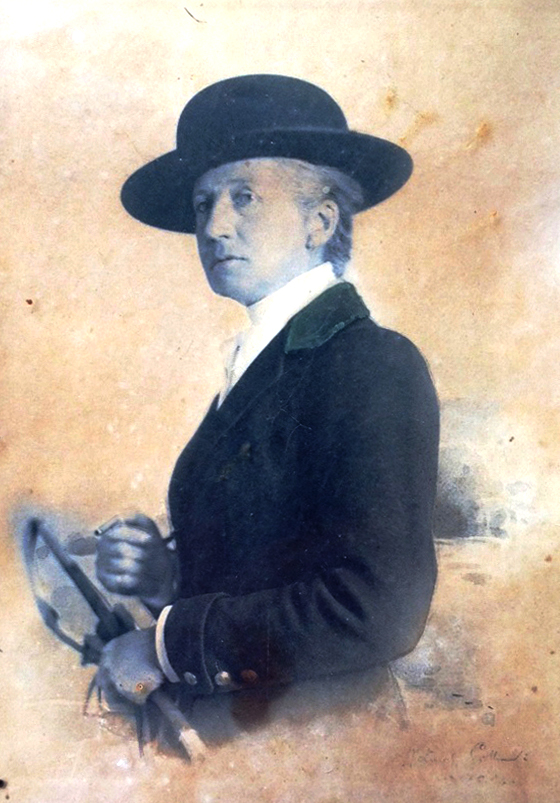
Henry Boyle Townshend Somerville (1863 – 1936) is mostly know in Ireland now for how he died, murdered by the IRA in 1936. And that’s a tragedy in many ways, not least of which is that the notoriety of his death has obscured his important contributions to Irish archaeology and especially to the once-controversial field of archaeoastronomy, of which he was a distinguished pioneer. [The portrait above is by Walter Stoneman and used with permission from the National Portrait Gallery under a Creative Commons License.]

Boyle was about 30 in this photograph. This illustration is from Somerville and Ross: A Biography by Maurice Collis. The family lived in Drishane House, below, in Castletownshend, West Cork. 

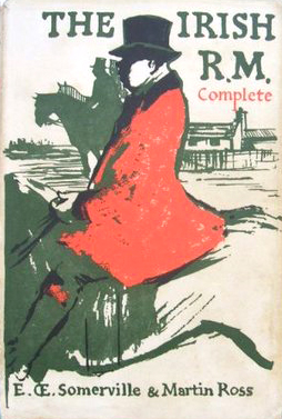
Boyle was one of the famous Castletownshend family of Somervilles that included Edith, the writer with Violet Martin of the Irish RM stories. He was her favourite brother and companion on youthful adventures, including the incursions into the souterrain at Knockdrum Fort, armed only with a poker and a candle. See Robert’s companion piece about this ancient site.

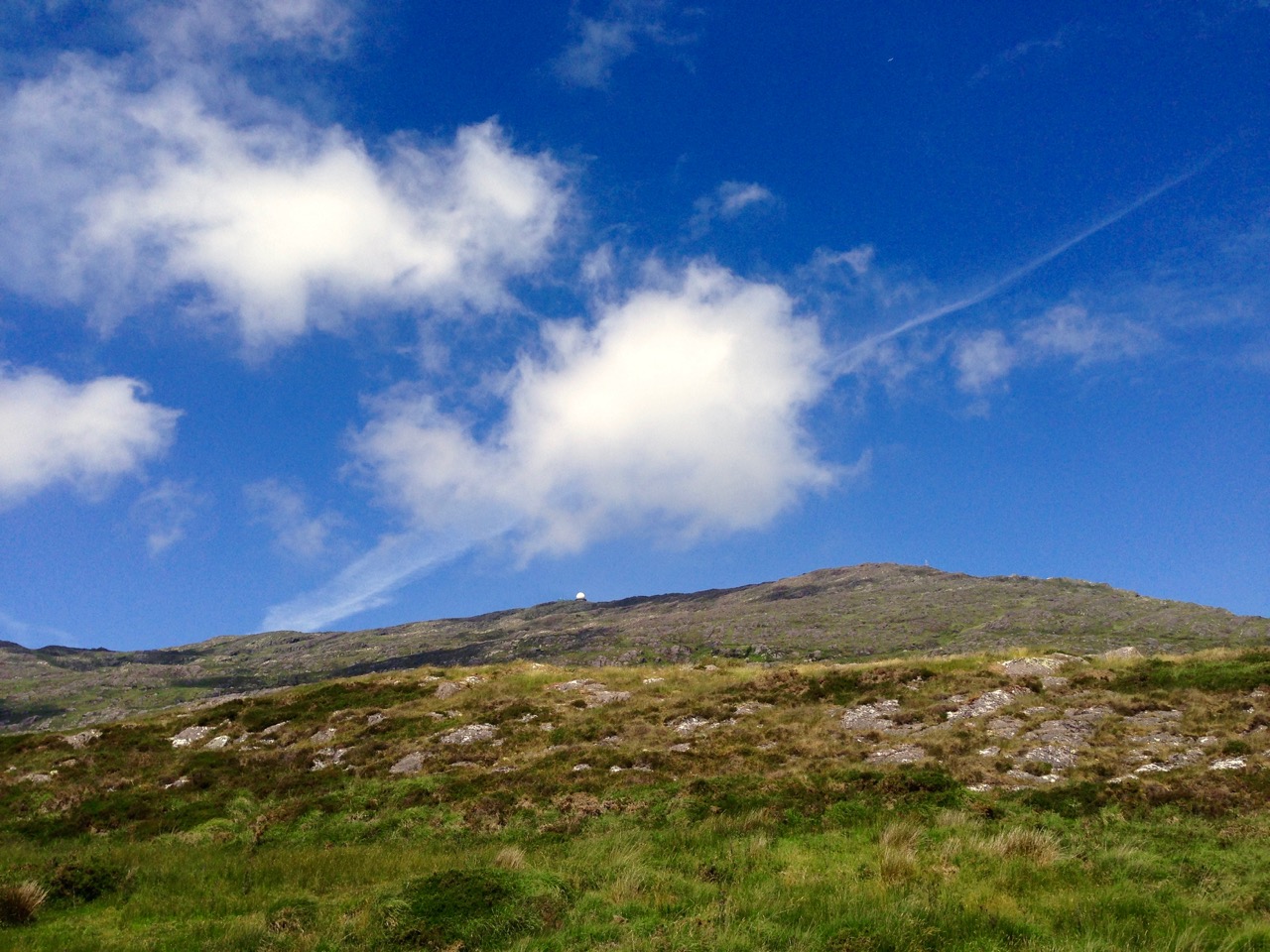
Boyle drew the first proper survey of Drombeg and his observations established the winter solstice orientation. Today, crowds gather to witness this spectacular event

He went off to sea in 1877 at the early age of 13 – seafaring was in the Somerville blood – and rose through the ranks of Commander, Captain and finally Vice-Admiral. Throughout his time in the navy he was engaged in surveying and in hydrographic, intelligence and research projects all over the world. He collected ethnographic materials (now in the Pitt-Rivers Museum) and wrote papers on his experiences.

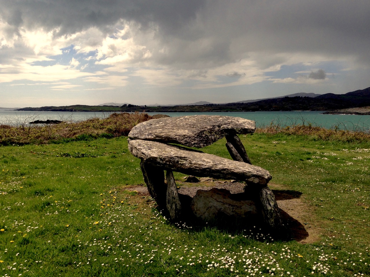
Another one of Boyle’s stone circle solar events, this one occurs at the autumn equinox at Bohonagh

But it was astronomy that fired his imagination, and specifically the astronomy of ancient sites. Following on the work of astronomer Norman Lockyer, he surveyed monuments in Scotland and Ireland and demonstrated that many of them had significant solar, stellar and lunar orientations. His 1927 paper, simply titled Orientation, in the first issue of Antiquity is a readable and well-argued essay that argues for the acceptance of the importance of calendrical observations to early farming communities.

The Bohonagh complex of monuments as Boyle described them – a stone circle, a cup-marked stone and a boulder burial

It is hard to remember now that the scientific community of the time was dismissive, but even the writer of his obituary in the journal of the Royal Society of Antiquaries of Ireland could not resist a patronising summation:

He was an accomplished surveyor and careful observer, and if the theories as to the orientation of megaliths which he held are not universally accepted, his investigations have resulted in presentations of an accuracy too often absent from the surveys of many writers on those subjects.

Makes him sound like a crank, doesn’t it? But let’s go back to that bit about being an ‘accomplished surveyor and careful observer.’ In paper after paper, he did just that – carefully observed and documented the archaeological monuments of West Cork and elsewhere. It was he who first described the West Cork Stone Circles and coined the term recumbent, providing properly surveyed plans and making careful notes of the way in which they offered sightings to solar events at significant times of the year through the axis provided by the line running from the ‘entrance’ through the ‘recumbent.’ (For an explantation of how this all works, see our post Ancient Calendars.)

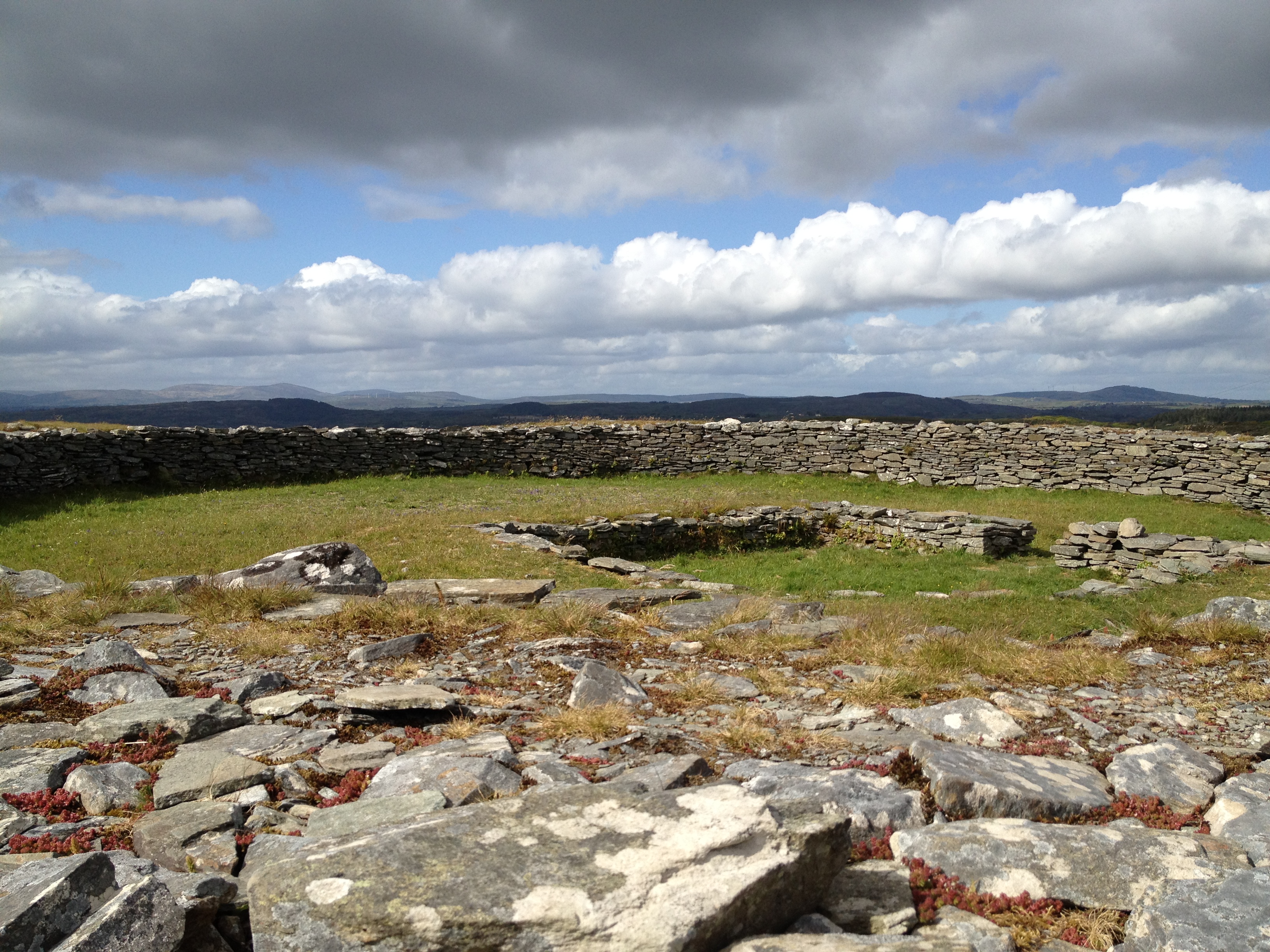
Reenascreena Stone Circle with its surrounding shallow fosse

Take a look at a couple of his papers for the Cork Historical and Archaeological Society. The first, on Five Stone Circles, is a good example of how he conducted his surveys. The second, titled Prehistorics sets out the case for a proper classification system for megalithic structures. Most of the terms he recommends, such as Standing Stone, Stone Row, Stone Circle, Passage Grave and Cup-Marked Stone are familiar to us and in everyday use now and he probably didn’t coin the terms. However, one of his terms never gained acceptance, and I think that’s a pity. It’s the charmingly named ‘Clochtogle’ and it’s what we now call a Boulder Burial. But in fact Clochtogle is a better term in being simply descriptive rather than assigning a function, since, as he points out in his paper, and as I pointed out in this post, there is precious little evidence that points to these monuments being burial places and they seem singularly unsuited for that function.

The Rathruane Clochtogle

Clochtogle is based on the Irish term cloch tógáil (cluck toe-gawl) which simply means raised up or lifted stone. We have lots of them in West Cork. In looking at the photograph of the Rathruane clochtogle (do you think this term might still catch on?) I am struck by how it seems to mirror the shape of Mount Gabriel in the background. Boyle, in his writings, did point out that not every monument was oriented to quarter or cross-quarter calendrical events: some, he said, may have other traditions reflected in their orientations. In our own investigations of West Cork monuments we are constantly struck by how many encompass views of Mount Gabriel.

Brian Lacey has an excellent paper in the Journal of the Royal Society of Antiquaries of Ireland* in which he describes Boyle Somerville as an important and distinguished. . .Irish archaeologist. . .and one of the founders of international archaeoastronomy. He details his various contributions to the field, and does not shy away from mentioning his less-than-scientific interest in ley-lines and also in the use of a medium to communicate with the builders of Drombeg. Edith, along with most of their circle (and indeed many of the literati of the time) routinely used mediums and ouija boards. After his death, as her biographer Maurice Collis puts it, Edith ‘lost no time in getting into touch with Boyle.’ But this does not detract from Boyle’s ultimate contributions: Without any doubt, states Lacey, Boyle Somerville was an extremely important and internationally-influential Irish archaeologist for his time. He deserves to be remembered better and celebrated with pride in this country.

Boyle’s death, at the hands of an IRA hit squad, triggered a national outcry. There’s a good account of it here so I won’t repeat the information that is widely available. I will emphasise, though, that the murder horrified the local community and brought together Catholic and Protestant in mourning the death of one who was highly regarded and universally respected in Castletownshend. Edith determined to raise a monument to the memory of her beloved brother and the notion that took was to erect a bench outside the entrance to Drishane House for the use and enjoyment of the village. She asked Seamus Murphy to execute it, one of his first commissions. Next time you come by, linger at this spot and reflect on the life of Vice-Admiral Boyle Somerville. Accomplished, erudite, decorated and distinguished, he is remembered by those who knew him by the simple and deeply moving words Cómharsa Maith – Good Neighbour.

*The Skibbereen and District Historical Journal, Vol 7, 2011, also has a paper by Brian Lacey about Boyle Somerville, substantially similar to the one in the RSAI Journal. It is not available online.


Tracking the Trains

Ballydehob’s own railway was known, affectionately, as The Flying Snail. Way back in 2013 I wrote a piece about it. All our past posts are still online and can be found through the search facility on the header: if you want to have a look at this older piece, click here.

Header – this picturesque bridge lies to the west of the viaduct and crosses the small back road which leads down to the Quay; the early postcard above shows a little train negotiating the viaduct, probably fairly early in the life of the line; lower picture – autumn atmospherics, taken in 2016

This morning – a pale and rather cold First of April – I set out to see how much I could find remaining of the old railway line in Ballydehob. As an erstwhile amateur industrial archaeologist I can get very excited about a few stones piled up, or a depression in the ground, as long as I know it marks the last traces of a long-lost canal or railway line. Our little West Cork settlement in fact has a whole lot to interest the transport enthusiast, as I discovered on my walk.

Today’s washed-out view of the Quay with the 12 arched viaduct behind it. This was a lifeline for the town before the railway came, and its commercial use survived the demise of the trains. In its heyday, the Quay was busy with arrivals of sand, seaweed, coal and timber, together with produce from the islands, and – once a week until the 1930s – a visit from the Cork coastal trading boat which brought in supplies of everything else, from sugar to cement. Around the mid 1800s (pre railway era) copper ore from the local West Cork mines was shipped out from here to Swansea

While researching this post I was pleased to find some additional early photos of the line that were not available when I first wrote on the subject, and I am including them on this page, with grateful thanks and acknowledgement to De La Salle Publication via Durrus History, and also to Irish Postcards at WordPress.

Ballydehob has established a public footpath on the line of the railway within the village. Top picture – the track bed to the west of the viaduct: the narrow gauge line from Skibbereen continued from here to Schull. Lower picture – the track bed crossing the viaduct over the river. The railway station was situated beyond this, quite a little way out of town

Sadly, the track-bed footpath only runs for a few hundred yards before petering out, but it is possible by walking over the viaduct to get a feel for what it was like to travel in the rather frail looking rolling stock of the 3ft gauge line, which was technically termed a ‘tramway’. If only enough of the old line had been retained to create a long-distance foot-and-cycling path, we would now have another amenity for locals and visitors to add to the wealth (food, culture, landscape and history) that’s already on offer here in West Cork.

Top left – along the boreen which runs from Ballydehob village centre (turn by Levis’ pub and go past the school) towards Cappaghglass and Schull can be found old railway bridge abutments – top right, while in the fields nearby the railway embankment is clearly visible – lower picture. Artefacts for archaeologists to ponder over a few hundred years hence, perhaps

The last train ran on the line in January 1947, so there must be many people around today who remember it in use. I am always on the lookout for anecdotes about it, so please let me know if you have any yourself, or know of anyone else who might have. There seems to be little recorded about travel on West Cork’s railways at the turn of the 19th / 20th centuries, although the train  journey to ‘Skewbawn’ (Skibbereen) does get mentioned in The Irish RM story Poisson d’Avril by Somerville and Ross. It’s quoted in Finola’s post on the Rossbrin Loop, here.

Above: two views of Ballydehob Station in use. The upper one is dated 1904. The lower one is much later and – because of the bilingual station name board – probably dates from after the 1925 amalgamation of all the smaller lines into The Great Southern Railway

There are many more traces of the line to be found in Ballydehob and beyond: look out for another post coming soon!

Words on Roaring Water

from Brow Head

…Anyone who has glanced even cursorily at the map of Ireland, will have noticed how the south-west corner of it has suffered from being the furthest outpost of European resistance to the Atlantic. Winter after winter the fight between sea and rock has raged on, and now, after all these centuries of warfare, the ragged fringe of points and headlands, with long, winding inlets between them, look as though some hungry monster’s sharp teeth had torn the soft, green land away, gnawing it out from between the uncompromising lines of rock that stand firm, indigestible and undefeated…

Naboth’s Vineyard, Somerville and Ross, Spencer Blackett, 1891

hedge and wall

So constantly entranced am I by the character of this remote corner in which we have chosen to settle (in my own experience – admittedly somewhat geographically limited – it is the most beautiful landscape in the world) that I am always excited when I discover that others have shared the same feelings. Consequently I am forever looking out for references to the coastline and country around Roaringwater Bay – particularly descriptive writing – in the wealth of books on West Cork that are harboured by local bookshops, libraries, and our own shelves here at Nead an Iolair: we are most fortunate that some of these books, especially the now out-of-print ones, came with the house! I have sifted through a few of the words: essays, extracts from novels, historical treatise and guidebooks that support my own feelings about the place. All are taken from writers I admire and thoroughly recommend. I present them here for you to take in, together with some hopefully seductive illustrations from the locality, in support of my thesis that there is no better place to be alive.

rosbrin cove days

…I believe that in West Cork water runs uphill. There is a small lake on the very summit of Mount Gabriel, nearly fourteen hundred steep feet above the Atlantic level. Small it is, but so deep that when, once upon a time, a heifer was lost in it, she came out in Schull harbour, on her way to America! (Or that is what the people tell you.)…

 ‘Happy Days!’ – Essays of Sorts, Somerville and Ross, Longmans, green and Co, 1946

stone beach

…There was a line of tables up the middle of the pier, each with its paraffin lamp smoking and flaring in the partial shelter of a fish-box, and each with its wild, Rembrandtish group of women splitting the innumerable mackerel, and rubbing lavish fistfuls of coarse gray salt into each, before it was flung to the men to be packed into barrels. The lamps shone fantastically on the double row of intent faces, on the quickly moving arms of the women, crimsoned to the elbows, on the tables, varnished with the same colour, and on the cold silvery heaps of fish…

Naboth’s Vineyard, Somerville and Ross, Spencer Blackett, 1891

cappacolour

…Think of a wandering road in – let me say West Cork… The way is rough and stony, and (most probably) muddy, but it can claim compensating charms, even though it can hardly fulfil any of the functions proper to respectable roads. And in its favour I would claim the broken varying lines of the hills against the sky. The untidy fences, with their flaming furze bushes, or crimson fuchsia hedges; their throngs of vagabond wild flowers, that can challenge the smug respectability of a well-kept garden. And the inevitable creatures, the donkeys, the pigs, the coupled goats, the geese, that regard the highroad as their lounge and playground. No doubt they exasperate the motorist in a hurry (as are all motorists) but for more tranquil wayfarers they can offer entertainment, almost charm…

‘Happy Days!’ – Essays of Sorts, Somerville and Ross, Longmans, green and Co, 1946

fuschia colour 2(Ireland) …is a land of surprises. She has the gift of unexpectedness, of uncertainty: her people, like her looks, and her weather, can be sometimes charming, often exasperating, but seldom commonplace. Is there another country, reasonably civilised, in which, in the course of a casual idle stroll, records of pre-history can be met with in any field, unconsidered, or found (as I have known) an immense cup-marked stone, built into the wall of a cow-house, ignored by the descendants of those who were once its worshippers? And yet, in characteristic contrariety – as is our way in Eire – in the field next to that cow-house, you can see that the plough has turned aside from its rightful course in respect for a little old deformity of a thorn-tree, which has asserted, for possibly a thousand years, its right to be reverenced and feared…

‘Happy Days!’ – Essays of Sorts, Somerville and Ross, Longmans, green and Co, 1946

sun rays

…In the mirror that memory will sometimes hold for us, I can see Rahyne Glen at four o’clock on a silver autumn morning before the sun has reached it. Opposite, just below the rim of the steep western side of the glen, there is one of the memorials of an older race and its religion. This is a broad slab of pale stone, leaning sideways against the hill, having, somehow slipped off the stones on which it had been supported. The sunlight falls full on it; it catches the eye and holds it. It is a dolmen, and the pale slab was its cap-stone. It marks the grave of a chief. He might have been content with his resting-place, had beauty of scene appealed to him (which seems improbable). Whether contented or no, he has lain there (if the archaeologists may be believed) undisturbed, through all the long centuries. If he were to look out now on those familiar hills he would see no change. His hills have defied civilization. All would look as it might have looked on any fair September morning during past thousands of years. And, I suppose, the pink ling, and the purple heather and the gold of the low-growing autumn furze, would then have spread the same carpet of colour over the hills… The wild stream comes storming through the thorn-bushes of the glen as fiercely as ever it did when the Chieftain and his warriors washed their spears in it… Beyond the glen the country rises, in long swathes of dim green, and purple, and misty blue, to a curving line of hills, and farther and higher still – for the viewpoint is a high one – a narrow flashing line tells of the silver plain below, which is the Western Ocean…

‘Happy Days!’ – Essays of Sorts, Somerville and Ross, Longmans, green and Co, 1946

roaring water

…The indented contours of Raring Water Bay enclose a maze of minute inlets and islands. The name derives from a stream which flows down the side of Mount Kidd amidst a landscape of bracken and boulders. The torrent roars in the narrow gaps and gullies as it rushes towards the sea. The little inlets penetrate the land like miniature fjords and create a sense of safe haven from dangerous seas. Their piers, long abandoned except for the occasional fisherman’s or tourist’s boat, are overgrown and tumbled-down romantic ruins, quiet spots for sighting a lone heron at low tide, grey against grey water. In the narrow defile where the roaring water debouches into the bay nature has done much to reclaim the territory usurped by human purpose. Perhaps, like the closing of a wound, this former embarcation point, which saw many thousands flee a country unable to support them, is being bound in ivy and decorated with wild fuchsia to heal the scar…

West of West – An Artist’s Encounter with West Cork – Brian Lalor, Brandon Book Publishers, 1990

gabriel side

…The islands of the West Cork coast are rather grandly referred to as Carbery’s Hundred Islands, but only Clear Island and Sherkin now sustain a viable population – though, like the other islands off the west coast, there is a steady draining of young people to the cities on the mainland for education and employment. Horse Island off Schull is evocative of the vanished communities of these islands. Silhouetted against the skyline, this piece of low-lying land appears like an old-fashioned, gap-toothed saw; a dark bulk of rock with triangular projections – the gable ends of a row of roofless cottages – biting into the clouds…

West of West – An Artist’s Encounter with West Cork – Brian Lalor, Brandon Book Publishers, 1990

kilcoe days

…Three or more centuries ago, before the landscape of West Cork became bound by a web of roads and fences, its contours would have been best understood when seen from above, from the heights of Mount Kidd or Mount Gabriel. Parallel ribs of rocks and hills, dividing up the pasture land, extended from the base of the mountains to the coast, where long fingers of rocky promontories projected out into the sea. There was a natural order to everything…

West of West – An Artist’s Encounter with West Cork – Brian Lalor, Brandon Book Publishers, 1990

rosbrin shadows

… Beyond Whitehall I rode out to the point at Cunamore where the road ended at a small pier which was the nearest point to Hare Island, also known as Inishdricoll. There was no regular ferry across, but the post boat went over several days a week, and the schoolmistress crossed daily to teach the dozen remaining children. It is a much less dramatic island than Cape or Sherkin, a low-lying slab of land with golden beaches. One road leads to a little village nicknamed Paris – probably a derivation of ‘pallace’ – once the centre of a fleet of lobster boats. Now I listened to an old man lamenting the terrible decline.

   “John has gone and Dennis has died, and we’ll die too, and then the foreigners can have it all.” Already half a dozen of the houses had been bought up by strangers.

   One by one the smaller islands became deserted. It is a long time since they were densely populated, but until quite recently they supported a certain number of families. Only a few years ago I visited Horse Island, just opposite Ballydehob. The last people there, an elderly couple, were living all alone. It was summer, and the old man was sitting in a chair outside his house, his feet in a basin of water. His wife, behind him, fed hens. Next year they were gone. The house, still intact and comfortable, stood empty, the linoleum in place, last year’s calendar on the wall. Down by the pier a plough had been thrown into the water where it looked like a gesture of despair…

The Coast of West Cork – Peter Somerville-Large, Victor Gollancz Ltd, 1974

rosbrin cool

…West of Ballydehob the laneways ran into each other like the veins of a leaf. Many of them were untapped; they seemed empty, with little life except for cattle or a white horse browsing in watery fields beside them. Most seemed to end up at the sea, and each little turn had its own alignment to the bay. One looked across the islands with Kilcoe standing squat and menacing on its headland; the next inlet had a view across to Horse Island; another lane climbed to a hill to where one could see the sweep from Baltimore Beacon and the Gascanane to the shattered tower of Rosbrin castle…

The Coast of West Cork – Peter Somerville-Large, Victor Gollancz Ltd, 1974

Afternoon in Ballydehob 04.2014

…May Day in Schull was the day for ‘bringing in the green’. But the ancient custom is dying out. Only a few branches of green leaves were tied on doors, and a twig of fuchsia dangled from the handle of a bike. “Old pishoges,” an old man muttered as he carefully arranged sycamore round a drainpipe…

The Coast of West Cork – Peter Somerville-Large, Victor Gollancz Ltd, 1974

altar

…Colla harbour and pier is the nearest point to embark for Long Island. Horse Island, Castle Island and Long Island lie in a line just outside Schull harbour. A tradition, quoted by Smith, claims that they were once all one island. “In the latter end of March, AD 830, Hugh Domdighe being monarch of Ireland, there happened . . . terrible shocks of thunder and lightning . . . at the same time the sea broke through the banks in a most violent manner. The island, then called Innisfadda, on the west coast of this country was forced asunder and divided into three parts”…

The Coast of West Cork – Peter Somerville-Large, Victor Gollancz Ltd, 1974

december sun over rossbrin

…From the vicinity off Dunanore, we obtain a view of the coast and the surrounding open, which is one of surpassing beauty, when the summer sun is setting in the far west. Towards the south, as far as the eye can reach, the broad expanse of the Atlantic is stretched before our gaze, the distant horizon dotted here and there by some white sail, or the dark hull of one of those leviathan steamers which ply their busy trades between the Old World and the New. Cape Clear is the first land which greets the American tourist or the returning emigrant on his approach to the old country, and the last cherished spot of his ‘own dear isle’ which bids adieu to the Irish peasant, when he parts, perhaps for ever, from his native country…

Sketches in Carbery, County Cork: its antiquities, history, legends, and topography – Daniel Donovan, McGlashan & Gill, 1876

down below

Fastnet Trails: Rossbrin Loop, Part 1

A joint post by Robert and Finola

In Robert’s post about the Fastnet Trails, we introduced you to this new trail system, and in particular to one of the delightful walks – the Lisheenacrehig Loop. Today’s post is about another of the walks – the Rossbrin Loop. This walk is all on country boreens, so you can wear your ordinary walking shoes and take the dog if you like but keep him on a leash and stick to the road. You will pass other dogs on the way, as well as fields of livestock.

The high road

You can do this whole walk as laid out in the brochure. It’s just under 12km and will take you at least three hours, but probably more if you like to stop to explore, take pictures, have a chat along the way. Oh, and see where it says ‘easy grade’? Take that with a pinch of salt – this walk will give you a good work out as it takes you from sea level to 70m (230ft) and back again.

Rossbrin Trail 1

But we know that many of you like to take an easier pace and, like us, might find a 12km loop a bit intimidating, so we’ve decided to give you another option. We will lay out a 2-walk option for you, beginning with Walk 1 now, and we will do Walk 2 in a future post. We provide our time estimate for a meander rather than a march. And – a disclaimer: our suggestions depart slightly from the official Fastnet Trail and have not been sanctioned by that group. Where you depart from the marked trail, you walk at your own risk.

Walk 1: Ballydehob, Greenmount, Foilnamuck, Cappaghglass, Ballydehob

Time: 2 to 2.5 hours (with diversion)

Level: Easy but some steep stretches

Take: Binoculars and camera

Twelve Arch Bridge

Park in the Ballydehob car park just east of the river estuary and start by taking the lovely nature walk that takes you over the 12 Arch Bridge. This beautiful structure was once part of the West Carbery Tramway and Light Railway. A train ran across this bridge from 1886 to 1947 – Robert has written about The Flying Snail that traversed West Cork, but for a real flavour of what it was like read Poisson d’Avril in Somerville and Ross’s The Irish R.M. Here’s the first paragraph:

The Irish R.M.The atmosphere of the waiting-room set at naught at a single glance the theory that there can be no smoke without fire. The stationmaster, when remonstrated with, stated, as an incontrovertible fact, that any chimney in the world would smoke in a south-easterly wind, and further, said there wasn’t a poker, and that if you poked the fire the grate would fall out. He was, however, sympathetic, and went on his knees before the smouldering mound of slack, endeavouring to charm it to a smile by subtle prodding with the handle of the ticket-punch. Finally, he took me to his own kitchen fire and talked politics and salmon-fishing, the former with judicial attention to my presumed point of view, and careful suppression of his own, the latter with no less tactful regard for my admission that for three days I had not caught a fish, while the steam rose from my wet boots, in witness of the ten miles of rain through which an outside car had carried me.

Ballydehob Quay saw brisk trade in the days before the Bay silted up. The lovely old Pier House once functioned as a coal warehouse. 

Greenmount Stream

Following the walkway, you emerge by the school and turn left on to the Greenmount Road. This can be a busy stretch, so be careful along here. Once you get to the turquoise shed, turn left. Here you find yourself beside a burbling stream that empties into Ballydehob Bay at a small and picturesque pier. This and others like it were busy piers in the old days, serving the fishing boats as well as the sand boats that worked these waters, dredging sand to be used as fertiliser and building material. Nowadays this little inlet seems hardly navigable and the same blue and white boat has been moored here for a long time.

Greenmount Quay

The road climbs steadily up now past working farms. Looking back towards Ballydehob you can see the Bay and even the 12 Arch Bridge in the distance.

Pastoral

As you round a corner your view changes  and Kilcoe Castle comes into view. Now home to Jeremy Irons, who has restored it beautifully from a complete ruin, it was a classic 15th century tower house owned by the McCarthy Clan. So well was it situated and defended that the inhabitants were able to hold out for two years in the aftermath of the Battle of Kinsale (1601). Situated on a tiny island and glowing a soft amber colour, it is a beloved landmark in these parts.

Kilcoe Castle from Greenmount

Below you is a shallow bay that is a haven for shorebirds and seals. If the tide is out linger a while and use your binoculars to see what you can pick out along the tidal flats below you. If you’re lucky the seals might be out along the rocks, sunning themselves. Once underway again, you’ll pass an old cottage on the left. A recently-dug pond in its garden is already full of water lillies.

Water lillies

Continue now along the narrow boreen and brace yourself for the climb to the highest point  of the walk. No longer on leafy lanes, you are now walking on a bare plateau with panoramic views in all directions. The whole of Roaringwater Bay gleams before you. To the east, towards Kilcoe, lie the mussel beds that now dot this part of the Bay. Sherkin Island and Cape Clear are on the horizon, as is the Fastnet Rock. Ahead of you is the looming shape of Mount Gabriel, dominating the skyline as it does in so many parts of West Cork.

Fields of Cappaghglass

If you look carefully here you will see that the gorse and bracken barely conceals the outline of tiny field walls. There was a large population around here once and a thriving industry. Read Robert’s piece, Copper Country, for more about the mining activities of Cappaghglass. There are a few clues left – the stump of a large chimney that once provided a prominent landmark but that was felled by lightning can still be seen.

Rust and heather

Don’t turn left here (as the trail map wants you to) but instead continue straight on and turn right at the T junction and descend to the crossroads. From the crossroads you can go right and follow the road back to Ballydehob. But if you still have the energy and want to prolong the walk a little, there a diversion here that is worth considering. Turn left and climb the hill until the road flattens out. About 500m from the crossroads look up and to your left and you will see the silhouette of a large ring fort. A tiny green lane leads up to it between some houses but it is on private land.  

Ballycummisk Ring Fort

Irish ring forts generally date to the Early Medieval period – this one may be between 1500 and 1000 years old and would have been the enclosure of a farm house. A wooden fence on top of the earthworks would have kept wolves out and animals in. But the prominent position of this one also meant that it would have been a high-status dwelling. There are hints of a fosse (an outer ditch), which was a defensive feature, and reports of a souterrain, or underground passage, situated in the middle. The ridges of lazy beds – the traditional potato-growing grooves – cross the interior of the fort, indicating that this ground was used to feed a family until the area was de-populated in the aftermath of the famine. There is a large standing stone, known locally as Bishop’s Luck, above the ring fort. This could be Bronze Age or even older.

Textures

It’s an easy walk, downhill all the way, back to Ballydehob. You’ll be more than ready for a coffee and cake in Budds or a lovely bowl of soup in the Porcelain Room by the time you get there. Tell them the Roaringwater Journal sent you.

Wall E lurking

See you next time for Walk 2.

Three Pilgrims in West Cork

Glebe Church, on the Ilen River

Glebe Church, on the Ilen River

The guest speaker at this Thursday’s Skibbereen Historical Society meeting was Louise Nugent, speaking on the topic of Pilgrimage in Medieval Ireland. We became familiar with Louise’s work though her blog of the same title – a blog which manages to be consistently erudite and down-to-earth and entertaining all at once – and suggested her as a speaker. This also gave us the opportunity to meet Louise in person (she is as engaging and as knowledgeable as her blog) and, the next day, show her a little bit of our part of West Cork.

One of the great delights of following Louise’s blog is realising that the concept of pilgrimage – a spiritual journey undertaken for a variety of purposes – is still very much alive in Ireland. Local veneration of shrines, relics and holy wells is common and often involves a mass or prayers on special days. The “journey” involves going to the shrine, and sometimes moving around it in a set pattern or round. Larger scale pilgrimages, such as the annual trek up Croagh Patrick or a stay at Lough Derg in Donegal or a Novena at Holy Cross Abbey, transcend the local and attract pilgrims from around Ireland. In her talk, Louise also described the popularity of pilgrimage in Medieval times to holy sites outside Ireland such as York, Santiago de Compostela, Rome, or Jerusalem. Those who completed the Santiago Camino wore scallop shells to signify their pilgrim status, an image we had just seen the previous weekend in Cork in the Cathedral of St Mary and St Anne, where we came across a shrine to Blessed Thaddeus McCarthy. There was a statue, a painting, scrolls, but most fascinating of all a reliquary containing a leg bone! Blessed Thaddeus lived in the 15th Century and was appointed a bishop twice but was never able to take up his see because of the activities of the rival clan O’Driscoll.

On our day with Louise we concentrated on the area around Skibbereen. We started off by visiting the 18th Century Church at Glebe, on the banks of the River Ilen. The church and graveyard enjoy a picturesque and peaceful setting and a wander around the graveyard yielded interesting headstones.

Holy Rosary Church at Aughadown, window detail

Holy Rosary Church at Aughadown, window detail

From there we went to the ruined medieval church at Kilcoe, stopping for a quick peak at the notable windows in the Church of the Most Holy Rosary at Aughadown. They deserve a fuller description at a future date, so for now I will include a detail from the rose window at the back of the church, designed and executed by the Harry Clarke studios in 1941.

The church at the tip of the Kilcoe Peninsula was already a ruin in the early 17th century. Although a simple rectangular structure, the pointed arched doorway and the tiny ogival windows mark it as medieval, perhaps as early as 14th or 15th century. Romantic and atmospheric as it is, it has the added advantage of a clear view of Kilcoe Castle, famously restored by Jeremy Irons and gently glowing in the afternoon light as we were there.

Two of the three pilgrims at a holy well

Two of the three pilgrims at a holy well

Louise’s special interest is in holy wells and several audience members the night before had come forward with information about local wells and the practices and beliefs associated with them. Two of the best known and most beloved local wells are situated close to each other at Lough Hyne. Robert is writing about these wells this week so I will leave the detailed description to him.

Our final stop was the village of Castletownshend and the Church of St Barrahane, filling two different functions. First, Louise had been to visit a holy well dedicated to St. Martin of Tours in Clare, and we wanted to show her the Harry Clarke window that Robert had described in his Martinmas post. Second, a trip to St Barrahane’s is always a pilgrimage of a different sort for me, as it is the final resting place of three of my heroes. The first two, of course, are the writing team of Somerville and Ross – more about them in this post. The third is Vice-Admiral Boyle Somerville, brother of Edith and a keen amateur archaeologist worthy of a post to himself in the future.

St Louis: detail of Harry Clarke window in St Barrahanes, Castletownshend

St Louis: detail of Harry Clarke window in St Barrahanes, Castletownshend

Come back soon, Louise – these two pilgrims have lots more to show you!

Stories and Stained Glass

Robert and Phoebe in front of Castle Townshend, now a hotel.

Nestled in Castlehaven Inlet lies a long narrow street running steeply down to the water, broken half way down by a curious jampot containing two huge sycamore trees, to be negotiated carefully by drivers. This is the charming West Cork village of Castletownshend.2013-02-05 12.34.00Castletownshend will be forever associated with Edith Somerville, whose family built, and still occupy, Drishane House at the top of the village. She and her cousin, Violet Martin, wrote a series of enormously popular stories and novels under the pen names Somerville and Ross.

Edith as Master of the Foxhounds

The best known stories centre on the character of the hapless Englishman, Major Sinclair Yates, who fetches up in West Cork as a Resident Magistrate. His adventures, courtship, neighbours, and local fox hunts are recounted in a series of wonderfully funny stories that, despite what some see as jarring Big House condescension, have stood the test of time to become classics of Anglo-Irish literature – and an entertaining TV series.

Drishane House is open to the public. The gardens are enchanting and the house and outbuildings are much as they were in Edith Somerville’s time.

Drishane House

A bastion of well-to-do protestant families, Castletownshend boasts several fine houses, including the Castle itself, right on the water, and continuously occupied by the Townshends since the 17th Century. Behind the Castle, on a commanding knoll, stands the Church of St. Barrahane. Founded originally in the 12th century, the current building is almost 200 years old. A visit, up the 56 stone steps, is a must, to view the extraordinary Harry Clarke stained glass windows and to pay homage at the graves of Somerville and Ross.

Detail from St. Martin window by Harry Clarke

Detail from the St Martin Window by Harry Clarke

2013-02-05 12.32.43

You must not leave Castletownshend without stopping at one of the most famous of all West Cork hostelries – Mary Ann’s pub. Winner of multiple awards, it is equally renowned for its excellent menu emphasising locally sourced seafood and its traditional character.

Knockdrum Stone Fort

Finally, after staggering from Mary Ann’s in the late afternoon after a huge lunch and a glass or two, you can undo all the damage to your arteries by climbing up to the Iron Age stone fort at Knockdrum, above the village, where you can drink in the spectacular coastal views.

Tell us, Dear Readers – have you read The Irish RM or other Somerville and Ross stories? Do you chuckle with remembered nostalgia, or shudder at turn-of-the-century Anglo attitudes? Did you see the TV series and what were your favourite moments?