The Mass Rock – revisited

This post was originally published way back in 2014 but I have updated it with a few new photographs and edited the text slightly.

An raibh tú ag an gCarraig? / Were You at the Rock?

nó a’ bhfaca tú féin mó grá / Or did you yourself see my love,

nó a’ bhfaca tú gile, / Or did you see a brightness,

finne agus scéimh na mná? / The fairness and the beauty of the woman?

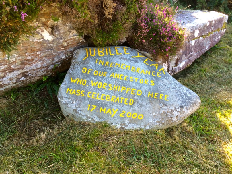
This beautiful song speaks to a revered tradition in Irish history and folk custom – the mass rock. During the period of the Penal Laws (late 17th and first half of 18th Century) when the practice of Catholicism was outlawed, parishioners would gather at a secret location to attend mass. The priest travelled from community to community in disguise, a lookout was posted, and mass was celebrated on a lonely rock far from the reach of the law. The song encodes the message that the people still find ways to attend mass, despite the harsh prohibition against it.

Mass rocks are often in remote locations, such as this one in Kerry, or the lead image on the Beara

Dr. Hilary Bishop, in her excellent website Find a Mass Rock says, As locations of a distinctively Catholic faith, Mass Rocks are important religious and historical monuments that provide a tangible and experiential link to Irish heritage and tradition. She also points out that, because of the imperative for secrecy, mass rocks are difficult to find.

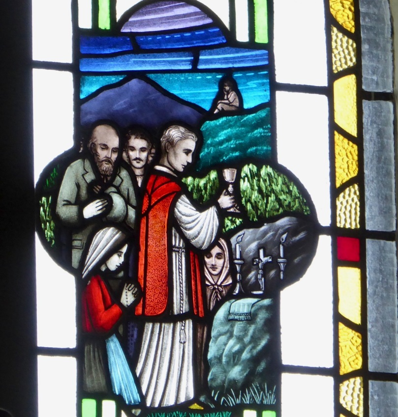
This stained glass window shows mass at a mass rock, with a lookout posted to keep an eye out for the redcoats

We certainly experienced this when we set out for a day of mass rock hunting. Working from a list generated from the National Monuments Service database we spent a day on the Sheep’s Head and the Mizen and had trouble finding all the rocks on the list. One, if it was still there, had disappeared under impenetrable layers of gorse. A second rock was last recorded in the 1980s: residents were no longer familiar with it.

One of our favourite holy wells, at Beach on the Sheep’s Head, also incorporates a mass rock. Mass is celebrated here every August

Knowledge of mass rocks has passed down from generation to generation. In the deep countryside, the sites maintain a mystique and a sense of the sacred. We’ve written about the mass rock and holy well at Beach, where Mary conjured up a blanket of fog to confuse the English soldiers and allow the priest to escape. At Beach and at our first stop, the mass rock at Glanalin on the Sheep’s Head Way, mass is still celebrated.

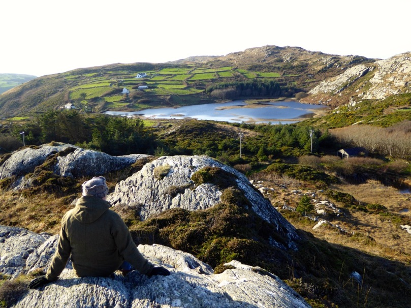
The Glanalin rock (above), and the one we visited on the Beara Peninsula, are good examples of the remote locations typical of many mass rocks, high on a hillside or hidden in an isolated valley. You can picture the procession of worshippers, in ones and twos, slipping silently through the bracken, pausing to make sure they are not being watched, climbing higher, following an overgrown trail, arriving at the meeting place where the hushed crowd awaits the arrival of the priest.

One of the rocks we found (above) looked for all the world like a fallen standing stone – and that’s probably what it was. (I wonder if I should go to confession, though – I’m sure that sitting on a mass rock would qualify as at least a venial sin.)

A mass rock that is easily visited is the one at Cononagh Village (above), right at the side of the main road into West Cork, the N71. This site is beautifully maintained – Cononagh is obviously proud of its heritage: signage and flowers invite the passerby to take a closer look.

The mass rock we visited last year, at Foherlagh, has a commanding view of the surrounding countryside. This one even had a small scoop-out in the rock, identified as a holy well

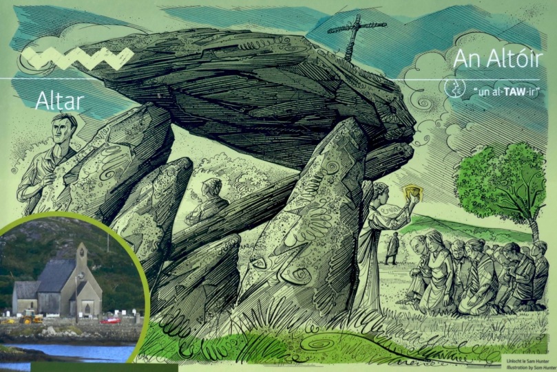
Another easily accessible site is Altar, at Toormore. This is a wedge tomb, probably over 4,000 years old and excavated in 1989. It remained in use through the Bronze Age and into the Iron Age. Dr. William O’Brien, in Iverni, says of this site: …over time this tomb came to be regarded as a sacred place, housing important ancestral remains in what was a type of community shrine. How fitting, then, that the flat capstone of the Altar wedge tomb became, in the Penal Days, a mass rock. And how intriguing to think of the continuation of this sacred space over the course of thousands of years.

But perhaps our favourite of all the mass rocks we have visited is the one at Castlemehigan. We wrote about it here. It started out life as a cupmarked stone perhaps in the Neolithic, then probably got converted into a bullaun stone in the Early Medieval period, before finally serving as a mass rock – and it has all the stories to go with its long history.


West Cork Obscura – Robert’s Choices

‘Hidden West Cork’ and ‘off the beaten track’ have been oft-used phrases in our posts – and that’s part of our mission with Roaringwater Journal: exploration of some of the more secret places, and researching and recording their stories. Finola has looked out her own favourites; my current choices are here – although, with 569 posts written to date between us, we could have picked out so many.

Header and above – one of the discoveries which made a great impression on me during the year was Tralong Bay, out beyond Glandore and Drombeg: it’s a beautiful piece of the coastline, at the end of a cul-de-sac and – it seemed to us – very little visited. But to visit is to transport yourselves back thousands of years as, on the beach and exposed at low tide, are the remains of an ancient forest. Here is the post.

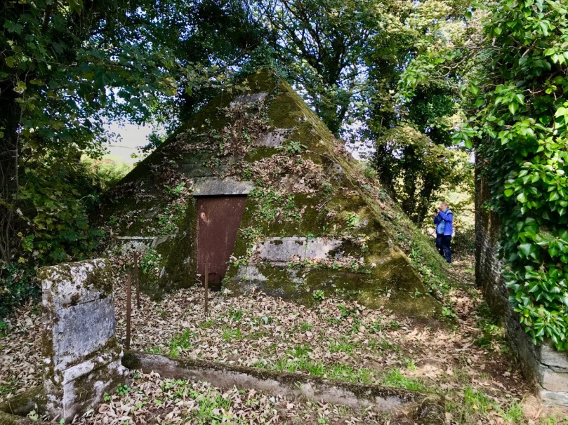
A quirky discovery, not too far away from Tralong, was the pyramid-shaped mausoleum in the old burial ground at Glandore. For us, ancient graveyards are treasure troves of local history. This one – a peaceful and secluded place well worth a visit anyway – conceals an enigma: find the story here.

The Rock Art at Castlemehigan in its spectacular setting (above). Below is a close view of some of the markings on the rock

Delving back a few years, I found this December post on a visit to a spectacular example of Rock Art at the far end the Mizen Peninsula: Castlemehigan. The cupmarks on this earthfast boulder are impressive and the view from it is spectacular, especially on the clear winter day that we were blessed with. The rock was also in use as a Mass Rock during penal times, and there is evidence of this on the surface. We were told a story about those times by Florence O’Driscoll, whose land the rock is on. Make sure you have permission to visit if you go!

Finola managed to combine her consuming interest in wildflowers with industrial history and an account of a very special walk on the Sheep’s Head. It’s one of the marked trails on that peninsula – and takes in the deserted settlement of Crimea where a cottage has been partially restored (picture above) – finishing at the abandoned mine workings at Gortavallig, perched precariously on the very edge of a cliff (below). Here is the link to Finola’s post.

Here am I trying to get my head around the enigmatic ‘Rolls of Butter’ (above). I have to admit they are in Kerry (only just), but involved us travelling one of our all-time favourite roads, much of which is actually in West Cork: that’s the Priest’s Leap Road which runs over the mountains from Bantry (more or less) to Kenmare (more or less). We go out of our way to use this road because of the superb views – and a special piece of folklore – but, if you give it a try, be prepared for a narrow and steep journey (below)! Here is the post.

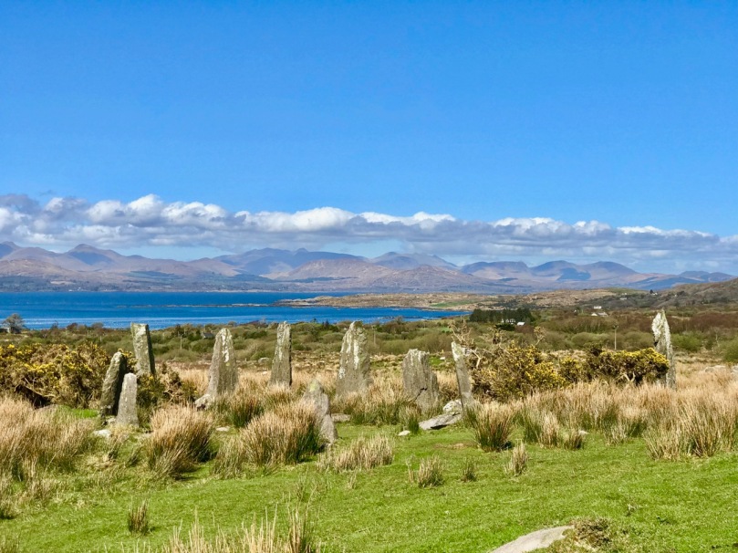
Archaeology dictates many of our outings. One of the less well-known monuments is Ardgroom Outward Stone Circle (pictured above and below) on the Beara Peninsula. This year, following a harsh winter, the weather turned sublime, and we have travelled extensively to make the most of it. We find ourselves often drawn to the Beara (much of which is in West Cork). This post describes an expedition which included stone monuments, colourful villages, stained glass – and ice cream! Have a look.

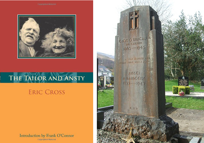
It was almost five years ago that we first reported on one of our perenially favourite West Cork locations: Gougane Barra (above). It’s a holy place – an alluringly beautiful lake sited in the Shehy Mountains, close to the source of Cork’s special River Lee. Here, in the sixth century, Saint Finbarr set up a collection of cells for his monastic community on an island. Here, also, lived the couple ‘The Tailor and Ansty’, immortalised in a book written in 1942 by Eric Cross. It’s a not entirely happy story as the book was banned because of its down-to-earth portrayal of the facts of life, and storyteller Tim Buckley (‘The Tailor’) was forced to burn his copy of it in front of the local priests: the incident led to an abrasive debate in Seanad Éireann on censorship. This story is, perhaps, one of the less well-known historical aspects of West Cork (and Ireland), but visit Gougane Barra for its beauty – and make sure you find the gravestone of ‘The Tailor & Ansty’: it was carved by their friend Seamus Murphy and bears the inscription . . .  A Star Danced And Under That Was I Born . . .

We hope that, between us, we might have given you some good ideas for exploration of our wonderful West Cork landscapes and – perhaps – encourage you off the highways and on to the byways: there are so many adventures to be had, summer or winter. Travel Well!

The Complex Cupmark

Rathruane More: the view from the rock art site includes a knoll with a row of cupmarks on its upper surface, and Mount Gabriel on the horizon

Rathruane More: the view from the rock art site includes a knoll with a row of cupmarks on its upper surface, and Mount Gabriel on the horizon

QUESTION: Is there a real difference between rock art and cupmarked stones?

A joint post by Finola and Robert
Distribution of 'rock art' (left) and 'cupmarked stones' (right) in Ireland

Distribution of ‘rock art’ (left) and ‘cupmarked stones’ (right) in Ireland, according to the National Monuments classification scheme

In recording the rock art of County Cork so far we have concentrated mainly on those examples described in the National Monuments Records as rock art. In the course of planning the Cork survey, years ago, a decision was made to distinguish between rock art and cupmarked stones and so they are listed separately. However, other counties appear to lump them together, or use the generic term rock art to include stones bearing only cupmarks. In addition, some monuments are classified using their most distinctive feature: a wedge tomb or a standing stone, for example, may well bear cupmarks on a surface, but do not therefore show up as examples of either rock art or cupmarked stones on the records.  
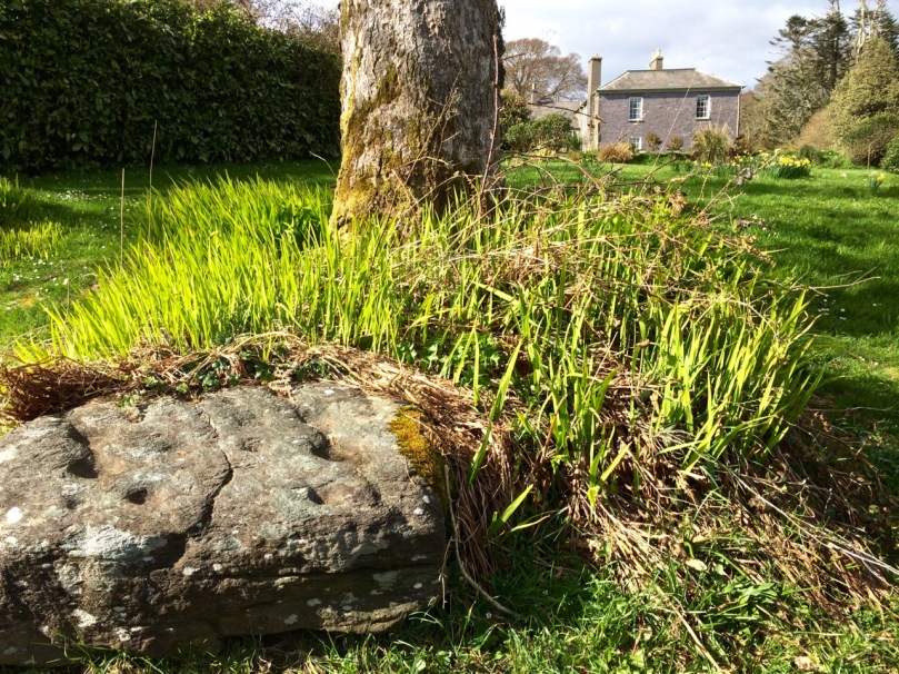
Drishane Cupmarked Stone. In other counties, this would be recorded as Rock art

Drishane Cupmarked Stone. In other counties, this would be recorded as Rock art

This is how the National Monuments Website describes cupmarked stones: A stone or rock outcrop, found in isolation, bearing one or more small, roughly hemispherical depressions, generally created by chipping or pecking. There are a total of 99 examples listed in Ireland, of which 64 are in Cork. However, as we have seen above, this is an arbitrary and misleading classification and varies from county to county. The number of cupmarked stones that fit the NM description is likely to be much larger. The question is – should we preserve this distinction between stones labelled rock art and those labelled cupmarked stones? Is it useful or merely confusing?

Rathruane - included in the list of rock art because, besdies cupmarks, it also has cup-and-ring marks, a rosette, and curved lines.

Rathruane – included in the list of rock art because, besides numerous cupmarks, it also has cup-and-ring marks, a rosette, and lines. The first photograph in this post was taken from this surface

The cupmark is the most basic and numerous element or motif of rock art in Ireland and elsewhere. In the examples labelled rock art in County Cork, they occur with other motifs, principally concentric rings, sometimes with radial grooves, and a variety of curved or straight lines. They can be incorporated within a motif (as in cup-and-ring marks, rosettes, or where enclosed by lines) or they may be scattered, seemingly randomly, over the surface of the rock, between and among the other motifs.

The two images above are from the shores of Lough Hyne. Two cupmarked stones lie on the beach, having probably fallen from the stone wall above. The right hand image is Robert’s drawing of the stone with 12 cupmarks

Since we have almost finished our recording of the rock art examples, we have moved on to focusing on those labelled cupmarked stones. As we spend time in the field recently with this class of monument we have begun to appreciate their differences from and similarities with rock art.

This simple cupmarked stone was placed many years ago within Knockdrum Fort, near Castletownshend, in the townland of Farrandau. It was brought to Vice-Admiral Boyle Sommerville by a local farmer

Let’s start with what differentiates them from rock art, apart from the obvious fact that the cupmark is the single motif employed in the carving.

  • Where a stone is smaller and moveable, it is more likely to bear only cupmarks. This also makes them more vulnerable to loss and to incorporation into field walls and other structures. While there are examples elsewhere, here in Cork we have found no examples of cup-and-ring carvings on small, easily moveable, stones.
  • We have found cupmarks on boulder burials here – Bohonagh is a good example, and Derreennatra (currently hidden under a mound of compost) may be another.
  • In general standing stones, where they have carvings, are more likely to have only cupmarks (we have three exceptions to this in West Cork).
  • The Bluid stone has cupmarks on both sides – there are no Cork examples with rock art on both sides.
The Bluid Stone is in Cork Public Museum but comes from near Castletownshend. It is a rare example of a stone with cupmarks on both sides, quite portable. Note the semi-circular patterns of the cupmarks

The Bluid Stone is in Cork Public Museum but comes from near Castletownshend. It is a rare example of a stone with cupmarks on both sides, quite portable. Note the semi-circular patterns of the cupmarks

Now – what’s the same?

  • Location: Most cupmark-only carvings are found in the open countryside, on large earthfast boulders or rock outcrops.
  • Clusters: as with rock art, cupmarked stones are often found within a kilometre or two of other examples or are within sight of each other or within site of rock art (intervisibility).
  • Carving technique: where it can be discerned, it appears to be the same as for rock art – pecking with a harder stone. In the case of some of the shaley sandstone that laminates easily, it is impossible to tell how the cupmarked was formed – it may have been simply bashed out.
  • Siting: where the cupmarks are found in situ, their siting is equally spectacular to rock art. In particular, many of them are found on rising ground with strongly marked horizons that include views, even quite distant views, of Mount Gabriel, Mount Kidd, or other prominent horizon features. The sea, or water in the form of a lake, stream or river, is often a feature of the vista from the rock. We have not worked with enough of them yet to form any opinion on whether they are sited at what may have been routes through a landscape or territorial boundaries.       
  • Patterns: as with more complex rock art, often the cupmarks appear to be scattered randomly over the surface of the rock. However, patterns of straight lines, or of rough circles or semi-circles, can be made out in several of the stones we have recorded to date.
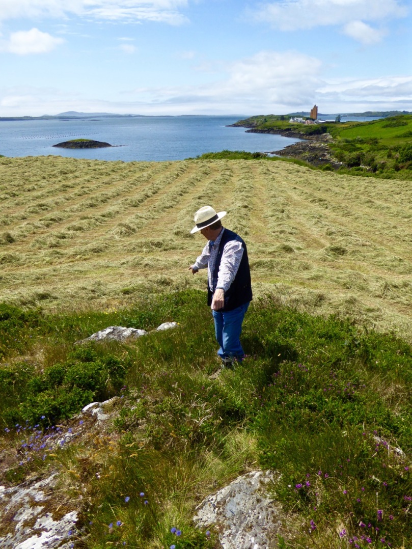
Robert points to two outcrops in Kilcoe. The lower one has one cupmark, the upper one has 13 cupmarks arranged in a rough circular patter. The sea and Mount Gabriel are visible from this location, as well as some rock art

Robert points to two outcrops in Kilcoe. The lower one has one cupmark, the upper one has 13 cupmarks arranged in a rough circular patter. The sea and Mount Gabriel are visible from this location, as well as some rock art

In researching this piece we have been influenced by Christiaan Corlett’s book Inscribed Landscape: The Rock Art of South Leinster. Christiaan is an archaeologist with the Dept of Arts, Heritage and the Gaeltacht and specialises in the archaeology of Leinster, and especially Wicklow. His book has been the first to catalogue the extensive body of rock art in the South Leinster area (indeed the first published work on rock art in Ireland) and in his corpus he includes both cup-and-ring art and cupmark-only stones without undue distinction. He notes many of the same things about rock art that we have observed. For example, he was struck, as we were, by the dominance of high mountains (in his case, Mount Leinster, the Blackstairs, or Brandon Hill) in the horizon views from the rocks he studied, and by the intervisibility of stones from each other.

The newly-discovered Kilbronoge cupmarked stone. From it you can see Roaringwater Bay and a wedge tomb to the SE, and Mount Gabriel diametrically opposite in the NW

The newly-discovered Kilbronoge cupmarked stone. From it you can see Roaringwater Bay and a wedge tomb to the SE, and Mount Gabriel diametrically opposite in the NW

Robert's drawing of the Kilbronoge Cupmarked Stone, done on CAD using architectural drawing tehniques

Robert’s drawing of the Kilbronoge Cupmarked Stone, made using architectural survey and CAD techniques

His work is a strong argument for the inclusion of all cupmarked-based prehistoric carving under one rubric – rock art. First of all, he argues that it is all likely to be of a similar early origin. Recent thinking is that rock art may predate megalithic art and belong to the Early Neolithic (at least 5,000 years old). In fact, the cup-and-ring art may already have been dying out during the great flowering of megalithic art that we see at Newgrange, Knowth and Loughcrew. Cupmarks on their own may have persisted longer, as they are found in association with Bronze Age monuments such as wedge tombs and boulder burials. Here’s what he has to say about our search for meaning, vis-a-vis the humble cupmarked stone (p.78):

Arguably, it is only within the context of the overall composition that we may come close to some comprehension of the motifs found in rock art. Even the meaning of a completed composition, however, may only have been understood by the person(s) responsible for it. Perhaps the symbols represent a complex message of family history or a personal spiritual journey associated with an initiation ceremony or rite of passage, or perhaps they simply served to delineate family, tribal or sacred boundaries… [There is] a natural temptation to focus on the more elaborate designs and compositions found in rock art, as if they are more important because they are more accomplished. Yet the frequency of compositions consisting solely of plain and unelaborated cup-marks should not devalue their significance. Clearly their commonness would strongly suggest that these examples were just as important as, or maybe even more important than, the most elaborate examples of rock art found in the region. Given the intrinsic simplicity of a composition consisting entirely of cup-marks, however, it is arguably impossible to decipher or decode the specific meaning of the symbols themselves. That is not to say, of course, that we cannot attempt to understand the broader message of rock art, particularly where a complex of sites can be analysed. In such cases it may be the context of these sites that will provide the key to unlocking the meaning of rock art, in terms of the position and relationships within a given landscape, and the relationship with other examples of rock art on the vicinity.
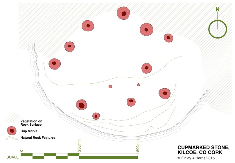
The Kilcoe Cupmarked stone. The original record described three cupmarks - in fact there are 13, arranged in a rough circle.

The Kilcoe Cupmarked stone. The original record described three cupmarks – in fact there are 13, arranged in a rough circle

Christiaan deals with the similarity of cupmarks to the bowl-shaped depressions known as bullauns, assumed to be Early Medieval. But that’s a topic for another day. Suffice it to say here that one of our favourite stones, Castlemehigan, may have both cupmarks and bullauns on its surface, as well as a cross indicating its later use as a mass rock. In its extraordinary mix of seemingly-randomly-scattered but also possibly-linear-arrangement of cupmarks; large bowl and basin-shaped elements; a spectacular siting that includes views to a distant Mount Gabriel and a closer view of the sea; a nearby cluster of other cupmarked stones; and the folklore that surrounds it – this very special cupmarked stone embodies all that is wonderful about this class of ancient monument.

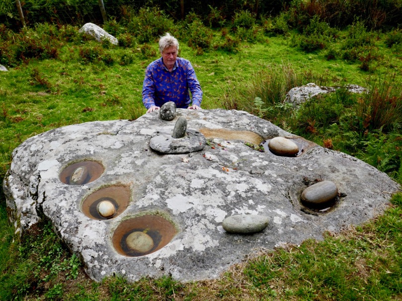
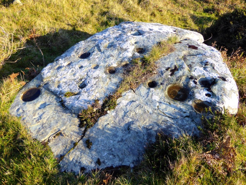
Castlemehigan cupmarked stone

Castlemehigan cupmarked stone

To come back to the question we posed at the beginning – should we preserve or abandon the notion that we are dealing with two classes of monument – rock art versus cupmarked stones? Our answer is that we’re not sure.  What do YOU think?
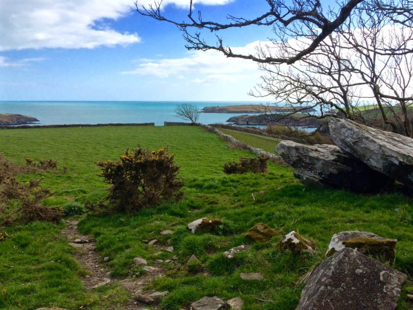
The Giant's Grave, Drishane. It bears numerous cupmarks on the upper surface of the 'capstone'

The Giant’s Grave, Drishane. It bears numerous cupmarks on the upper surface of the ‘capstone’

For those interested in more of our posts on rock art, go to Derrynablaha Expedition and scroll to the end for a list.

Mizen Mission

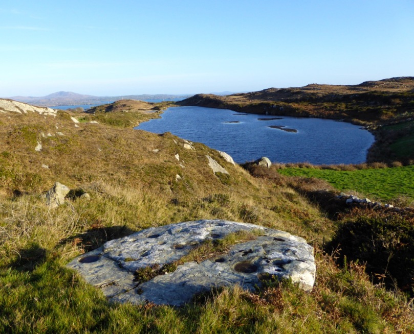
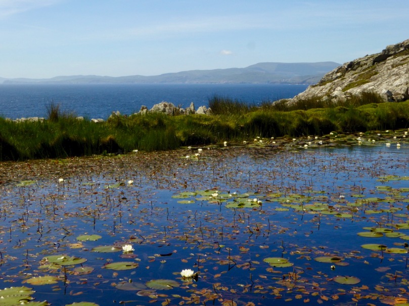
Tooreen Lake

Tooreen Lake

A joint post by Robert and Finola…

Finola

According to the forecast today could be the last fine day of 2014, so we decided to make the most of it and set off on a mission. And what a day it was! Cold, yes, but with that brilliant light that only happens on crisp winter days.

Looking across Roaringwater Bay

Looking across Roaringwater Bay

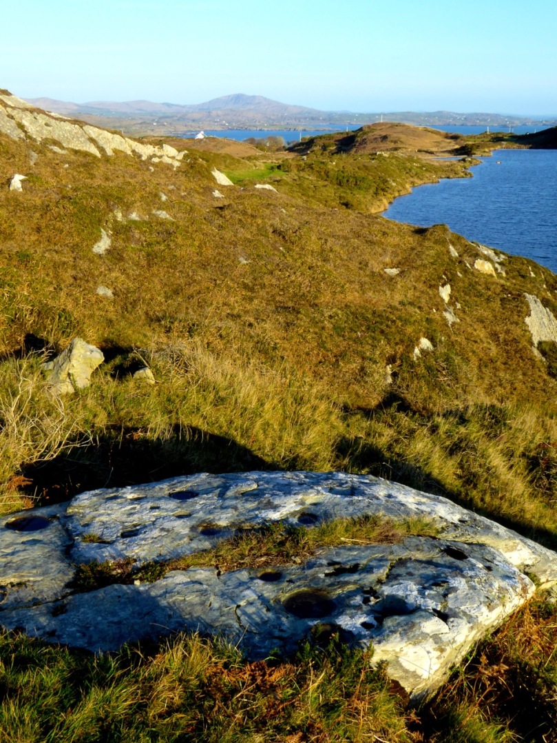
Our mission? it was to find a piece of prehistoric rock art I had last visited over 40 years ago in the townland of Castlemehigan, near the end of the Mizen Peninsula. But once in the vicinity of Castlemehigan we couldn’t resist continuing to the end of the tiny road, which climbed up the rocky hills on the northern side of Crook Haven. Parking the car, we climbed to the highest point we could find. We’re used, by now, to the jaw-dropping views around here, but even by Mizen standards, this was something special. 

Crookhaven Village

Crookhaven Village

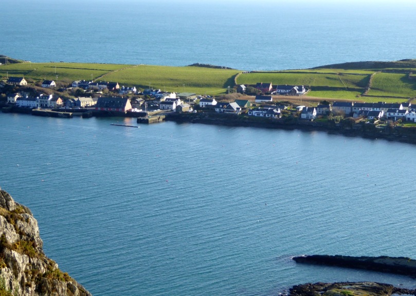
South of us, across the Haven was the village of Crookhaven nestled in its protective harbour. Looking north we could see across the Sheep’s Head to where the unmistakeable outline of Hungry Hill loomed on the Beara Peninsula. To the west was the White Strand and Brow Head, crowned by the historic Marconi telegraph station and to the east was the whole of Roaringwater Bay: Cape Clear Island, Sherkin, Baltimore, and the ring of hills that run down to the water.

Back in the vicinity of the rock we knocked on the door of a farmhouse to ask directions and permission. Often when we do this we are met with a blank look – not every ancient monument location has survived in the folk memory of the local residents. But this time we hit it lucky, with Florence O’Driscoll – ah yes, he knew it – the mass rock is what we were looking for. I showed him a picture of the rock and he confirmed that was the one, it was on his land and he would take us there.

Castlemehigan Rock

Castlemehigan Rock

My write-up and drawing of the time brought back some memories of an unusual rock with very large depressions, almost more basins than cupmarks. I also had a very clear recollection of being taken to the site by Bernard O’Regan, a local (and well-remembered) amateur archaeologist who was very helpful to me at the time. Because the rock was very overgrown, he had arranged to have it cleaned for me and when we arrived there were two men on top of the rock hacking away the gorse and heather. Nowadays, rock art specialists abide by an ethic of zero surface contact – no clearing or scrubbing allowed!

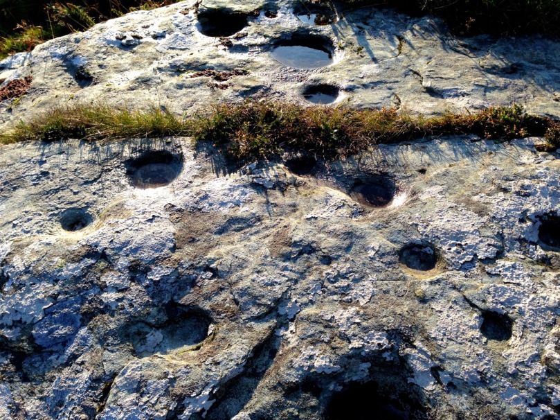
Castlemehigan rock surface

Castlemehigan rock surface

Although this rock lacks any of the circles, grooves and lines that add interest and appeal to many panels of rock art, it is special in other ways. Several of the cupmarks are unusually large, and one is basin-shaped (that is, with straight sides and a flat bottom).

Oriented to Mount Gabriel to the east

Mount Gabriel clearly visible

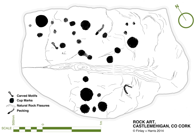
Some cupmarks appear to run in rows and the rows run in specific directions – one line of cupmarks run directly east/west pointing at the lake that lies about 100 meters away at the bottom of the field. Another line pointed to Mount Gabriel, about 15 kms away on the distant horizon. The two large basin-like depressions are directly north/south of each other.

row of cupmarks

Row of cupmarks

What could be a standing stone is located a few metres away.

Standing stone?

Standing stone?

In comparing my original drawing, done 42 years ago, there wasn’t much I would change. Some cupmarks appear to have pecked areas between them which conjoin them in a dumb-bell motif. My original decision was that there were two dumb-bells, but perhaps now I would be tempted to say there were three or even four. However, this just illustrates the subjective nature of the recording process. Especially where lichen obscures the surface, decisions like this come down to professional judgement and experience: drawings can differ from one recorder to another, or even from one visit to another when lighting conditions show up more or less of the carving detail.

Original drawing, updated by Robert

Original drawing, updated by Robert

Robert

This earthfast boulder is a beautiful object – not least because of its setting. I love these Mizen landscapes – they have a very particular character. Large areas of rock outcrop are interspersed with the tiniest fields, tracks and bog. Here there are lakes close by – once natural features, they have been turned into reservoirs to serve local communities. The marked rock overlooks one of these – this one supplying nearby Goleen.

Mount Gabriel clearly visible from the Derreennaclogh stones

Mount Gabriel clearly visible from the Derreennaclogh rock

This example reminds me in some ways of the Derreennaclogh rock – it’s of similar size and shape. Also, at Derreennaclogh Mount Gabriel is prominent on the western horizon, and we’ve been told that the setting sun towards the short end of the year appears to ‘roll’ down the slope of the hill at times. At Castlemehigan the rock also looks out to Mount Gabriel – this time to the east. This is a relatively isolated piece of rock art: the nearest recorded example is at Cooradarrigan, on the far side of Schull. It’s tempting to think that the flat, table-like surfaces of both Derreennaclogh and Castlemehigan were considered significant to those ancient people – who made them notable by marking them – because of their settings which relate to unmistakable landscape features. Otherwise, one might question why large areas of flat rock surface in the immediate vicinities – ideal for carving – have apparently been left untouched.

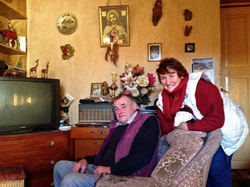
Florence and Finola

Florence and Finola

Florence O’Driscoll, our guide on this expedition, proved to be a fund of information. He had farmed the land which had been his father’s before him. Finola must have met his father when she explored the rocks over forty years ago. Florence carried the stories of the rock from his father’s generation, and probably from generations before that. He told us that the rock had been used as a mass rock in penal times – and that the hill above it was known as Cnocan an Aifreann (the hill of the mass): there is what certainly appears to be a cross carved into the rock surface, close to the large basin (Finola did not record this in her original drawing – she will add it when we update the records). Florence told of the time that the ‘Tans’ (the Black-and-Tans) caught red-handed the Priest celebrating the mass: the Priest threw the crucifix into the lake below the rock (the lake was then smaller than it is now). Ever since then, says Florence, the lake has never run dry – and never will.

Look for the possible cross carving on the right

Look for the possible cross carving on the right

It’s interesting that stories carried through local tradition pay no heed to time or history. They don’t need to: the ‘story’ is a part of the rock, as much as the carvings are. Florence told the tales as if they had happened yesterday. I hope they will continue to be told as long as the rock continues to display its enigmas.

Mass in penal times (Maggie Land Blanck Collection)

Mass in penal times (Maggie Land Blanck Collection)