Wending the Boreens

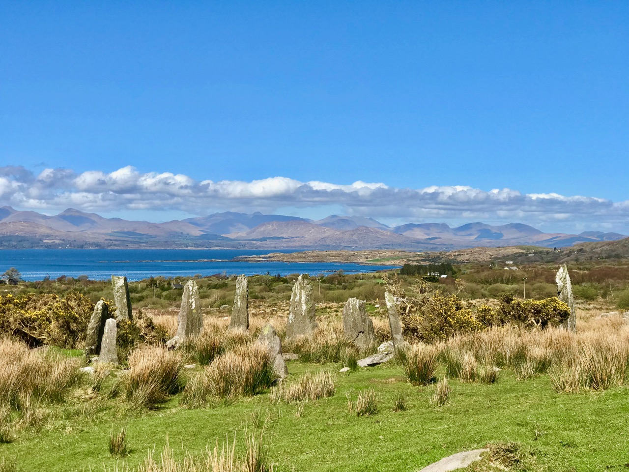
Only in Ireland can you wend your way along boreens. The Irish word is bóithrín, – a small bóthar (road). We are surrounded by them in our West Cork townlands. In these days of Covid19 restrictions, they are our whole world. With a maximum walk of 5 kilometres allowed, we can only ever be on boreens. But that’s no hardship – mostly they are beautiful (in fact they are all beautiful), and we enjoy every step we can take. So today’s post is simply a celebration of what is around us. But I have also combed the RWJ archives to look for boreens outside of our local area, for a bit of variety and comparison. Rest assured that any illustrations beyond our present limits were taken in other – normal – times!

Of course a ‘boreen’ or small road doesn’t have to be in a rural location, This fine boreen in Eyries, on the Beara Peninsula, is in fact a well used highway through the town, but you can’t deny that it is as atmospheric and picturesque as many of the rural byways shown here. It’s a moment in time captured for all time.

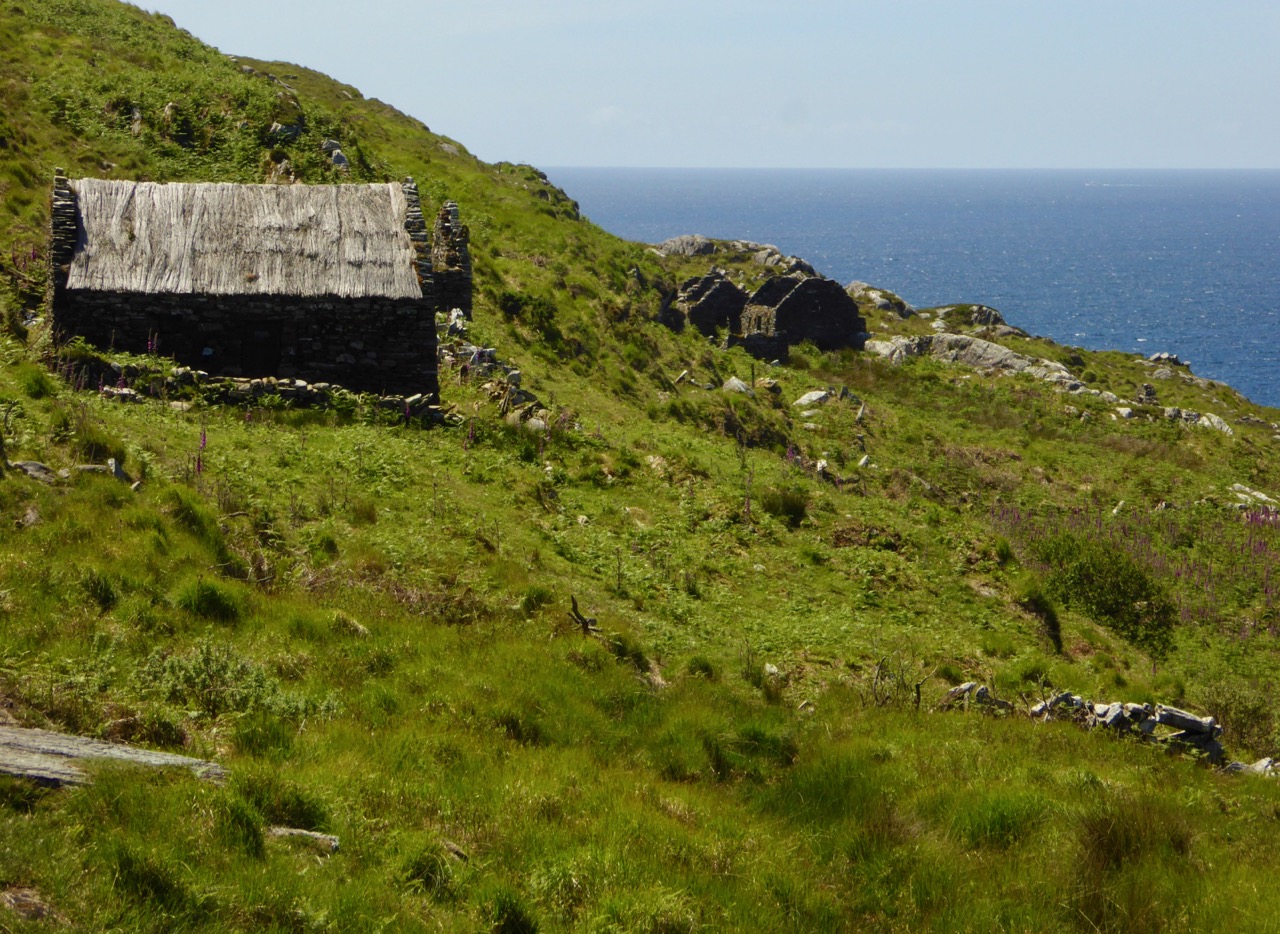
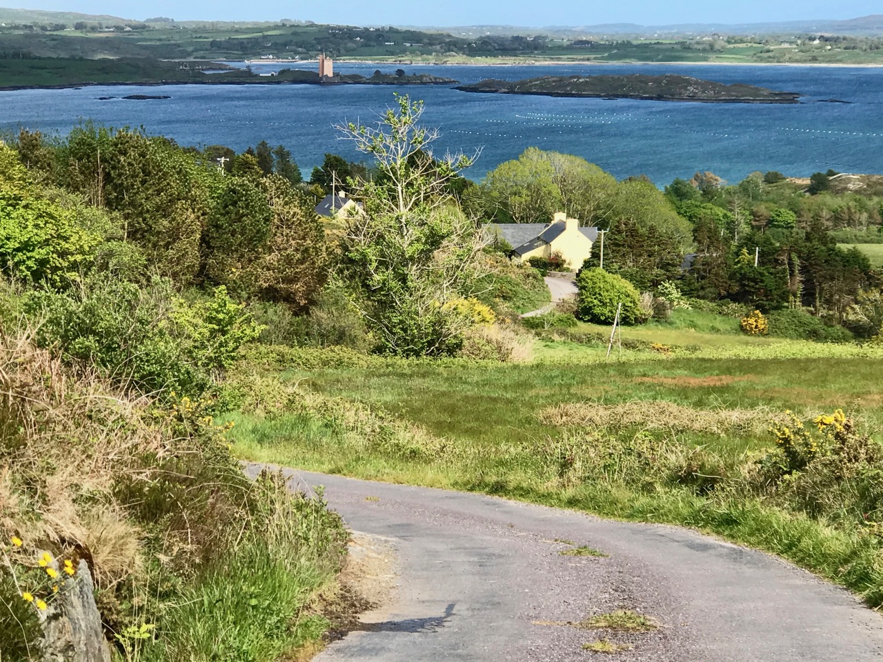
The photo at the top of the page is special for us: it’s the view we get when we turn out of Nead an Iolair, heading down towards Rossbrin Cove. And there (above) is our first glimpse of the sheltered harbour, overlooked by the medieval castle that was the home of Clan Chieftain Fininn O’Mahony in the 15th century. Not only do we have all the wonders of West Cork’s landscape on our doorstep, but we also have deep history as well…

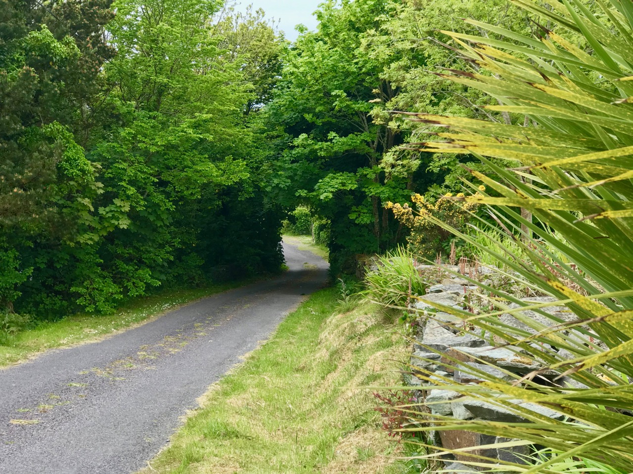
How much closer can you get to nature than this ‘green’ boreen just a short walk up the road from where we live in Cappaghglass? The stone hedge banks have become completely assimilated into the surroundings, and are a haven for so many native species of wildflowers, as Finola will readily point out to us!

And just a few yards from that last green trackway is the boreen that takes us down into our village of Ballydehob. Those are apple trees flourishing as part of the natural hedgerow.

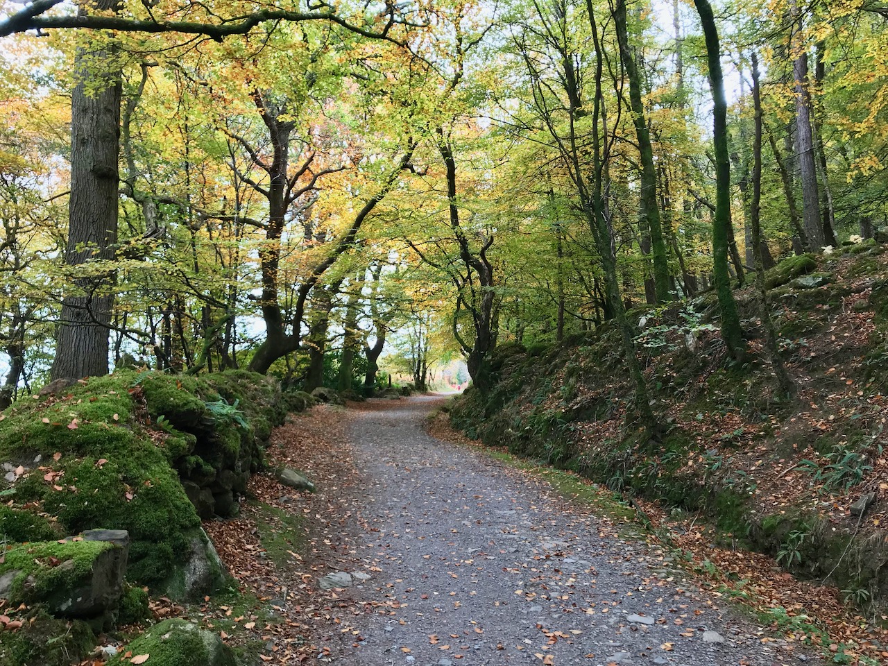
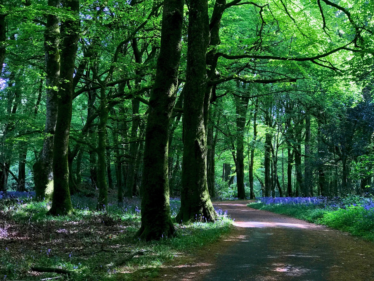
We have very little woodland around us here. This slightly mysterious tree-lined boreen was found on our travels near Glendalough, in County Wicklow, last year.

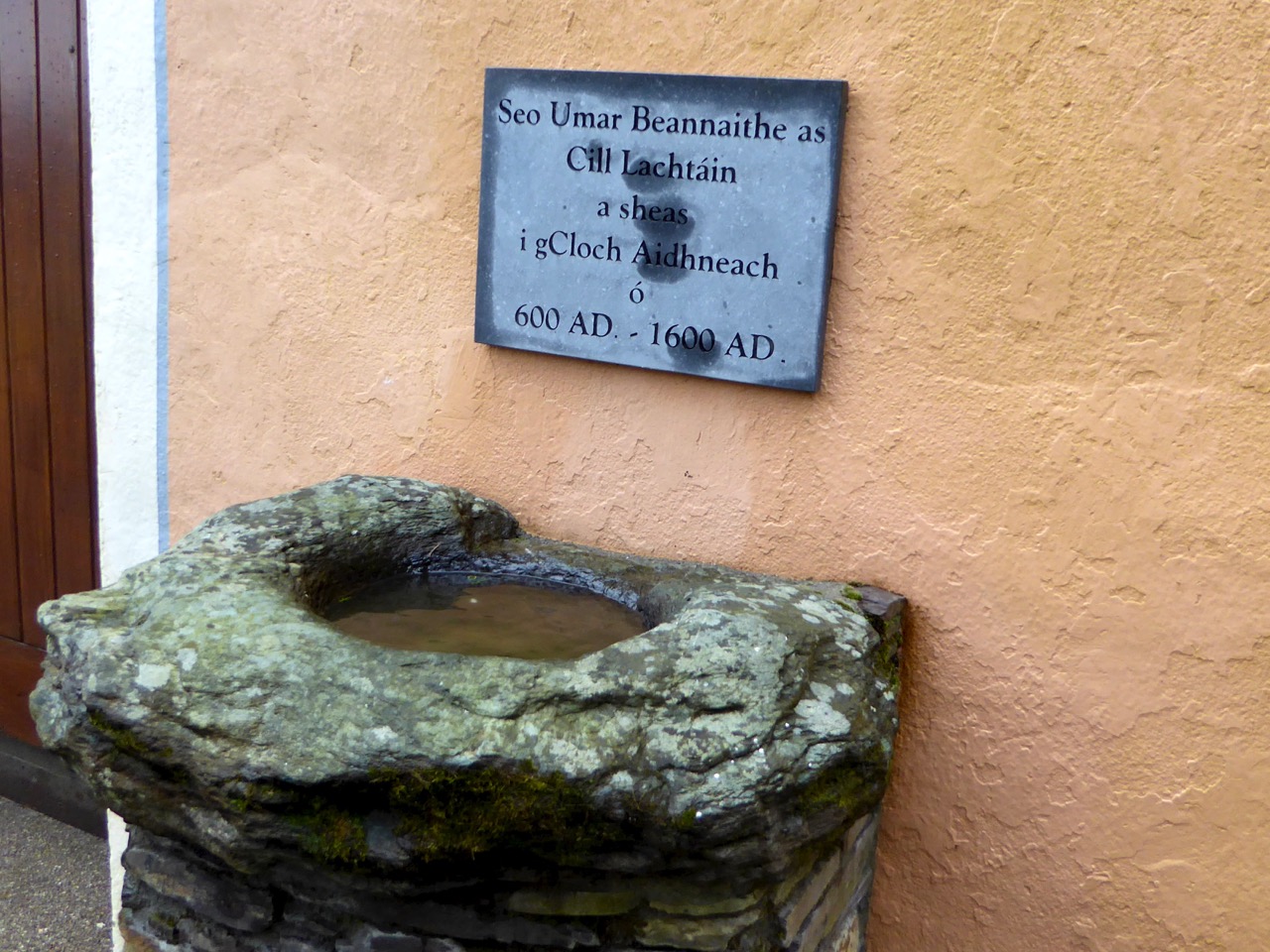
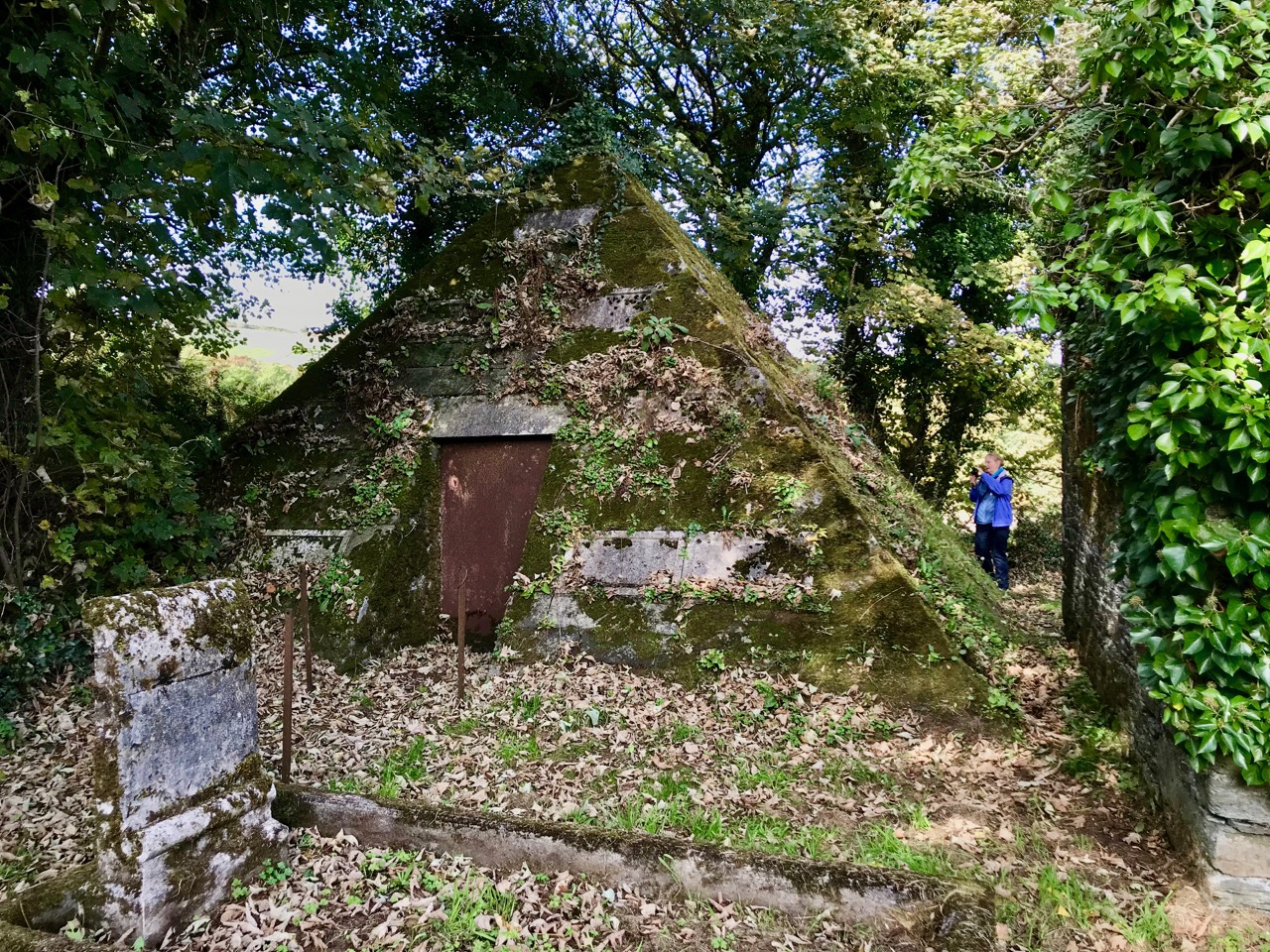
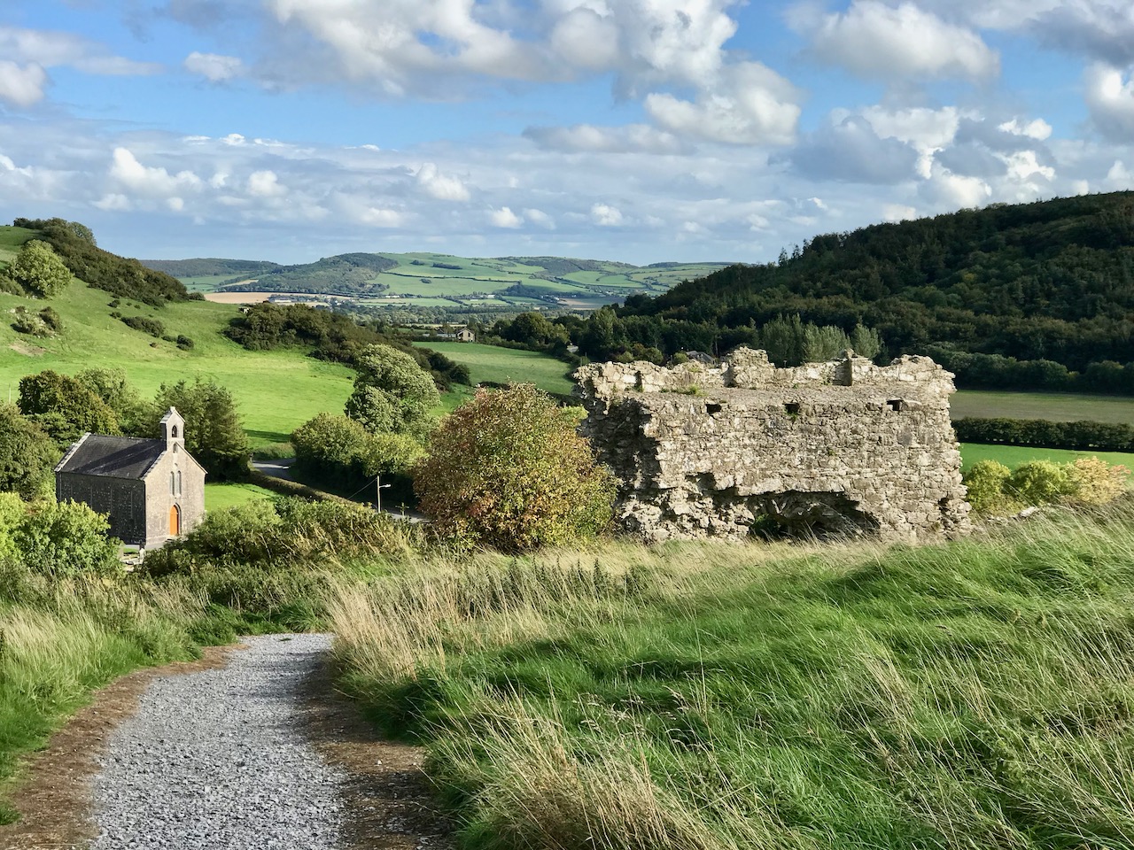
Close by the little harbour of Glandore (in Irish Cuan D’Ór – Harbour of Gold) in West Cork, we found a secluded boreen which pointed us towards an oddity: a pyramid in a graveyard – well worth a visit. Read about it in this post from two years ago.

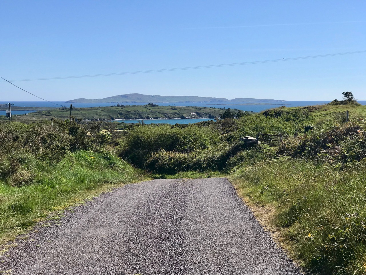
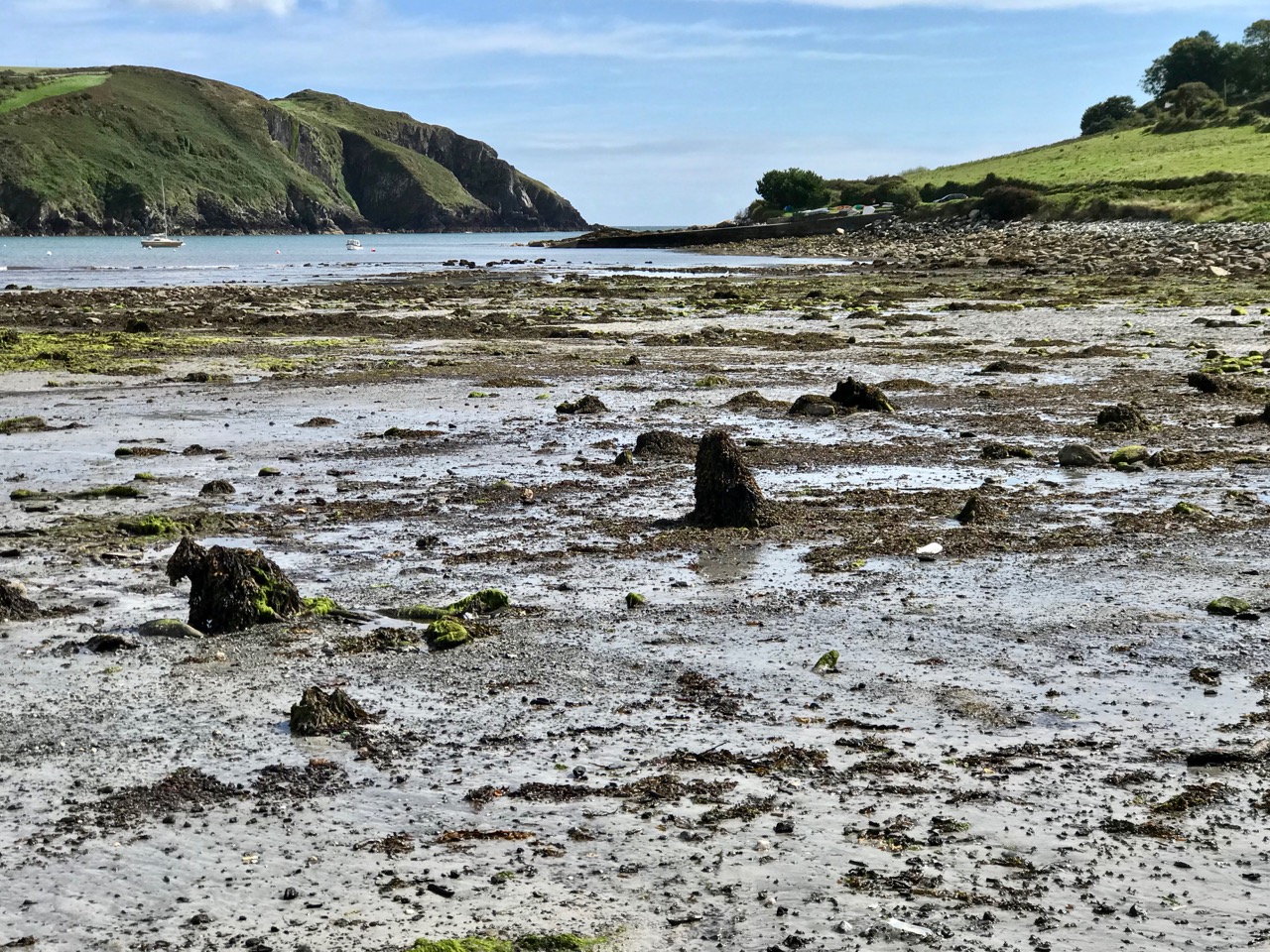
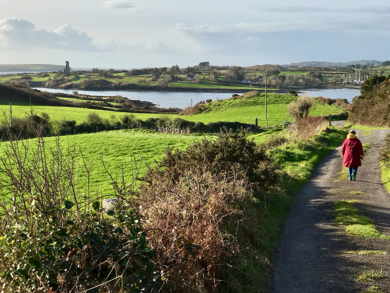
Returning to our own neighbourhood these two recent photos, taken only a couple of days ago, show how you can never quite know what you are going to find just around the corner or over the brow of the next hill. That’s Jeremy Irons’ Kilcoe Castle in the upper picture, and Cape Clear Island (on the horizon) in the lower one.

In contrast, here’s a little trackway that takes you up to the summit of the Rock of Dunamase in County Laois. This historic site with a view is associated with momentous events in the history of this country: in the painting by Daniel Maclise that hangs in the National Gallery of Ireland, The Marriage of Strongbow and Aoife is depicted as taking place at the now ruined Great Hall on the Rock. You can find the whole story of this most critical juncture in Ireland’s history in Finola’s post here.

Even further afield – in Ballymoney, Co Antrim – is this spectacular avenue of beech trees planted on the entrance driveway leading to an eighteenth century Georgian mansion, Gracehill House. This boreen – open to pedestrians – is known as the Dark Hedges, and we visited it when we explored the North of Ireland three years ago.

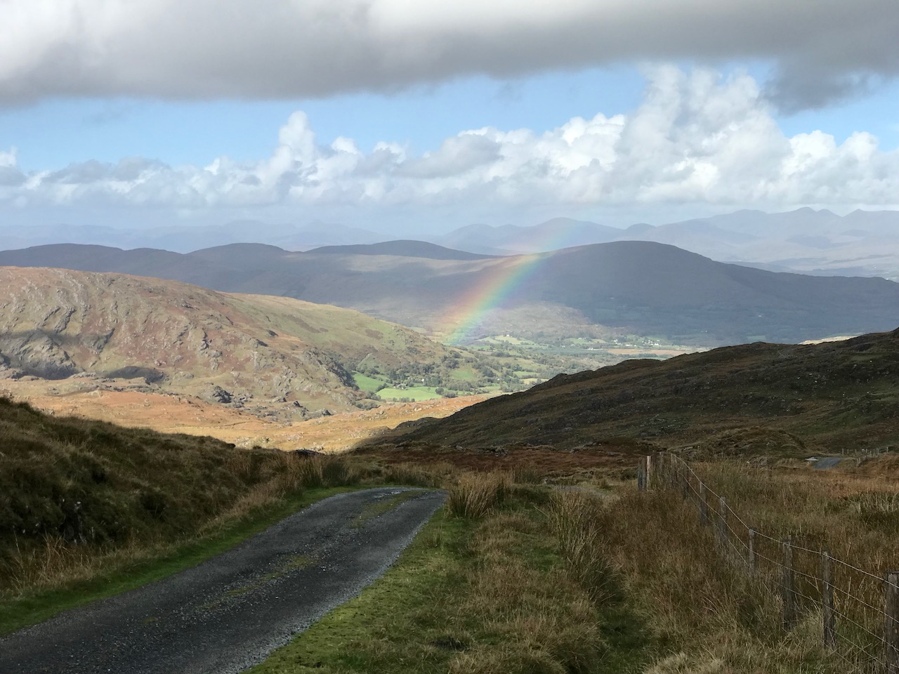
Although in normal times we travel a lot – on major roads and motorways, as well as boreens – the places we like the best are near to home. How could we not be impressed by the winding boreen that climbs to the top of Mount Gabriel, the highest point on the Mizen? Look at the spectacular views (above). The preacher Caeser Otway travelling in this area in 1822 wrote:

. . . On my way to Bantry I passed the dark and lofty Mount Gabriel and took my way over a dreary, comfortless tract of country. Let no one say after looking at these moors , studded over with cabins crowded with children, pigs, goats, cocks and hens that an Irishman is not an industrious creature . . . Men, women, boys and girls toiling up the mountainside with seaweed and sea sand in baskets on their backs . . . See them reclaiming from amidst rocks and bogs, patches of ground on which to cultivate their only food, the potato; and no one witnessing this struggle of human industry against nature, but must acknowledge that the Irish are a most industrious race . . .

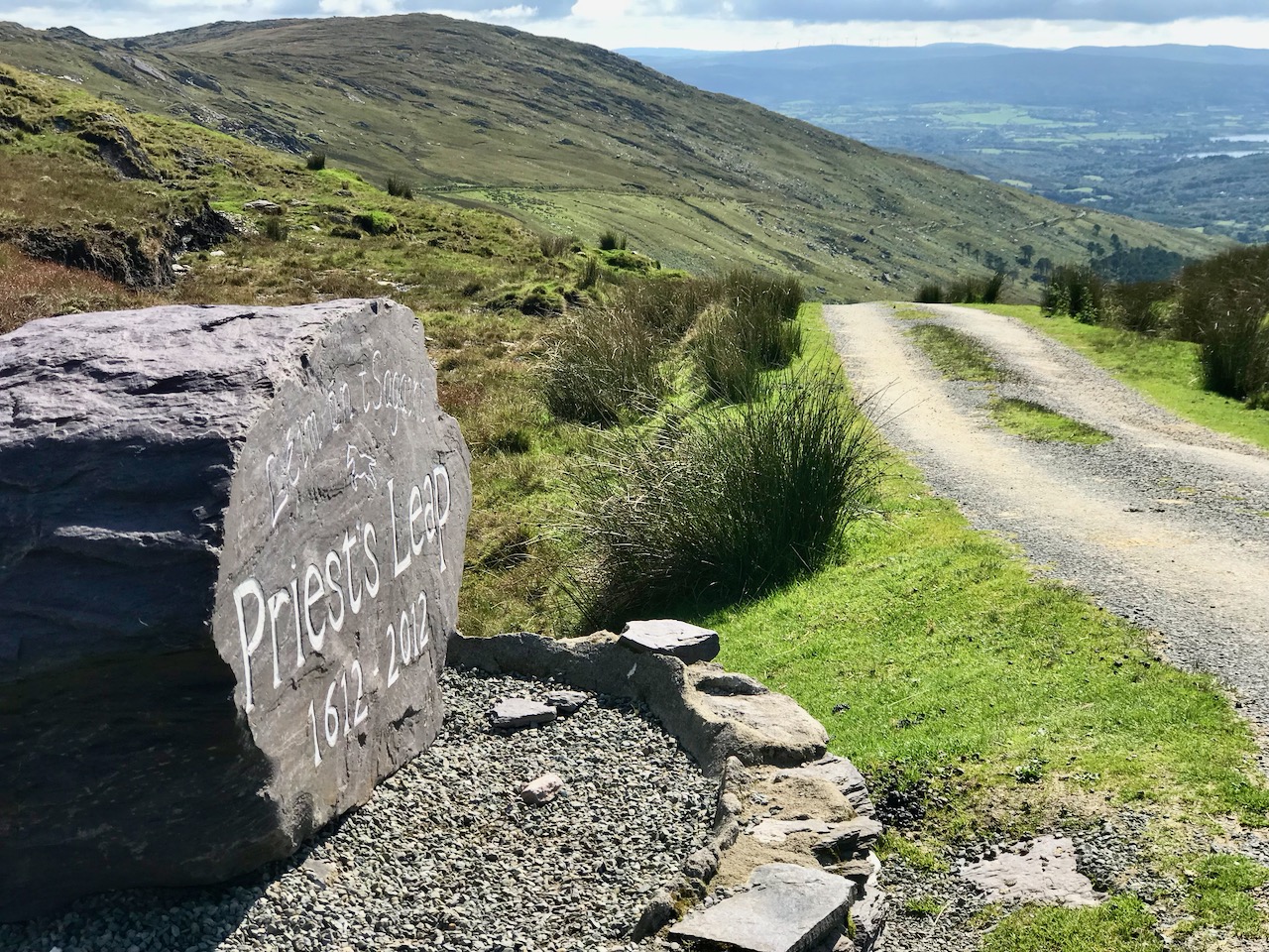
The 400 year old road that crosses the mountains from Cork into Kerry north of Bantry has to count as a boreen, as it’s single track for much of the way. The Priest’s Leap sign (above) marks the point at which the two counties meet. Although we have travelled all over Ireland in our explorations, this is still one of our favourite routes, and always will be. We so look forward to being able to go there again, when the present ‘lockdown’ is lifted.

Another glimpse of the Priest’s Leap ‘boreen’.

This elegant woodland boreen is a fine example of regency landscaping, being part of the Ballyfin Demesne in Co Laois. Like so many of Ireland’s fine luxury hotels, Ballyfin remains closed until the Covid19 restrictions are lifted.

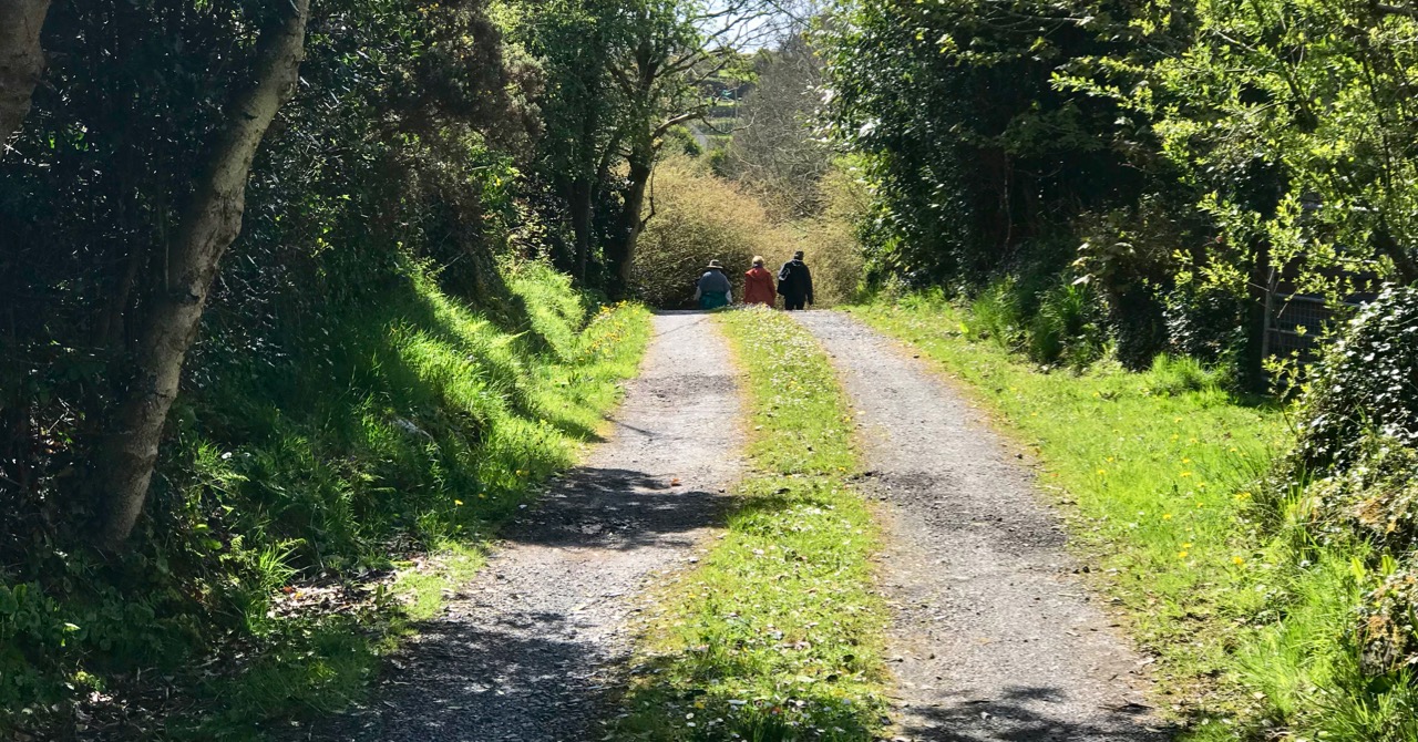
We’ll finish this post where we started – near to home in West Cork, with happy memories of unrestricted rambles with friends along the quietest and most beautiful of Ireland’s boreens . . .

The Enigmatic Bullaun

Bullaun Stones abound in Ireland. They are usually found nowadays at sites with ecclesiastical connections, as in the example above at Maulinward, an ancient West Cork burial ground. This association does not reduce or affect their traditional uses – according to folk convention – to cure or to curse. The Irish word Bullán means ‘bowl’ – a water container. At pilgrimage sites, such as St Gobnait‘s, Ballyvourney (below), the bullaun stones often hold quartz fragments or smooth, rounded pebbles – perhaps incised with a cross – which are turned around each time a pattern or procession is completed.

The Maulinward example on the header picture shows how the tradition of making offerings at some of these locations continues to this day. At other sites, such as the one below, the hollowed-out stone filled with rainwater takes on the properties of a holy well, and is visited for cures or simply good fortune.

This example, outside the door of the church at Cill Lachtáin, Co Cork seems to have been mounted to perform as a holy water stoup: the plaque reads ” . . . This blessed font of Cill Lachtáin was standing in Cloch Aidhneach from 600AD to 1600AD . . . “ Others resemble fonts and are similarly associated with places of worship. Look at this striking stone from Timoleague Friary, whose purpose – according to tradition – is clearly stated:

In the sixth century, the Council of Tours ordered its ministers ” . . . to expel from the Church all those whom they may see performing before certain stones things which have no relation with the ceremonies of the Church . . . ”  Such an order doesn’t seem to have prevented folk customs of curing continuing into the twenty-first century.

The ongoing use of bullauns as fonts, stoops or holy wells does not explain their original purpose (which is probably pre-Christian: here’s an interesting conjectural world view of the phemomenon), and it’s quite likely that we will never fathom for sure what they were for. The example above, at Kilmalkedar, Co Kerry is as enigmatic as they will get, with its multiple ‘basins’ carved into a large earth-fast boulder isolated in the middle of a field, although not far from a remarkably complex ecclesiastical site. But the one I find the most fascinating can be found along the Priest’s Leap road, a mere few steps away from our own home in West Cork . . .

This rock outcrop – known locally as The Rolls of Butter – is large (I’m there to give it scale!) with seven scooped-out bullaun like basins and a somewhat phallic central upright stone. The basins each contain a large, smoothed pebble. Some folk traditions in Ireland identify such pebbles as ‘cursing stones’: “. . . if you wanted to put a curse on someone, you turned the stones anti-clockwise in the morning . . . ” However, the curse had to be ‘just’ otherwise it came back to curse you in the evening! The illustration below – of ‘cursing stones’ at Killinagh, Co Cavan was made by antiquarian W F Wakeman in 1875. He also noted the similar local folk traditions of these examples.

Many bullaun stones or stone groups around Ireland have been included in the National Monuments records, and number in the hundreds. Functional, magical, sinister? Who knows . . . Your guess is as good as anyone else’s. But one thing is certain – they are intriguing and mysterious. Keep a look out for them – as we do – in your travels around this land.

Note: this is a re-run of a post I published five years ago – but it’s been augmented, updated and – hopefully – improved!

West Cork Obscura – Robert’s Choices

‘Hidden West Cork’ and ‘off the beaten track’ have been oft-used phrases in our posts – and that’s part of our mission with Roaringwater Journal: exploration of some of the more secret places, and researching and recording their stories. Finola has looked out her own favourites; my current choices are here – although, with 569 posts written to date between us, we could have picked out so many.

Header and above – one of the discoveries which made a great impression on me during the year was Tralong Bay, out beyond Glandore and Drombeg: it’s a beautiful piece of the coastline, at the end of a cul-de-sac and – it seemed to us – very little visited. But to visit is to transport yourselves back thousands of years as, on the beach and exposed at low tide, are the remains of an ancient forest. Here is the post.

A quirky discovery, not too far away from Tralong, was the pyramid-shaped mausoleum in the old burial ground at Glandore. For us, ancient graveyards are treasure troves of local history. This one – a peaceful and secluded place well worth a visit anyway – conceals an enigma: find the story here.

The Rock Art at Castlemehigan in its spectacular setting (above). Below is a close view of some of the markings on the rock

Delving back a few years, I found this December post on a visit to a spectacular example of Rock Art at the far end the Mizen Peninsula: Castlemehigan. The cupmarks on this earthfast boulder are impressive and the view from it is spectacular, especially on the clear winter day that we were blessed with. The rock was also in use as a Mass Rock during penal times, and there is evidence of this on the surface. We were told a story about those times by Florence O’Driscoll, whose land the rock is on. Make sure you have permission to visit if you go!

Finola managed to combine her consuming interest in wildflowers with industrial history and an account of a very special walk on the Sheep’s Head. It’s one of the marked trails on that peninsula – and takes in the deserted settlement of Crimea where a cottage has been partially restored (picture above) – finishing at the abandoned mine workings at Gortavallig, perched precariously on the very edge of a cliff (below). Here is the link to Finola’s post.

Here am I trying to get my head around the enigmatic ‘Rolls of Butter’ (above). I have to admit they are in Kerry (only just), but involved us travelling one of our all-time favourite roads, much of which is actually in West Cork: that’s the Priest’s Leap Road which runs over the mountains from Bantry (more or less) to Kenmare (more or less). We go out of our way to use this road because of the superb views – and a special piece of folklore – but, if you give it a try, be prepared for a narrow and steep journey (below)! Here is the post.

Archaeology dictates many of our outings. One of the less well-known monuments is Ardgroom Outward Stone Circle (pictured above and below) on the Beara Peninsula. This year, following a harsh winter, the weather turned sublime, and we have travelled extensively to make the most of it. We find ourselves often drawn to the Beara (much of which is in West Cork). This post describes an expedition which included stone monuments, colourful villages, stained glass – and ice cream! Have a look.

It was almost five years ago that we first reported on one of our perenially favourite West Cork locations: Gougane Barra (above). It’s a holy place – an alluringly beautiful lake sited in the Shehy Mountains, close to the source of Cork’s special River Lee. Here, in the sixth century, Saint Finbarr set up a collection of cells for his monastic community on an island. Here, also, lived the couple ‘The Tailor and Ansty’, immortalised in a book written in 1942 by Eric Cross. It’s a not entirely happy story as the book was banned because of its down-to-earth portrayal of the facts of life, and storyteller Tim Buckley (‘The Tailor’) was forced to burn his copy of it in front of the local priests: the incident led to an abrasive debate in Seanad Éireann on censorship. This story is, perhaps, one of the less well-known historical aspects of West Cork (and Ireland), but visit Gougane Barra for its beauty – and make sure you find the gravestone of ‘The Tailor & Ansty’: it was carved by their friend Seamus Murphy and bears the inscription . . .  A Star Danced And Under That Was I Born . . .

We hope that, between us, we might have given you some good ideas for exploration of our wonderful West Cork landscapes and – perhaps – encourage you off the highways and on to the byways: there are so many adventures to be had, summer or winter. Travel Well!