Field Trip – with Jack Roberts

Jack Roberts expounds on holy wells

Jack Roberts expounds on holy wells

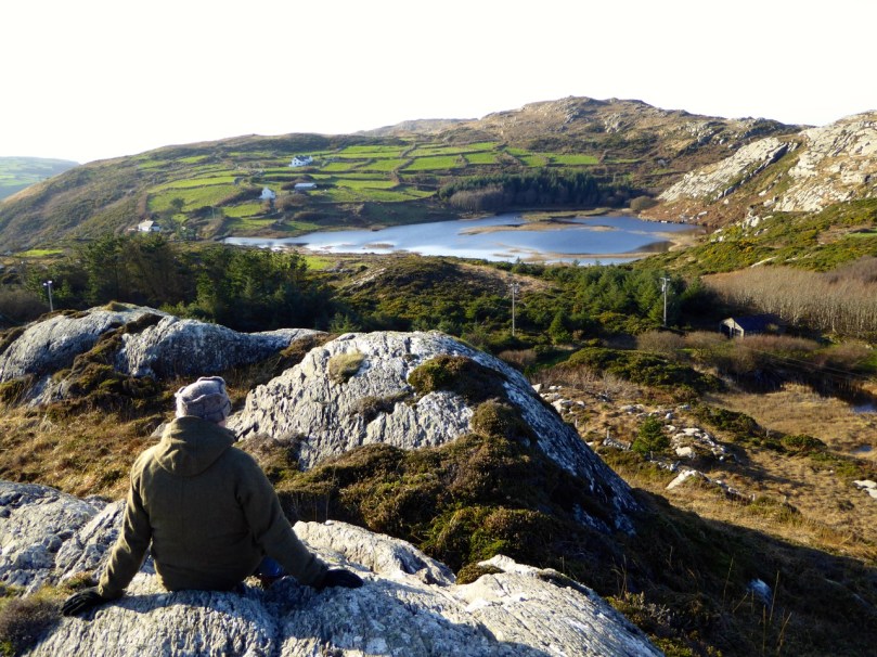
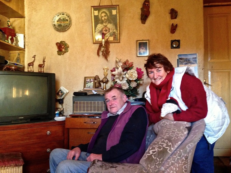
Anybody interested in exploring West Cork will have copies of Jack Robert’s books in their libraries. We have several but until this weekend we hadn’t really known the man himself. We were fortunate to be invited along on a field trip organised by old friends of his, on the occasion of one of his visits to West Cork.

Some of Jack's books

Some of Jack’s books

Jack arrived from England in 1975 as a fisherman. As he describes it, he was immediately intrigued with the landscape and the deep sense of history he saw all around him. He worked with Martin Brennan at Newgrange and Loughcrew, learning about the ancient monuments and observing first hand the astronomical alignments of passage graves and stone circles. Eventually returning to West Cork, he started to write guides to the ancient and spiritual sites of the area, illustrating them with his own charming and highly accurate pen and ink drawings. Well researched, delightfully succinct and displaying his vast knowledge of the area, these guides came to be prized possessions of those who purchased them. They’re still available, from Jack’s website, from Whyte Books in Schull and other bookstores, and on Amazon.

Jack lives in Galway now and has branched out. His latest book, The Sun Circles of Ireland, covers the whole country, as does his research into Sheela-na-Gigs. He makes jewellery based on prehistoric, Celtic and Early Christian motifs and has a stall in the Galway market.

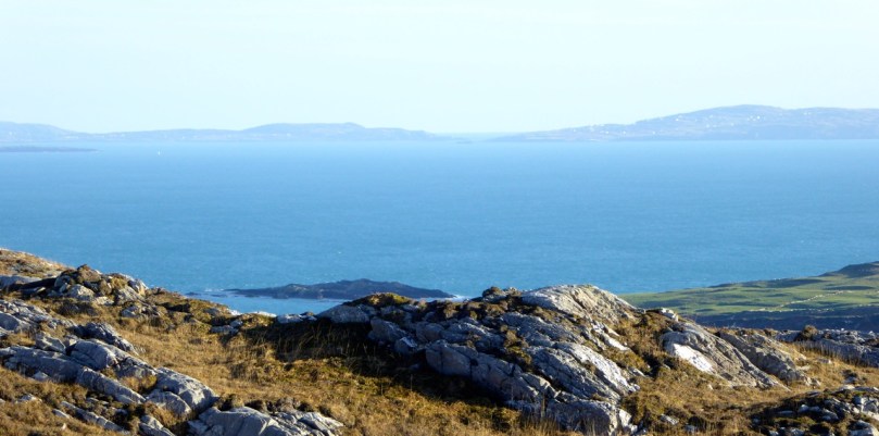
Our field trip took us into parts of West Cork unfamiliar to Robert and me, to visit a wide variety of monuments. In Inchigeelagh we stopped to examine a strange stone built into a grotto in the grounds of the Catholic church. Listed under Rock Art in the National Monuments site inventory, it is an anomalous piece of carving that is as mysterious as it is interesting. Of course Robert and I can never resist a peek inside churches, and this one contained some very fine stained glass. Lots of lovely windows but my favourite was this one of St Columbanus, an early Irish missionary who founded monastic houses throughout Europe. One of his miracles was to tame a bear – and somehow he ended up as the patron saint of motorcyclists! 

Saint Columbanus

Saint Columbanus

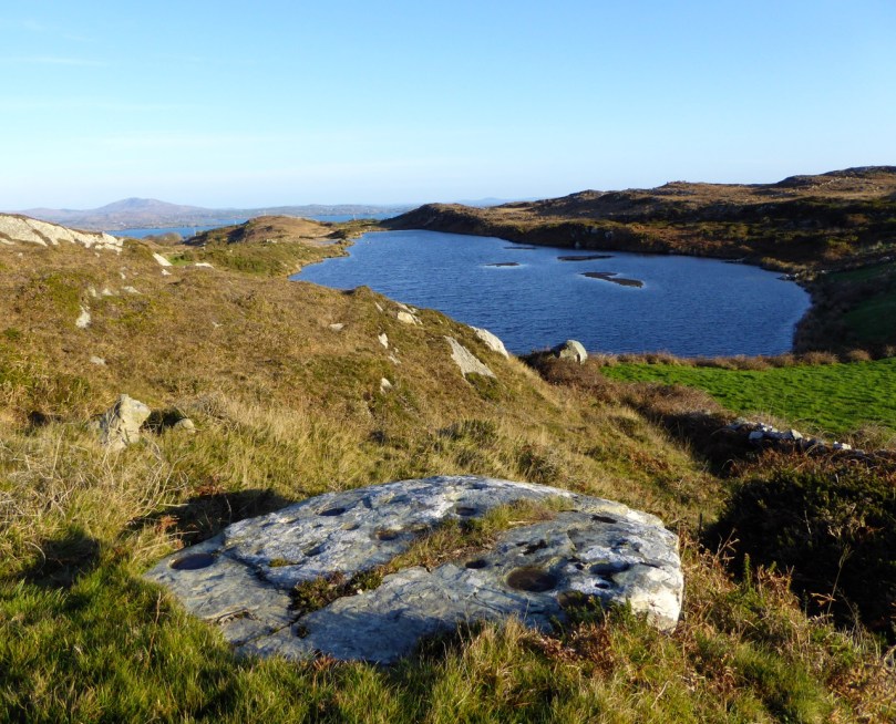
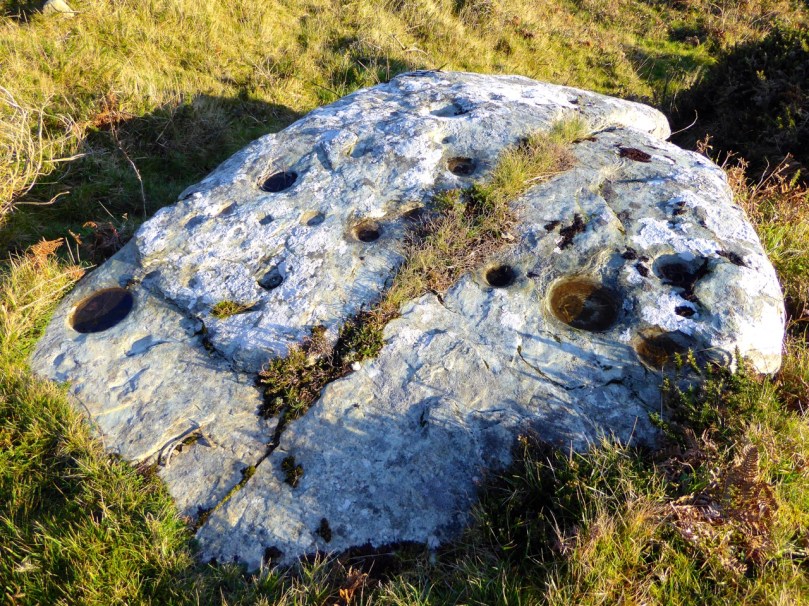
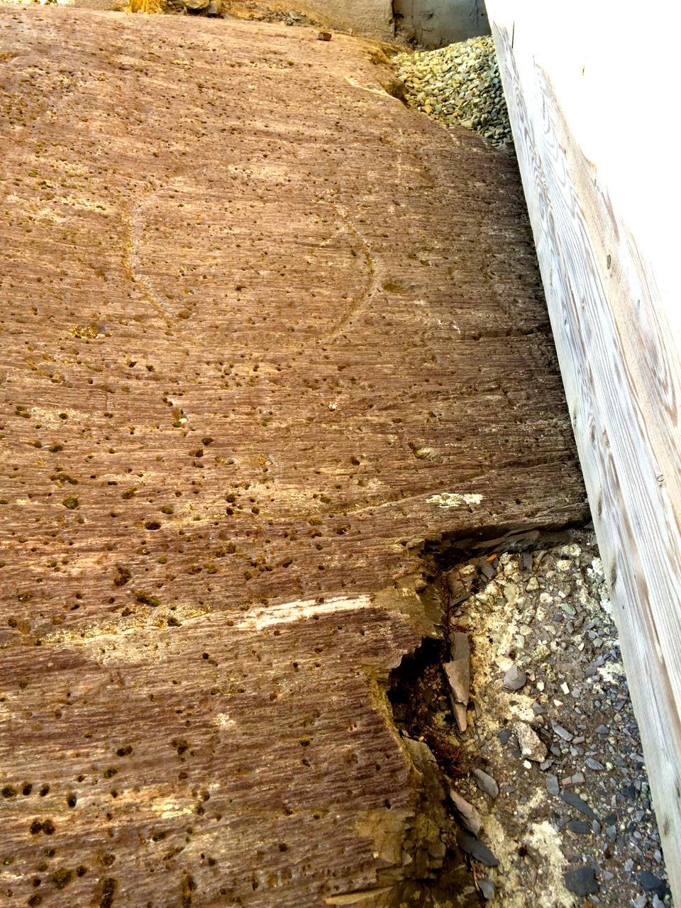
A couple of holy wells followed, the first dedicated to St Lachtan had two stone bowls and a large concrete cross. The second was the complete opposite – a quiet little spot in a wood with a simple bullaun stone (more about bullaun stones in a future post), white quartz pebbles, and two cups to use for drinking. It was part of an ancient monastic site of which little remains.

We stopped to walk over an old clapper bridge, recently restored, and tramped through a field to where a standing stone loomed over us, standing guard in the landscape, and ended the day with a visit to a cross slab.

Restored clapper bridge

Restored clapper bridge

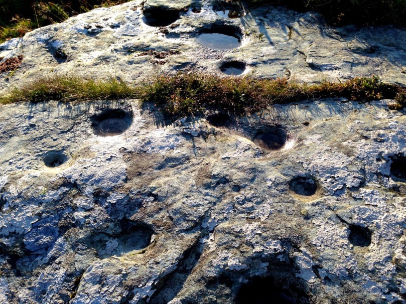
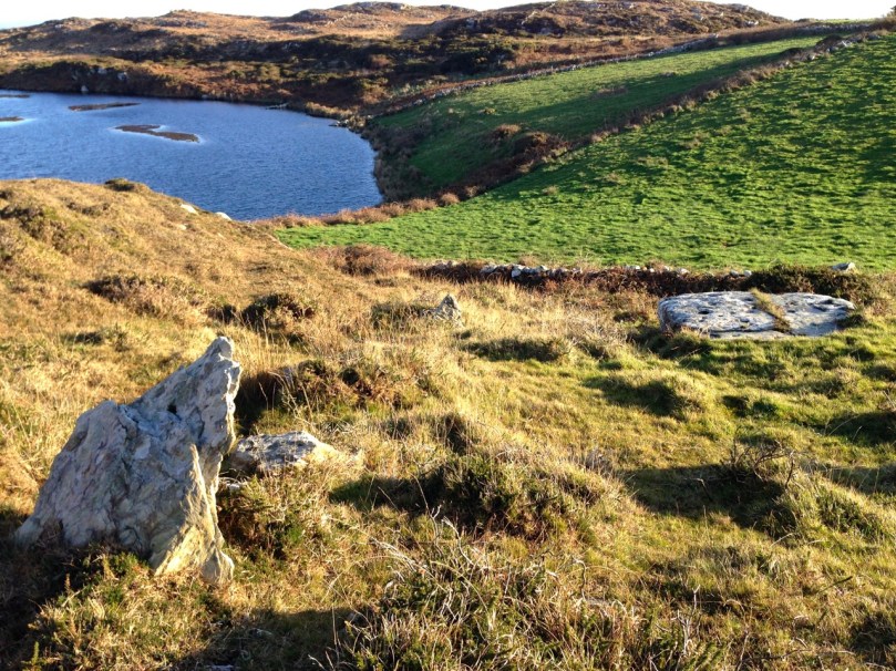
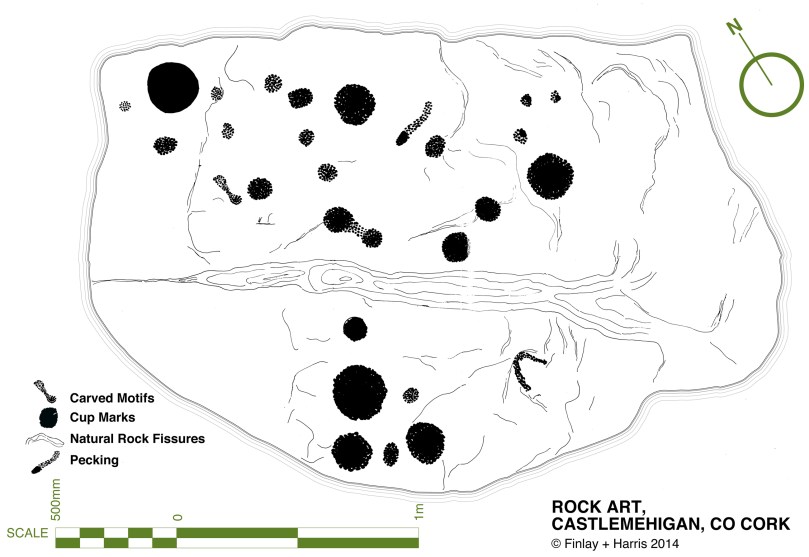
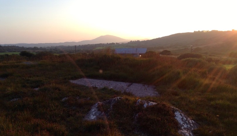
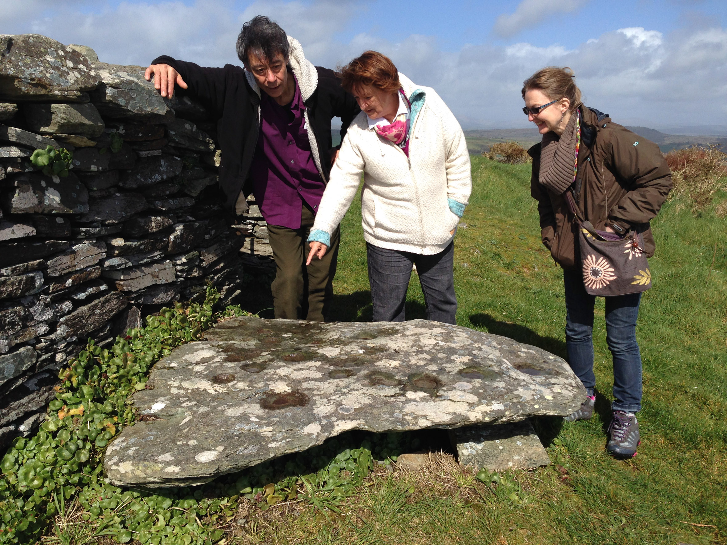
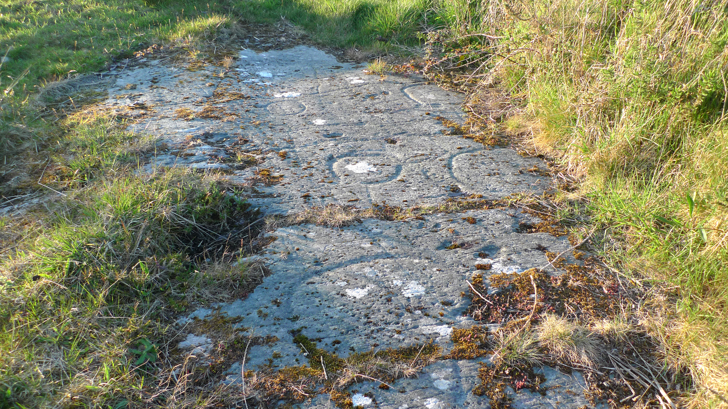
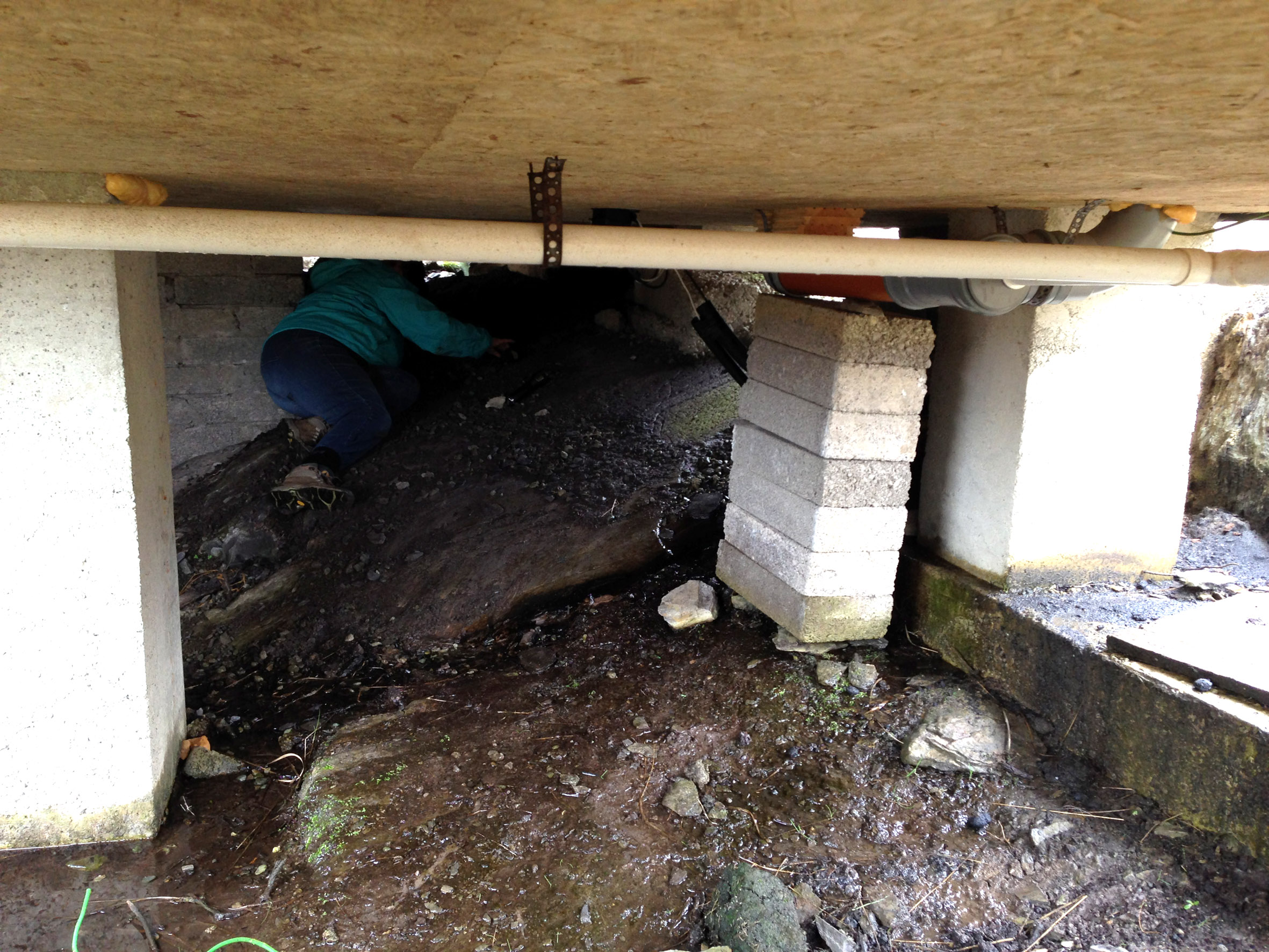
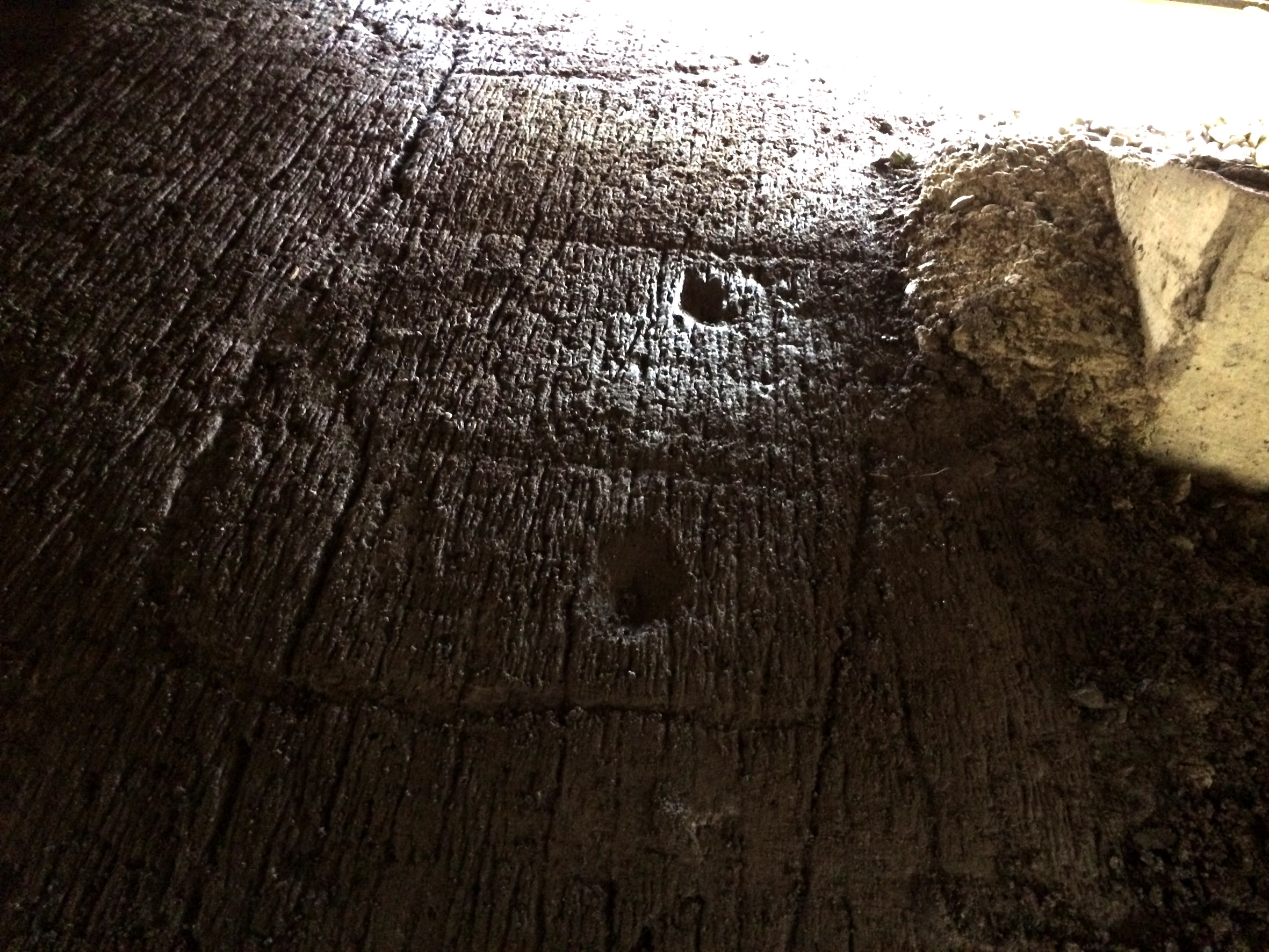
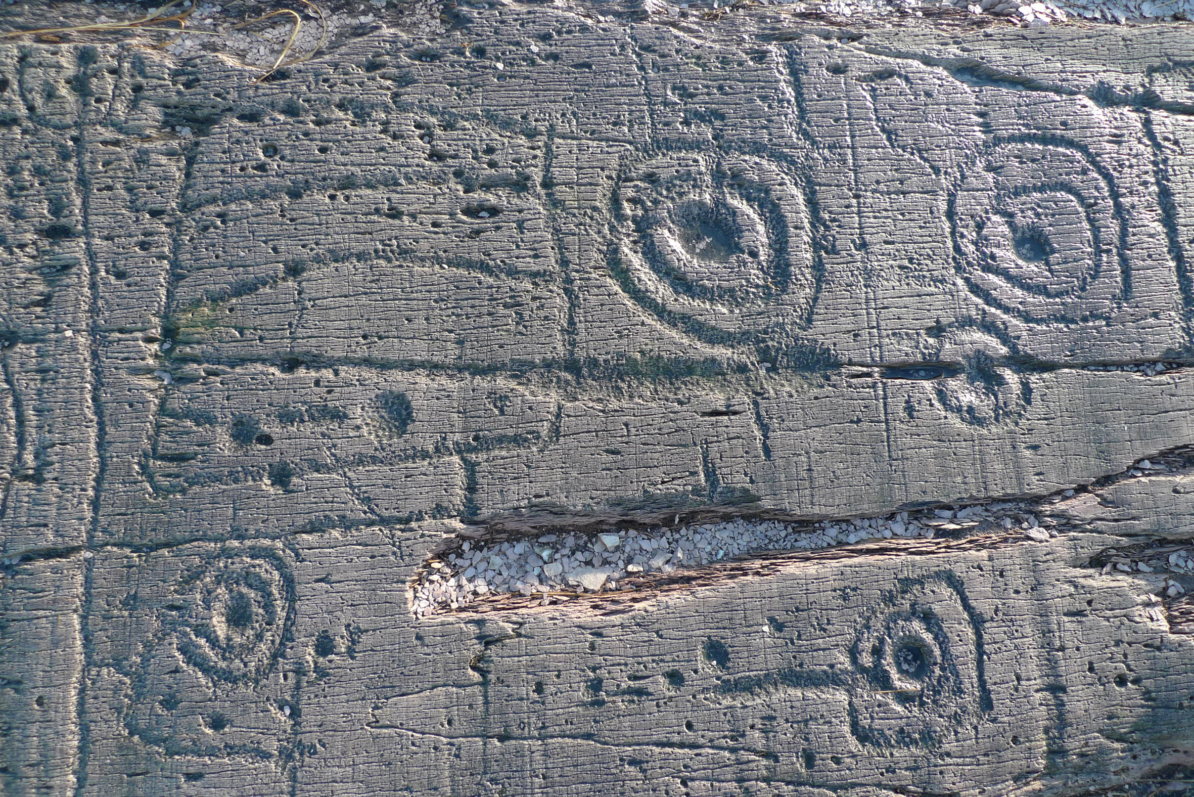
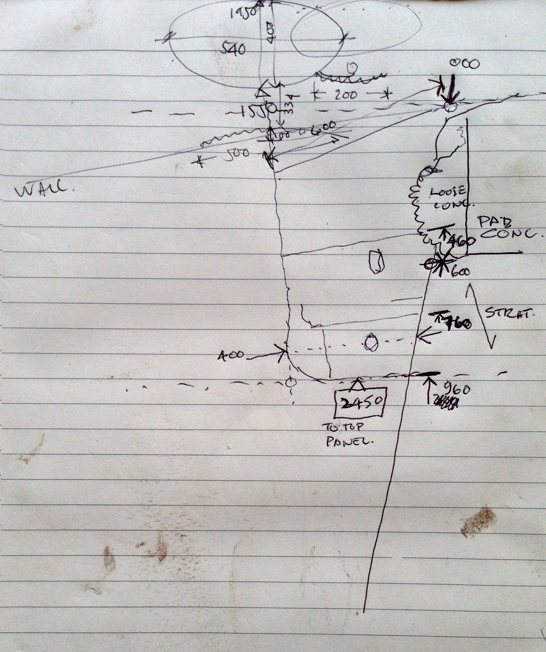
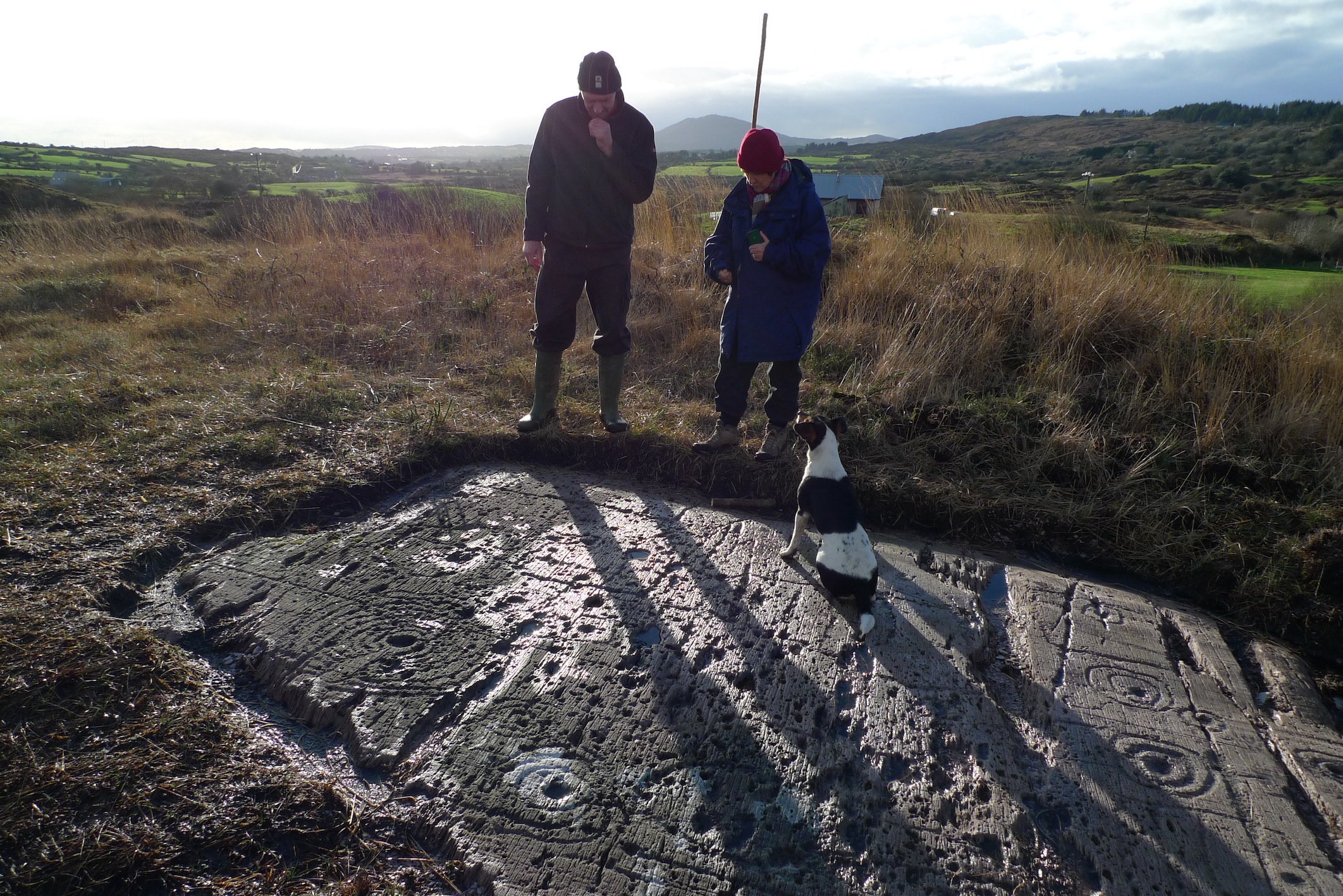
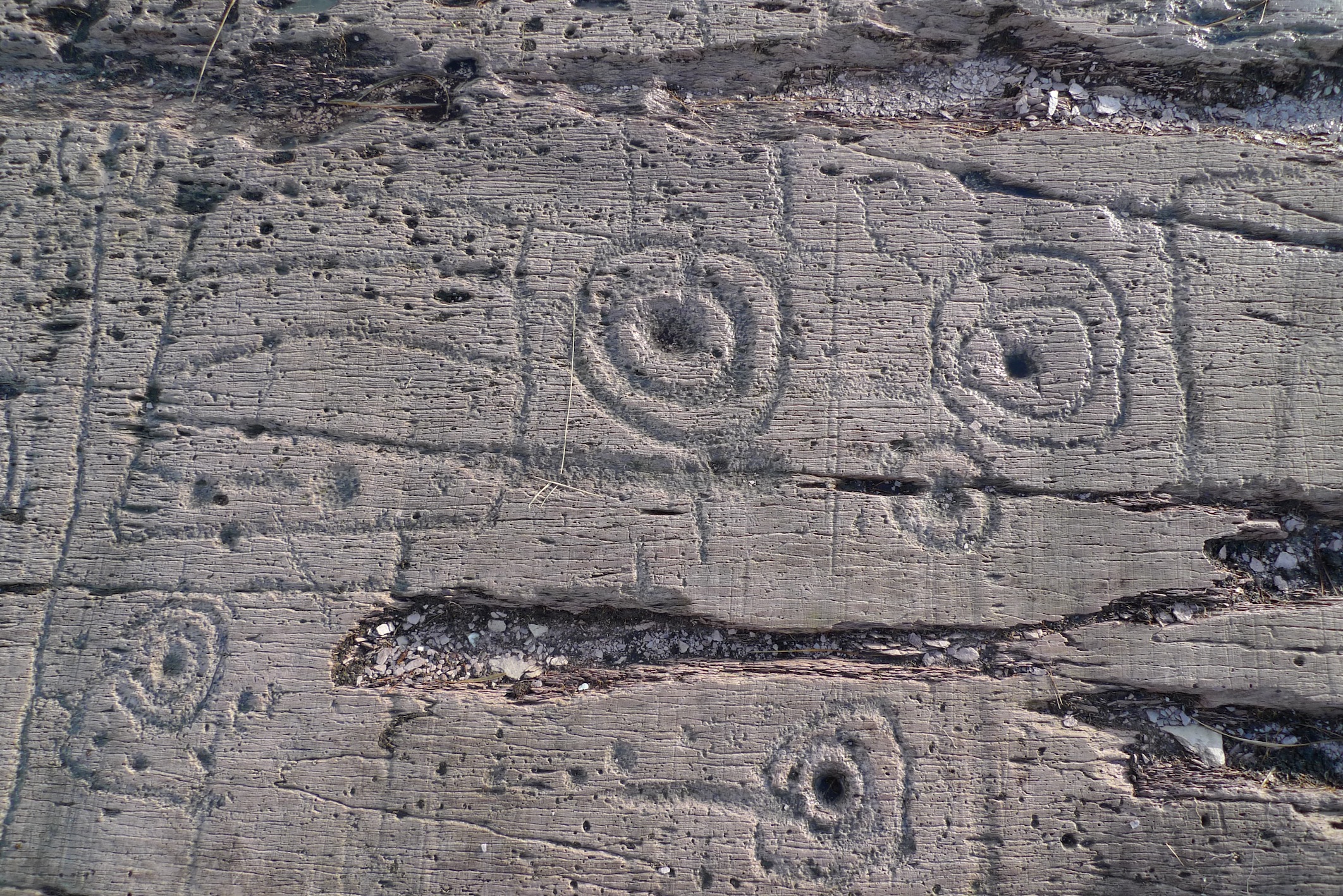
The next day Jack came to us for lunch followed by a trip to the Derreennaclogh and the Ballybane West rock art sites. At Derreennaclogh Gary, the discoverer of this spectacular site, showed us the lines of ancient field fences he is tracing through the bog. 

While Derreennaclogh was new to Jack, he had visited the Ballybane site many times and had cleared away scrub there, to reveal hitherto hidden carvings. We were particularly interested to hear this, as my drawings of the site, done in the early 70s, were missing some of the motifs that are now obvious and we had long wondered why.

Jack shows us where he cleared away the undergrowth

Jack shows us where he cleared away the undergrowth

It’s always a treat to put a face to a well-known name and with Jack it was a rare privilege. We enjoyed very much continuing our education into the wonders of West Cork, through his eyes. We highly recommend his books to anyone who wants to do the same.

Jack Roberts, author, artist, and one man encyclopedia of West Cork

Jack Roberts, author, artist, and one man encyclopedia of West Cork

Mizen Mission

Tooreen Lake

Tooreen Lake

A joint post by Robert and Finola…

Finola

According to the forecast today could be the last fine day of 2014, so we decided to make the most of it and set off on a mission. And what a day it was! Cold, yes, but with that brilliant light that only happens on crisp winter days.

Looking across Roaringwater Bay

Looking across Roaringwater Bay

Our mission? it was to find a piece of prehistoric rock art I had last visited over 40 years ago in the townland of Castlemehigan, near the end of the Mizen Peninsula. But once in the vicinity of Castlemehigan we couldn’t resist continuing to the end of the tiny road, which climbed up the rocky hills on the northern side of Crook Haven. Parking the car, we climbed to the highest point we could find. We’re used, by now, to the jaw-dropping views around here, but even by Mizen standards, this was something special. 

Crookhaven Village

Crookhaven Village

South of us, across the Haven was the village of Crookhaven nestled in its protective harbour. Looking north we could see across the Sheep’s Head to where the unmistakeable outline of Hungry Hill loomed on the Beara Peninsula. To the west was the White Strand and Brow Head, crowned by the historic Marconi telegraph station and to the east was the whole of Roaringwater Bay: Cape Clear Island, Sherkin, Baltimore, and the ring of hills that run down to the water.

Back in the vicinity of the rock we knocked on the door of a farmhouse to ask directions and permission. Often when we do this we are met with a blank look – not every ancient monument location has survived in the folk memory of the local residents. But this time we hit it lucky, with Florence O’Driscoll – ah yes, he knew it – the mass rock is what we were looking for. I showed him a picture of the rock and he confirmed that was the one, it was on his land and he would take us there.

Castlemehigan Rock

Castlemehigan Rock

My write-up and drawing of the time brought back some memories of an unusual rock with very large depressions, almost more basins than cupmarks. I also had a very clear recollection of being taken to the site by Bernard O’Regan, a local (and well-remembered) amateur archaeologist who was very helpful to me at the time. Because the rock was very overgrown, he had arranged to have it cleaned for me and when we arrived there were two men on top of the rock hacking away the gorse and heather. Nowadays, rock art specialists abide by an ethic of zero surface contact – no clearing or scrubbing allowed!

Castlemehigan rock surface

Castlemehigan rock surface

Although this rock lacks any of the circles, grooves and lines that add interest and appeal to many panels of rock art, it is special in other ways. Several of the cupmarks are unusually large, and one is basin-shaped (that is, with straight sides and a flat bottom).

Oriented to Mount Gabriel to the east

Mount Gabriel clearly visible

Some cupmarks appear to run in rows and the rows run in specific directions – one line of cupmarks run directly east/west pointing at the lake that lies about 100 meters away at the bottom of the field. Another line pointed to Mount Gabriel, about 15 kms away on the distant horizon. The two large basin-like depressions are directly north/south of each other.

row of cupmarks

Row of cupmarks

What could be a standing stone is located a few metres away.

Standing stone?

Standing stone?

In comparing my original drawing, done 42 years ago, there wasn’t much I would change. Some cupmarks appear to have pecked areas between them which conjoin them in a dumb-bell motif. My original decision was that there were two dumb-bells, but perhaps now I would be tempted to say there were three or even four. However, this just illustrates the subjective nature of the recording process. Especially where lichen obscures the surface, decisions like this come down to professional judgement and experience: drawings can differ from one recorder to another, or even from one visit to another when lighting conditions show up more or less of the carving detail.

Original drawing, updated by Robert

Original drawing, updated by Robert

Robert

This earthfast boulder is a beautiful object – not least because of its setting. I love these Mizen landscapes – they have a very particular character. Large areas of rock outcrop are interspersed with the tiniest fields, tracks and bog. Here there are lakes close by – once natural features, they have been turned into reservoirs to serve local communities. The marked rock overlooks one of these – this one supplying nearby Goleen.

Mount Gabriel clearly visible from the Derreennaclogh stones

Mount Gabriel clearly visible from the Derreennaclogh rock

This example reminds me in some ways of the Derreennaclogh rock – it’s of similar size and shape. Also, at Derreennaclogh Mount Gabriel is prominent on the western horizon, and we’ve been told that the setting sun towards the short end of the year appears to ‘roll’ down the slope of the hill at times. At Castlemehigan the rock also looks out to Mount Gabriel – this time to the east. This is a relatively isolated piece of rock art: the nearest recorded example is at Cooradarrigan, on the far side of Schull. It’s tempting to think that the flat, table-like surfaces of both Derreennaclogh and Castlemehigan were considered significant to those ancient people – who made them notable by marking them – because of their settings which relate to unmistakable landscape features. Otherwise, one might question why large areas of flat rock surface in the immediate vicinities – ideal for carving – have apparently been left untouched.

Florence and Finola

Florence and Finola

Florence O’Driscoll, our guide on this expedition, proved to be a fund of information. He had farmed the land which had been his father’s before him. Finola must have met his father when she explored the rocks over forty years ago. Florence carried the stories of the rock from his father’s generation, and probably from generations before that. He told us that the rock had been used as a mass rock in penal times – and that the hill above it was known as Cnocan an Aifreann (the hill of the mass): there is what certainly appears to be a cross carved into the rock surface, close to the large basin (Finola did not record this in her original drawing – she will add it when we update the records). Florence told of the time that the ‘Tans’ (the Black-and-Tans) caught red-handed the Priest celebrating the mass: the Priest threw the crucifix into the lake below the rock (the lake was then smaller than it is now). Ever since then, says Florence, the lake has never run dry – and never will.

Look for the possible cross carving on the right

Look for the possible cross carving on the right

It’s interesting that stories carried through local tradition pay no heed to time or history. They don’t need to: the ‘story’ is a part of the rock, as much as the carvings are. Florence told the tales as if they had happened yesterday. I hope they will continue to be told as long as the rock continues to display its enigmas.

Mass in penal times (Maggie Land Blanck Collection)

Mass in penal times (Maggie Land Blanck Collection)

Diving for Petroglyphs

Finola unravels the mysteries of Rock Art

Finola unravels the mysteries of Rock Art at Knockdrum

Our friends Chris and Gill from Devon are staying with us at the moment, so we took them on the mandatory Rock Art tour: be warned, anyone who comes to see us…

The Rock of the Rings at Ballybane West

The Rock of the Rings at Ballybane West

Visible signs of newly discovered Rock Art

Visible signs of newly discovered Rock Art: note the building on the right

There have been rumours of a new discovery in the Ballybane West area – not far from the Rock of the Rings and the piece on Danny and Gill’s land (and within spitting distance of the Derreennaclogh find), so we set out to track it down. And discover it we did: a distinct but unexciting single ring, right beside a newly built timber studio in someone’s garden. For me this was all fine and neat and tidy: we measured and photographed it and I was ready to move on to the next location without any loss of dignity. Finola, however, was like a dog with a bone – you’ve heard of Truffle Hounds: Finola is like a Petroglyph Hound with a bone – she won’t let it go. She was convinced there was more of the Rock Art – underneath the building! Of course not, said I, uncomfortably eyeing the very small space between the timber framed walls and the muddy wet rock underneath. But too late! Within seconds all you could see were Finola’s feet sticking out from the foundations and muffled shouts of enthusiasm from some deep and murky place. I gingerly stuck a few fingers in the crevice and quickly realised that I have always suffered badly from claustrophobia. Chris, however,  smartly and snazzily dressed as always in something totally unsuitable for pot-holing was away down there in no time, and we soon heard calls for torches, paper and measuring tape.

Finola goes underground

Finola goes underground

We will have to go back another time to somehow accurately measure and record this example, but Finola and Chris emerged mud-encrusted but triumphant with some photographs and sketches of another unusual panel containing circles, rectangles and cup-marks. These are very much in the style of the panels at Derreennaclogh and Ballybane West, themselves atypical of the more usual cups and circles which show a pattern of Bronze Age carving extending through the Atlantic seaboard from Scotland, Britain, Ireland to the Iberian coast, and pose so many questions on the culture and communications of those times.

The find: a piece of carving with similarities to motifs seen at Derreennaclogh (below)

The find: a piece of carving with similarities to motifs seen at Derreennaclogh (below)

derreennacloghBut this discovery does highlight the vulnerability of Rock Art – perhaps the ‘poor relation’ of archaeology in Ireland. Examples can go unnoticed (as in this case), can become overgrown, and can be so easily damaged or obliterated by weather or human intervention. They can also be underwhelmingly low key: a few circles or marks faintly visible on a rock surface. Farming practices are changing, and the transformation of rocky rough land into ‘pasture’ through grants which encourage large scale rock-breaking is a great potential threat to examples of petroglyphs which have only a paper protection through being listed on the Archaeological Survey of Ireland. As yet, we are unsure of how we can best look after this heritage: this is clearly an area of discussion for the future.

Trophy: Chris produced a valuable sketch of the 'hidden' motifs

Trophy: Chris produced a valuable sketch of the ‘hidden’ motifs

Enigma

gary, Finola and Furry friend contemplate the Enigma

Gary, Finola and Furry Friend contemplate the Enigma

We went to look at an exciting new Rock Art discovery, in the hills between Ballydehob and Bantry: wild country. The man who uncovered it – Gary Cox – lives close by, and became familiar with the terrain through walking his dogs over the land every day. He noticed in passing a small piece of exposed rock, just a few centimetres square, on which it was possible to make out a couple of curved lines. Intrigued, he began to carefully pull back the moss and gorse to expose a secret which had lain hidden from view for hundreds – perhaps thousands – of years.

L1080544

The Derreennaclogh panel is one of the finest and most intriguing pieces of Rock Art that we have seen in West Cork. Because the surface has (until now) been largely protected from direct contact with the weather, the carvings are pristinely visible, especially on a good bright day. On the rocks at Ballybane West – just over the hill – the designs are so weathered that you can go there day after day and never make them out, unless the shadows from a low sun are just right.

details

Details from the Derreenaclogh motifs

Current thinking suggests that all the Rock Art in ireland is Bronze Age – between four and five thousand years old: it’s breathtaking to think that we are looking at such ancient depictions of …. what? There’s the enigma: we have no idea – there are cup marks, circles, lines, even squares and waves on this newly revealed one: very unusual. Theories abound, of course: sun, moon, stars, maps, calendars – I’m sure someone has suggested they are flying saucers! We’ve written more on this in previous posts, and of the prolific appearance of rock carvings on the whole Atlantic facing coast from Scandinavia down through Scotland, Britain, Ireland, Brittany, Spain and Portugal. There are variations but the same symbols or motifs occur over and over. But here – on our doorstep – are some of the most unusual shapes to challenge our imaginations.

pukas

I have been extending my researches to petroglyph cultures beyond our own roots. I was intrigued to find some images from New Mexico – strikingly similar to our rock art – and Hawaii. In the latter place there are numerous circular depressions, around 50mm in diameter, interspersed with lines and circles. On our rocks in West Cork cup marks are also widespread – one of the most common images. They are also surrounded by concentric circles: at Derreennaclogh there is one cup mark with eight concentric circles around it – that’s more than we’ve seen on any other site.

Boca Negra Canyon Petroglyphs

Petroglyphs from New Mexico (left) and Hawaii (right)

There is folklore attached to the Hawaiian cup marks: local historians explain that these holes are called ‘Puka’. When a child was born a Puka would be carved in the lava stone. The new baby’s ‘Piko’ – umbilical cord – would be placed in the Puka to wish blessings upon the child for a long and prosperous life. In Hawaii and New Mexico the carvings are reckoned to be between 500 and 1,000 years old – much younger than our Rock Art. But here’s more food for thought: in Irish there’s also a word ‘Púka’ or ‘Pooka’ – sometimes a Fairy, or a shapeshifting spirit which can appear as a Hare or a Horse with dark fur. If a human can jump on the back of the Horse he will be given a wild ride but will probably be thrown off. Legend says that Brian Boru – the High King of Ireland – was the only man who could truly ride the Púka – by using a bridle incorporating three hairs of the Púka’s tail.