Rock Art – A Diversion to Wicklow

While writing this Journal over the years, Finola and I have included many examples of Prehistoric Rock Art, mainly on the west side of the country, in Cork and Kerry. Here is just one – you can find others through the search facility in the header. Finola’s UCC thesis from 1973 also concentrated on specimens from the southwest and her own drawings based on tracings direct from the rock surfaces provide a unique record of this form of prehistoric art. They have formed the basis of exhibitions which we have promoted over the years: here’s one from 2015.

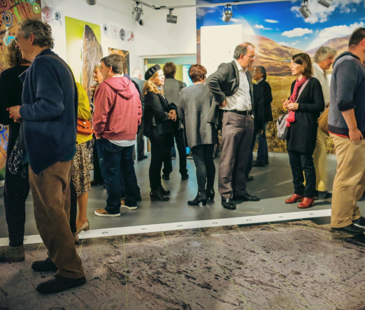
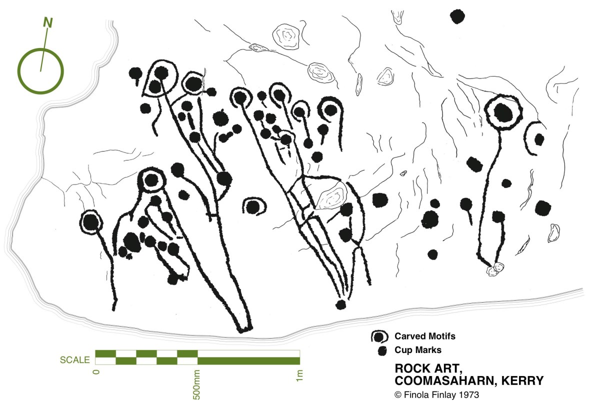
Upper: the opening of our Rock Art exhibition at Cork Public Museum , October 2015 and (lower) one of Finola’s drawings from 1973. Another area in Ireland which has a concentration of Rock Art is Wicklow. We have been spending a few days in that county, and decide to go and have a look for some examples there. Finola dug out from her archives a photo which she took in 1972 when she and some college friends visited a Wicklow site:

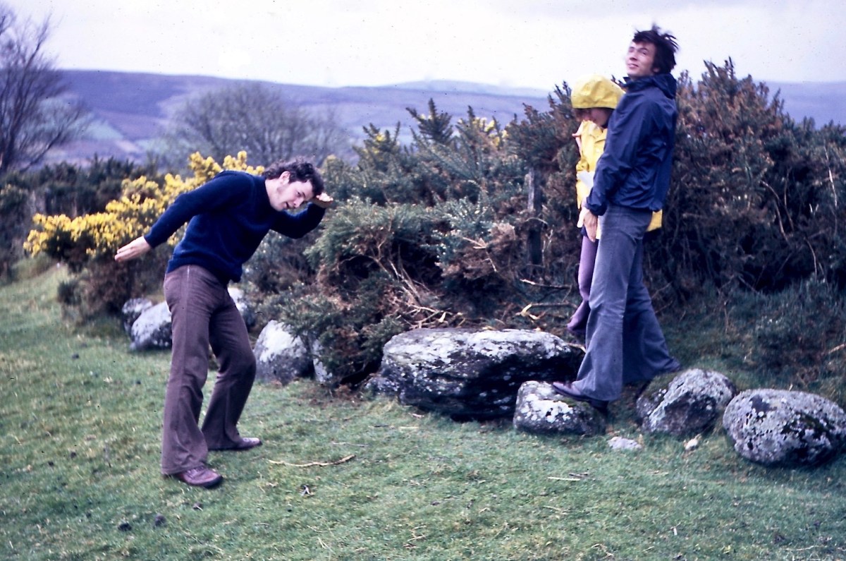
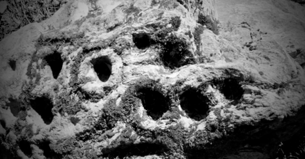
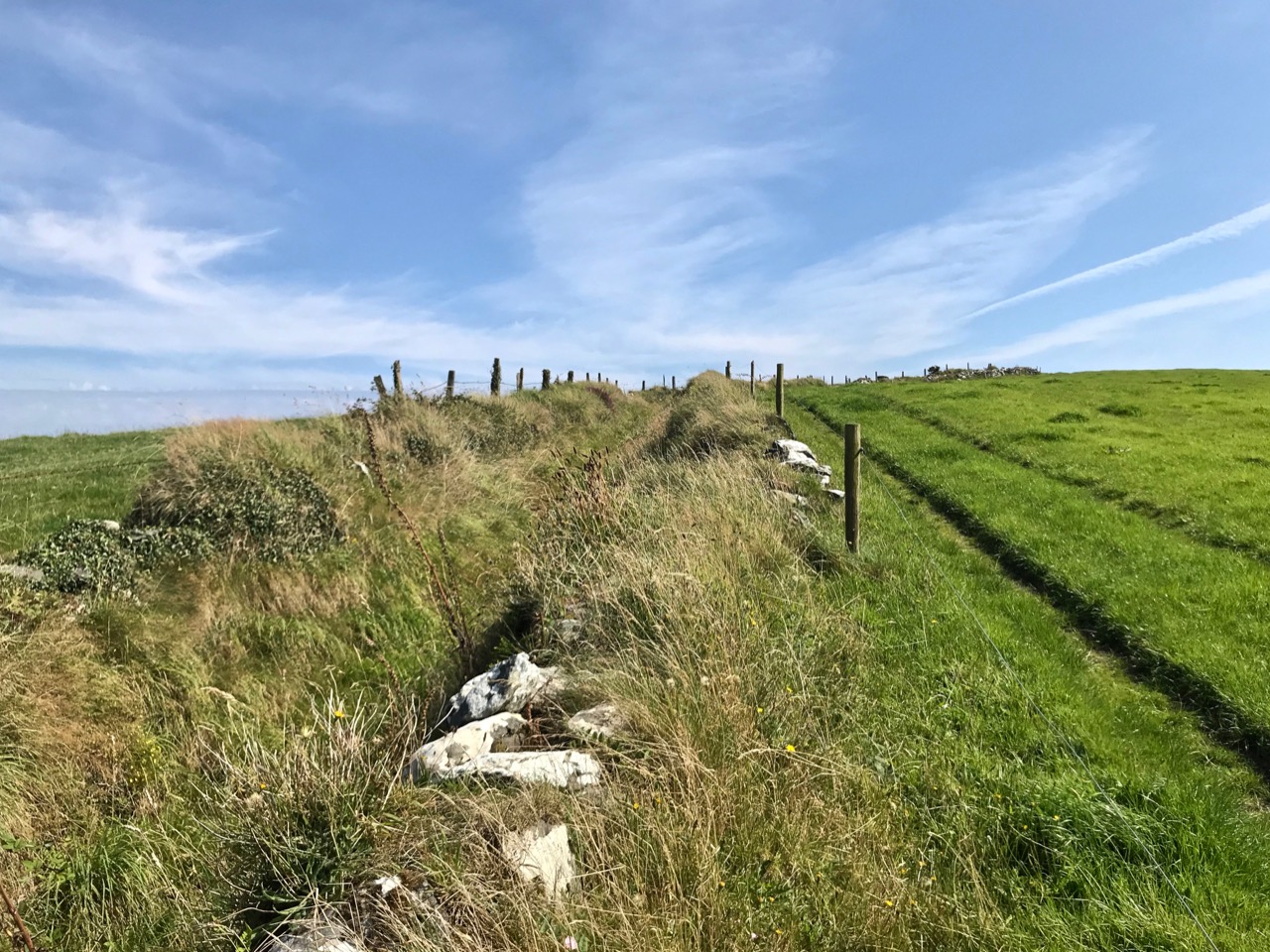
Could we find that particular rock again? Well, we think we did, but it has been moved in fairly recent times. Here it is in its new setting (we believe) – it’s not very propitious:

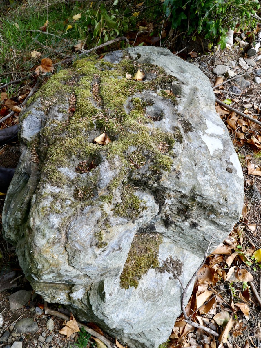
The present site is in the townland of Togher More, behind a fence lining a main road. The National Monuments record tells the story, which confirms that Finola’s earlier photograph was taken in the townland of Baltynanima:

. . . Class: Rock art (present location) Townland: TOGHER MORE Description: Found during ploughing c. 1.8m to the SW in Baltynanima and moved here in the mid 1980’s (see W1018-036—- for original location record). An irregular shaped schist boulder (L 1.3m; W 0.9m; T 0.5m) with 16 cup marks and the remains of another where the corner of the boulder appears to have come away. The four largest cups (diameters 10-12cm; depth c. 6cm) are enclosed by circles (max ext. diameter 20cm) formed by incised lines (widths 1.5-2cm; depths 1cm) with the exception of one which has only a semi circle incised line around it. The remaining 13 cups have diameters of 6-8cm and depths of 4-5cm. There are also three incised linear grooves (L 14- 22cm; W 4cm; D 2.5-3.5cm) visible on the stones surface. Described, photographed and drawn by Price on the 29th January 1933 . . .

National Monuments Record WI018-049

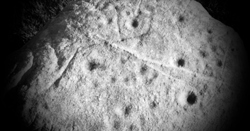
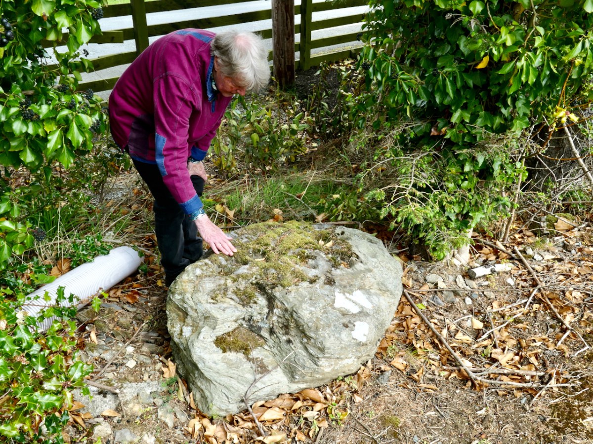
It’s not unusual to find that ‘portable’ stones with Rock Art on the surface are moved, usually to protect them if a site is to be developed. Here’s another example we found, in the townland of Knockrahen:

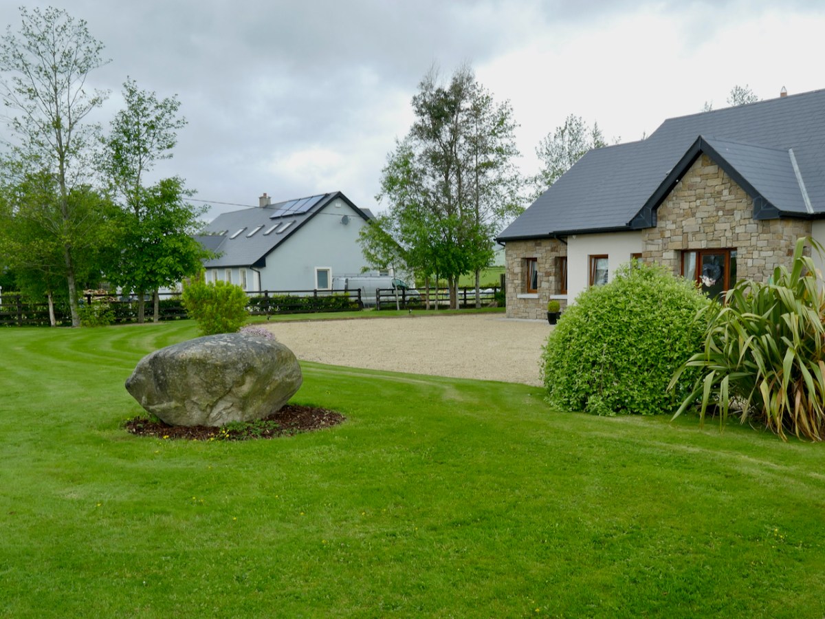
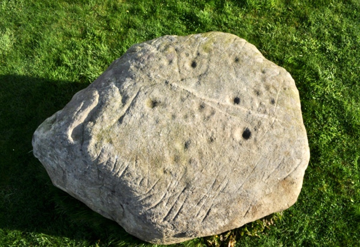
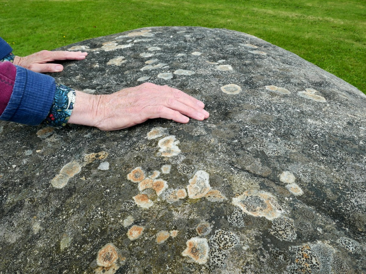
In this case the rock was found while the foundations were being dug for the house. The owner (with whom we spoke) noticed the markings and decided to keep it as a feature in her new garden. The photo below was taken by Chris Corlett for the National Monuments records. Thank you, Chris (and the NM), for allowing us to use this – and the detail on the header pic. Below Chris’s photo is Finola’s, with my hand in the shot to give it scale.

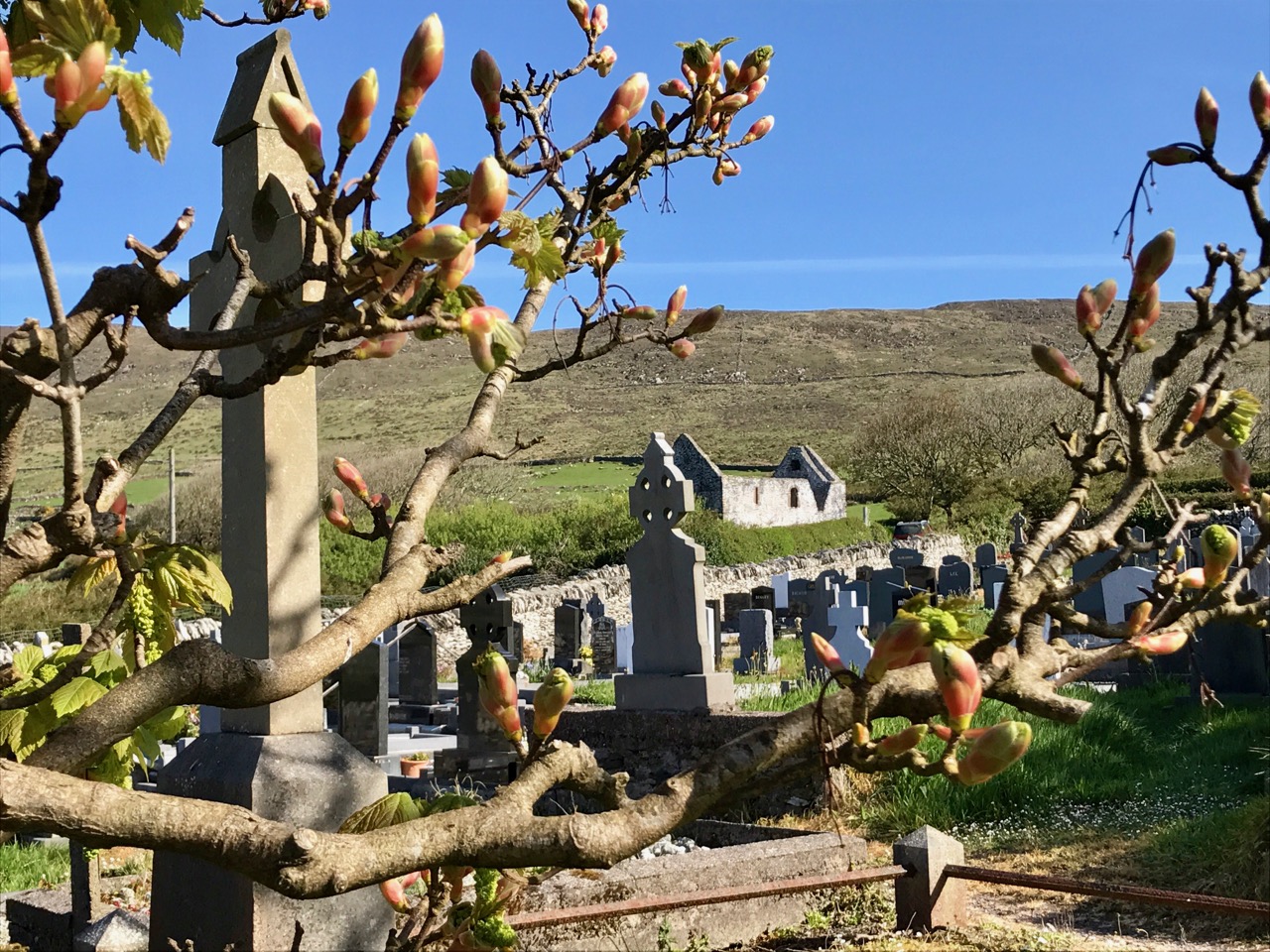
While out in Wicklow we noticed that many of the National Monument records of Rock Art are credited to George Henry Kinihan (1829 – 1908). He was a geologist who also had an interest in archaeology. His home was in Clontarf and he is buried in the Protestant churchyard in Avoca, Co Wicklow. He was involved in his lifetime in engineering works, particular railway construction, but was also a keen Rock Art enthusiast.

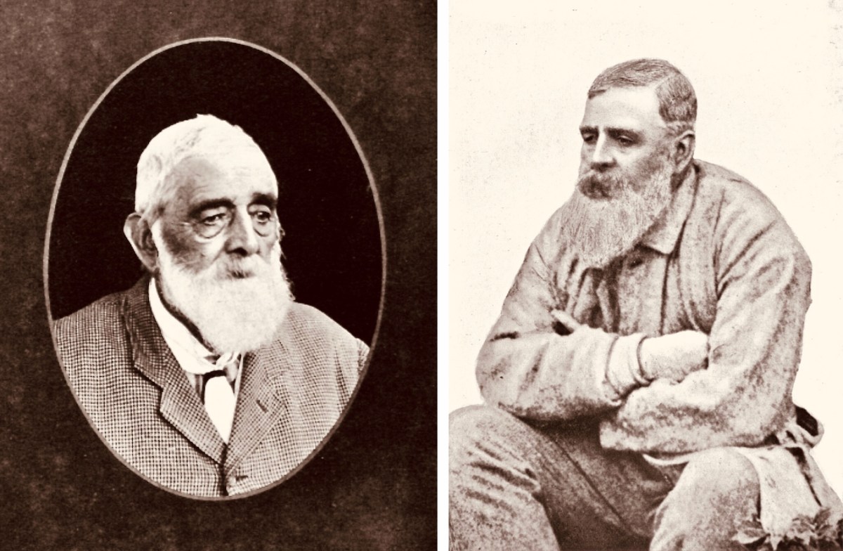
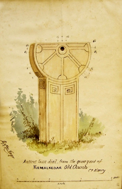
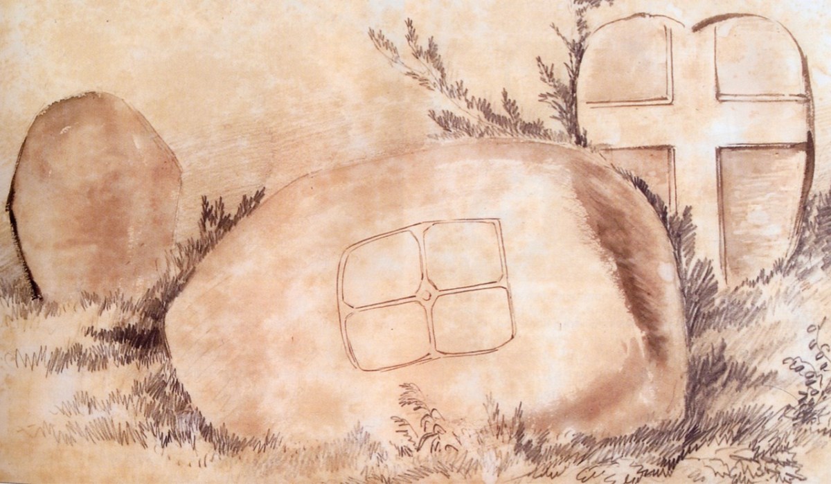
Two portraits of Kinihan: he was said to have been of ‘strong and massive build’. He spent some of his early years working under George du Noyer of the Irish Geological Survey – who shared with him an interest in antiquities in the landscape. Here is a du Noyer drawing of cross slabs in Co Wexford:

On du Noyer’s death in 1869, Kinihan was appointed District Surveyor of the Geological Survey, in charge of field work and mapping, and oversaw the completion of the One Inch Geological Map of Ireland. He also became President of The Royal Geological Society of Ireland in 1880. Now, here is a conundrum:

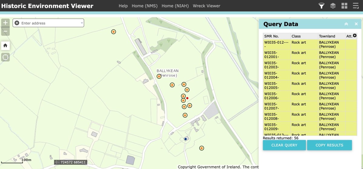
Here is part of the current Historic Monuments Viewer, showing the location of archaeological sites in Ballykean, Co Wicklow. All the yellow-and-red dots are recorded as Rock Art, discovered by Kinihan (there are 14 just in this small area of the townland). In every case, the site is described in detail, with numbers of cupmarks etc recorded. But also – in every case – the description concludes: ‘…The site indicated by Kinahan in 1884 was inspected in 1990, however this stone was not located…’ These are not the only instances in Co Wicklow where Rock Art found by Kinihan can no longer be traced. Does this mean that all these instances have now been destroyed or buried? Is it possible that this experienced archaeological enthusiast could have misinterpreted so many sites? It remains an adventure for us – another day – to go in search of some of these enigmatic examples to see if we re-establish the credibility of this Wicklow giant in this very particular specialism.

A Signal Success in Irish Engineering – Part 5: Downeen

County Cork is well-endowed with the sites of Napoleonic-era signal towers. By my calculations there are 20 sites in this county, almost a quarter of the generally accepted number of sites around the whole island. For a map of the 81 locations identified by Bill Clements in 2013 have a look at part 2 of this series – Ballyroon Mountain. Today’s subject is Downeen Signal Tower, close to picturesque Mill Cove, a naturally sheltered quay around which a small settlement can be found, most active in the summer months.

The header picture shows all that remains of the buildings of Downeen signal tower today. In the distance you can see Galley Head with its lighthouse. There was no signal station on Galley Head itself, the next in line to the east being at Dunnycove, in the townland of Ballyluck – this will be the subject of a future post. The aerial views above show the Downeen site: note the well-defined access trackway, a feature of all the locations we have visited to date. This signal tower has been changed and extended over the years, as can be seen by comparing the two OS maps below:

The upper map is based on the earliest 6″ survey which the Ordnace Survey carried out between 1829 and 1841. By that time, of course, the signal towers would have become redundant and this map shows a simple building and the trackway, with no label. The lower map is from the Historic 25″ survey, produced between 1888 and 1913. Here we see the site extended and the buildings altered, more in keeping with the present day aerial views. On this OS map the building is labelled as a ‘Lookout Station’ and there is also ‘F.S.’ shown, which I assume to indicate ‘Flag Staff’. This comparison exercise shows us how invaluable the Ordance Survey can be to historians in providing information often not documented elsewhere. Both maps show a ‘Coast Guard Station’ as the main feature of Mill Cove itself and this gives us the clue to the further incarnations of the original signal tower at Downeen. Here is an enlarged section from the 25″ map:

On this extract I have also underlined the two ‘F.S.’ indicators, which I take to mean flagstaffs – one at the Lookout Station, and the other at the ‘Coastguard Station’. Based on this I am putting forward the opinion that the original signal tower was taken over, extended or rebuilt for the use of the Coast Guards. I don’t have any other supporting evidence for this at Downeen, but at other stations I know this has definitely happened (either from written evidence or – more importantly – direct contact with local recollections). It certainly makes sense, as the towers were generally placed at the highest and best vantage points in the landscape – and had good access, verified by the surviving trackways.

The upper picture is taken from the Downeen signal station looking west – the sweeping vista is commanding. Two views of the access trackway show that it remains well defined by continuous masonry walls, but overgrown. Our only companions on our exploration regarded us with benign curiosity! Attempts to uncover a comprehensive history of Coast Guards and Coastguard stations here have not been rewarded so far – except to establish that, in Ireland, we should correctly refer to them as Coast Guards – not Coastguards. This information is taken from the Irish Government website (gov.ie):

In 1809  the “Water Guard” was formed. Also known as the Preventative Boat Service. The Waterguard was the sea-based arm of revenue enforcement who patrolled the shore. The Waterguard was initially based in Watch Houses around the coast, and boat crews patrolled the coast each night. It was under Navy control from 1816 to 1822, when it and riding officers were amalgamated under the control of the Board of Customs . . . in 1856 control of the Coast Guard passed to the Admiralty . . . In 1921, after Independence, the Coast Life Saving Service was established in Ireland . . . The duties formerly performed by His Majesty’s Coastguard (HMCG) were taken over by Saorstát Eireann (Irish Free State) and the Coast Lifesaving Service (CLSS) was established . . . In 1925 the UK Coastguard Act passed, formally defining its powers and responsibilities. This inadvertently used the single word ‘Coastguard’ for the first time, and affected all crown dominions . . . In 2000 Ireland re-established the Coast Guard as the original two-word variant . . .

It’s fairly logical that the signal towers built between the 1790s and early 1800s to frustrate a French invasion of Ireland were still intact at the time of the Waterguard, and would have been ideal for the general purpose of watching the coast. (Above) – the ruins of the buildings at Downeen signal tower cum Coastguard lookout station as seen today. They enjoy the conceptual protection of being classified as a scheduled monument, but are unlikely ever to be more than crumbling vestigial stone walls. In their decay they command a poignant respect, and our imaginations can recreate the activities they may have witnessed. Here’s another quote, from the engrossing forum Coastguards of Yesteryear:

Nineteenth-century coastguards must have formed a close-knit group. Mostly ex-naval men, they presumably shared a sense of camaraderie . Often stationed as coastguards in remote spots, moved every few years to prevent them becoming too friendly with the locals, and often viewed with suspicion by those many locals with smuggling sympathies, coastguards were presumably drawn to marrying each others’ daughters. The more generous notion that “every nice girl loves a sailor” was only to develop later in the general population!

Notwithstanding the slight vestiges of its signal tower, Downeen has significantly more to offer in the way of history – worth a mention as it has led to some confusion in the story of this particular site.

We came across these two further ‘towers’ not too far away from the signal station site – also in Downeen. The first (upper) is classified as designed landscape – a belvedere. The second is a most intriguing tower house, a seemingly impossibly surviving clifftop ruin. On the day we visited, we were unable to get really close to either of these structures, but I was able to find a bit more about them on the internet, including a reference to the belvedere on the National Inventory of Architectural Heritage, where it is described as a ‘Signal Tower’ dating from between 1780 and 1820! In fact, further research has shown that this is a mis-attribution. Both these structures are connected to Castle Downeen. The tower house is described as possibly an O’Cowhig castle taken by crown forces in 1602 and approached by “a little drawbridge of wood”.

Here is the remarkably poised tower house at Downeen. The upper picture is courtesy of rowler21 via Google, 2020. I was delighted to find this small sketch (lower) by George du Noyer, titled Dooneen Castle, Rosscarbery, Sept 1853. Although almost 170 years have passed since du Noyer visited this part of West Cork – possibly in connection with his work for the Ordnance Survey – not much appears to have changed: perhaps the loss of part of the parapet. The ruin was apparently as precariously balanced then as it is now.

Downeen, with its lush valleys, old stone built settlement, former Coastguard station and this trackway serving a site formerly of great importance in the history of communications in Ireland is worth further exploration. As well as the 16th century tower house there are the abandoned and heavily overgrown remains of an 18th century ‘Country house’. This had a walled garden and the belvedere appears to be part of this. We are always surprised – and delighted – by the sheer volume of history that can be found in these out-of-the-way places, and remember – it is always worth talking to local people if you want to get under the skin of that history!

The previous posts in this series can be found through these links:

Part 1: Kedge Point, Co Cork

Part 2: Ballyroon Mountain, Co Cork

Part 3: Old Head of Kinsale, Co Cork

Part 4: Robert’s Head, Co Cork

Dividing the Day

We were on the trail of Saint Brendan, and the road took us deep into County Kerry. The spring days were blue, and the unparalleled scenery at its best for us. As we made our ways through the high hills and mountain passes we could see across to the coast:

20,000 years ago, ice shaped the Kerry landscape: a huge glacier flowed from here towards the sea. Looking down from An Chonair, the highest mountain pass on the Wild Atlantic Way; the peak in the centre is Mount Brandon, named for Saint Brendan. The header picture shows the burial ground and, beyond, the medieval “Brendan’s House’ at Kilmalkedar, seen through the burgeoning spring growth

Our first call was to the Cathedral in Ardfert, which was built in medieval times over a Christian monastic site founded by the Saint in the sixth century. There’s nothing left of that, but the later buildings, while ruined, are well looked after by the Office of Public Works, and an information centre is open through the summer months – certainly worth a visit.

Seen in Ardfert Cathedral, an image of a woodcut dating from 1479: it shows St Brendan and his monks on their epic voyage in search of Paradise. On the way, they discovered the American continent!

We could not miss a visit to the place of the Saint’s birth in 484 – Fenit, near Tralee – where a monumental bronze sculpture was installed in 2004. It was made by Tighe O Donoghue/Ross of Glenflesk.

It’s hard to do photographic justice to Tighe O Donoghue/Ross of Glenflesk’s sculpture of Saint Brendan in Fenit: he’s depicted as a ‘warrior saint’ (in the same vein as St Fanahan – or St Fionnchú – of Mitchelstown, Co Cork). Certainly he has a heroic character, necessary for someone who embarked on (and returned from) so many adventures

The culmination of our Brendan travels for this trip (there’s so much more yet to be explored) was the medieval site at Kilmalkedar, on the Dingle Peninsula. This monastic settlement is rich in history, and includes St Brendan’s House, and St Brendan’s Oratory. These alone are spectacular monuments, but there are further riches to delight the eye of Irish history enthusiasts. Finola’s post this week concentrates on the wonders of Irish Romanesque architecture, and the ancient stone-roofed church at Kilmalkedar is a prime example.

The wonderful Romanesque early Christian church at Kilmalkedar – right – with ‘Brendan’s House’ in the distance. The site is overflowing with medieval history. Below. the setting for the monastic site is stunningly beautiful. Note the large, very ancient cross and the holed ogham stone

A good while ago – in 1845, in fact – our excursion was foreshadowed by Mary Jane Fisher Leadbeater, who writes in her Letters from the Kingdom of Kerry:

…Our object to-day was not entirely to pay homage to Nature, though in the heart of her lovely works, but to visit the ruins of the wonderful church of Kilmelkedar, which we were solemnly assured “was built in one night by holy angels.” One evening, ever so many many ages ago, the sun, when he set in those wilds, saw no place dedicated to the worship of the Creator: he rose the following morning, and smiled upon a perfect chapel, with pillared niche and carved saint, and a holy fount, and massy cross! all ready for the purposes of prayer and sacrifice! A matin-call rang loud and clear over lofty mountain and lonely glen, to summon the devout and arouse the unthinking, where no vesper strain could sound the evening before; all gleamed proud and fair in the glad light, and the heart of man became purified, as the sacred bell called him to prayer! And this was the reward of the unceasing prayers of the holy Saint Brandon! Such is the legend…

St Brendan’s House – behind a locked and barbed gate!

We spent hours at the Kilmalkedar site and didn’t take everything in. We consider ourselves so privileged: we had it completely to ourselves, and the day was perfect. Saint Brendan treated us very kindly – except that his ‘House’ and an associated holy well were not accessible: although an OPW project which has recently undergone significant restoration, the enclosure around it is impenetrable with barbed wire and a firmly locked gate. However, in an adjacent field, a gate and path gave us free access to a large, flat stone which seemed to be covered in giant cup-marks. The National Monuments register describes it as a ‘Ballaun Stone’: it’s very fine, and I was delighted to find that Mary Jane Fisher Leadbeater had unearthed some folklore about it:

…This place contained a colony of monks; and well they knew what they were about when they fixed on this retirement; for, besides its real advantages, it commands a most lovely view of Smerwick Harbour, The Sisters, and Sybil Head. They need not want for fish in the refectory in the days of abstinence. It is situated in a sheltered recess of the mountains, fine springs around, and, another popular legend bearing witness, in the centre of what was once good grazing and tillage ground. A cow is the subject of this legend—a cow of size and breed suited to provide milk for the giant race of those days. We saw the milk vessels, and if she filled them morning and evening, she was indeed a marvellous cow. In a huge flat rock were these milk pans; six large round holes, regular in their distances from each other, and nearly of equal size; they could each contain some gallons of liquid. This said cow gave sufficient milk for one whole parish; and was the property of a widow—her only wealth. Another parish and another clan desired to be possessed of this prize; so a marauder, endued with superior strength and courage, drove her off one moonlight night. The widow followed wailing, and he jeered her and cursed her as he proceeded. The cow suddenly stopped; in vain the thief strove to drive her on; she could neither go on, nor yet return; she stuck fast. At length, aroused by the widow’s cries, her neighbours arrived, and the delinquent endeavoured to escape. In vain—for he too stuck fast in the opposite rock; he was taken and killed. The cow then returned to her own home, and continued to contribute her share towards making the parish like Canaan, “a land flowing with milk and honey.” The prints of her hoofs, where the bees made their nests, are still to be seen in one rock ; and those of the marauder’s foot and hand in another, where he was held fast by a stronger bond than that of conscience…

Kilmalkedar’s giant ballaun – the cups were filled every day by the widow’s marvellous cow, providing milk for St Brendan’s community of monks back in the day

One of the special features of the Kilmalkedar site harks back to its medieval monastic associations – a sundial. The ordered lives of the monks were regulated by divisions of the day (and night) – the Canonical Hours, also known as the Divine Office or Liturgy of the Hours. These were the regular periods of prayer: seven daytime Offices of Lauds (at daybreak), Prime, Terce, Sext, None, Vespers, Compline (at sunset) and a night Office of Vigils. This was the important work of the monastery, of course: constant and regular prayers. In between it the monks had to fit in all the requirements of daily life: sustenance, growing crops, brewing, beekeeping. And, on top of all that, Brendan and his companions undertook their peregrinatio all around the known world. No wonder a timepiece was necessary!

The Kilmalkedar sundial is a particularly elegant example – it’s probably my favourite item on this site: functional and beautiful, as all things wrought by the human hand should be. In such an evocative environment it certainly helps us to cast our minds back to the life and times of the travelling Saint. The antiquarian George Du Noyer visited the place back in the 1860s, and was also drawn to this particular artefact, accurately recording it for us in one of his exquisite watercolour sketches.