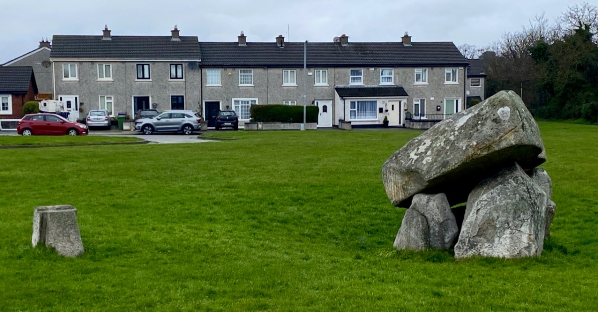
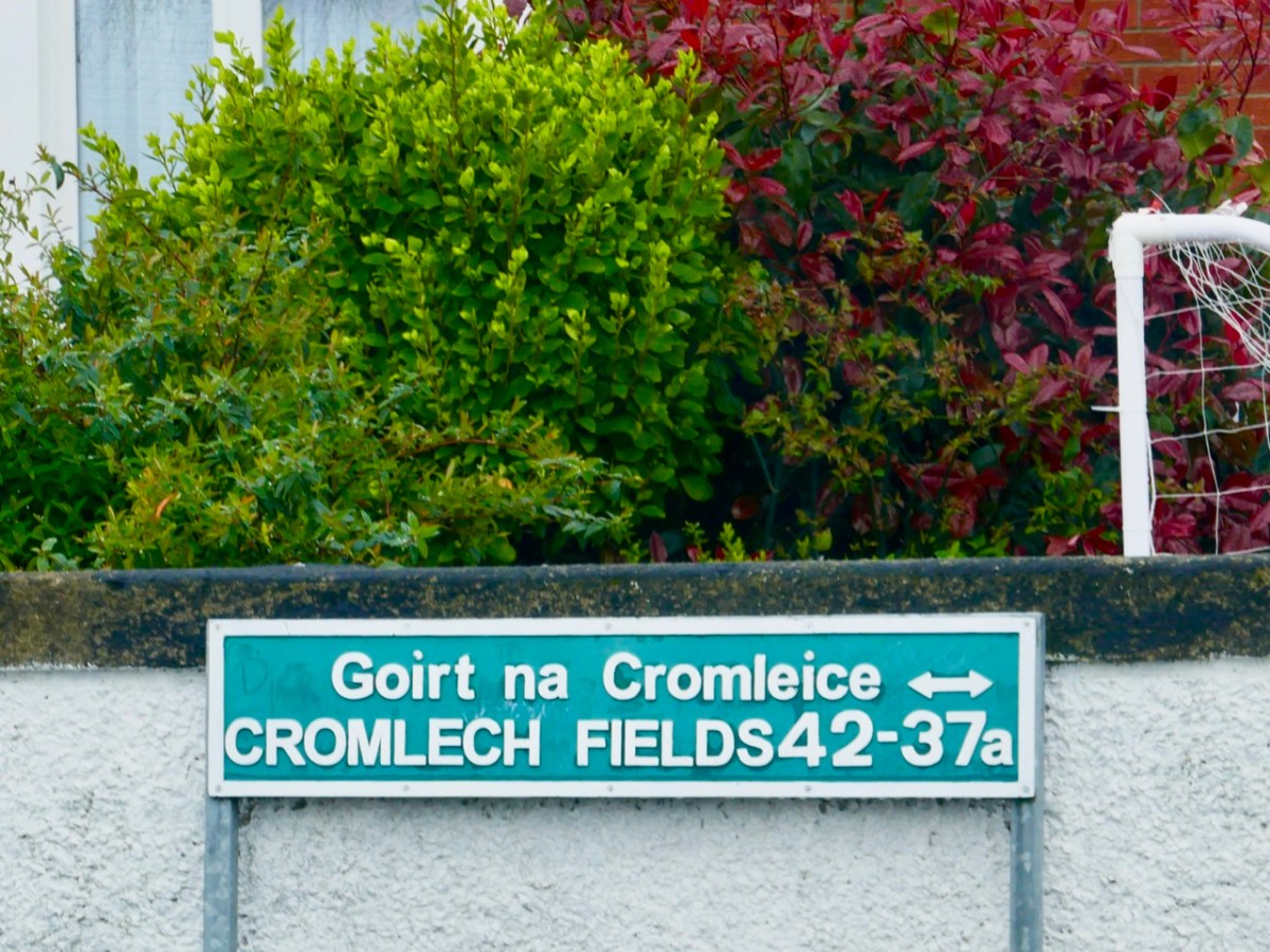
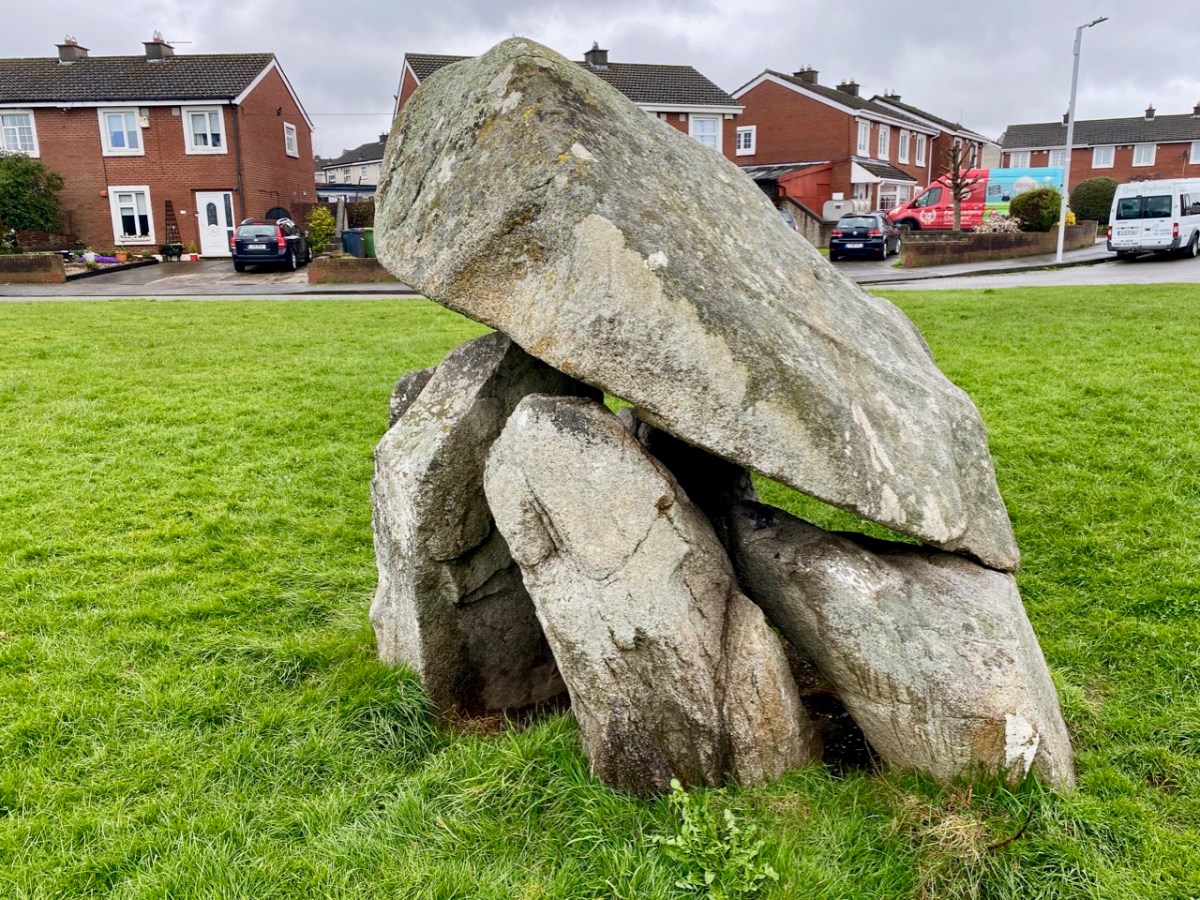
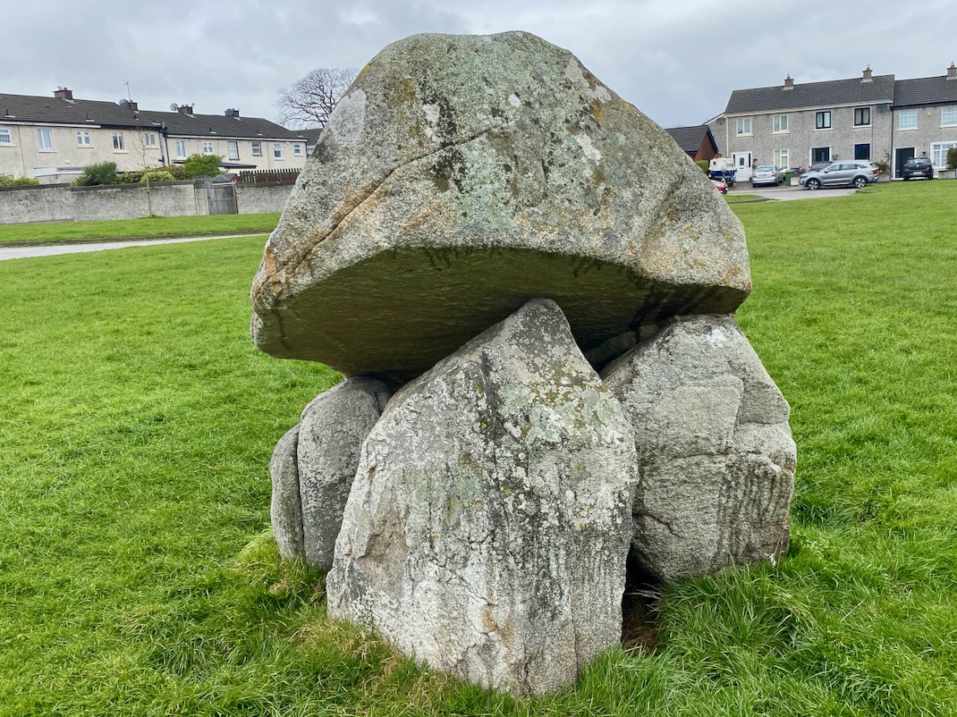
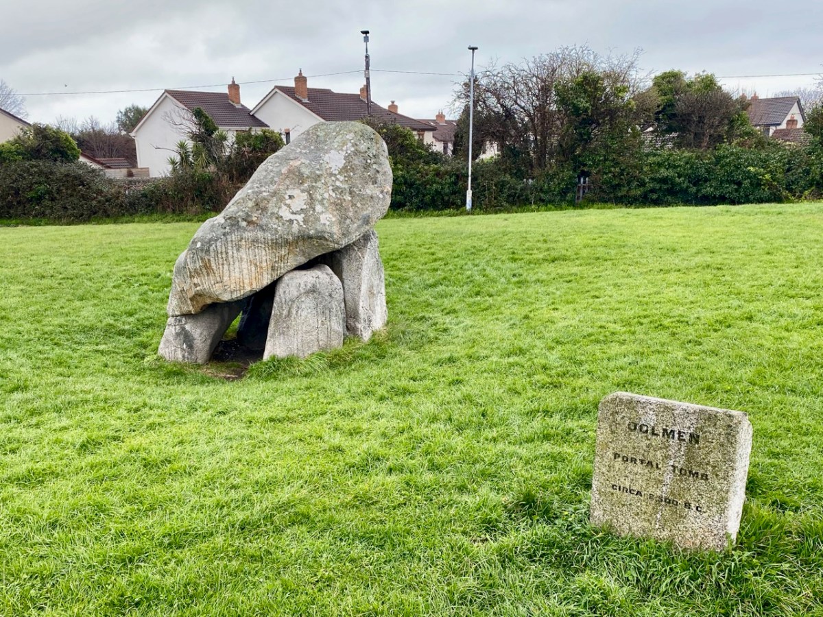
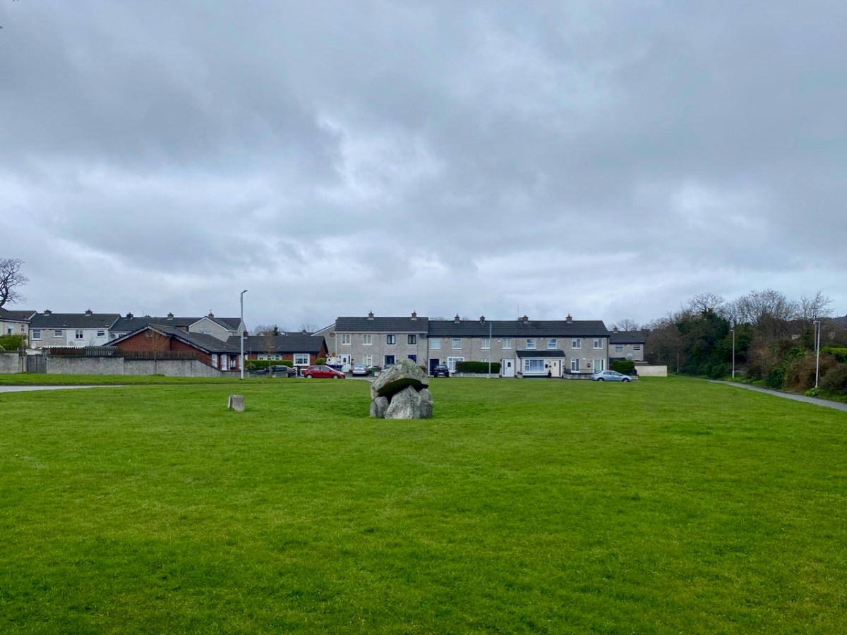
We are used to searching out archaeology in the Irish countryside. More unusual, perhaps, is finding examples in an urban setting. Here’s one – at Cromlech Fields, Hackettsland, Dublin.
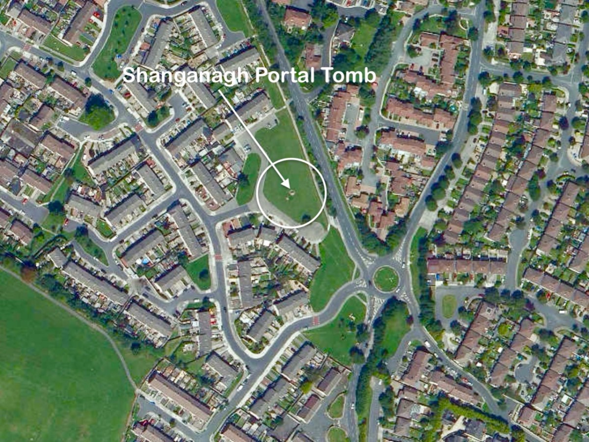
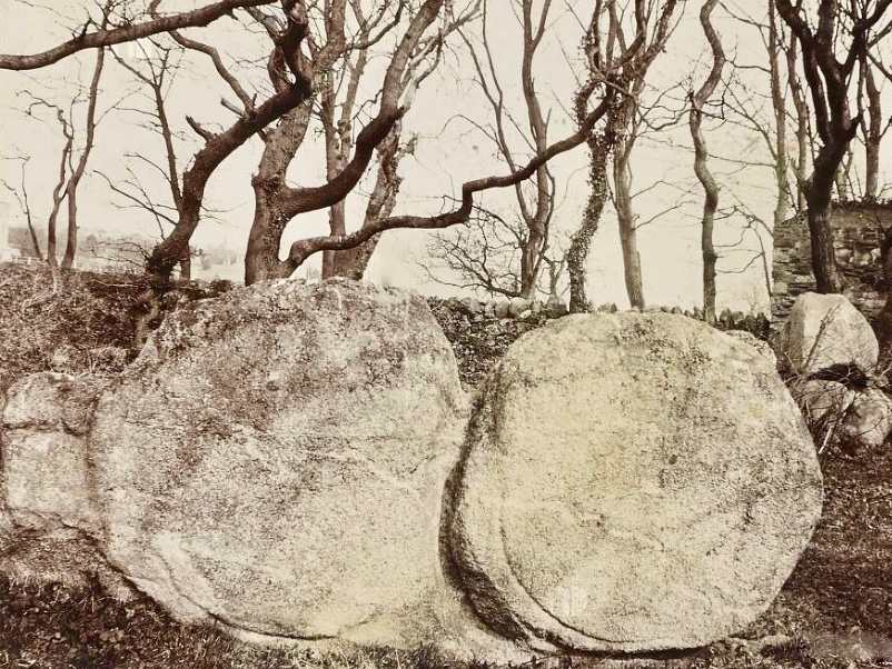
This particular example of a prehistoric structure has survived the encroachment of the city suburbs and is, in fact, in good condition and apparently accepted as part of the landscaping in a dense housing community. It is well-placed in a slightly sunken setting within a substantial green area. It is known variously as the Shanganagh Portal Tomb, Hackettsland Cromlech, or Ballybrack Dolmen. And it’s ancient: portal tombs can date back four or five thousand years – some even more. This arrangement of stones has seen civilisations evolve significantly, but it sits there unchanged.
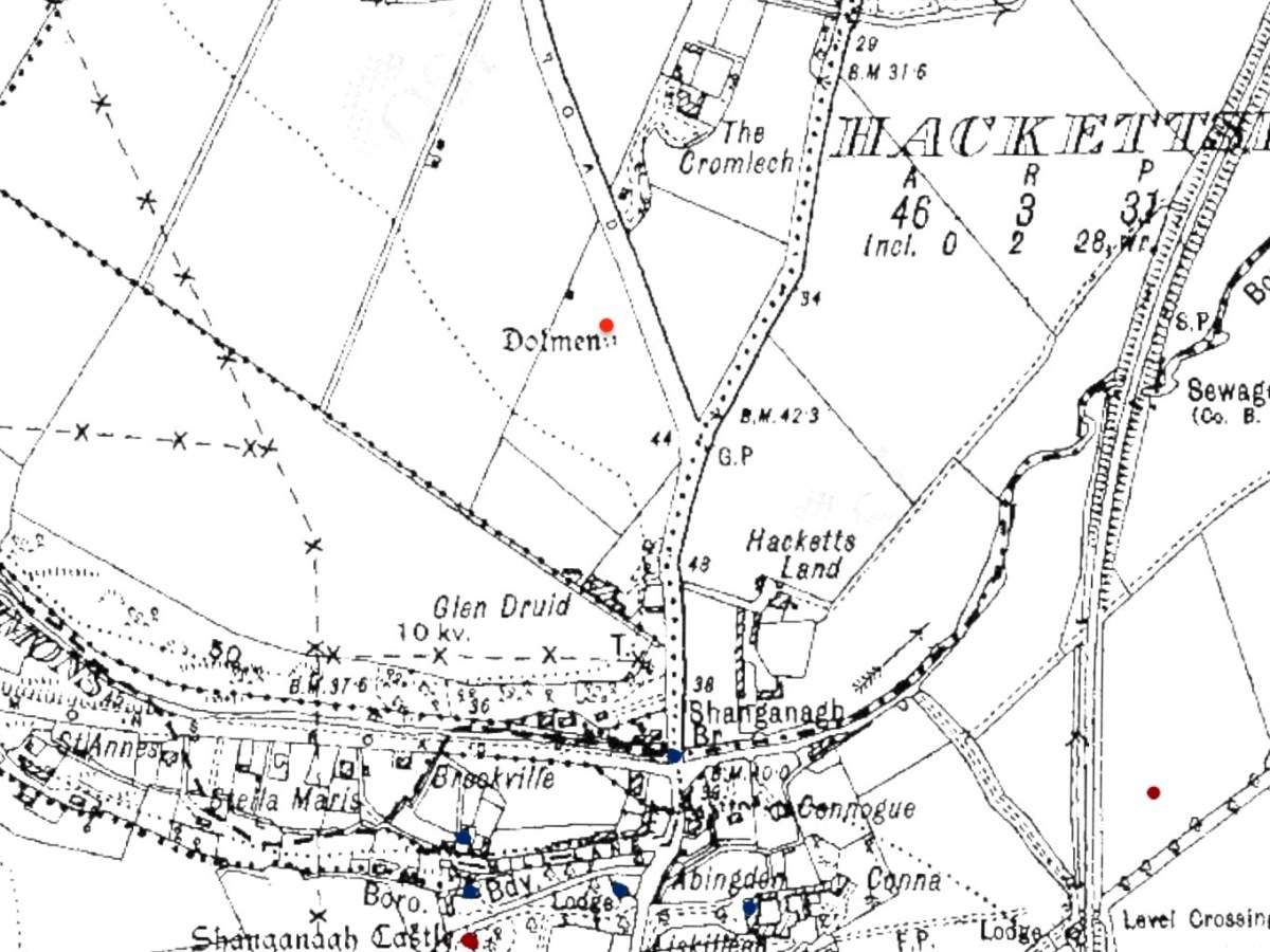
The historic 25″ OS map of Ireland – surveyed from the late 1890s and into the early 20th century. It is clear from this edition that the ‘dolmen’ was still sited in open country at that time.
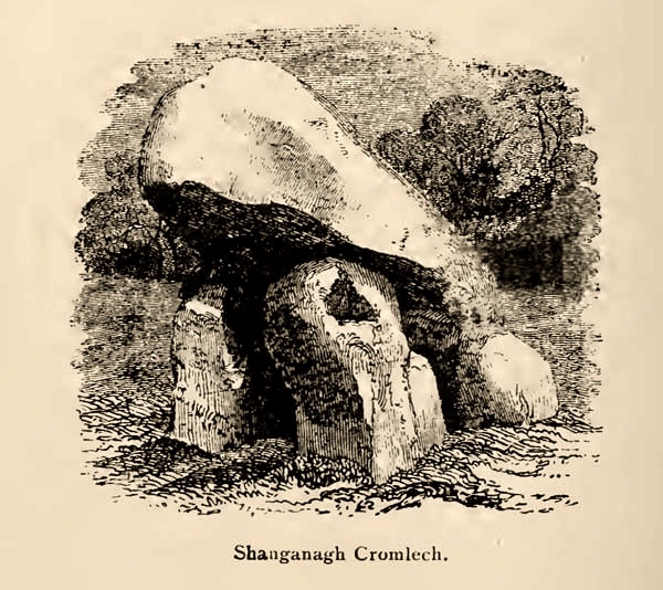
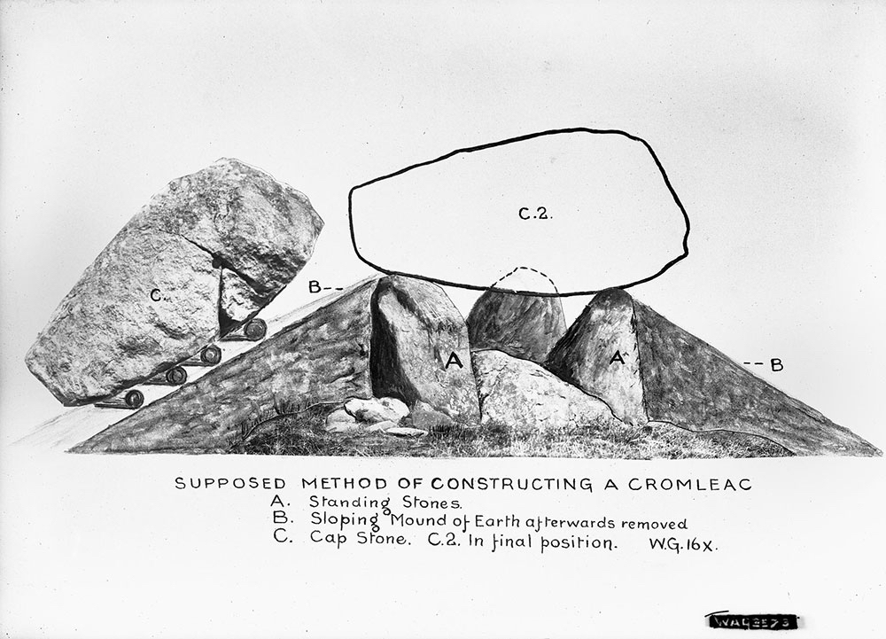
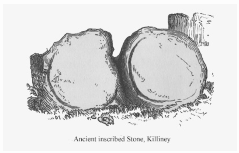
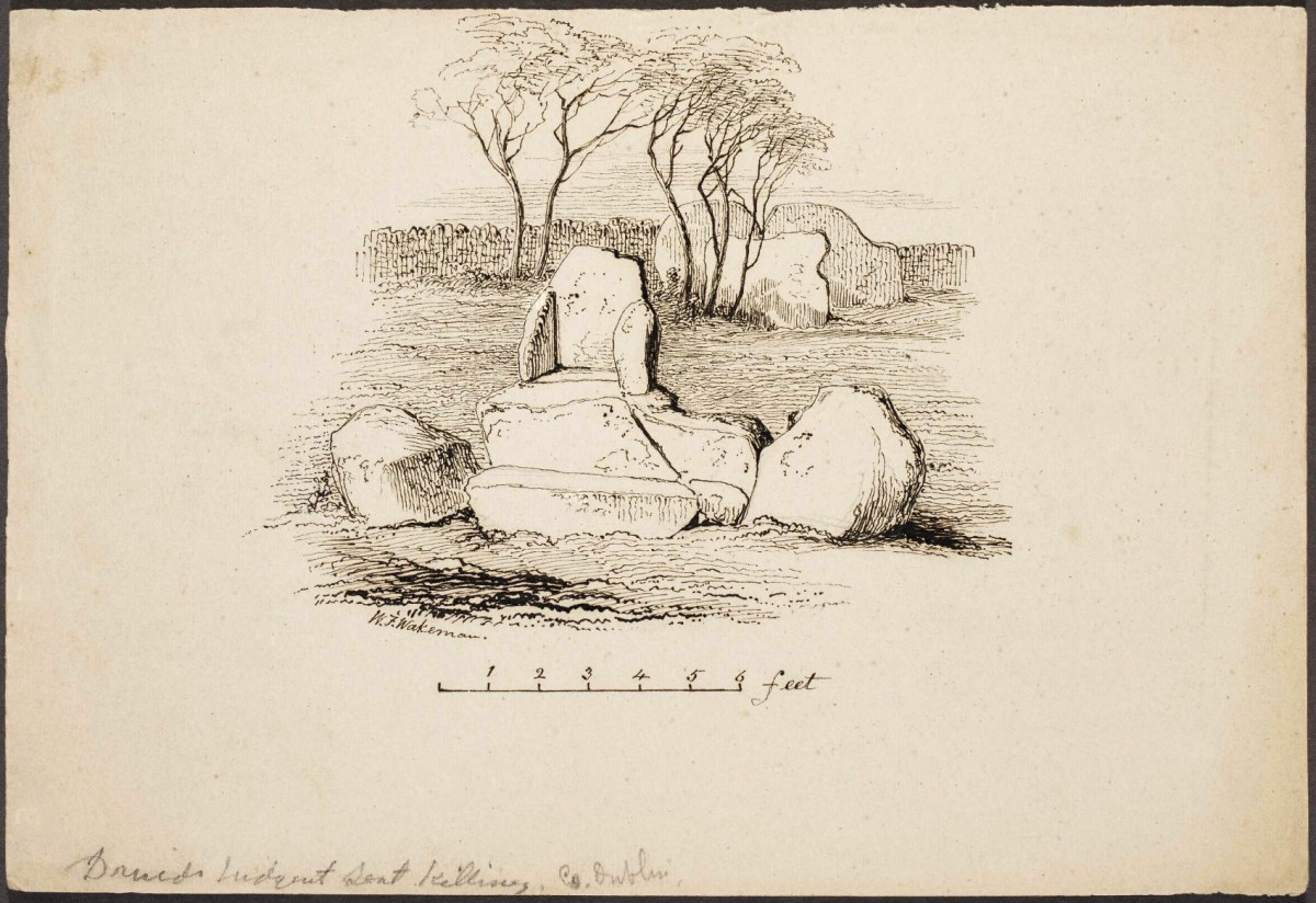
Illustration from: A Hand-book of Irish Antiquaries by William F Wakeman, 1903.
. . . We cannot conclude our notice of this class of monuments without making some mention of the very interesting example remaining at Shanganagh, near the village of Loughlinstown, and not far from the ancient church of Killiney. Though inferior in size to several which we have already described, its dimensions are considerable; and as it remains, to all appearance, in its original state, the student will find it an object well worthy of his attention. The covering stone measures in length nine, in breadth seven, and in thickness three and a half feet, and is supported upon four stones. The highest part of the pile is nine feet above the level of the adjoining field . . .
William F Wakeman
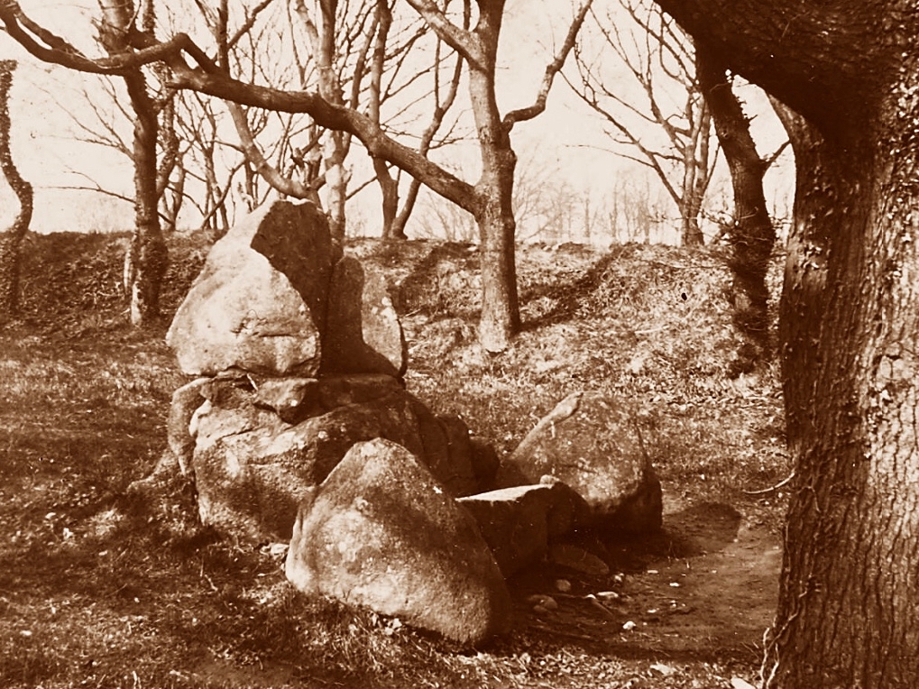
You may want to be aware of the full range of portal tombs in terms of relative scale. Have a look at my post here from a few years ago: it features the largest of the Dolmens in Ireland (and, perhaps, in the world). That one provides challenges in terms of how it was constructed: the capstone, which has been raised on to supporting rocks, is estimated to weigh over 160 tons. Also, this post from Finola offers detailed information on these structures generally. Here is a nineteenth century view of how such monuments were erected:
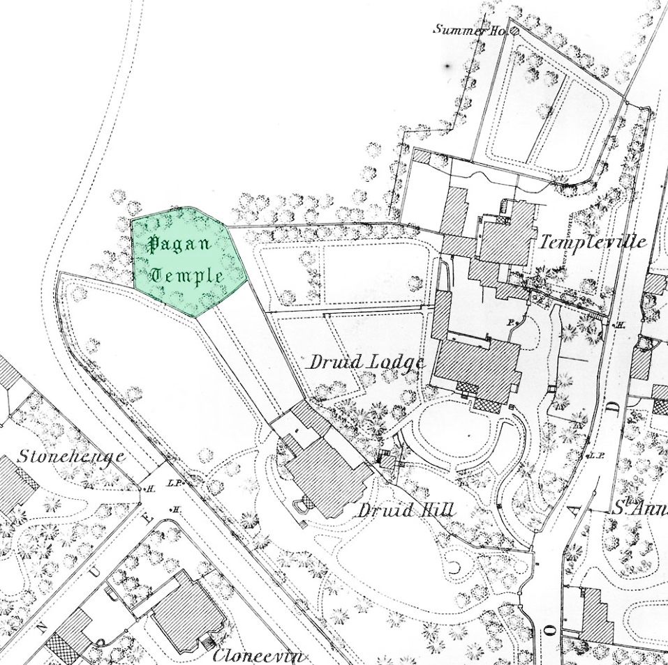
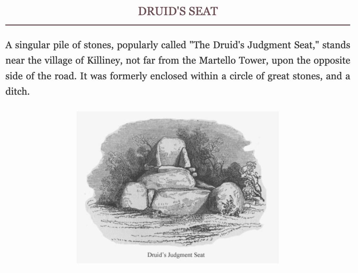
Some intriguing arrangements of stones here – and some enigmatic reporting of their significance as history. We are a long way from West Cork – in fact, over on Ireland’s east coast, among the fine estates of Killiney. We can’t help but search out examples of archaeology wherever we go, and a red dot on the Historic Environment map is always a good starting point, as is anything with an enigmatic name.
In this case, the red dot is just to the left of the ‘Pagan Temple’ at the top of the 25″ OS map – but look at all the other intriguing names in the locality!
Here’s a close up -extracted from the 1888 OS map, highlighting the site that we are looking at today. With Templeville, Druid Lodge, Druid Hill and Stonehenge as neighbours, the Pagan Temple demands a closer look!
It was last week’s subject – the writer and photographer Thomas Holmes Mason – who directed us to this County Dublin location. As a significant producer of picture postcards, Mason has left a large body of work, even though many of his photographic plates were destroyed in a warehouse fire in 1963. The National Library of Ireland houses a comprehensive collection, and I am grateful to them for this image, above, which shows an intriguing stone formation on the Killiney ‘Pagan Temple’ site. It is referred to as The Sun and Moon stone by some antiquarians, and the following description appears on the current Historic Environment Viewer:
DU026-010—-
Scope note
Class: Megalithic structure
Townland: KILLINEY
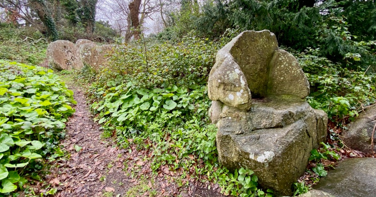
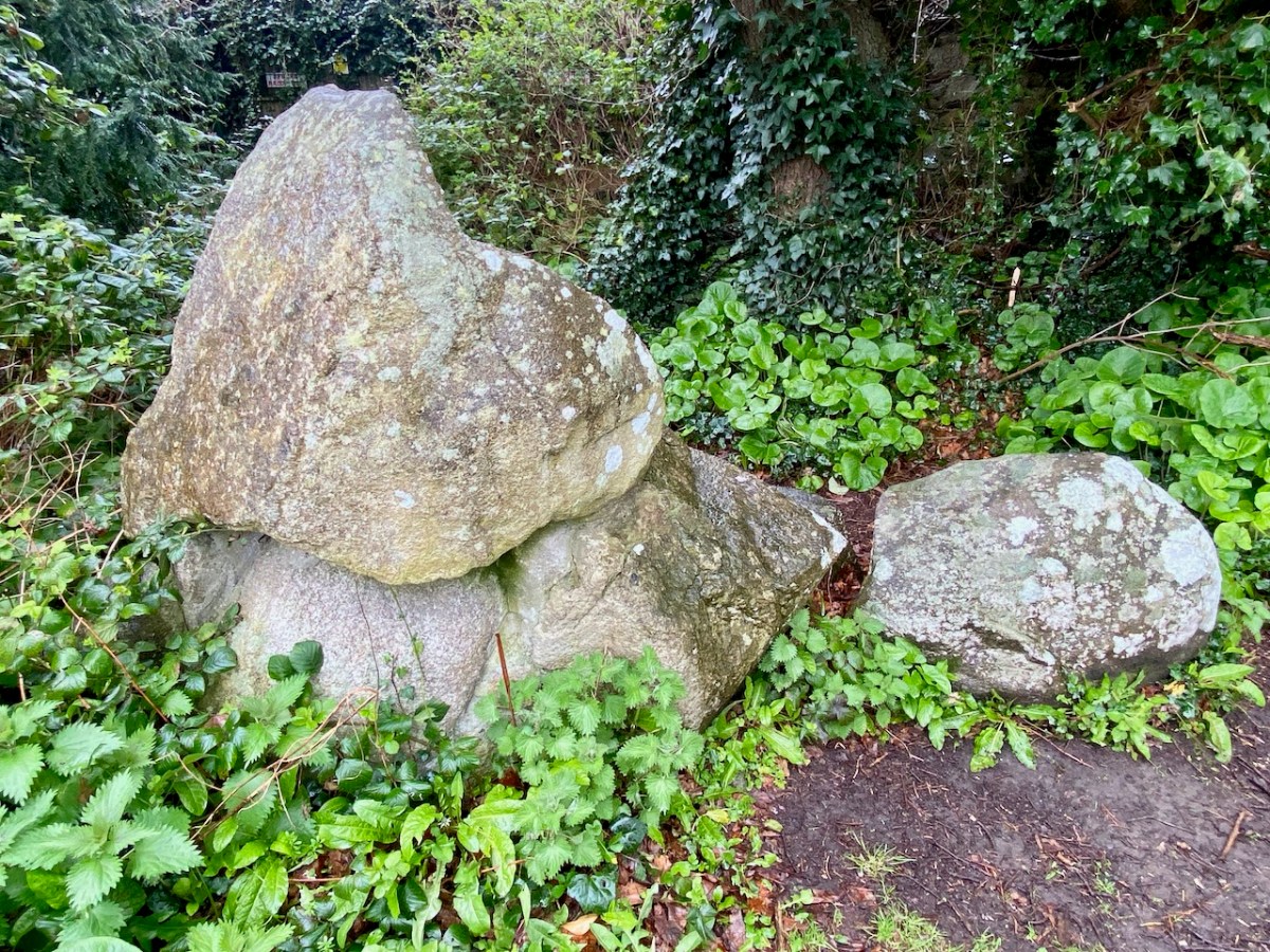
Description: “. . .This enigmatic structure is located within an area enclosed by a hedge on top of Druid Hill. In the E side of the enclosure are three irregular granite boulders that form a façade behind which is a larger boulder containing a setting of stones that form a seat. To the W of this are two large granite slabs set on their long axis. There are tool marks present. This structure appears to be a folly but it may incorporate the remnants of an earlier monument . . .”
Archaeology.ie Historic Environment Viewer
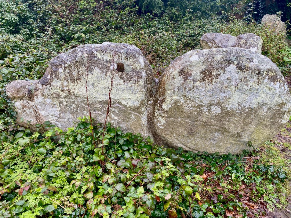
The Archaeology.ie write-up is accurate. In addition to the ‘chair’ (which Finola is elegantly modelling while trying not to sit in a puddle!) there are two further irregular granite boulders – but one of them (detailed in the T H Mason photograph) looks like two circles – hence ‘sun and moon’ – but is in fact a single boulder, here seen from the ‘front’ face:
The right-hand side of this stone has some marks carved on it (by human hand) – possibly part of a large circle that outlines this half, while the vertical ‘groove’, central to the boulder, also appears to have been chased out. It’s worth noting as well, perhaps, that there are two small holes drilled on the back face of this stone, one on each side but not aligned on any centre. Additionally, there is also a small hole drilled on the back face of the second stone:
This article – by William Wakeman – appeared in The Journal of the Royal Society of Antiquaries of Ireland December, 1896. It introduces an element of scepticism, which we should perhaps explore. The excellent Killiney History website has collected together a number of writings and observations about this site.
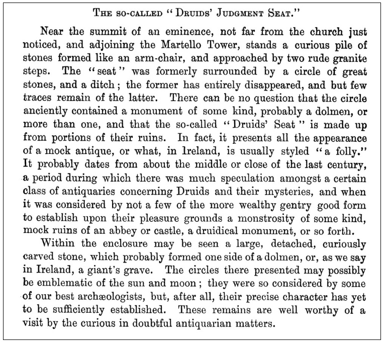
John Dalton writing in 1858 seems quite satisfied of the antiquity of the Judgment Seat. The Gazetteer of Ireland states “A well-preserved Druidical circle with its priests’ seat and its sacrificing stone, occur within a carefully kept enclosure, behind Mount Druid demesne, and near the Martello Tower, but is made accessible by the proprietor to respectable visitors.”
Killineyhistory.ie
William Wakeman, a well known antiquarian of the last century, appears to have been the first to condemn these remains as spurious. “Formerly it was enclosed within a circle of great stones and a ditch. The circle has been destroyed and the ditch so altered that little of its original character remains. The seat is composed of large rough granite blocks and, if really of the period to which tradition refers it, an unusual degree of care must have been exercised for its preservation. The stones bear many indications of their having been at least rearranged at no very distant time. Small wedges have been introduced as props between the greater stones. The right arm is detached from the other part, to which it fits but clumsily. The whole, indeed, bears the appearance of a modern antique, composed of stones which once formed a portion of some ancient monument.”
Killineyhistory.ie
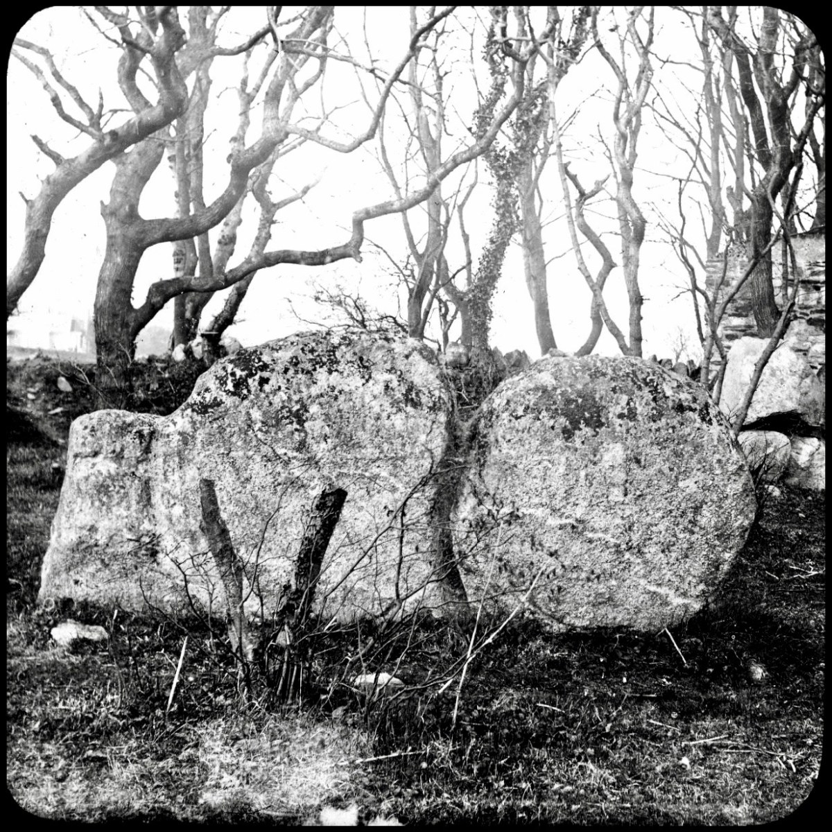
These photographs were taken by William Frazer in 1898. The arrangements of stones at that time are very similar to what we see today – well over a century later – but with far less growth of ground cover.
Above: Druid’s judgement Seat, Killiney – from Library of Ireland archives.
Elrington Ball [1863–1928] confirms this view of the Druid’s Judgment Seat. The stones of which it is composed formed part of a Sepulchral memorial dating from very early times, consisting of three small cromlechs, surrounded by a circle of upright stones about 135 feet in diameter, and, at the time of its first attracting attention, in the 18th Century when everything prehistoric was attributed to the Druids or the Danes, it was assumed to be a Pagan Temple . . . Near the circle was discovered at the same time an ancient burying place, and some stones with curious markings, which are still to be seen. The burying place was of considerable extent, the bodies, which were enclosed in coffins made of flags, having been laid in a number of rows of ten each . . .
Killineyhistory.ie
Finally Woodmartin [Traces of the Elder Faiths of Ireland 1902 Vol 11] makes the sweeping statement: the entire structure leaves the unmistakeable impression of very modern fabrication, and it is a mere clumsy attempt to gull the public . . . As seen to-day these relics of antiquity present rather an unlovely picture, in an obscure and ill-kept corner, surrounded by an unsightly hedge, where weeds and brambles share their ancient sanctity; they seem to arouse but little interest . . .
Killineyhistory.ie
Today, the jury seems to be out on what we are looking at on this site. Time has undoubtedly changed the shape of things: wouldn’t we like to go back a while and see the burying place of considerable extent with all those . . . bodies, which were enclosed in coffins made of flags, having been laid in a number of rows of ten each . . . ? But we do appreciate that a former landowner must have donated the land to excite our interest!
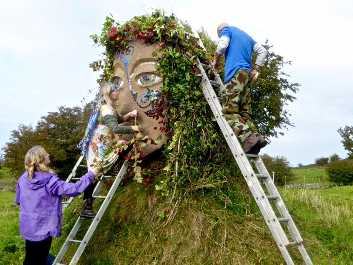
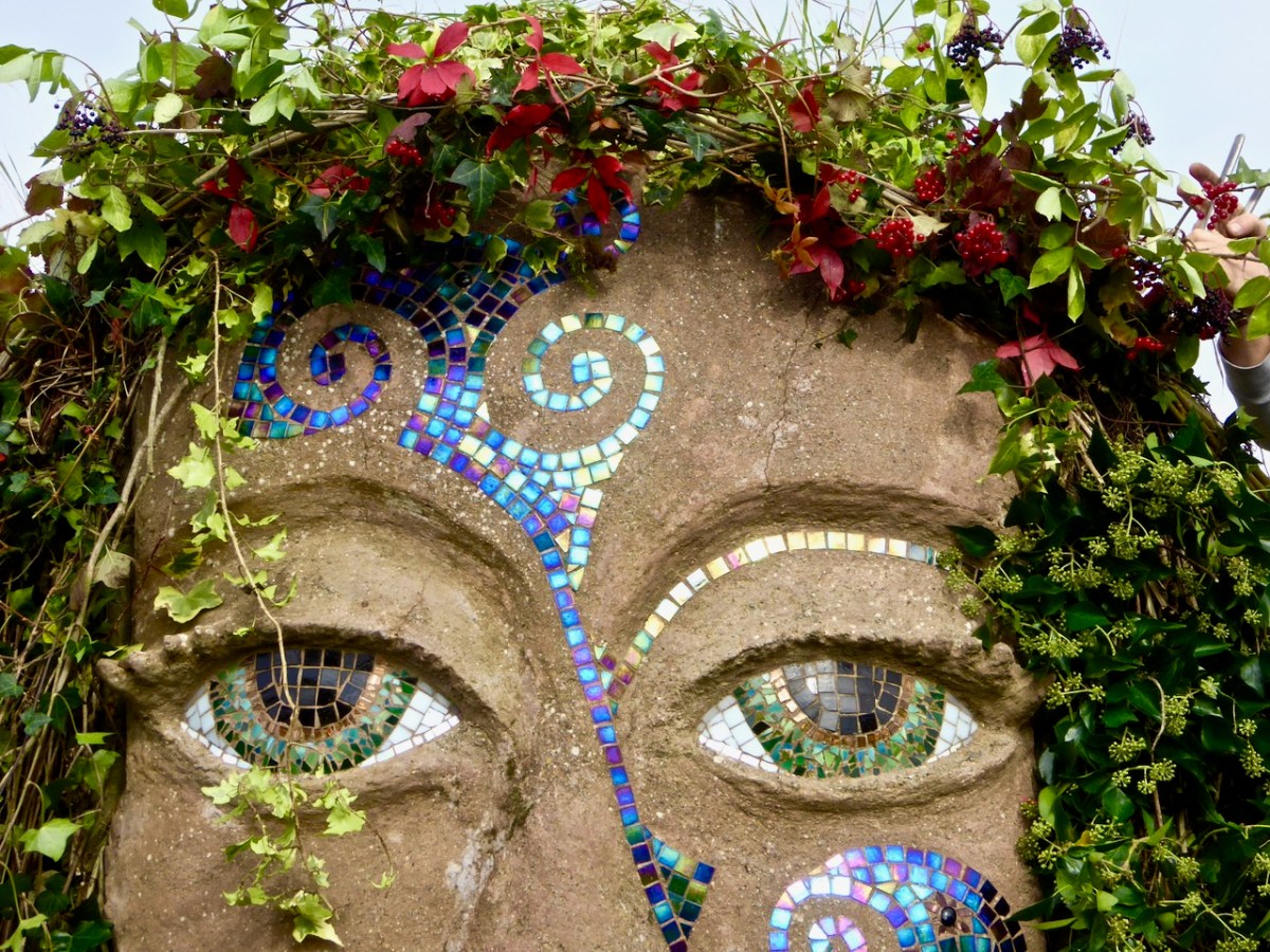
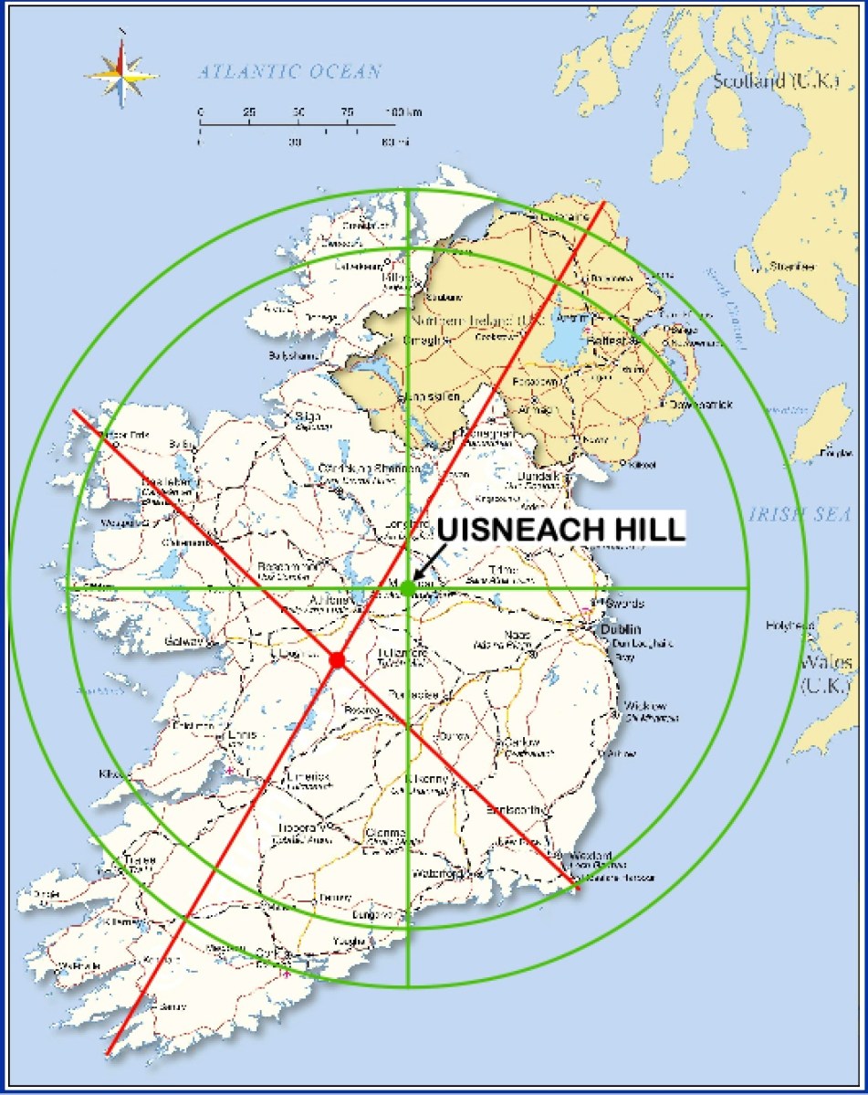
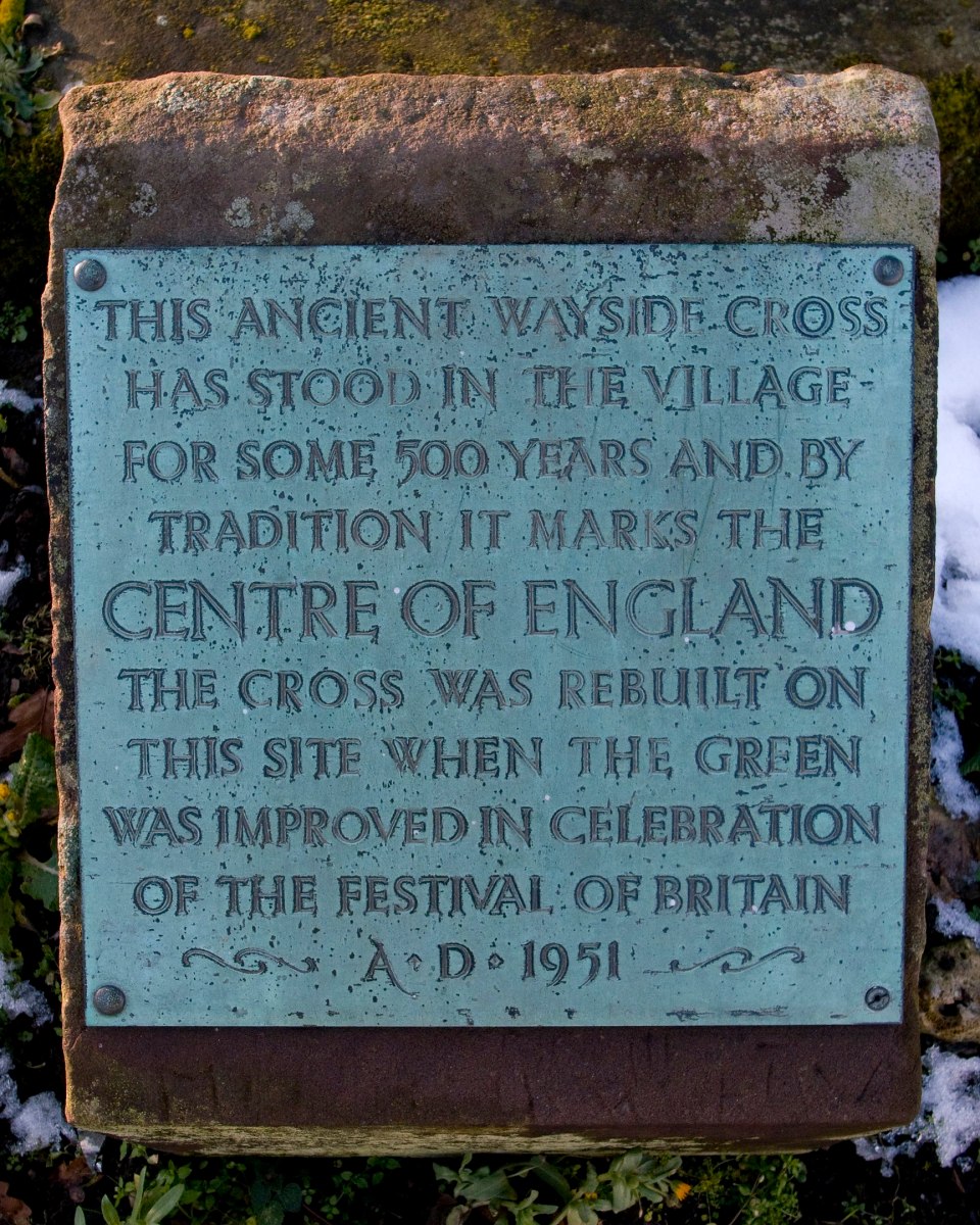
We have written previously about the sacred site reputed to be the “Centre of Ireland”. In other words the midpoint of the country: that’s the whole of the island of course – the division into Ireland and Northern Ireland is an artificial designation barely a century old. It’s a many-centuries-old tradition that the Hill of Uisneach, in Co Westmeath, is regarded as the geographical centre of this whole island and has been regarded as a major ritual site for the assembly of the ruling families and debate on the lore of the land.
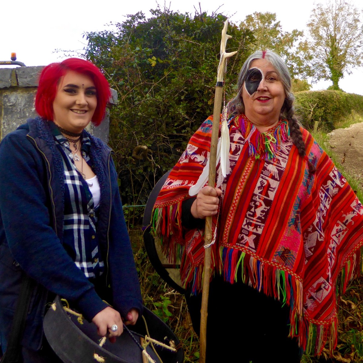
We visited the hill in October 2016, while preparations were being made to celebrate autumn festivities there. In the picture above, you can see the Godess Eriu being decorated. It was she who gave Ireland its name – Eire. Before you read on about Uisneach’s other claim to fame, have a look at my post from six years ago, here. My friend Michael read this post and sent me a fascinating article on the subject of ‘the geographical centre of Ireland‘. Please read it – and, if you understand the technicalities of the process, please let me know!
. . . The calculation to find the exact geographic centre of Ireland was carried out by OSi using the most up-to-date, openly available geospatial data and widely used geographic information system (GIS) technology. Specifically, OSi used Esri’s Mean Centre Point tool in ArcMap and features data for the Republic of Ireland from its own open-source data set, OSi Admin Areas Ungeneralised, as well as an openly available OSNI Largescale County Boundaries data set from Land & Property Services of Northern Ireland (LPS). The Northern Ireland features were reprojected from an Irish National Grid coordinate system to line up with the OSi features for the republic of Ireland (ITM), enabling the datasets to be processed together. In just a few short minutes, the coordinates 633015.166477, 744493.046768 were revealed, providing one scientific answer to an age-old question . . .
Ordnance Survey of Ireland Data February 25th 2022
To get to the salient point, the Ordnance Survey of Ireland is rejecting tradition in favour of science! They claim the true centre of this island is a little distance from Uisneach:
. . . According to a new calculation from Ordnance Survey Ireland (OSi), the centre of the island of Ireland actually lies at the Irish Transverse Mercator (ITM) coordinates 633015.166477, 744493.046768, near the community of Castletown Geoghegan, between the towns of Athlone and Mullingar. This scientifically-calculated centre point is situated, as the crow flies, approximately 31km east of the Hill of Berries, 35km east-south-east of the townland of Carnagh East and a mere 5km south-east of the Hill of Uisneach, Loughnavalley, Co. Westmeath . . .
Ordnance Survey of Ireland Data February 25th 2022
Whilst acknowledging that ” . . . Over time, new data, advancing technologies and new techniques could generate different versions of the truth . . .” the Ordnance Survey throws out a challenge to tradition. I’m throwing that challenge right back!
If I was going to set out to find the geographical centre of Ireland, I would take a large map and pin it up on the wall:
Then I would throw a dart at it – aiming for the middle! I’d get somewhere near, for sure. In fact, there’s a little red dot on this map – just under Mullingar: this is where Uisneach is located. But, if you want something more technical, might you work out a centre based on distances from the extremities? Here are some possibilities:
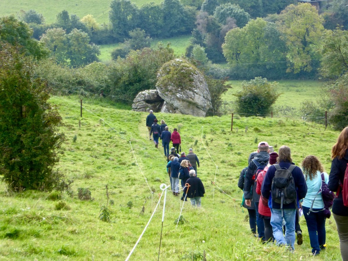
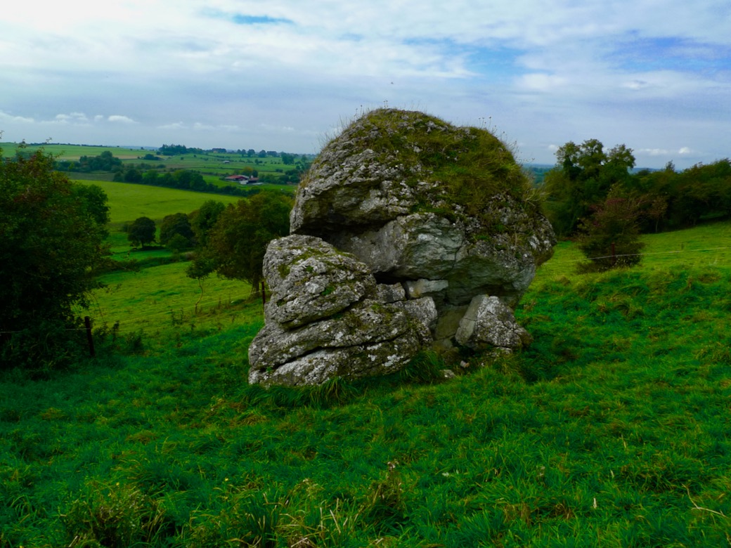
However, this map does rather show up the inadequacies of this methodology! So, what does Uisneach have to recommend it – and justify the long-held tradition? Well, it does have a large rock, known as ‘The Cat’s Stone’ . . .
This enormous erratic is also known as ‘The Navel’, which is quite a clue as far as I’m concerned. so, how might our ancestors have come to this conclusion – by maps?
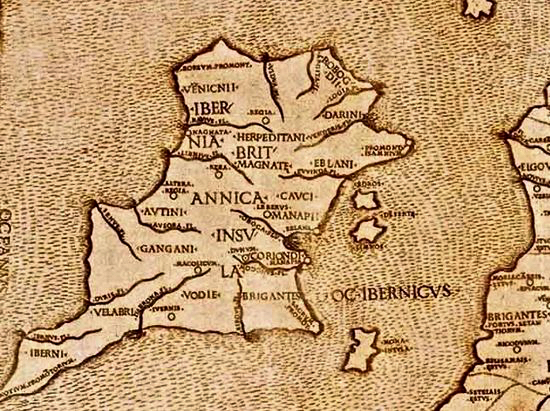
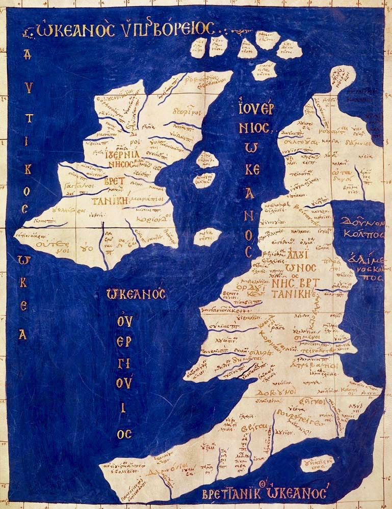
This is known as Ptolemy’s Map of Ireland. It is often said to date from 140AD, but is in fact a Greek copy dating from around 1400AD. Ptolemy did produce maps: he didn’t visit the distant locations, but based his projections on information recorded by sailors who explored the corners of the world.
This map of the British Isles has a similar heritage. Again, you could throw a dart at the centre of Ireland on either of these maps and get pretty close to Uisneach!
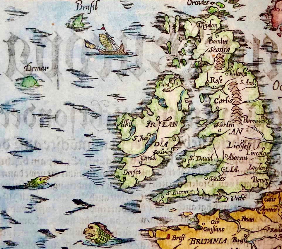
This map is somewhat later (1325) and is far more accurate. It’s interesting to me that it shows the fabled islands of Brasil and Demar, mentioned in accounts of St Brendan’s sixth century voyage. We can also wonder at the fact that the only place marked on the south western part of Ireland here is Dorsie (Dursey). But none of these early maps – while fascinating – can support the observation that anyone living in those days could calculate the ‘centre’ of Ireland by looking on a map!
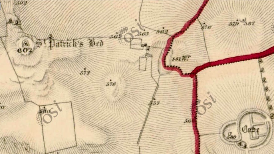
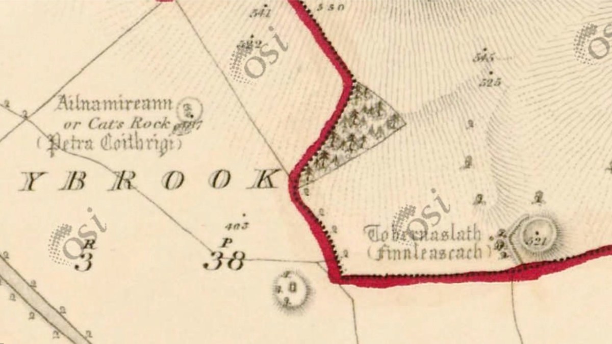
Examining the area around Uisneach on the earliest Ordnance Survey maps (above) gives an idea of the earthworks which were considered important to record in the area. I’m wondering what the ‘cave’ is that’s indicated lower right in the top extract?
Preparing for the autumn ceremony at Uisneach Hill, above. We can ponder and argue on the claims to be able to locate the centre of an island (and it’s certainly fascinating to do so) but – while thanking my friend Michael for stimulating this thought process – perhaps the UK Ordnance Survey should be given the final word here:
. . . The truth is, that there can be no absolute centre for a three dimensional land mass sitting on the surface of a sphere and surrounded by the ebb and flow of sea water. If you consider the movement of tides on a beach, the shape of the object will change on a constant basis. Another contributing factor is how far you consider the coast to stretch up river estuaries. Different projections, scales and methods of calculation will all produce different results . . .
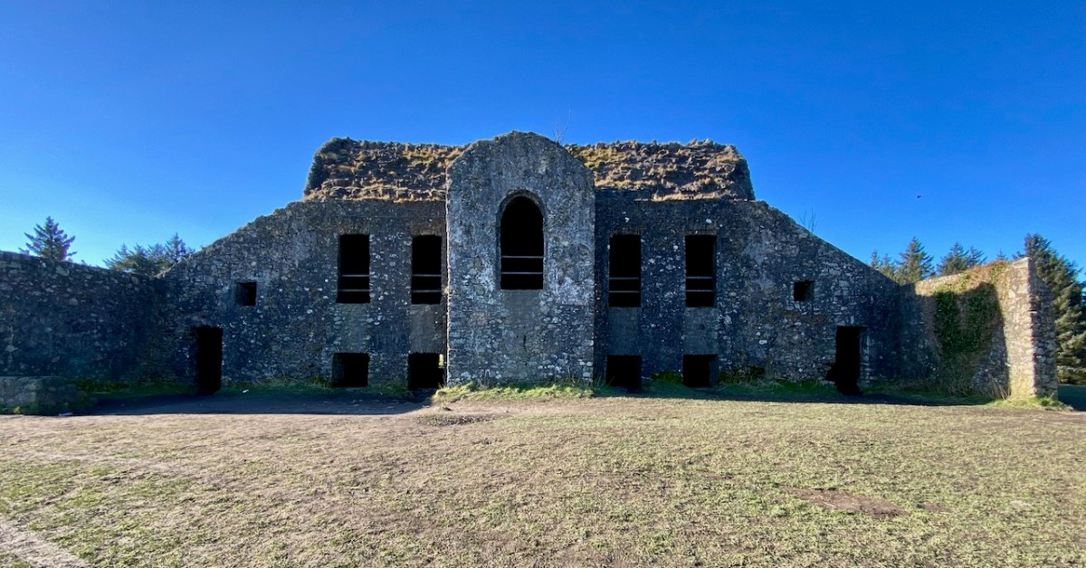
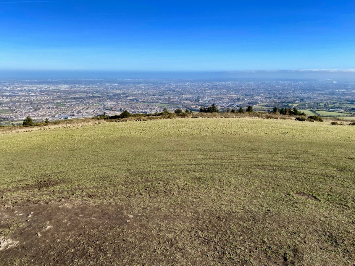
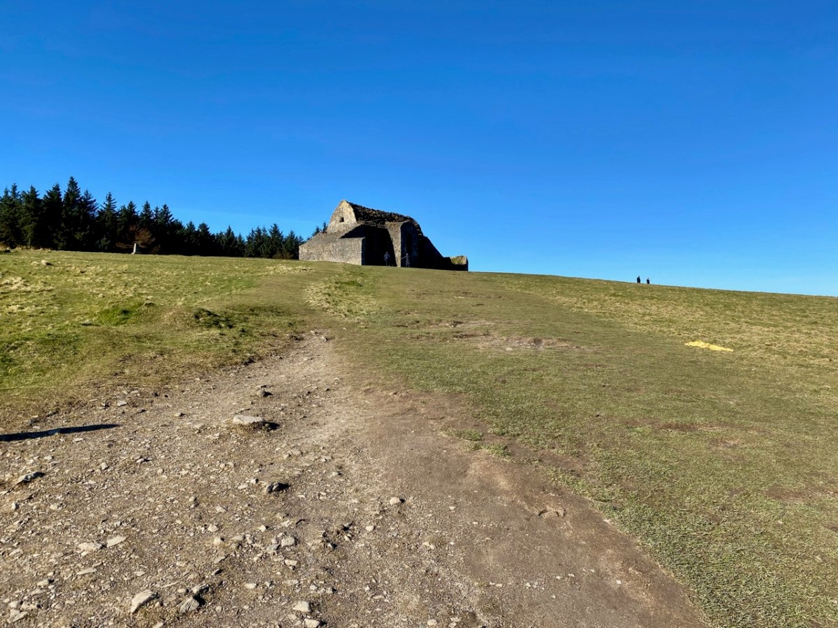
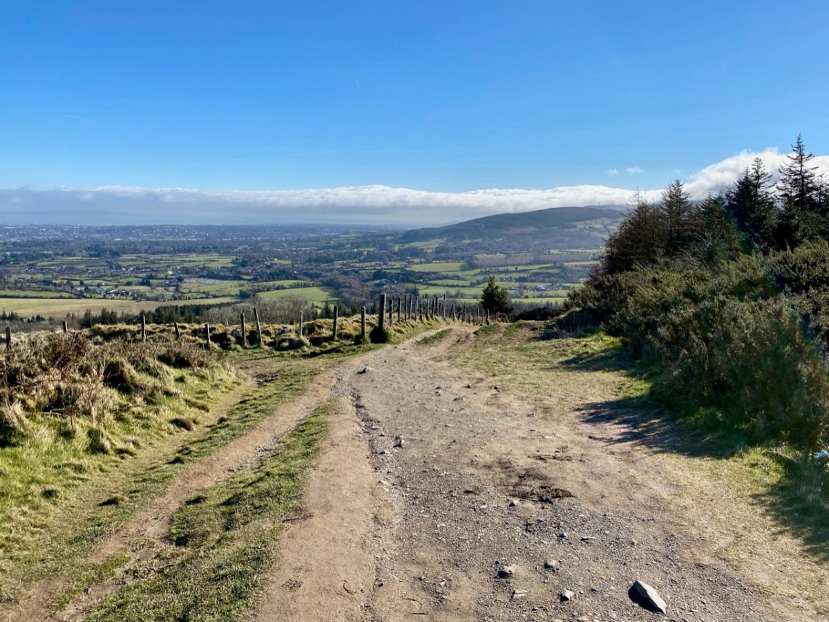
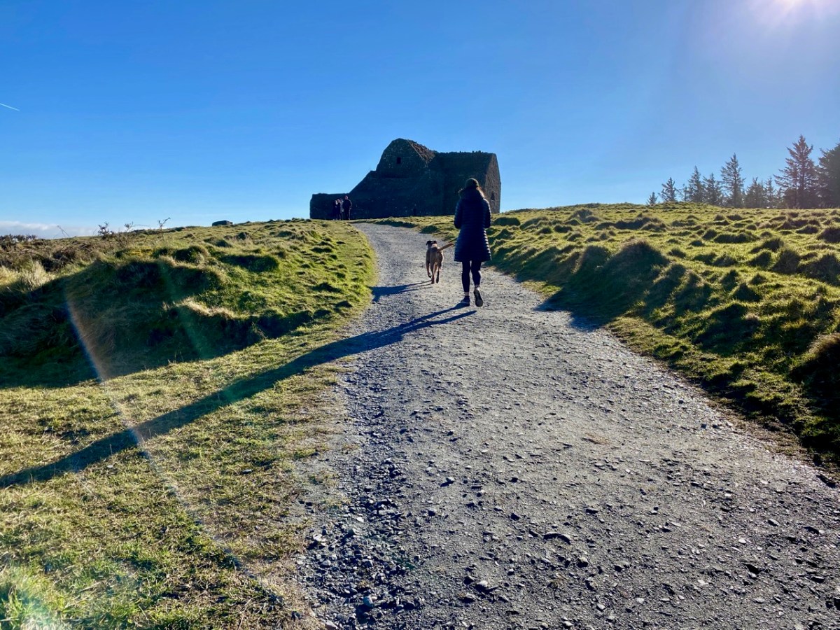
It’s taken me a while to visit this notorious site which is situated on a summit of the Dublin Mountains. The view across the city from the 390 metre peak is stunning:
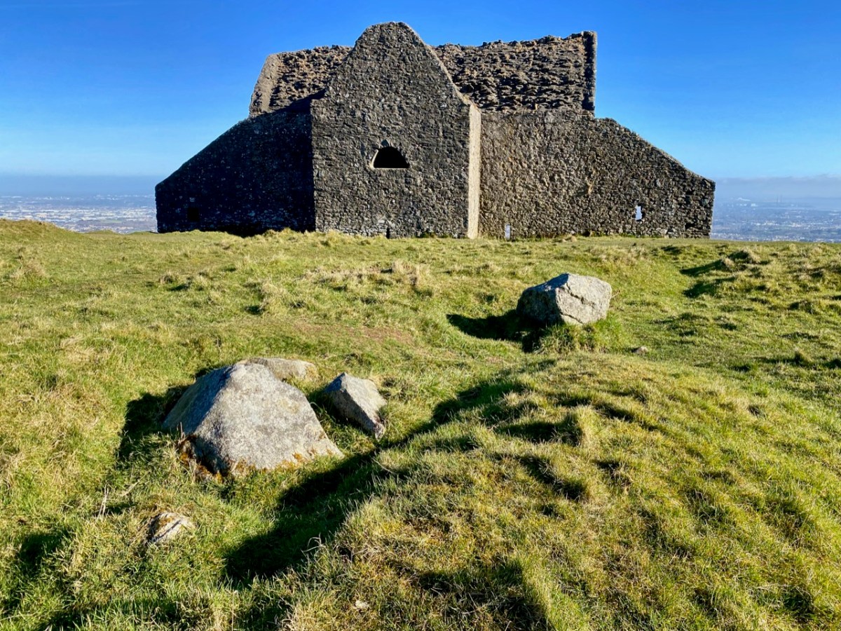
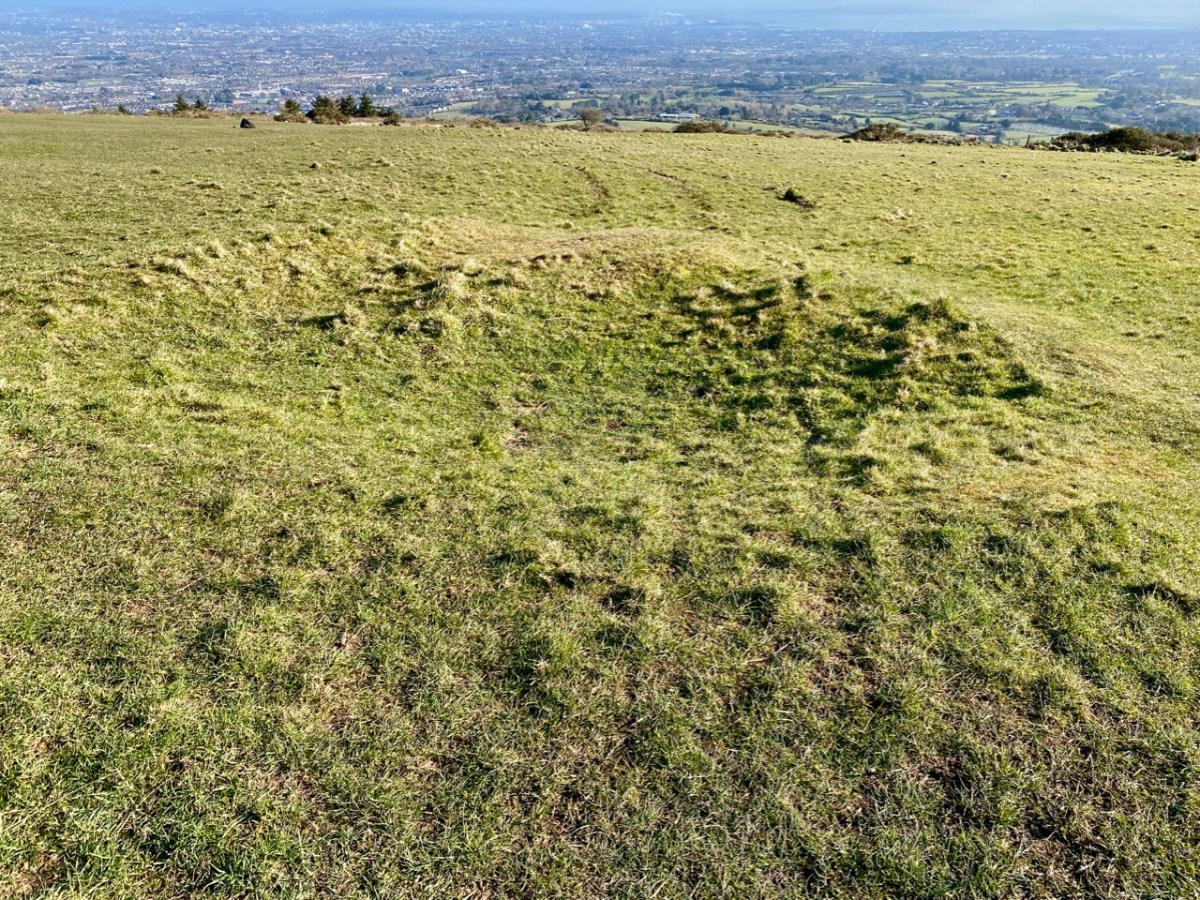
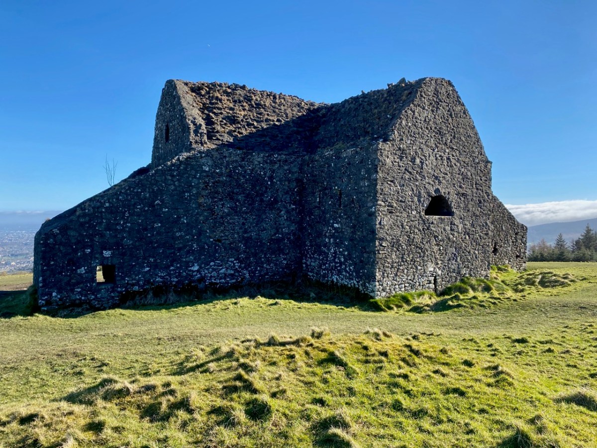
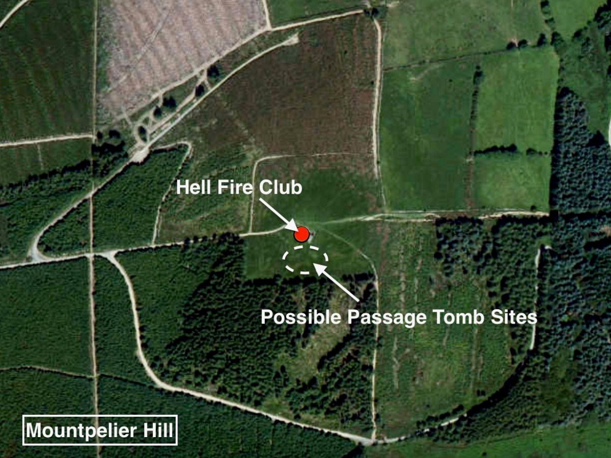
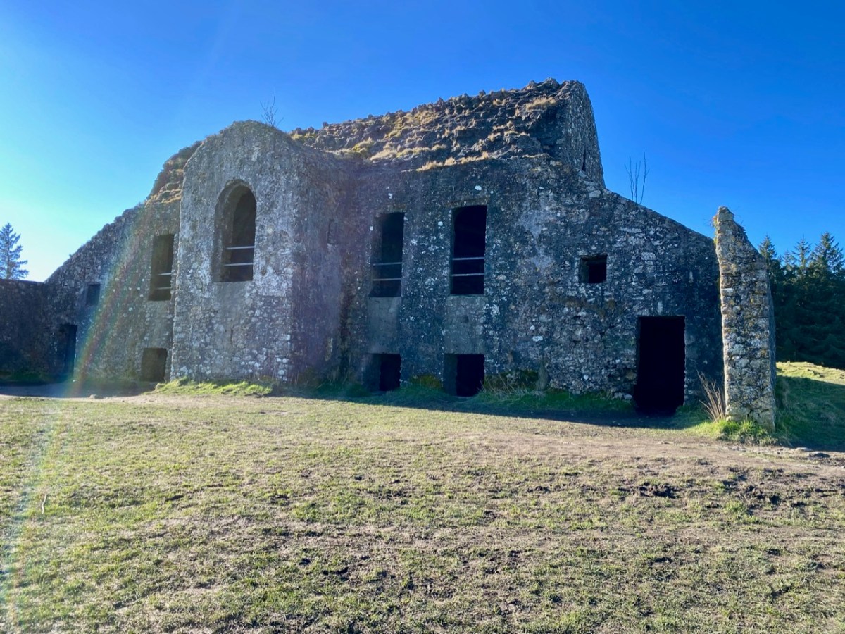
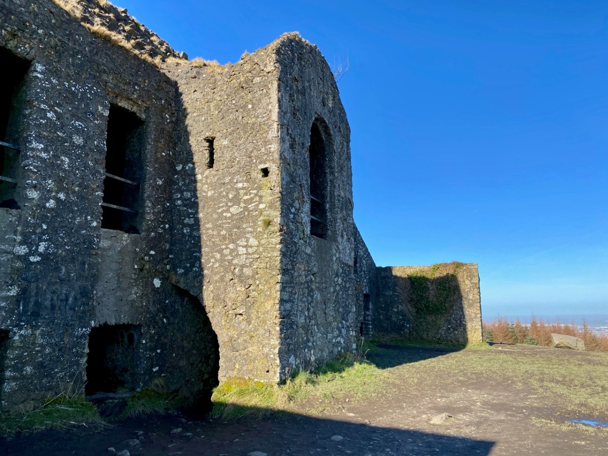
It’s the stories and the folklore that attracted me to this place, long known as the Hell Fire Club. In the eighteenth century ‘Speaker’ Connolly built it as a hunting lodge. According to tradition he used the stones from a prehistoric monument that was previously on the hill. It’s now known from recent excavations that at this location was one – or two – passage tombs dating from the Neolithic Period (4500 – 2000 BC). This – or these – were surrounded by a circle of large boulders known as a cairn. Today, some fragmentary traces of the earliest use of the site can be detected. The best information on the neolithic site is found in the Abarta Heritage report, here. An earlier description, dating from 1779 in fact, was written by Austin Cooper, who visited in that year:
. . . Behind the house are still the remains of the cairn, the limits of which were composed of large stones set edgeways which made a sort of wall or boundary about 18 inches high and withinside these were the small stones heaped up. It is 34 yards diameter or 102 yards in circumference. In the very centre is a large stone 9 feet long and 6 feet broad and about 3 feet thick not raised upon large stones but lying low with the stones cleared away from about it. There are several other large stones lying upon the heap . . .
William Connolly (Speaker of the Irish House of Commons) was one of the wealthiest men in Ireland; he had a house in the city and a country estate at Castletown, near Celbridge. It is said that he deliberately used stones from the ancient tomb in the construction of the hunting lodge at Mountpelier. Shortly after it was built the roof, which was originally slated, was blown off in a great storm. Locals attributed this misfortune to the work of the devil, in revenge for the destruction of the cairn. Following this event the lodge gained a reputation as a place where evil prevailed. However, Connolly replaced the slated roof with a stone vault which still exists today, although the building is effectively a ruin.
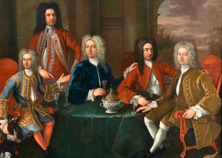
The Irish Hell Fire Club members were some of the elite of society, and included peers of the realm, high ranking army officers as well as wealthy gentlemen and artists. Here is a portrait of some of them by James Worsdale (himself a Club member); it is in the collection of the National Gallery of Ireland, Dublin.
From left to right: Henry Barry 4th Baron of Santry, Colonel Henry Clements, Colonel Henry Ponsonby, Colonel Richard St George, and Simon Luttrell, 1st Earl Carhampton. Biographies of all of them are summarised here – also from the Abarta reports. Their lives in general were debauched and relatively short. Missing from the portrait are father and son Richard Chappell Whaley and Thomas ‘Buck’ Whaley, who was to become ‘the most famous Buck of all’. Richard’s nickname was ‘Burn-Chapel’ Whaley because of his hatred of religion and in particular, the Roman Catholic church. He would amuse himself on Sundays by riding around Dublin setting fire to the thatched roofs of Catholic chapels. The Whaleys were related through their ancestry to Oliver Cromwell. Their family residence was Whaley Abbey, Co Wicklow: you can find more on this in Finola’s post today.
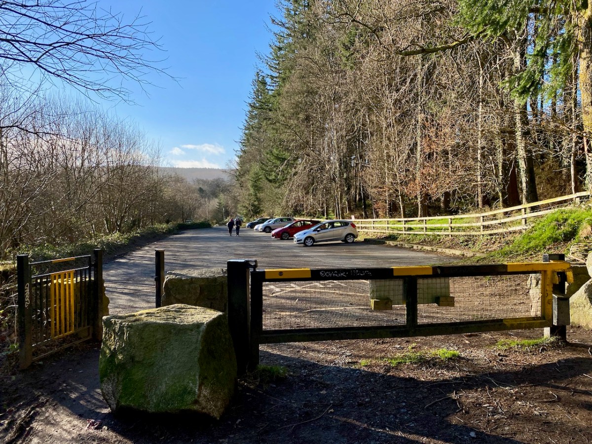
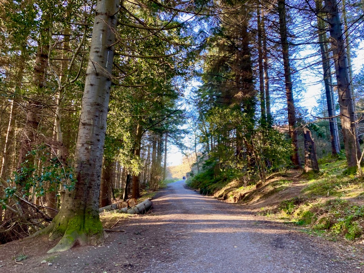
Mountpelier is a significant mountain top overlooking Dublin, and is now fully accessible to all. A warning, though – in good weather the Coillte car-park very soon fills up (at all times of the year) and there is nowhere else nearby to leave your vehicle – get there early!
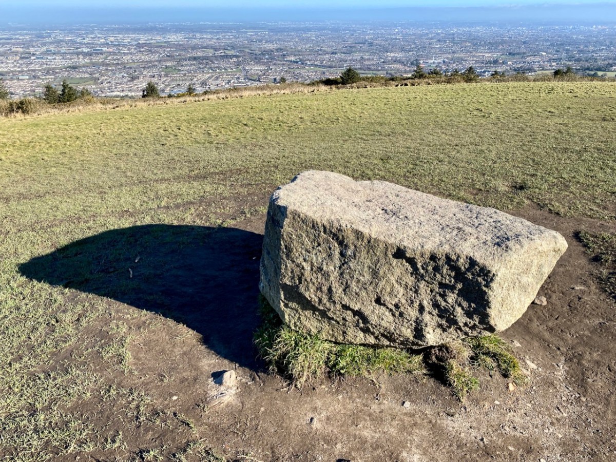
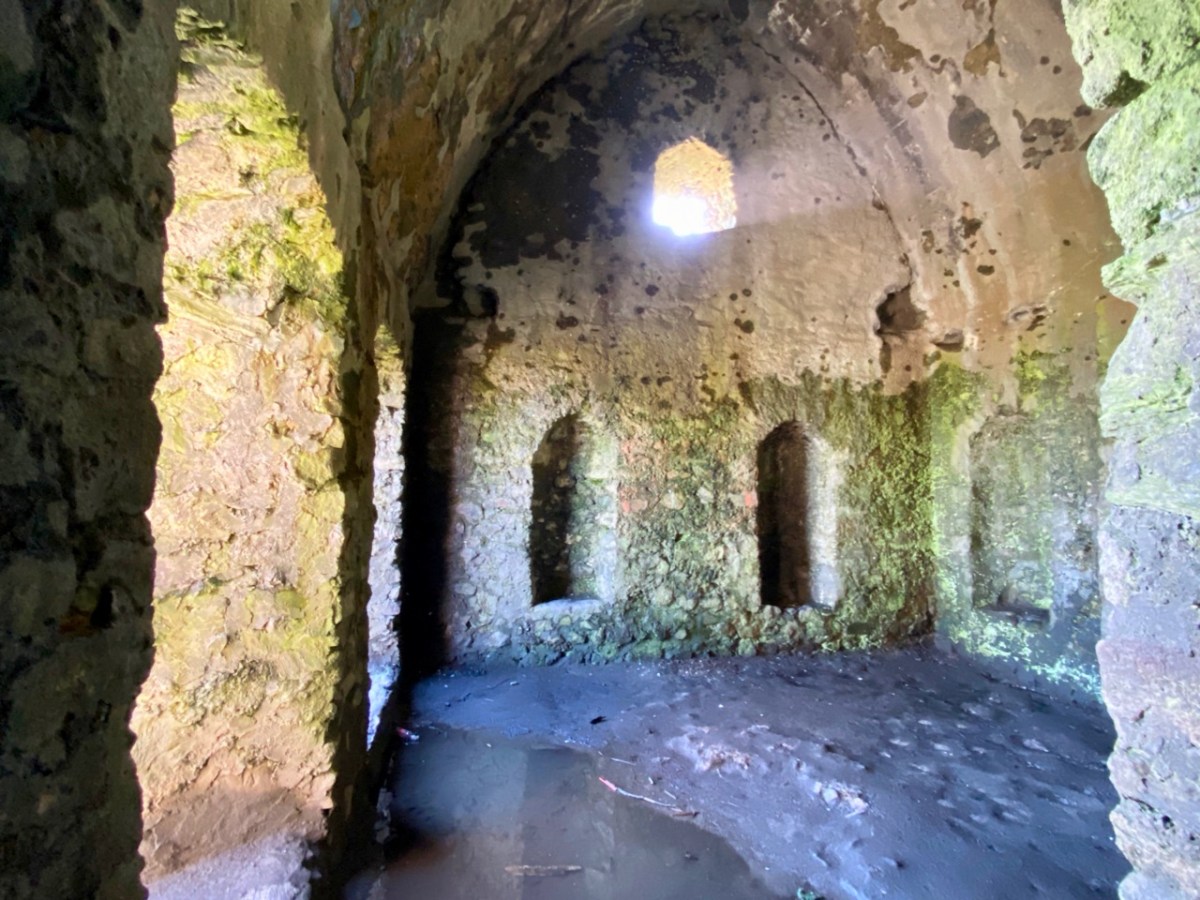
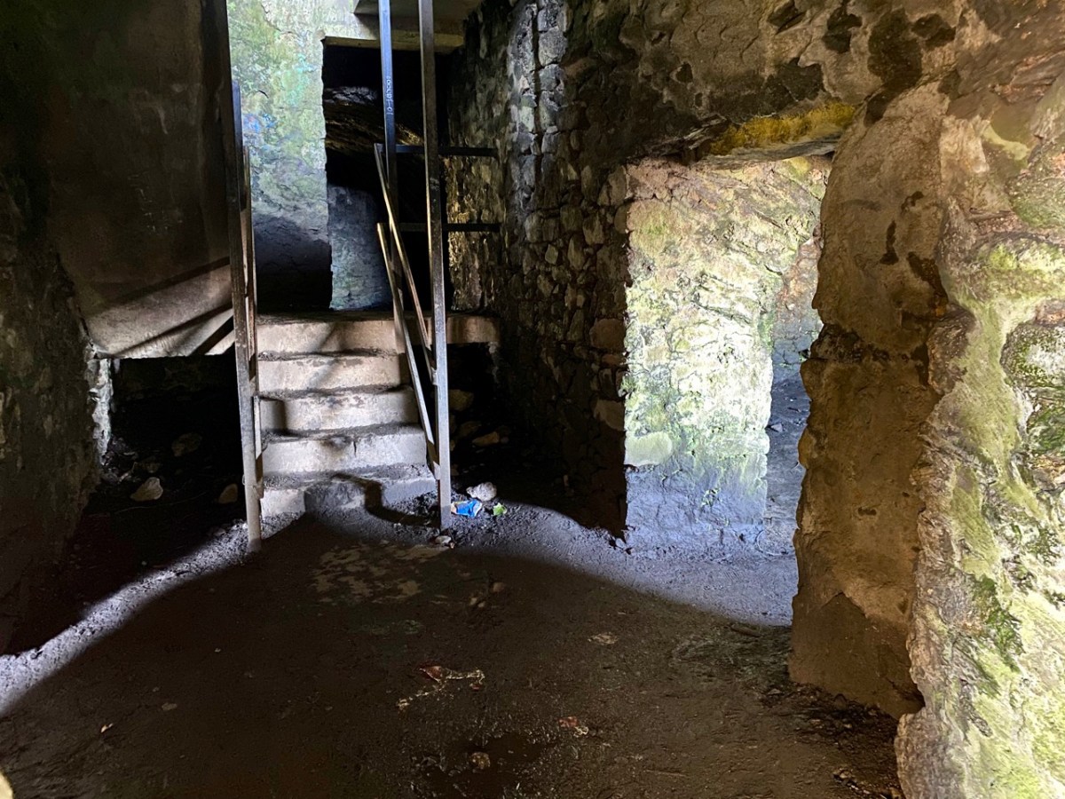
It could be said that the ruin of the lodge is ‘maintained’ in that it is stabilised and unlikely to fall down. If you are exploring, look out for the lintel over the large fireplace, which is supposed to be a standing stone removed from the passage grave site.
The Hell Fire Club is, of course, haunted! Not that we saw anything untoward when we visited on a glorious spring day. But the stories abound. They are probably best told through the accounts in the Schools Folklore Collection:
. . . About six miles from Dublin the Hell Fire Club is on a hill. It is a medium size old castle.When the owner of it died nobody else claimed it. All the men of the district came to play cards in it every night. One night when all the men were playing their nightly game one of the men cheated. The men rushed upon him over-powered him. The bound him hand and foot and put him in a barrel of whiskey. Then they set fire to it burning him alive. That was a cruel thing to do but then men did not care. From that day on that old castle was called the Hell Fire Club . . .
Stewart Somerville, Dundrum School
. . . There is an old ruin called Hell Fire Club on the very top of one of the Dublin Hills. This house was built by a man named Connelly, during the time of the Famine. It was built to give employment to the men. Many men used to got to Hell Fire Club to gamble. It is said that one night they were playing cards and there was much money on the table. One man dropped a card on the floor, and when he stooped down to pick it up he noticed a man with cows feet, and he wore a red cloak. The men were very frightened and they made a great uproar. The man turned into a ball of fire. All the men were burned in the fire. There was one man who had a bunch of medals attached to his coat and he was the only man who escaped from the burning house . . .
Mr Finlay, Rockbrook, Co Dublin
. . . The Hell Fire Club, or the Brass Castle is situated near Rathfarnham in the Co Dublin. My Great-grandfather used to pass by the Brass Castle on his way home from work, (he was a mason) he had a habit of hitting the wall with his trowel to hear the ring of the brass. One night a priest had to go on a sick call. When he was coming home through the mountains he lost his way. Seeing a light he went in that direction. He knocked at the door of the house, which happened to be the Brass Castle – The door was opened by a man who was dressed in black with a black mask on his face. The priest was brought in to a room. Sitting at a large table were twelve men dressed the same as the first one. The men were playing cards. On the table was seated a large black cat. The men defied the priest to put the cat away. The priest ordered the cat down, but it never moved. Again he ordered it down, but the cat did not move. The men laughed at the priest and jeered him. The third time the priest said “Begone Satan”. The cat jumped from the table and disappeared up the chimney with a loud roar. The priest told the men that the cat was the devil. The men were never heard of again. The priest got home safe, and from that time onward the Brass Castle was called the Hell Fire Club. This story is true. It was told to me by mother, because the Brass Castle belonged to her ancestors . . .
Seán Ó Nuamáin, Kilbride, Co Wicklow
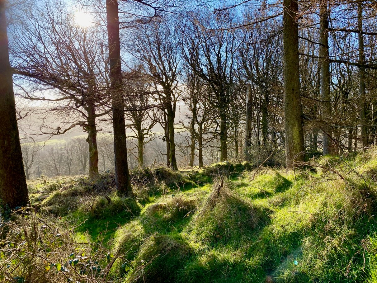
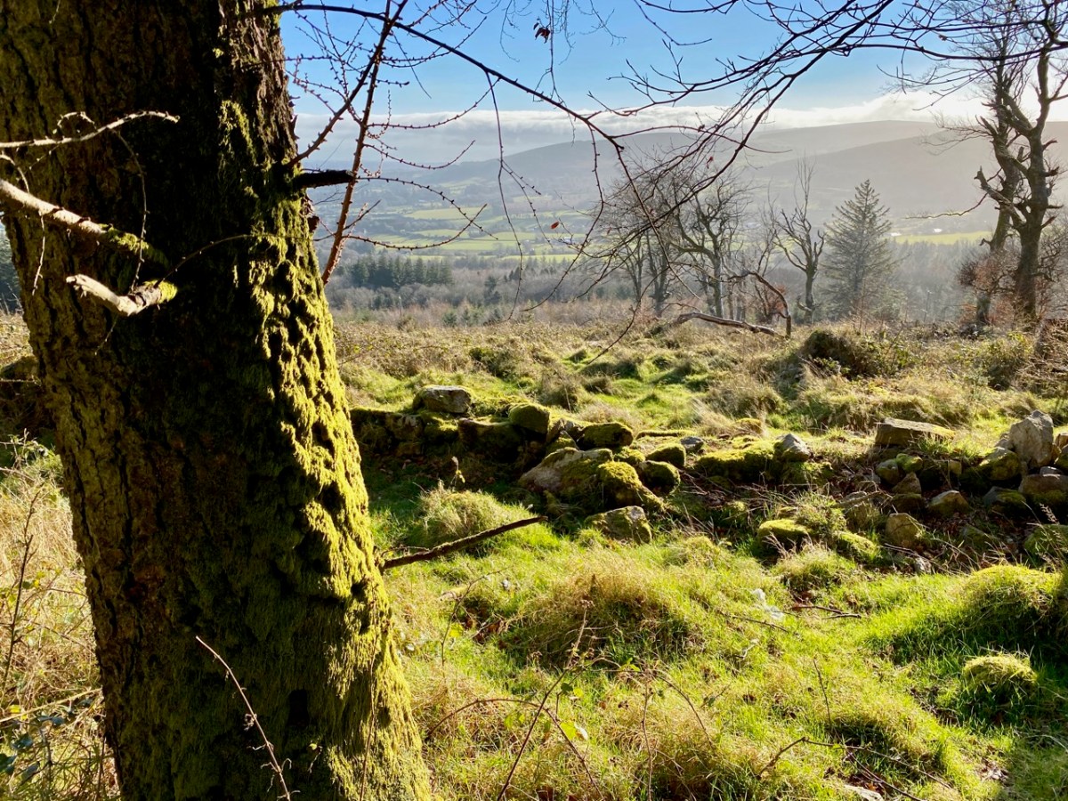
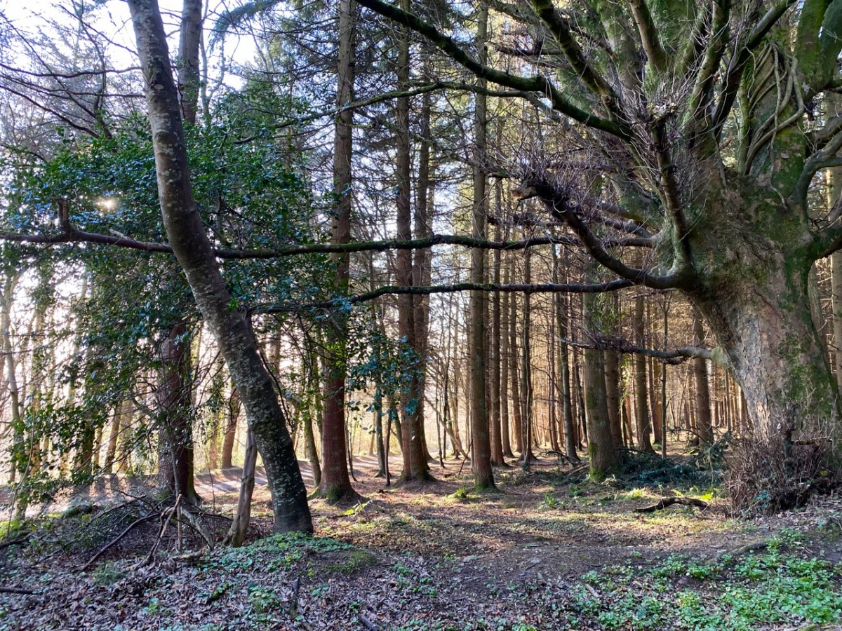
The Mountpelier Woods consist of around 5.5 kilometres of forest roads and tracks. The woods offer nature trails and a permanent orienteering course. Lord Massy’s Estate and Mountpelier Hill are also traversed by the Dublin Mountains Way hiking trail that runs between Shankill and Tallaght. It’s an attractive walk at all times of the year, with easy access from Dublin city centre.
A comprehensive application to An Bord Pleanála was submitted in July 2017, seeking permission to establish a Dublin Mountains Visitor Centre with associated works relating to tourism, leisure and recreational activities which would embrace the Hell Fire Club site and the mountain trails. Permission was granted, subject to conditions, on 25 June 2020. Another chapter in the story of this notorious locality unfolds . . .
As a tailpiece, I found this image of a ‘Hell Fire Club Goblet’ dating from c1745. It’s currently in the Philadelphia Museum of Art, but it must originate from Ireland: James Worsdale, whose name appears on this glass, was appointed Master of the Revels in the Dublin Hell Fire Club in 1741. It was also he who painted the portrait of Club members illustrated in this post: look at their goblets in the painting!
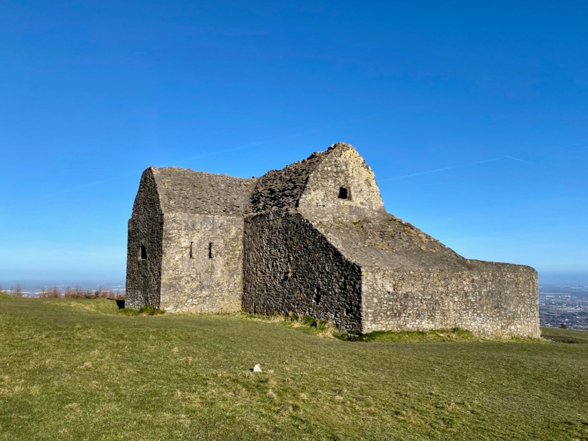
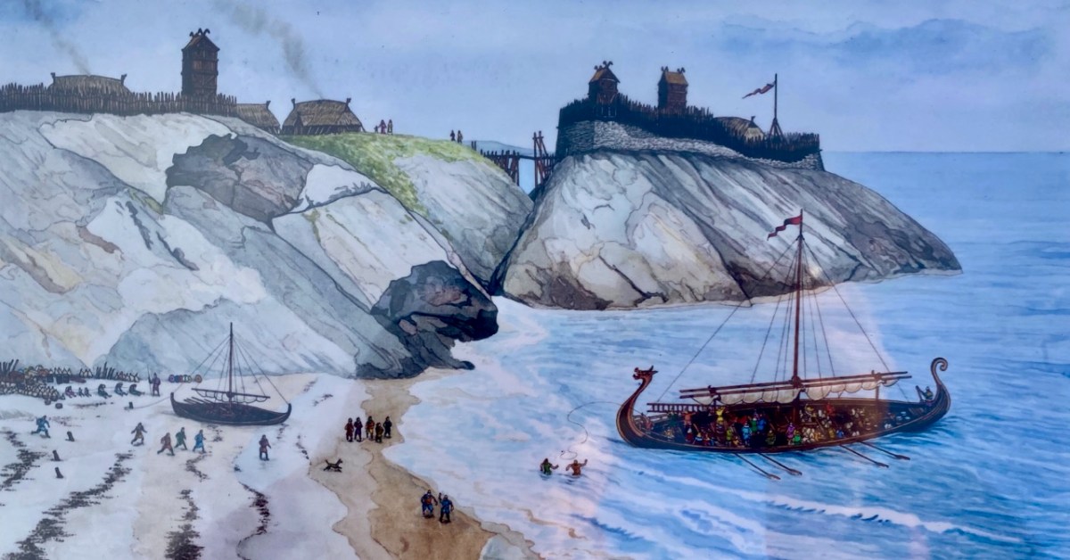
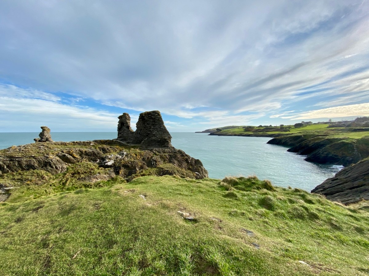
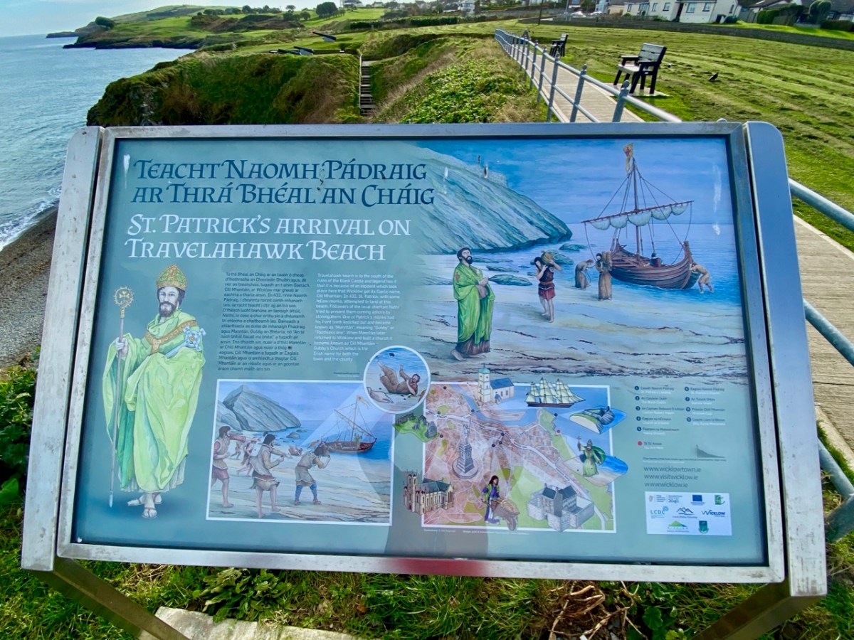
If you can’t be in West Cork – what’s the next best place? Why – County Wicklow of course! It’s also full of wonderful scenery and imbued with Irish history. That’s Wicklow Town, above, in Viking times: there had already been a Bronze Age settlement on this site. In the twelfth century the Normans arrived, led by Strongbow, who we have encountered before, and Black Castle was built (below). They were wild times, and the castle was attacked and destroyed completely in 1301 by local chieftains, notably O’Byrnes and O’Tooles. There were several subsequent revivals, and the gaunt remains we see today probably date from the 17th century.
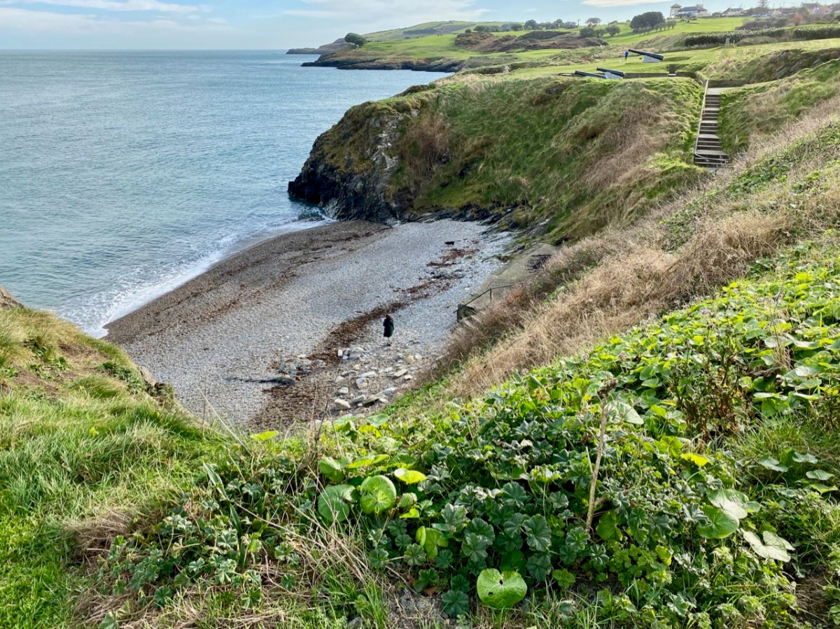
While at this site, have a look down at the inlet on the coast to the south: that’s Travelahawk Beach, the scene of a bit of Wicklow history that’s sure to stick in the mind. It was there that St Patrick first landed in Ireland!
I have to admit that the beach is only one of several sites on the east coast that lays claim to this historic occasion, but I like the associated story of Travelahawk which tells how the local people, suspicious of this stranger, threw rocks at St Patrick and his crew. One of them hit the saint’s companion, and he lost his front teeth. He was known ever after as ‘Gubby’ or ‘Gap-toothed’ which is translated in Irish Mhantáin. Hence the old name for Wicklow is ‘Chill Mhantáin’ – the Church of Gubby. Today’s name for the town, Wicklow, is of Viking origin, and means ‘Bay of the Meadows’.
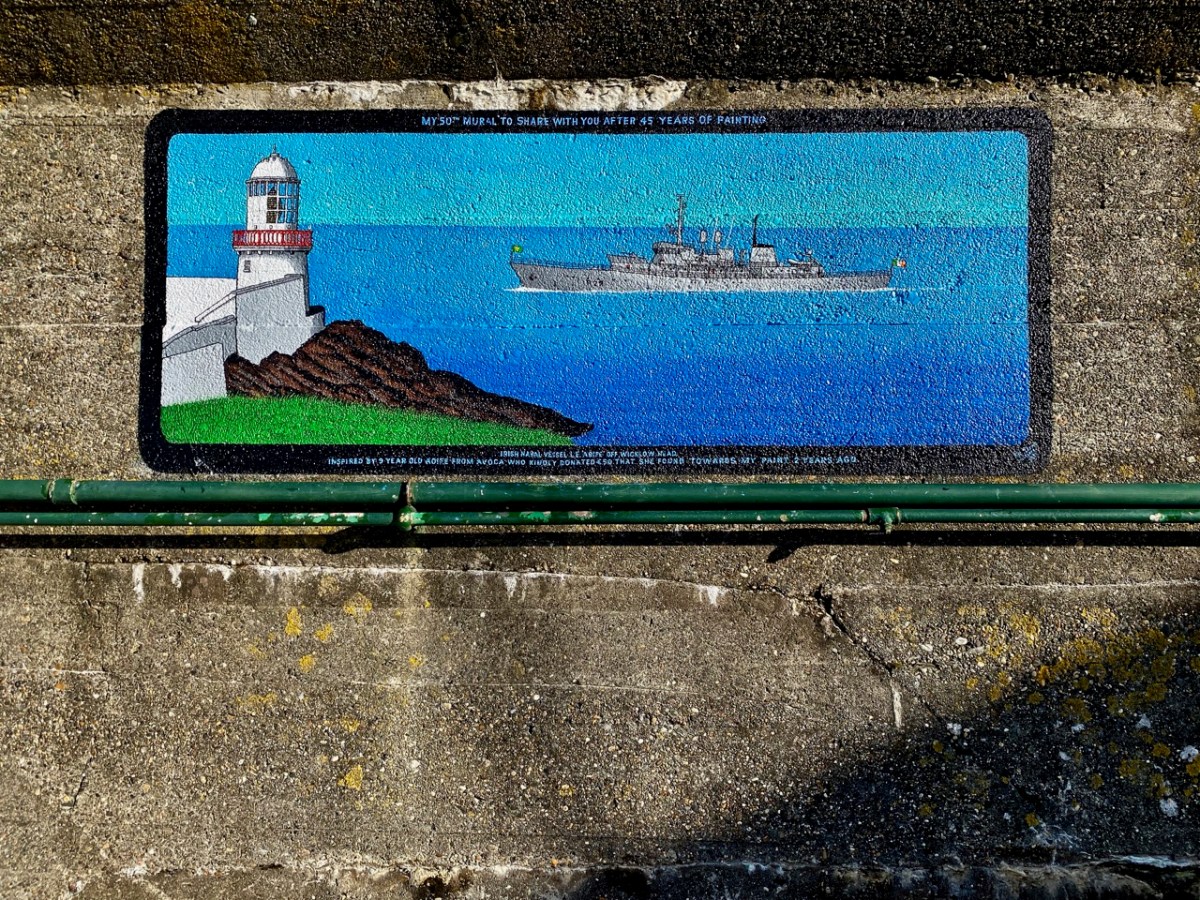
We popped over to Wicklow on a mild February day for a change of scene – and to absent ourselves from Nead an Iolair while some upgrading works were taking place. I was impressed: I had never explored the town before. Finola, however, was brought up in County Wicklow, and her impressions of the county town today were embellished with memories of times past. There’s much about the place that’s picturesque: I was taken with the number of painted murals about the place. The pier has, appropriately, a whole series of ships on the breakwater wall. There is an example, above . . .
. . . And here’s another. In fact, this one is the 50th mural to be painted by Pat Davis, who is the local postman. Each one depicts a vessel which has visited the harbour. It’s a wonderful and colourful record of one aspect of the maritime town’s history.
Here’s Pat at work. The image is courtesy of Ceaneacht O Hoctun, and appeared in the Wicklow People newspaper in 2020. Pat started painting the ships in the 1970s.
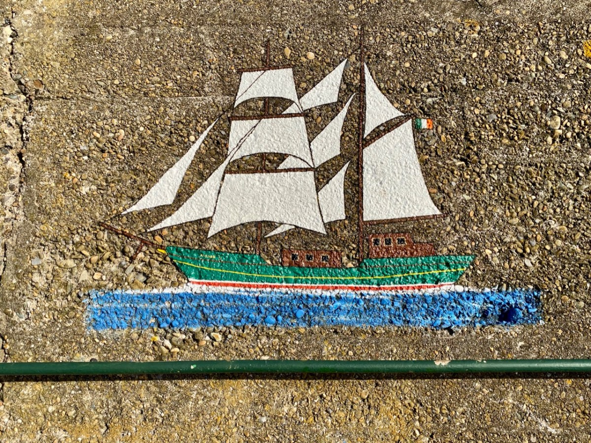
This one will be familiar to West Cork folk. It’s the Saoirse, a 42ft ketch built in Baltimore in 1922 for her designer, Conor O’Brien.
. . . This unique sailing ship was also a maritime inspiration for the new Ireland, uncertain of itself in an uncertain world. For this was Conor O’Brien’s characterful 42ft ketch Saoirse, which he designed himself, and with which – between 1923 and 1925 – he pioneered the round the world route south of the Great Capes, an ocean voyaging “first” which was forever written into world sailing history. . .
The Asgard, above, was famous for gun-running at Howth by Irish Volunteers in 1914. Below is an Irish Navy vessel, LÉ Gráinne – a mine sweeper. Gráinne was a legendary princess who was promised to Fionn Mac Cumhail but ran away with his young follower Diarmuid. The ship was decommissioned in 1987.
We found that the town of Wicklow has so many maritime associations – everywhere you look there are reminders. But also it’s a thriving commercial centre and we were impressed by what is on offer there: great eateries, and a most wonderful bookshop. I think there might be another post in the making . . .
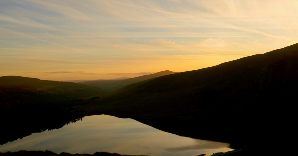
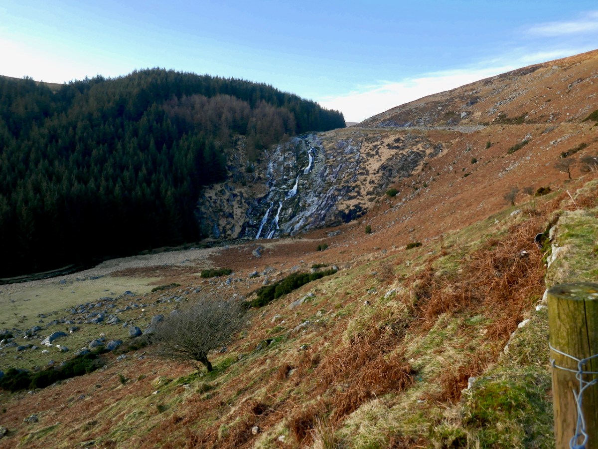
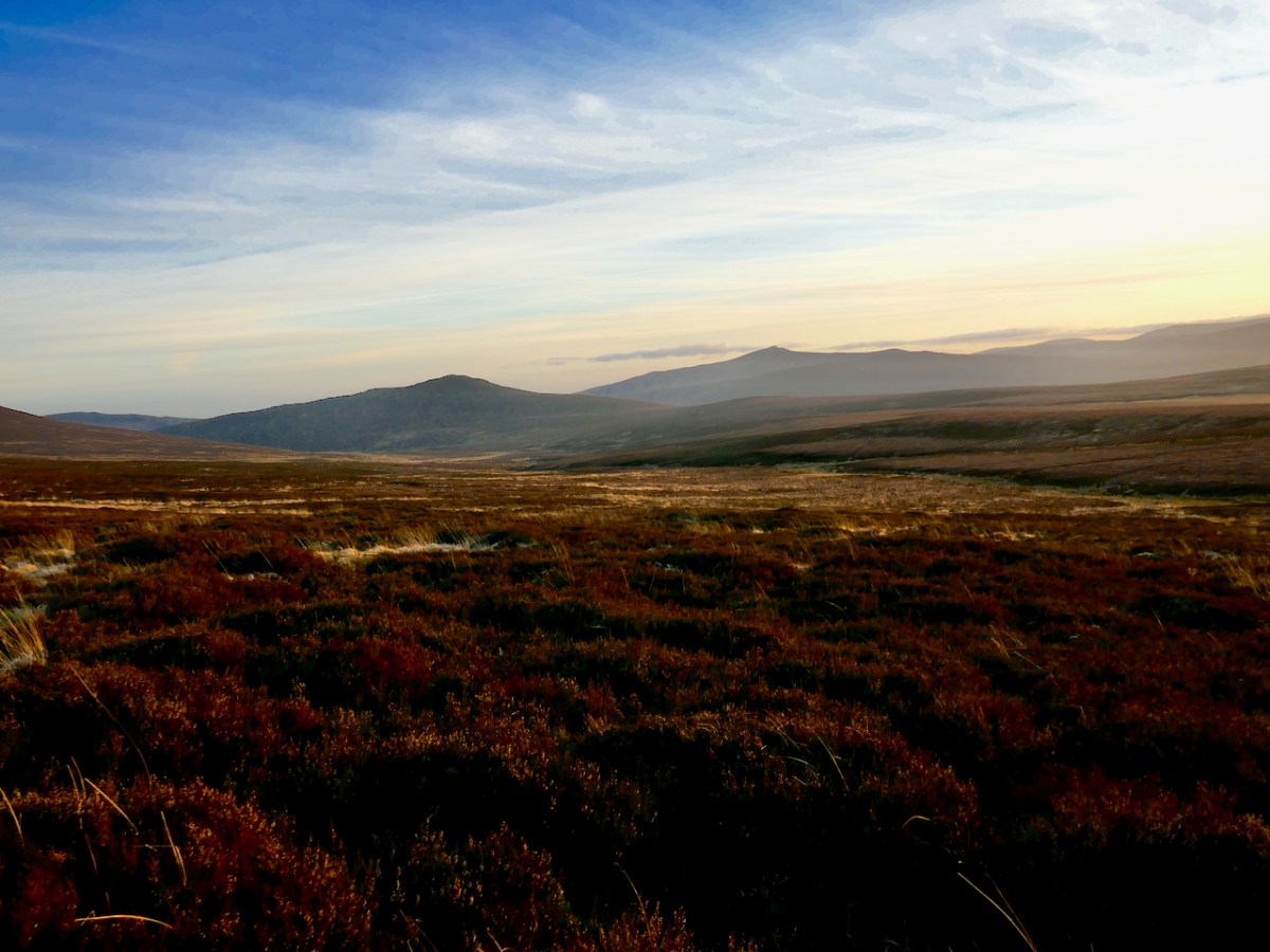
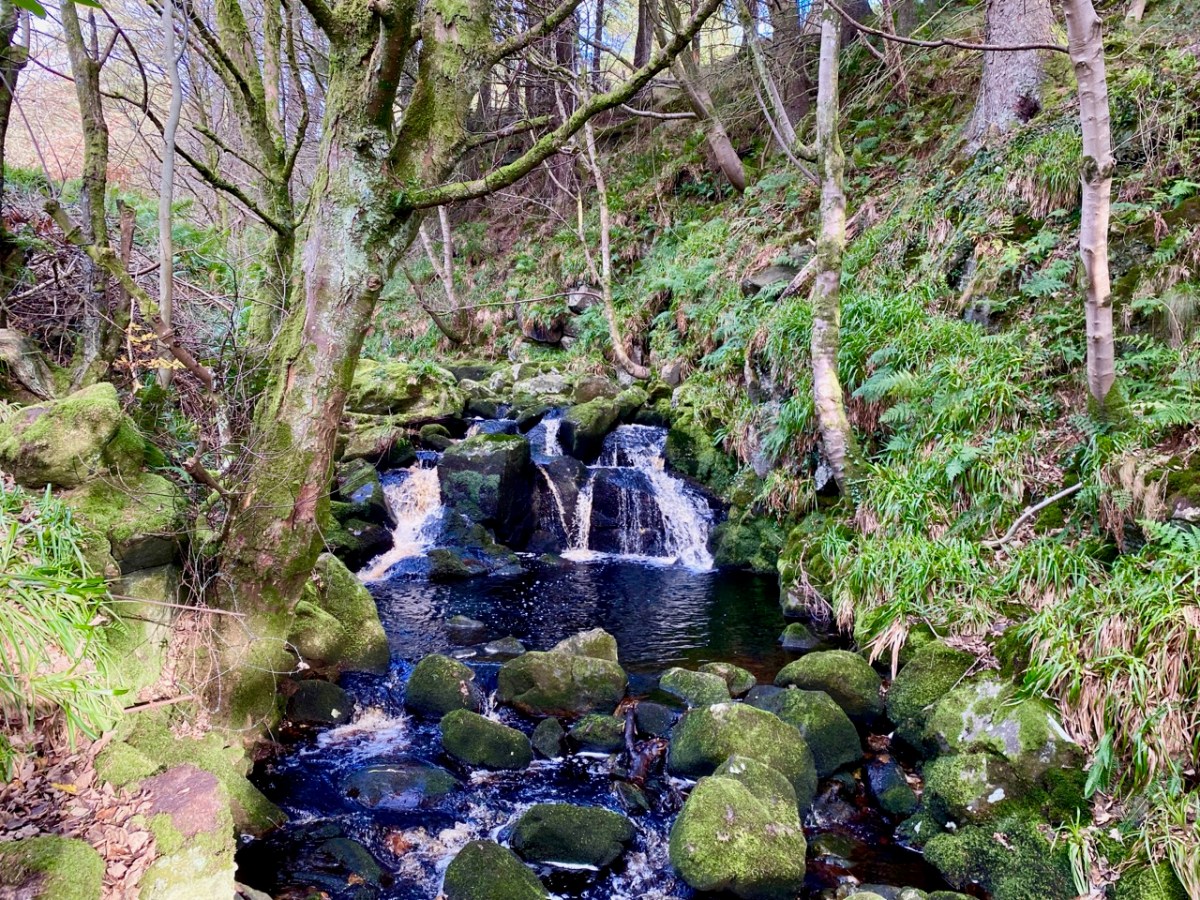
On our most recent trip to the east of this beautiful country – County Wicklow – we experienced the first snows of winter lining the edges of the remote roads that penetrate the mountains here. It’s a magnificent although often bleak wilderness: immersed in such vast, empty tracts of moorland you feel as far away from the civilised world as you can get without leaving these shores, yet Dublin city itself is just a stone’s throw distant – another of Ireland’s remarkable idiosyncrasies.
The 1790s was an era of conflict and change across the western world. News of independence in America and revolution in France inspired Catholic and Presbyterian communities in Ireland. In 1791, the Society of United Irishmen was founded, with the hope of uniting all religious persuasions in pursuit of Irish independence. In the late 18th century, the wild, inaccessible Wicklow mountains provided ideal shelter for insurgent groups who set out to disrupt British and loyalist forces. The deep valleys and fast strongholds of the natural terrain hid rebels from reprisals long after the United Irish forces had succumbed in other areas of the country. This group of ‘outlaws’ was so troublesome that the authorities resolved to forge a road across the impenetrable landscape:
. . . Construction of the road began in 1800 through parts of the county “infested with insurgent plunderers”. The road commenced from Rathfarnham in Dublin to Killakee and continued over the Featherbed Mountain to Glencree, where a major camp was formed. There were four work parties of fifty men each. Soldiers were paid a shilling a day and overseers earned five shillings daily; but very few local civilians could be induced to accept work and no “dependence” was placed on those that did . . .
The Sally Gap and Wicklow Gap roads built by the British are still the main roads through the Wicklow Mountains today. The network of military barracks that they link are still to be seen at Glencree, Laragh, Glenmalure, and Aughavannagh. Intended to stop local unrest, ‘Wicklow Military Road’ is today a scenic reminder of the dramatic events of that time.
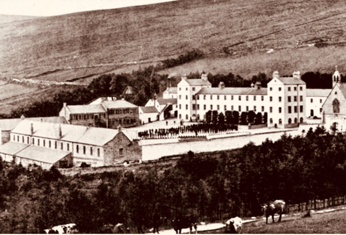
Built originally as a British Army barracks, the settlement at Glencree has gone through several mutations. This photo from the nineteenth century (above – courtesy Glencree.ie) shows St Kevin’s Reformatory, established on the site of the then abandoned barracks in 1858 and running through to 1940. One suspects it was a grim place: there are few records existing. It housed up to 300 boys.
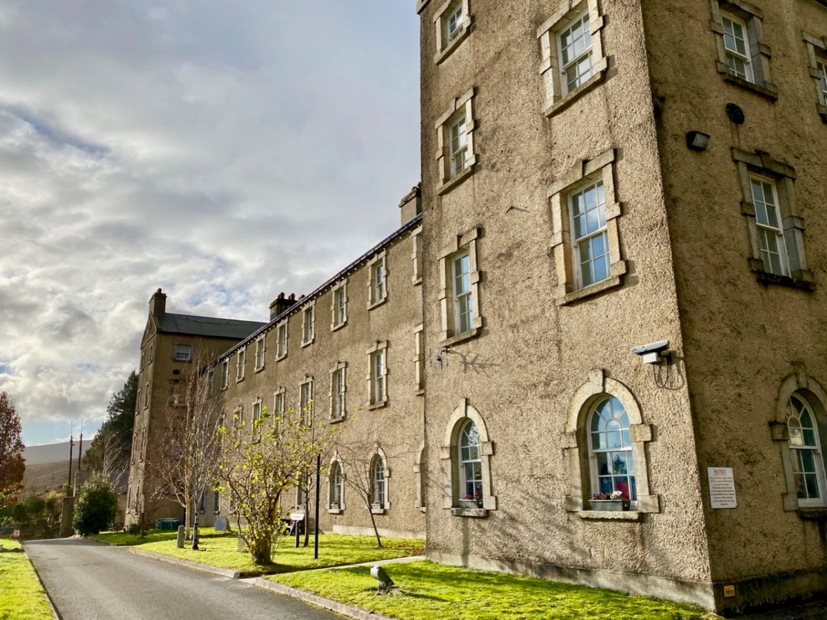
Many of the buildings survive today, when Glencree has become the home of The Centre for Peace and Reconciliation. Founded in 1974 in response to the conflict in Northern Ireland, Glencree played an important role in the Irish Peace Process, bringing together those in conflict for confidential dialogue and helping to build relationships across divides. This Irish-based, independent, non-governmental organisation has evolved its expertise on a global basis, and this has been shared in more than ten conflict and post-conflict countries around the world.
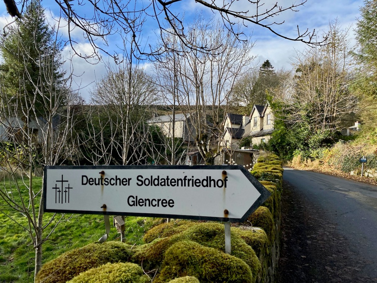
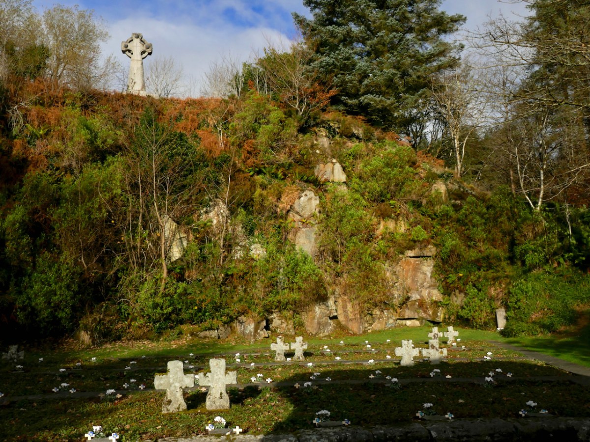
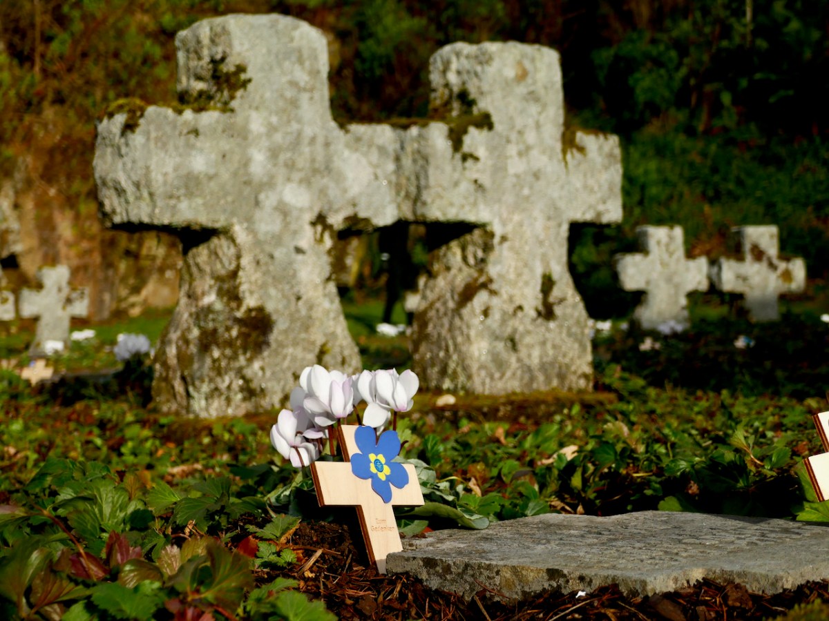
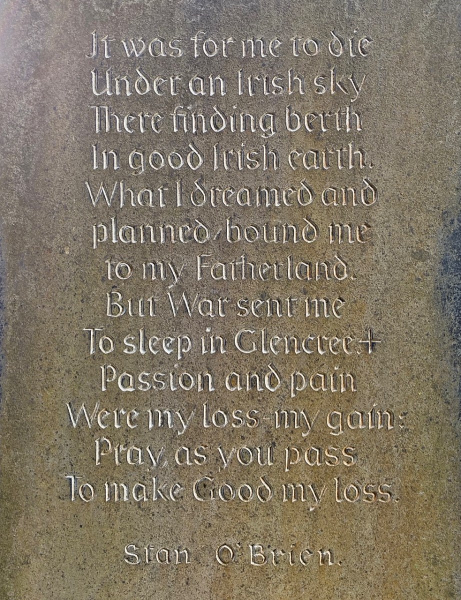
There is so much to discover in Glencree. You may be surprised – as we were when we first visited – to come across a German cemetery. Set in a landscaped former quarry, the German Military Cemetery is one of the many German war cemeteries in Western Europe. The bodies of 134 German military servicemen and civilians are buried here, dating from both World Wars. It is a secluded, peaceful garden of memory, marked by art and poetry, and kept in immaculate order.
You could ponder at length on this little graveyard: there are many historical connections. After the nearby Reformatory School closed, the buildings were used for a time as a refugee centre for German children following the bombing of Dresden in 1945. In 1954 the German Legation sent a letter urging the Irish authorities to give consideration to a single cemetery for German war dead in Ireland. These would include German soldiers and sailors washed up on Irish beaches, wrecked or crash-landed after being shot down during the Second World War. Six graves at Glencree remember German soldiers who died in British prisoner-of-war camps in Ireland during the First World War. All the bodies were re-interred here after this cemetery opened in 1961. In pre-Covid times, there would be a series of commemorative events in Glencree every November to pay respect to all victims of all wars.
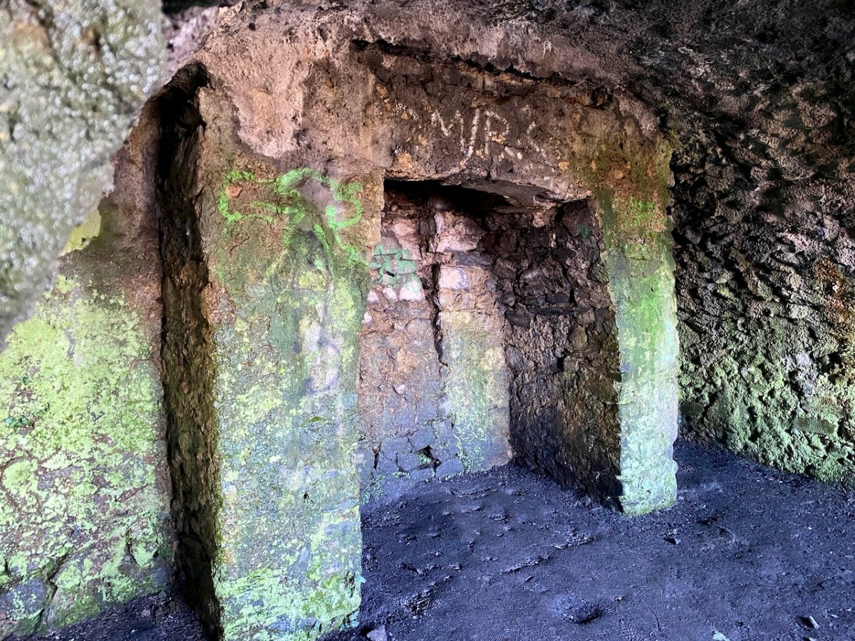
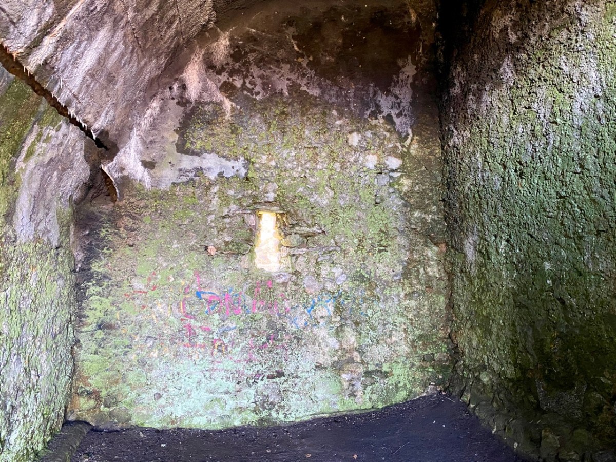
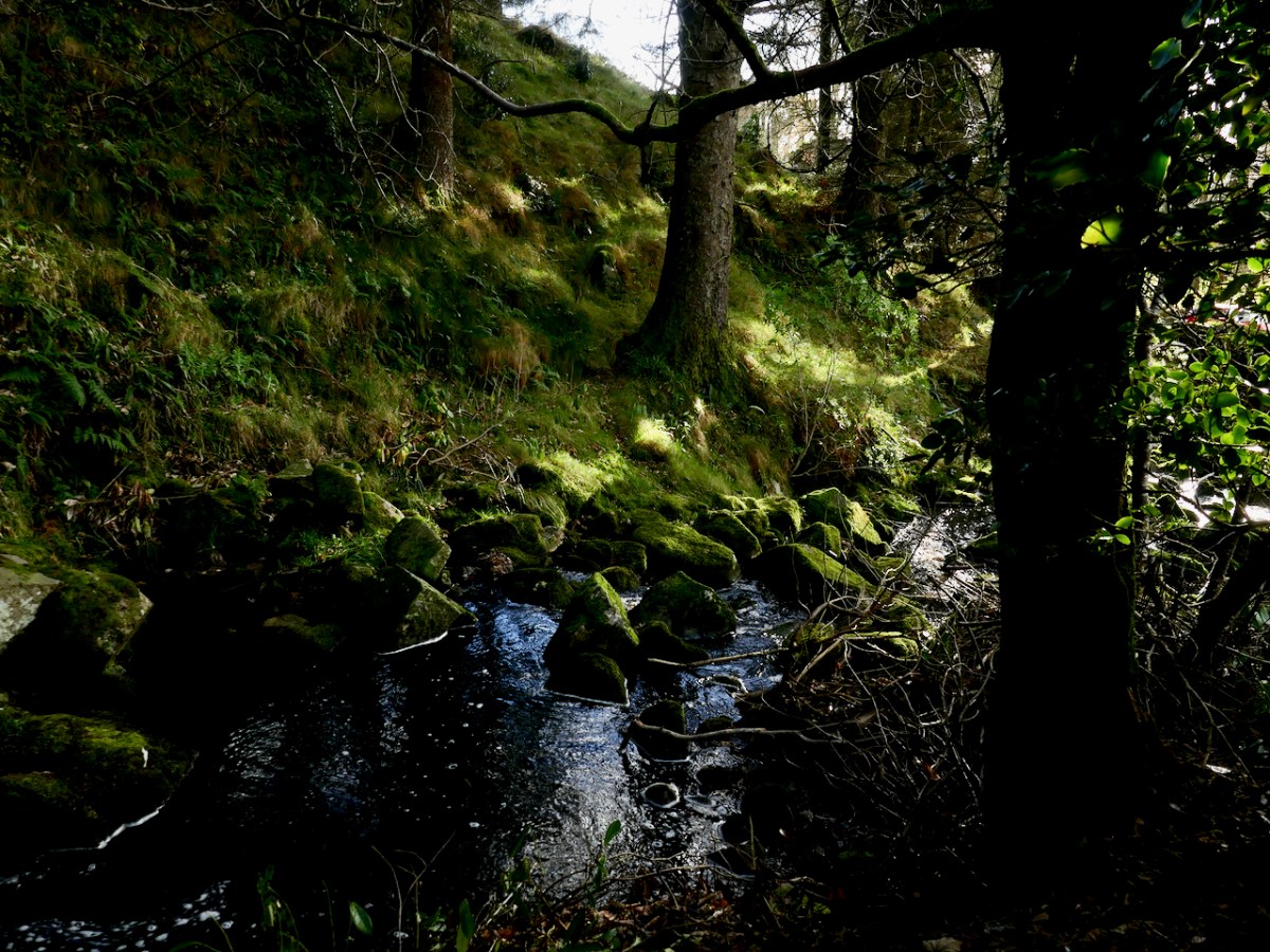
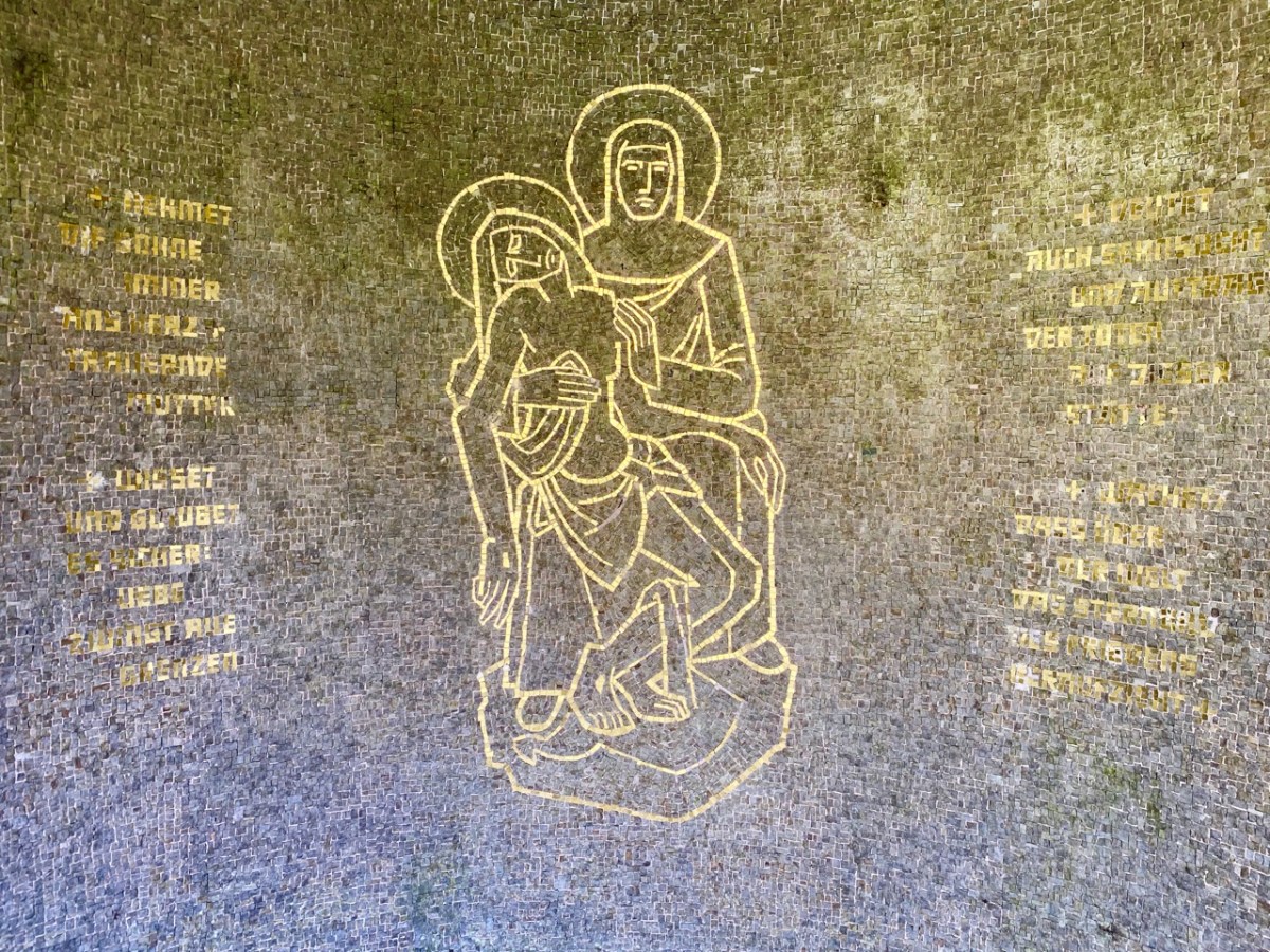
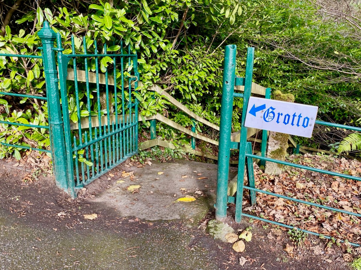
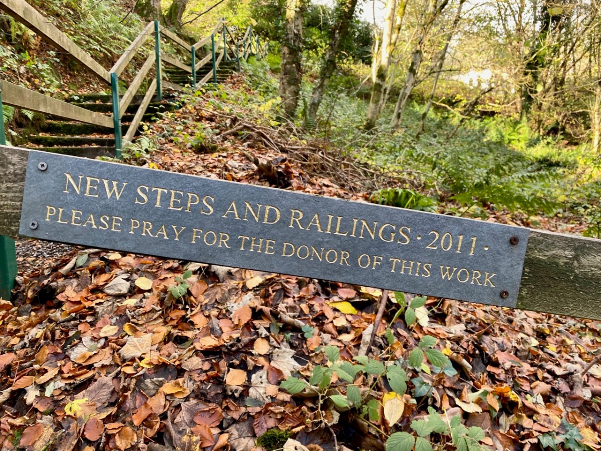
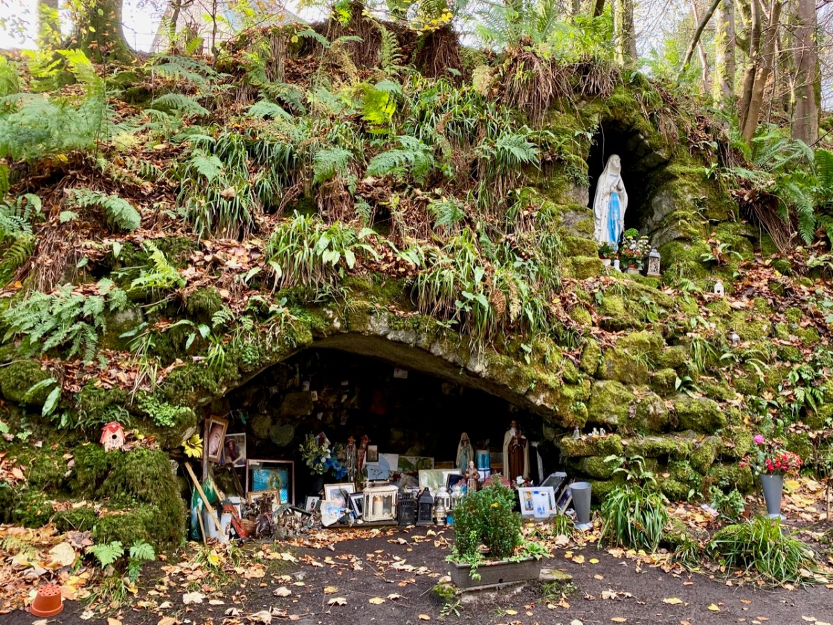
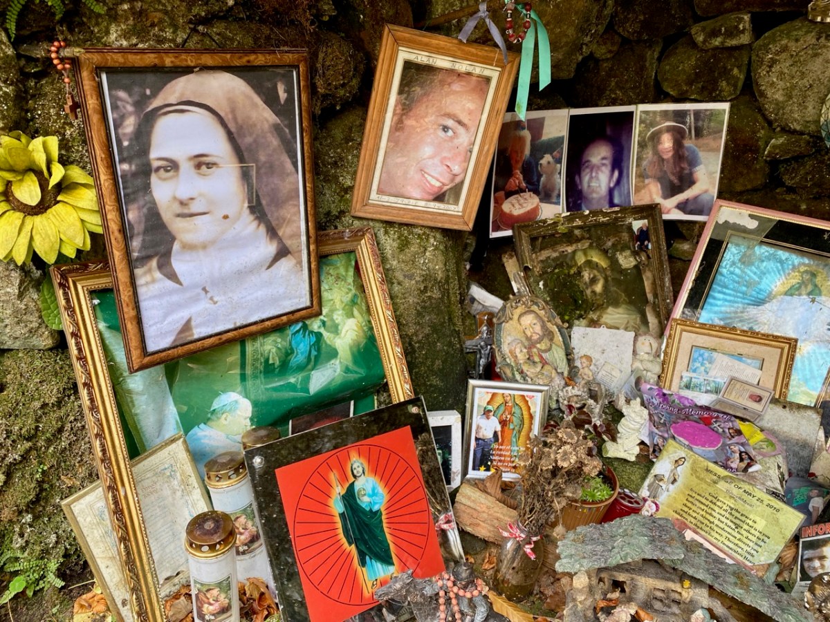
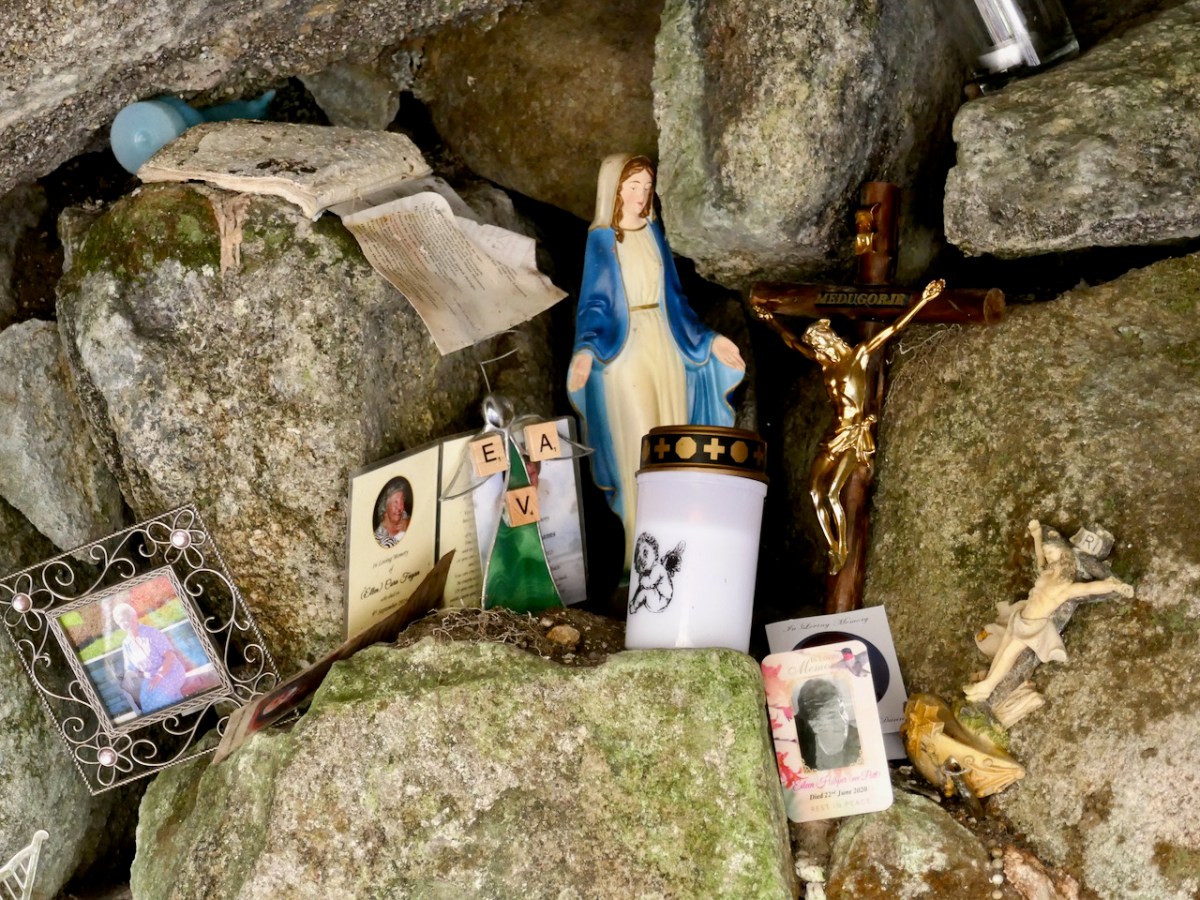
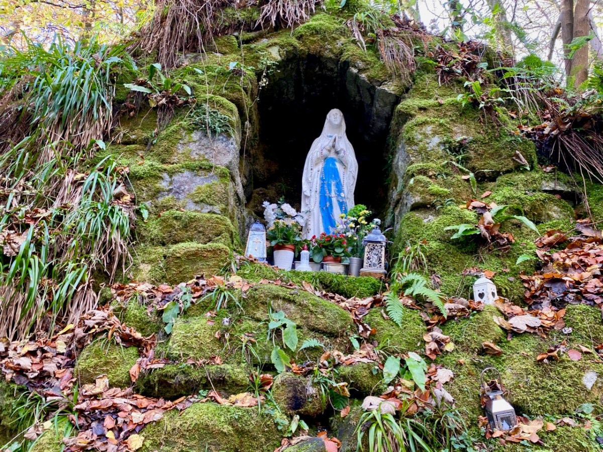
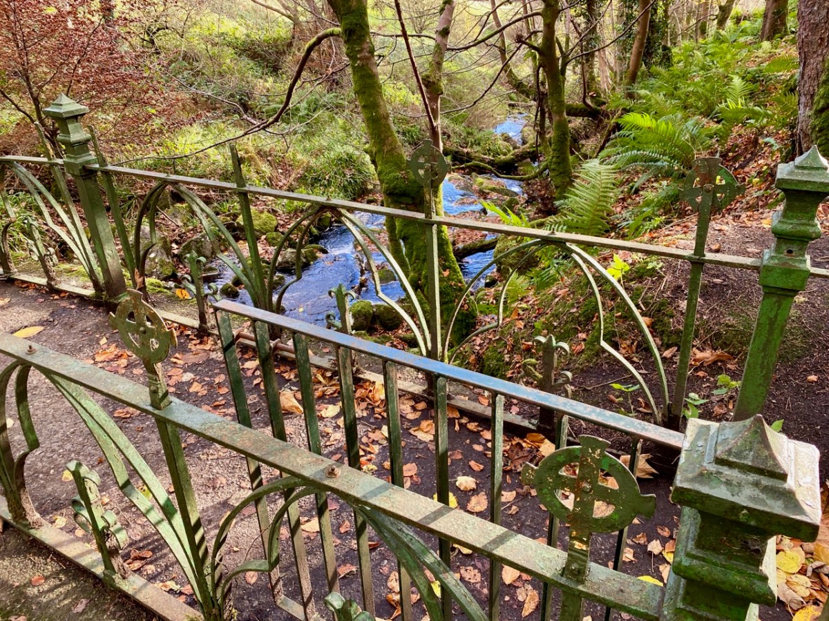
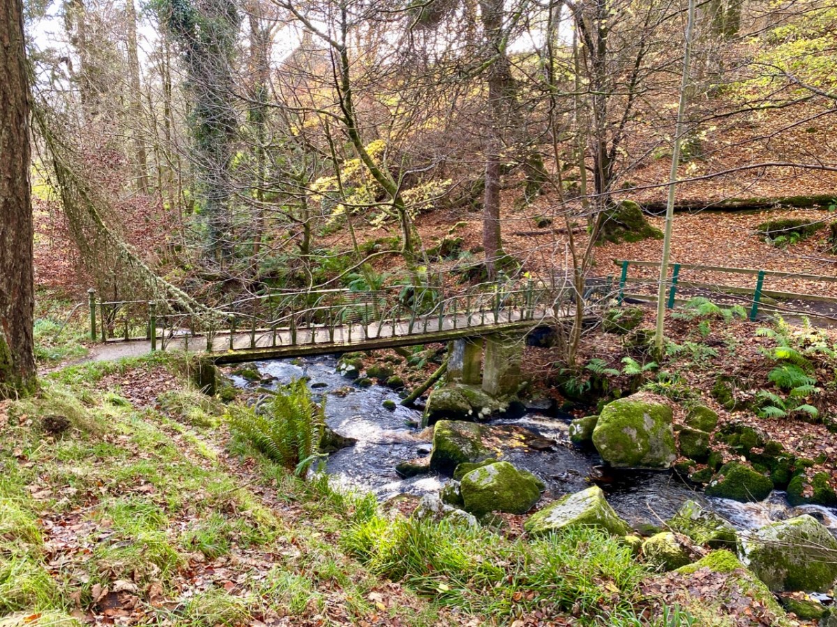
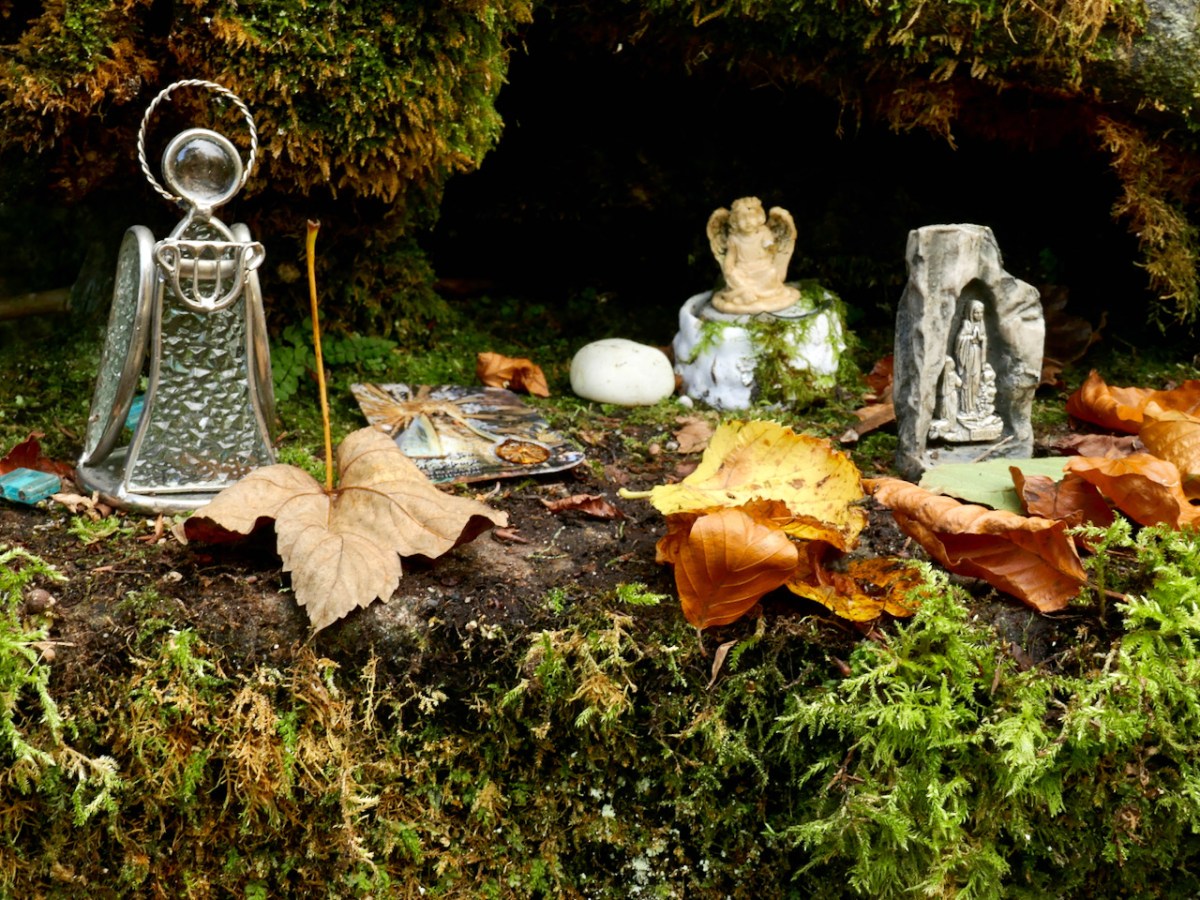
There is added interest, for us, at Glencree: a grotto established (as far as I can ascertain) in the Marian Year of 1954, dedicated to Our Lady of Reconciliation. It is reached from a path and steps which descend into the stream valley below the church.
The ‘cave’ is much visited, and – as in many other locations in Ireland, particularly holy wells – petitions for the good health of individuals, and personal relics are in evidence.
Glencree is a place apart. You might, as did we, come across it by accident and get drawn into its many strands. You should certainly visit this secluded haven of tranquility in Wicklow, and consider the implications of its transition from a base of an occupying military force in a wilderness haunted by outlaws to a modern-day centre of reconciliation.
Welcome to the UCD Library Cultural Heritage Collections blog. Discover and explore the historical treasures housed within our Archives, Special Collections, National Folklore Collection and Digital Library