I wish all our readers and and followers the very best of the season. This has been a difficult year and as it draws to a close I feel gratitude for having been able to travel this road with Robert for the last twelve years, and gratitude that I am able to continue the Journal on my own, with his spirit always with me.
Above all, I am grateful for the many messages of sympathy and encouragement from all of you lovely readers. Thank you – onward and upward!
It’s become a bit of a tradition with us here at Roaringwater Journal to do a post like this in the lead up to Christmas. See this post, and this one, or maybe this one. All busy stained glass studios were requested to supply Nativity windows – a favourite of Catholic Churches throughout Ireland. Harry himself made several Nativities, but this post deals with windows made in his style, but not by him. All of them were made in his father’s business, Joshua Clarke and Sons, or in The Harry Clarke Studios, as it was renamed in 1930. Sometimes windows are just signed Clarke, or Clarke and Sons. If you’re looking at these images and saying to yourself, Surely these are Harry Clarkes! I recommend reading some of my previous posts for the difference between a Harry Clarke and a Harry Clarke Studio window. Perhaps begin with The House Style: William Dowling and the Harry Clarke Studios.
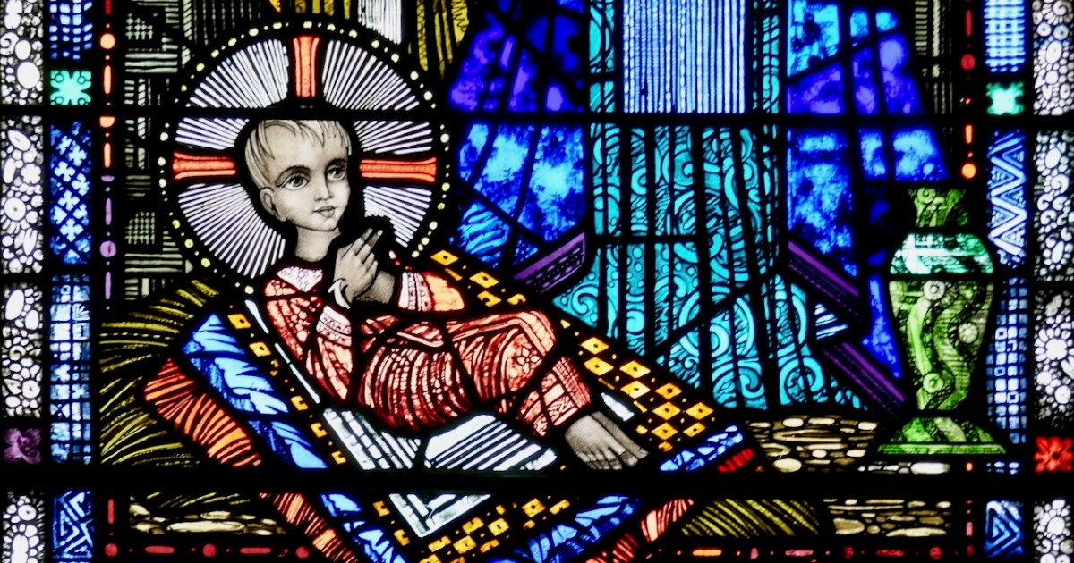
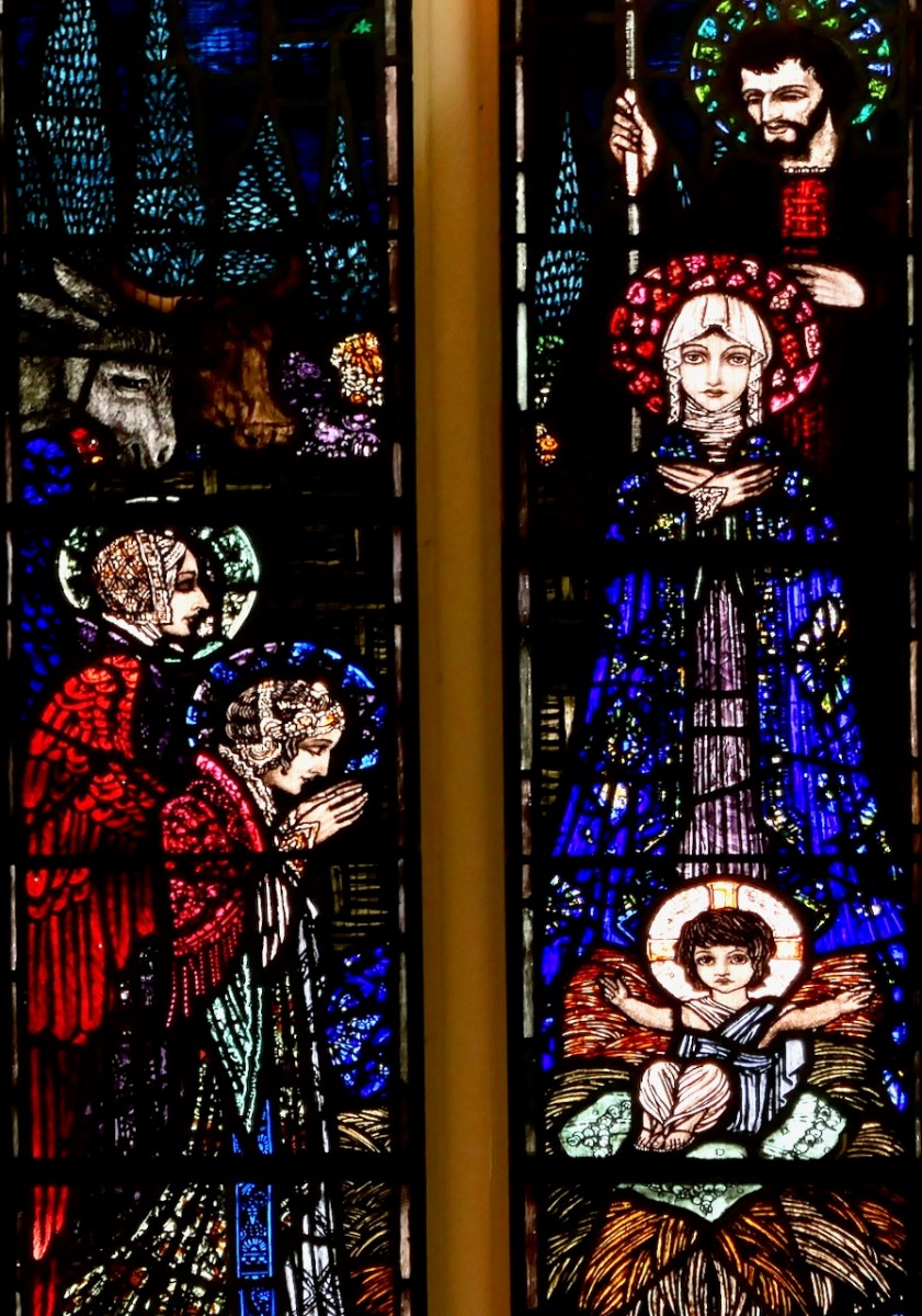
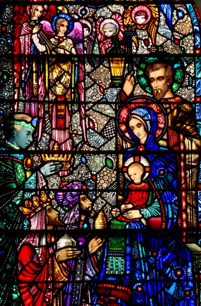
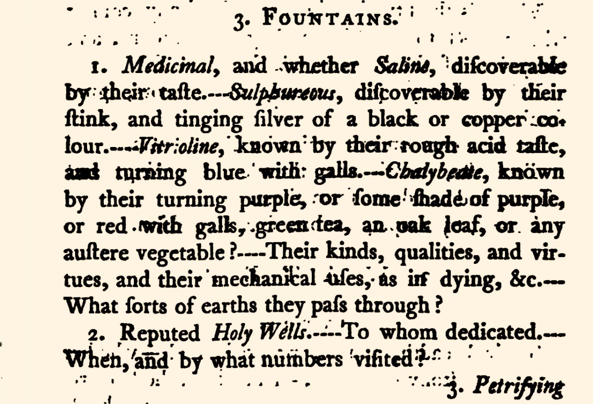
These first two images are from a remote church in Wicklow, in the townland of Killamoat, near Rathdangan. They were done in the Harry Clarke Studios, after Harry died in 1931, and are attributed to George Stephen Walsh, who had started as an apprentice with Harry several years before he died. I particularly love all the details surrounding the Baby Jesus – the blankets upon which he lies and that strange green urn.
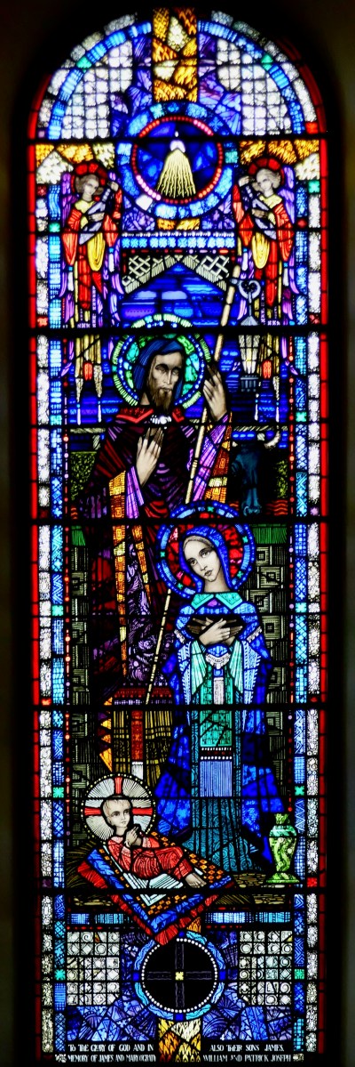
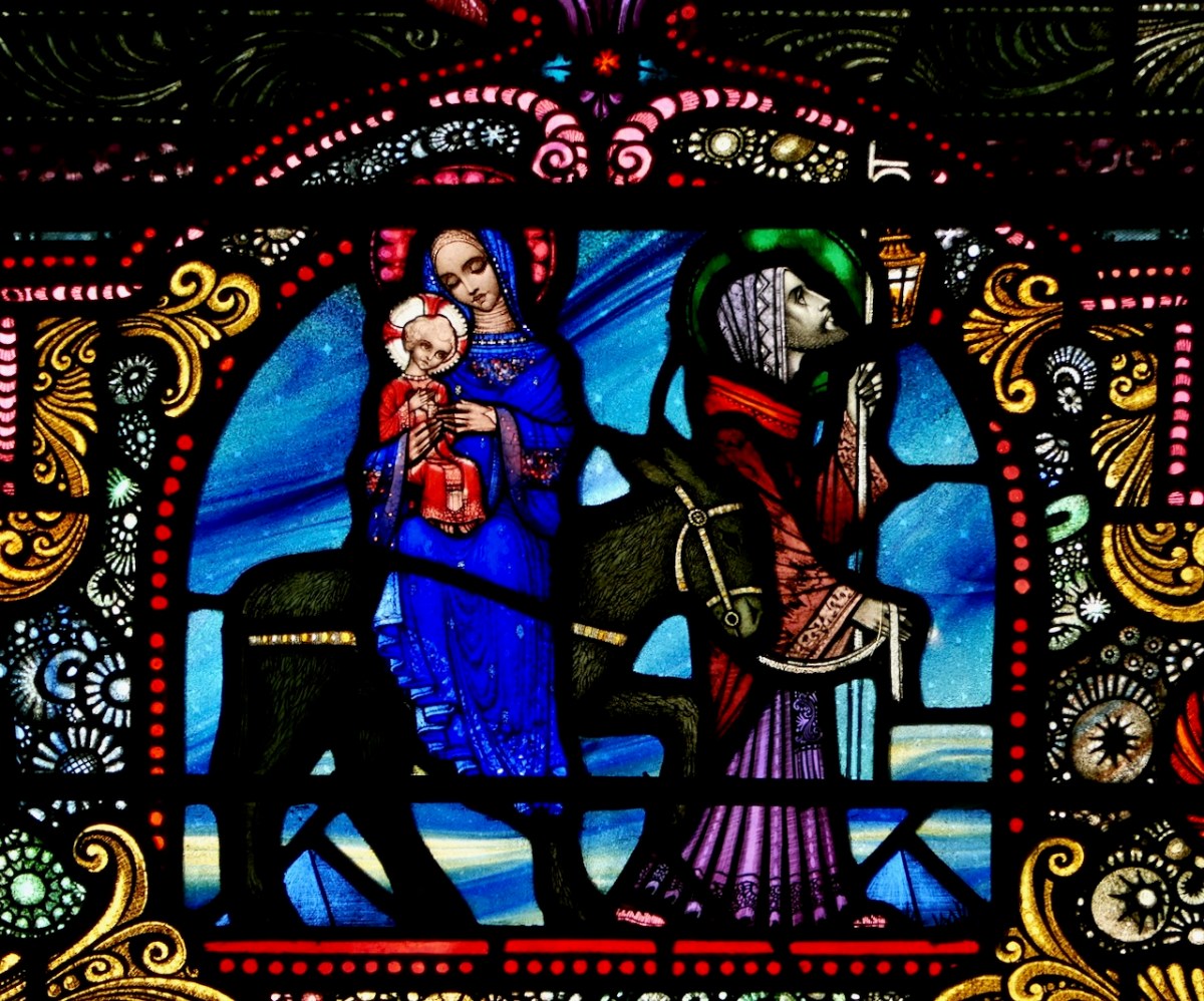
This is from a series of small windows in Leixlip – I made a slide show of those windows, which you can watch here, in a post titledClarke-Style Windows. They were made in 1925, in the Joshua Clarke Studios, in which Harry served his own apprenticeship and which retained its name until it became the Harry Clarke Studios in 1930, shortly before Harry died. In 1925 Harry was an established artist and had taken on several apprentices to help out in the busy studio – one of them made these windows and we don’t know which, although it could have been Philip Deegan. Deegan had taken Harry’s courses at the Dublin Metropolitan School of Art, and was accomplished at reproducing his style.
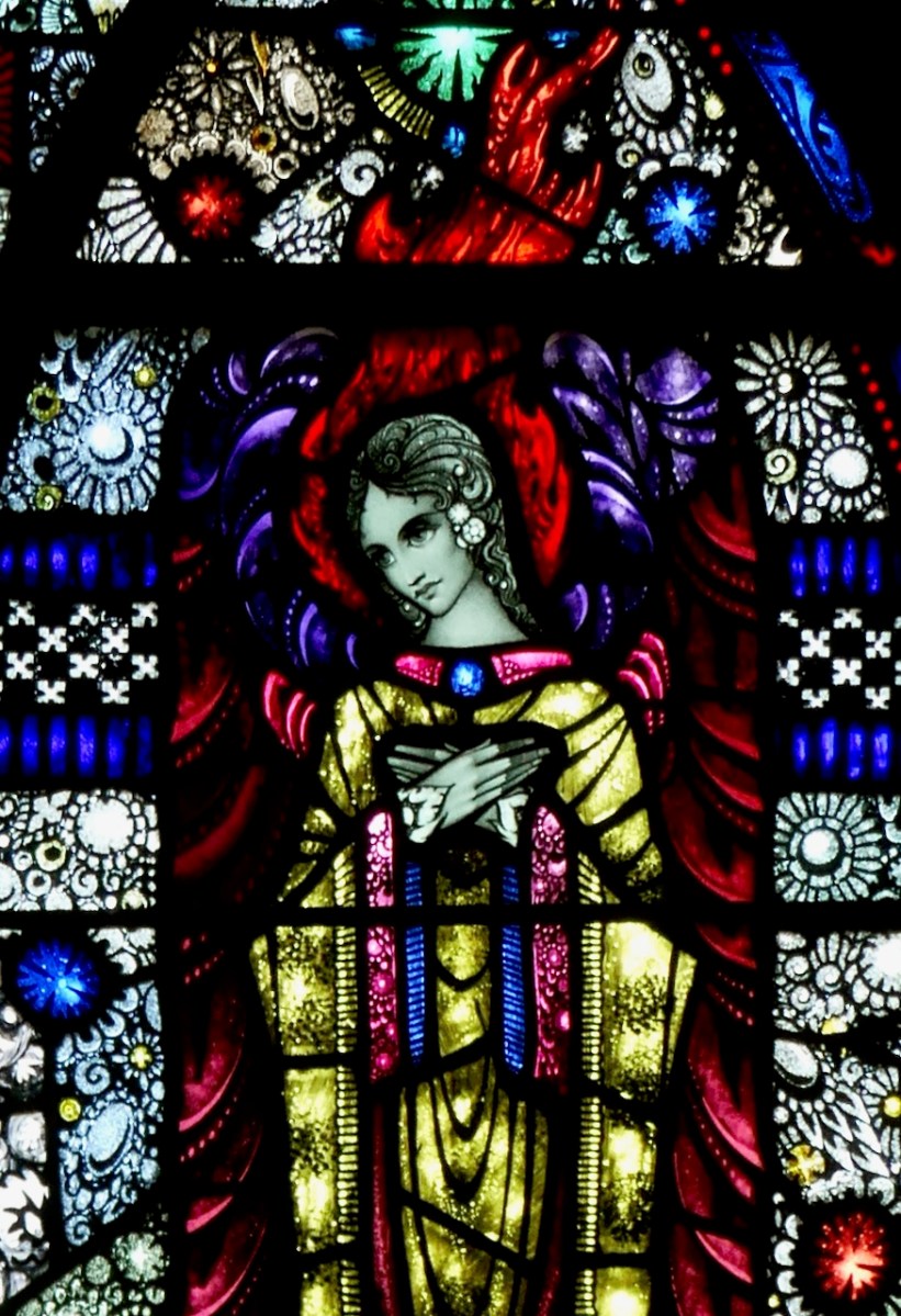
William Dowling* was one of Harry’s most accomplished artists and the one who stayed on in the studio the longest, up to the 1970s. In the years after Harry died he and Richard King produced beautiful windows in the Clarke tradition, using very good glass and carrying on the ‘house style’ of dense, jewel-like surfaces, packed with ornamental detail. Above is one of his windows from Knockainey, Co Limerick, dating from 1940 .
This is the angel from that window – I was struck by the fiery aureole that burns behind his head, instead of the usual halo.
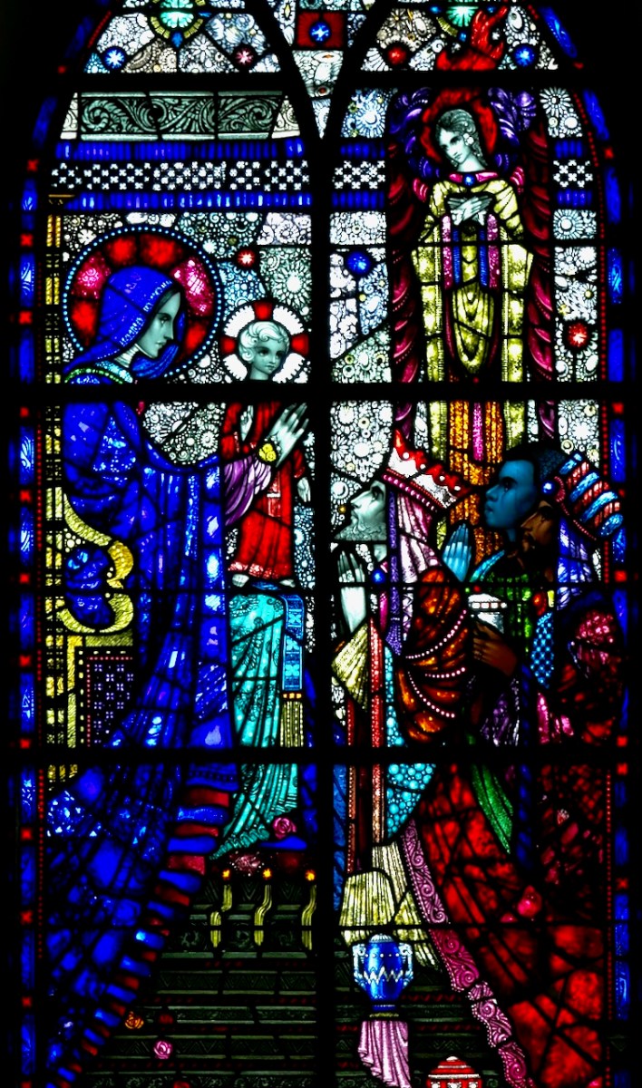
This one is also by Dowling, but from somewhat later, in 1948, and it’s in the Catholic Church in Bandon. You can see how Dowling’s style has evolved – it’s not quite as dense. The composition is still beautiful and local lore has it that many of the young relatives of the priest who commissioned the window are immortalised in some of the faces. Can anyone in Bandon tell us more?
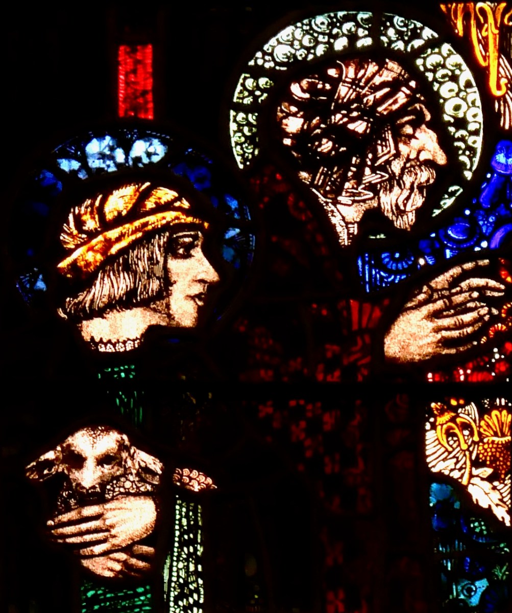
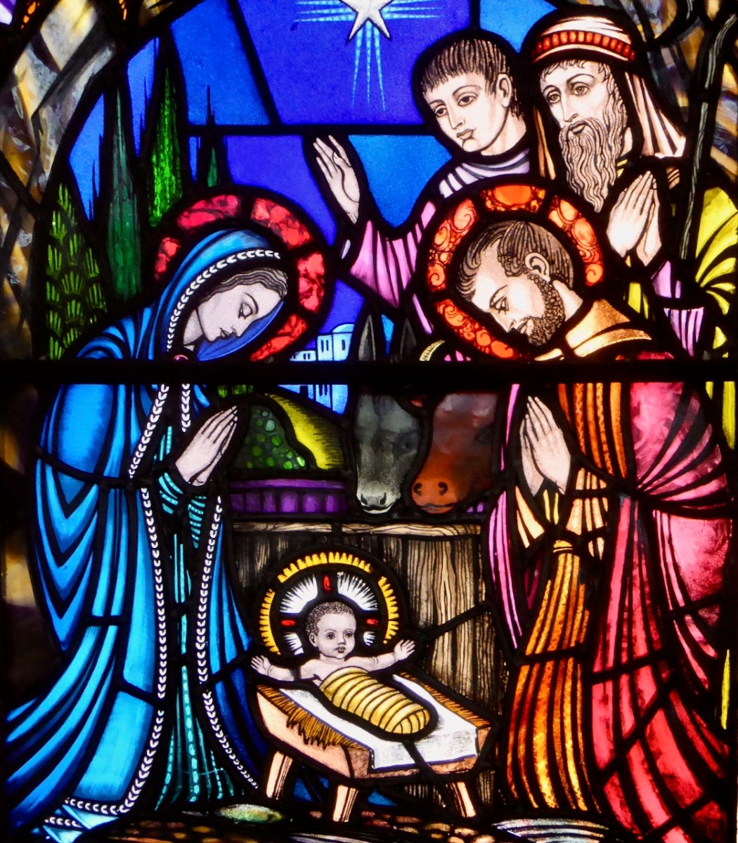
Another from the Studios after Harry Died – this one is in the Catholic Church in Wicklow town and we don’t know to whom it should be attributed.
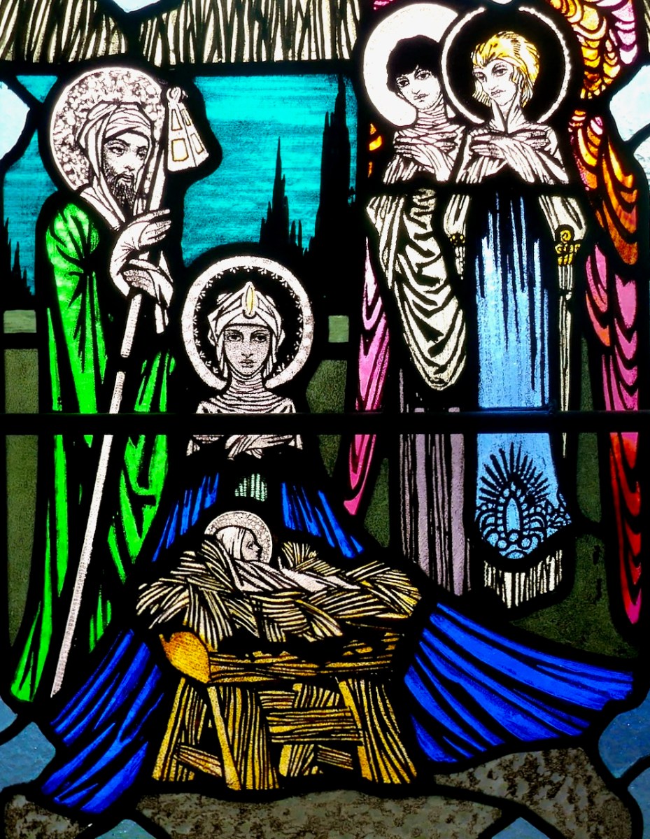
I picked out two of the shepherds to highlight as they had such interesting faces. I also loved the fact that the lamb appears to have a little triangular lacy cap.
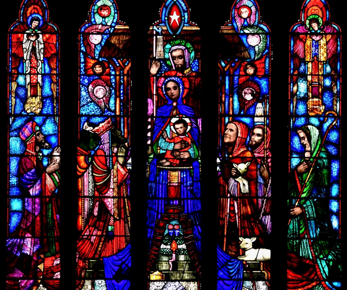
This window is from Millstreet, Co Cork and is another of Dowling’s wonderful productions, dating from 1940. Below is the predella (lowermost panel) from this window.
I suppose we’d have to say that overall there is a bit of a sameness to these Nativity windows and that’s down to the overarching influence of Harry’s very particular style. Eventually, this style fell out of fashion – a victim of its own success, or a failure to change with the times. While it lasted, though, it was superb. Eventually, due to falling demand and the price of good glass, the windows coming from the Harry Clarke Studios failed to keep up the high standards established by him and kept up by Dowling and King as long as they could. Here’s an example from around 1950 so you can see what I mean.
* For more on William Dowling, see Paul Donnelly’s excellent essay Legacy and Identity: Harry Clarke, William Dowling and the Harry Clarke Studios (in Harry Clarke and Artistic Visions of the New Irish State). Paul’s research has greatly informed all my work on William Dowling and other aspects of the Harry Clarke Studios.
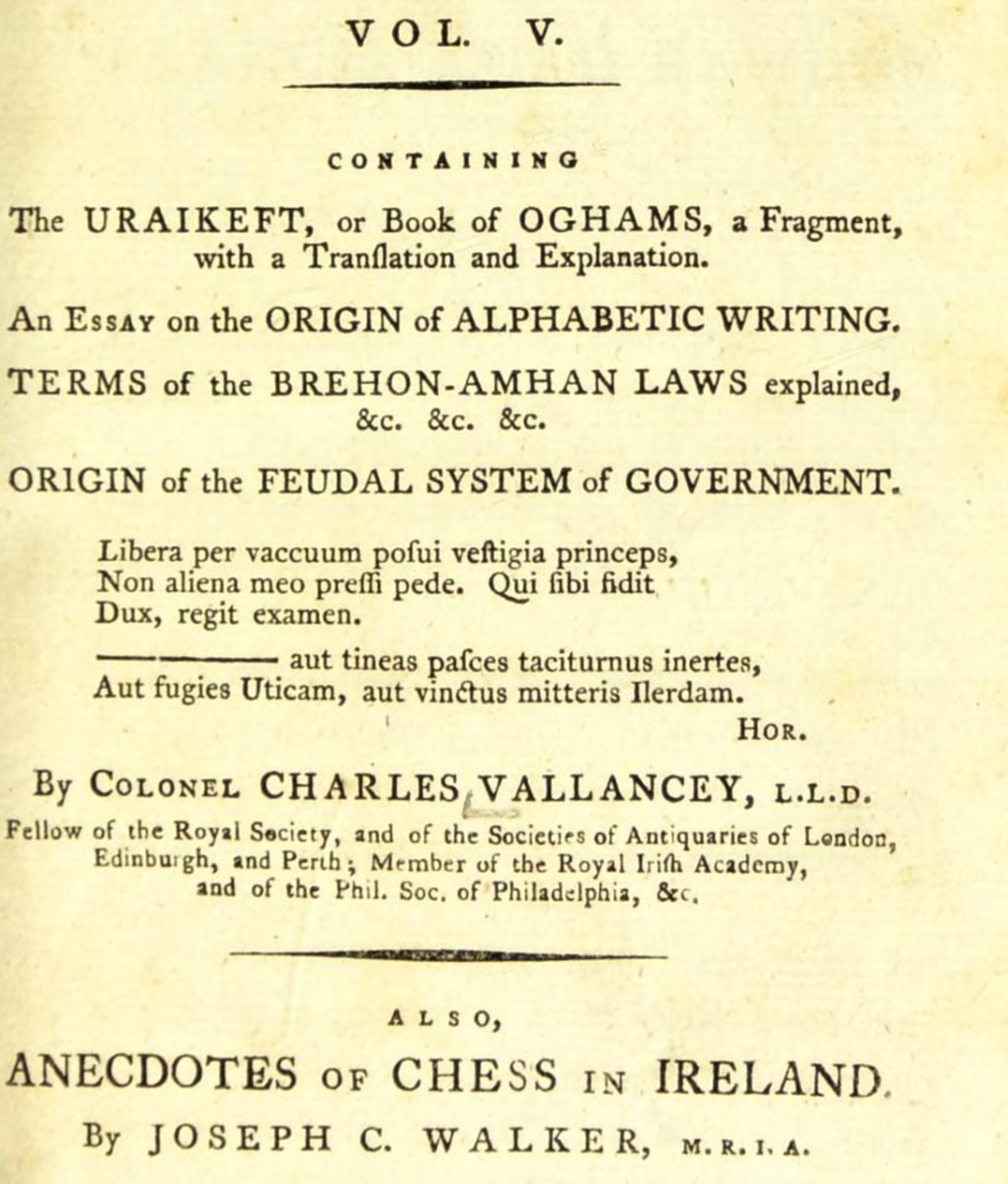
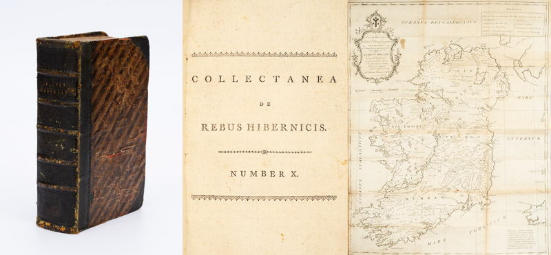
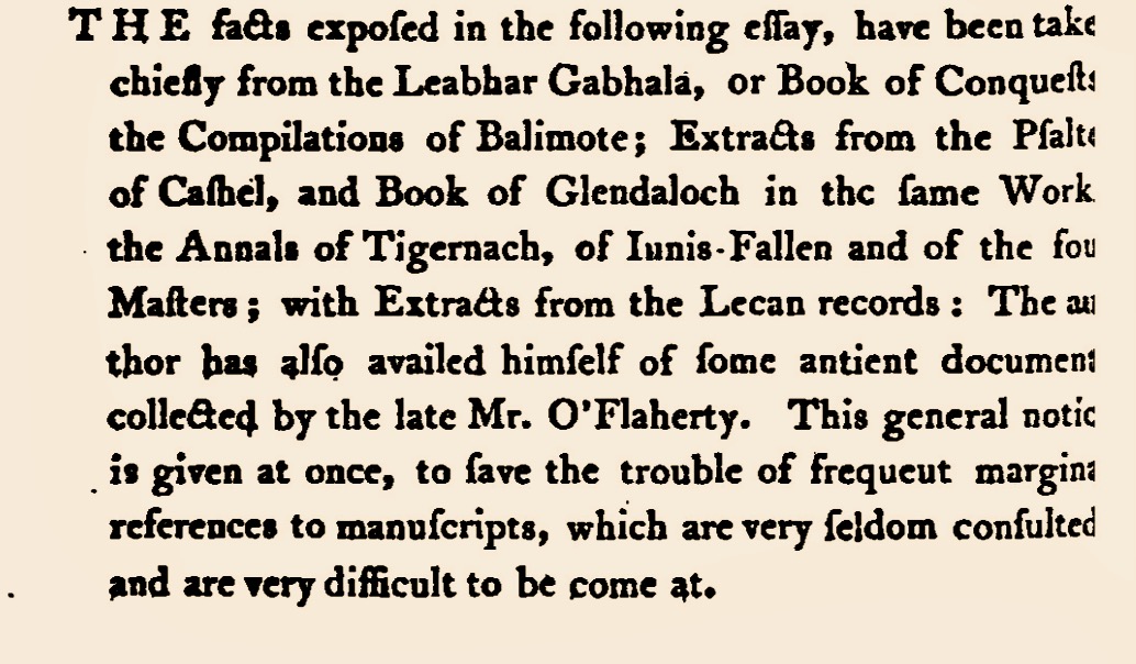
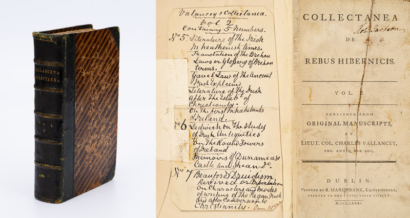
As promised this will be a skip and a hop over Vols 4 and 5, as this is my last post and I want to leave time for a final evaluation of Vallancey and his work. I’m just going to pick out items that caught my attention or appealed to me for my own quirky reasons. For everything I write about, there will be a dozen that might appeal to you more. But then, as a friend of mine said recently about an interminable novel – we’ll be reading it at your funeral.
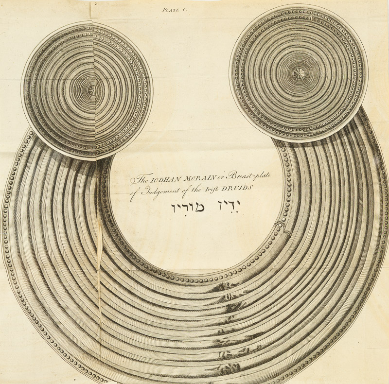
After his usual lengthy preface (this one is only 60 pages and yet another opportunity to talk about Phoenicians) we come to a series of short articles about archaeological objects. Below is what archaeologists call a gorget – its a gold collar, beautifully worked. There are fewer than a dozen of them known from Irish contexts and they have some parallels with others found on the continent.
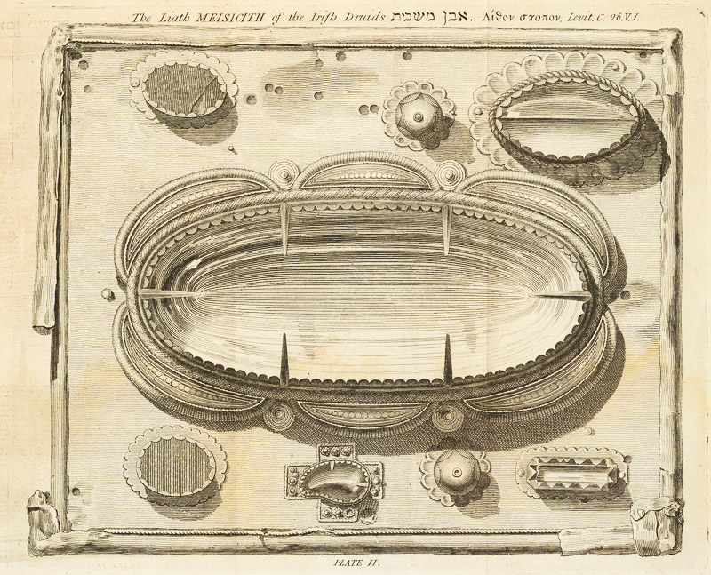
Of solid gold, they were heavy and obviously made to be worn by a high-status individual, perhaps a king. Vallancey concludes it is a Druid’s (what else?) breast plate and christens it the Iodhan Morain. He comes to this conclusion by examining the Bible and accounts from ‘the Chaldees’. It is to be worn, he asserts, as the Druids are making their most solemn pronouncements. And while he’s on the subject of druids, here’s another one of his evidence-free assignment of purpose. This is what he calls the Liath Meisicith.
It is a box, the size of the drawing, and two inches deep, it is made of brass cased with silver : it contains a number of loose sheets of vellum, on which are written extracts of the gospel and prayers for the sick, in the Latin language, and in the Irish character. There are also, some drawings in water colours of the apostles, not ill executed : these are supposed to be the work of Saint Moling, the patron of that part of the country.
So – a fairly straightforward conclusion might be reached that this box dates from the medieval period and was some kind of Christian votive object, right? Alas no – for Vallancey sees only the absence of a cross or any other Christian symbol, and concludes that this is for containing incense or oil to be used as part of a druidic fire ceremony.
How this fire was communicated, I cannot pretend to say, but, as it is well known, that Cobalt ground up with oil, will lye an hour or more in that unctious state and then burst into an amazing blaze : it is probable that the Druids, who were skilled chimysts, (for their days) could not be ignorant of so simple an experiment. A fire lying so long concealed, would afford them ample time for prayers and incantations.
I think this one example gives you, as a microcosm of the whole Collectanea, how eagerness to embrace an exotic and far-fetched explanation, and shoehorn it into your overall theory, can get the better of a man. And it was this exact kind of thing that led to him being derided by his contemporaries and those who followed.
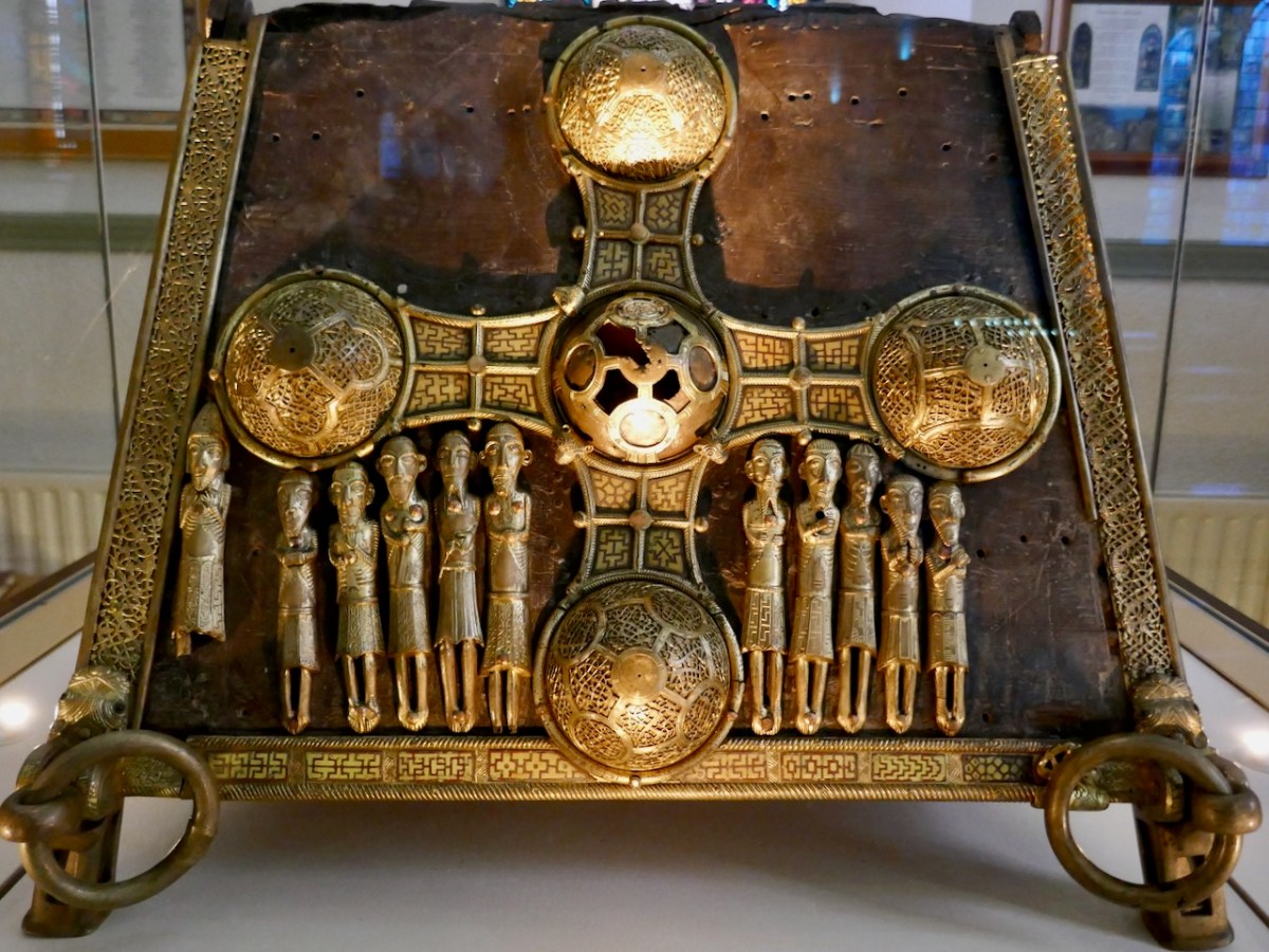
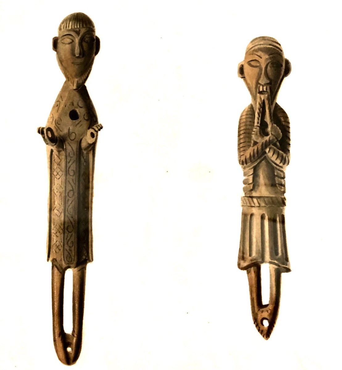
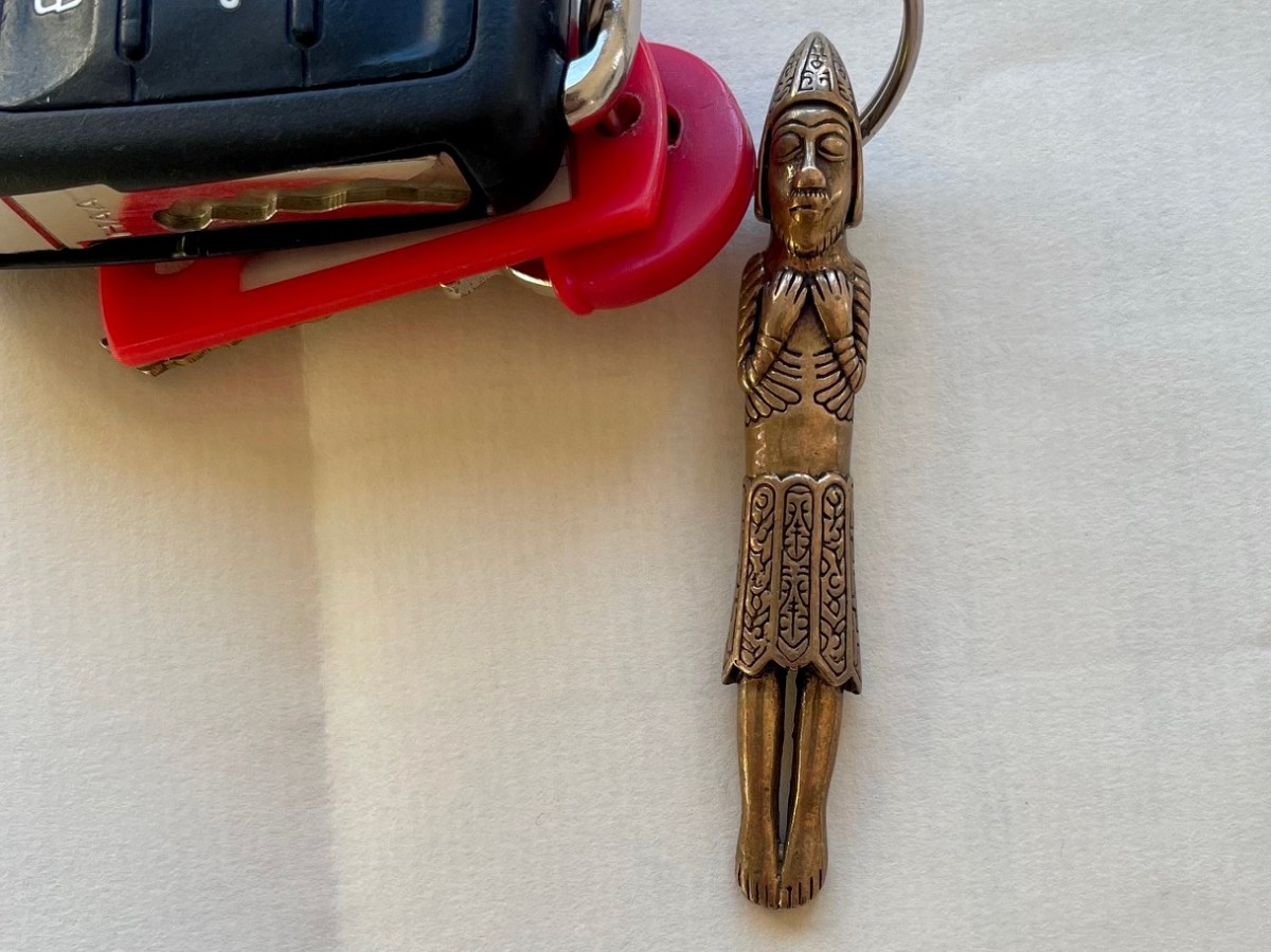
A final example, as it is meaningful to me – a little reliquary figure comes next. This figure bears a striking resemblance to one of the figures on St Manchan’s Shrine. One of the missing figures was located and returned to it – it’s known as the 11th figure and it’s on the far left, below.
Could this be a 12th – and what has happened to it? We know it was still extant when our old friend George Victor du Noyer was recording archaeological items – here is his sketch of the same one as in Vallancey’s volume, done in 1837.
I put the question to Dr Griffin Murray, author of the superb book on St Manchan’s Shrine and he told me that this one was known as the Beard Puller, that is was from Co Roscommon and was in the Trinity College Museum, but is now lost. It could definitely be from St Manchan’s the shrine, he says, although equally it could be from another one. Why is this little guy meaningful to me? Well, I subscribed to the publication of the book, and a reproduction of the 11th figure was my reward!
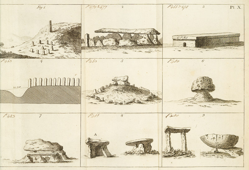
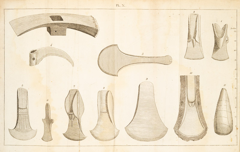
This section contains important illustrations of prehistoric objects – important because this was the first publication to bring them to the notice of the general public. I will use some of these to illustrate the rest of this post, so look out – they will not all relate to the text around them..
However, I am going to skip down now to a section called Proposals for collecting materials for publishing the ancient and present state of the several counties of Ireland. This is an significant section in that it lays out the need for actual knowledge of the country of Ireland, including its natural assets – air, water, geology, animals – and man-made such as buildings, charities, manufactures, and antiquities.
Vallancey lays out the questions to be answered. It all seems so elementary, doesn’t it – and that’s what is so staggering, that there could have been so little in-depth knowledge of the actual country at that time. You might remember that we read about one of these county surveys for Westmeath in Vol 1. What a wealth of detail we might now have of life in 18th century Ireland if only this had been accomplished as Vallancey described it. My friend Amanda, of Holy Wells fame, would be particularly grateful!
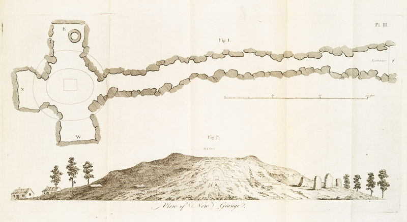
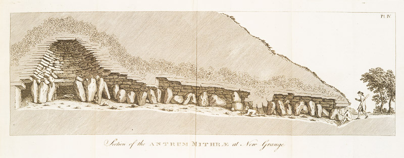
The rest of this volume is taken up with A Vindication of the Antient History of Ireland, with lots of Vallancey’s pet theories on display. It contains a really excellent plan and section of Newgrange – a truly outstanding piece of mapping, given the fanciful nature of most drawing of prehistoric monuments of the time. His conclusion about Newgrange, that it was a Mithratic Fire Cave, turned out be in fact not so far-fetched as some of his other notions, given what we now know about the winter solstice at Newgrange.
There is also some fascinating stuff about Irish paganism and Irish saints. The sequence is based on the mythological original story for Irish history called the Leabhar Gabhala. It’s a pity to give it such short shrift, but I am determined to press on and so I now pass to Volume 5, which is the last volume in the set. There is a Volume 6, and I can access that online only, so have decided to finish with the last volume I have been able to examine in person.
As you can see from the Table of Contents (which, by the way, never seems to be quite the same as the frontispiece that lays out What This Volume Contains), there is a certain amount of repetition here from previous sections on The Scythians, Ogham, the Chaldeans, and the Brehon Laws. So, I am going to confine myself to the part about the Irish Feudal System of Government, as it so well represents what it’s like to read Vallancey.
After a preamble of many, many pages in which are mentioned the Phoenicians, the Egyptians, Aristotle, the Belgae, gold from Wicklow, Alexander the Great, Mr Wilkins (I’m not making this up), Aboul-Hassan-Aly, Armenians, the Empress of Russia (honestly), Father Georgius (who resided long with the Tibetans but who wrote in Latin, quoted at length here), the Huns (we might actually be Indo-Scythian-Huns, apparently), the Japanese, the Peruvians, the Great Mogul, Vallancey, perhaps not surprisingly informs us that the feudal system in Ireland was based on all of the above, except for two things.
The Tuarasdal, wages or subsidies paid annually by the sovereign to his feudatory chiefs, for which he received from them a certain supply of military forces, or some other state contributions tending to the common interest.
The Tribute for Protection. It is called in the Irish laws. . . eneclann, (i. e. protection of the clann). . . It does not appear that these vassals were originally obliged to furnish troops for their chiefs, but to pay a certain impost or tax for their protection.
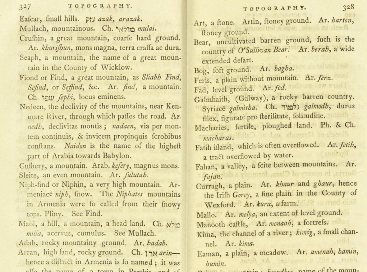
He’s particularly fond of the oriental influences here and to hammer home his point he provided a dictionary of topographical terms all of which he assures us come from Oriental Languages. Some examples, including their Arabian, Hebrew, Chinese, origins, etc:
My head hurts, so this is a good place to stop. How do I sum up this amazing man and his colossal and controversial achievements? The marvellous site Ricorso has a whole section on him which brilliantly sums up the person (although by one authority in here he has acquired 27 children!) and is worth reading in its entirety. The following quotes all come from there. It gives me the new information that Vallancey, despite all claims to the contrary, never actually learned Irish, although he owned a grammatical dictionary compiled by a school-teacher named Crab. One commentator, James Hardiman, confirms this, stating
It is well known, that the late General Vallancey obtained much literary celebrity, both at home and abroad, and, in fact, first acquired the reputation of an Irish scholar, by the collation of Hanno, the Carthaginian’s speech in Plautus. . . but it is not so well known that that speech had been collated many years before, by Teige O’Neachtain, an excellent Irish poet, and author of the extempore epigram, Vol. ii. p. 120, of this collection. Vallancey had this collation in O’Neachtan’s hand-writing, in his possession; and I am obliged (with regret) to add, that he never acknowledged the fact, but assumed the entire credit of the discovery to himself.
Thomas Davis says:
His “Collectanea”, and his discourses in the Royal Irish Academy, of which he was an original member, spread far and wide his oriental theories. He was an amiable and plausible man, but of little learning, little industry [not fair, I think], great boldness, and no scruples [nor this]; and while he certainly stimulated men’s feelings towards Irish antiquities, he has left us a reproducing swarm of falsehood, of which Mr. Petrie has happily begun the destruction. Perhaps nothing gave Vallancey’s follies more popularity than the opposition of the Rev. Edward Ledwich, whose Antiquities of Ireland is a mass of falsehoods, disparaging to the people and the country.
Here’s a good summation, from Joseph Leerssen
The successor of the Select Committee was the Hibernian Antiquarian Society, 1779-83, which in turn set in motion the creation of RIA in 1782, with Vallancey as one of its founding members. Vallancey was the son of a Huguenot émigré, Army officer; derided by many as a charlatan or at best a naive nitwit, Vallancey contributed few ideas of any value to the study of Gaelic antiquity, but much badly-needed enthusiasm, energy and social/religious respectability. He had founded his periodical Collectanea de rebus Hibernicis as a forum for antiquarianism. Further, it was the additional merit of Vallancey to open this world [of Ascendancy] enthusiasm for Irish antiquity] to his friend and mentor Charles O’Conor, in whose wake younger Gaelic, Catholic scholars like O’Halloran and Theophilus Flanagan could begin to function in close collaboration with Ascendancy Protestants.
So what have I concluded after lo these many weeks of sitting with Vallancey? The first is that it was a wonderful experience to be able to read the five volumes ‘in the flesh.’ The second was the whole things gave me a unique insight into the origins of my own discipline of Irish archaeology – how it was born out of a cauldron of claim and counter-claim, hubris and argument, ideology and fieldwork, nationalism and orientalism. None of that can be understood and appreciated without the towering, if ultimately misguided, figure of Charles Vallancey. Thank you, Holger of Inanna Rare Books, for this opportunity.
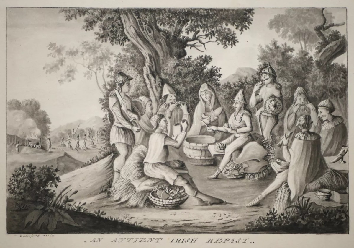
I took a breather last week, but I’m back with more Vallancey. I’ll dispatch Vol 2 as quickly as possible now by telling you that it contains a section on Druidism by William Beauford, an ardent student of Irish antiquities and ancient music and an accomplished draughtsman. He, along with Vallencey, Wm. Burton Conyngham, Ledwich and others, founded the Hibernian Society of Antiquarians – the ill-fated organisation that broke apart under the strain of the quarrels between Vallancey and Ledwich. He was also an artist, contributing drawings to several publications. Below is a piece of his I found online. I think it’s an evidence-free depiction of how these antiquarians saw the antient Irish. And – is the man on the right about to bite the head off a fish?
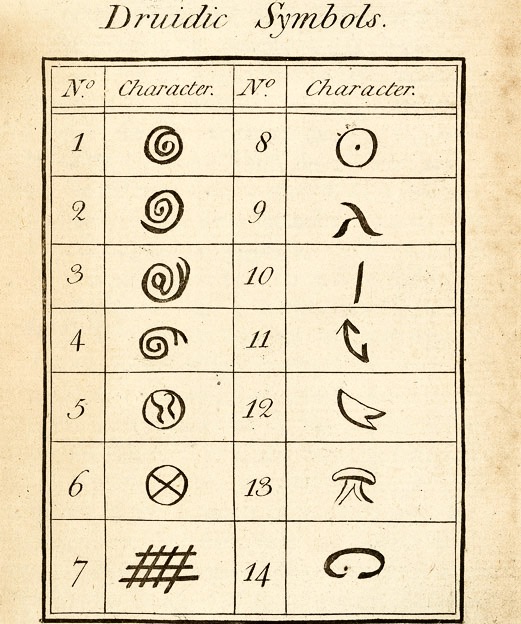
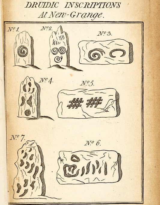
In this piece, his thesis was that the druids had writing long before Christianity and we can see their symbols in Newgrange and other places and figure out their meanings. Since the cup and circle is the central motif of Irish rock art (on which I wrote a theses) I was particularly interested in his interpretation of the dot-and-circle:
Number eight is a circle found on several Irish coins. The circle among the Egyptians, Phoenicians, Carthaginians etc generally represented the Sun and sometimes the World. With the Celtic Druids it also represented the Sun, and with a dot in the centre, the whole universe. The ancient Irish retained it during the Middle Ages as the symbol of a country, and with a point in the centre, for the whole kingdom, or Ireland in general.
The spiral, by the way, was a serpent, ‘symbols of the Divine Being,’ the cross hatch or trellis is the symbol of ‘fate, providence, chance or fortune.” So now!
One of the many problems with this, of course is that while Beauford asserts this all flows from Egypt, we know that Newgrange predates the pyramids and hieroglyphic writing. Another problem is that the above illustration bears no resembance ot the carvings at Newgrange. Volume 2 continues with more on Druids, including a spirited defence of the ancient beauty of the Irish language, which “should be taught in our university”, and a grammar of Iberno-Celtic. As might be expected, there is much discussion here about Phoenicians and Carthaginians.
There’s more, but I’m going to move on now to Vol 3. At last – I hear you cry! This one is full of more arguments about the origins of the Irish and our language, including a lengthy section on ‘Japonese’ and Chinese ‘collated with the Irish’. And, as is his wont Vallancey provides his usual lengthy preface (70 pages!), full of interesting titbits. One that caught my eye was his claim that the Irish word Pósadh, meaning marriage, was based on the word Bósadh (Bó is a cow in Irish), and the sense of it was a dowry ‘endowed with cows’. Asserts Vallancey:
The men of quality amongst the old Irish never required a marriage portion with their wives, but rather settled such a dowry upon them, as was sufficient maintenance for life, in case of widowhood.
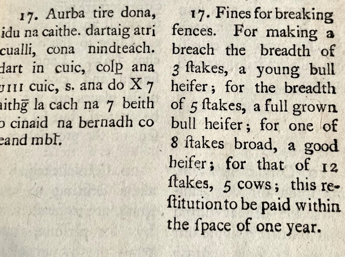
He can’t resist adding and this was the custom of the German nobles and of the Franks. This is followed by another interesting section on the Brehon Laws. These laws of medieval Ireland (a Brehon was a judge) were concerned mostly with fines and compensations for wrongdoing, and this section deals for example with trespass.
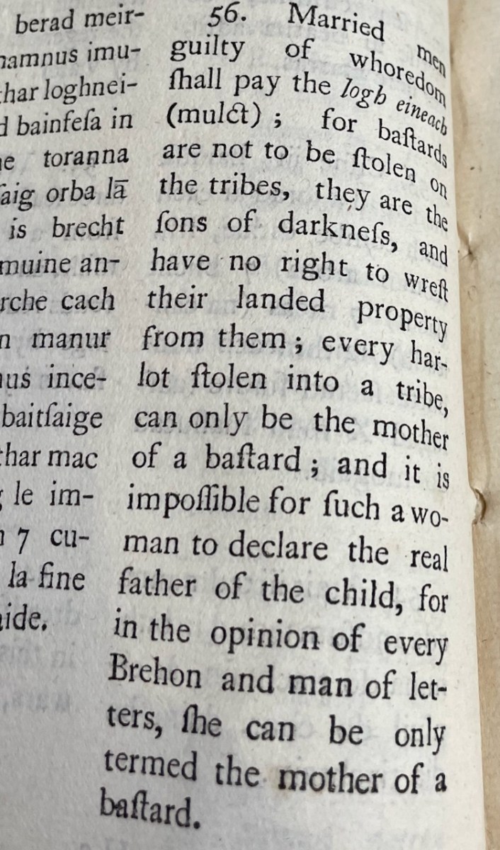
It also talks about children born to unmarried women. Although it refers to men guilty of ‘whoredom’ and the logh eineach (honour price) they must pay, it goes on to say that such bastards are sons of darkness and must not be foisted upon the tribe by the harlot. Here we see how important it is to preserve inheritance within the ruling sept of the tribe, and how women were expendable in that process.
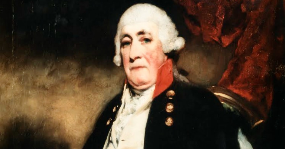
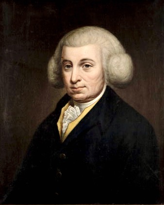
And now we come to yet another of the cohort of antiquarian scholars that were contemporaries of Vallancey – Charles O’Connor of Belanagare. Perhaps the most learned of them all, O’Connor came from old Irish nobility. See the fascinating biography of him in the always-superb resource from the Royal Irish Academy – the Dictionary of Irish Biography. Fluent in Irish and a collector of manuscripts, he was connected to many gifted and interesting scholars and scribes in Irish. and eventually acquired or obtained sight of practically every important Irish manuscript in the country. He was, with Vallancey, one of the founders of the ill-fated Hibernian Antiquarian Society, and later the Royal Irish Academy. The portrait below is from Wikimedia Commons.
He had previously written a manuscript titled Dissertations on the antient history of Ireland in 1753, but for this volume of the Collectanea he produced a further essay, a letter really, addressed to his friend Vallancey, titled Reflections on the History of Ireland During the Times of Heathenism. In it, he coined the term “Fenian” for Fionn MacCumhaill’s band of warriors, a term that certainly had sticking power in Irish History. In this letter he appears to support Vallancey’s daft ideas about Phoenicians. However, he was a better scholar than Vallancey and pioneered the use of primary sources including manuscripts from his personal collection, to research and write about Irish history, and his familiarity with these sources is obvious in this piece. Here’s his list.
William Beauford makes another appearance now, with his Antient Topography of Ireland. Unlike what it sounds, this is actually a dictionary of place names, with an explanation of the meaning of the name and some historical associations.
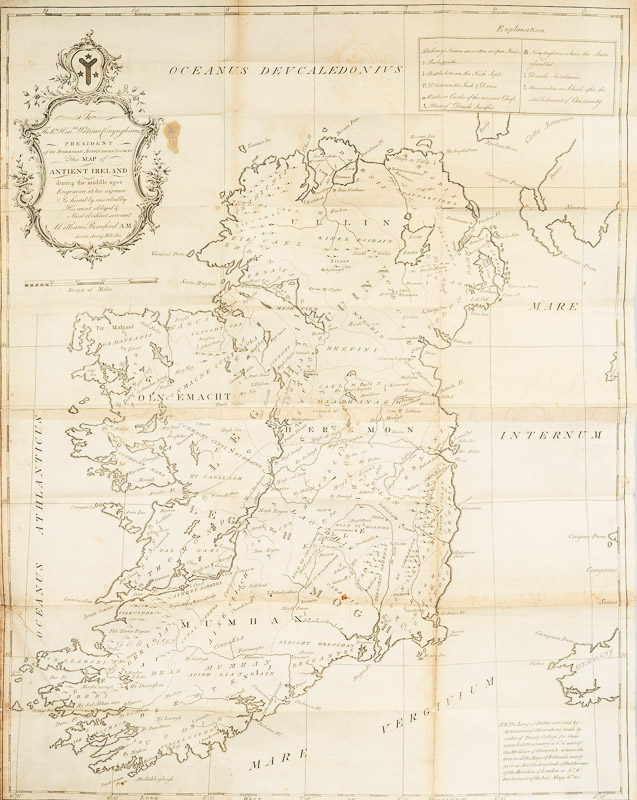
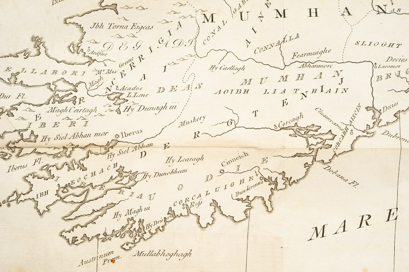
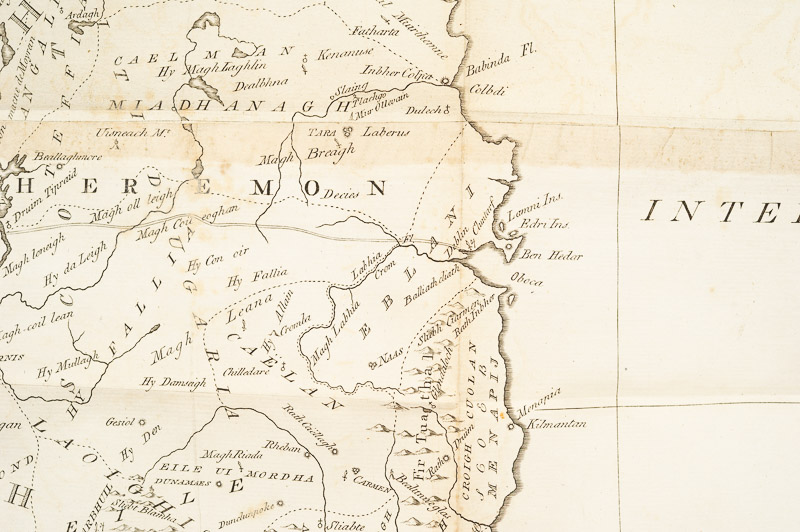
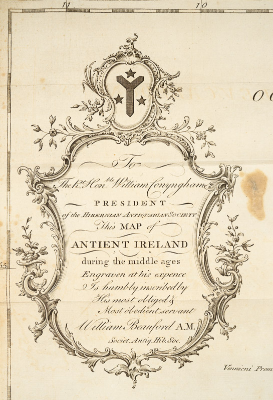
However, there is also a wonderful map! It’s a fold out, and dedicated to yet another of the Hibernian Antiquarians, Willian Conyngham. Regular readers know how I love a good map!
And now all the dictionary entries become clear, as Beauford matches the placenames with the map.
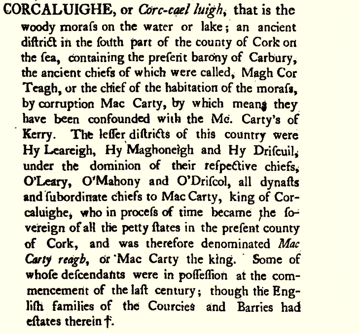
Above is his section on Corcaluighe (Pronounced Kurka Lee) while below is the section of the map showing the location of Corcaluighe.
Of course, I had to choose West Cork. But just to show you how broadminded I am, here is the area around Dublin. How many names can you make out?
I’ll leave it at that now for Volume 3. I’m actually still only half way through it, but I’m going to skip over the rest of it now, in favour of covering 4 and 5 next time – at least that’s the plan! Wish me luck.
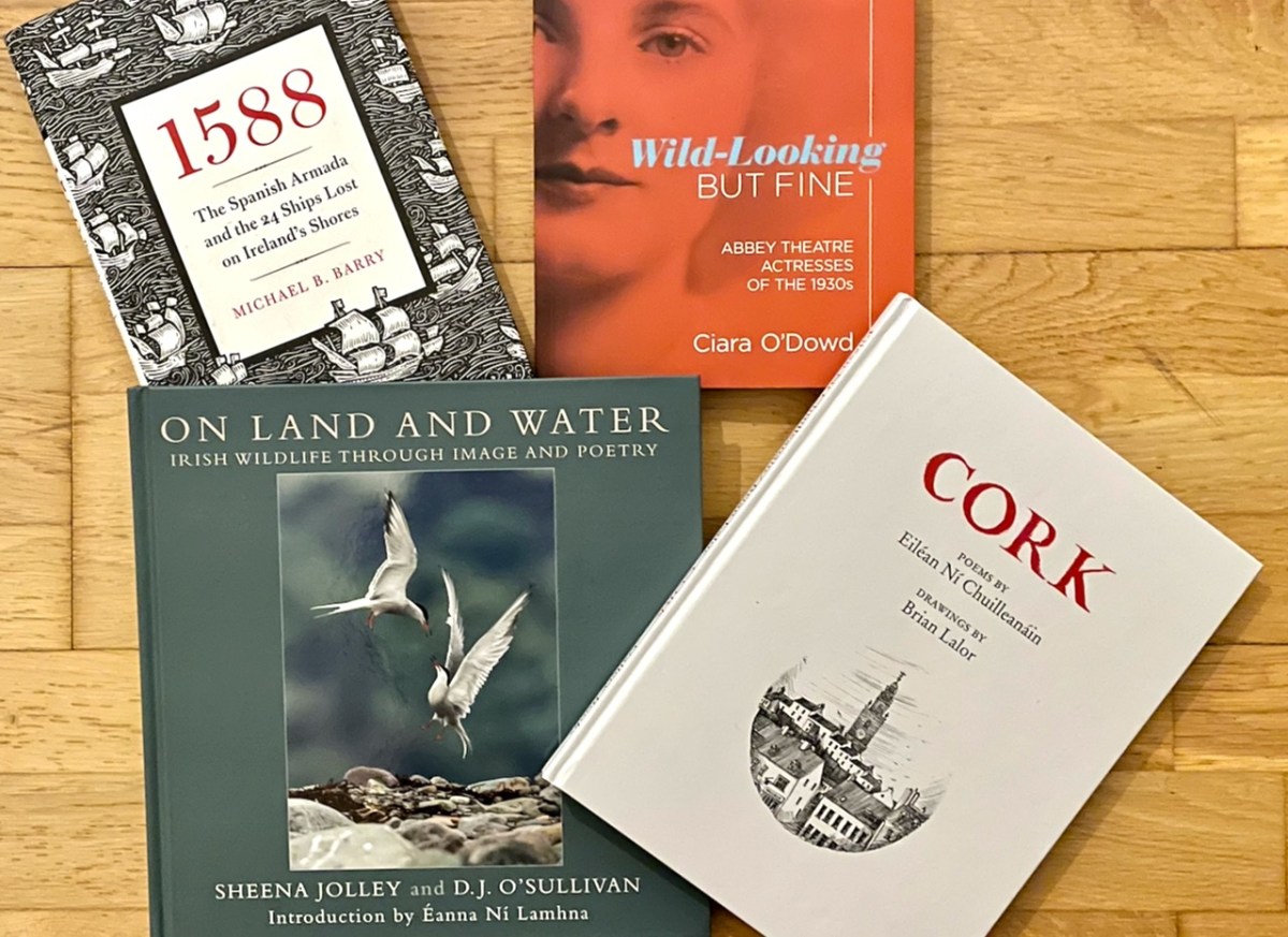
What do we need for Christmas? More books! Where will we put them? We’ll figure that out later. (You know who you are.) Or are you stuck for ideas on what to get other people? Or someone has asked you for a hint on what to buy for you?
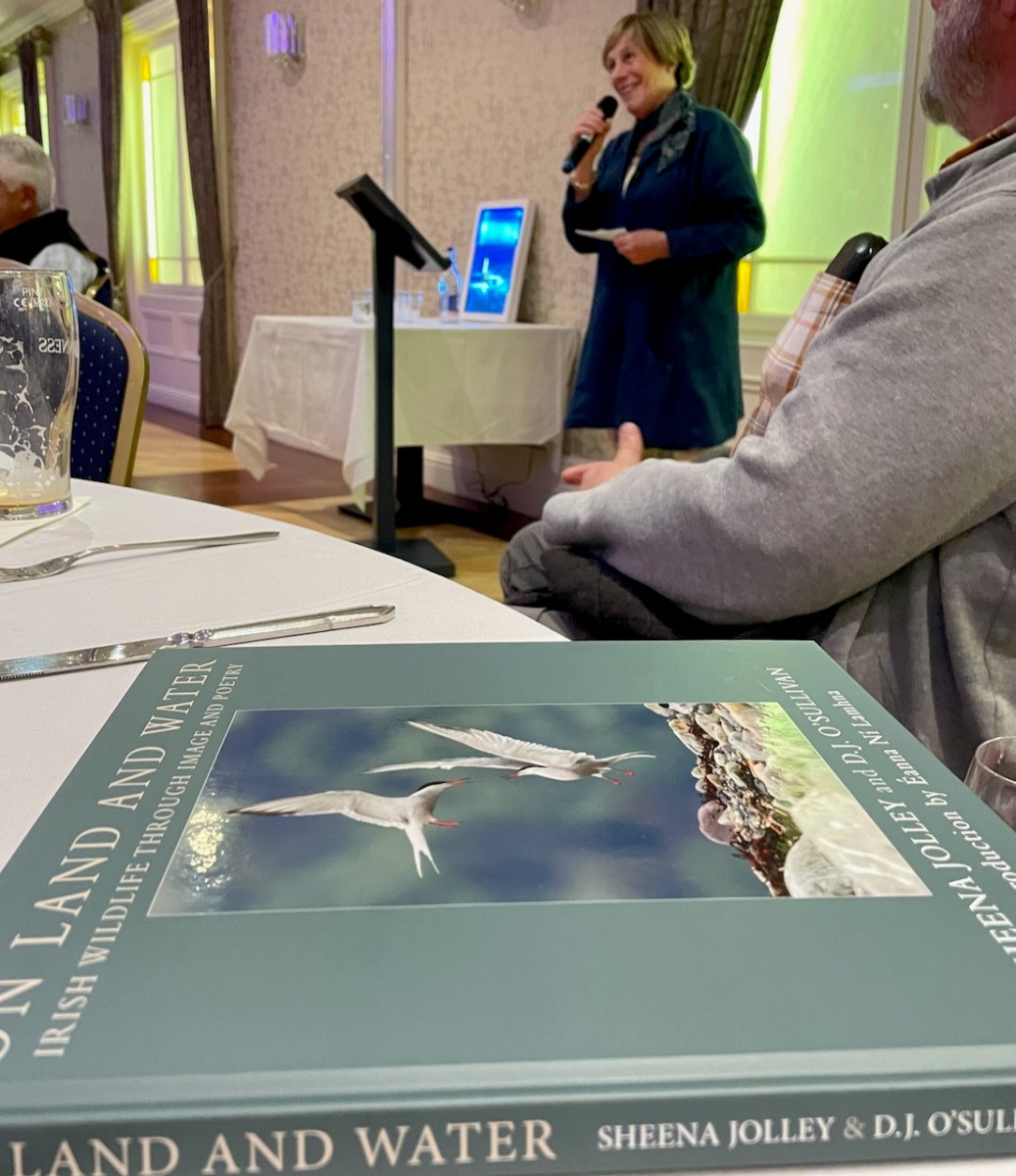
So here are my recommendations for your wish list this Christmas, and I am doing you a favour because I’m keeping it to four. I have a personal interest in all of them – but I am of course completely unbiased. The first is On Land and Water, a truly beautiful production from Menma Books (available through their website or in bookstores) that combine the poetry of lighthouse keeper DJ O’Sullivan, and the exquisite wildlife images of renowned photographer Sheena Jolley.
I cannot overstate what a lovely production this is. DJ O’Sullivan spent his life in close communion with the birds and sea-creatures of Ireland’s remotest places. He writes with the insight of one who has honed his observations skills through long hours and days.
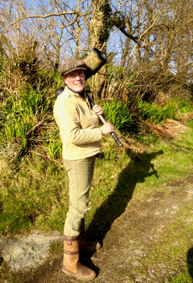
Sheena is one of Ireland’s top wildlife photographers. At the launch in Skull we were all transfixed by her relation of what that takes – being dropped off on an uninhabited island with your equipment and food, and making the boatman promise he will remember to come back for you in a couple of days. Then getting up before dawn and being ready for that golden light when the animals stir.
This is Sheena out to photograph some choughs
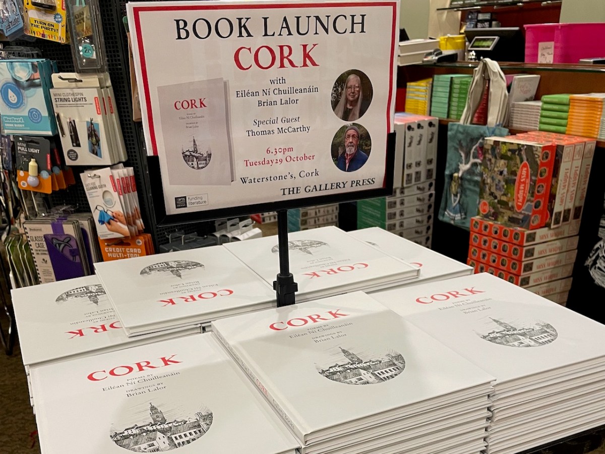
Besides the photographs, Sheena provides text that describes the creatures, their habitats and habits. This is the kind of book you will dip into over and over. And the same is true of my next choice – Cork by the artist Brian Lalor and the poet Eiléan Ní Chuilleanáin.
I have written about this book before – four years ago, in a two-part post titled Cork, Part 1: Brian Lalor and Cork, Part 2: Eiléan Ní Chuilleanáin. At that time, I was writing about a treasured gift given to me by my parents in the 70s – the amazing news is that 50 years later the book has been re-issued! It was launched (re-launched!), in a revised edition, in Waterstones in Cork at the end of October. Both Brian and Eiléan were there!
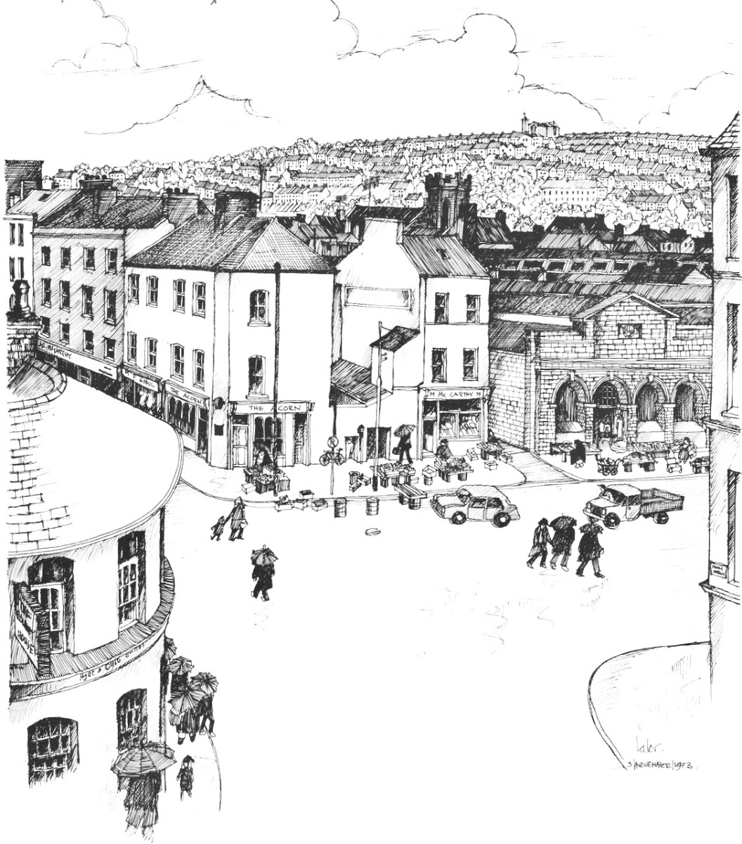
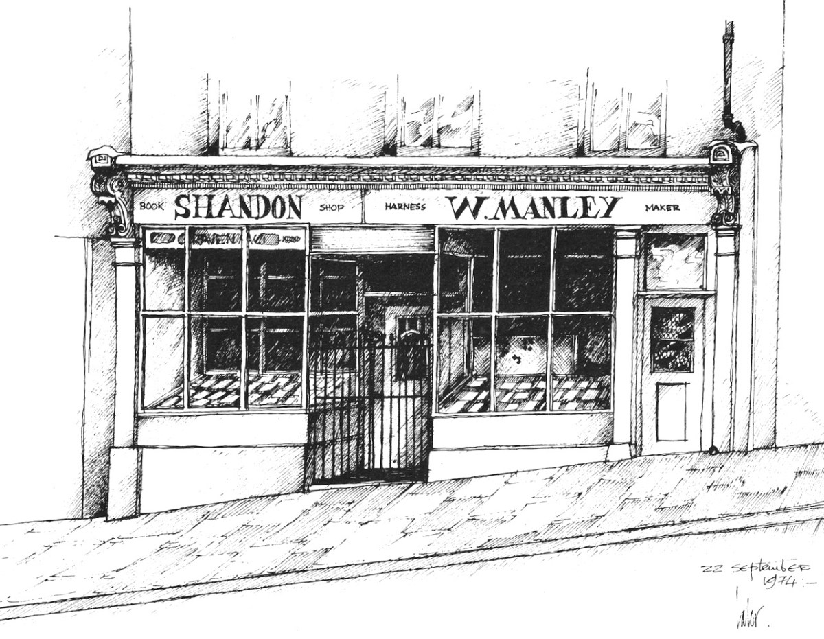
Take a look at the two posts above for a real flavour of what this book is all about. If you have ever lived in Cork, or even if you’ve visited, this is the book for you.
Wild Looking But Fine, by Ciara O’Dowd is my next recommendation. You might remember my post about Ciara and the chocolate box of letters between my mother, Lilian Robert Finlay, and other people associated with the Abbey Theatre. Eight years, and one child, later, Ciara’s book is finished and my brother and I attended the launch in Dublin. Ciara’s account of how difficult it was for women in 1930s Ireland to forge a professional and autonomous life is riveting. In her review of the book in Books Ireland, Jane Brennan asks, Why don’t we know more about their lives and achievements? Why, for example, is Ria Mooney not more widely remembered as the renaissance woman she was? Why had I never before heard of Aideen O’Connor (but am well acquainted with the name and reputation of her husband Arthur Shields)?
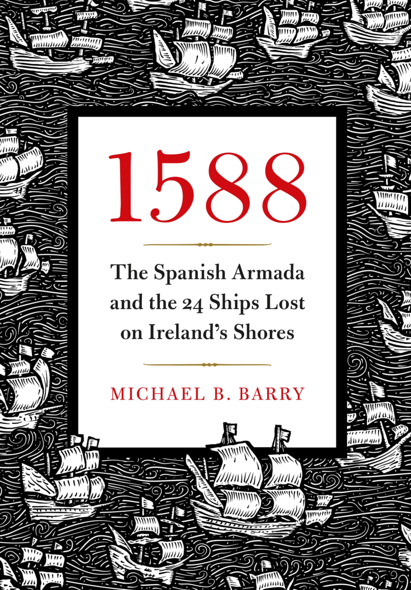
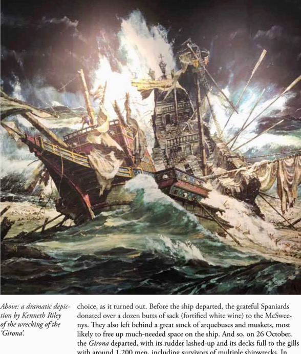
The thing is, the story of the Spanish Armada was taught to us through an English lens. Prepare to have everything you thought you knew questioned and turned on its head. That’s because Michael has done his research in Spanish and Irish sources and, as is his wont, (see this post from eight years ago about his books) the book is profusely illustrated with lots of images sourced from unusual archives as well as his own fine photography.
The books are all available from their publishers or in all fine bookshops. You can think me in the New Year, once your loved ones have taken the hint and bought you one or all of the above.
Remember I told you that Vallancey was not above publishing the work of others, and omitting the name of the author, thus giving the impression that he had written it? Was this deliberate or not? Were the standards of plagiarism the same then as they are now? He does give a kind of attribution in Vol II, below, but it’s not precise.
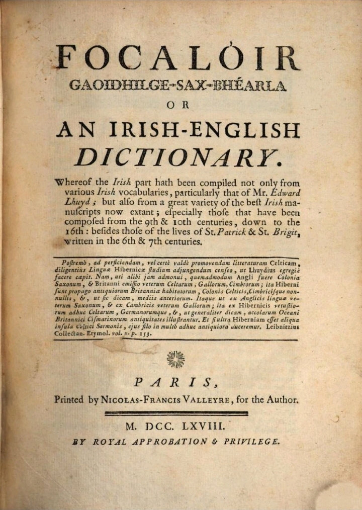
The second part of Vol I begins with just such a treatise: Dissertations on the National Customs and State laws of the Ancient Irish. However, although no author is given, implying this was Vallancey’s work, in fact it was written by John O’Brien, Catholic Bishop of Cloyne and Ross from 1747 to 1767, and originally titled A Critico-Historical Dissertation concerning the Antient Irish Laws, or National Customs, called Gavel-Kind, and Thanistry, or Senior Government. O’Brien was a considerable scholar, author of one of the earliest Irish-English Dictionaries (below). [Most of the illustrations in this blog post are not from the Collectanea.]
Although this is all about gavelkind – the Irish custom that dictated how land was divided between male heirs, the first section is devoted to how succession works in various countries (much talk about the Franks) and to the exclusion of daughters from succession and inheritance. Yes – those of you who think that women had more agency and autonomy in ancient Ireland than in other cultures, should bear in mind that this was a deeply patriarchal society. Here’s what O’Brien has to say about succession and property rights for women:
No inasmuch as I have treated the good old ladies of antient times with all the severity of the primitive maxims by excluding them from the enjoyment of all landed properties, it is fit and decent, that before I take my leave, I should provide for them otherwise in some becoming manner; their fortunes and natural establishments were not the less secure for such an exclusion, they were under no necessity of providing a marriage portion to attract courtiers, or satisfy husbands; on the contrary their husbands were obliged to portion and endow them according to the wise maxims of the primitive times, and without this condition they could obtain no female conforts. Women were therefore as earnestly courted and demanded in disinterested marriage in those days, as they are now haunted and in some countries run away with for their fortunes, more than for any conjugal affection. And hence we may assure ourselves the unfortuned good women of antient times found the marriage state much happier, then some of our modern ladies find it with all their thousands.
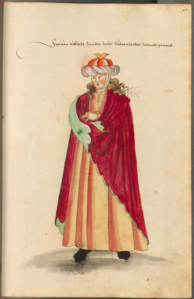
In short – the ladies, like the delightful one below*, should count themselves lucky!
He finally gets down to describing how gavel worked. Several forms existed but all consisted of dividing the property between sons or brothers. He asserts this was common in many countries – or antient lands – and also describes the practice of tanistry, whereby clan chiefs and their successors were chosen. Page after page is devoted to Scythians, Egyptians, Franks, Saxons, etc as precedents, showing it to be a common form of inheritance in the ancient world. This seems to be in service of counteracting the English prejudice agains it as barbarous and conflict-promoting. Clovis is mentioned, Gregory of Tours, the Visigoths and Vandals . . . O’Brien was obviously a man after Vallancey’s heart.
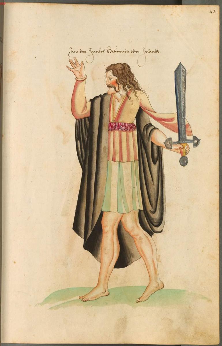
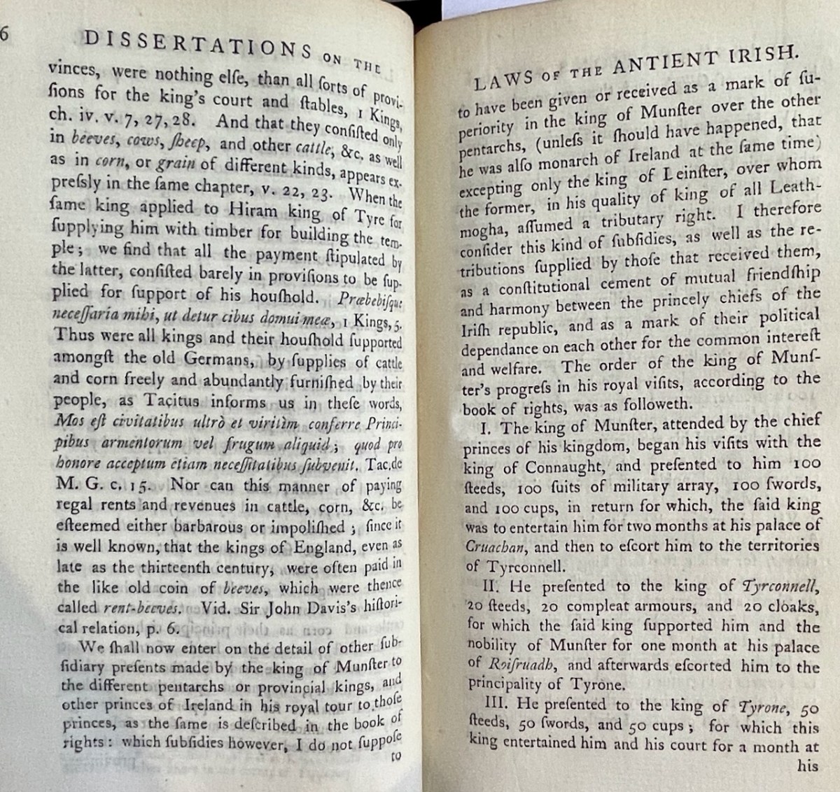
Chap 2 deals with all the tributes due to the king or chief (Above*) and his fiscal rights. The king or chief was NOT king or chief until inaugurated. I was surprised to find that the traffic went both ways – the king bestowed gifts on the chiefs within his sphere of influence and received tribute from them in turn.
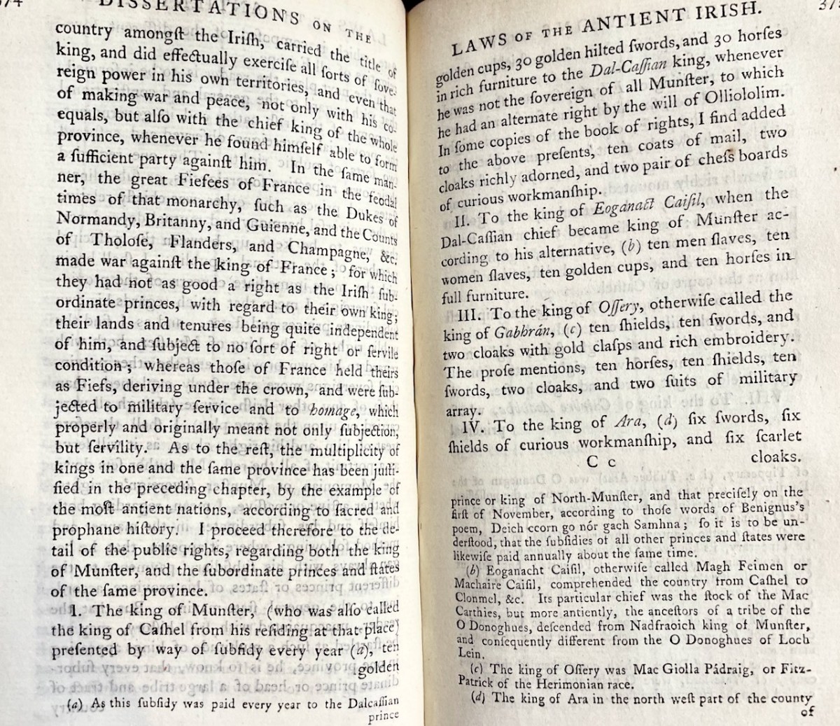
For example the King of Munster (or Cashel) paid to the Dal-Cassian king
10 golden cups, 30 golden-hilted swords, 30 horses in rich furniture, 10 coats of mail, 2 cloaks richly adorned, 2 pairs of chess boards of curious workmanship
Another one mentions
10 men slaves, 10 women slaves,10 golden cups, 10 horses in full furniture
The King of Cashel, in return, received from his subject chiefs large gifts of livestock – bullocks, milch cows, hogs, weathers and beehives, along with, for some reason, many cloaks, some specifically described as scarlet.
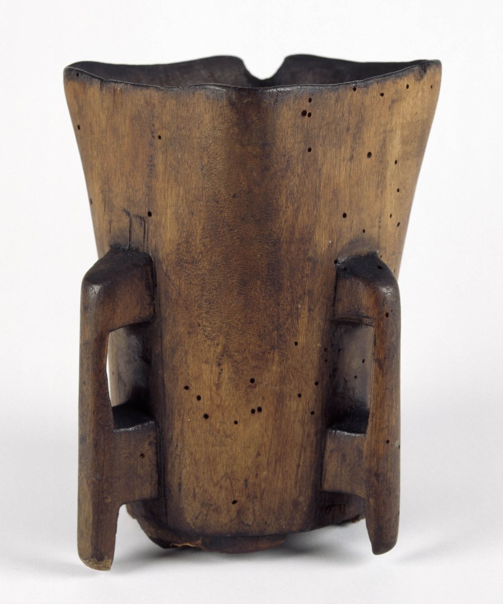
The King also paid visits to other kings, as a constitutional cement of mutual friendship and harmony between the princely chiefs of the Irish republic (sic), and as a mark of their political dependence on each other for the common interest and welfare. The photo above sets out some of those kingly visits and what was involved for the visitor and the host. Lots of mentions of cups – perhaps like this one from the Hunt Museum Collection?
The second part of this Treatise is essentially a history of the O’Brien’s of Munster, offered as an illustration of the laws of Tanistry. It certainly offers many examples of conflict and treachery in the line of succession! And once again it wanders all over Europe and the ancient world as it traces the origin of the practice
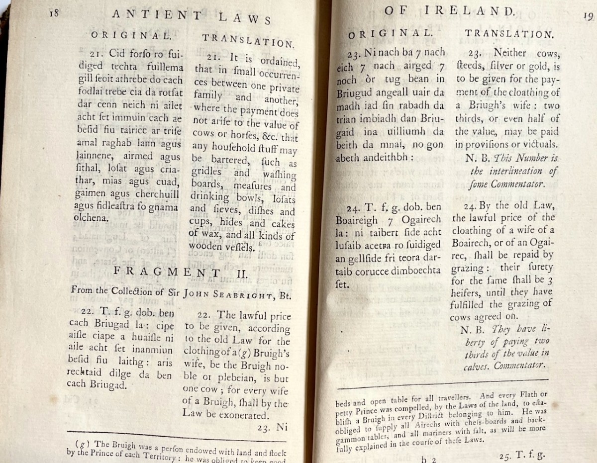
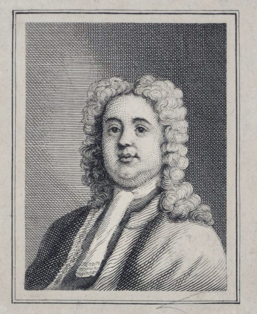
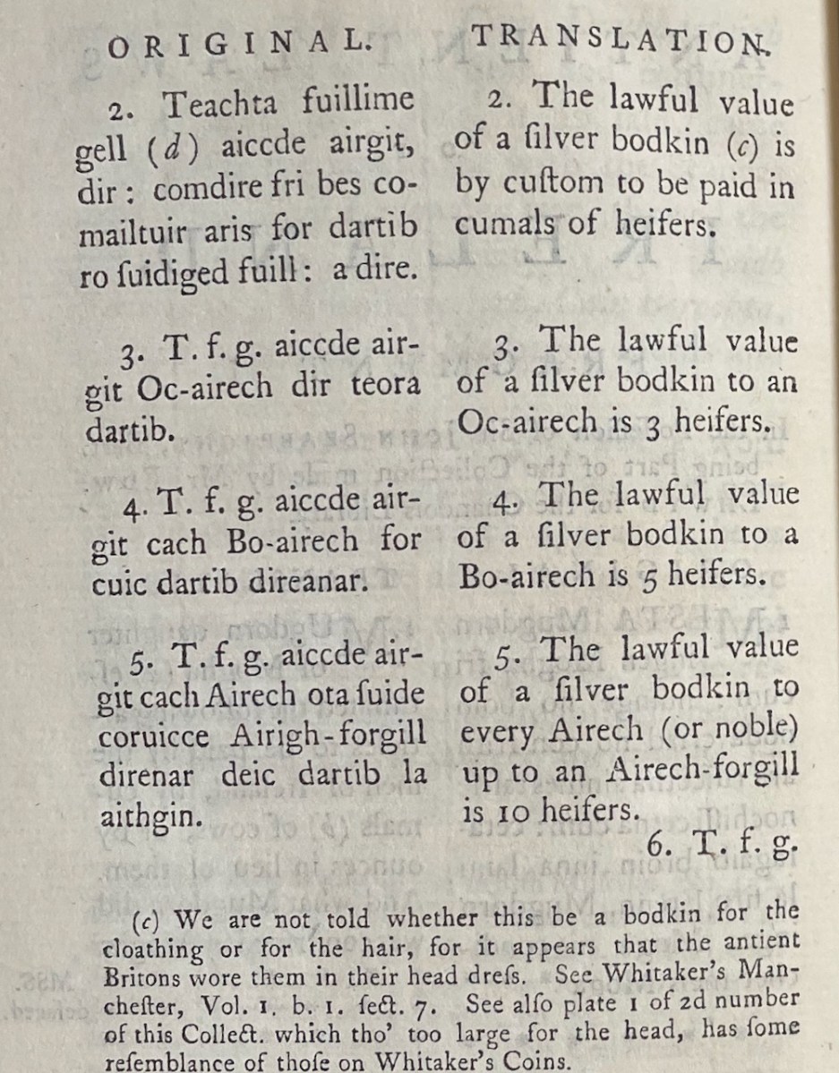
The final, and most interesting part of Vol 1 is about the Brehon Laws. This part indeed may have been by Vallancey. It consists of a number of fragments (above and below), originally collected by Edward Lhwyd (1660-17090, below) one of the earliest antiquaries to visit Ireland, document ancient sites and collect textual material.
The section consists of individual laws, mostly pertaining to the value and goods and therefore the fines that were to be levied if something was stolen.
My favourites of these has to do with the value of the clothing of a poetess or the wife of a bard – three milk cows, apparently. However, if the clothing is embroidered the value goes up. For work properly done and completely finished, the reward is an ounce of silver. More is to be paid for extraordinary work in proportion. However, beware – if she be divorced for adultery this law is reversed and the woman must pay two thirds of the said value.
Having spent so much time on Vol 1, I am going to gallop, if I can, through Vol II. It starts with an essay called Brehon Laws and Gavel Kind Explained. This is mainly a defence agains the accusation by English of ‘barbarous’ customs’ and dwells on obscure points of orthography, such as when the letter P was introduced to Irish. It also deals with more of the practice of gavelkind, the exclusion of women, where else it was practiced and uses the marvellous term Strongbonian for the Anglo Norman settlers.
An Inquiry Into the First Inhabitants of Ireland follows. This is where Vallancey introduces his claim that the first Irish Irish were Phoenicians. I have dealt with this in the first post so I will not cover this in detail.
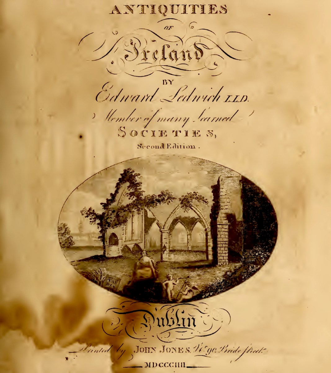
The next section was written by Edward Ledwich another of the early Irish antiquaries – see my post on the marvellous Monaincha for more about Ledwich. What’s fascinating about this is that Ledwich and Vallancey were subsequently at war with each other and Ledwich had views that were just as biased and erroneous as Vallancey’s.
Ledwich afterwards openly and very strongly opposed Vallancey’s views on ancient Irish history, particularly his beliefs about the Phoenician origins of the Irish people. Ledwich was convinced that the ancient Irish had been as barbarous as the scanty Greek and Roman descriptions suggested; that they originated in Scandinavia; and that English colonisation had brought to the island such civilisation as it had subsequently enjoyed. Both Vallancey and Ledwich, along with Charles O’Conor (qv) of Belanagare and William Burton Conyngham (qv), were founder members (1779) of the Hibernian Antiquarian Society, which collapsed in 1783 in the bitter disagreements between Vallancey and Ledwich.
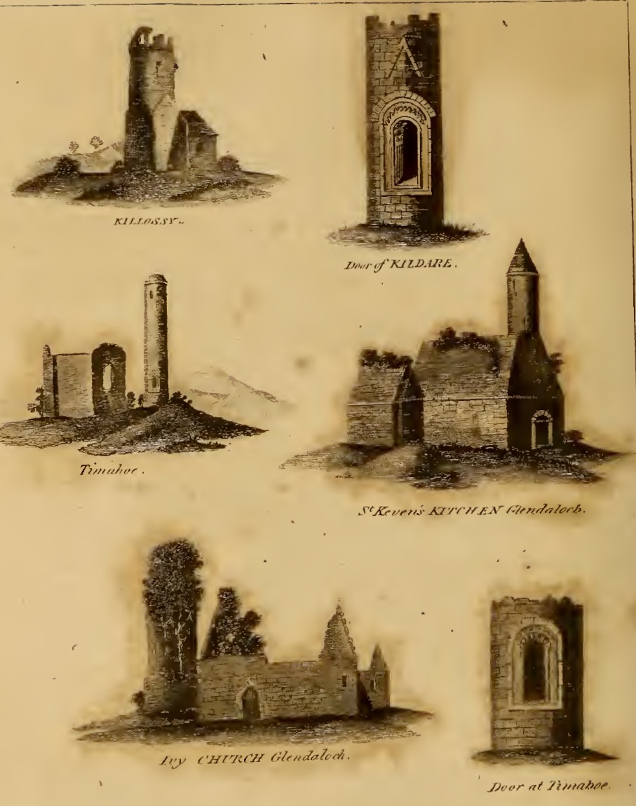
The piece on round towers was written by Ledwich, (although these illustrations are from his later Antiquities of Ireland) presumably before the great falling out between the two men. Whereas Vallancey saw round towers as observatories for an astral, or sun-worshipping, cult that had been brought to Ireland by the Phoenicians, Ledwich believed that the round towers were Danish works. In fact, he was as obsessed with the Danes as Vallancey was with the Phoenicians. They were built, he says as ‘watch towers against the natives’, thus neatly upending the most common belief in Ireland about round towers – that they were watch towers against Viking Raids. (In fact they were bell towers, but that’s another story.) Here, Ledwich obliquely refers to Vallancey’s work that towers were erected by Phoenicians and says ‘this description is plainly the work of fancy’.
Ledwich was convinced that nothing of any architectural value could have been constructed by the Irish themselves. Reading his argument (and Vallancey’s) I was struck by how it foreshadows the pseudo-archaeolologists who claimed that big impressive monuments must be the work of superior races – people like Von Daniken in his Chariots of the Godsin the 60s who assigned them to aliens, or more recently the conspiracy theorist, inexplicably given a platform by Netflix, Graham Hancock. Hancock’s series Ancient Apocalypse tries to find a race of Ice Age people who must have constructed many of the ancient monuments (or even odd geographical features) around the world. Hancock (‘I’m just asking questions’) is a true inheritor of the nuttiness and hubris of both Vallancey and Ledwich. Later, Ledwich felt sufficiently incensed by Vallancey’s theories to say this, in his Antiquities of Ireland:
No wonder they were at war! Can anyone translate the Latin? I suspect it’s a further insult. I do absolve Vallancey, by the way, of the baser motivations visible in Ledwich and Hancock – that is, a racist and colonial ideology that sees indigenous people as incapable of building impressive monuments. No – Vallancey had no difficulty at all in promoting the ancient Irish as one of the great and noble races.
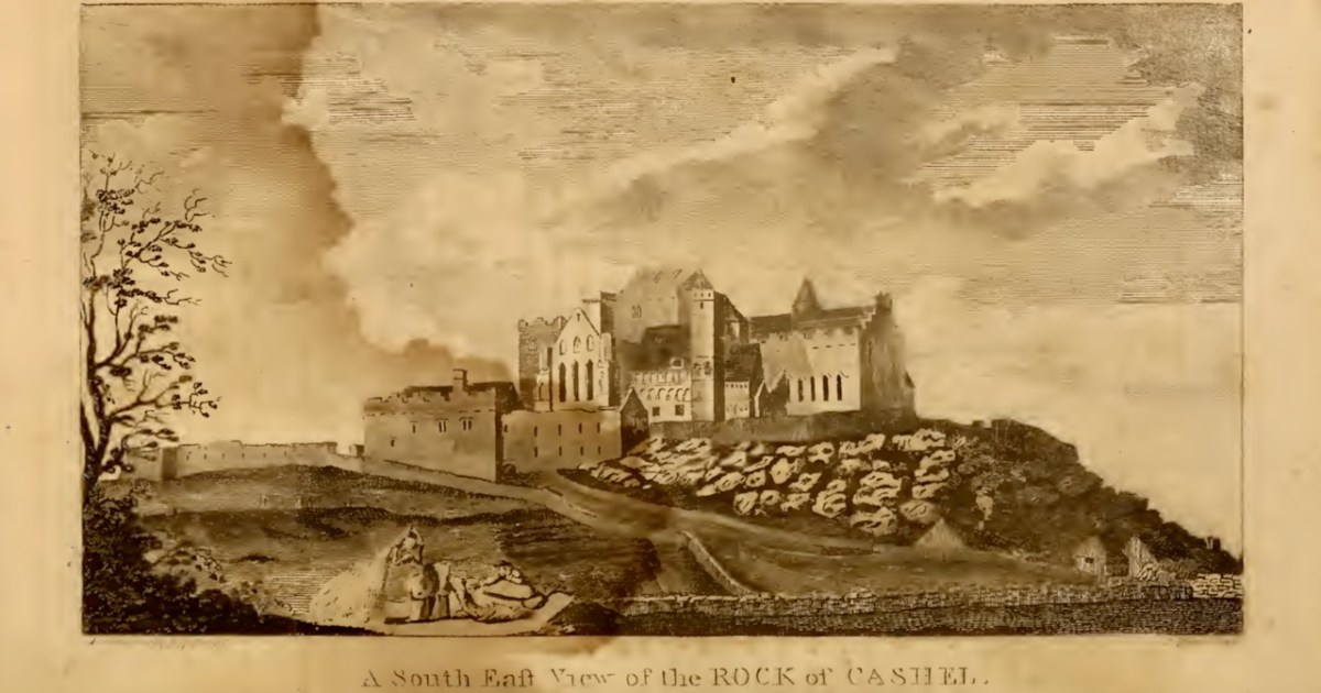
I’ll leave you with this view of Cashel from Ledwich’s Antiquities of Ireland. Despite all my best intentions of getting through several volumes, I am still only half way through Vol 2 of 5. Any suggestions, dear readers, on how I can wrap this up so that I can get my life back?
*Kostüme der Männer und Frauen in Augsburg und Nürnberg, Deutschland, Europa, Orient und Afrika available here.
Welcome to the UCD Library Cultural Heritage Collections blog. Discover and explore the historical treasures housed within our Archives, Special Collections, National Folklore Collection and Digital Library