The three books I am recommending today are ideal for the person in your life who loves West Cork and/or fine art. All three are by West Cork men and all three are self-published. Even though self-publishing is increasingly common, distribution is often monopolised by the large publishing houses, so I am delighted to have the opportunity to bring these three to your attention.
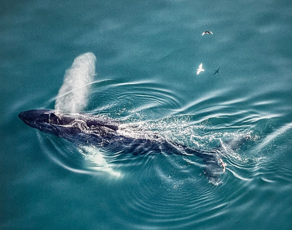
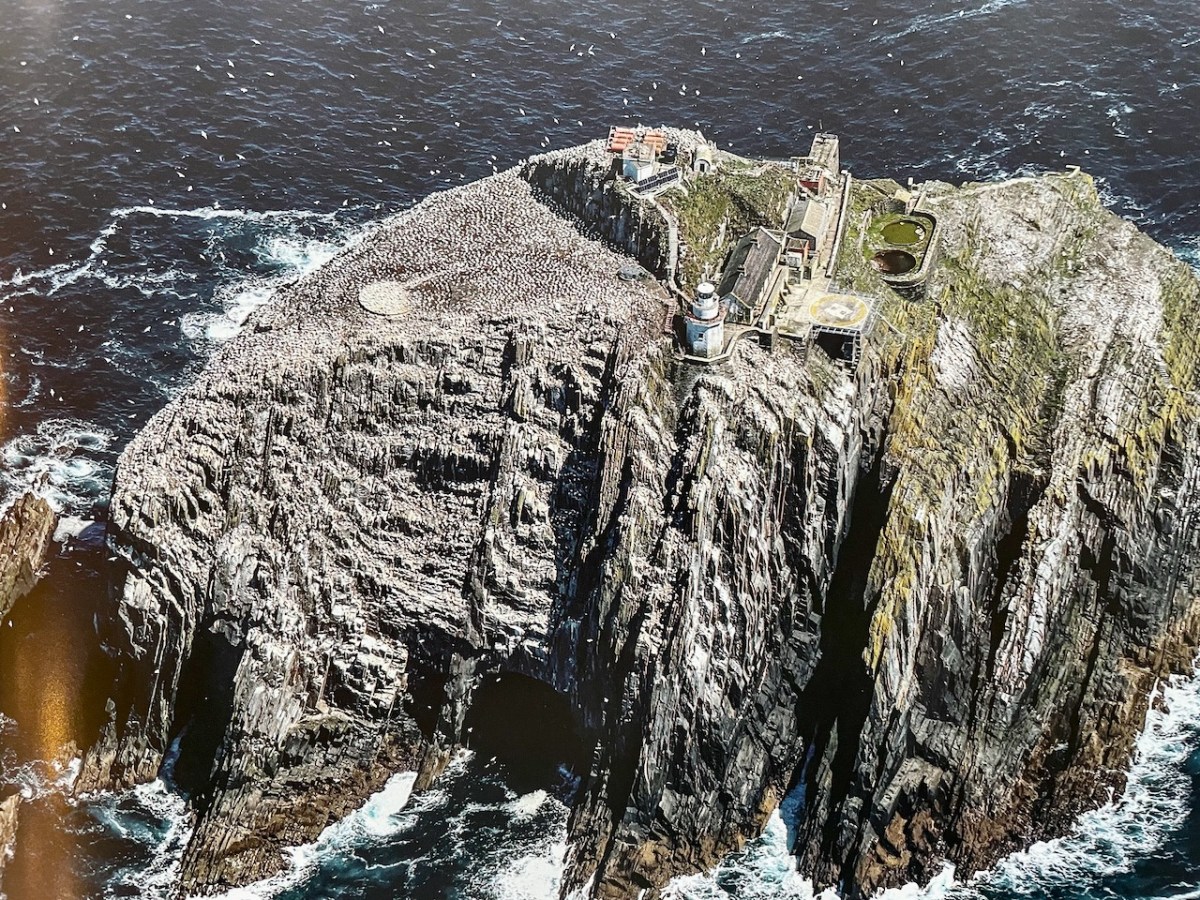
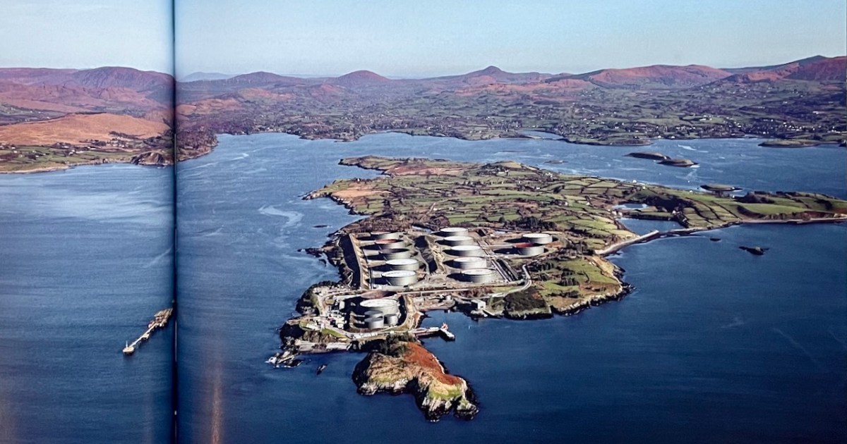
Let’s start with Dennis Horgan’s latest – The Coast of Cork, A View from Above. Dennis has been incredibly generous in allowing us to use his photographs in the past, but we have never reviewed one of his books before. In the age of the drone, it’s easy to forget that only an aerial photograph can capture the most expansive views – a whole island, for example, or the sudden rise of a humpback whale, or a seascape feature that is too far from land to capture any other way.
Dennis is the real deal. Leaning out of a plane flying at 150 miles an hour, kept safe only by a seat belt – it’s not for cowards. Add to this his mastery of photographic techniques necessitated by speed, varying light, changing focal lengths, wind and cloud and here you have a virtuoso photographer working at the height of his powers.
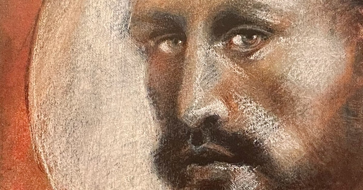
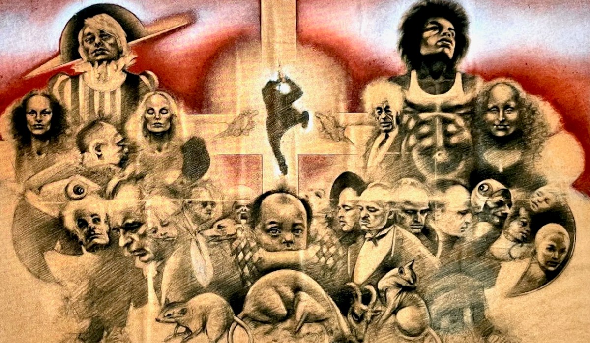
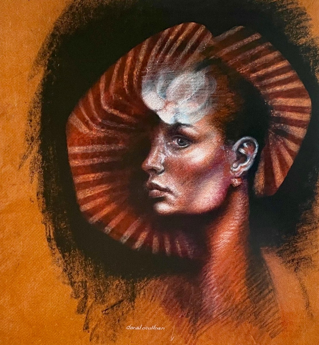
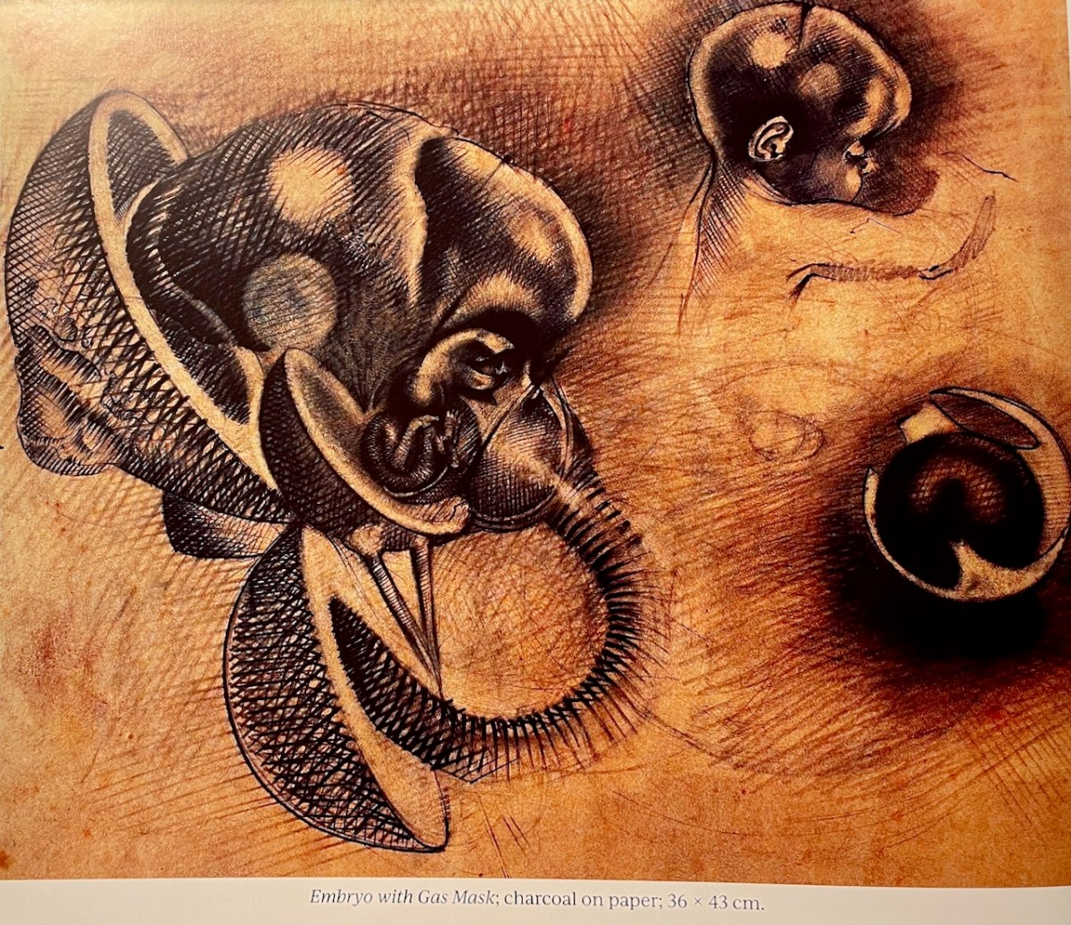
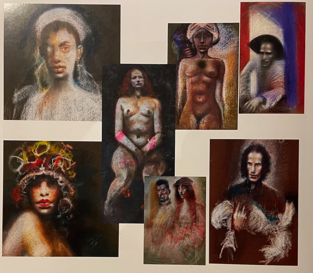
Our second book, Donal O’Sullivan: An Artist Remembered, is a revelation – why has nobody heard of this man? In jaw-dropping image after image, Paul Finucane and Brendan Lyons reveal the forgotten genius of O’Sullivan, whose preferred media, pastels and pencil, glow out from these pages.
We learn about his students activism – he was a leader in reforming the old-fashioned and under-resourced College of Art, still languishing in basement rooms in Kildare street in the late 60s, with a curriculum dictated by civil servants (no life drawing, use those plaster casts!). Later, he was a beloved teacher in Dun Laoghaire, a friend and mentor to many.
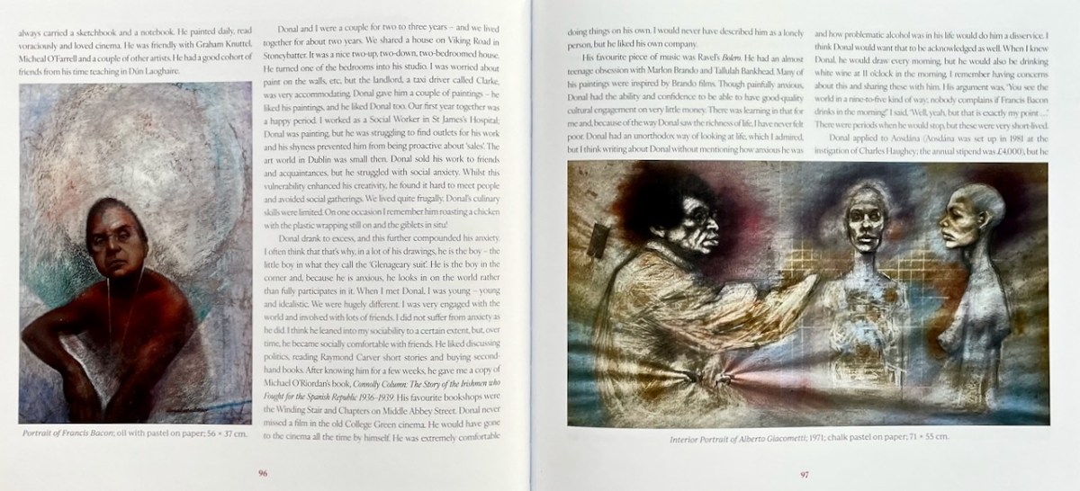
There are several descriptions of his chaotic studio. It sounded much like that of one of his inspirations, Francis Bacon, now reproduced in the Hugh Lane Gallery. He died by suicide when he was only 46, mourned by the family who loved and supported him through his later addiction battles, and those in the art world who remembered him as gentle, kind, encouraging, and fiercely individual.
A piece in the Irish Times says, he had gone against the expressionism that was fashionable in Irish art circles at the time, trading instead in powerful, elegant and melancholy figurative art that often discomfited its viewers. That same piece has a video that shows many, many of his works, carefully preserved by his sister, Marie. There are many self-portraits – my lead image is a detail from one. And many nudes, despite the best efforts of those 1960s civil servants.
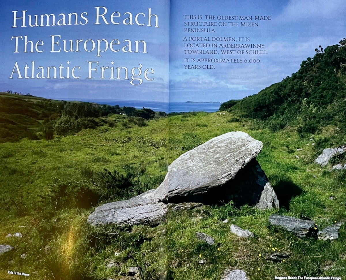
Finally, a book that, according to its writer, has been 18 years in the making, deals with a topic dear to my own heart. This Is The Mizen, by John D’Alton, delves into the history and prehistory of the Mizen Peninsula, copiously illustrated by John’s own photographs as well as historical images.
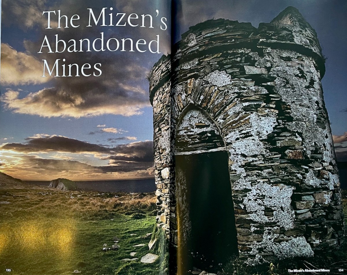
John, a former journalist and professional photographer, loves a moody landscape and his photographs often highlight a building or landscape lit by a setting sun. He has produced two previous books about West Cork (see here for example), using his own images.
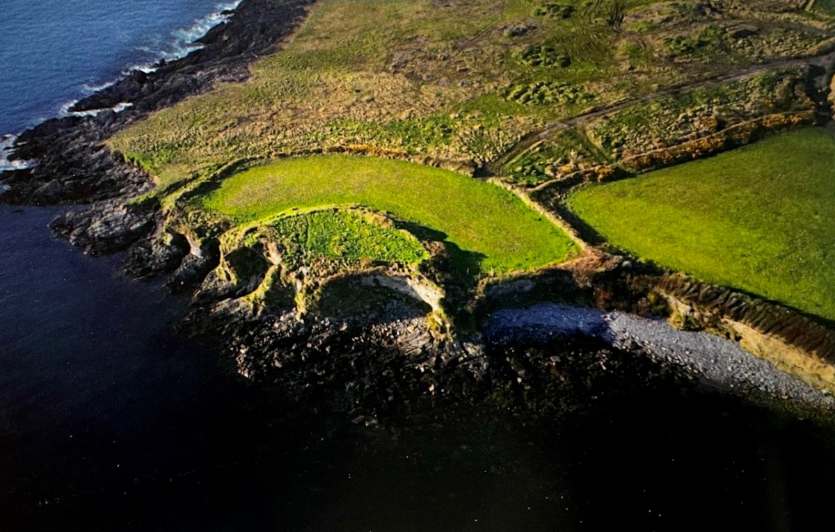
But this is not primarily a picture book, but rather an extended essay on the history of the Mizen Peninsula, from the earliest times. Regular readers might recognise the partial fort above – I wrote about it here and here. Don’t expect a turgid academic treatise: John has done his homework, and combines that with his own trenchant opinions, and a take-no-prisoners approach, to provide a highly readable account of this area. The book is available at local bookstores, such as the lovely Worm Books, or at https://www.buythebook.ie/product/this-is-the-mizen/
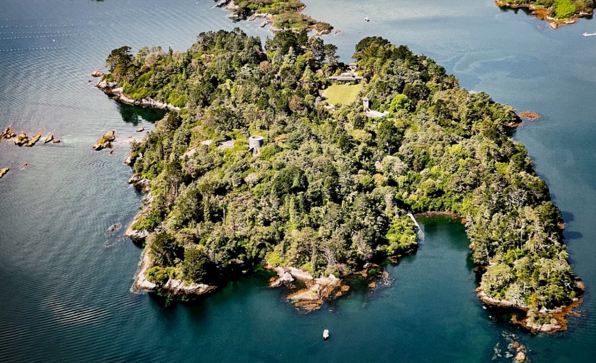
Above, Whiddy Island from Dennis Horgan’s The Coast of Cork
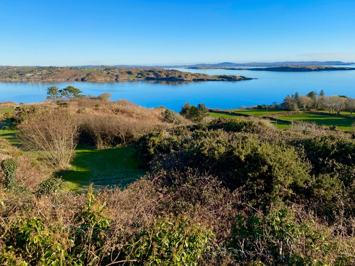
Last week my post explored a part of the Colla Loop on the Fastnet Trails. That walk passed by a site described on Archaeology Ireland as a possible early Christian settlement: . . . the ancient school of Sancta Maria de Scholia, ‘a place known in early times as a centre of learning’ . . . That information was ascribed to ‘Burke 1914’ but I can find no links to that source anywhere. If anyone can enlighten me, that would be great.
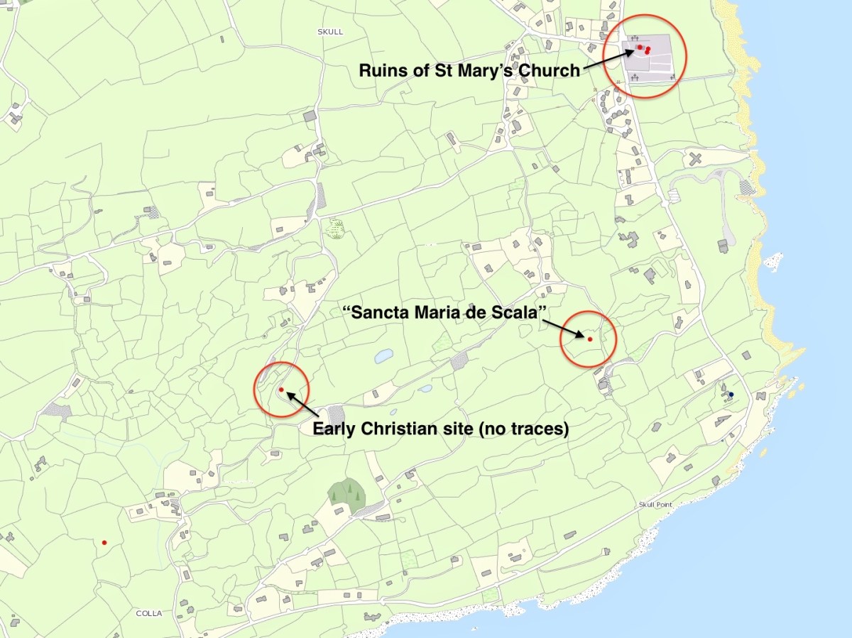
The location of this possible site is in the gorse covered area on the right hand side of the picture above. There is nothing to be seen there today, although such dense scrub could be hiding a lot. That record on the archaeological site is now described as ‘redundant’ – because there is no trace – but is maintained as it does indicate that there has been a tradition of the associations of the place historically. Certainly, if you were a group of wandering monks in medieval times looking for a new home it would have much to commend it – a south facing slope, sweeping views to the ocean below and defensible high ground behind. Not much shelter from the weather, though. The map below shows the possible site on the lower left, but note there are two further candidates, which we will discuss.
I found the historical reference to this possible site intriguing, especially in view of the suggestion that it could have been the original ‘school’ (centre of learning) that supposedly gave the settlement of Schull its name. If you want to delve further into the origins of the name ‘Schull’ – which the Ordnance Survey, interestingly, insisted should be spelled Skull right up to modern times: you can see it on the the Archaeology Ireland record extract above – I commend you to John D’Alton’s fascinating and comprehensive article here. John himself is a well-known long term resident of the village; I would love to have a discussion with John (and likely will when times permit) on some of his conclusions, but he certainly lays the foundations for questioning long-held assumptions. He does, however, posit that the name of the place has sounded the same for over a thousand years. For me, it is reasonable to conclude that ‘Schull’ is most likely to derive from the Irish word scoil – school – and that a ‘centre of learning’ did, indeed, exist in the area anciently. There are precedents enough for sites like this in West Cork. Our own Rossbrin Castle was the home of Finnin O’Mahony – Taoiseach of the clan – in the late fifteenth century and he was known to have established what has been described as ‘the greatest centre of learning in Europe’ on these now remote and deserted shores, while the Sheep’s Head peninsula boasts the remains of a great medieval ‘Bardic School’ close to Kilcrohane. My post of (yes!) eight years ago gives a brief outline. But let’s now turn to those other sites shown above.
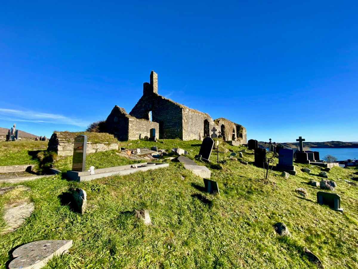
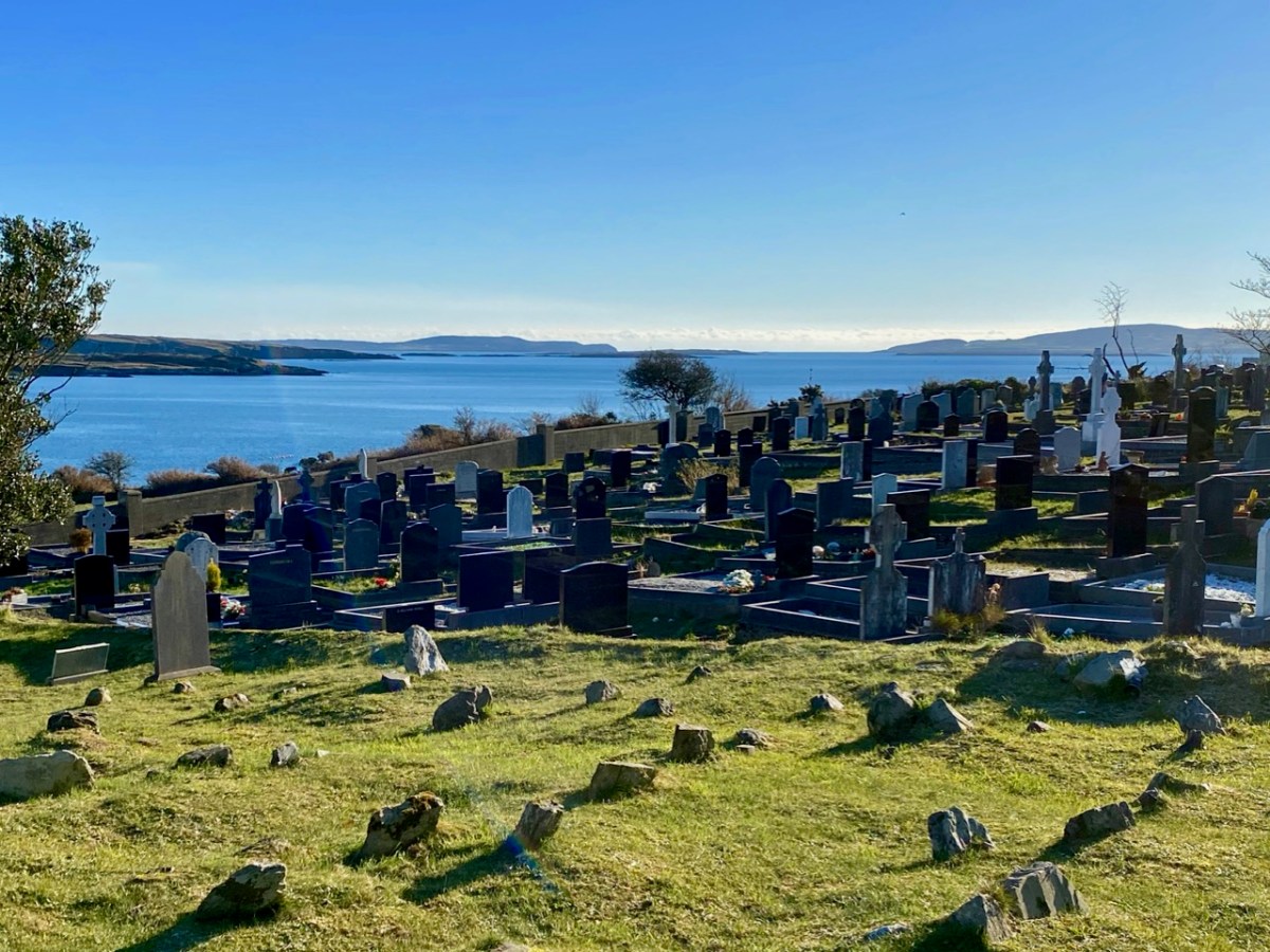
Here’s St Mary’s Church, the ruin which sits above – and dominates – the large burial ground to the south of Schull today. Tradition has it that it was built in 1720, but there is a fair bit of evidence to suggest that this ecclesiastical site goes back much further than that. I am indebted to Mary Mackey for her article in Mizen Journal – Volume 8, 2000: A Short History of the Ruins of St Mary’s Church, Colla Road, Schull.
The parish church is first recorded in a decretal letter issued in 1199 from Pope Innocent III to the Bishop of Cork listing the parishes in the diocese. The entry reads “scol cum suis pertinentiis” – Schull with its appurtenances. It is this early spelling of ‘scol’ meaning school which goes some way to authenticating the ancient tradition . . . During the reformation (16th century) when all church and monastic benefices and land were confiscated, the detailed rent roll for the Diocese of Cork records Schull with nine ploughlands, and in 1581 in a list of parishes in the diocese, Schull church is called “Saint Maria de Scoll”. This seems to be the first written record of the name of the church and it adds weight to the theory of the ancient monastic school, and to the origin of ‘Scoil Mhuire’ . . .
Mary Mackey – MiZEN Journal Volume 8
The same article notes that in 1653 the church commissioners stated “Upon 9 plowlands of Schull are the walls of a church” and in May 1700 Bishop Dive Downes, visiting the western part of his diocese records: “The church walls are standing and good, made of stone and lime 84′ long and 24′ broad”. Mackey comments that this was a large parish church compared with others in the Mizen area.
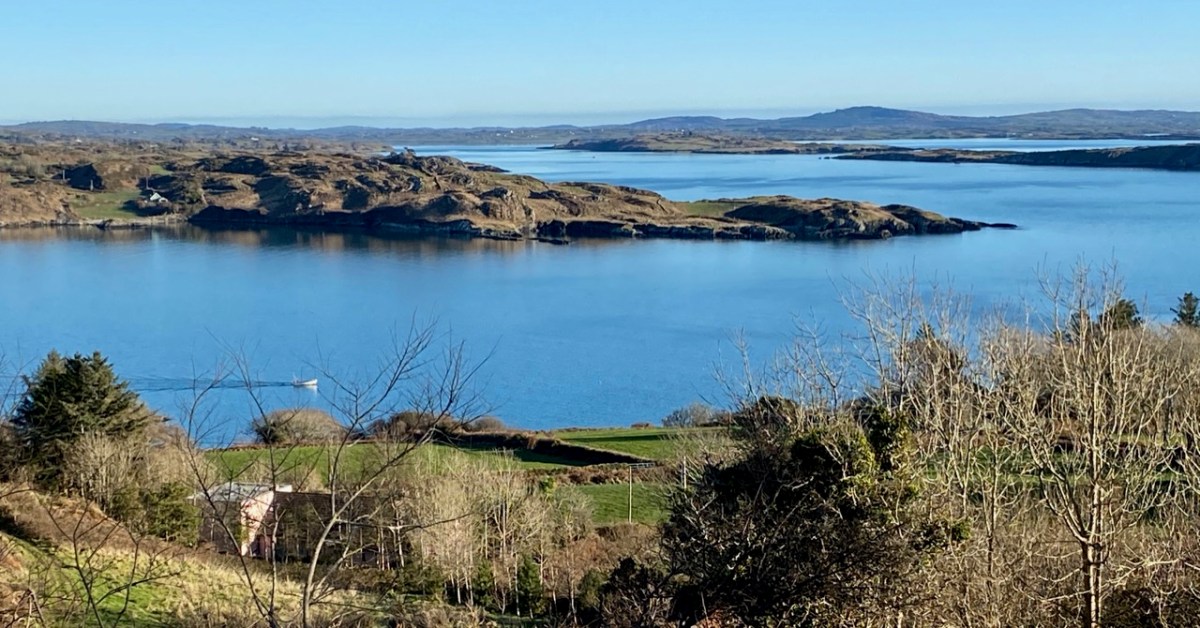
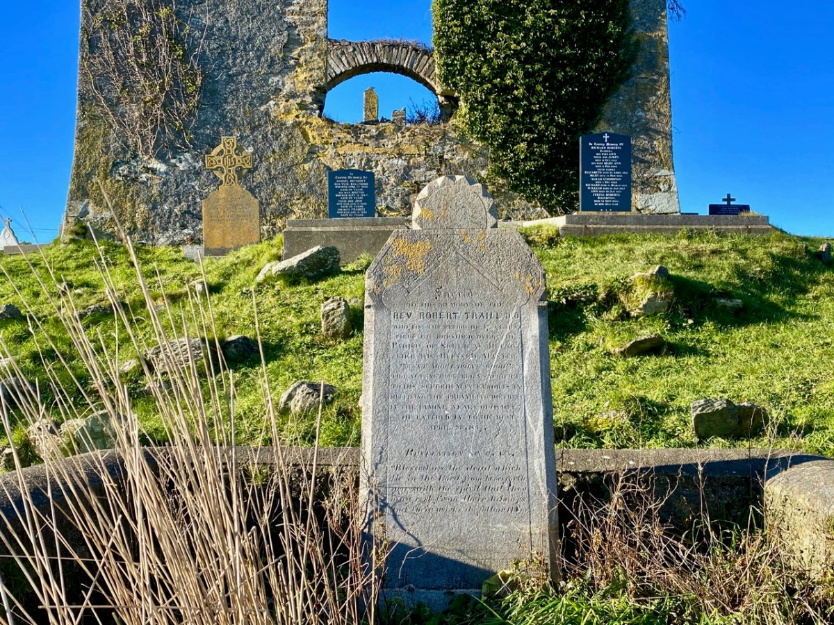
The local population will be very familiar with this ruin, and the graveyard which it overlooks. The grave marker (above) is dedicated to the Reverend Robert Traill – Finola has included him in her Saints and Soupers series. Schull graveyard must have one of the finest prospects of any burial place in the west, with its views out towards Long Island Sound and Roaringwater Bay:
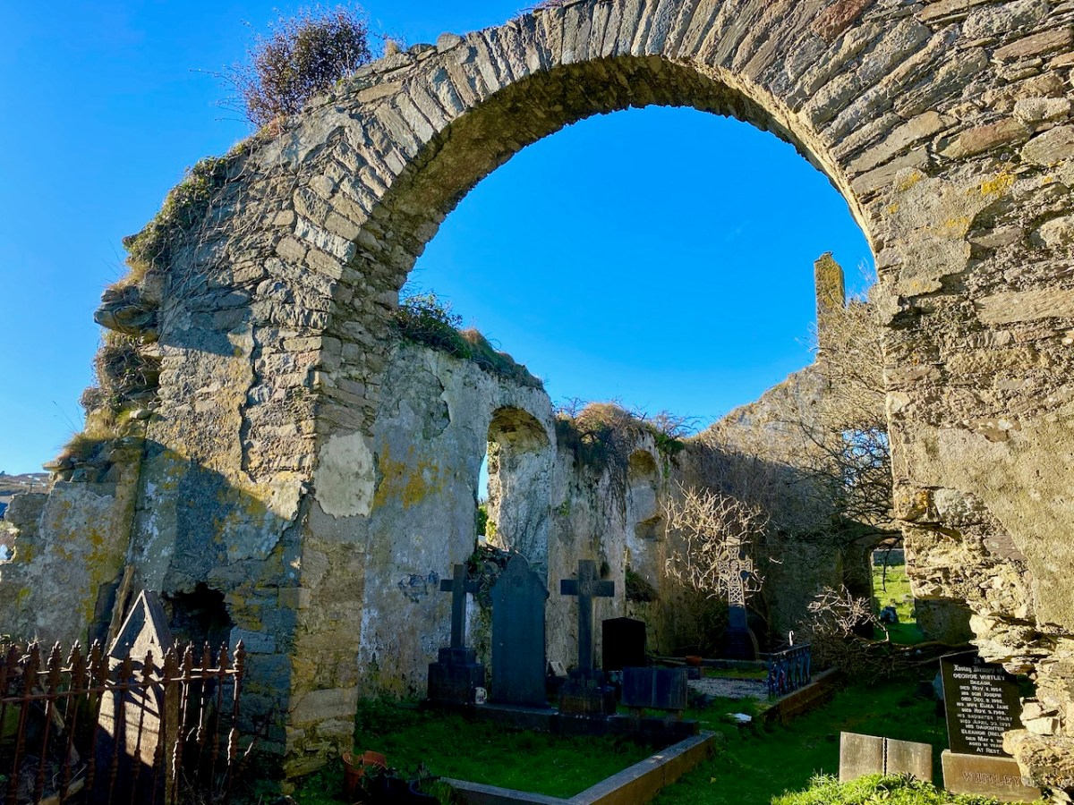
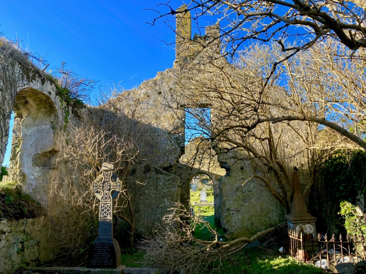
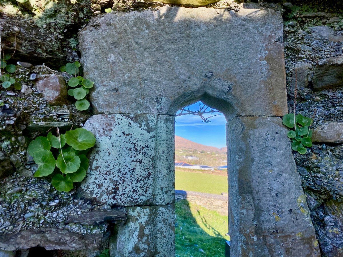
In 1936 we find Con O’Leary writing in A Wayfarer in Ireland (published by R M McBride): . . . Schull, named from Scoil Mhuire, the School of Mary, in the sixth century, is picturesquely situated , with Long Island thrown across the mouth of the bay . . . Well, that’s stretching us back a fair bit – but there’s nothing to confirm it. In the ruins of the church, however, there is one element which leads us to think that the architecture is quite ancient – this cut-stone ogival window in the northeast wall (possibly fifteenth century):
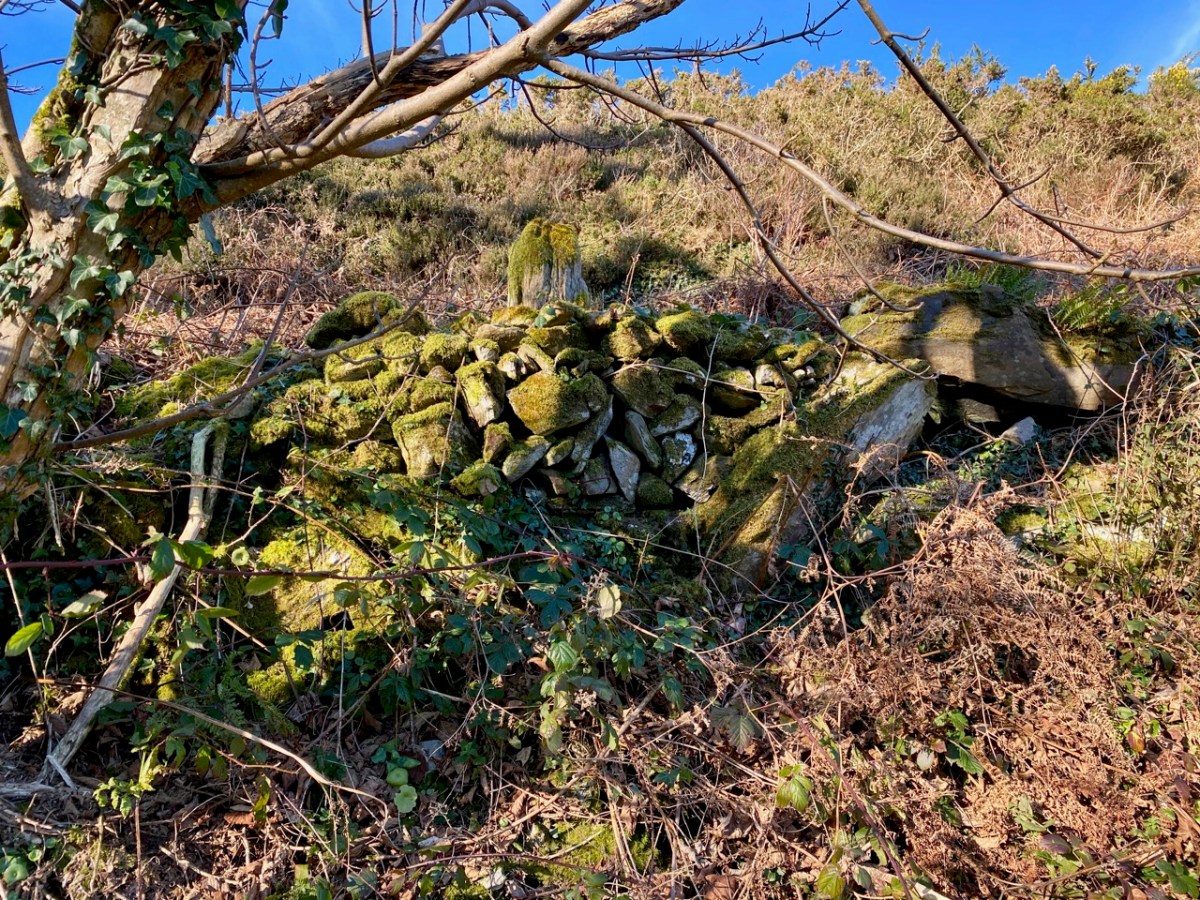
Now let’s turn to the third candidate in our search for Schull’s origins as a ‘great centre of learning’ – shown on the map towards the top of this post to the south of St Mary’s Church. Here is the Archaeology Ireland listing and the record note:
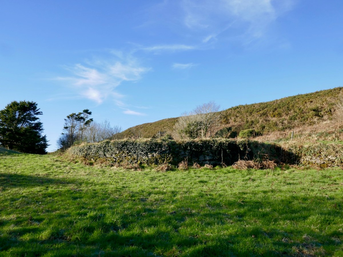
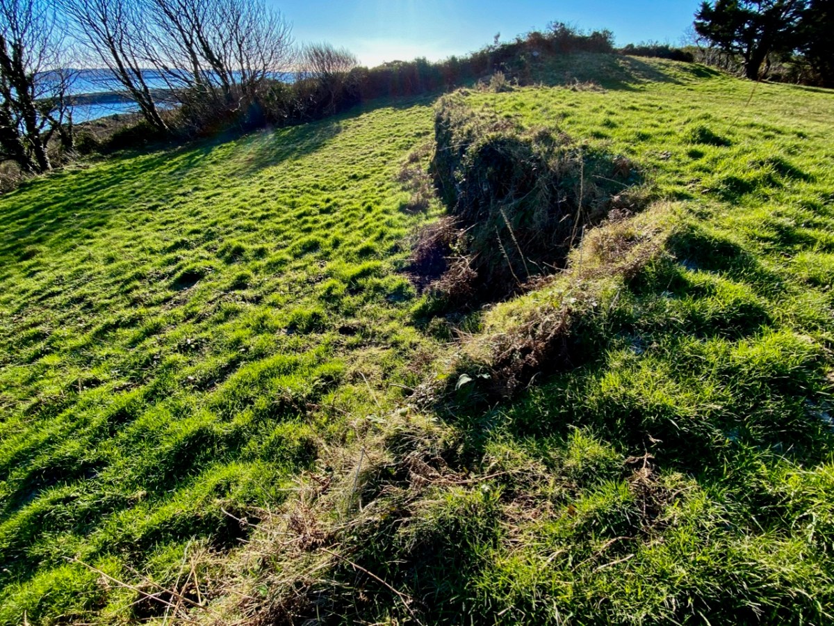
Description: In rough grazing, on a S-facing slope overlooking Long Island to the S and Skull Harbour to the E. Recent reclamation work exposed a level earthen platform-like area (c. 35m E-W; c. 17m N-S) faced externally on its curving S side by a roughly constructed drystone revetment (H 0.2m at W to 1.6m at E). According to local information, this is the location of Scoil Mhuire or Sancta Maria de Scala, a medieval church and school that gave its name to this townland and to Skull village . . .
The Archaeological Inventory of County Cork. Volume 5 (Dublin: Stationery Office, 2009)
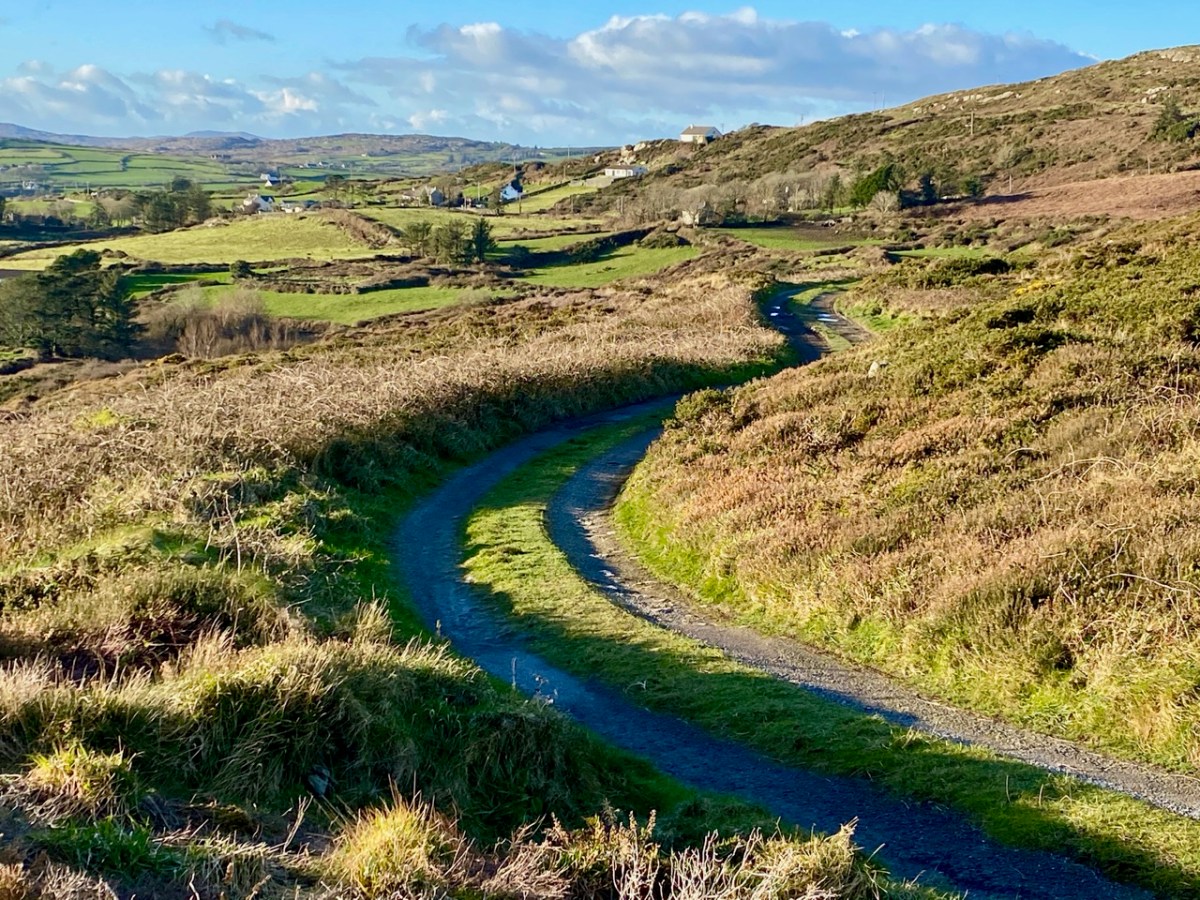
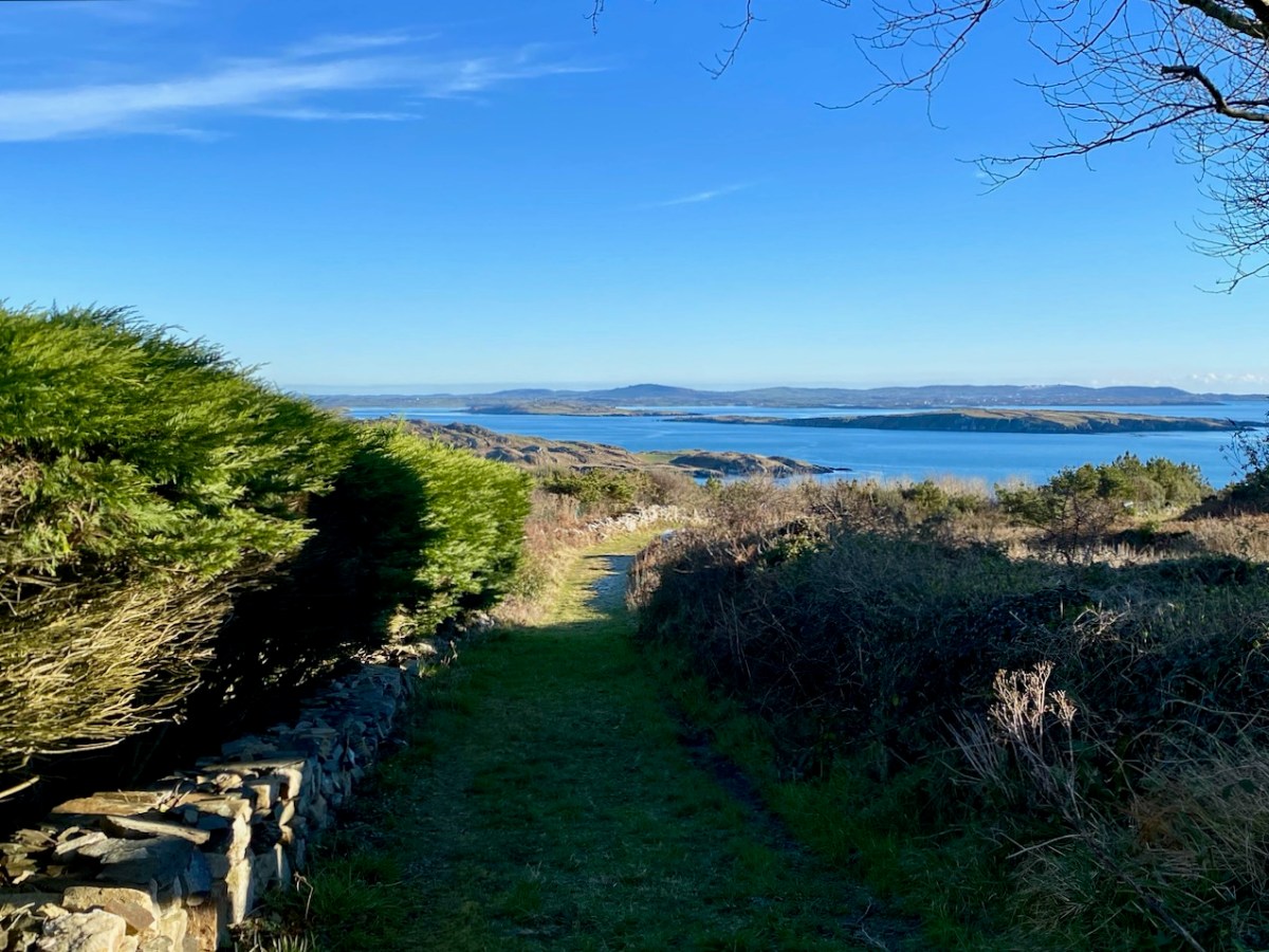
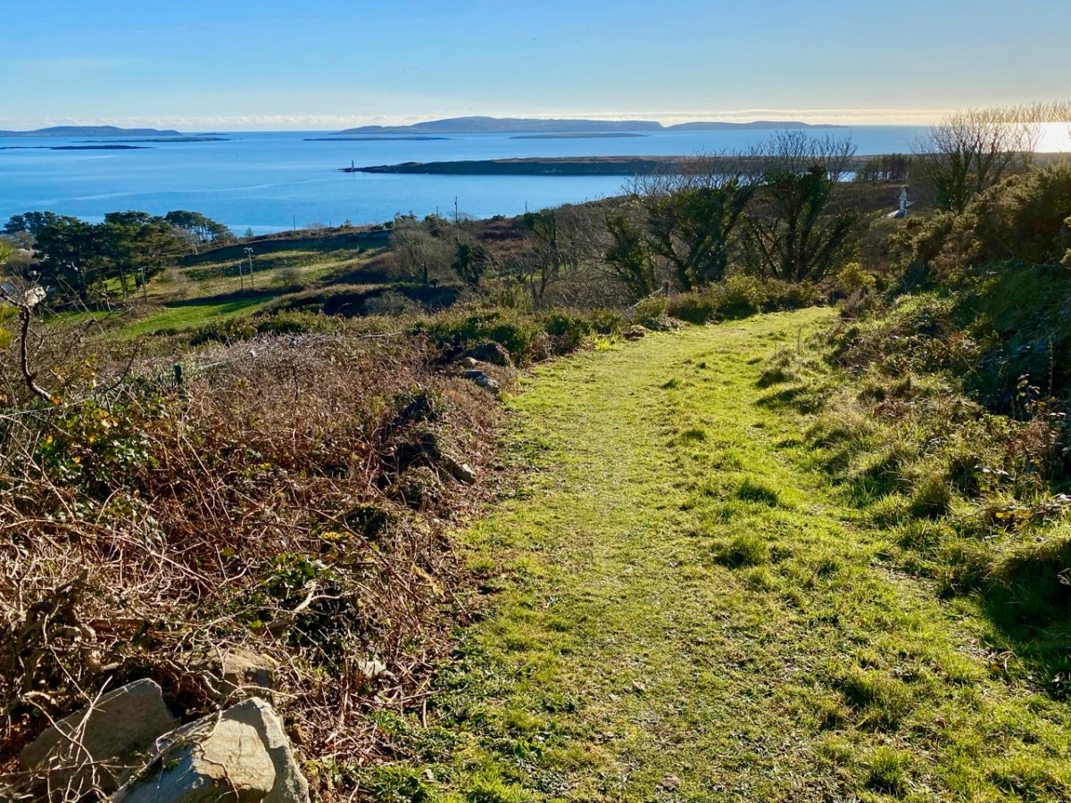
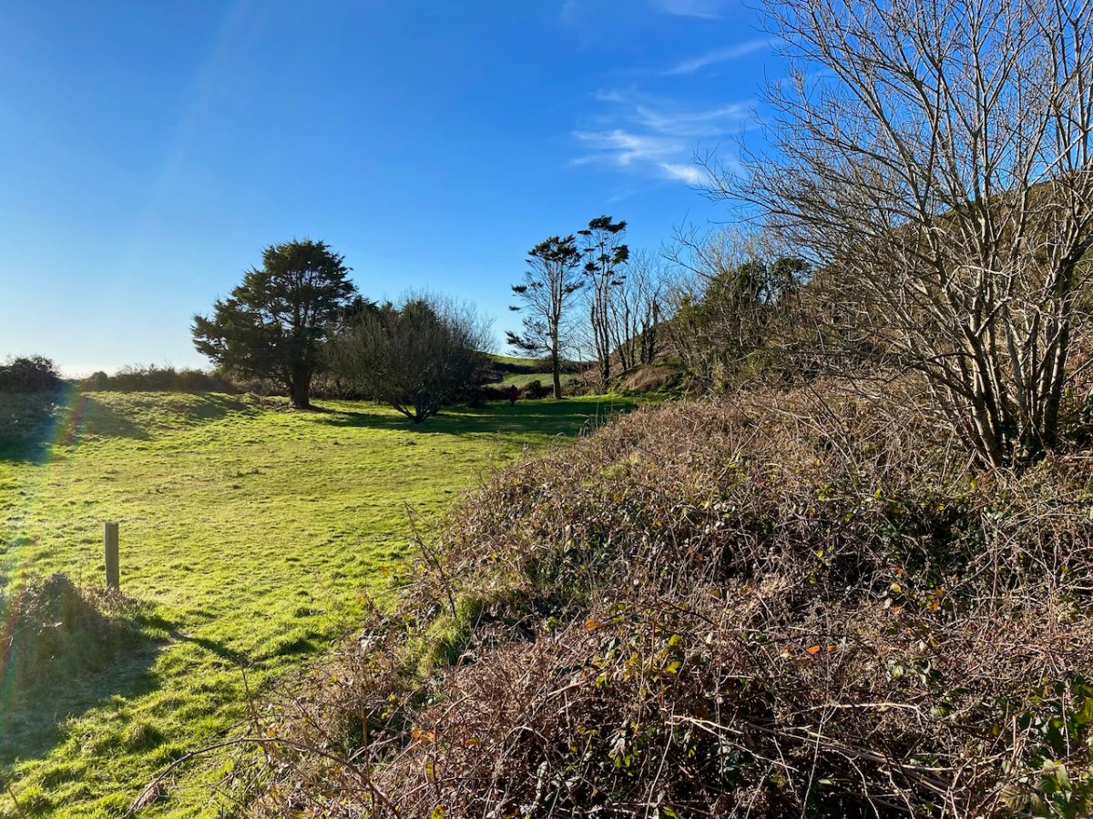
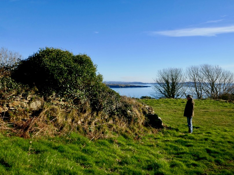
The prospect of unearthing ancient history sent us out into the field on an idyllic January day, under an almost surreal clear blue sky. We don’t exactly know what we found, but the expedition was rewarding, if only for the joy of walking through a beautiful country and knowing that other generations had walked here before us.
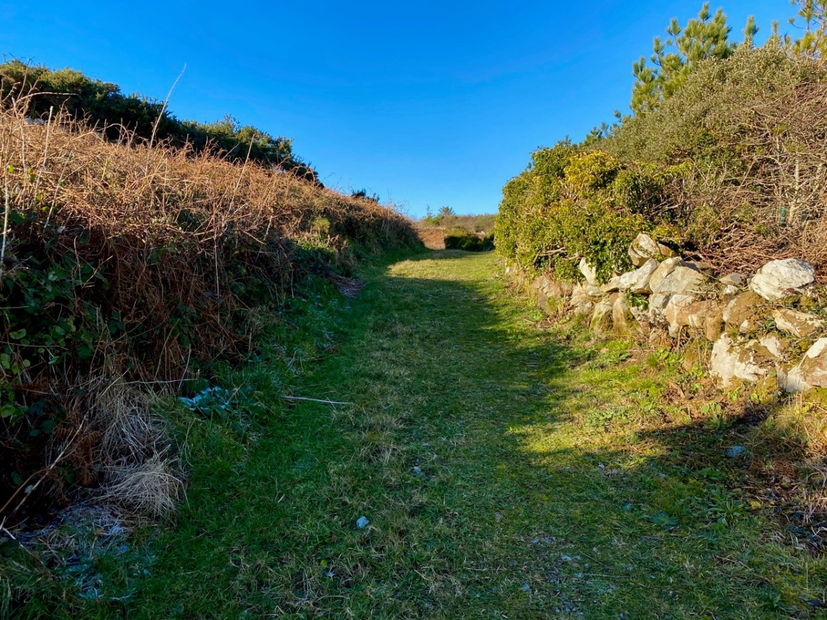
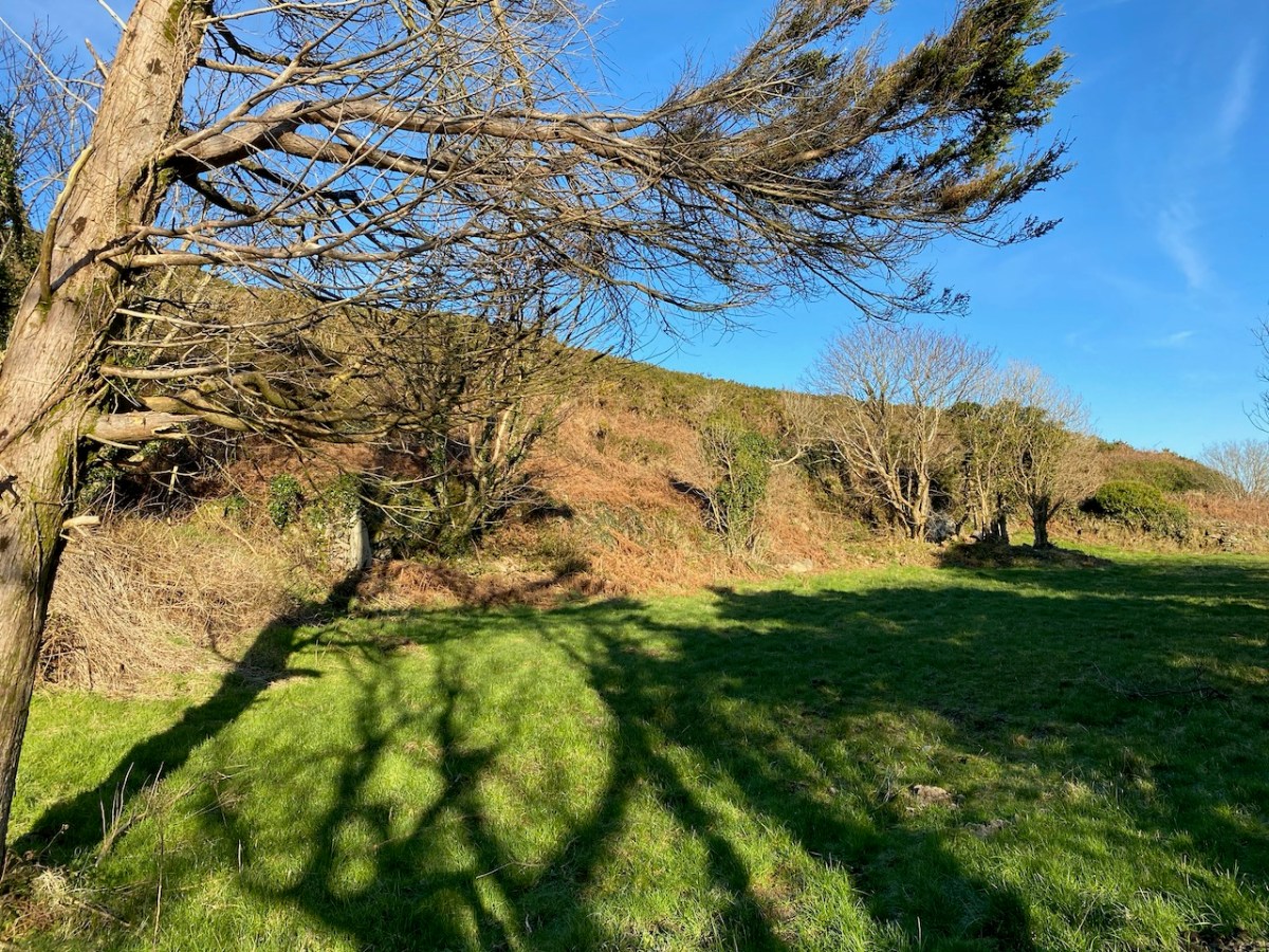
Always we were in sight of water, and the islands of the Bay beyond. We left the metalled boreen and found a narrow green path lined with old walls.
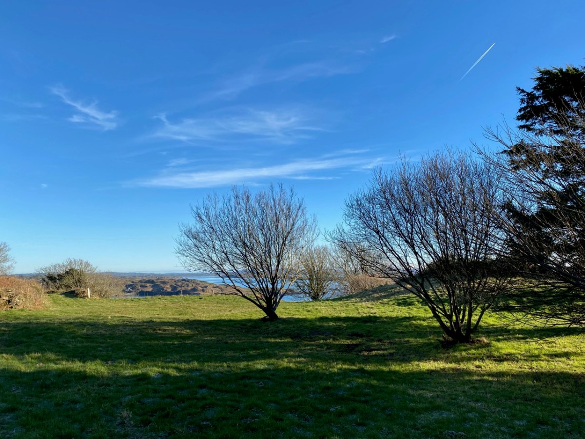
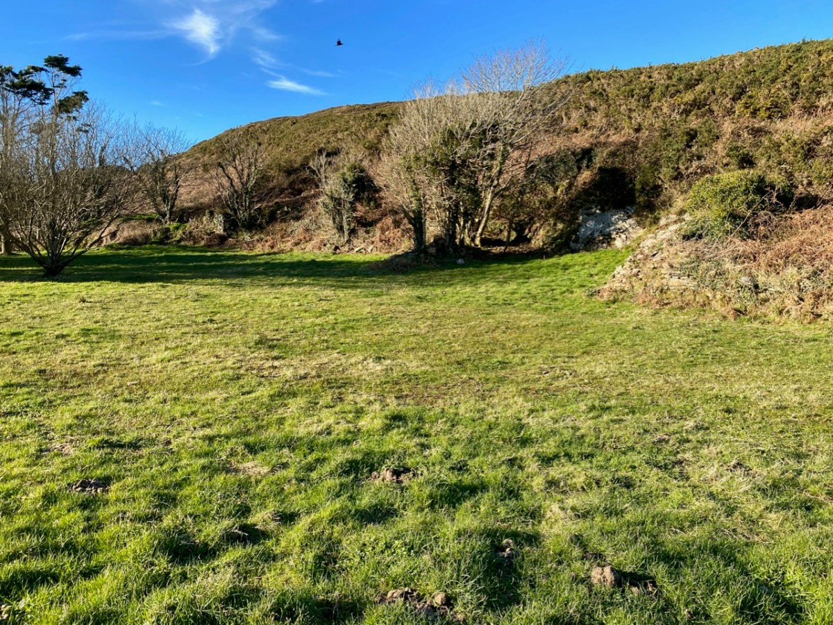
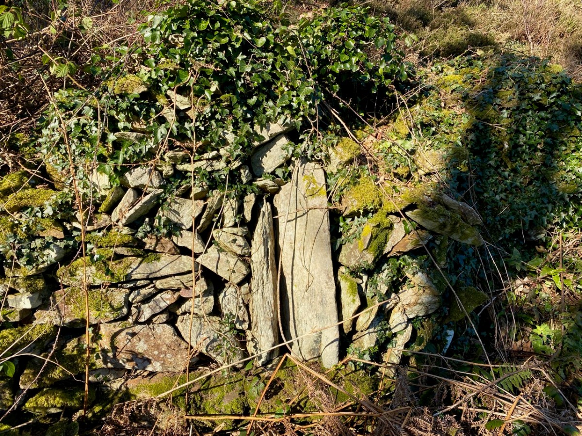
The path led to a sheltered paddock. We could clearly see the ‘level earthen platform-like area’ and the curved retaining wall supporting it: also, in several areas, there were the vestiges of old walls and probable structures. We immediately sensed the zeitgeist of a place which had tales to tell. Could it really be an early Christian settlement? Did the old stone walls echo the chanting of monks from long ago? Could we look through their eyes and see the grove of trees and the spectacular azure cast of the sea receding to the horizon across all the islands as they had?
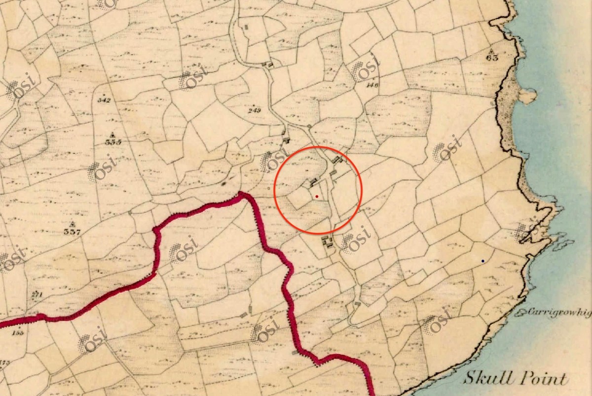
The Historic 6″ Ordnance Survey map is the earliest record we have of what existed on the site: it dates, at the latest, from around 1840. There are buildings clearly shown. Could they have been simple farm cottages and barns? Might those buildings perhaps have incorporated much earlier structures?
There you have it: a creation tale (myth, perhaps) for Schull. I will give the last word to a pupil from ‘Skull School’, recorded in the 1930s:
The O’Mahony’s had a stronghold in Castle Island, which is known as the Middle Island. It is situated about three miles from the beautiful village of Schull, which lies by the harbour of the same name. Situated amid picturesque and varied scenery, nestling at the foot of Gabriel’s rough defiles, and fronting the wild Atlantic, it is a charming spot. It was anciently called Scoll Muire (B.V. Mary’s School) and in mediaeval documents it is designated “Sancta Maria de Scholia.” This school is said to have been founded by the “Universitie of Rosse, St.Fachtna’s Carbery”. However this may be – I doubt it – the parish is mentioned as Scol in the Papal Letters of Pope Innocent III. (1199 A.D.). Canon O’Mahony says its site has been identified in south Schull. At all events, Ardmanagh (Monks Hill), on which part of Schull is built, attests the presence of cenobites in the district . . .
Brighid Ní Choithir – Skull School – Dúchas Schools Folkore Collection 1937
Please note that the ‘Sancta Maria Scala’ site is on private land, and permission to visit should be sought.
Welcome to the UCD Library Cultural Heritage Collections blog. Discover and explore the historical treasures housed within our Archives, Special Collections, National Folklore Collection and Digital Library