
The middle of January: you might expect to be battened down here in West Cork with raging gales or bitter north winds, but Saturday dawned with a clear sky to reveal a most beautiful sun-warmed landscape. We had to be out! We adopted exploring mode and headed for the hills to the north-east of Bantry. OS Map 85 entices with a whole swathe of archaeological sites from megalithic tombs to stone rows and circles, but it was a name that drew us: Barrboy – probably from the original Irish barrabhuidhe – which means ‘yellow summit’. As the highest point of the road in that place (pictured below – about 350m above sea level) is a mountain pass, we have chosen to name our journey Through the Yellow Gap.

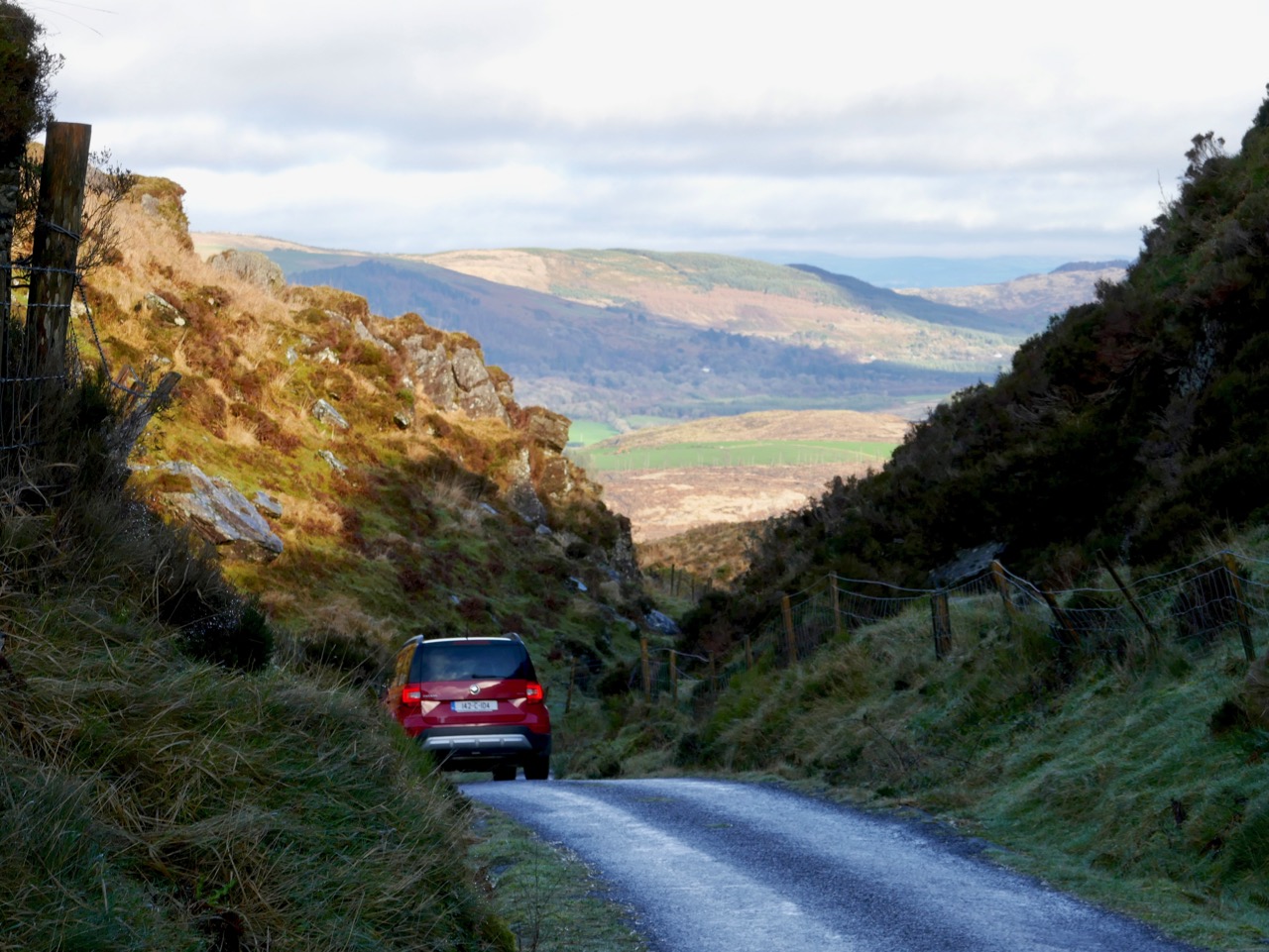

The ‘Yellow Gap Road’ runs west to east across the centre of this extract from OS Map 85: we turned on to it from the N71 at Lahadane, just north of Bantry, and dropped back on to the main road to Drimoleague south of Coolkellure
The first part of our route followed the Mealagh river and we were intrigued by the boreens that cross it in places over very fine stone arches: these will have to be explored another time – we were aiming for the hills.

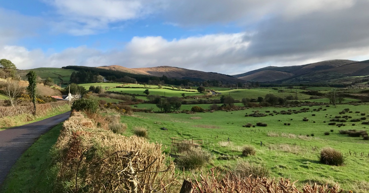
Our day offered us a study of light and landscape, which only the combination of January low sun and shadows can give. If anything the yellowness of the uplands with their rocks, mosses and furze is emphasised by this light: Finola is sure that the colour is due to the fionnán (blonde) grass which is so prevalent during the winter months (header picture). We felt we were in a very remote place, known only to those who spend their lives there, but we were in fact barely a hop and a skip from our own home.


Studies in light and landscape: with a different vista at every turn we were treated to outstanding views typical of rural Ireland
As is so often the case with our off-the-beaten-track excursions, we saw hardly anyone in the whole day, but we did chance to bump into our cycling friend Tim who is in training for yet another Everesting event. The rules are straightforward:
. . . The concept of Everesting is fiendishly simple. Pick any hill, anywhere in the world and ride repeats of it in a single activity until you climb 8,848m – the equivalent height of Mt Everest. Complete the challenge, and you’ll find your name in the Hall of Fame, alongside the best climbers in the world . . .

Tim on his way up the Yellow Gap Road (also known as Nowen Hill). He has to do this climb 56 times in one go to achieve the ‘Everest’. In fact, his aim is to do a ‘Double Everest’ on this hill! This will be his third Everesting event in West Cork… Good luck, Tim
Our travels took us through some very attractive ‘deep’ countryside dotted with cottages and small settlements. Humans have been here for a very long time and have left evidence of their occupation in enigmatic standing stones, alignments, circles and tombs. Some can be seen from the roadside, but many involve explorations across fields or into forests. Always, we are left wanting to know who these early settlers were and why they left us these monuments.


Upper pictures – single standing stones which can be seen from the roadside; lower picture – a five-stone circle and a two-stone alignment on high pasture land: all are ancient and mysterious
As the road threaded its way through the gap and began to descend we seemed to re-enter a less wild landscape, and habitations became more frequent. Eventually we found ourselves in a small community – Coolkelure – with a great sense of history. there was a fine C of I church, a school which had been in use until the 1950s, and an avenue leading to a large house which has had a chequered history, There is an entry in Duchas (the Schools Folklore Collection) about this village:
. . . Coolkelure is situated about four miles and a half west of Dunmanway. There is a holy well at the side of the road but it is covered in now with briars and bushes. Its origin is unknown. There are three steps going into it and there are medals, pieces of cloth and pennies up on a stone over the well. About twenty feet in from it there are rocks nearly a thousand feet high. It is said that a giant lived there in olden times. On the other side of the road is a marsh and the giant is supposed to be buried there. There is a huge stone over his grave. Further on is Coolkelure House. This formerly belonged to Shouldhams, now it is the property of Lady Bandon. The avenue looks beautiful in summer and it is hedged with rhododendrons of every hue . . . (Joan Collins, aged 12 years, from Patrick Collins, aged 60 years – c1934)


Upper – Coollkelure Church; centre – the Lodge at the gateway to Coolkelure House; lower – one of many fine gargoyles on the eccentric Lodge
Well, we didn’t see the holy well, the thousand feet high cliff, the giant or his grave. But we did see rhododendrons – large thickets of them – all the way along many of the roads we travelled. They must look very striking when in bloom in the springtime, but they are an invasive species which threatens the true natural hedgerows. In Coolkelure, also, occurred one of the highlights of our day. We met and got into conversation with Donal and Caitriona – a most hospitable couple who own a small house overlooking the lake. They invited us in, we were given coffee and cakes, and the chat was mighty!


Upper – looking back at our way through the mountains; centre – an example of the many stands of invasive rhododendrons that we encountered and lower – the road becomes tamer as we approach a pastured landscape
We left Coolkelure and headed out of the hills, feeling fulfilled by all the events of the day. Our adventures were not quite over, however, as we encountered Daisy and her owner with their ‘road-car’, delighted that we stopped to photograph them (below). In fact, between us we took at least two hundred photographs on our day out and can only include a modest selection on these pages.


Awesome photos in this post. I decided some time ago that my efforts to photograph scenery didn’t do justice to the subject, but yours certainly does. Sandy Denny’s ‘Briars and Bushes’ might have been written for Coolkelure.
LikeLiked by 1 person
Thank you, Roy. You’ve brought back whole waves of nostalgia to me with Bushes and Briars. The 1970s were a great era for good folksong.
LikeLiked by 1 person
What a wonderful post, Robert. I really felt that I was there…
LikeLiked by 1 person
It was a great day out, Gill. We’ll take you out that way next time we go.
LikeLike
Great read & photos too, have relatives in the lovely mealagh valley area..
LikeLiked by 1 person
It is fine country out there!
LikeLike
Daisy’s owner is obviously involved with old and new forms of transport. The logo for Scania trucks (King of the Road) is embossed on his jacket. The roads around Coolkelure are certainly better suited to Daisy than a Scania!
LikeLiked by 1 person
Well spotted, Dan – I hadn’t noticed the logo. We hardly saw a soul – or a vehicle – in our day spent on those rural roads…
LikeLike
Just missed yous! We stopped by (probably) that bridge – walking a short way along the river is a group of standing stones but I decided they must be modern, and opposite is a ruined mill(?) building. I hiked up the gap last year on my way from Kealkill to Drimoleague over Maughalamesha. There is also a pleasant waymarked walk off the main valley road through woodland to a small wedge tomb where I ate my lunch! There are some interesting sites (and sights) up Maughalamesha too, especially the old house of ‘George the Sky’ (see the Drimoleague Walkways leaflet for details).
LikeLiked by 1 person
Thank you, Peter – that’s great additional information. Yes, I saw the modern standing stones too. We missed the other places you mention: good excuse for a re-visit!
LikeLike
I think I’ve found the well Robert and a sad little one it is too but in the most beautiful glen:https://holywellsofcork.com/2016/09/21/on-the-road-to-derryduff/
LikeLiked by 1 person
What an excellent day out, full of interest and encounters! We too were in the Mealagh investigating a well- isn’t it a remote and wonderful place. Will check out that holy well too, it’s not on my list!
LikeLiked by 1 person
The Duchas report is fascinating, but probably full of hearsay and good stories! Nowhere in that area could there be a thousand feet high cliff! There is a lake – which could have been the ‘marsh’, but we didn’t see a ‘big stone’. Perhaps there was / is a holy well: certainly worth investigating…
LikeLiked by 1 person
Robert there are times when I get so homesick for the “green fields” and today is no exception.
LikeLiked by 1 person
I can well imagine that, Shauna!
LikeLike
That’s a low arch to that bridge, shades of Brunel at Maidenhead.
All the best Paul Dyson
LikeLike
It’s a fascinating and splendid bridge, Paul: it just carries a very small road. But we did see evidence of a ruin in a field close by – and read about a large mansion that used to be there. So it’s likely that the bridge was in the demense of the house, and therefore built to enhance the view from the house. Otherwise it’s unnecessarily extravagant for its purpose.
LikeLike