Harry Clarke’s window in St Brigid’s Church of Ireland, Kilbride, Co Wicklow, is a bit of a mystery: simultaneously one of his most beautiful and his most mis-described windows. It’s almost as if there’s some kind of spell on it – whoever shall describe this window shall be led down erroneous pathways*. I hope this post will break that spell and set the record straight.
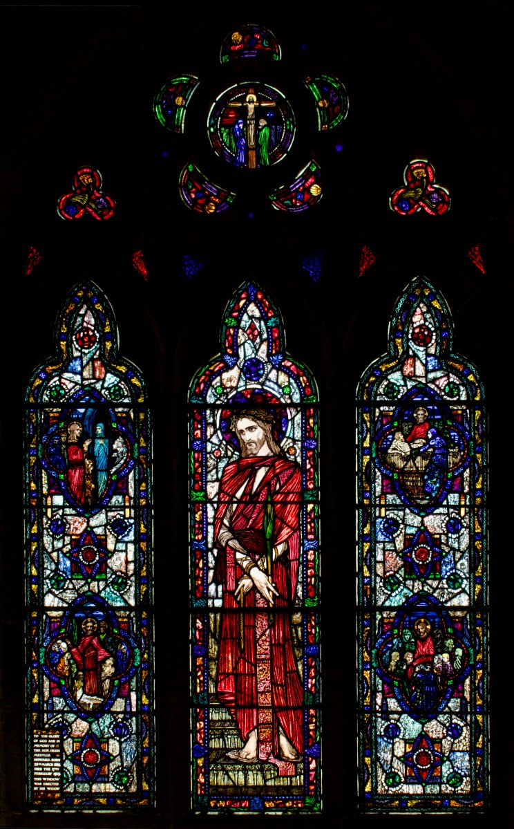
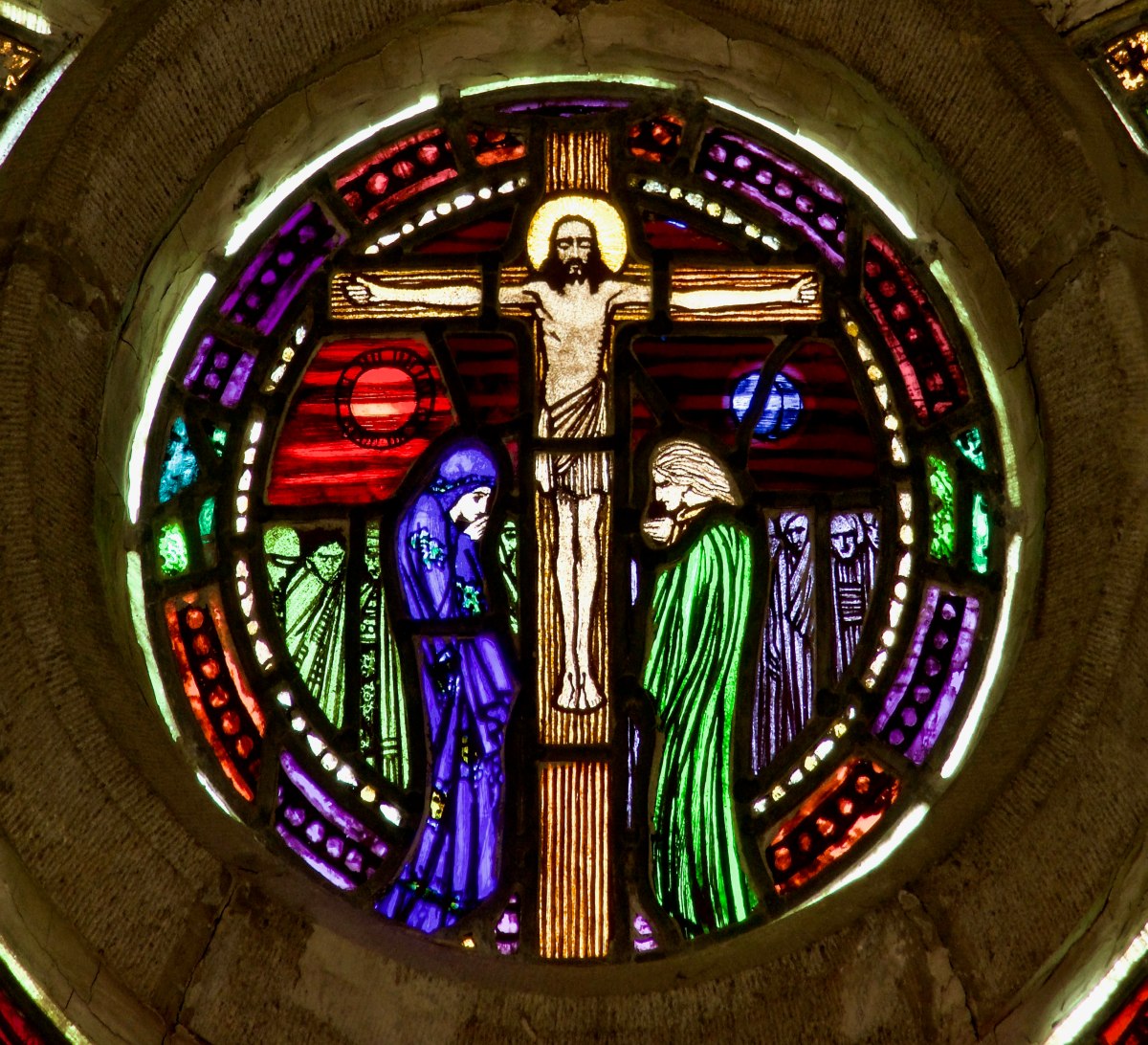
This is the whole window, which occupies the wall behind the altar. It’s a three-light window and the tracery above includes a small roundel with a crucifixion scene.
When it comes to Harry Clarke, there is no more authoritative source than Nicola Gordon Bowe. Hers are the shoulders upon which all of us stand to gain insight and understanding of the man and his work. She didn’t make many mistakes. However, inexplicably, she described this window as a ‘Resurrection’. In The Life and Work of Harry Clarke, she states that: As a result of the St Stephen Lea-Wilson Window in Gorey, Clarke was asked by the Earl of Wicklow to design a Resurrection window for the parish church of Enerily and Kilbride, Co. Wicklow near the Earl’s estate, Shelton Abbey. Several pages further on, she says Harry . . . spent 9 February with the Earl of Wicklow discussing a further window for the small church of Enerily and Kilbride near Arklow.
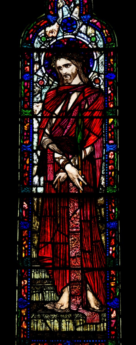
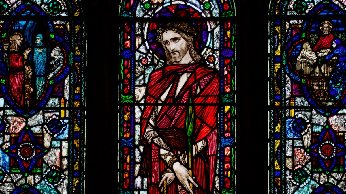
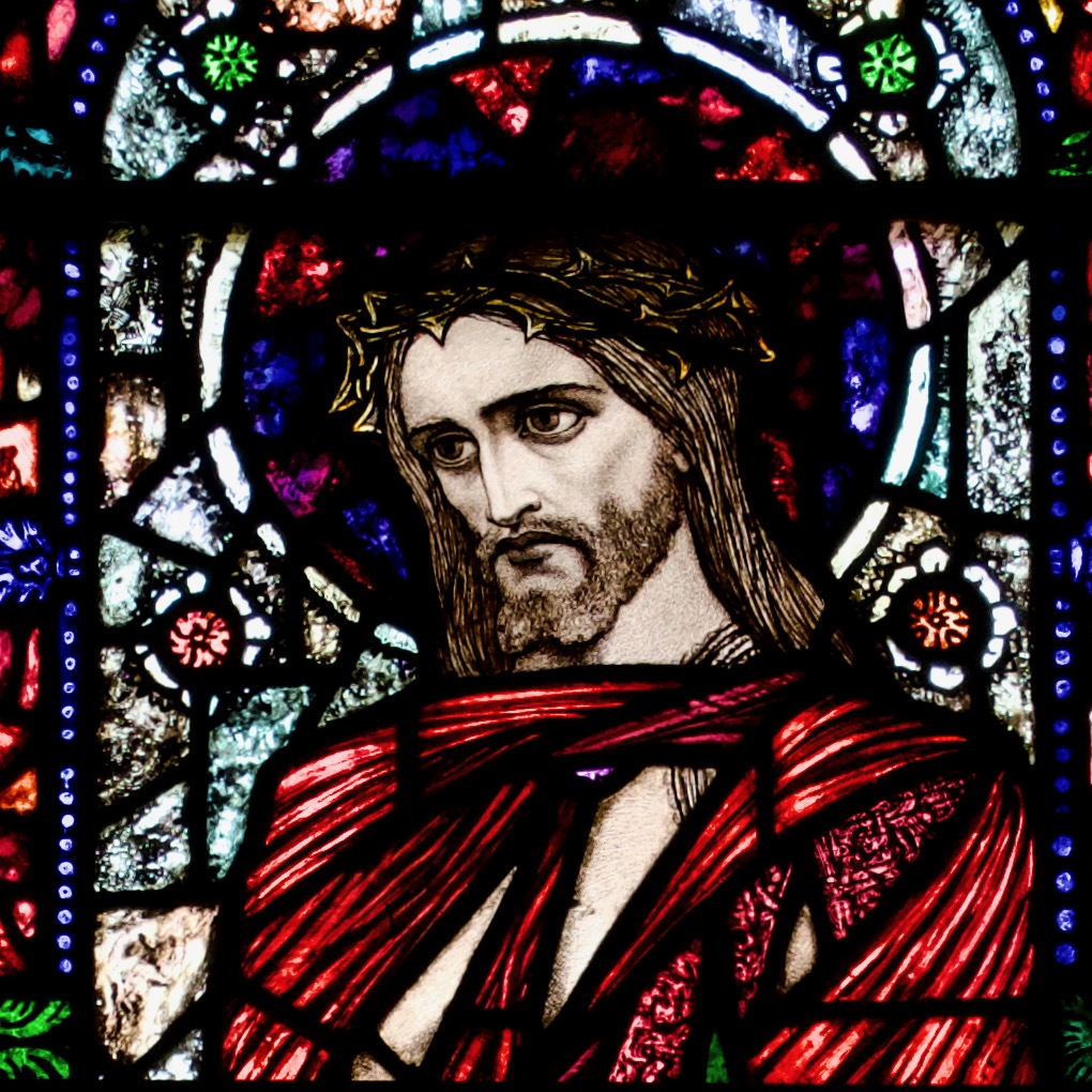
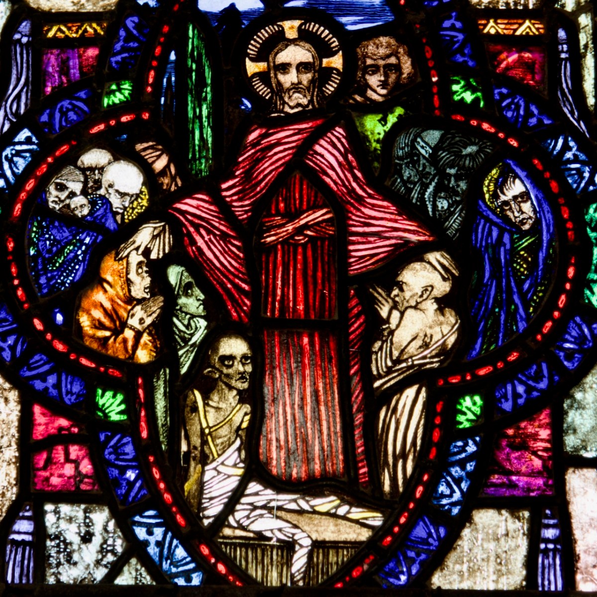
The central figure is of Christ as he was paraded before Pilate, who washed his hands of the affair and declared, as he presented him to the Jews, Ecce Home – Behold the Man. As described in John and Matthew, he is bound, crowned with thorns, holding a reed (Harry has chosen a bulrush), and clad in a scarlet robe. He is standing on steps (as frequently depicted in paintings) and under his feet the cloth may represent his own clothes, stripped from him
She describes the finished window thus: In the three-light Resurrection, the figure of Christ in the centre light stands at the foot of a staircase, robed in ruby, crowned with thorns and bearing the palm of martyrdom. The ruby glass is carried into the border, into the side traceries where it is neither painted nor acided, and is echoed in the medallion showing The Crucifixion in the centre of the rose tracery above. It is also used in the figure of Christ, which appears in each of the quatrefoil panels of the side lights which, set in rich borders of ruby, blue and green, seem inspired by medieval glass. A rich blue dominates four medallions showing miracles of the Lord. The medallion in the lower right-hand light features a self-portrait of the artist, a halo over his untidy hair, and huge eyes giving him a haunted look while above, the resurrection theme is evocatively illustrated by the miracle of Lazarus. This window is much enhanced by the rough, unplastered wall in which it is set.
Clarke’s Jesus in this window is one of his most striking depiction of suffering and compassion
However, the dedication on the window is to Hugh Melville Howard, younger half-brother to the Earl of Wicklow, and donated not by the Earl, but by Hugh’s widow. Hugh had died in 1919. The date might make you suspect that this was a war memorial window, but in fact, Hugh died of pneumonia at the age of 36. This must have been a tragedy indeed for his wife, May Sands, the only daughter and heiress of New York lawyer and real estate mogul, Benjamin Aymar Sands. They had married in America in 1908 – a high society wedding, every detail of which was gleefully reported in the New York Times. At the time of his death they were living in Bellevue House in Delgany and had two children. The window was not installed until 1924.
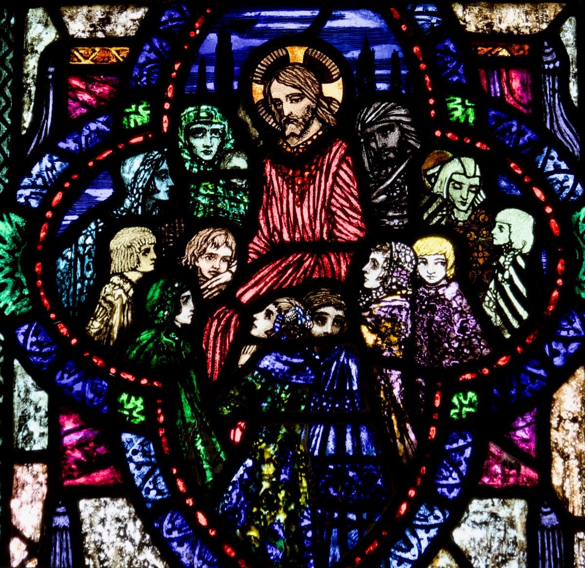
Christ and the Children
So there seems to be a disconnect between the original idea for a Resurrection Window for Kilbride, and the final product, which depicts not, indeed, a Resurrection image but that of the suffering Jesus, mocked by his tormentors, scourged, bound with ropes, crowned with thorns, carrying a reed to stand in for a sceptre. This is the image that is known as Ecce Homo – Behold the Man.
Matthew 27: 26-31
Then released he Barabbas unto them: and when he had scourged Jesus, he delivered him to be crucified. Then the soldiers of the governor took Jesus into the common hall, and gathered unto him the whole band of soldiers. And they stripped him, and put on him a scarlet robe. And when they had platted a crown of thorns, they put it upon his head, and a reed in his right hand: and they bowed the knee before him, and mocked him, saying, Hail, King of the Jews! And they spit upon him, and took the reed, and smote him on the head. And after that they had mocked him, they took the robe off from him, and put his own raiment on him, and led him away to crucify him.
John 19: 1-5
Then Pilate therefore took Jesus, and scourged him. And the soldiers platted a crown of thorns, and put it on his head, and they put on him a purple robe, And said, Hail, King of the Jews! and they smote him with their hands. Pilate therefore went forth again, and saith unto them, Behold, I bring him forth to you, that ye may know that I find no fault in him. Then came Jesus forth, wearing the crown of thorns, and the purple robe. And Pilate saith unto them, Behold the man!
I surmise that, whereas the original idea, as proposed to Harry by the Earl, may have been for a Resurrection-themed window, the final central image, of suffering and preparation for death, would have seemed more apt to May, the grieving widow.
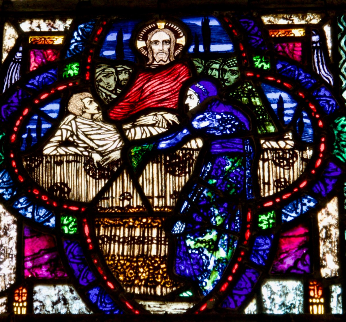
The Raising of Lazarus
May and Hugh had been married in a charming country church called St Andrews Church of the Dunes in the heart of the Hamptons on Long Island. It was an Episcopalian church patronised by wealthy New Yorkers who had country houses in the area. Episcopalian services focus on the sacraments, similar to a Catholic Mass, and the church was filled with stained glass, some by Tiffany.
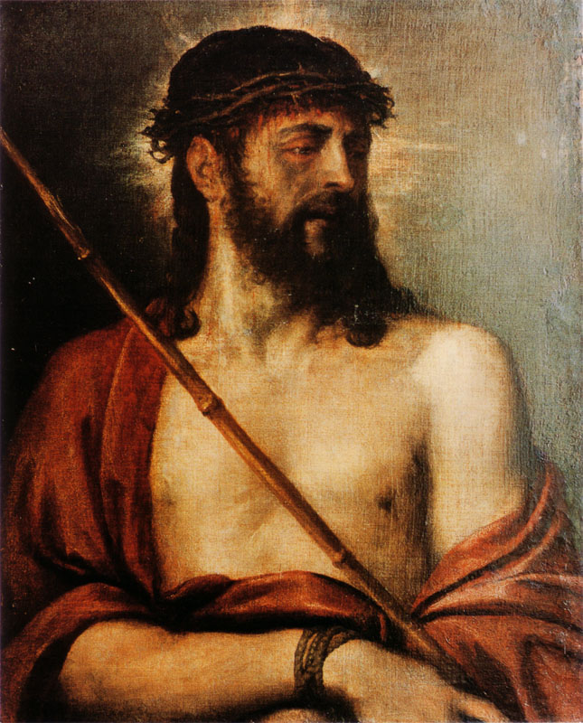
Ecce Homo by Titian (Unknown source, Public Domain, https://commons.wikimedia.org/w/index.php?curid=5557882)
This is relevant because Ecce Homo, despite being a staple of Renaissance imagery (Titian alone did several versions, including the one above), is not a frequent choice for Church of Ireland windows. I can identify only eight windows (of 3,198) which contain Christ in this state of having been scourged or mocked. (There are, on the other hand, one hundred and eleven Resurrection windows.) If it was May, rather than Lord Wicklow, who had the final say in the central imagery, I can see how her background in a more Catholic form of worship might have made her more amenable to an Ecce Homo depiction, and that therefore what started out as a Resurrection Window (with supporting Resurrection-themed medallions), ended as a window depicting suffering, healing, and children.
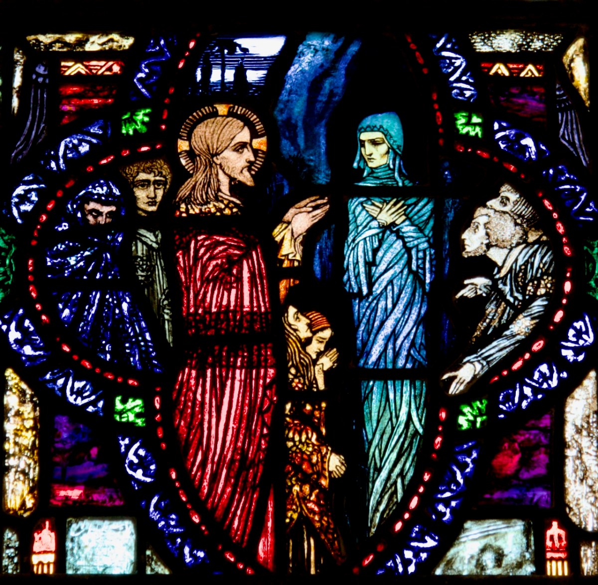
The Raising of the Widow’s Son at Nain
Four medallions are placed on either side of the central figure of Christ. Three relates to the theme of Resurrection and/or healing – The Raising of Lazarus (Top Left); The Raising of the Widow’s Son at Nain (top right); and Christ’s Healing Ministry (bottom left). The final medallion is Christ Blessing Children (bottom right), perhaps a reference to hope that May’s children, now fatherless, would find comfort.
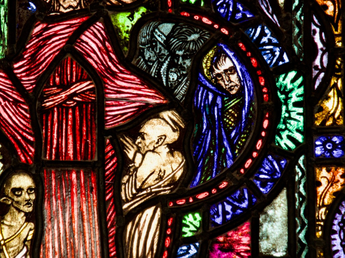
Christ’s Healing Ministry
In the medallion above, Gordon Bowe identifies a self-portrait of Harry, peering in on the right-hand side (below). Harry has done this in other windows, often more immediately recognisable than here. The parade of sick, palsied, bandaged and leprous sufferers are typical of Harry’s affinity to the macabre.
In the cinquefoil tracery at the top of the window is a small roundel containing the Crucifixion. Although tiny, it is as full of detail as are the medallions.
David Lawrence, in his entry in Gloine, correctly identifies the medallions, and uses Christ as Martyr for the central figure, perhaps because he (like Gordon Bowe) interprets the ‘sceptre’ that Jesus is carrying as a palm, the icon of martyrdom. In Strangest Genius, by Lucy Costigan and Michael Cullen, the authors simply repeat the description and background as gleaned from the work of Gordon Bowe (although without credit, as seems to be their practice), along with the errors, and add one of their own, describing the reed as a ‘lily. . .denoting his virtue.’
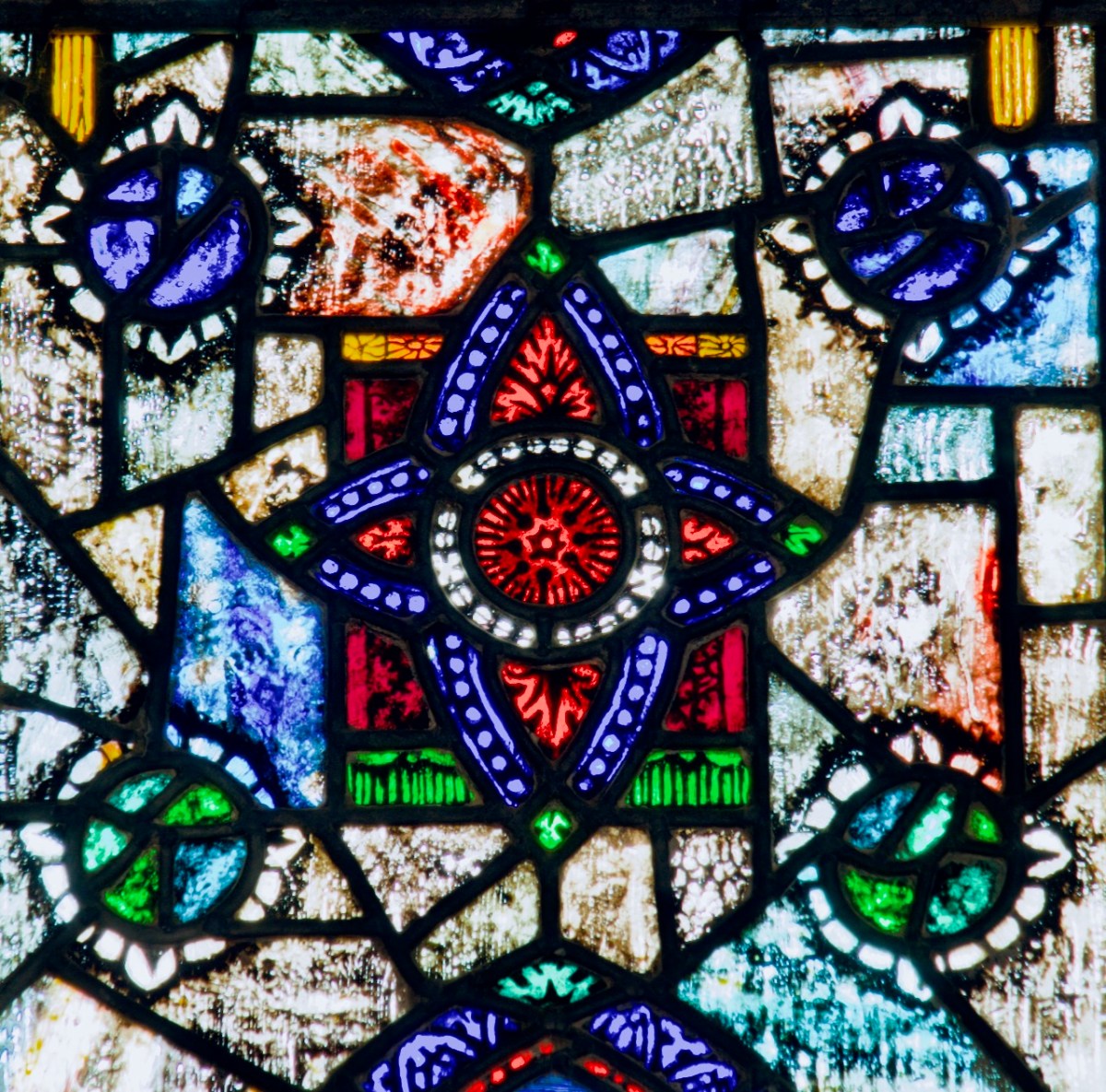
Gordon Bowe often uses the term jewel-like to describe Harry’s ability to make his windows sparkle and shimmer and to use advanced techniques (such as plating and acid-etching) to create depth and allow the sun to refract through the glass. The window in Kilbride is a master-class in how he achieves this effect, especially in the decorative areas between the scenes, as in the one above. No photograph can do justice to this effect.
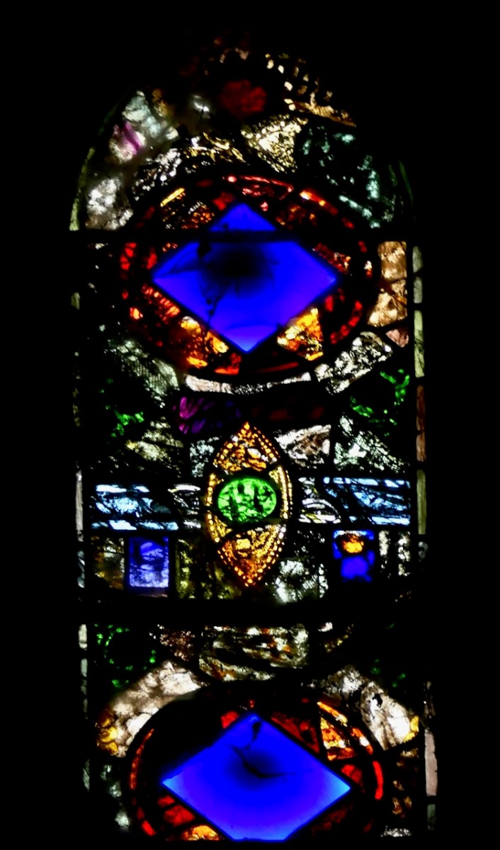
Oh, and just to add to the fact that this tiny church has an exceptional Harry Clarke window – it has a second one (above). Harry made it with left over ‘scraps’ of glass, to fill a small, high, transept window, and he described it as an ‘experiment.’ The two pieces of blue glass prefigure the mid-century practice of dalles de verre, of which we have several excellent examples in Irish Churches.
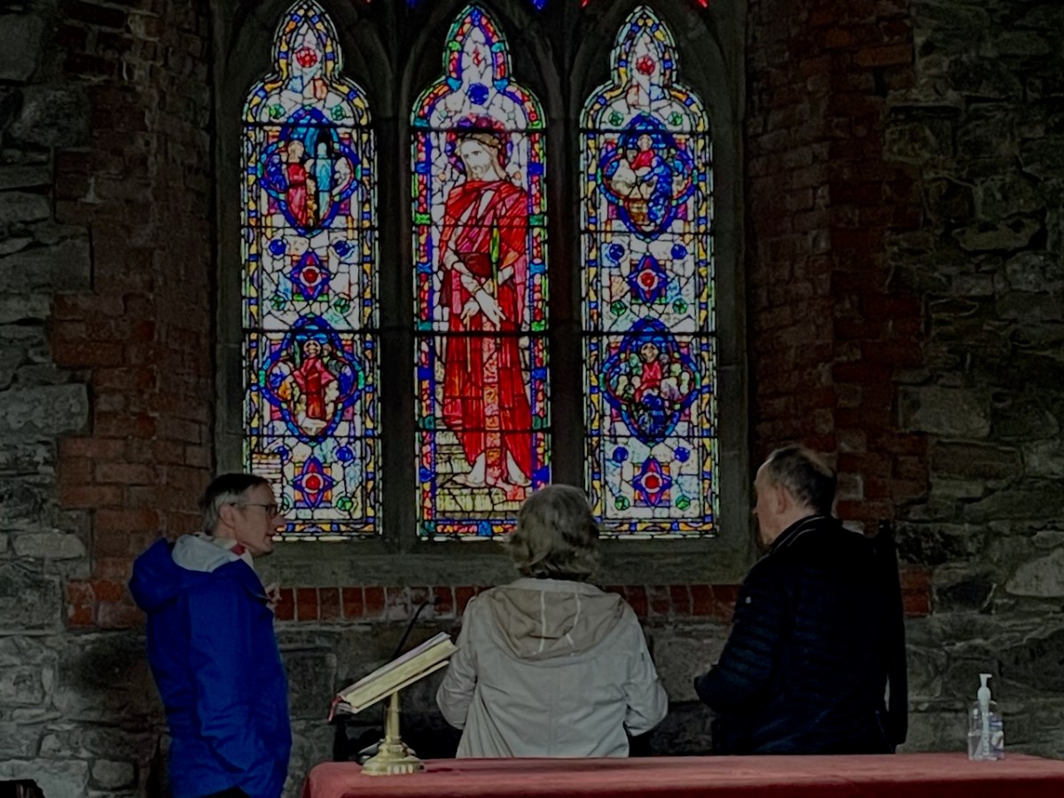
David Caron, Editor of The Gazetteer of Irish Stained Glass; Ruth Sheehy, author of The Life and Work of Richard King; and Paul Donnelly, expert researcher on the Harry Clarke Studios, in front of the Ecce Homo window on a recent visit. Together, we discussed the most appropriate title for the window. Like most Church of Ireland churches, Kilbride is closed most of the time, and therefore the window is not easily accessible. I am very grateful to the Rev Barrett for allowing us to view and photograph the windows last week. Besides the photographs in Gloine, I can find no other images of the window online, so I hope this post will clarify what this window is actually all about.
*The most head-scratching erroneous description comes from this report in The Wicklow People