Films on Cape

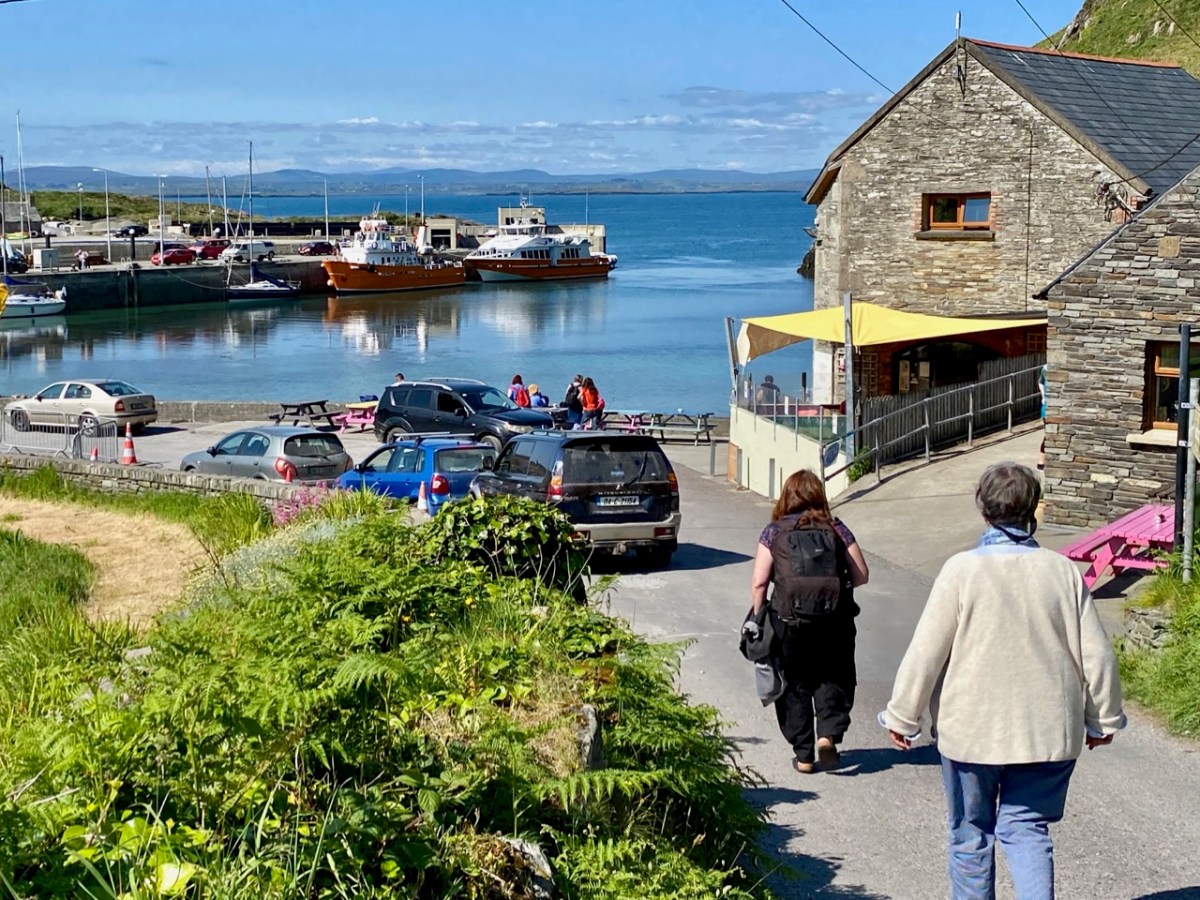
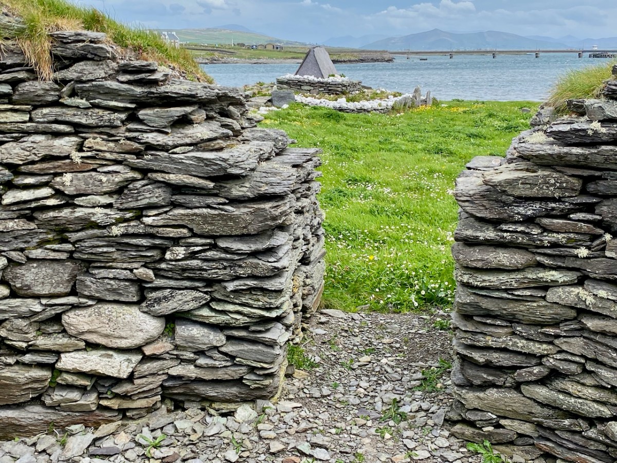
The island of Cape Clear is a constant in our daily view from Nead an Iolair. We don’t visit often enough… But this week the Fastnet Film Festival – based in Schull – had a day out on The Cape, and we went along for the excursion! That’s the harbour, above.

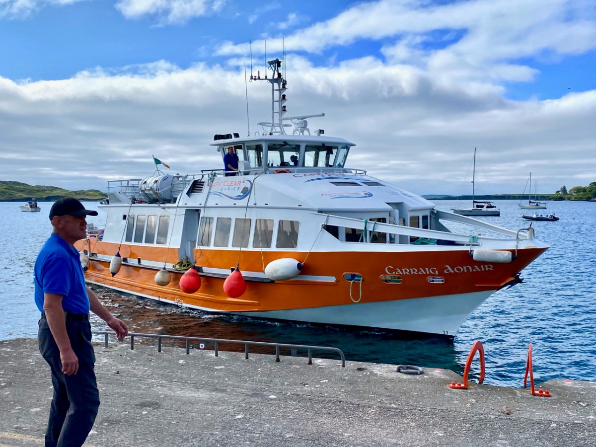
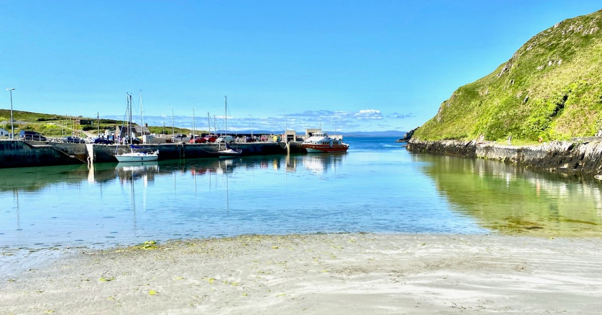
And this is Schull Harbour, where Cape Clear Ferries’ newest boat, Carraig Aonair, picked us up. The name is Irish for The Fastnet and means, literally, The Lone Rock. We have written about the lighthouse in previous posts.

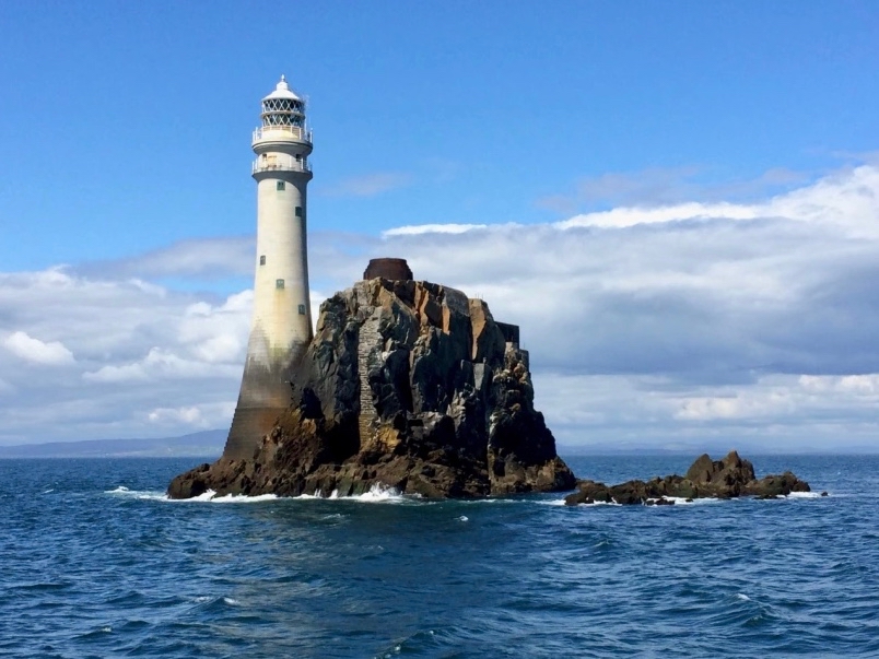
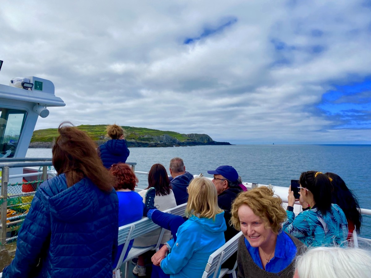
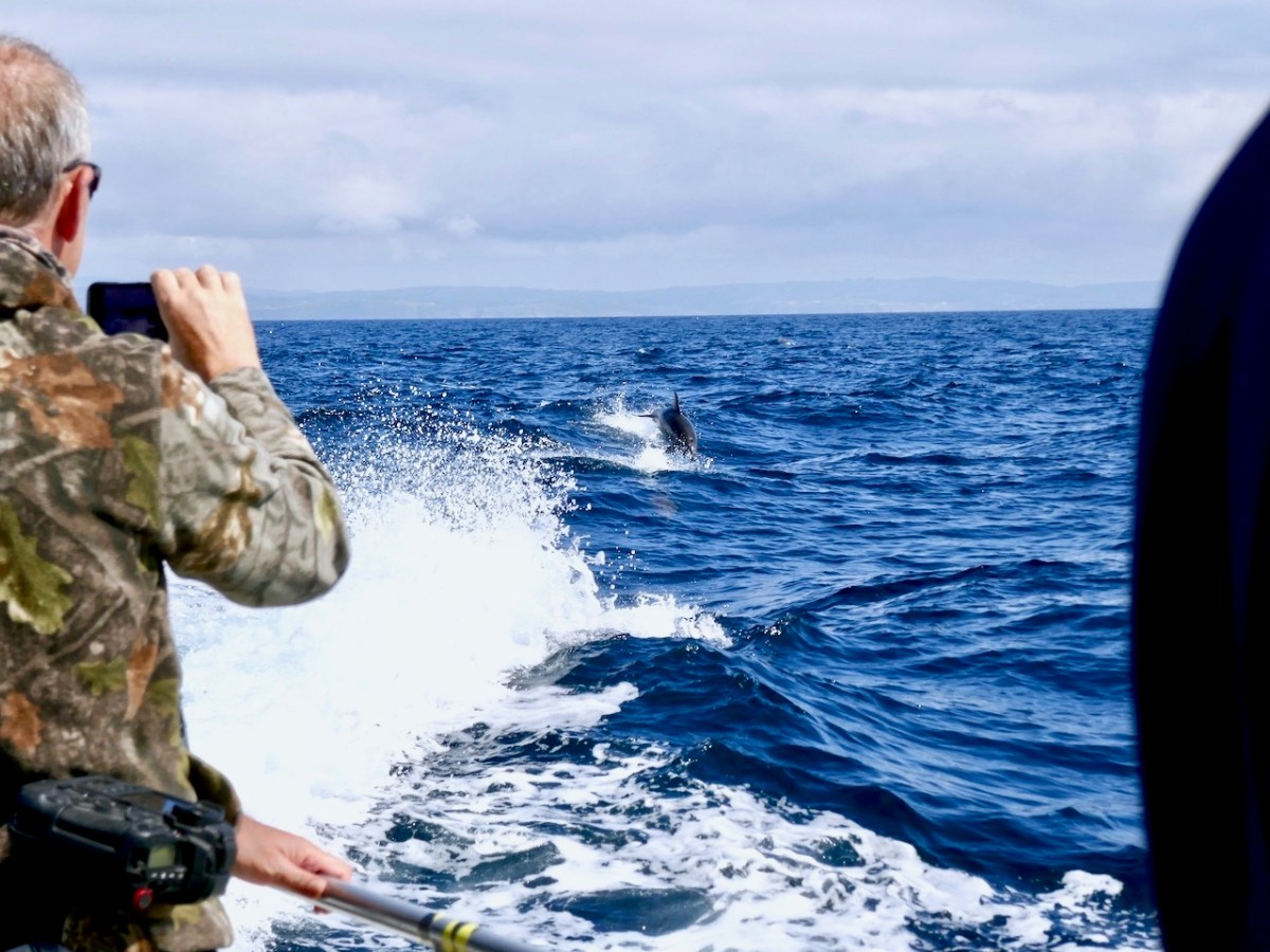
The dot on the horizon, seen here (above) from our ferry to Cape Clear, is the Fastnet Lighthouse. The crossing from Schull takes only half an hour and we were fortunate to have good weather and calm waters. The crowd on board was delighted by a diversion on the way – a pod of dolphins kept the boat company for a while.

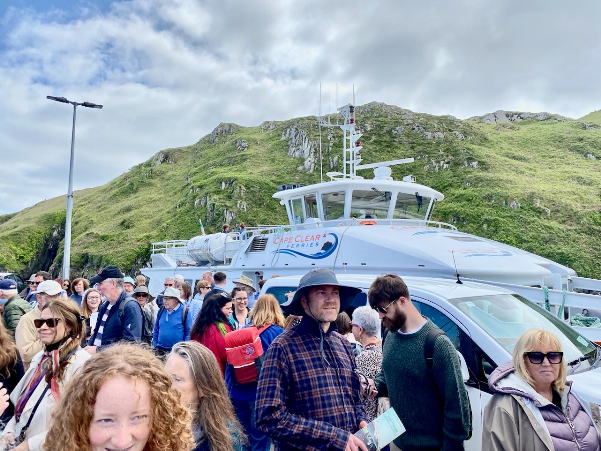
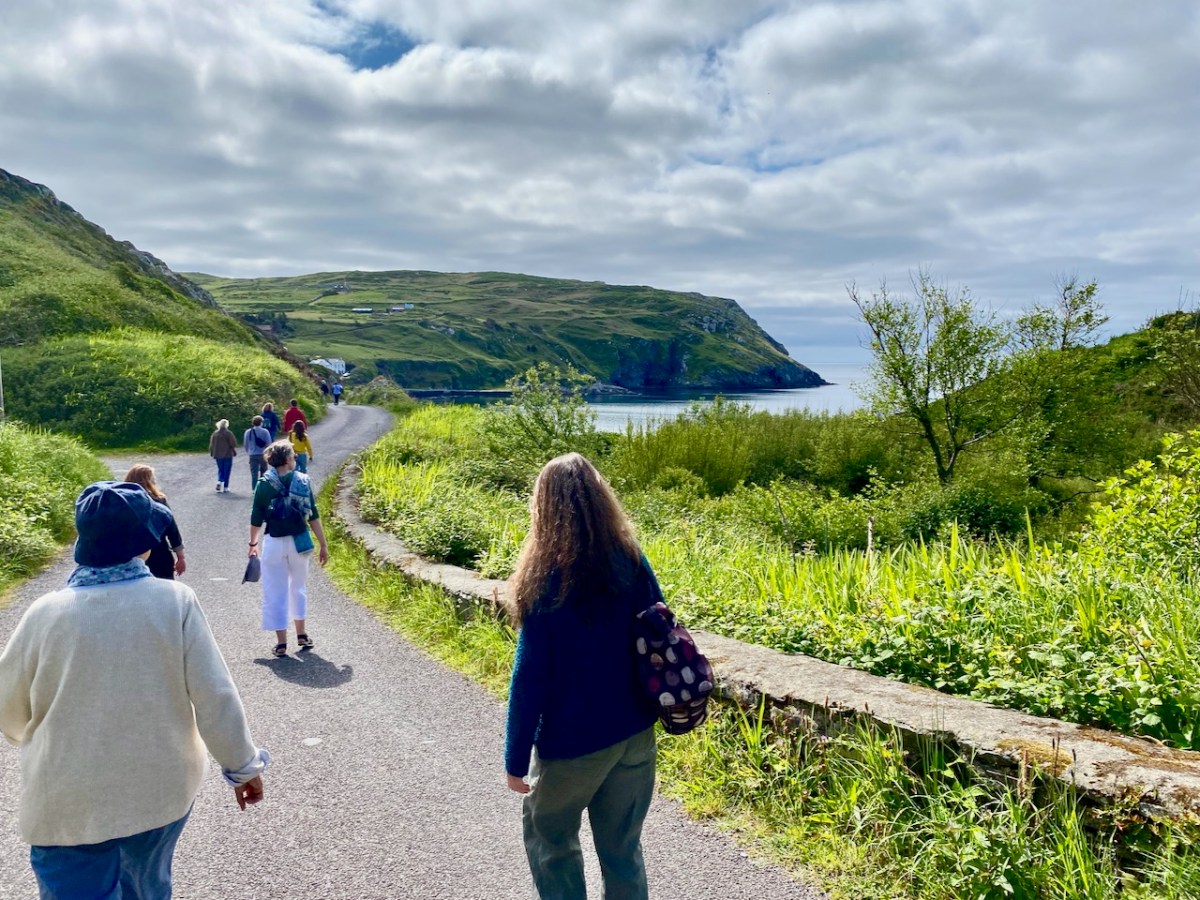
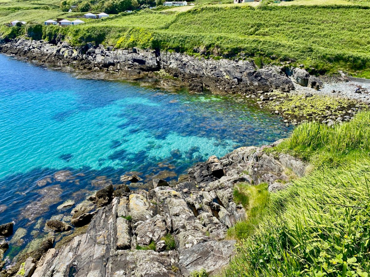
Arriving in the North Harbour we were looking forward to our Teanga na Gaeilge ar Oileán Chléire: an Irish Language Day on Cape Clear. First, we had a long hill to climb to reach an Halla Mór: a whole team of islanders were on hand to provide lifts in cars and buses. Some of us chose to do it the hard and steep way, but were rewarded by stunning views and azure water.

Our first film treat was An Cailín CiúinThe Quiet Girl.

. . . Nominated for this year’s 95th Academy Awards in the ‘International Feature Film’ category of the Oscars, Colm Bairéad’s debut feature became one of the most lauded Irish films of recent years. Adapted from Foster, a short story by Claire Keegan, it centres on nine-year-old Cáit, a shy and withdrawn child who receives little affection from a family ruled by an uncaring patriarch. When she is sent to spend the summer with her aunt Eibhlín (Carrie Crowley) and her husband Seán (Andrew Bennet), she blossoms in their care. At the end of the summer, difficult decisions must be faced . . .

2023 Fastnet Film Festival Programme

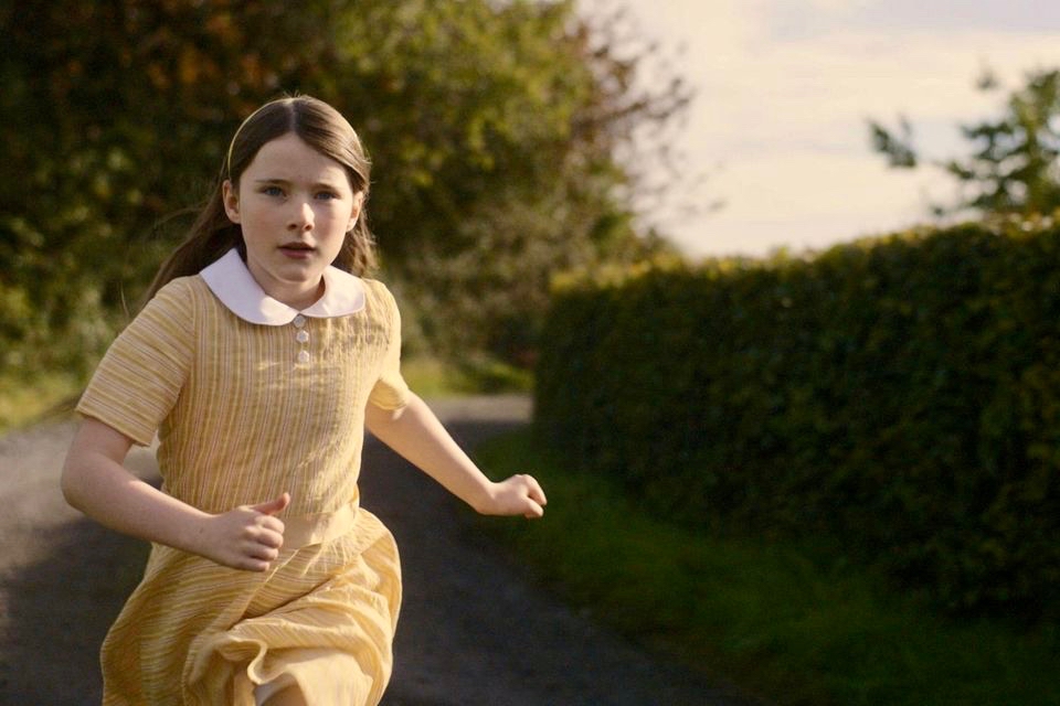
Catherine Clinch is ‘The Quiet Girl’ in the film (above). Born in 2009, this is her debut role. Happily, she joined us for our day on the island. I was affected by the story in the film, as were many others in the audience. In fact, I don’t think I have been as moved by something on screen since I was taken to see Bambi at the age of five. Although not topping the Oscars ‘Best International Feature Film’ category (this went to All Quiet on the Western Front) it has rightly gained many other accolades. I think the most apt review I read said simply:

” . . . As beautiful as it is devastating . . .” (Boston Globe).

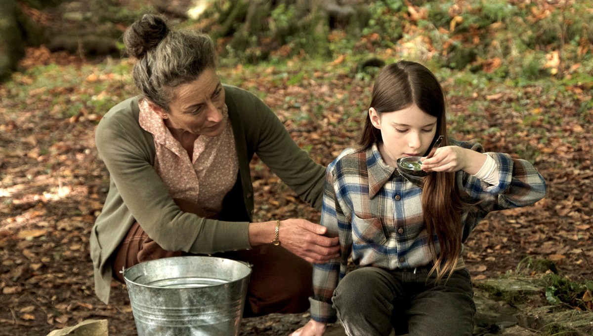
Carrie Crowley also deserves mention for her sensitive role as the aunt of The Quiet Girl. Crowley and Clinch – below.

This Irish language film was undoubtedly the highlight of the day, but there were plenty more moments, including short film viewings, coffee and good lunches, on Cape Clear. With some long-awaited summer weather to help us enjoy the island.

We had to be sure to arrive back at the harbour before the boat left at five. The alternative would be to sleep out under the stars – tempting! For very many reasons, this was a most memorable day.

Burgatia – and Rock Carvings

If you can stretch your memories, think back. We started to write Roaringwater Journal in October 2012. At that time we had just settled in West Cork, and we were anxious to revisit the work which Finola had carried out between 1971 and 1973, when she was studying Archaeology at the University of Cork. For her final thesis subject, she specialised in surveying and recording the Rock Art of West Cork and Kerry.

Finola has her thesis, above, and is turning to the page which shows the drawing she made from Burgatia, which is a townland outside Rosscarbery, in West Cork. When Finola was researching, there was only the one standing stone in Burgatia listed as bearing the cup marks and circles of Rock Art. Since the 1970s, however, a further stone has been identified with this feature. It is a standing stone just to the right of the N71 as that road rises from the Causeway as you travel East from Rosscarbery. In Finola’s day, this rock was only identified as a ‘standing stone’. The header picture to this post shows the stone.

These two extracts from the present day OS map show the entries given for each of these stones – stone 1 at the top and stone 2 below. The current edition of the map now indicates that stone 2 has significant Rock Art on the west-facing elevation. The Archaeological Inventory has been revised and updated twice since Finola’s survey – in 1992 and 2009. One of these revisions has added the information that “…the stone has twenty-four cup marks, including one cup-and-circle, on NW face…”

Here is that NW face, photographed this month – May 2023. Many of the cup marks show up well. Back in 2014 we decided that we would fully measure the marked surface of this rock, in order to add to the inventory created by Finola in her University days. Here is my own 2014 drawing:

In the lower picture, I have adapted the same drawing to overlay it on a photograph taken as part of the survey. That was in 2014. Now – nine years later – I believe I have discovered an additional cup mark! Have a look at this close-up of the lower part of the stone:

Comparisons between the two photographs (2023) and the one taken in 2014 (below) show that the level of the ground has apparently lowered in nine years, exposing the additional marking. As the field is cultivated, it is quite possible that there has been some movement of the ground in relation to the rock foundation.

Above – Burgatia 2, January 2014. Note the cup-and-ring mark, and the higher ground level.

The aerial view, above, shows the relationship between Burgatia 2 and Burgatia 1. As we were revisiting, we also called to have a look at the latter. Here is Finola’s drawing from 1973 – the one that appeared in her thesis:

Here’s Finola at Burgatia 1 earlier this month (thanks to Amanda for this):

And the view west from the rock, from which you can glimpse the sea (also this month). See below for the same view in 2014:

Burgatia 1 seen this month: note the graffiti. We don’t recall having seen this before. Please note this stone is on private land, and permission must always be obtained from the owners (who live in the adjacent house) before accessing it. Here’s the stone in context, showing its southwest facing face which – in this case – has no markings. No one can tell the full history of any of the archaeology discussed today. There are some theories that the standing stones may once have been lying down, and the carvings were made on their (then) upper faces. They were then, possibly, erected to make more significant monuments – one with its cup marks facing one way, and the other facing the opposite way (as it happens).

I’ll finish with this extract from the earliest 6″ Ordnance Survey marked up map. I’m interested to see that here Burgatia 2 is shown in a field boundary:

The Antiquities of Bealad

There’s an area of West Cork bounded on the south by Castleventry and on the north by Ballinvard. In between and round about there’s Bealad, Rossmore and Caherkirky. This is the territory into which we were inducted by Dan O’Leary and Sean O’Donovan, this week. It’s like a fellowship – people who are passionate about local history find each other and it’s only a matter of time before we start talking field trips.

Dan and Sean had organised the whole thing – including the all important coffee and food and bathroom breaks. Our headquarters was the old National School in Bealad, now wonderfully re-purposed as a community hub – a lesson in how to do this for others with such buildings on their hands. We started with an overview of local history and then it was off to Castleventry. 

Amanda is, as you all know by now, the expert on Holy Wells (book will be out soon!) and the first time she and I visited this well, several years ago, we met Sean, who was restoring it. You can read all about that here, and more about the well itself. All are invited to the annual celebration at the well, which takes place on June the 4th at 8pm (after milking).

Just up the road from the well is the Castleventry graveyard and ring fort. An extraordinary site by any standards, this site encompasses an impressive bi-vallate ring fort/cashel, and a ruined ‘something’ within, as well as a graveyard. 

This was obviously the residence of a high-status individual – a chief of a local Clan. The banks and ditches are deep and would have represented a formidable fortification, along with a palisade fence on top of the inner bank. The photo below gives some idea of the depth of the ditch that separates the outer and inner banks. There are commanding views across the country in all directions – nobody seeing it would have been in any doubt as to the importance of the occupier. Souterrains, no longer accessible, were found within – see Robert’s post about Knockdrum Stone Fort for a similar type of fort and souterrain.

But it was the church within that presented an interesting challenge! According to its listing, this is the medieval parish church of Castleventry, already in ruins by 1615.

A screen shot of the relevant page in Clerical and Parochial Records of Cork, Cloyne, and Ross, by W Maziere Brady.

One of the participants on the field trip was our friend Con Manning, a distinguished medievalist and archaeologist, now retired from the National Monuments Service. Con was immediately struck by a couple of things. First, it’s unusual to find a church in a ring fort, and second, it just didn’t look like a church to him – in fact it looked more like a tower of some kind. Not a tower house, but perhaps a small Anglo-Norman keep.

There are no examples in West Cork of such keeps – the Castle at Glanworth, north of Fermoy, would be the closest example to an early Norman masonry tower. When Fineen McCarthy defeated the Anglo-Normans at the Battle of Callan in 1261, it is said he rampaged through West Cork, burning and destroying every structure they had built – which would certainly explain their absence. 

But – what if this one survived, or survived in part? What if it was taken over by the local Irish chief – there are certainly precedents for them building their tower houses inside ring forts, we have only to look at Ardintenant for that. What if, over the centuries, in its ruinous state, people took it that it had been a church? There was a medieval Castleventry church – Brady’s listing shows it clearly – but was this it? Also, Brady calls it Castrumventry and the word Castrum is applied to castles – the closest castle to here is 5kms north at Ballinvard (we’re coming to that). The Irish word for Castleventry, according to the sign at the entrance is Caislean na Gaoithe – Castle of the Winds.

Here we are at this puzzling site: Robert, Sean, Dan, Una, Amanda and Con

So many questions! Con is continuing his investigations, raising even more intriguing possibilities about the site and so we may revisit this one at some time in the future.

From Castleventry we travelled on to Ballinvard Castle, just outside Rossmore, where the owners, Pat and Mary Daly had kindly agreed to meet us and show us the castle, which is in a working farm and not normally open to visit. In the last few years, the ivy has died back due to heavy frosts, and this has allowed a clear view of many of the hitherto-obscured features of the castle. Once again, we were grateful to Con’s expertise as he pointed out various aspects of the building that placed it in the 16th century – a castle of the Hurley (Ó Muirthile) family.

One of those was the workings of the Yett, an iron grill that sat outside the main door and could be closed from inside by way of a hole of the doorway through which a chain was pulled tight from a room inside.

Here’s a illustration of how it works. You can see the same Yett hole at Castle Donovan, which has many features in common with Ballinvard. 

Dan had one surprise for us – he brought us to the townland of Caherkirky, to a double boulder burial with a very tall standing stone. In a previous visit to this site he thought he detected cupmarks – and he was right! There was one on the boulder burial, and several on the standing stone. See Robert’s post today for another example of the same kind of monument. It was a good feeling to be back again with my beloved rock art!

Knowing my penchant for popping into every church I pass, Dan’s final treat for us was the church in Rossmore, but this time, instead of the stained glass, what he wanted me to see were the Stations of the Cross. Obviously Italian, they were painted, and the artist had let his/her imagination take flight on the costumes – more like Spanish grandees than the biblical characters we’re used to. Not like any I had ever seen before and a real surprise.

Thank you, Dan and Sean – it was a great and eclectic day, and who knows what will come out of Con’s close examination of Castleventry – stay tuned!

The Fassaroe-Type Crosses – How Old Are They?

This is Part 2 of my examination of the Fassaroe Crosses of South County Dublin. In the first post I described the four crosses that comprise the Fassaroe-Type group, so well described and drawn by Pádraig Ó hÉailidhe. In this one, given that some authorities have claimed they may be of a relatively recent 17th century date, I will look at a probable dating horizon for those crosses, based on analogies with other Irish examples. 

Let’s look first at the figure of the crucified Christ on the crosses at Fassaroe, Rathmichael and Kiltuck. It is immediately obvious that they are similar to each other in the slender shape and in the head, which is inclined or tilted to the right, and in the fact that the figure is recessed (although Rathmichael also has a figure in relief with no incline to the head). That tilt is pronounced on the Fassaroe cross but slightly less so on the figures on the Kiltuck example and the back of the Rathmichael Cross. 

In the Kerry County Museum (the photo above is taken, with thanks, from their Facebook page) is a bronze figure, about 10cm long, probably once attached to a cross. It is dated to C1150 (I am not sure by what method since I cannot access the 1980 Journal article) and comes from Skellig Michael. The tilt of the head and the elongated figure are both clearly analogous to the Fassaroe-type figures.

What about the shape of the cross-head? In Fassaroe this is a simple disc, while Rathmichael and Kiltuck have very short projecting arms. None of the South County Dublin examples have pierced heads, as in the classic Irish High Cross. We find similar crosses, in fact, in Ballymore Eustace (see this post in Pilgrimage in Medieval Ireland for more on that example – this image is from that post, with thanks), Kilfenora and Killaloe.

The Killaloe Cross, above, which actually came originally from Kilfenora, is perhaps the closest, and is dated to the 11/early 12th century. I have rendered my photograph in black and white as it is easier to make out that way,

There are several crosses in Kilfenora, associated with the 12th century church. Although they are more highly carved than the Fassaroe-type crosses, the unpierced disc form with the short arms can be seen on the back of the Doorty Cross (above). 

The back face of the Tuam High cross, below, captured from a 3D image* although pierced, has a simple figure with an elongated and tilted head.

The Dysert O’Dea high cross (below) has several features of interest to us here. First, the conical mitre may be analogous to the Fassaroe head.

But it also points us to another monument close to the Fassaroe crosses – the Loughanstown Cross, below, now marooned in a new housing estate and very badly damaged. The form of the cross, however, looks quite similar to that of the Dysert O’Dea crosses while the projecting head (on one side) and the long figure (on the other) is also reminiscent.

There is one more cross in the South County Dublin group which was situated in Killegar, about 4kms north-west of Fassaroe. It’s fragmentary, with only the disc-head remaining, containing on one side a simple crucified figure, with the head straight. In a piece for the JRSAI in 1947, Ó Ríordáin describes the other side as a cup-and-circle. This may mean that this cross was carved on the back of a piece of prehistoric rock art, but more likely that it relates it to the Rathdown Slabs, and brings us back full circle to the Rathmichael graveyard that Robert wrote about in his post Viking Traces.

The Rathdown Slabs slabs (also described and drawn by Pádraig Ó hÉailidhe, below) use that cup-and-circle form as part of their decorative technique, and are generally dated to the Viking period, or anything from the 9th to the 12th century.

That leaves us with the Blackrock cross, different in form from the others, except for that projecting head . The only analogy I can find among my own photographs ties it firmly to the Romanesque period (12th century) – that cross is at Kilmalkedar in Kerry (below). 

So – all of the evidence through association connects these crosses into a 12th century (or earlier), cross-carving tradition in Ireland. But Ó hÉailidhe also drew analogies with a group of very similar crosses from Cornwall, often referred to as ‘wheel-headed’. Their date? They were assigned to ‘very early Romanesque’ by Andrew Langdon, the authority on Cornish crosses over a century ago, and this assessment had been upheld by the august editors of the Corpus of Anglo Saxon Stone Sculpture in their 2015 Volume Early Cornish Sculpture. They state: The relationship of the Cornish sculpture to monuments in Wales, Ireland and Western Britain is of particular interest given Cornwall’s position as a peninsula jutting into the western seaways. In this context, the potential role of Scandinavian influence is considered against the absence of evidence for Scandinavian settlement in Cornwall.

Langdon’s illustration (above) will amply demonstrate how similar in form these crosses are both to the Fassaroe-type and to the Blackrock cross.

I will finish with a photograph of the Laughinstown Cross, behind its chain-link barrier in an under-developed park in a new housing estate. Behind me as I took this photograph is an equally beleaguered church (called Tully Church) of early medieval origins with associated graveyard. It is all but consumed by encroaching apartments, and clinging perilously to a cliff that is being dug out for yet more building. Although it’s clear we need more housing, it makes me sad that not more is being done to celebrate the heritage that still exists in this part of Dublin.

*In the public domain, but thanks to Digital Heritage Age and to the funding bodies: The Community Monuments Fund Awarded by The National Monuments Service, Department of Housing, Local Government and Heritage. Supported by Old Tuam Society, Galway County Council, TheHeritage Council and Galway Community Archaeology Project.

Primaeval Forest

. . . It is very seldomly violently cold here, and freezeth but little. There are commonly three or four frosts in one winter, but they are very short, seldom lasting more than three of four days together and with all their very worst, nothing so near so violent as in most other countries. But, how mild they ordinarily be, and how little subject to excessive cold. And as the cold in winter is moderate and tolerable, so is also the heat in summer; which is seldom so great, even in the hottest times of the year as to be greatly troublesome . . .


1726: A Natural History of Ireland in Three Parts by Gerard Boate, Gerard and Thomas Molyneaux

I was attracted to the early 18th century quote by Boate (first paragraph), because it certainly always seemed to be the case that Ireland has the perfect climate: never too cold and never too hot. In these days of global warming, maybe that’s less so than it used to be: we are experiencing long, cold and wet winters (here we are in mid May and we have to keep our fires burning!) and some scorching summer days when it’s exhausting to be out in the sun. Nevertheless, I believe we are fortunate not to suffer too much from unhealthy extremes – as yet.

Today’s post sees us travelling again with our frequent companions Amanda and Peter (above, with Finola). Remember my post from last week? For that expedition we stayed at Kells Bay House, in Co Kerry: Peter and Amanda organised that wonderful trip. We decided we couldn’t leave that sublime place until we had visited the Primaeval Forest there.

. . . Rowland Ponsonby Blennerhassett (1850-1928), grandson of Rowland Blennerhassett, married Mary Beatrice Armstrong from London in 1876 and is recorded as living at Kells. He extended the original Hollymount Cottage and renamed it Kells. They also kept a house at Hans Place, Chelsea, near to the Chelsea Physic Garden. Rowland Ponsonby is widely held responsible for making additions to the garden which still stand today. He established the Ladies Walled Garden adjacent to the front of the house for his wife Lady Mary, planted the Primeval Forest and laid out the pathways through the gardens . . .

The History of Kells Bay House & Gardens
Helen M Haugh 2015

One of the principal attractions of the gardens at Kells Bay – and the Primaeval Forest – is a series of sculptures carved from tree fragments, commenced in 2011, by Kerry sculptor Pieter Koning. Here is a striking portrait of that artist by photographer David Molloy:

David Molloy: A portrait of the Artist Pieter Koning, 2017 © David Molloy

The Dinosaur sculptures have blended well into the natural landscape over the years: we were delighted with them!

In addition to the Dinosaurs, which are well worth an exploration (I have only shown a few here to tantalise you into a visit!), there is a tree-fern forest planted by Blennerhassett, and spectacularly enhanced by the present owner, Billy Alexander, who has been awarded a Gold Medal at Chelsea Flower Show for his Kells Bay Gardens ‘mirocosm’. There are plenty of landscaping features old and new, and a ‘Sky Walk’ rope bridge, which is quite challenging.

Finola and I are at odds about this species: Gunnera manicata. Finola sees them springing up in the countryside where they ‘don’t belong’ – they originate in South America and are now spreading wildly, particularly here in the west of Ireland. Gunnera is listed on the Third Schedule of the EU Habitats Regulations which makes it an offence under Regulation 49 …to plant, disperse, allow or cause to grow this plant in the Republic of Ireland… So I can see Finola’s viewpoint. But I have always admired them. They grow so fast that you can almost see them getting bigger if you stand and stare for a few minutes. In this context, at Kells Bay House, they are part of an exotic collection dating from the 1800s, and therefore excused (says I).

I hope you will agree that Kells Bay House and Gardens is a ‘must see’ destination. And it’s well worth more than one visit. Include it – as we did – in a tour of landscape, archaeology and Holy Wells. The county of Kerry has so much to offer!

Illaunloughan

We embarked on a sea voyage in order to explore the island of Illaunloughan, which is off the coast of Kerry not far from Portmagee. To the north is Valentia Island. It is said that this tiny landfall – only 0.3 acres in area – is the smallest of Ireland’s offshore islands which contain medieval monastic remains.

Our sea journey was on board an aluminium fishing boat – there it is, below, with the island of Illaunloughan in the background.

And there’s the full crew (two pics below): myself, Amanda, Peter, David the boatman and Finola. We were – as you might guess – on an archaeological expedition in Kerry, which included the search for a holy well on this island.

You can see Portmagee in the background of the photo above. It’s not a long journey: just a few minutes from the harbour there. In fact it is said that on a couple of tidal events during the year you can actually walk across to Illaunloughan, but the voyage was far more exciting for us!

This is the view of the island as the boat approaches it: you can see various of the archaeological features. It doesn’t take long to explore – but it’s fascinating. A full survey of the surviving monuments was undertaken by Jenny White-Marshall and Claire Walsh in the 1990s: this resulted in the publication Illaunloughan Island: An Early Medieval Monastery in County Kerry, Wordwell Press, 2005. Here is a synopsis:

 . . . The gable-shrine is one of a small group of reliquary shrines that occurs at the western end of the Iveragh Peninsula: similar examples are found at Killoluaig, Kilpeacan and Killabuonia. These shrines or specially marked graves are generally ascribed to the founder. The base of the gable-shrine at Illaunloughan consists of a large terraced mound, 9m by 7.6m, which rises to a height of 1.5m. The mound is partly built on an area of rock outcrop which was levelled off on its southern side with soil, stone and pea-gravel. Vertically set kerb-stones and masonry walling were placed along the edges to retain this fill; the mound has been eroded on the northern side by the action of the sea. White quartz stones of varying sizes were liberally scattered over the mound. At its western edge stone steps lead up to an area of rough paving that surrounds a rectangular drystone structure on which stands the slab-shrine. The end-slabs are missing. When the side-slabs were removed an underlying core of pea-gravel and white quartz was exposed. This sealed two small, irregularly shaped, stone-lined cists, each of contained neatly stacked exhumed human bones. A minimum of three individuals, all male, is represented in this skeletal assemblage which comprised fragments of the skulls of two individuals, a single mandible, and several long bones. Large numbers of scallop shells and white quartz pebbles were placed both within and around the cists.
The eastern quadrant of the gravel mound was evidently planned as a cemetery for monks who wished to be buried close to their saints, for at least five bodies were interred here. These were laid side by side, and were extended inhumations oriented from east to west, with the heads to the west.
Following excavation, much of the shrine platform was dismantled. This revealed three rock-cut graves, all oriented from east to west, sealed beneath the mound material. The graves, located on the north-eastern, the southern and the western sides of the shrine, clearly predate the construction of the mound and shrine. Fragments of human bone were recovered from two of them, including a sizeable part of a shattered femur, found at the western end of the grave. No bone was recovered from the third grave. It is hoped to determine, through trace element analysis, whether the bones in the earlier graves represent parts of the individuals translated into the cists beneath the gable-shrine. The evidence so far collated on the Illaunloughan shrine indicates that it is a multiperiod structure. The presence of a sacred focus (an earlier shrine?) is strongly suggested by the earlier graves, though no trace of any such structure survives. C14 (AMS analysis) dating of bone from the cists beneath the gable-shrine has yielded a date in the early seventh century for one individual and the middle of the eighth century for a second. Half-scallop shells, present in the fill of the cists and on their stone lids, were clearly of some significance to those who interred the translated bones. Some of the scallop shells from the shrine have been perforated and they may have been suspended from cords. The scallop is, of course, the emblem of St James, whose remains were ‘discovered’ in a field of shells in Compostela, north-western Spain, in AD 813. The shrine at Compostela rose to prominence as a place of pilgrimage in the eleventh century (Harbison 1991, 22). This may be further evidence of refurbishment of the shrine at a late period . . .

National MoNuments Historic Environment Viewer

Two views of the gable shrine (upper photographs) together with a scaled drawing from the National Monuments Service (above). This distinctive site, with its embellishments of white quartz pebbles and slate capping, suggests an internment of some great importance – probably a local saint. The gable-shrine was reconstructed after excavation and is now complete. Note from the description above (National Monuments Service) that three rock-cut graves were revealed under the present structure – empty – and the suggestion has been made that the later shrine was constructed to ‘translate’ the earlier burials because of the significant status of those who were buried there.

The gable shrine seen with the bridge from Portmagee to Valentia Island in the background. In front of the shrine are (probably much later) grave markers. It was common practice to put burials close to anciently sacred sites: in fact, up to the 20th century Illaunloughan was used as a cillín for the burial of unbaptised infants and as a graveyard by local people.

This plan of the island (National Monuments Service) shows the principal features: the gable shrine, an oratory, a stone hut and a well. It also serves to show how small the island actually is – yet it supported a community of men and children (one of the three burials in the shrine was seven or eight years old). Their main diet is said to have been fish and seafowl based. The drystone oratory (church) was excavated and radiocarbon dated to the 8th century. The excavations of the surrounding land revealed that a range of domestic and industrial activities were undertaken, including fine metal-working, bone-working and cereal processing (Irish Heritage News 2018).

The pics above show the oratory, a stone hut and the well. The latter would have been a necessity for any permanently based community on the island: Amanda’s particular interests in holy wells made her wonder whether this one had any local folklore or dedication.

Further areas of worked stone marked out enclosures or terraced areas which would have had some significance to the community based there. After excavation, the island’s features have been returned to good structural condition. The site suffered some serious vandalism in fairly recent years. Fortunately, its general lack of access has provided some protection.

This felt to us a very special site, and we were privileged to be able to visit it. If you read the book about it, you will see that the thinking of those who carried out the excavations was that it was active from the 7th to the 9th centuries. In more recent times this dating has been questioned – possibly because radio-carbon dating results have been revised since those findings. It is now being suggested that use of the monastic site may have continued into the 11th century: we have to note that a Hiberno-Norse coin of 1020-35 was found under the paving of the plinth surrounding the gable shrine. White-Marshall and Walsh suggest this could be evidence for the use or maintenance of the shrine in the 11th century, while another commentator – Cormac Bourke (in reviewing the excavation report) – has suggested the continuous use of the site into that period.

For Amanda, the dedication of this site to a local saint would be important. Two saints named Lochan appear in the Martyrology of Tallaght (c. AD 800); one could have been the founder. It’s also worth noting that Saint Finnbar of Cork was baptised Lochan: he was educated at Kilmacahil, Kilkenny, where the monks named him Fionnbharr (white head) because of his light hair. His dates in any case do not fit with Illaunloughan: Finnbar was born around 550.

The island of Illaunloughan is low-lying, and at some risk of future indundation if climate change leads to drastic sea-level rise. We were fortunate to get the opportunity to visit this magical place, thanks to our local boatman – who bore us safely back to dry land!

PS Many thanks to Amanda ClarkeHoly Wells of Cork & Kerry – for dreaming up this remarkable adventure. And for finding us a boatman!