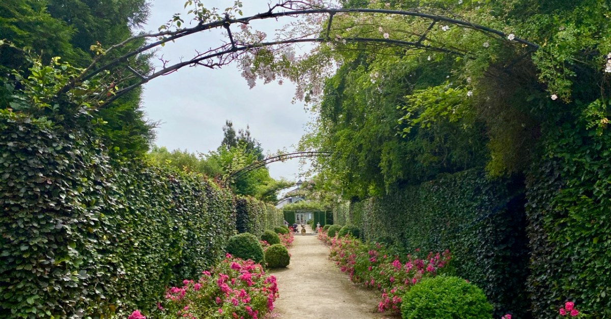
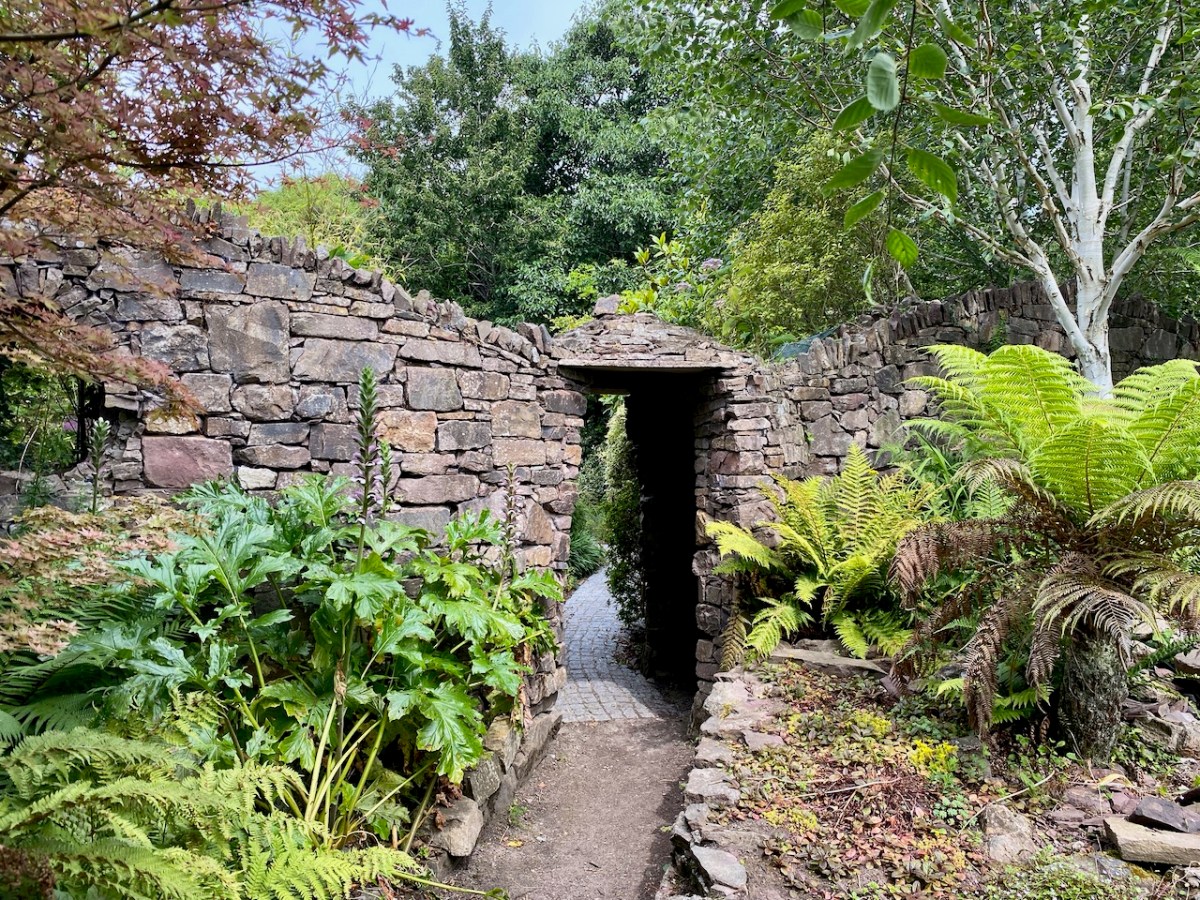
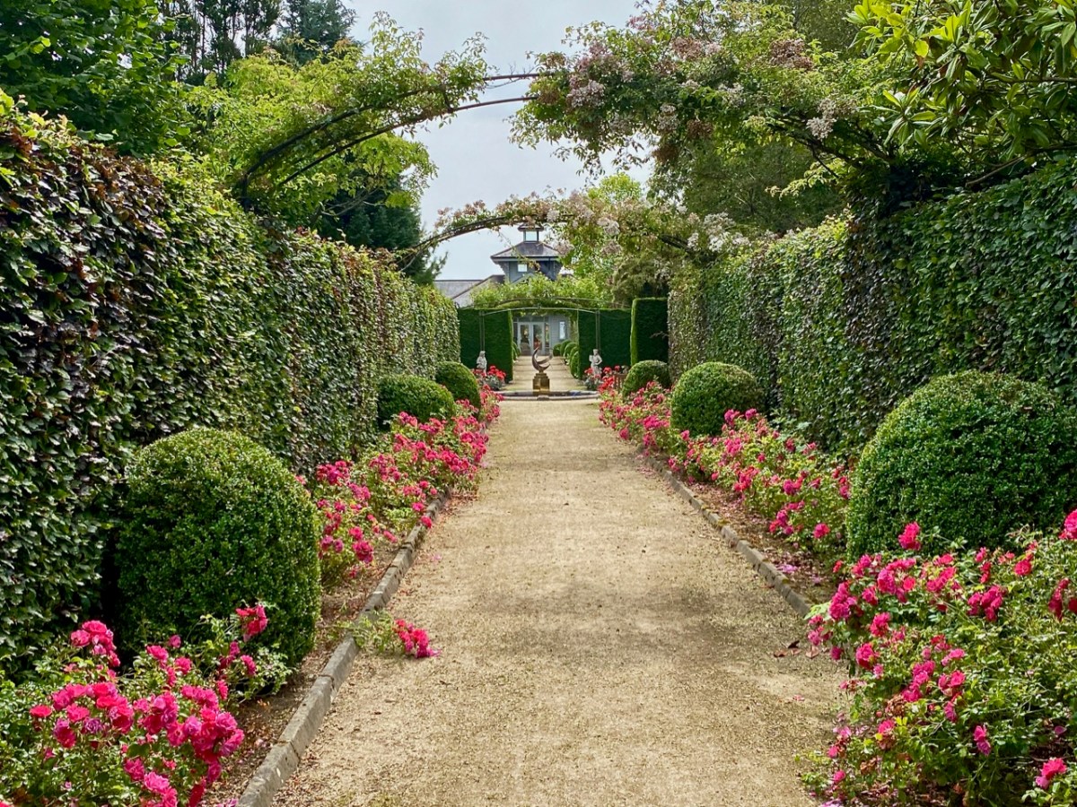
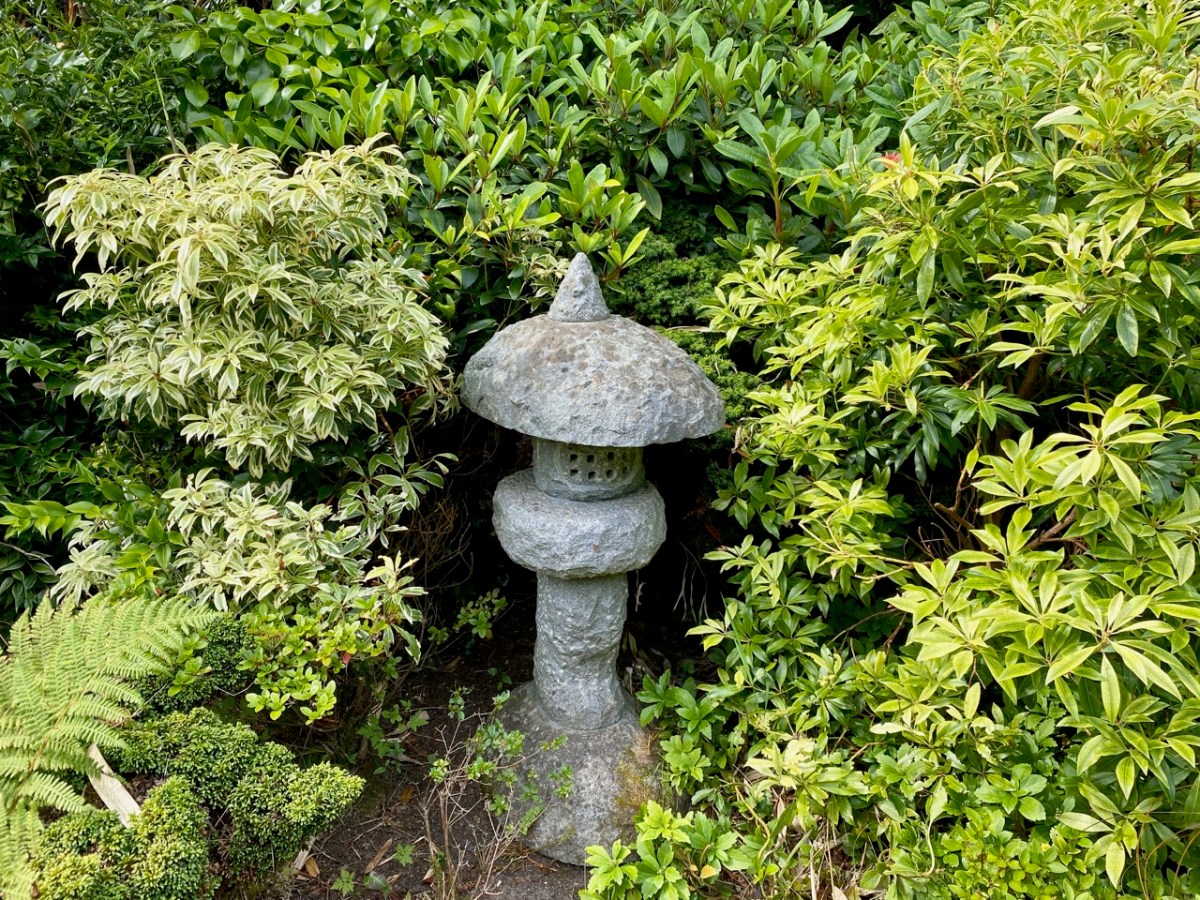
Wicklow is the Garden County of Ireland. Whenever we visit, we are impressed by the exuberance of the verdant landscapes and woodlands, and outstanding gardens abound. Do you remember our exploration of the Kilruddery Estate a few weeks ago? Here’s another venue well worth a visit: Kilquade Arboretum, formerly the ‘National Garden Exhibition Centre’. The modest 5.2 acre site is billed as the perfect escape from the stresses of everyday life – and rightly so. Not only can you wander through a collection of inspirational gardens, formal and informal, which were designed by a number of highly experienced horticulturists, but also you can eat and drink in superb outdoor dining settings: everything is well maintained and efficient. And – if you are a gardener yourself – there is a great shop to supply your every need!
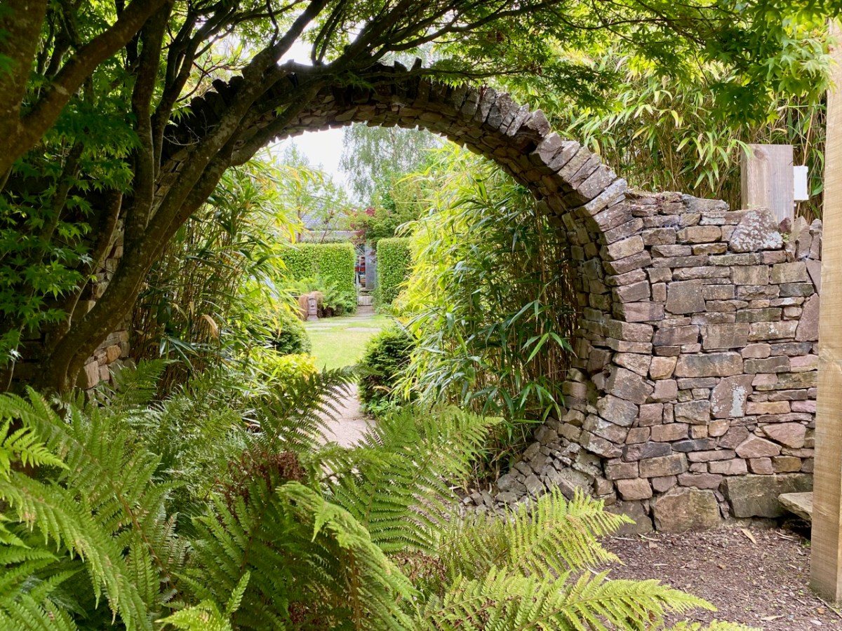
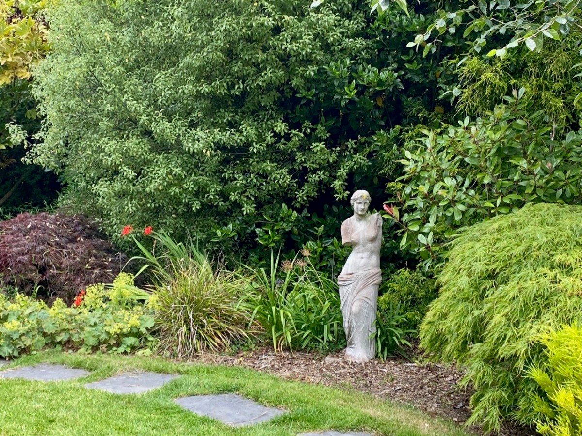
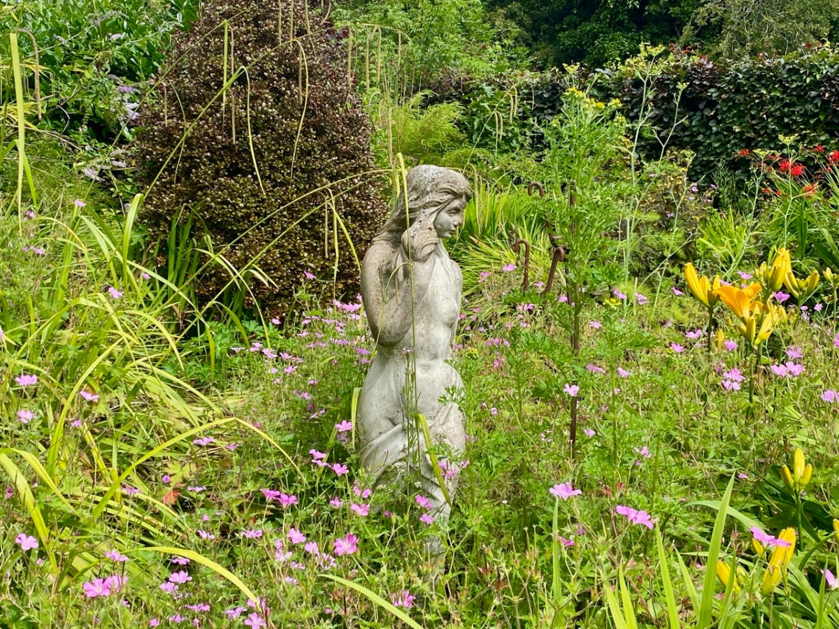
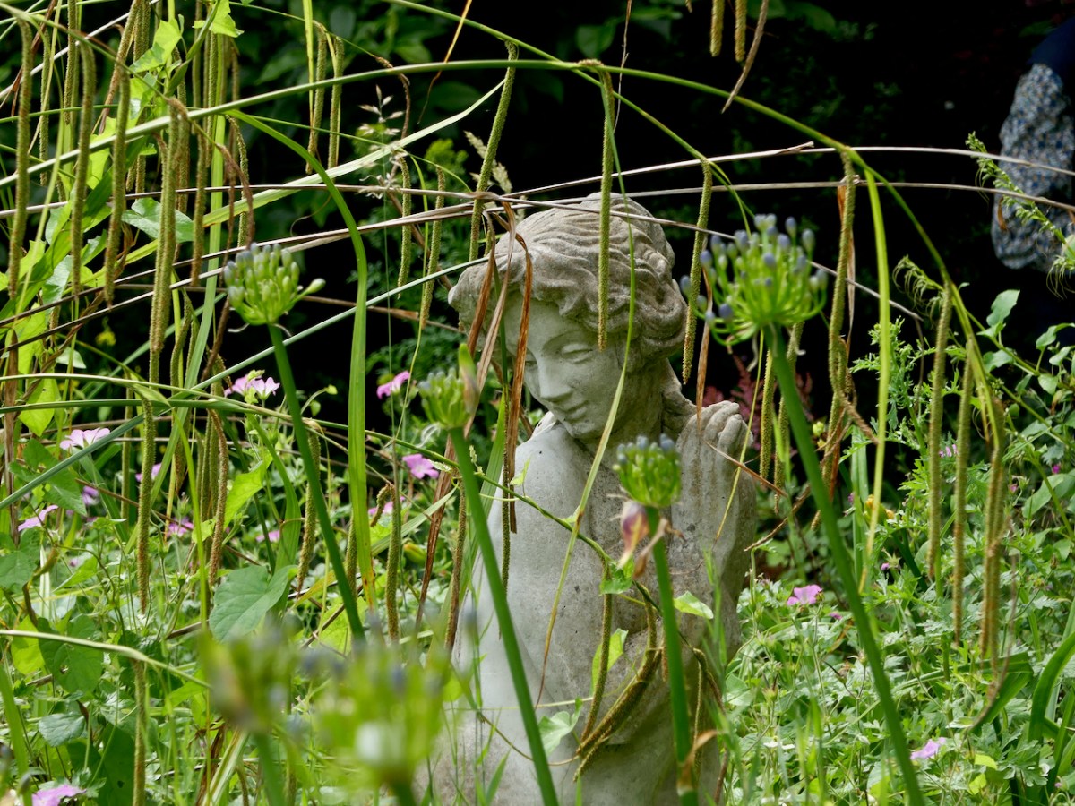
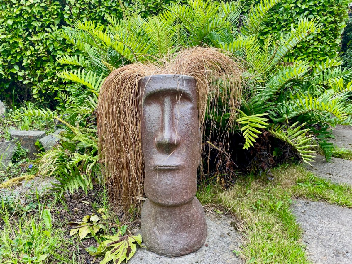
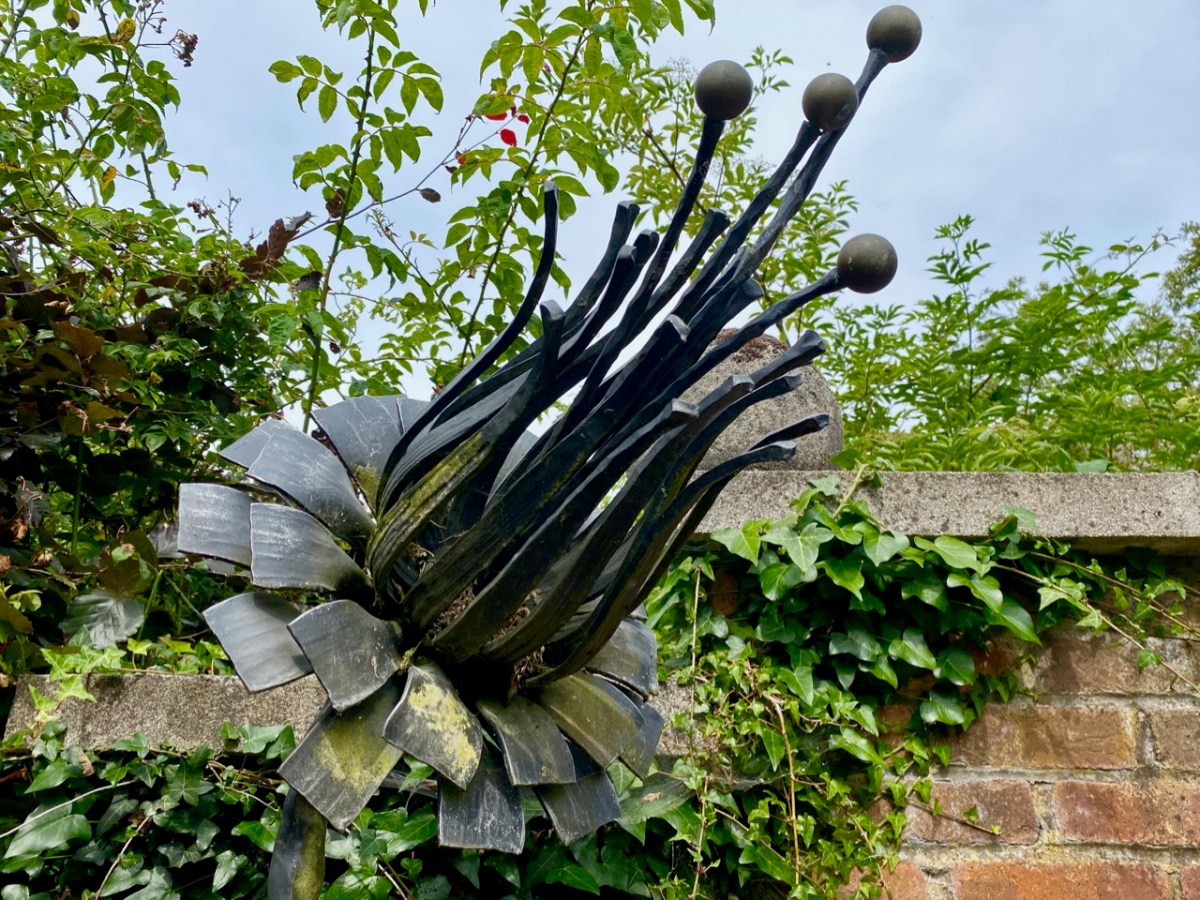
As you can see, you never know what might await you as you traverse the grounds, moving from one creative vision to another. At the height of this Irish summer – which is unmatched, so far, in its brilliant weather – you are guaranteed shady nooks and surprises, and plenty of places to rest and contemplate. You will happily spend half a day or more at Kilquade, and come away satisfied in body and mind! Here’s an enigmatic sculpture by Fiona Coffey:
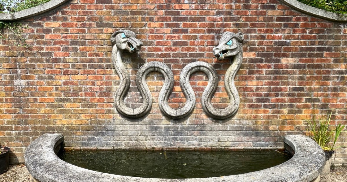
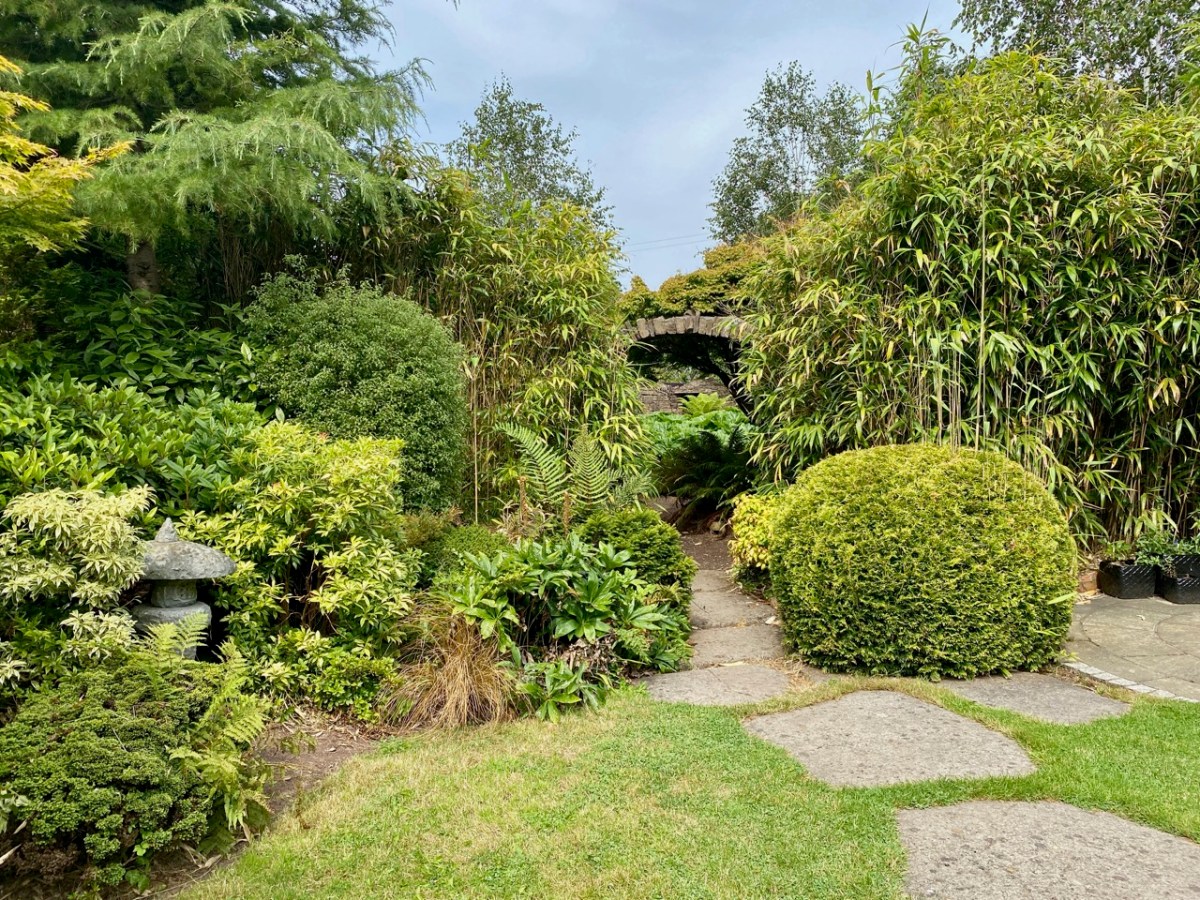
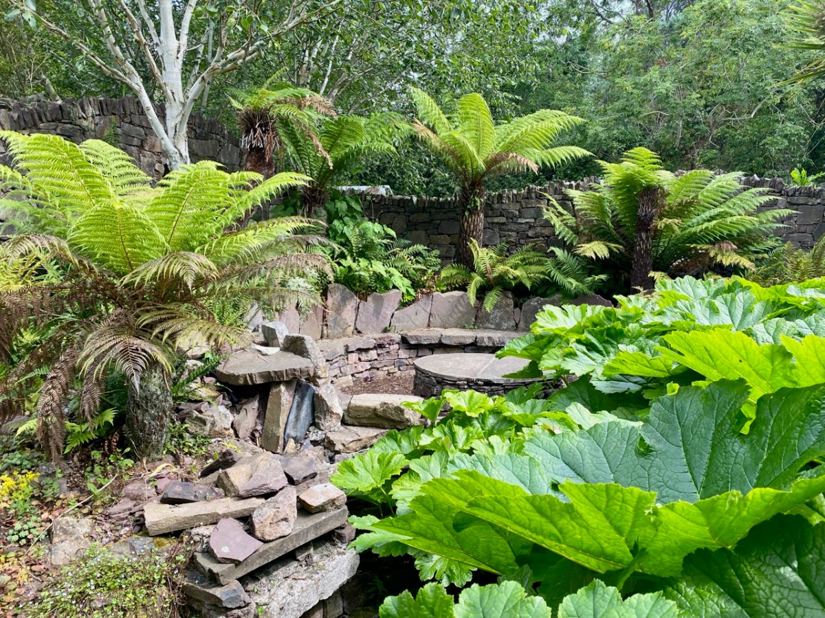
Water is used refreshingly within the gardens – at times you have the feeling of wandering beside a mountain stream; at others you can just find a spot for contemplation by a cool pool.
You can be methodical in your walks through each of the garden areas or you can, like us, wander haphazardly, not taking any particular straight line. If you do this, you are sure to miss something – but that’s good reason for a return visit. We are keen to come back when the autumn is setting in: the colours will be a treat. But we will return before then anyway: the excellent coffee and snacks are calling!
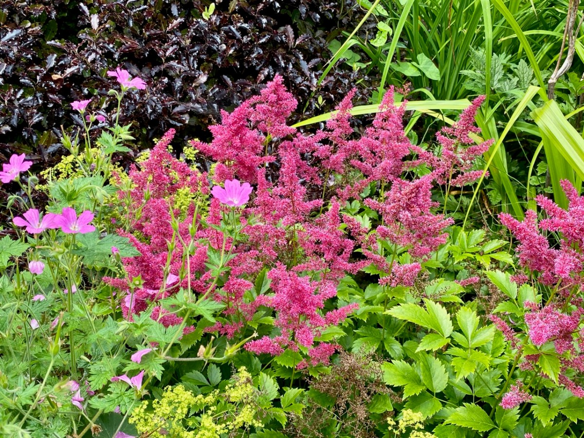
I haven’t mentioned the profuse planting that veers between formal and – as you can see – naturally wild. Finola is particularly pleased to see the latter: she firmly believes that wildflowers have a big part to play, nowadays, in any established garden: have a look at our post on West Cork’s Bantry House Gardens, here. Allowing nature to contribute to established planting schemes will ensure that good habitats evolve to support our pollinators and a balanced eco-system.
One of the things that struck us on our visit to Kilquade was how easy it is to get away from the crowds! We saw others walking through the gardens but we often had each little designed space to ourselves. Possibly the unbelievable (for Ireland) weather (temperatures approaching 30 degrees) meant that many visitors were sweating it out on the beaches. We were calm and cool, and felt safely tucked away from ‘the madding crowd’. All in all, the experience was exceptional.
Ivaha was the name for the West Cork peninsula that was the traditional territory of the O’Mahonys. The modern name for the peninsular – the Mizen – appeared on maps as early as the 17th century but it is unclear how the name change came about. Ivaha (sometimes Ivahagh or Ivagha) is a corruption of Uibh Eachach Múmhan (pronounced Iv Ahok Moo-en), the Clan Eochy of Munster. Eochy Mac Erc was one of the mythical High Kings of Ireland, from whom the clan claimed descent, acquiring the name O’Mahony from Mahon, son of Cian, an eleventh century chieftain.
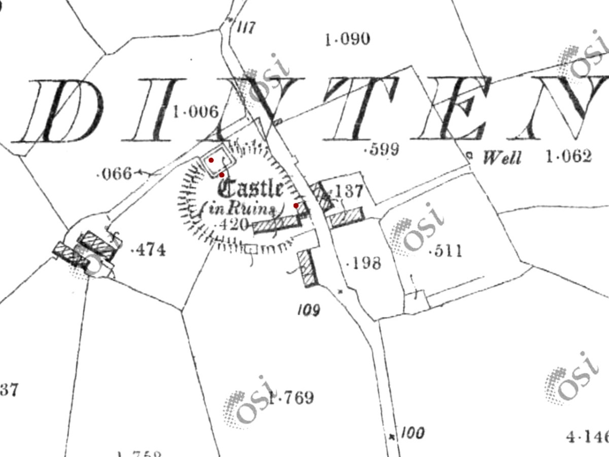
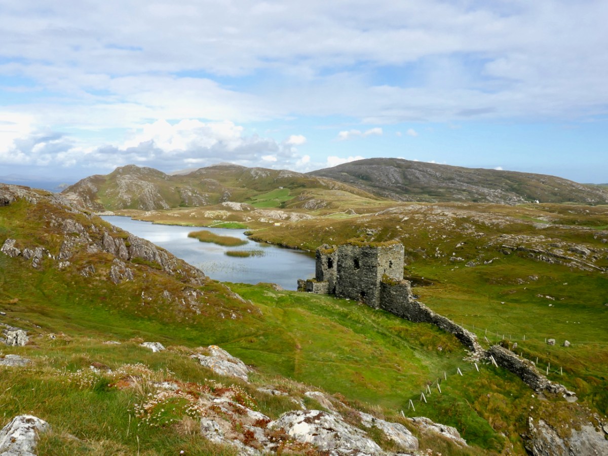
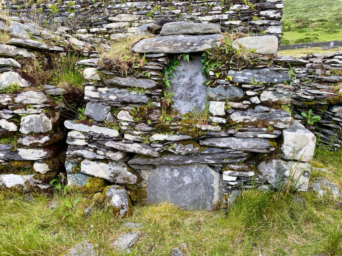
Ardintenant Castle was built on/within an existing ringfort
This expansive territory with its complex coastline was defended and controlled by a series of raths (earthen ring-forts), cashels (stone ring forts), cliff-edge and promontory forts until the 15th century, when wealthy chieftains and high-status individuals (such as bards and brehons) adopted the new style of stone fortification which we now call tower houses, or simply castles.
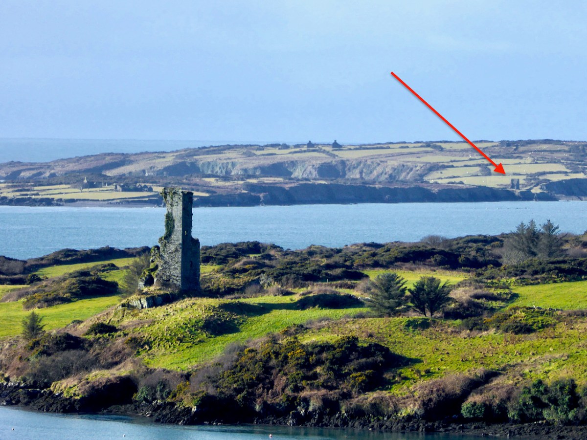
Rossbrin Castle. The arrow points to the location of the remaining wall of the tower house on Castle Island
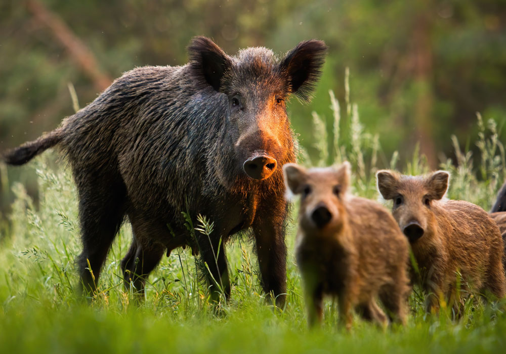
And the O’Mahonys were certainly wealthy. Control of maritime resources was ensured by castles commanding all harbours and with sight-lines out to sea and to other castles, as well as by fleets of ships. The waters around Ivaha teemed with herring and pilchards, one of the staples of the Medieval European diet, once salted and processed in ‘palaces’ owned by the chieftains. Fishing dues were a lucrative source of income, as were exports of fur and wool and control of vast herds of swine which fed on the mast in the all-surrounding forests.
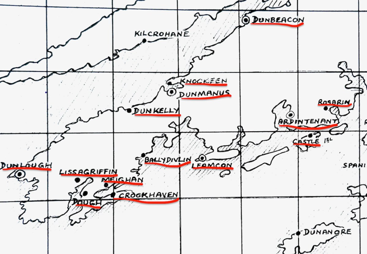
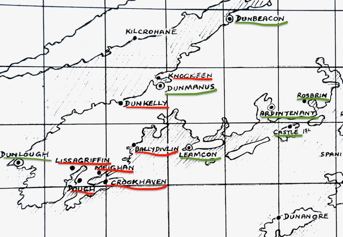
Several of the castles deserve an individual post (all in good time, although Robert has certainly written often about Rossbrin, see for example here and here) but for this introduction I want to lay out exactly how many O’Mahony Castles there were and how many we can see in the landscape now. Let’s start with the total number, each one underlined in red.
As you can see, there are fourteen locations indicated on the map*. Some of these may be familiar to you from previous posts we have written about the history and archaeology of West Cork, and some of them may look strange. Dough? I hear you say – Never heard of it! Not to mention Knockeen, or Meighan.
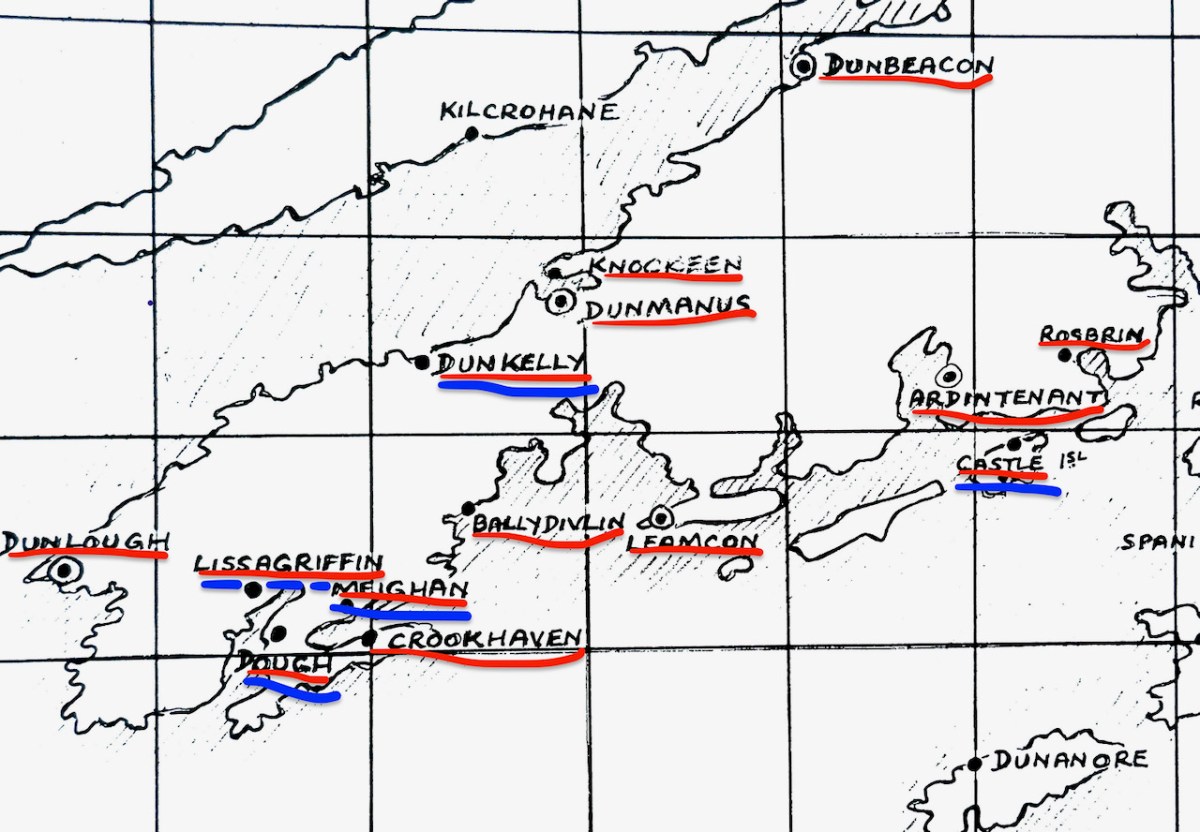
The castles underlined in blue are certainly in O’Mahony territory, but may not have been built, or owned or occupied by O’Mahonys. There is some suggestion, and some local belief, that the tower on Castle Island may have been owned by the O’Driscolls, built for the purpose of keeping an eye on their neighbours. However, on the whole this seems highly implausible, since it is so deep within O’Mahony lands and indeed within sight and easy reach of both Ardintenant, where the clan chieftain, (or Taoiseach) resided and Rossbrin, where the next-in-line to the chieftaincy, (known as the Táiniste) had his stronghold.
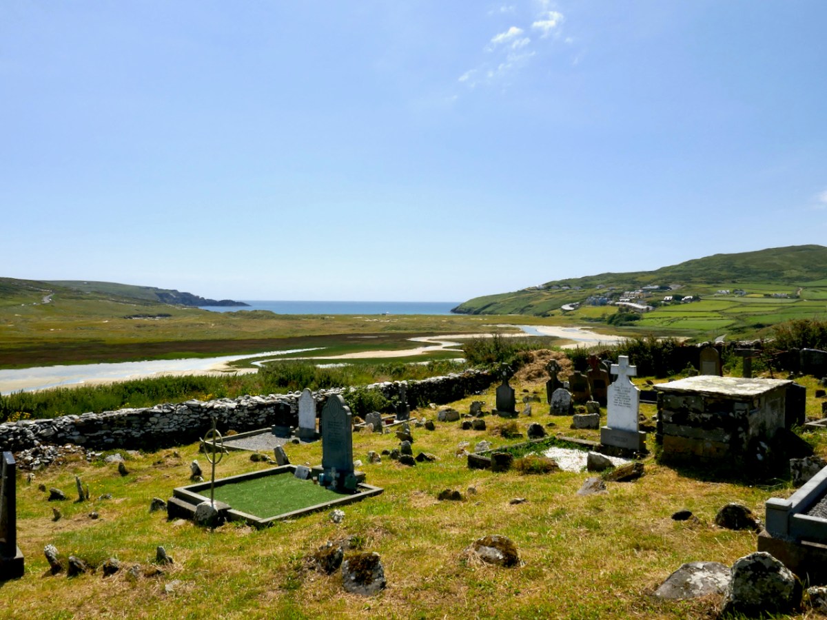
This is the site of the graveyard and ancient church at Lissagriffin – the castle would have a short distance to the west but with the same commanding view
Lissagriffin, Castlemehigan and Doagh Castle may have been built for or by the Mehigans, the traditional bards to the O’Mahonys. According to John O’Mahony,** A well-endowed hereditary family of Bards was considered to be an indispensable appendage of every considerable Chieftain’s establishment. Canon O’Mahony goes on to say
In process of time, if not from the beginning of the new chieftaincy, the western O’Mahony employed another Bardic family, that of O’Mehigan, and endowed them with some three hundred acres of land in Kilmoe (as appears from the Inquisition of Dermod O’Mehigan taken in 1623), and with the wardership of a castle―Castle Mehigan―built by the Chieftain, as, of course, it could not have been built from their own limited resources.
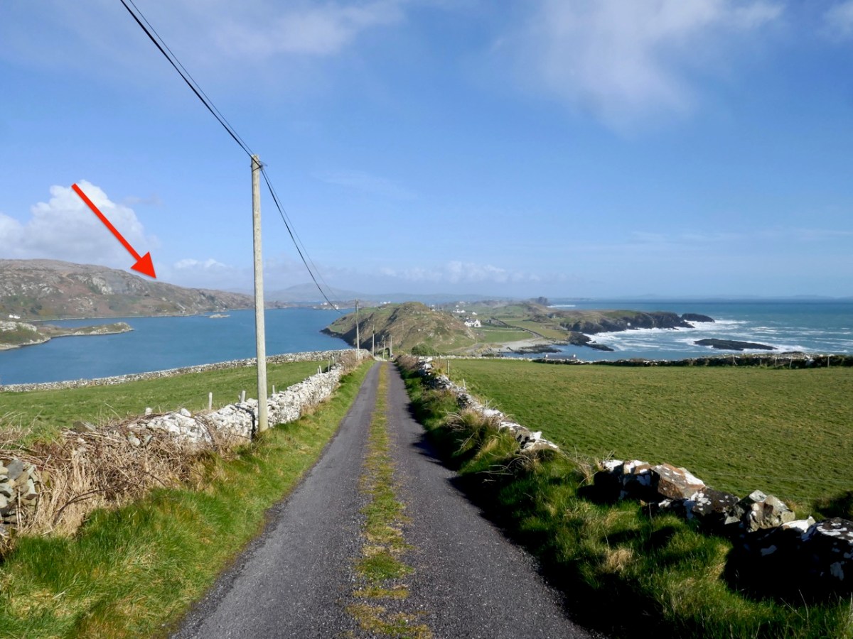
Other authorities posit that the O’Mehigans had not one but three castles of their own. The arrow below indicates the approximate location of Castle Mehigan.
Finally, there is Dunkelly. This one is traditionally associated with the pirate, Canty, and you can read all about him and his exploits in Robert’s post, Canty.
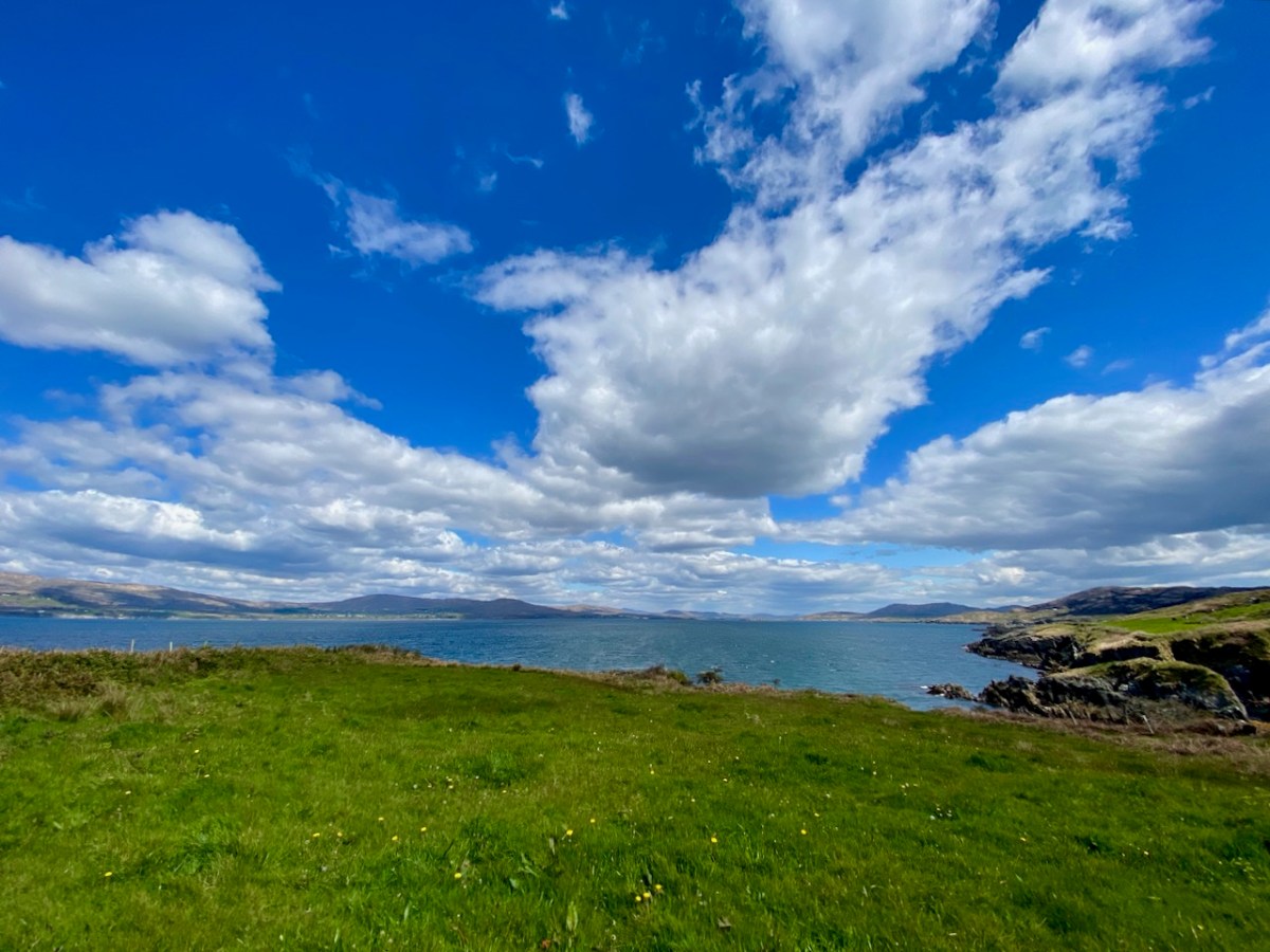
The view from where Dunkelly Castle was sited, looking up Dunmanus Bay
Some of these castles may be unfamiliar to those of you who already know most of these sites. That’s because there is nothing left of them. Besides the O’Mehigan and Canty castles, which have totally disappeared, there is now no longer any trace of the O’Mahony castes at Knockeen, Ballydivlin and Crookhaven. Knockeen, across the bay from Dunmanus Castle, may never have been completed. According to ‘Finnerty’ writing in the Southern Star in 1935, a ‘wise stranger’ came along as the castle was being built and warned that it would fall into the sea – so all operations were moved across the bay to the current location of Dunmanus Castle.
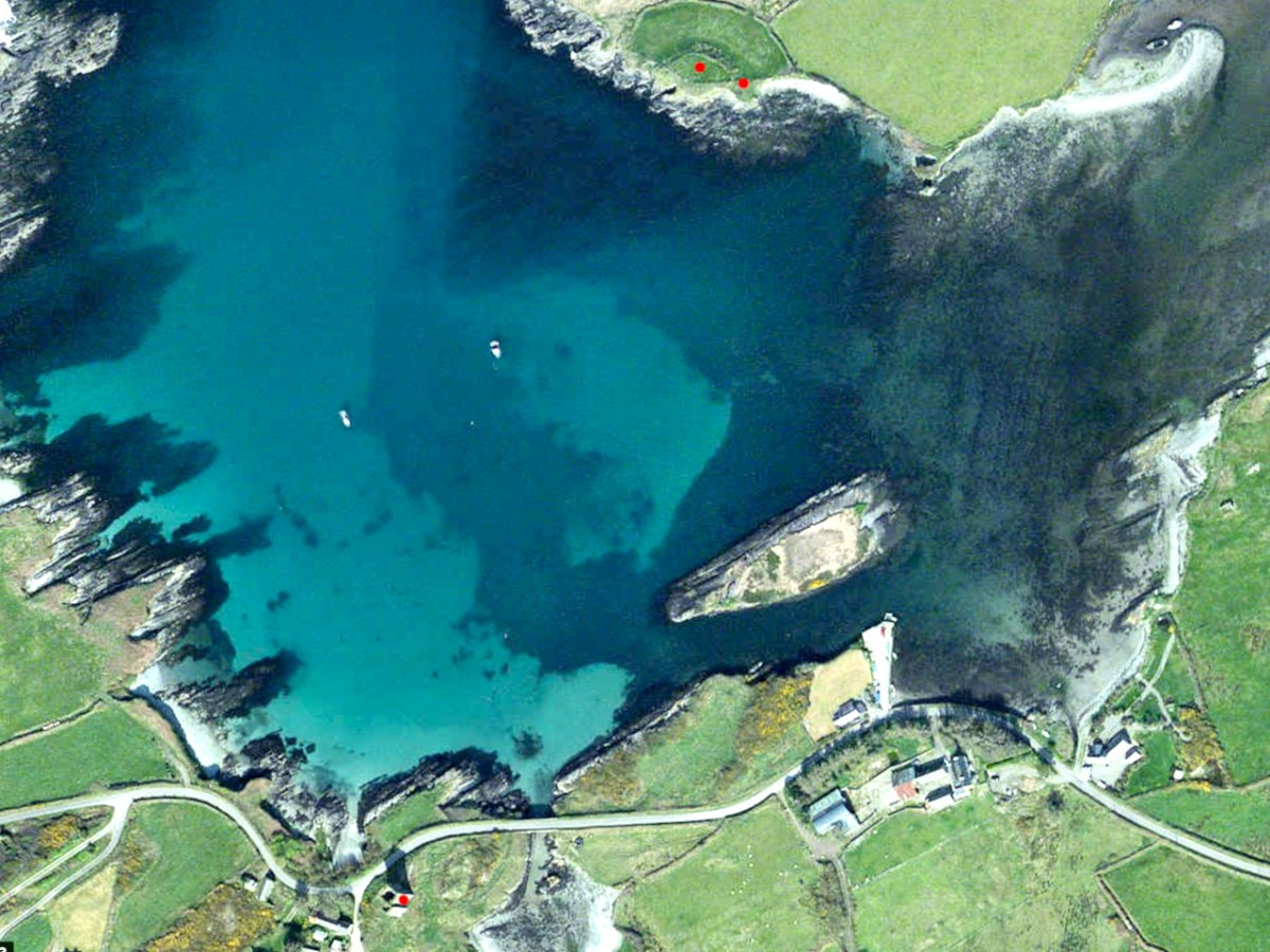
The two red dots on the north side of Dunmanus Harbour mark the site of Knockeen Castle, which was built (or started) on an existing cliff-edge fort. The red dot on the south side is Dunmanus Castle
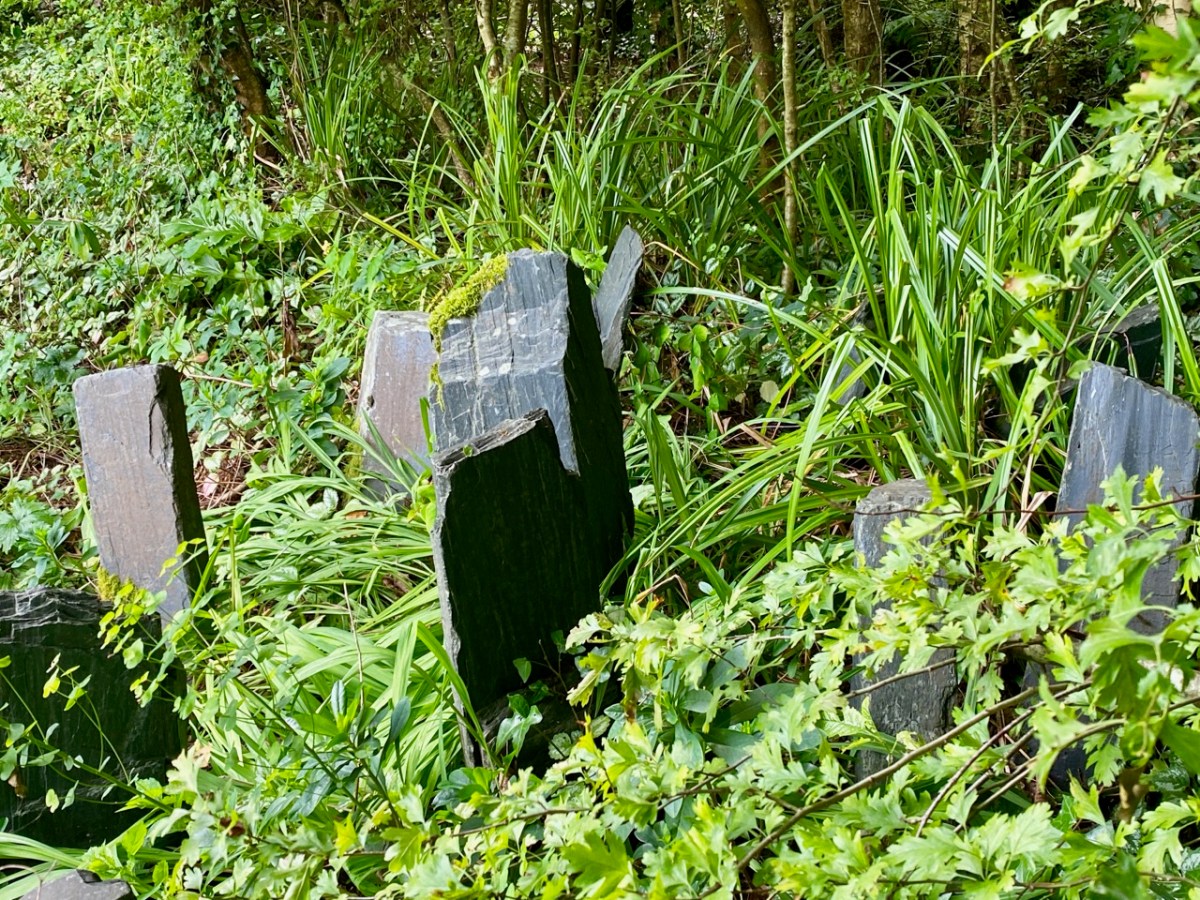
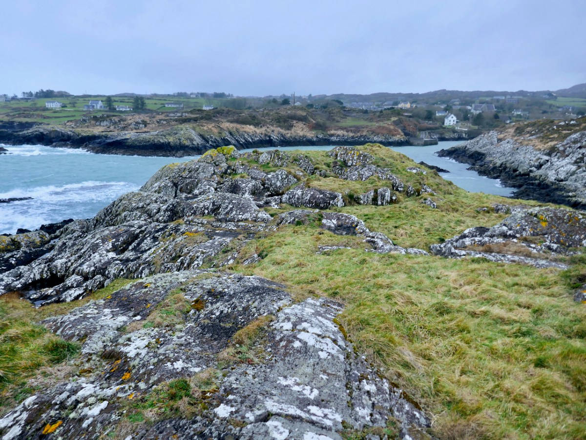
Ballydivlin, sometimes called Ballydesmond, was still standing, according to Healy, until the middle of the nineteenth century when it was demolished and its stones used for road making. Likewise, Bishop Dive Downes, visiting Crookhaven in 1700 described the walls of an old castle in the middle of what is now the village. Both Crookhaven and Ballydivlin (the photograph below shows where it was) followed the pattern of strategic siting to dominate the entrances to harbours.
Of those we have left, Dunbeacon and Castle Island are vestigial – only parts of one or two walls remain. Dunbeacon is my lead photograph – you can see not only how little is left, but also how strategically sited it was, with views right down Dunmanus Bay.
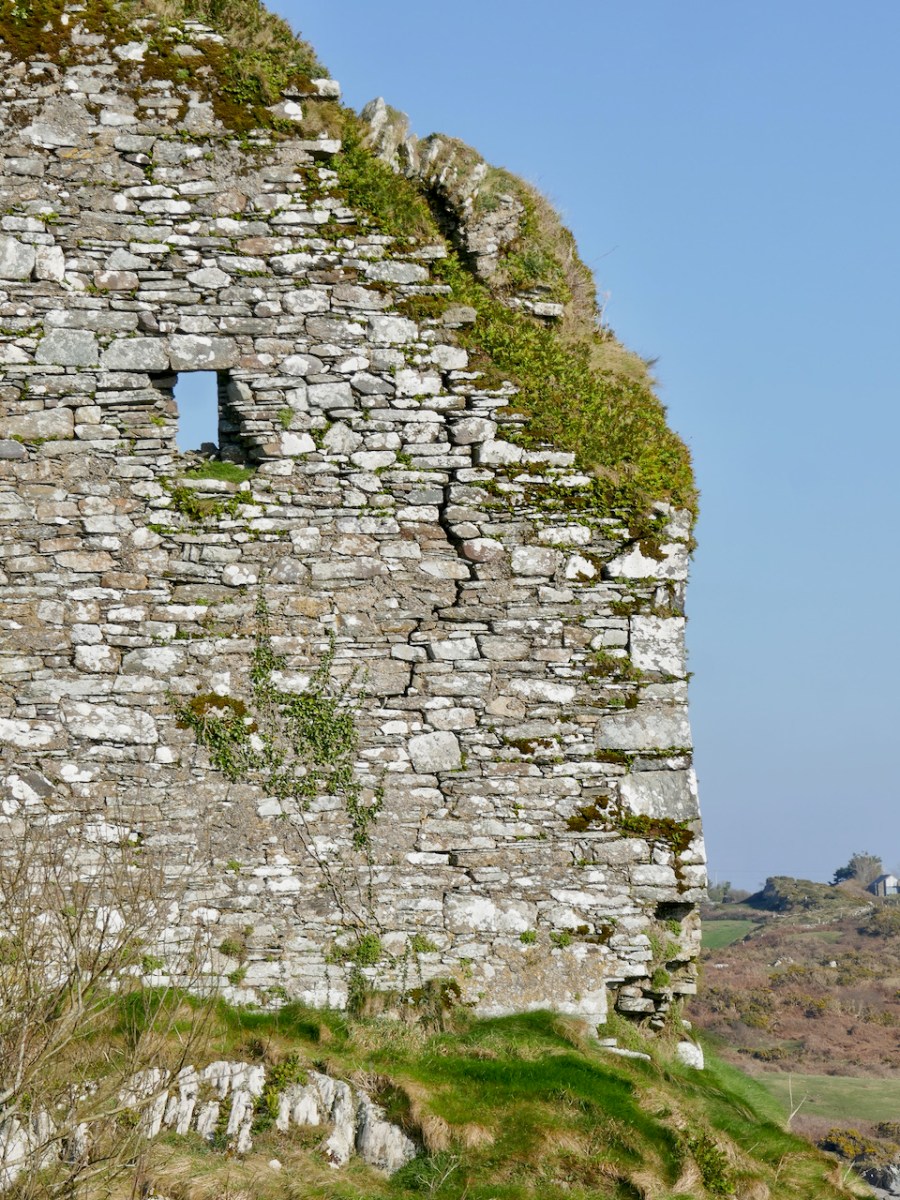
Rossbrin is in a perilous state, having been battered by storms over the years and with cracks and holes in its walls (above). And so we are left with seven of the original fourteen castles – the ones underlined in green, below.
But the final four castles of Ivaha – Ardintenant (White Castle), Dunmanus, Leamcon (Black Castle) and Dunlough (Three Castle Head) are all relatively intact, and Leamcon (below) has been stabilised and preserved by its dedicated owner.
Future posts will describe the defining characteristics of the Castle of Ivaha and explore what we can learn from those that can still yield information.
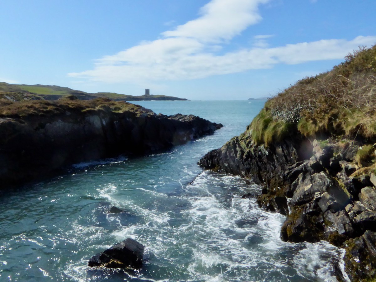
Three Castle Head
*map, and information where noted, based on James N Healy’s The Castles of County Cork, Mercier Press, 1988
**A History of the O’Mahony Septs of Kinelmeky and Ivagha, Rev Canon John O’Mahony, Glenville, Crookstown, Journal of the Cork Archaeological and Historical Society, various issues, 1906-10
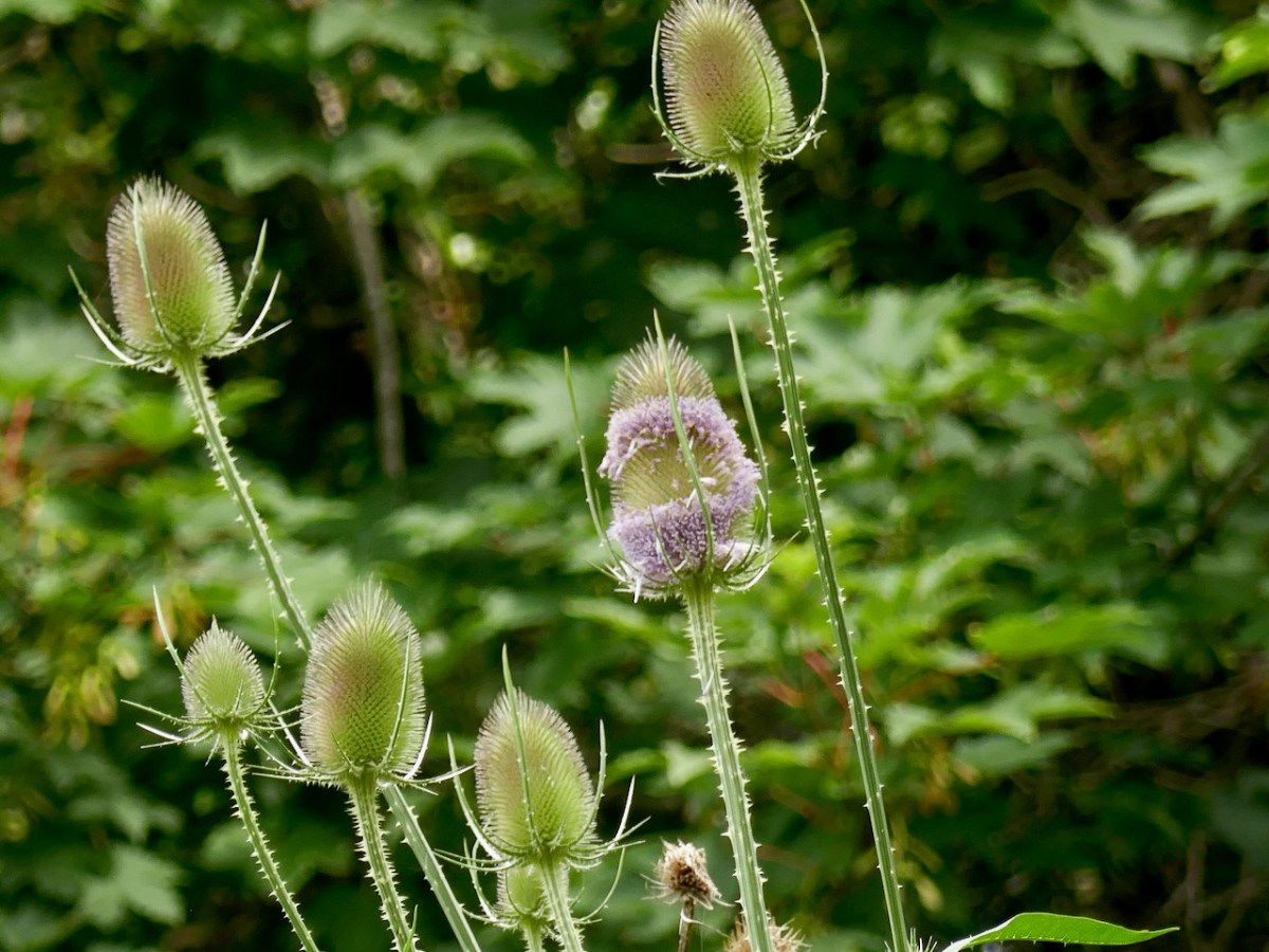
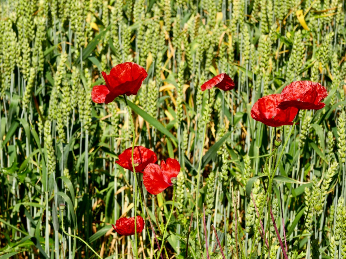
One of our goals in writing Roaringwater Journal is to say – Look what we have here! And one of the things we have in abundance in West Cork is a flourishing wildflower population. There is nothing so good for the soul as wandering our boreens and enjoying our amazing floral heritage. This little movie will show you what I mean, although it’s only a tiny selection of the richness.
Like Lying in the Grass, all the flowers are native, and all photographed within the last two or three weeks in West Cork – that is, late June and early July, 2021. Both posts are a testament to our biodiversity – always under threat. The music is the same, too – Turas go Tír na nÓg by the incomparable Michaeál O’Suilleabháin from his album, Templum, available here.
Here’s the list of all the flowers in the video:
Foxglove – title slide +2
Ragged Robin X2
Sheep’s-bit (the blue one) X3
Oxeye Daisy and Common Vetch
Cat’s-ear, Oxeye Daisy, Bedstraw
Mostly Cat’s-ear
Dog-rose X3
Field-rose X2
Blackberry X2
Tutsan (a type of St John’s-wort) X3
Tufted Vetch (blue) and Meadow Vetchling (yellow)
Tufted Vetch X2
Honeysuckle X2
Hedge Woundwort X2
Purple Loosestrife X2
Foxglove and Meadowsweet
Meadowsweet X2
Wild Strawberry (consumed after photograph taken)
Upright Hedge-parsley X2
Hedge Bindweed (white)
Field Bindweed (pink and white)
Chamomile X2
Common Centaury X2
Oxeye Daisy
Ringlet Butterfly
Bell Heather X2
Spear Thistle and Fuchsia (Fuchsia is not native) X2
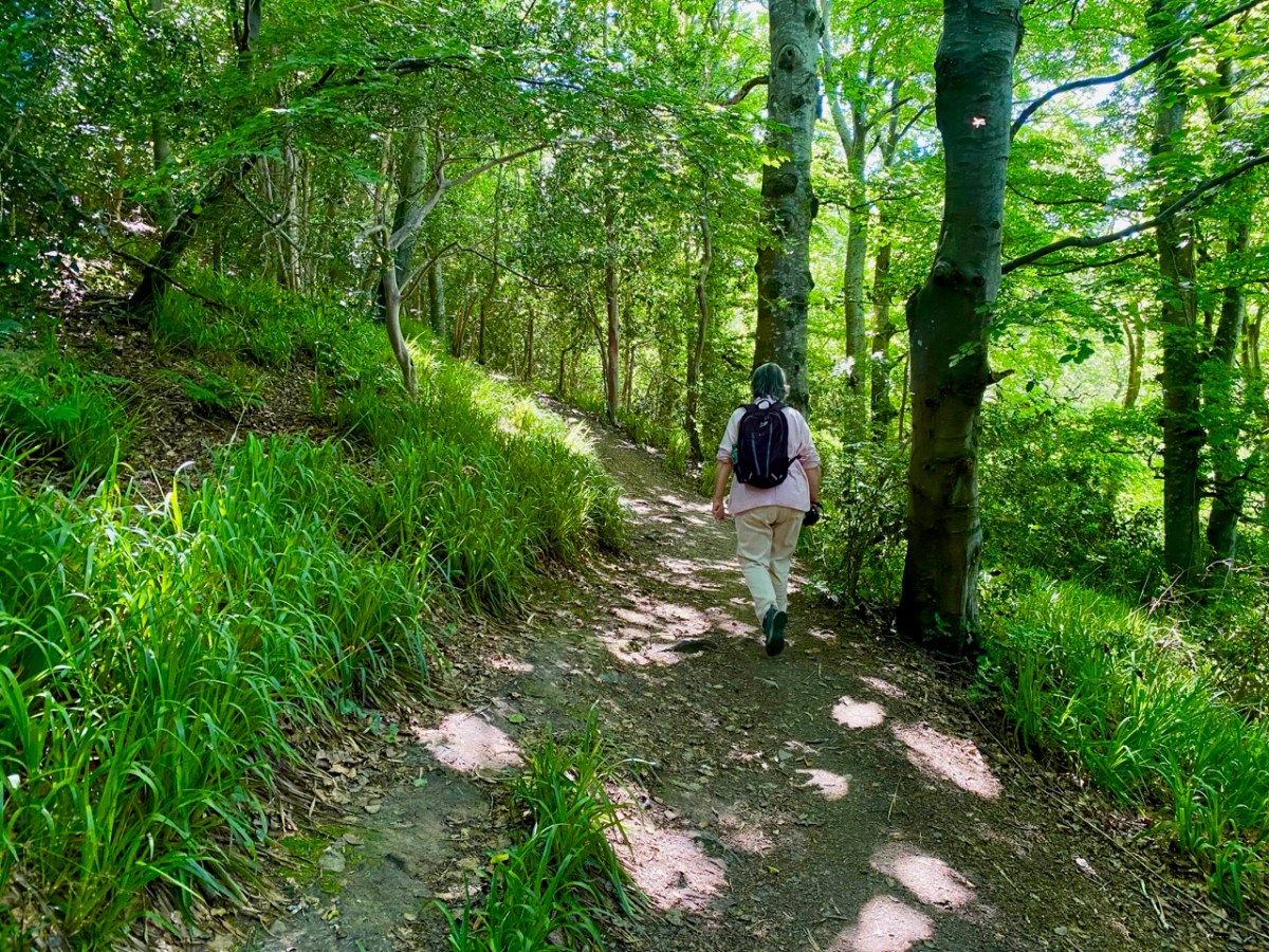
There’s a very attractive woodland walk near Delgany, County Wicklow, to the south of Dublin. It’s well worth an exploration, but be prepared for the intrusive sound of the main N11 road which runs alongside the path as you set out from the public car park: you will leave it behind – eventually – as you climb up into the trees.
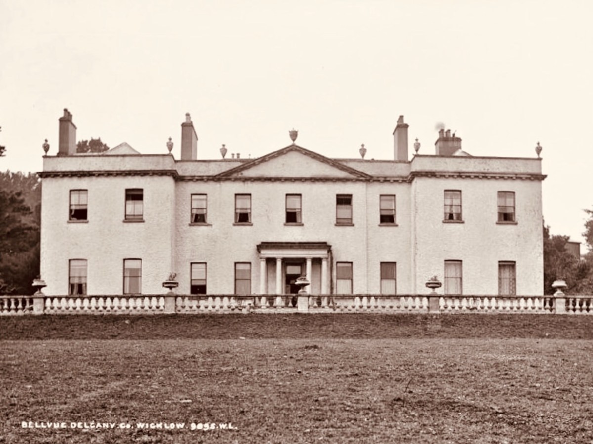
It’s a now rare ancient Irish oak wood, once all part of Bellevue Estate, a 300 acre demesne established by the La Touche family in the mid eighteenth century. Through many generations the Huguenot family was known as an ‘ample benefactor of mankind’ who ‘left a record of noble deeds behind them’. During their heyday the La Touches acquired the lands of Upper and Lower Rathdown on which much of modern Greystones has been built, and their name is familiar in the fabric of that town today.
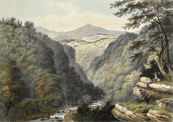
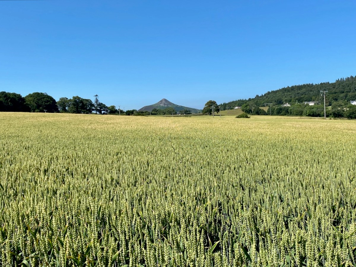
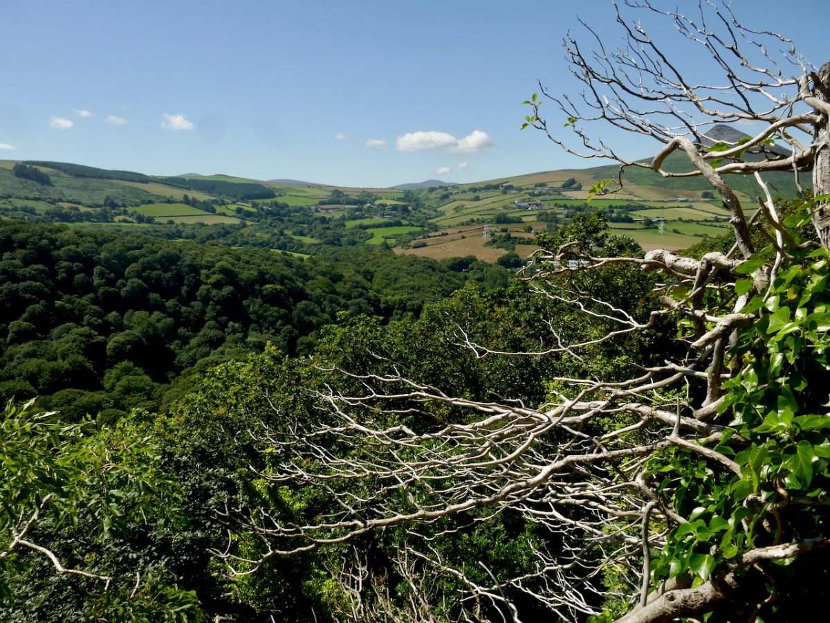
The beauty of this part of County Wicklow has been celebrated by many artists over the years: here are a couple of examples from the late 1700s showing the Glen of the Downs landscape. Always, one or both of the topographical high-points – the Great and Little Sugar Loaves – are prominently featured.
We have photographic records of the La Touche mansion, Georgian Bellevue House – with its famed hot-houses where many exotic plants were cultivated, before its decline in the 1900s and its eventual demise: the crumbling pile was demolished in 1950 to make way for wheat-fields and a golf course.
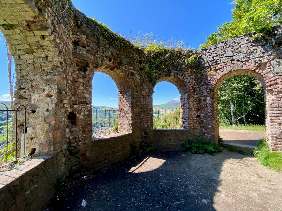
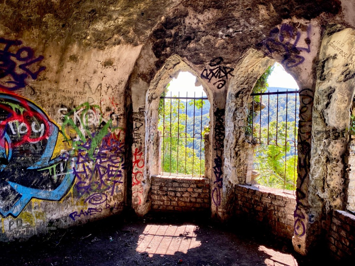
Hidden away in the oak wood is a remnant of the once vibrant La Touche estate: today it’s known as ‘The Octagon’ because of its shape. Its purpose originally was a banqueting hall, set high up on a platform looking out over the landscape. It must have been quite an undertaking, bringing food, furnishings and serving staff up from the ‘big house’: there are remains of tunnels said to have been used for this purpose. Most intriguingly . . .
. . . The estate at Ballydonagh comprised 300 acres, with fine views across the Glen of the Downs and towards the Irish Sea. David, the younger La Touche, built his favourite country retreat here between 1754 and 1756, at a cost of £30,000, and called it Bellevue. Beautiful gardens were laid out with winding paths and “extras” built by David and his son, Peter, when he inherited in 1785. Among these was the Octagon, built in 1766, with a panther on springs, which could be made to jump out at unwary visitors. The house was most famous for its huge glasshouse, built between 1783 and 1793, in which many exotic plants were grown . . .
Judith Flannery, The Story of Delgany, 1990
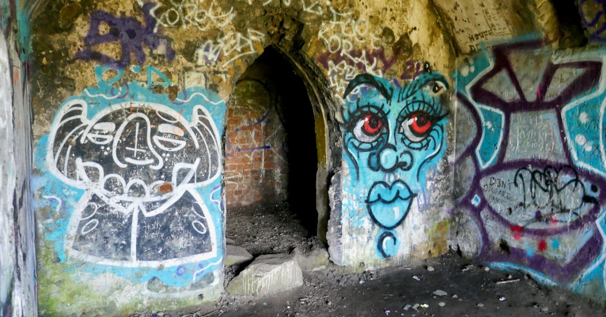
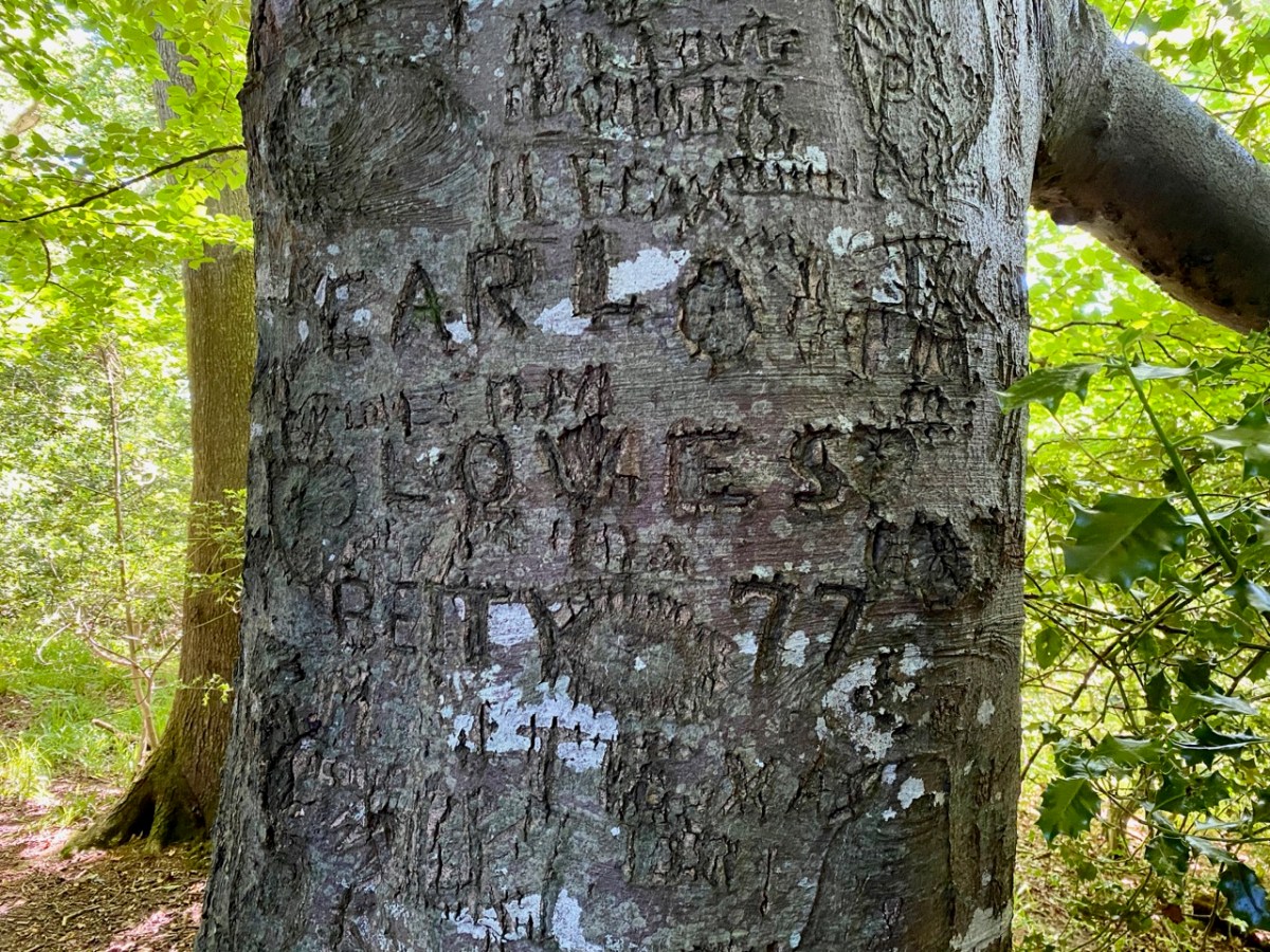
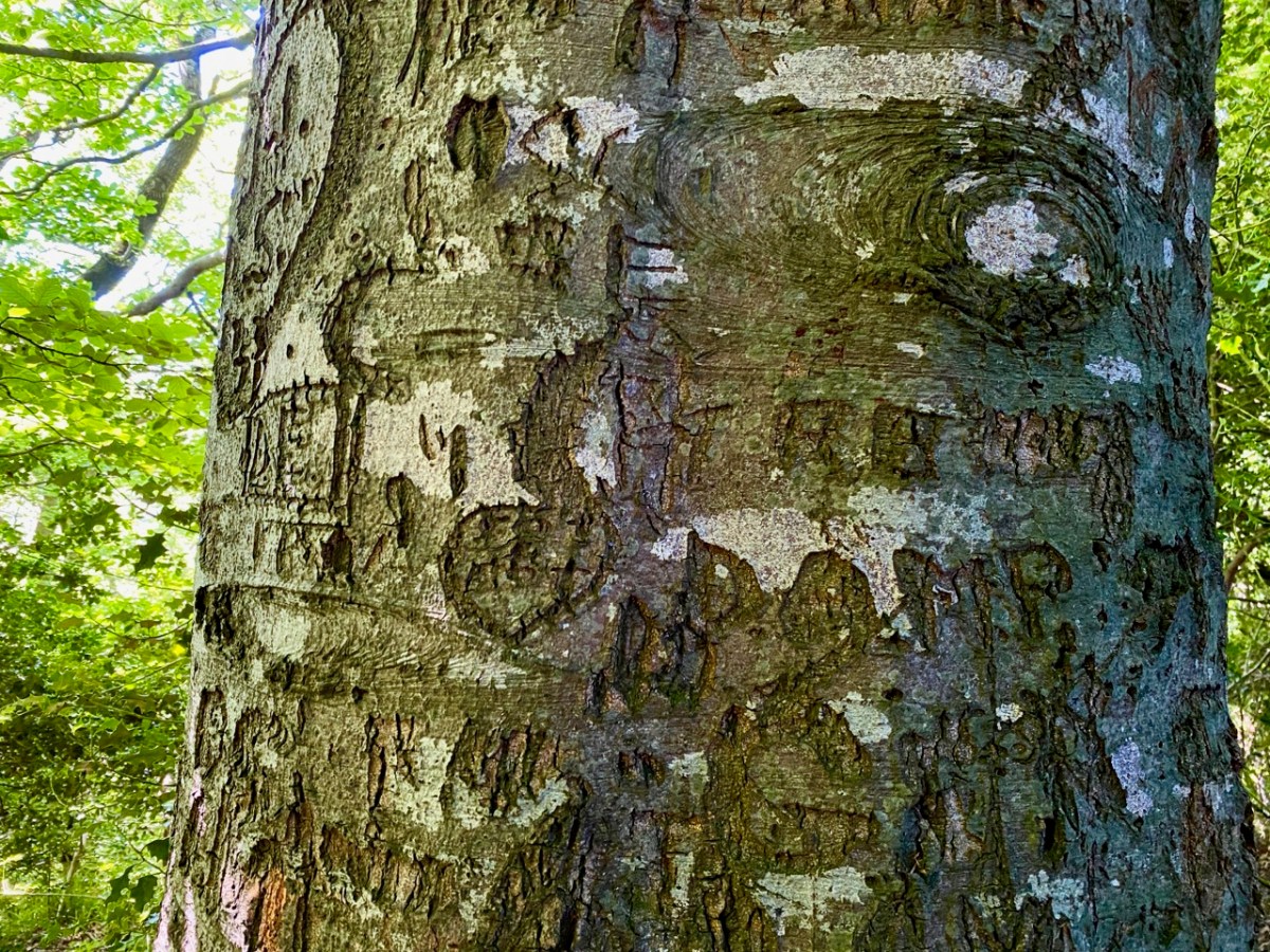
There is no doubt that the building was superbly sited to maximise the good views. Beyond that, it’s hard to fathom how the architecture functioned – and the panther on springs remains a puzzle! Over years of exposure to the elements, and inquisitive visitors, the Octagon has gained a patina of graffiti – which adds, perhaps, to its character and attributes.
The practice of ‘making one’s mark’ seems to have migrated to trees surrounding the site: perhaps some of these can be attributed to people who lived in them once! In 1997 eco-warriors staged a protest campaign when plans were put forward to upgrade and widen the N11 road, involving felling over 1,700 mature beech, oak and ash trees. The protesters ‘occupied’ the trees for over two years (below), ‘climbing down’ eventually when the Courts upheld the highway authority proposals.
The road has since been widened, and the intrusive traffic sound within the Glen of the Downs has accordingly increased manyfold. Interestingly, there are currently proposals under discussion to further improve the N11/M11 route in this same locality – including the possibility of a road tunnel which might even remove traffic altogether. Meanwhile, the trees continue to present us with messages for our own complex times . . .
For all its ups and downs, and possibly mixed messages, the Glen of the Downs woodland walk is beautiful, and well worth a visit. Who knows what – or who – you might encounter among the trees?
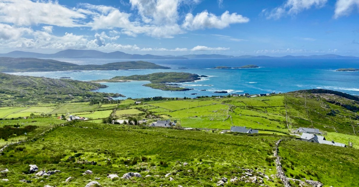
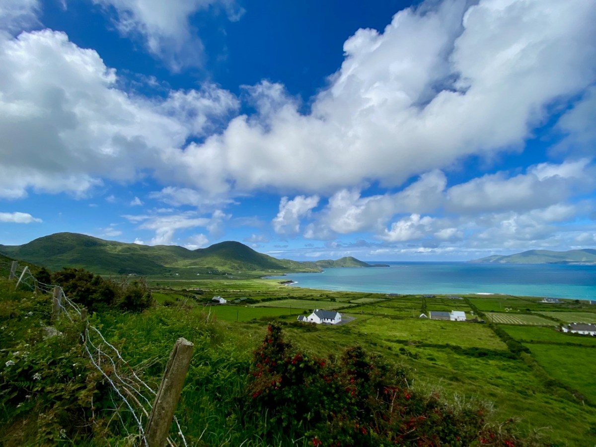
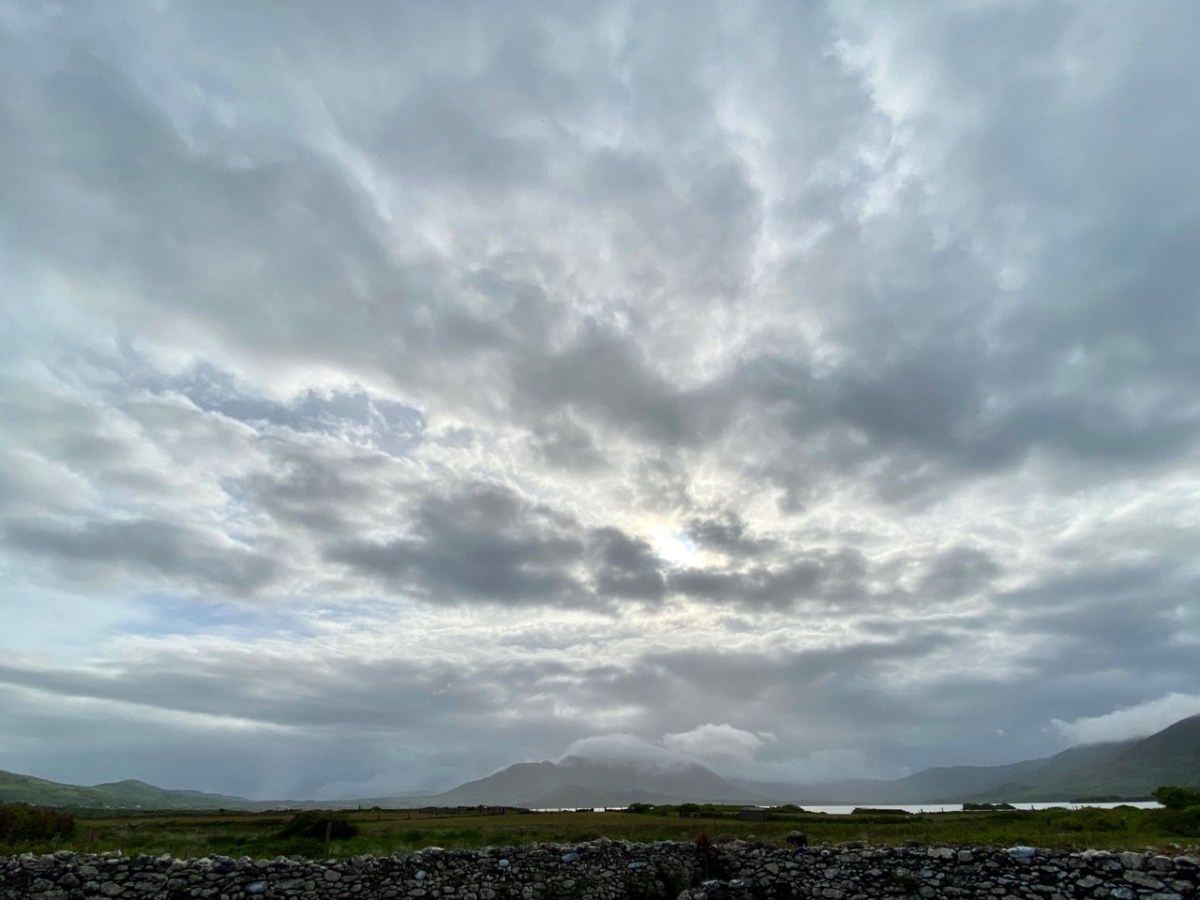
We spent a couple of days in Kerry a week before midsummer, and gave you some account of our discoveries on Church Island, Lough Currane, and up in the hills at Caherlehillan – both memorable Early Christian sites. Our adventures did not end there: we managed to take in, also, some other ancient treasures, a couple of Kerry characters, and some stunning scenery – hard to match – as we travelled back to West Cork along the Ring of Kerry road (above).
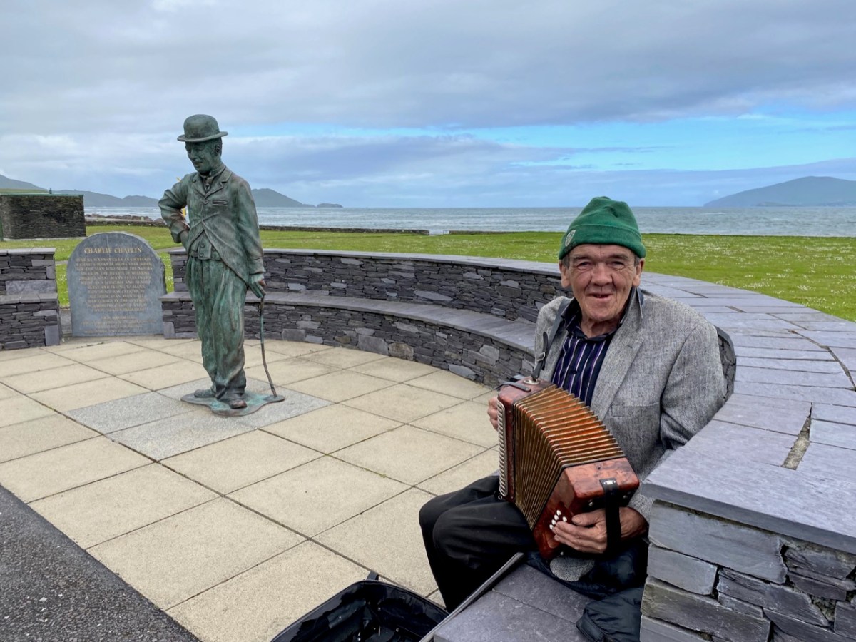
Firstly, here are Charlie Chaplin and Michael Collins (above), both familiar figures in Waterville. The Hollywood star spent his summer holidays in the coastal town for many years with his family and is commemorated by a bronze statue, while Michael can be found on most days in this much photographed location, always ready to entertain with Kerry polkas and slides on his accordion.
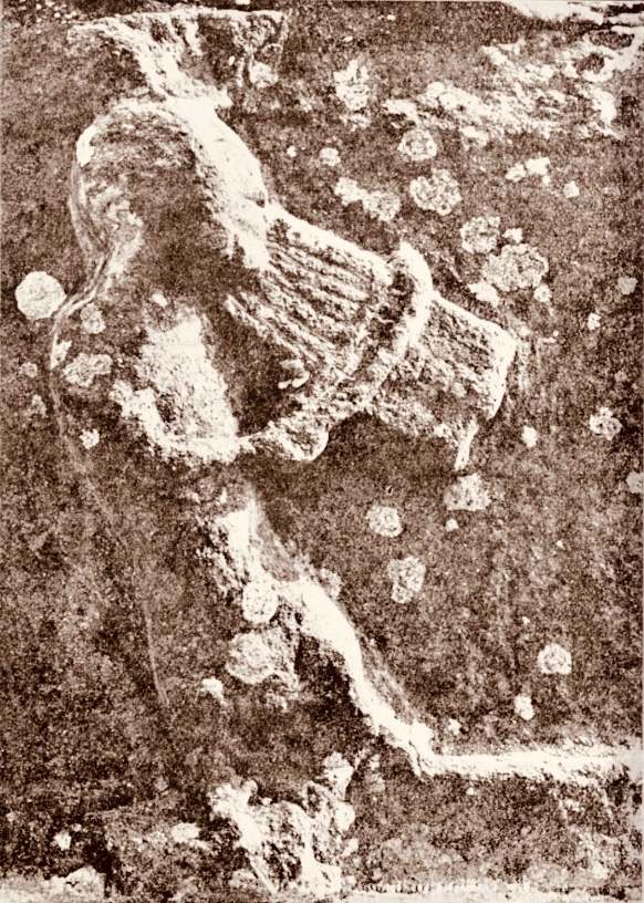
Here’s a much earlier Kerry musician: he’s known as ‘The Fiddler’, and is an unusual medieval representation of an instrumentalist found in the romanesque ruin on Church Island, Lough Currane. I was pleased to find this photograph in the Royal Society of Antiquaries of Ireland Notes from 1908 by P J Lynch as it shows the carving as it was found by the OPW when they took over the site. Now the original, which had suffered accelerated weathering, is kept protected in a museum while a well-worn replica is in place on the site. I believe the carving is a good representation of a medieval bowed lyre, an instrument with six strings which survives today in some cultures, although Lynch gave the following commentary:
. . . The interest in this stone centres in the musical instrument. The examples of ancient carving in Ireland representing stringed instruments are few, and confined to harpers. The photograph illustrates this instrument very clearly. It is the ancient cruit or fidil, said to be the parent of the violin. There are six strings indicated by sunken lines in the stone. The figure appears to wear a kind of tight-fitting tunic. Dr O’Sullivan states that the word fidil being a teutonic version of the original name vièle, it may be concluded that the original instrument was introduced through the Anglo-Saxons, and not through the Normans. He adds that up to the eleventh century it consisted of a conical body, and after that it became oval. If this be a portion of the twelfth-century instrument, the older pattern must have survived. The Kerry people were probably as unwilling to change in those days as they are at present . . .
P J Lynch – Some notes on church island – RSAI 1908
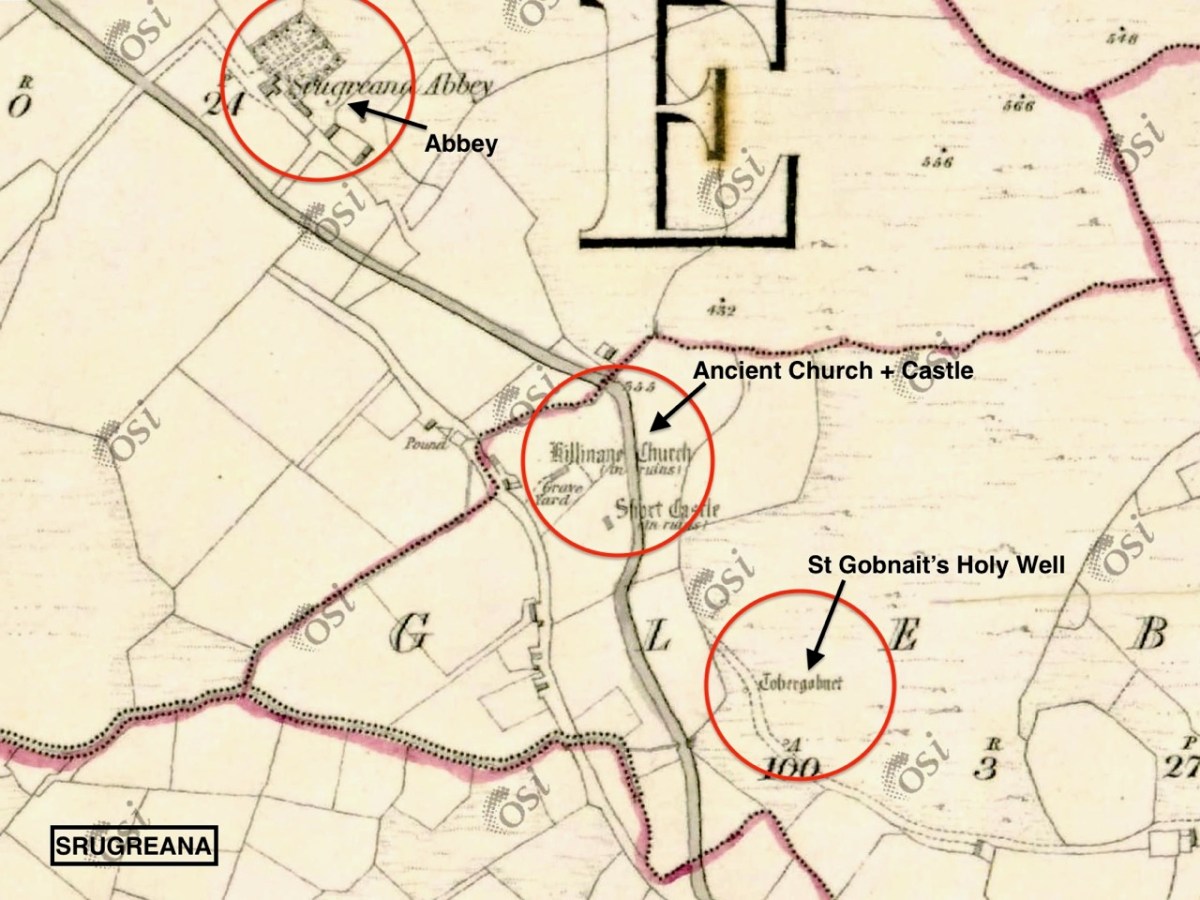
Our trip out to Church Island (above) was accompanied by moody weather, but we were fortunate with other expeditions which included the discovery of ancient sites in the townland of Srugreana (Srúbh Gréine in Irish, which is translated variously as sunny stream, gravelly stream or – my favourite – snout of the sun: Kerry certainly offers some tricky pronunciations for those unfamiliar with the area, or the language!).
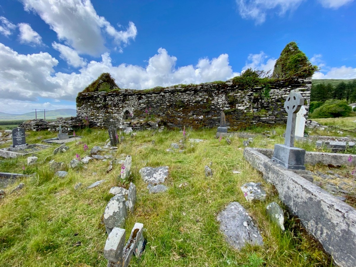
This extract from the 6″ OS map, dating from the mid-1800s, shows one area we explored on our Kerry day. It throws up some enigmas: Killinane Church (the church of Saint Lonan or Lonáin) is often referred to as Srugreana Abbey, but this is a separate site indicated further to the north-west on the early plan.
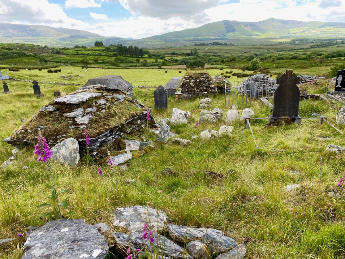
The church site at Srugreana is remarkable in many ways. A 2012 survey commissioned by Kerry County Council Heritage Office found there are at least 1,290 unhewn, uninscribed gravemarkers around the medieval church, and a significant number of ‘house type’ tombs, some of which are ‘two-storey’, like the one above. The concentration of graves – many of which cannot be dated – suggests how populous this now remote area was at one time.
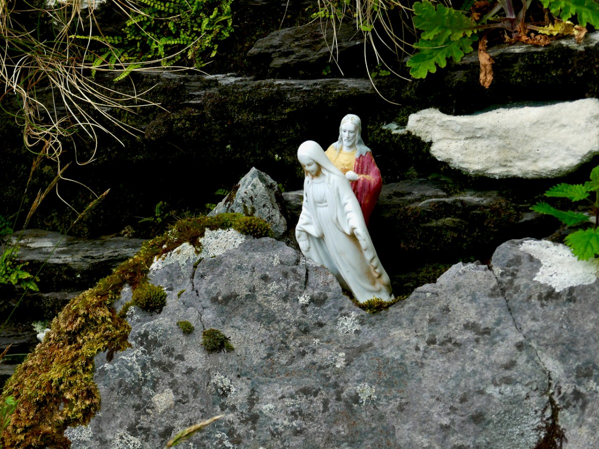
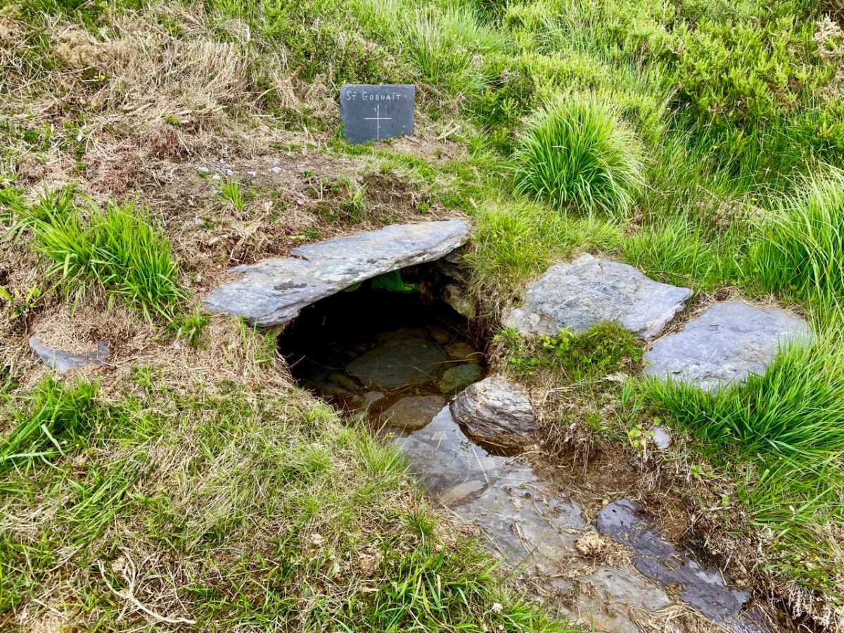
The main purpose of our visit to Srugreana was to search out a holy well dedicated to Saint Gobnait (above). The expedition was led by Amanda, who runs the Holy Wells of Cork and Kerry website. You need to read her comprehensive article on this particular saint here. Interestingly, while we were visiting the well we met the new owner of the land on which it sits. She had no idea that there was a holy well here, and also was unaware of its apparently recent renovation! Note the crosses carved on the stones by visiting pilgrims, above.
From the above accounts, and our two previous posts, you can tell that we had a most productive time exploring just one small area in the ‘Kingdom’ of Kerry. I am rounding off this entry with some more photographs of our journey back along the coast. The weather gave of its best for this county which is our neighbour, and we will continue to explore it and look for more archaeological gems. Keep reading!
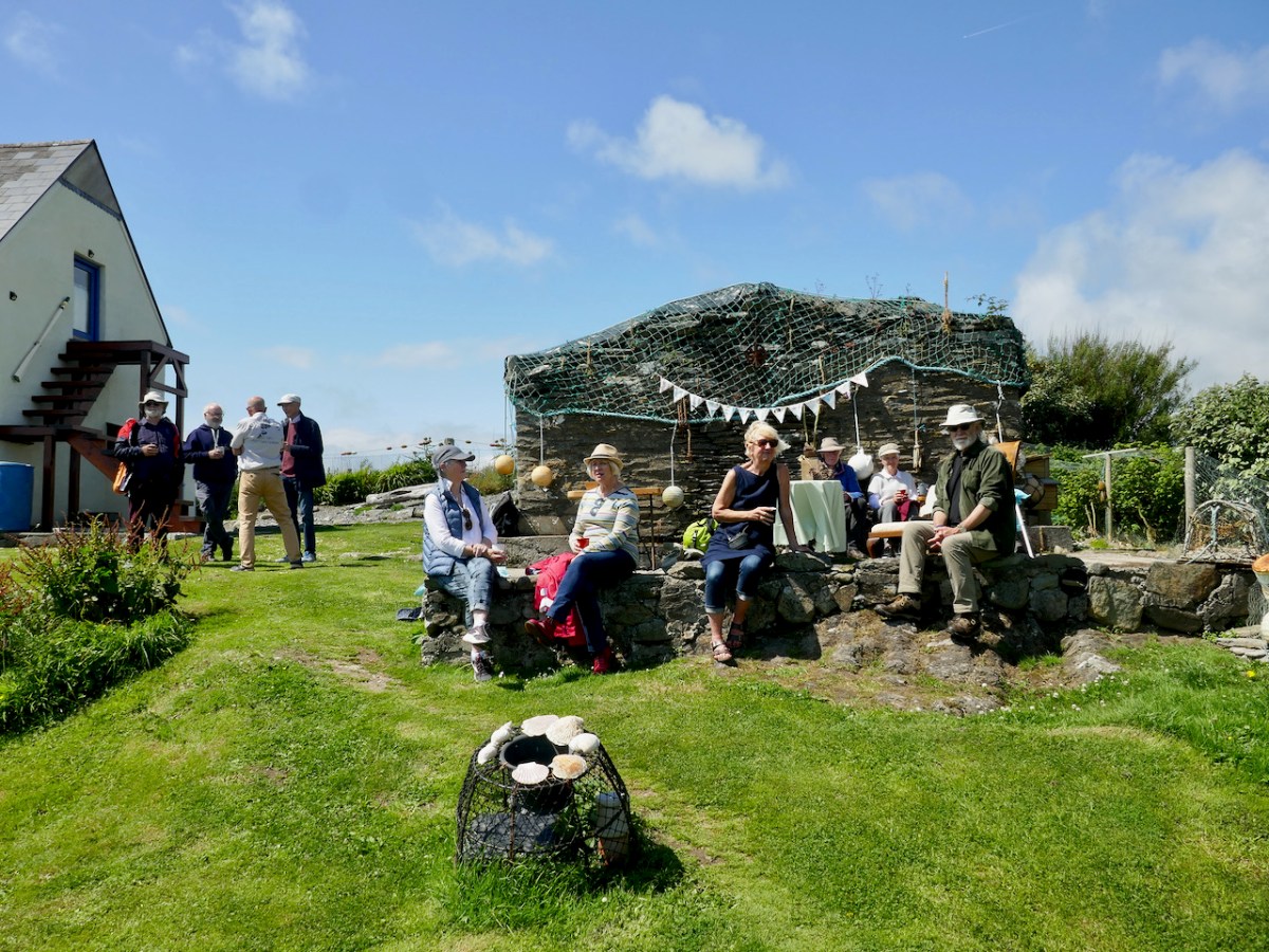
When the occasion arose for a celebration – the publication of The Gazetteer of Irish Stained Glass – we knew exactly what we wanted. We don’t know yet when we can have a launch of the book in Dublin, but it might be the autumn before it can happen, so Robert and I decided that a little local jollification was in order.
We know what Tracy and Peter could do. They’re the Long Island Wild Camping couple who organised the Wildflower Walk and who will do picnics or catering for you on Long Island. Tracy’s eyes lit up when we were talking about her idea of doing ‘proper’ high teas on the island and my need for a celebration, and the plan was conceived.
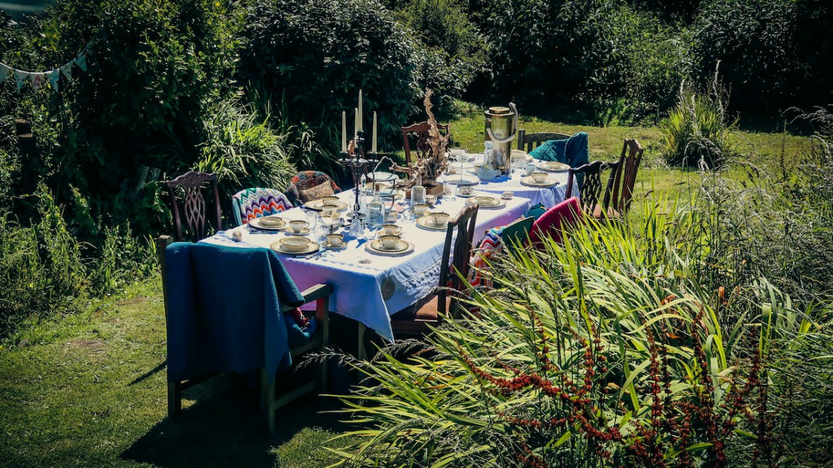
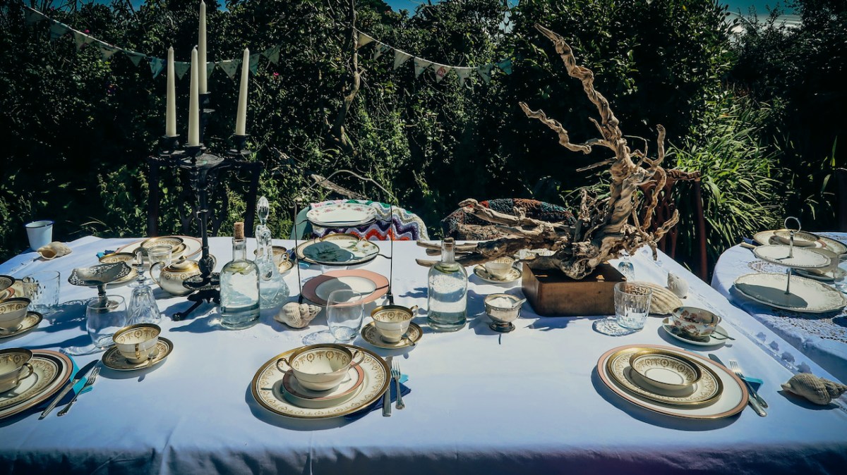
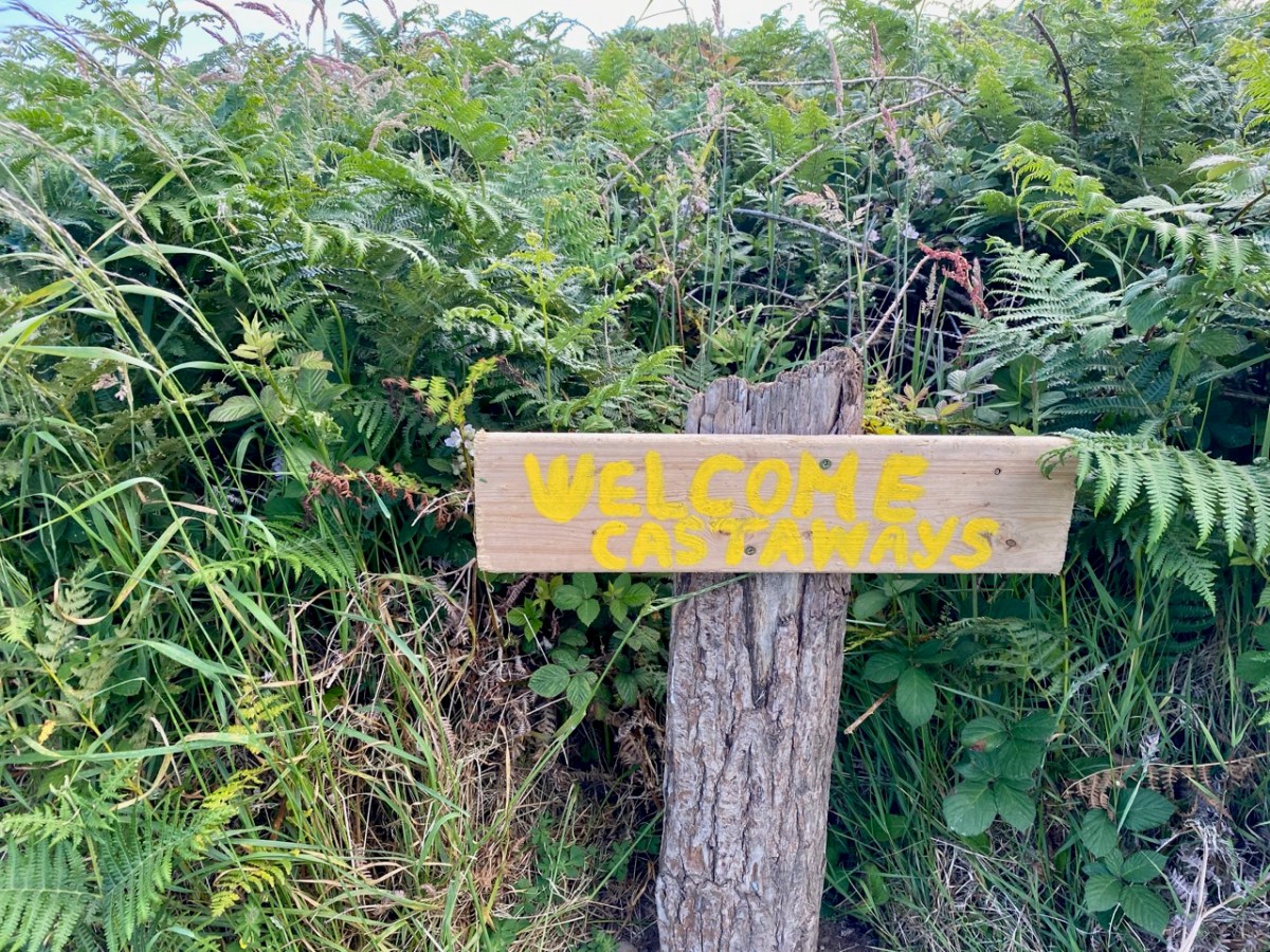
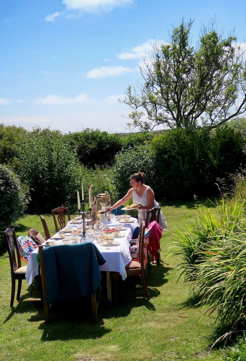
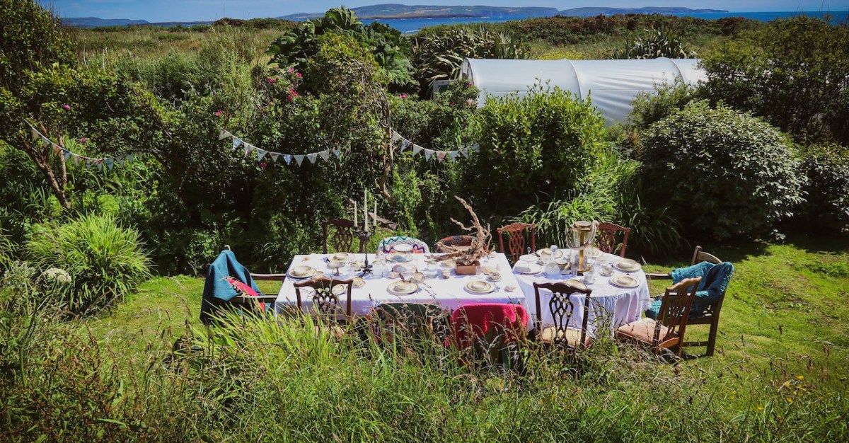
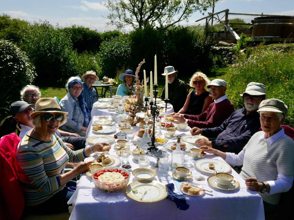
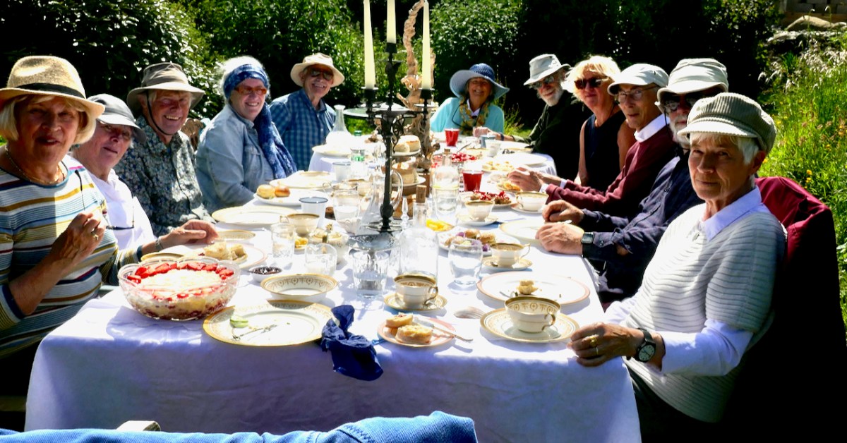
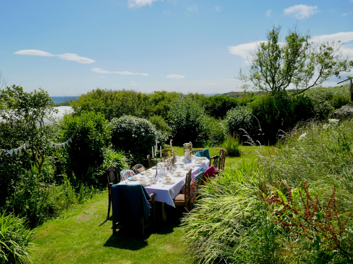
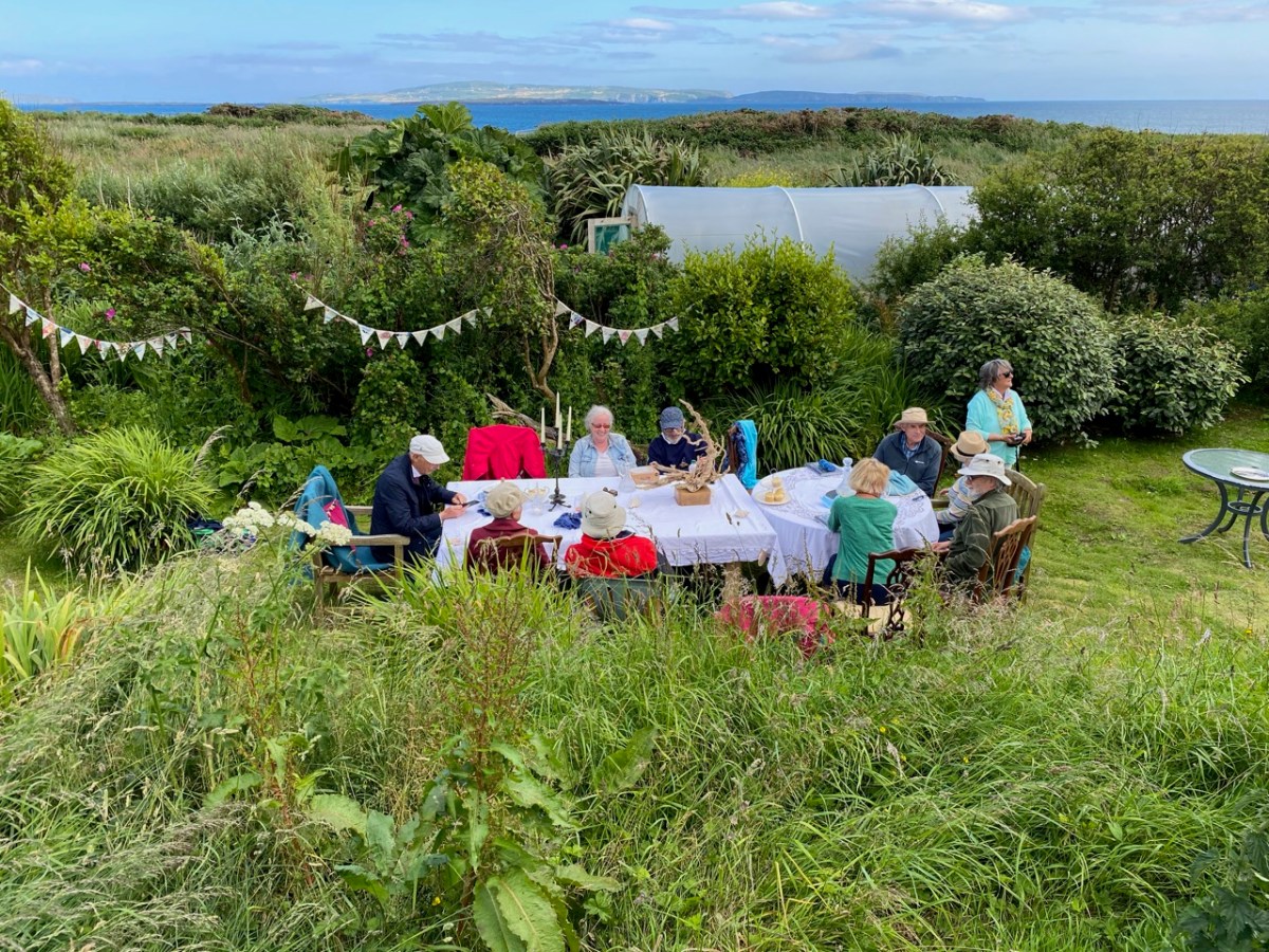
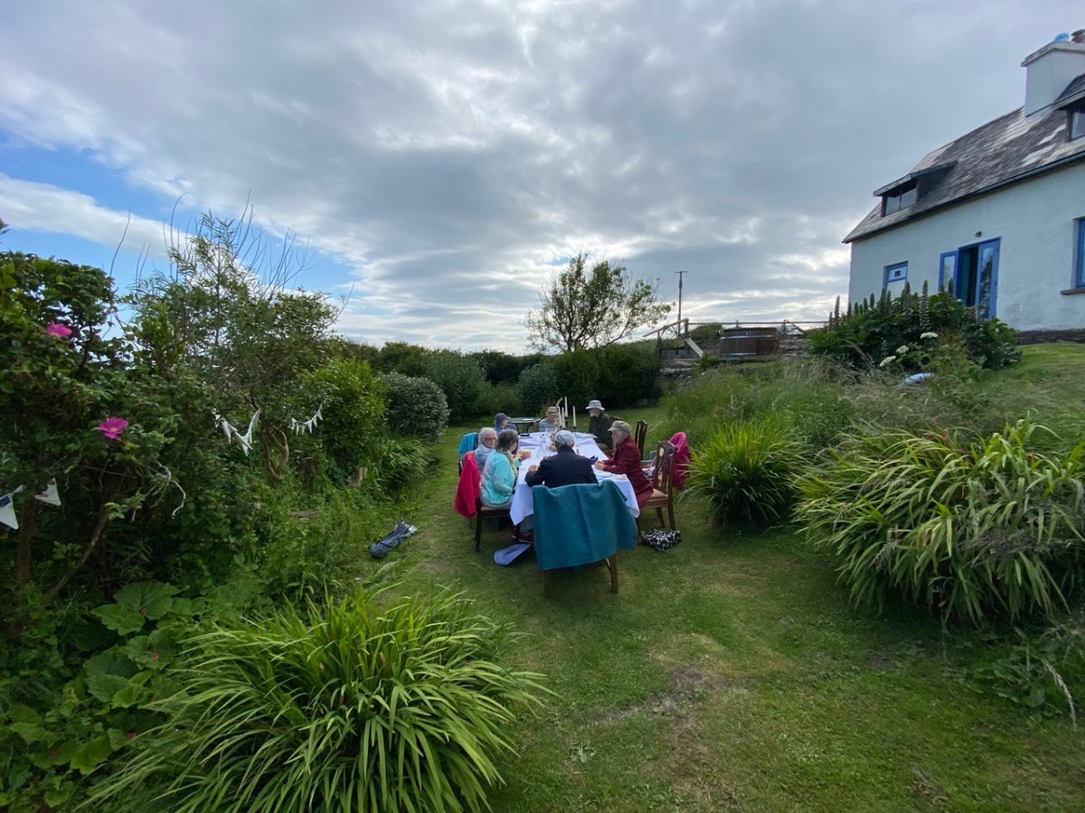
Twelve of us were conveyed to the Island by Maurice and Helen of the Long Island Ferry, and Glory Be! – the sun shone all day for us. It’s a short walk along boreens fringed with blooming hedgebanks to the East House, and what a sight awaited us there*!
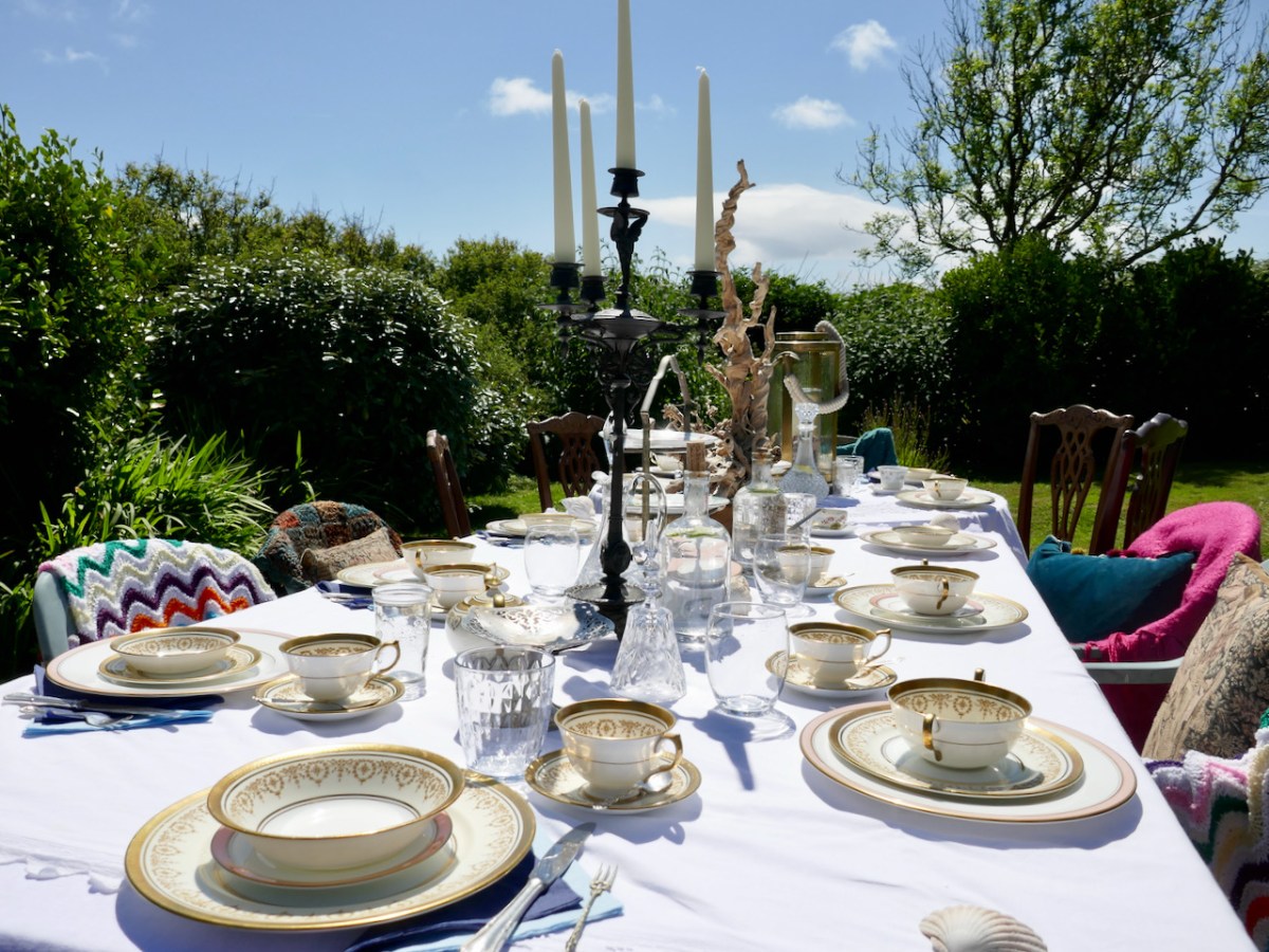
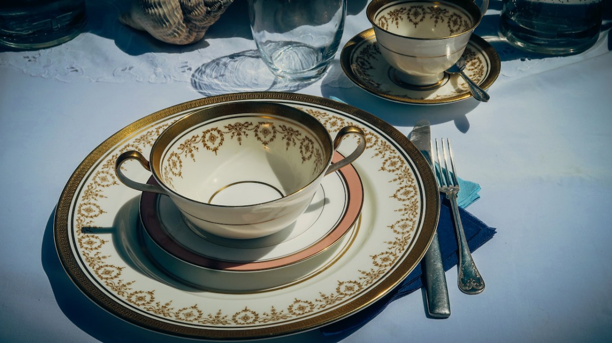
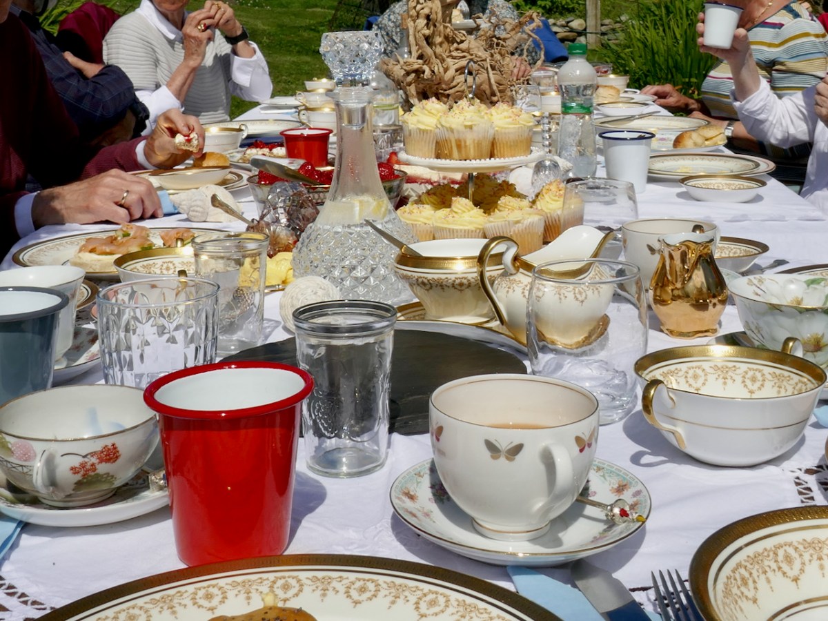
Tracy had created a Long Island version of a Mad Hatter’s Tea Party! It looked magnificent, quirky, fantastical, sumptuous. Real china – her grandmother’s – lots of glass, a chandelier, old-fashioned cutlery (remember those bone handles?), lanterns, decanters, tiered cake stands – all ranged along a long table covered in vintage tablecloths. The table was set out in a hollow in their amazing garden and it looked like something out of Wonderland.
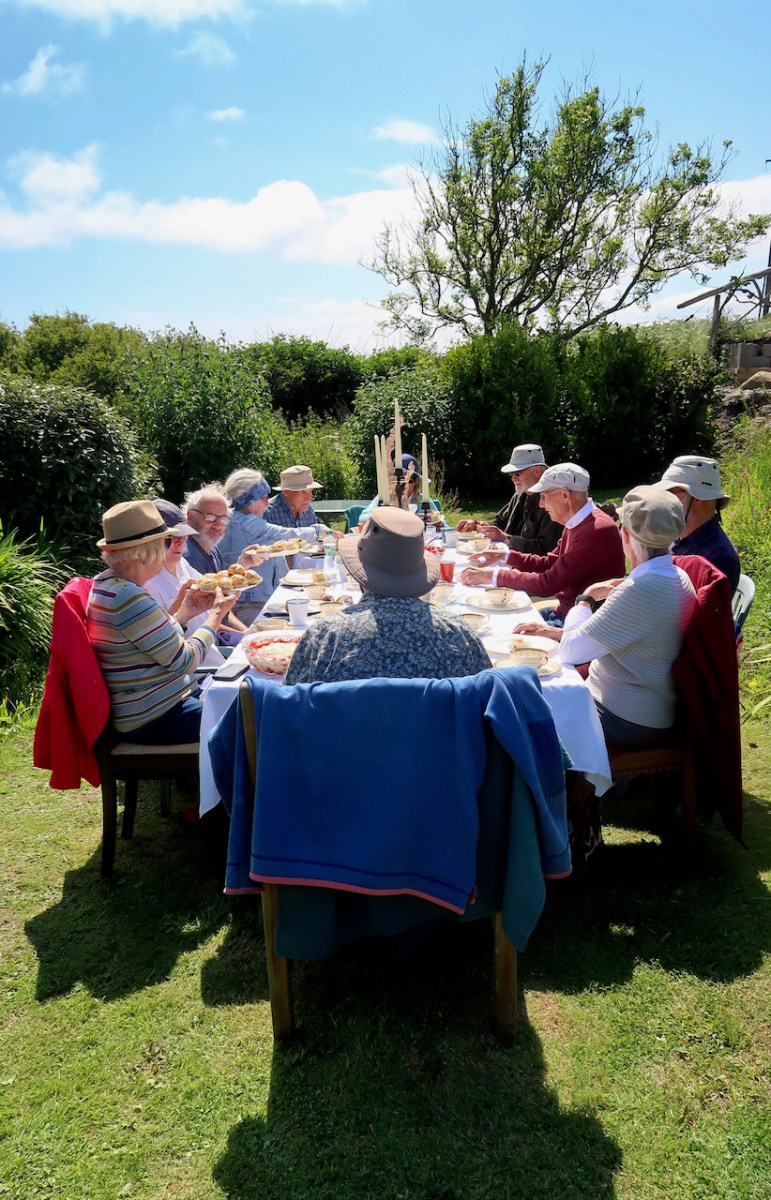
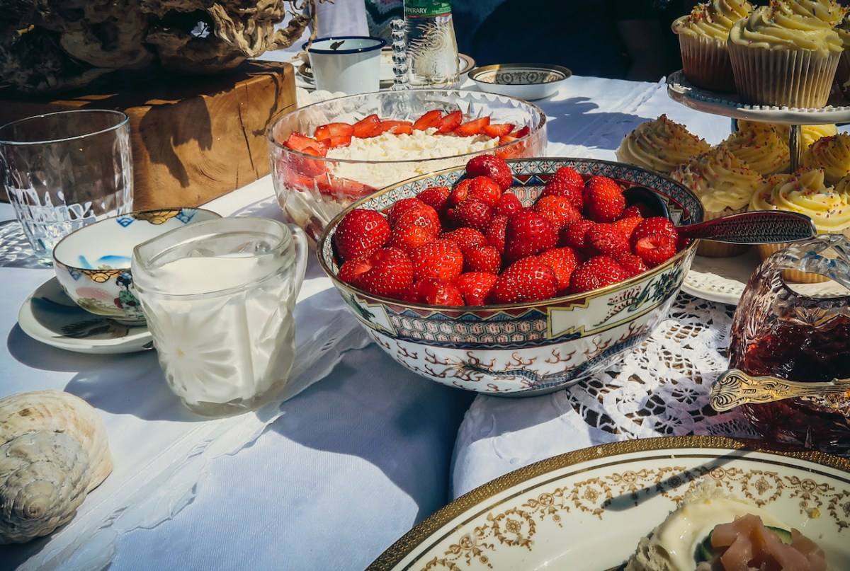
There were mojito mocktails to start with (yum!) and then it was down to the serious business of eating. Pretty well everything was homemade, including all the scones and buns, or from their garden (cucumbers, strawberries, jam) or locally sourced (smoked salmon).
And just when you thought you couldn’t fit in any more, out came two enormous bowls of trifle accompanied by their own strawberries.
I couldn’t have asked for a better, tastier, more unique or memorable way to celebrate. And here’s the thing – you can do this too! Tracy and Peter can organise this kind of tea party for you, or meet you with a picnic after your day of exploring Long Island, or feed you a cream tea in their garden. Just give them a shout.
A few final photos to convey the fun and fabulousness of it all.
*Thanks to Amanda Clarke and Robert for most of these photographs
Welcome to the UCD Library Cultural Heritage Collections blog. Discover and explore the historical treasures housed within our Archives, Special Collections, National Folklore Collection and Digital Library