Sugar Loaf

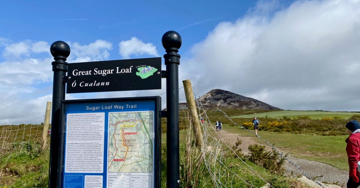
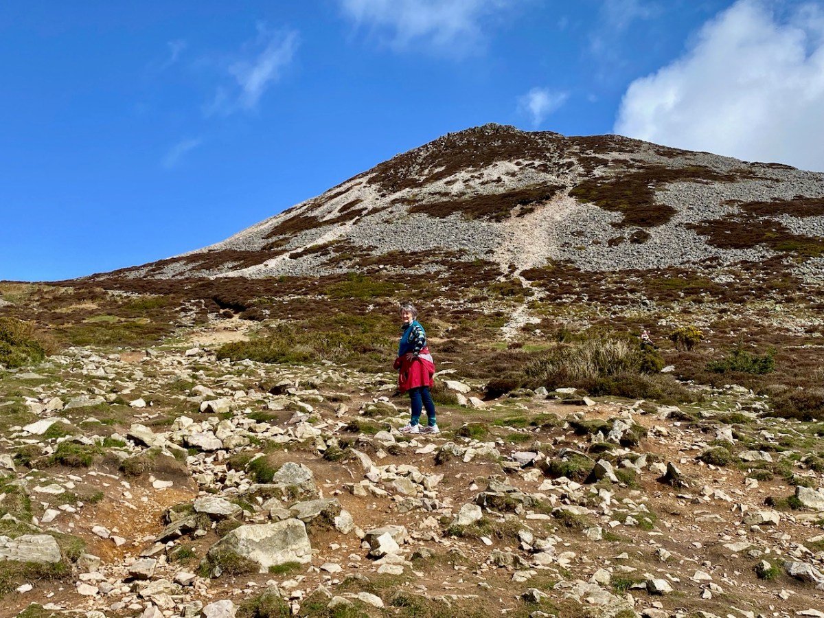
We were unexpectedly in County Wicklow, and had a day or two of sunshine. To take advantage of this, we found our way up to the Great Sugar Loaf, with every good intention of climbing to its peak – 501 metres above sea level. I’ll come clean and mention that the starting point for the walk is already halfway up this elevation – and also we didn’t make it all the way on this occasion, as we were heavily overdressed! Only yesterday we still seemed to be in the grip of a very harsh winter, so had assumed that gloves, scarves and thick jackets would be the order of the day. In fact, quite a few other climbers were clad in tee shirts and shorts…

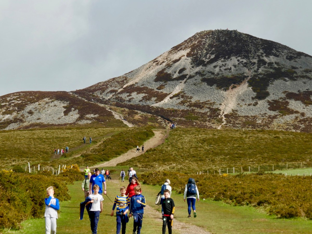
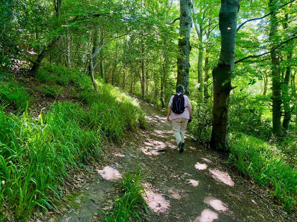
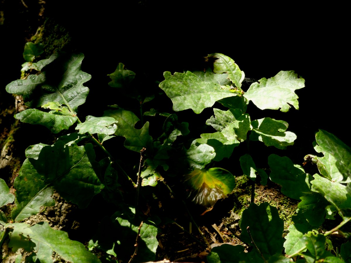
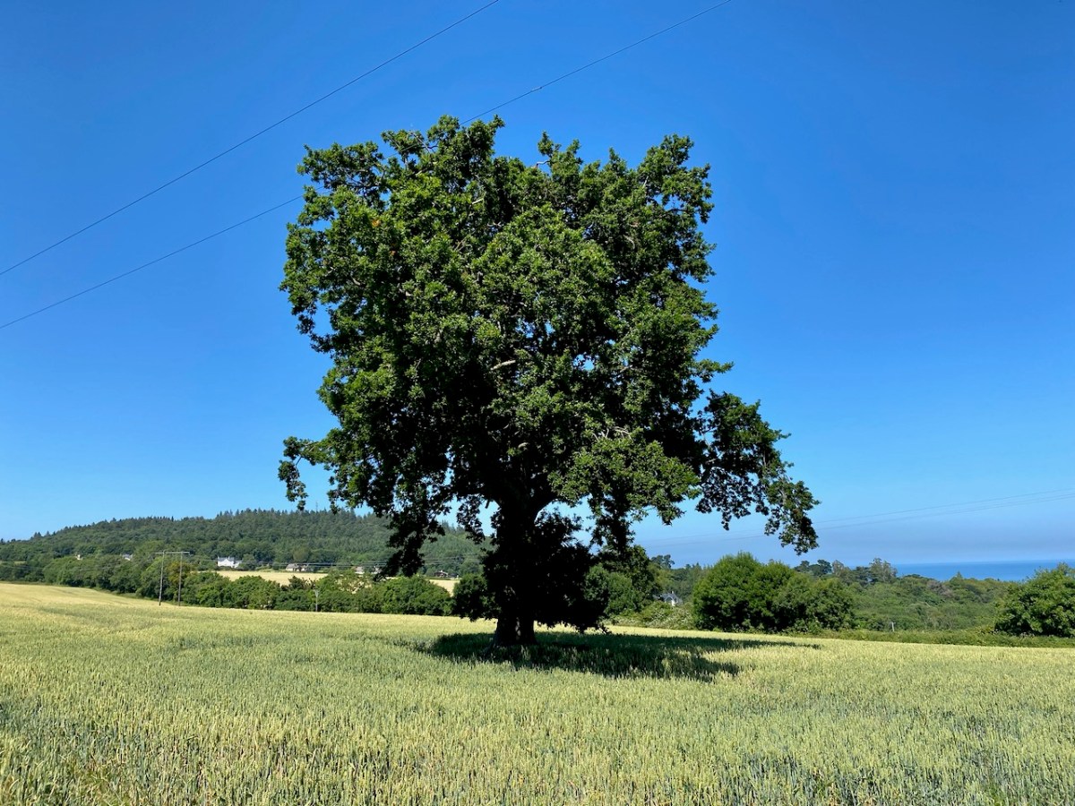
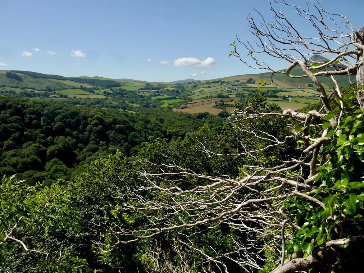
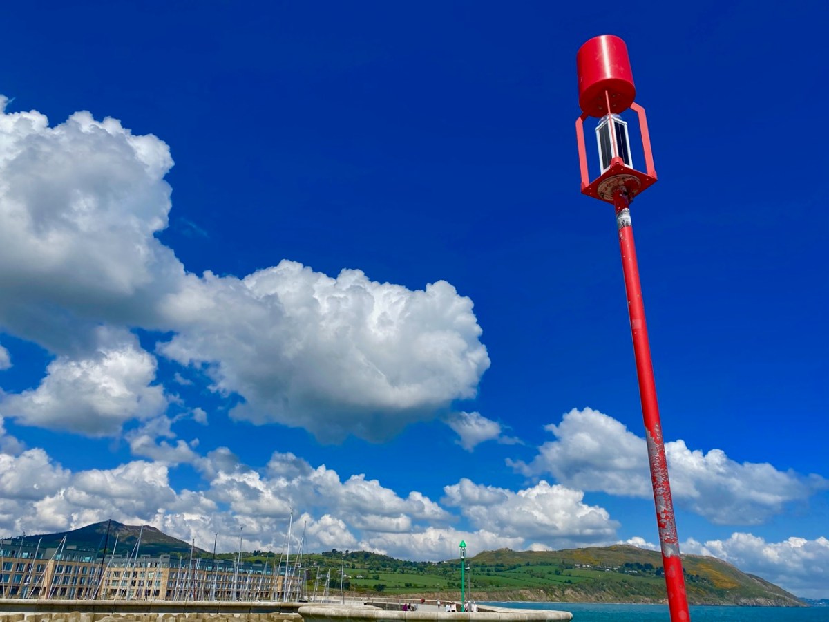
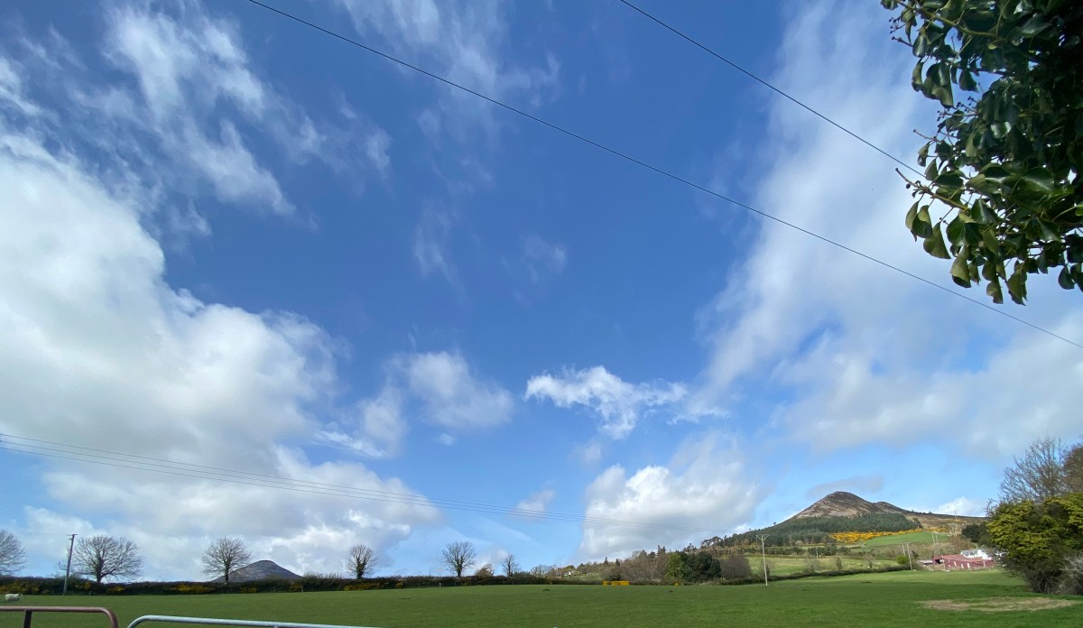
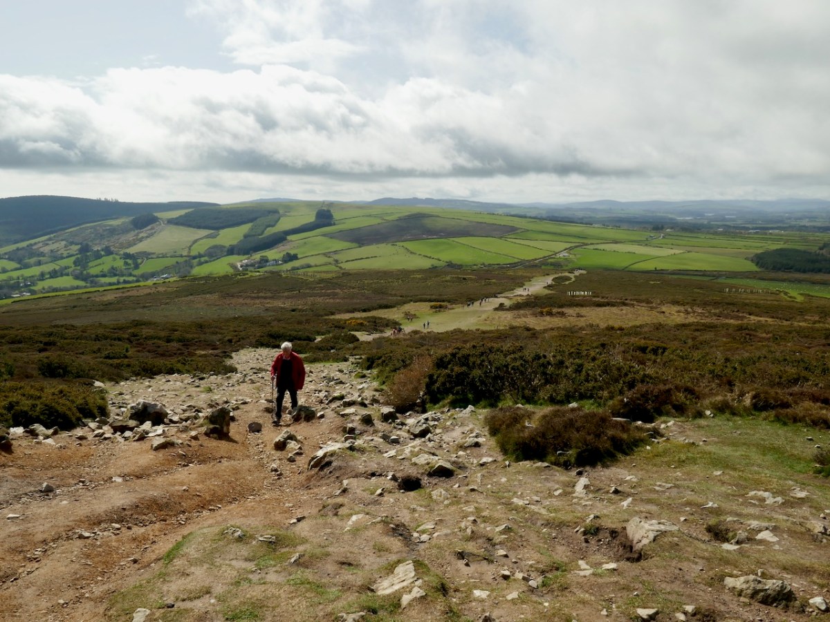
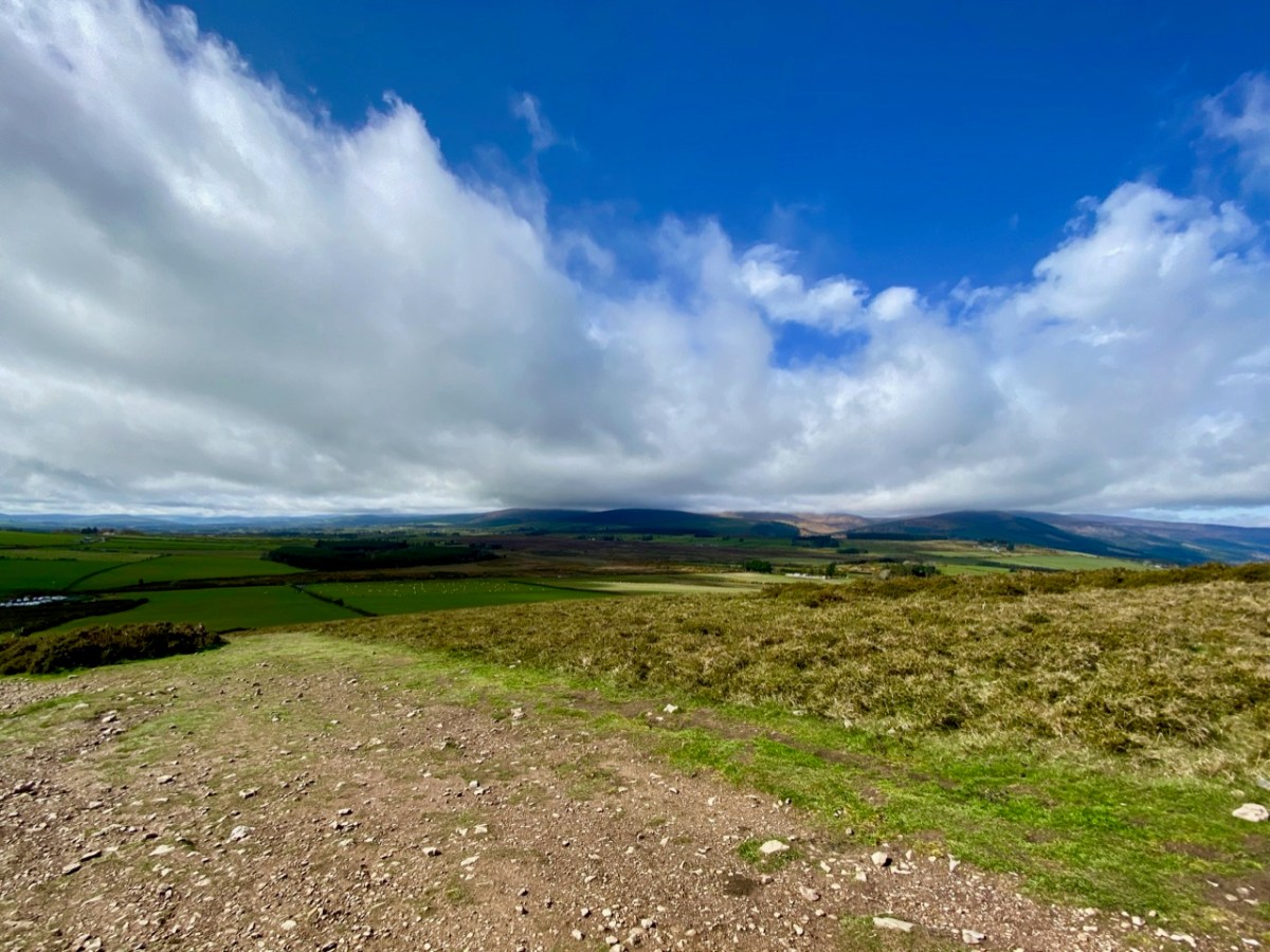
The upper view was taken on the path going up to the top – this morning. The lower view – taken a couple of years ago from Bray Head – gives a good impression of the Great Sugar Loaf (the furthest peak on the right) as the high point in a range, rather than a lone conical summit. There is also a Little Sugar Loaf which – in this view – is the high point in the central range in the photo. From other places, the ‘Little’ loaf also appears like a conical ‘peak’. Have a look at the pic below, where I have tried to show both ‘cones’ in the same view.

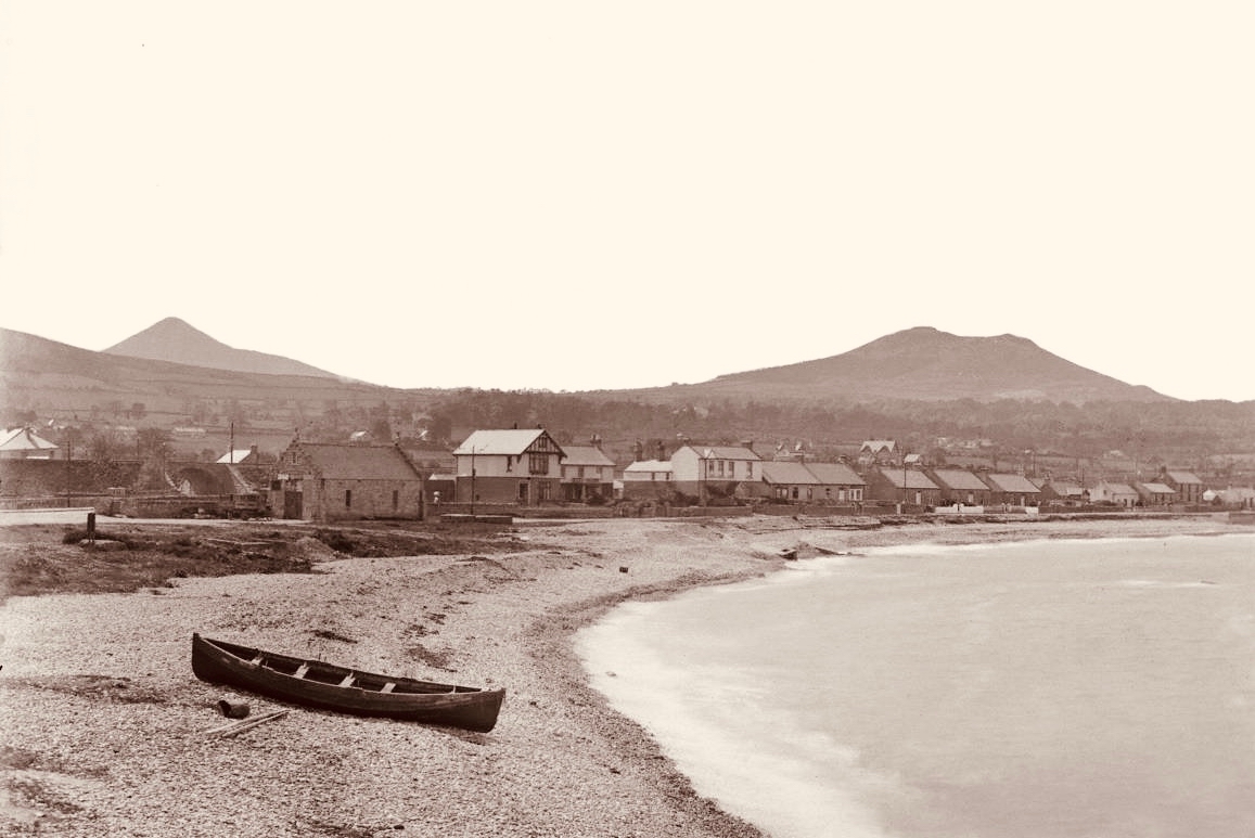
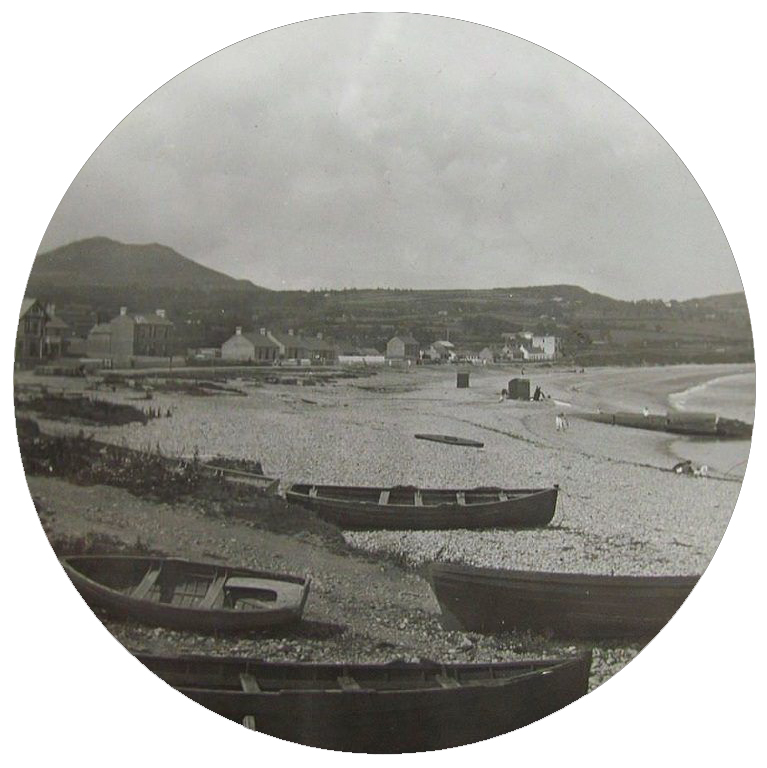
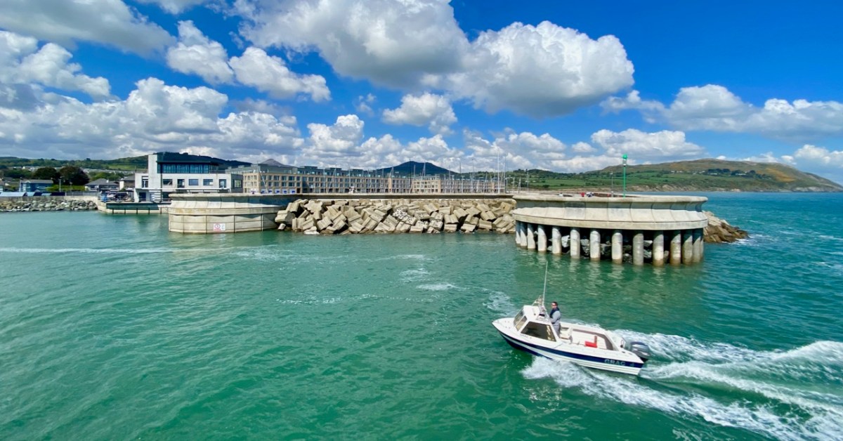
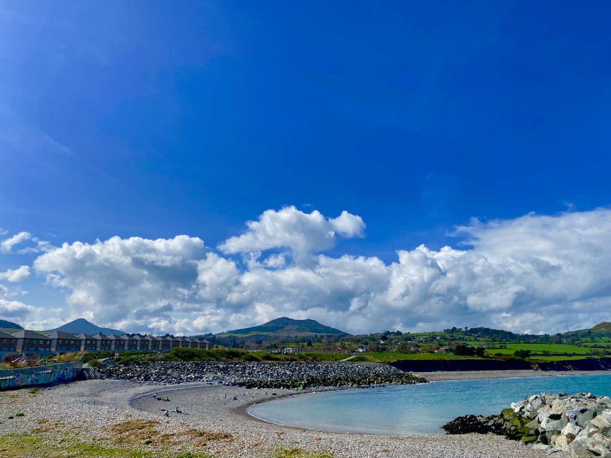
This photo, which dates from the early 1900s, is taken from the old beach in Greystones: the Little Sugar Loaf is over to the left, while the ‘Great’ one is at the left end of the further ridge (photo by William Alfred Green (1870–1958) – courtesy of Ulster Folk Museum). Below – the same view of the two ‘sugar loaves’ taken from the Marina, Greystones, today.

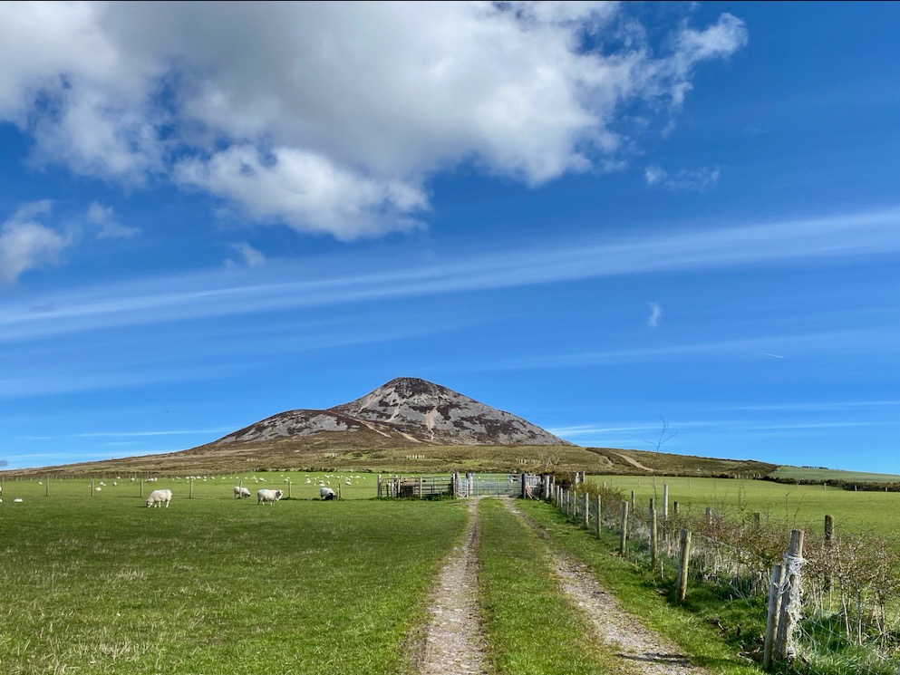
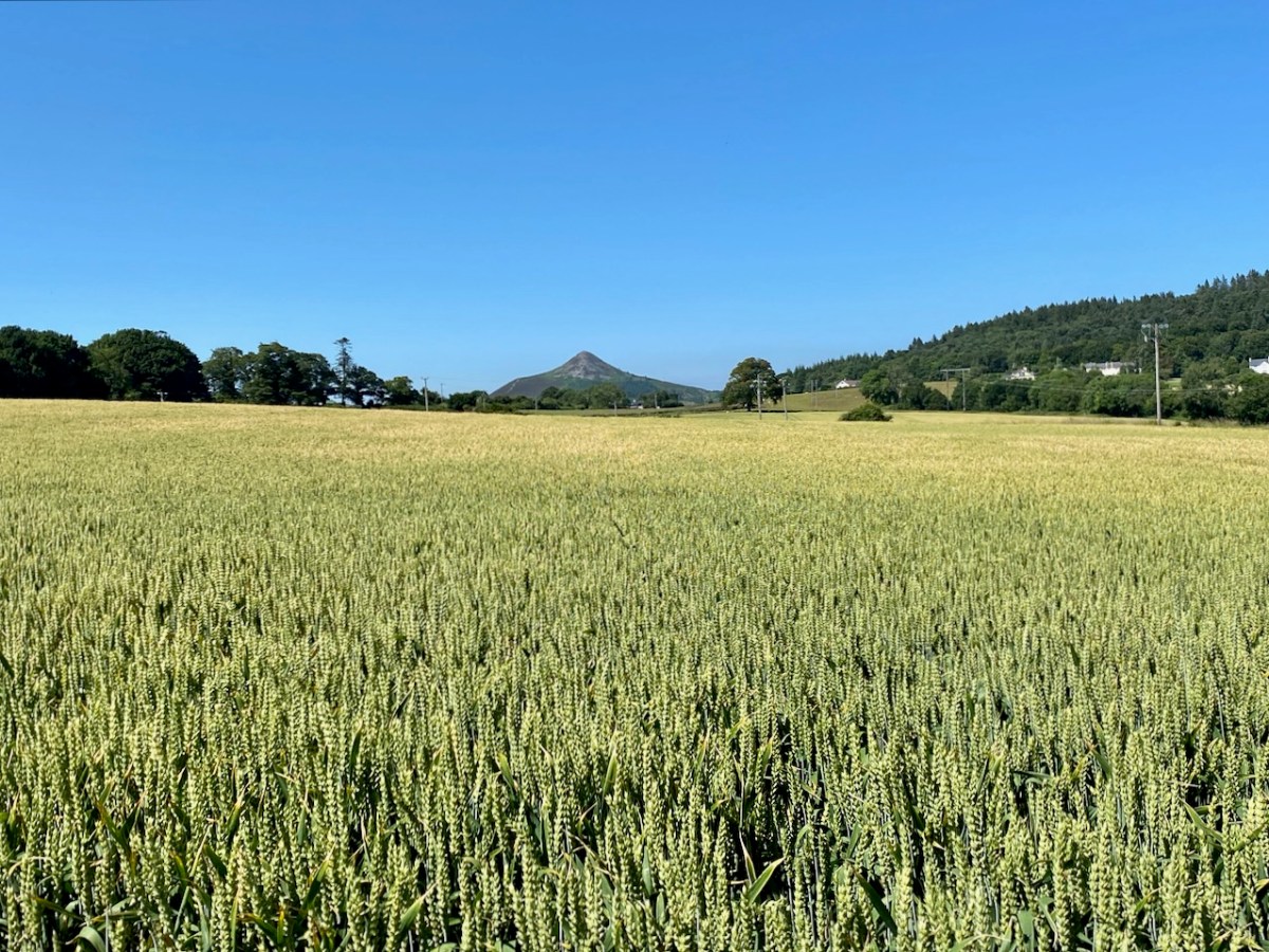
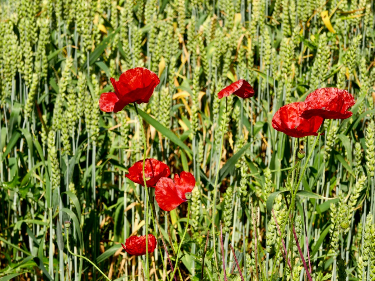
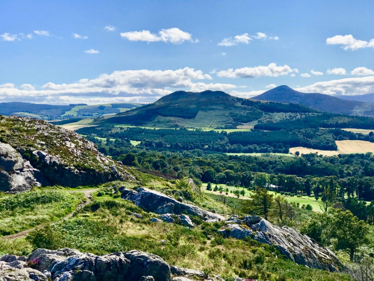
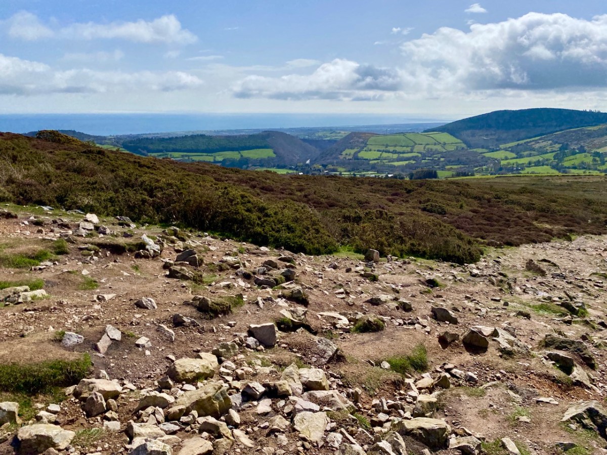
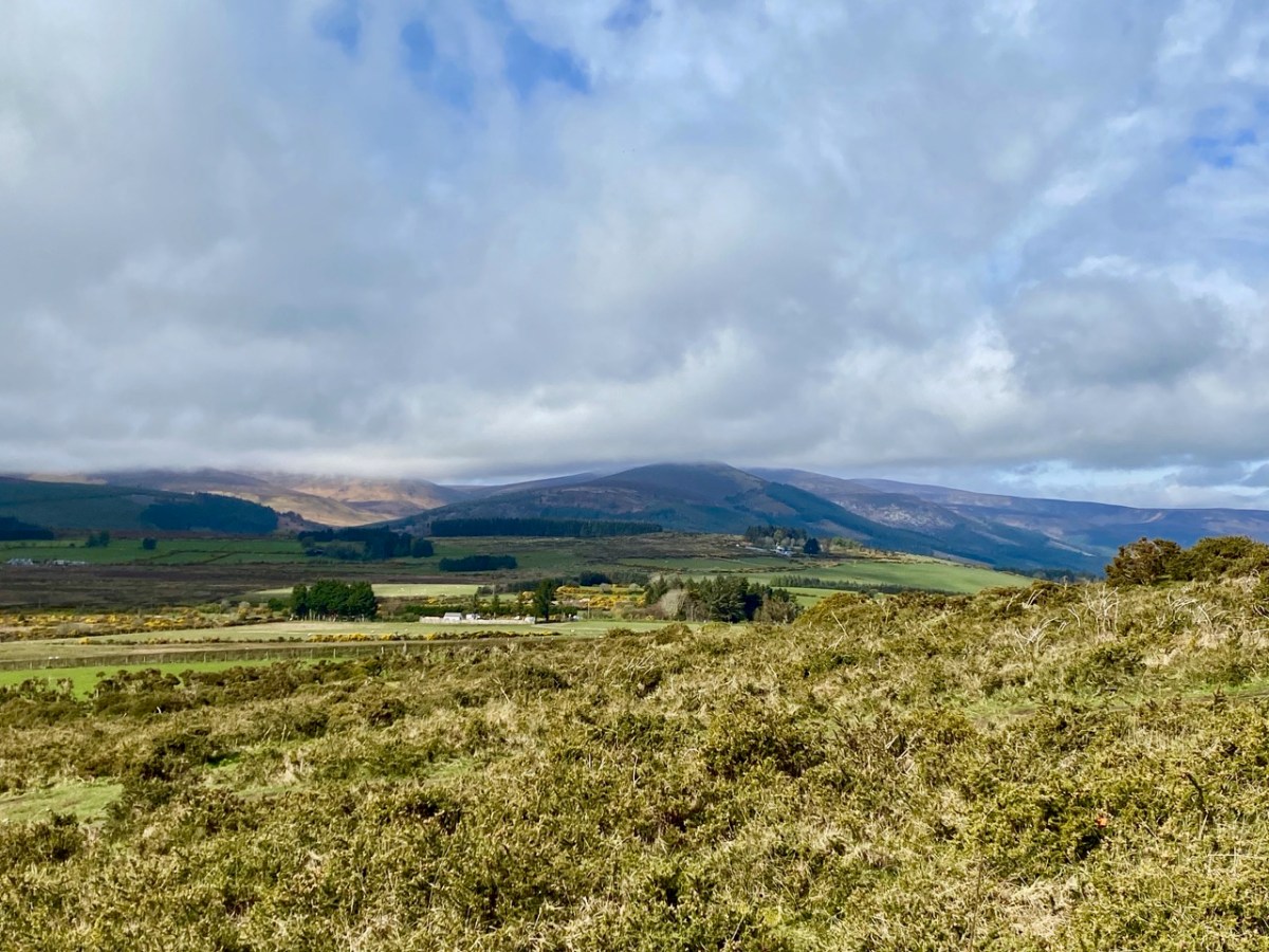
Here’s another view of the ‘Great’ loaf, with further pics of today’s adventures below, including the prospects from on the hill:

The area deserves considerable further exploration. The extracts below are from the Schools Folklore Collection, recorded in the 1930s: valuable commentary and memories collected from local inhabitants.

. . . If we were to visit Kilmacanogue over a hundred years ago it would present to us a very different appearance from what it does now. Our journey would be by the end of the Sugar Loaf Hotel of today, up the school lane, turning west for about a quarter of a mile and crossing the present day Rocky Valley road and following in a south-western direction along the foot of Sugar Loaf mountain. On our left was a church (in Brerton’s Garden) but not even the ruins of this remain. It is said the monks fled from this church in the Penal days, burying behind them their gold chalice, which still lies hidden in the field still know as the Church field. The road leading from Kilmacanogue to Kilmurry (now known as the Old Road) was the Coach Road between Dublin and Wexford. At the Kilmurry end there is a plot of ground about one acre known as Kilmurry Green which is believed to have been an old burial ground. The lane leading off from this road to the present main road near Kilmurry Dispensary locally known as Connolly’s Lane is supposed to have been lined with houses. The field on the North side of this lane (now in the possession of Miss Powell) is called the Street Field which indicates that a village must have been there at one time. The south part of Kilmurry Green contains the sites of two buildings – the stones, are still to be seen there, which marked the foundation of the gable. Traces of graves remain, though the place has not been used as a burying ground within any person’s memory . . .

Schools folklore Collection Kilmacanogue, Bray
Teacher: Caitlín Ní Chuinneáin

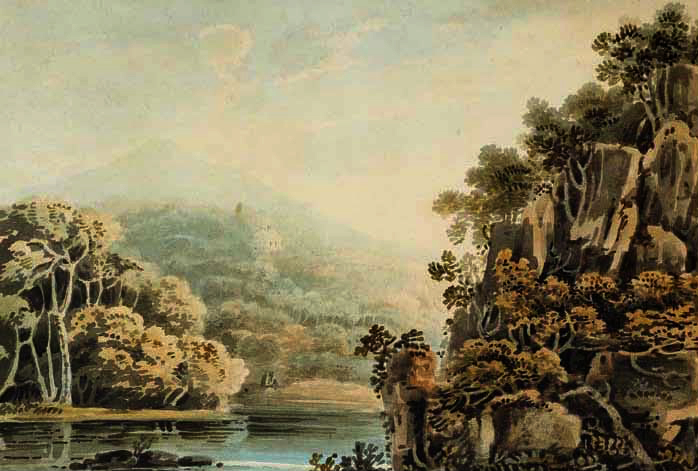
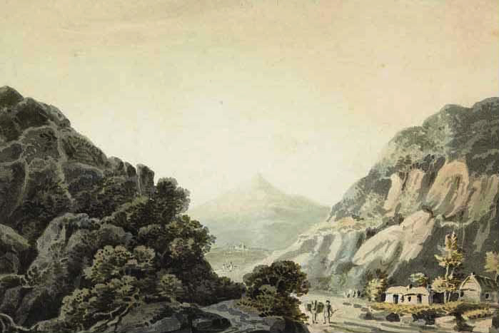
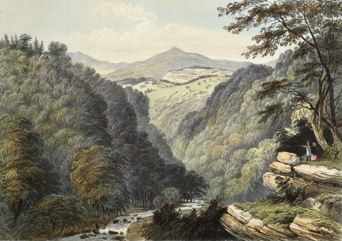
The Great Sugarloaf was a popular subject for artists. Examples are these watercolours: from Views of Bray and the Sugarloaf, County Wicklow, circa 1820 John Henry Campbell (1757-1828) – Whytes.ie. Back to the Schools Folklore Collection: we were particularly interested in the mentions of Red Lane, where there was evidently once a church, burial ground and holy well: it is said that none of these are visible today, but we will pencil in some further visits to have a closer explore.

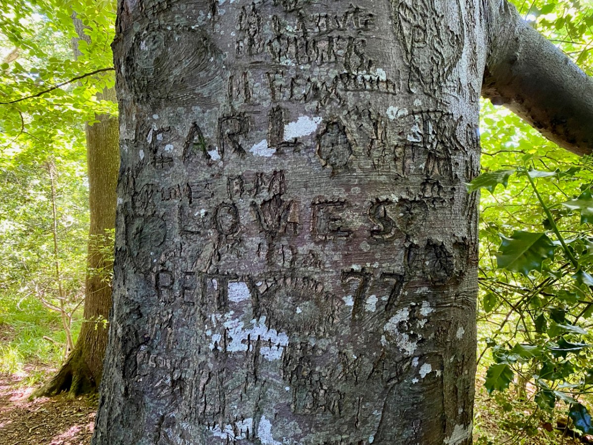
. . . At the Southern extremity of Kilmurry bordering on Calary are two ruins which are popularly called Leghteampall or the Monasteries. These ruins stand in two adjacent fields, separated by a narrow lane (Red Lane). They lie east and west of each other in the Kelly’s and Whelan’s land, that in the west forming a square of thirty two yards each way. On the south side stands an angle of ancient wall built of stones and mortar 4′ 2″ high 2′ 2″ thick. There is a clump of stones and thorns at the north side 30′ long by 12′ broad and 2’2′ in height. There is an ancient holly tree in full vigour at the south-east angle a cross is cut in the tree and funerals stopped here and recited the prayers for the dead. About thirty yards east of there are the traces of an ancient church. A few stones of irregular shape remain in the foundation of the south wall; the stones appear to have been carried away from the north side within a comparatively late period. A heap of stones and rubbish occupies the place of the western gable, along which lies a large shapeless lump of a stone, having at the top a rudely formed cavity 7″ deep and 9″ in diameter at top, narrowing gradually to the bottom. This was a holy water stoup, one of the rudest ecclesiastical antiquities. An ancient decayed ash tree stands on the north of the church and graves may be traced in several places around it, though it has not been used as a burying ground for a long time. About a furlong south west of this place is a holy well called Bride’s Well (in Chapman’s Lane) at which Patrons were held, but none was held there within the last forty years . . .

Schools folklore Collection Kilmacanogue, Bray
Teacher: Caitlín Ní Chuinneáin

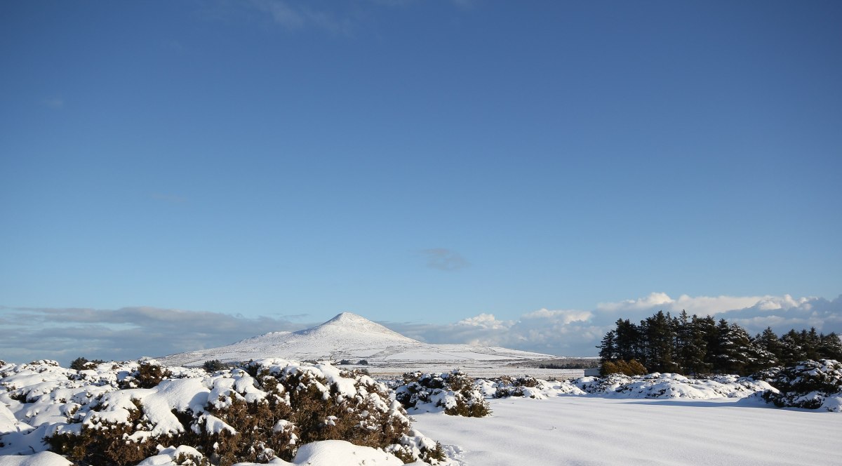
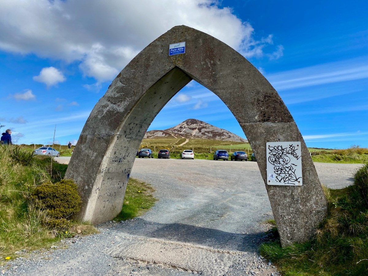
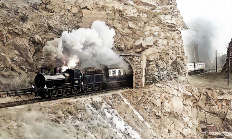
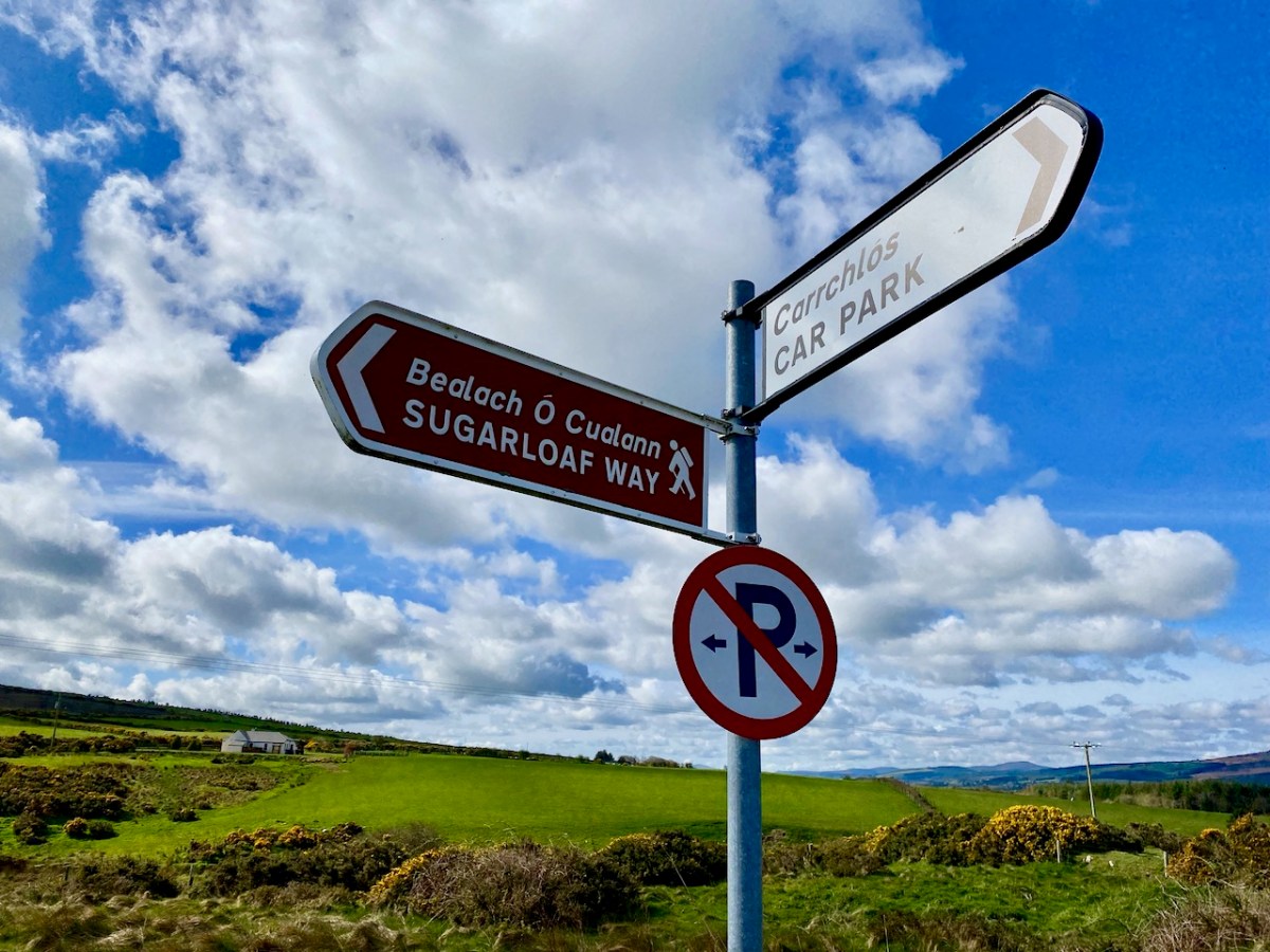
This winter scene is courtesy of Wiki Commons: we would like to visit at that time of the year, although the mountain may well not be hospitable then. Below – that’s the somewhat unusual gateway to the car-park at the Great Sugarloaf: take care when entering!

Cork Fella Comes to County Wicklow

Above – Trafalgar Road, leading down to the harbour, Greystones, c1900. This seaside town is in Co Wicklow, and the connection with West Cork is that our ‘Big Fella’ – Michael Collins – had intended to set up home there once he had married Catherine (Kitty) Kiernan. Collins was staying in the Grand Hotel when he proposed to Kitty. That building is better known to us as the La Touche (photo below from the National Library of Ireland).

Above: la Touche, mid 20th century. Today, the hotel has been transformed into modern apartments (below). The fine original central building has been retained and upgraded:

Michael Collins and Kitty Kiernan have been described as ‘star-crossed lovers’. The pair were first introduced by Michael’s cousin, Gearoid O’Sullivan, who was friendly at the time with Kathy’s sister, Maud. Kitty was also close to Harry Boland, who served as President of the Irish Republican Brotherhood from 1919 to 1920. Boland was a good friend of Collins.

Harry Boland (left), Michael Collins (centre) and Éamon de Valera (NLI public domain c1920). Collins and Kiernan announced their engagement in 1921 and planned to marry the following year, but the political upheavals of the time kept delaying the wedding. During this turbulent period, Collins had ‘grown quite fond of Greystones’, often spending time in the house of his aunt, Maisie O’Brien Twohig – Dysart, Kimberly Road. Ironically, this property backed on to the RIC station.

(Upper) Dysart – home of Michael Collins’ Aunt Maisie. (Lower) former RIC barracks and present-day Garda station, immediately adjacent to Dysart.

(Above) Kitty Kiernan. Collins and Kitty had planned to live in Brooklands, on Trafalgar Road, Greystones (below), after their marriage.

Michael Collins, Arthur Griffith and Robert Barton were delegates to the Treaty Negotiations that ended the Irish War of Independence in December 1921. Before he left Greystones, it is recorded that Collins visited Fr Ignatius of the Congregation of the Passion:

. . . The facts are these: he [Collins] was staying at the Grand Hotel, Greystones, while I was giving a mission there. It was coming near the close of the Mission. Michael was very busy in Dublin, worked and worried almost beyond endurance. He got to Greystones one night very late and very tired. It was the eve of his departure to London, re the Pact. He got up the next morning as early as 5.30 am and came to the Church, and made a glorious General Confession and received Holy Communion. He said to me after Confession, “Say the Mass for Ireland, and God bless you, Father”. He crossed an hour or so later to London . . .


Patrick J Doyle PP, BMH.WS0807, pp 39-40, 90-91

(Above) St Brigid’s Church, Greystones. Fatefully, Collins was shot in West Cork on 22 August 1922. Collins “. . . One of the World’s greatest figures . . . Knightliest Soul of the Land . . .” was mourned by the nation, and – of course – by Kitty.

(Above) headlines in the Boston Post on the morning of 23 August 1922.

The de Valeras – Éamon and Sinéad (above, in 1910) – took a house in Greystones soon after the 1916 rising, situated on Kinlen Road in the Burnaby Estate. The house was built at the turn of the 20th century by Patrick Joseph (PJ) Kinlen, who lived there for a time himself. PJ built much of the Burnaby estate and Kinlen Road was named after him. They named the house Craigliath – it is now known as Edenmore (below).

A reason for the popularity of Greystones in the early 20th century was its relative proximity to the centre of Dublin, and the railway line which gave access to the city. If any readers have travelled on this line – which goes down the east coast as far as Wexford – you will know that the section between Bray and Greystones is one of the most adventurous railway journeys in the world! Engineered by Isambard Kingdom Brunel, it clings to the precipitous cliffs and ran on trestle-bridges and through a series of tunnels: there have been many incidents during its history, and the line has had to be reconstructed a few times to avoid the effects of erosion. (With thanks to the Greystones Guide for the image below):

A popular story tells how Éamon de Valera was travelling home from Harcourt Street to Greystones on the night of 17 May 1918. When the train reached Bray, the driver saw that “two detectives” (although some versions say it was a number of constables) had boarded the train a few carriages behind.

 . . . [The driver] felt sure that the intention was to arrest de Valera that night in Greystones. He said that they would slow down the train coming into Greystones before they arrived at the station at a certain point, which they indicated to de Valera, and they advised him to jump out of the carriage on the off-side, and that he could easily get away, and afterwards they would put on speed . . .

However, de Valera chose not to accept this offer, and when the train arrived at Greystones, he was apprehended and arrested. The Irish Independent adds a few further details:

. . . Dev “. . . was taken to the waiting room under a heavy guard, and after being searched, was placed in a motor car and driven to Kingstown, where he was handed over to the military and placed on board the transport … for England” . . .


Irish Independent, 20 May 1918

(Above: Greystones Station – late 19h Century). Personally, I am unsurprised that de Valera did not accept the train driver’s offer. Jumping from a moving train is not a recommended course of action – especially when the terrain of that section of railway-line is so hazardous. De Valera was imprisoned in England but escaped and then went to America: his wife did not see him for three years. During this time Michael Collins visited her often in Greystones to bring her news and also to provide funds. Later she reportedly told her husband that she was ‘quite in love with Collins’. He grumpily responded: “…That’ll do. There are enough people in love with Michael Collins…” (Below – lantern slide of Greystones Harbour, 1900):

Of course, de Valera lived to tell his tale – he died on 29 August 1975, aged 92, having achieved the status of Taoiseach and President of Ireland – whereas Michael Collins did not: he was shot at Béal na Bláth, County Cork, at the age of 31. It is fair to say that he undoubtedly achieved the perhaps more fulfilling status of National Hero.

Greystones Harbour in 1911. With many thanks to the excellent Greystones Guide for invaluable free access to pictures and information.

Glen of the Downs

There’s a very attractive woodland walk near Delgany, County Wicklow, to the south of Dublin. It’s well worth an exploration, but be prepared for the intrusive sound of the main N11 road which runs alongside the path as you set out from the public car park: you will leave it behind – eventually – as you climb up into the trees.

It’s a now rare ancient Irish oak wood, once all part of Bellevue Estate, a 300 acre demesne established by the La Touche family in the mid eighteenth century. Through many generations the Huguenot family was known as an ‘ample benefactor of mankind’ who ‘left a record of noble deeds behind them’. During their heyday the La Touches acquired the lands of Upper and Lower Rathdown on which much of modern Greystones has been built, and their name is familiar in the fabric of that town today.

The beauty of this part of County Wicklow has been celebrated by many artists over the years: here are a couple of examples from the late 1700s showing the Glen of the Downs landscape. Always, one or both of the topographical high-points – the Great and Little Sugar Loaves – are prominently featured.

We have photographic records of the La Touche mansion, Georgian Bellevue House – with its famed hot-houses where many exotic plants were cultivated, before its decline in the 1900s and its eventual demise: the crumbling pile was demolished in 1950 to make way for wheat-fields and a golf course.

Hidden away in the oak wood is a remnant of the once vibrant La Touche estate: today it’s known as ‘The Octagon’ because of its shape. Its purpose originally was a banqueting hall, set high up on a platform looking out over the landscape. It must have been quite an undertaking, bringing food, furnishings and serving staff up from the ‘big house’: there are remains of tunnels said to have been used for this purpose. Most intriguingly . . .

. . . The estate at Ballydonagh comprised 300 acres, with fine views across the Glen of the Downs and towards the Irish Sea. David, the younger La Touche, built his favourite country retreat here between 1754 and 1756, at a cost of £30,000, and called it Bellevue. Beautiful gardens were laid out with winding paths and “extras” built by David and his son, Peter, when he inherited in 1785. Among these was the Octagon, built in 1766, with a panther on springs, which could be made to jump out at unwary visitors. The house was most famous for its huge glasshouse, built between 1783 and 1793, in which many exotic plants were grown . . .


Judith Flannery, The Story of Delgany, 1990

There is no doubt that the building was superbly sited to maximise the good views. Beyond that, it’s hard to fathom how the architecture functioned – and the panther on springs remains a puzzle! Over years of exposure to the elements, and inquisitive visitors, the Octagon has gained a patina of graffiti – which adds, perhaps, to its character and attributes.

The practice of ‘making one’s mark’ seems to have migrated to trees surrounding the site: perhaps some of these can be attributed to people who lived in them once! In 1997 eco-warriors staged a protest campaign when plans were put forward to upgrade and widen the N11 road, involving felling over 1,700 mature beech, oak and ash trees. The protesters ‘occupied’ the trees for over two years (below), ‘climbing down’ eventually when the Courts upheld the highway authority proposals.

The road has since been widened, and the intrusive traffic sound within the Glen of the Downs has accordingly increased manyfold. Interestingly, there are currently proposals under discussion to further improve the N11/M11 route in this same locality – including the possibility of a road tunnel which might even remove traffic altogether. Meanwhile, the trees continue to present us with messages for our own complex times . . .

For all its ups and downs, and possibly mixed messages, the Glen of the Downs woodland walk is beautiful, and well worth a visit. Who knows what – or who – you might encounter among the trees?

Wicklow Ways

There is a world beyond West Cork! In fact, we quite often visit Wicklow and Ireland’s ‘Ancient East’: it’s a contrast to our wild Mizen, and currently looking verdant in the early summer sunlight. We have taken a trip to Ireland’s ‘garden county’ to celebrate a bit of a let-up in the long, hard lockdown that we have all endured for most of this year. We based ourselves in Greystones (that’s the entrance to Greystones Harbour in the header pic). On a hot weekend it was buzzing with people, but we did all have to keep our distance from each other which, in Ireland particularly, is a sad state of affairs.

Greystones (evidently named after the ‘grey stones’ on the beach) has transformed itself from the sleepy seaside town and small harbour photographed by Co Wicklow man Robert French in the late 19th century (above). You can see many more of his photographs in this excellent website. Today it boasts a smart new marina and harbour, modern houses and apartments, and a major amenity park giving access to the old cliff walk that leads to Bray. It’s an attractive and vibrant venue in the 21st century, popular with residents and visitors alike.

Greystones : nautical connections, dancing in the new park, aqua shades and Patrick O’Reilly’s wonderful ‘Marching Bear’ sculpture on the sea-front. When this statue was unveiled in 2014 it created quite a stir. Some locals claimed it was an eyesore and ‘spoiled the sweeping sea views’. The striking feature cost the town nothing, as it was donated by Dermod Dwyer – a local property developer and guardian of Ireland’s National Gallery – in memory of his daughter Caroline who, sadly, had died of cancer.

Not far from Greystones is Killruddery House and estate. This was founded by William Brabazon of Leicestershire in the 1500s and went through several incarnations, with the present house being substantially reconstructed between 1820 and 1830. The Brabazon family and their descendants remain in the house to the present day: they became the Earls of Meath, a title created in 1627. The estate, which amounts to 800 acres, is open to the public as an amenity and it is possible to perambulate the grounds for a small fee. We visited: in fact, Finola is descended from the Brabazons somewhere down the line, and she knows her way about!

The demesne is beautiful, and elegantly laid out, with canals, pools, fountains and well placed statues. In its fresh summer greenery it is an impressive place to explore. Finola’s post today is all about Killruddery.

On another day we revisited a further Co Wicklow treasure – Glendalough, and admired again the extensive Monastic City, its fine examples of Romanesque architecture, round tower and stone crosses.

Amanda (Holy Wells of Cork and Kerry) and Peter (Hikelines) were with us on our Glendalough visit and, to my own surprise and delight, we were led to St Kevin’s holy well in the grounds of Glendalough which we had never known about previously. It took a bit of finding, but it was complete with a rag tree – and cures for headaches and eye ailments.

I hope you will agree that County Wicklow has something to offer everyone. We have just dipped in to its treasures in our few days away from West Cork. There is so much more to be discovered… But, of course, the same can be said of all parts of Ireland.