The 1811 Grand Jury Map of Cork by Neville Bath: Part 2, The Islands of Roaringwater Bay

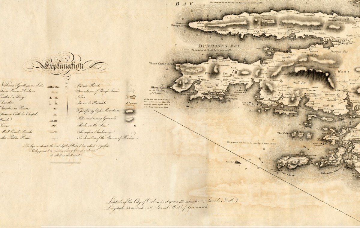
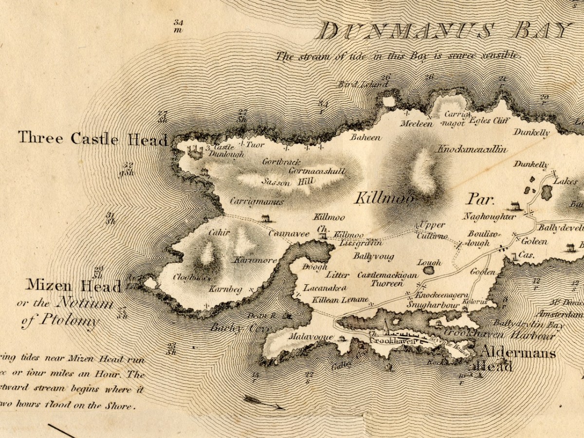
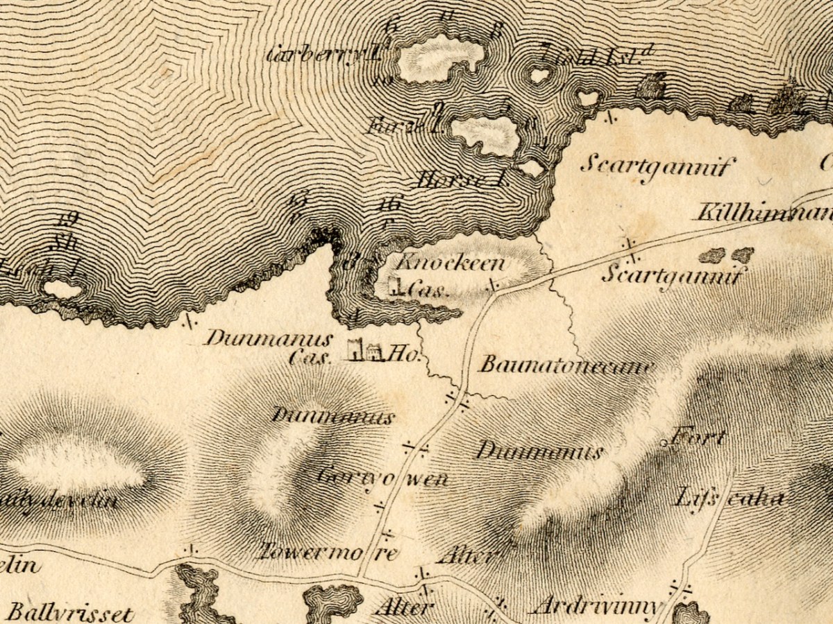
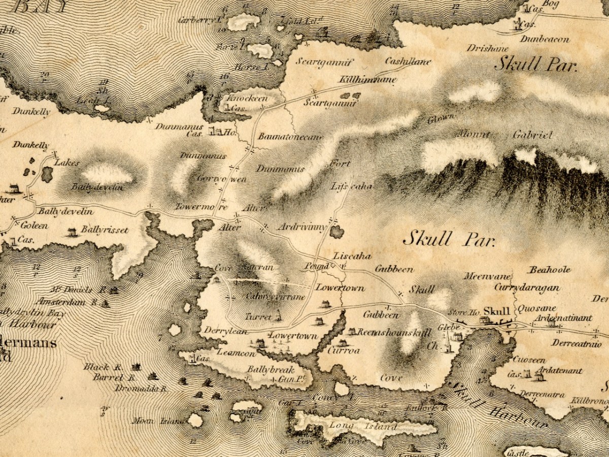
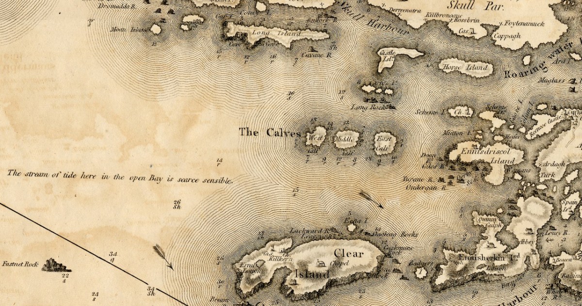
The first thing to say about this map is that on it the name Roaringwater Bay is assigned to a restricted area area eastwards from Horse Island, up to the entrance to Ballydehob Bay, and across to Skeaghanore, Kilcoe and Turk Head. This, in fact, is still how modern maps are labelled.

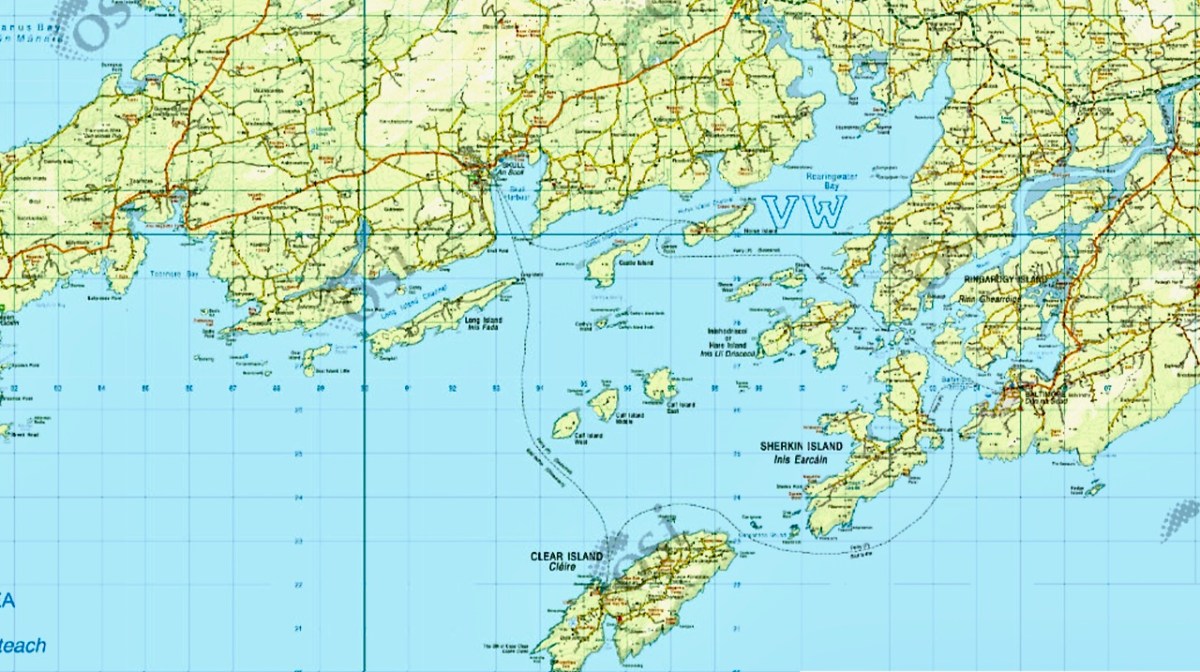
However, when you live here, you realise the term Roaringwater Bay is used to refer to the whole area that encompasses all the Islands, right out to Cape Clear. In Irish, Roaringwater Bay is called Lough Trasna, which simply means Lake ‘Across’ – a term which carries the implication of a body of water you have to cross over.

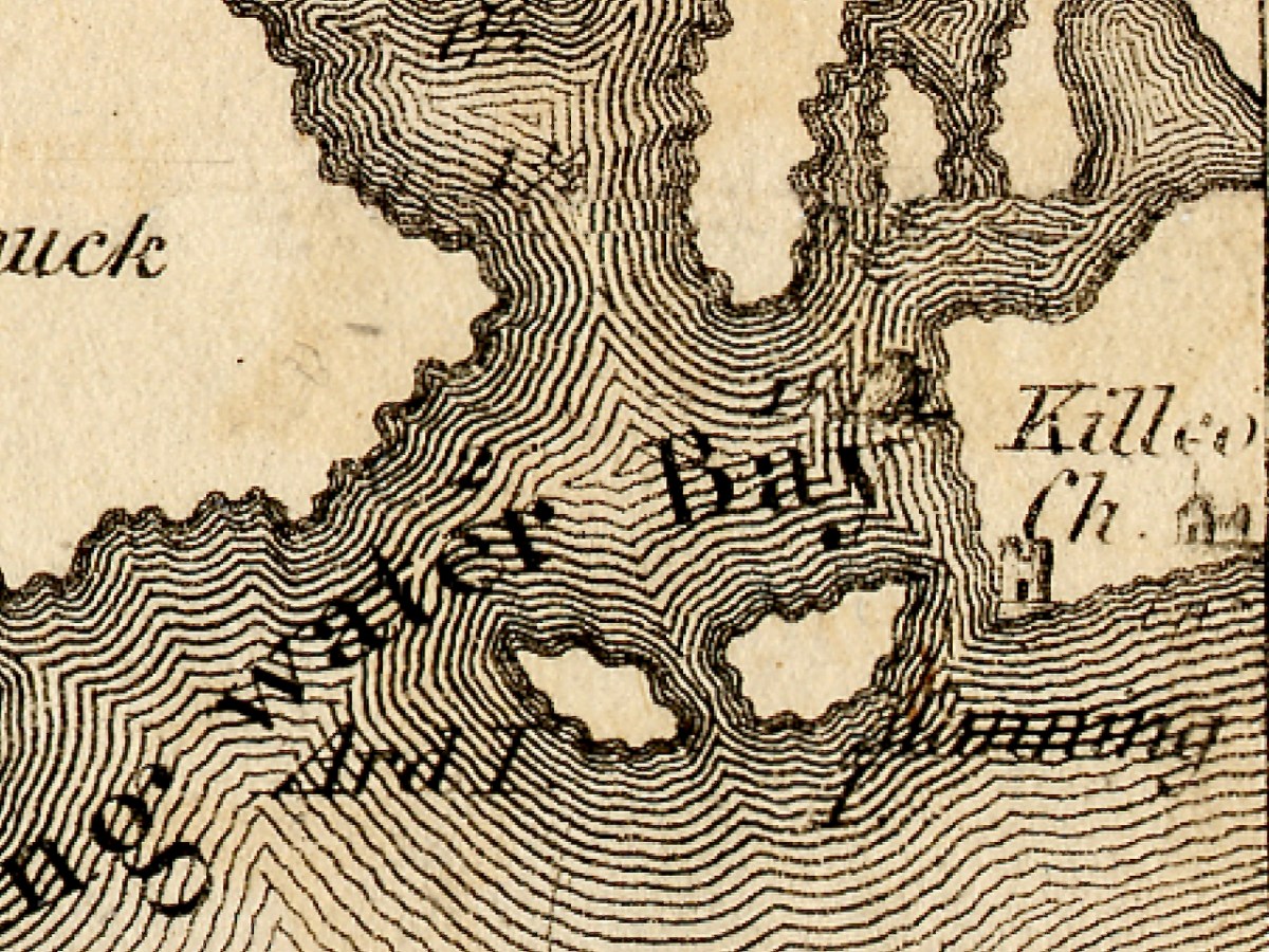
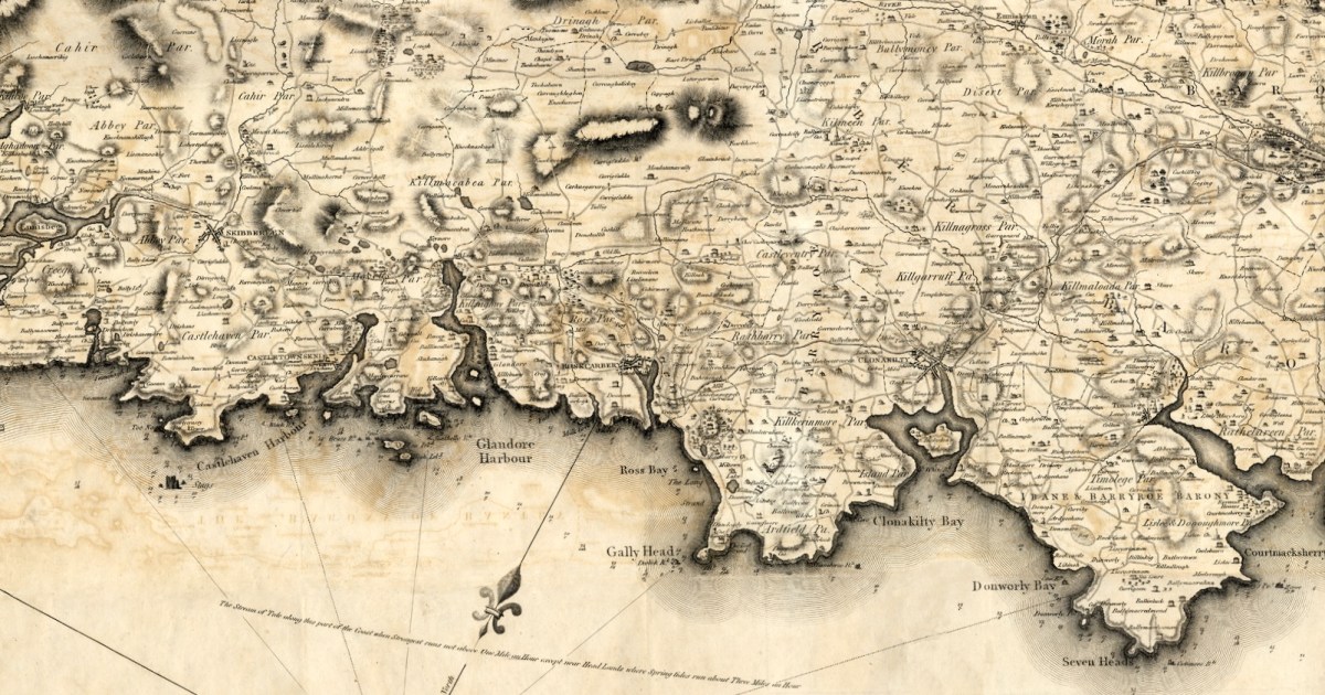
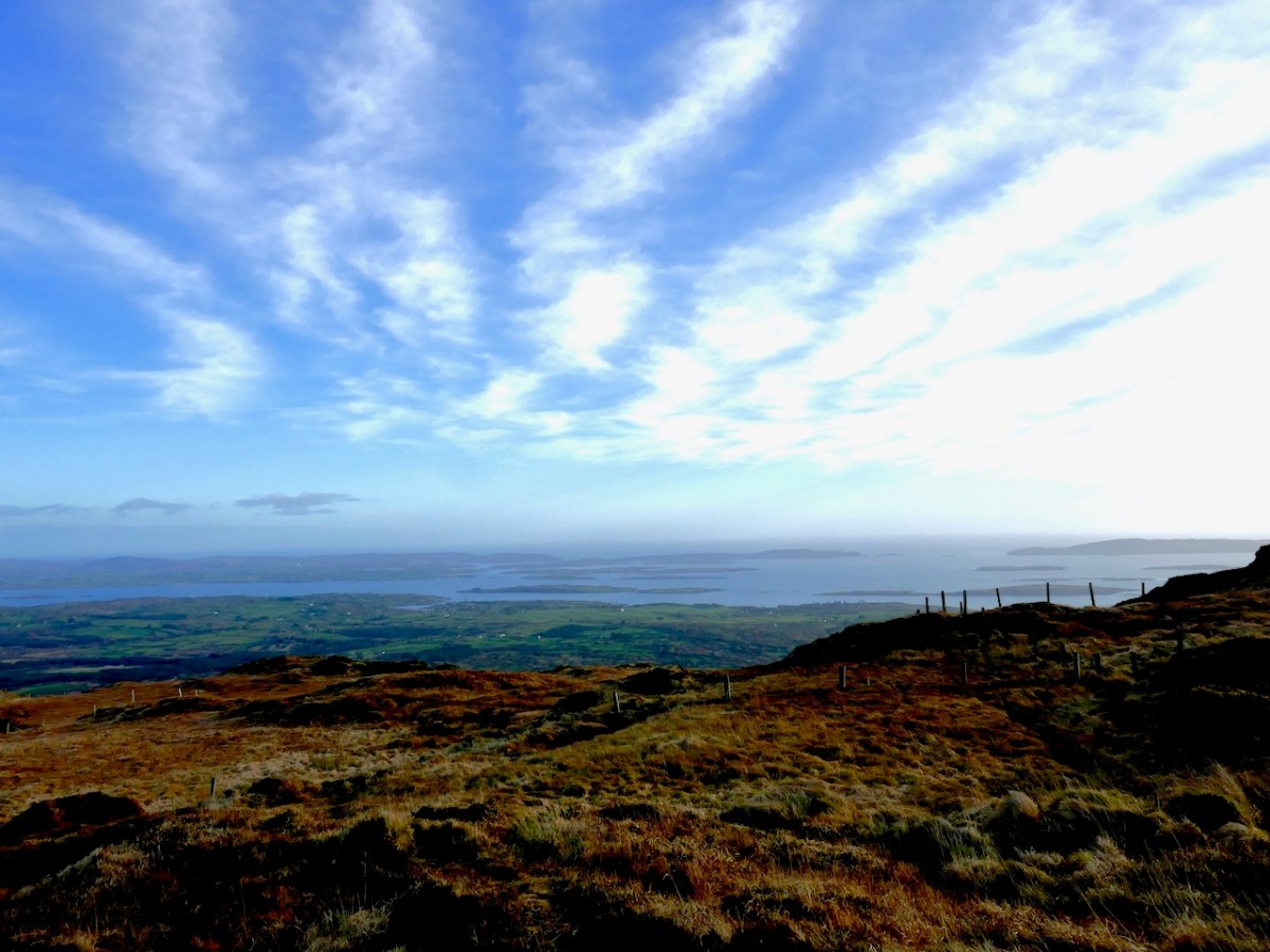
And how did it get the name Roaringwater – the official version is that it’s called after the Roaringwater River, which in turn gets it name from the way the water roars as it tumbles over rocks. But read my post from way back in 2014, The Roaring, and you will realise that there is a much more sensible explanation. So I will use the term Roaringwater Bay in this post as we use it every day around here – to include everything you see from the top of Mount Gabriel, looking south and east, as below. Before I move from the image above, however, let me point out Kilcoe Church, and Kilcoe Castle, both of which I have written about.

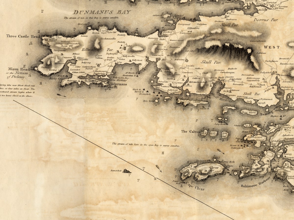
Let’s start with the biggest island – familiarly known locally as Cape Clear. Clear Island, as it is properly called (Oileán Cléire) and as it is labelled on this map, shows the name Cape Clear reserved for its southwestern tip.

Dún an Óir Castle (see this post, and this one) is clearly shown, as is St Kieran’s Church, which was a ruin even then. Intriguingly, there is a Catholic Chapel shown which must have been in place before the current church was built in 1839, approximately in the same area. Even more strange is a building shown as a ‘Gentleman’s Seat’ – that is, a Big House, on the south side of the Island. Can anyone help us with that this might have been?

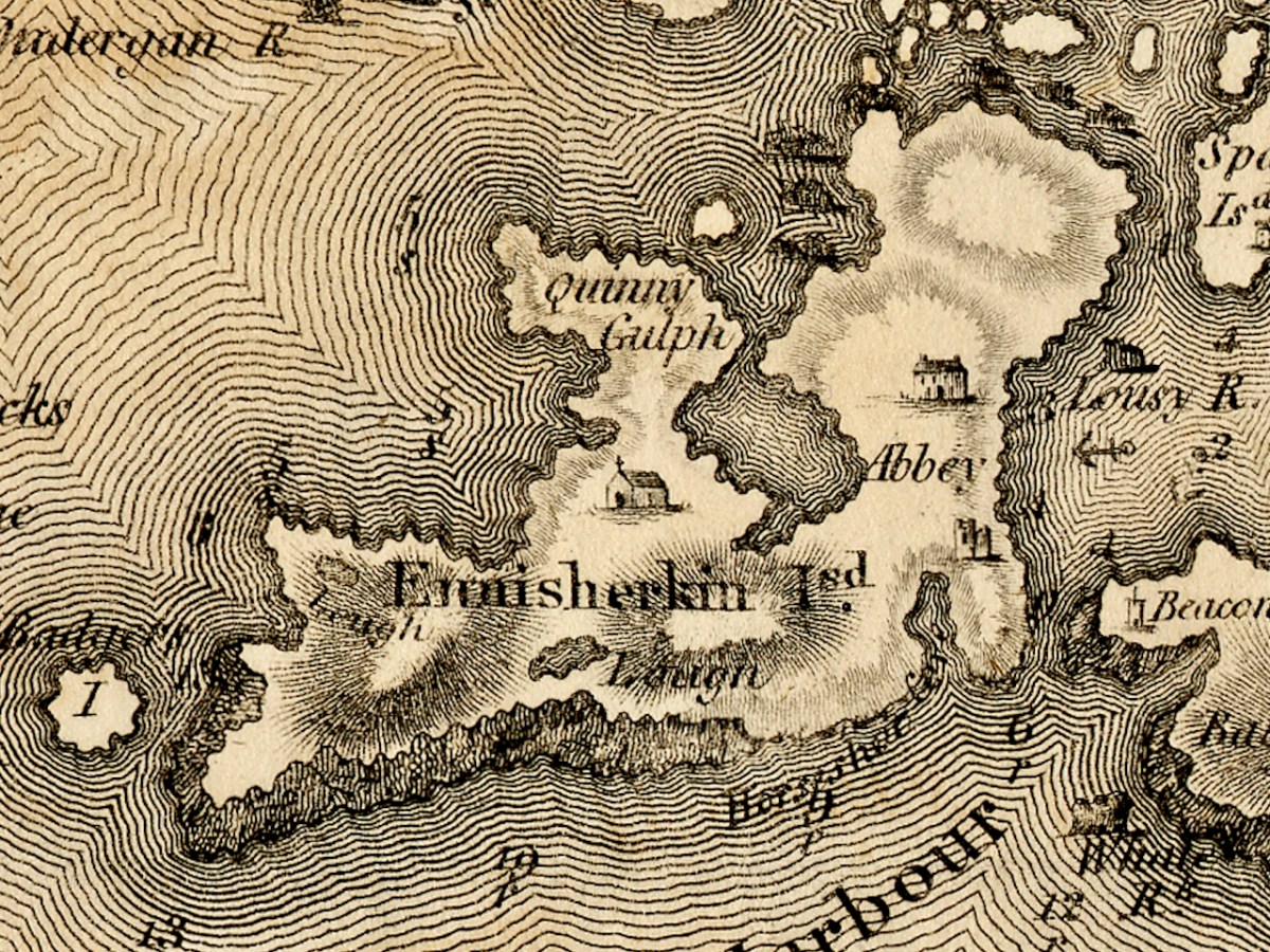
Sherkin Island is shown as Ennisherkin. This is from the Irish Inis Arcán, translating literally as Piglet Island, but likely from the Irish word for porpoise, which is muc mara, or sea-piglet. Anyone who has boated in the area will know how prevalent porpoises are in the seas around the islands. Once again, we have a catholic chapel, and of course the ruined Abbey and castle. Take a look at my post A Walk on Sherkin Island for a taste of what that’s all about. The term Quinny Gulph, by the way, must be Kinnish Harbour, the large bay in the centre of Sherkin. Once again, we have a ‘gentleman’s seat’ on Sherkin, and once again I am asking readers to identify this.

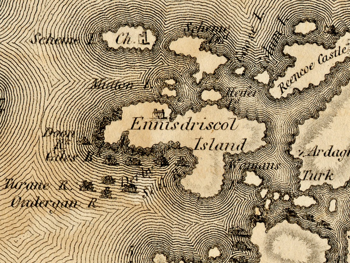
Ennisdriscol Island is of course now called Heir Island – the older name indicating that it was very much the domain of the O’Driscolls in the past. It’s curiously featureless on this map, apart from yet another large house. Right above it are the Skeams, East and West, or the Schemes, as Bath has it. West Skeam has a pre-Romanesque church on it which I have yet to explore – a new blog post one day! I’d better hurry – it’s in a perilous position on the edge of a cliff and much of it has already been swept away.

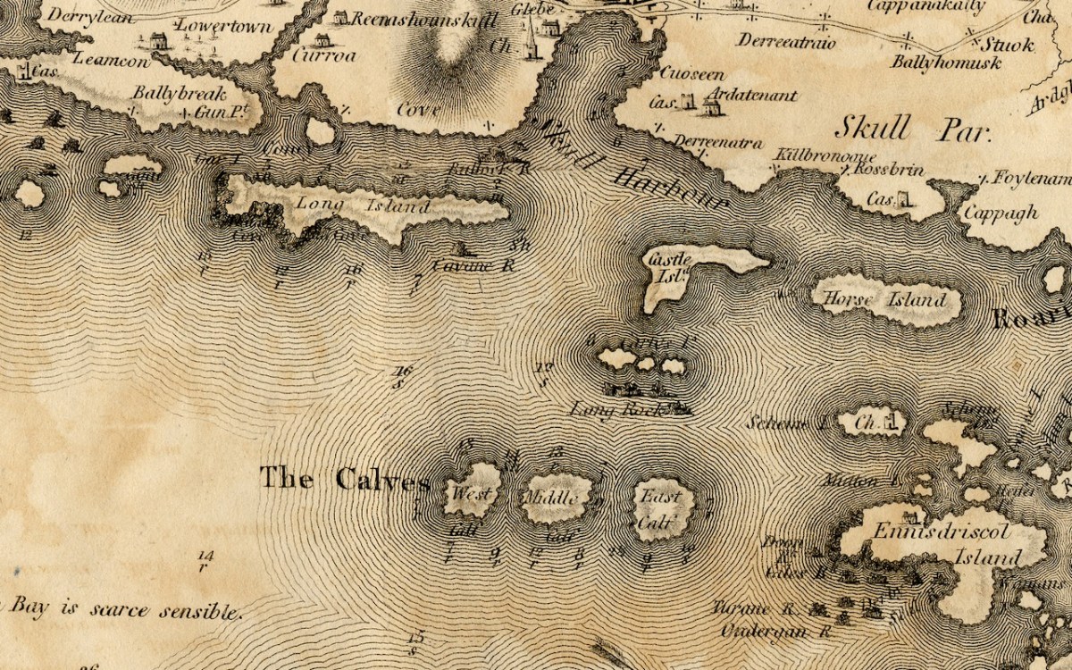
The Calves, now uninhabited, occupy the middle ground of Lough Trasna between the mainland and Cape Clear, while Long Island, Castle Island and Horse Island parallel the coast. Horse Island and Castle Island are each now owned by a single individual, while Long Island still has a resident population of several owners. The vestigial castle on Castle Island is not shown. To the east of Long Island is Goat Island and Goat Island Little – the cleft between them is actually much narrower than appears on Bath’s map and only navigable with care by kayak. It is home to a herd of feral goats.

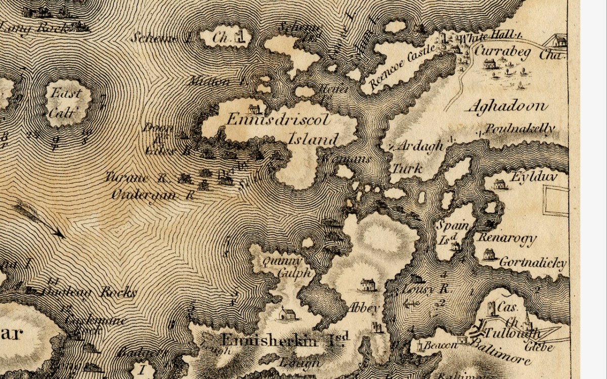
And finally Spain Island, now called Spanish Island, and the western end of Ringarogy. Note that the only one of the small islands scattered between Sherkin, Turk Head and Heir Island that is named on this map, is Woman’s. In fact, there is a tiny rock in this area labelled on modern maps as Two Women’s Rock. The largest island in this group is actually called Sandy Island and the smaller ones are The Catalogues. Note also that the castle now called Rincolisky, is here labelled Reencoe. And let’s include Baltimore, with its castle and – the beacon!

I know we have been a bit forensic about the area I call home – my next post will take a much broader look at West Cork. Here’s a sneak peak.

The 1811 Grand Jury Map of Cork by Neville Bath: Part 1, the Mizen

As readers know, I love old maps and there’s a map of Cork I haven’t written about yet. This is a truly beautiful piece of work, and a huge step forward on some of the older maps of Cork I have described – for the list, see my page The Magic of Old Maps. 

Since it will take me more than one post to talk about this county map properly, I will start today by concentrating on Map 4, and stick to the Mizen Peninsula. The map is in 6 parts and I am able to share it with you today through the generous assistance and permission of the Cork County Library. You can view their hi-res images here – they may be sharper than mine, as I do have to compress images for the blog.

But first, some context… We assume that proper, professional mapping really got underway with the Ordnance Survey in the 1830s, but indeed there were competent cartographers in Ireland before then. Neville Bath was one. In an essay by J H Andrews (see reference in the final quote) he is described as English but spending his whole cartographic career in Ireland, starting off by drawing estate maps in Kerry. He finished a map of Cork City in 1788, so was well placed to be awarded the contract for the county map, when the Irish parliament allowed public money to be spent on producing Grand Jury barony maps as well as county maps, but only for official purposes and only in the form of manuscript ‘protractions.’ Bath tried to arrange for the manuscript protraction to be turned into a proper published map by selling subscriptions – that did not go well, and it wasn’t until 1811 that the map was finally published, engraved by the London firm of S J Neele, acknowledged as the finest artists in the Kingdom.

What was a Grand Jury and why were they commissioning maps? As the name suggests, Grand Juries were initially conceived as groups of 24 men (yes, only men) who wielded authority for the administration of the criminal justice system in Ireland. The exclusive domain of wealthy landlords, the Juries exerted enormous power over the whole population – a population with which they had little in common, including economic status but also language, religion and cultural affiliation.  Over time, the Grand Juries accumulated other responsibilities, for roads, bridges, hospitals, schools and tax collection.

Eventually, all those duties were taken over by other bodies – County Councils, the Poor Law Union, a proper legal system. Above is the final sitting of the Cork Grand Jury in 1899. But while it lasted it was already an archaic system, deeply unfair and rife with corruption. It also became highly competitive, with one Grand Jury after another building more and more elaborate courthouses*. The same thing happened with maps:


Almost inevitably, the maps enabled each grand jury to convey its own prestige to its neighbours, and the ‘Grand Jury map’ project took on an increasingly expensive and stunningly elaborate life of its own. William Larkin was the greatest exponent of the genre and produced maps for six out of the twenty-six counties that made it into print using the public purse. Larkin produced maps for Westmeath (1808), Meath (1817), Waterford (1818) and Galway, Leitrim and Sligo (1819). From 1784 grand juries were required to have their county map ‘put up, and kept constantly during the assizes in the grand jury room of said county’.

People, Place and Power: the Grand Jury System in ireland, Brian Gurrin with David Brown, Peter Crooks and Ciarán Wallace

Let’s take a look at Neville Bath’s map now, working from west to east along the Mizen Peninsula. you will have your own favourite spots to check out – I am just going to point out a few of interest to me.

This map pre-dates Richard Griffiths road-building along the Mizen, but nevertheless it shows a road going all the way to Crookhaven. I love the little depiction of Dunlough/Three Castles, and also that a church is shown at Lissagriffin – we can see the ruins still. Alderman’s Head is called Streek Head on the early OS maps, while the rocks offshore at this point are called Alderman’s rocks. (Who was the Alderman, I wonder?)

Before we move East to Schull, I just want to highlight Dunmanus. The ‘castle’ at Knockeens is clearly shown. As I discussed in my post Dunmanus Castle 1: The Cliff-Edge Fort, there is much much local folklore about this site. There may have been more to see when Bath was mapping this area.

Moving towards Schull, I am intrigued by the noting of a ‘pound’, which does not occur on later maps. A pound was used to secure animals seized by the landlord’s agents for payment of rent. Note also the ‘Fort’ at the end of the Lisscaha road. While I haven’t written about this fort, I have visited it, and very impressive it is.

Schull is shown as a sizeable settlement, with a storehouse, Glebe, and Church – St Mary’s Church, now replaced by Trinity Church. A number of Gentlemen’s Seats are shown in the vicinity.

And finally we arrive at our own Ballydehob, shown as a town. Note the church to the south west of the town – I wonder if this is the church that once stood in Stouke Graveyard. It hadn’t occurred to me that Skeaghanore was the Irish for Golden Bush – there must be a story there! We will cover other parts of West Cork in subsequent posts. This map is an incredibly valuable resource dating as it does from well before the Ordnance Survey. We are lucky that it was published and copies saved. But what happened to Neville Bath? As JH Andrews tells us, Bath

may well have been dead by the time his work was officially published on 20 February 1811, and the map itself was only just in time. Irish cartography was about to pass into the hands of a new elite, engineers rather than land surveyors, whose most distinguished members were immigrants from Britain like Alexander Nimmo and William Bald. This later generation had a low opinion of Bath, and within fifteen years of his departure the counties of Limerick, Tipperary and Kilkenny had all decided to have his work done again. Not surprisingly, none of his manuscript county surveys appears to have been preserved. The map of Cork is available in a number of Irish libraries, however, and only awaits the judgement of the county’s own historians.


A Cork Cartographer’s Advertising Campaign by J H Andrews

Journal of the Cork Historical and Archaeological Soc, 1979

*See Richard Butler’s magisterial Building the Irish Courthouse and Prison 1750-1850