The Down Survey 3 – Close-up of Kerry

It’s time for another look at Ireland’s history, through the medium of early maps. We have previously examined the Down Survey here and here (the latter looked specifically at West Cork). You may remember that the project was instigated by Oliver Cromwell to catalogue the ownership of land given to British settlers after his invasion of Ireland which commenced in 1649. The Act of Settlement 1652 formalised the changes. We don’t like the recollection of those times, but we do find all early maps fascinating when we compare them to our present day topographical knowledge.

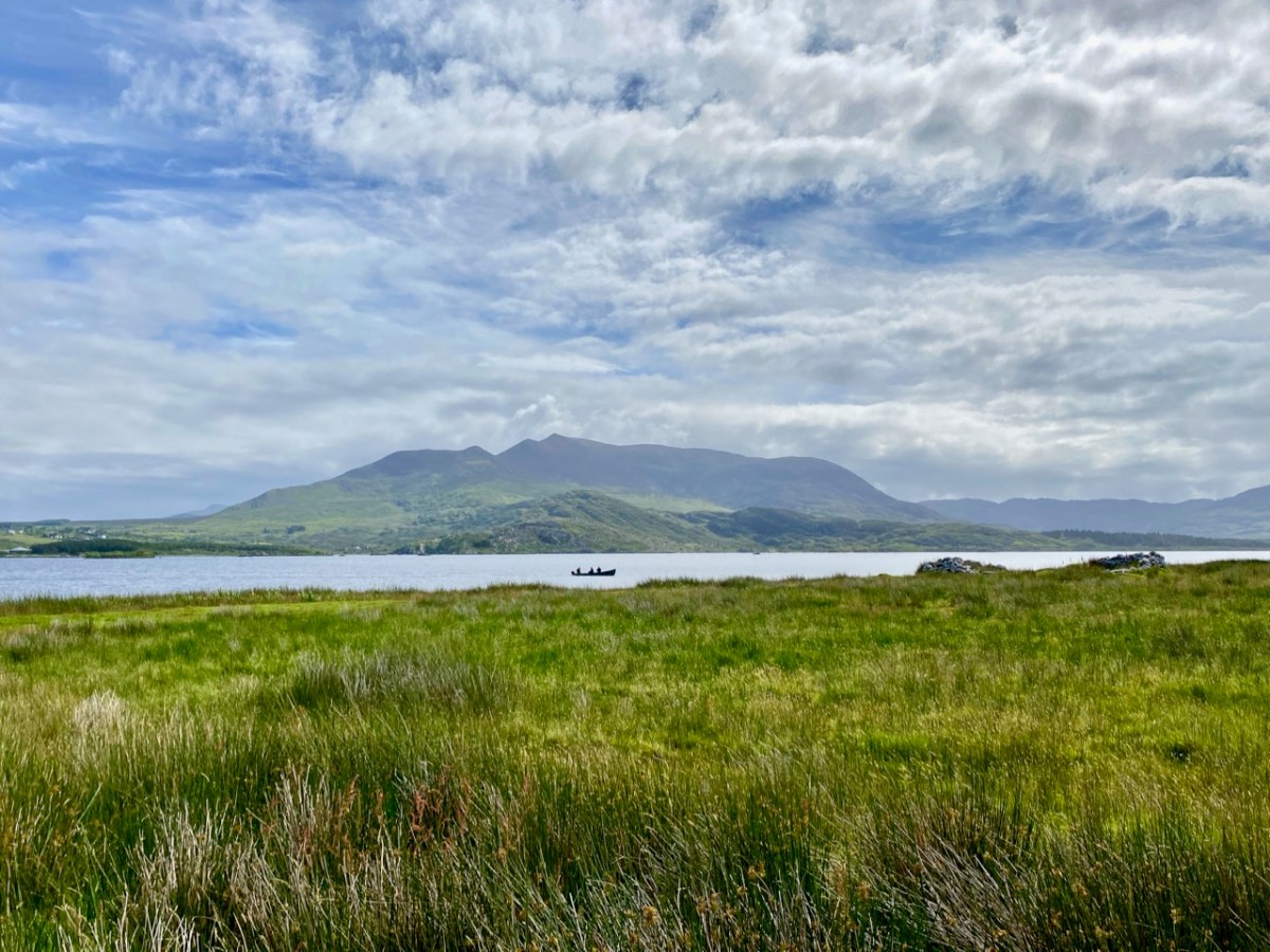
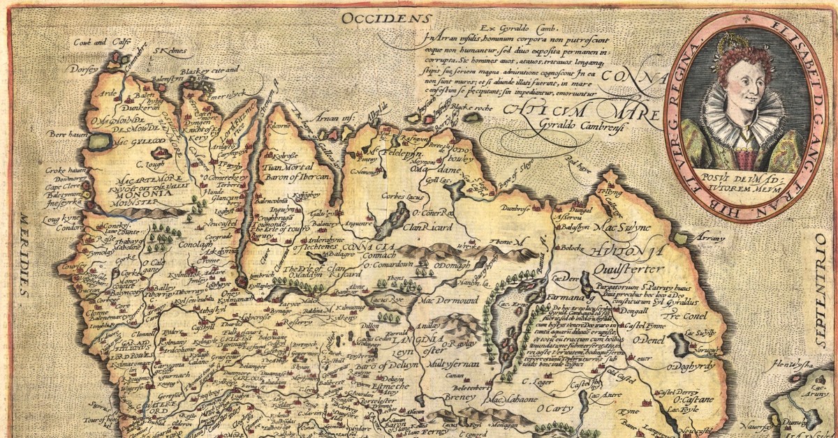
Kerry: it’s one of our favourite destinations. Visually spectacular, it offers a dramatic natural terrain of coastlines, mountains – and remembered history. Above is a view from Church Island, on Lough Currane near Waterville. The Down Survey gives us a mid-17th century aspect of the landscape, but there are earlier maps. The header is a part of Ortelius’ Theatrum Orbis Terrarum, published in many editions from 1570. Note Queen Elizabeth prominently displayed. Here’s the full page map (courtesy of the David J Butler Collection of Maps of Ireland):

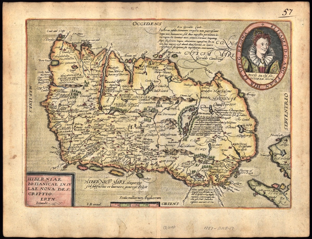
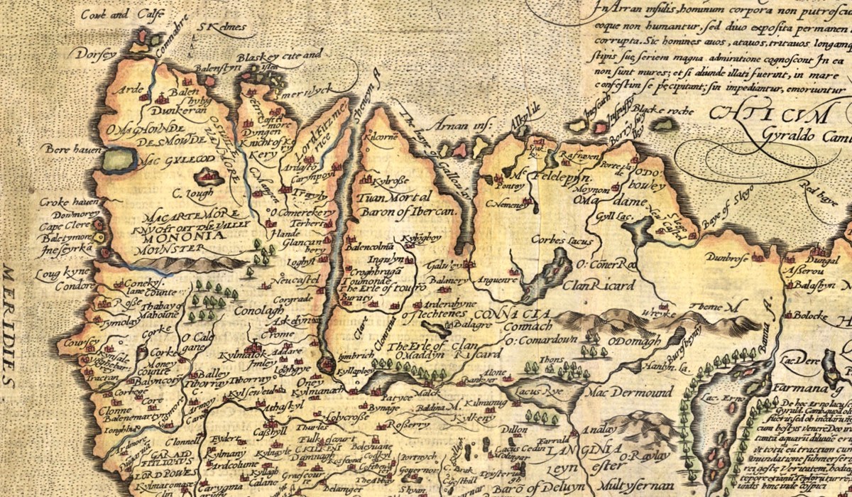
Above is an enlarged detail from the Theatrum Orbis Terrarum showing much of today’s Cork and Kerry counties. You have to get used to thinking through ninety degrees: it was the convention in many early maps to put West at the top of the image, and North to the right. Here you will see Roaringwater Bay over to the left. To make things easier, here is a much enlarged view of part of this map, although with some loss of definition:

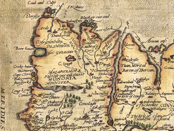
You will recognise Dorsey (Dursey Island), Croke haven (Crookhaven), Cape Clere (Cape Clear Island), Baletymore (Baltimore), Tymolay (Timoleague), Kynfale (Kinsale), all within Movnster (Munster). Going round the corner we find Balenftyn (Valentia), Kery (Kerry), Trayly (Tralee), and many more, including names we cannot now relate to.

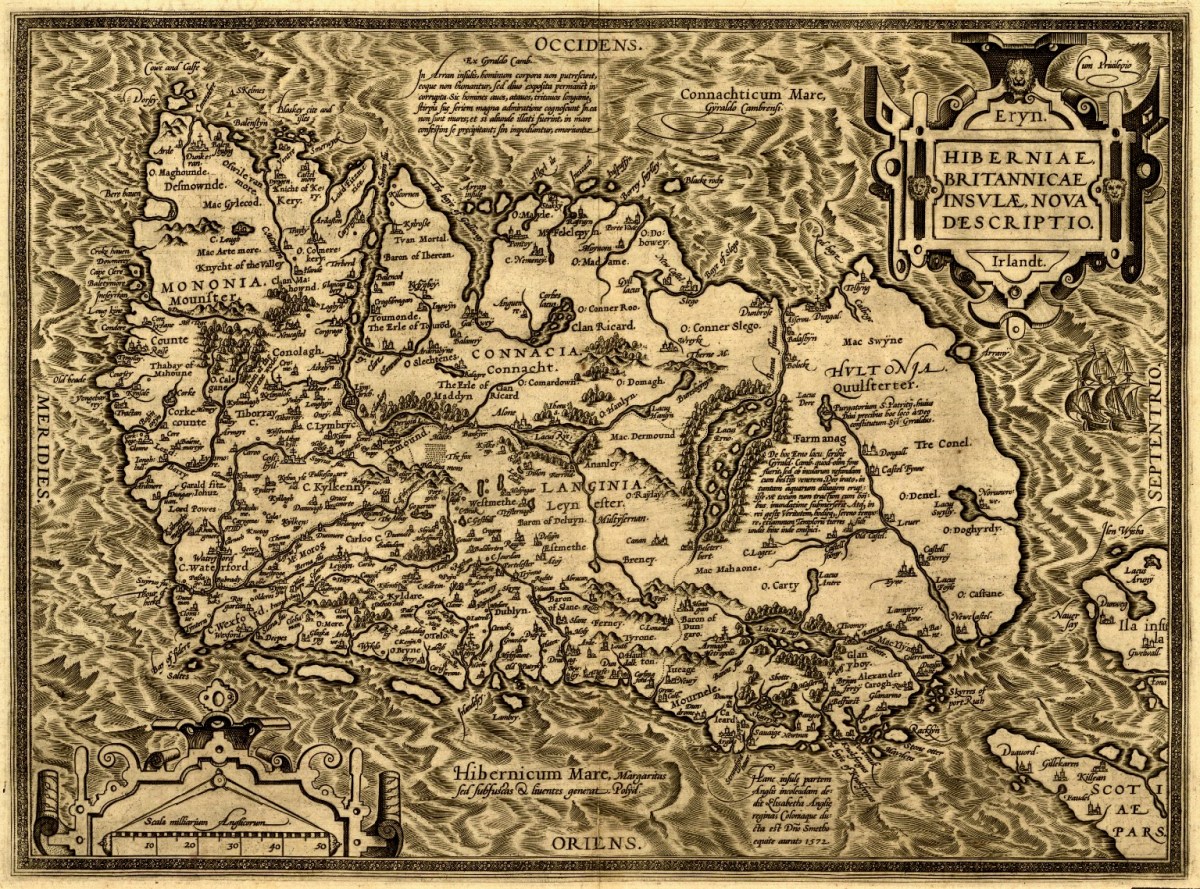
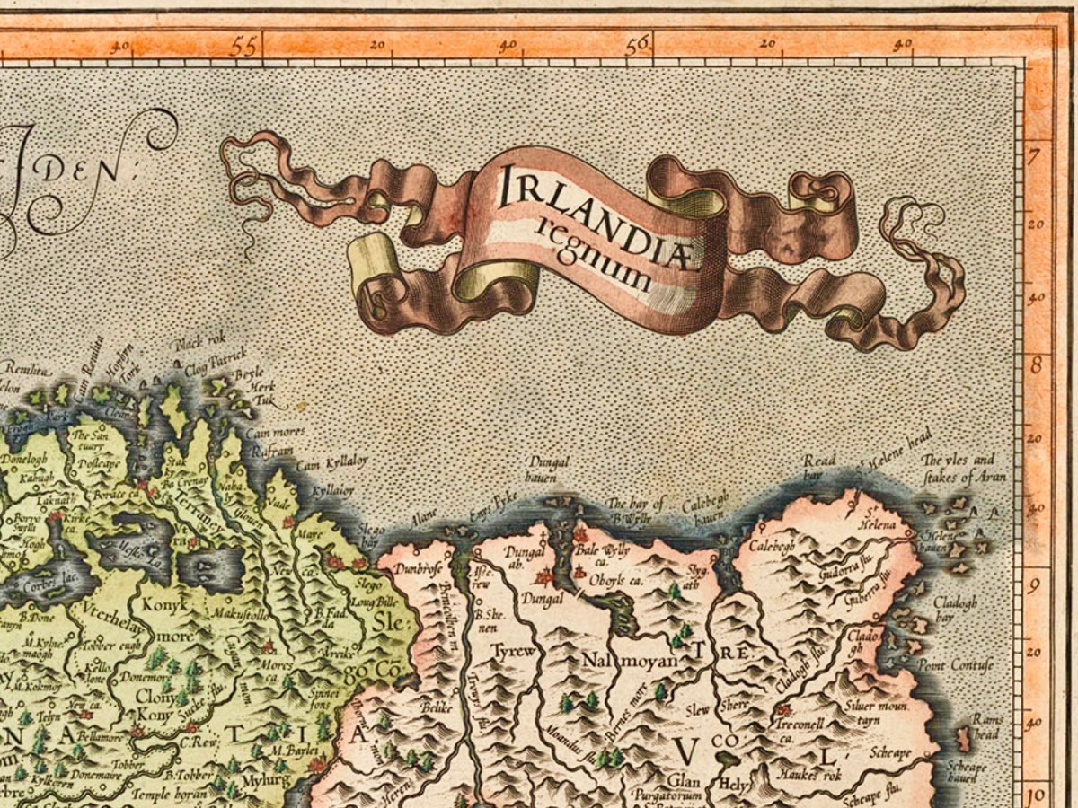
(Above) – here’s another pre-Down Survey map: Hiberniae, Britannicae Insvlae nova descripto, published by Abraham Ortelius (1527-98), a Flemish engraver. The map is thought to date from 1598 and is in the collection of The Library of Congress, Geography and Map Division, Washington, DC. Here’s a detail of the area which interests us today – again, many names can be recognised:

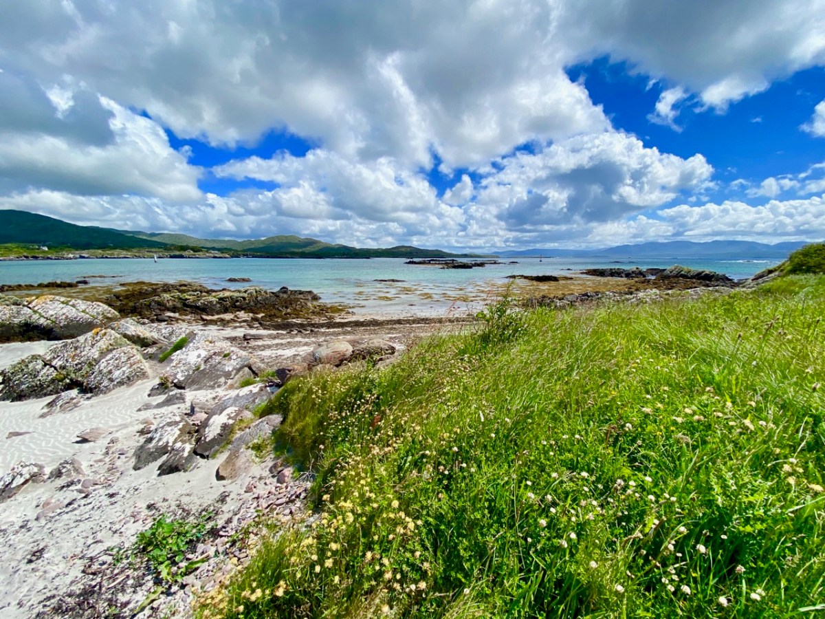
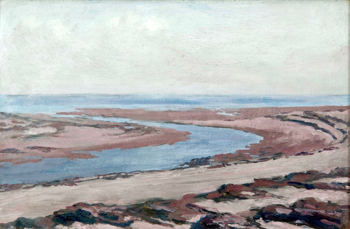
Another present-day Kerry scene: in fact a photograph from a friend’s garden. To add a further dimension to our review of Kerry through time, this Jack B Yeats painting – Kerry Landscape – dates from 1913 (current whereabouts unknown – it was offered for sale by Adams in 2016):

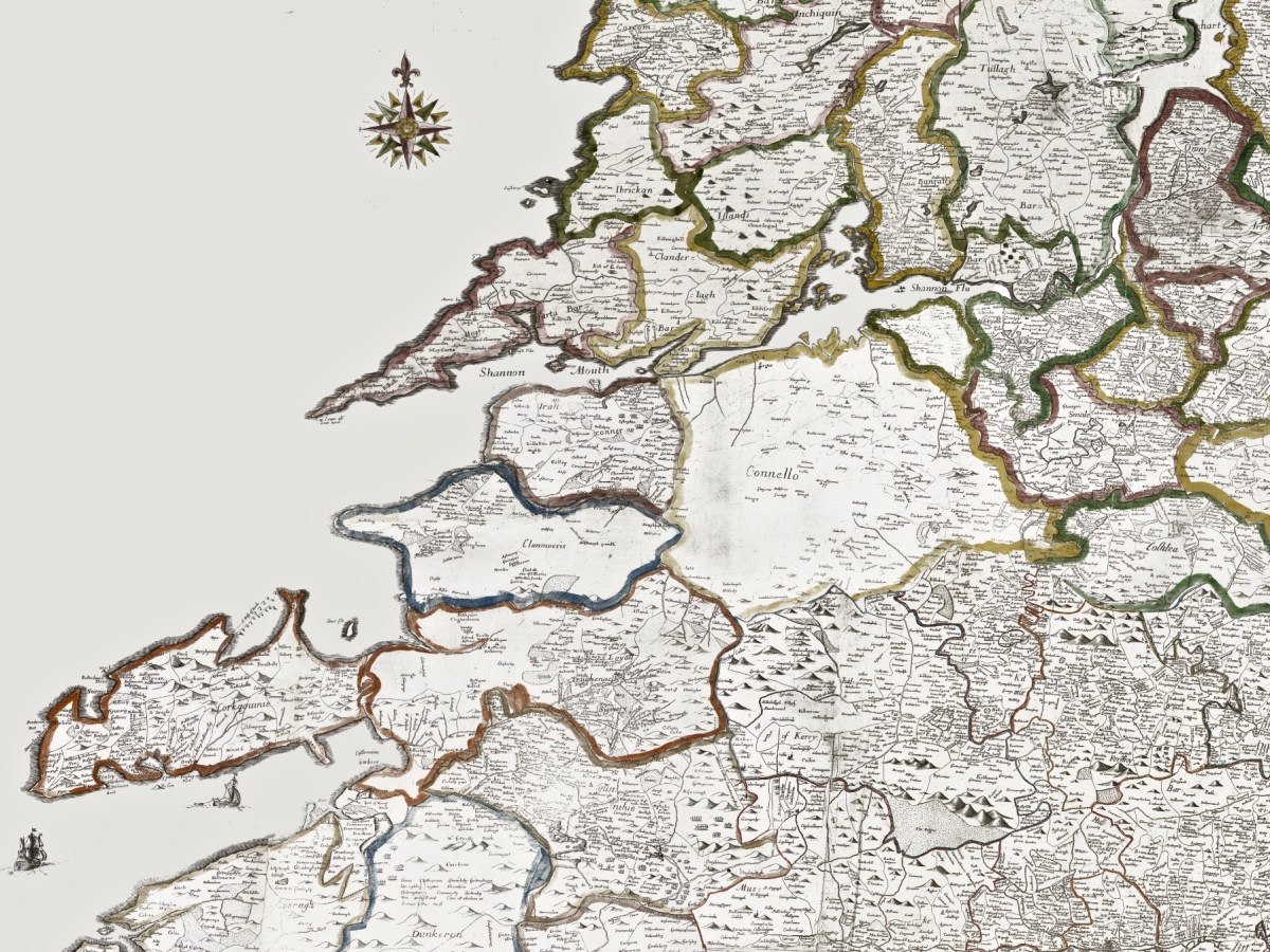
Getting back to The Down Survey, the following details are from the available survey documents which were taken in the years 1656-1658. They show parts of Clare, Limerick and Kerry:

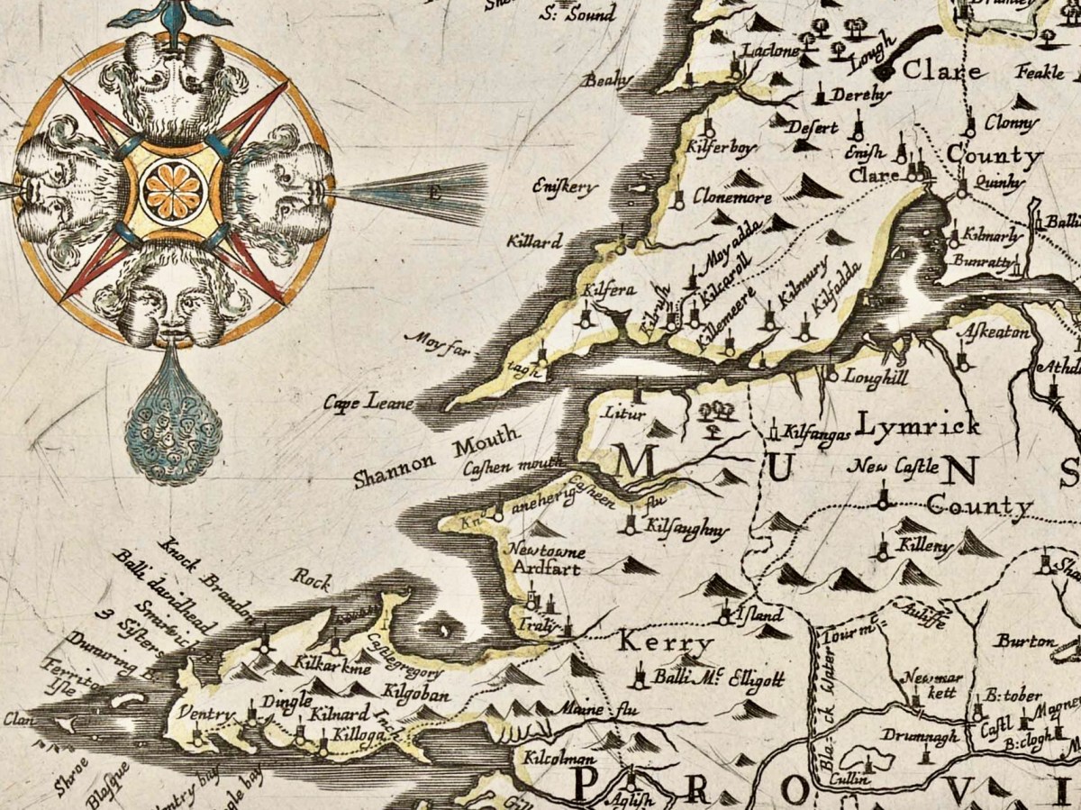
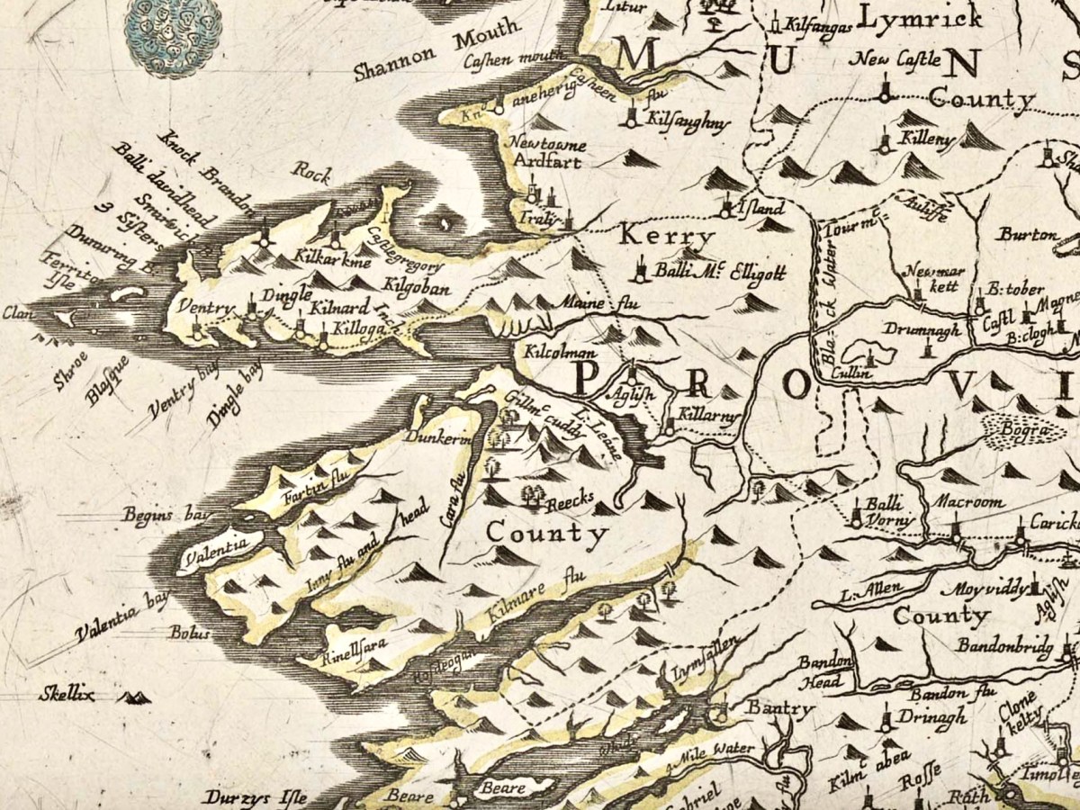
Here is a specific County map of Kerry in greater detail: it encompasses the land divisions spanning from Kenmare to the mouth of the Shannon (Down Survey GIS 1641 – 1670).

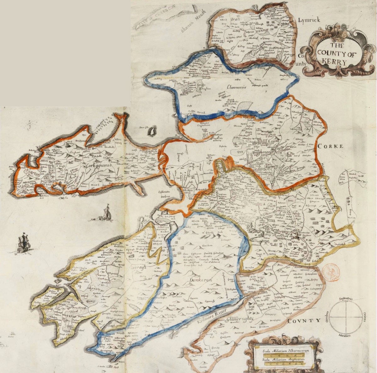
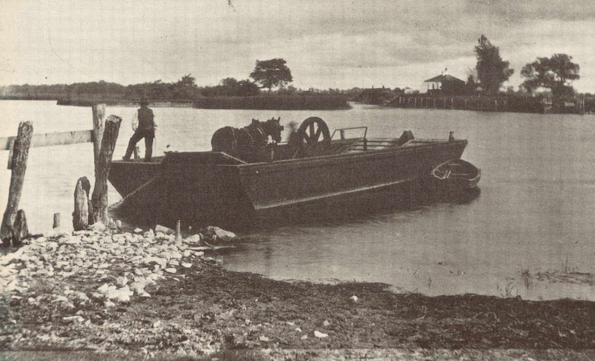
Above: a ferry across the Shannon, c1890. Below: this map is also from The Down Survey collection and is titled Landowner Map 1641 – 1670.

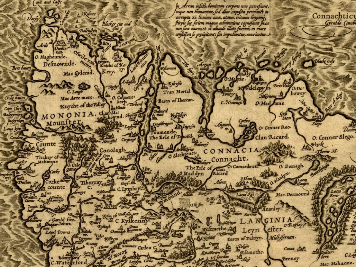
Before leaving this little outline of Ireland’s ancient western coastline, I can’t resist going back to the Twelfth century and to Giraldus Cambrensis (c 1146 – c 1223). Described as a Roman-minded Cambro-Norman cleric, Giraldus lived most of his life in Wales but visited Ireland in 1183 and 1185. He wrote descriptions of what he encountered there, and they are entertaining. Here are two examples: though not specific to Kerry, they are not geographically distant.

. . . There is an island called Aren, situated in the western part of Connaught, and consecrated, as it is said, to St Brendan, where human corpses are neither buried nor decay, but, deposited in the open air, remain uncorrupted. Here men can behold, and recognise with wonder, grandfathers, great-grandfathers, and great-great-grandfathers, and the long series of their ancestors to a remote period of past time . . .


Giraldus Cambrensis

. . . There is another thing remarkable in this land. Although mice swarm in vast numbers in other parts of Ireland, here not a single one is found. No mouse is bred here, nor does it live if it be introduced; when brought over, it runs immediately away and leaps into the sea. If it be stopped, it instantly dies . . .


Giraldus Cambrensis

Further Reading! Some past Roaringwater Journal posts which look at early maps and the West of Ireland can be found here and here.

Grand Canal Hotels

rbtstown hotel through bridge

This view of the old hotel on the Grand Canal at Robertstown, Co Kildare, is our best effort to replicate the photo taken by Angela Rolt in 1946 for Green & Silver, Tom Rolt’s book about their Irish waterways adventures exactly seventy years ago:

robertstown

Angela Rolt’s 1946 photograph of the Canal Hotel at Robertstown. We could not get the same view (which must have been taken from their boat) as we were on dry land! By clever manipualtion of her lenses, Finola produced our own version (top picture)

…We had travelled less than a mile along the summit level before we saw ahead, framed by the arch of a bridge, the canal hotel at Robertstown. It is an almost exact replica of the Shannon Harbour hotel, but is in better repair being at the present time a Turf Board hostel for workers on the bogs. Robertstown itself, a whitewashed canal depot, a post office and a shop and ‘select bar’ or two strung along the canal waterfront beside the hotel, is a canal village… There was, for me at any rate, a fascination about Robertstown which I find difficult to define and which our photograph can scarcely convey. A particular atmosphere, melancholy, nostalgic yet captivating, always invests a waterfront no matter whether it is that of some old seaport town, some cliff-walled fishing cove or merely, as in this case, some inland village beside a still canal. It captivates because it is a doorway to the unknown and so appeals to our sense of adventure and that nomadic instinct which lies buried in all of us. It is nostalgic because it recalls memories of places visited and never perhaps to be revisited. It is melancholy because it is redolent with the unnumbered farewells which it has witnessed; a reminder that life, in the words of some poet whose name I cannot recall, is a perpetual farewell… (from Green & Silver, L T C Rolt, George Allen and Unwin, 1946)

canal port

canal in roberstown

The canal village of Robertstown: upper picture – Angela Rolt’s photograph of 1946 sums up the ‘melancholy and nostalgic’ character of the place then. The Rolts’ boat, Le Coq – is seen moored up on the quay: its journey created significant interest as in those days the appearance of a ‘pleasure craft’ was rare. A crowd of small children always materialized out of nowhere to gaze, ask questions and – sometimes – throw stones. Lower picture – Robertstown in 2016

Rolt was a prolific – and often romantic – writer: more than 500 publications are attributed to him, including articles and letters and forty significant books on canals, railways, engineering and philosophy: Green & Silver is the second of these. His summing up of Robertstown as ‘melancholy and nostalgic’ reflects the times in which he lived and travelled on the waterways. The heyday of canal transport was long gone, although the Grand Canal and Shannon were still in commercial use seventy years ago. Carrying then was in severe decline: it would only last another ten years or so and the Rolts’ transit of the Royal Canal was probably the last before the canal became impassable before being formally closed in 1961.

bargehorse robertstown

Horse drawn commercial traffic on the Grand Canal in Robertstown is remembered there in this modern relief carving of a barge horse on the wall of the Garda station

My own journeys on the English canal system during the 1960s could similarly be described as ‘melancholy and nostalgic’ and I certainly shared Tom Rolt’s fascination for what I found. The era of water transport was over and in those days the canals were imbued with an air of neglect and decay, although better times were remembered by the local populations. As did the Rolts, I had difficulties in making a passage through some of the near derelict canals in the English midlands with my little boat (often bow-hauling from the bank was the only answer to the weed and rubbish-choked ‘navigations’); however – like them – I always succeeded. Today, in both Ireland and England the picture is very different: generations of pioneering enthusiasts and campaigners (I was one of them!) have succeeded in reawakening interest in our industrial history and realised the amenity asset of the waterways systems which have generally been brought back in a new incarnation as ‘cruiseways’.

faded elegance robertstown

The Canal Hotel at Robertstown: from a distance it retains its elegant façade but it’s all a sham, and the building is in urgent need of conservation

In both places there is still an architectural and industrial heritage to be acknowledged. A particular example in Ireland is the Grand Canal hotels. There were five constructed originally: Shannon Harbour, Tullamore, Robertstown, Portobello and James’ Street Harbour. All were of a pattern and impressive architecturally. Two have vanished.

portobello-grand-canal-hotel

The former Grand Canal Hotel at Portobello Harbour, Dublin, in the 1940s: it became a nursing home (Jack B Yeats spent his last years there) and is now a private college

rbstown hotel elevation

Robertstown Canal Hotel: a local civic amenity group has painted in the fenestration to improve the look of this significant building in the townscape, but the reality is masked decay and an uncertain future

The other remaining hotel building is at Shannon Harbour, where the Grand Canal meets the mighty river. In the heady days of canal prosperity …the company’s hotels were simply the posting houses of this water-road… (Rolt) …There was considerable interchange of passenger as well as goods traffic at Shannon Harbour. Travellers changed here from the Dublin passage boats into Bianconi’s ‘long cars’ which operated between Birr, Shannon Harbour and Athlone in connection with the boats. Alternatively they might board the paddle steamers The Lady Lansdowne or The Lady Burgoyne which plied between Killaloe pier head and Athlone, calling at a jetty on the river near the mouth of the canal. Smaller craft sailed from Killaloe pier head to the transatlantic port of Limerick, and so the Grand Canal became a link in the route between Dublin and America…

Shannon Harbour, Grand Canal Hotel

shannon harbour view with hotel

Upper picture – Angela Rolt’s view of Shannon Harbour and the intact hotel. Lower picture – the same view in 2016, showing the hotel in a state of near dereliction

The Shannon Harbour hotel today is but a shell: the roof has fallen, the windows are empty sockets. But, like the building at Robertstown, it is a scheduled historic monument. The structure has been stabilised with steel props and there is talk – rumour, at least – of some future project. Even in its distressed state the hotel has a ‘grand’ air: certainly a prominent presence in the minimalist architecture of this small settlement which had a bustling past.

Shannon Harbour canal hotel: a stabilised shell today, recognised as historically and architecturally important for Ireland

It’s hard to imagine what the future could hold for such a monument of a different age, especially in this rural hinterland of County Offaly. Meanwhile, our own adventures continue – we still have some way to go yet to catch up with Tom and Angela Rolts’ voyages. This is the seventh instalment of the Travel by Water series. All the posts to date are available to view by clicking on the blue link.

canal fest robertstown