Schull – Delving into History

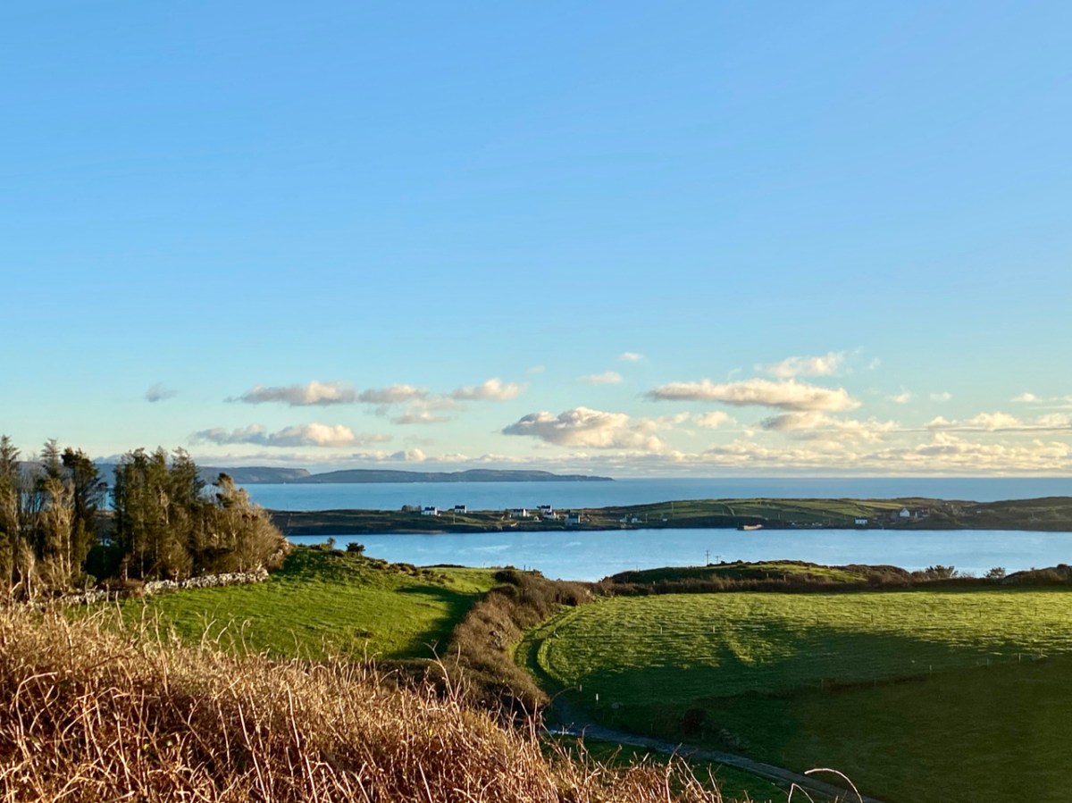
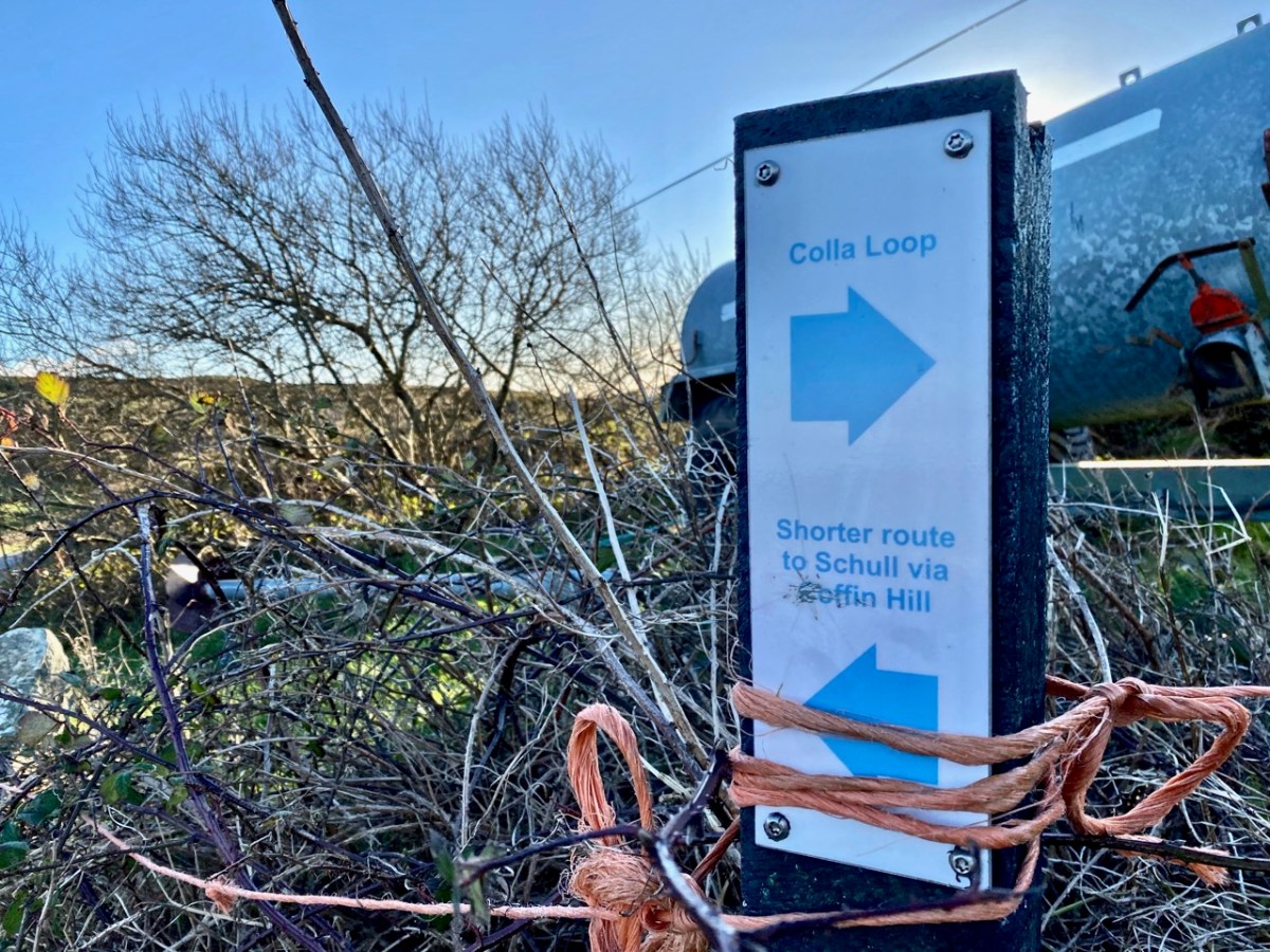
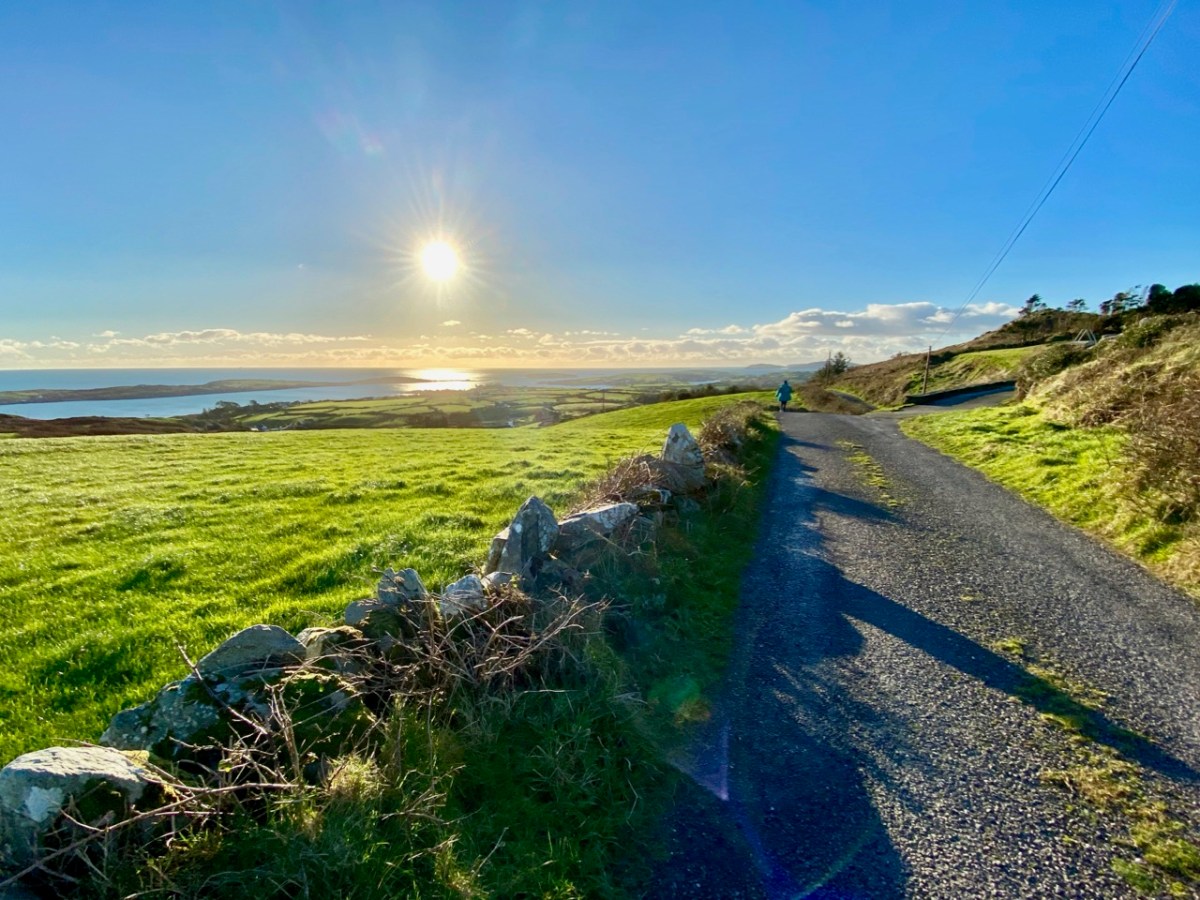
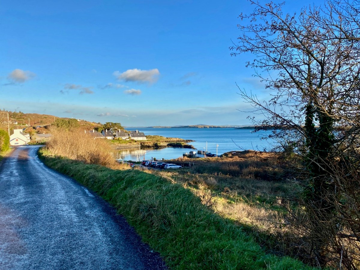
Last week my post explored a part of the Colla Loop on the Fastnet Trails. That walk passed by a site described on Archaeology Ireland as a possible early Christian settlement: . . . the ancient school of Sancta Maria de Scholia, ‘a place known in early times as a centre of learning’ . . . That information was ascribed to ‘Burke 1914’ but I can find no links to that source anywhere. If anyone can enlighten me, that would be great.

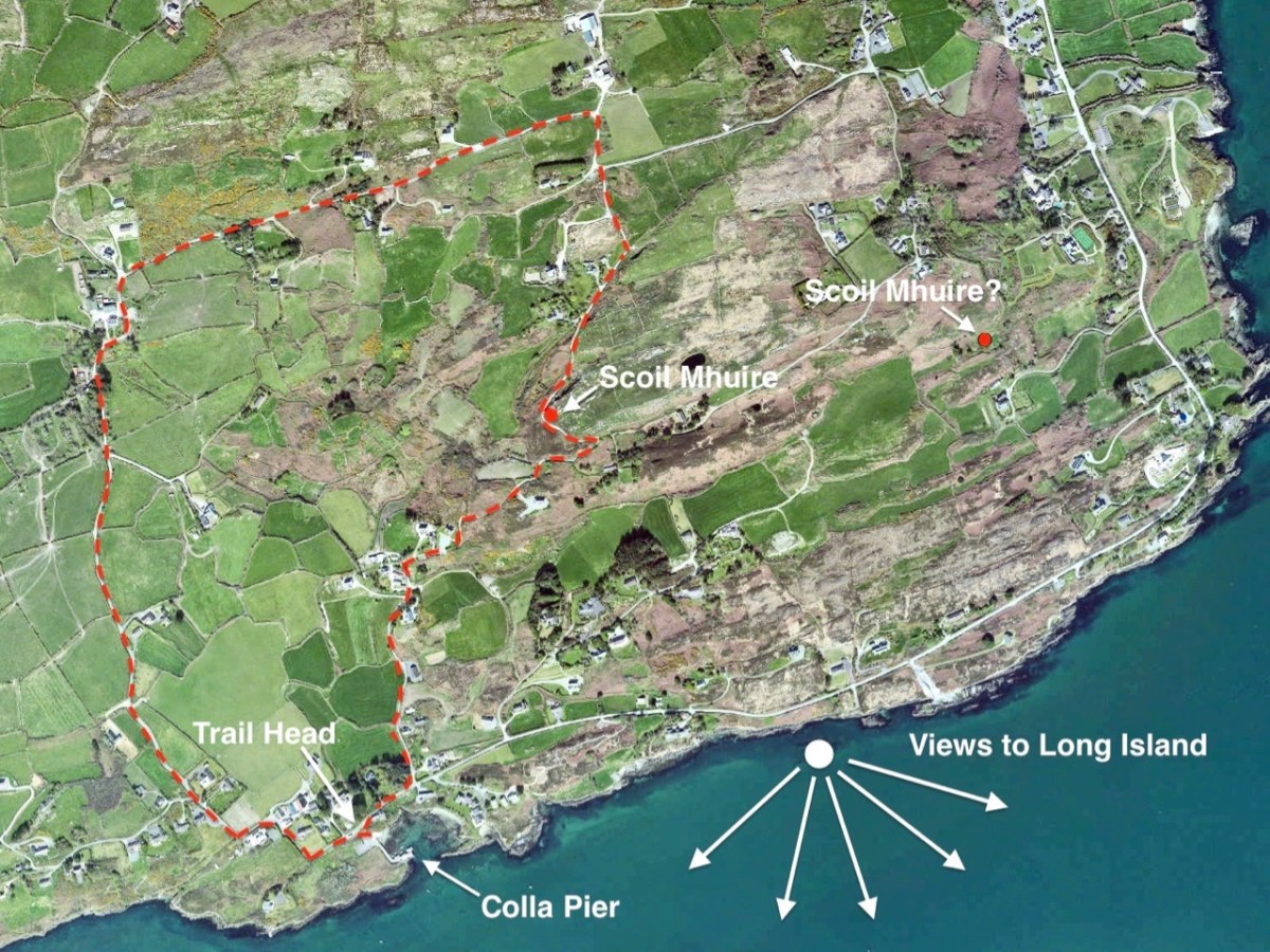
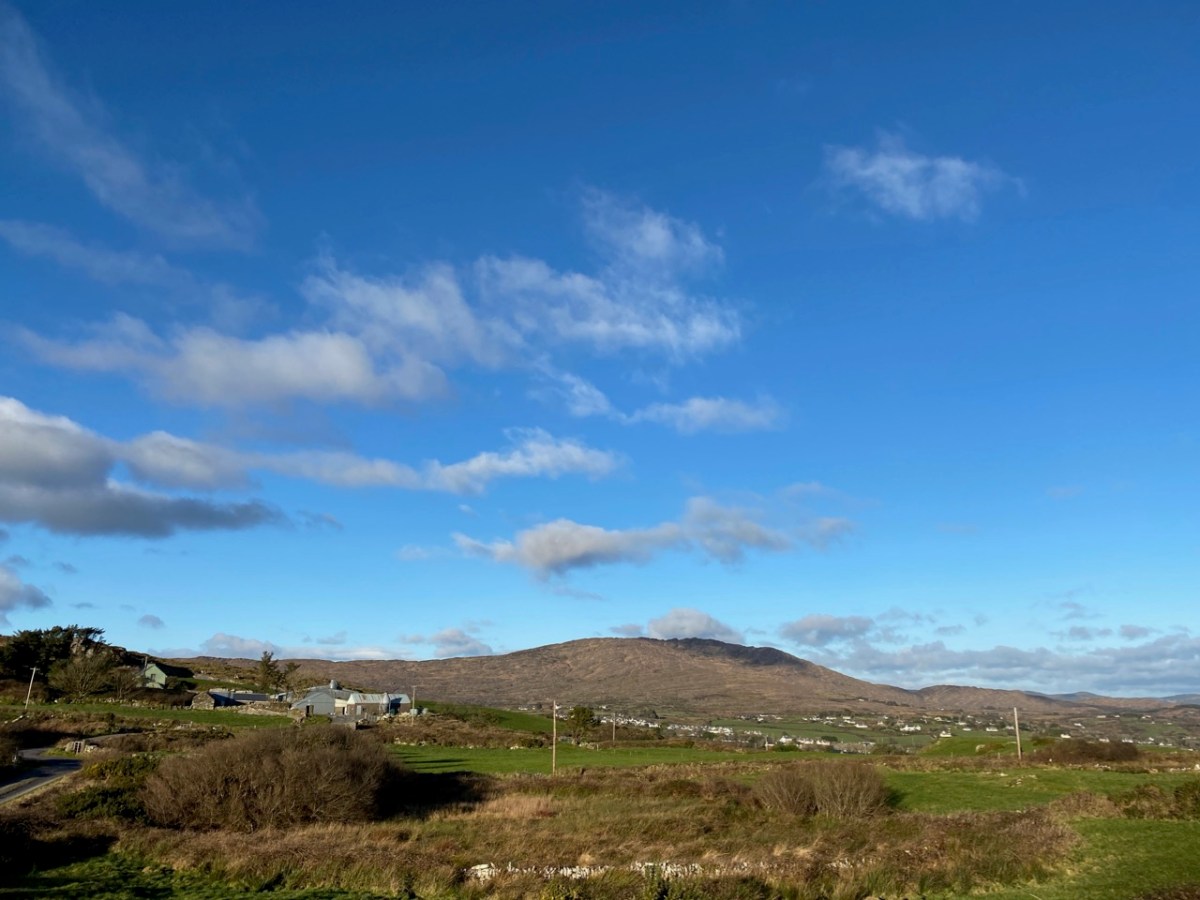
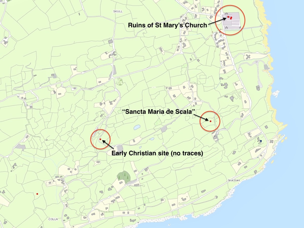
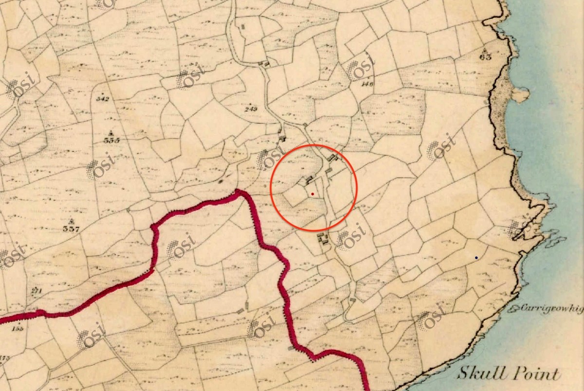
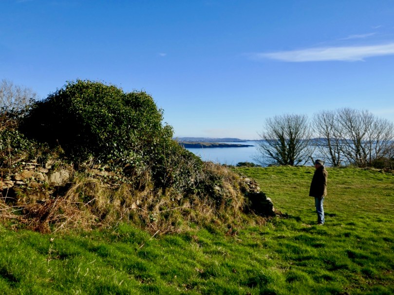
The location of this possible site is in the gorse covered area on the right hand side of the picture above. There is nothing to be seen there today, although such dense scrub could be hiding a lot. That record on the archaeological site is now described as ‘redundant’ – because there is no trace – but is maintained as it does indicate that there has been a tradition of the associations of the place historically. Certainly, if you were a group of wandering monks in medieval times looking for a new home it would have much to commend it – a south facing slope, sweeping views to the ocean below and defensible high ground behind. Not much shelter from the weather, though. The map below shows the possible site on the lower left, but note there are two further candidates, which we will discuss.

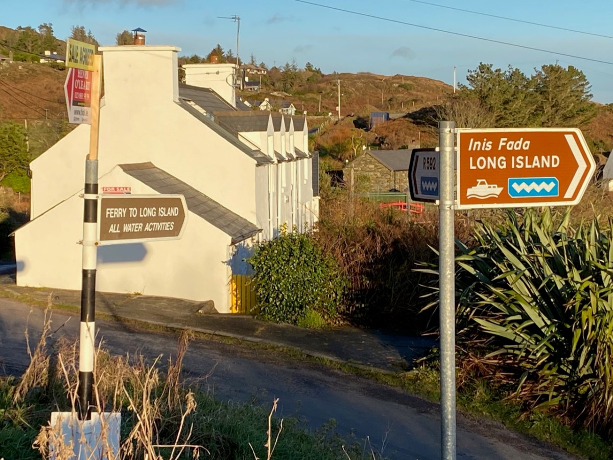
I found the historical reference to this possible site intriguing, especially in view of the suggestion that it could have been the original ‘school’ (centre of learning) that supposedly gave the settlement of Schull its name. If you want to delve further into the origins of the name ‘Schull’ – which the Ordnance Survey, interestingly, insisted should be spelled Skull right up to modern times: you can see it on the the Archaeology Ireland record extract above – I commend you to John D’Alton’s fascinating and comprehensive article here. John himself is a well-known long term resident of the village; I would love to have a discussion with John (and likely will when times permit) on some of his conclusions, but he certainly lays the foundations for questioning long-held assumptions. He does, however, posit that the name of the place has sounded the same for over a thousand years. For me, it is reasonable to conclude that ‘Schull’ is most likely to derive from the Irish word scoil – school – and that a ‘centre of learning’ did, indeed, exist in the area anciently. There are precedents enough for sites like this in West Cork. Our own Rossbrin Castle was the home of Finnin O’Mahony – Taoiseach of the clan – in the late fifteenth century and he was known to have established what has been described as ‘the greatest centre of learning in Europe’ on these now remote and deserted shores, while the Sheep’s Head peninsula boasts the remains of a great medieval ‘Bardic School’ close to Kilcrohane. My post of (yes!) eight years ago gives a brief outline. But let’s now turn to those other sites shown above.

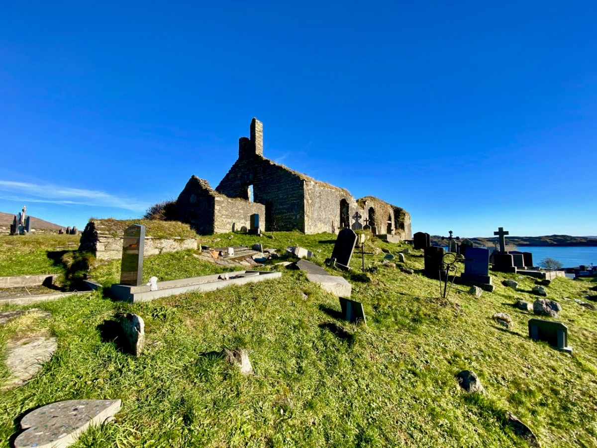
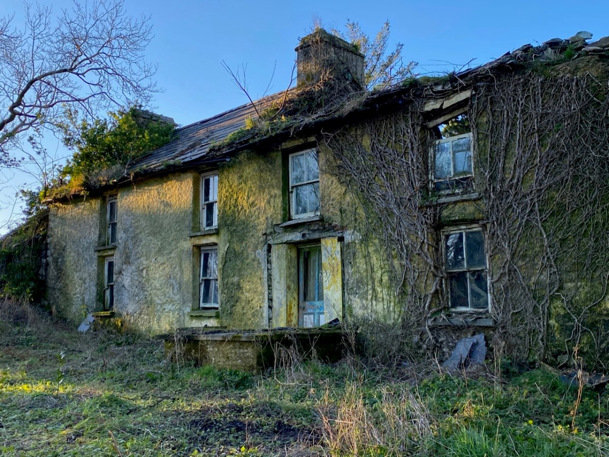
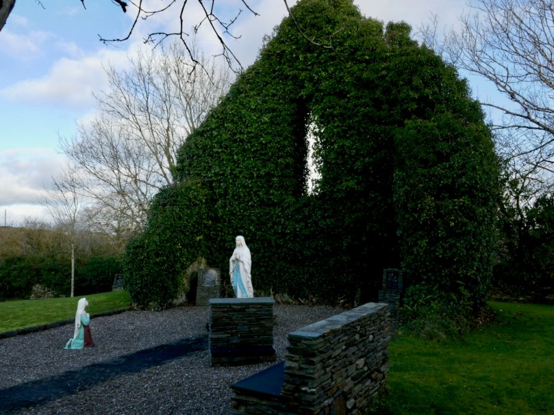
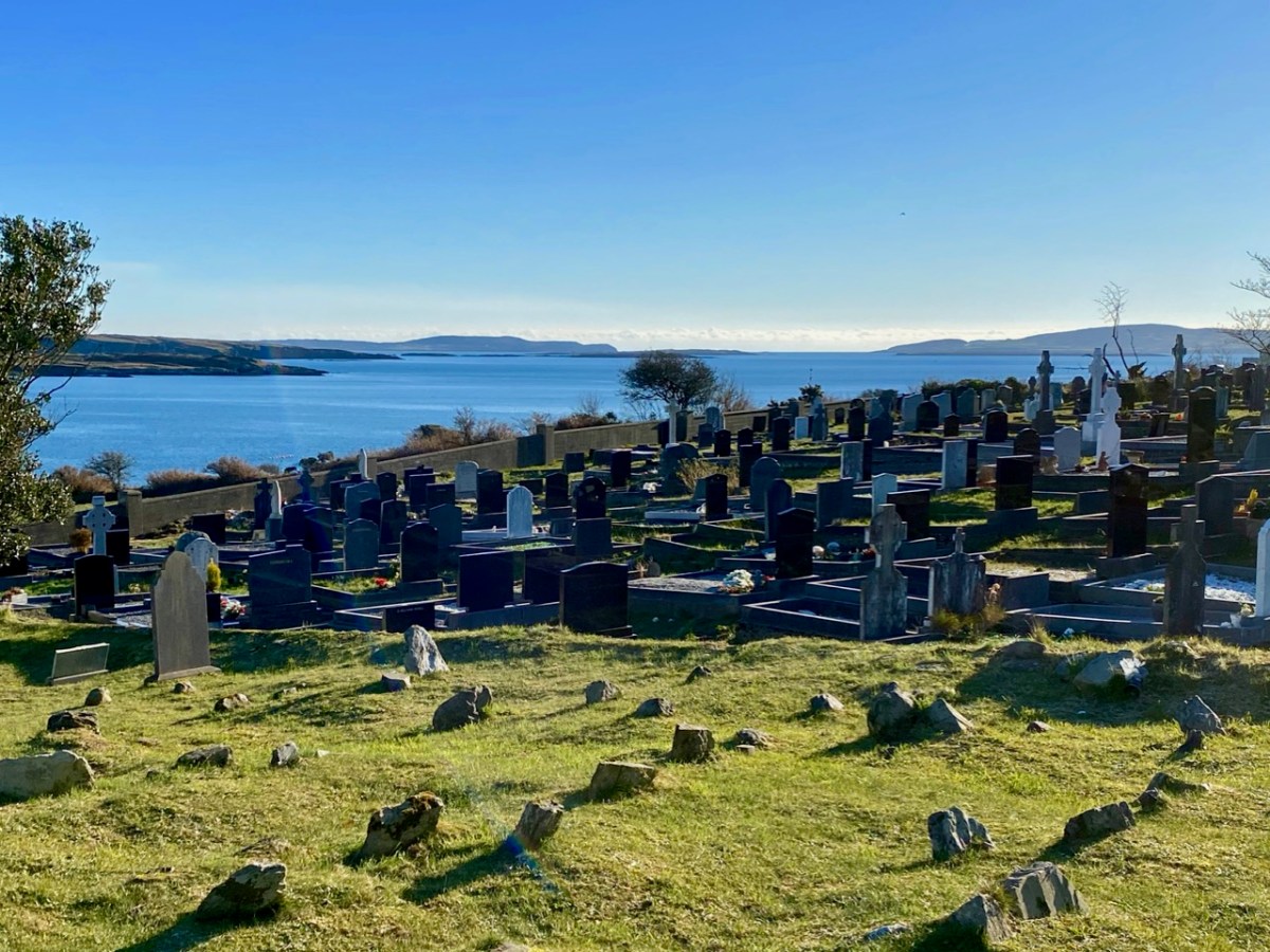
Here’s St Mary’s Church, the ruin which sits above – and dominates – the large burial ground to the south of Schull today. Tradition has it that it was built in 1720, but there is a fair bit of evidence to suggest that this ecclesiastical site goes back much further than that. I am indebted to Mary Mackey for her article in Mizen Journal – Volume 8, 2000: A Short History of the Ruins of St Mary’s Church, Colla Road, Schull.

The parish church is first recorded in a decretal letter issued in 1199 from Pope Innocent III to the Bishop of Cork listing the parishes in the diocese. The entry reads “scol cum suis pertinentiis” – Schull with its appurtenances. It is this early spelling of ‘scol’ meaning school which goes some way to authenticating the ancient tradition . . . During the reformation (16th century) when all church and monastic benefices and land were confiscated, the detailed rent roll for the Diocese of Cork records Schull with nine ploughlands, and in 1581 in a list of parishes in the diocese, Schull church is called “Saint Maria de Scoll”. This seems to be the first written record of the name of the church and it adds weight to the theory of the ancient monastic school, and to the origin of ‘Scoil Mhuire’ . . .

Mary Mackey – MiZEN Journal Volume 8

The same article notes that in 1653 the church commissioners stated “Upon 9 plowlands of Schull are the walls of a church” and in May 1700 Bishop Dive Downes, visiting the western part of his diocese records: “The church walls are standing and good, made of stone and lime 84′ long and 24′ broad”. Mackey comments that this was a large parish church compared with others in the Mizen area.

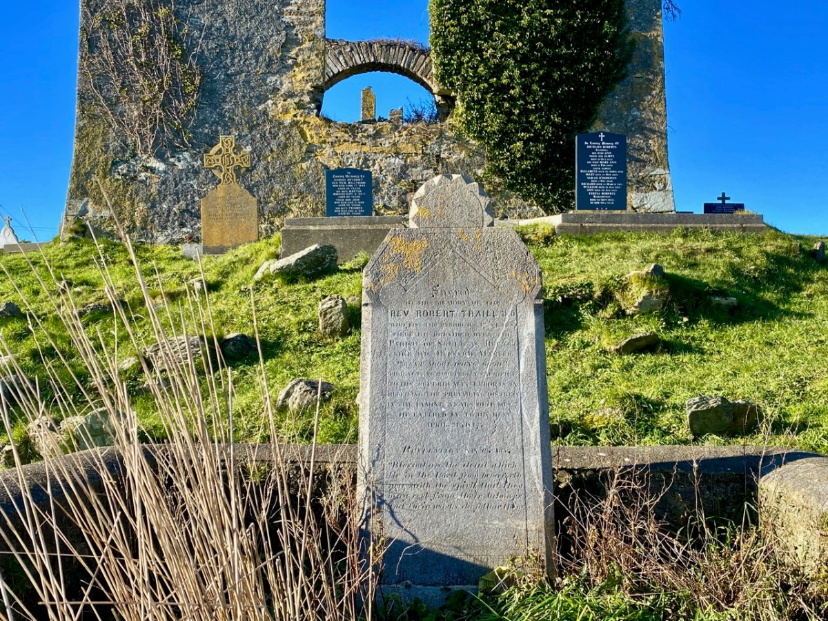
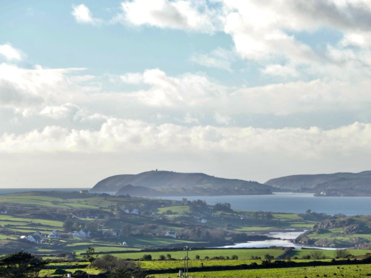
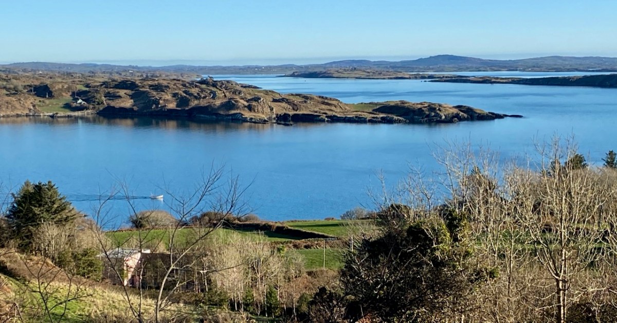
The local population will be very familiar with this ruin, and the graveyard which it overlooks. The grave marker (above) is dedicated to the Reverend Robert Traill – Finola has included him in her Saints and Soupers series. Schull graveyard must have one of the finest prospects of any burial place in the west, with its views out towards Long Island Sound and Roaringwater Bay:

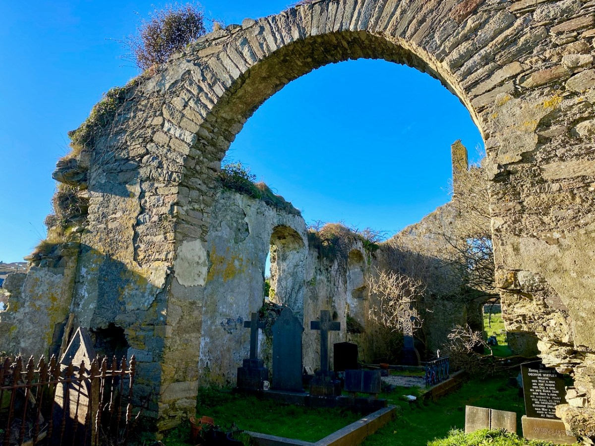
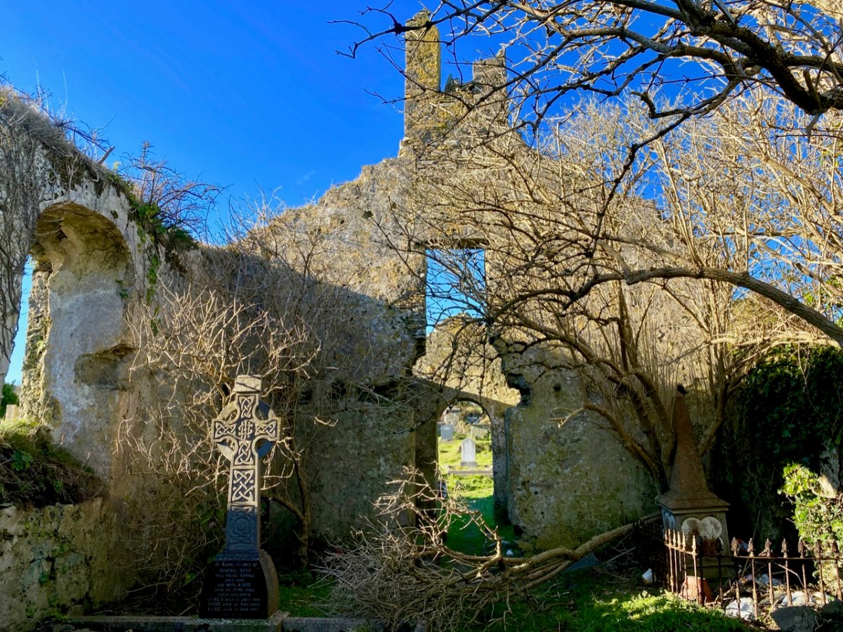
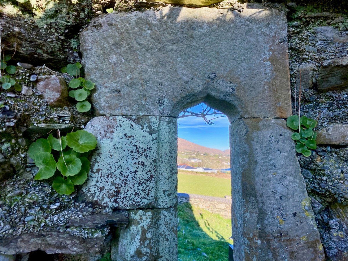
In 1936 we find Con O’Leary writing in A Wayfarer in Ireland (published by R M McBride): . . . Schull, named from Scoil Mhuire, the School of Mary, in the sixth century, is picturesquely situated , with Long Island thrown across the mouth of the bay . . . Well, that’s stretching us back a fair bit – but there’s nothing to confirm it. In the ruins of the church, however, there is one element which leads us to think that the architecture is quite ancient – this cut-stone ogival window in the northeast wall (possibly fifteenth century):

Now let’s turn to the third candidate in our search for Schull’s origins as a ‘great centre of learning’ – shown on the map towards the top of this post to the south of St Mary’s Church. Here is the Archaeology Ireland listing and the record note:

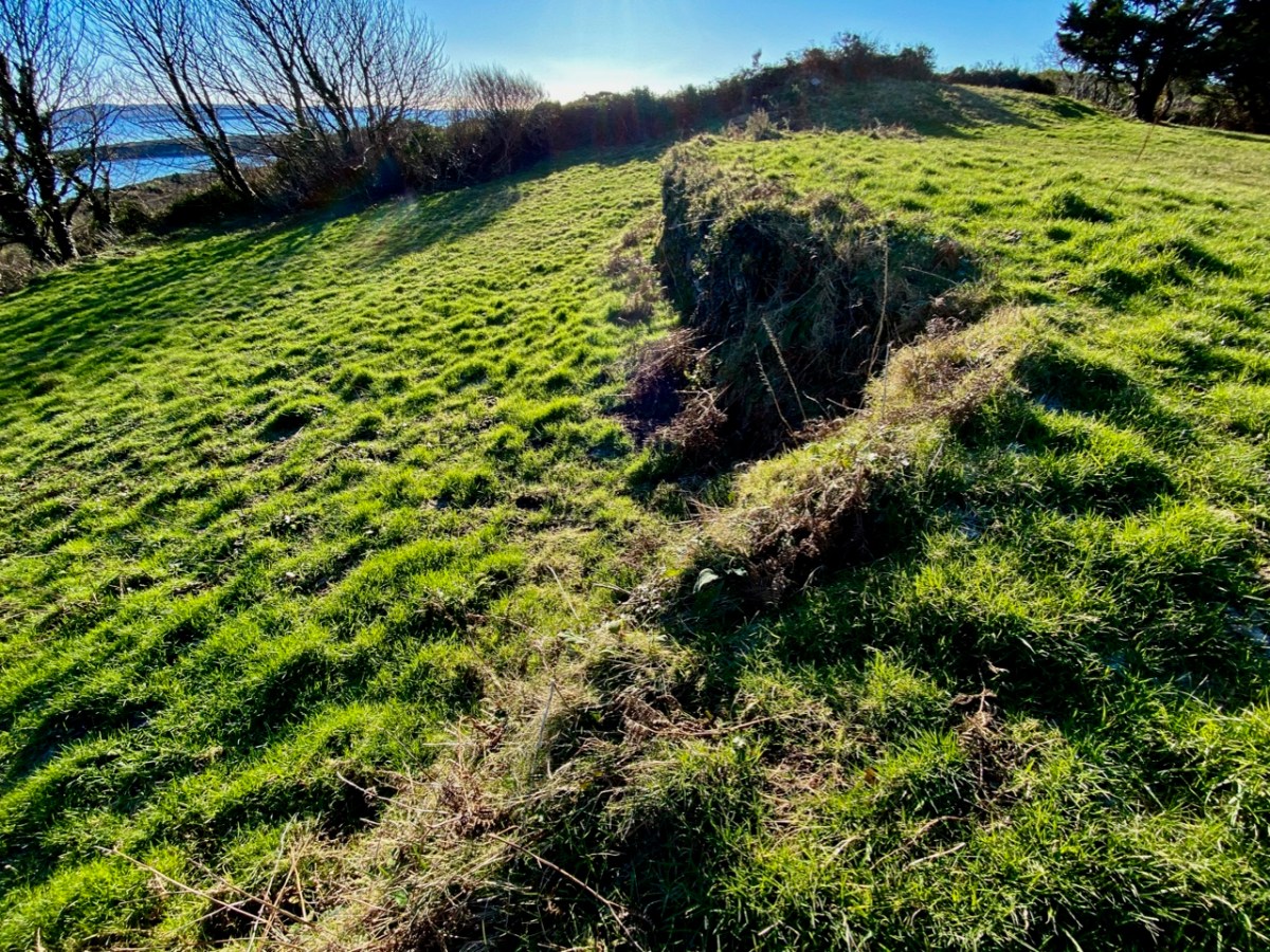
Description: In rough grazing, on a S-facing slope overlooking Long Island to the S and Skull Harbour to the E. Recent reclamation work exposed a level earthen platform-like area (c. 35m E-W; c. 17m N-S) faced externally on its curving S side by a roughly constructed drystone revetment (H 0.2m at W to 1.6m at E). According to local information, this is the location of Scoil Mhuire or Sancta Maria de Scala, a medieval church and school that gave its name to this townland and to Skull village . . .


The Archaeological Inventory of County Cork. Volume 5 (Dublin: Stationery Office, 2009)

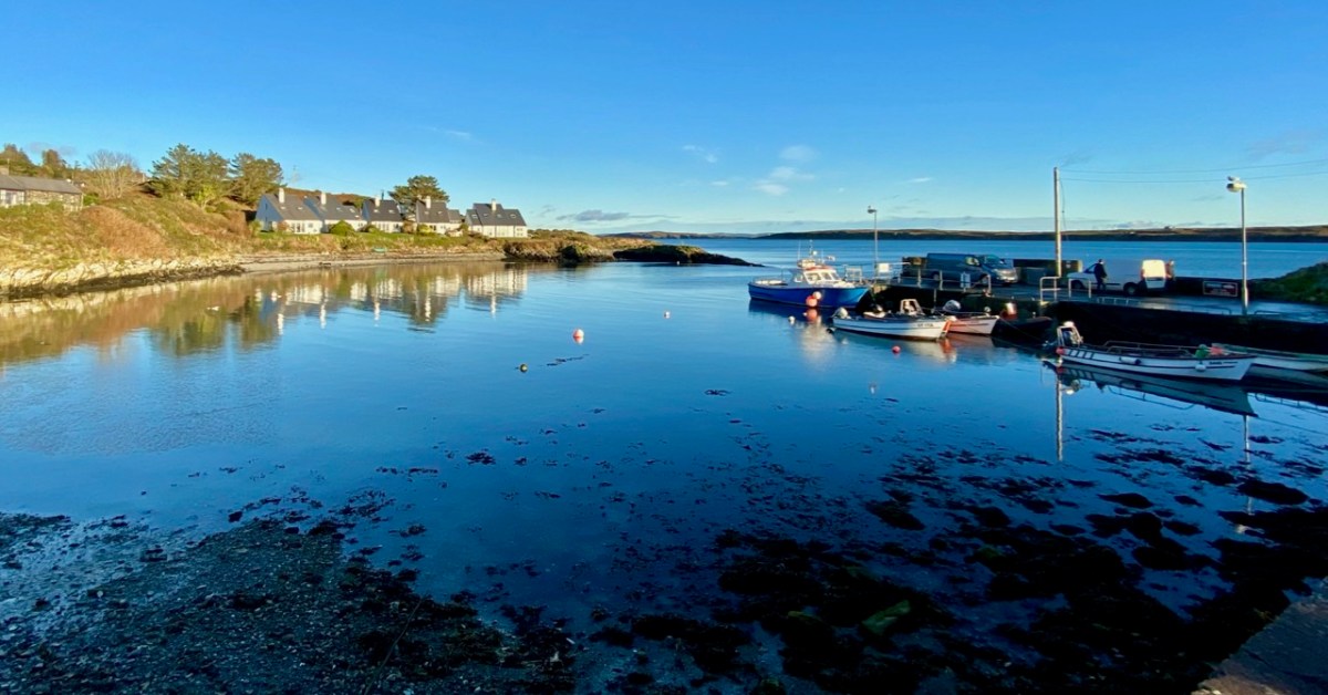
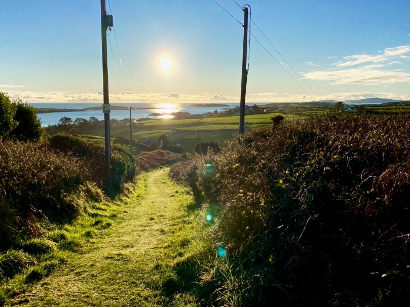
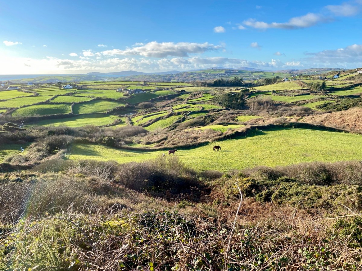
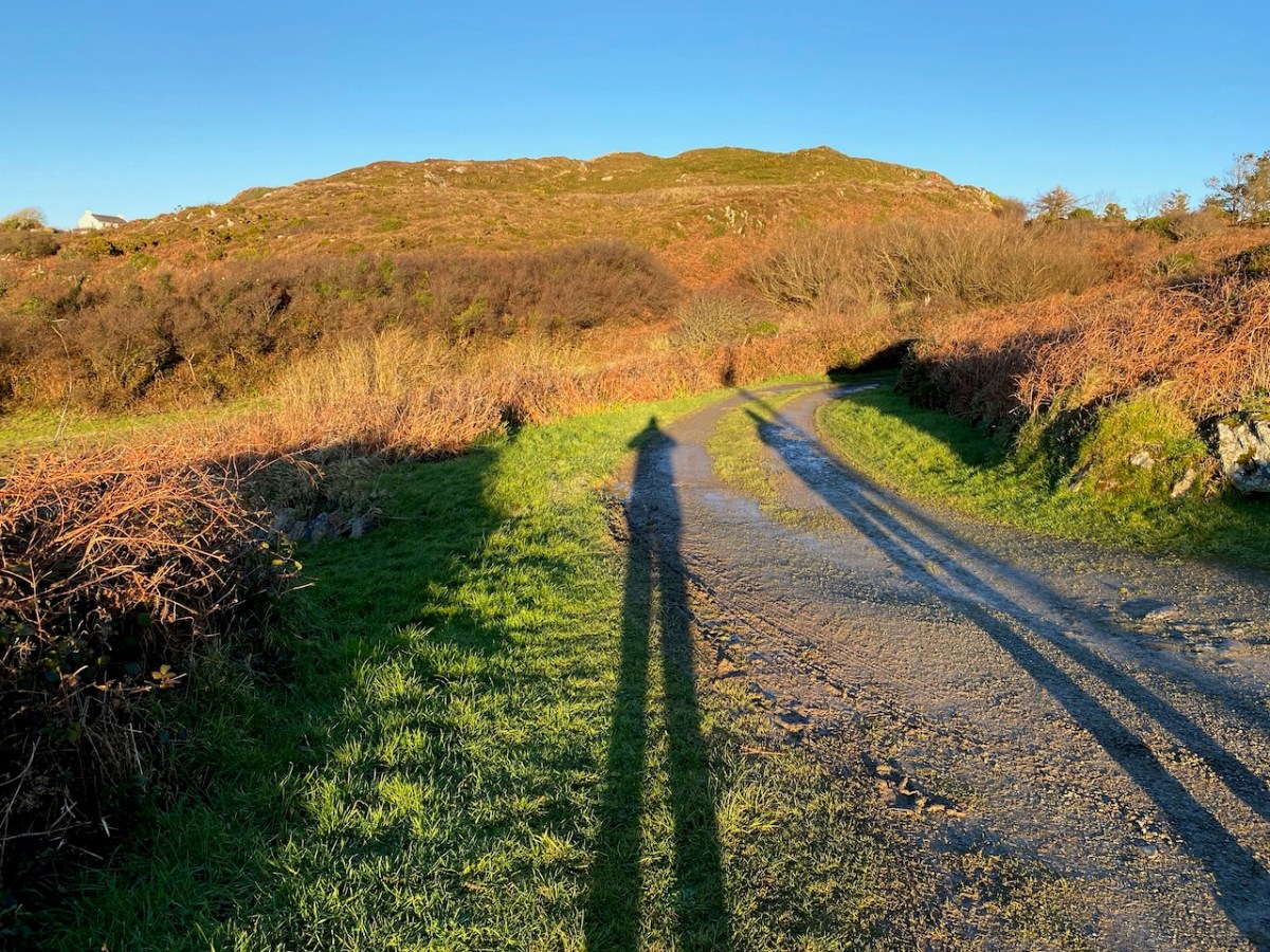
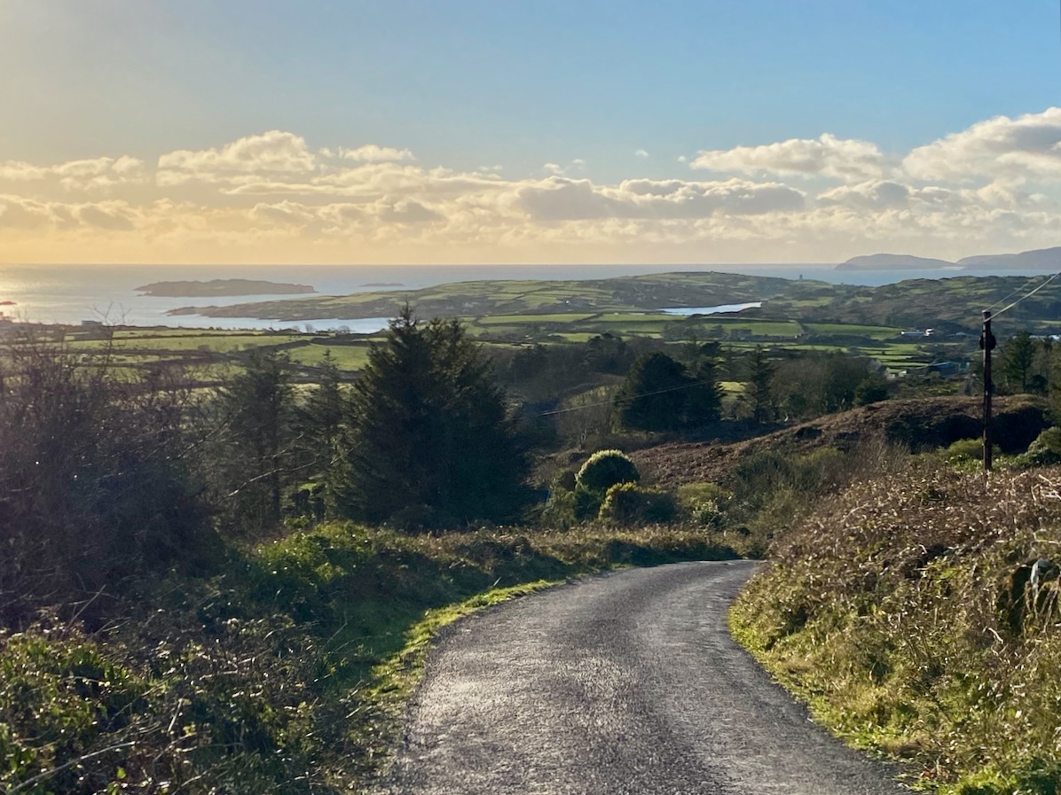
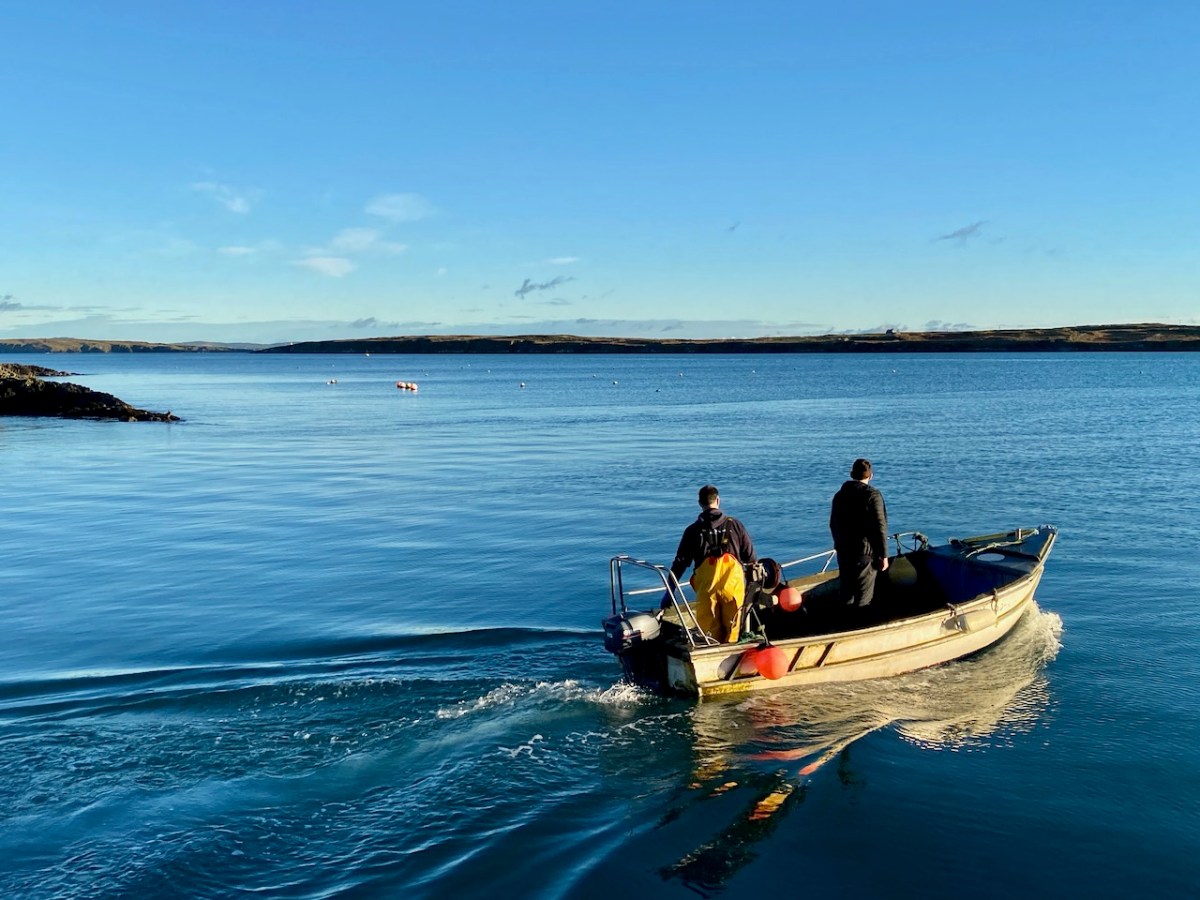
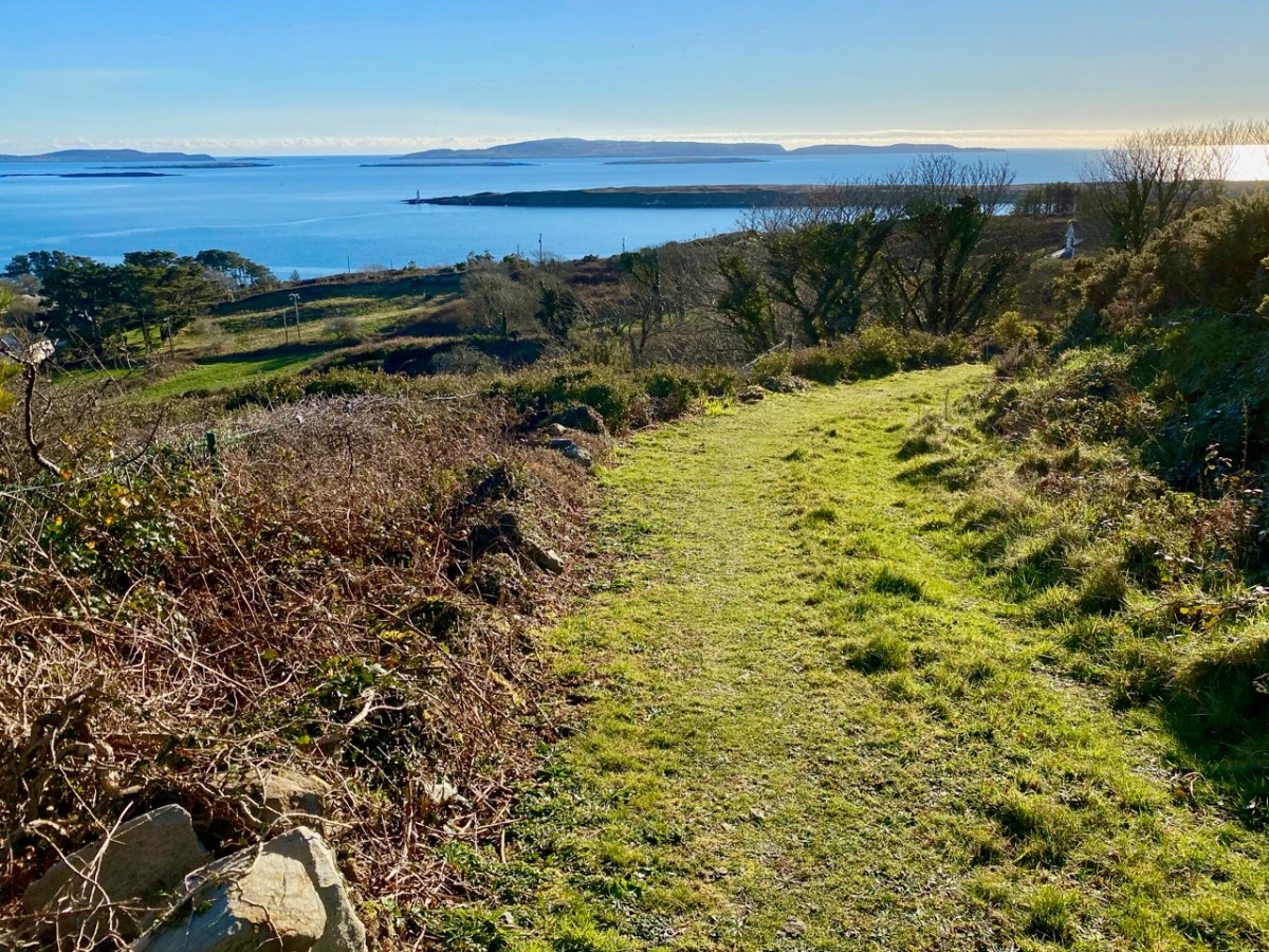
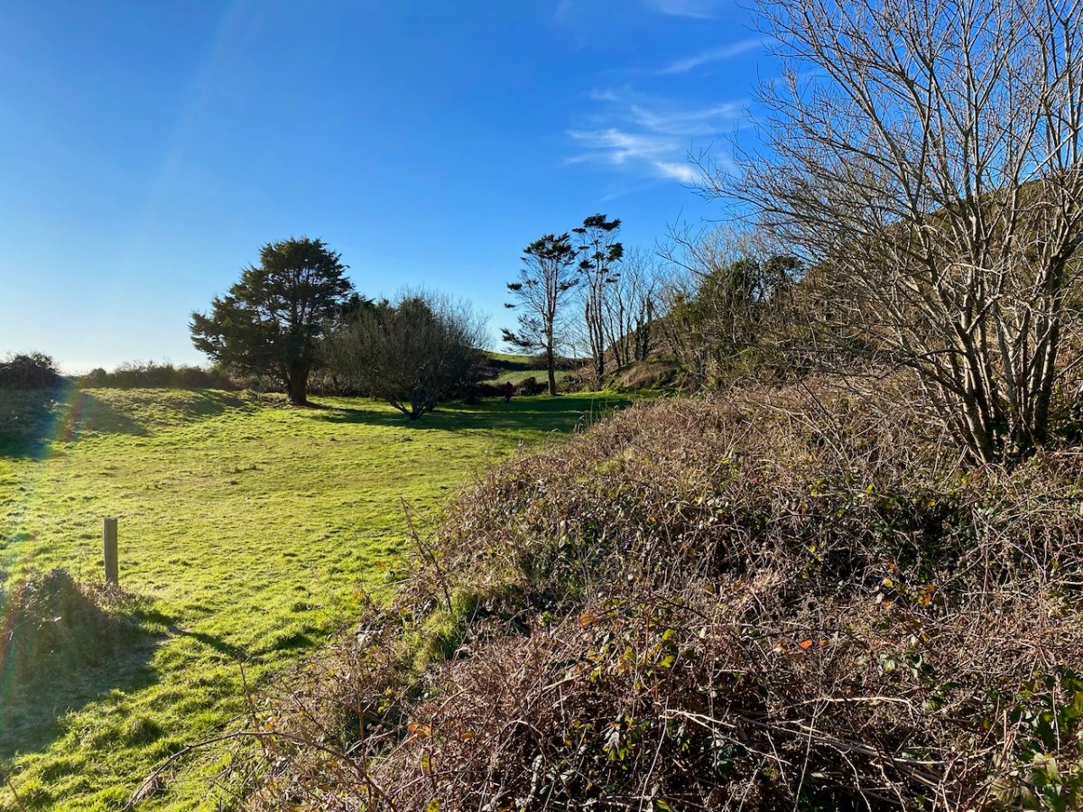
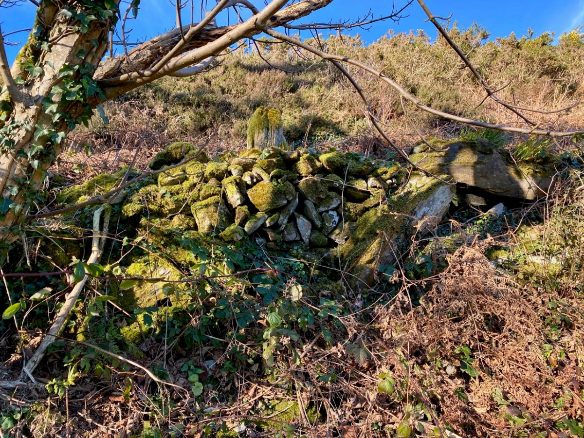
The prospect of unearthing ancient history sent us out into the field on an idyllic January day, under an almost surreal clear blue sky. We don’t exactly know what we found, but the expedition was rewarding, if only for the joy of walking through a beautiful country and knowing that other generations had walked here before us.

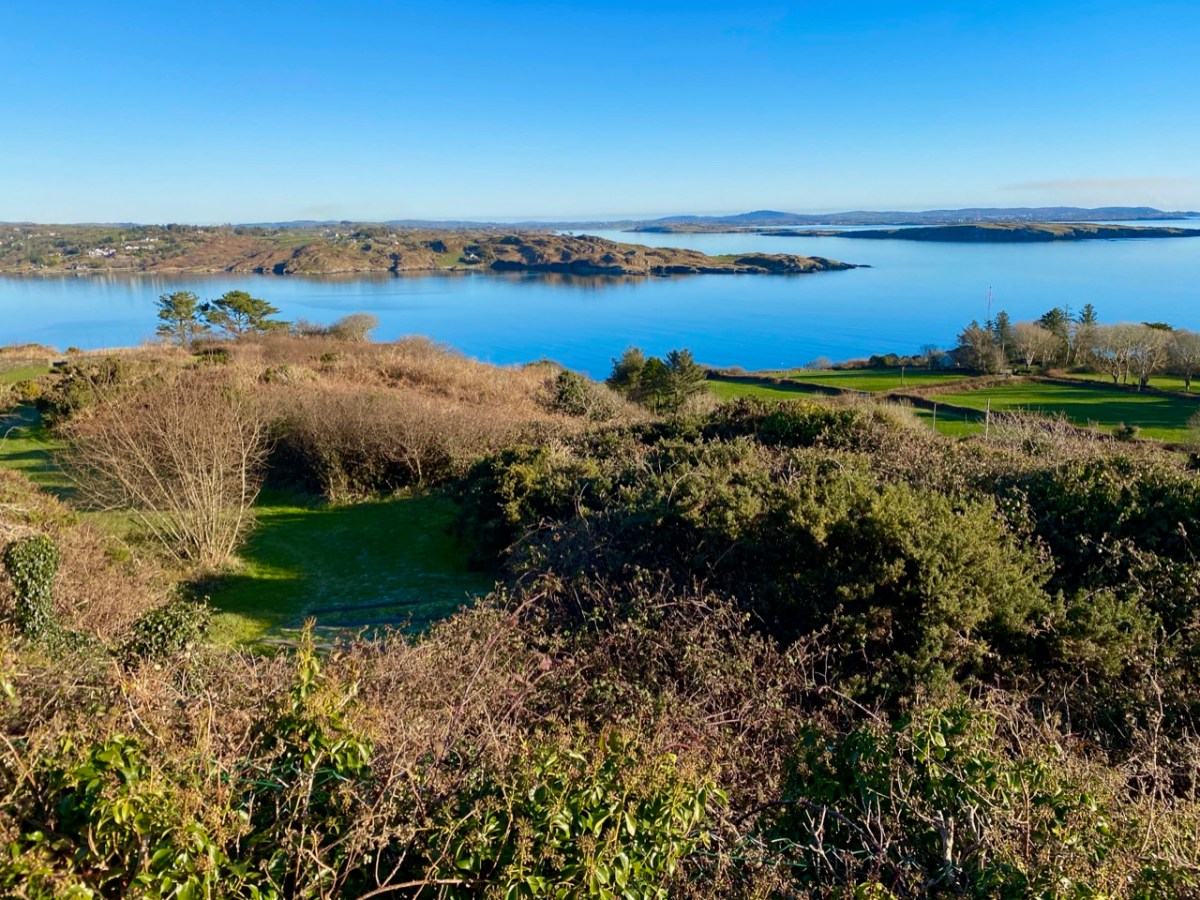
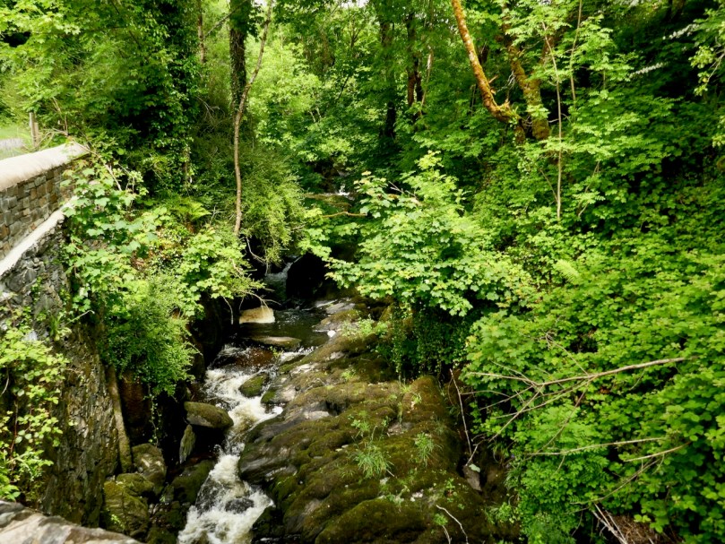
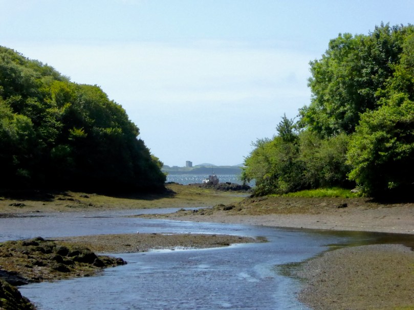
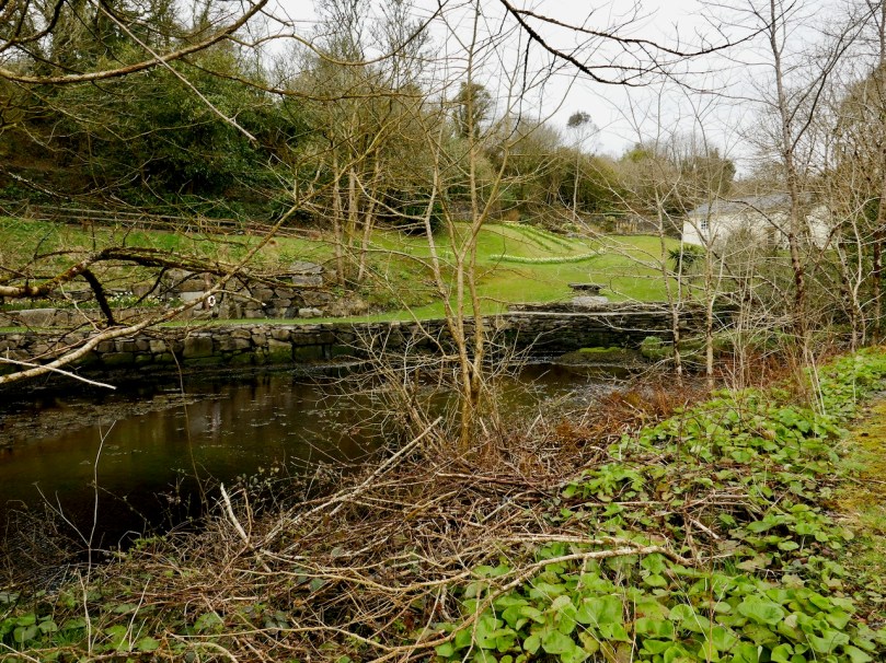
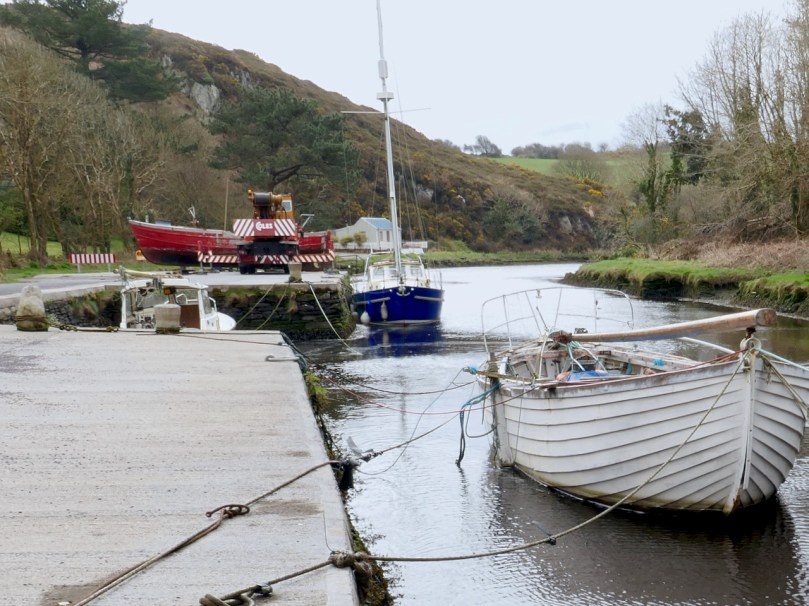
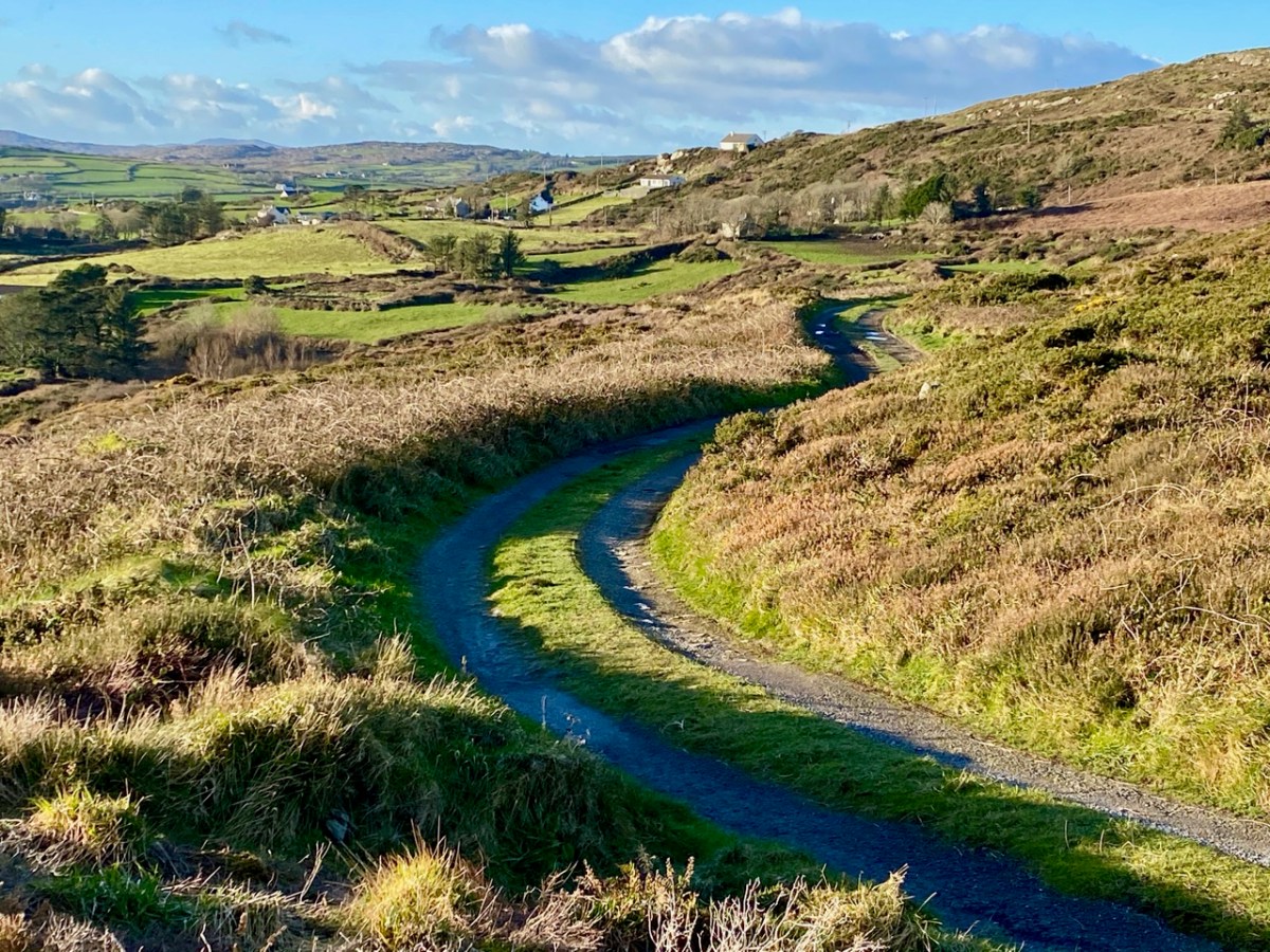
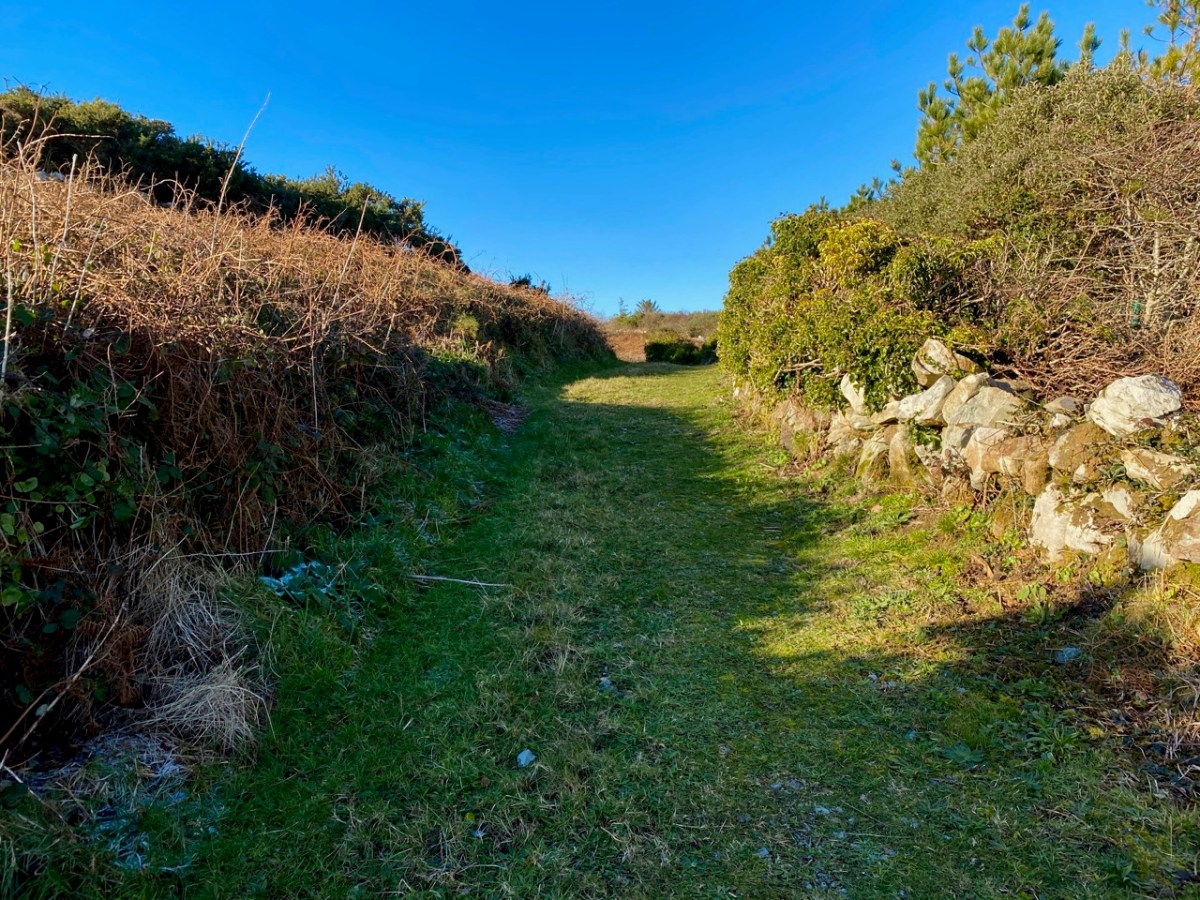
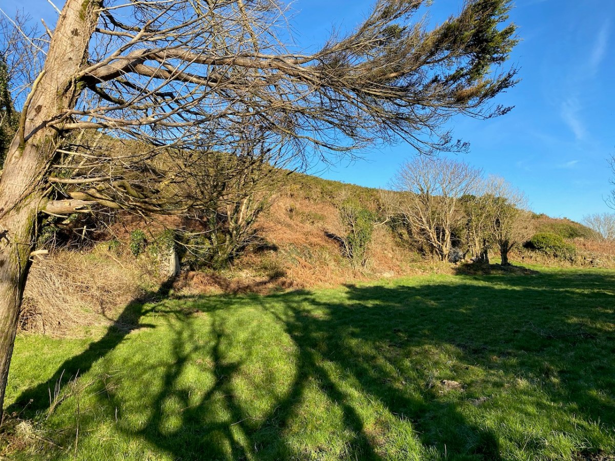
Always we were in sight of water, and the islands of the Bay beyond. We left the metalled boreen and found a narrow green path lined with old walls.

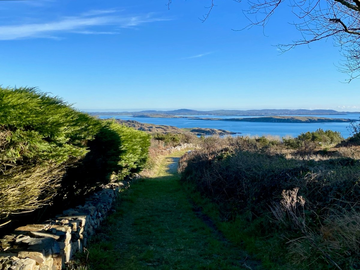
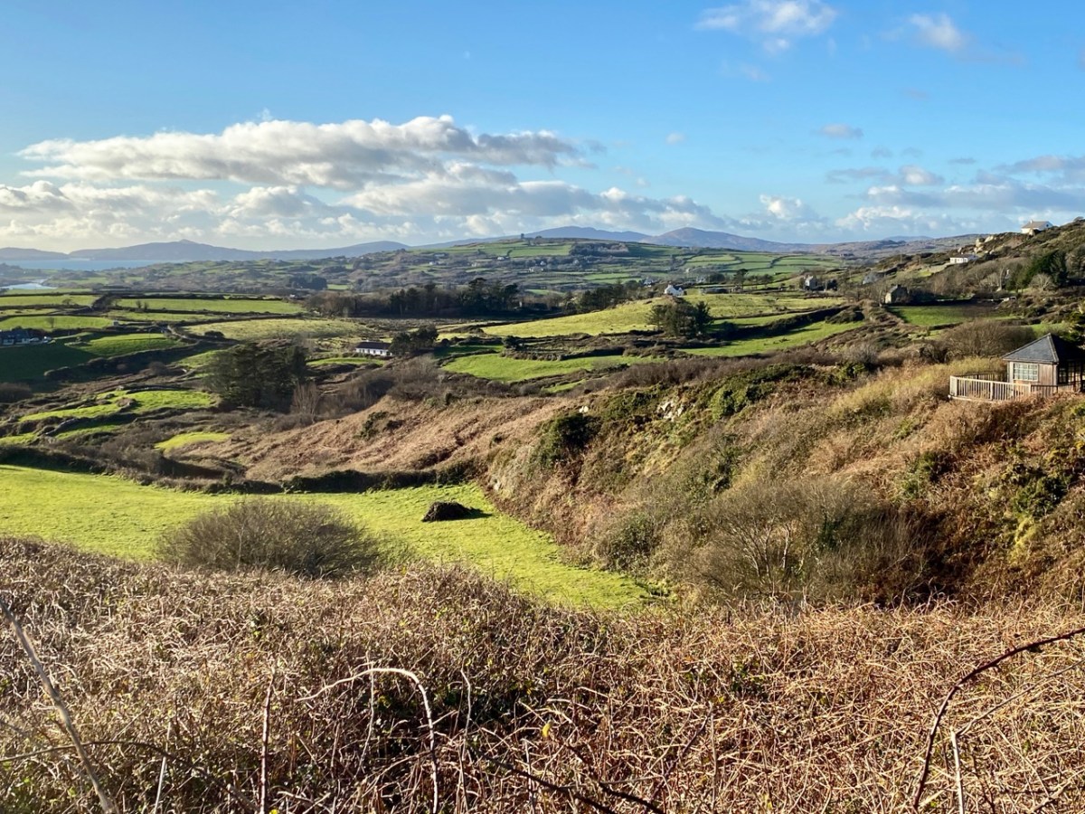
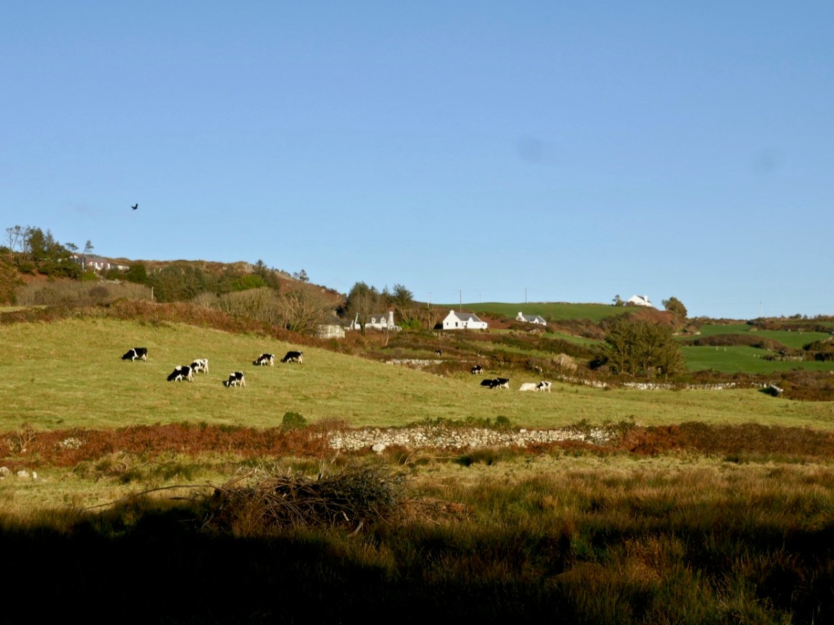
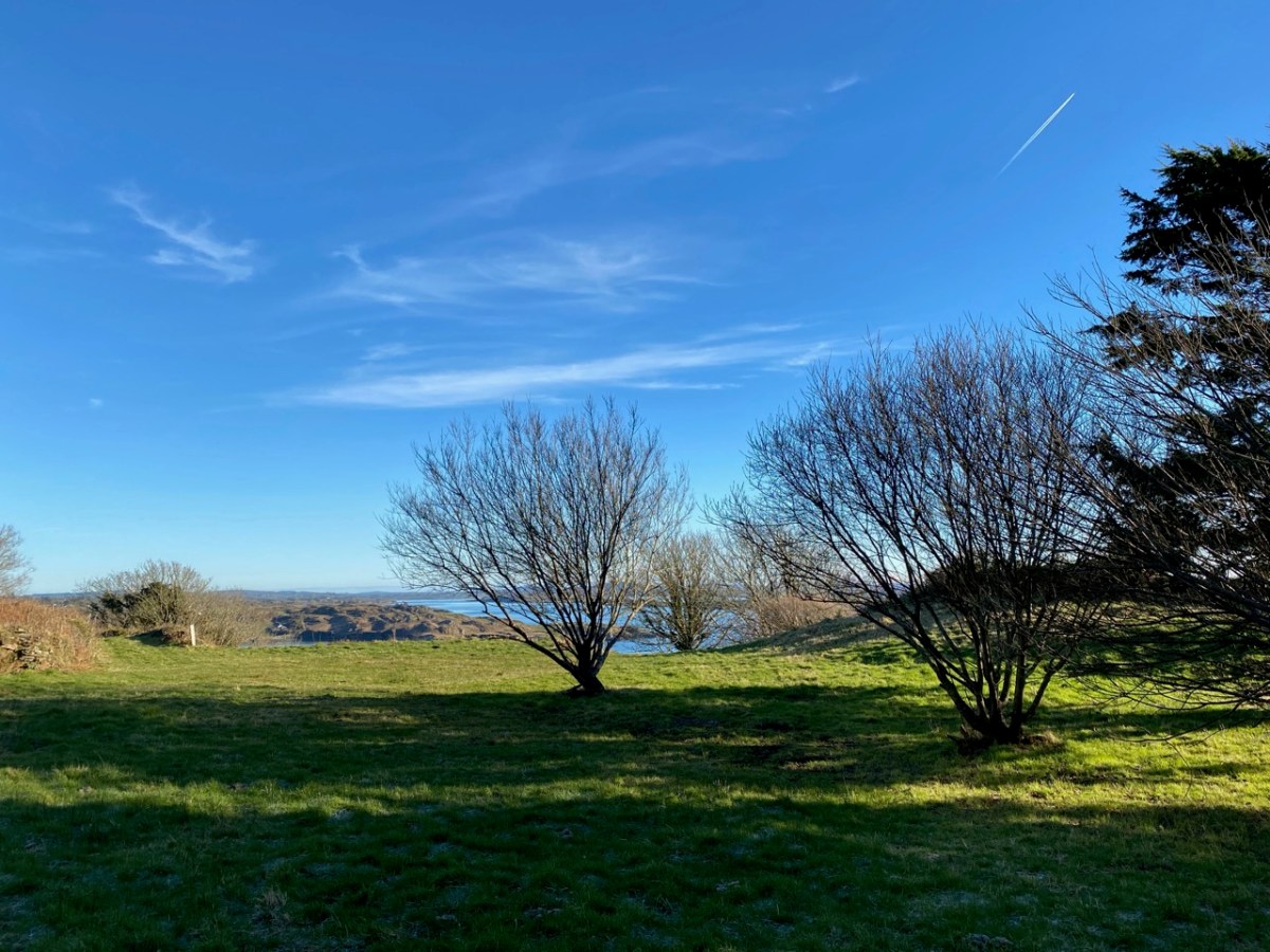
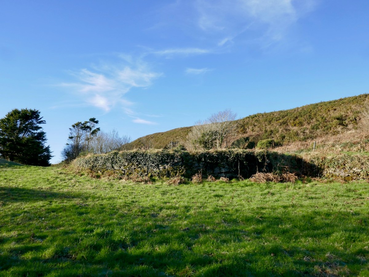
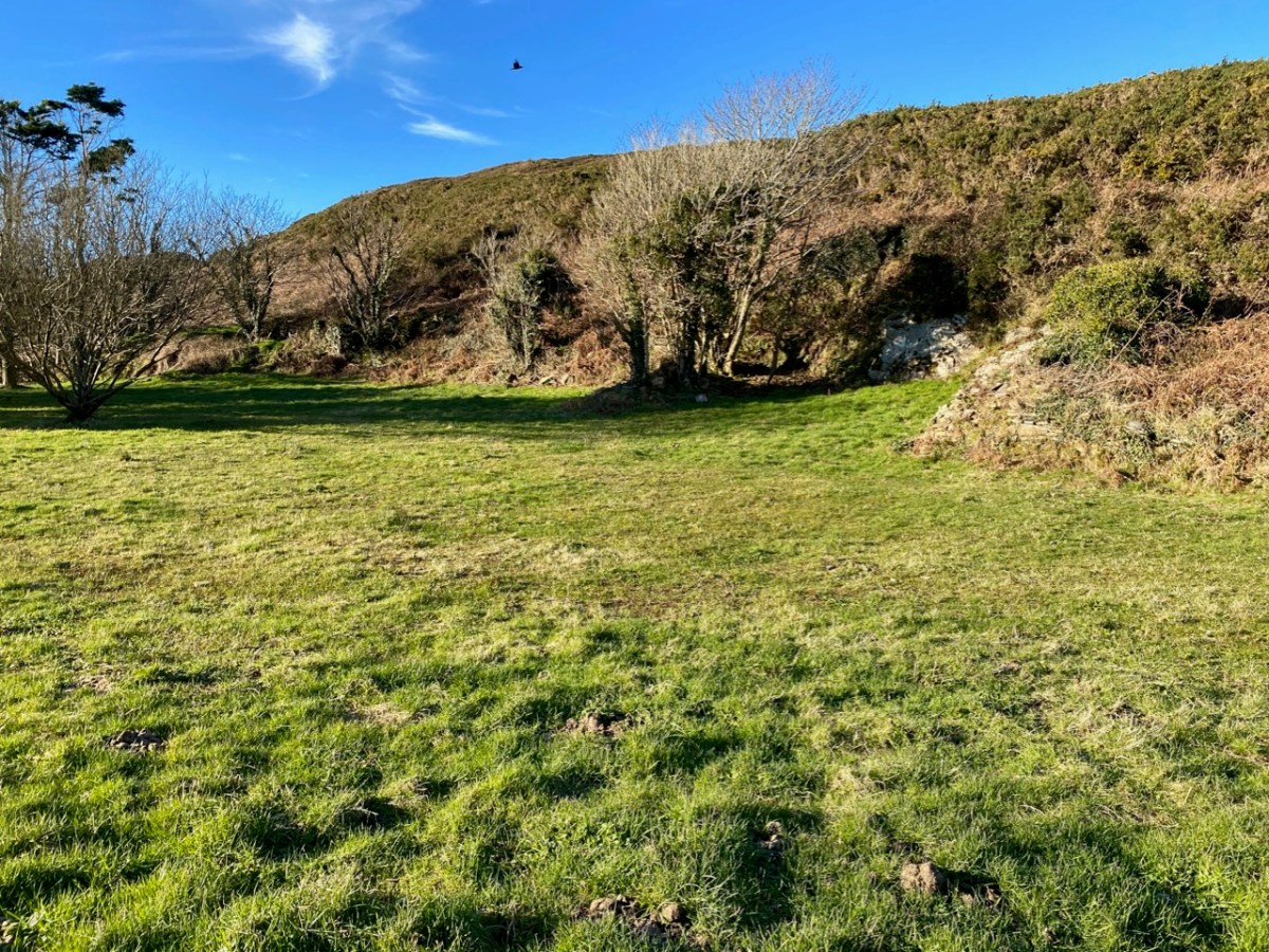
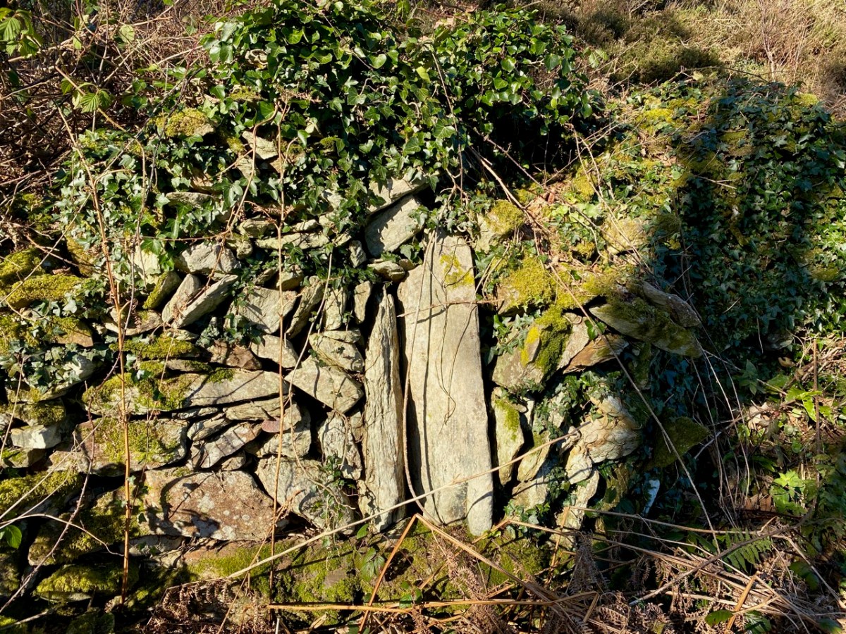
The path led to a sheltered paddock. We could clearly see the ‘level earthen platform-like area’ and the curved retaining wall supporting it: also, in several areas, there were the vestiges of old walls and probable structures. We immediately sensed the zeitgeist of a place which had tales to tell. Could it really be an early Christian settlement? Did the old stone walls echo the chanting of monks from long ago? Could we look through their eyes and see the grove of trees and the spectacular azure cast of the sea receding to the horizon across all the islands as they had?

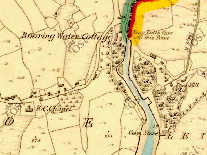
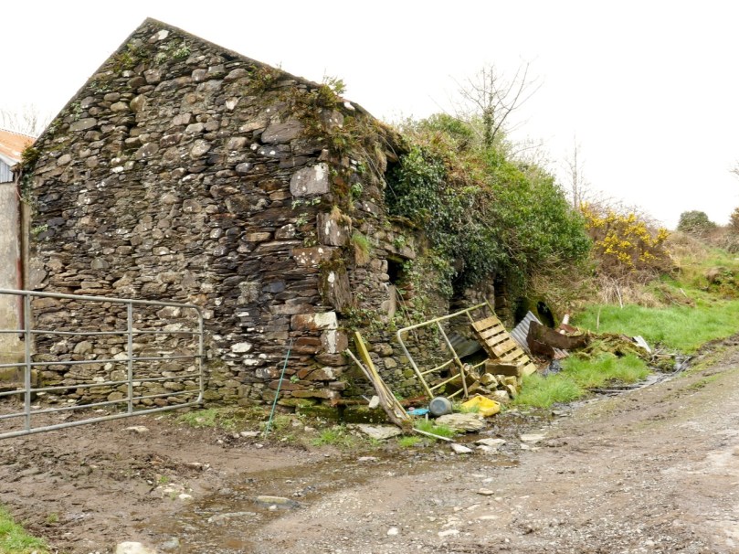
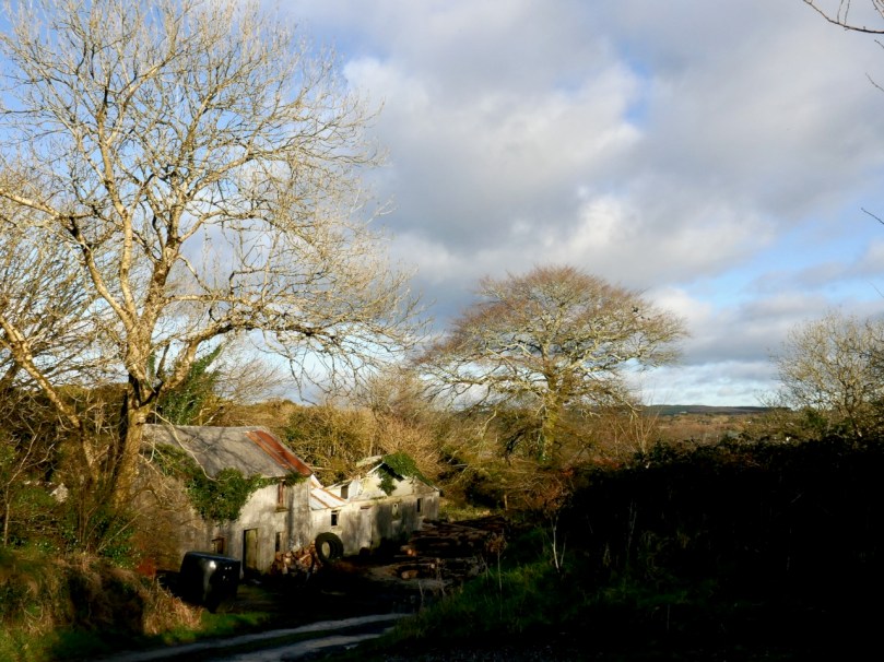
The Historic 6″ Ordnance Survey map is the earliest record we have of what existed on the site: it dates, at the latest, from around 1840. There are buildings clearly shown. Could they have been simple farm cottages and barns? Might those buildings perhaps have incorporated much earlier structures?

There you have it: a creation tale (myth, perhaps) for Schull. I will give the last word to a pupil from ‘Skull School’, recorded in the 1930s:

The O’Mahony’s had a stronghold in Castle Island, which is known as the Middle Island. It is situated about three miles from the beautiful village of Schull, which lies by the harbour of the same name. Situated amid picturesque and varied scenery, nestling at the foot of Gabriel’s rough defiles, and fronting the wild Atlantic, it is a charming spot. It was anciently called Scoll Muire (B.V. Mary’s School) and in mediaeval documents it is designated “Sancta Maria de Scholia.” This school is said to have been founded by the “Universitie of Rosse, St.Fachtna’s Carbery”. However this may be – I doubt it – the parish is mentioned as Scol in the Papal Letters of Pope Innocent III. (1199 A.D.). Canon O’Mahony says its site has been identified in south Schull. At all events, Ardmanagh (Monks Hill), on which part of Schull is built, attests the presence of cenobites in the district . . .

Brighid Ní Choithir – Skull School – Dúchas Schools Folkore Collection 1937

Please note that the ‘Sancta Maria Scala’ site is on private land, and permission to visit should be sought.

Walking West Cork – Half the Colla Loop!

The first post of 2021…

I never expected to live in plague-ridden times, but that’s where we find ourselves – at the start of a new year. And – because of the plague – our travels are restricted once again. On the very last day of 2020, keeping things as local as possible, we hastened to Schull and explored half of the Colla Loop on the Fastnet Trails.

We started at the Trailhead by the pier at Colla (header picture). I have drawn our route as a dotted red line on the aerial view, above: we walked ‘widdershins’ – anti-clockwise. You will find the whole of the Colla Loop on the leaflet here. The full trail from Schull and back is 9km: by my calculation our own version carried us a mere 4km: there was a lot of uphill, though, and it was very satisfying with great views to the south, over Long Island Sound, and then to the west: it’s always good to be following the setting sun.

Colla had been taken over by a swan family, who wished us well on our journey. Their sentiment was echoed by some four-legged friends on the steep way up the hill:

As we left the small boreen, following a green path through a signed gate, we began a climb which opened up a panorama behind us, encompassing Long Island and Cape Clear. The day was perfect, a few scudding clouds giving perspective to a a vivid blue sky which seemed to have been borrowed from the summer:

In fact, the views in every direction get even more rewarding as this walk progresses: we were surprised that we had never ‘discovered’ this little corner of West Cork before! Every rise, and each bend in the track, opens up a new prospect.

A ‘telephoto’ view towards the end of the Mizen (above) reveals the inlet of Croagh Bay in the foreground, with Crookhaven beyond. You can just make out the top of ‘Black Castle’ at Castlepoint in the centre of the picture and a Napoleonic-era signal tower at the summit of the highest ground at Brow Head.

At the highest point of the walk we are back on a partly metalled boreen. I was particularly keen to find the site of . . . the ancient school of Sancta Maria de Scholia, ‘a place known in early times as a centre of learning’. . . which is indicated on the Archaeological Monuments Survey just to the right of the bend in the trackway, above. However, this record has been superseded by another site further to the west (indicated with a question mark on my aerial view) where it is noted:

. . . In rough grazing, on a S-facing slope overlooking Long Island to the S and Skull Harbour to the E. Recent reclamation work exposed a level earthen platform-like area faced externally on its curving S side by a roughly constructed drystone revetment. According to local information, this is the site of Scoil Mhuire or Sancta Maria de Scala, a medieval church and school that gave its name to this townland and to Skull village . . .

National Monuments Record 2009 – CO148-040

I suppose we can make up our own minds as to which of these two sites claiming to have given Schull its name is the most likely candidate. If it’s about having a good view, for me it has to be the first.

As shadows lengthen, a trail marker (above) tells us we have been walking on Coffin Hill. I can find no specific reference to this name and can only assume it was the route used to reach the burial ground just outside Schull village when coming from settlements to the north.

From the high ground we had clear views of Schull set below Mount Gabriel (upper picture); our route turned west along the ridge and followed the sun. We wanted the idyll to go on forever . . .

The road began to descend, and we found ourselves approaching a neighbourhood of scattered houses that heralded the way back to Colla. On our half-a-trail we passed half an abandoned house: the other half still shows signs of occupation:

We could not have celebrated the close of such a momentous year in a better way! We are determined to rise to the challenge of the restrictions we are currently faced with and discover all of our beautiful byways. We are so fortunate to live in this wonderful land, and we look forward to heading out with you on many more voyages during 2021!

Merchant, Miller, Smuggler: James O’Sullivan and Roaring Water

If you park your car at Kilcoe Church, at Meen Bridge on the N71 between Skibbereen and Ballydehob, and walk straight south, you arrive at a picturesque pier – a quiet backwater of leafy boreens. This is the outlet for the Roaring Water River (yes, that’s how the river is spelled on the OS maps), which rises on the southern slopes of Mount Kidd, a bare 6km away. Despite the short distance, this little river is a notable torrent by the time it reaches the sea, and it is said that the noise it made as it rushed over the rocks and weirs in its last stretch gave its name not only to the river but also to Roaringwater Bay (and yes, that’s how the Bay is spelled on the OS maps). 

Your walking route from Kilcoe Church to the pier takes you along the river. Here and there are perilous but satisfying opportunities to hop over a wall, hang on to branches and lean out to see over the river. This is a marvellous stretch of road in spring and early summer, with the river full on and hosting a riot of Marsh-marigold, and the banks heady with Whitethorn and Guelder-rose.

Eventually, you arrive at the final bridge – an interesting single span with a high arch – and can walk down to the Pier. You’ll be lucky if you encounter another person here, a dog-walker perhaps, or somebody messing about in a boat. It’s an idyllic spot, with views down the narrow channel to the medieval castle of Rincolisky (or Whitehall) across the water.

But in the first half of the nineteenth century, this was a bustling place indeed, and most of that came down to the the vision and energy of one man, James O’Sullivan. His house is still at the head of the inlet, still lived in and lovingly maintained. The quays he built for his various enterprises have stood the test of time and are as straight and sturdy as they were in their heyday.

No longer here are the industrial buildings that once marked this place as an active centre of industry and commerce. On the 1840s OS maps you can see them – there’s a Tuck Mill (used in wool processing) and a Corn Store. An historic account refers to a large building beside O’Sullivan’s house used to store potatoes until they were ready for export. There’s a slate quarry over to the east and a small village to the west. In addition the Archaeological Survey uncovered a metal working site on the rising east bank beside the quay, and a lime kiln at the edge of the water on the west bank. 

That little ‘village’? You can clearly see it as a cluster of buildings on the old maps, although there’s nothing there now you would call a community. But if you look hard, some traces are still visible. The old Catholic church became unfit for purpose by the end of the nineteenth century and was replaced by the splendid Church of the Most Holy Rosary (where you left your car). But it’s still a place of reverence for local people, having been repurposed as a grotto and a place for quiet contemplation and prayer – new Stations of the Cross were unveiled here as recently as 2018. It’s also a Cillín (pronounced killeen), a place where unbaptised children were buried – see this post for more on that.

There were two schools here, a boys’ and a girls’, and the boys’ school can still be seen in ruins along the road (below). By the 1840s they had both been replaced by a new school up by Meen Bridge – it, or its successor, is still there. There was a shop here once, no longer in use except for storage and partly ruined, and several houses only one of which remains. It is estimated that up to 200 people may have worked here. 

Who was James O’Sullivan? for all the information that follows I am indebted to a piece by Timothy Cadogan in the Seanchas Cairbre (a now-defunct publication) for 1993. Born around 1758, he was from the area and appeared to have engaged, by his own admission, in some lucrative smuggling in his younger days, mostly tobacco but “he could give you a bottle of good cognac”. After a crackdown, he turned to more legitimate businesses, perhaps funded by his earlier nefarious dealings. He was by no means alone in the smuggling trade – many a local gentleman had a hand in it too.

Turning to commerce, he operated both a corn mill and a tuck mill (the latter marked on the OS map). Both were overshot mills (see illustration below), in which the wheel was fed by a mill stream which diverted water from the Roaring Water River. The corn was stored in a large building on the quay (more or less where the small corrugated house is now, see image above) and shipped to Cork and Dublin. He had his own ships for this purpose and a storehouse in both cities.

Part of the Overshot Mill at Aberdulais 1786 or 1800 Philip James De Loutherbourg 1740-1812 Accepted by the nation as part of the Turner Bequest 1856 http://www.tate.org.uk/art/work/D36368

Timothy Cadogan points out that O’Sullivan played an active role in the politics of the time, “as might be expected from the most prominent Catholic in Aughadown and Kilcoe”. He chaired, for example, the great Anti-Tithe meeting in Skibbereen in 1832 – you can read more about that movement, and that meeting, in this post. The image below is of a tithe collector, called a Proctor, extracting his dues.

James O’Sullivan died between 1837-39. He had been married twice, first to Ellen Fitzgerald and after her death in 1826 to Ellen Coleman. No record has been left of any children, and indeed his great enterprises failed to survive his death, although copper mining was subsequently carried out in the vicinity with no great success. The building below was a later shop, across from the old church.

Perhaps though, if you linger a while on the Quay and close your eyes, you can hear the shouts of those loading corn, the sheets slapping against the masts in the wind, the rumble of barrels coming down the road to the waiting ships – maybe even make out, in your mind’s eye, a skiff silently slipping into the inlet loaded with an ‘irregular’ cargo to be delivered under cover of darkness.