Caheragh Explorer

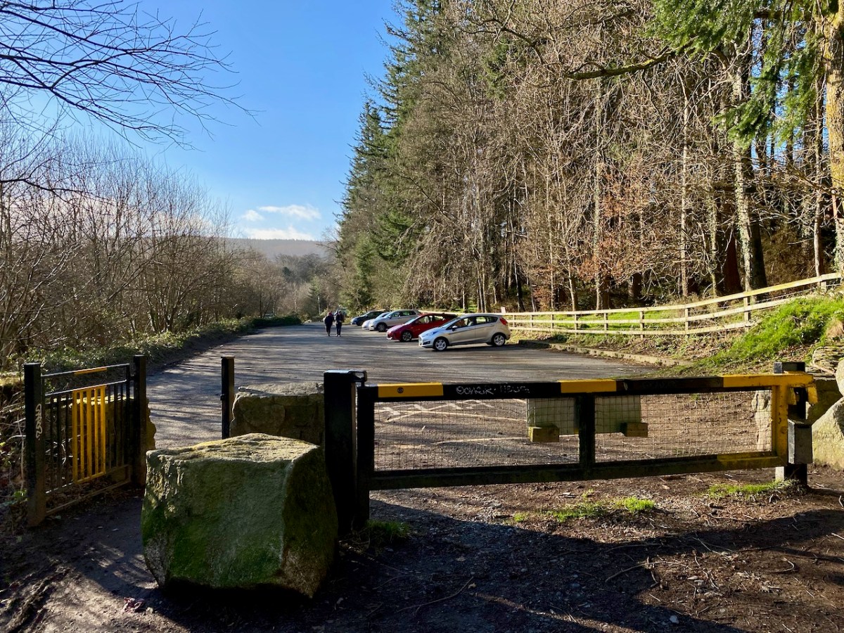
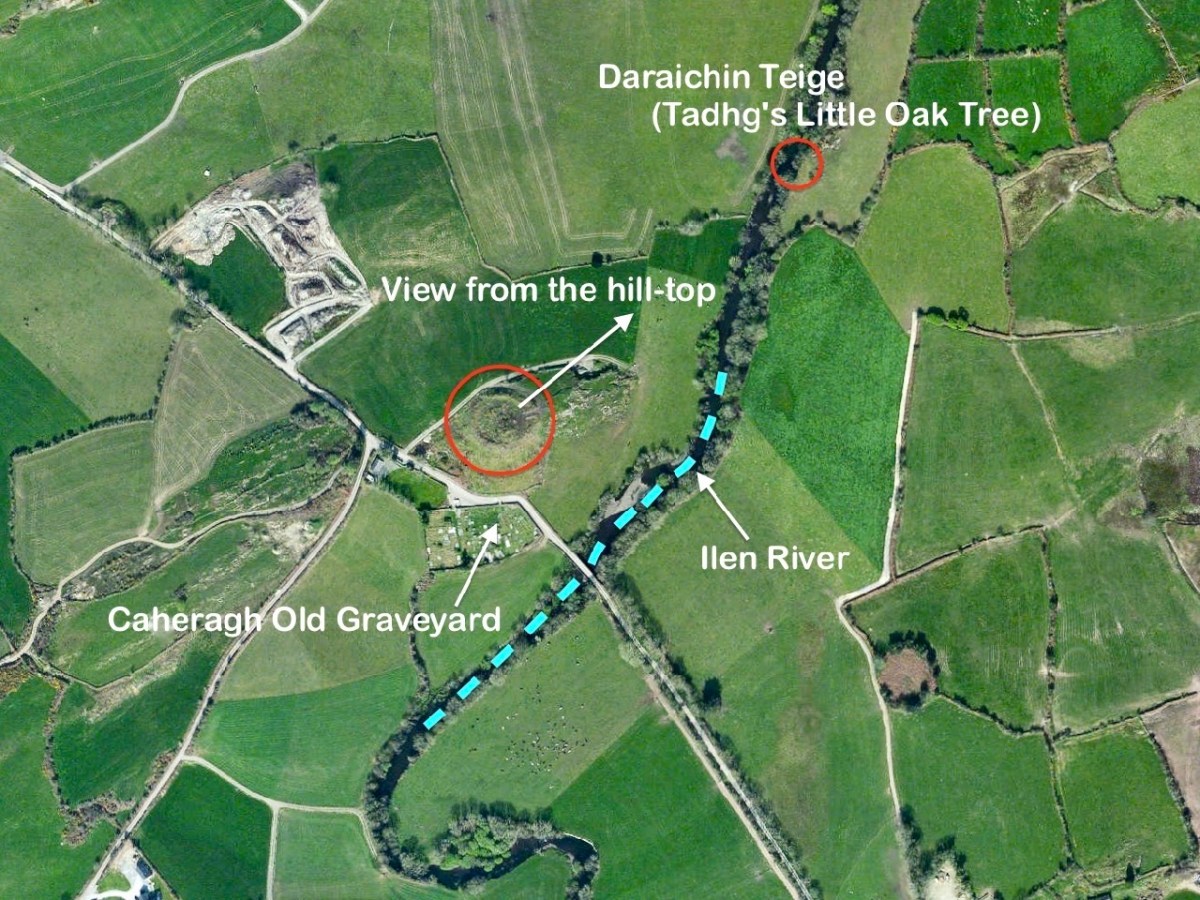
I’ll explain at the outset that Caheragh is (more or less) pronounced ‘corer’ (as in coring apples)! It’s a parish in West Cork that we have visited before. Have a look at my article on the Ilen River, here. This locality is brimming over with history and we go exploring as often as possible: there is always more to find. And – with wide views and cloud scapes in all directions from the high ground – it’s an uplifting place, especially when blessed with the August sun.

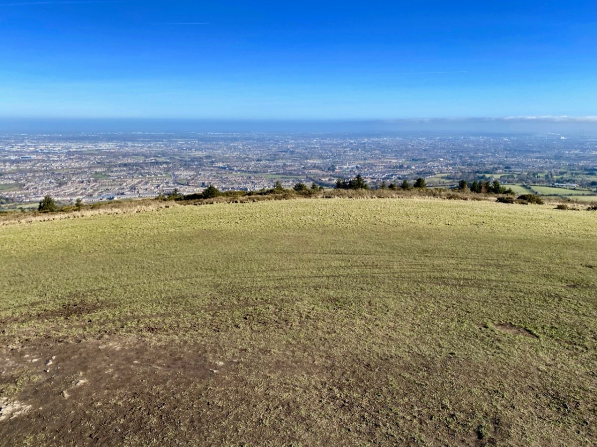
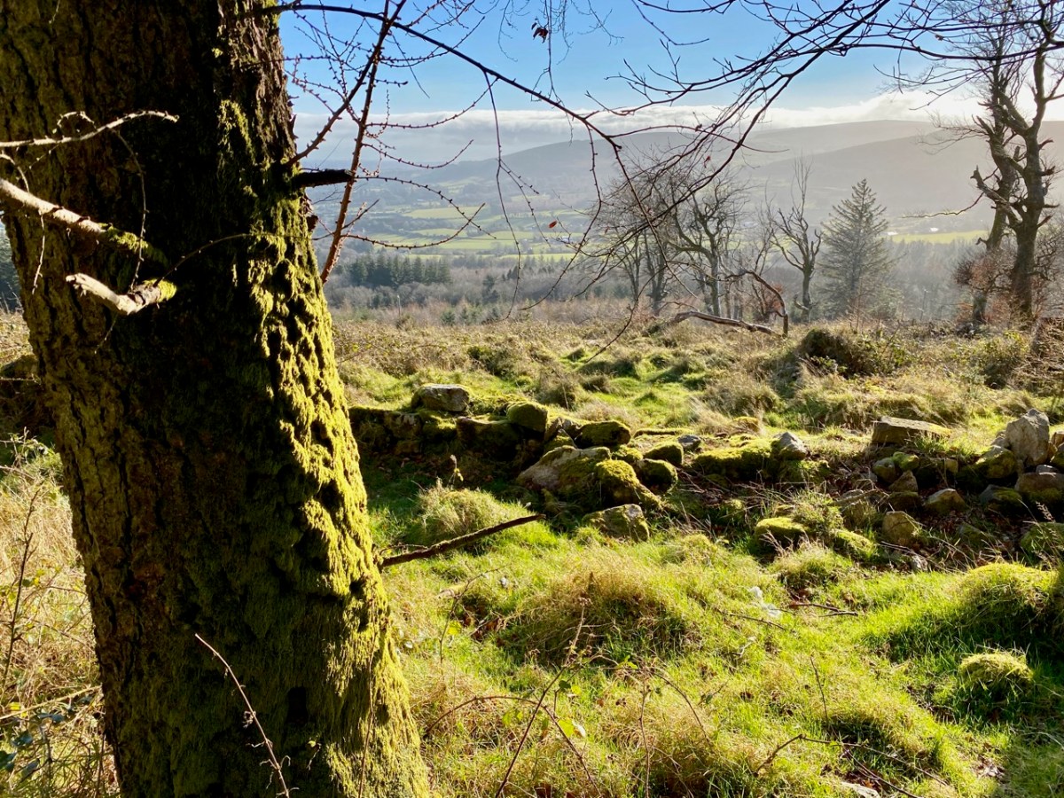
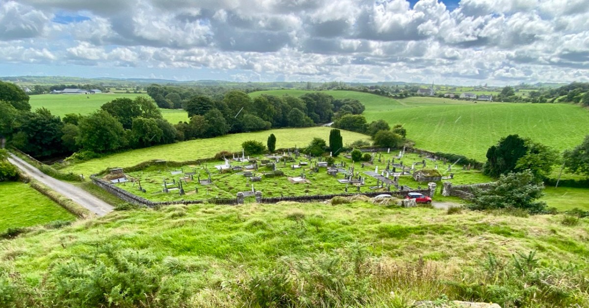
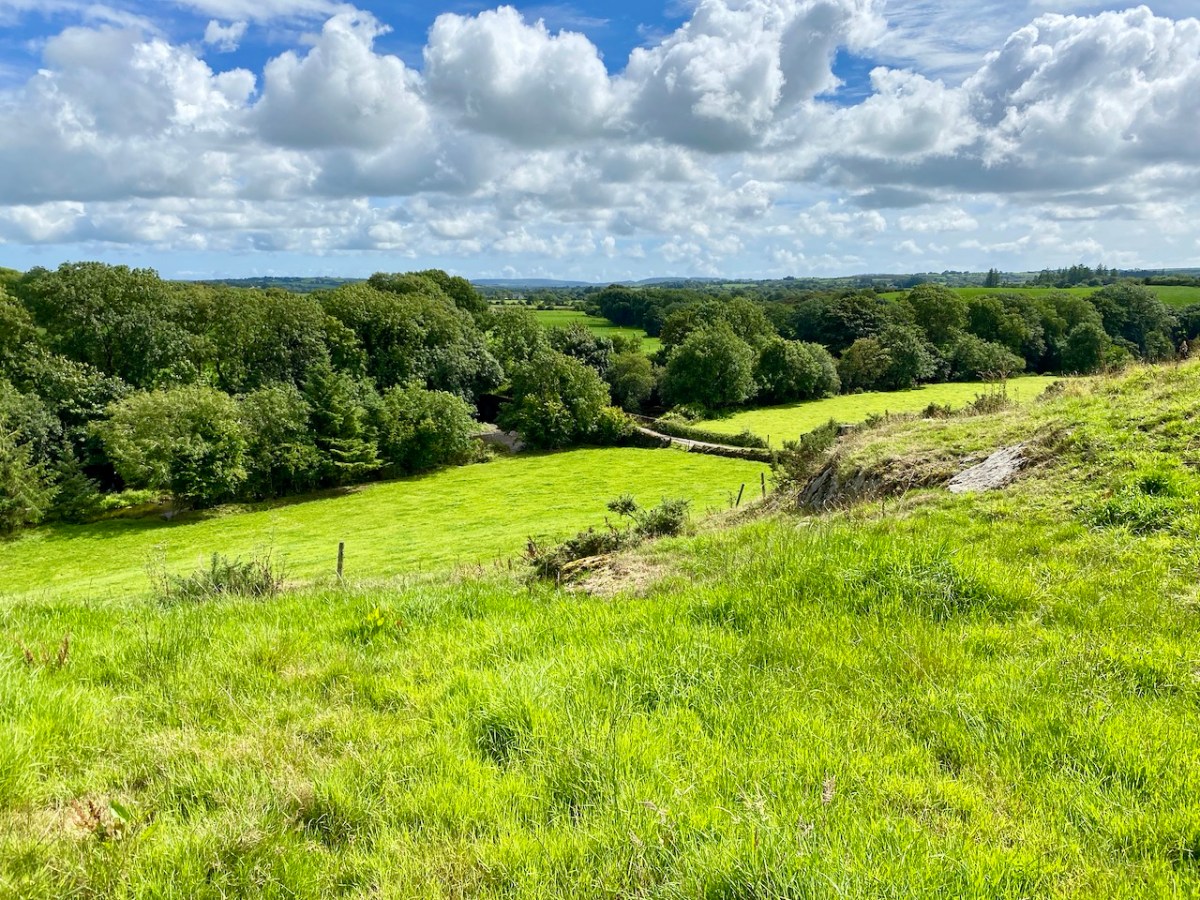
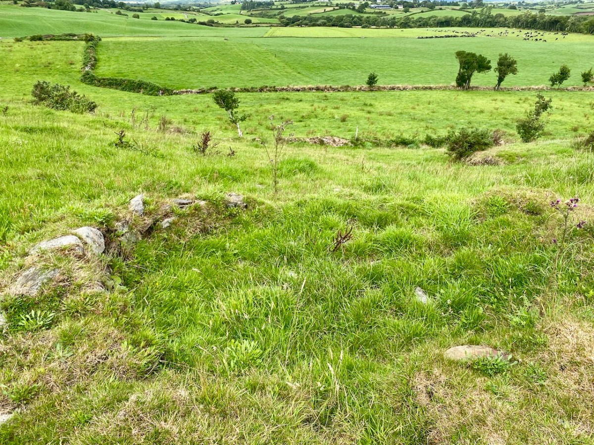
Here’s a vista to the north-east, from the top of the mound beside the graveyard that might just be a ring-fort, or possibly the site of a monastic centre dating from medieval times – more on that later. In the middle distance is the Ilen River with its wooded banks, heading out towards Castle Donovan and – eventually – to its source on Mullaghmesha (or, perhaps, Nowen Hill – we have yet to determine exactly where it rises. This post from the Sweet Ilen series covers the area). And that Donovan castle itself graces the cover of the latest Skibbereen Historical Journal (Volume 18, 2022), which you can get in bookshops locally, or online here. You will find a summary of some of my research on the Ilen River in this journal, together with many other fascinating and erudite articles.

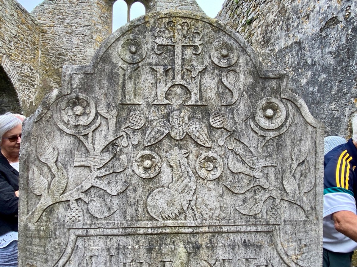
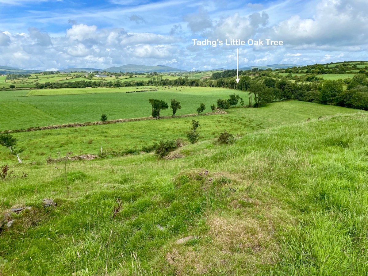
But, going back to that sunlit vista, you’ll notice Tadhg’s Little Oak Tree is indicated. I can’t resist quoting the story of this feature that appears as a ‘Redundant Record’ in the Historic Environment Viewer:

. . . On E bank of River Ilen. Site of tree, ‘Darriheen Teige’ or ‘Daraichin Teige’ (Tadhg’s little oak tree), where Tadhg O’Donovan, chieftain of Clan Cahill, was slain c 1560 by rival group of O’Donovan’s (O’Donoghue 1986, 55). Nearby is Poll a’ Daraichin (pool of the little oak) . . .

Archaeology.ie Historic Environment Viewer – Record CO132-066

Well, it seems strange that the ‘site of a tree’ is a recorded monument. In fact, if the oak was still flourishing (we couldn’t find it), it would probably be just one of only a few trees included in Ireland’s vast record of archaeological monuments!

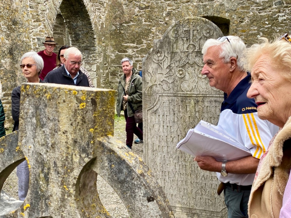
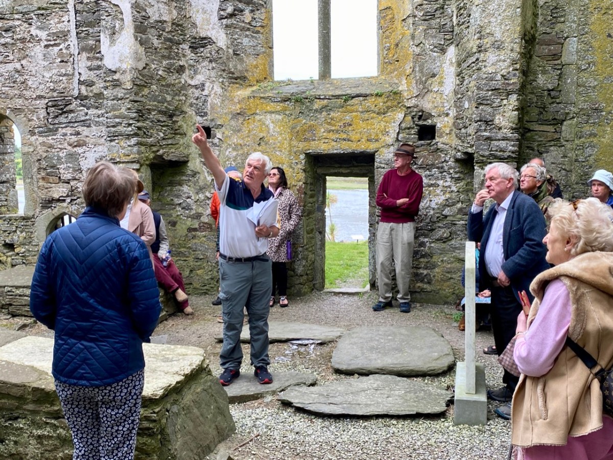
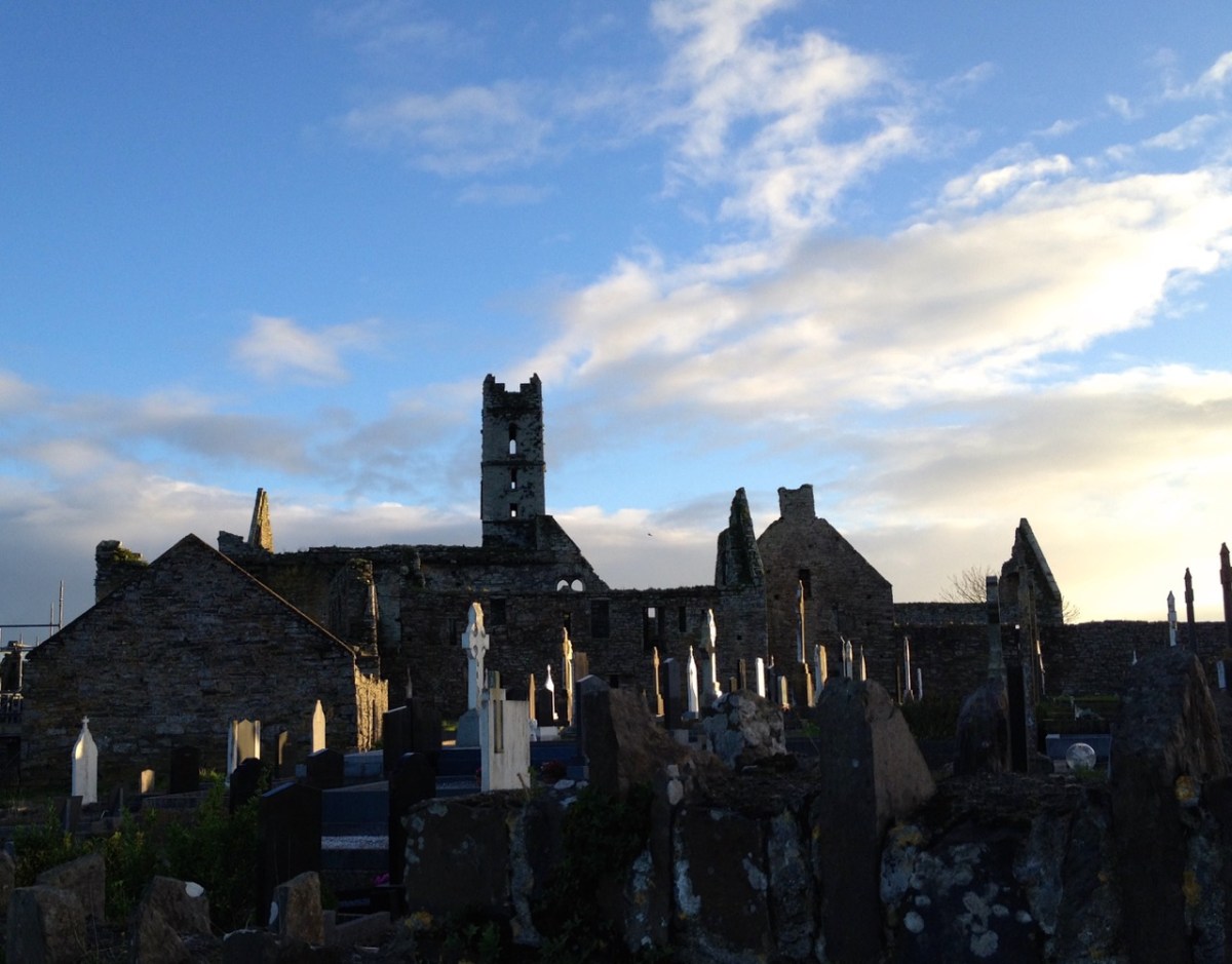
For today’s post I am indebted to our historian friend Pat Crowley, who directed us to a clip from The Southern Star newspaper dated January 12, 1929. It was a letter written to the newspaper by Captain Francis O’Neill, retired Chief of Police in Chicago and well-known prolific collector of traditional Irish music. O’Neill (1848-1936) was raised in his family home at Tralibane, in the parish of Caheragh. He has been mentioned in this journal, and I was fascinated to read his letter, which became a protracted discussion on the parish, the old graveyard, historic sites and archaeology in the area.

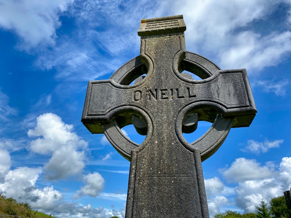
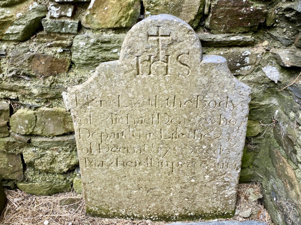
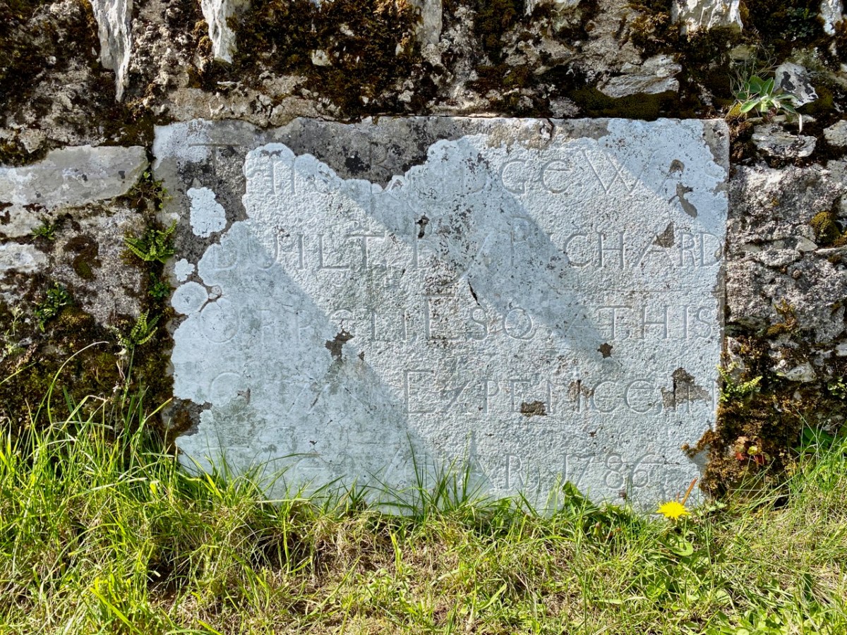
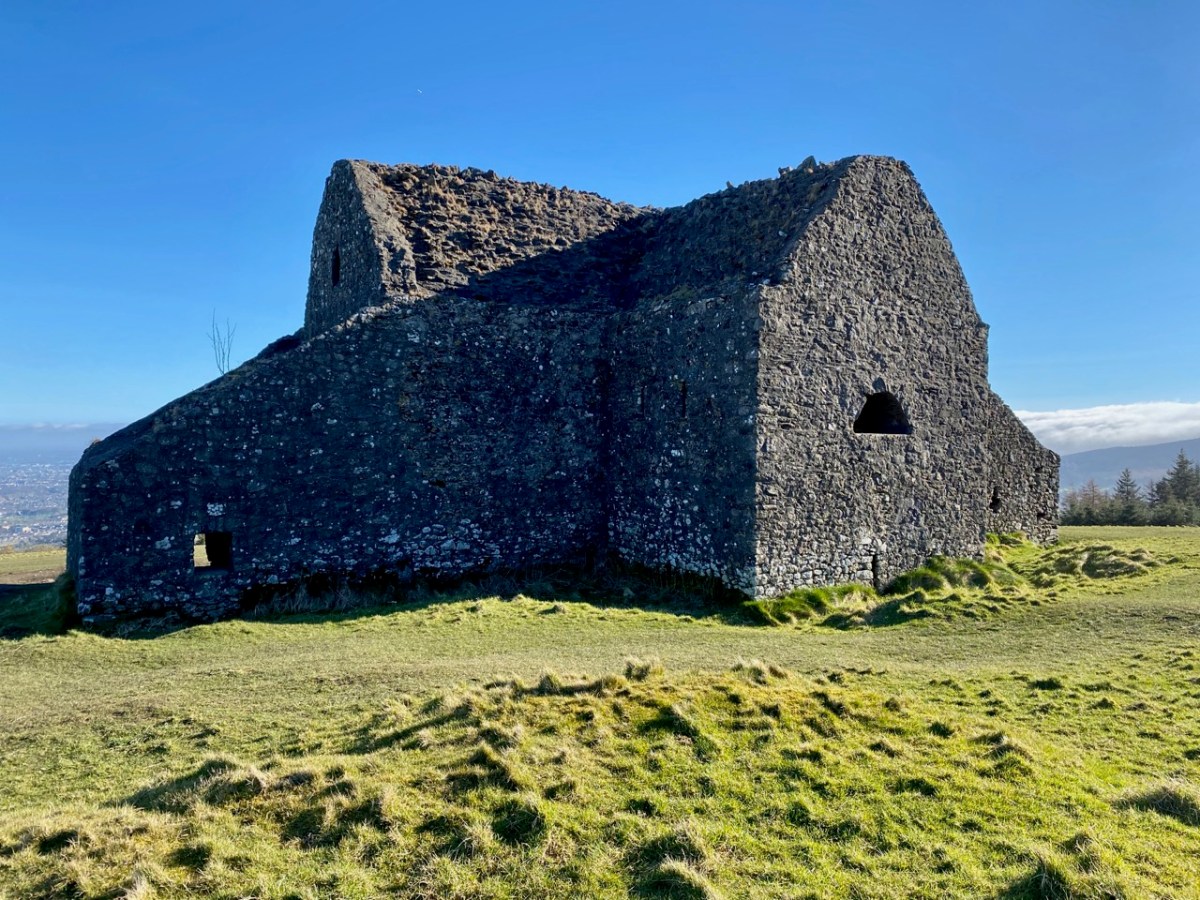
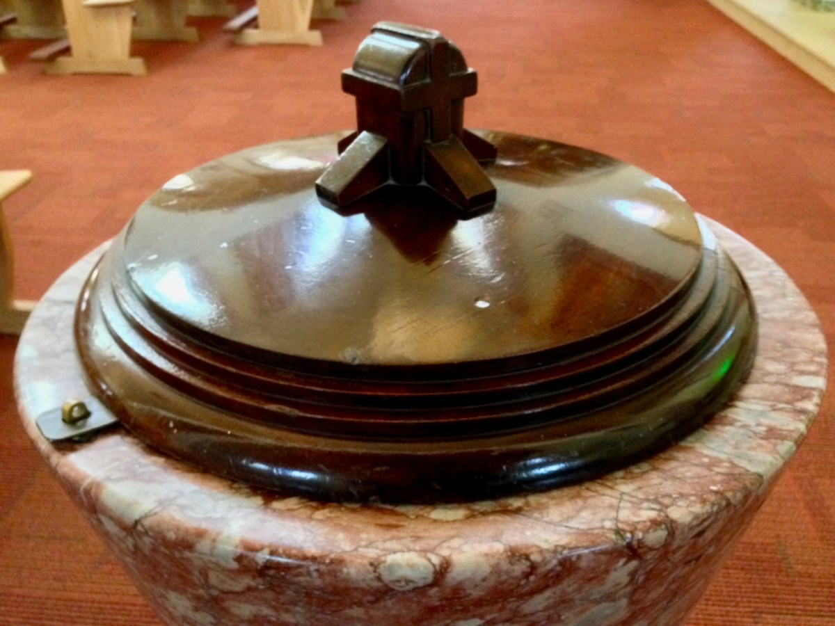
All this came about because Francis had returned from Chicago to West Cork in 1906 – after a long absence – ostensibly to visit the burial place of his parents, and to order a suitable monument to mark their graves (above).

. . . On my return to Ireland July 1906, after an absence of 41 years, I visited the bleak Caheragh graveyard, in which the remains of my parents, and O’Neill ancestors, were buried. There being nothing visible in the environment to indicate its origin as a cemetery, personal curiosity, abetted by that of the Downings of Tralibane – cousins of McCarthy Downing, MP – led to investigation . . . The result, somewhat disconnected and fragmentary, is herewith submitted for publication . . .

Southern Star 12.01.1929

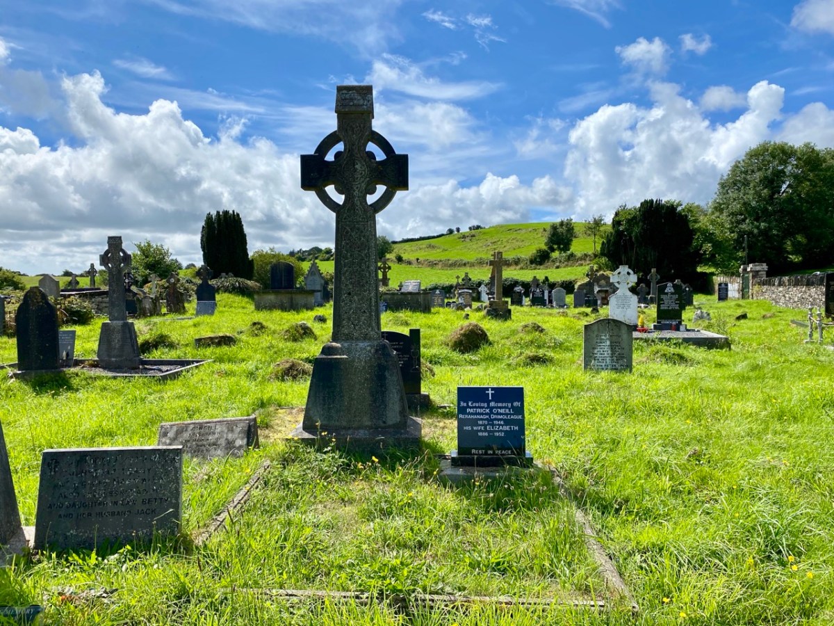
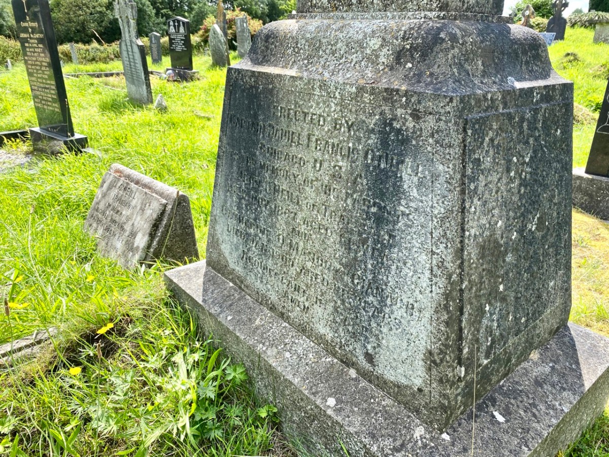
The O’Neill burial plot at Caheragh. Francis ordered the large cross to mark the graves of his parents. The inscription reads:

Erected By
Captain Daniel Francis O’Neill
Chicago USA
To the Memory of his Parents
John O’Neill of Tralibane
Died Nov 1867 Aged 66 Years
And
Catherine O’Mahoney (Cianach)
Died 1900 Aged 88 Years
Requiescant In Pace
Amen

Quoting again from Francis O’Neill’s letter to the Southern Star:

. . . All available authorities in my library have been consulted, and I find that references to the parish of Caheragh are both meagre and obscure… The earliest mention of this parish which has come to my notice, is in the report of Dive Downes, Episcopal Bishop of Cork and Ross, who made a trip on horseback to all parishes in his diocese in the years 1699 – 1702. Following is the entry: – “Caheragh Church, about two miles distant from Drommaleage Church to the SW lies close to the Island River (he means Ilen). On the west side of the river are 35.5 lowlands in this parish, of which 20 lie on the west side of the river, and 6.5 lie on the east side of the said river . . . There are about 12 Protestant families in this parish. ’Tis thought there are forty Papists for one Protestant in this parish . . . Will Gureheen, a very old man, is priest of this parish . . . The church is ruinous. The north side is down . . .”

Southern Star 12.01.1929

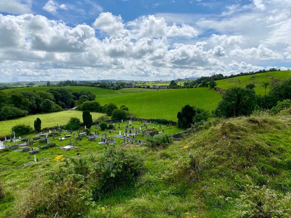
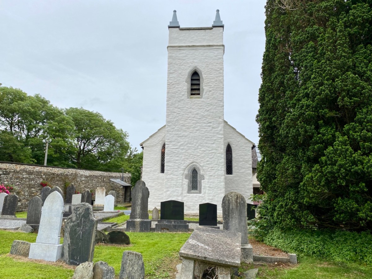
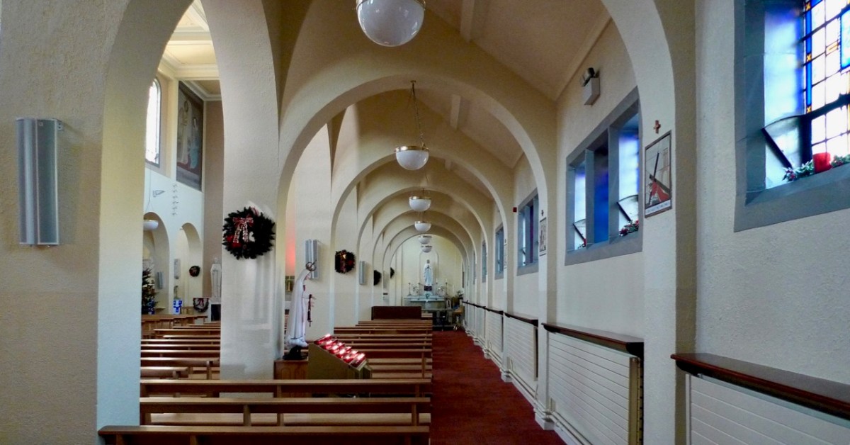
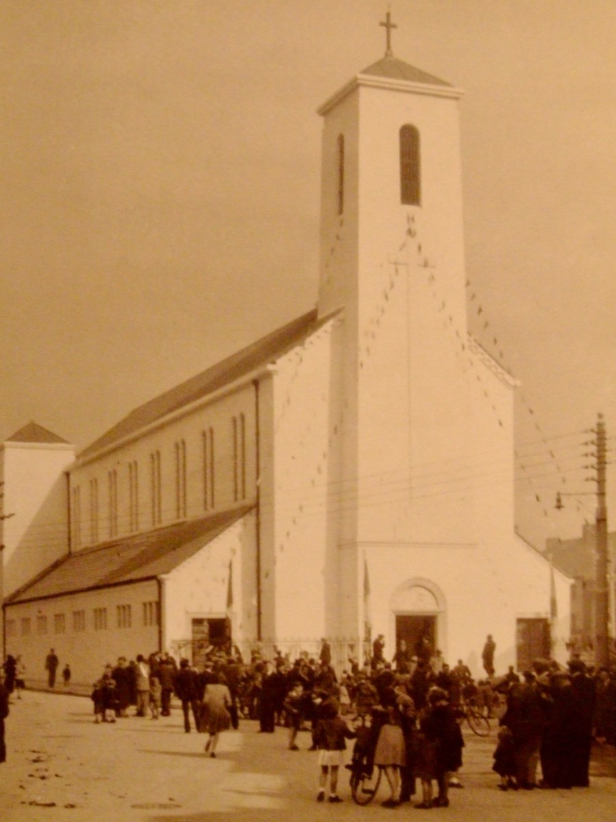
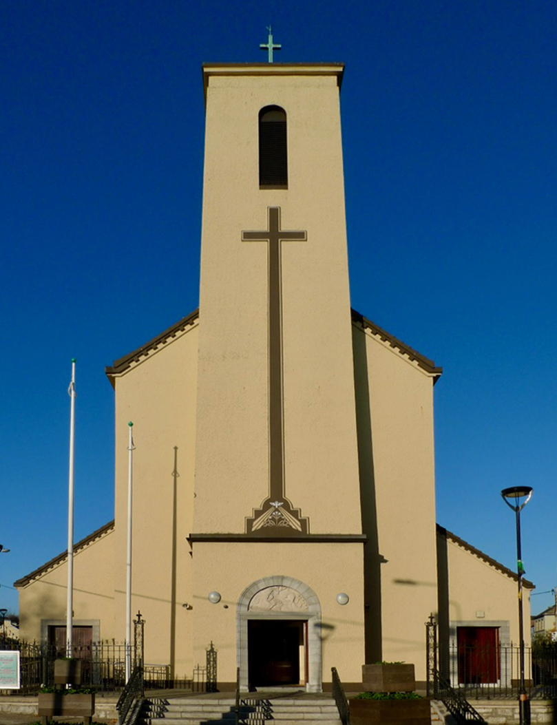
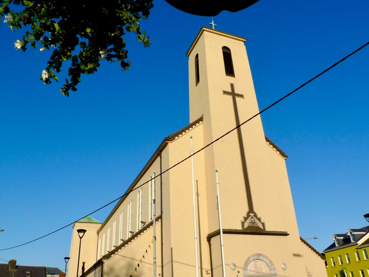
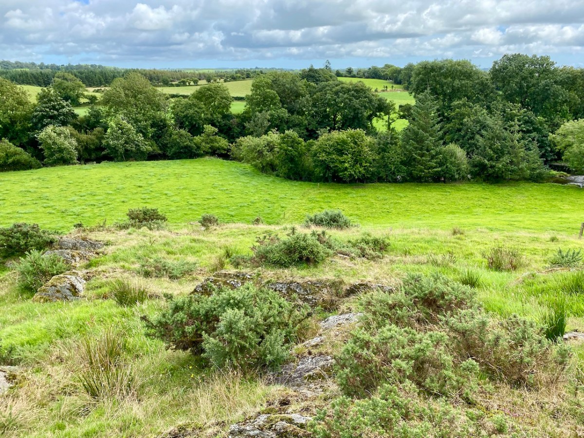
A vista to the west, from the top of the mound beside the graveyard. The present-day village of Caheragh is distant beyond the green pasture (a long way from this ‘Old Graveyard’ – why…?), identifiable through the spire of the 1963 Holy Family Church. O’Neill continues, now quoting from Samuel Lewis “A Topographical Dictionary of Ireland” published in London in 1837:

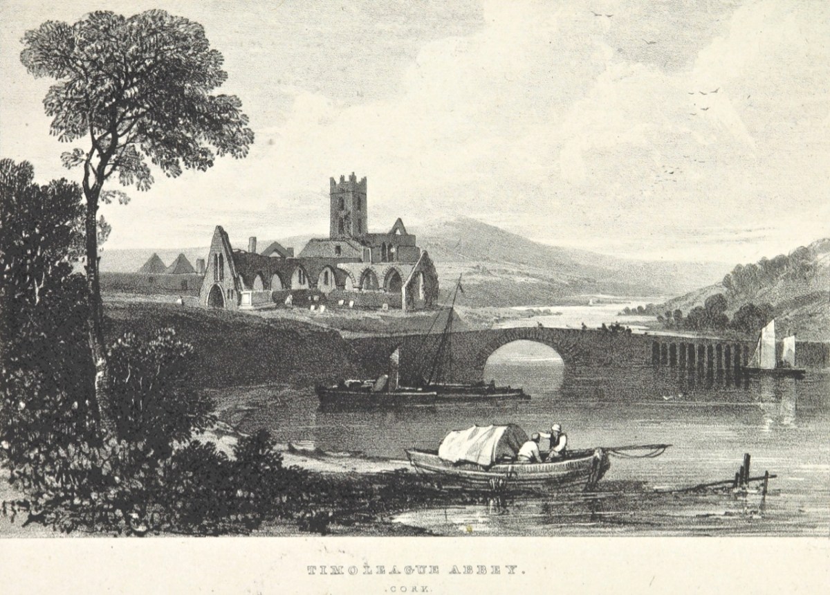
“Near Lisangle are the ruins of a strong castle, once the residence of McCarthy, King of Cork. The ruins of the old church also remain, which the people here call the ‘Abbey of Cahir” . . . The absence of ruins at Caheragh, which, by the way, seems to have never attracted the attention of historians or antiquaries, is easily accounted for. The stones, conveniently at hand, were utilised in the building of the walls which encompassed the graveyard . . .

Southern Star 12.01.1929

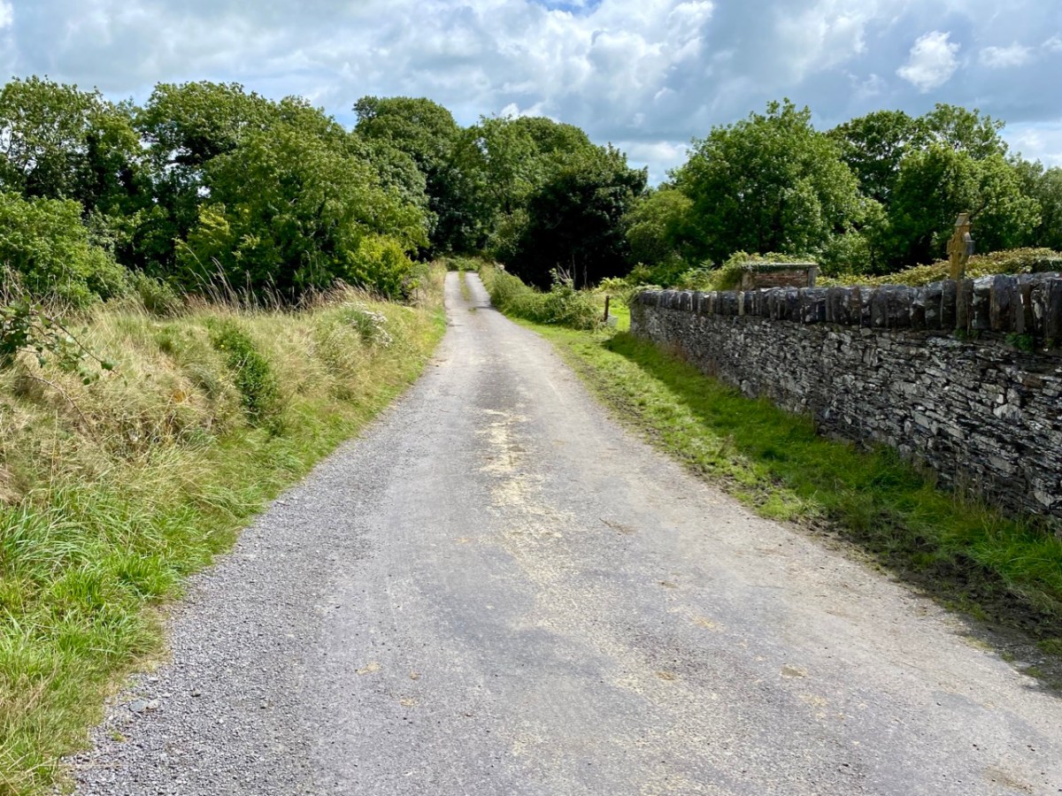
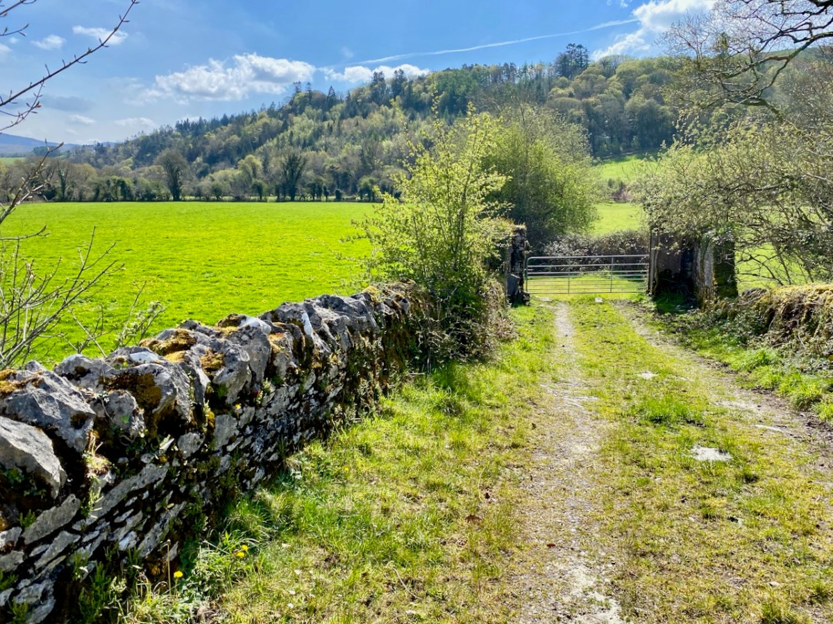
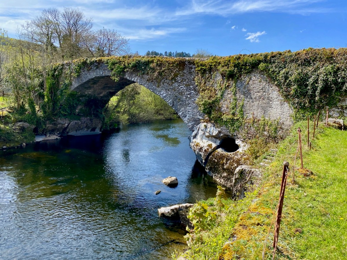
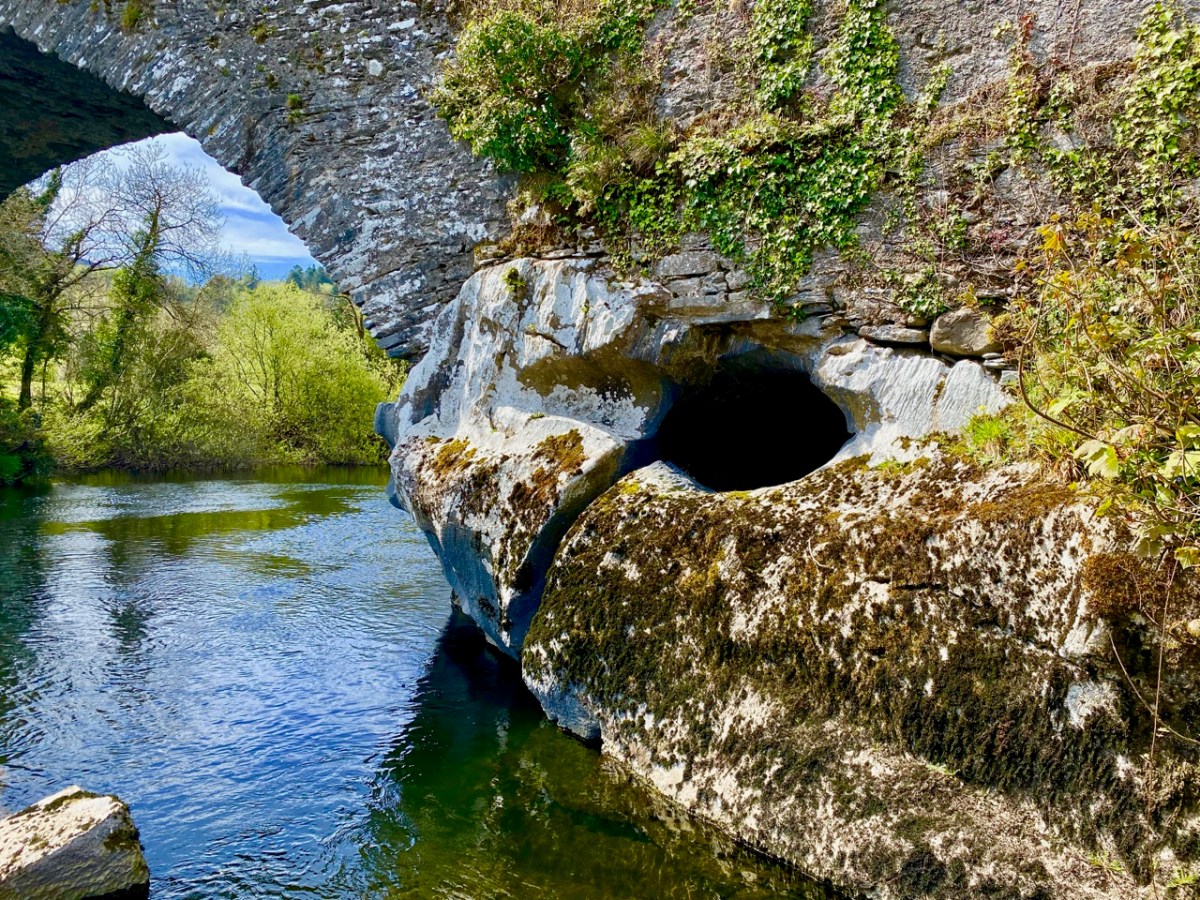
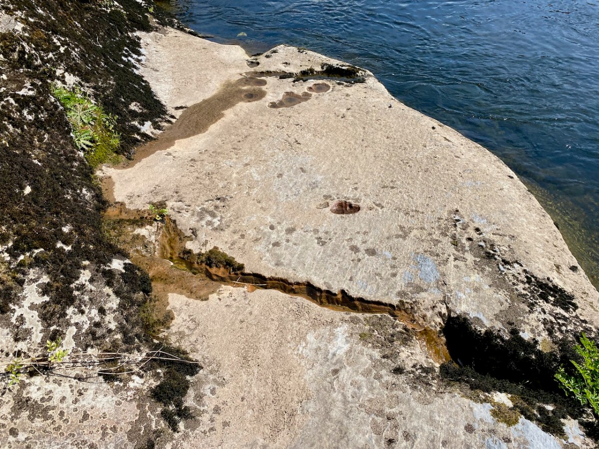
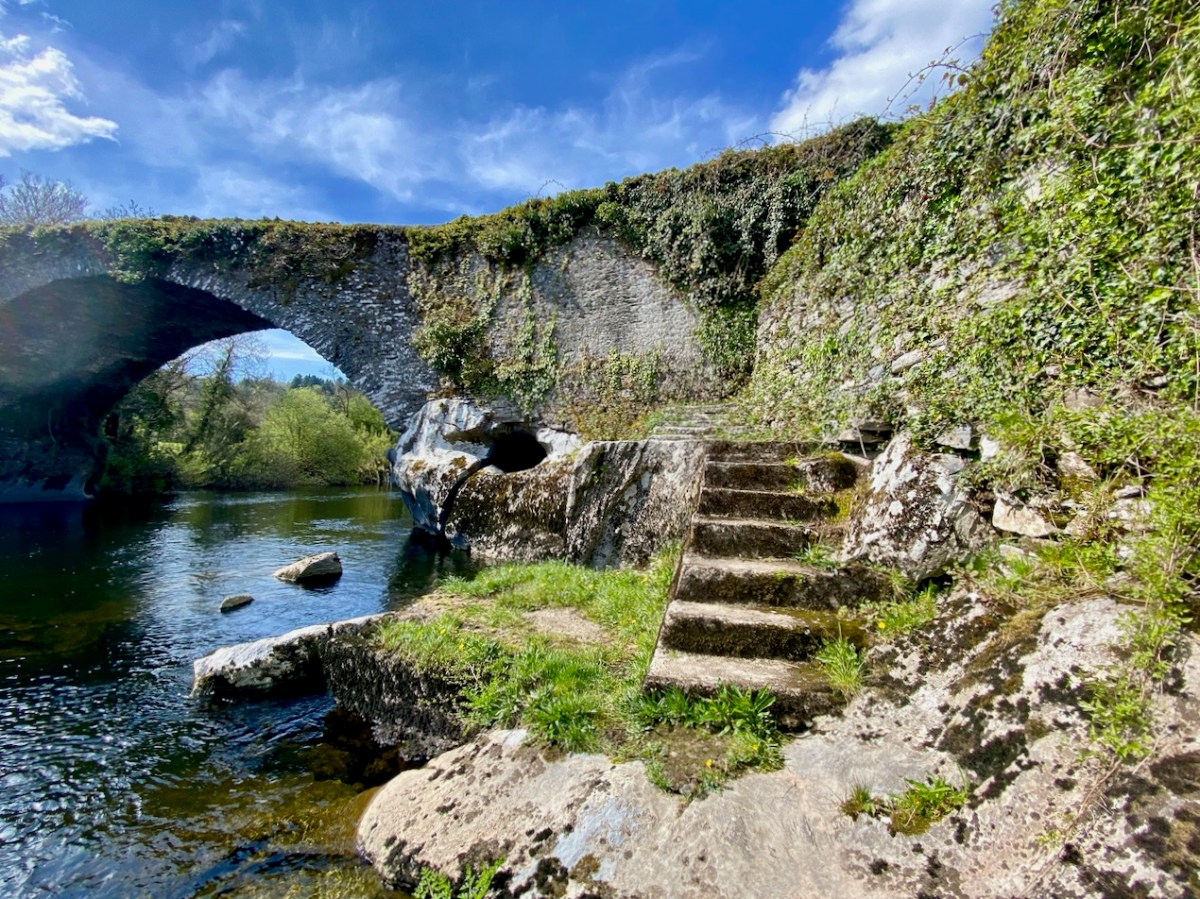
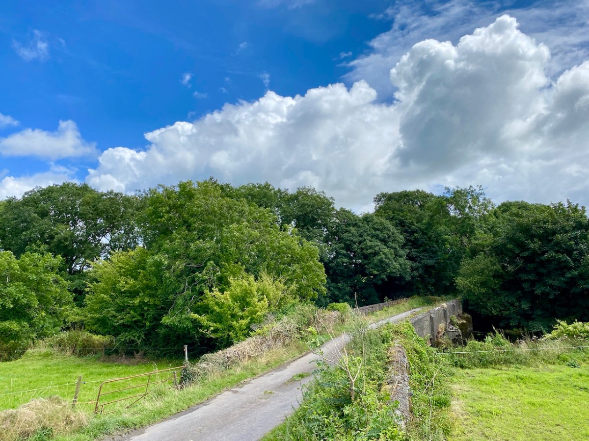
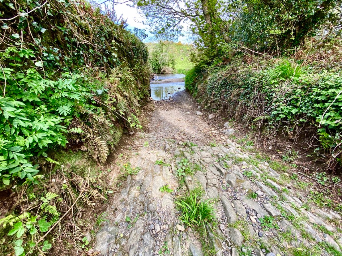
Above – the western boundary wall of Caheragh Old Graveyard. The small road continues over the Ilen River: the bridge here was built by the Congested Districts Board for Ireland in the early years of the twentieth century, to replace a ford, the stone flag bed of which can still be seen.

. . . The Irish word Cathair, spelled and pronounced in English Caher or Cahir, meant a circular stone fort, and therefore Caheragh, under any form of spelling, signifies the field of the stone fort. But where is the fort? one naturally asks. Remembering the descriptive nature of the Irish place names on my short call at Caheragh in 1906, I looked for something to justify the name and found it. In order to gain a vantage point, to view the country round about, I struggled through the thicket of furze to the top of the hill east of the road and, unexpectedly, to my great delight, found the outlines of the stone foundations of the Cahir, mostly covered with soil and grass, but quite distinct on the flat top. Again was the correctness of Irish topographical names vindicated . . .

Letter from Capt Francis O’Neill, Southern Star 12.01.1929

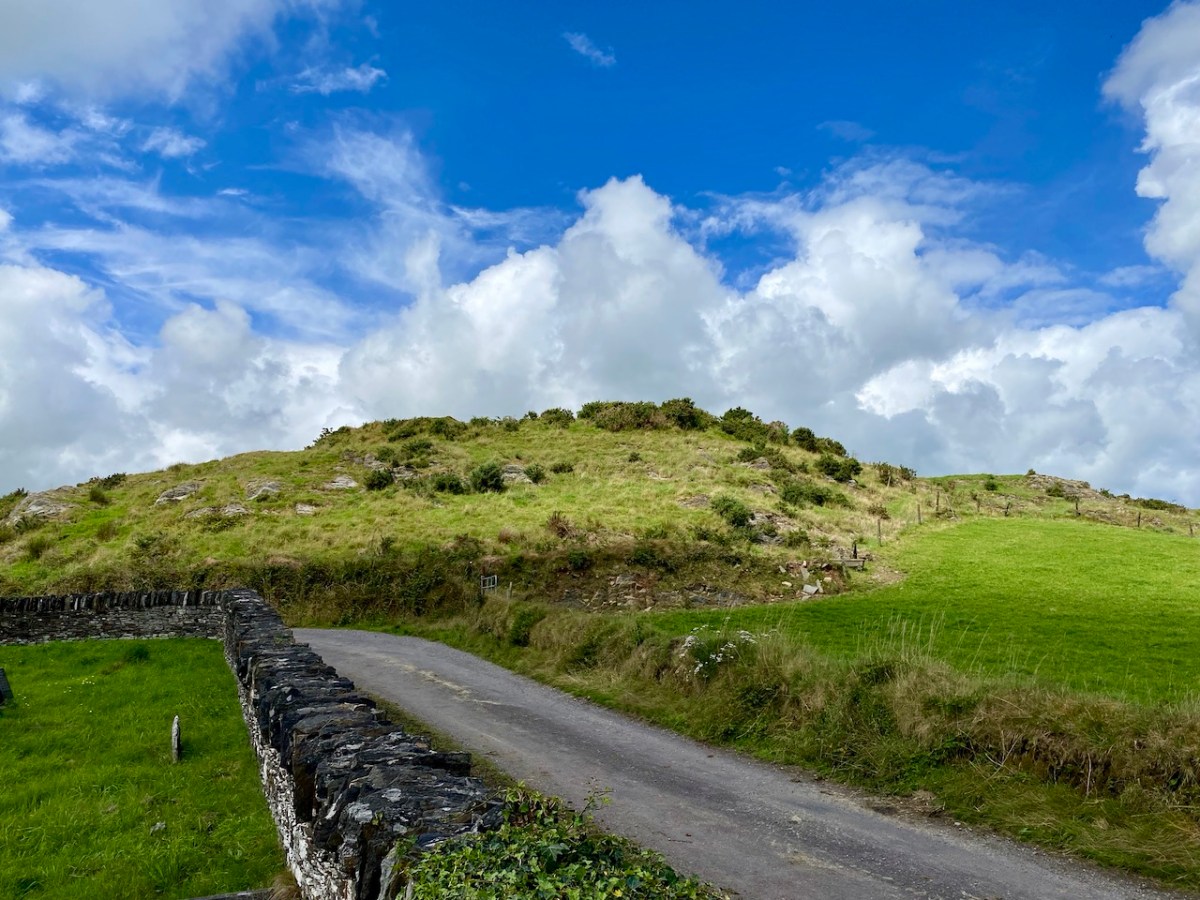
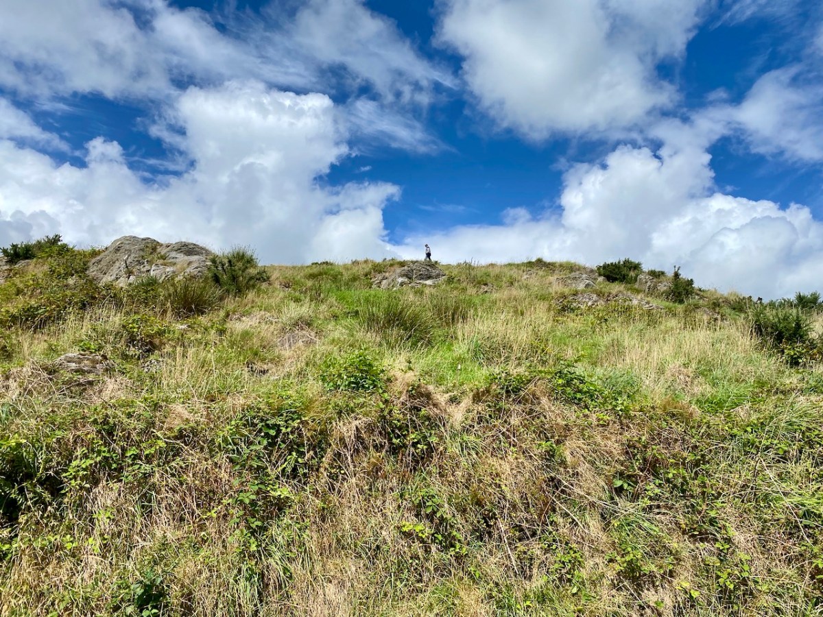
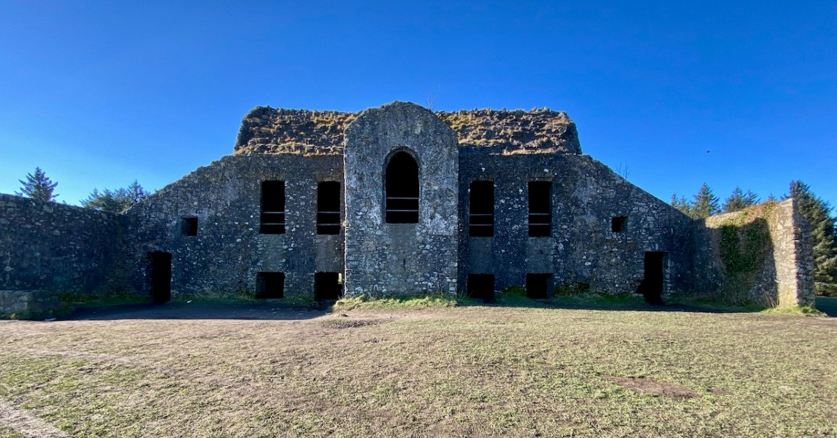
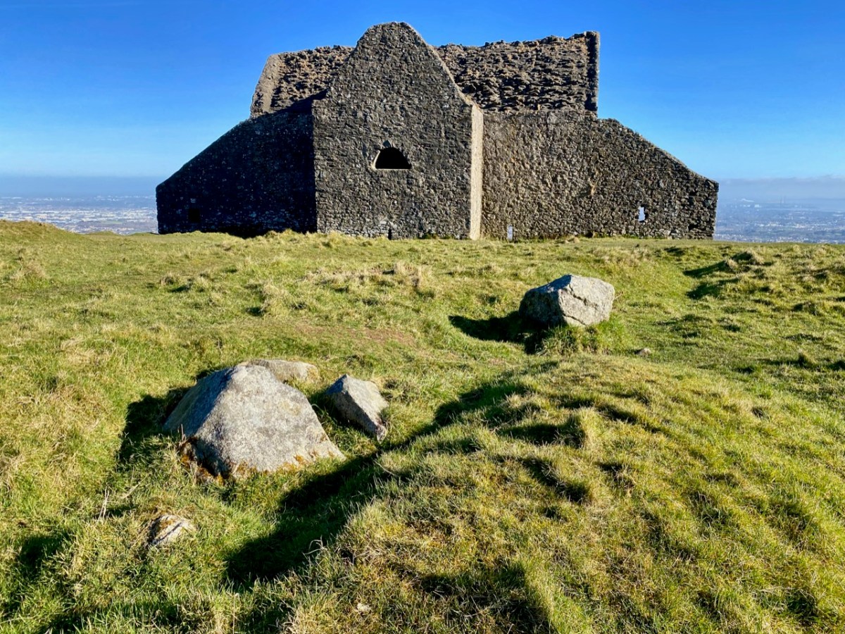
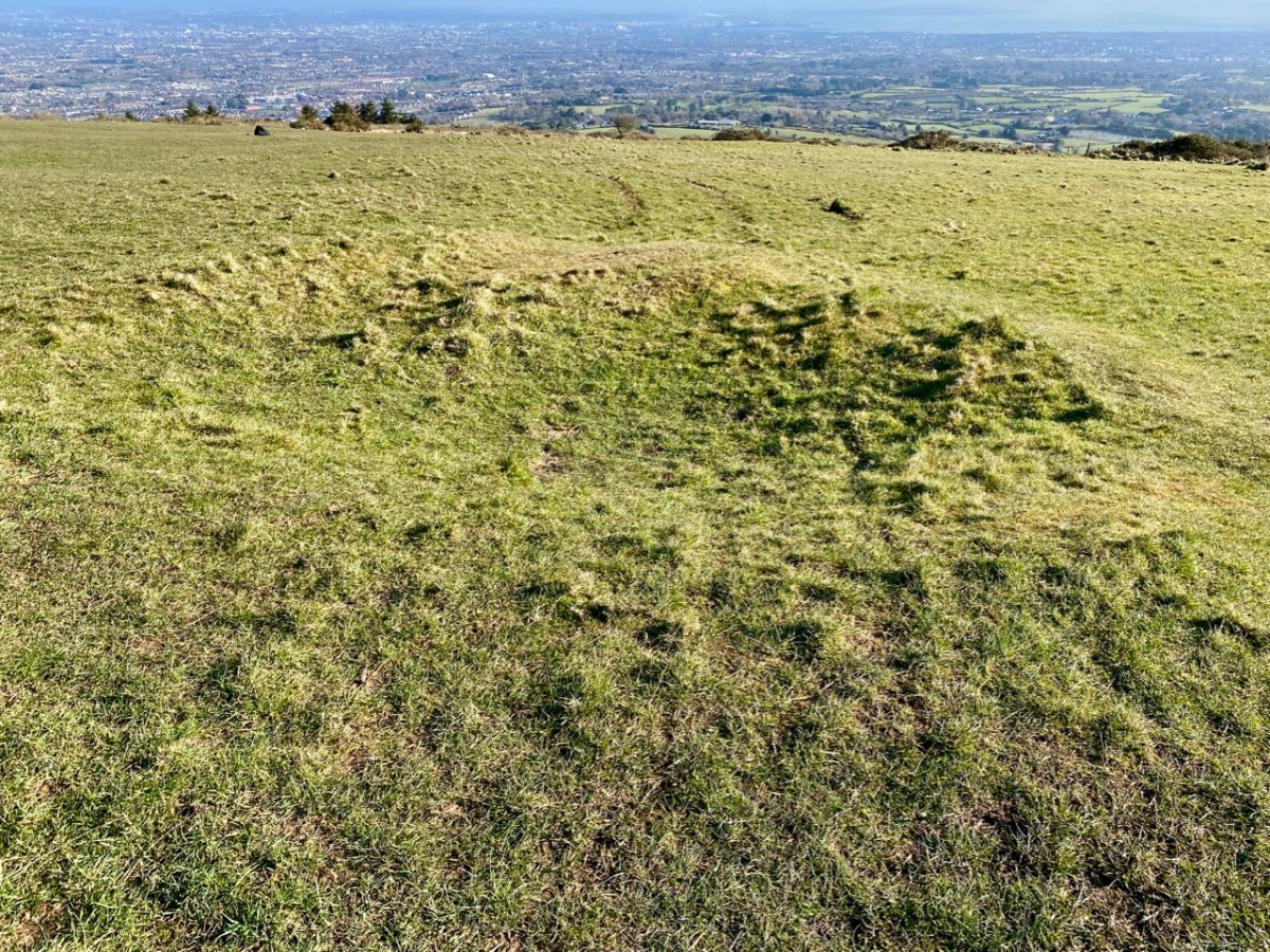
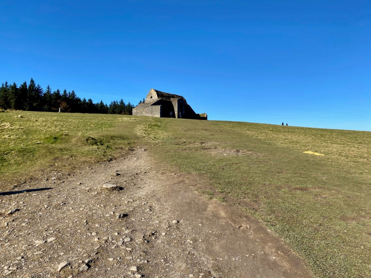
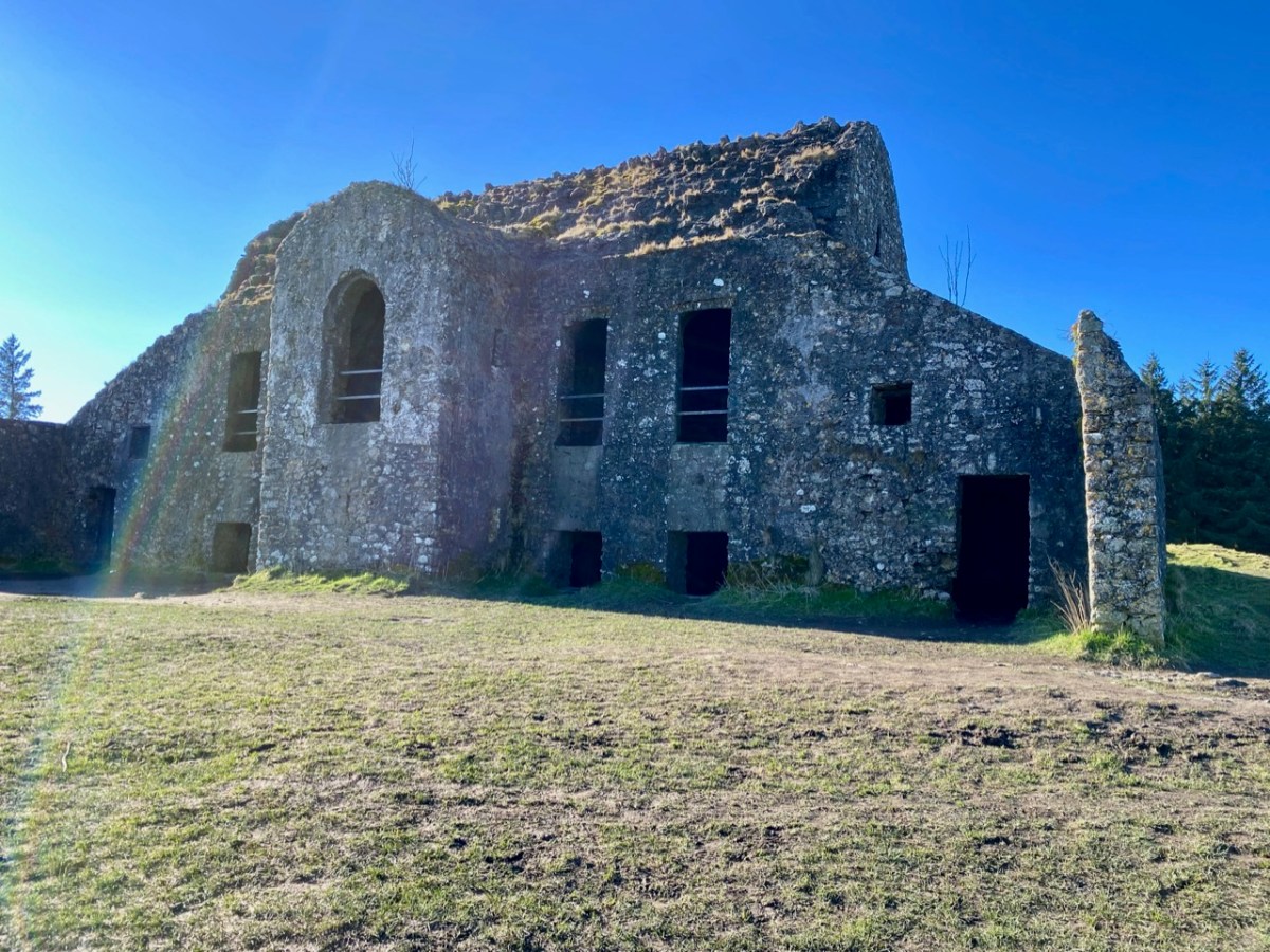
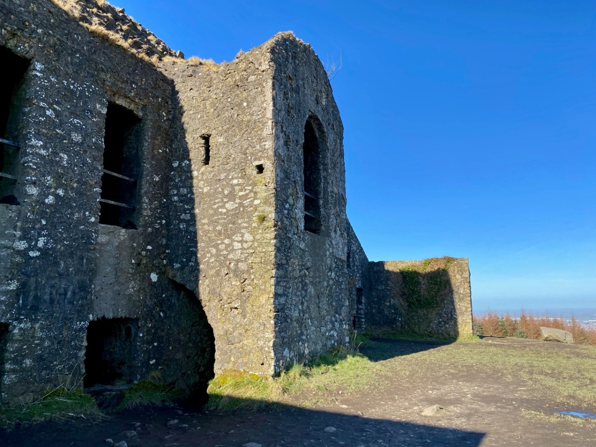
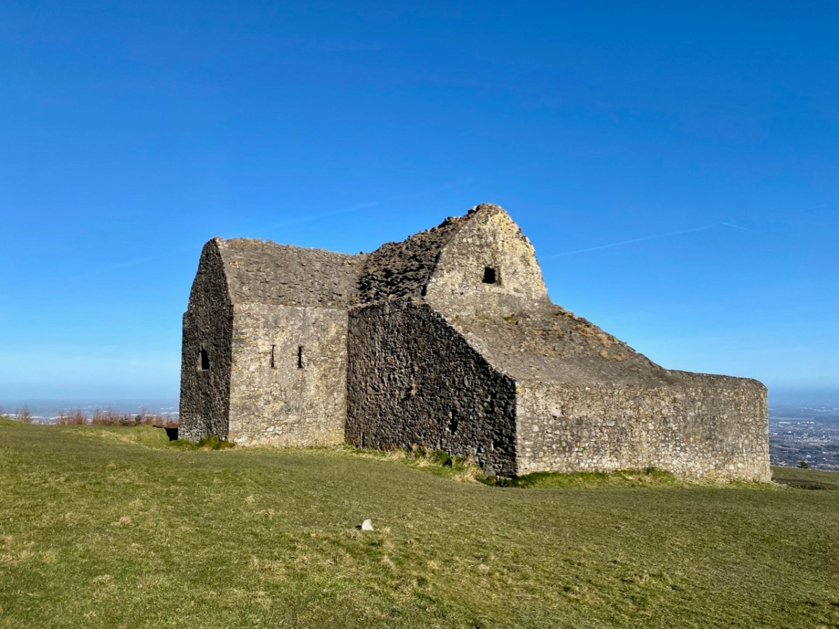
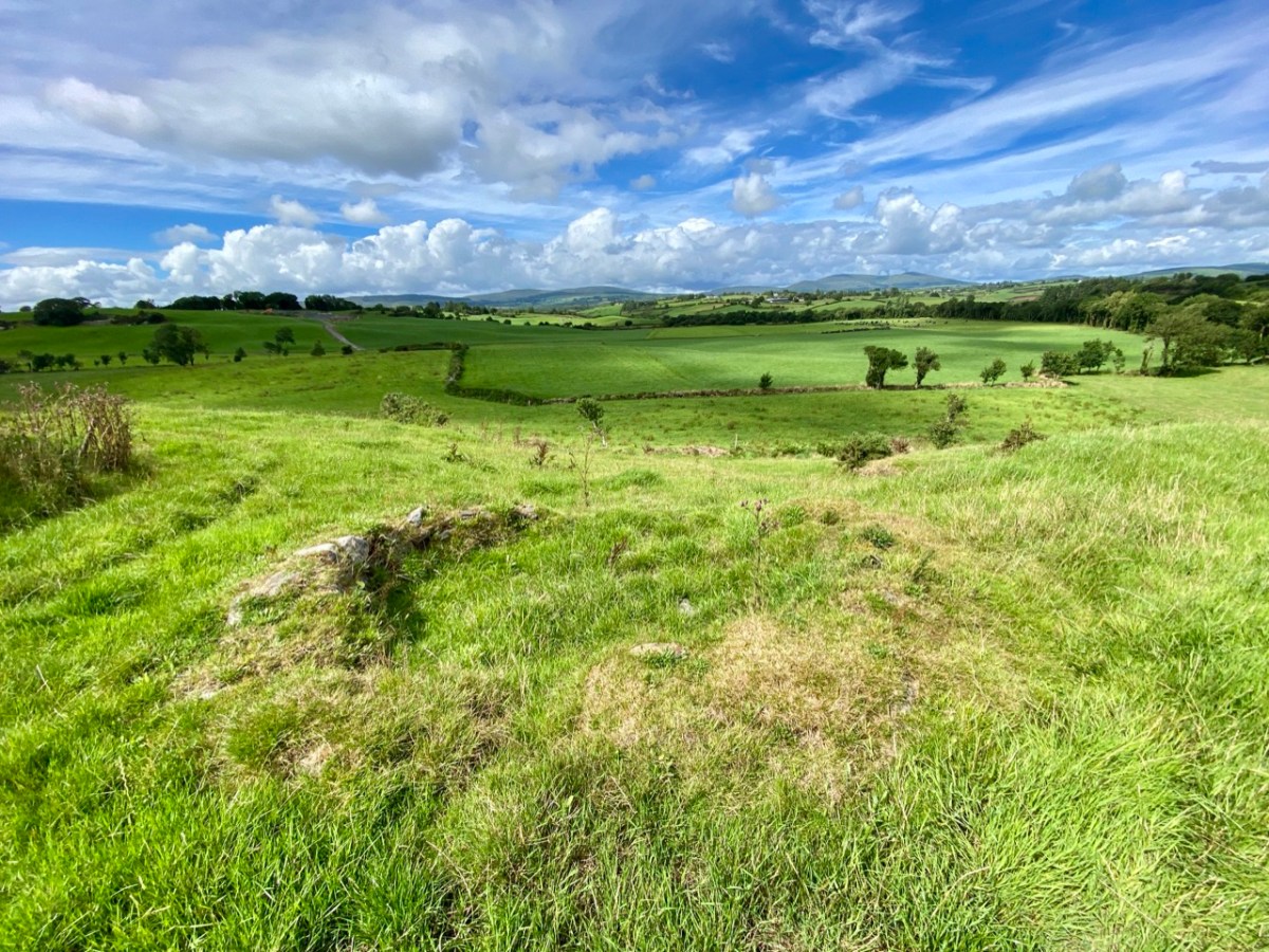
This feature (the two pictures above) is the hilltop referred to by O’Neill, where he claims to have found the ruins of the ‘Cahir’. Today it is recorded on the National Monuments Record as a ‘ringfort’ or ‘rath’:

CO132-017001-

Class: Ringfort – rath

Townland: CAHERAGH

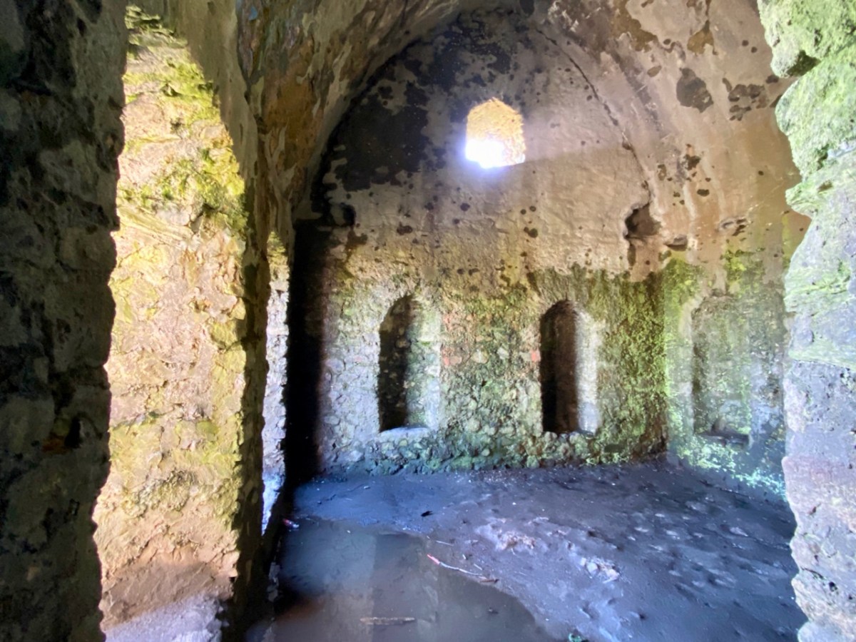
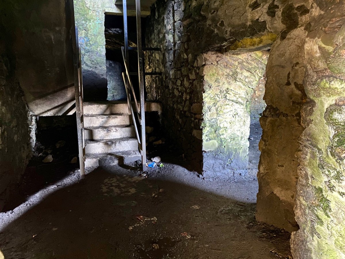
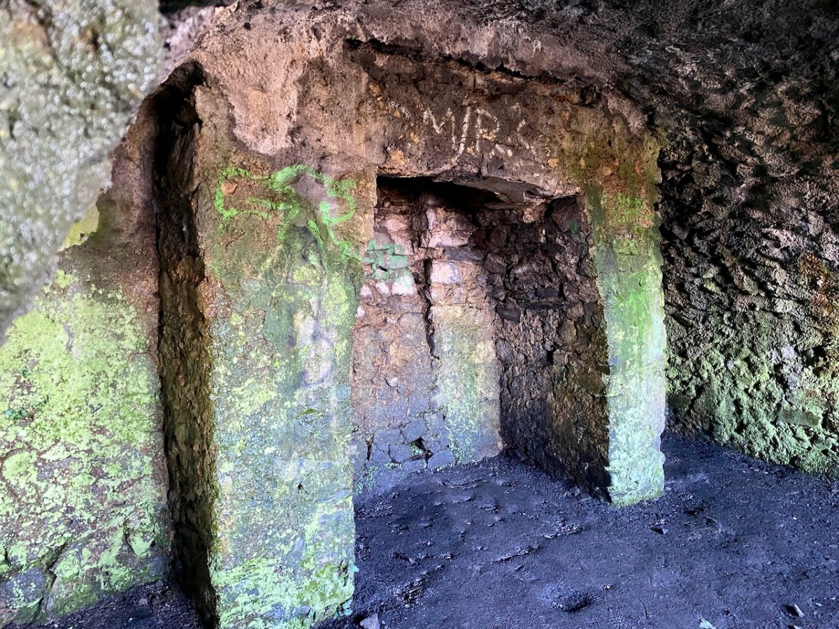
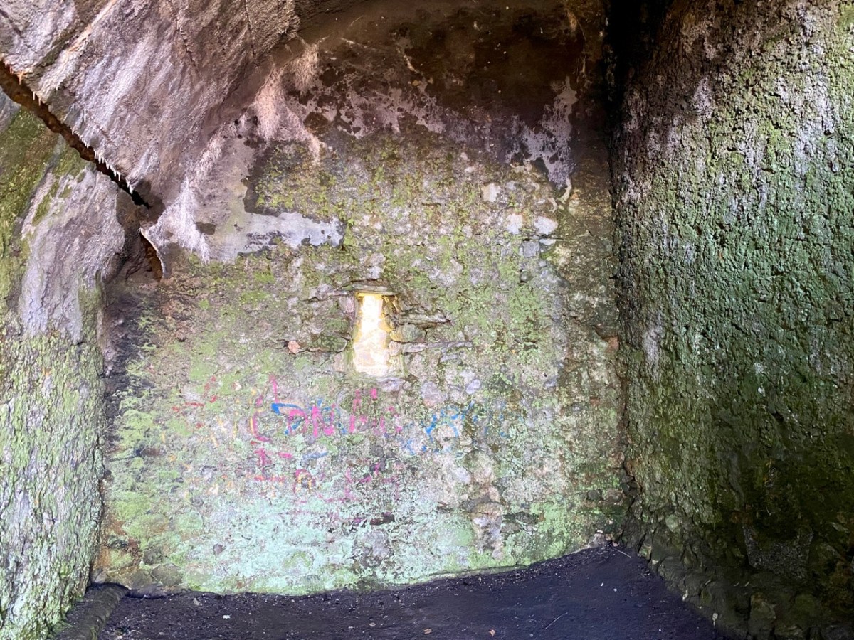
Description: In pasture, atop hillock broken by rock outcrop. Circular area (36.5m N-S; 37.5m E-W) enclosed by earthen bank (max H 3.8m). Break in bank to NNW (Wth 5m); and WSW (Wth 4m), where triangular feature adjoins inner bank face. Possible souterrain (CO132-017002-) in SW quadrant

Archaeology.IE National Monuments Record

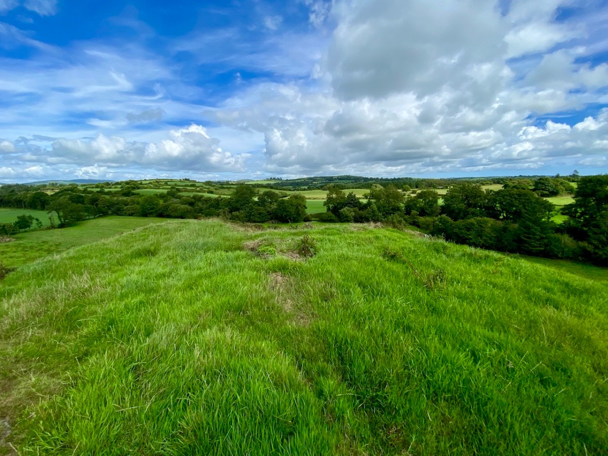
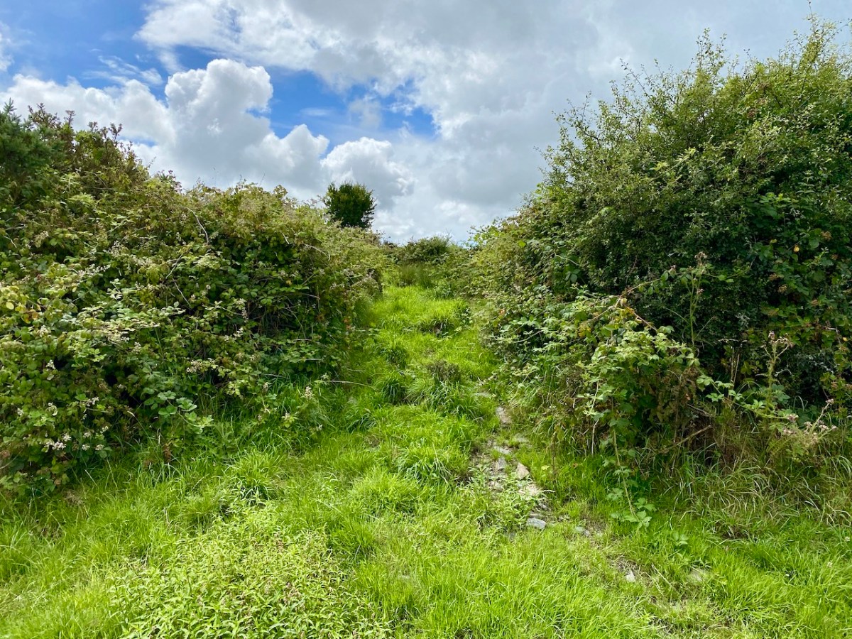
Top: flat-topped mound with circular summit, very much in line with the expectation of a ringfort structure. Centre: stone embankment seen from the top of the ‘fort’. Lower: a defined ‘entrance’ through the ‘fort embankment’ on the summit of the mound. This could be ancient or modern: cattle use the fields in which this feature is located, and some of the topography could be shaped by this usage over centuries.

. . . The builders of Abbeys and Monasteries were wise in their day in the choice of locations for their establishment, and one essential desideratum was near to a plentiful supply of water, such as the banks of lakes and rivers, or adjoining never-failing springs. In this instance the River Ilen met all requirements, and taking everything into consideration, I am led to the conclusion that the graveyard at Caheragh was the site of the “Abbey of Cahir” mentioned by Lewis in the Topographical Dictionary of Ireland . . .

Letter from Capt Francis O’Neill, Southern Star 12.01.1929

Above: evidence of built structures on the summit of the ‘ringfort’ mound at Caheragh. A significant circular foundation is clearly outlined. Perhaps, after all, there is some substance in the Captain’s musings on what occupied this site in earlier times? This account is from The county and city of Cork remembrancer; or, Annals of the county and city of Cork by Francis H Tuckey, Savage and Son, 1837:

. . . 1317 December 28, Geoffrey Fitz John de Cogan is presented by the King (by mandate to the Bishop of Cork), to the church of the Blessed Mary de Catheragh, in the King’s gift, by reason of his wardship of the lands and heir of John de Cogan . . . ‘Blessed Mary de Caheragh’ was a monastic site, said to be ‘situated on the hilltop commanding the view above the graveyard at Caheragh’ (possibly on the site of the ringfort). It was no doubt founded here because of the proximity of the watercourse . . .

So there – for your consideration – is the suggestion that the hill above Caheragh’s Old Graveyard (which may, in earlier times, have been a ringfort with a souterrain) was the monastic settlement Blessed Mary de Caheragh in medieval times. That’s quite a thought. My own opinion would be that the monastery would have been founded on the level ground close to the river: in fact where the graveyard is today. As the monastery declined, a church might have remained, eventually becoming a ruin. It was common for old churches and their environs to be used for burials and this might account for the comparative remoteness of this site from the village itself. Now – of course – there is no trace of a church ruin. This theory would hold good except for the annals quoted above, which state that a monastic site was situated on the hilltop overlooking what is now the graveyard.

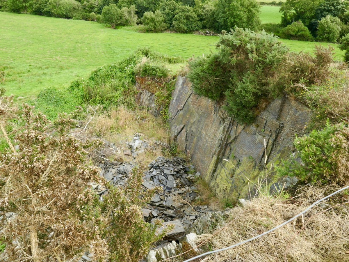
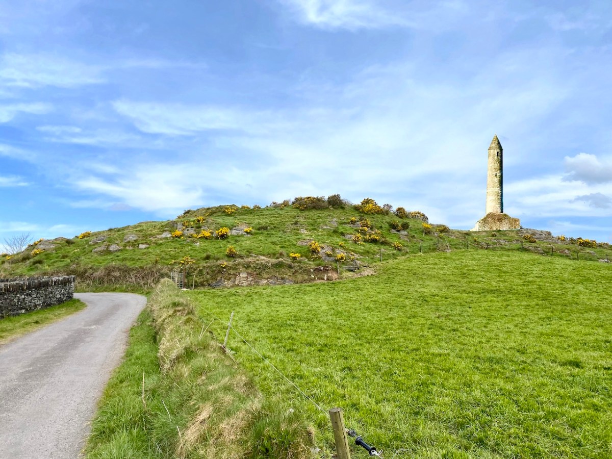
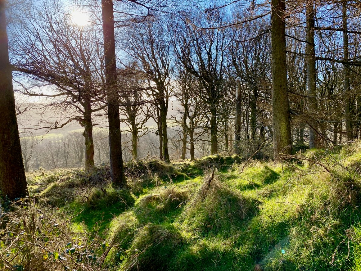
Evidence of stone quarries on the hillside suggest that significant quantities of stone has been used locally. Graveyard wall, field fences, or built structures? But the most challenging feature has to be the ringed foundation, or base, clear to see on the edge of the hill (below). Could it be a souterrain entrance – or, more fanciful, the base of a round tower?

I’ll leave you with that conundrum (and my whimsical daydream below) for now, but we will continue with Francis O’Neill’s musings (which become even more complex) in a future post.

Timoleague Tour

We had a great afternoon yesterday, exploring aspects of the history of Timoleague, in West Cork. Our Finola Finlay (above) was involved in an event organised by the Glass Society of Ireland . . . a professional all-island, non-profit association that opens a window onto the contemporary Irish Glass Community . . . The day’s proceedings were centred around the ecclesiastical buildings in the town, the earliest of which is the Franciscan Friary, now a substantial ruin beside the Argideen River.

This view of the ruined ‘abbey’, above, dates from 1830. It is located on the site of an early Christian monastic settlement founded by Saint Molaga, from whom the town of Timoleague derives its name. A story that I heard for the first time yesterday was told by local historian Donal Whooley: the Saint was trying to found his community back in the sixth century, but everything that he and his followers built fell down the following day. According to legend, it was originally to be built a mile west of Timoleague, but all work done on that site by day would fall down by morning. Interpreting this as God’s wish that the church should be built elsewhere, Molaga fixed a blessed candle on a sheaf of corn, and floated it down the Argideen river, siting his settlement on the spot that it came ashore, on the big bend in the waterway where the Friary ruins can be found today. Here is a view from the great three-light window which looks out to the east over the river. Finola told us that, in its heyday, this window would have been filled with beautiful medieval glass, bringing light and colour into the substantial nave of the church.

That’s Donal, above, leading our group of almost fifty keenly attentive people who shared an interest in the town and its history. To the right (in a blue jacket) is Father Patrick Hickey. He told us of the symbolism of the cockerel you can see on the large headstone in the nave (below), dating from 1821. Evidently some of the disciples were standing together while Christ was being crucified: nearby stood a pot in which a rooster was being boiled for supper. Judas reportedly said: do you think there’s any chance that our Lord will rise again? Mrs Judas retorted: there’s about as much chance of that as there is of that rooster jumping out of the pot and crowing! At which point – of course – the cockerel did just that!

It was the custom to place burials in ruined church buildings. Here’s another fine headstone in Timoleague Abbey, to Michael Deasy, ” . . . who departed this life on the 23 December 1755, aged 33. May he rest in peace. Amen . . . “

Lively discussions ensued on the efficacy of wart wells, and Donal suggested that this repurposed bullaun stone, above could be the oldest human element on the whole site!

Here’s an aerial overview of the geography of Timoleague. The Friary ruin is only one of many historic sites of interest which caught our interest yesterday. It was Finola’s task to introduce us (or those of us who had never seen it) to the little Church of the Ascension.

This building is currently undergoing major improvement works: the lime rendered tower has created a striking landmark in the town. This work has become necessary by water penetration through the stonework leading to deterioration of the fabric. The conservation project is led by a hard-working Parish committee who also served us delicious tea and cakes since the tour was a fund-raiser for their efforts.

You can see Finola addressing us in this little Protestant church in the header picture. Above is one example of the fine early glass here, this one by Clayton and Bell. For a fuller description of this church and its many stories, read our post here.

The early OS map extracts, above, give further context to the town’s history. The top map dates from the 1830s and comparison of the plan forms of the Church and Chapel buildings with those in the lower map, which dates from c1900, and then the present day aerial view (higher up the page) shows the degree of change which has taken place. We finished our town tour in the Church of the Nativity of the Blessed Virgin Mary. Here’s Finola standing outside it, below, prior to giving us an introduction to the history of the building, and its windows.

The fine Harry Clarke Studio window (one panel of which is shown in the upper picture) is a ‘must-see’, as is the mosaic work from the same church. The building work for this Catholic church, replacing an earlier chapel, dates from 1912.

Father Patrick Hickey nicely rounded off our day of Timoleague history by showing us the replica of the ‘Timoleague Chalice’ (above). The replica is kept in this Catholic church. According to Fr Hickey, ‘back in the penal days’ three monks were found floating in an open boat just off the island of Cape Clear. They had with them a box, or trunk. They were brought ashore but two of them died. The other asked that the box be kept on the island – but unopened – until he could return to retrieve it. He never returned, and in later years another visiting Priest said it could be opened. Inside was a gold chalice – blackened with age – and some liturgical vestments. The vestments fell to dust immediately, but the chalice was sent away for inspection, and was confirmed as coming from the Friary at Timoleague, where the replica is now kept.

Here is another ‘souvenir’ of Timoleague – it’s an extract from a poem written in Irish: The Mourner’s Soliloquy in the Ruined Abbey of Timoleague. The poet, Seághan Ó Coileáin, ” . . . was a Gaelic-language poet born in County Cork, in a time of faded Irish glory. He lived as a village schoolmaster, with a large family and no patron . . . “

Abroad one night in loneliness I stroll’d,
Along the wave-worn beach my footpath lay;
Struggling the while with sorrows yet untold,
Yielding to cares that wore my strength away:
On as I mov’d, my wayward musings ran
O’er the strange turns that mark the fleeting life of man.

The little stars shone sweetly in the sky;
Not one faint murmur rose from sea or shore;
The wind with silent wing went slowly by,
As tho’ some secret on its path it bore:
All, all was calm, — tree, flower, and shrub stood still,
And the soft moonlight slept on valley and on hill.

Ardtully and the Orpens

We took a few steps over the border – from Cork County to Kerry Kingdom – to search out some vestiges of architecture which relate to the Orpen family, which claimed it could trace its history back to the sixth century. Probably the best-known member of that clan – certainly in Ireland – was William Orpen (1878 – 1931). Orpen was a ‘naturally talented painter’ who spent much of the First World War as an officially commissioned artist, producing strikingly graphic images of that depraved conflict, including the Battle of the Somme, from direct experience in the trenches.

Upper – Zonnebeke 1918, and lower – Self portrait 1917 by Orpen. William Orpen’s grandfather was Sir Richard Theodore Orpen (1788-1876), Born and brought up in Dublin, this Orpen married Elizabeth Stack in 1819 and they built a large mansion on the site of an earlier castle and medieval monastery beside the meeting of the rivers Obeg and Roughty, in the townland of Ardtully, Co Kerry. In Irish, the name is Ard Tuilithe, meaning ‘high flood’.

The Orpen’s Grand Design project consisted of a 27-roomed two-storey dwelling with a tower, in what can be loosely described as the ‘Baronial’ style. The house was the family’s residence throughout the rest of Sir Richard’s life, and was inherited by one of his sons, Right Reverend Dr Raymond D’Audemar Stack Orpen, who was the last to live there.

It’s useful to compare the first OS 6″ map (top) – which dates from around 1840, prior to the construction of the new house, which was completed in 1847 – with (lower) the OS 25″ version, dating to the late 1800s. the house is clear there, as is the bridge over the rivers, built by an earlier Orpen generation: it bears the date 1786.

That’s the 1847 Ardtully House, above, in its heyday. The illustration is from The  County Seats of The Noblemen and Gentlemen of Great Britain and Ireland (published 1870). Here (below) is an aerial view of the dwelling within its immediate context. Below that is today’s view from the ‘Ardtully Old Bridge’.

The fine bridge once led to the Demesne; now it ignominiously ends in a field gate. The construction of it is worth a close look – there are some fascinating rocks and outcrops used in its foundation.

The house met its end in 1921 – a victim of IRA burnings. It stands, gaunt and crumbling: a symbol of a period in Irish history. It’s fully accessible, and the Kerry landscape is stunning on a wonderful sunny spring day. Well worth a visit.

The ‘Baronial’ style of architecture – sometimes called ‘Scottish Baronial’ is given short shrift by ‘The Irish Aesthete‘:

. . . Its architect unknown, the house is customarily summarised as being in the Scottish Baronial style but this seems more a flag of convenience than an accurate description. In truth Ardtully looks to have been a typically Victorian grab-bag of architectural elements, its most prominent feature being a castellated round tower and turret on the south-east corner. Looking towards the river Roughty, the entrance front features a porch topped by the Orpen coat of arms (now damaged), another attempt by Sir Richard to demonstrate his lineage. Inside the house looks to have contained the usual collection of reception and bedrooms ranged over two storeys, the roofline marked by a succession of stepped gables and dormers . . .

https://theirishaesthete.com/2017/08/07/ardtully/

Certainly, the house in its present state doesn’t present much grace. The architectural style was fairly short-lived, and was said to have its origins in France, with references to the Gothic Revival and romanticism. There are further examples extant in Ireland: the nearest (probably) is Blarney House, Co Cork, altogether a more elaborate project, designed and built by Sir Thomas Lanyon of Belfast for the Colthurst family of Ardrum. Surviving today – close to the well-known Blarney Castle, it was also completed in the 1840s.

I will finish this post with the only photograph I could find of Ardtully intact (courtesy http://www.sirwilliamorpen.com). Also have a look at this site.

Hell Fire

It’s taken me a while to visit this notorious site which is situated on a summit of the Dublin Mountains. The view across the city from the 390 metre peak is stunning:

It’s the stories and the folklore that attracted me to this place, long known as the Hell Fire Club. In the eighteenth century ‘Speaker’ Connolly built it as a hunting lodge. According to tradition he used the stones from a prehistoric monument that was previously on the hill. It’s now known from recent excavations that at this location was one – or two – passage tombs dating from the Neolithic Period (4500 – 2000 BC). This – or these – were surrounded by a circle of large boulders known as a cairn. Today, some fragmentary traces of the earliest use of the site can be detected. The best information on the neolithic site is found in the Abarta Heritage report, here. An earlier description, dating from 1779 in fact, was written by Austin Cooper, who visited in that year:

. . . Behind the house are still the remains of the cairn, the limits of which were composed of large stones set edgeways which made a sort of wall or boundary about 18 inches high and withinside these were the small stones heaped up. It is 34 yards diameter or 102 yards in circumference. In the very centre is a large stone 9 feet long and 6 feet broad and about 3 feet thick not raised upon large stones but lying low with the stones cleared away from about it. There are several other large stones lying upon the heap . . .

William Connolly (Speaker of the Irish House of Commons) was one of the wealthiest men in Ireland; he had a house in the city and a country estate at Castletown, near Celbridge. It is said that he deliberately used stones from the ancient tomb in the construction of the hunting lodge at Mountpelier. Shortly after it was built the roof, which was originally slated, was blown off in a great storm. Locals attributed this misfortune to the work of the devil, in revenge for the destruction of the cairn. Following this event the lodge gained a reputation as a place where evil prevailed. However, Connolly replaced the slated roof with a stone vault which still exists today, although the building is effectively a ruin.

The Irish Hell Fire Club members were some of the elite of society, and included peers of the realm, high ranking army officers as well as wealthy gentlemen and artists. Here is a portrait of some of them by James Worsdale (himself a Club member); it is in the collection of the National Gallery of Ireland, Dublin.

From left to right: Henry Barry 4th Baron of Santry, Colonel Henry Clements, Colonel Henry Ponsonby, Colonel Richard St George, and Simon Luttrell, 1st Earl Carhampton. Biographies of all of them are summarised here – also from the Abarta reports. Their lives in general were debauched and relatively short. Missing from the portrait are father and son Richard Chappell Whaley and Thomas ‘Buck’ Whaley, who was to become ‘the most famous Buck of all’. Richard’s nickname was ‘Burn-Chapel’ Whaley because of his hatred of religion and in particular, the Roman Catholic church. He would amuse himself on Sundays by riding around Dublin setting fire to the thatched roofs of Catholic chapels. The Whaleys were related through their ancestry to Oliver Cromwell. Their family residence was Whaley Abbey, Co Wicklow: you can find more on this in Finola’s post today.

Mountpelier is a significant mountain top overlooking Dublin, and is now fully accessible to all. A warning, though – in good weather the Coillte car-park very soon fills up (at all times of the year) and there is nowhere else nearby to leave your vehicle – get there early!

It could be said that the ruin of the lodge is ‘maintained’ in that it is stabilised and unlikely to fall down. If you are exploring, look out for the lintel over the large fireplace, which is supposed to be a standing stone removed from the passage grave site.

The Hell Fire Club is, of course, haunted! Not that we saw anything untoward when we visited on a glorious spring day. But the stories abound. They are probably best told through the accounts in the Schools Folklore Collection:

. . . About six miles from Dublin the Hell Fire Club is on a hill. It is a medium size old castle. When the owner of it died nobody else claimed it. All the men of the district came to play cards in it every night. One night when all the men were playing their nightly game one of the men cheated. The men rushed upon him over-powered him. The bound him hand and foot and put him in a barrel of whiskey. Then they set fire to it burning him alive. That was a cruel thing to do but then men did not care. From that day on that old castle was called the Hell Fire Club . . .


Stewart Somerville, Dundrum School

. . . There is an old ruin called Hell Fire Club on the very top of one of the Dublin Hills. This house was built by a man named Connelly, during the time of the Famine. It was built to give employment to the men. Many men used to got to Hell Fire Club to gamble. It is said that one night they were playing cards and there was much money on the table. One man dropped a card on the floor, and when he stooped down to pick it up he noticed a man with cows feet, and he wore a red cloak. The men were very frightened and they made a great uproar. The man turned into a ball of fire. All the men were burned in the fire. There was one man who had a bunch of medals attached to his coat and he was the only man who escaped from the burning house . . .

Mr Finlay, Rockbrook, Co Dublin

. . . The Hell Fire Club, or the Brass Castle is situated near Rathfarnham in the Co Dublin. My Great-grandfather used to pass by the Brass Castle on his way home from work, (he was a mason) he had a habit of hitting the wall with his trowel to hear the ring of the brass. One night a priest had to go on a sick call. When he was coming home through the mountains he lost his way. Seeing a light he went in that direction. He knocked at the door of the house, which happened to be the Brass Castle – The door was opened by a man who was dressed in black with a black mask on his face. The priest was brought in to a room. Sitting at a large table were twelve men dressed the same as the first one. The men were playing cards. On the table was seated a large black cat. The men defied the priest to put the cat away. The priest ordered the cat down, but it never moved. Again he ordered it down, but the cat did not move. The men laughed at the priest and jeered him. The third time the priest said “Begone Satan”. The cat jumped from the table and disappeared up the chimney with a loud roar. The priest told the men that the cat was the devil. The men were never heard of again. The priest got home safe, and from that time onward the Brass Castle was called the Hell Fire Club. This story is true. It was told to me by mother, because the Brass Castle belonged to her ancestors . . .

Seán Ó Nuamáin, Kilbride, Co Wicklow

The Mountpelier Woods consist of around 5.5 kilometres of forest roads and tracks. The woods offer nature trails and a permanent orienteering course. Lord Massy’s Estate and Mountpelier Hill are also traversed by the Dublin Mountains Way hiking trail that runs between Shankill and Tallaght. It’s an attractive walk at all times of the year, with easy access from Dublin city centre.

A comprehensive application to An Bord Pleanála was submitted in July 2017, seeking permission to establish a Dublin Mountains Visitor Centre with associated works relating to tourism, leisure and recreational activities which would embrace the Hell Fire Club site and the mountain trails. Permission was granted, subject to conditions, on 25 June 2020. Another chapter in the story of this notorious locality unfolds . . .

As a tailpiece, I found this image of a ‘Hell Fire Club Goblet’ dating from c1745. It’s currently in the Philadelphia Museum of Art, but it must originate from Ireland: James Worsdale, whose name appears on this glass, was appointed Master of the Revels in the Dublin Hell Fire Club in 1741. It was also he who painted the portrait of Club members illustrated in this post: look at their goblets in the painting!

Séamus Murphy: At Home in Cork

This is Cork city in the 1940s. The subject of today’s post is a Cork man – the sculptor Séamus Murphy. Born in 1907 near Mallow, Murphy took classes at the Crawford School of Art before apprenticing as a stone carver at O’Connell’s Stone Yard in Blackpool, a parish in the city, for seven years. Murphy and his work could occupy several posts, but today we concentrate on his only architectural building project, the Church of the Annunciation in Blackpool. Séamus Murphy can fairly claim to be the ‘sculptural designer’ of this building – as he conceived the way it would appear – while the architect Edmond Patrick O’Flynn most likely carried out the technical drawings and specifications.

According to the Murphy family, Séamus found inspiration for Blackpool from pictures of churches in South America. In particular, the roughly textured render on the external walls is said to have derived from the adobe finish common in Spanish missionary churches there. The Cork church was commenced in January 1945, and the picture above (courtesy of Cork City Library) dates from around that time. The picture below – also courtesy Cork City Library – shows the dedication ceremony in the church on 7 October 1945.

This picture of Séamus, above, is from the RTE archives. The Blackpool project is a good area of study, as the church shows the sculptor’s ability to conceive large, three-dimensional spaces as well as his skills in producing his own figurative and relief works, a number of which are used in the church furnishings: they are of polished Portland stone.

While the church is a valuable repository of Séamus Murphy’s design and carving skills, the work of many other contemporary artists can also be found in the building. The stained glass windows are from the Harry Clarke Studios, designed by William Dowling.

Particularly striking is the crucifix window at the east end. Above is the original cartoon (courtesy of Trinity College Library Dublin) by Dowling, side-by-side with an image of the window today. All the windows are of fine quality.

Examples of the ‘opus sectile’ Stations of the Cross are shown above. According to the Blackpool Parish website these were the work of Richard King. Finola has written extensively about this artist, who managed the Clarke studios after Harry’s death. She is also now researching the art-form of ‘Stations of the Cross’. In fact, researchers believe that these stations at Blackpool were carried out by William Dowling at the Harry Clarke Studios. Richard King was no longer working for the Studios in 1945, although he had produced designs of a similar style for Belvedere College SJ, Dublin, in 1939.

A full view of the east end of the church. The interior has changed very little over 77 years and is, therefore, a great tribute to Séamus Murphy and the the commissioning family of William Dwyer, then head of the nearby Sunbeam Wolsey factory. Dwyer funded the whole project as a memorial to his daughter Maeve who had sadly passed away in 1943.

This fine font cover was carved by hand by Bart, a younger brother of Séamus.

Murphy’s Church of the Annunciation is certainly a landmark building – not just for Cork, but for the whole of Ireland. And Séamus himself must rank as one of the outstanding artists of the Free State. You will come across his distinctive work in many locations; I will be directing you to some of them in future posts.

Many thanks to Orla Murphy for giving me valuable insights on her father’s works

Evolving Cork – The Great Exhibitions

Here’s a fine view over the city of Cork, taken early one morning from the grounds of the Montenotte Hotel, on Middle Glanmire Rd. It reminded me that way back in 2016 I mentioned in Roaringwater Journal the fact that Cork City has over the years hosted a number of world-class fairs. The first was in the mid nineteenth century:

This engraving from the Illustrated London News shows the ‘Fine Arts Hall’ which was part of the Cork National Industrial Exhibition held in 1852:

. . . The site of the Cork Exhibition was the Corn Market, where ships carrying visitors and goods could dock and unload at the entrance gates. The old Corn Exchange building, lent for the occasion, formed one end of the structure, while a new mart served as a principal show room. This ran across the southern part of the old building, parallel to the quay, for 300 feet in length and 30 feet in breadth, giving the impression of a contemporary railway station, even to the strip of glass along the roof to admit daylight. By the opening day ad hoc extensions had been added which converted the original elongated T – shape into a cross, with covered galleries and passageways running from the central structure to an adjacent building used as a hall for banquets, balls and public lectures . . .

A C Davies – Irish Economic and Social History, Vol 2, 1975

. . . The exhibition remained open for three months, until 10 September. The opening ceremony had been performed by the Lord Lieutenant after a procession watched by the townspeople, ‘in all the pomp and circumstance of majesty, with waving banners, prancing horses, peals of artillery, and multitudinous shouts’. At first attendance was sparse. It rained steadily for the whole of the first week, but then the weather improved and the number of visitors increased. It amounted to about 140,000. Ten thousand free admissions were granted to children from over seventy schools in the area . . .

A C Davies – Irish Economic and Social History, Vol 2, 1975

When the 1852 exhibition closed, the people of Cork decided their city should have a venue suitable for the holding of public lectures, meetings and concerts. Within a few years the building above was constructed. Known as the The Athenaeum, it was designed by Sir john Benson, who had been responsible for the Great Hall of the Cork Exhibition. It is said that many of the materials which had been used in Benson’s exhibition hall were salvaged and re-used in The Athenaeum. The new building was renamed The Munster Hall in 1875 and then became the Cork Opera House in 1877. It survived until 1955, when it was destroyed by fire. The present Opera House, on the same site, was opened by President Eamon de Valera in 1965. It was extensively remodelled, with the glazed facade added, in 2000.

Half a century later Cork city embarked on another major ‘world fair’ class event. In 1902 the Lord Mayor of Cork, Edward Fitzgerald, presided over creating Cork International Exhibition, which ran from May to October. Reclaimed marshland beside the river at Mardyke was used for the site, which occupied an area of about 44 acres. Here are the ‘leading lights’ of the exhibition organisers, with Fitzgerald on the right:

This exhibition was considered such a success that it was repeated the following year – 1903 – and the site plan above bears this date. The artist’s aerial view of the site, below, gives a good impression of the extent of the grounds. Note the ‘switchback railway’ to the left: this was a precursor to roller-coaster fairground rides and was immensely popular…

…As was the ‘Water Chute’ from which it was unlikely that you would emerge dry!

Such attractions were very popular with the general public, but the exhibition had a more serious commercial side:

Several large exhibition halls and pavilions housed a range of industrial and agricultural exhibits from many countries including Canada, Turkey and China. There were displays of industrial and agricultural machinery as well as horticulture, fisheries, art, craft and ceramics . . . The Irish Department of Agricultural and Technical Instruction had a strong presence at The Exhibition with exhibits on dairying, cheese-making, cottage gardening, forestry, bee-keeping, poultry, fruit and vegetable drying and preserving . . .

National Museum of Ireland Collections & Research

Hadji Bey is a name that will be familiar to any Cork person with a sweet tooth! The true story goes that Armenian immigrants Harutun Batmazian and his wife Esther chose Cork as their new home during the early years of the 20th century, after escaping the persecution and violence against Armenian Christians taking place in the Ottoman Empire at the time. In 1902, the Batmazians participated in the Cork International Exhibition and introduced their Turkish Delight – a skill Harutun learned while studying in Istanbul – to the market. Although they spoke no English at the time, the city was to became their home and the popularity of their sweets – still made in Ireland today – is legendary. After their success at the Exhibition they opened a shop on MacCurtain Street: this survived for many decades.

Turkish Delight is just one success story from Cork’s International Exhibitions. The 1902 event attracted nearly two million visitors. Surely, it’s time for another one?

After all the clamour and excitement had died down the Exhibition buildings (below) were dismantled and auctioned off. In 1906 the park and Shrubberies House were taken over by Cork Corporation with the proviso that the Corporation would levy a rate of half penny in the pound for annual upkeep and maintenance.  A further proviso stipulated that the Shrubberies House would be used by the Corporation as a municipal museum. Today we can all enjoy enjoy Fitzgerald’s Park and the Cork Public Museum, where Finola and I put on an exhibition about Rock Art back in 2015.

If you want to know more, I thoroughly recommend this book, written by Daniel Breen (now Curator of the Cork Public Museum) and Tom Spalding, published by the Irish Academic Press.