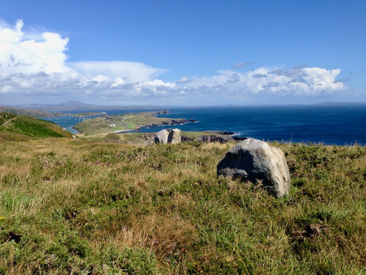
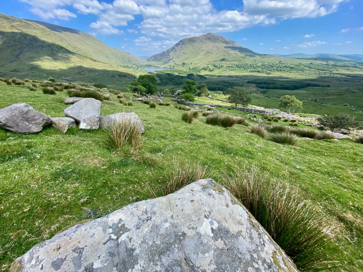
Here is a collection of photographs taken in West Cork from some of the high places: ridges, peaks, mountain paths. The pics were all taken around ten years ago, and haven’t been used in our blog posts previously. They serve to show stunning landscapes, of course, and hopefully illustrate the variety of the country which surrounds us here. The header is taken from the peak above Three Castle Head.
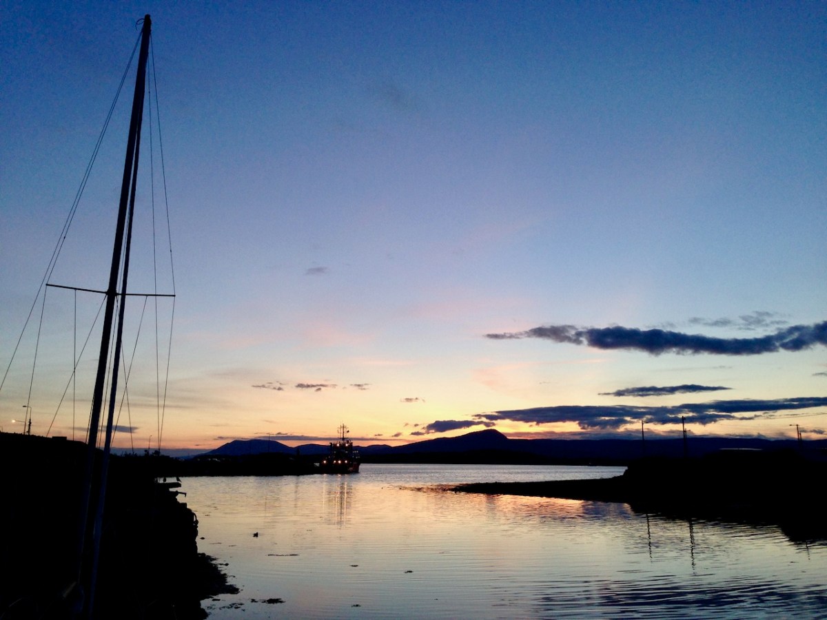
The upper pic is looking down on Bantry town from the high ground to the south, while the lower one reminds you of the evening view from Bantry at sea level.
If you leave your car at Galley Cove Beach and walk up the steep track towards Brow Head you will come across this enormous stone row – and you will look back to the peninsula of Crookhaven. Don’t be fooled by the stones: they have been placed on this site fairly recently. They are impressive, nevertheless.
And here is a closer view of Crookhaven.
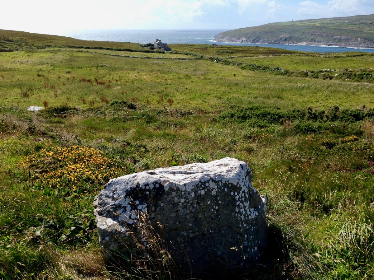
While turning from this spot and looking west, you will see the end of the coastline at Brow Head. This stone is likely to be more anciently placed. In the distance is Mizen Head with its Napoleonic era signal tower at Cloghane.
Contrasting light effects seen on the footpath that follows the ridge on the Sheep’s Head Way. That’s the spit of land that runs from east to west between the Mizen Head and the Beara Peninsula. There are cairns on the summits, with the remains of a wedge tomb and a Marriage Stone to be seen along the way.
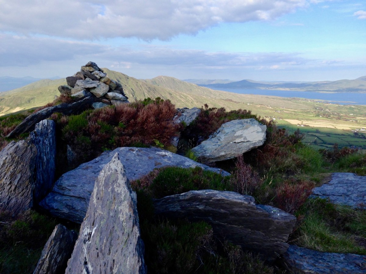
The view north from the heights of the Sheep’s Head takes in the Beara Peninsula and – seen above – the high point of Hungry Hill dominating the distant rugged landscape.
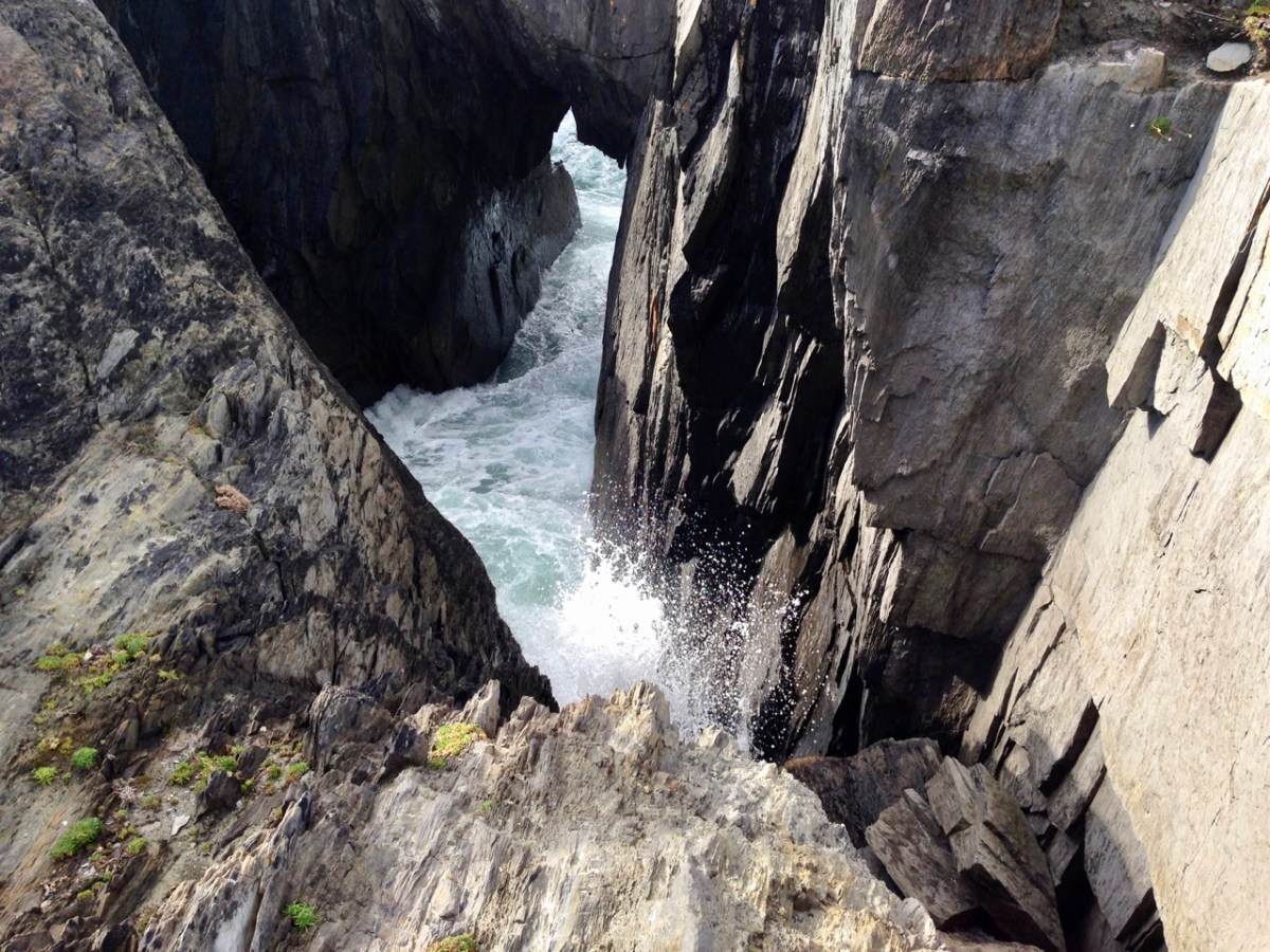
You are never far from the coastline in West Cork. Look out for wild seas constantly sculpting the rocks over millennia.
From our home in Cappaghglass we look out to our own ‘high place’ – Mount Gabriel. This enigmatic tract of land dominates the area and is imbued with legends and folklore. It is also one of the most atmospheric of our peaks at all times of the year.
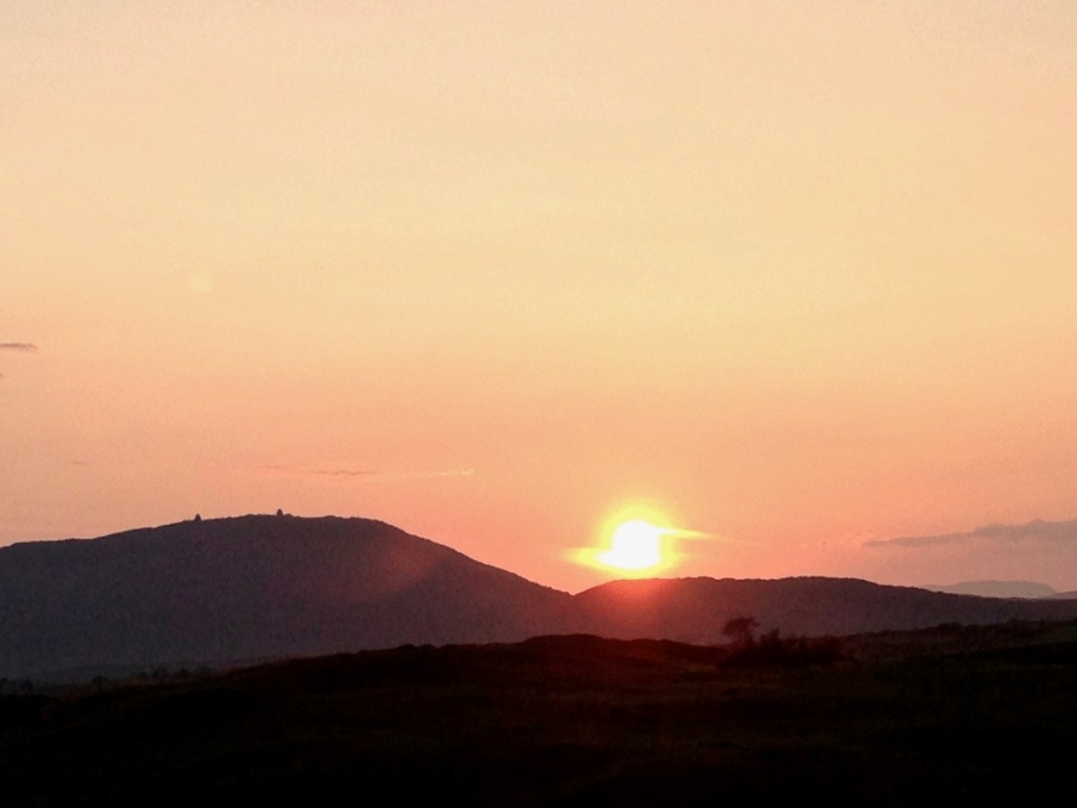
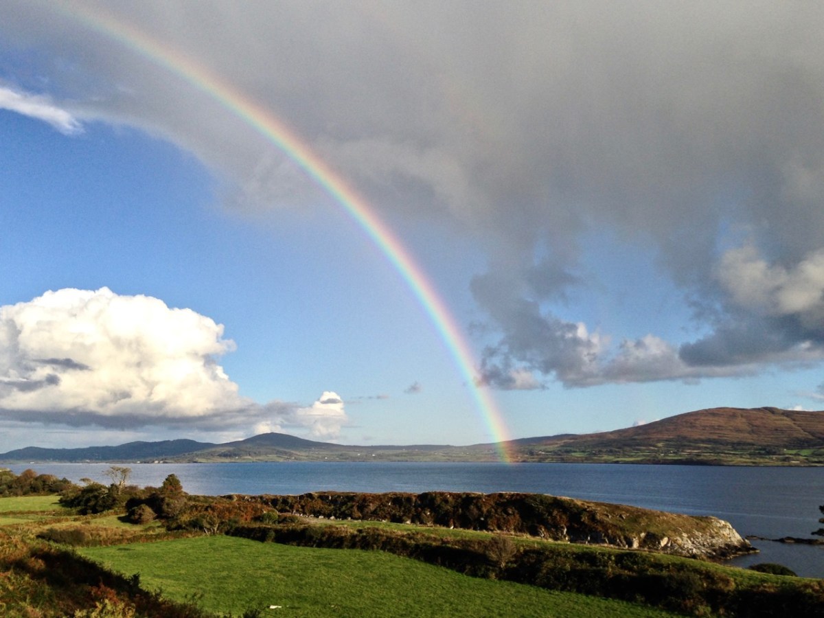
Another local view for us (above): we face out to Rossbrin Cove on the Mizen Peninsula. Finally, the celestial spectacle (below) finds its pot of gold on the shores of the Mizen.
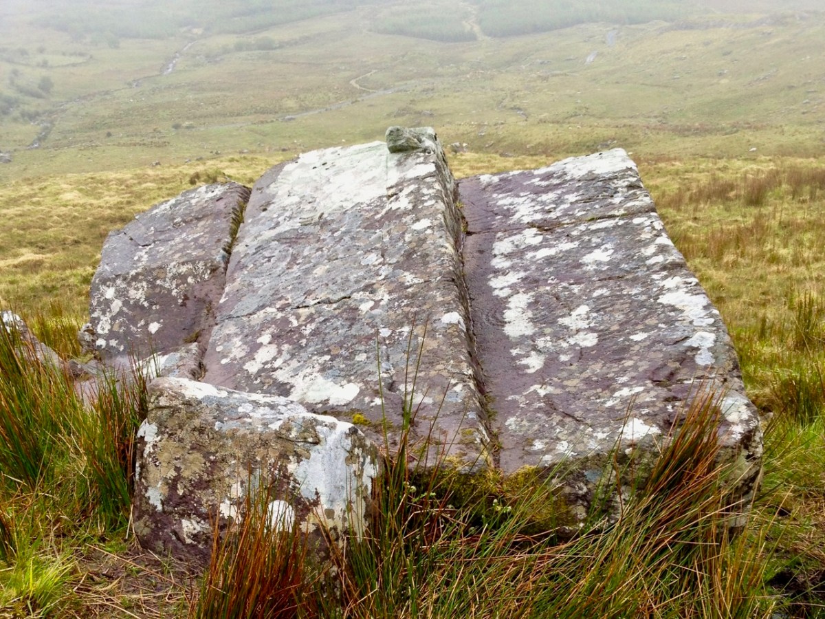
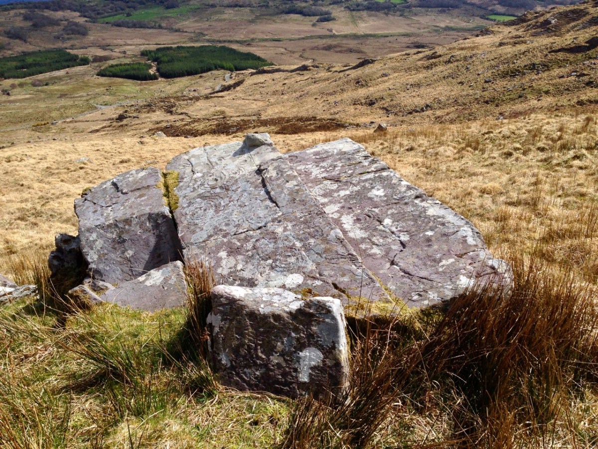
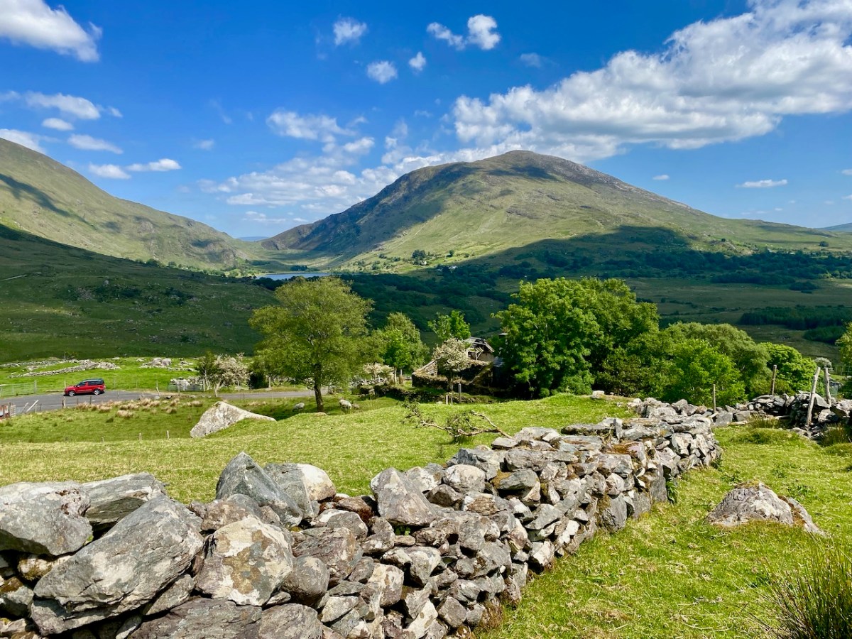
A bit of a nostalgia trip for Finola and me this week: we spent a couple of days in Kerry and dropped in to Derrynablaha – the iconic valley which has some of Ireland’s most notable Rock Art. These stones were carved on natural rocks on the hillsides many thousands of years ago. To this day, we don’t know what they signify.
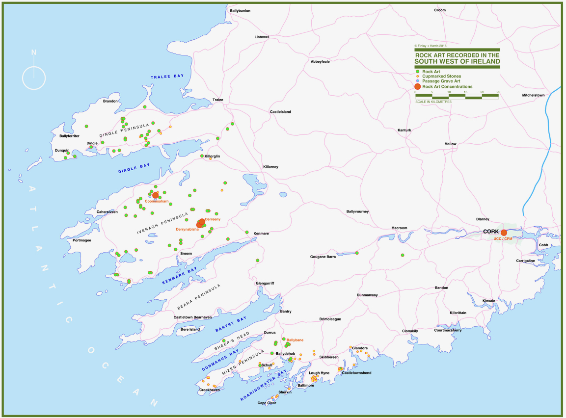
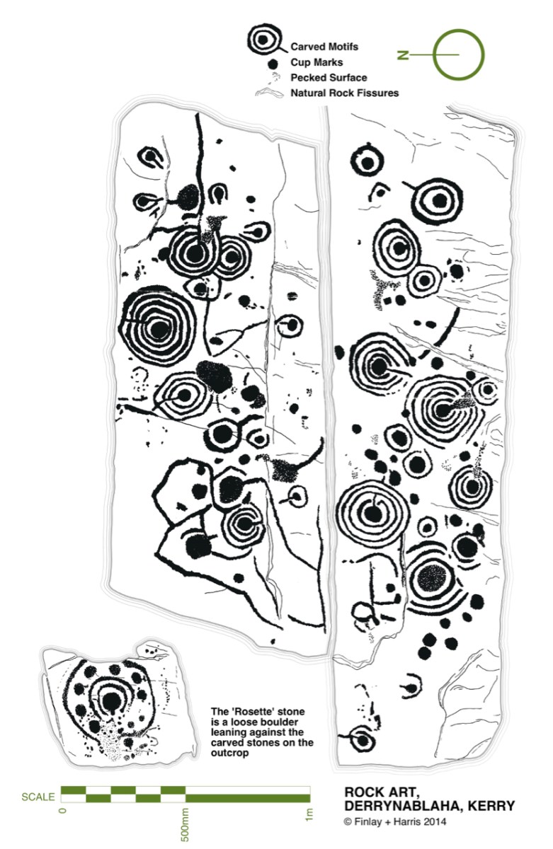
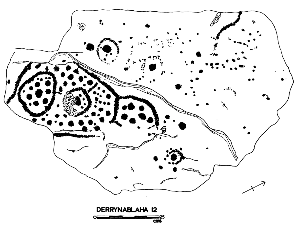
Some years ago, Finola and I organised exhibitions showing examples of Rock Art – many taken from Finola’s 1973 University of Cork thesis. The map above was drawn for the exhibitions: you can find Derrynablaha in the centre of the Iveragh Peninsula, left of centre. Below is a rendering of Finola’s thesis drawing showing – arguably – the most significant piece of Rock Art on this island:
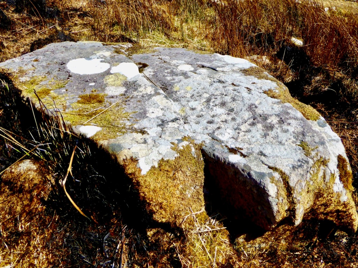
Here’s a photo of these rocks which I took on my first visit to this valley, in 2012. It was a dull day! The next photo was taken on a better day three years later. This shows how weather conditions can affect the way that Rock Art motifs are seen:
On our most recent visit – last week – we didn’t have time to scale the steep hillside to view this rock formation, but we enjoyed just taking in the stunning landscapes of the townland.
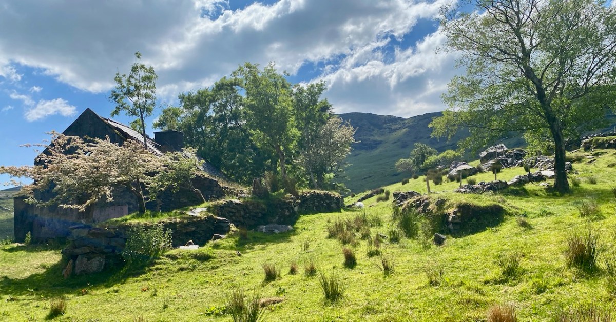
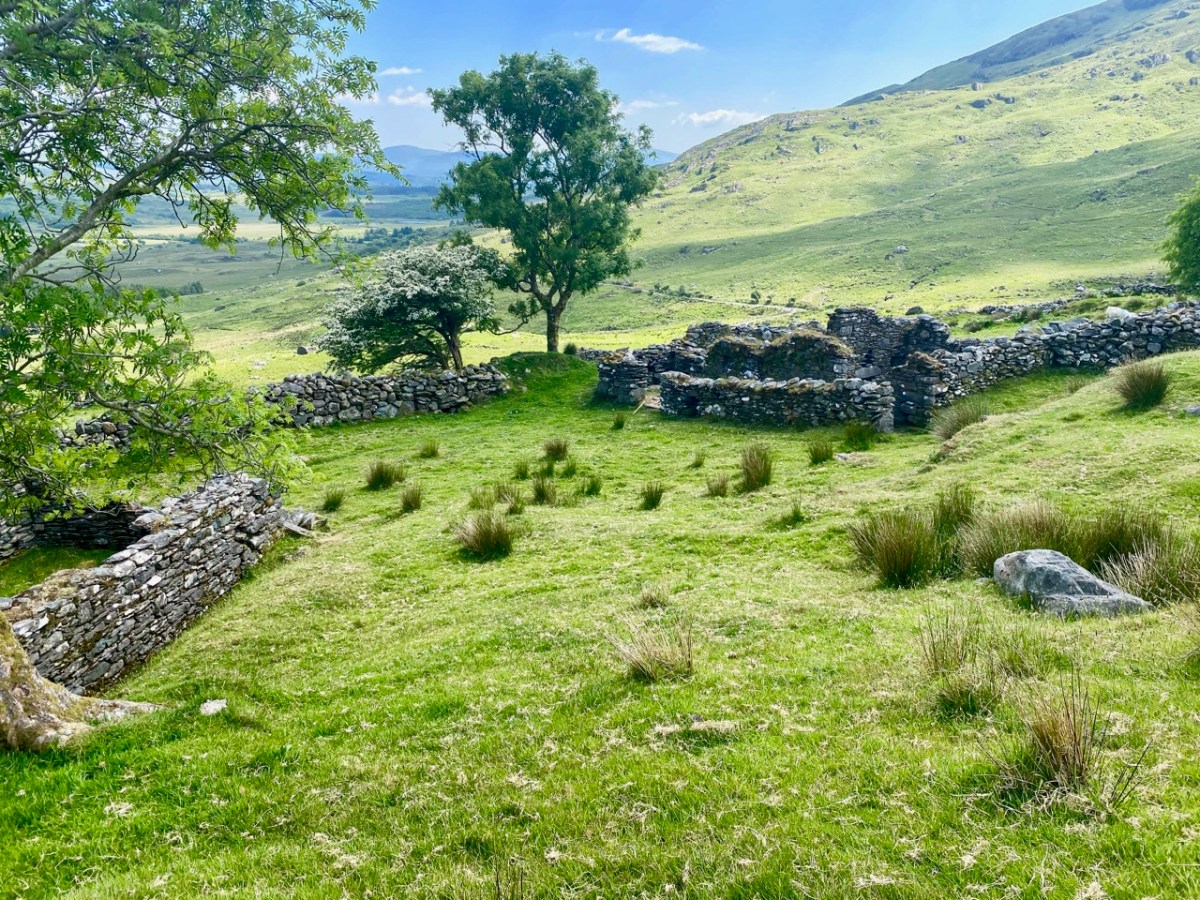
Above, and in the header picture, you can see the ruin of the cottage, which was once the only dwelling in this valley. It was still lived in when Finola visited to carry out her survey of the Rock Art in 1972 – fifty years ago. Then it was occupied by John O’Sullivan and his sister, May. John’s brother – Daniel – discovered much of the Rock Art in the surrounding landscape and reported this in the 1960s to Michael Joseph O’Kelly, then Professor of archaeology at UCC, and his wife Claire. Subsequently the O’Kellys made some expeditions to Derrynablaha, as did the Italian rock art expert, Emannuel Anati. Daniel had died prior to Finola’s visits and she recalls that the remaining family were excellent stewards of the Rock Art, ensuring that it was preserved and not damaged. She has ‘hazy memories’ of being brought into the house and given cups of tea and brown bread.
After we had published earlier posts about Derrynablaha, Finola was contacted by Faith Rose – the great niece of the O’Sullivans who lived in this cottage in 1969: Faith had visited the valley in that year. She recalls:
. . . I remember their bedroom was downstairs, the staircase to the upstairs being unsafe. There were none of the usual services in the house. There was an old fashioned fireplace where you could cook with a settle at the side. I seem to remember being told it had been built under some government scheme and the original stone farmhouse was to be seen slowly returning to nature close by. I wonder if you recall any of this. My great aunt and uncle were shy people who extended us the best hospitality. To my sister and I it was a magical place, but the hardness of their lives there was clear . . .
Faith Rose 2021
There are the ruins of several other buildings set within this landscape, indicating that the settlement was once significantly more populated in earlier times. Now it is wildly lonely, but impressively beautiful. When Finola carried out her surveys, she recorded 23 pieces of Rock Art. Today it is recognised that there are 26 known examples, with a further 7 stones in the adjacent townland of Derreeny. Long term readers of this Journal may recall that we visited the townland in April of 2015 – together with a small group of enthusiasts – to seek out all the known examples. At that time Ken Williams was using techniques he had developed to photograph the carvings in fine detail. These employed several portable light sources. The following sequence shows one of the rocks (number 12) taken without lighting; Finola’s drawing traced in 1972; then Ken’s technique in action and his results, which are remarkable:
Once again you are reading about the Rock Art at Derrynablaha! There have been several posts on this subject over the years, but we make no apologies: we never tire of the beautiful landscapes of Kerry – and we have seen it in all weathers. It would be good if we could be closer to solving the meanings of these rock carvings; this is unlikely to happen. Over the last 300 years since the phenomenon was first recorded in Ireland (and Britain, and many other places in Europe and the world) there have been varying theories – dozens – put forward for its existence: none of them is conclusive. Think on . . .
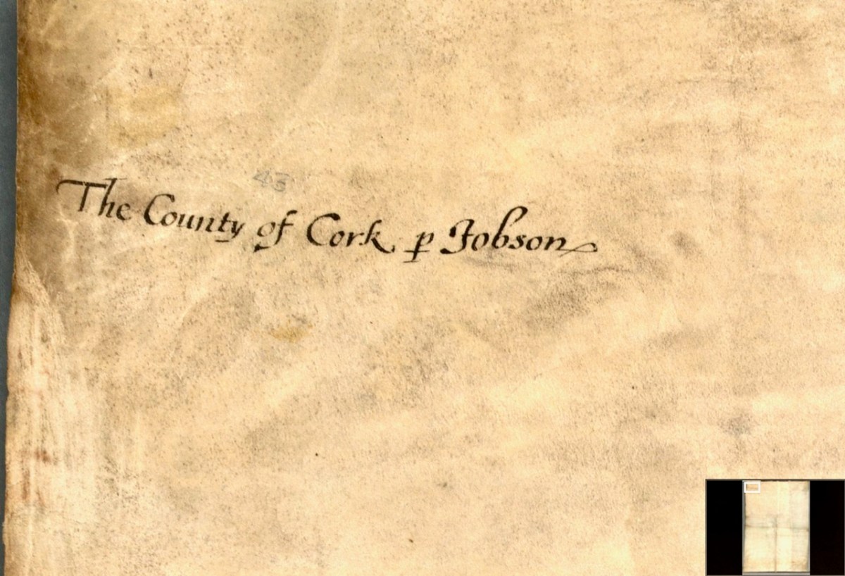
In Part 1, I said that We don’t know who did this one, or when: The date is given as 1560-1620. It seems in some ways more basic than other maps of the period, and less exact. I have now gone to the Atlas itself in Trinity College and discovered that the maps in the Digital Repository are an incomplete set. Specifically, the original Atlas at TCD contains the reverse side, the ‘verso’ of each map. Here’s what’s on the verso of the County of Cork. This:
and this:
So we see that the map is attributed to our old friend Jobson – he who drew the plantation map I wrote about here and here and which was dated to 1589. There are similarities and differences between this map and that one – the galleons and scales for example look very alike. But there’s a lot more information on the plantation map and some of it is different from our Map of the County of Cork. As to the date of the County of Cork map – we will try in this post to see if we can narrow that down a bit from the broad estimate of 1560-1620.
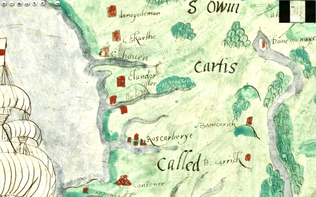
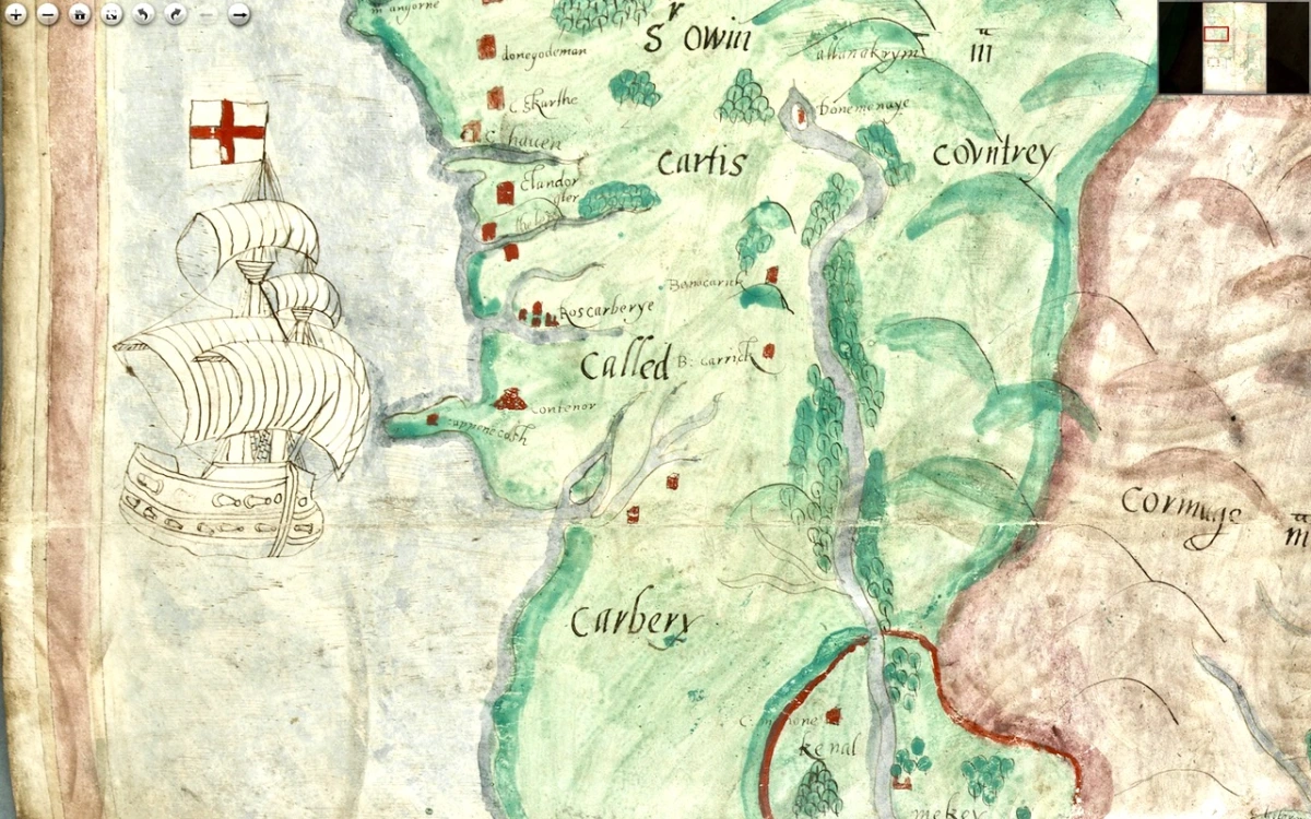
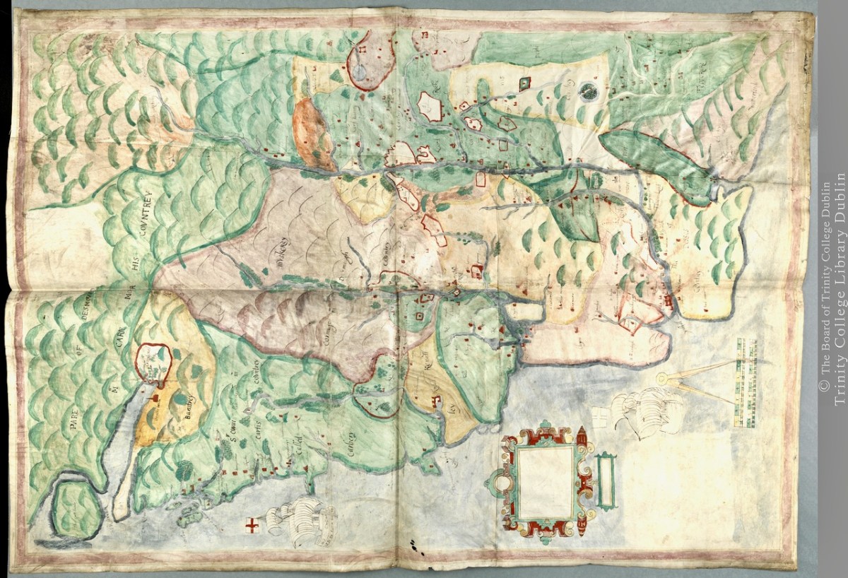
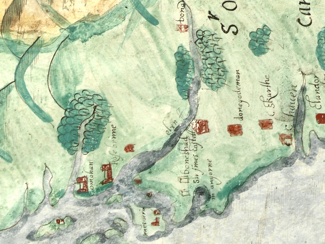
I want to go, as they say in Ireland, east along. That is, take off from where I finished last time, and travel east along the coast towards Cork, taking in the River Bandon. For the rest of this post, I’m keeping the map oriented as it is originally – that is, with west at the top (it’s actually surprising how quickly you can get used to this). Between Baltimore (Donashad) and Castlehaven (C haven), there are three castles shown, one labelled Sir Jmes Castell, Doneygodman and C skarthe. These are all a bit of a puzzle and I would invite readers to contribute ideas. On the archaeological list of Monuments for this area we can identify the O’Driscoll Castle on the Island in Lough Ine – could this be the Sir Jmes Castell? A promontory fort on Toe Head, known now as Dooneendermotmore, although likely originally an iron age refuge, was refortified in the 16th century and may, like the one I wrote about in Dunworley, have had a significant curtain wall. Was this Doneygodeman? It seems unlikely, as Doneygodeman is show inland – I wonder if instead it could be the castle at Raheen, which was a castle of the O’Donovans.
Finally, C skarthe might be a castle of the McCarthy’s – McCarthy is spelled in a variety of ways on this map, but there I can find no trace of it now. There was a castle in Listarkin, but once again, this is in the wrong place, unless this map, while certainly approximate in places, is wildly inaccurate. It seems reasonable to conclude that the more inland castles may have been harder to plot on a map that the coastal ones.
The castle at Glandore (c Landorgter) is clearly shown, along with two castles guarding the entrance to a long inlet labelled ‘the lepp.’ One may have been Kilfinnan, actually located near Glandore, which the other could possible be the coastal tower house at Downeen. This brings us to Rosscarbery (Roscarberye), shown as a collection of Buildings, as befits its status as a substantial town with a cathedral and a college, and a place of pilgrimage in the name of St Fachtna.
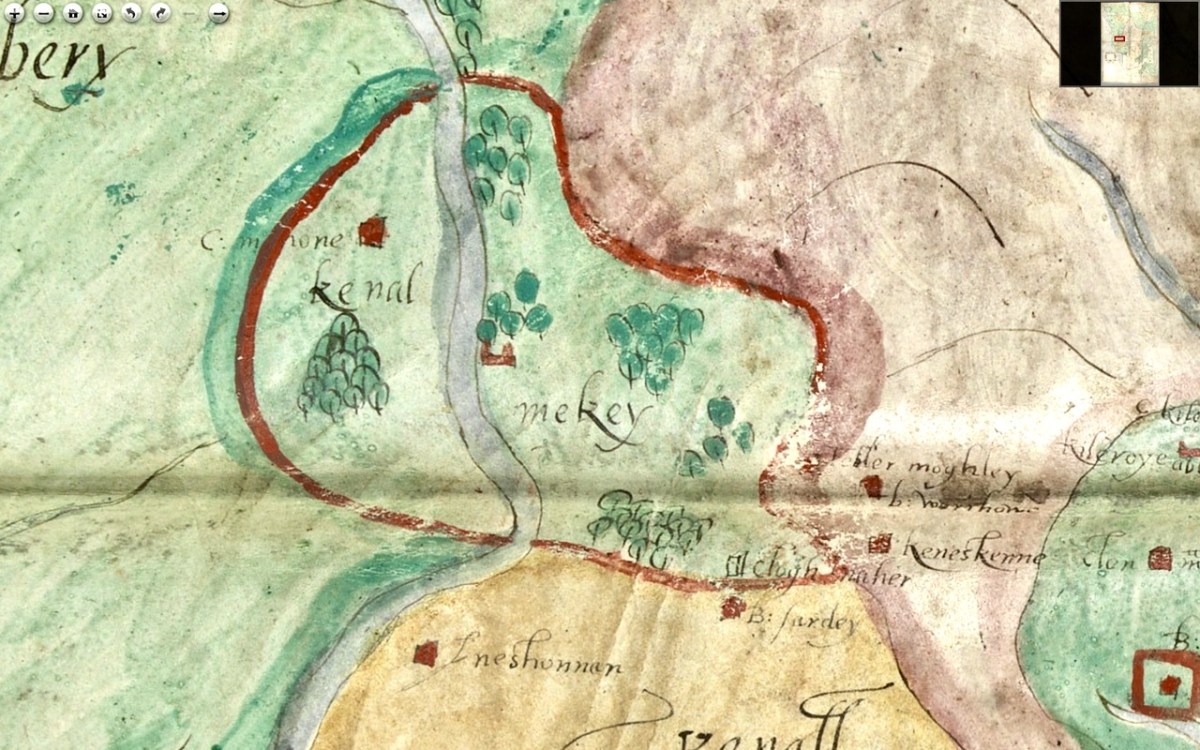
The entirety of this area, in green, is identified as Sir Owin Mc Cartis Countrey Called Carbery. Several other castles are identified here and there, and the course of the River Bandon is traced. The southernmost area is identified as Kenal Mekey, and to the south of the green-shaded section is Kennal Ley. In Canon O’Mahony’s magisterial History of the O’Mahony septs of Kinelmeky and Ivagha he states:
In the history of South Munster there is no fact attested by more abundant evidence (evidence unknown to Smith and Gibson) than that the Sept-land of the Ui Eachach Mumhan during many centuries extended from Cork to the Mizen Head, as one continuous territory, including Kinelea and Muskerry, and was ruled by a chief whose principal residence was Rath Rathleann, in Kinelmeky.
He identifies Rath Rathleann as the mighty multi-vallate ringfort of Gurranes, which was superseded by Castle Mahon, which stood where Bandon is now situated. And here it is, Kinelmeky, with C Mahon shown beside the river. Castle Mahon was later incorporated into Castle Bernard, home of Lords Bandon. Another Castle is shown further down the river – no doubt the one we are familiar with as we travel the N71.
We know that all this land was acquired by Richard Boyle after the Battle of Kinsale (1601) and that he started on his walled town of Bandon Bridge around 1620. Since this is still clearly identified as O’Mahony Territory I think we can take it that this map dates to before the battle of Kinsale.
We see Kenall Ley (Kinelea) in yellow, with the walled town of Kinsale at its heart. Kinsale walls were begun around 1380 and lasted until most of them were destroyed around 1690 by the forces of William of Orange. Inishannon is noted in Kinelea, as well as Park Castell (in what is now the townland of Castlelands) and finally B: Sardey (or is that a different first letter?). We know from another map in the Hardiman Atlas (below) that B designated a small town. Given that Kinsale is such a prominent walled town on this map, once again, a date before 1601 is likely.
Supporting a pre-1600 date is the fact that it is the old Irish families that are identified with their territories – no settler or Plantation names are given. In fact the O’Mahonys and McCarthys are the only names on the sections of the map we have seen so far. Moreover, it it really was the work of Jobson, we know he was actively mapping in 1589.
In Part 3 I’ll do a quick meander through the most interesting parts of the rest of the map. Stay tuned.
The Hardiman Atlas*, held in the Digital Repository of Ireland, is a bound volume of maps all of which were collected by James Hardiman. An erudite Mayo man born in 1782, he spoke Irish as his first language, studied law but was an historian to his core. He wrote histories, including one of Galway, and collected songs and manuscripts. He eventually became the librarian at Queen’s College Galway (now the University of Galway) where the main library is named for him. I’ve used the Hardiman Atlas before, for my posts on Jobson’s work on Planning a Plantation Part 1 and Part 2.
In the Digital Repository description we find this information of the Hardiman Atlas:
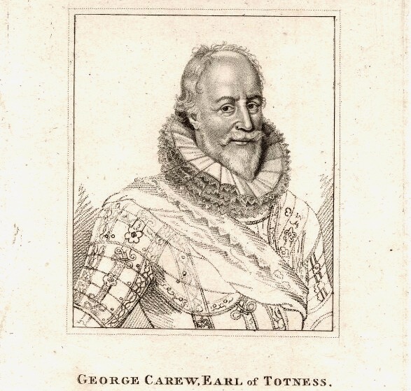
IE TCD MS 1209 is the collection of maps held in the Library of Trinity College Dublin and made by George Carew (1555-1629) 1st Earl of Totnes and Lord President of Munster at the beginning of the 17th century. Presented to the Library of Trinity College Dublin in the late 1700s. It contains nearly 90 maps and plans and is one of the largest sets of original Tudor and early Stuart maps of Ireland surviving anywhere. They are known collectively as the ‘Hardiman atlas’ after their first cataloguer, James Hardiman. Hardiman (1782-1855) was born in Co. Mayo and trained as a lawyer. He was librarian in Queen’s College Galway. Quoting from J.H. Andrews (‘Maps and Atlases’, Treasures of the Library Trinity College Dublin ed., Peter Fox (RIA: Dublin, 1986)): These maps, which are ‘for the most part competently drawn and attractively coloured’ and which ‘display not one scale of latitude or longitude in the entire collection … are essentially the by-product of a military and political conquest. However, as well as forts, defended towns and troop movements, they are rich in placenames, territorial boundaries and a good deal of ordinary landscape detail. Carew is said to have wanted all his Irish papers to be deposited at Trinity … though as it turned out most of them finally came to rest at Lambeth Palace in London. Nobody knows when, how or why the maps became detached from the collection and found their way to Dublin. They simply turn up in the College records of the late eighteenth century …. It was a non-Trinity historian, James Hardiman of Galway, who first catalogued them in 1821, apparently on his own initiative, and after being bound into a single, large volume they became generally known as the Hardiman atlas … The credit for [the rediscovery of their true origin] belongs to a recent Keeper of Manuscripts William O’Sullivan, who put the issue beyond any doubt by identifying Carew’s hand on many of the Hardiman maps and by collating all their titles and subjects with the original early-seventeenth-century catalogue still at Lambeth’.
George Carew** collected anything that helped to support his claim to large tracts of land in Munster. But maps were also vital for him as one of the military leaders in charge of subduing Ireland before and after the Battle of Kinsale in 1601. Read all about Carew and his time in Ireland in this excellent entry by Terry Clavin in the Dictionary of Irish Biography. (You might want to take a blood-pressure tablet first.)
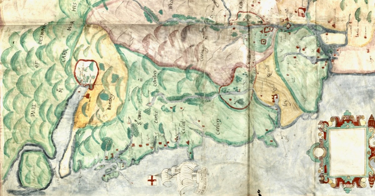
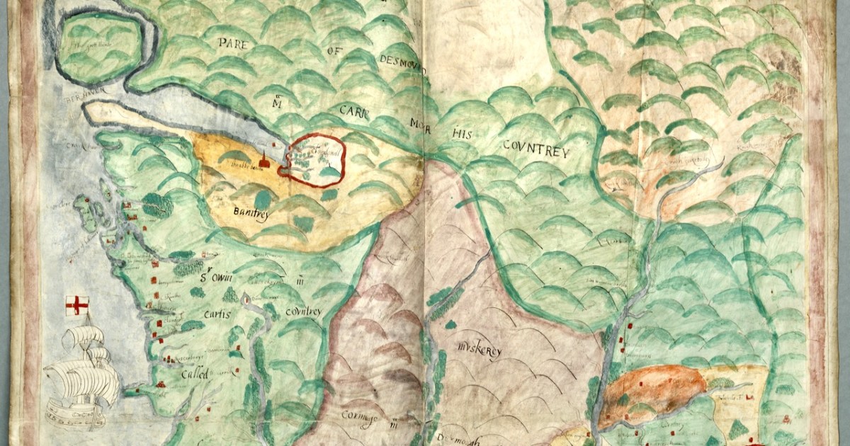
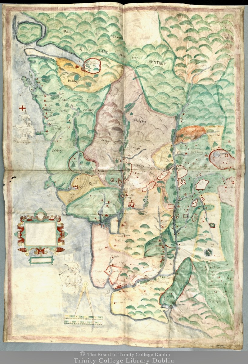
We don’t know who did this one, or when: The date is given as 1560-1620. It seems in some ways more basic than other maps of the period, and less exact. However, it still contains an extraordinary amount of information. The area it covers stretches from Bere Island to Waterford and from the sea to the Limerick and Tipperary borders. For ease, I have turned it rightside-up, so that West Cork is now as we expect to see it, on the bottom left of the map.
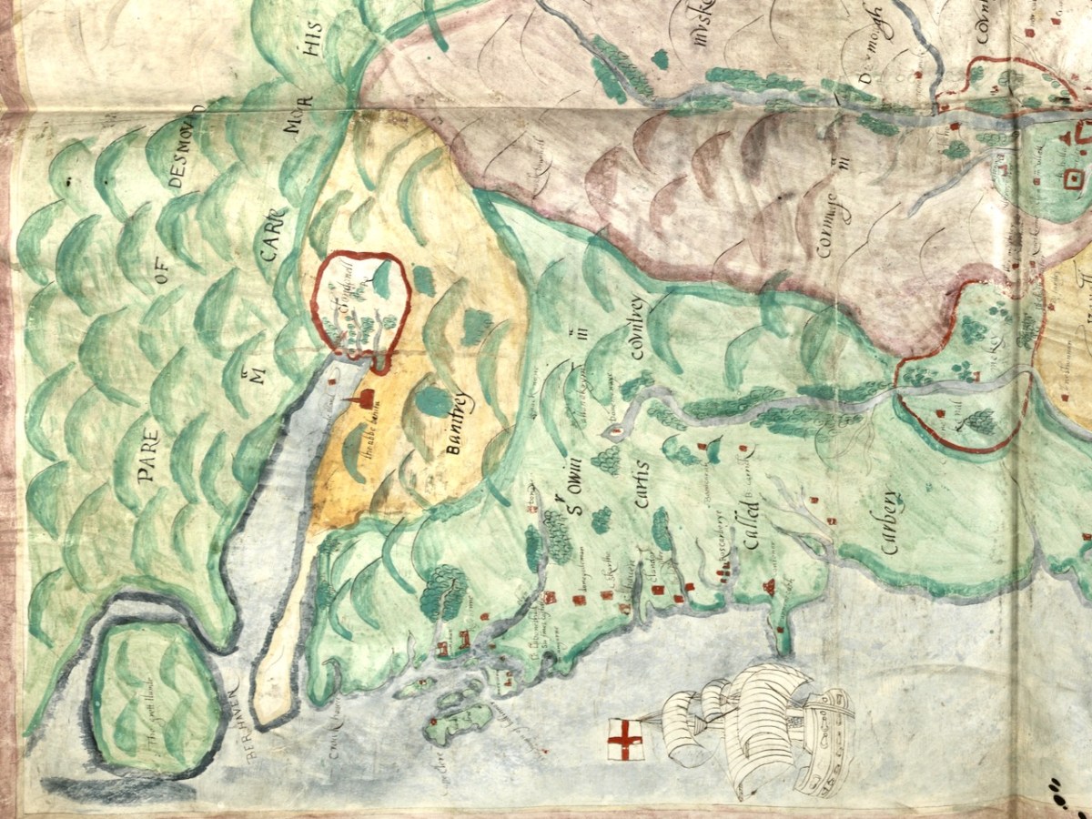
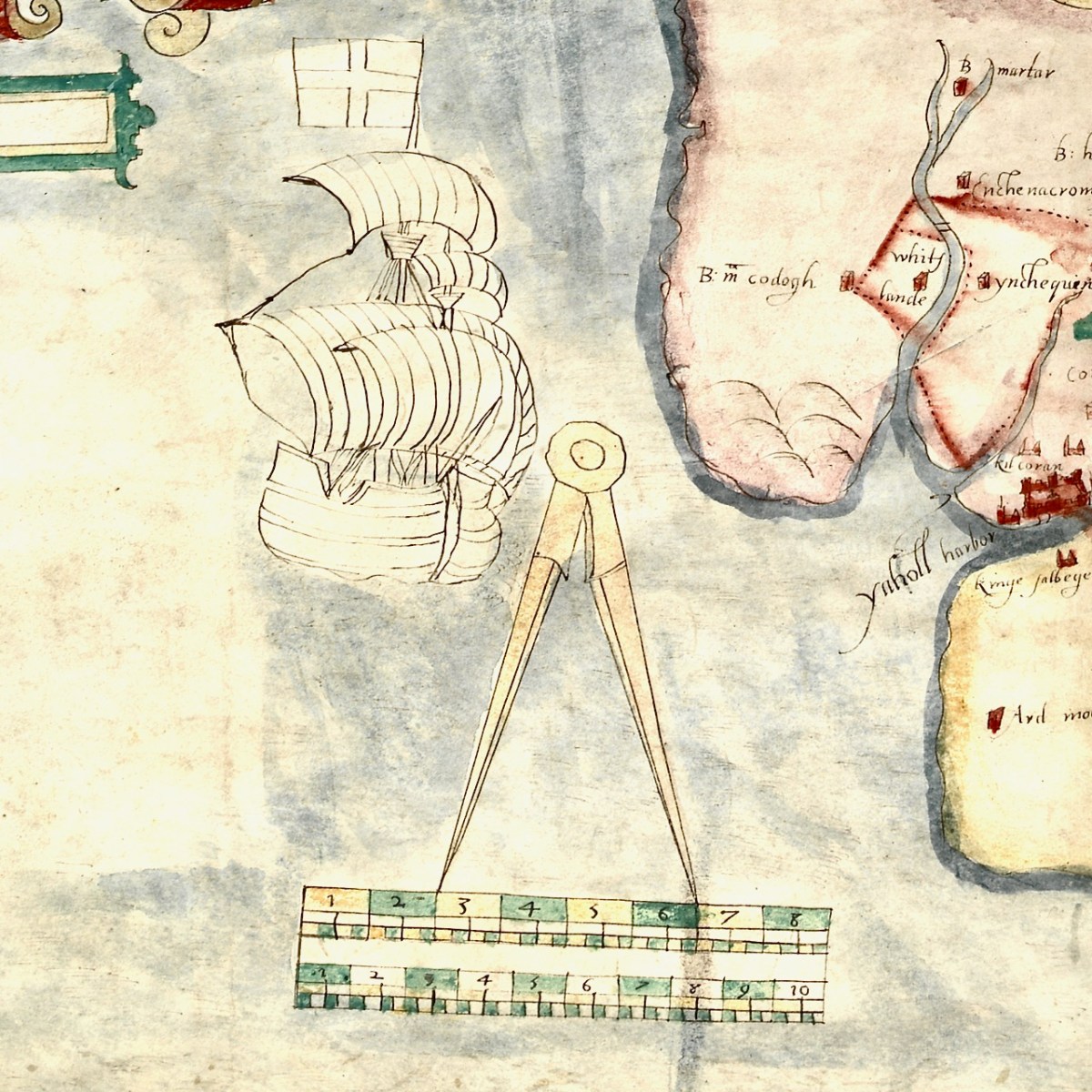
For this first post, I will concentrate on the area around Roaringwater Bay and west to Castlehaven, since this is my home turf, but we will explore further afield later. To put it in a little context, here’s a slightly broader view of the area (below). Note that it is labelled Sir Owen McCarthy’s Country called Carbery. There is also a large tract simply labelled Bantrey, of which the only feature is The Abbe Benita. Dunmanway, Donemenuye, is shown on an island at the head of the Bandon River. Berhaven, Croukhaven, Cape Clere, and The Haven of Boltimore are shown along the coast, along with a very fine warship in full sail, with cannons, a crow’s nest and an English flag.
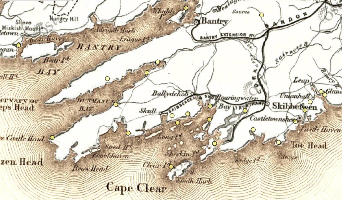
So you can further orient yourself, here is the 1880s map of the same area (more or less). The yellow dots indicate castles/tower houses as identified on the 1880s Ordnance Survey Map as part of the National Monuments Service.
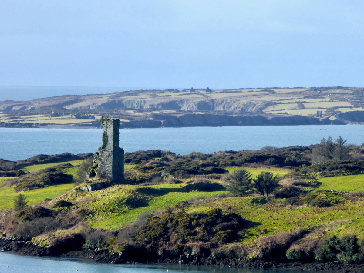
While Ardintenant still has one wall-tower, Rossbrin is a vestige of what it once must have been. This is what it looks like now, and you can see the remnants of what was once also a small castle on Castle Island behind it.
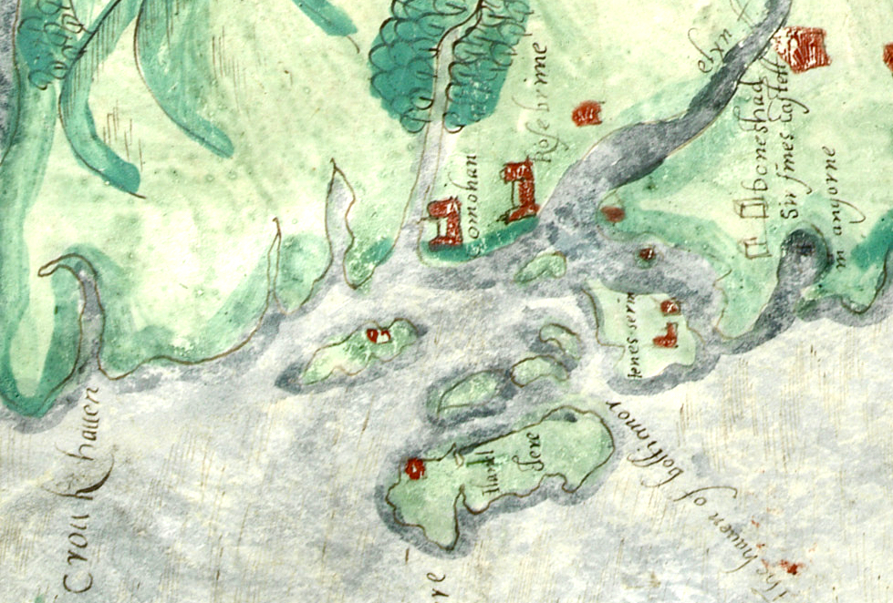
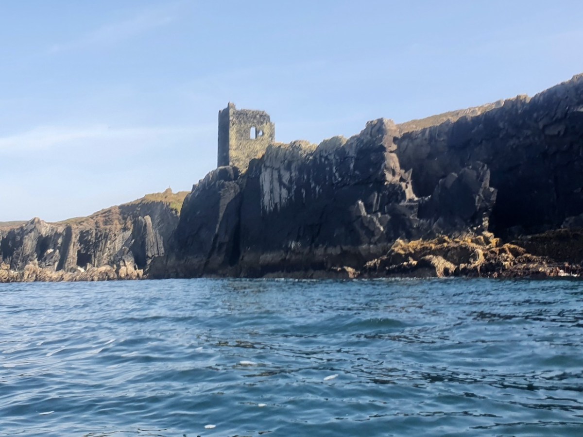
Castle Island castle and Dún an Óir Castle on Cape Clear are shown although not labelled, as is both the Castle (Dúnalong, or Castle of the Ships) and the Friary on Sherkin Island. It’s hard to imagine when you look at what remains of Dún an Óir now (below) that its name means Castle Of Gold – a testament to the wealth of the O’Driscolls who built it. Thank you so much to our reader, Tash, who sent me this wonderful photograph.
Moving West, into O’Driscoll territory (below), we see Baltimore in outline (the colorist ran out of brown ink?) – it’s called Doneshade (Dún na Séad, or Castle of the Jewels). Beside it is the brown square used to indicate tower houses and the words Sir Jmes Castlell. Following the Ilen Rover (Elyn ff) to its source we find Castle Donovan. Two more brown blobs at the entrance to the Ilen River may indicate Dún na Gall (Fort of the Foreigners) on Ringarogy Island, and Old Court Castle.
I’m going to leave it at that for now, but I hope your appetite is whetted to see more of this invaluable record of Cork 400 years ago.
*I am grateful to Digital Collections, at the Library of Trinity College Dublin, who gave permission to feature this map from the Hardiman collection in this blog. The complete citation for the map is as follows: Unattributed, & Manuscripts & Archives Research Library, Trinity College Dublin. (2021) Map of the County of Cork, Digital Repository of Ireland [Distributor], Trinity College Dublin, the University of Dublin [Depositing Institution], https://doi.org/10.7486/DRI.p554ng24v
**I am also grateful to the British National Portrait Gallery, who provide an easy method to use images from their collection under license, for purposes such as this non-commercial blog. The portrait of Carew is from their collection.
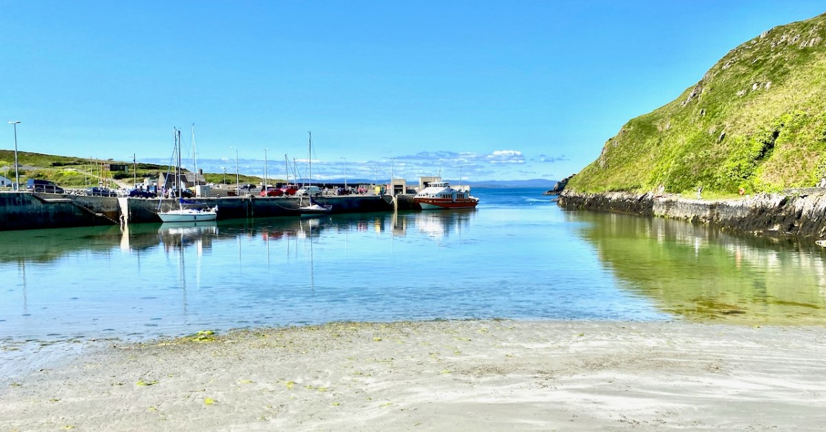
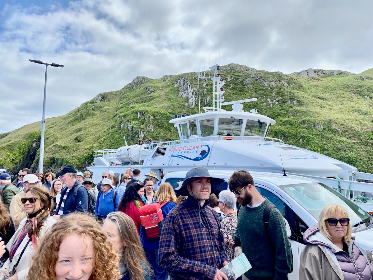
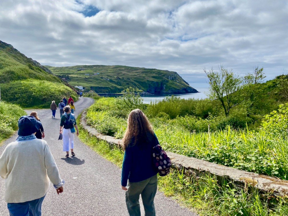
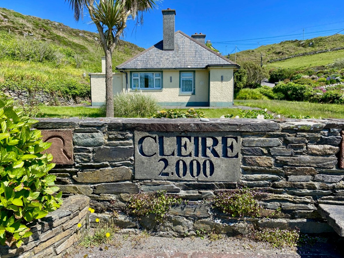
The island of Cape Clear is a constant in our daily view from Nead an Iolair. We don’t visit often enough… But this week the Fastnet Film Festival – based in Schull – had a day out on The Cape, and we went along for the excursion! That’s the harbour, above.
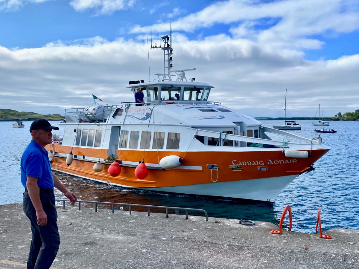
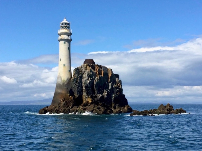
And this is Schull Harbour, where Cape Clear Ferries’ newest boat, Carraig Aonair, picked us up. The name is Irish for The Fastnet and means, literally, The Lone Rock. We have written about the lighthouse in previous posts.
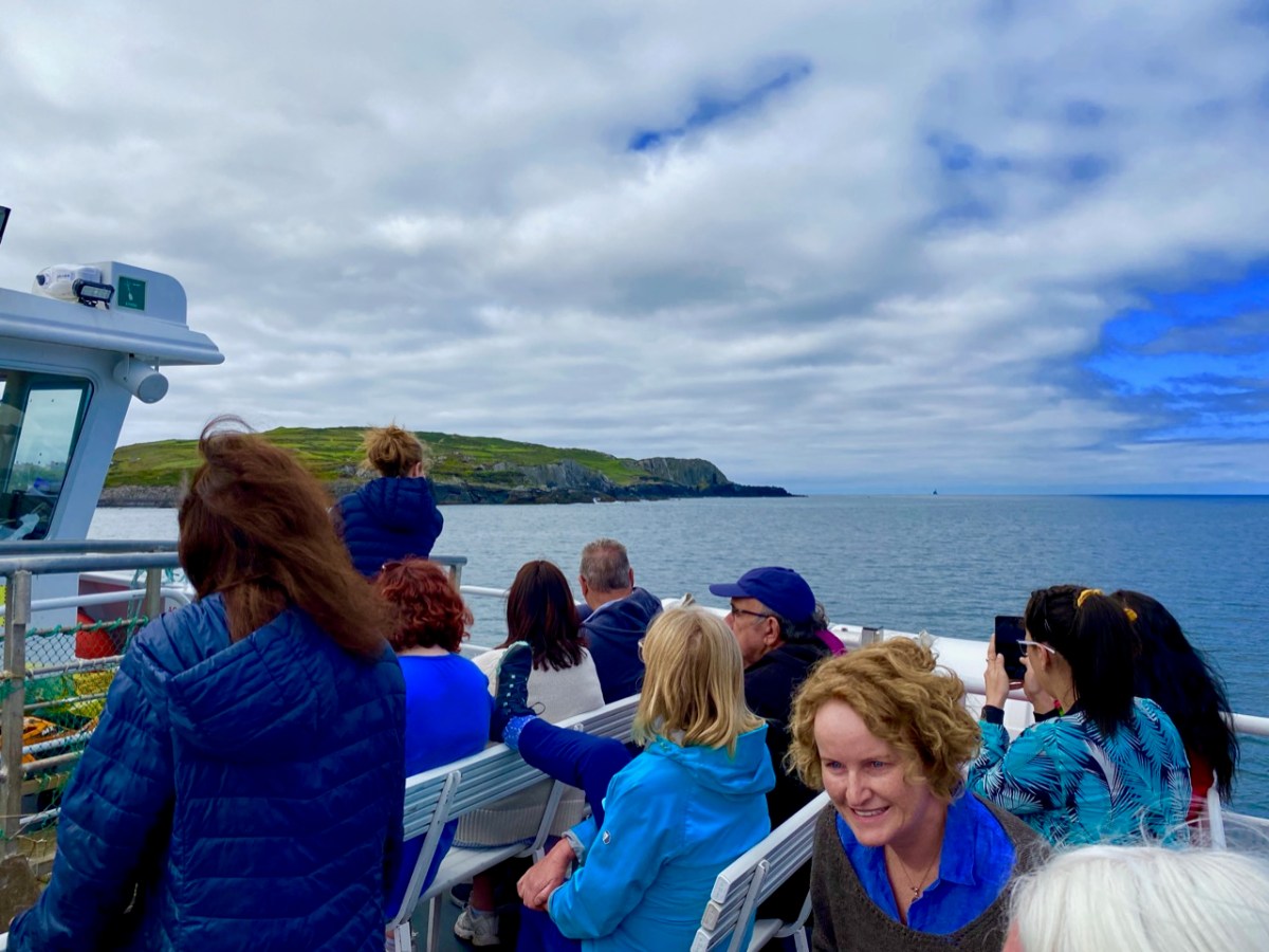
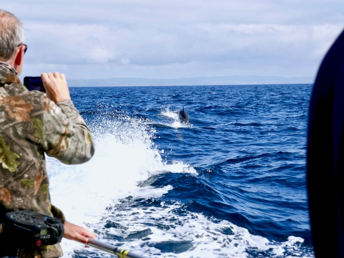
The dot on the horizon, seen here (above) from our ferry to Cape Clear, is the Fastnet Lighthouse. The crossing from Schull takes only half an hour and we were fortunate to have good weather and calm waters. The crowd on board was delighted by a diversion on the way – a pod of dolphins kept the boat company for a while.
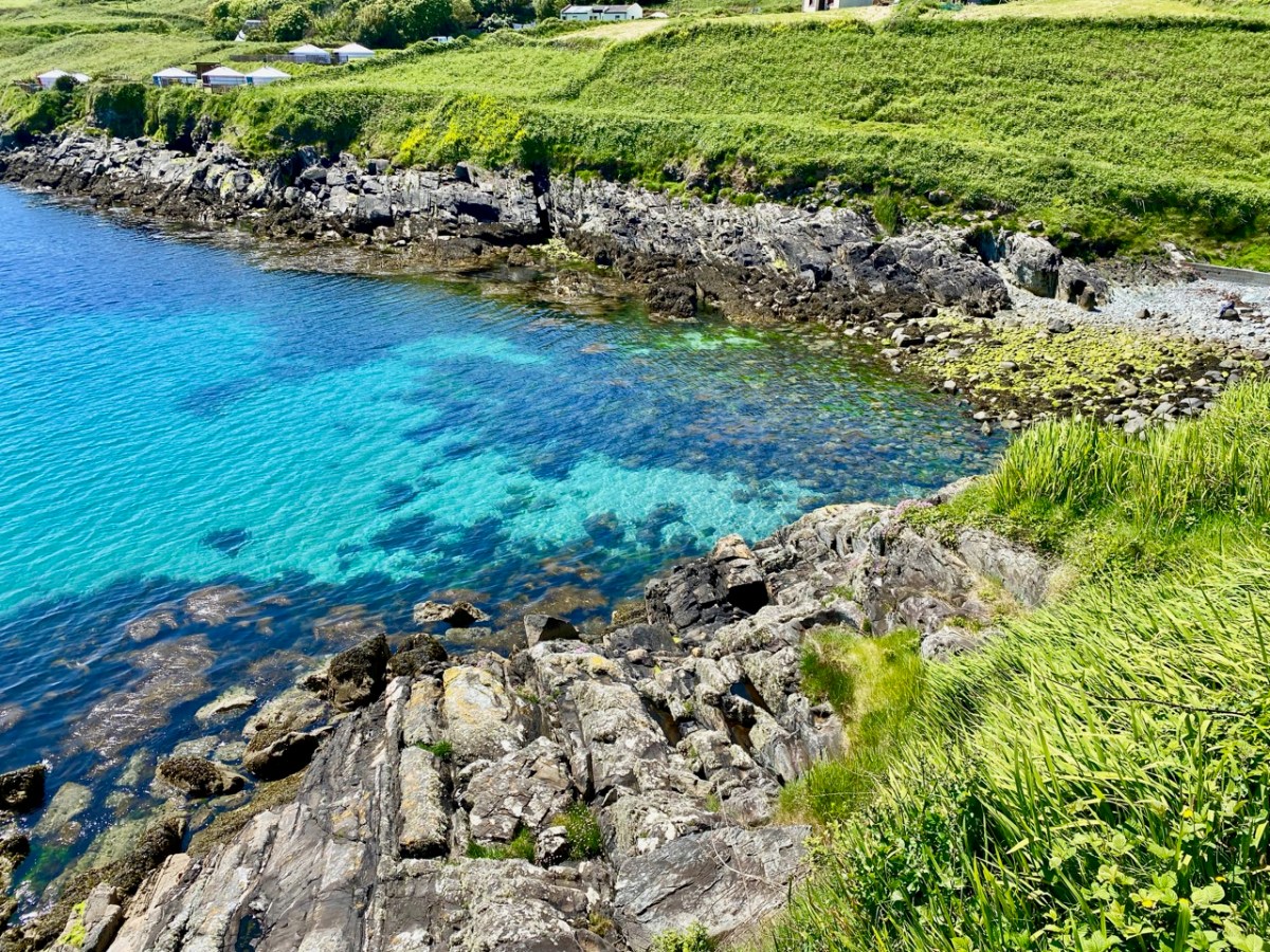
Arriving in the North Harbour we were looking forward to our Teanga na Gaeilge ar Oileán Chléire: an Irish Language Day on Cape Clear. First, we had a long hill to climb to reach an Halla Mór: a whole team of islanders were on hand to provide lifts in cars and buses. Some of us chose to do it the hard and steep way, but were rewarded by stunning views and azure water.
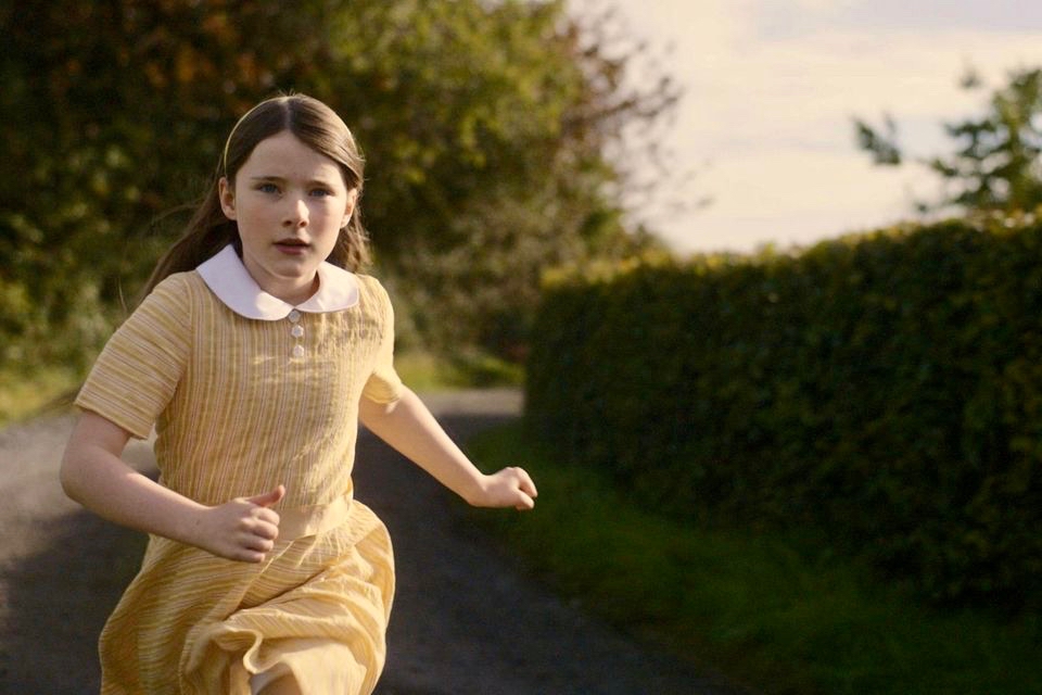
Our first film treat was An Cailín Ciúin – The Quiet Girl.
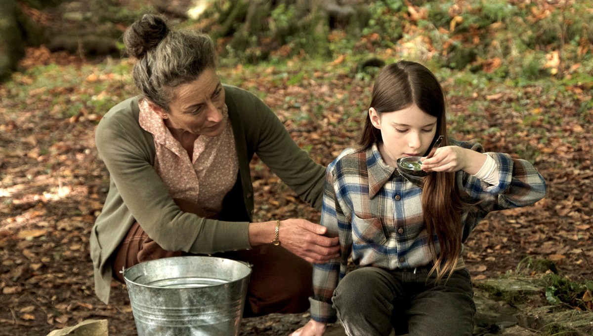
. . . Nominated for this year’s 95th Academy Awards in the ‘International Feature Film’ category of the Oscars, Colm Bairéad’s debut feature became one of the most lauded Irish films of recent years. Adapted from Foster, a short story by Claire Keegan, it centres on nine-year-old Cáit, a shy and withdrawn child who receives little affection from a family ruled by an uncaring patriarch. When she is sent to spend the summer with her aunt Eibhlín (Carrie Crowley) and her husband Seán (Andrew Bennet), she blossoms in their care. At the end of the summer, difficult decisions must be faced . . .
2023 Fastnet Film Festival Programme
Catherine Clinch is ‘The Quiet Girl’ in the film (above). Born in 2009, this is her debut role. Happily, she joined us for our day on the island. I was affected by the story in the film, as were many others in the audience. In fact, I don’t think I have been as moved by something on screen since I was taken to see Bambi at the age of five. Although not topping the Oscars ‘Best International Feature Film’ category (this went to All Quiet on the Western Front) it has rightly gained many other accolades. I think the most apt review I read said simply:
” . . . As beautiful as it is devastating . . .” (Boston Globe).
Carrie Crowley also deserves mention for her sensitive role as the aunt of The Quiet Girl. Crowley and Clinch – below.
This Irish language film was undoubtedly the highlight of the day, but there were plenty more moments, including short film viewings, coffee and good lunches, on Cape Clear. With some long-awaited summer weather to help us enjoy the island.
We had to be sure to arrive back at the harbour before the boat left at five. The alternative would be to sleep out under the stars – tempting! For very many reasons, this was a most memorable day.
If you can stretch your memories, think back. We started to write Roaringwater Journal in October 2012. At that time we had just settled in West Cork, and we were anxious to revisit the work which Finola had carried out between 1971 and 1973, when she was studying Archaeology at the University of Cork. For her final thesis subject, she specialised in surveying and recording the Rock Art of West Cork and Kerry.
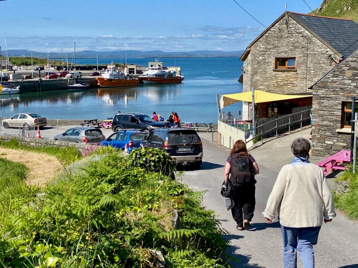
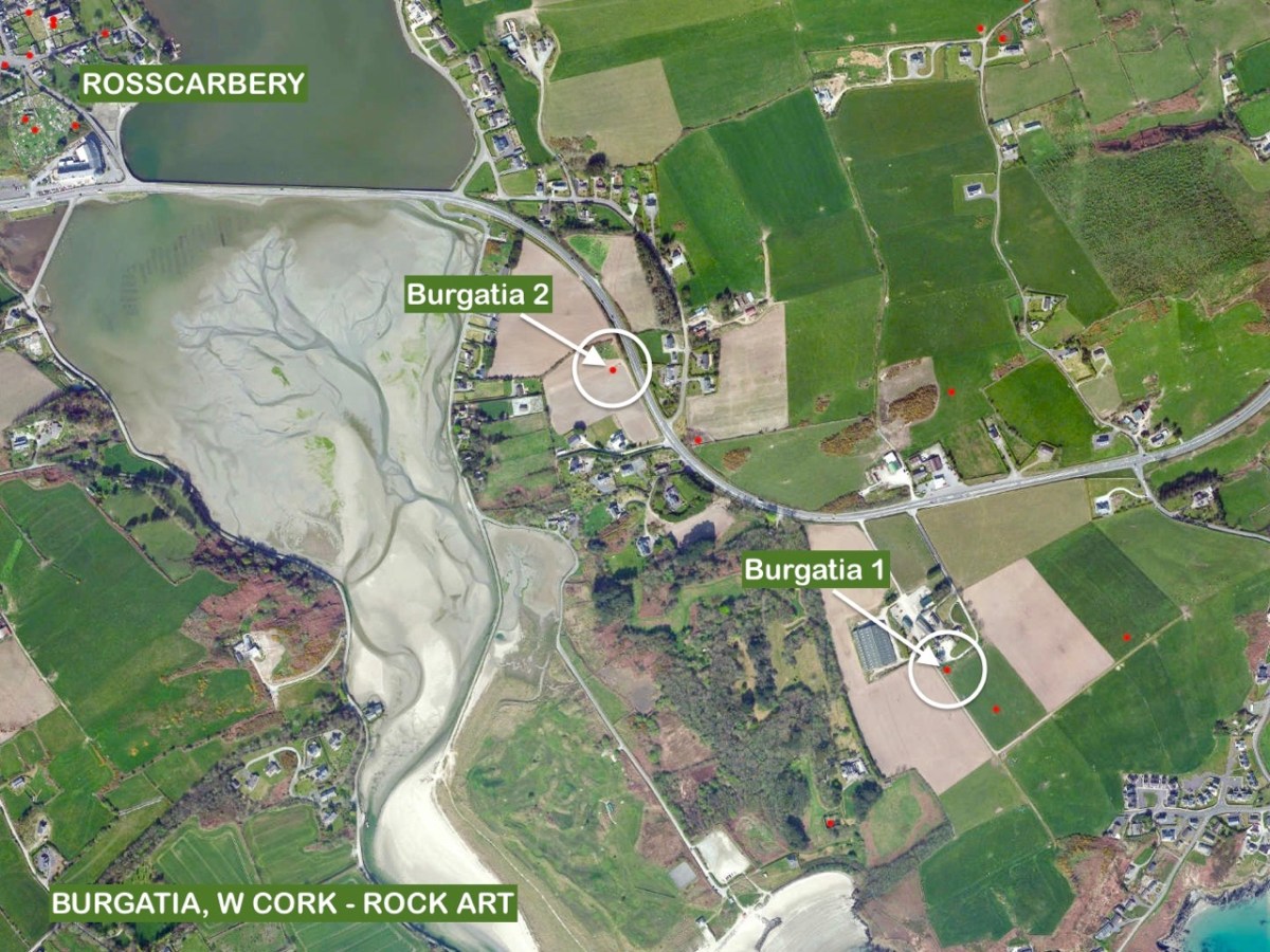
Finola has her thesis, above, and is turning to the page which shows the drawing she made from Burgatia, which is a townland outside Rosscarbery, in West Cork. When Finola was researching, there was only the one standing stone in Burgatia listed as bearing the cup marks and circles of Rock Art. Since the 1970s, however, a further stone has been identified with this feature. It is a standing stone just to the right of the N71 as that road rises from the Causeway as you travel East from Rosscarbery. In Finola’s day, this rock was only identified as a ‘standing stone’. The header picture to this post shows the stone.
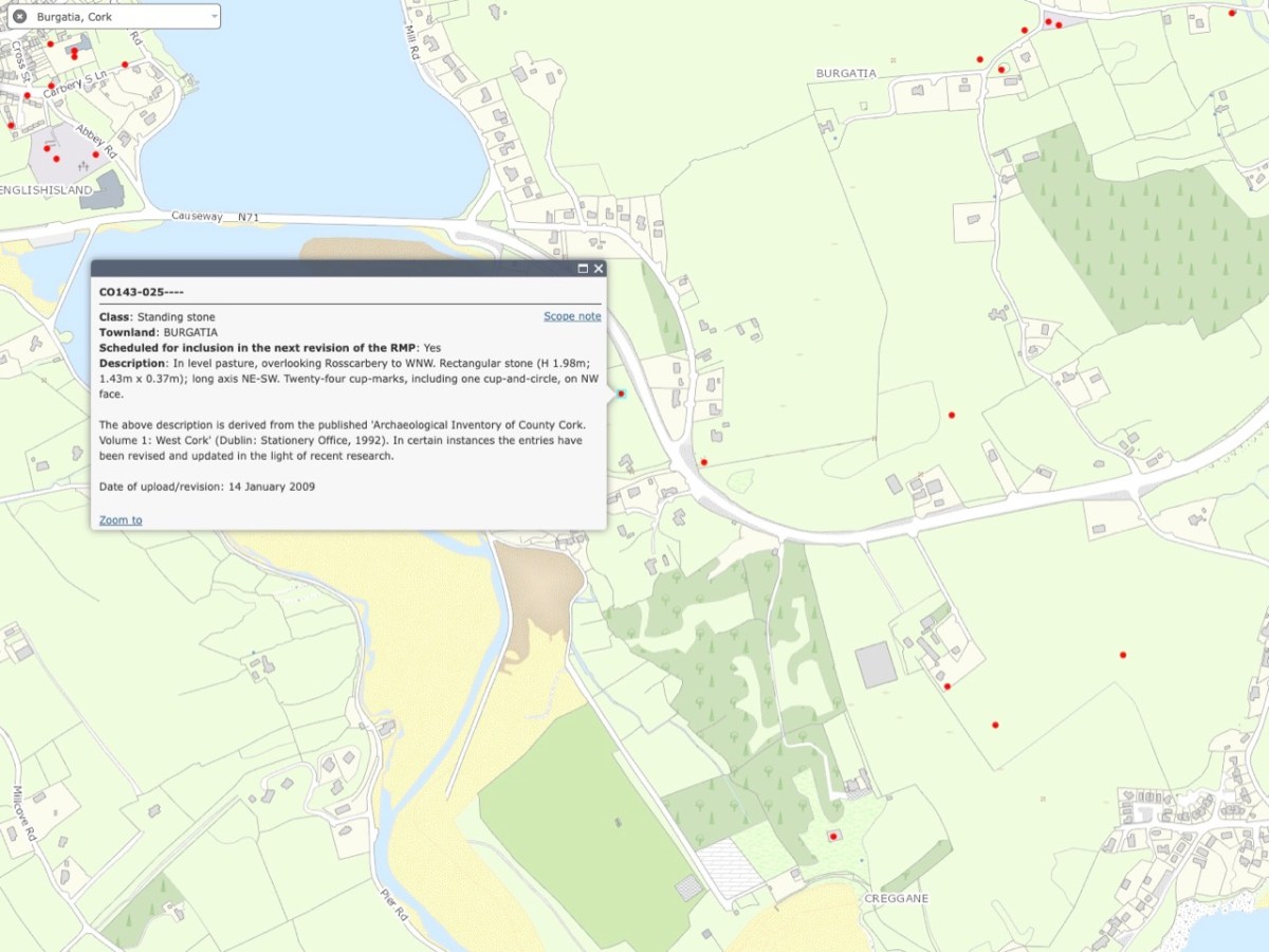
These two extracts from the present day OS map show the entries given for each of these stones – stone 1 at the top and stone 2 below. The current edition of the map now indicates that stone 2 has significant Rock Art on the west-facing elevation. The Archaeological Inventory has been revised and updated twice since Finola’s survey – in 1992 and 2009. One of these revisions has added the information that “…the stone has twenty-four cup marks, including one cup-and-circle, on NW face…”
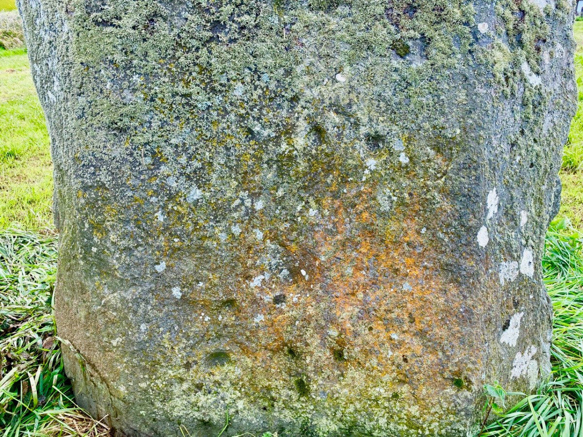
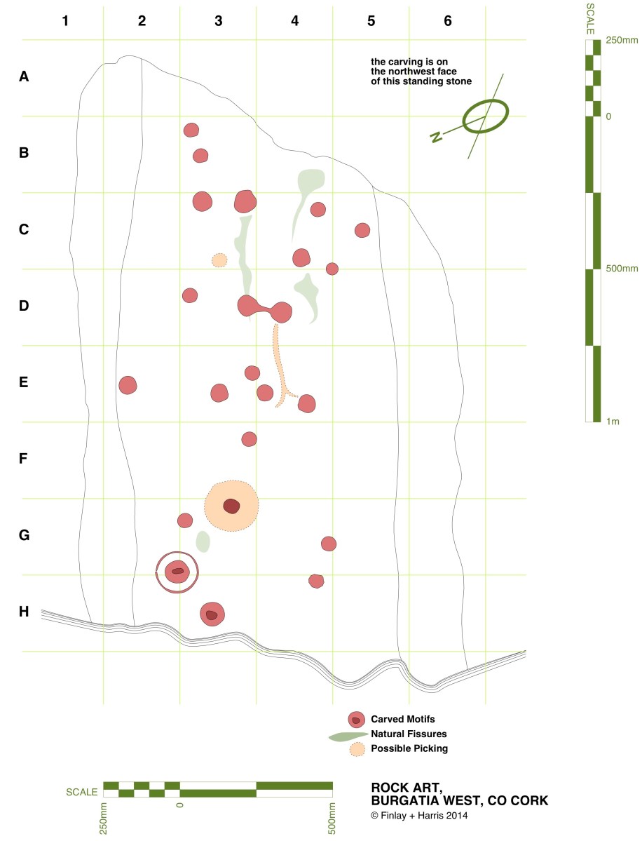
Here is that NW face, photographed this month – May 2023. Many of the cup marks show up well. Back in 2014 we decided that we would fully measure the marked surface of this rock, in order to add to the inventory created by Finola in her University days. Here is my own 2014 drawing:
In the lower picture, I have adapted the same drawing to overlay it on a photograph taken as part of the survey. That was in 2014. Now – nine years later – I believe I have discovered an additional cup mark! Have a look at this close-up of the lower part of the stone:
Comparisons between the two photographs (2023) and the one taken in 2014 (below) show that the level of the ground has apparently lowered in nine years, exposing the additional marking. As the field is cultivated, it is quite possible that there has been some movement of the ground in relation to the rock foundation.
Above – Burgatia 2, January 2014. Note the cup-and-ring mark, and the higher ground level.
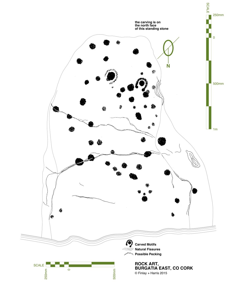
The aerial view, above, shows the relationship between Burgatia 2 and Burgatia 1. As we were revisiting, we also called to have a look at the latter. Here is Finola’s drawing from 1973 – the one that appeared in her thesis:
Here’s Finola at Burgatia 1 earlier this month (thanks to Amanda for this):
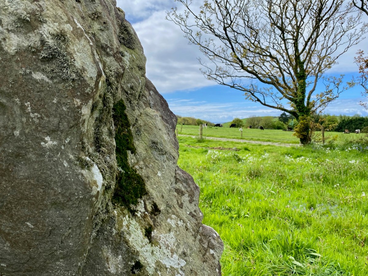
And the view west from the rock, from which you can glimpse the sea (also this month). See below for the same view in 2014:
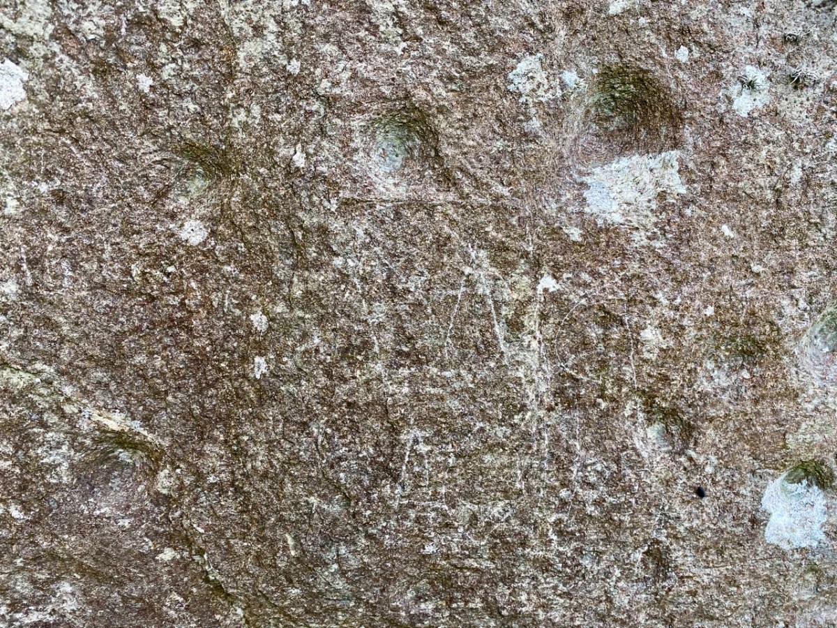
Burgatia 1 seen this month: note the graffiti. We don’t recall having seen this before. Please note this stone is on private land, and permission must always be obtained from the owners (who live in the adjacent house) before accessing it. Here’s the stone in context, showing its southwest facing face which – in this case – has no markings. No one can tell the full history of any of the archaeology discussed today. There are some theories that the standing stones may once have been lying down, and the carvings were made on their (then) upper faces. They were then, possibly, erected to make more significant monuments – one with its cup marks facing one way, and the other facing the opposite way (as it happens).
I’ll finish with this extract from the earliest 6″ Ordnance Survey marked up map. I’m interested to see that here Burgatia 2 is shown in a field boundary:
Welcome to the UCD Library Cultural Heritage Collections blog. Discover and explore the historical treasures housed within our Archives, Special Collections, National Folklore Collection and Digital Library