As a finale to this little series on Ireland’s Electrification Ventures back in the 20th century, I’m taking you on a tour of Ardnacrusha. This generating station – powered entirely by water from the River Shannon – was the largest in the world when it was built by Siemens, between 1925 and 1929. Siemens AG is the foremost industrial manufacturing company in Europe, and its Irish connections began in 1874, when Siemens laid the first direct electrical cable across the Atlantic, linking Ballinskelligs Bay on Ireland’s west coast to North America. The pioneering continued, in 1883, when the company built one of the world’s first electric railways, linking Portrush and Bushmills in Co Antrim. After Ardnacrusha, Siemens became responsible for many of Ireland’s landmark achievements, including the ESB’s first pumped storage power plant at Turlough Hill; the DART rapid transport network; the baggage handling systems for Dublin Airport’s Terminal 2; and – in 2016 – the orders for Galway Wind Park – then the largest in Ireland.
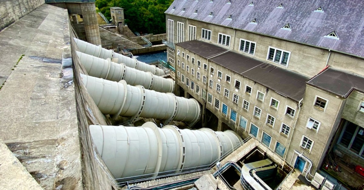
The header pic shows one of the three vertical-shaft Francis turbo-generator units after construction. These were joined by one vertical-shaft Kaplan turbo-generator unit between 1933 and 1934. Above is one of the penstocks which brings the water into the turbine casings.
. . . The construction of the Shannon Scheme was a mammoth undertaking for a country the size of Ireland, especially when the State was barely three years old. The project cost £5.2 million, about 20% of the Government’s revenue budget in 1925 . . .
ESB DOCUMENTS
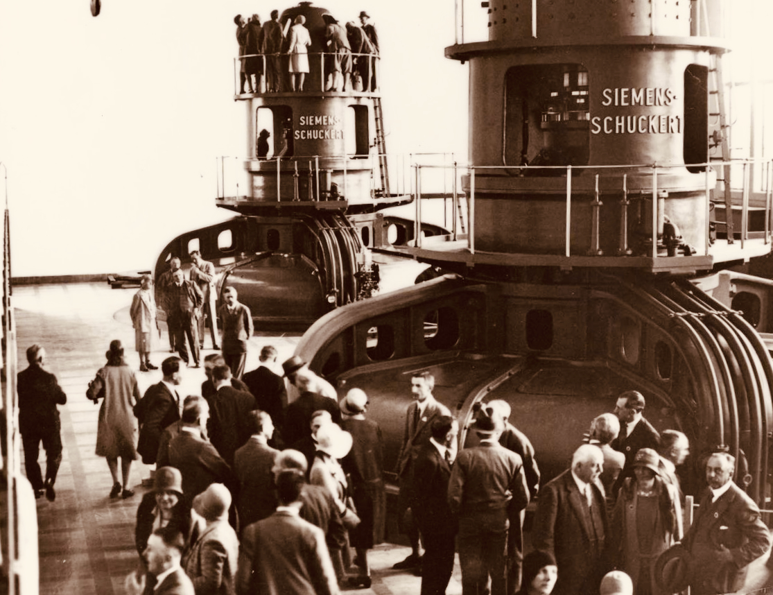
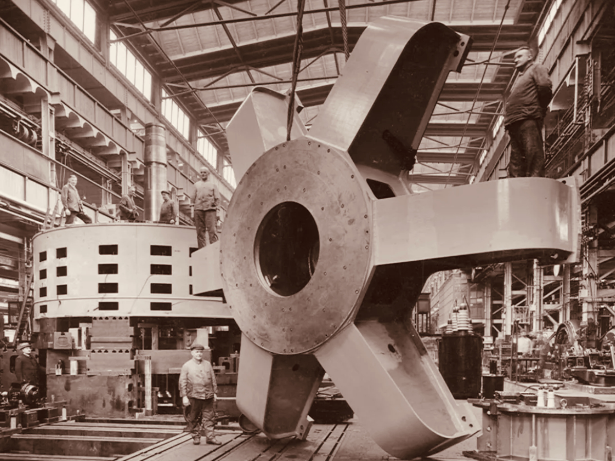
Visitors to Ardnacrusha in the turbine house on opening day, 22 July 1929 (ESB Archives). Below – a part of one generator awaiting installation (ESB Archives).
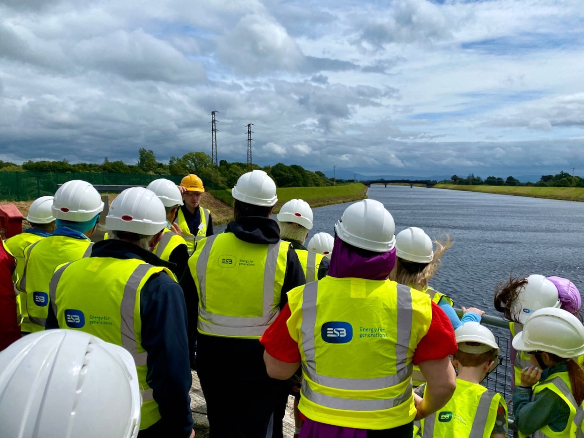
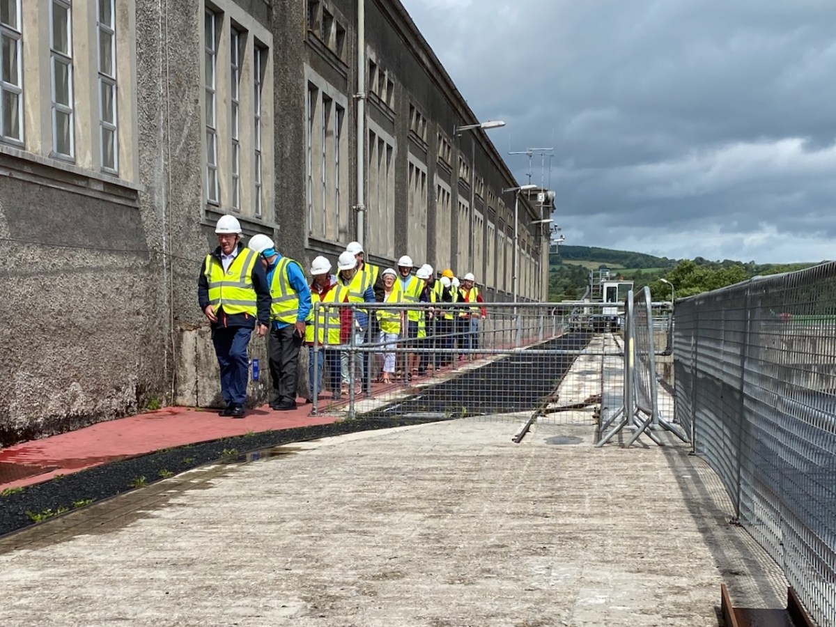
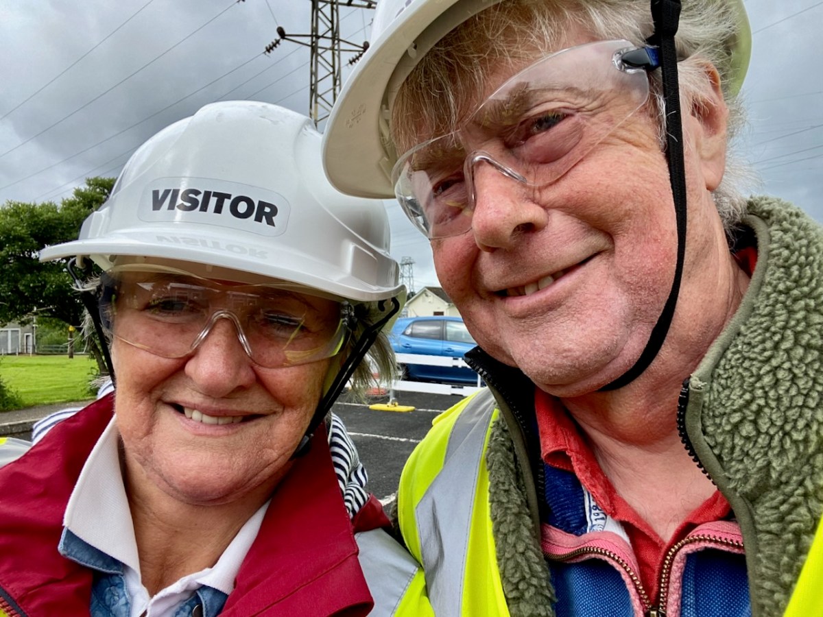
We joined a group visiting the generating station in early July. It was a great and satisfying experience! Safety was the top principle, but we got to see all the features of the whole set-up. If you want to go, book in advance – it’s free – and fascinating (if, like me, you are moved by engineering and history).
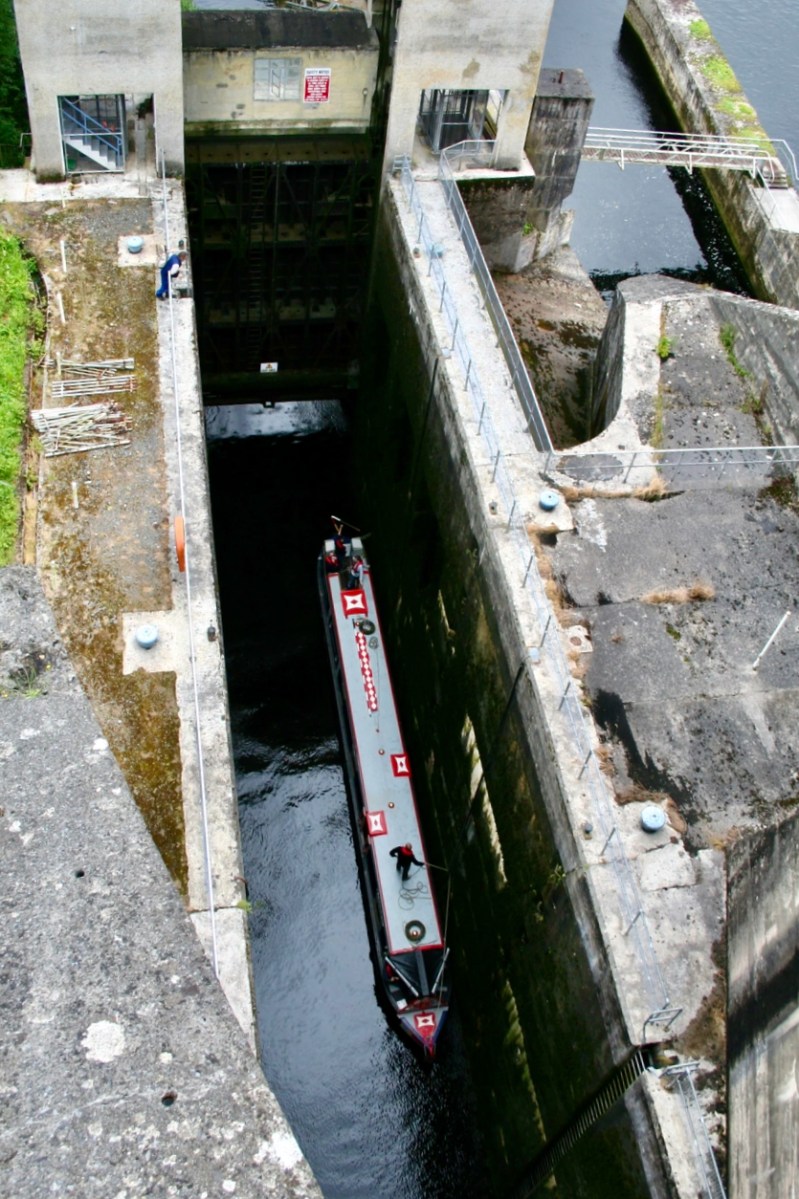
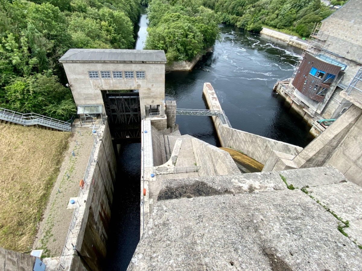
The pound lock at Ardnacrusha: it provides navigation for boats through the dam. At a drop of 100ft – 30 metres – it’s the deepest lock in the whole of Britain and Ireland. Following is a pic of a traditional British narrow-boat – NB Earnest – traversing the lock (Irish Waterways History).
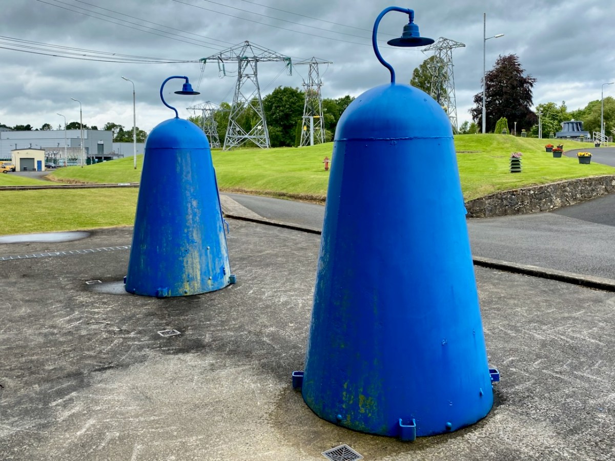
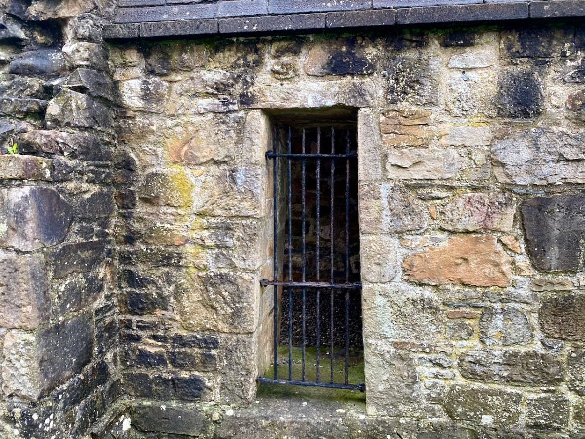
The main building at Ardnacrusha has a definite sense of ‘Bavarian Character’ to it – probably because of its German roots. I wonder if that’s the reason it escaped being bombed in World War II? Concerns were definitely expressed that this could have happened, and steps were taken to mitigate any possible damage. I was particularly impressed by these one-person air-raid shelters, which have been preserved because of their historical interest:
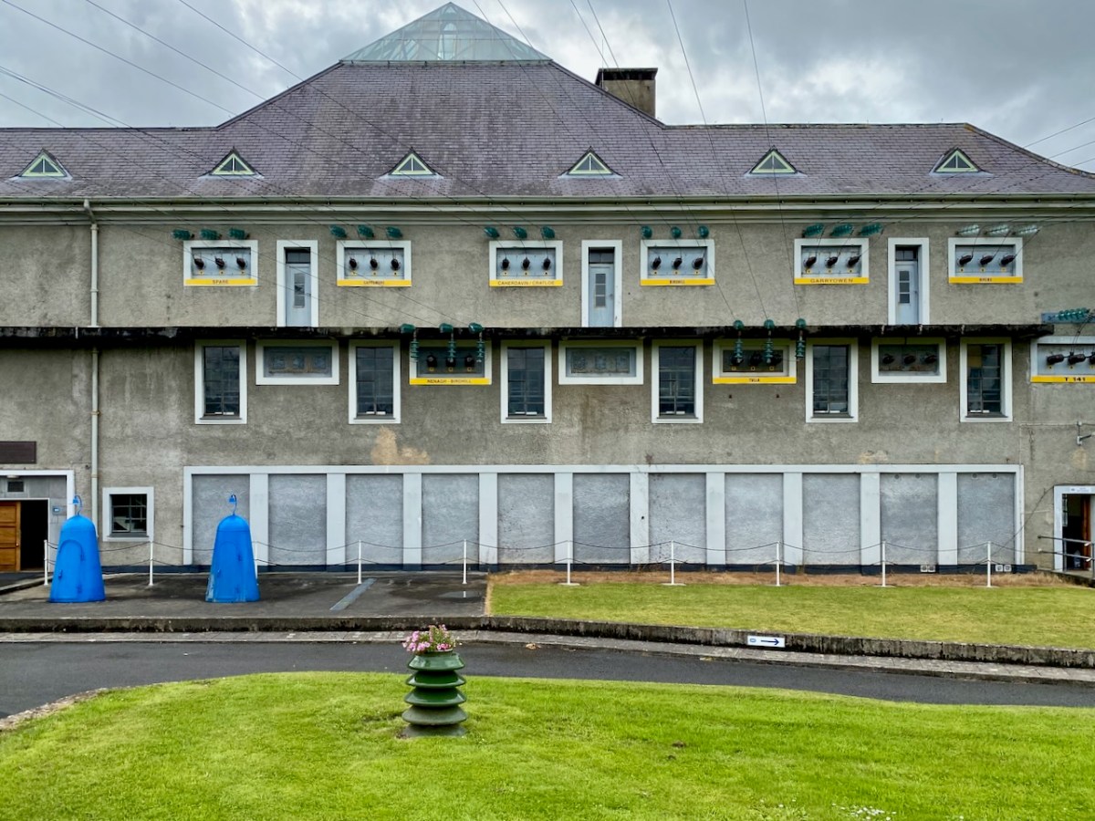
Here’s the ‘back end’ of the main building block, showing the position of the canal lock but also the new architectural-award winning control room – copper sheet clad – which has taken the place of the original room and desk, which have nevertheless been preserved as a piece of history:
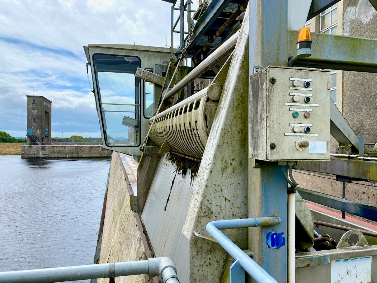
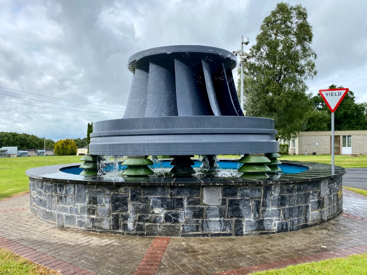
The machine above cleans the weir intake grills leading to the turbines. Everything here has its historical aspects emphasised, where relevant. The wondrous machine above is in full working order to this day, cleaning the intake grids on the weirs coming in from the main dam. A replaced turbine impeller is used as a decorative fountain feature beside the driveway into the station:
In a previous post, I mentioned that the artist Seán Keating was so impressed by the project that he painted a series of canvases during the construction process. The majority of these originals are now on display in the power station offices – accessible on the tour.
I once again express my thanks to Michael Barry for setting me on this rewarding path. I understand he is giving electrification and Ardnacrusha due mention in his forthcoming book A Nation is Born.
Further information on the Electrification of Ireland can be found in these posts:
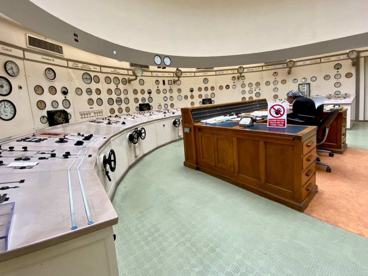
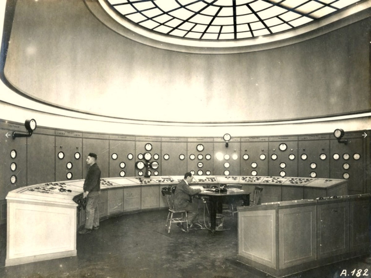
In my recent posts I have set out a brief history of how the new State became electrified – and how this affected the urban and rural ways of life in Ireland. An important part of the story was the building of the hydro electric power station at Ardnacrusha, on the River Shannon, between 1925 and 1929. That’s the original control room, above, unaltered since construction – there’s not a screen in sight! Most of the works of the station are now handled elsewhere using screens and keyboards rather than dials and switches. This site became the nerve centre for the electrification of Ireland and the National Grid was established in tandem with the project.
This selfie shows Finola and I on a visit to Ardnacrusha last week. (If you want to go yourself you have to book in advance). We had a great time! And I’ll be reporting back on that trip in due course. But first I want to take you back in time – more than a thousand years . . .
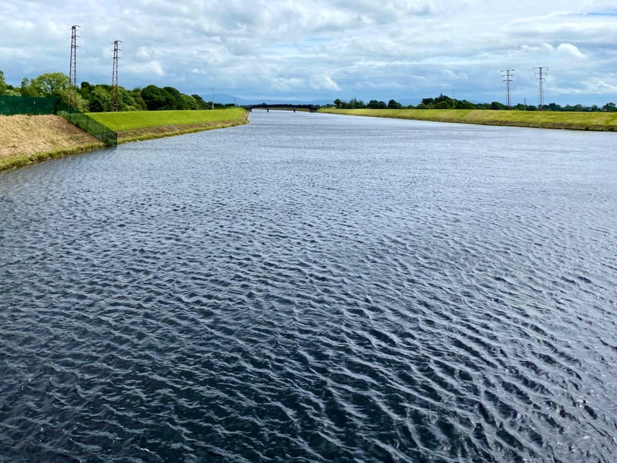
Here’s the River Shannon today, just north of the power station. There’s a big head of water there, and the river had to be dammed and flooded to maximise the feed to the turbines. The significantly raised water level had consequences.
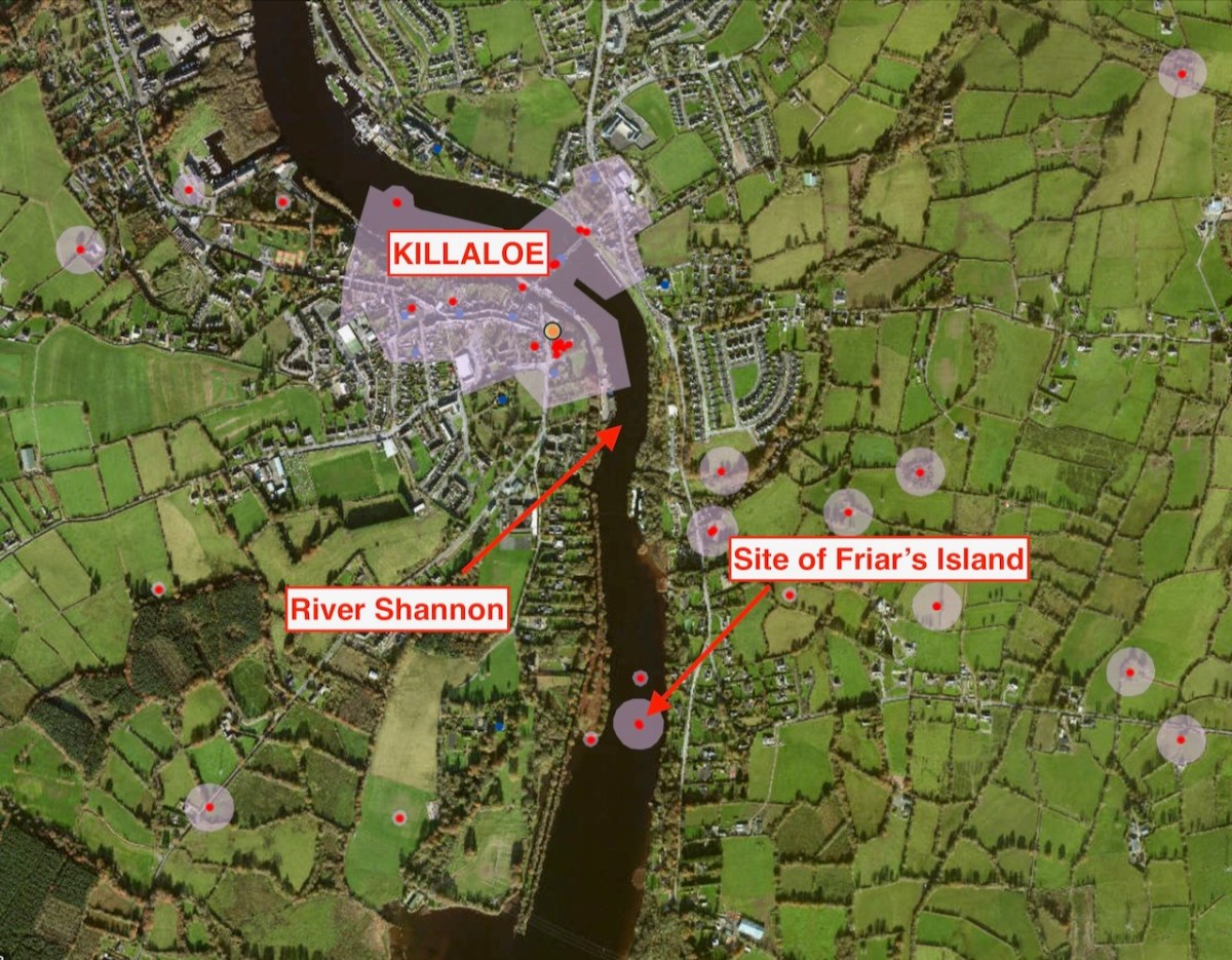
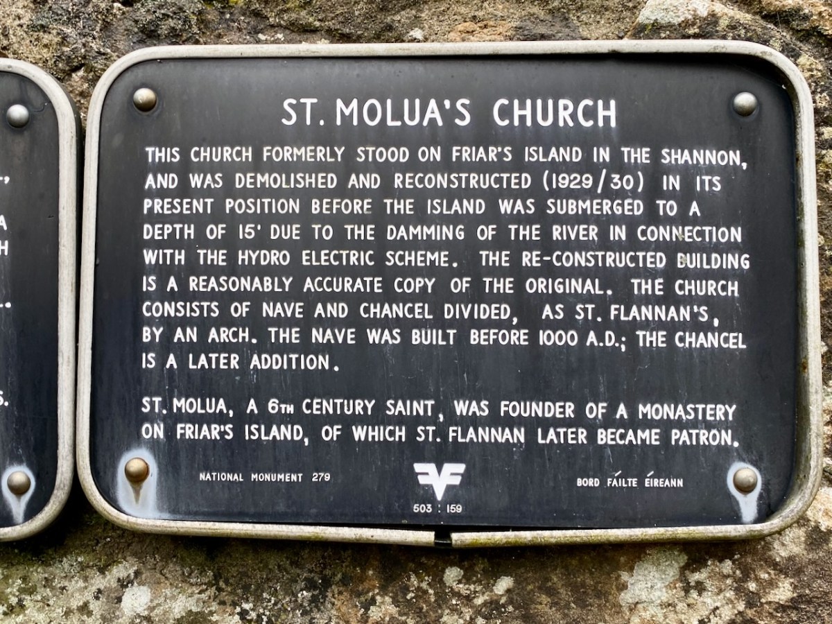
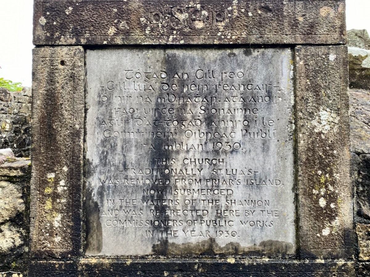
The aerial view, above, shows the river today with its elevated water level. In the pic you can see the ‘Site of Friar’s Island’ indicated: before 1930 there was an island there, on which were some noted relics, including the Oratory of St Molua of Kyle (also known as St Lua), who died in the year 608. His feast is celebrated on August 4th. It’s said that crowds used to assemble there on that day, most of them wading across the water to get to the island. This description of the saint is from the Schools Folklore Collection (informant Tom Seymour, aged 60, Cloncully Co Laois):
. . . We don’t know where he belongs. Some say he belongs to Killaloe. He had his monastery in Kyle. Near the monastery he had a big stone where he used to pray. There are two big holes where he laid his elbows, and two more where the tears fell. In Ballaghmore there is a trough laid up on a stone. It is always half-full of St Molua’s water. The hottest day in the summer the well is always half-full of water. When he died the people of Killaloe wanted to bury him in Killaloe and the people of Kyle wanted to bury him in Kyle. They made two coffins, one went to Kyle and the other to Killaloe. He had another monastery in Offaly . . .
Schools Folklore Collection
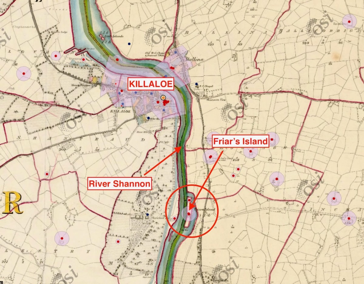
In this extract from the early OS 6″ map (above) you can see that the island was quite substantial. The pilgrimage involved visiting a holy well and St Lua’s Oratory. The small church was by tradition built by the saint, although it seems likely to date from the ninth or tenth centuries.
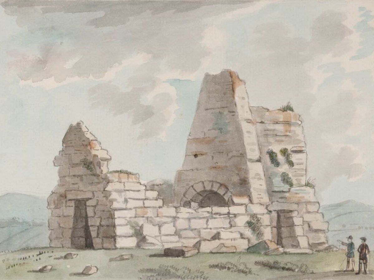
St Lua’s Oratory – Eighteenth Century water colour – Royal Irish Academy. The figures are somewhat out of scale. Below is a photograph of the Romanesque structure taken on the island in the 1920s.
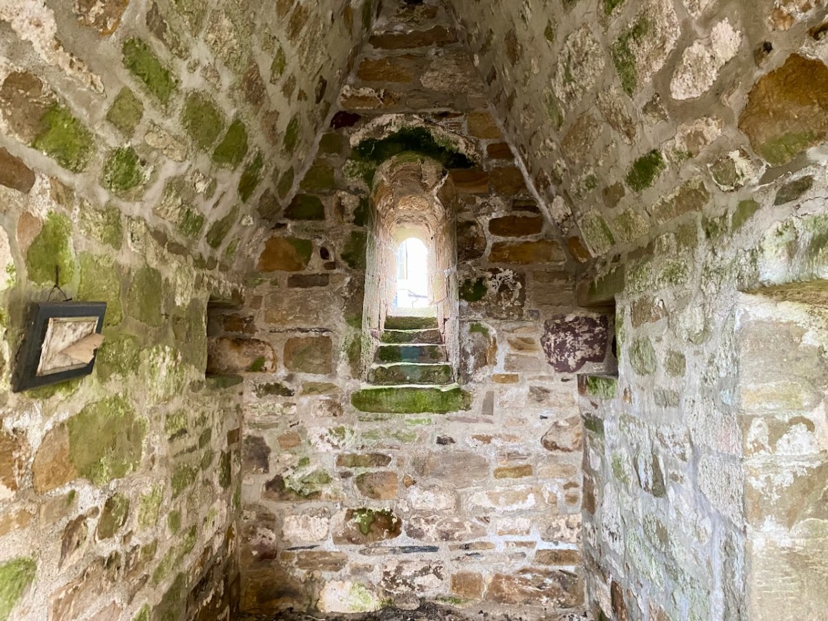
. . . The nave walls are constructed with uncoursed cyclopean sandstone masonry while the chancel walls are constructed with roughly squared stones of smaller size. The chancel has a single-light round-headed E window with stepped sill-stone and unusual flat-headed doorway in the S wall. The round-headed chancel arch has curious jamb-stones which are not flush with the chancel arch and project inwards. The triangular-shaped chancel roof is bonded with lime mortar and is well preserved. The nave walls are poorly preserved and only survive several courses high with a trabeate doorway in the W wall. Excavations at Friar’s Island prior to the removal of the church revealed that the church was constructed on a stone platform enclosed by a possible cashel with a revetment wall of unknown purpose. A second stone platform (dims. 22ft (6.71m) N-S; 50ft (15.25m) E-W) was located to the S of the church and eleven skeletons were uncovered under or close to the foundations of the N wall of the church (Macalister 1929, 16-24) . . .
National Monuments Service description
As the plan to establish the new power station progressed, it became obvious that the level of the river below Killaloe would have to be raised significantly in order to maximise the water power turning the turbines to be installed: some five meters, in fact. The consequence for Friar’s Island were that it would be flooded, and the Oratory would be lost.
Considerable debate ensued, the main factions being archaeologists, engineers, and the Catholic Church. Politically, the efficient functioning of the new power station was paramount in order to show the State and the world that Ireland was an entity to be reckoned with. At the same time, the archaeologists were keen to project that the independent country recognised and championed its very rich ancient heritage, and would therefore go out of its way to preserve all surviving artefacts. The Catholic Church was anxious to show allegiance to all aspects of progress in the State, while noting that it was also the fundamental root of the unique Irish culture that led to the historical founding of sites such as St Lua’s Oratory. I was fortunate to be given access to a paper by Niamh NicGhabhann of the University of Limerick: Medieval Ireland and the Shannon Hydro-Electric Scheme: reconstructing the past in independent Ireland. Here’s an abstract:
. . . This essay considers the position of Irish medieval buildings in the early years of the twentieth century. Focusing on the treatment of the oratory of St Lua at Killaloe, it examines the ways in which the ruins of the medieval past were used to signify a range of political, religious and cultural ideas and attitudes. The rising water levels following the Shannon Scheme works (begun in 1925) meant that this stone oratory was moved from its original position on Friar’s Island to the grounds of St Flannan’s Roman Catholic Church in 1929. The resulting paper trail reflects the complex processes of decision-making within a civil service in transition as the new Irish Free State calibrated its position with regard to the past and the treatment of medieval ruins throughout the countryside. The case study of St Lua’s oratory is considered here in the context of the nineteenth-century tradition of scholarship on medieval buildings, the development of the idea of a national Irish architecture during this period, and the impact of this tradition on subsequent engagement with the buildings of the medieval past . . .
Above – a surviving photograph of St Lua’s Oratory being disassembled in 1929. The various debates had produced three alternative solutions to the dilemma of the impending inundation of Friar’s Island:
1 – Allow the island and the ruins to vanish below the flood: by far the cheapest course of action.
2 – Build a new concrete platform (effectively a new ‘island’) above the level of the flood water, and transfer the remains of the building to this.
. . . The RSAI officially responded in support of the second proposed scheme of work, involving the elevation of the building and the construction of a concrete pier. They suggested one amendment to the plan, that a ring of grass be added around the building to give the concrete plinth the appearance of an island. Given that both the RSAI and the OPW were in favour of the second scheme as the most appropriate and cost-effective course of action, the fact that the oratory was eventually moved and transported some distance from the site, however, reflects competing values, as well as several structural problems that emerged in the second scheme as proposed. As works progressed, it became clear that the elevated island site would be eventually undermined by the flow of the river, making this process untenable . . .
3 – The Scheme that was eventually adopted involved dismantling the Oratory and re-assembling it as faithfully as possible, on a suitable mainland site. Initially the suggested site was on the Clare bank of the Shannon, but the ground conditions were not suitable for a permanent structure.
. . . A further plan for relocation was also progressed, which involved moving the ruin into the town of Killaloe, and locating it beside the later and larger oratory of St. Flannan, and the medieval cathedral of St Flannan. These plans were at quite an advanced stage by mid – 1929, with several drawings and maps produced by Leask’s office for the purpose. However, while the preservation process was certainly hampered by these structural issues, ideological concerns also had a direct impact on the treatment of the oratory . . . The intervention of Bishop Fogarty was also noted on 13 July 1929, when the Limerick Leader reported that “the safeguarding of such a venerable relic of primitive Christian architecture is due to the timely intervention of Dr Fogarty, Bishop of Killaloe, who put the matter before the Government”. (Limerick Leader, 13 July 1929) . The use of the word “relic” as opposed to “ruin” is significant here, reflecting an interpretation of the site as part of a tradition of faith, rather than of architectural or antiquarian interest . . .
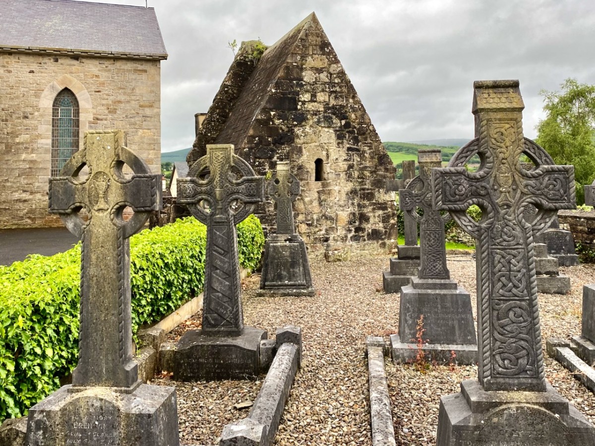
In this photograph of the Oratory as it stands today in the church grounds at Killaloe, it is perhaps worth wryly commenting that we see a true piece of early medieval architecture behind the screen of ‘pseudo’ high crosses. We have a good record of how the remains were dismantled and accurately re-assembled: this was written by the archaeologist H G Leask MRIA in 1930:
. . . In order that the rebuilding should be, as far as was possible, an accurate one, it was necessary to adopt a system of marking the stonework by which the original stones should occupy their original positions when reassemble. The stones being very varied in size and irregular in shape, and laid uncured, no system of numbering such as could easily be applied to squared ashlar was admissible. To the Clerk of Works in charge, Mr C J Dowdall, must be given the credit for the scheme finally decided upon. This consisted in marking with paint of different colours a series of level lines at two feet vertical intervals all round the exterior and interior wall faces. These lines were crossed again by a series of vertical lines at the same intervals but of one distinctive colour for each wall face inside and out. Where the squares formed by this grid of paint enclosed, unmarked, a number of small stones, diagonal lines were added to each square to ensure that every stone showed the same marking. A complete series of elevational photographs of each wall face was taken and careful drawings were also made with the coloured guide lines indicated upon them. On the large plot of ground on the opposite side of the river kindly lent by Major Lefroy, above future water level, timber guide planks were laid down as a frame to each wall and gable face. On the timber frames the coloured guide lines were indicated and the stones when transported were laid down face upwards, in sand, in correct relation with the coloured marks. Each wall, of course, was divided in two vertically along its length and “displayed”. Important quoin, jamb, and arch stones were numbered in colour in regular order. The transport over the Shannon was carried out by means of a specially built barge and a rope stretched from shore to shore, the workmen simply “handing” the boat across by this means. An inclined trackway with truck and winch was erected by Messrs Siemens Bau Union and two small temporary jetties by direct labour. The Most Reverend Dr Fogarty, Bishop of Killaloe, vested a site in the Church enclosure on the summit of the hill in Killaloe town, and the building has been erected there and is now (May, 1930) approaching completion. (Note: the work of re-erection was finally completed in July, 1930) . . .
The Church of St Lua, or Molua, Friar’s Island, Co Tipperary, Near Killaloe Further Notes – H G Leask 13 May 1930
A couple of afterthoughts to finish off with: a letter from Canon Clancy to Leask, dated 14 October 1930, asked whether a gate could be installed, as it is “liable to be desecrated by boys using it as a urinal, in fact, some boys have already been using it”. And a contemporary cutting from the Nenagh Guardian noted that . . . works cost thousands of pounds are being misused on a “folly” in demolishing St Lua’s Chapel and hiding it in a yard when they could have lifted it above the waters and put a strong light in it that would have illuminated the whole country round, and made it one of the sights of the place . . .
I am grateful to Niamh NicGhabhann for allowing me access to her excellent paper on the tensions surrounding the proposals for the Oratory remains. Further information on the Electrification of Ireland can be found in these posts:
There’s a wealth of tales to be told about the first decades of independent Ireland. The 1920s and 1930s saw a flourishing of confident projects portraying a nation on the cusp of change, establishing itself in Europe and beyond. One such was the hydro-electric scheme at Ardnacrusha on the River Shannon. Foundations were laid in 1925 and works completed within four years, providing the young country with what was then the world’s largest power station. The intention was to enable everyone in Ireland to avail of the most trendsetting modern commodity: electricity.
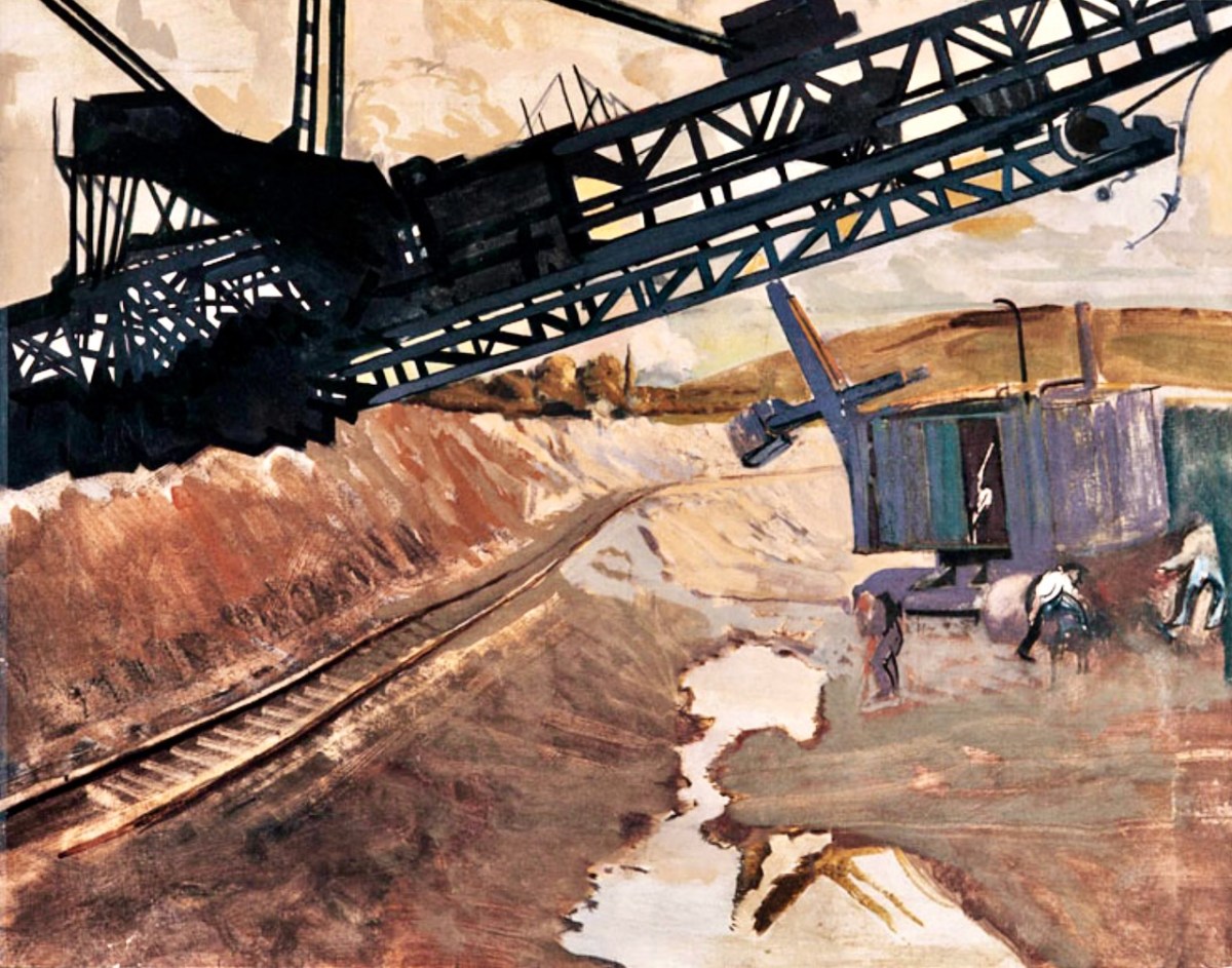
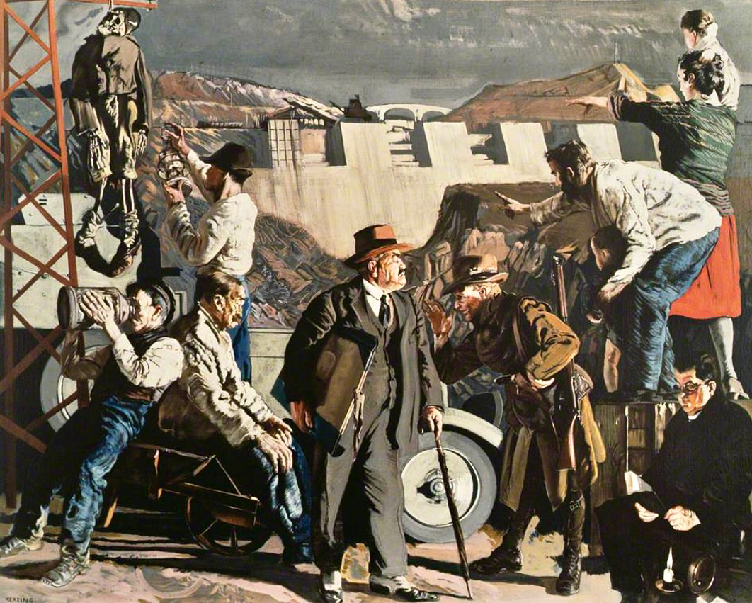
The documentary photo above looks like a scene from a science-fiction film: it’s the control station at Ardnacrushsa, shortly after the completion of the project. This, and many other of the illustrations which I will refer to, are taken from the excellent ESB Archives: I am very grateful to them for the use of these. The building of the huge dam and power station was documented in fine detail – and not just in words and photographs. The notoriously outspoken and visionary artist – Seán Keating – chose to record the accomplishments in his own medium, painting.
This is one of Keating’s works from the time: Night’s Candles are Burnt Out. (Thanks to Gallery Oldham). It is, perhaps, the finale of his series drawn and painted during the construction of the works – which he undertook on site under his own initiative and without a sponsor. Art historian (and biographer of Keating) Dr Éimear O’Connor suggests:
. . . Keating went down to Ardnacrusha because he knew that the construction project was emerging history. It was all happening around where he was born and raised. The machinery was going to carve up this landscape that he saw as ‘a medieval dungheap’, that was how he described it in later years. And this was a metaphor for him, the whole thing was all about Ireland moving forward into modernity. Night’s Candles features the dam at Ardnacrusha, but also includes a group of figures in the foreground, all of whom represent different aspects of what Keating saw as the Ireland of the day. When he showed it at the Royal Hibernian Academy in Dublin, it was called ‘the problem painting of the year,’ which Keating thought was hilarious. They couldn’t get their heads around this idea of what he was trying to do at all . . .
O’Connor: Seán Keating: Art, Politics and Building the Irish Nation, 2013 (Irish Academic Press)
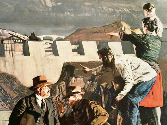
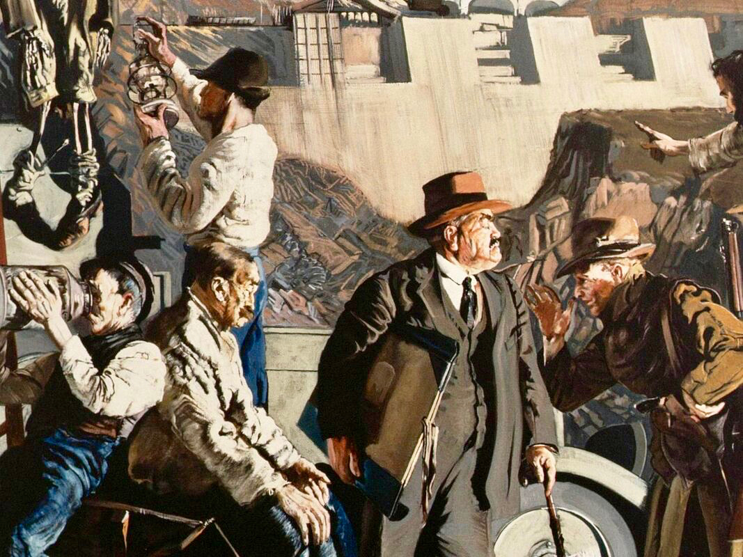
In this detail from the painting we see Keating himself (top right) together with his wife and sons, pointing to the vision of Ireland’s future. On the left of the full painting is Keating again, inspecting a hanging skeleton, perhaps reminiscent of the Famine. Most significantly, perhaps, at the bottom right is a priest reading by the light of the candle. O’Connor is clear about this portrayal:
. . . It tells you an awful lot about Keating and his attitude to the Church at the time. Like many others in the cultural sphere in Ireland, he was disappointed with post-Treaty Ireland, with successive governments and the Church, who were in cahoots, if you know what I mean. He knew well that the whole country was tied up with them, and with that kind of organized religion that was deeply conservative. And Night’s Candles is very much an expression of that disappointment, I think . . .
O’Connor: Seán Keating: Art, Politics and Building the Irish Nation, 2013 (Irish Academic Press)
It’s worth dwelling on this painting a little longer, and viewing Keating’s thought processes, through O’Connor’s eyes:
. . . What Keating was trying to do was reflect upon a country on the brink of change. It was in those years, in the 1920s, that the term ‘gombeen man’ came into being. We all know that it means the kind of businessman or politician who’s making money off the backs of everybody else. And that’s the gombeen man in the middle of the painting. I think it’s quite clear that Keating’s hope was that modernity, as represented by Ardnacrusha, would end all that stage-Ireland paddywhackery that had prevailed for years . . .
O’Connor: Seán Keating: Art, Politics and Building the Irish Nation, 2013 (Irish Academic Press)
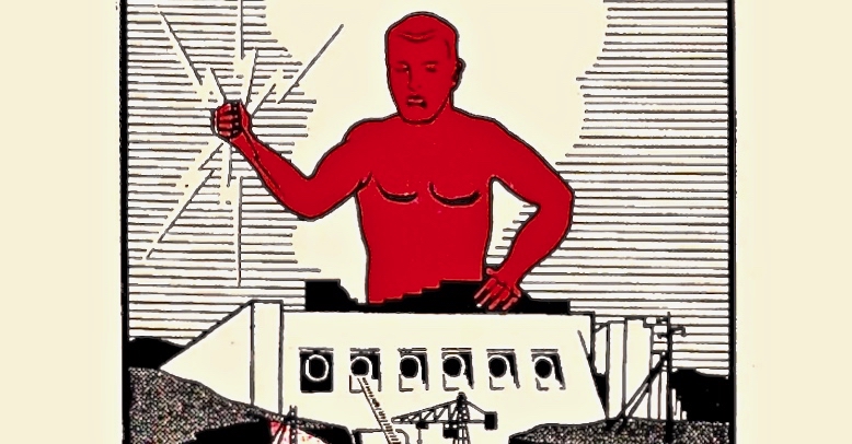
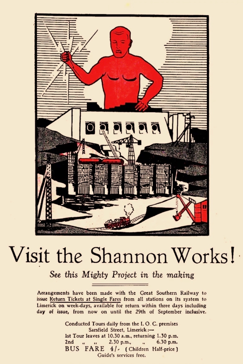
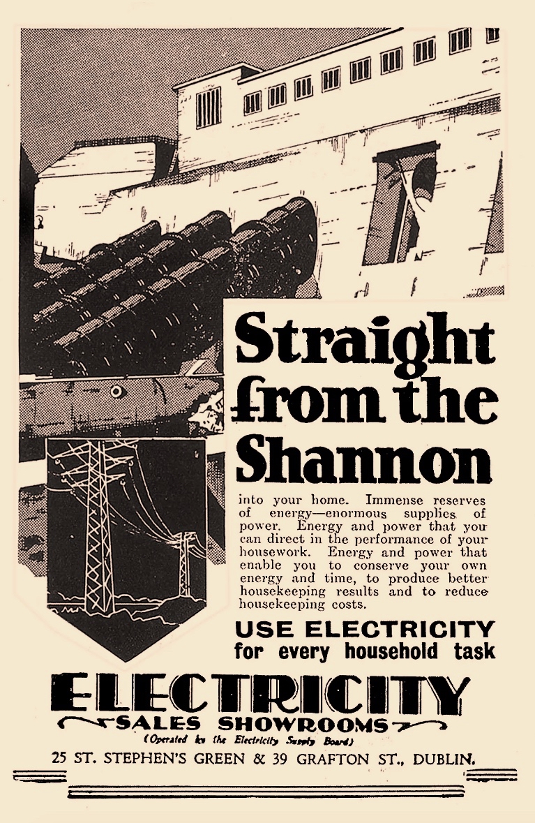
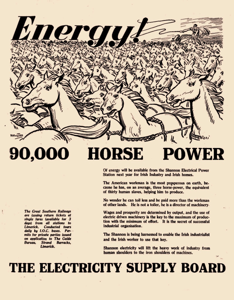
Above – posters from the time of the construction work at Ardnacrusha (ESB Archives). It was certainly the most exciting project in Ireland’s young days, and tourism was encouraged. Hand-in-hand with the major works themselves went a crucial publicity campaign to encourage people to embrace the coming of a readily available electricity supply to homes and businesses. The steps taken to try and ‘get the message across’ was an uphill task. Considerable funds were expended – and a large sales force garnered – to tour the country and persuade the population to buy into the project.
The visuals, humour and underlying psychology of this Ardnacrusha construction-era promotional poster really appeal to me. In case you can’t read the ‘small print’, this is the message that’s being pushed:
. . . 90,000 Horse Power of energy will be available from the Shannon Electrical Power Station next year for Irish Industry and Irish homes . . . The American workman is the most prosperous on earth, because he has, on average, three horse-power, the equivalent of thirty human slaves, helping him to produce. No wonder he can toil less and be paid more than the workman of other lands. He is not a toiler, he is a director of machinery . . .
Post-Famine, America was always seen as the ‘golden land of opportunity’ for Irish emigrants. Now, in 1930, we are being told that Ireland will have the capability to match those fabled fortunes!
. . . Shannon Electricity will lift the heavy work of industry from human shoulders to the iron shoulders of machines . . .
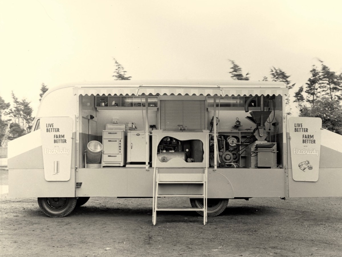
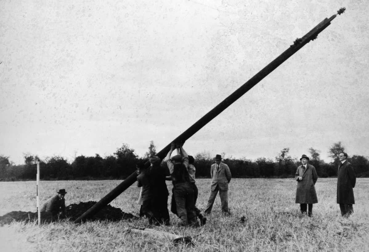
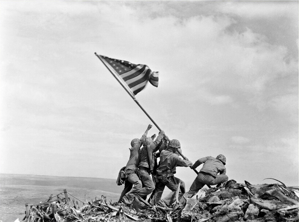
The coming of electricity across Ireland opened up markets for retailers to vend a host of innovative gadgets. This mobile electricity showroom from the 1950s (ESB Archives) covers the gamut of lighting, cooking, refrigerating, water supply to sinks using pumps, milking machines and labour-saving devices for farms. In a future post I want to focus on Rural Electrification, which was a long haul: taking poles and wires out into the extensive hinterland. This was – arguably – the most heroic part of the process of electrification, and we can’t help wondering whether the following somewhat iconic ESB print of the first ‘peg’ being raised at Kilsallaghan, on 5 November 1946 was inspired by the famous Iwo Jima Victory photograph taken by Associated Press photographer Joe Rosenthal on February 23 1945 (lower pic). Both portray a moment of triumph.
Many thanks are due to Michael Barry who referred me to material from the ESB Archives covering our own West Cork areas. Watch out for our commentary on this in a forthcoming post!
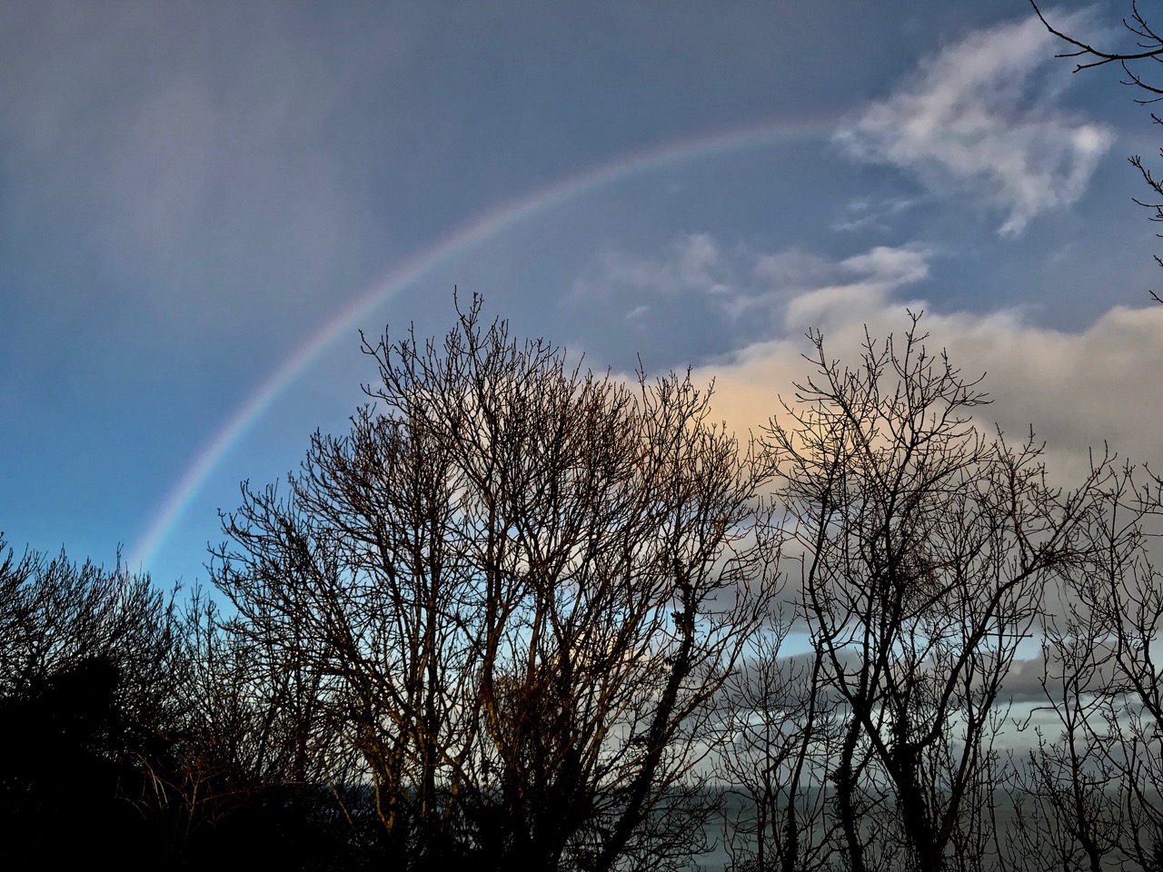
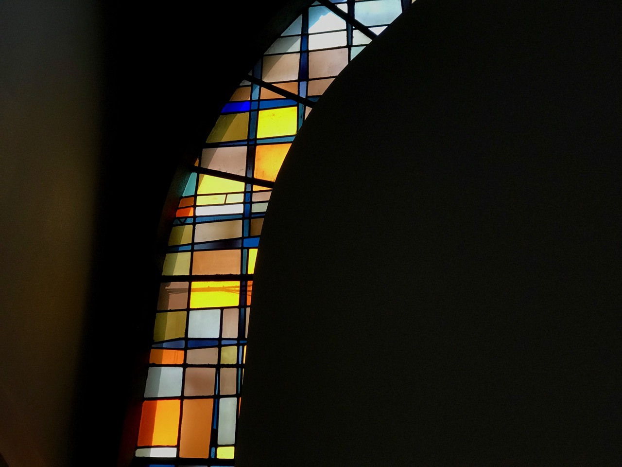
Storm Ciara was upon us as we headed over to the east coast – a mere few hops from Nead an Iolair. But it wasn’t all black clouds and thunder and lightning: winter storms here in Ireland feature high winds and spectacles such as this rainbow (above) which seemed to hang in the sky over County Wicklow for hours. When the rain comes, we often find refuge in a church – especially if it helps Finola’s quest for new stained glass windows. Sometimes they seem to reflect the weather patterns:
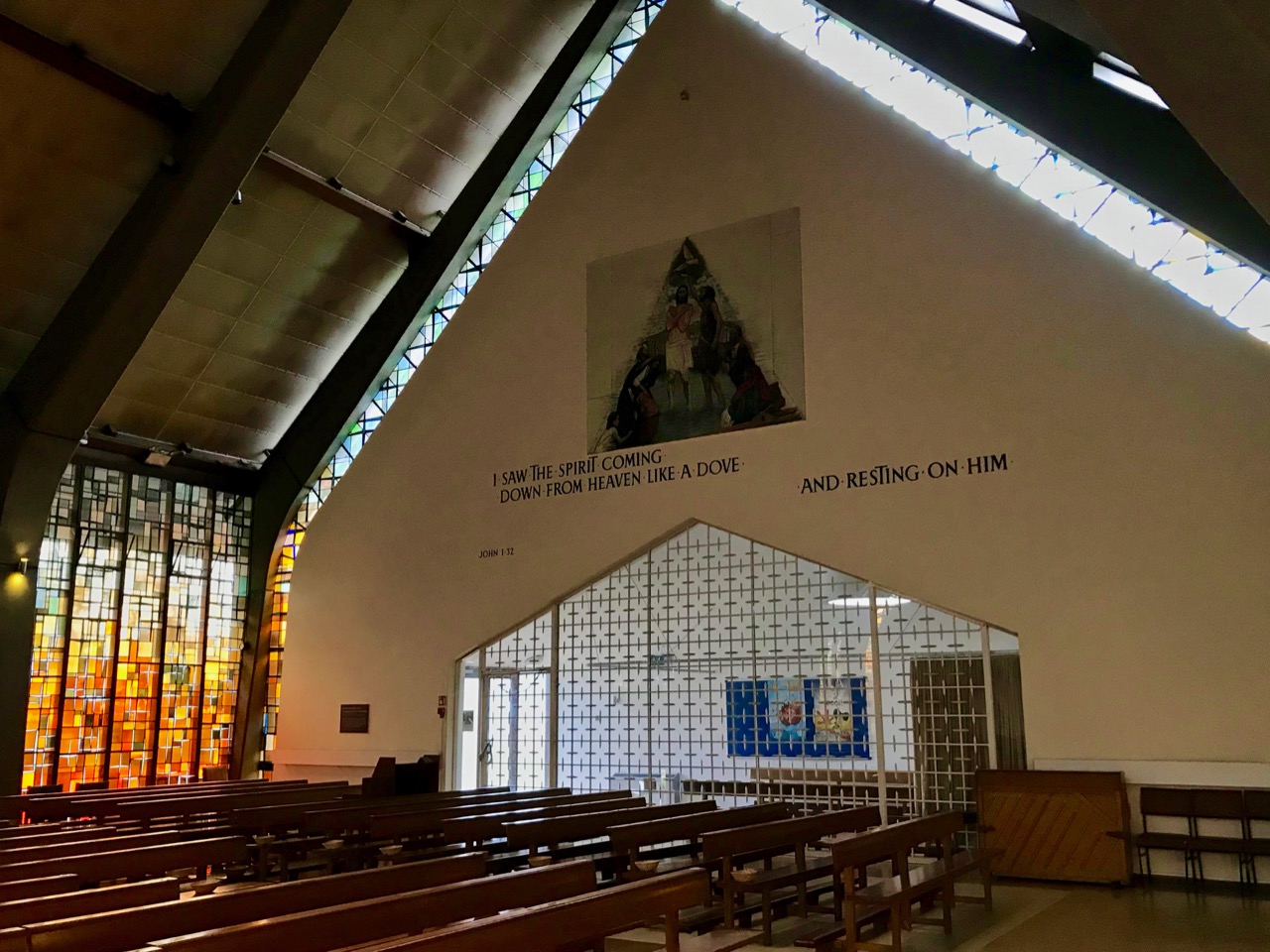
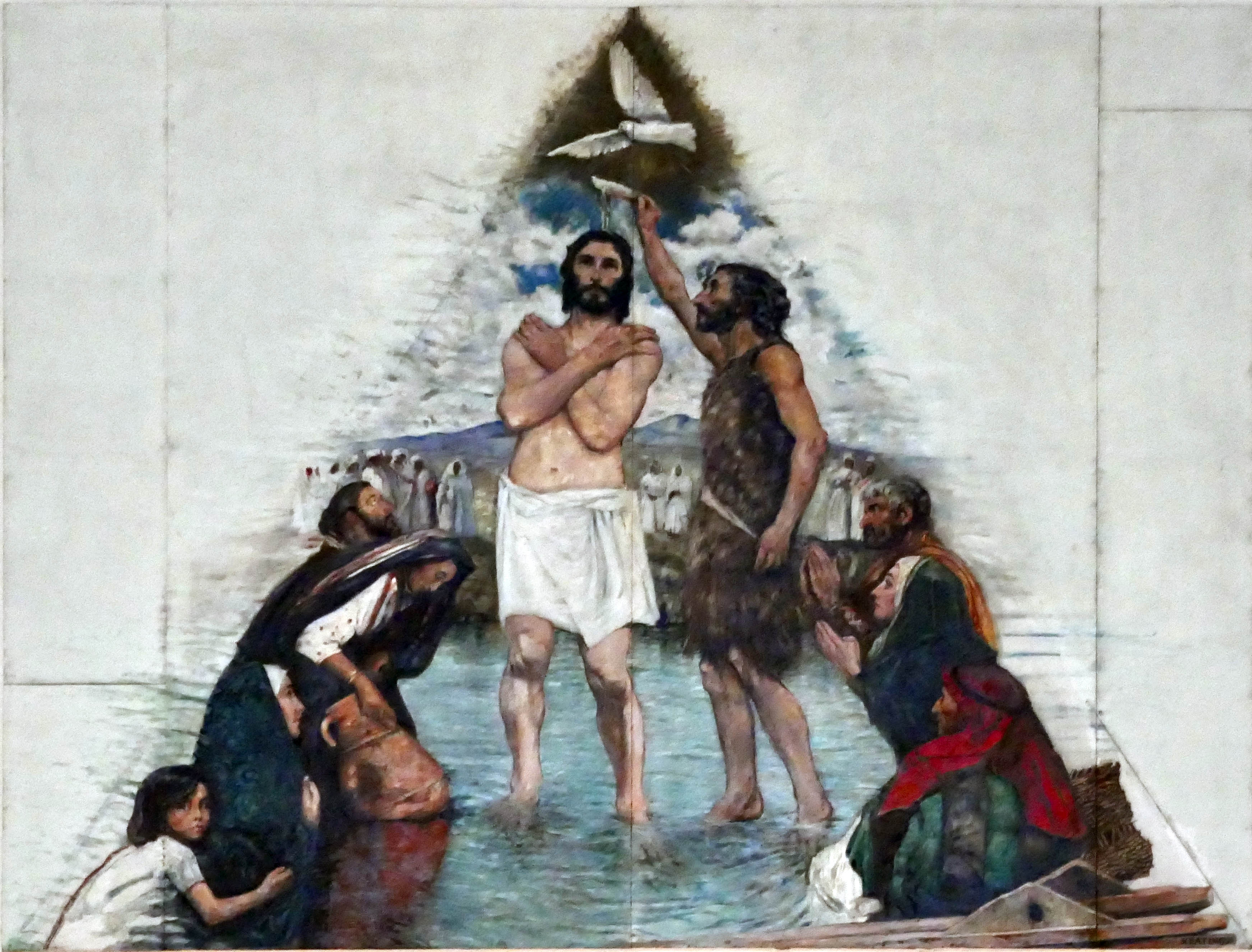
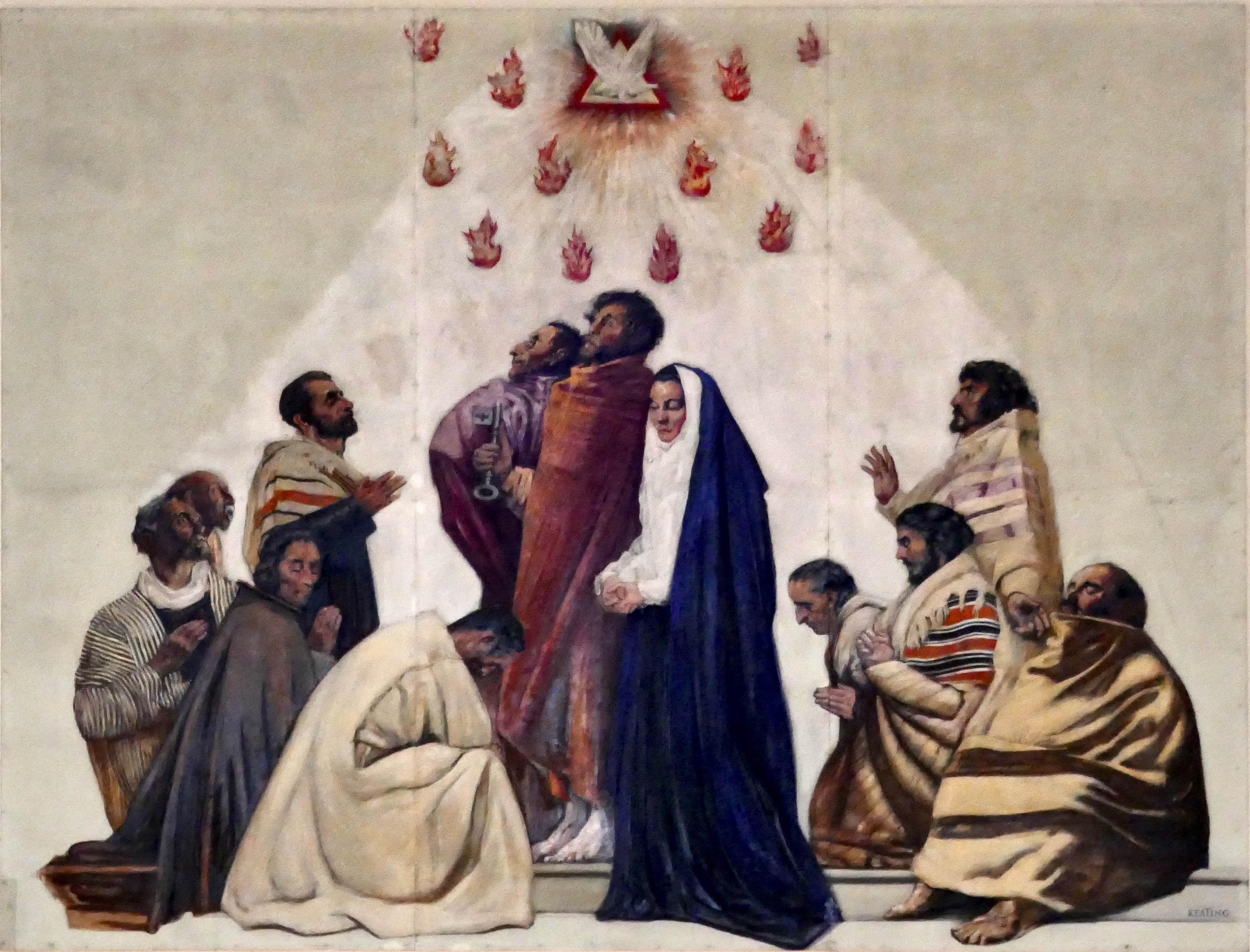
This panel, which could be seen as an indoor rainbow, is in an impressively large church in Ballyroan, Rathfarnham Parish, County Dublin: it was built in 1967 to seat a thousand. What caught my eyes was not the array of windows by Murphy Devitt (Finola has written extensively about this creative partnership), but two murals high on the walls of the crossing. I was delighted to find that these were painted by one of Ireland’s great artists working through the turbulent twentieth century – Seán Keating.
Seán Keating’s ‘Baptism of Christ’ mural in the Church of the Holy Spirit, Ballyroan
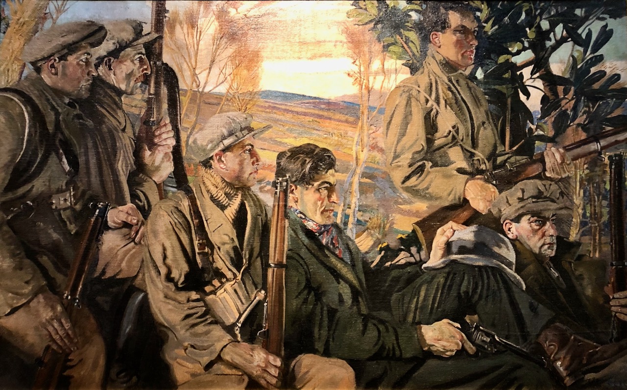
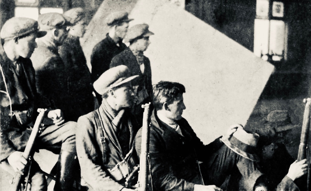
I am always surprised to find that Keating is under-appreciated: yes, he gets mentioned in books of art history, and is reasonably well represented in the state’s galleries. Yet you will also find terms such as ‘not great art’ applied to his work by critics and commentators. This is possibly because he is best known for his documentary work and, particularly, for his raw representations of the tempestuous years of Ireland’s struggle to gain independence. Here is ‘Men of the South’, dating from 1921 when there was a ceasefire in the Irish War of Independence while the Anglo-Irish Treaty was being negotiated and out of which the Irish Free State was born.
Top: Men of the South – Seán Keating’s documentary portrayal of the North Cork Brigade of the Irish Republican Army. Below the painting is one of the photographs taken in Keating’s Dublin studio in preparation for the work. Two versions of this painting were made by the artist: the one above is in the Crawford Gallery, Cork City, while the other (which depicts eight men) is now in Áras an Uachtaráin, the official residence of the President of Ireland.
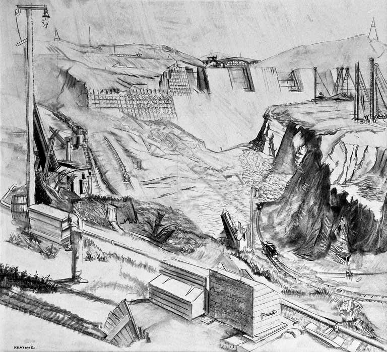
After the War of Independence and the abhorrent Civil War which followed it, Keating’s work concentrated on documenting the founding and burgeoning of the new State. Scenes of conflict were replaced by works showing industrial development, such as Ireland’s largest ever civil engineering contract: harnessing the power potential of the State’s major waterway, the River Shannon. The construction of a dam and hydro-electric generating station at Ardnacrusha, County Clare, together with a country-wide electric distribution infrastructure, was a symbol of major importance to the nation’s fledgling government. Keating began recording the work in 1926, soon after inception. No-one had commissioned him – he saw the significance of making dramatic documentary work of this nature, but his vision was eventually recognised by the Electricity Supply Board (ESB) – which now owns the largest collection of Keating’s paintings in Ireland. Above is one of the artist’s working sketches of the dam under construction.
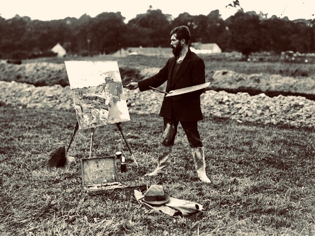
Seán Keating painting en plein air at Ardnacrusha, 1920s
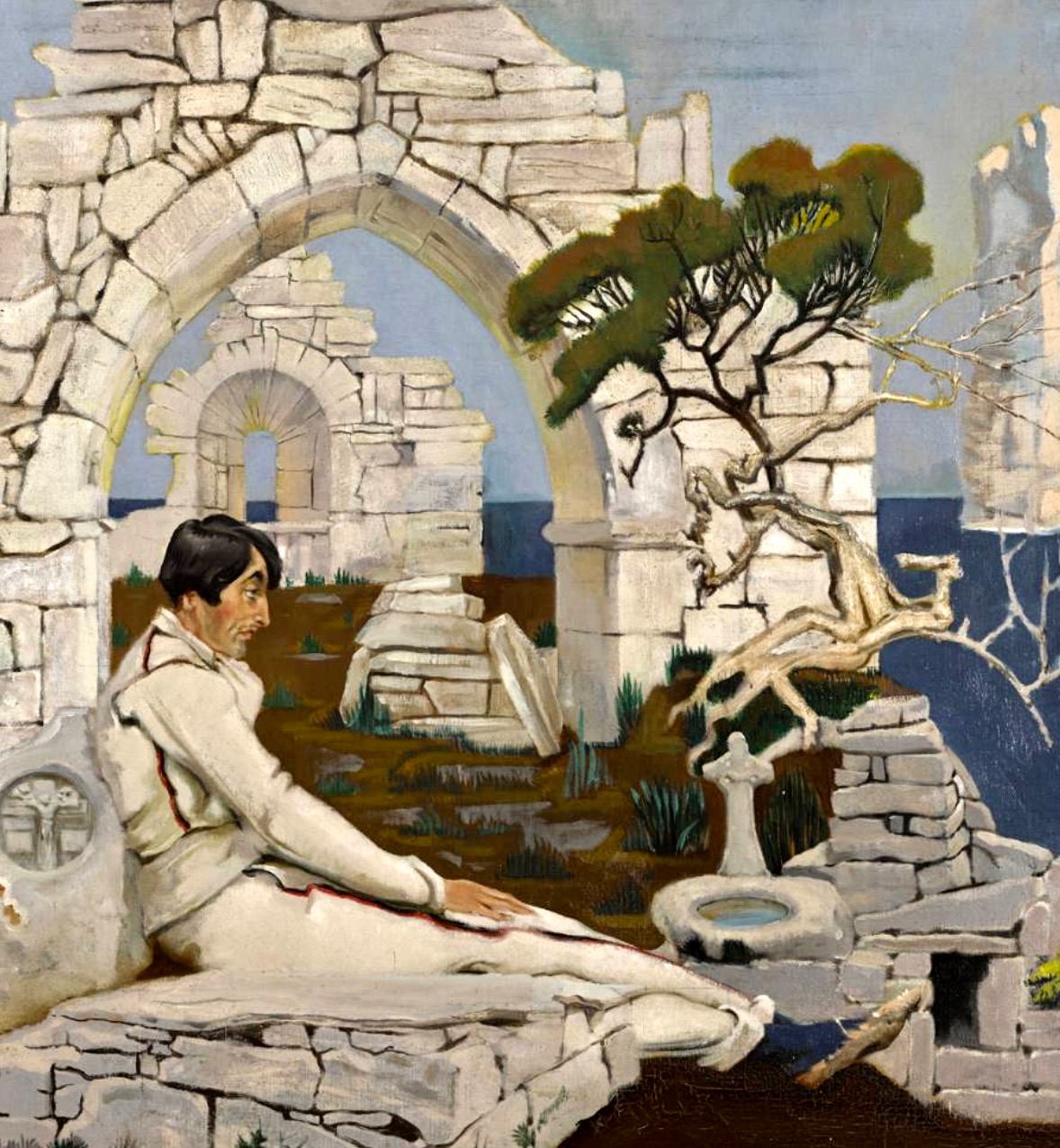
Keating studied under William Orpen in Dublin. He was to become one of Orpen’s important pupils (and, latterly, his assistant) and his documentary painting style owes a debt to his teacher. One of his famous early paintings is Thinking Out Gobnet (below), a portrait of his good friend Harry Clarke, dating from 1917. Keating and Clarke frequently visited the Aran Islands together. The painting shows Clarke sitting on a grave slab within the ruins of Teampall Chaomháin (St Kevin’s church) on Inis Oírr, along with a holy water font at his feet, and a holy well to the bottom right of the image. The suggestion is that Clarke is finding inspiration for his series of eleven windows for the Honan Chapel, Cork, which include a fine representation of St Gobnet. The ‘healing’ symbolism of the holy water and well are deliberate references to Clarke’s TB, the illness which ended his life at the age of 41.
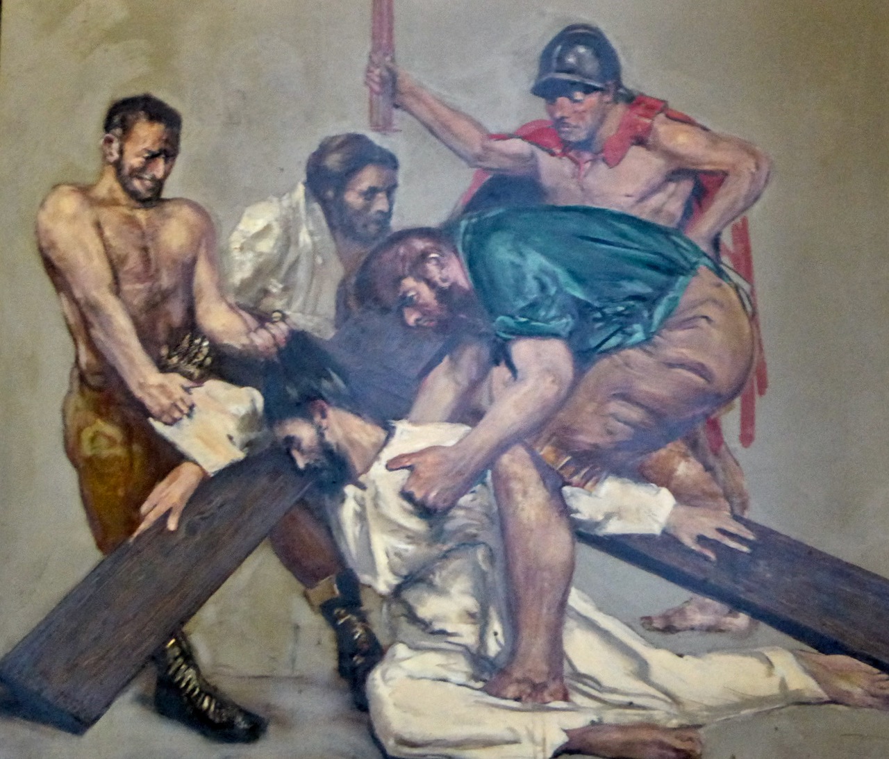
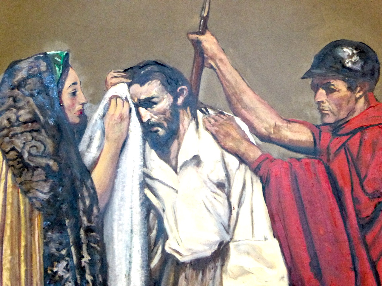
Seán Keating was always a committed Catholic, and we have seen many examples of his artwork in churches, including the murals at Ballyroan. Most striking, perhaps, are the Stations of the Cross which he painted for St John’s Church, Tralee – the church which features in Finola’s wonderful Irish Arts Review article (and RWJ blog post) about Ireland’sNewest Stained Glass Window.
Stations of the Cross by Seán Keating in St John’s Church, Tralee, County Kerry
Back to Ballyroan: while we were sheltering from the tempest and admiring the church architecture, and the murals, I was delighted to find out that Seán Keating had lived for much of his life just down the road, in Ballyboden, in a house which he had designed himself. He attended mass regularly at Ballyroan until his death in December 1977, aged 88.
Keating’s mural The Descent of the Holy Spirit in his own church of Ballyroan, Parish of Rathfarnham, installed in 1967
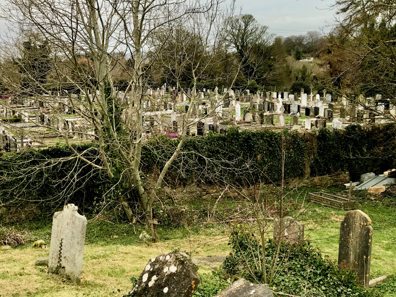
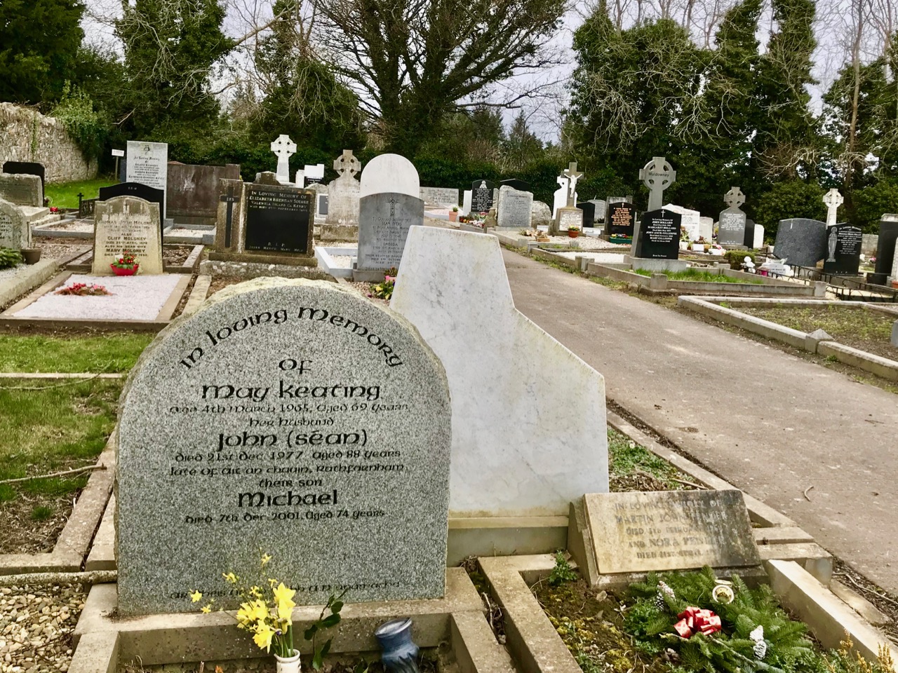
We discovered that Keating is buried in the nearby Cruagh Cemetery, so we had to head out into the storm again to find his grave. It is as unassuming as he apparently was in life: a visitor would not be aware that herein lies one of modern Ireland’s greats.
Cruagh Cemetery, Co Dublin (top) is the resting place of Seán Keating. His grave is shared with his wife, May, and son Michael
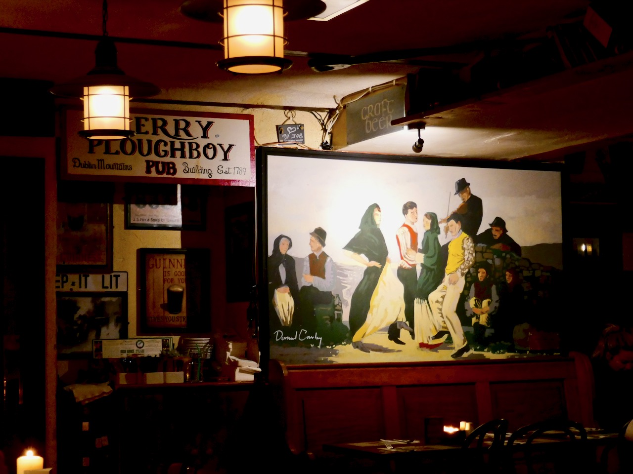
Our little artist’s memoir is almost over. The gale continued with ferocious lashing rain: cold and hungry we made a beeline for the local pub – the Merry Ploughboy, evidently a famous music venue. It was warm and welcoming, and full of a crowd watching Six Nations Rugby on the big screen (Ireland won the match).
In the lounge we were intrigued to find an oblique reference to Seán Keating – a painting which has a nod to his style but is by a different artist!
We agreed that our day trip to the east, in the teeth of the gale, was a memorable way to discover the life, work and death of one of Ireland’s significant artists.
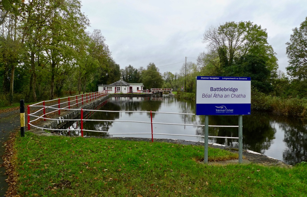
In 1946, the Rolts travelled to the upper limit of the Shannon Navigation in their borrowed boat, Le Coq. In 2016, exactly seventy years later, we followed them and found ourselves in Battlebridge, Co Leitrim. The Rolts’ travels – and our journey retracing their steps – have been the subject of a series of posts on this blog, and there are still a few more to come!
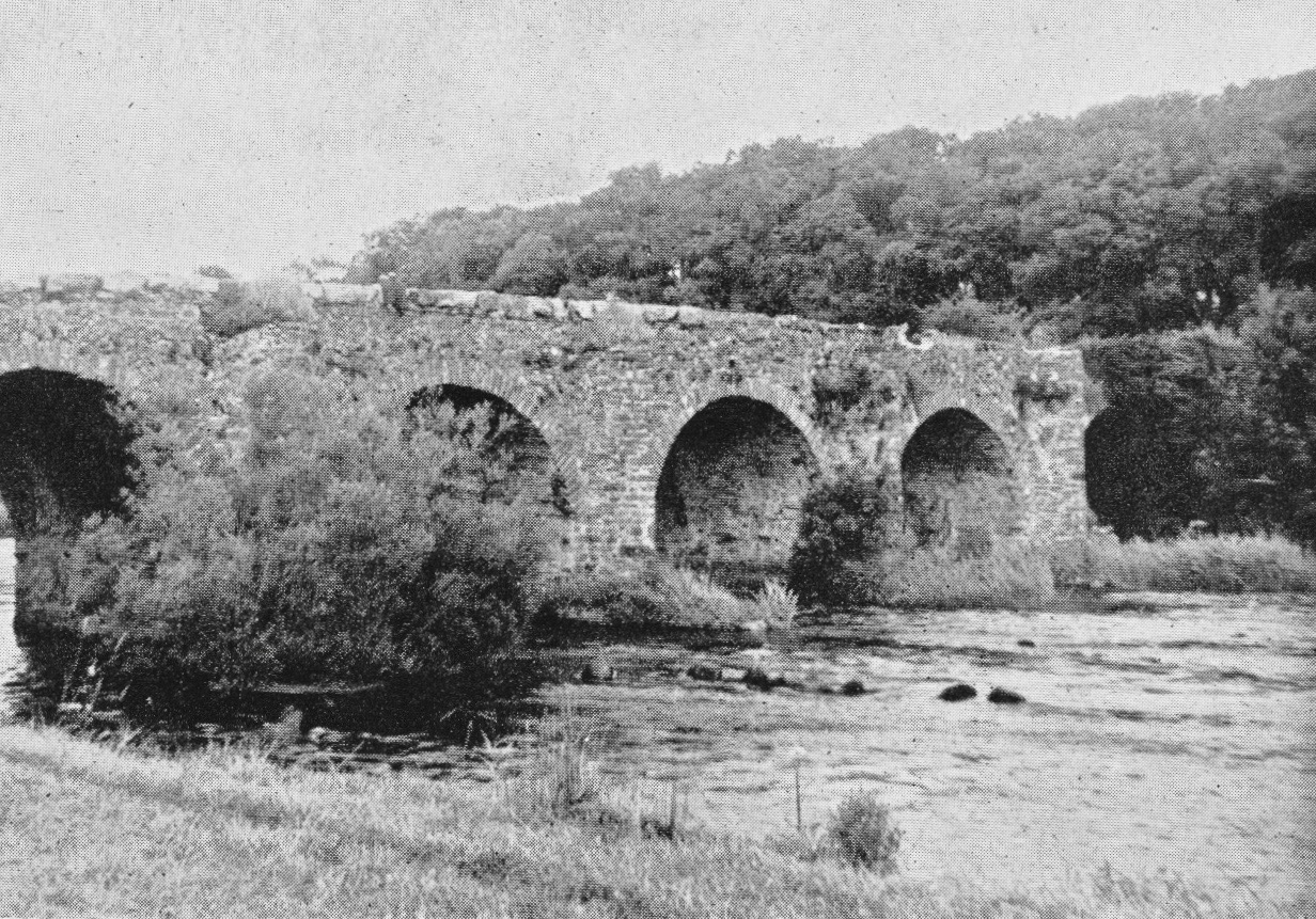
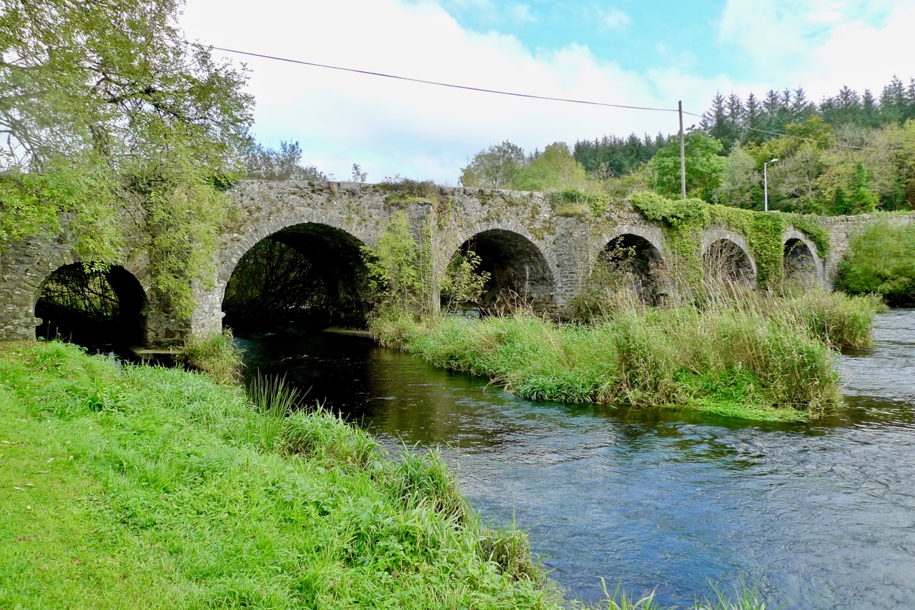
Upper picture: Angels Rolt’s photograph of the historic Battlebridge, taken in 1946. Lower picture: we revisited the site in 2016 – very little has changed
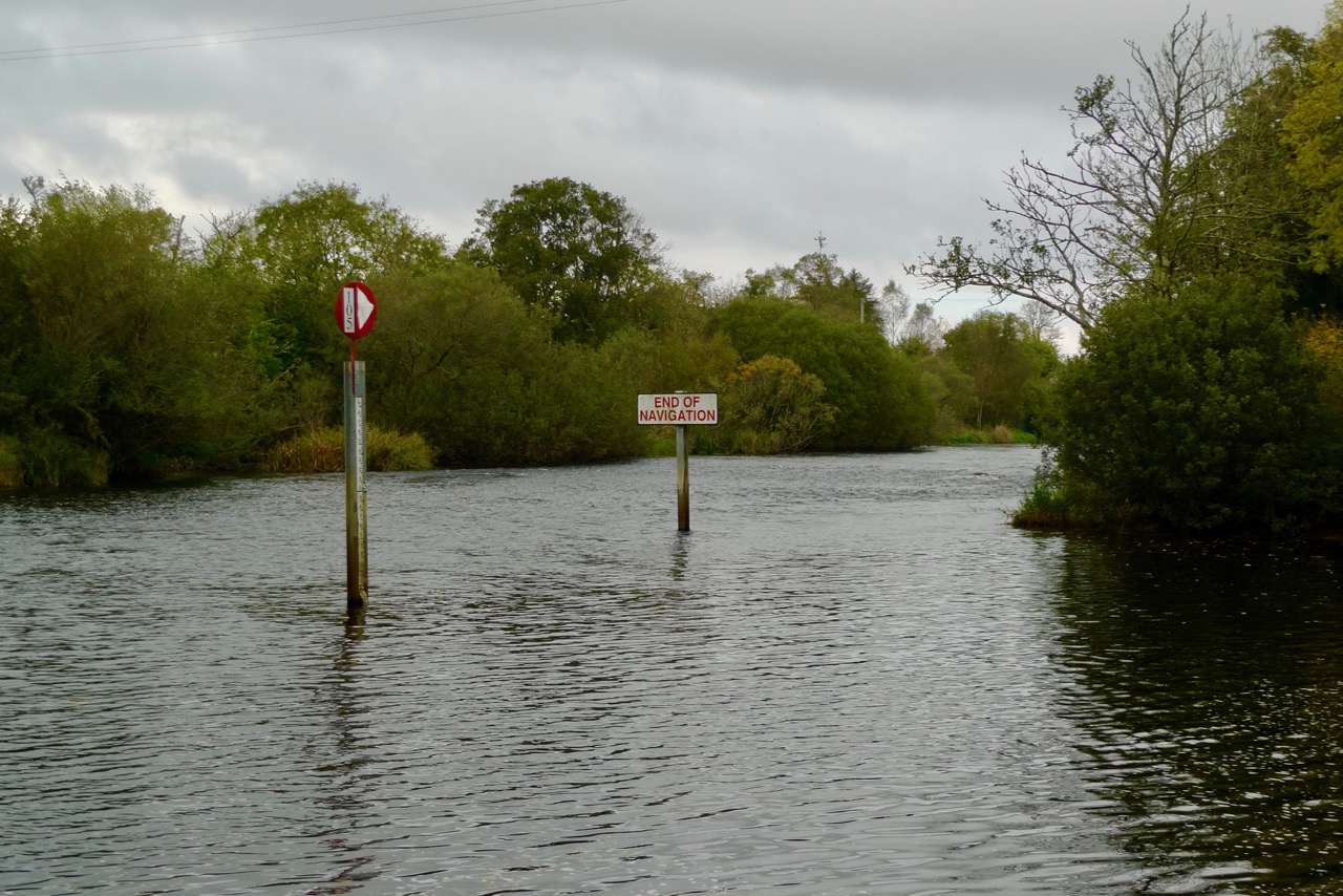
Battlebridge is still the ‘end of navigation’ on the Shannon itself. But, interestingly, it is now possible to travel by water much further north – something the Rolts were unable to do.
…It was but a brief journey to Battlebridge where the Shannon becomes a shallow stream brawling over boulder strewn rapids under the arches of the fine old bridge. Here, in the last few yards of deep water, we came about to moor to two trees beside the bank at the tail of the ruined entrance lock of the Lough Allen Canal. It was a delightful mooring, secure, secluded and sheltered, the country round being undulating and well-wooded, for we had now left the level plain for the fringe of the broken, lake-studded country of central Leitrim… (Green and Silver L T C Rolt, George Allen and Unwin 1949)
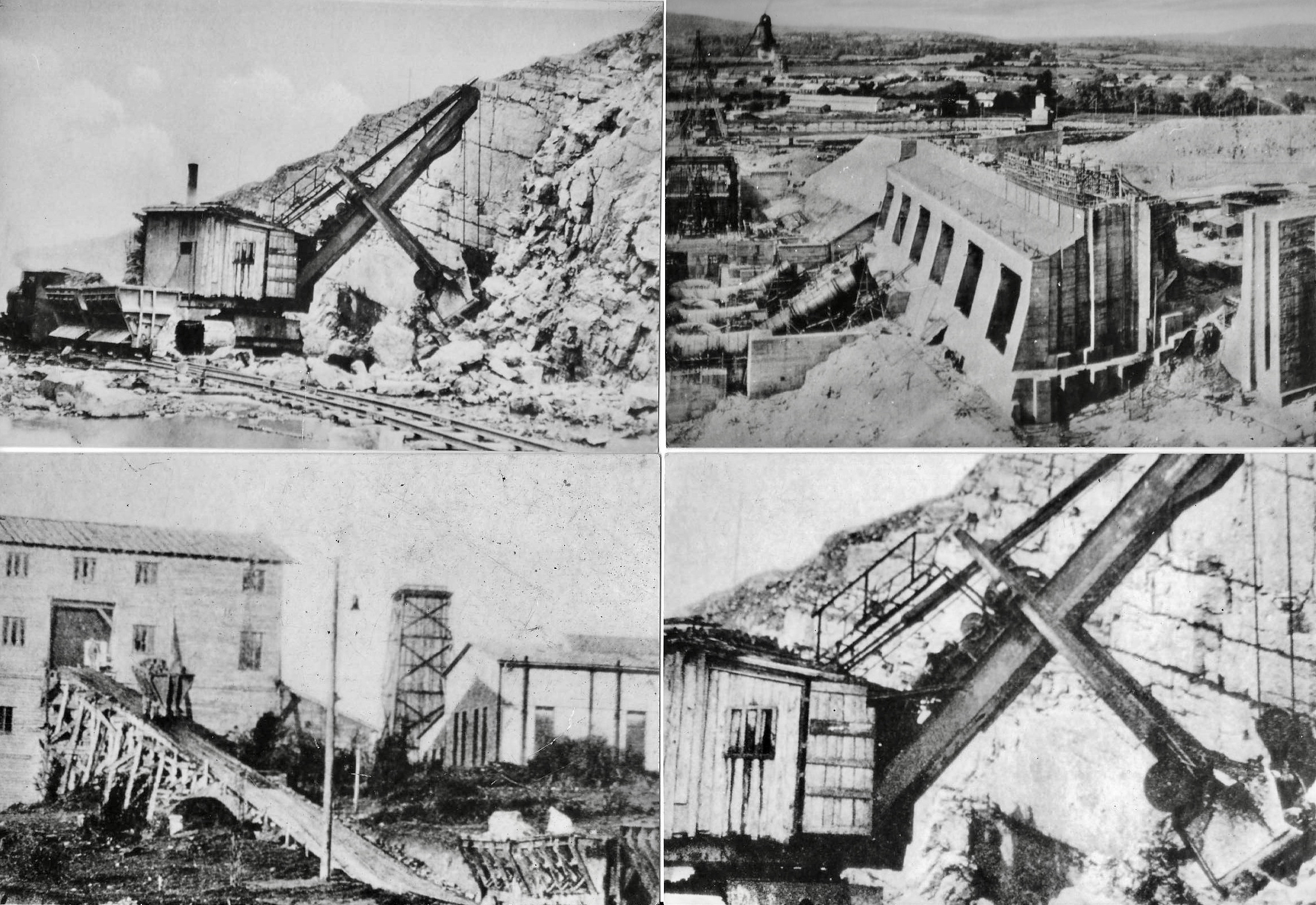
The huge Ardnacrusha power station – in its day the largest hydroelectric generating scheme in the world – under construction in 1925: it was completed and opened on 22 July 1929 and, by 1935, was producing 80% of all electricity in the Free State
The Lough Allen Canal connected the Shannon Navigation to the Lough: it was first opened in 1817. Boats would trade to quays on the lake with grain and return with sand or with coal from the Arigna mines. The fate of the canal was sealed when Lough Allen became a storage reservoir for the great hydro-electric station at Ardnacrusha. To increase its capacity, the level of the lake was raised by dam to a height above the old canal banks.
…The last trading boat left the Lough Allen Canal in 1927, while the last pleasure craft battled its way through the weeds in 1932. The lock-keeper, young Sean Nangle, still lived in the neat, freshly white-washed cottage beside the ruined entrance lock, but his duties were confined to bank ranging on the reach of the river below. Le Coq was the first craft to visit Battlebridge for seven years, so that our arrival was a minor sensation, and it was with a sense of newly discovered importance that Sean signed his name on our pass… (Green and Silver)
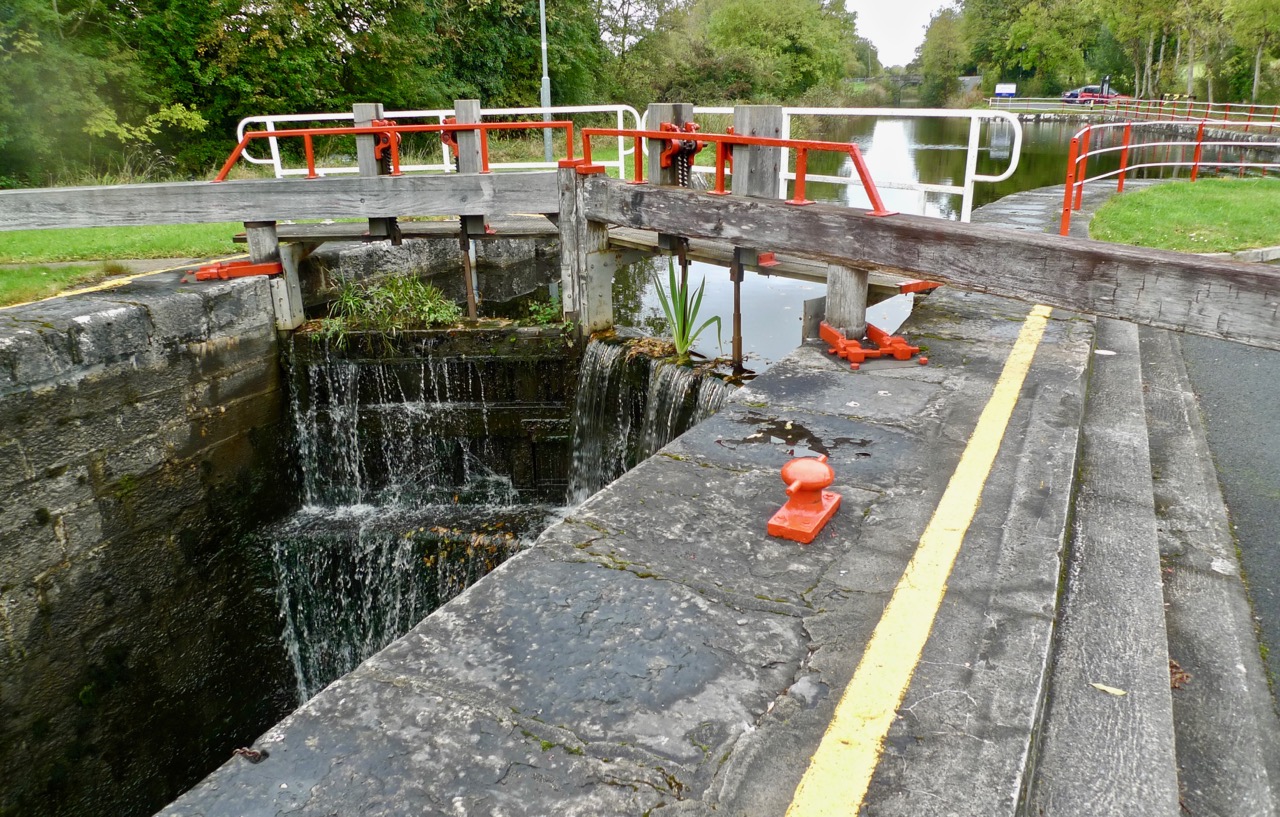
Battlebridge Lock, the first lock on the now restored Lough Allen Canal. The cottage in the distance was the home of ‘young’ Sean Nangle in 1946
One thing that the Rolts might never have anticipated was the revival of the Irish canals which has come about during the seventy years since their adventures, mainly during the economic boom of the decade or so from the mid 1990s. A cross-border authority – Waterways Ireland – is now responsible for a significant network of canal and river navigations within the island, including many that have been re-established. One is the Lough Allen Canal, now providing access from the Shannon to Upper Lough Erne in County Fermanagh, Northern Ireland.
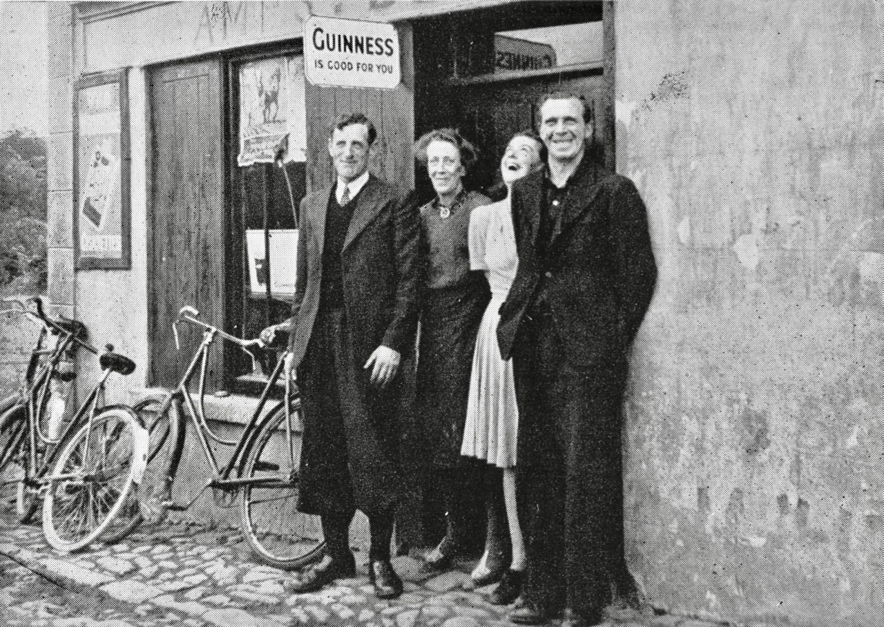
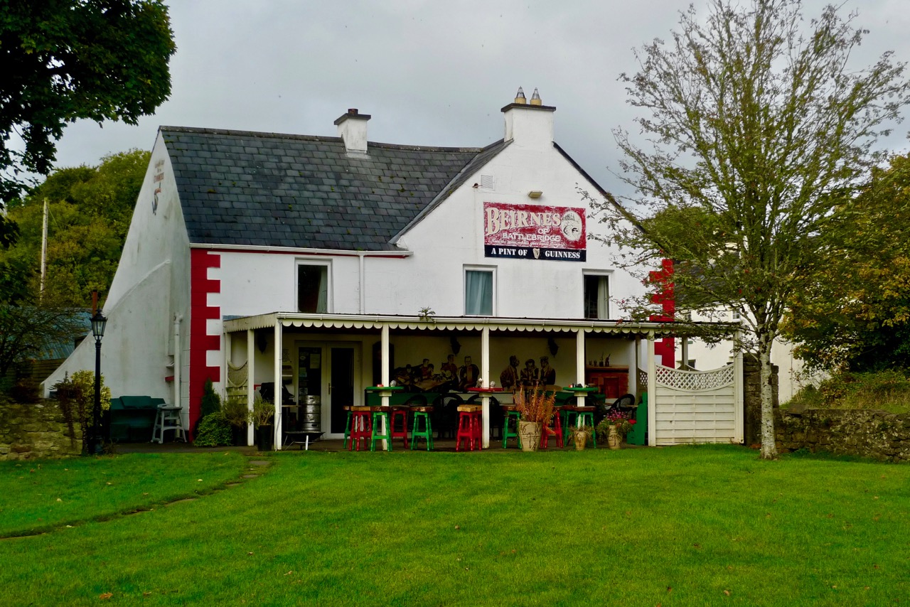
…That evening Sean accompanied us to the inn which stood by the road side just across the old bridge, and a grand friendly house it proved to be. Nowhere in rural Ireland did we find any lack of kindness, hospitality and friendship, but in these respects this little inn at Battlebridge is particularly memorable. For this, credit must go to the Beirne family, mother, daughter and son. I will not attempt to characterize them; they speak for themselves in their photograph. Leaning against the counter in the bare whitewashed bar we enjoyed the best glass of ‘single’ porter that we found on our travels, while intruding chickens pecked unconcerned about our feet. Through an open doorway a turf fire glowed in a wide open hearth equipped with crane and ratchet hook. Upon the fire reposed a squat, black pot-oven with more smouldering turf upon its lid… Conversation was interrupted when a drove of bullocks passed by with a soft patter of hooves. Everyone crowded to the door to comment and criticize and to speculate where they had come from and whither they were bound, an argument which was settled when the drover himself stepped in for a glass… (Green and Silver)
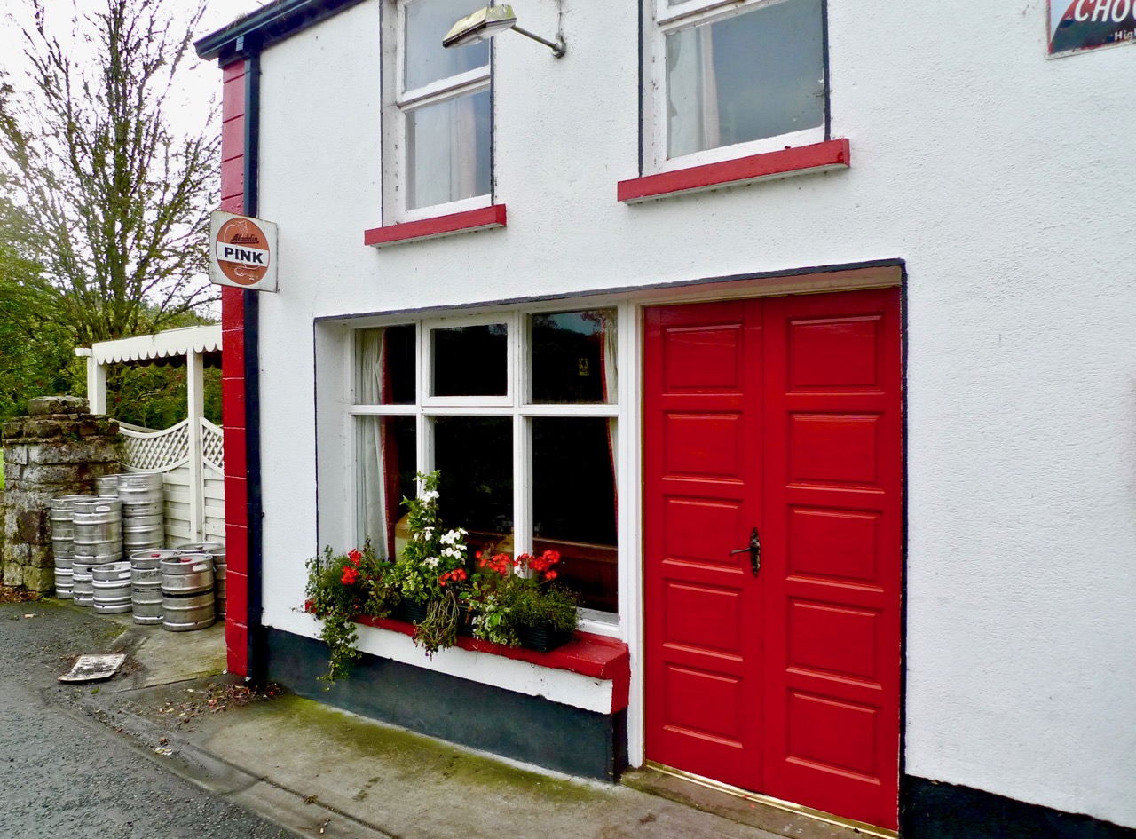
Upper picture: Angela Rolt’s photograph of the Beirne family in 1946. Lower pictures: Beirnes Bar is still trading in 2016
The re-opening of the Lough Allen Canal was heralded triumphantly in April 1996. I was pleased to find an archived RTE news report on that event. The official cutting of the tape was carried out by the Minister for Arts, Culture and the Gaeltacht – Michael D Higgins, now our President.
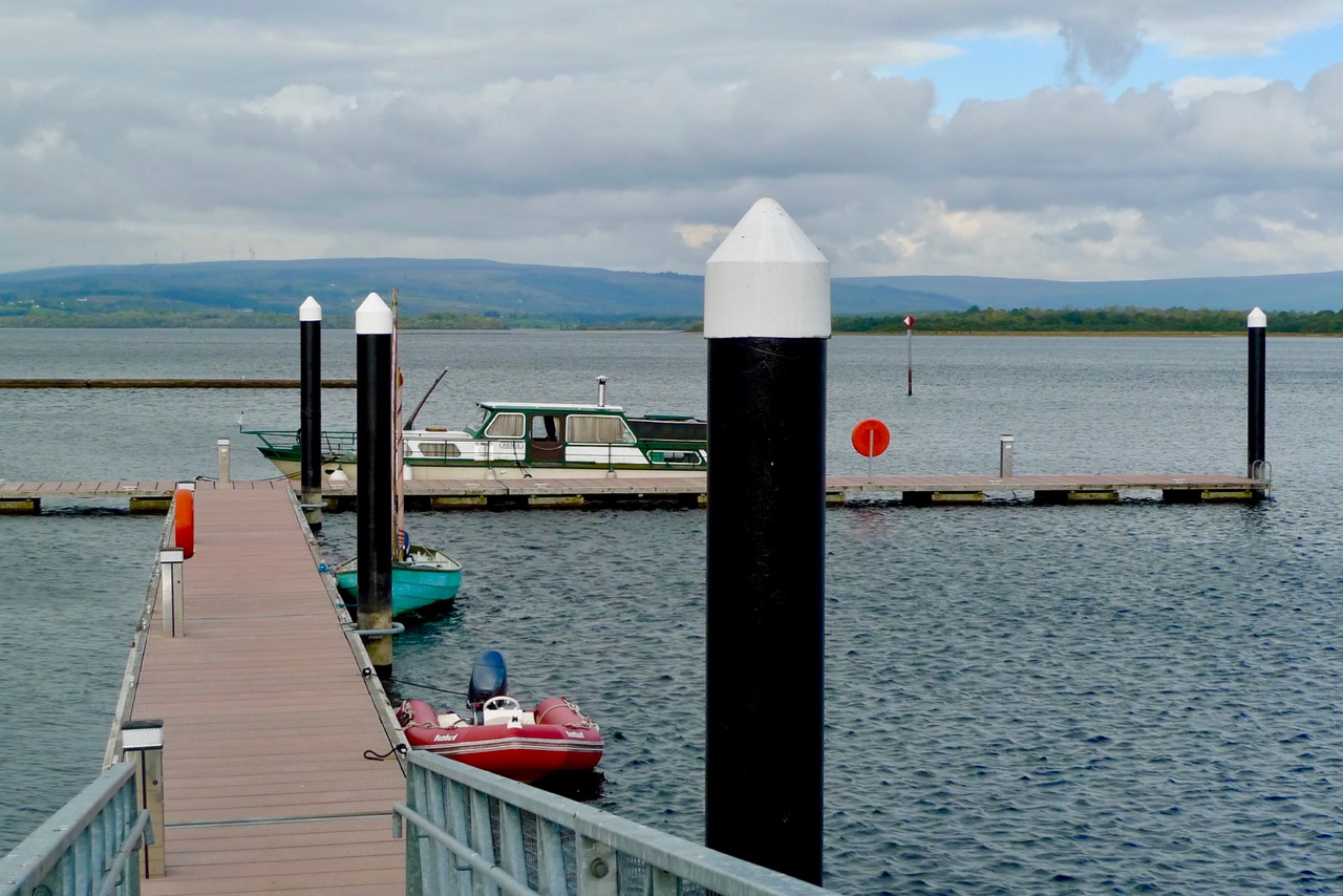
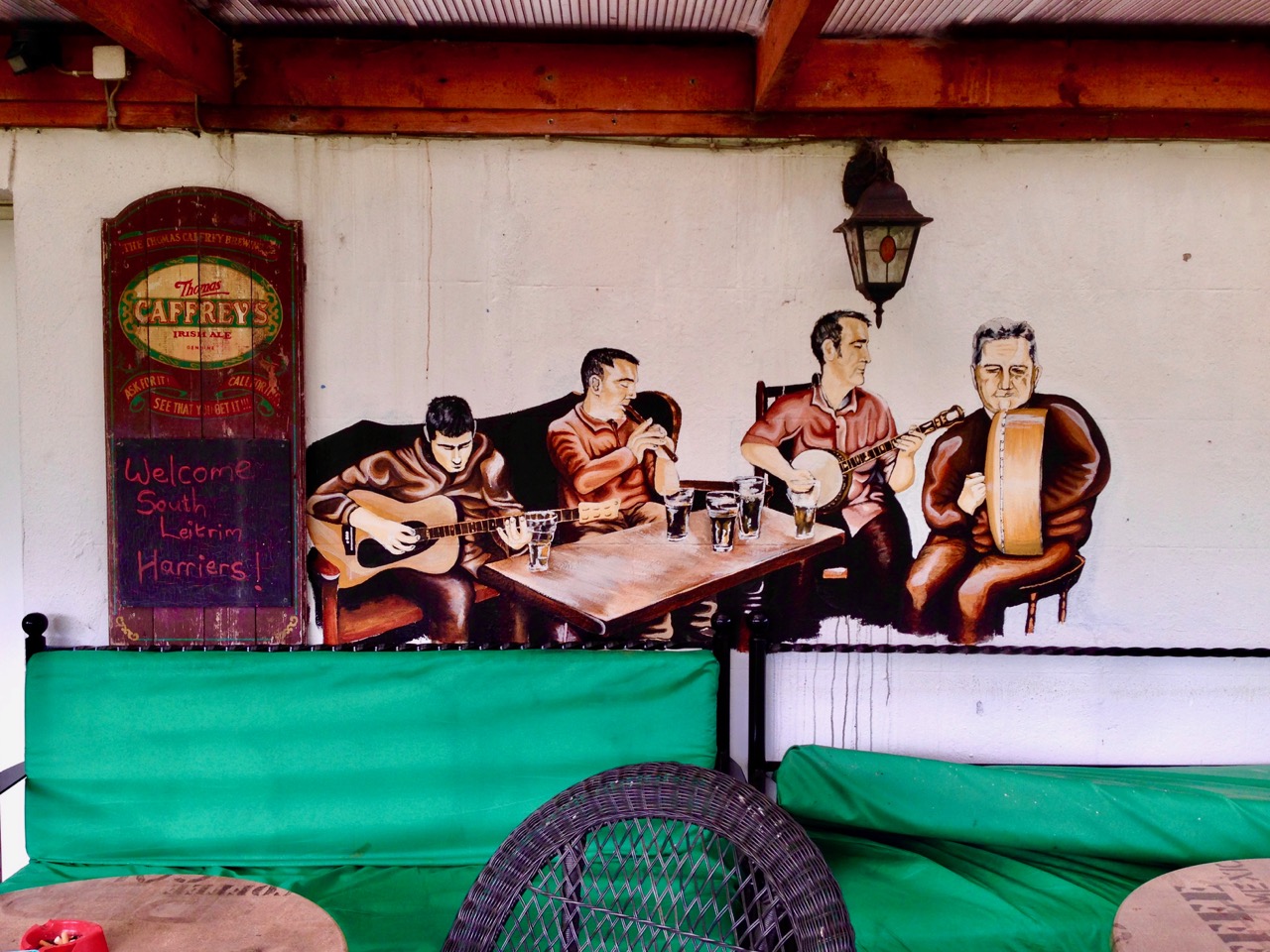
Upper picture: the lock at Battlebridge on the restored canal. Lower picture: Lough Allen today. Below: A mural on the garden terrace of Beirnes Bar
Welcome to the UCD Library Cultural Heritage Collections blog. Discover and explore the historical treasures housed within our Archives, Special Collections, National Folklore Collection and Digital Library