Goat Islands and Spirit Music

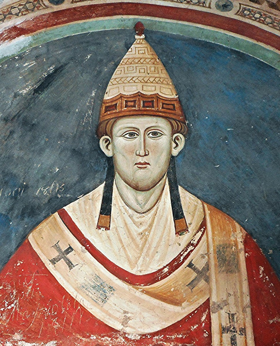
I can give you a little more information about the Goat Islands now, thanks to Jim O’Keefe, the fount of all wisdom in regards to Schull History. First – the name Lough Buidhe (Pronounced Bwee) – I had forgotten that there is significant folklore associated with this area. Jim tells me that it was believed that gold coins were to be seen on the sea bed as a result of a ship wreck on the Barrell Rocks. But there’s another story too, one that is illustrated in the information sign at Colla Pier.

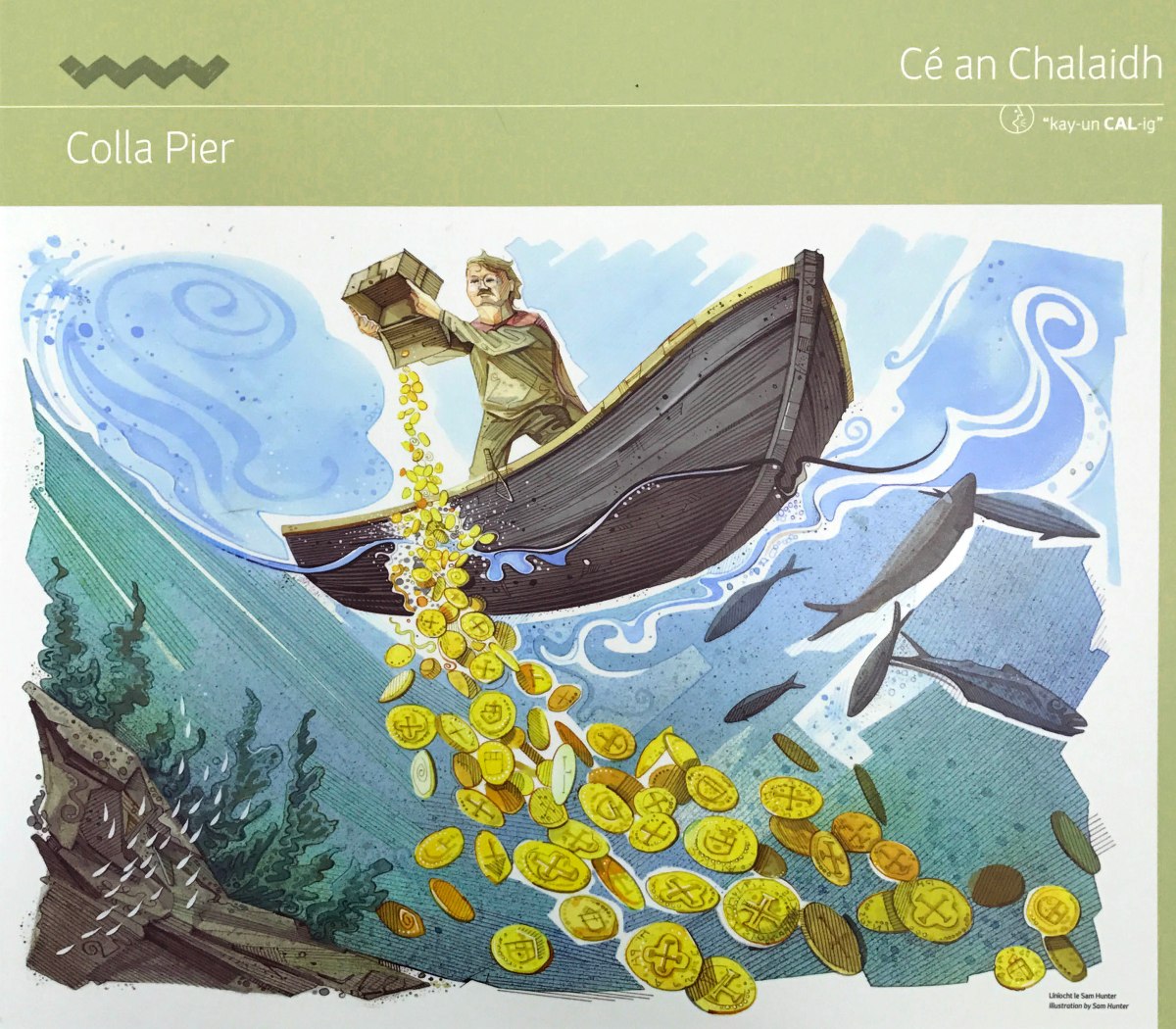
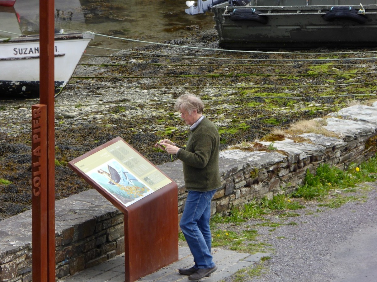
This one features Fineen O’Driscoll, chief of Baltimore and you can read Robert’s account of it in his post A Watery Tale. As backup – here is my photo of Robert taking it all in, in 2017.

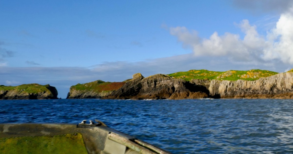
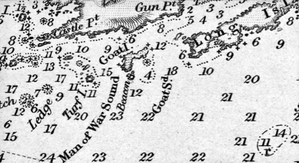
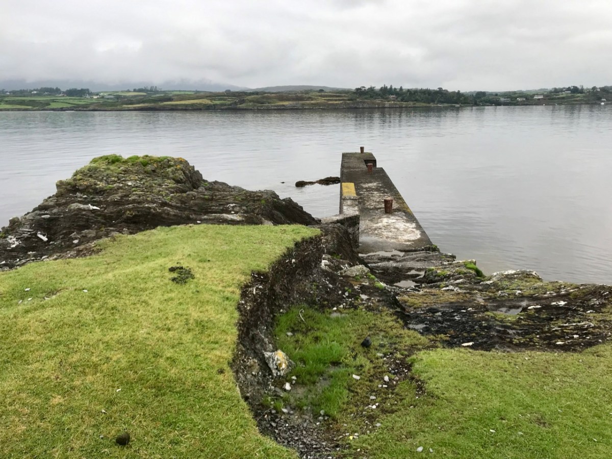
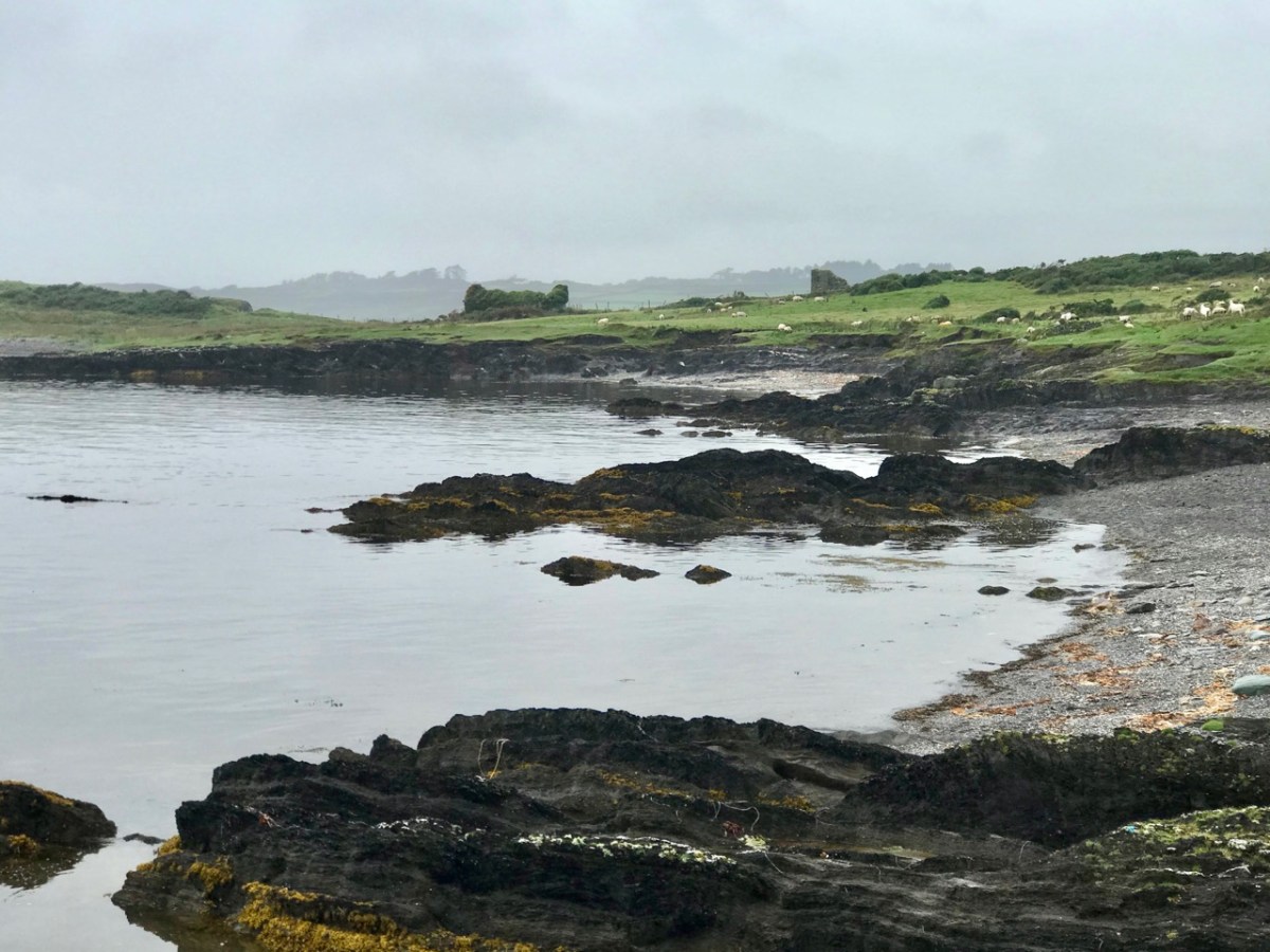
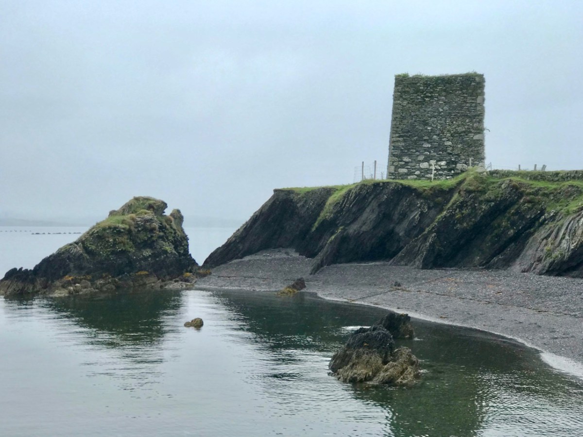
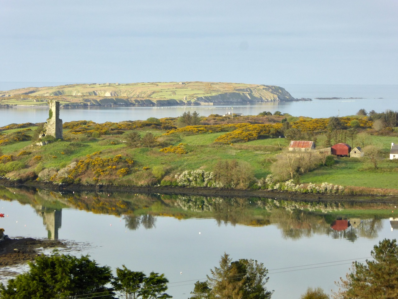
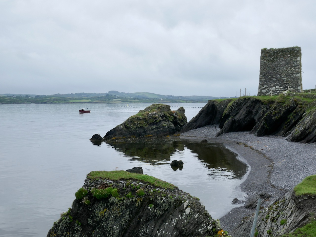
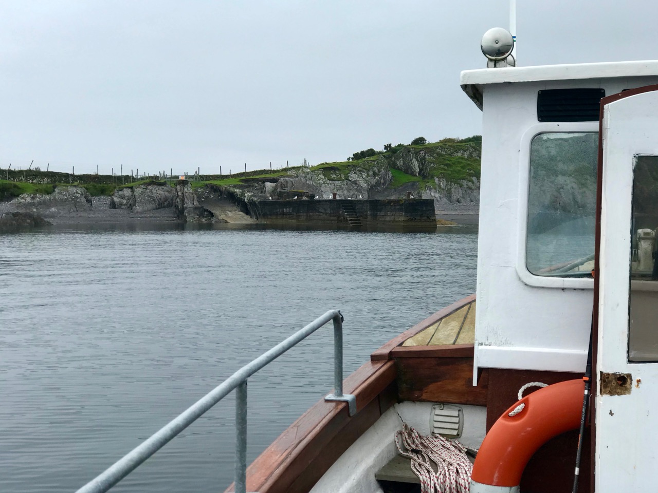
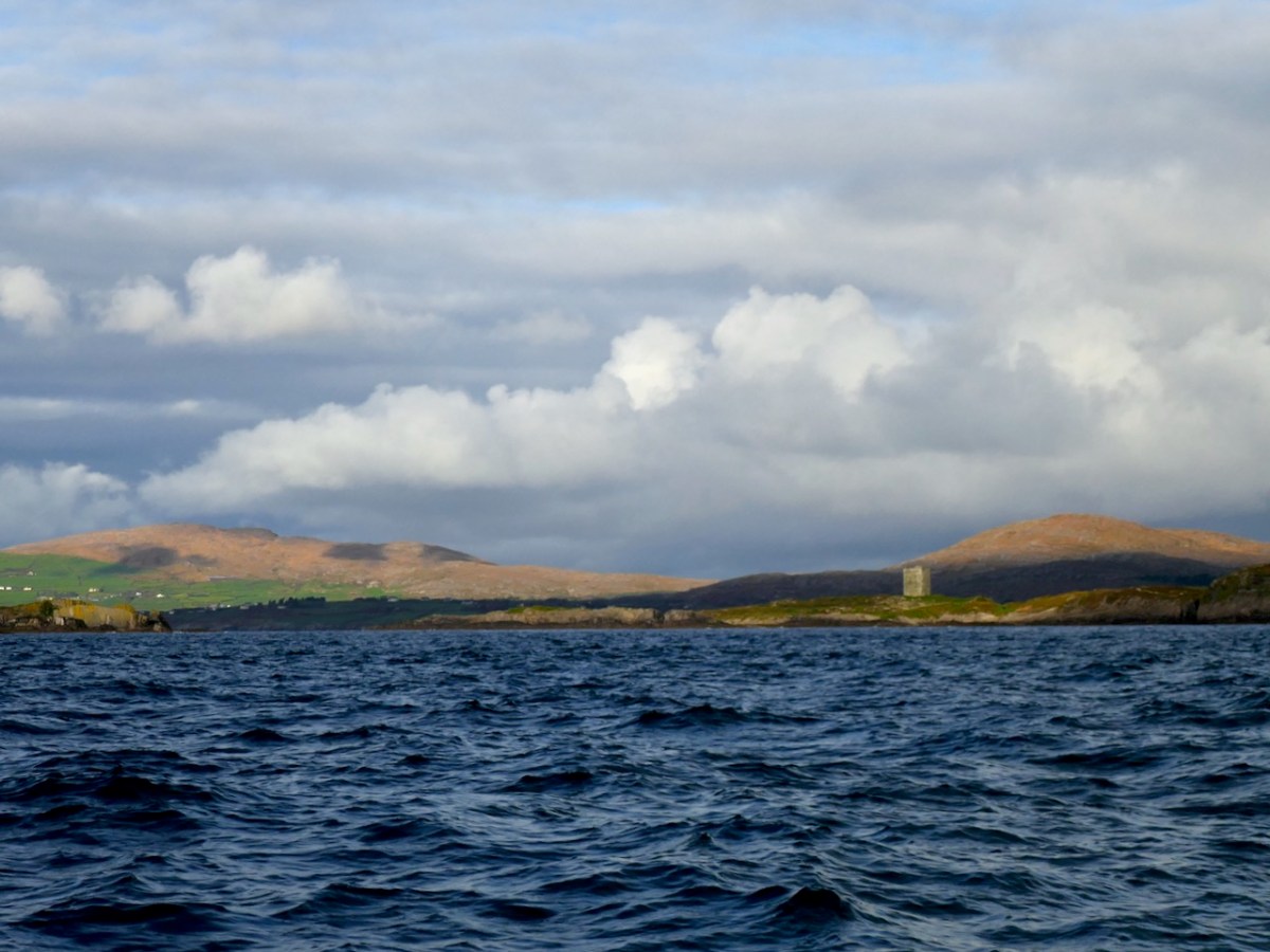
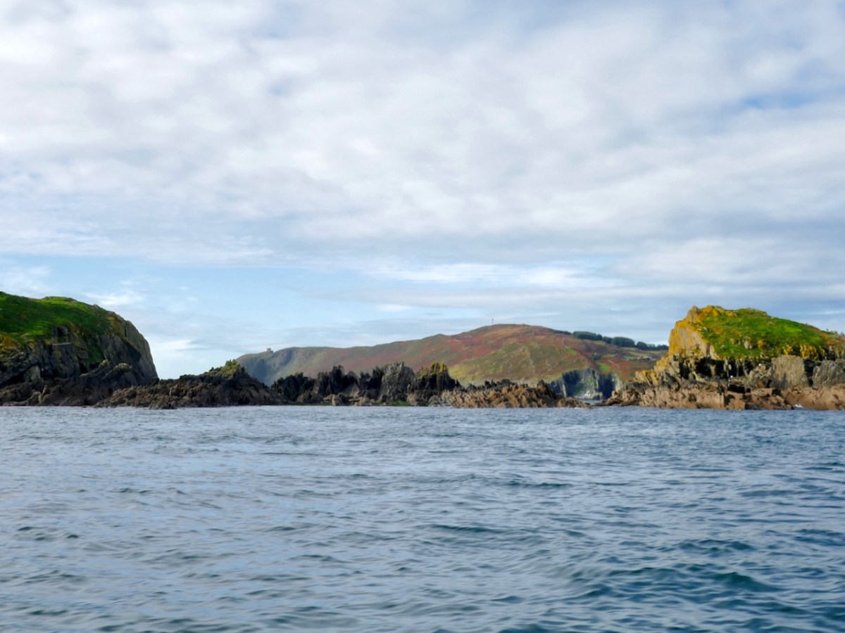
Second, Man of War Sound – Jim tells me this is a mis-translation of ‘Mean Bothar’, main road, or main entrance into Long Island Sound. Here we are in that sound, with Leamcon Castle in view.

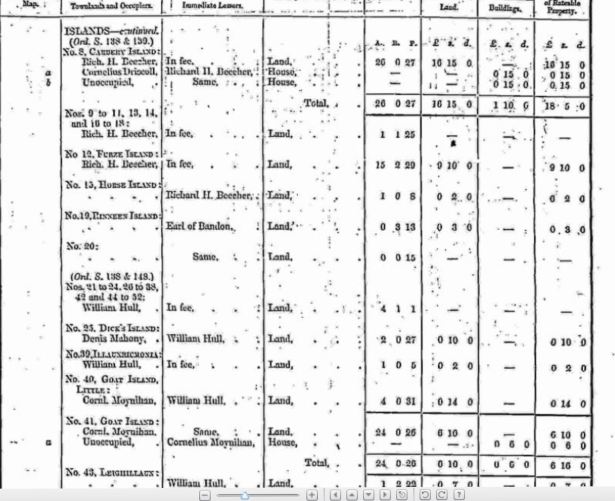
I was wondering who owned the island – Jim told me the owner also owns Coney Island. He bought the Goat Islands thus:

He bought the islands from Nelly Downey; I was the auctioneer acting on Nelly’s behalf. Nelly wanted thirty five thousand for the islands. He thought that too much and offered twenty five thousand. Nelly dismissed us at the door of her cottage with the words: “thanks very much bye”…repeating “it’ll need no salt” …. “good day and good luck.”  As we walked away he said to me : what was she saying? I said “It will need no salt” Mike was highly amused and said I must buy it so . We returned to Nelly and sealed the deal .    

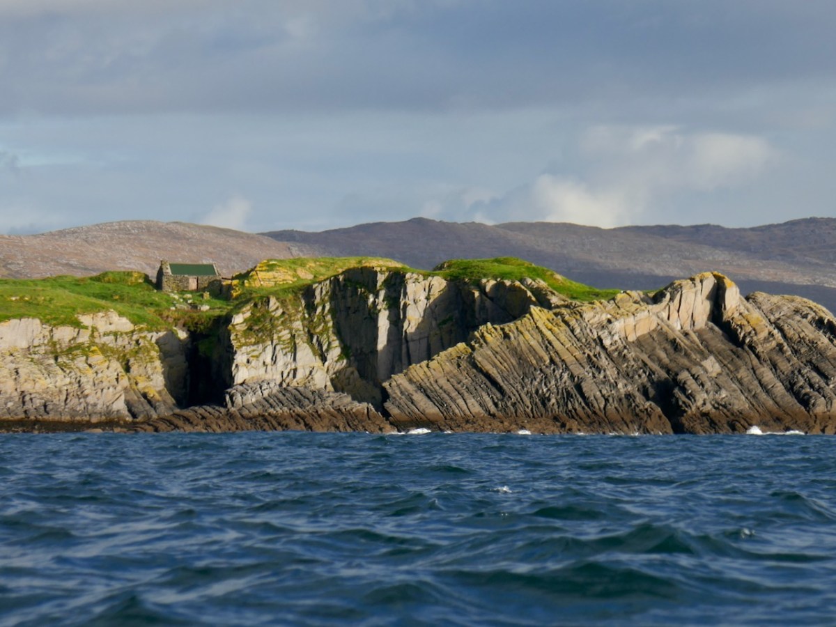
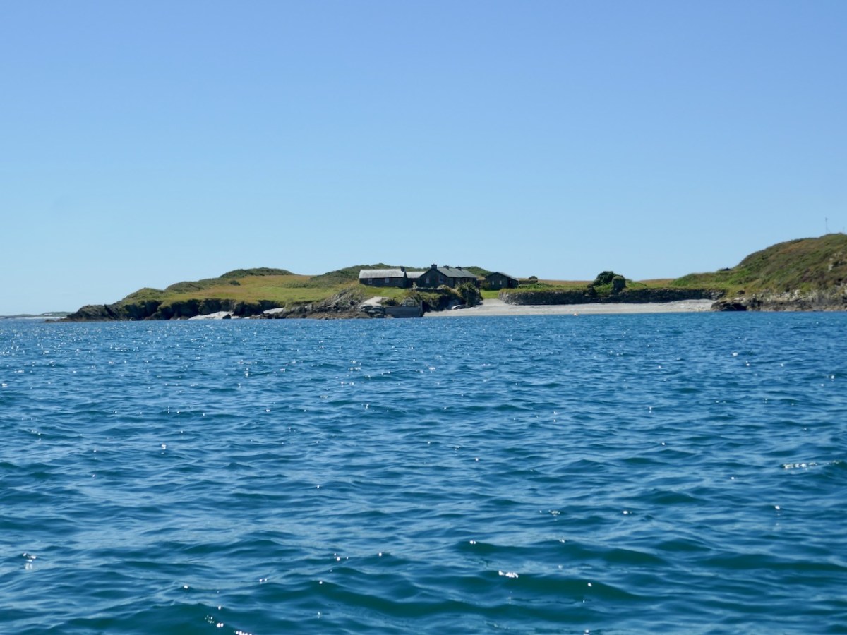
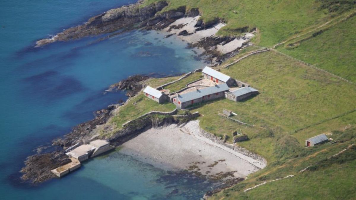
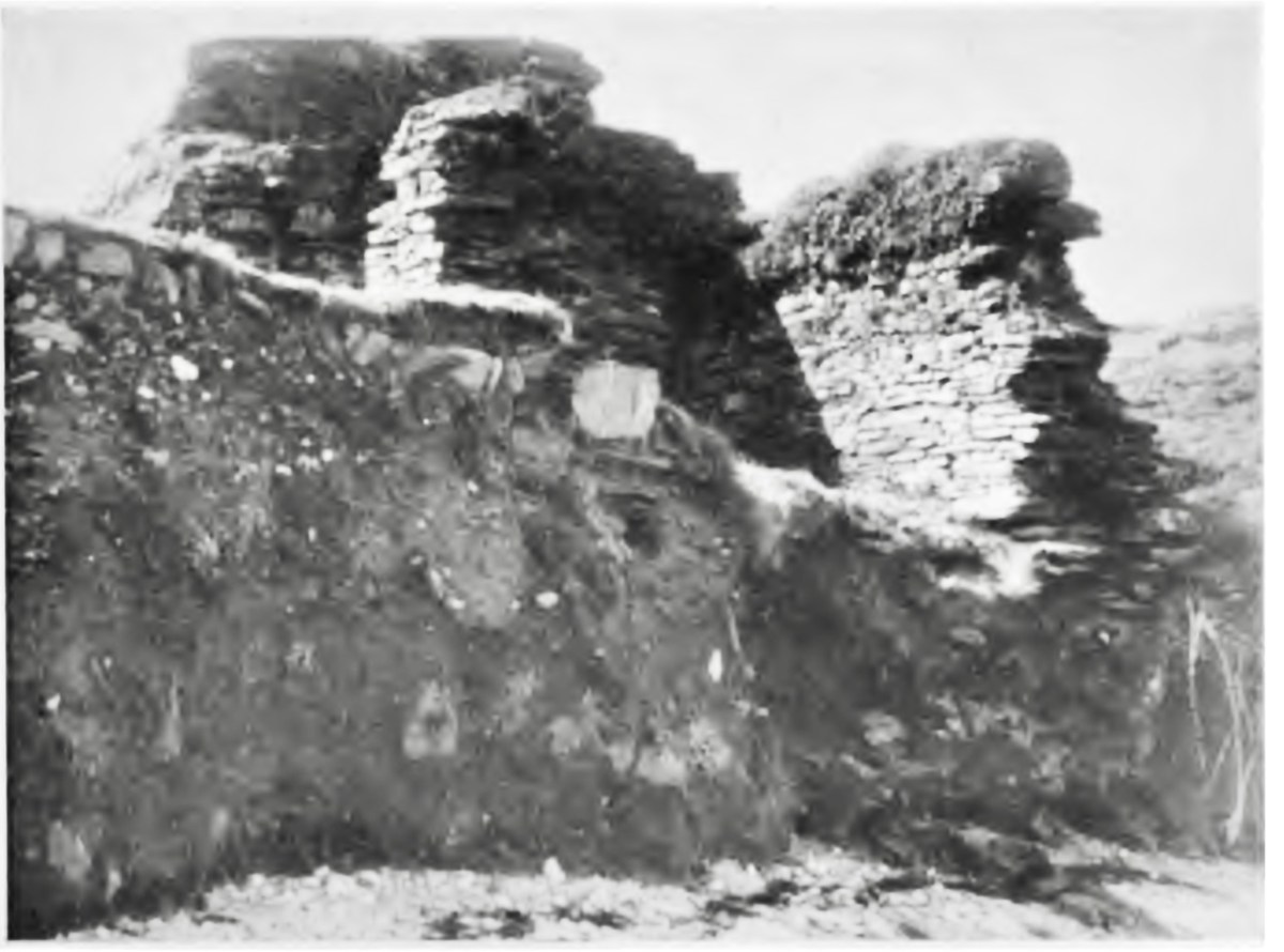
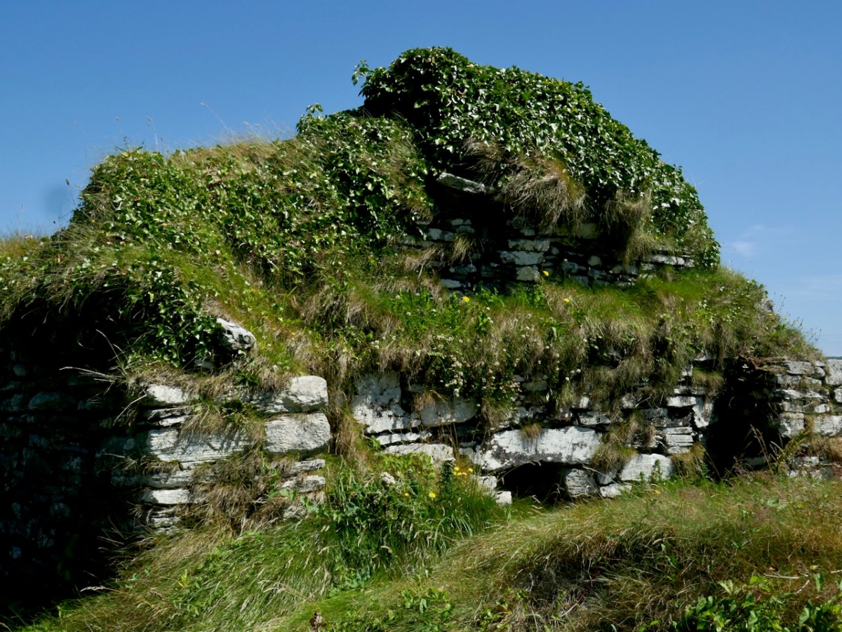
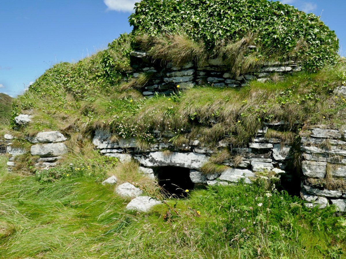
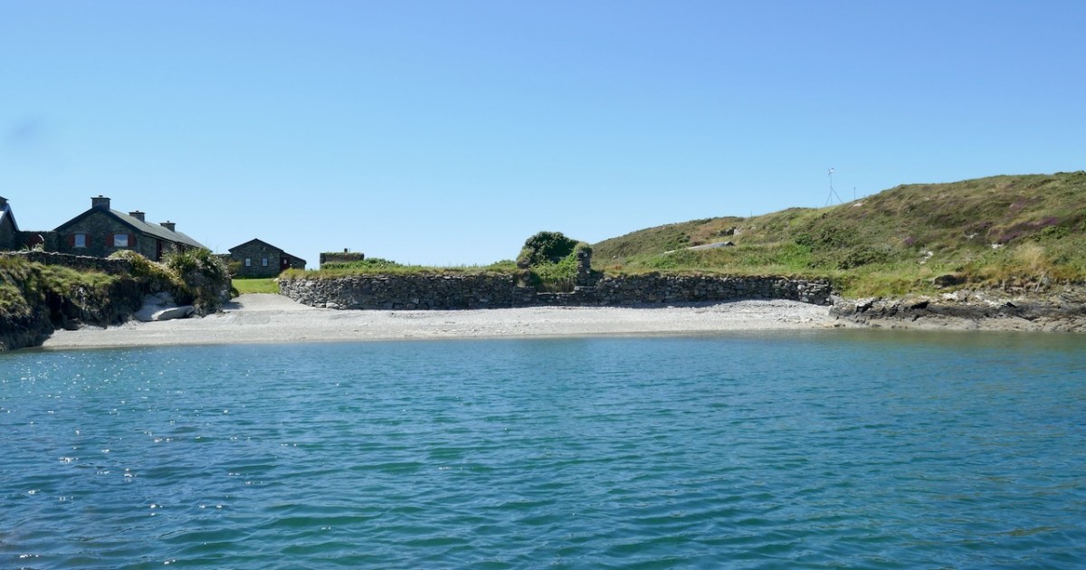
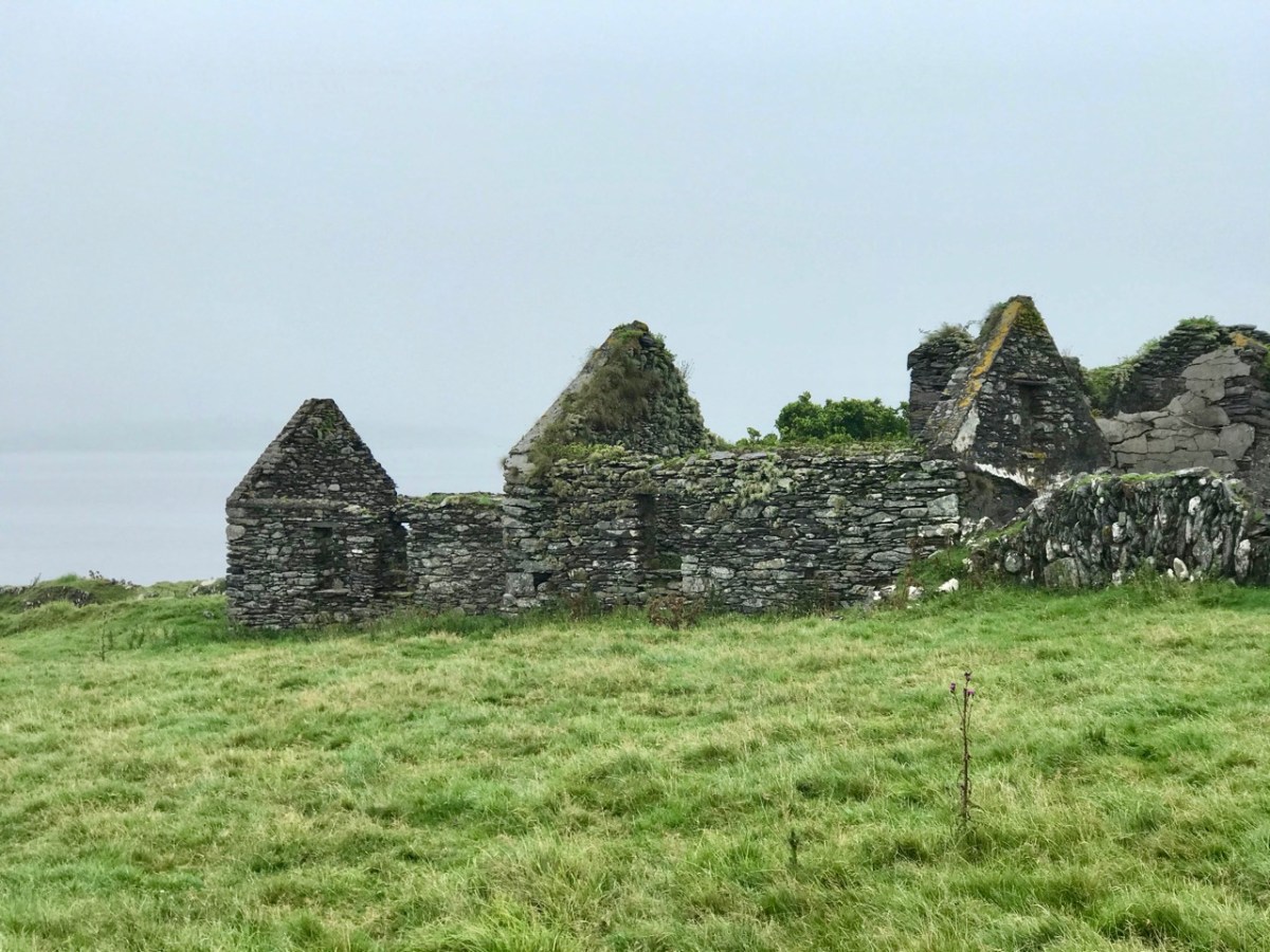
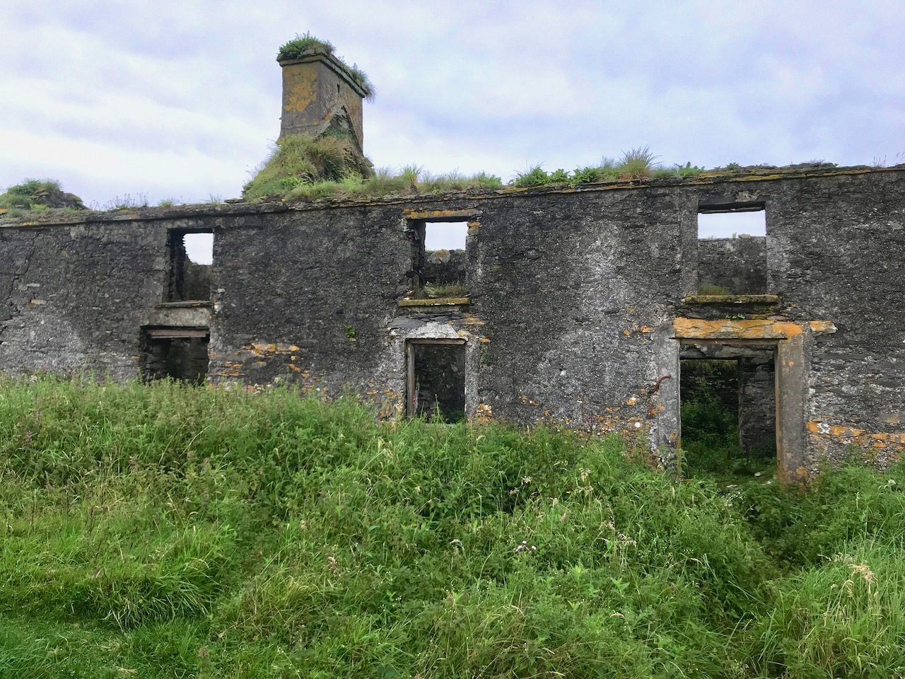
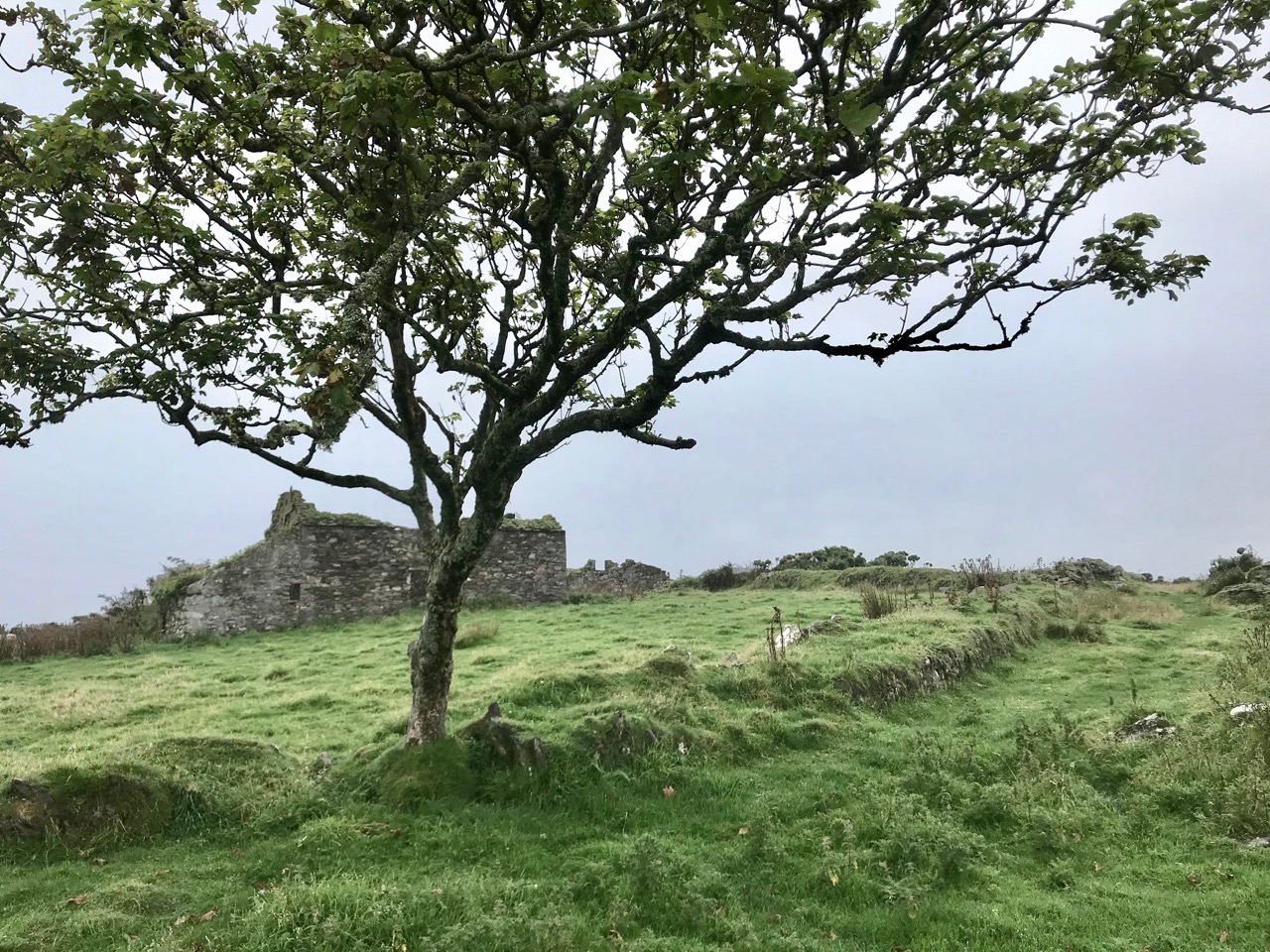
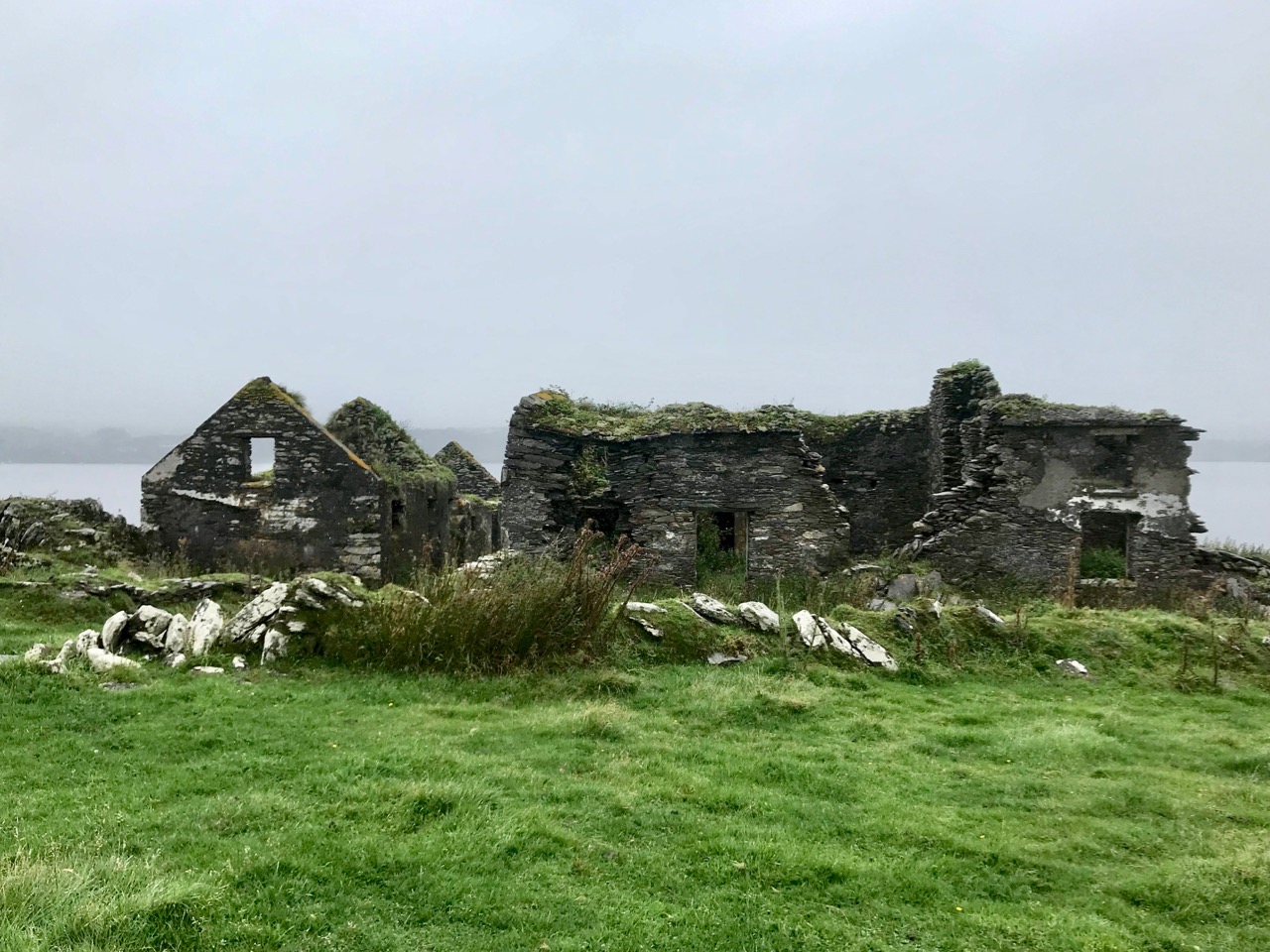
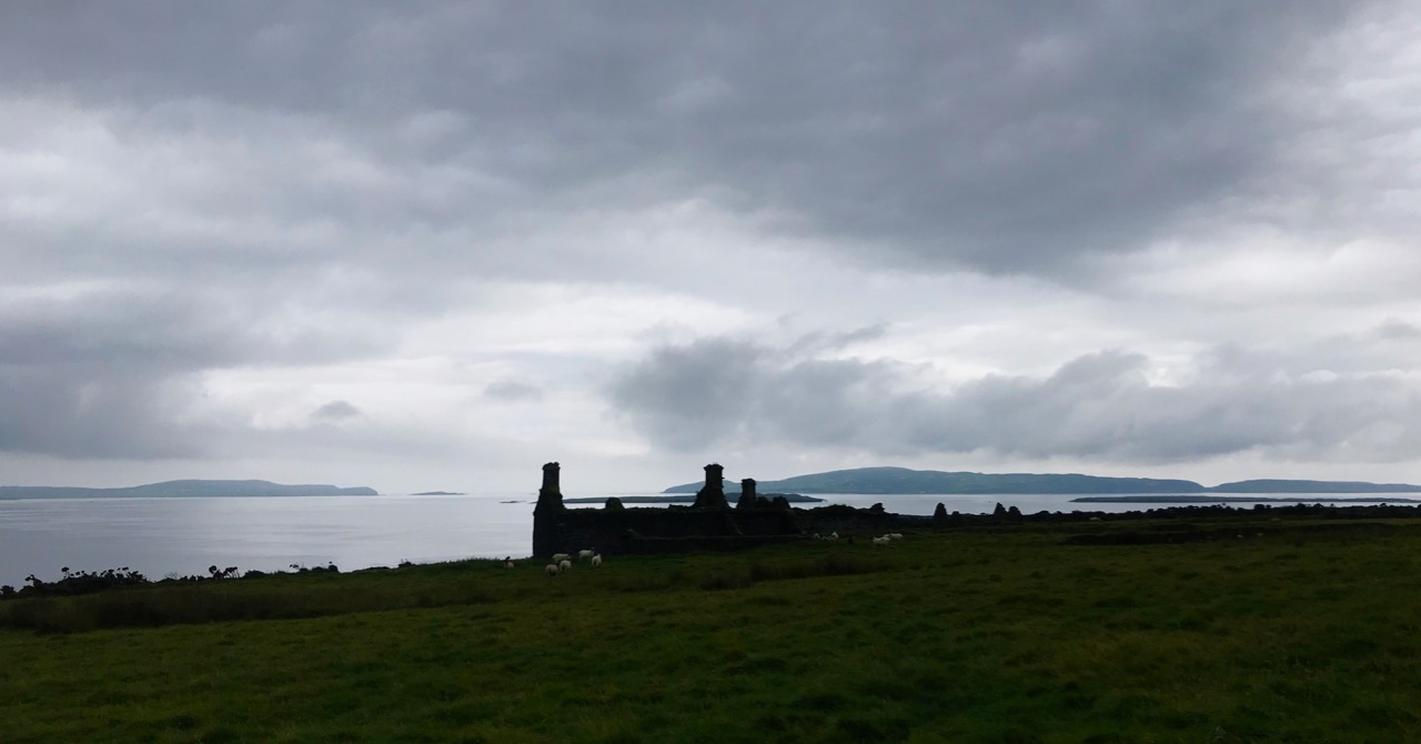
The owner, with his daughters, did some work on the stone cottage. In the gap in the south side of the main island there is a nice sandy cove and a large flat rock, ideal for sun bathing.

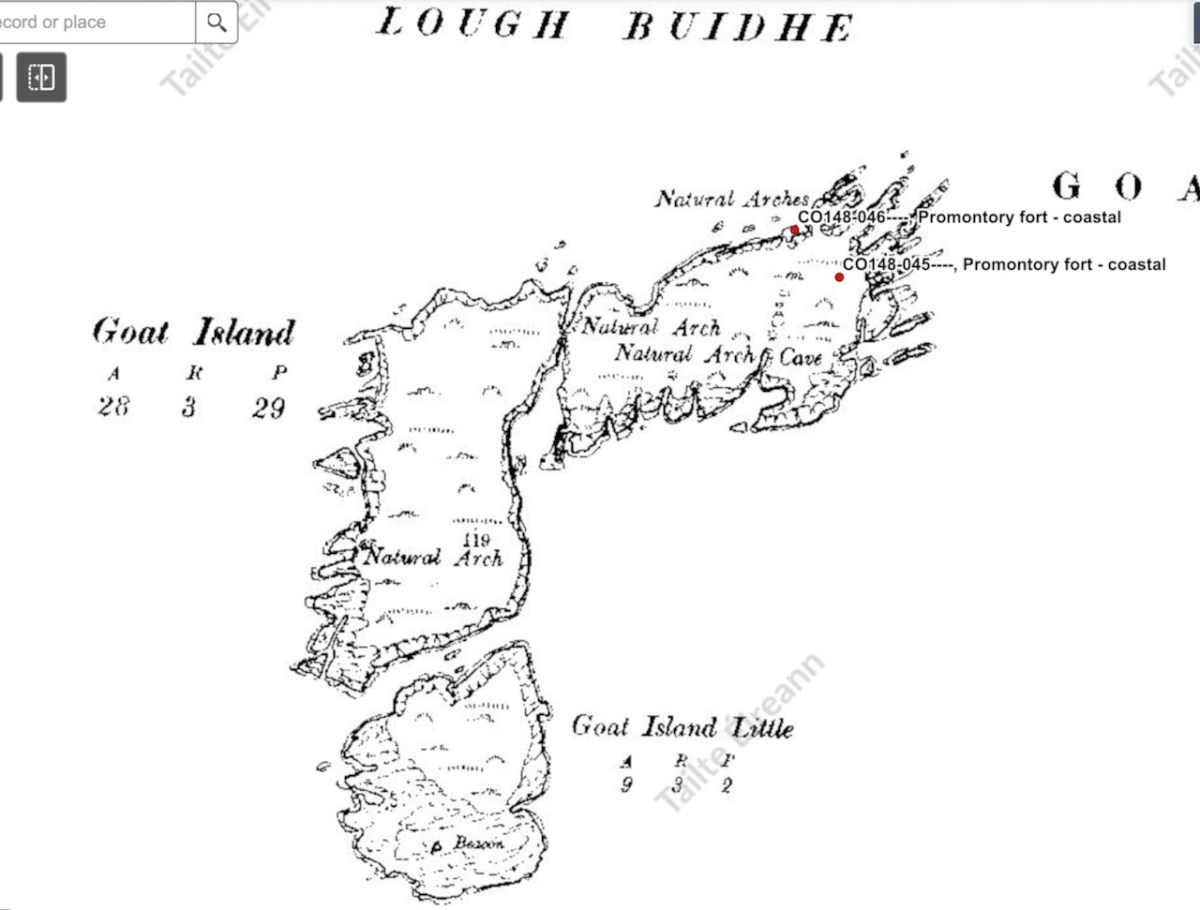
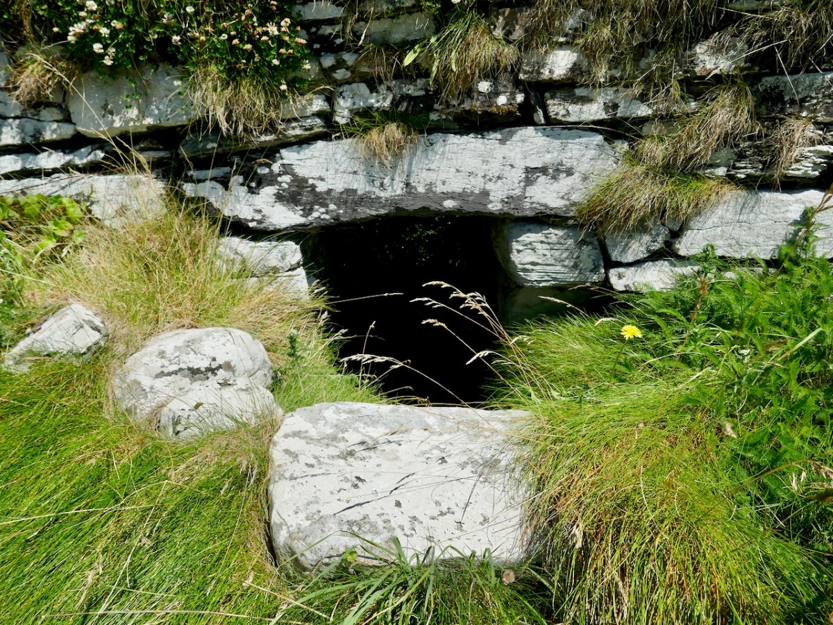
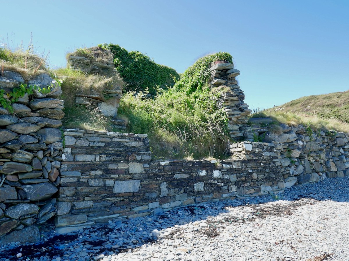
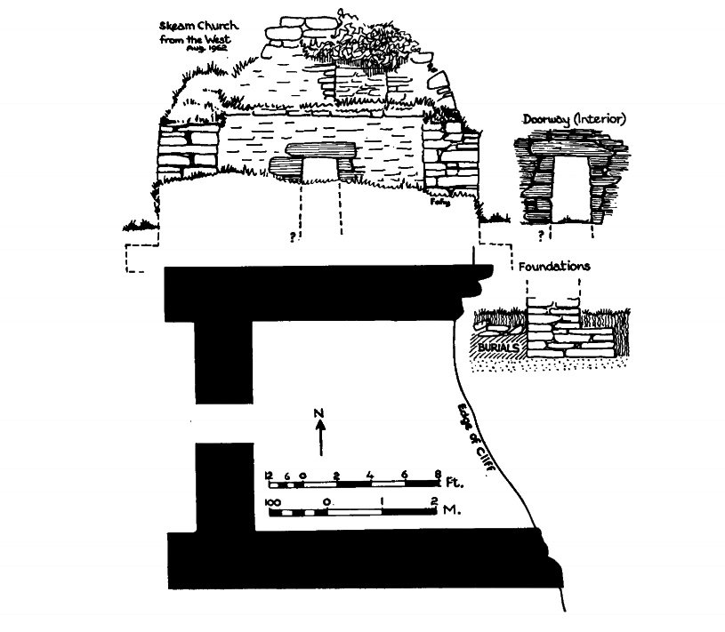
On the eastern end of the main island there is a ‘cuas’ with stone steps cut into the rock, making landing there possible. Apparently a lone man lived on the island at one point. On the Little island there is a rock on the east side with a mooring point on it to facilitate lading there .

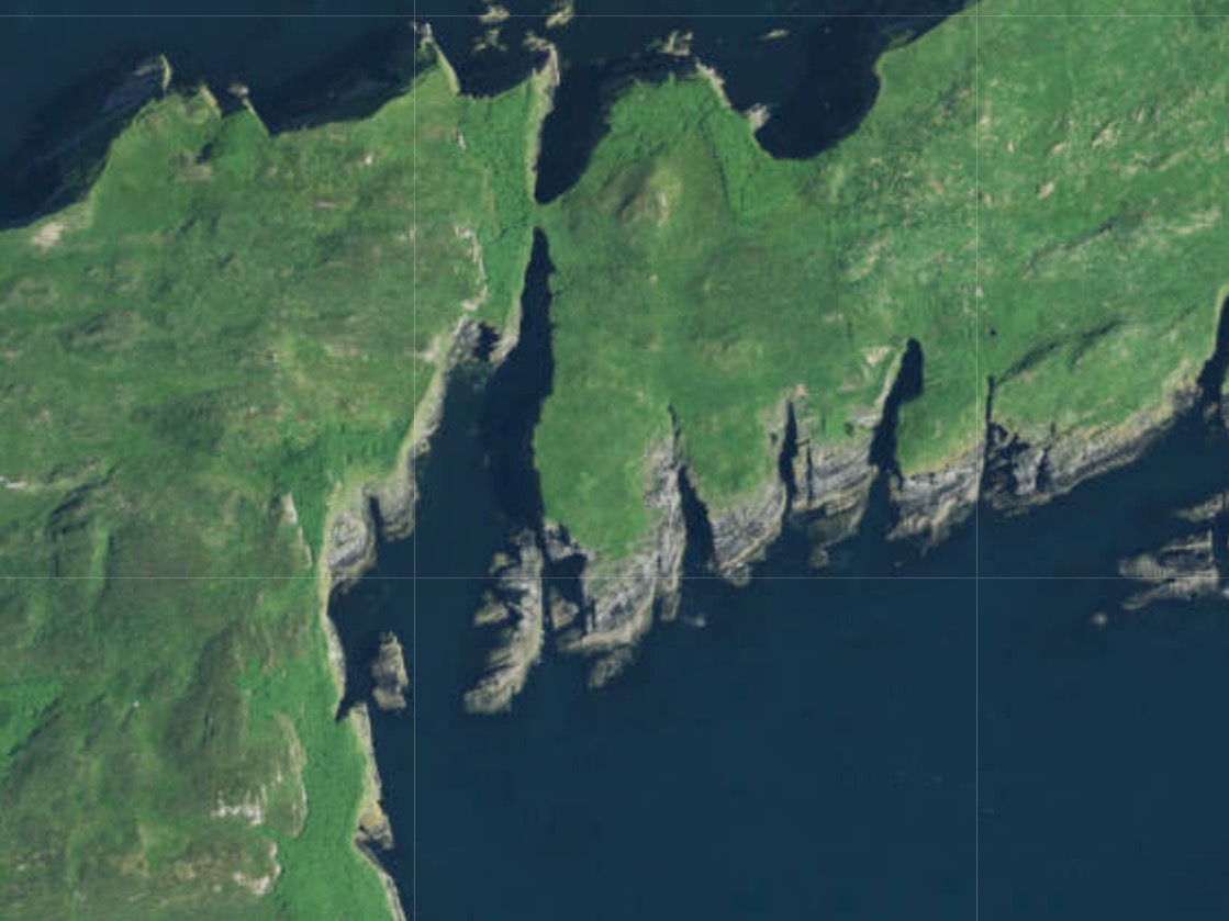
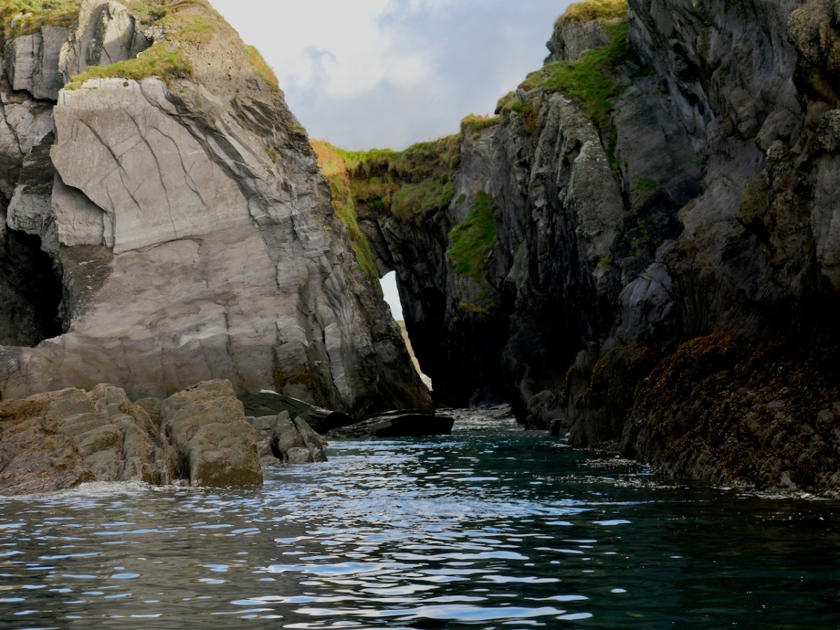
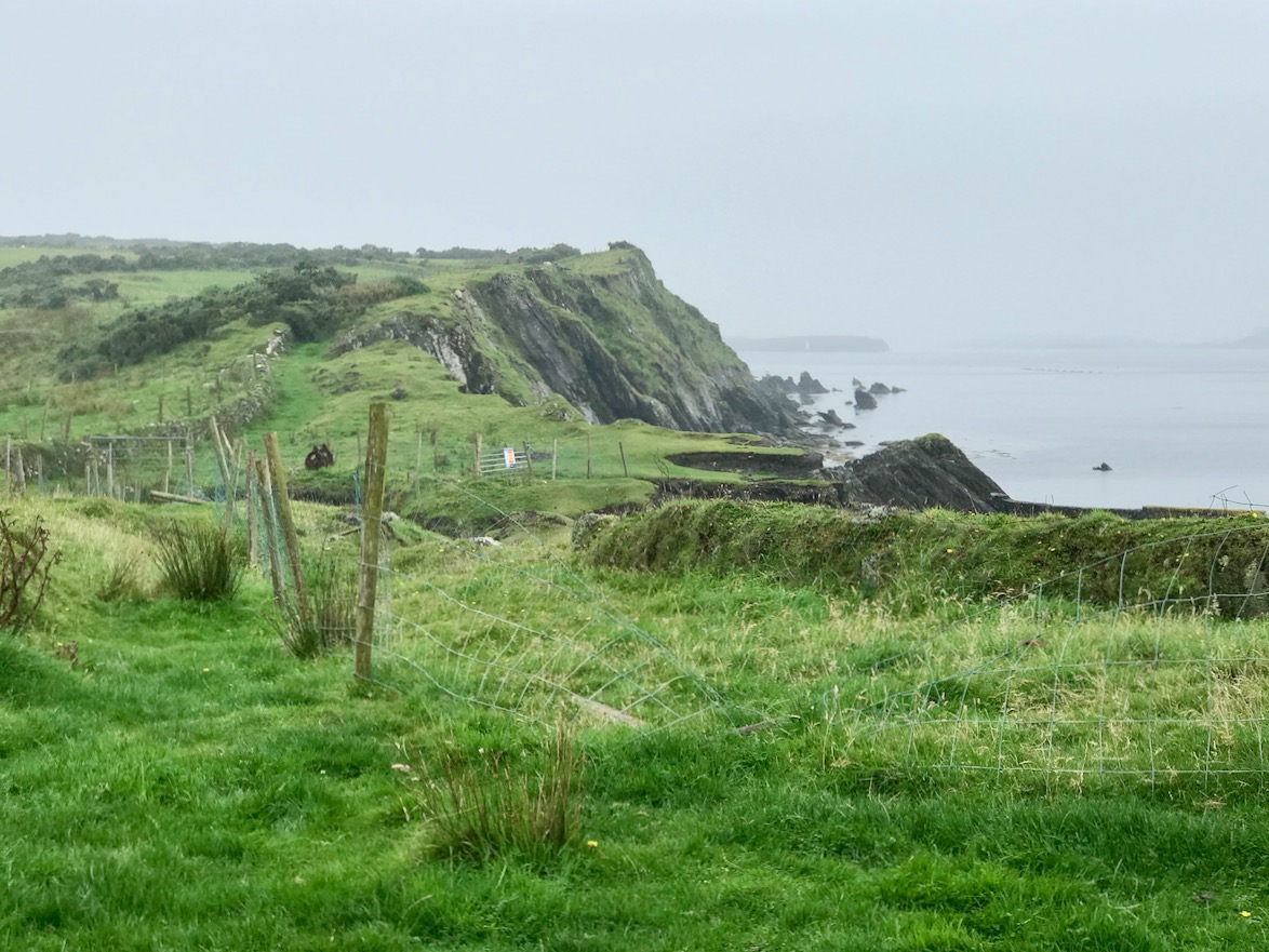
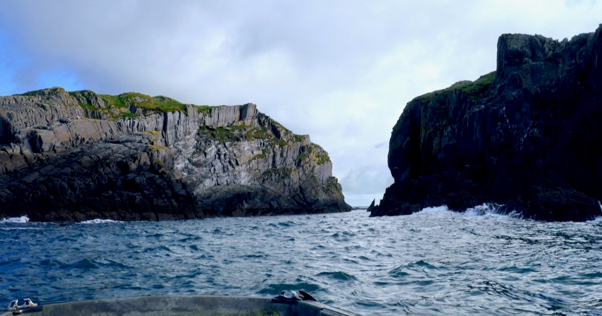
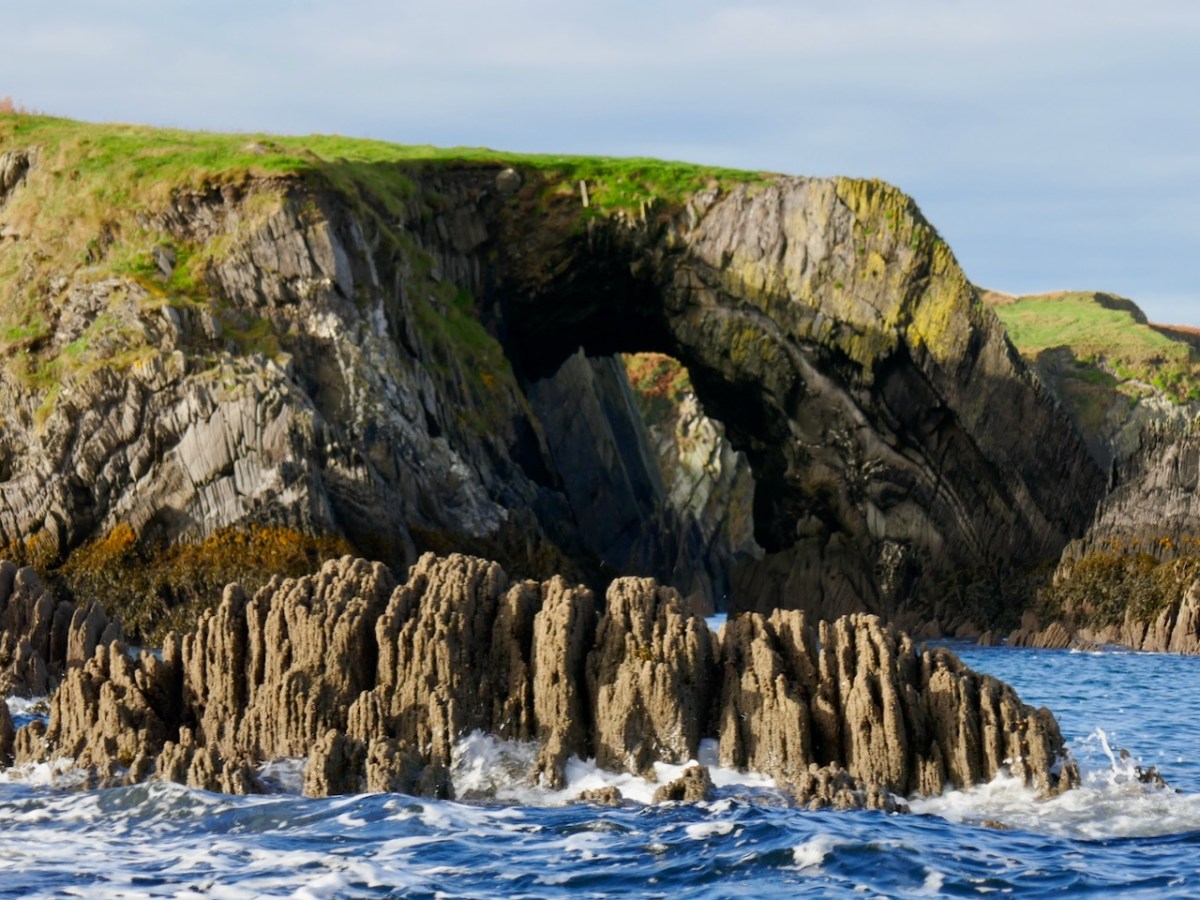
I wonder if the Lone Man was the elusive Cornelius Moynihan? A Cuas is a small cove. Jim also reminded me that Goat Island is also known as Goat Island Great. We didn’t see the Cuas, but did get great views on the sea arches on the north side of Goat Island Great.

In my last post I told you there was more to the story of our morning on the sea. First – we turned around and went back through the Gorge from the other side. This video has a reminder not to take the depth of the water for granted.

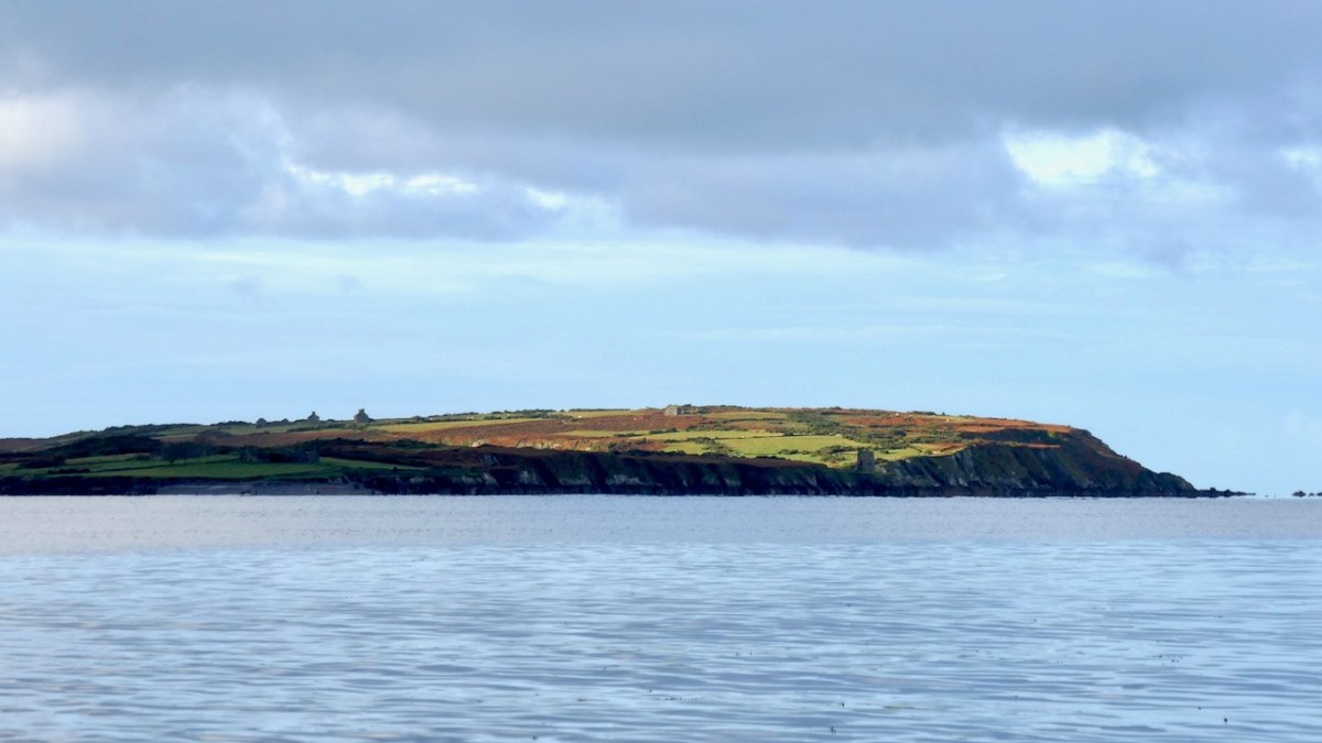
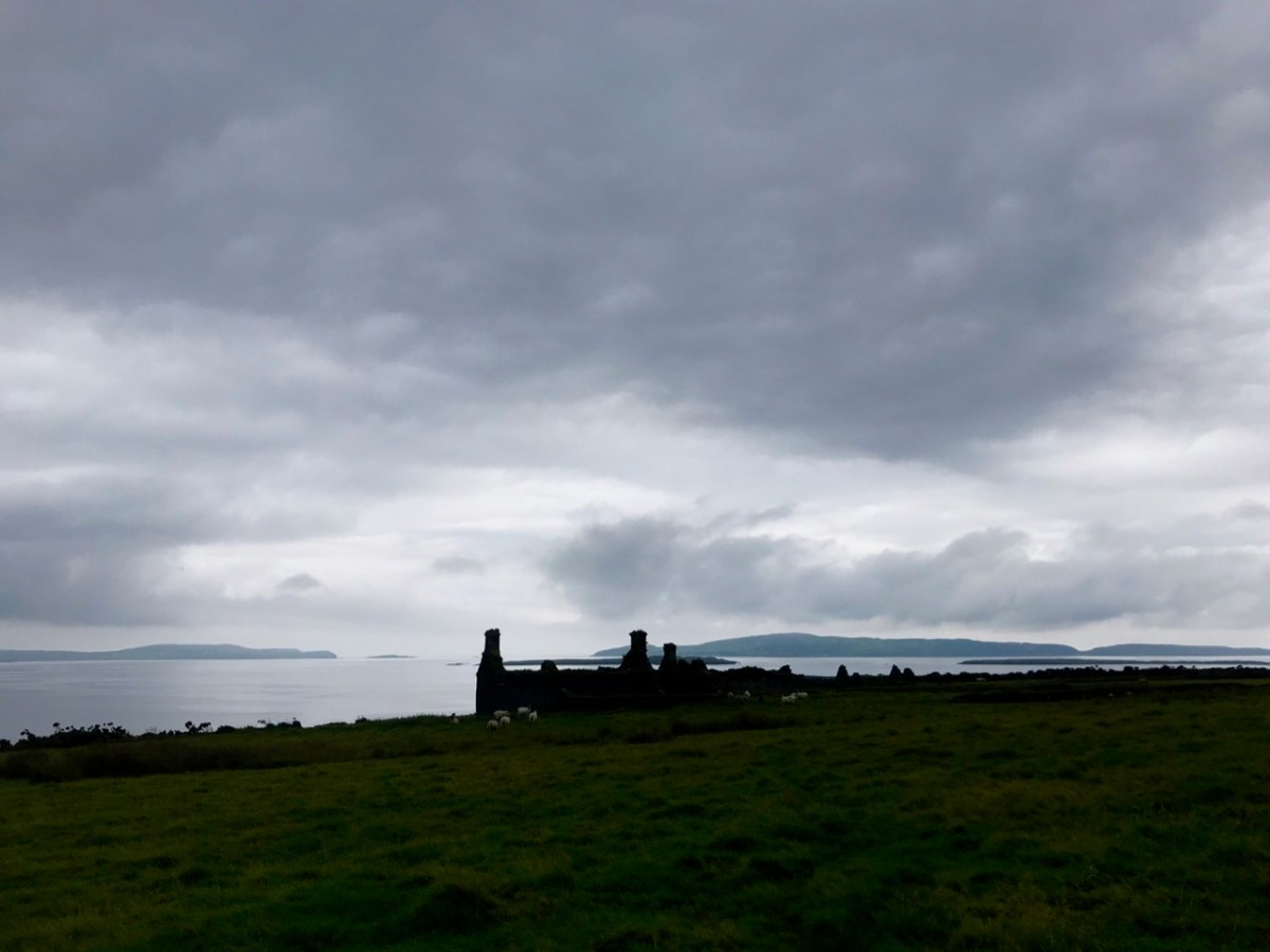
Just when I thought Nicky would turn for home – after all, I was now totally satisfied with my marvellous adventure – it became apparent he had other ideas. It was a fine day after all and it would be a sin to waste it, so off we set across Roaringwater Bay in search of dolphins. Nicky explained that Atlantic waters pour into the Bay through Gascanane Sound, between Sherkin and Cape Clear, bringing the fish with the tide, and the dolphins chasing the fish. We did see two dolphins but only a glimpse and they were gone. That’s Cape Clear below – the distant buildings on the headland are the original Fastnet Lighthouse and the Signal Tower.

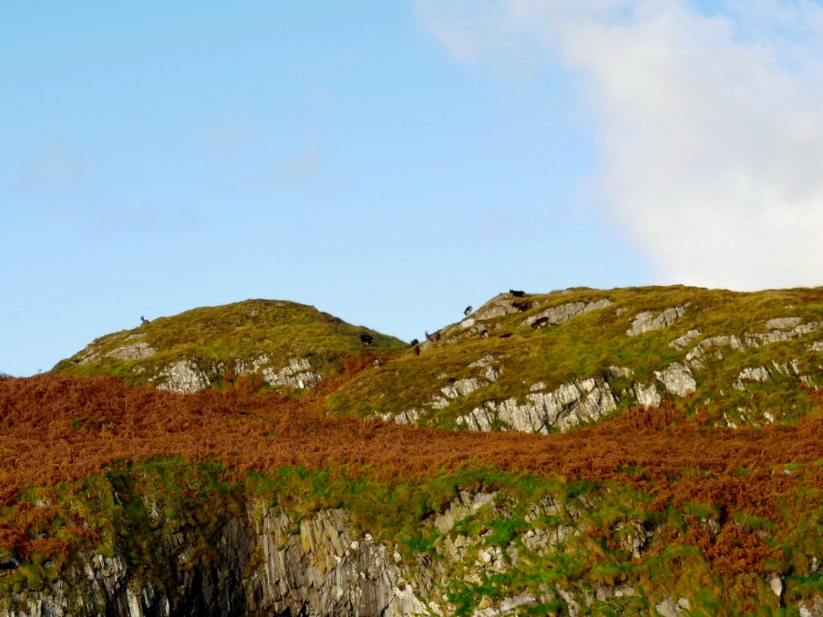
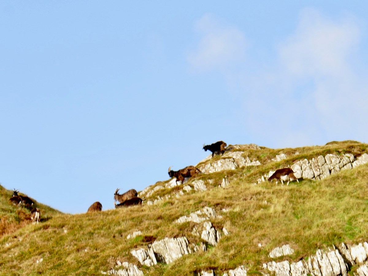
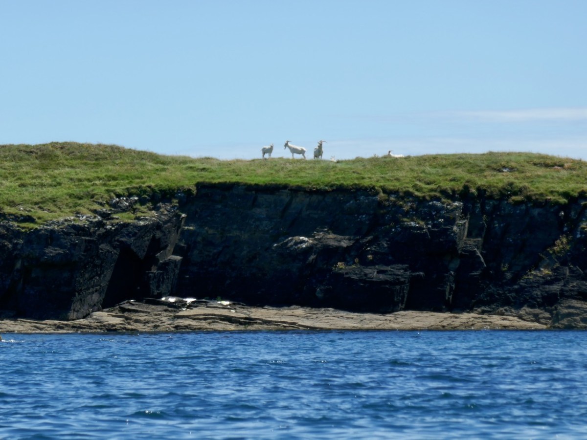
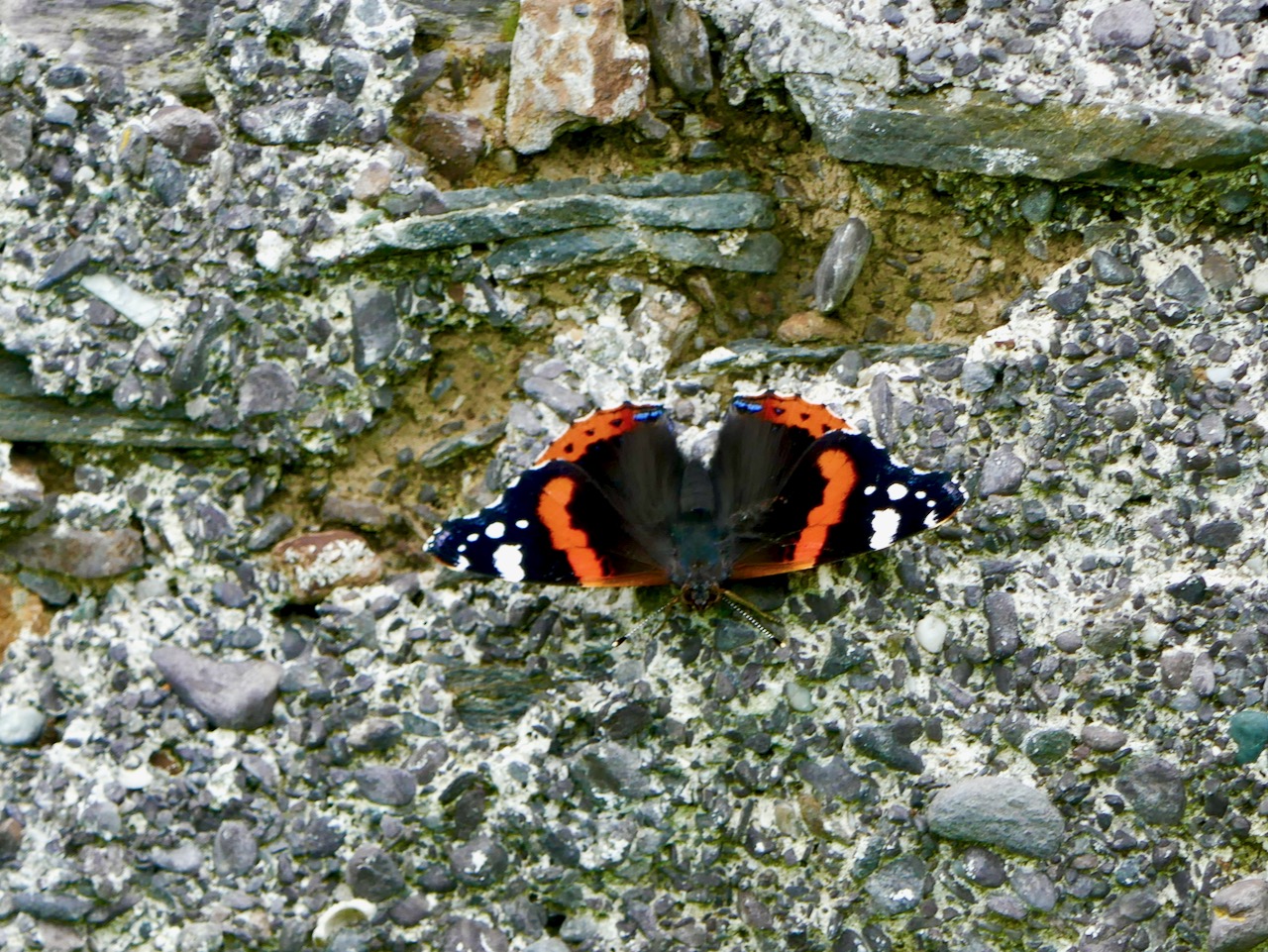
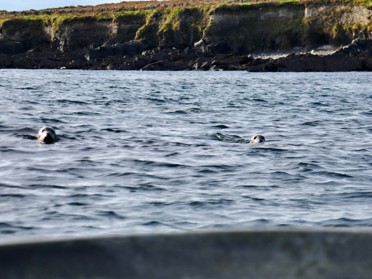
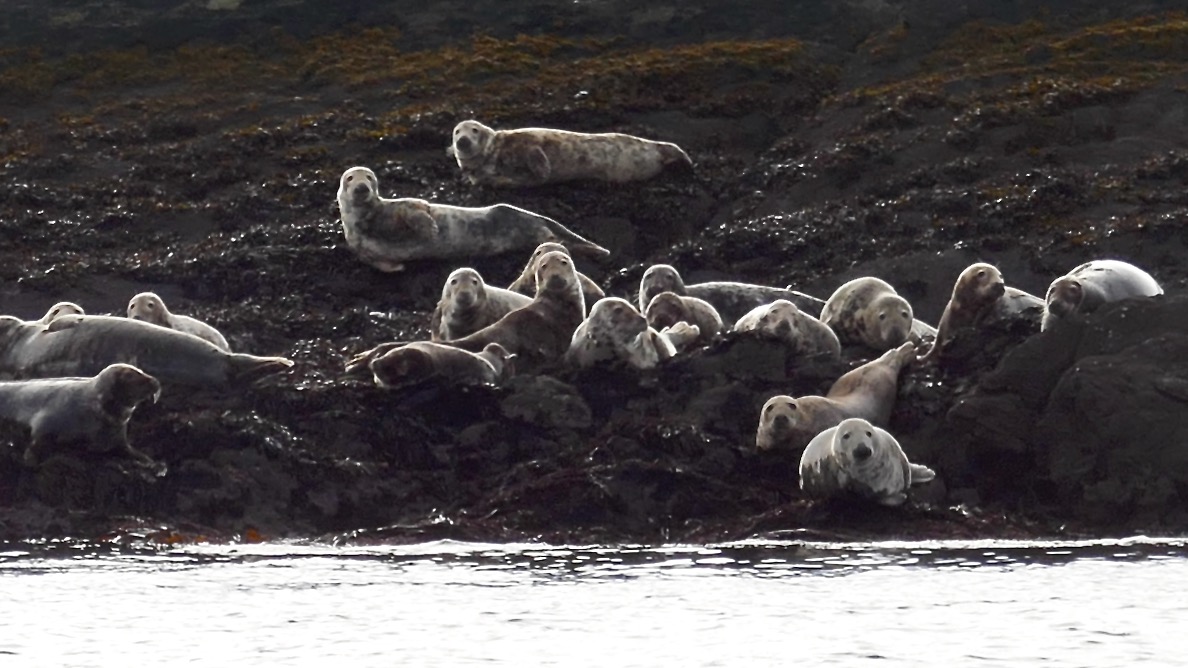
As we threaded our way back through the Carthys, Nicky had another surprise for me. This is a significant habitat for seals. There are two seal species in the waters around Ireland – Harbour Seals (aka Common Seals) and the larger (and actually more common) Grey Seals. I am, alas, totally ignorant about seals, but I think these were Harbour Seals (corrections welcome). ** Correction received – see Julian’s comment below.

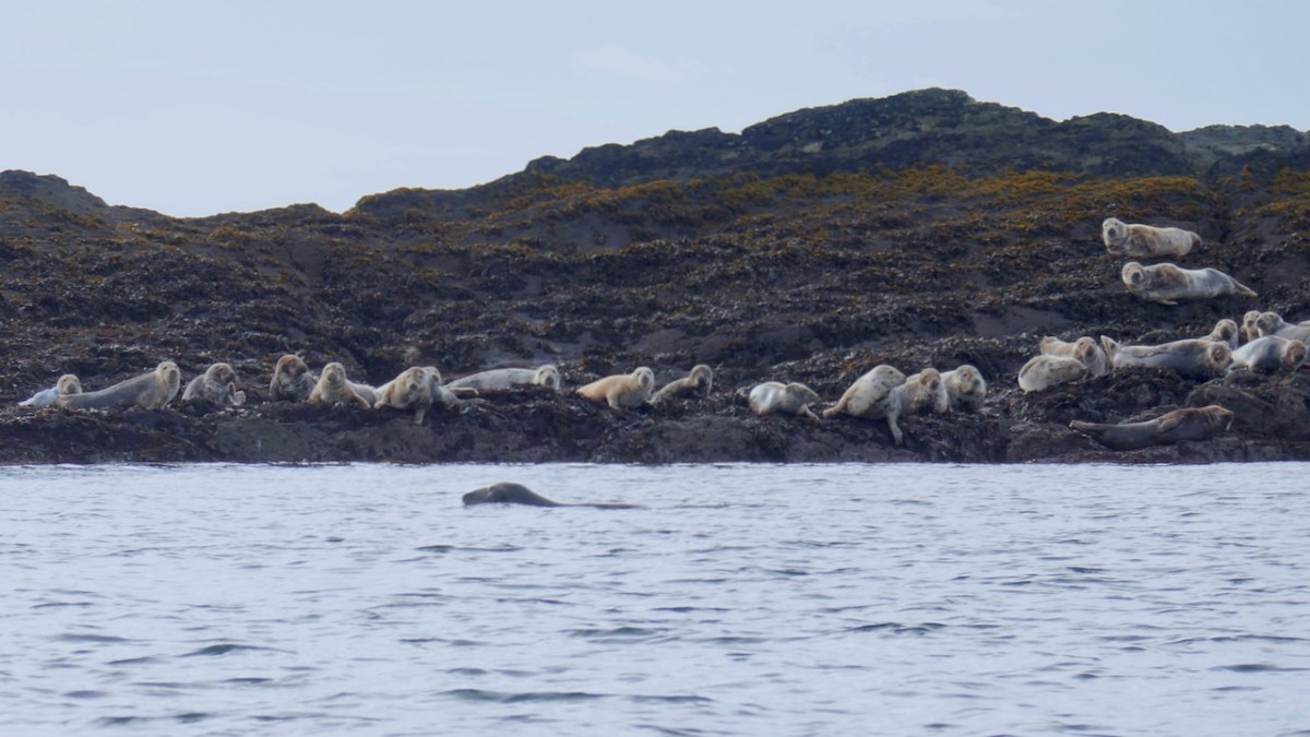
Nicky pointed out that the seals like to keep an eye on whatever gets too close. He pointed out that some scouts has slipped into the water and were now behind us. Another couple were abreast of us, on either side, perhaps making sure we didn’t get too close to the colonies.

As Nicky slowed down a haunting sound came drifting across the waves. It was the seals vocalising. I had never heard this before and was immediately captivated. Wild and resonant, mournful and moving, soul-stirring and plaintive – it was a sound that seemed to reach inside me and conjure up the watery undersea realm of selkies, those mythical half-seal half-human creatures.

And that, in turn, of course, brought to mind Port na bPúcaí (purt na boo key), or Spirit Music. This is how Robert told the story in his post Troll Tuning:

Port na pBúcaí (Music of the Fairies) is a haunted song if ever there was one. It’s said that the islanders were out fishing in their currachs when a storm broke out. It turned into a gale and they feared for their lives as the canvas hulled craft became swamped. Then, the wind suddenly died and they became aware of music playing somewhere around them – an unearthly music. The island fiddler was amongst the crew; when they got safely back to land he found he could remember the tune they had heard. It has passed into the traditional repertoire and has been played ever since.

Púca (pronounced pooka. Plural Púcaí, pronounced pookee), can be translated in a number of ways, but a Púca is generally considered to be a mischievous spirit. And here is Robert’s own rendition of Port na bPúcaí on his concertina.

We were only gone a morning. It felt like an Oisín-like lifetime.

Goat Islands: Two, For Now

This week I was fortunate to be taken on a trip to the Goat Islands – Goat Island and Goat Island Little – by my friend Nicky – thank you, Nicky! We had a fine forecast for the morning and seized our chance.  

I can see the Goat Islands from my house and have been wanting to view them up close for as long as I’ve lived here. That’s because the two islands are separated by a cleft and twice a year the sun sets directly in the gorge created by that cleft. I’ve never managed to capture that moment (darn clouds) but I have come close. And somehow that impossibly romantic image, like a corridor to some magical realm, has sunk into my consciousness and manifested as a longing to go through that gorge in person. The experience was just as wonderful as I thought it would be.

There isn’t much history to the Goat Islands. They are unoccupied now except for a herd of feral goats, but there is a small hut on Goat Island, recently re-roofed (does anyone know who has done this and why?).

When the first Ordnance Survey was done in the 1840s there was a cluster of buildings – probably the hut and a couple of outbuildings. 

The name in Irish is Oileán Clutharach, which means Sheltered Island. Hmmmm – anything less sheltered is hard to imagine. On some maps and charts, the gap between Goat and Long Island is called Goat Sound, while the gap between Goat Island and the small rocky islet to the west is called Man-of-War Sound. That’s the 1849 Admiralty Chart below. I happen to have a copy, but you can find it here.

That islet is called Illaunricmonia, which translates, improbably, as Island of the King’s Copse, although it is called Turf Island on the Admiralty Chart. The sea between Goat Island and the mainland is labelled, on one of the early OS maps, Lough Buidhe, meaning Yellow Sea. All in all, a curious and seemingly inapt set of names that hint at more history that appears at first glance.

Griffith’s Valuation tells us both islands were owned by William Hull and Leased to Cornelius Moynihan. In the mid-nineteenth century, Goat Island Little was worth 14s and Goat Island 6£ 10s, while Moynihan’s hut was worth 6s. There are traces of lazy beds, visible even on the aerial photos – it’s hard to imagine how difficult it must have been to live here. Neither island has an obvious landing place but I understand it is possible to land on Goat Island if you know what you’re doing.

Not much history – but lots of geography! This was once one island, and probably joined to Long Island, which itself is one of a string of continuous islands off the coast. The cleft which divides it into two Islands probably started off as an indentation – and there are more indentations and developing clefts and fissures. Some of these now form sea-arches and at least one will eventually collapse, creating two island out of Goat Island. 

We could see right through the crack at the join point. 

The only structure on Little is a masonry beacon. Dan McCarthy in an entertaining piece for the Examiner, give the following account of the beacon.

Goat Island Little . . . was deemed suitable in the 1850s for the construction of a beacon to aid navigation for boats entering Schull Harbour via Long Island bay. A second beacon was constructed at Copper Point at the west end of Long Island. How the workers and boatmen managed to land themselves, as well as the stone, cement, and other materials needed for construction can only be marvelled at. In the end, the structure reached almost 5m in height and weighed 250 tonnes when it was completed in 1864. It was repaired in 1961 when 40 tons of gravel were brought from Schull to reinforce the foundations. However, The Skibbereen Eagle newspaper . . . recorded its distaste at the new construction. “These celebrated structures, finished at last… but to what order or style of architecture they belong we have been unable to discover. We have however been informed that, like their neighbour at Crookhaven, they are neither useful nor ornamental, as in the day time they are not required, while at night they can not be seen.”  The newspaper went on to recommend that, as in Normandy, the head of the gurnet fish, when properly dried, be filled with tow (wick) from which a brilliant light emanates when lit. Thus ‘an inexpensive and brilliant light would be produced, and the effect, no doubt, would be exceedingly useful and picturesque during the ensuing dark winter nights’.

While we don’t endorse the gurnet fish alternative, we do have to admit that this is not the prettiest beacon, being remarkably phallic is its appearance.

And what about the goats? Yes, they are there, on the larger island, with nothing to disturb them. The population, I imagine, is kept in check naturally by the availability of food.

While a managed herd can be used to keep down invasive species (as in the Burren), in general a herd like this will just eat everything in sight and so John Akeroyd and the team who wrote The Wild Plants of Sherkin, Cape Clear and Adjacent Islands of West Cork, say that there are few plants to record and that the islands are of more interest for their birds than their plants.

Nicky is familiar with these waters so I knew I was in good hands. We set out shortly after nine, leaving from Rossbrin Cove, looking resplendent in the morning sunshine.

We passed Castle Island, the entrance to Schull harbour, and then Long Island.

Our first glimpse of the islands was through the rocks at the end of Long Island. 

As we approached, the cleft loomed ahead and soon we were in it!

I switched to my iPhone, which does a better job of videos like this than my camera, so come with us now as we venture through the gorge, trying to avoid the very jagged rock right in the middle of the passage. You can view in YouTube by clicking on Shorts at the bottom of the video.

I’ve done it – fulfilled the ambition of many years and gone thought the corridor to the magical realm! There’s more to the story – we didn’t just turn around and go home, but I will leave that to the next post.

West Cork’s Earliest Church: The Skeams Part 1

The highlight of last week was a trip around Roaringwater Bay in a traditional wooden boat, the Saoirse Muireann, visiting the Skeam Islands. Our captain was Cormac Levis, who led us last year on a trip to Castle Island and who is encyclopaedic in his knowledge of Roaringwater Bay.

Now, you may be tempted, as I was, to pronounce this The Skeems, but you can mark yourself out as a true local by referring casually to the Shkames. Called after St Céim (pronounced Kame), apparently, although this particular saint is surprisingly controversial, cropping up as Céin, Keane, or Kame, depending on the authority. THE authority, Pádraig O’Riain, in his Dictionary of Irish Saints is uncharacteristically silent on this saint, so we turn to the Mizen Journal for more information. The Mizen Journal was the much-missed publication of the Mizen Archaeological and Historical Society and it combined well-researched articles with lots of local lore. Bernard O’Regan was a highly-regarded local historian, interviewed by two others, Lee Snodgrass and Paddy O’Leary, before his death in 1994. In the interview he gave this account:

When St Ciaran left Cape Clear to go to the continent to be educated, he left his brother Kame and his sister in Cape [Clear]. Kame then built a wooden church on the West Skeam (Inis Kame, Kame’s Island).

The Bernard O’Regan Story Part 2

Mizen Journal No 4

Remember the bit about the wooden church, as we’ll come back to that. 

According to the geologist Anthony Beese, the West Skeam and the East Skeam were once probably joined, and possibly to Heir Island also, since the seas are very shallow between them. Based on geomorphological evidence, and Keating’s 17th century History of Ireland, Beese estimates that the islands may have separated due to storm activity some time between the 5th and the 9th centuries. Such a scenario, he says, would explain the lack of evidence for an early medieval settlement and burial ground on Heir Island

His own interpretation of the placename is more prosaic – rather than being based on a saint, he speculates that the Irish word scéimh (pronounced shcay-ev) might be apt – it means an overhang, a projecting rim or edge. He says:

The attitude of the cliffs of the Skeam Islands is determined by the subvertical dip of bedding planes, and when walking over the ridges, the feeling is one of looking down from a high table, boats below your feet, the rocky shore hidden.

Anthony Beese

The Natural Environment and Place-Names of the Skeam Islands

Mizen Journal, Vol 8, 2000

The goats on East Skeam certainly appreciate the cliffs.

So take your pick – the Skeams are named from a saintly church builder from Cape Clear, or the name reflects the geology of the island. Which side are you on?

West Skeam has a fascinating history, as evidenced by the barely-hanging-on remains of an early Christian Church. It’s a small single chamber with antae and a splayed linteled doorway. In the photo above, courtesy of the Irish Times, it’s the small ruin on the bank halfway along the beach. Take a look at my post Irish Romanesque – an Introduction for more about this kind of early, pre-Romanesque Church. It is presumed that antae – the projections of the side walls beyond the gable wall – reflect an earlier form of wooden church in which those projections helped to hold up the roof and provide shelter over the entry. The survival of this feature is known as a Skeuomorph – an imitation in the stone-built form of the earlier wooden construction method. 

This little church is very significant – It’s the only one of its kind in West Cork. For many years it has been falling into the sea. Although once, Beese notes, it would have been high and dry, successive storms and the prevailing winds have eroded the bank it stands on over the centuries. Local people, Cormac included, tell of bones eroding out of the bank. The archaeologist Edward Fahy conducted a brief survey in 1962. The drawing above and one at the top of this post are from that report, and here is the conclusion:

Inhumed burials are visible in the cliff for a distance of almost thirty feet to the north and south as well as within the church itself where they are overlain by some soil and 18” of collapse from the walls. The burials extend downwards to foundation level of the building and appear to post-date it. The density of burials is not high and the skeletons are laid parallel to the axis of the church with their feet to the east. One grave is slab-lined but the rest are simple inhumations.

The architectural features of the church, dry stone building, simple doorway with inclined jambs and without architrave, the antae and the estimated length/breath ratio of the interior suggest a ninth century date for the structure. It is to be regretted that this, the only church of its date in the area is to be allowed to crumble into the sea.


Edward Fahy

Skeam Island Church,

Journal of the Cork Historical and Archaeological Society, 1962

A proper excavation was conducted by Claire Cotter in 1990, necessitated by a proposal by the OPW to build a wall to protect the church from further erosion. Here’s what the bank looked like when Fahy reported in 1962, and it was in an even more perilous condition by 1990.

Cotter published her findings in an article, Archaeological Excavations at Skeam West, in the Mizen Journal, Vol 3, 1995. The excavation was confined to the burial grounds – that is, the area outside the church itself. It revealed that burials had been taking place there long before the stone church had been built! In fact, radiocarbon dating of the first phase, containing 24 individuals, mostly adult males, assigned a date range of 430 to 770AD.

Phase 2, consisting of 15 bodies buried in the north side of the church, once again mostly adults, but this time one body could be identified as female. Rather than in body-shaped cuttings, some of these bodies had been placed in pits, and they were in a semi-propped up positions. These burials dated from 550 to 855. 

This is what the church looks like now from the landward side. It’s very overgrown, but you can clearly see the antae and the linteled entry

Phrase 3 encompassed 33 bodies and dated from 1165 to 1395, after which the graveyard went out of use. Some of these graves may have had markers – a stone cross and notched stones were found.

Another interesting find, Cotter tells us:

In a number of burials the head was marked by small flat stones – generally one stone set close to the head on each side. This may indicate that the bodies had been placed on timber planking – the cradle stones would subsequently support the head and keep it in position when the timber planks had rotted away leaving a void within the grave. Remains of such timbers have been found in early medieval graves in England. In the case of Skeam, such timber planking could have formed part of a bier, perhaps used to carry the body on the sea journey. Two burials of newborn infants also belong to this phase and these had been placed on large stone flags.

It looks as if this burial ground was accommodating people from the other islands. Apart from a cillín on Heir Island, there are no burial grounds on East Skeam or on Heir. A midden to the south of the church contained lots of fish and shellfish remains, as well as fragments of seal and whale bones, and cattle sheep and pig bones. This activity dated to the 16th and 17th centuries.

Cotter, in her discussion, says the following:

There are no historical references to the church on Skeam west. It lies in the parish of Aughadown; and a decretal letter of Pope Innocent III [that’s him, below] issued in 1199 refers to “Aughadown and its appurtenances” and the Church in Skeam West may well have been included in these. Local tradition attributes the origins of some ecclesiastical foundation on the island to Ceim or Keims, a brother of Kieran of Cape Clear. This would place the foundation in the pre-patrician period and the site is therefore of great interest. Was the stone church built to replace an earlier wooden structure – perhaps destroyed by the storm which washed up the deposit of shingle visible at the north side of the present building?

. . . Small church sites such as Skeam were generally located within an enclosure which defined the termon or area of sanctuary of the church, and the ditch uncovered to the south of the church is probably the remains of such an enclosure. The question as to whether these foundations should be regarded as monastic has been much discussed in recent years. Some scholars suggest that these ecclesiastical foundations should be regarded as small church sites which provided essential religious services for the local community. Others would argue that the majority of these foundations began as monasteries and only later assumed a community role. In many examples the earliest burials are exclusively male and only at a later stage do we find mixed burial i.e. adults and children of both sexes.

. . . The burial ground at Skeam West appears to have been used over a long period perhaps as long as the 900 years. During its later history it may have been used by a wider community drawn from the neighbouring islands and coastal district as well as the Skeams.

She adds:

The human burials uncovered during the excavations were re-buried on the island in 1992 in what is hopefully their final resting place.

Above is the OPW wall, which seems to be doing the job of arresting erosion for the moment.

There’s lots more to tell you about the West Skeam Island, including fascinating details as to who owned it, and what life was like there. And we haven’t even arrived at the other Skeam Island, East Skeam, yet! Next time. 

One final note – the island is privately owned and monitored by video link. A disembodied voice reminded us that we were trespassing, at which point we left. 

Castle Island – Facts and Fictions

That’s Castle Island, above, beyond Gaelic Lord Finnin O’Mahony’s dilapidated realm at the entrance to Rossbrin Cove, in Roaringwater Bay. In the fifteenth century there would have been a hive of activity at Rossbrin: quays alive with fishing activity, boats being repaired and prepared, houses, stores and cellars – all full. Castle Island itself would also have been inhabited in those days, as were many of Carbery’s Hundred Isles. Skeam West – to the east of Castle, and roughly in the centre of all the islands of Roaringwater Bay, has the remnants of a church said to date from the ninth century (Fahy – Journal of the Cork Historical and Archaeological Society, Volume 67, 1962).

Upper – Castle island with its close neighbours in Roaringwater Bay; lower – the ancient church on nearby Skeam West, drawn by Fahy in 1962 (courtesy Cork Historical and Archaeological Society). Fahy suggested a ninth century date for this structure, although other commentators have suggested an earlier origin, possibly even before St Patrick’s time

We set foot on Castle Island for the first time in August of last year – during a reprieve in the Covid lockdown measures. Those days seem halcyon now, compared to our current scourge and severe restrictions. We have not been able to return, but I am setting out to bring my reporting a bit more up to date, as I have been provided with further information from a range of sources.

Approaching Castle Island in 2020: upper – view of the island from the shore in Rossbrin townland; centre – proceeding to the island from Rossbrin Cove; lower – the quay on Castle Island, reportedly built in the early 20th century by the Congested Districts Board: “…the beach that it is laid upon was the best natural landing point on the island, well sheltered from the Atlantic swell …” (Mark Wycliff Samuel – The Tower House of West Cork, UCL 1998)

The history of the population of Castle Island is enigmatic and somewhat contradictory. Here is a quotation copied from the Ireland Byways site but uncredited and undated; I can find no other link containing the same information, but it must originally have been written when the island was still inhabited:

. . . Castle Island (Meadhon Inis – “middle island”) lies about 2km offshore, east of the mouth of Schull Harbour on the Mizen Peninsula. The island derives its English name from a ruined C14th Tower House, one of 12 built by the powerful O’Mahony clan in the area. The 1837 census recorded 89 people living on the island. At present there are fewer than 30 permanent residents, who make their living from farming . . .

quoted by ireland byways.co.uk

You will find some accounts which suggest that Castle Island was inhabited only up to the 1870s. These are incorrect: there is no doubt that the island was the home to a number of families in the 1890s as they suffered evictions then. It also seems questionable that the expense of constructing a substantial pier could have been justified only for the benefit of those who might run their cattle and sheep on a deserted island (as happens today). It is possible, therefore, that regular population of the island continued into the early years of the 20th century.

The remains of substantial houses exist on Castle island today: some do not seem to be as ruinous as would be expected if they had been unoccupied for well over 100 years

Recently, my attention was drawn to a Land Register folio recording the title for one of the parcels of land comprising Castle Island: ” . . . a burden, dated April 14, 1904, indicates that the property was transferred at that time subject to the right of . . . Jeremiah Regan to be supported clothed and maintained in the dwellinghouse on the said lands . . . ” That would imply, for sure, that there was at least one person who had the right to live on the island in the twentieth century.

Details from the ruined houses at the settlement of Wester, Castle Island: upper – brick and render chimney stack in reasonable condition; centre – elements from timber window frames still in existence; lower – traces of paint on an internal rendered wall

Accounts of the evictions which occurred on Castle Island have been well summarised in a Mizen Journal article by Liam O’Regan in Volume 6, 1998. The article is much too long to be included here, but it’s worth anyone’s while ferreting it out to get a vividly descriptive picture of the island in the 1890s.

Here’s a brief summary of the eviction story: the villain is on the left, above – he is Thomas Henry Marmion JP, principle landlord of Castle Island. He lived from 1839 to 1921 and – incidentally – his father (who had the same name) was said to have been responsible for providing the ‘soup kitchen’ at the Steam Mill, Skibbereen during the Great Famine of the 1840s. Notwithstanding this, recorded history does not have much that’s good to say about the Marmions, who in the eighteenth century had been land agents for the Bechers and Townsends. At the beginning of March 1890 (as reported, somewhat floridly, in the Cork County Eagle):

. . . A few days ago, the sheriff’s officer from Skibbereen made his appearance in Schull, surrounded by a force of police, on an evicting expedition. After a short delay, they proceeded to the water’s edge where their galleys were found to await them and the sheriff’s representative having secured himself in one of the crafts, the whole party proceeded to sea for a distance of some three miles when they landed on Castle island. This wild and sea-washed home of a few small farmers and fishermen is the property of Mr Thomas Henry Marmion . . . whose interest in recent years appears more of an incumberance or embarrassment than any advantage as the poor creatures who live in it (misnamed farmers) and on the many islands surrounding it, have to live chiefly on the profits of the sea. The fortification of Jerry Nugent was the first laid siege by the invading army, Jerry’s offence being that he owed a few years’ rent which he found impossible to pay and he was, therefore, sent adrift on the sea-washed rocks where he had a full view of the passing emigrant ships which will probably bear him away to seek out a livelihood in the land of the stranger . . .

Cork County Eagle, march 7th, 1890

There’s much more – and it’s a harrowing story – not untypical, of course, of what was happening all over Ireland during the nineteenth century. In the portrait gallery, above, the figure in the middle is a ‘hero’: he is William O’Brien MP, a founder of the National League who, in September 1890 visited West Cork and held a meeting on Middle Calf island to support the case of tenants evicted from Castle Island and the Calves. On the right is James Gilhooly, MP, Bantry, who was chairman of the ‘All for Ireland League’ and who strongly supported the Castle Island tenants and attended many official meetings on their behalf. Matters rumbled on laboriously into the mid 1890s: eventually, it seems that the introduction of new land purchase acts (benefitting tenants), enabled six tenants to return to, and continue to occupy, Castle Island. As yet I have found no further records to help us establish how long occupation of this sparse rocky outcrop in Roaringwater Bay continued into the twentieth century.

The Mizen Journal, Volume 5 1997, has published a study by Anthony Beese of the place-names on Castle Island. I have been unable to locate this article online, but here is Anthony’s excellent map, above.

When we visited the island on a brooding August day we sensed its many ghosts, perhaps including those who returned over a hundred years ago and, possibly, lived out their working lives there. I have called this post ‘Facts and Fictions’ . . . You have had the facts. After I wrote my first post, last year, I received a communication from a writer: William Wall. I was delighted to learn that he had written a book – Grace’s Day – published in 2018, part of which is set on Castle Island. I obtained the book and read it avidly: it has opened up for me a new dimension in the story of the island – and it’s thoroughly believable.

. . . A long time ago I had two sisters and we lived on an island. There was me and Jeannie and Em. They called me Grace, but I have never had much of that. I was an awkward child. I still am all these years later. Our house had two doors, one to the south, one to the north. Its garden looked towards the setting sun. It was a garden of apple trees and fuchsia and everything in it leaned away from the wind. Dry stone walls encircled it and sheep and children broke them down. My mother lived there with us. Boats came and went bringing food and sometimes sheep, and there were times when we lived by catching fish and rabbits, though we were not so good at either . . .

Grace’s Day – a novel by William Wall, published by new island books 2018

William Wall is familiar with West Cork: he has stayed here many times, and has visited Castle Island. It’s not just the island, but the whole story of 1960s West Cork that has been his inspiration. Readers of this Journal will be aware of my own interest in the days when Ballydehob became the hub of an artists’ community: I have helped to set up the Ballydehob Arts Museum, which has celebrated this era and is now in ‘suspended animation’ due to the Covid outbreak. I also look after a website for the Museum. Grace’s Day is set in this era, and follows the unconventional lives of a family who is ‘getting away from it all’ and trying to survive following the then prevalent bible of self-sufficiency. It’s perfectly feasible that an abandoned island in Roaringwater Bay could be the setting for such a romantic pursuit of ideals. I won’t give away any spoilers, but one more extract could help to persuade you that this book is for you. You should find it in all good bookshops: please support them in these tricky times.

. . . One day on our island my sister Jeannie ran in to say that she had seen a whale in the sound and I ran out after her, my mother calling me: Grace, it’s your day, take Em. But I was too excited. And there were three fin whales making their way into the rising tide. We heard their breathing. It carried perfectly in the still grey air, reflected back at us now by the low cloud. The sea was still and burnished. We ran along the rocks watching for their breaching. We decided it was a mother, a father and a calf. They were in no hurry. When we reached the beacon, a small unlit concrete marker indicating the western edge of the island, we watched them breaching and diving into the distance until we could see them no more. But they left behind their calmness and the unhurried but forceful sound of their blows . . .

GRACE’S DAY – A NOVEL BY WILLIAM WALL, PUBLISHED BY NEW ISLAND BOOKS 2018
Our own view of Castle Island in the distance, surreally shadowed by the full moon’s glimmer, while the Fastnet Lighthouse winks away on the horizon

Castle Island Explored – Part 1

In this early spring photograph, taken from our Eyrie at Nead an Iolair, you can see Rossbrin Castle in the foreground. Beyond it lies Castle Island, uninhabited and slightly mysterious, but with clear traces of former occupation including a medieval tower house, a substantial quay and several abandoned dwellings. As we look over this island every day, we have long held an ambition to visit it, recently fulfilled when we were offered a lift out there on our good friend and neighbour’s fishing boat.

This map shows the scale of the island – just under a mile in length, and occupying 123 acres of mixed land. The main settlements – of Wester’ and Easter’ – are shown, as are the Quay and the Castle. It’s interesting to compare the two Ordnance Survey plans (below): the first 6″ edition was drawn up between 1829 and 1841, and the second one is the 25″ edition, drawn between 1888 and 1913. You can clearly see how the fields have changed, with new boundaries created in the later survey. Presumably this was due to an increase in population resulting in more clearances of rough land.

Both these maps show the Castle – said to date from the 15th century and one of the chain of O’Mahony fortresses that are strategically situated around this most south-westerly part of the Mizen. Of that clan we can find the following written by W O’Halloran in 1916:

Dr Smith says – these Mahowns derive their pedigree from Kean Mc Moyle More, who marrid Sarah, daughter to Brian Boru, by whom he had Mahown, the ancestor of all the sept. It is from this Kean the village of Iniskeen, in Carbery, has its name, and from this sept the Bandon is sometimes called Droghid Mahon. Mahon was the ancestor of the Mahonys, or O’Mahonys . . . The O’Mahonys, whose stronghlad was in the neighbourhood of Bandon (Drohid Mahon), were the first to encroach on the territory of the O’Driscolls. This occurred long before the Anglo-Norman invasion. They possessed themselves of the western portion of Corca Laidhe called Ivahah, which comprised the parishes of Kilmoe, Schull, Durrus, Kilcrohane, Kilmacougue, and Caheragh. They had fourteen strongly built castles . . .

Early Irish History and Antiquities and the History of West Cork, W O’Halloran

The M V Barracuda approaches Castle Island on an atmospherically damp day in late August. The quay itself seems to have been constructed  during the time of the Congested Districts Board from 1892 to 1922. It is a substantial structure and the investment in that time suggests that there was a significant community living and working on the island to justify it. However, a number of sources assert that Castle Island was “. . . home to a community of approximately 15 families who were last resident on the island up to the year 1870 . . .” Our own observations of the abandoned dwellings on the island led us to the conclusion that, although now significantly deteriorating, these habitations must have been in use more recently than this.

Examples of now-ruined houses, barns and boreens on Castle Island. These are not ‘cabins’ or even cottages, but significant homesteads. Some – including the large residence in the upper picture – have the vestigial remnants of timber door and window frames, unlikely to have survived in place in this harsh environment for 150 years.

A community of sheep roams unhampered by fences or boundaries, and Finola absorbed how nature has taken over and populated the landscape in spite of wild winters and lack of shelter: we counted precisely two and a bit trees on the whole island!

The story of this island is somewhat overlooked generally – one of the reasons we were so keen to visit. In our library, however, we are fortunate enough to have some copies of the Journals of the Mizen Archaelogical and Historical Society – now out of print. That Society was active for thirty years between 1979 and 2010, and produced a dozen journals gathering important historical research by mainly local people. Here’s a post we put together when our good friend Lee Snodgrass – a leading light in that organisation – passed away recently.

In that Journal we have found two articles about Castle Island. One – by Anthony Beese – explores the local placenames, and the other – by Liam O’Regan – speaks of The Castle Island Evictions 1889 – 90. This latter clearly shows that the island was inhabited in the late nineteenth century (apparently contrary to current popular thinking). Also, following those evictions, many of the tenants returned later and it seems very possible that some islanders remained in situ into the twentieth century. Both Journal articles have stories which need to be told, and I will attempt to do that in a later Roaringwater Journal post. For now, however, you will have to be content with . . . the story so far . . . which tells of our voyage of discovery to the island on an overcast day in the summer.