We have been on a voyage of discovery – or, perhaps, rediscovery. You remember that recently I reviewed a book which I received as a school prize in 1963: Green & Silver by L T C Rolt? That was a book about travelling by water through some of the canals and rivers of Ireland. The book was published in 1949 but I found out that the journey was undertaken in 1946 – exactly 70 years ago and, also, the year in which I was born. Tom Rolt was a good travel writer and a good observer, and the book is full of descriptions of the places and people that he and his wife Angela came across: it’s a valuable social document and it is rather significant that three score years and ten have passed since they completed their explorations.


Tom Rolt (left) and Angela and Tom Rolt (right) aboard Le Coq, the boat with which they set sail from Athlone to circumnavigate the inland waterways of Ireland between June and September 1946. The photos are taken on the Grand Canal
Back in my more youthful days I also travelled by water, but around the English canal system, a journey of nearly 2,000 miles, taking several months. I also wrote a book after the journey: Canals and their Architecture. Tom Rolt was to have written the introduction to that book but he was unable to, because of illness. As a tribute to him, and to mark his journey through Ireland, Finola and I have been retracing his steps. We should have travelled by water, too, but that would have impinged overmuch on our busy lives here in West Cork. Instead, we covered in a couple of weeks by car what Tom and Angela had taken three months to achieve. Their’s were difficult times, too, immediately after The Emergency when fuel was virtually unobtainable.
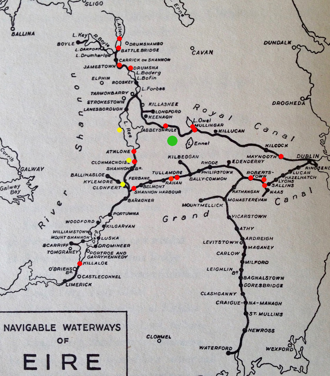
Map of the journey taken from Green & Silver. We have marked on it the sites which we wanted to visit, either because Angela had photographed them or because there was a ‘story’ about the place in the book
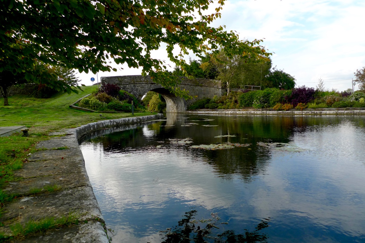
Angela Rolt recorded the journey in her own way – through the lens of her camera. Her wonderfully evocative monochrome photographs illustrate Green and Silver, and provided a goal for each leg of our own travels. Armed with the book and digital scans of all her pictures we set out to retrace the watery steps of Le Coq – the little boat which the Rolts borrowed – and take a new photograph at every place they visited. The aim was to set up each photograph of 2016 to exactly match those of 1946 and, through the lens, to record the differences that have taken place in Ireland during all those years. Of course, there is much more to this exercise than the photos: Rolt’s book contains many stories, of people and places not necessarily illustrated but well described, so we also looked out for those: would anyone today have any memories of the people talked about in the book? And would the descriptions of the places that the waterways served in those days ring true in the present?
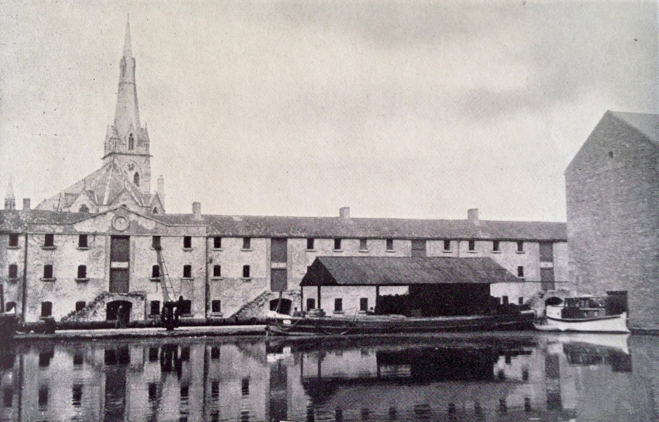
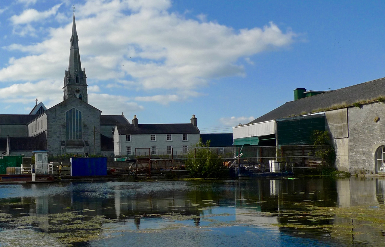
Just one example of our efforts to retrace the steps of the Rolts and record a changing Ireland. Upper photograph – taken by Angela Rolt in 1946 at Tullamore Harbour, Grand Canal. Lower photograph – taken by Robert at the same site. Although the canal harbour itself is intact today – it is an administrative centre for Waterways Ireland – there have been some significant changes. The fine three storeyed warehouses which faced on to the canal 70 years ago have gone, demolished in the 1960s. The Church of the Assumption beyond the harbour was destroyed by fire in 1983 and has since been rebuilt to a modern design except for the tower, which survived the fire
This project will take a little time to fully document. It might occupy a few blog posts! This one is by way of introduction. One thing that struck me most forcefully is the change which the waterways of Ireland have undergone in seventy years. Now all the navigable waterways of Ireland are administered by a single cross-border authority – Uiscebhealaí Éireann (Waterways Ireland); some of the canals which were derelict or near-derelict in 1946 have been fully restored, and many are equipped with modern electric lock gear – something which the Rolts could never have envisaged in their time. However, the volatile economic situations which Ireland has been subjected to in the late twentieth century, and into the twenty-first, have also had their effects, and we found this reflected in some of the stories which we followed during our travels.
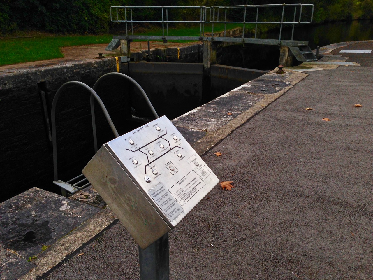
The restored Shannon-Erne navigation links waterways between the Republic of Ireland and Northern Ireland. The 63km canal was constructed originally in the mid nineteenth century but became moribund by 1865. The navigation was reopened in 1994. All sixteen new modern locks are operated electronically by hydraulics: boaters are issued with a key which activates the control panels (above)
Another surprise for me was the quality of the engineering and the scale of the undertakings which Ireland displays on its system of navigations. These were massive construction projects in their day, but they nonetheless manage still to convey a sense of respect for their settings, an appropriateness of all materials used, and a constant appreciation of human scale. The architecture of Ireland’s canals is truly vernacular, something I hope to demonstrate during these explorations.
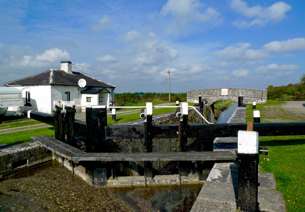
Mullawornia Lock, Lock 40, Royal Canal, County Longford. The lock-keeper’s house is an unspoilt example of a vernacular architecture which can be seen across Ireland’s canals
To be continued…
