As readers know, I love old maps and there’s a map of Cork I haven’t written about yet. This is a truly beautiful piece of work, and a huge step forward on some of the older maps of Cork I have described – for the list, see my page The Magic of Old Maps.
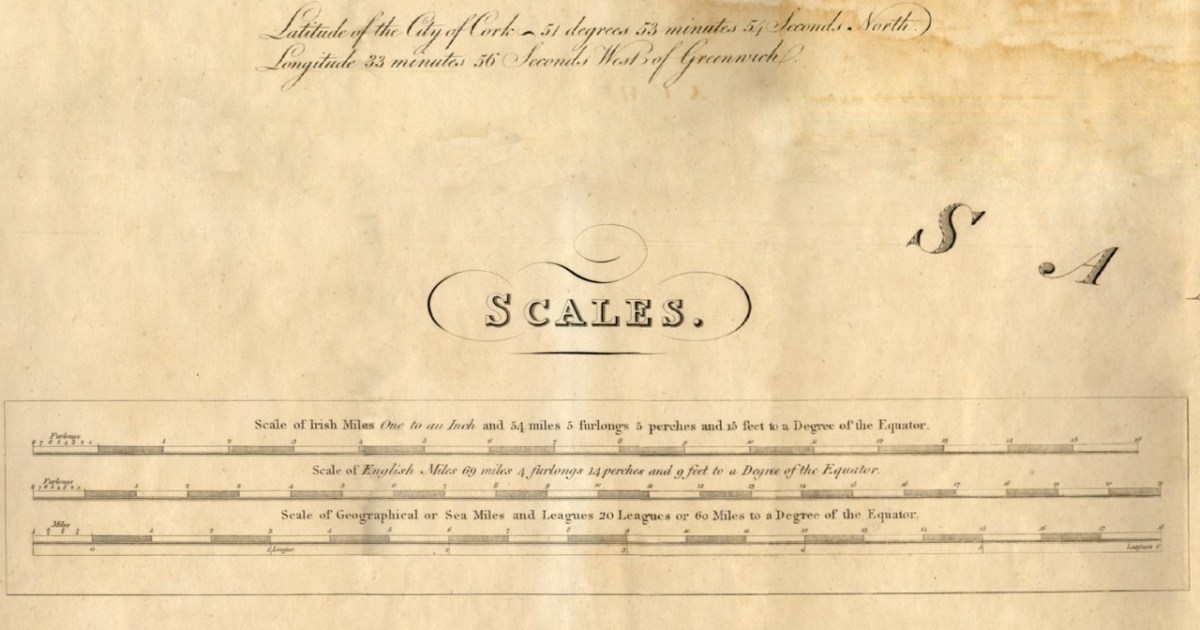
Since it will take me more than one post to talk about this county map properly, I will start today by concentrating on Map 4, and stick to the Mizen Peninsula. The map is in 6 parts and I am able to share it with you today through the generous assistance and permission of the Cork County Library. You can view their hi-res images here – they may be sharper than mine, as I do have to compress images for the blog.
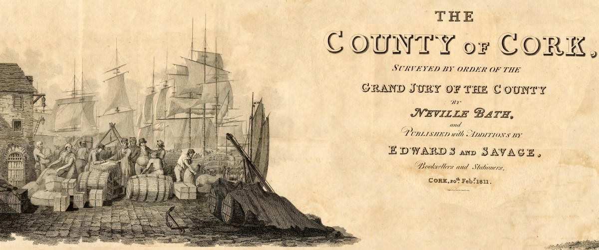
But first, some context… We assume that proper, professional mapping really got underway with the Ordnance Survey in the 1830s, but indeed there were competent cartographers in Ireland before then. Neville Bath was one. In an essay by J H Andrews (see reference in the final quote) he is described as English but spending his whole cartographic career in Ireland, starting off by drawing estate maps in Kerry. He finished a map of Cork City in 1788, so was well placed to be awarded the contract for the county map, when the Irish parliament allowed public money to be spent on producing Grand Jury barony maps as well as county maps, but only for official purposes and only in the form of manuscript ‘protractions.’ Bath tried to arrange for the manuscript protraction to be turned into a proper published map by selling subscriptions – that did not go well, and it wasn’t until 1811 that the map was finally published, engraved by the London firm of S J Neele, acknowledged as the finest artists in the Kingdom.
What was a Grand Jury and why were they commissioning maps? As the name suggests, Grand Juries were initially conceived as groups of 24 men (yes, only men) who wielded authority for the administration of the criminal justice system in Ireland. The exclusive domain of wealthy landlords, the Juries exerted enormous power over the whole population – a population with which they had little in common, including economic status but also language, religion and cultural affiliation. Over time, the Grand Juries accumulated other responsibilities, for roads, bridges, hospitals, schools and tax collection.
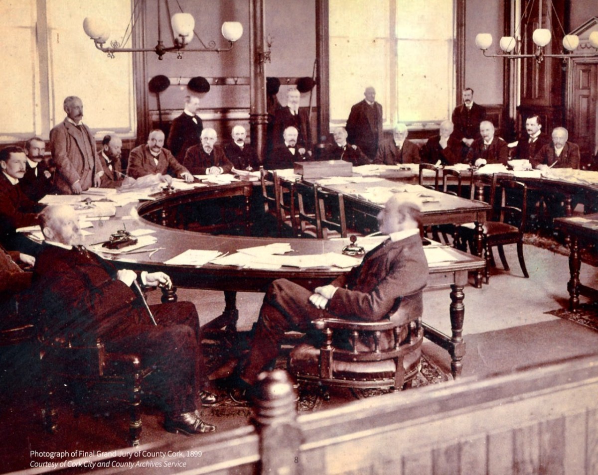
Eventually, all those duties were taken over by other bodies – County Councils, the Poor Law Union, a proper legal system. Above is the final sitting of the Cork Grand Jury in 1899. But while it lasted it was already an archaic system, deeply unfair and rife with corruption. It also became highly competitive, with one Grand Jury after another building more and more elaborate courthouses*. The same thing happened with maps:
Almost inevitably, the maps enabled each grand jury to convey its own prestige to its neighbours, and the ‘Grand Jury map’ project took on an increasingly expensive and stunningly elaborate life of its own. William Larkin was the greatest exponent of the genre and produced maps for six out of the twenty-six counties that made it into print using the public purse. Larkin produced maps for Westmeath (1808), Meath (1817), Waterford (1818) and Galway, Leitrim and Sligo (1819). From 1784 grand juries were required to have their county map ‘put up, and kept constantly during the assizes in the grand jury room of said county’.People, Place and Power: the Grand Jury System in ireland, Brian Gurrin with David Brown, Peter Crooks and Ciarán Wallace
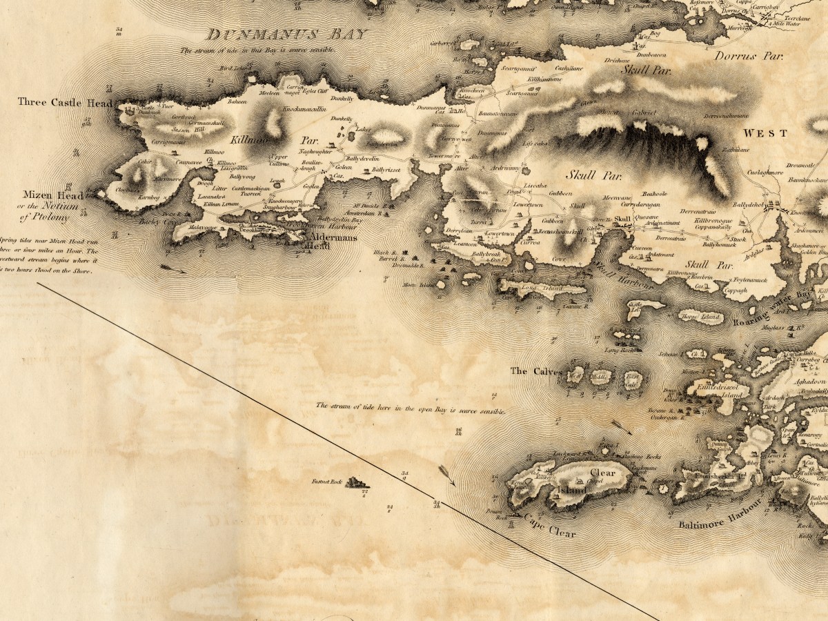
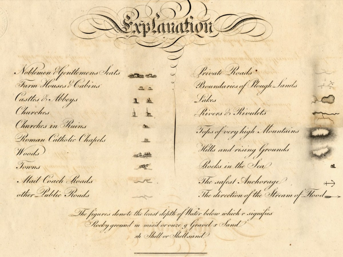
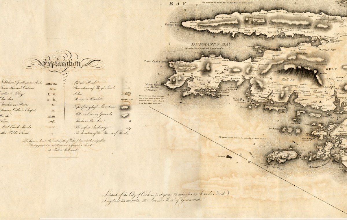
Let’s take a look at Neville Bath’s map now, working from west to east along the Mizen Peninsula. you will have your own favourite spots to check out – I am just going to point out a few of interest to me.
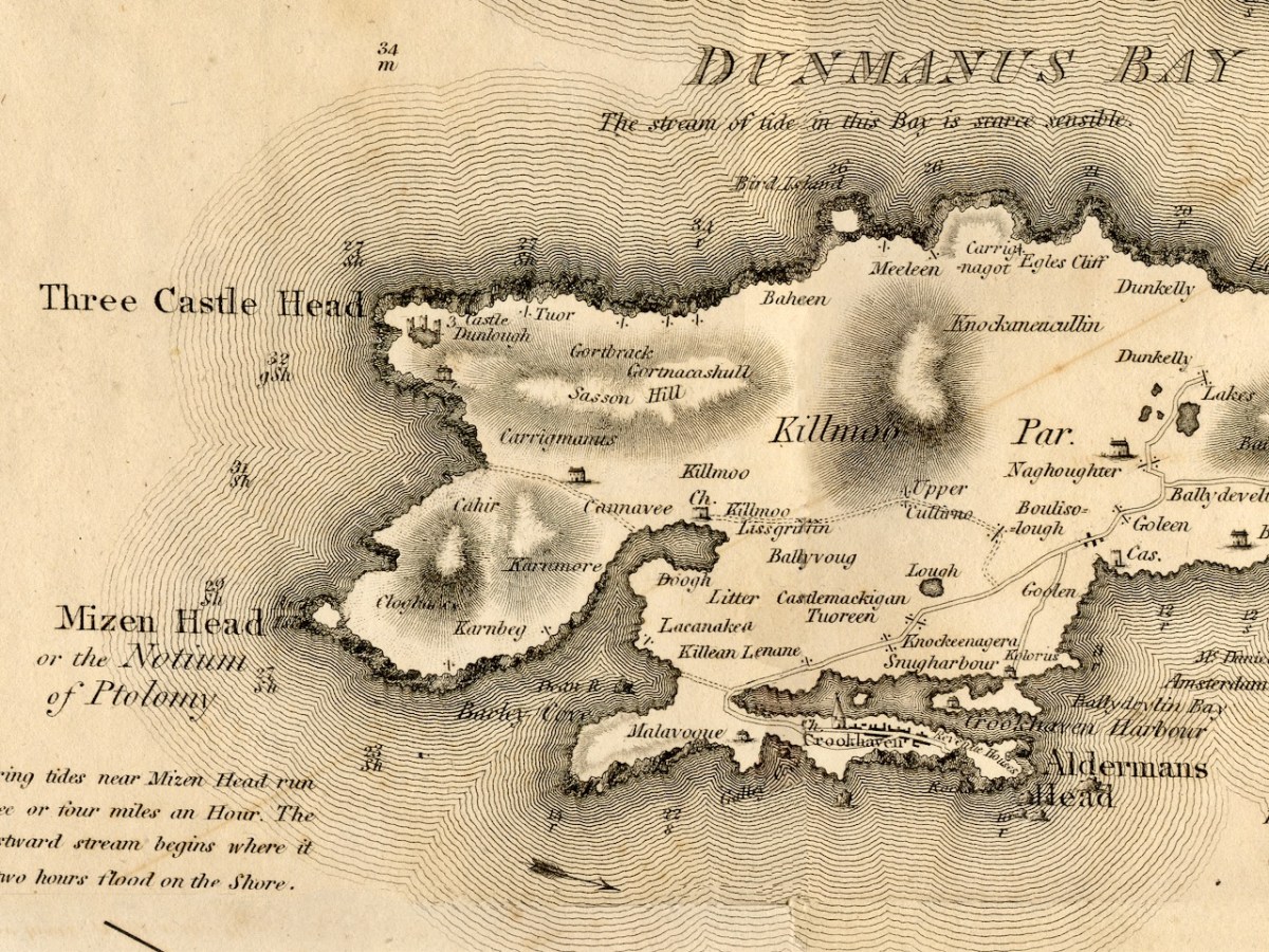
This map pre-dates Richard Griffiths road-building along the Mizen, but nevertheless it shows a road going all the way to Crookhaven. I love the little depiction of Dunlough/Three Castles, and also that a church is shown at Lissagriffin – we can see the ruins still. Alderman’s Head is called Streek Head on the early OS maps, while the rocks offshore at this point are called Alderman’s rocks. (Who was the Alderman, I wonder?)
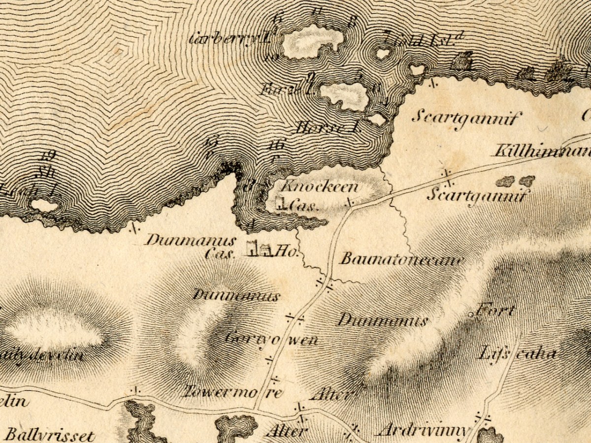
Before we move East to Schull, I just want to highlight Dunmanus. The ‘castle’ at Knockeens is clearly shown. As I discussed in my post Dunmanus Castle 1: The Cliff-Edge Fort, there is much much local folklore about this site. There may have been more to see when Bath was mapping this area.
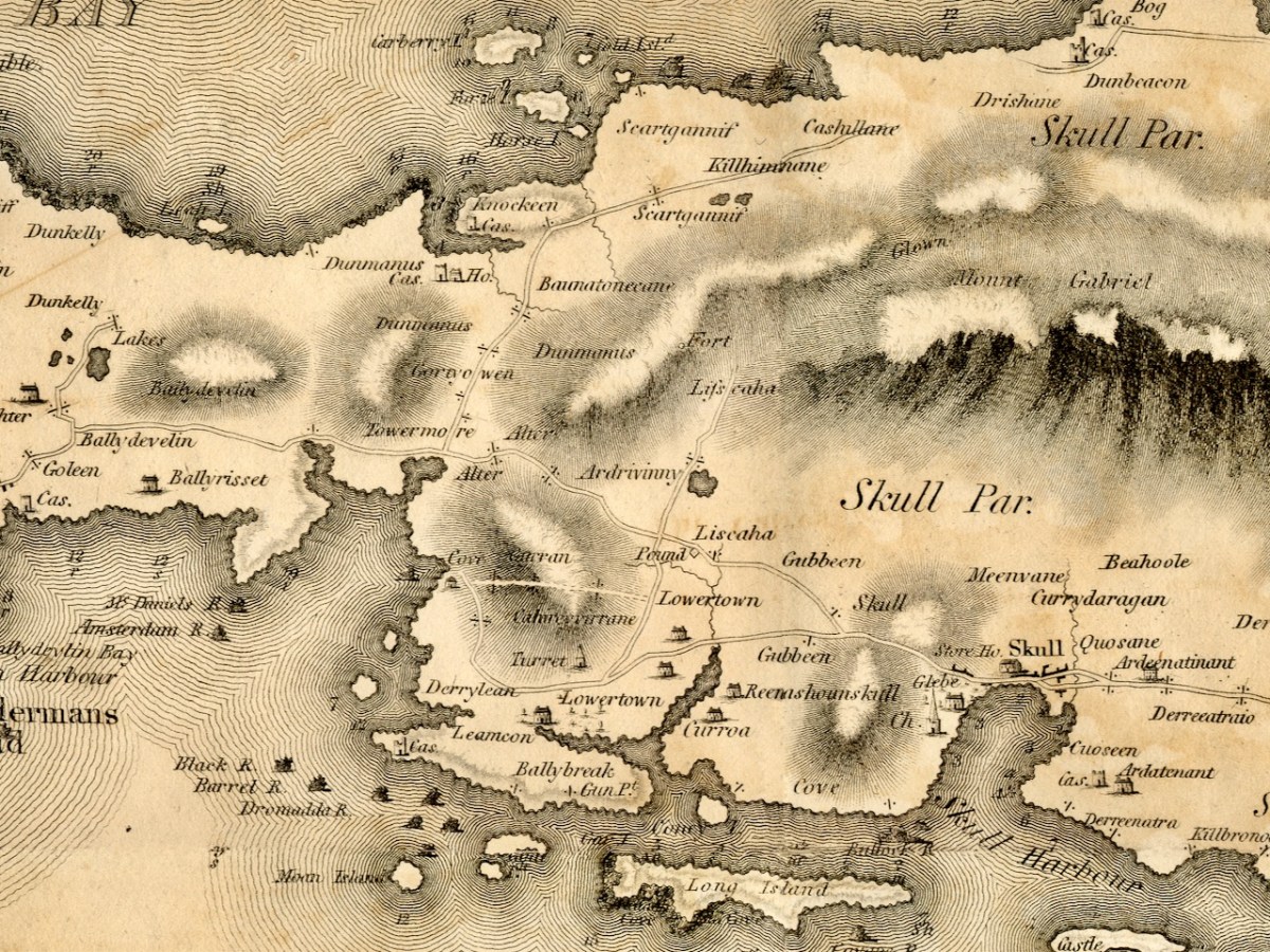
Moving towards Schull, I am intrigued by the noting of a ‘pound’, which does not occur on later maps. A pound was used to secure animals seized by the landlord’s agents for payment of rent. Note also the ‘Fort’ at the end of the Lisscaha road. While I haven’t written about this fort, I have visited it, and very impressive it is.
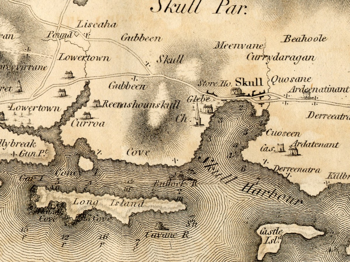
Schull is shown as a sizeable settlement, with a storehouse, Glebe, and Church – St Mary’s Church, now replaced by Trinity Church. A number of Gentlemen’s Seats are shown in the vicinity.
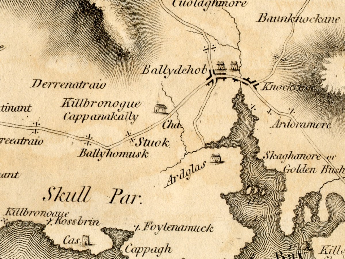
And finally we arrive at our own Ballydehob, shown as a town. Note the church to the south west of the town – I wonder if this is the church that once stood in Stouke Graveyard. It hadn’t occurred to me that Skeaghanore was the Irish for Golden Bush – there must be a story there! We will cover other parts of West Cork in subsequent posts. This map is an incredibly valuable resource dating as it does from well before the Ordnance Survey. We are lucky that it was published and copies saved. But what happened to Neville Bath? As JH Andrews tells us, Bath
may well have been dead by the time his work was officially published on 20 February 1811, and the map itself was only just in time. Irish cartography was about to pass into the hands of a new elite, engineers rather than land surveyors, whose most distinguished members were immigrants from Britain like Alexander Nimmo and William Bald. This later generation had a low opinion of Bath, and within fifteen years of his departure the counties of Limerick, Tipperary and Kilkenny had all decided to have his work done again. Not surprisingly, none of his manuscript county surveys appears to have been preserved. The map of Cork is available in a number of Irish libraries, however, and only awaits the judgement of the county’s own historians.
A Cork Cartographer’s Advertising Campaign by J H AndrewsJournal of the Cork Historical and Archaeological Soc, 1979
*See Richard Butler’s magisterial Building the Irish Courthouse and Prison 1750-1850
Discover more from Roaringwater Journal
Subscribe to get the latest posts sent to your email.

Brilliant and fascinating post, Finola. These old maps reveal so much of the past. Providing information on the cartographers gives the maps a much more intimate and personal feel. They are really works of art. I am also struck by the ornate cursive writing. I think the development of script and cursive writing would be another fascinating topic (hint, hint). Best Regards, Dermot
LikeLike
That sounds like it might be more down your alley than mine, Dermot. hint hint. 🙂
LikeLike
Damn it! I thought I had baited the trap nicely.
LikeLike
Only what it says in Wikipedia!!! A precursor of the tenement house!
LikeLike
Thank you Finola for this fascinating post (as they always are). I am curious what the “Revenue houses” in Crookhaven were, just east of the village
LikeLike
I had assumed they were to do with the excuse / like ‘the Inland Revenue’. But as far as I can see they were built by the Coastguard (or other authority) for rental to those working for or with the coastguard. There’s not much information, so I’ll keep digging.
LikeLike
Had to look up the Notion of Ptolemy. Every days a school day.
LikeLike
Pete – do you know anything about ‘revenue houses’?
LikeLike
Very interesting to read about Bath’s maps and looking forward to more. For those who my have missed it on the news last month, all of the 6 inch to the mile OS maps of 200 years ago are now freely available at the site: https://dri.ie/os200
LikeLike
Thanks, Dick. I usually use the Historic Environment viewer at archaeology.ie, which allows more free movement around country, But this is good that the 6″ maps are now available in the digital repository. 25″ next, I hope. I looks like these maps are now covered by the Creative Commons licence, and that would be very welcome – I’ve read the licensing statement and I am still not entirely sure. Do you know?
LikeLike
Hi Finola, Am not sure if the 6 inch maps are covered by the Creative Commons Licence, Sorry…….
LikeLike
So interesting, you could spend hours poring over this map. I wonder if the small church is actually the one that is now ruined at Kilbronogue? Remember the mud!!
LikeLike
I remember the mud indeed – but I think that was Kilbrown, as Kilbronoge is closer to Ballydehob. Overall, though, i think this is the Lissagriffin church.
LikeLike
Ah, I think you are absolutely right
LikeLike
What great history and interest these maps hold.
LikeLike
Ah – a fellow enthusiast, I see.
LikeLiked by 1 person
Hi FinolaI just attempted to send a comment to RWJ but think I messed it up as never tried before I wanted to tell you how much I loved your post about old maps. I have been fascinated, looking and reading for an hour whi
LikeLike
It worked – thanks for persisting, Sarah!
LikeLike
Wonderful images, Finola, modern maps wouldn’t hold a candle to them. But here I am tapping away on the keyboard! Many thanks for sharing. Paddy.
LikeLike
And of course, I viewed the map itself online. Love the irony.
LikeLike