West Cork’s Earliest Church: The Skeams Part 1

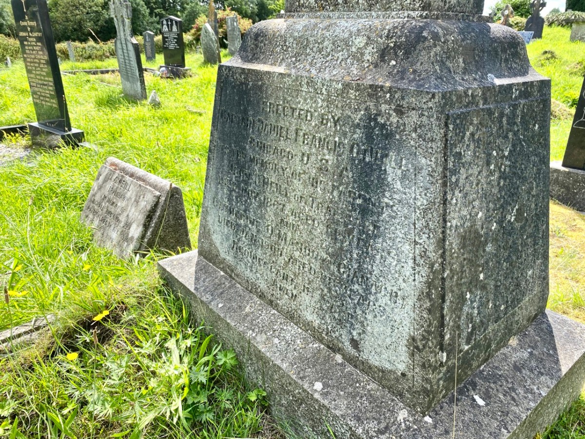
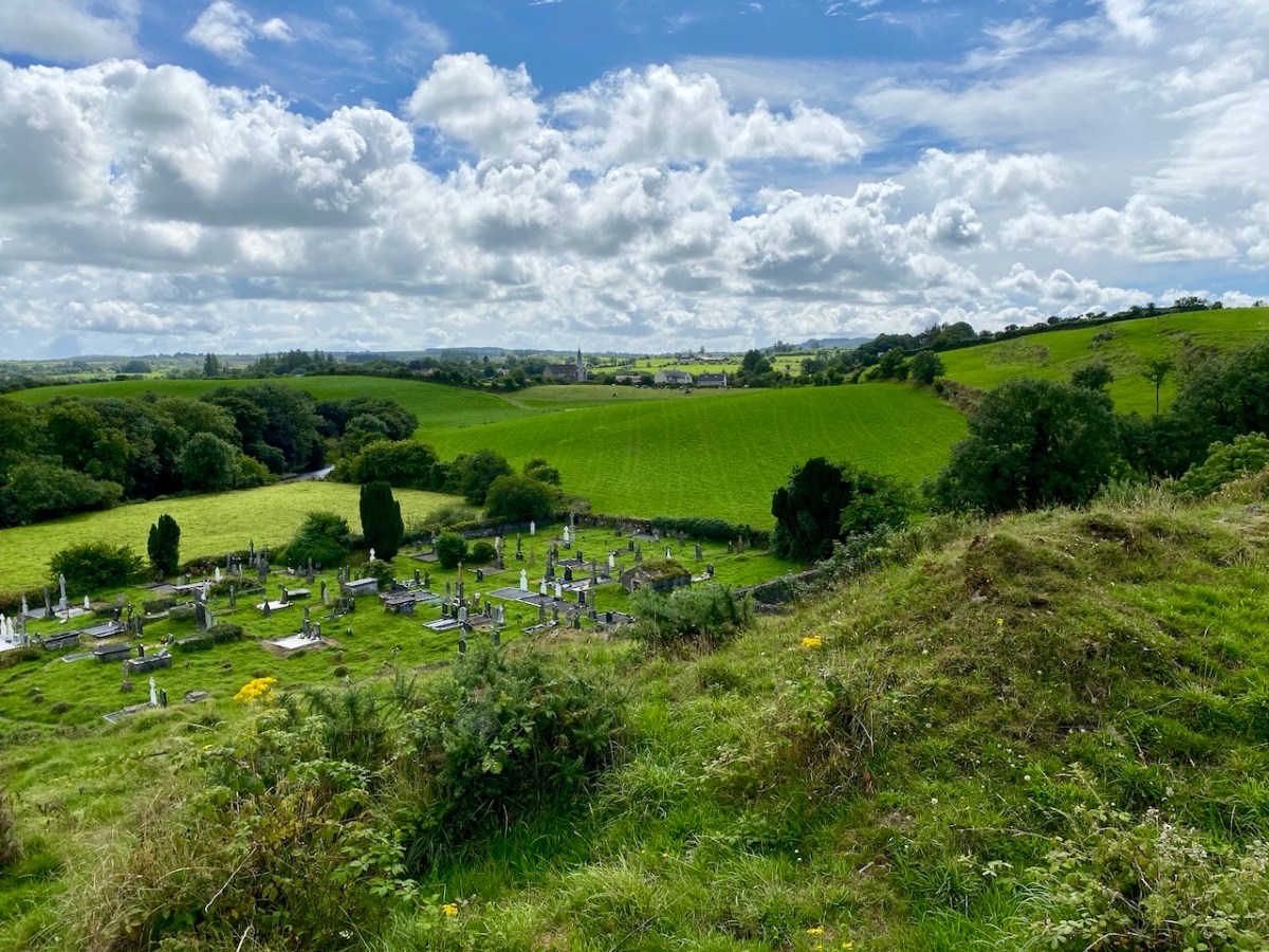
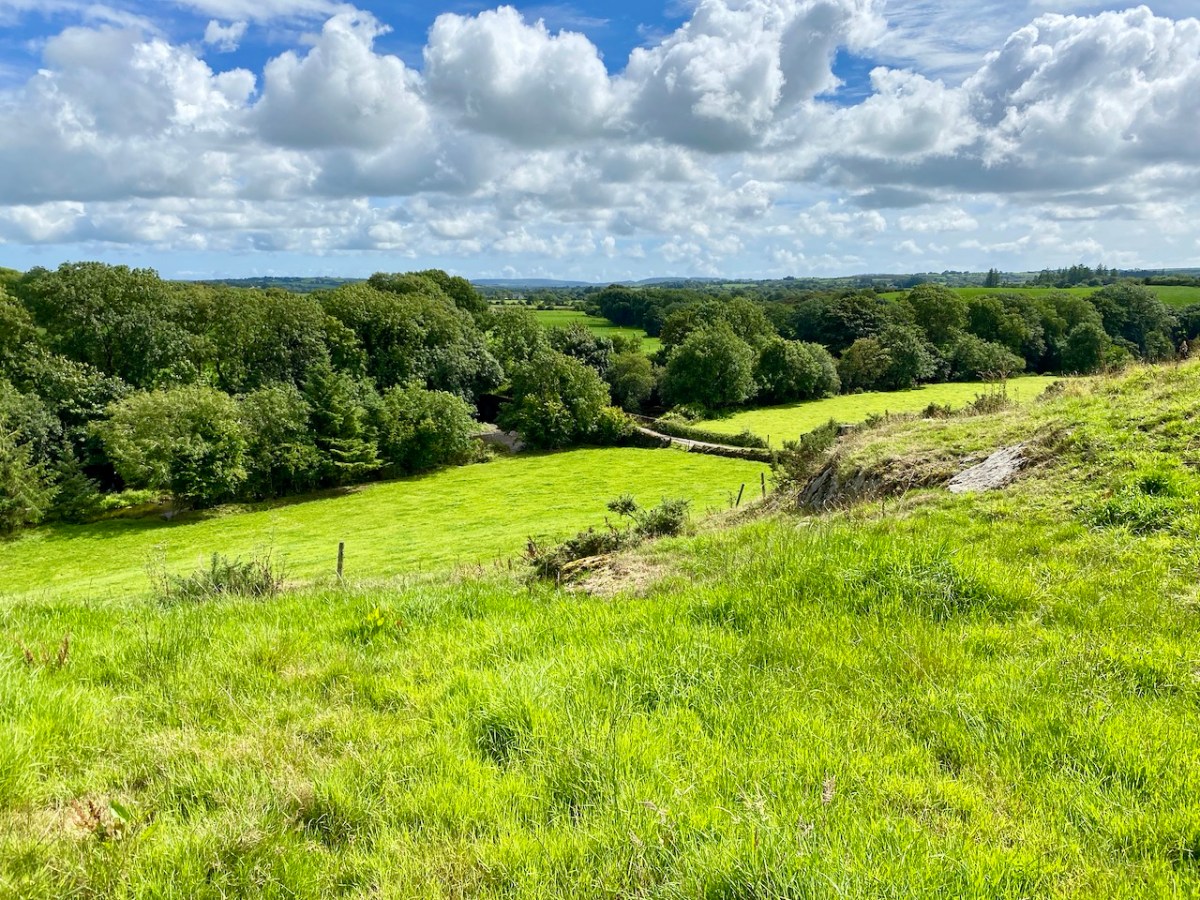
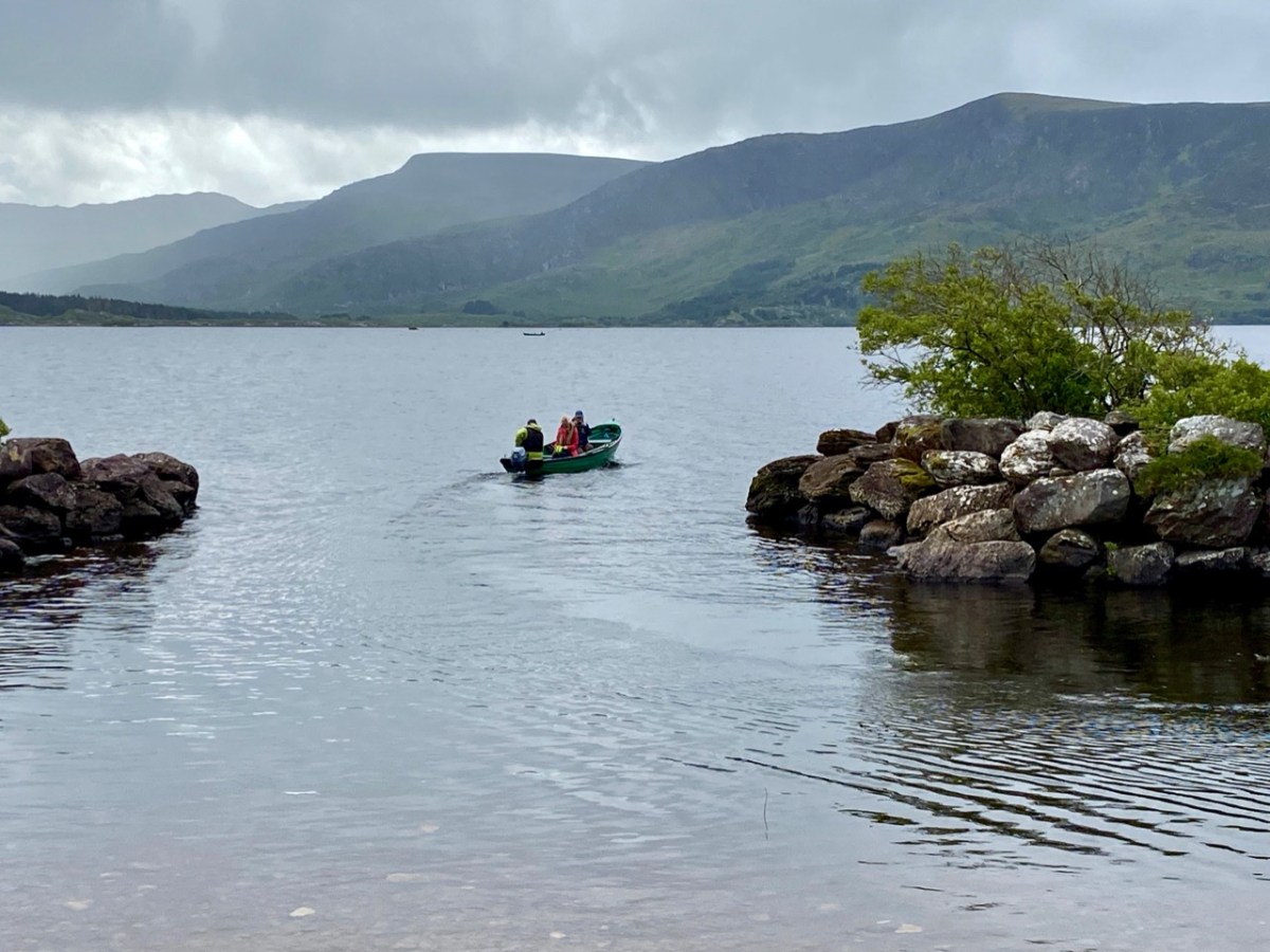
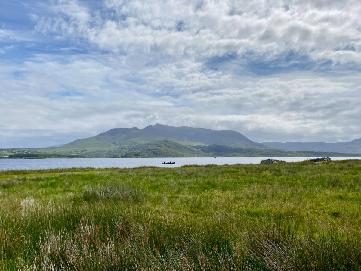
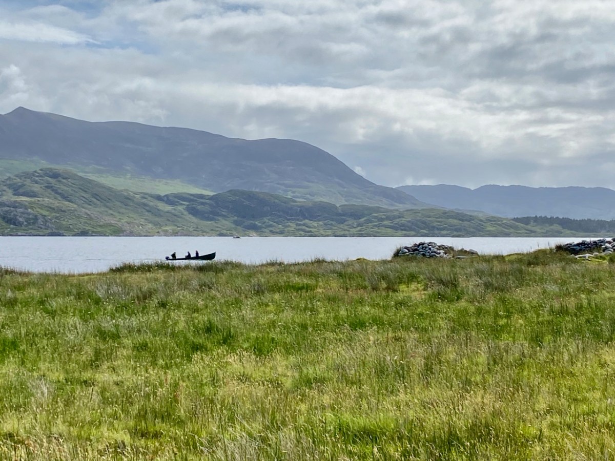
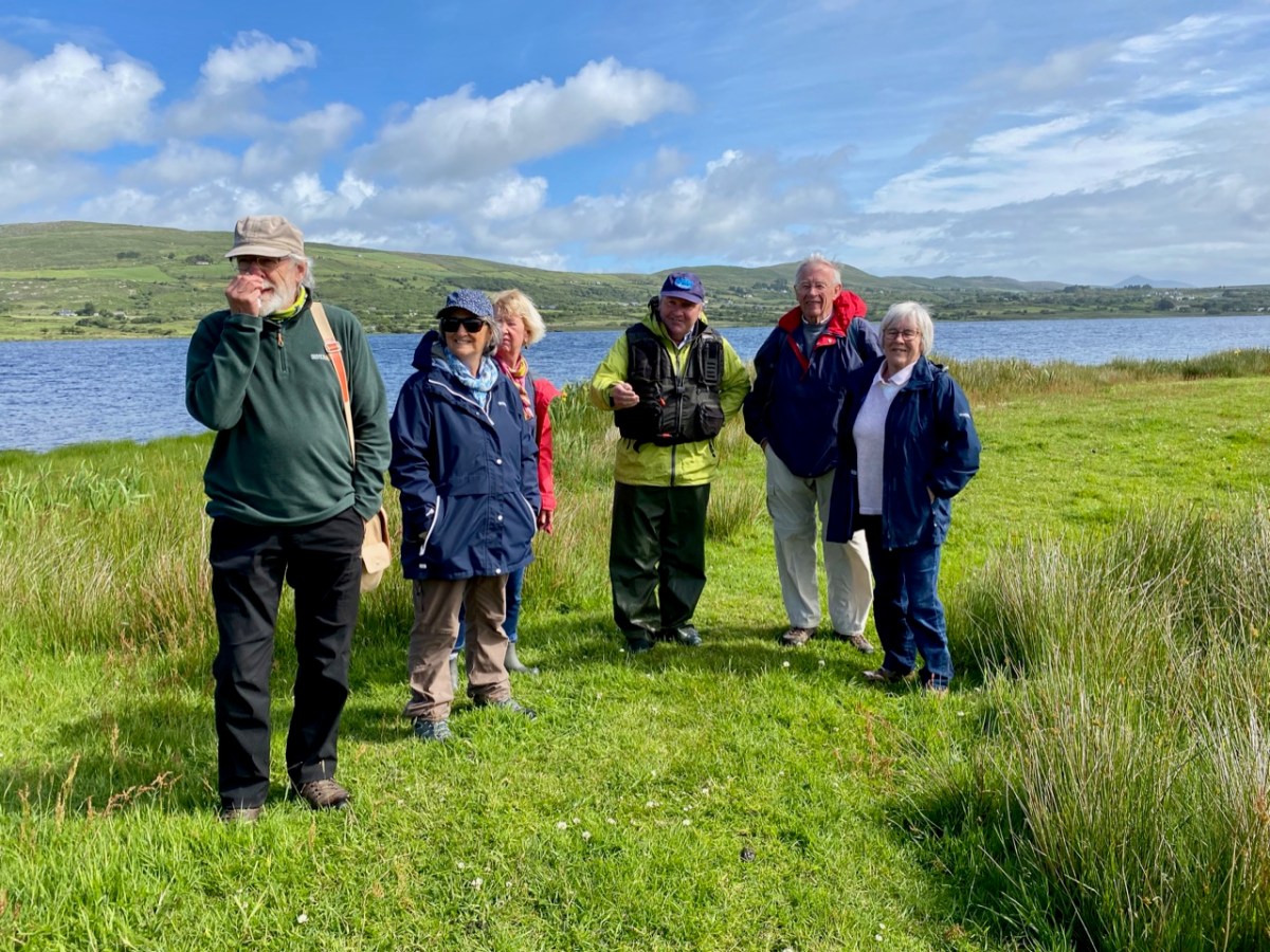
The highlight of last week was a trip around Roaringwater Bay in a traditional wooden boat, the Saoirse Muireann, visiting the Skeam Islands. Our captain was Cormac Levis, who led us last year on a trip to Castle Island and who is encyclopaedic in his knowledge of Roaringwater Bay.

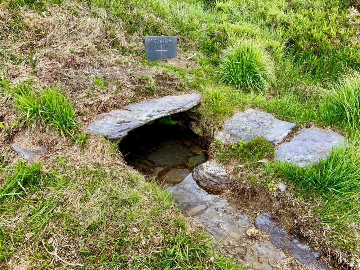
Now, you may be tempted, as I was, to pronounce this The Skeems, but you can mark yourself out as a true local by referring casually to the Shkames. Called after St Céim (pronounced Kame), apparently, although this particular saint is surprisingly controversial, cropping up as Céin, Keane, or Kame, depending on the authority. THE authority, Pádraig O’Riain, in his Dictionary of Irish Saints is uncharacteristically silent on this saint, so we turn to the Mizen Journal for more information. The Mizen Journal was the much-missed publication of the Mizen Archaeological and Historical Society and it combined well-researched articles with lots of local lore. Bernard O’Regan was a highly-regarded local historian, interviewed by two others, Lee Snodgrass and Paddy O’Leary, before his death in 1994. In the interview he gave this account:

When St Ciaran left Cape Clear to go to the continent to be educated, he left his brother Kame and his sister in Cape [Clear]. Kame then built a wooden church on the West Skeam (Inis Kame, Kame’s Island).

The Bernard O’Regan Story Part 2

Mizen Journal No 4

Remember the bit about the wooden church, as we’ll come back to that. 

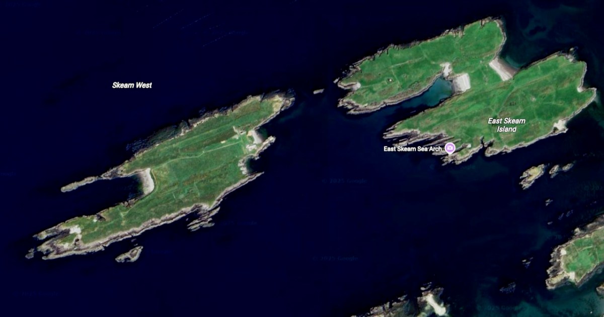
According to the geologist Anthony Beese, the West Skeam and the East Skeam were once probably joined, and possibly to Heir Island also, since the seas are very shallow between them. Based on geomorphological evidence, and Keating’s 17th century History of Ireland, Beese estimates that the islands may have separated due to storm activity some time between the 5th and the 9th centuries. Such a scenario, he says, would explain the lack of evidence for an early medieval settlement and burial ground on Heir Island

His own interpretation of the placename is more prosaic – rather than being based on a saint, he speculates that the Irish word scéimh (pronounced shcay-ev) might be apt – it means an overhang, a projecting rim or edge. He says:

The attitude of the cliffs of the Skeam Islands is determined by the subvertical dip of bedding planes, and when walking over the ridges, the feeling is one of looking down from a high table, boats below your feet, the rocky shore hidden.

Anthony Beese

The Natural Environment and Place-Names of the Skeam Islands

Mizen Journal, Vol 8, 2000

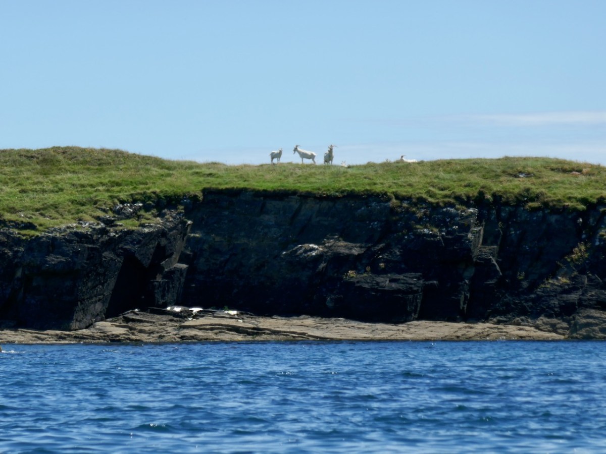
The goats on East Skeam certainly appreciate the cliffs.

So take your pick – the Skeams are named from a saintly church builder from Cape Clear, or the name reflects the geology of the island. Which side are you on?

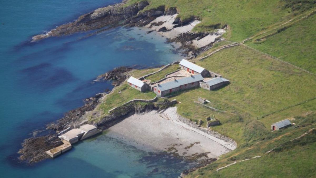
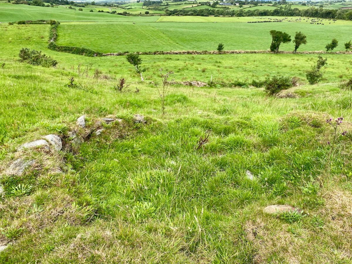
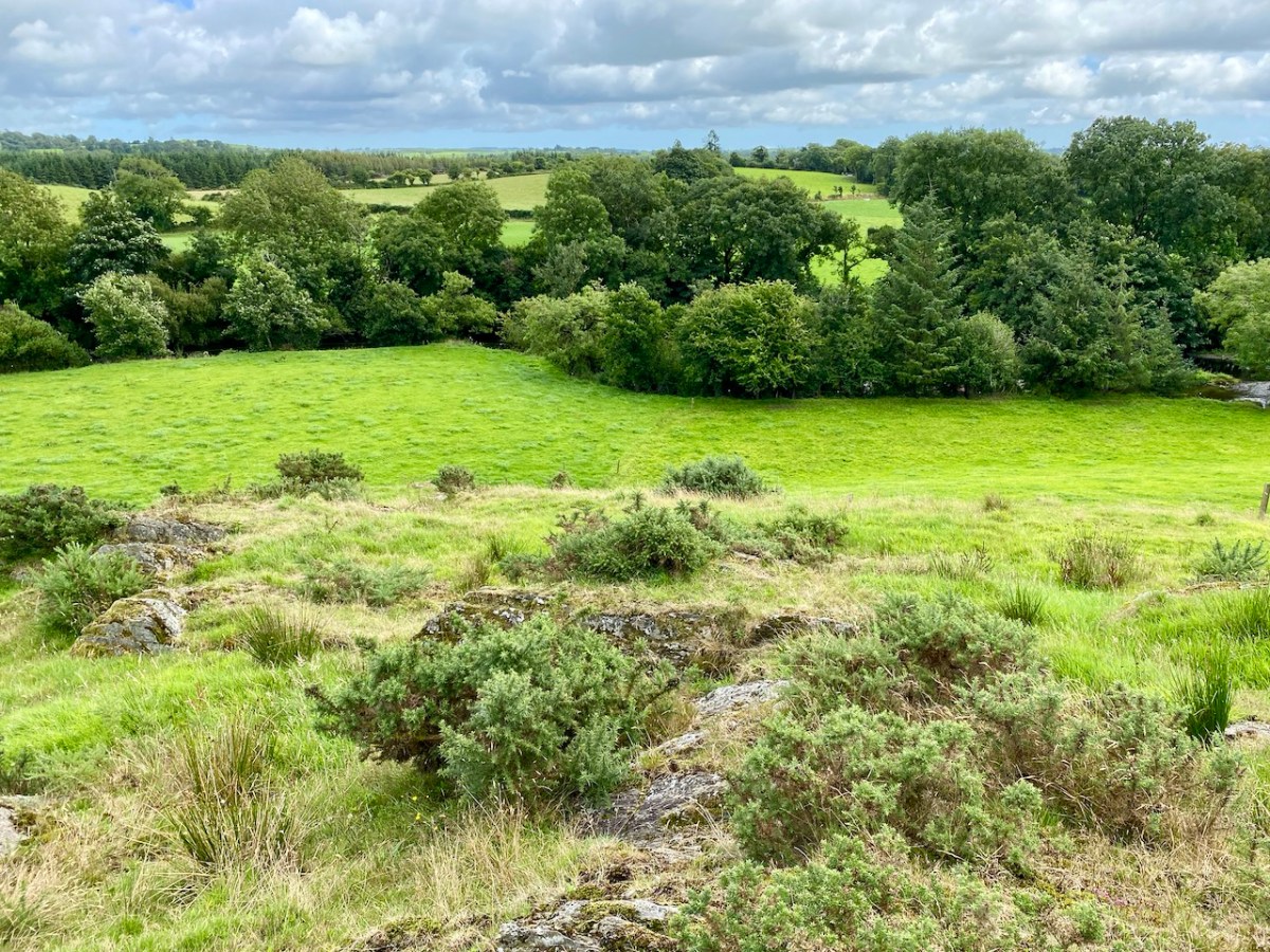
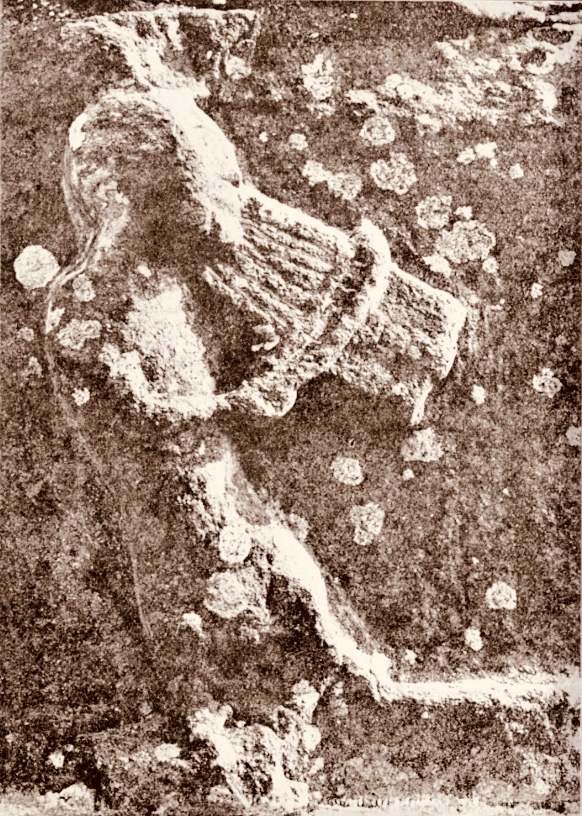
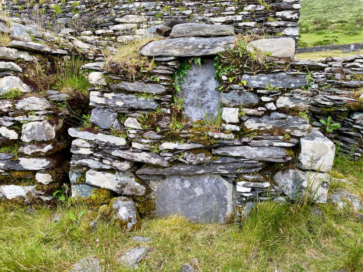
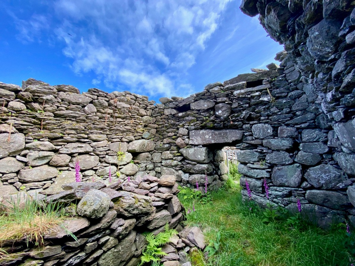
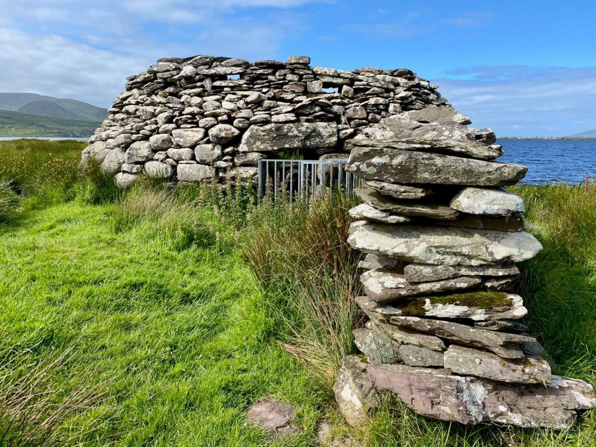
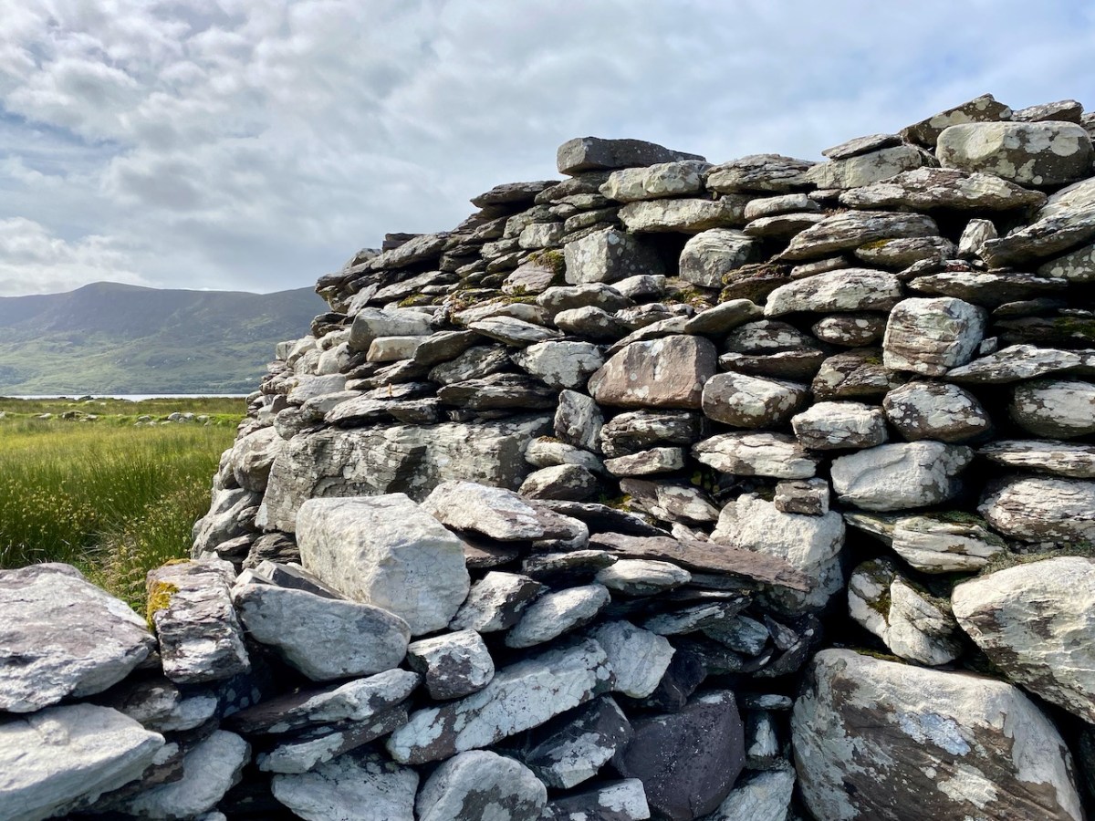
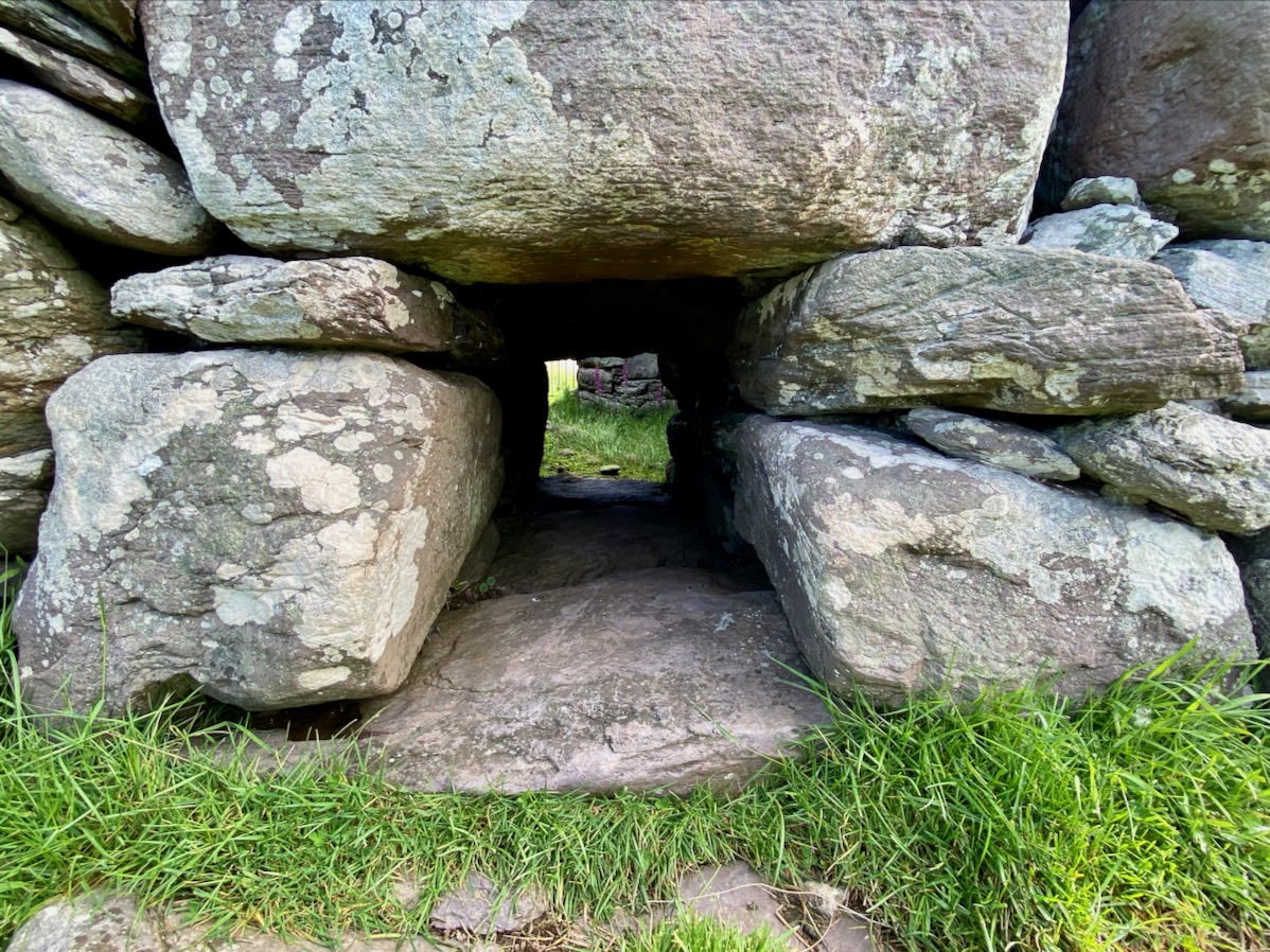
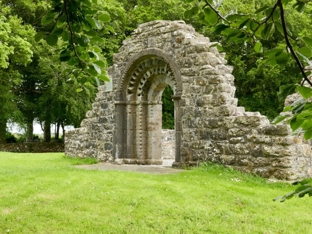
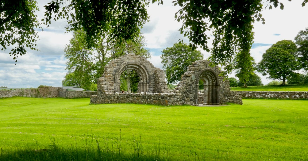
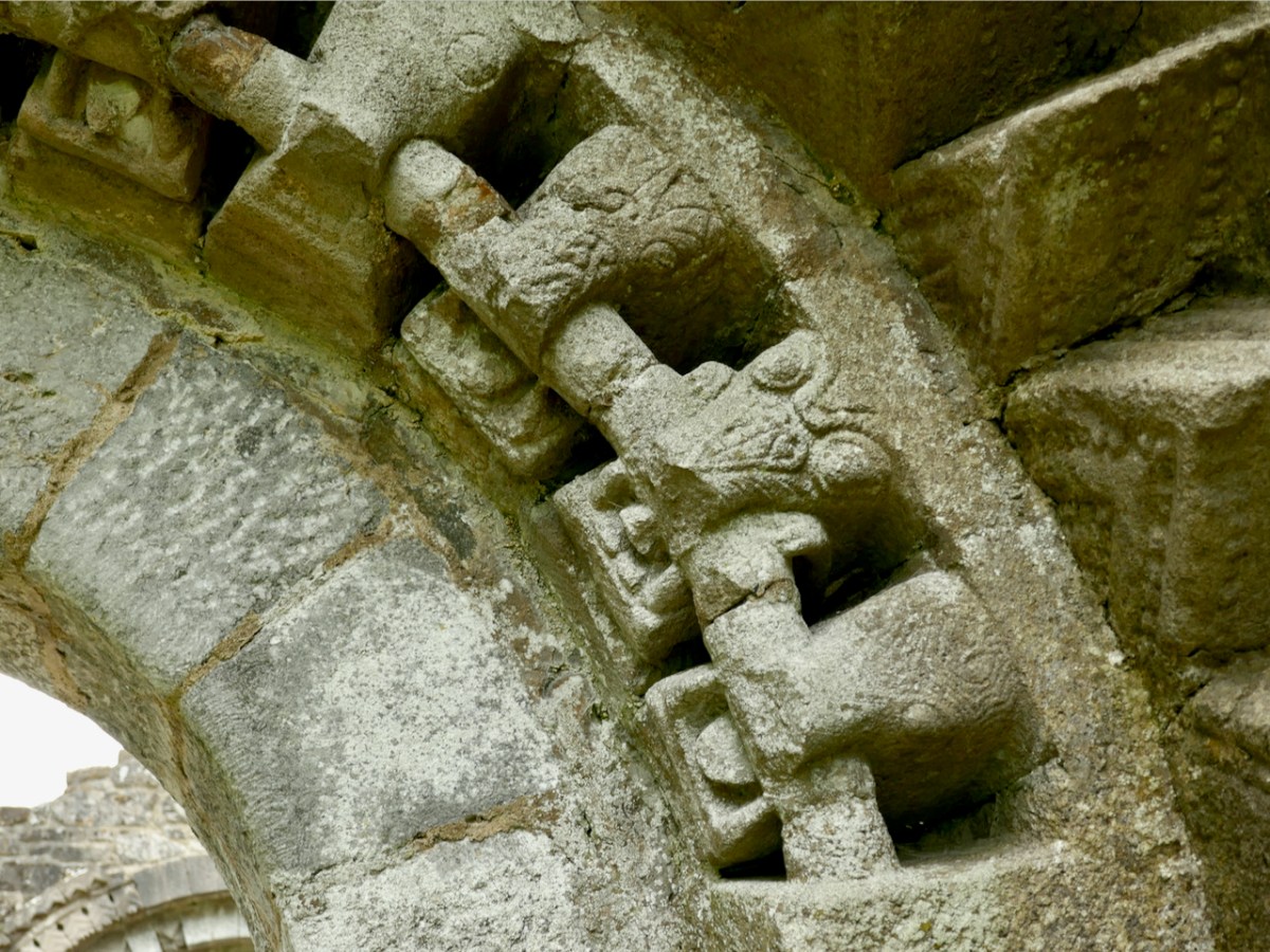
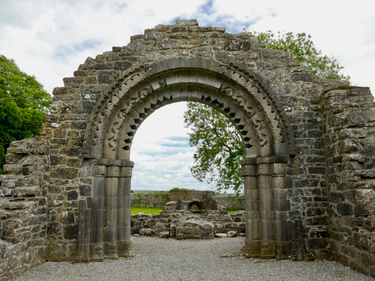
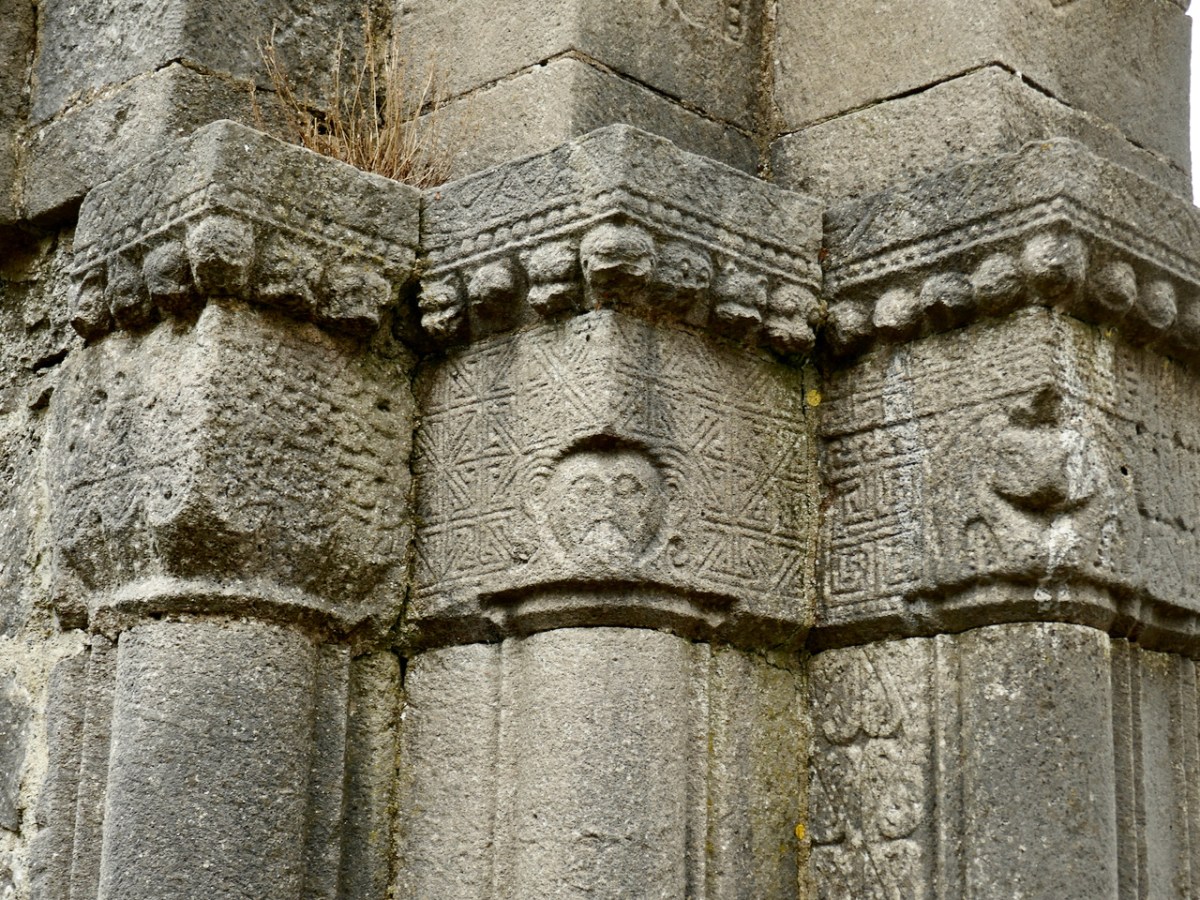
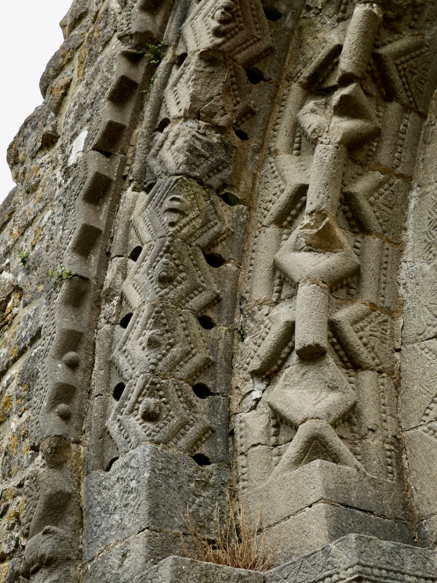
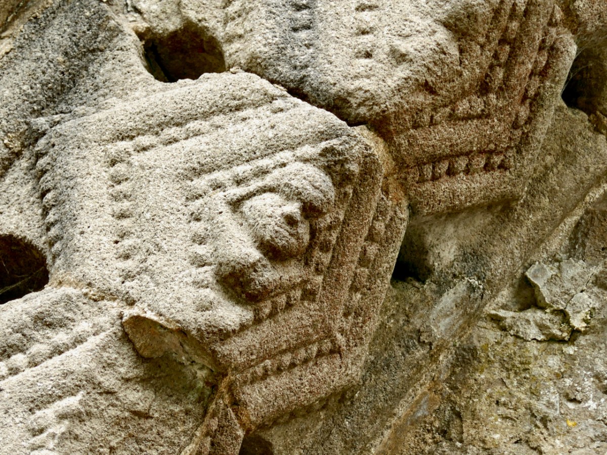
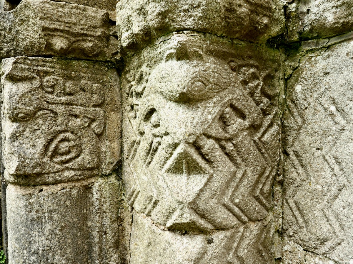
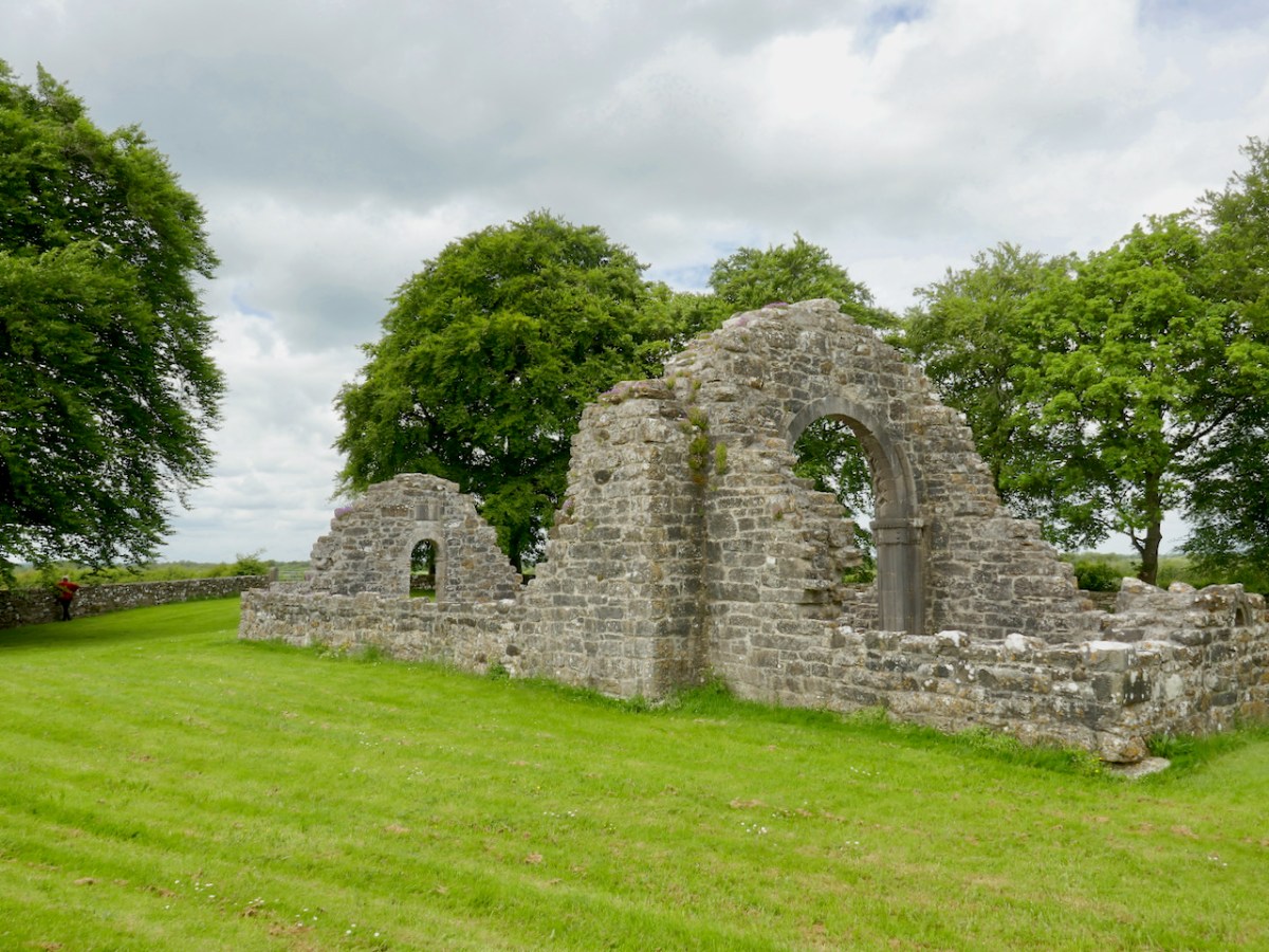
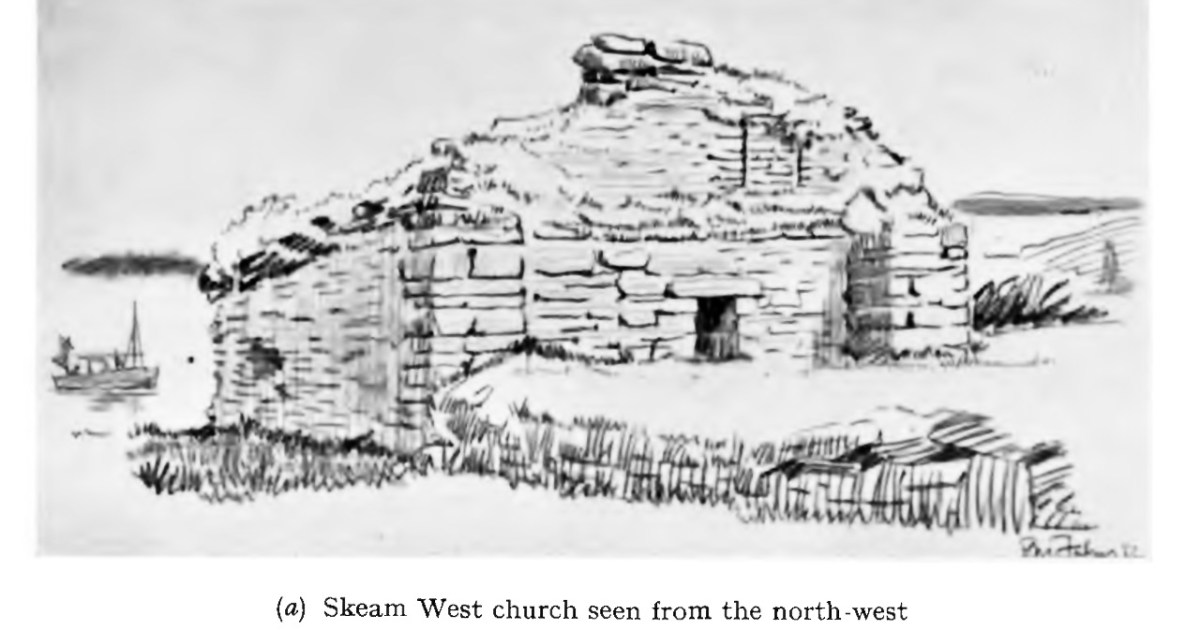
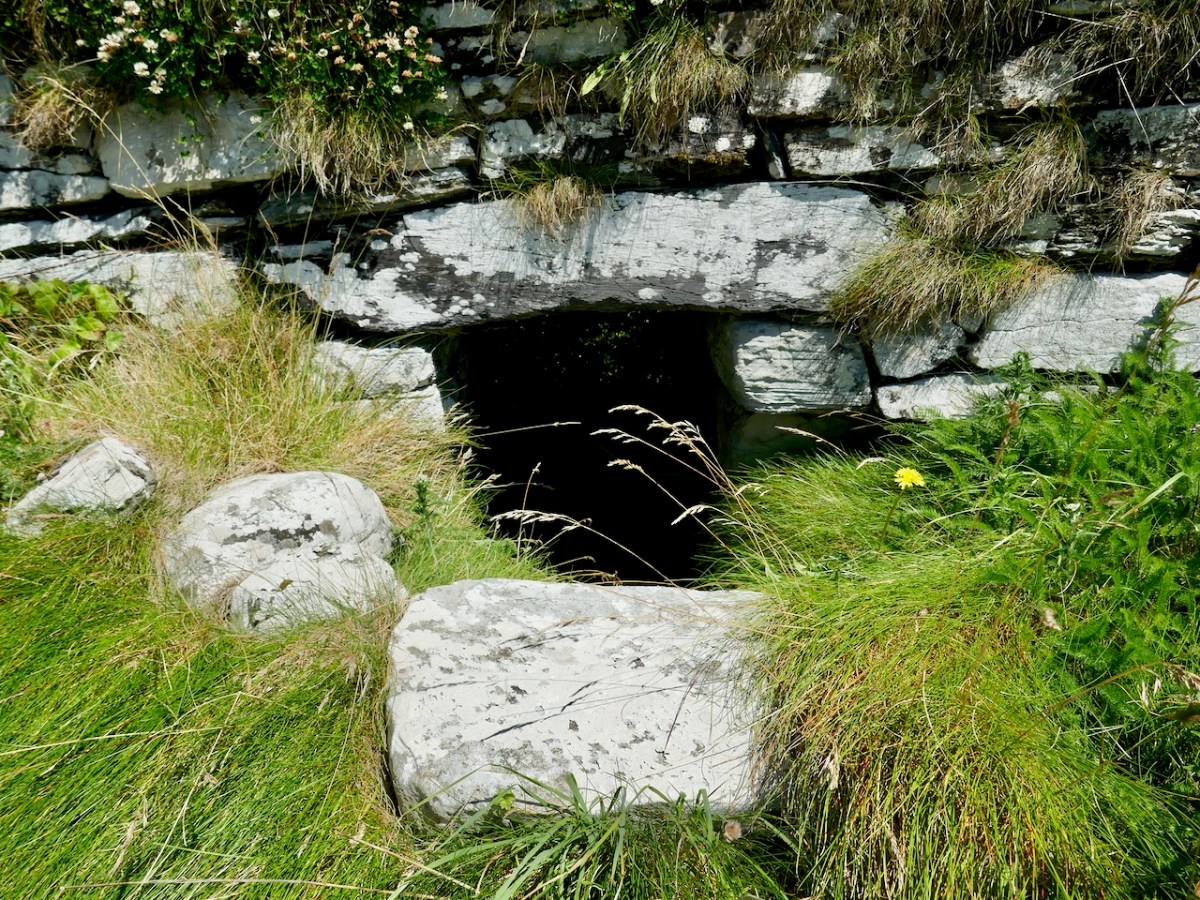
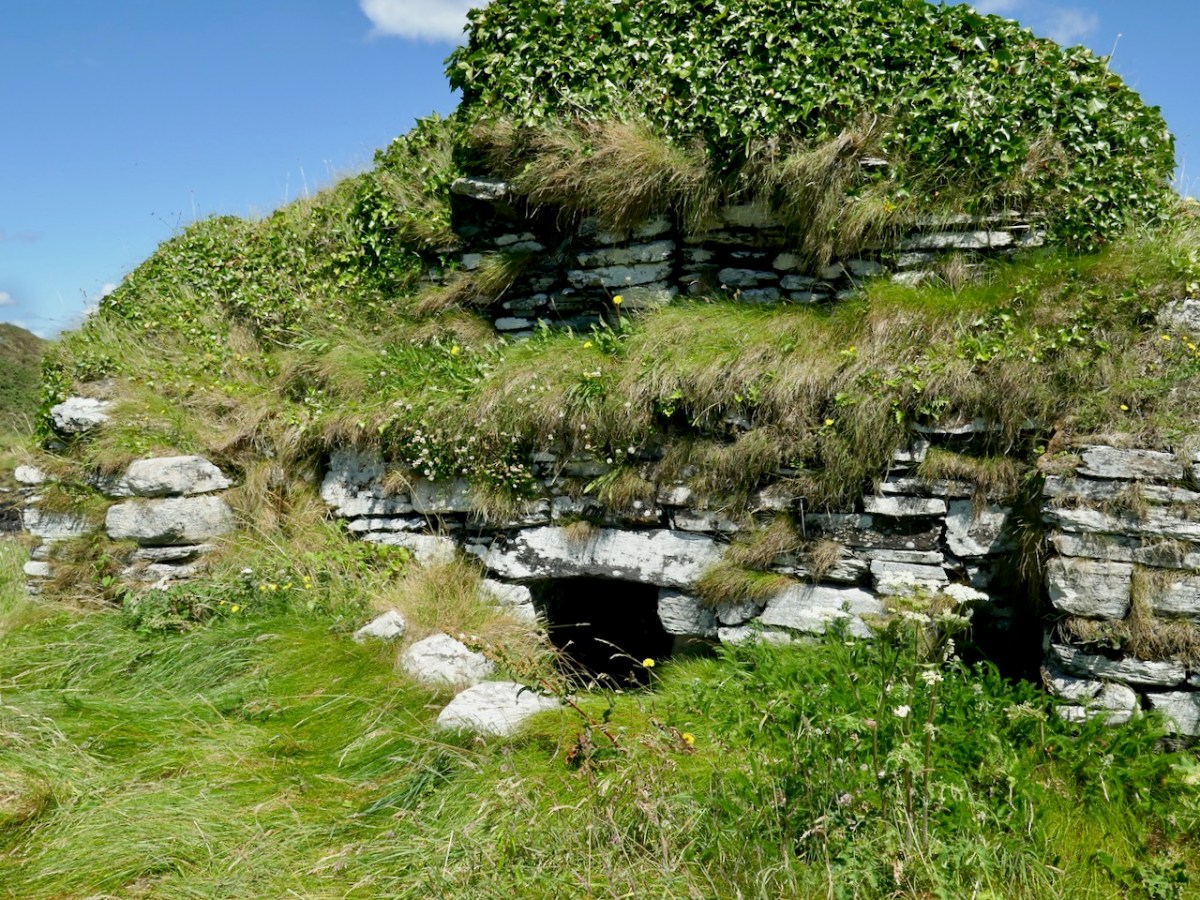
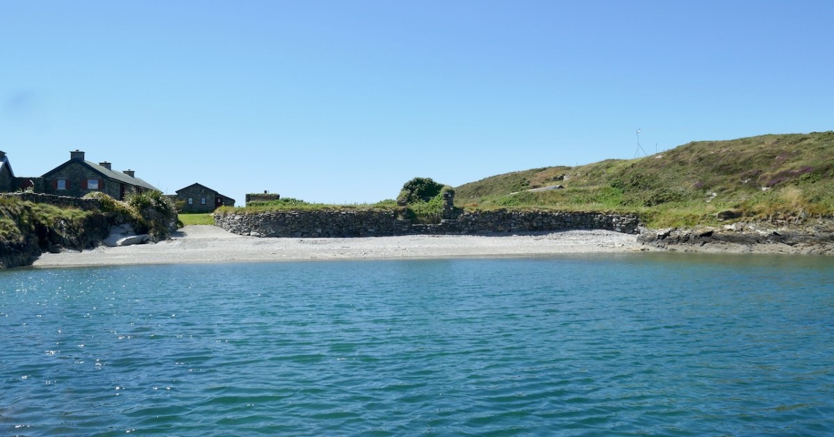
West Skeam has a fascinating history, as evidenced by the barely-hanging-on remains of an early Christian Church. It’s a small single chamber with antae and a splayed linteled doorway. In the photo above, courtesy of the Irish Times, it’s the small ruin on the bank halfway along the beach. Take a look at my post Irish Romanesque – an Introduction for more about this kind of early, pre-Romanesque Church. It is presumed that antae – the projections of the side walls beyond the gable wall – reflect an earlier form of wooden church in which those projections helped to hold up the roof and provide shelter over the entry. The survival of this feature is known as a Skeuomorph – an imitation in the stone-built form of the earlier wooden construction method. 

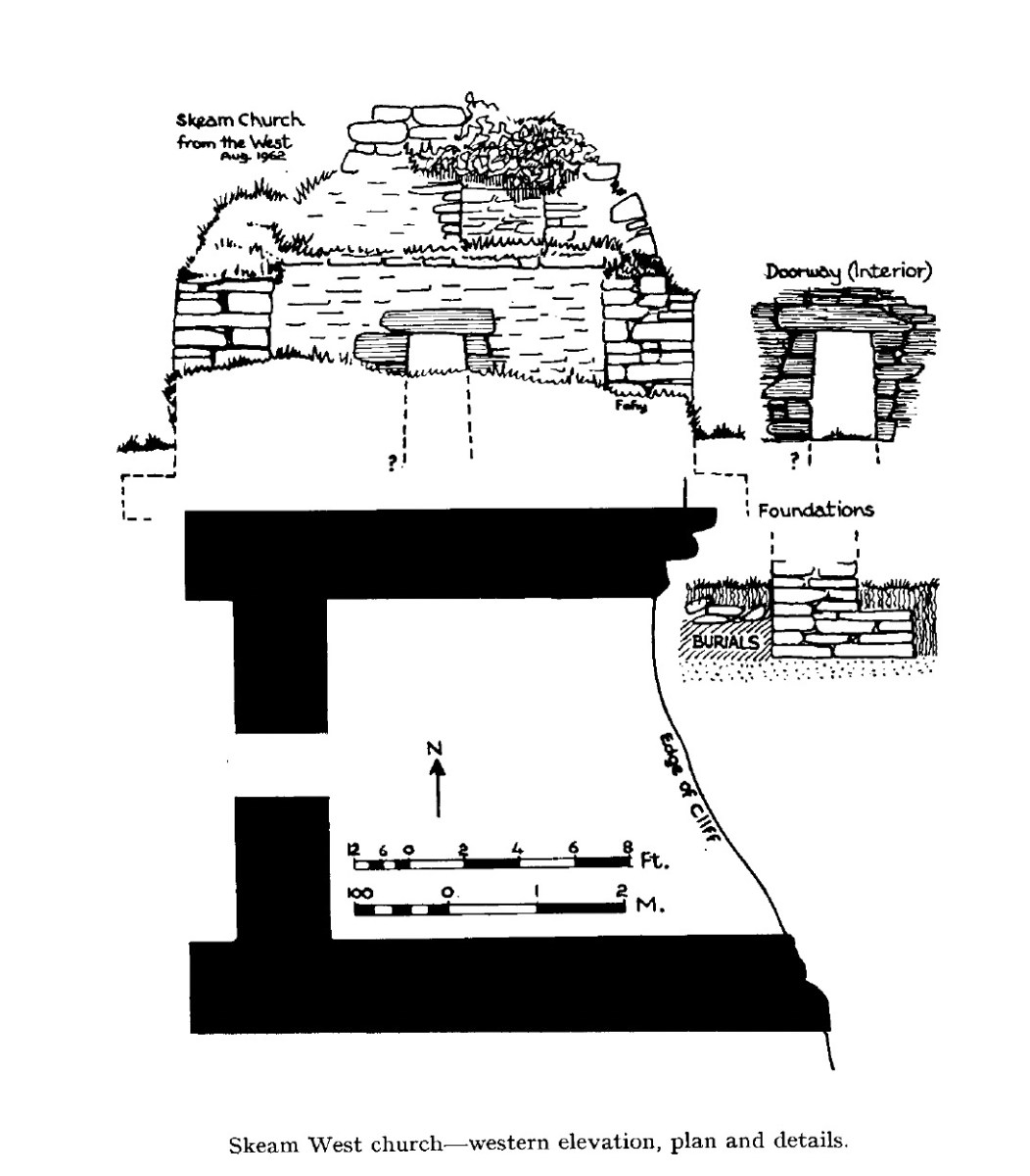
This little church is very significant – It’s the only one of its kind in West Cork. For many years it has been falling into the sea. Although once, Beese notes, it would have been high and dry, successive storms and the prevailing winds have eroded the bank it stands on over the centuries. Local people, Cormac included, tell of bones eroding out of the bank. The archaeologist Edward Fahy conducted a brief survey in 1962. The drawing above and one at the top of this post are from that report, and here is the conclusion:

Inhumed burials are visible in the cliff for a distance of almost thirty feet to the north and south as well as within the church itself where they are overlain by some soil and 18” of collapse from the walls. The burials extend downwards to foundation level of the building and appear to post-date it. The density of burials is not high and the skeletons are laid parallel to the axis of the church with their feet to the east. One grave is slab-lined but the rest are simple inhumations.

The architectural features of the church, dry stone building, simple doorway with inclined jambs and without architrave, the antae and the estimated length/breath ratio of the interior suggest a ninth century date for the structure. It is to be regretted that this, the only church of its date in the area is to be allowed to crumble into the sea.


Edward Fahy

Skeam Island Church,

Journal of the Cork Historical and Archaeological Society, 1962

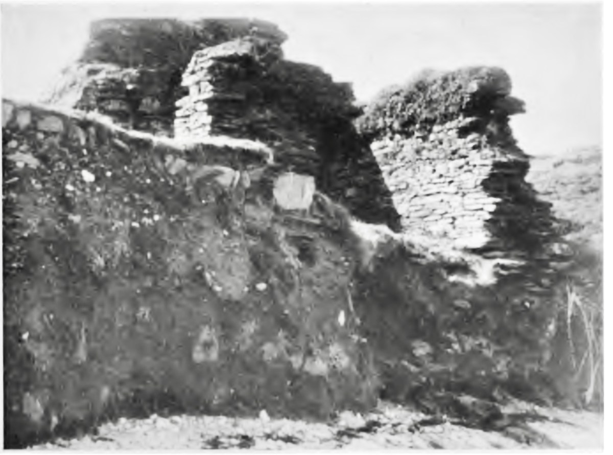
A proper excavation was conducted by Claire Cotter in 1990, necessitated by a proposal by the OPW to build a wall to protect the church from further erosion. Here’s what the bank looked like when Fahy reported in 1962, and it was in an even more perilous condition by 1990.

Cotter published her findings in an article, Archaeological Excavations at Skeam West, in the Mizen Journal, Vol 3, 1995. The excavation was confined to the burial grounds – that is, the area outside the church itself. It revealed that burials had been taking place there long before the stone church had been built! In fact, radiocarbon dating of the first phase, containing 24 individuals, mostly adult males, assigned a date range of 430 to 770AD.

Phase 2, consisting of 15 bodies buried in the north side of the church, once again mostly adults, but this time one body could be identified as female. Rather than in body-shaped cuttings, some of these bodies had been placed in pits, and they were in a semi-propped up positions. These burials dated from 550 to 855. 

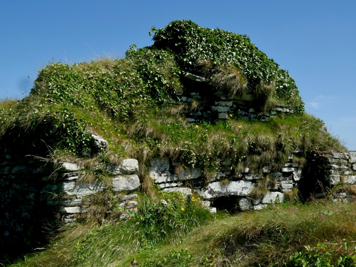
This is what the church looks like now from the landward side. It’s very overgrown, but you can clearly see the antae and the linteled entry

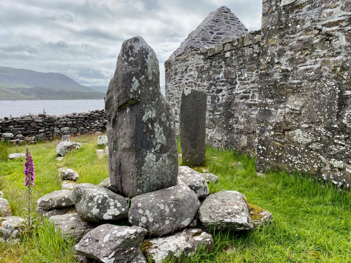
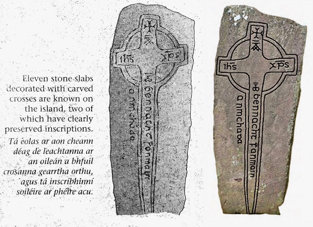
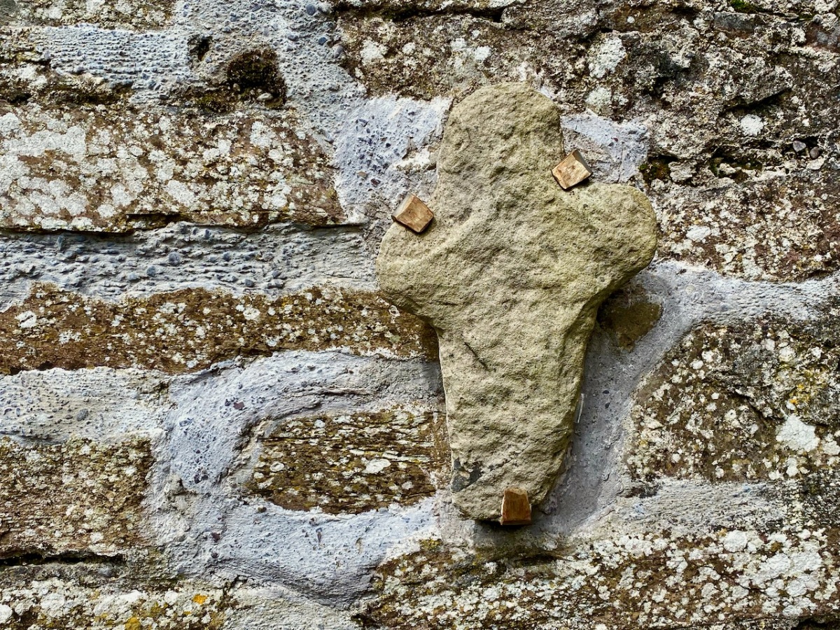
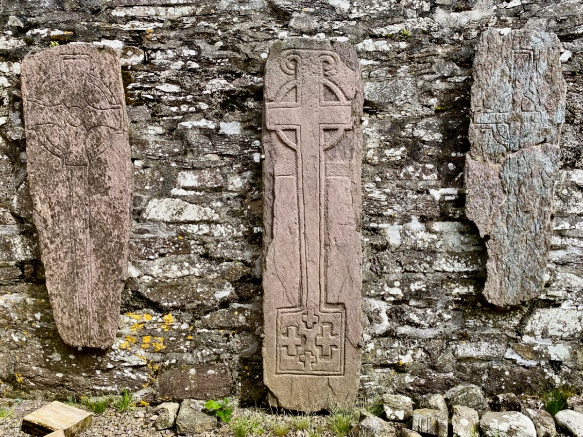
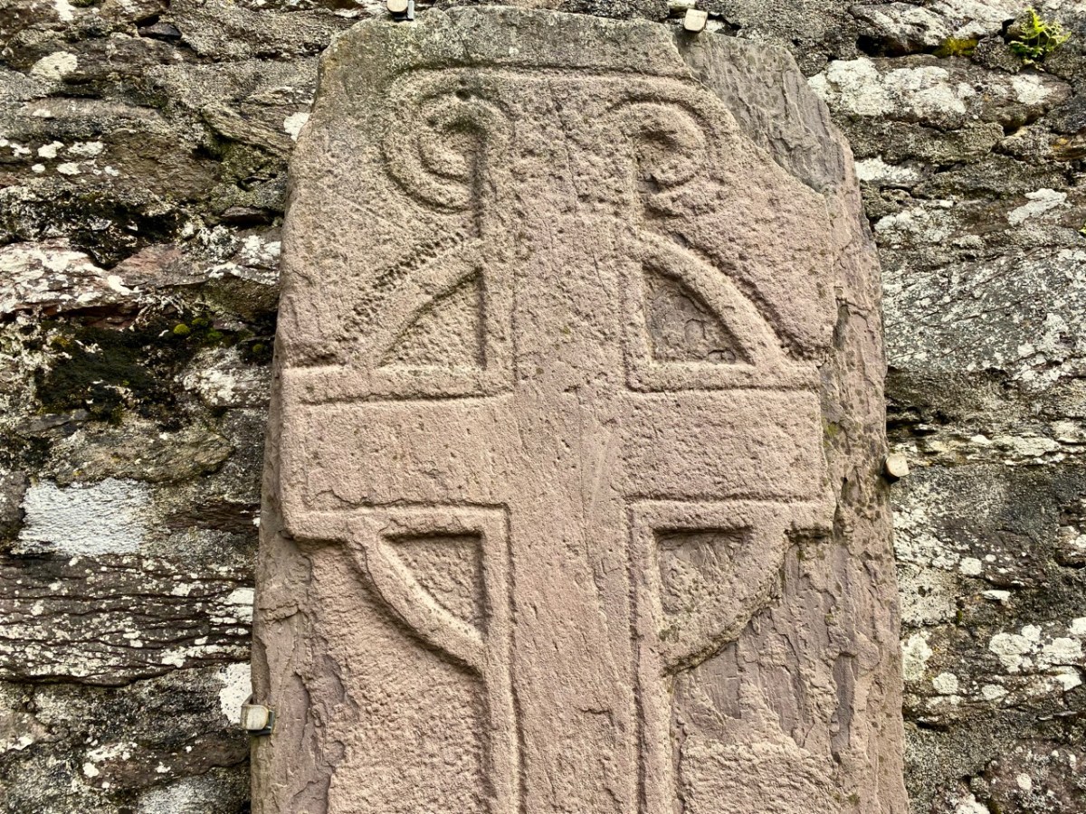
Phrase 3 encompassed 33 bodies and dated from 1165 to 1395, after which the graveyard went out of use. Some of these graves may have had markers – a stone cross and notched stones were found.

Another interesting find, Cotter tells us:

In a number of burials the head was marked by small flat stones – generally one stone set close to the head on each side. This may indicate that the bodies had been placed on timber planking – the cradle stones would subsequently support the head and keep it in position when the timber planks had rotted away leaving a void within the grave. Remains of such timbers have been found in early medieval graves in England. In the case of Skeam, such timber planking could have formed part of a bier, perhaps used to carry the body on the sea journey. Two burials of newborn infants also belong to this phase and these had been placed on large stone flags.

It looks as if this burial ground was accommodating people from the other islands. Apart from a cillín on Heir Island, there are no burial grounds on East Skeam or on Heir. A midden to the south of the church contained lots of fish and shellfish remains, as well as fragments of seal and whale bones, and cattle sheep and pig bones. This activity dated to the 16th and 17th centuries.

Cotter, in her discussion, says the following:

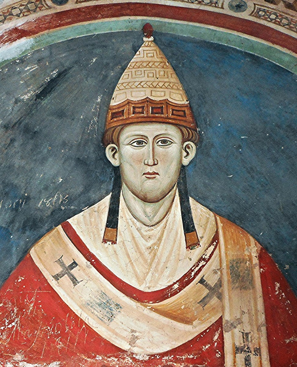
There are no historical references to the church on Skeam west. It lies in the parish of Aughadown; and a decretal letter of Pope Innocent III [that’s him, below] issued in 1199 refers to “Aughadown and its appurtenances” and the Church in Skeam West may well have been included in these. Local tradition attributes the origins of some ecclesiastical foundation on the island to Ceim or Keims, a brother of Kieran of Cape Clear. This would place the foundation in the pre-patrician period and the site is therefore of great interest. Was the stone church built to replace an earlier wooden structure – perhaps destroyed by the storm which washed up the deposit of shingle visible at the north side of the present building?

. . . Small church sites such as Skeam were generally located within an enclosure which defined the termon or area of sanctuary of the church, and the ditch uncovered to the south of the church is probably the remains of such an enclosure. The question as to whether these foundations should be regarded as monastic has been much discussed in recent years. Some scholars suggest that these ecclesiastical foundations should be regarded as small church sites which provided essential religious services for the local community. Others would argue that the majority of these foundations began as monasteries and only later assumed a community role. In many examples the earliest burials are exclusively male and only at a later stage do we find mixed burial i.e. adults and children of both sexes.

. . . The burial ground at Skeam West appears to have been used over a long period perhaps as long as the 900 years. During its later history it may have been used by a wider community drawn from the neighbouring islands and coastal district as well as the Skeams.

She adds:

The human burials uncovered during the excavations were re-buried on the island in 1992 in what is hopefully their final resting place.

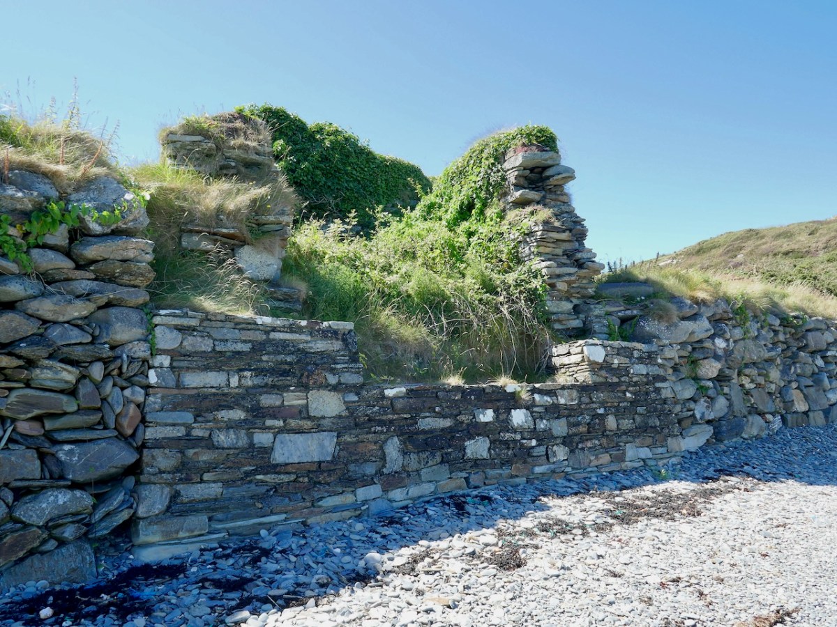
Above is the OPW wall, which seems to be doing the job of arresting erosion for the moment.

There’s lots more to tell you about the West Skeam Island, including fascinating details as to who owned it, and what life was like there. And we haven’t even arrived at the other Skeam Island, East Skeam, yet! Next time. 

One final note – the island is privately owned and monitored by video link. A disembodied voice reminded us that we were trespassing, at which point we left. 

The Electrification of Ireland – A Medieval Diversion

In my recent posts I have set out a brief history of how the new State became electrified – and how this affected the urban and rural ways of life in Ireland. An important part of the story was the building of the hydro electric power station at Ardnacrusha, on the River Shannon, between 1925 and 1929. That’s the original control room, above, unaltered since construction – there’s not a screen in sight! Most of the works of the station are now handled elsewhere using screens and keyboards rather than dials and switches. This site became the nerve centre for the electrification of Ireland and the National Grid was established in tandem with the project.

This selfie shows Finola and I on a visit to Ardnacrusha last week. (If you want to go yourself you have to book in advance). We had a great time! And I’ll be reporting back on that trip in due course. But first I want to take you back in time – more than a thousand years . . .

Here’s the River Shannon today, just north of the power station. There’s a big head of water there, and the river had to be dammed and flooded to maximise the feed to the turbines. The significantly raised water level had consequences.

The aerial view, above, shows the river today with its elevated water level. In the pic you can see the ‘Site of Friar’s Island’ indicated: before 1930 there was an island there, on which were some noted relics, including the Oratory of St Molua of Kyle (also known as St Lua), who died in the year 608. His feast is celebrated on August 4th. It’s said that crowds used to assemble there on that day, most of them wading across the water to get to the island. This description of the saint is from the Schools Folklore Collection (informant Tom Seymour, aged 60, Cloncully Co Laois):

. . . We don’t know where he belongs. Some say he belongs to Killaloe. He had his monastery in Kyle. Near the monastery he had a big stone where he used to pray. There are two big holes where he laid his elbows, and two more where the tears fell. In Ballaghmore there is a trough laid up on a stone. It is always half-full of St Molua’s water. The hottest day in the summer the well is always half-full of water. When he died the people of Killaloe wanted to bury him in Killaloe and the people of Kyle wanted to bury him in Kyle. They made two coffins, one went to Kyle and the other to Killaloe. He had another monastery in Offaly . . .

Schools Folklore Collection

In this extract from the early OS 6″ map (above) you can see that the island was quite substantial. The pilgrimage involved visiting a holy well and St Lua’s Oratory. The small church was by tradition built by the saint, although it seems likely to date from the ninth or tenth centuries.

St Lua’s Oratory – Eighteenth Century water colour – Royal Irish Academy. The figures are somewhat out of scale. Below is a photograph of the Romanesque structure taken on the island in the 1920s.

. . . The nave walls are constructed with uncoursed cyclopean sandstone masonry while the chancel walls are constructed with roughly squared stones of smaller size. The chancel has a single-light round-headed E window with stepped sill-stone and unusual flat-headed doorway in the S wall. The round-headed chancel arch has curious jamb-stones which are not flush with the chancel arch and project inwards. The triangular-shaped chancel roof is bonded with lime mortar and is well preserved. The nave walls are poorly preserved and only survive several courses high with a trabeate doorway in the W wall. Excavations at Friar’s Island prior to the removal of the church revealed that the church was constructed on a stone platform enclosed by a possible cashel with a revetment wall of unknown purpose. A second stone platform (dims. 22ft (6.71m) N-S; 50ft (15.25m) E-W) was located to the S of the church and eleven skeletons were uncovered under or close to the foundations of the N wall of the church (Macalister 1929, 16-24) . . .

National Monuments Service description

As the plan to establish the new power station progressed, it became obvious that the level of the river below Killaloe would have to be raised significantly in order to maximise the water power turning the turbines to be installed: some five meters, in fact. The consequence for Friar’s Island were that it would be flooded, and the Oratory would be lost.

Considerable debate ensued, the main factions being archaeologists, engineers, and the Catholic Church. Politically, the efficient functioning of the new power station was paramount in order to show the State and the world that Ireland was an entity to be reckoned with. At the same time, the archaeologists were keen to project that the independent country recognised and championed its very rich ancient heritage, and would therefore go out of its way to preserve all surviving artefacts. The Catholic Church was anxious to show allegiance to all aspects of progress in the State, while noting that it was also the fundamental root of the unique Irish culture that led to the historical founding of sites such as St Lua’s Oratory. I was fortunate to be given access to a paper by Niamh NicGhabhann of the University of Limerick: Medieval Ireland and the Shannon Hydro-Electric Scheme: reconstructing the past in independent Ireland. Here’s an abstract:

. . . This essay considers the position of Irish medieval buildings in the early years of the twentieth century. Focusing on the treatment of the oratory of St Lua at Killaloe, it examines the ways in which the ruins of the medieval past were used to signify a range of political, religious and cultural ideas and attitudes. The rising water levels following the Shannon Scheme works (begun in 1925) meant that this stone oratory was moved from its original position on Friar’s Island to the grounds of St Flannan’s Roman Catholic Church in 1929. The resulting paper trail reflects the complex processes of decision-making within a civil service in transition as the new Irish Free State calibrated its position with regard to the past and the treatment of medieval ruins throughout the countryside. The case study of St Lua’s oratory is considered here in the context of the nineteenth-century tradition of scholarship on medieval buildings, the development of the idea of a national Irish architecture during this period, and the impact of this tradition on subsequent engagement with the buildings of the medieval past . . .

Niamh NicGhabhann
IrIsh studIes revIew, 2017 vOL 25 NO. 4

Above – a surviving photograph of St Lua’s Oratory being disassembled in 1929. The various debates had produced three alternative solutions to the dilemma of the impending inundation of Friar’s Island:

1 – Allow the island and the ruins to vanish below the flood: by far the cheapest course of action.

2 – Build a new concrete platform (effectively a new ‘island’) above the level of the flood water, and transfer the remains of the building to this.

. . . The RSAI officially responded in support of the second proposed scheme of work, involving the elevation of the building and the construction of a concrete pier. They suggested one amendment to the plan, that a ring of grass be added around the building to give the concrete plinth the appearance of an island. Given that both the RSAI and the OPW were in favour of the second scheme as the most appropriate and cost-effective course of action, the fact that the oratory was eventually moved and transported some distance from the site, however, reflects competing values, as well as several structural problems that emerged in the second scheme as proposed. As works progressed, it became clear that the elevated island site would be eventually undermined by the flow of the river, making this process untenable . . .

Niamh NicGhabhann
IrIsh studIes revIew, 2017 vOL 25 NO. 44

3 – The Scheme that was eventually adopted involved dismantling the Oratory and re-assembling it as faithfully as possible, on a suitable mainland site. Initially the suggested site was on the Clare bank of the Shannon, but the ground conditions were not suitable for a permanent structure.

. . . A further plan for relocation was also progressed, which involved moving the ruin into the town of Killaloe, and locating it beside the later and larger oratory of St. Flannan, and the medieval cathedral of St Flannan. These plans were at quite an advanced stage by mid – 1929, with several drawings and maps produced by Leask’s office for the purpose. However, while the preservation process was certainly hampered by these structural issues, ideological concerns also had a direct impact on the treatment of the oratory . . . The intervention of Bishop Fogarty was also noted on 13 July 1929, when the Limerick Leader reported that “the safeguarding of such a venerable relic of primitive Christian architecture is due to the timely intervention of Dr Fogarty, Bishop of Killaloe, who put the matter before the Government”. (Limerick Leader, 13 July 1929) . The use of the word “relic” as opposed to “ruin” is significant here, reflecting an interpretation of the site as part of a tradition of faith, rather than of architectural or antiquarian interest . . .

NIAMH NICGHABHANN
IRISH STUDIES REVIEW, 2017 VOL 25 NO. 44

In this photograph of the Oratory as it stands today in the church grounds at Killaloe, it is perhaps worth wryly commenting that we see a true piece of early medieval architecture behind the screen of ‘pseudo’ high crosses. We have a good record of how the remains were dismantled and accurately re-assembled: this was written by the archaeologist H G Leask MRIA in 1930:

. . . In order that the rebuilding should be, as far as was possible, an accurate one, it was necessary to adopt a system of marking the stonework by which the original stones should occupy their original positions when reassemble. The stones being very varied in size and irregular in shape, and laid uncured, no system of numbering such as could easily be applied to squared ashlar was admissible. To the Clerk of Works in charge, Mr C J Dowdall, must be given the credit for the scheme finally decided upon. This consisted in marking with paint of different colours a series of level lines at two feet vertical intervals all round the exterior and interior wall faces. These lines were crossed again by a series of vertical lines at the same intervals but of one distinctive colour for each wall face inside and out. Where the squares formed by this grid of paint enclosed, unmarked, a number of small stones, diagonal lines were added to each square to ensure that every stone showed the same marking. A complete series of elevational photographs of each wall face was taken and careful drawings were also made with the coloured guide lines indicated upon them. On the large plot of ground on the opposite side of the river kindly lent by Major Lefroy, above future water level, timber guide planks were laid down as a frame to each wall and gable face. On the timber frames the coloured guide lines were indicated and the stones when transported were laid down face upwards, in sand, in correct relation with the coloured marks. Each wall, of course, was divided in two vertically along its length and “displayed”. Important quoin, jamb, and arch stones were numbered in colour in regular order. The transport over the Shannon was carried out by means of a specially built barge and a rope stretched from shore to shore, the workmen simply “handing” the boat across by this means. An inclined trackway with truck and winch was erected by Messrs Siemens Bau Union and two small temporary jetties by direct labour. The Most Reverend Dr Fogarty, Bishop of Killaloe, vested a site in the Church enclosure on the summit of the hill in Killaloe town, and the building has been erected there and is now (May, 1930) approaching completion. (Note: the work of re-erection was finally completed in July, 1930) . . .

The Church of St Lua, or Molua, Friar’s Island, Co Tipperary, Near Killaloe
Further Notes – H G Leask
13 May 1930

A couple of afterthoughts to finish off with: a letter from Canon Clancy to Leask, dated 14 October 1930, asked whether a gate could be installed, as it is “liable to be desecrated by boys using it as a urinal, in fact, some boys have already been using it”. And a contemporary cutting from the Nenagh Guardian noted that . . . works cost thousands of pounds are being misused on a “folly” in demolishing St Lua’s Chapel and hiding it in a yard when they could have lifted it above the waters and put a strong light in it that would have illuminated the whole country round, and made it one of the sights of the place . . .

I am grateful to Niamh NicGhabhann for allowing me access to her excellent paper on the tensions surrounding the proposals for the Oratory remains. Further information on the Electrification of Ireland can be found in these posts:

Night’s Candles are Burnt Out

Electrifying West Cork

Rural Electrification – Process and Effect

Caheragh Explorer

I’ll explain at the outset that Caheragh is (more or less) pronounced ‘corer’ (as in coring apples)! It’s a parish in West Cork that we have visited before. Have a look at my article on the Ilen River, here. This locality is brimming over with history and we go exploring as often as possible: there is always more to find. And – with wide views and cloud scapes in all directions from the high ground – it’s an uplifting place, especially when blessed with the August sun.

Here’s a vista to the north-east, from the top of the mound beside the graveyard that might just be a ring-fort, or possibly the site of a monastic centre dating from medieval times – more on that later. In the middle distance is the Ilen River with its wooded banks, heading out towards Castle Donovan and – eventually – to its source on Mullaghmesha (or, perhaps, Nowen Hill – we have yet to determine exactly where it rises. This post from the Sweet Ilen series covers the area). And that Donovan castle itself graces the cover of the latest Skibbereen Historical Journal (Volume 18, 2022), which you can get in bookshops locally, or online here. You will find a summary of some of my research on the Ilen River in this journal, together with many other fascinating and erudite articles.

But, going back to that sunlit vista, you’ll notice Tadhg’s Little Oak Tree is indicated. I can’t resist quoting the story of this feature that appears as a ‘Redundant Record’ in the Historic Environment Viewer:

. . . On E bank of River Ilen. Site of tree, ‘Darriheen Teige’ or ‘Daraichin Teige’ (Tadhg’s little oak tree), where Tadhg O’Donovan, chieftain of Clan Cahill, was slain c 1560 by rival group of O’Donovan’s (O’Donoghue 1986, 55). Nearby is Poll a’ Daraichin (pool of the little oak) . . .

Archaeology.ie Historic Environment Viewer – Record CO132-066

Well, it seems strange that the ‘site of a tree’ is a recorded monument. In fact, if the oak was still flourishing (we couldn’t find it), it would probably be just one of only a few trees included in Ireland’s vast record of archaeological monuments!

For today’s post I am indebted to our historian friend Pat Crowley, who directed us to a clip from The Southern Star newspaper dated January 12, 1929. It was a letter written to the newspaper by Captain Francis O’Neill, retired Chief of Police in Chicago and well-known prolific collector of traditional Irish music. O’Neill (1848-1936) was raised in his family home at Tralibane, in the parish of Caheragh. He has been mentioned in this journal, and I was fascinated to read his letter, which became a protracted discussion on the parish, the old graveyard, historic sites and archaeology in the area.

All this came about because Francis had returned from Chicago to West Cork in 1906 – after a long absence – ostensibly to visit the burial place of his parents, and to order a suitable monument to mark their graves (above).

. . . On my return to Ireland July 1906, after an absence of 41 years, I visited the bleak Caheragh graveyard, in which the remains of my parents, and O’Neill ancestors, were buried. There being nothing visible in the environment to indicate its origin as a cemetery, personal curiosity, abetted by that of the Downings of Tralibane – cousins of McCarthy Downing, MP – led to investigation . . . The result, somewhat disconnected and fragmentary, is herewith submitted for publication . . .

Southern Star 12.01.1929

The O’Neill burial plot at Caheragh. Francis ordered the large cross to mark the graves of his parents. The inscription reads:

Erected By
Captain Daniel Francis O’Neill
Chicago USA
To the Memory of his Parents
John O’Neill of Tralibane
Died Nov 1867 Aged 66 Years
And
Catherine O’Mahoney (Cianach)
Died 1900 Aged 88 Years
Requiescant In Pace
Amen

Quoting again from Francis O’Neill’s letter to the Southern Star:

. . . All available authorities in my library have been consulted, and I find that references to the parish of Caheragh are both meagre and obscure… The earliest mention of this parish which has come to my notice, is in the report of Dive Downes, Episcopal Bishop of Cork and Ross, who made a trip on horseback to all parishes in his diocese in the years 1699 – 1702. Following is the entry: – “Caheragh Church, about two miles distant from Drommaleage Church to the SW lies close to the Island River (he means Ilen). On the west side of the river are 35.5 lowlands in this parish, of which 20 lie on the west side of the river, and 6.5 lie on the east side of the said river . . . There are about 12 Protestant families in this parish. ’Tis thought there are forty Papists for one Protestant in this parish . . . Will Gureheen, a very old man, is priest of this parish . . . The church is ruinous. The north side is down . . .”

Southern Star 12.01.1929

A vista to the west, from the top of the mound beside the graveyard. The present-day village of Caheragh is distant beyond the green pasture (a long way from this ‘Old Graveyard’ – why…?), identifiable through the spire of the 1963 Holy Family Church. O’Neill continues, now quoting from Samuel Lewis “A Topographical Dictionary of Ireland” published in London in 1837:

“Near Lisangle are the ruins of a strong castle, once the residence of McCarthy, King of Cork. The ruins of the old church also remain, which the people here call the ‘Abbey of Cahir” . . . The absence of ruins at Caheragh, which, by the way, seems to have never attracted the attention of historians or antiquaries, is easily accounted for. The stones, conveniently at hand, were utilised in the building of the walls which encompassed the graveyard . . .

Southern Star 12.01.1929

Above – the western boundary wall of Caheragh Old Graveyard. The small road continues over the Ilen River: the bridge here was built by the Congested Districts Board for Ireland in the early years of the twentieth century, to replace a ford, the stone flag bed of which can still be seen.

. . . The Irish word Cathair, spelled and pronounced in English Caher or Cahir, meant a circular stone fort, and therefore Caheragh, under any form of spelling, signifies the field of the stone fort. But where is the fort? one naturally asks. Remembering the descriptive nature of the Irish place names on my short call at Caheragh in 1906, I looked for something to justify the name and found it. In order to gain a vantage point, to view the country round about, I struggled through the thicket of furze to the top of the hill east of the road and, unexpectedly, to my great delight, found the outlines of the stone foundations of the Cahir, mostly covered with soil and grass, but quite distinct on the flat top. Again was the correctness of Irish topographical names vindicated . . .

Letter from Capt Francis O’Neill, Southern Star 12.01.1929

This feature (the two pictures above) is the hilltop referred to by O’Neill, where he claims to have found the ruins of the ‘Cahir’. Today it is recorded on the National Monuments Record as a ‘ringfort’ or ‘rath’:

CO132-017001-

Class: Ringfort – rath

Townland: CAHERAGH

Description: In pasture, atop hillock broken by rock outcrop. Circular area (36.5m N-S; 37.5m E-W) enclosed by earthen bank (max H 3.8m). Break in bank to NNW (Wth 5m); and WSW (Wth 4m), where triangular feature adjoins inner bank face. Possible souterrain (CO132-017002-) in SW quadrant

Archaeology.IE National Monuments Record

Top: flat-topped mound with circular summit, very much in line with the expectation of a ringfort structure. Centre: stone embankment seen from the top of the ‘fort’. Lower: a defined ‘entrance’ through the ‘fort embankment’ on the summit of the mound. This could be ancient or modern: cattle use the fields in which this feature is located, and some of the topography could be shaped by this usage over centuries.

. . . The builders of Abbeys and Monasteries were wise in their day in the choice of locations for their establishment, and one essential desideratum was near to a plentiful supply of water, such as the banks of lakes and rivers, or adjoining never-failing springs. In this instance the River Ilen met all requirements, and taking everything into consideration, I am led to the conclusion that the graveyard at Caheragh was the site of the “Abbey of Cahir” mentioned by Lewis in the Topographical Dictionary of Ireland . . .

Letter from Capt Francis O’Neill, Southern Star 12.01.1929

Above: evidence of built structures on the summit of the ‘ringfort’ mound at Caheragh. A significant circular foundation is clearly outlined. Perhaps, after all, there is some substance in the Captain’s musings on what occupied this site in earlier times? This account is from The county and city of Cork remembrancer; or, Annals of the county and city of Cork by Francis H Tuckey, Savage and Son, 1837:

. . . 1317 December 28, Geoffrey Fitz John de Cogan is presented by the King (by mandate to the Bishop of Cork), to the church of the Blessed Mary de Catheragh, in the King’s gift, by reason of his wardship of the lands and heir of John de Cogan . . . ‘Blessed Mary de Caheragh’ was a monastic site, said to be ‘situated on the hilltop commanding the view above the graveyard at Caheragh’ (possibly on the site of the ringfort). It was no doubt founded here because of the proximity of the watercourse . . .

So there – for your consideration – is the suggestion that the hill above Caheragh’s Old Graveyard (which may, in earlier times, have been a ringfort with a souterrain) was the monastic settlement Blessed Mary de Caheragh in medieval times. That’s quite a thought. My own opinion would be that the monastery would have been founded on the level ground close to the river: in fact where the graveyard is today. As the monastery declined, a church might have remained, eventually becoming a ruin. It was common for old churches and their environs to be used for burials and this might account for the comparative remoteness of this site from the village itself. Now – of course – there is no trace of a church ruin. This theory would hold good except for the annals quoted above, which state that a monastic site was situated on the hilltop overlooking what is now the graveyard.

Evidence of stone quarries on the hillside suggest that significant quantities of stone has been used locally. Graveyard wall, field fences, or built structures? But the most challenging feature has to be the ringed foundation, or base, clear to see on the edge of the hill (below). Could it be a souterrain entrance – or, more fanciful, the base of a round tower?

I’ll leave you with that conundrum (and my whimsical daydream below) for now, but we will continue with Francis O’Neill’s musings (which become even more complex) in a future post.

Kerry Leftovers

We spent a couple of days in Kerry a week before midsummer, and gave you some account of our discoveries on Church Island, Lough Currane, and up in the hills at Caherlehillan – both memorable Early Christian sites. Our adventures did not end there: we managed to take in, also, some other ancient treasures, a couple of Kerry characters, and some stunning scenery – hard to match – as we travelled back to West Cork along the Ring of Kerry road (above).

Firstly, here are Charlie Chaplin and Michael Collins (above), both familiar figures in Waterville. The Hollywood star spent his summer holidays in the coastal town for many years with his family and is commemorated by a bronze statue, while Michael can be found on most days in this much photographed location, always ready to entertain with Kerry polkas and slides on his accordion.

Here’s a much earlier Kerry musician: he’s known as ‘The Fiddler’, and is an unusual medieval representation of an instrumentalist found in the romanesque ruin on Church Island, Lough Currane. I was pleased to find this photograph in the Royal Society of Antiquaries of Ireland Notes from 1908 by P J Lynch as it shows the carving as it was found by the OPW when they took over the site. Now the original, which had suffered accelerated weathering, is kept protected in a museum while a well-worn replica is in place on the site. I believe the carving is a good representation of a medieval bowed lyre, an instrument with six strings which survives today in some cultures, although Lynch gave the following commentary:

. . . The interest in this stone centres in the musical instrument. The examples of ancient carving in Ireland representing stringed instruments are few, and confined to harpers. The photograph illustrates this instrument very clearly. It is the ancient cruit or fidil, said to be the parent of the violin. There are six strings indicated by sunken lines in the stone. The figure appears to wear a kind of tight-fitting tunic. Dr O’Sullivan states that the word fidil being a teutonic version of the original name vièle, it may be concluded that the original instrument was introduced through the Anglo-Saxons, and not through the Normans. He adds that up to the eleventh century it consisted of a conical body, and after that it became oval. If this be a portion of the twelfth-century instrument, the older pattern must have survived. The Kerry people were probably as unwilling to change in those days as they are at present . . .

P J Lynch – Some notes on church island – RSAI 1908

Our trip out to Church Island (above) was accompanied by moody weather, but we were fortunate with other expeditions which included the discovery of ancient sites in the townland of Srugreana (Srúbh Gréine in Irish, which is translated variously as sunny stream, gravelly stream or – my favourite – snout of the sun: Kerry certainly offers some tricky pronunciations for those unfamiliar with the area, or the language!).

This extract from the 6″ OS map, dating from the mid-1800s, shows one area we explored on our Kerry day. It throws up some enigmas: Killinane Church (the church of Saint Lonan or Lonáin) is often referred to as Srugreana Abbey, but this is a separate site indicated further to the north-west on the early plan.

The church site at Srugreana is remarkable in many ways. A 2012 survey commissioned by Kerry County Council Heritage Office found there are at least 1,290 unhewn, uninscribed gravemarkers around the medieval church, and a significant number of ‘house type’ tombs, some of which are ‘two-storey’, like the one above. The concentration of graves – many of which cannot be dated – suggests how populous this now remote area was at one time.

The main purpose of our visit to Srugreana was to search out a holy well dedicated to Saint Gobnait (above). The expedition was led by Amanda, who runs the Holy Wells of Cork and Kerry website. You need to read her comprehensive article on this particular saint here. Interestingly, while we were visiting the well we met the new owner of the land on which it sits. She had no idea that there was a holy well here, and also was unaware of its apparently recent renovation! Note the crosses carved on the stones by visiting pilgrims, above.

From the above accounts, and our two previous posts, you can tell that we had a most productive time exploring just one small area in the ‘Kingdom’ of Kerry. I am rounding off this entry with some more photographs of our journey back along the coast. The weather gave of its best for this county which is our neighbour, and we will continue to explore it and look for more archaeological gems. Keep reading!

Half a Kerry Day

Kerry is an Irish county rich in history and archaeology. Our day was spent in the company of the ‘Saints’ – a term given to devout men and women who set themselves apart, leading small communities in the remotest of places, dedicated to order, prayer, knowledge, and the contemplation of humanity. Traces of these medieval ecclesiastical sites abound in Ireland, (sometimes described as The Land of Saints and Scholars), and we are always eager to search them out.

The header and the picture above are from Church Island, formerly known as Inis Uasal (meaning Island of the nobles), on Lough Currane near Waterville. The Lough – also known as Loch Luioch or Leeagh – is a substantial body of water, about 1,000 hectares in area. It is fed by the Cumneragh River in the north, Isknagahiny in the east, and drains to Ballinskelligs Bay at its south-western end. This Aerial view (below) shows the Lough in context, while the 6″ OS map extract dates from the 1840s.

We were fortunate to be taken to the island by Tom O’Shea. He is the owner of the island today, and a mine of information on its history and traditions associated with it. He is also a Ghillie – anciently the attendant of a Gaelic chief, whose job it was to carry the chief across a river or lake – but in the present day an organiser of fishing or hunting expeditions: Lough Currane is one of Ireland’s premier sea trout fisheries. We hired Tom to carry us across the water to this ancient sanctuary which had been occupied by saints and monks for over a thousand years!

That’s Tom ferrying us across the lake in the upper picture – only two at a time due to Covid restrictions. Above is my picture of the rest of our group on the island, with Tom in the centre explaining the geography and history of this remarkable place. The day was organised by our good friends Amanda and Peter Clarke, and we had along with us friends from Kerry – David and Janet, all of us discovering this gem for the first time.

The monastic foundation on Church Island was set up by Saint Fionán Cam in the sixth century. Cam means ‘bent’ or ‘squint-eyed’, and it is significant that the name already gives us a picture of the man – a picture which has survived in local tradition for more than fifteen hundred years. One of the most impressive aspects of this island is that some of the historic structures date from the time of the saint – the one above is known as his oratory, or ‘cell’. This is a ‘gallurus’ type of oratory, and would have been roofed completely in corbelled stone: the upper part of the roof has fallen. Archaeologists do not agree over the dating of the structure, but local tradition is clear that it was built by the saint himself, and his community. At its eastern end is a low doorway with two roof boxes above, while opposite is a small, rectangular ‘squint’. It has been noted that the opes of this oratory align with the sunrise at midsummer. As that is almost upon us as I write, it is appropriate that we should have visited at this time of the year. The old photograph is courtesy of the National Library of Ireland Lawrence Collection, dating from the late 1800s. Below is the same view today: the ivy and creeper growth has been removed, revealing the roof box ‘slots’.

Fionán Cam was an important figure in Kerry: he is regarded as one of the three coinnle – or ‘candles’ of the Múscraighe, and descended from Conaire Cóem, High King of Munster. His birth was miraculous, his mother Beagnad – a virgin – having conceived while swimming in Killarney Lake, with a salmon. There are numerous dedications to this Fionán in the west of Ireland, but most traditions link him to Lough Currane and he is reputed to be buried beneath one of the three Leachta – or shrines – on the island, within the enclosure of the Romanesque church at its eastern end.

The OPW took over the archaeology of the island in 1880 and this illustration (above) from the Duchas information board shows pilgrims paying their devotions at the Leachta in 1000 AD. Nearly a century and a half on, the OPW has not yet completed their work on the island! There were plans to restore the west doorway of the twelfth century church (below), but this has not happened.

One of the Leachta (shrines) in the church enclosure. This probably marks the burial place of a later saint (or holy man) – Anmchad Ua Dúnchada – described as ‘anchorite of God’ in the Annals of Inisfallen, which states that he was buried here in 1058. Close by this shrine, and shown in the photograph above, is an inscribed slab on which can still be read the inscription to him:

The eleven stone slabs – mentioned on the Duchas information board – are beautiful examples of this medieval craft: some are displayed now within the church building, although still open to the elements. Nevertheless they are surviving reasonably well.

One carved stone from Church Island is very unusual, being a rare representation of a musician. Known as ‘the fiddler’ the figure is clearly playing a stringed instrument with a bow. It is thought to be a lyre, an instrument which came to Europe in the eleventh century. This is the only known early representation of a lyre found in Ireland. In fact, the stone that we saw is a replica (on the left, below), which has become very weathered: the original (right) is being conserved in museum conditions.

There are other early buildings on the island, including the base of a ‘beehive hut’, said to have been the home of the early saint.

Some quite fine examples of graffiti by visitors to the island, on the Romanesque church walls: some of it dates from the nineteenth century.

Our visit to Church Island only occupied half of our Kerry day. We had more treats from medieval times – and earlier – in our explorations later on. These will have to wait for another post, but here are some tasters:

Irish Romanesque 4: The Nuns’ Church at Clonmacnoise

It’s been a while since I wrote about Irish Romanesque architecture, but a recent visit to Clonmacnoise included a walk to an outlying site – the Nuns’ Church – which ranks as one of the gems of this form. 

If you’re new to this series of posts, you can bring yourself up to date with a quick read of previous posts, which will give you the background and vocabulary on this form of architecture – the dominant church building style of 12th century Ireland.

The Nuns’ Church was connected to the main monastery of Clonmacnoise by a causeway, still evident in places,  but is now reached by wandering along a boreen that, at this time of year, is delightfully fringed with Cow Parsely, Buttercups and Hawthorn.

There is no glimpse of it in advance – you arrive at a gate, and there it is – one of the wonders of medieval architecture marooned in a peaceful little field.

This is a nave-and-chancel church, typical of the time. It is associated with Devorgilla, wife of Tiarnan O’Rourke, as it is said to be the place to which she retired as a penitent, for the sin of absconding with Diarmuid McMurrough and being the unwitting cause of the Norman Invasion. However, there are many sides to this story, and I have just read a most entertaining version, Dervorgilla: scarlet woman or scapegoat?, which claims that she was entirely innocent of the misdeeds she is famous for. Whether she died there, or at Mellifont, as the article asserts, she was certainly responsible for re-building the church in 1167, which places it firmly in the date-range for the full flowering of the Hiberno-Romanesque style.

The little church was in ruins by the 1860s and one of the foremost antiquarians of the day, James Graves, of the Kilkenny Antiquarian Society, supervised the reconstruction of the chancel arch, as recorded on a plaque on the inside wall. Our old friend George Victor du Noyer was along to give advice.

By all accounts, they did a careful and informed job of it, digging out the carved stones from the rubble and debris of the collapsed arch and walls, and using a skilled mason to rebuild the arch and doorway. Du Noyer’s drawings* at the time, such as the one above, give an insight into what they found – all the pieces had to be carefully re-assembled, or replaced with ‘blanks’ to indicate what was lost.

In 1907, Thomas Westropp arrived to admire the skill of the reconstruction job and to make his own observations and drawings. (You’ve met Westropp before too, and may again.) From those drawings, it can be seen that Graves’s reconstruction has lasted intact to the present day. While not quite as accurate as du Noyer’s sketches, Westropp’s drawings are a valuable addition to the literature on this church and capture in particular the spectacular west doorway (above).**

My Romanesque Bible says of the carvings on the Nuns’ Church, The emphasis on low-relief ornament and the use of zoomorphic elements are typical of Irish Romanesque and show the adaptation of English and Continental Romanesque influences to the traditions of Insular art. That’s a fancy way of saying that there are lots of animal motifs here. Most obvious are the voussoirs of beast heads biting on roll moulding that form the arch of the second order of the four orders of the West doorway. 

But monster heads and snakes are seen here and there on capitals and jambs, as well as all the usual chevrons, roll mouldings, foliage and interlace patterns. 

The chancel arch is equally highly carved. Among the intriguing elements are the capitals on the both sides of the arch, which have both human and beast heads, together with geometric ornamentation (such as a Greek key design), rows of cats’ heads, and beading. 

Westropp’s drawing and my photographs above, of the north side of the chancel arch and below, of the south side.

Westropp’s drawing also shows the base or plinth of the jambs, which he says are quite unusual because of both the ‘strange bulbs’ and the ‘discs displaying crosses.’ My photo of what he’s referring to is below.

In one of the lozenges formed by the two rows of chevrons, carved point-to-point on the chancel arch, is an exhibitionist figure – a tiny head and legs, with the legs pulled behind the head. Can you see it in the photograph below?

How about this one, below? It’s been interpreted as a sheela-na-gig, a similar exhibitionist genitals-displaying figure, although this one is a lot smaller than a typical sheela. 

Give yourself enough time here to trace the carvings with your eyes – there is so much detail to observe and some of it is easy to miss. 

The small field is full of bumps and hollows – evidence that this was once the centre of a convent with substantial buildings around the church, separated, of course, by a ‘decent’ distance from the male monastery, but connected by those causeways.

Many people who visit Clonmacnoise don’t realise that the Nuns’ Church is only a short stroll away and never see this tiny, perfect example of Irish Romanesque architecture. Now – you’ve been let in on the secret!

* Du Noyer drawing courtesy of Europeana.eu
**A Description of the Ancient Buildings and Crosses at Clonmacnois, King’s County, Thomas Johnson Westropp, The Journal of the Royal Society of Antiquaries of Ireland, Fifth Series, Vol. 37, No. 3, 1907, pp. 277-306