Road Bowling Catch-Up!

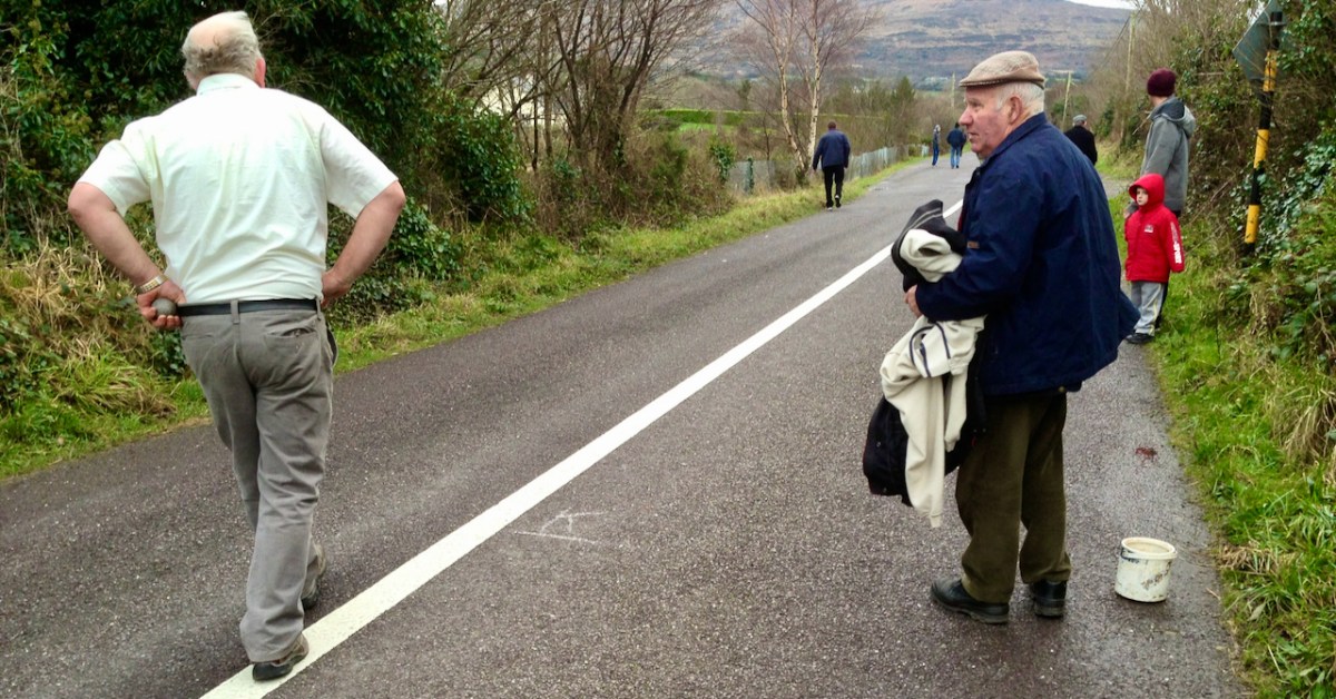
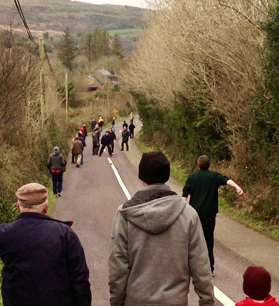
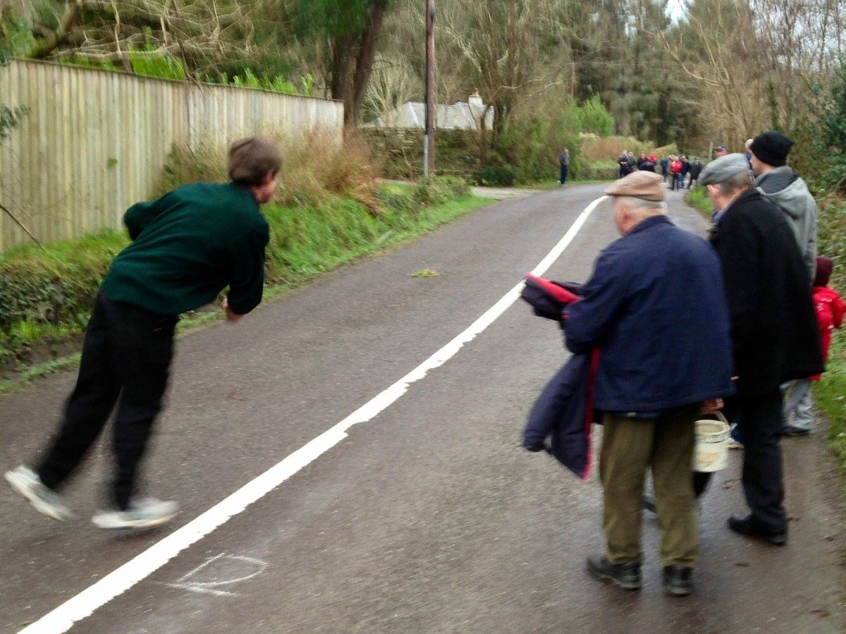
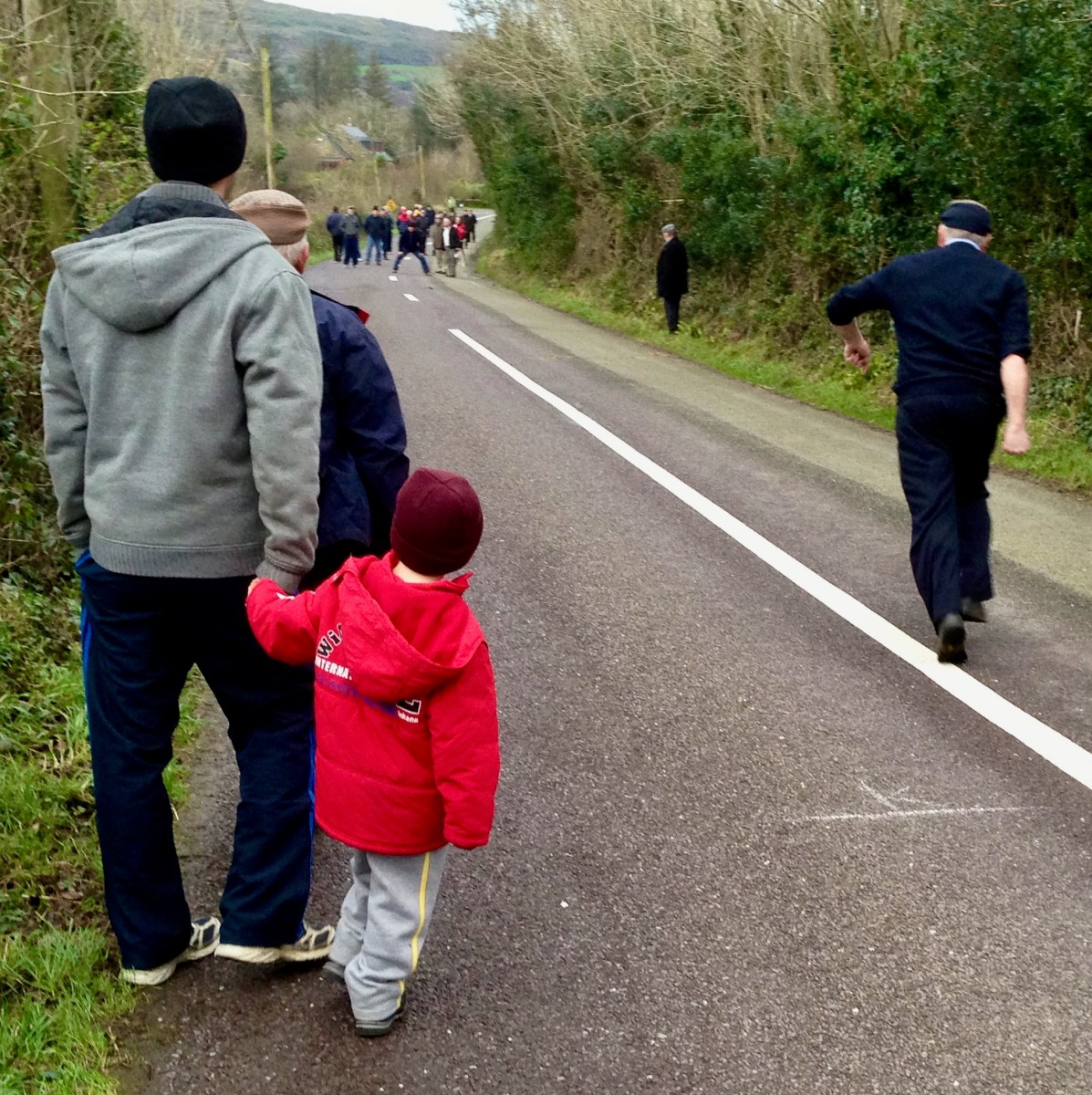
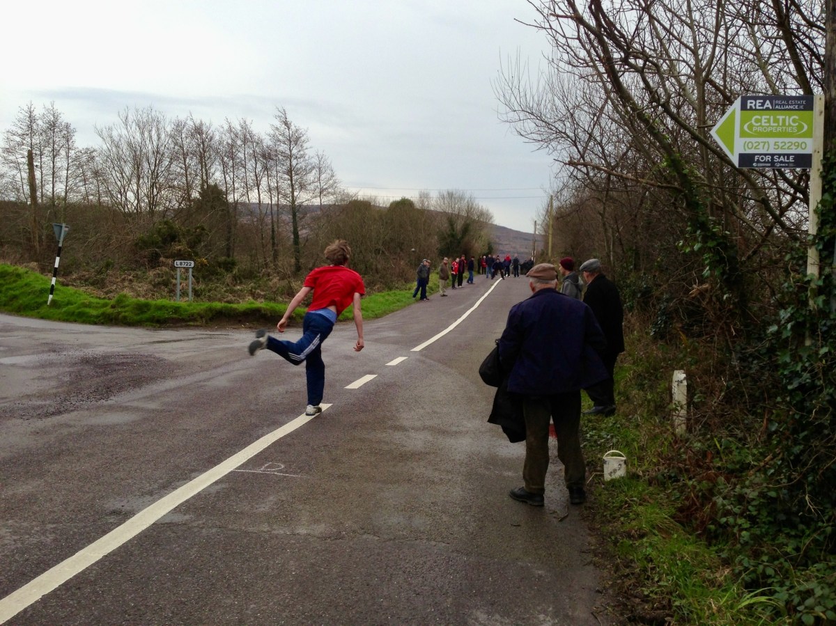
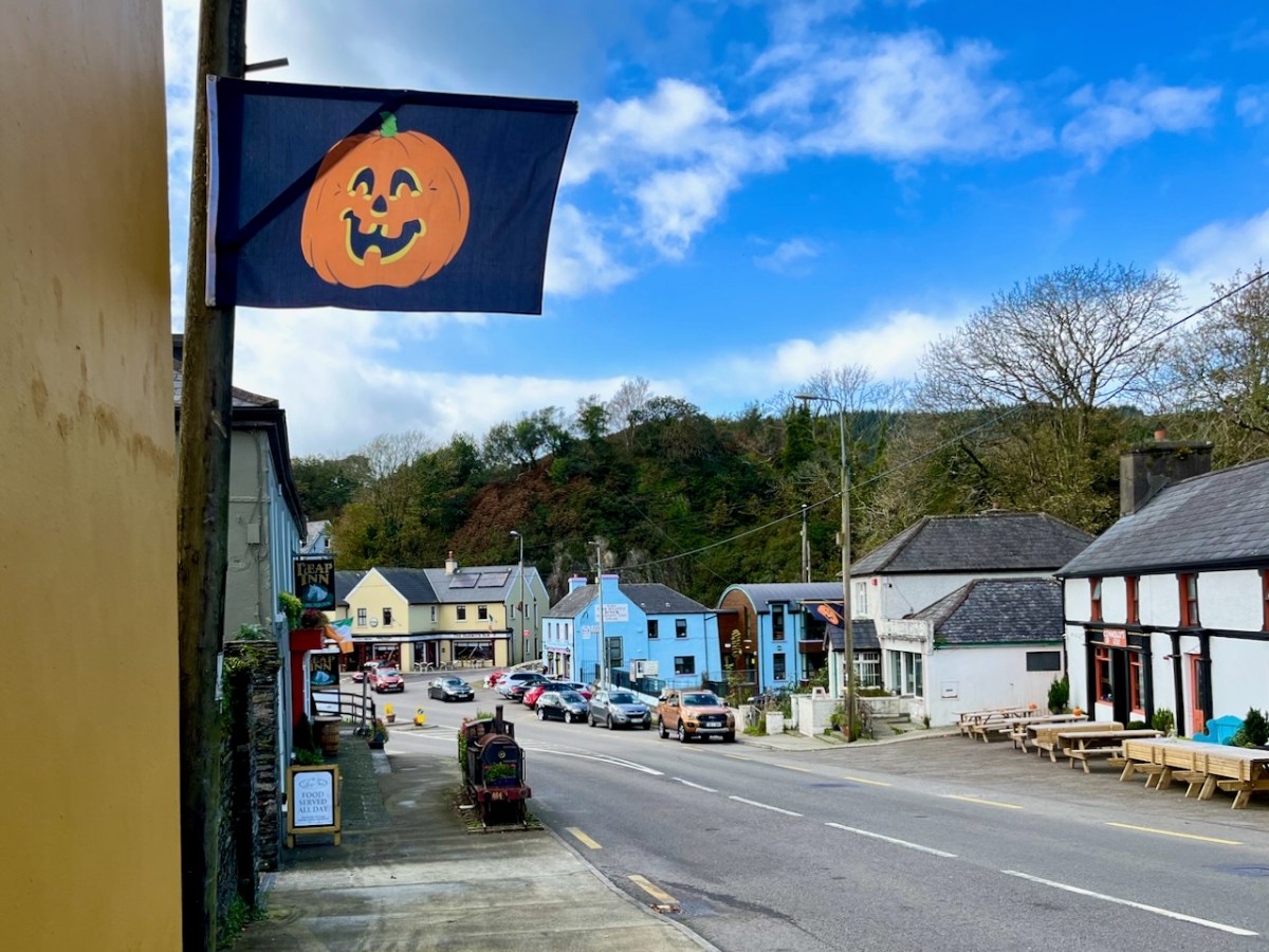
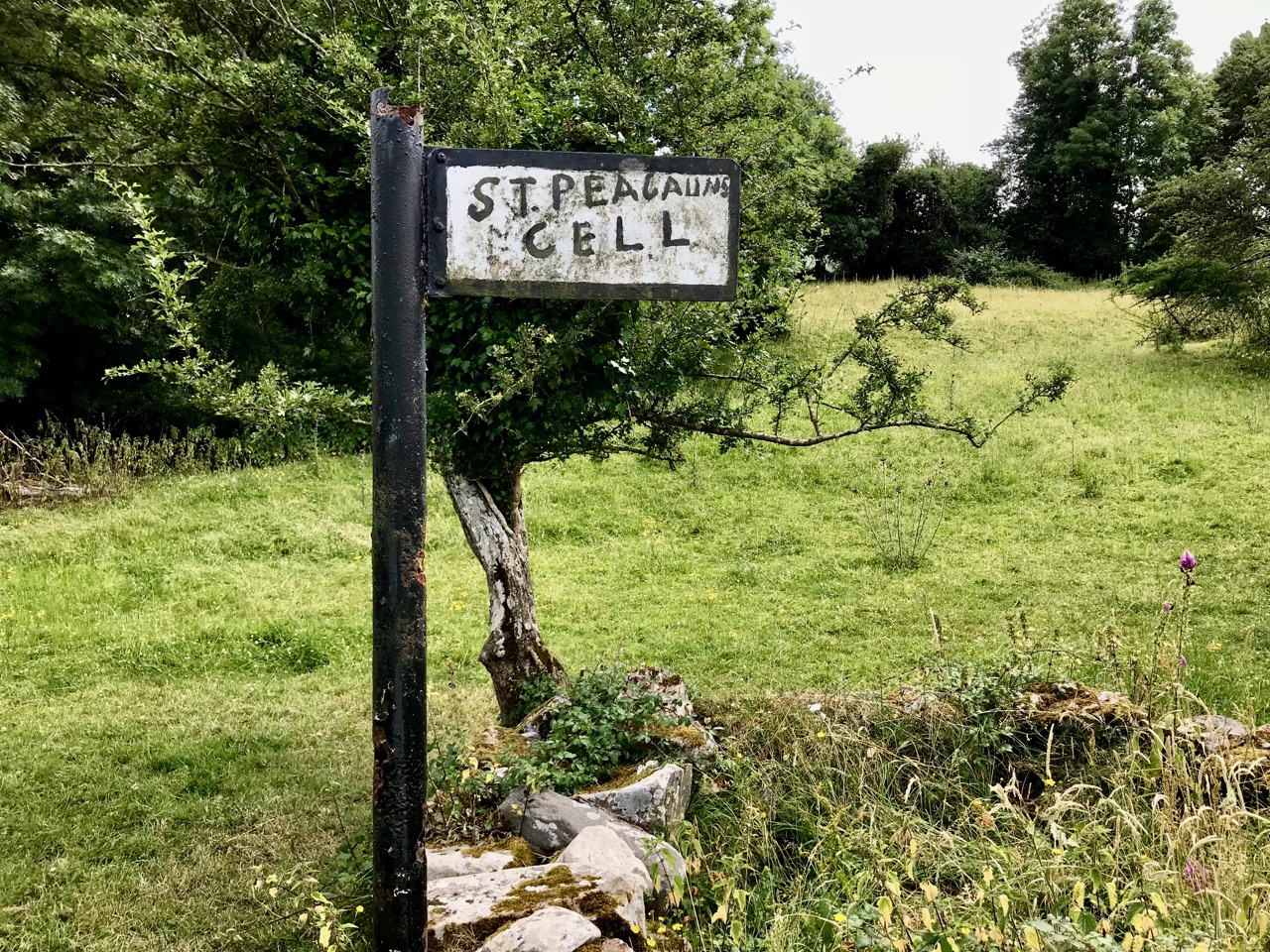
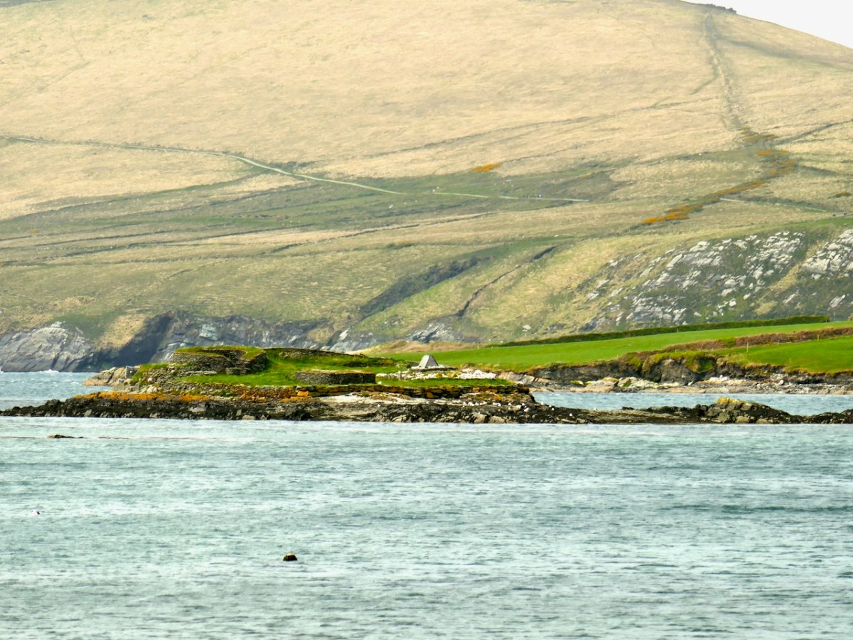
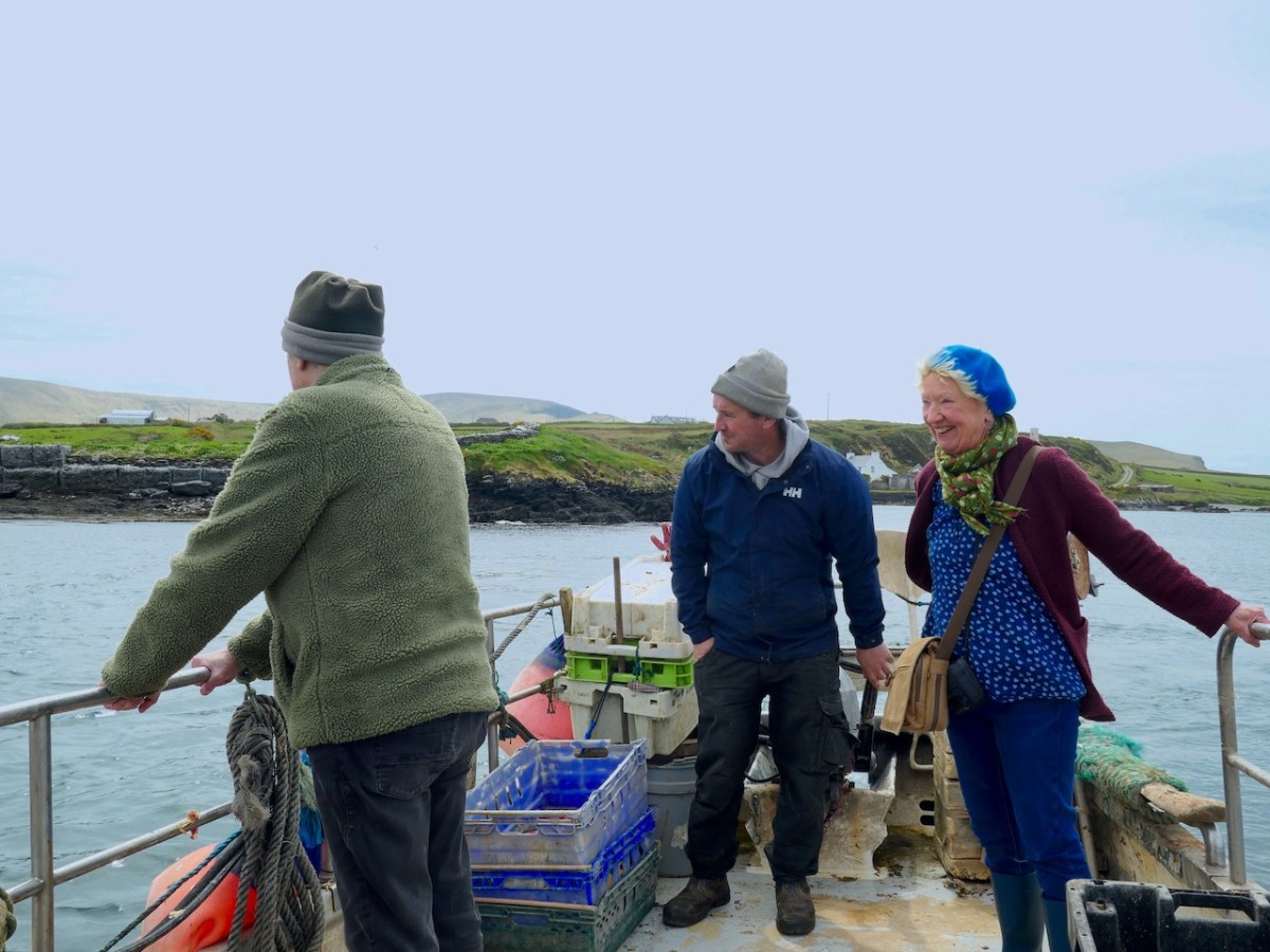
There’s a man about to ‘loft’ a bowling ball. Pronounce it Bowling, to rhyme with ‘growling’: in the Irish language it’s Ból an bhóthair – I’ve also seen the term Long Bullets used. This is a match we watched close to home – here in West Cork – all of ten years ago. It’s amazing we haven’t visited the subject again until now. In fact, it’s quite a secretive sport: if you put yourself ‘in the know’ you will be aware when it’s happening. Otherwise it’s something which you may pass by chance on any of the myriad by-roads of our county – and others.

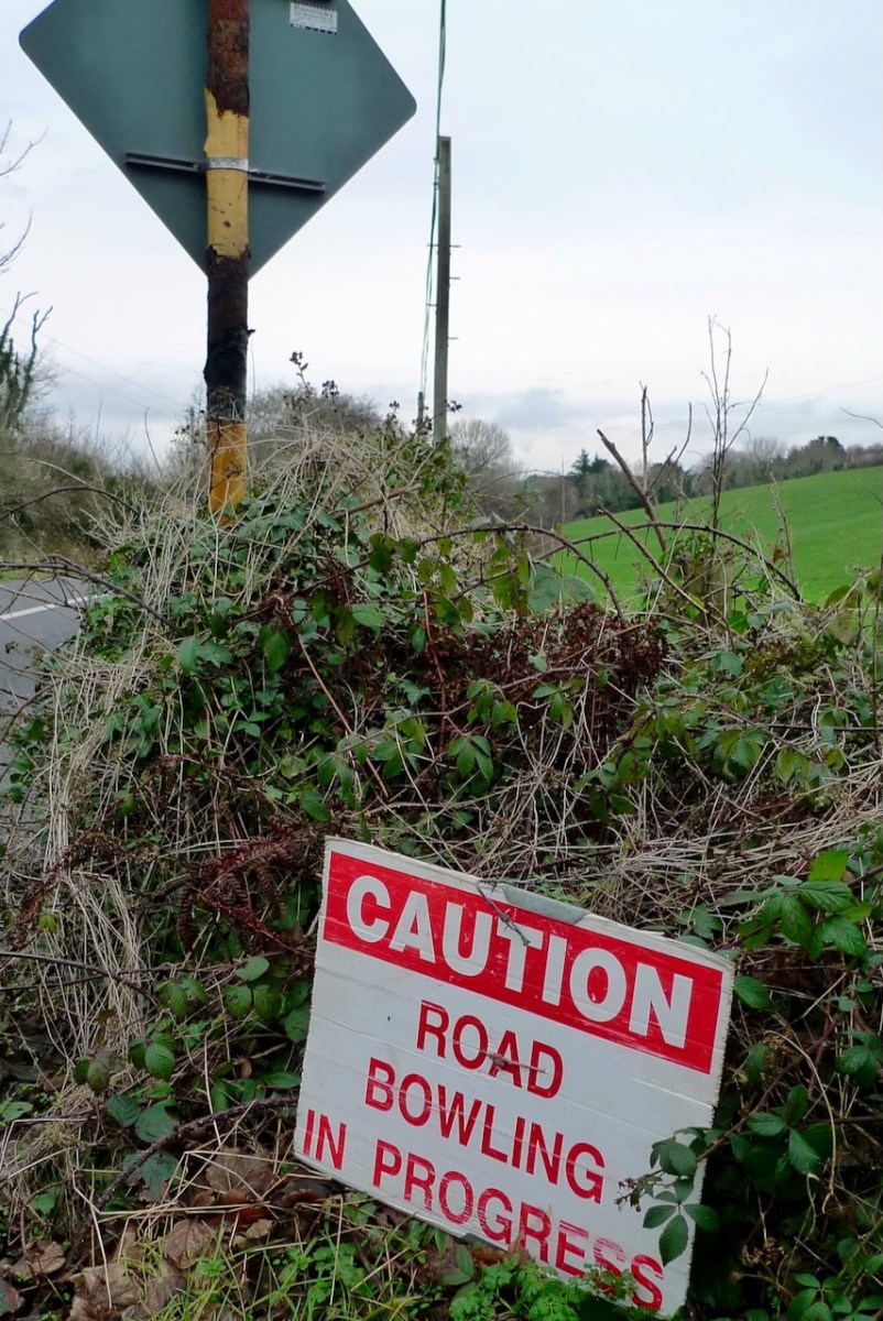
The sport is played mainly in the Counties of Cork and Armagh, although it may be encountered elsewhere in Ireland – in England, The Netherlands, Germany and – nowadays – in many of the United States. But you won’t find it on any Olympic Games timetable, and I’m not sure that it is ever televised: that would be a strange programme, as it’s challenging to follow and involves walks of many kilometres through tangled lanes and byways. Also, I don’t know whether any traffic laws are bent or broken in its pursuit.

Certainly, it has produced its champions.

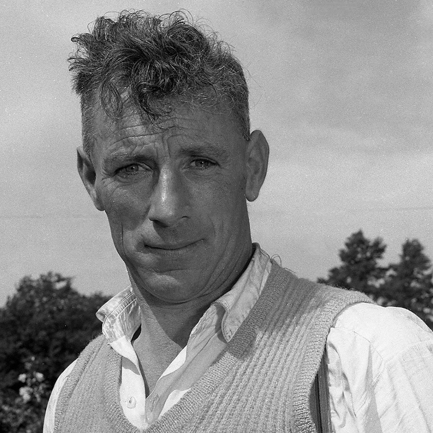
Here’s one: Mick Barry. The photo is likely to date from around 1955. Mick was All-Ireland Champion on eight occasions between 1965 and 1975. He lived a long life – 1919 to 2014. But he is best-known for having established a record – on St Patrick’s Day 1955 – for lofting a bowl on to the 100 ft high parapet of the Chetwynd Railway Viaduct just outside Cork.

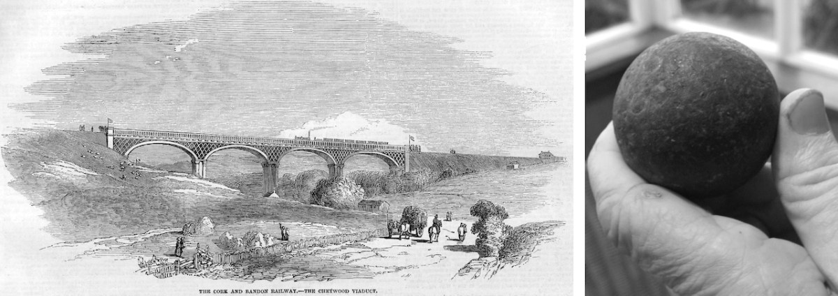
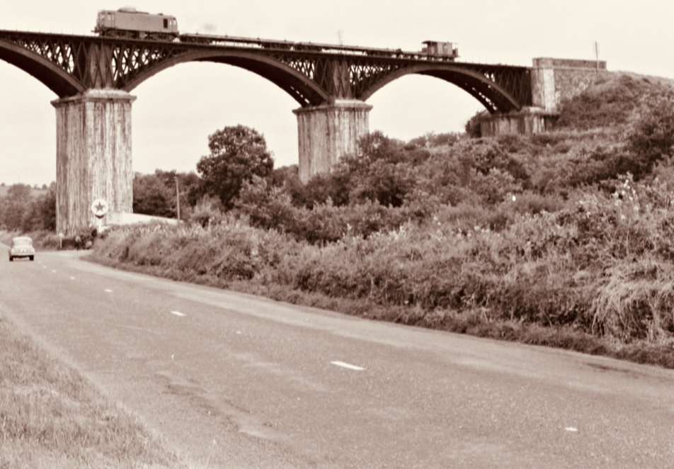
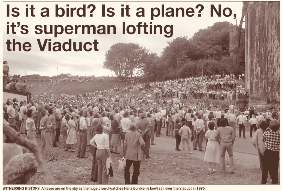
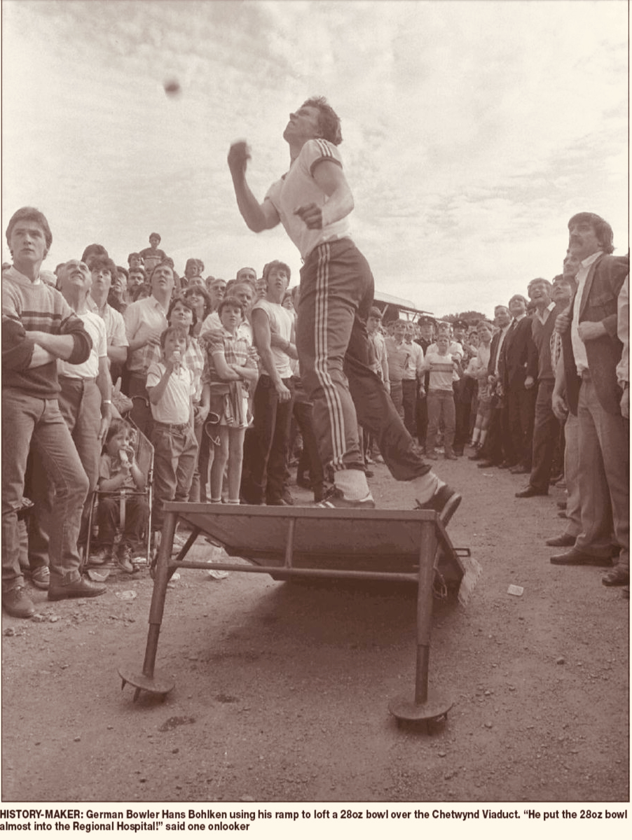
Above – the Chetwynd Viaduct in the 1960s, – after the line was closed, carrying a maintenance train, and – above that – a somewhat fanciful print of the same structure dating from a century before, together with the lead ball used by Barry. The same venue was the scene of another bowling spectacle thirty years later. In 1985 10,000 people showed up to watch a young German named Hans Bohlken loft a 28oz Road Bowl over the viaduct, using a portable ramp to improve his throw (images courtesy Cork Echo):

. . . In Irish road bowling the small iron and steel cannonball called a bowl is hurled down a 1 to 2-mile country lane. Throws can roll 250 or even 300 yards. Similar to golf, the player with the fewest throws to the finish line wins. Excitement builds as two evenly skilled players match each other shot for shot for more than a mile. Often, these memorable matches, called scores, are decided by only a few feet or inches’ distance past the finish line, both players with the same number of throws. The twists and turns of a narrow country lane, as well as the tilt of the road surface (the pitch and camber), provide a rich playing field for strategy and can spark spirited debate among the thrower, his coach and full-throated spectators . . .

WVROADBOWLING.COM

Finola drew my attention to a poem written by folk-poet Liam McGrath, who grew up in Skeaghanore, not far from us here in Nead an Iolair – and therefore as local a ‘folk’ as you could ever find. His work has been collected, but never widely published. Here is his commentary on the ancient pastime of Road Bowling:

Please dear Lord, forgive us all, for that boyish little sin,
When we dashed out from the Rosary, before that last Amen.
Could we only turn back the clock, to re-live those days of Yore,
In the Summer twilight of a Sunday ‘eve, to throw just one more score.

So clearly now each face I see, as we pass Jer Coughlan’s gate,
As the ladies from Ballydehob walked by, looking charming and sedate.
The finishing line was at Stouke cross, then a score the other way.
To stroll the streets of Ballydehob, our young hearts bright and gay.

When’re the twilight lingered on, we had many a thrilling score
’Til the last throw was decided, near Will Regan’s of Clashmore,
Sometimes we changed the venue, our choice, the old Church road.
But the skill and thrill remained unchanged, it was the bowler’s code.

A penny, tossed high in the air, a bowler called the toss.
The first bowl flew from the bowler’s hand, in a score to Raheen Cross.
From Bantry Cross to Skehanore, was also a favourite distance.
Such happy lads in the good old days, when nothing seemed a nuisance.

St Peter and St Patrick, went out for a little walk.
“What’s that iron ball, asked Peter, and who is that happy mob?”
“They are throwing a score, said Patrick, and they’re all from Ballydehob.”

I must conclude this little poem, ‘cause I know it’s getting late,
Only time for a score up Bantry Road, to Charlie Daly’s gate.
Just lofted that turn, near Berry’s house, and my wrist is feeling sore,
So I’ll down this pen, may we meet again, to throw just one more score . . .

LIAM MCGRATH – Died in Australia – 1990

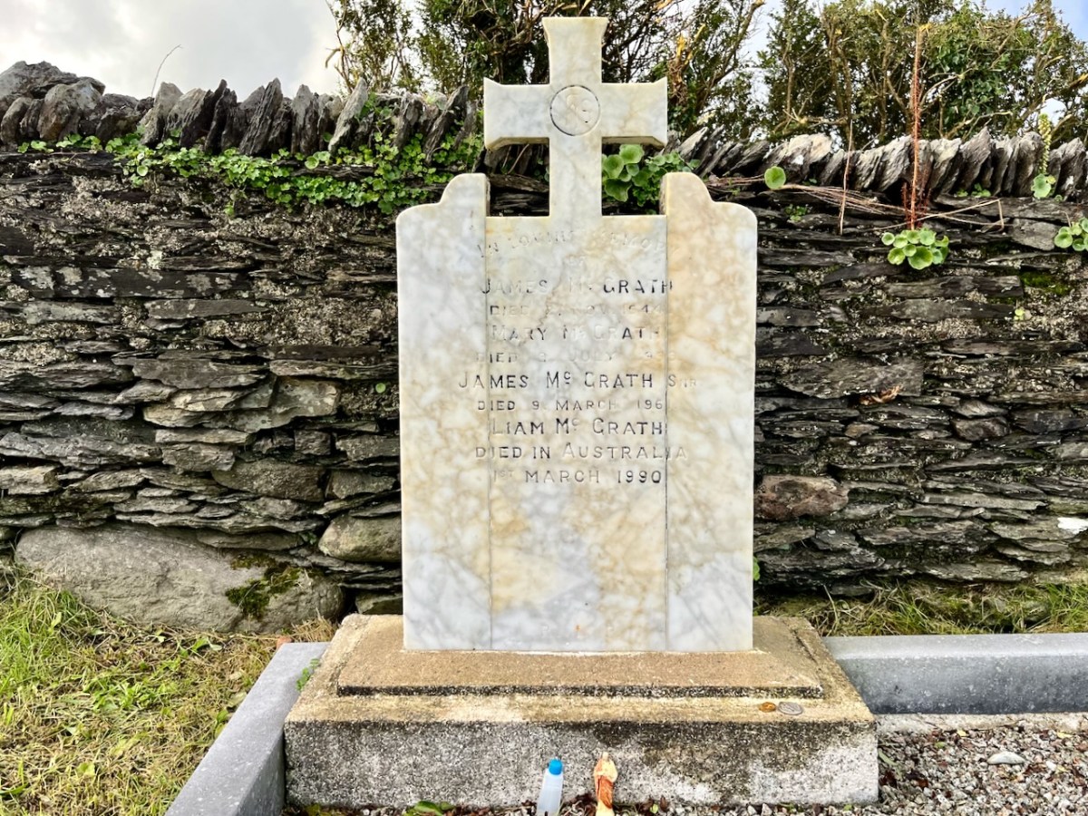
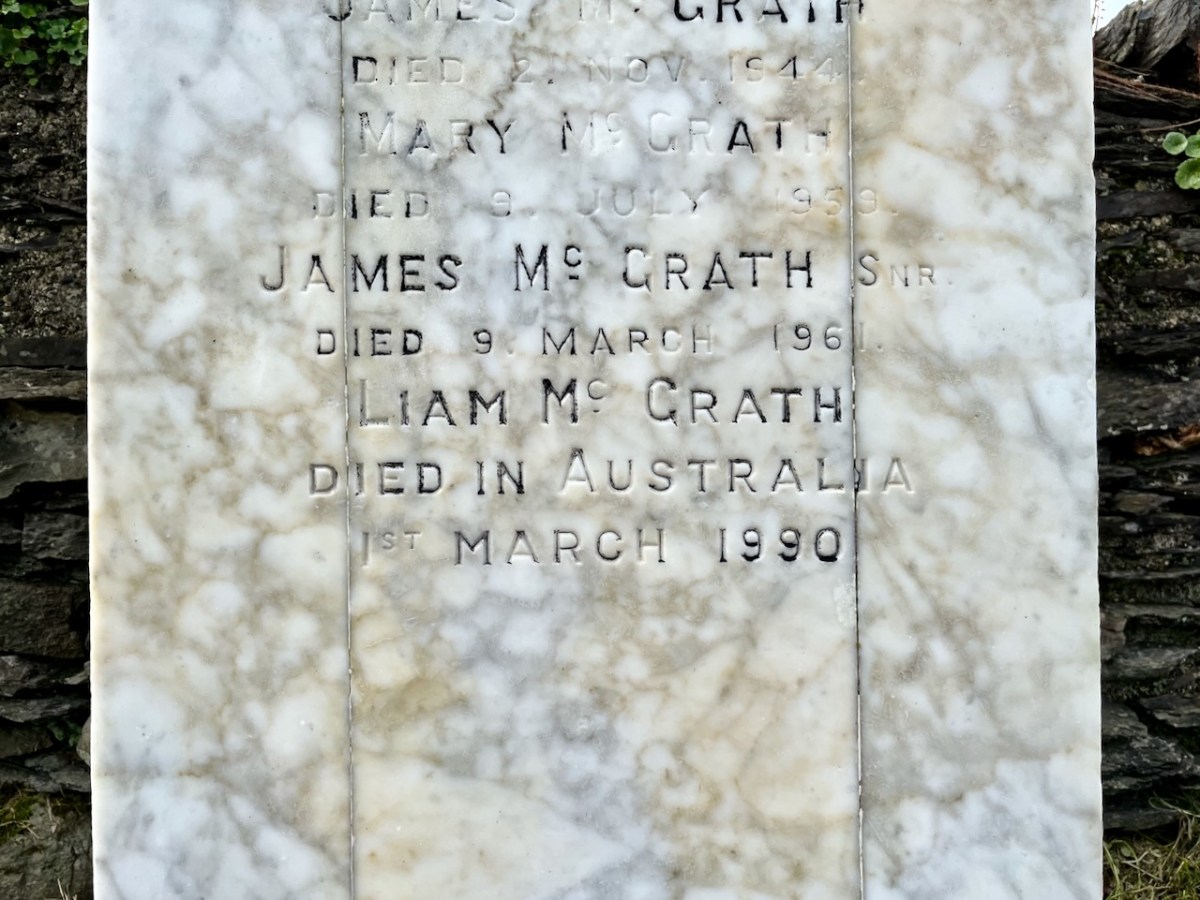
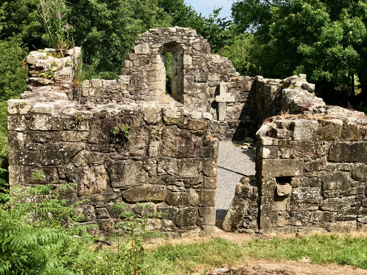
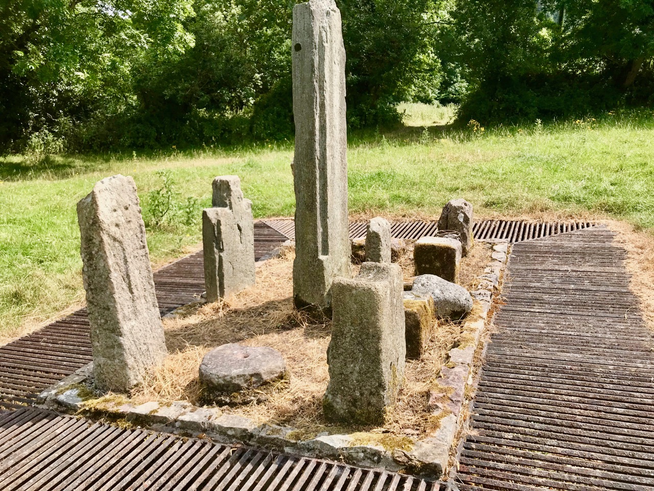
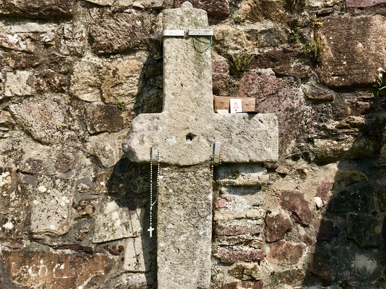
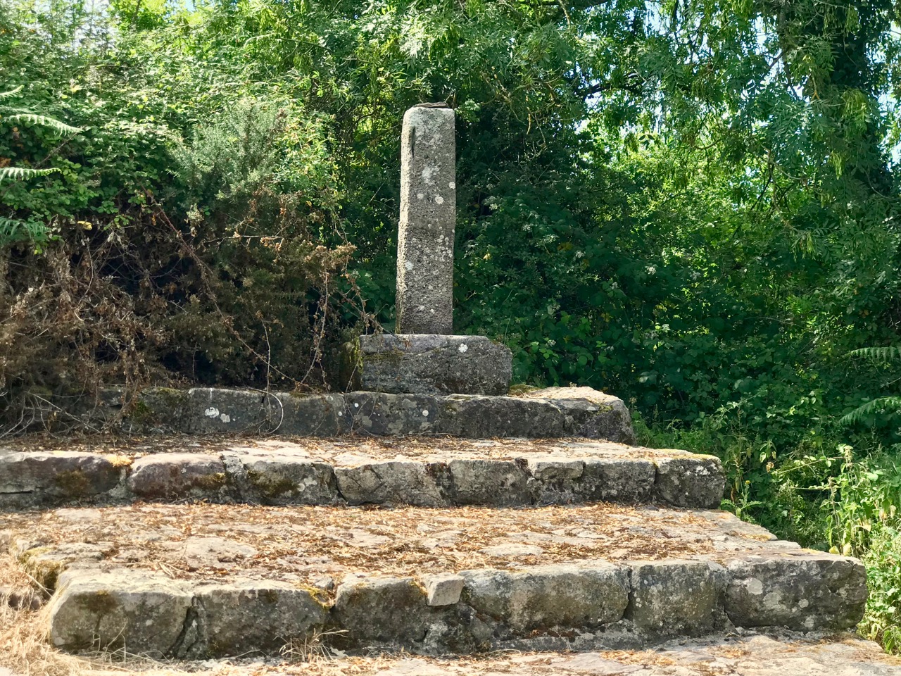
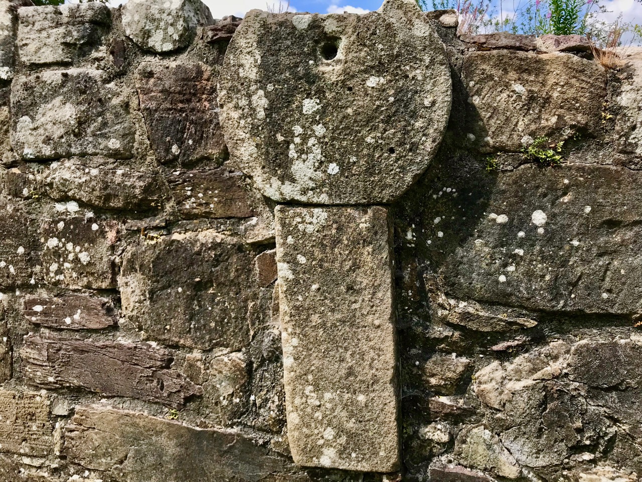
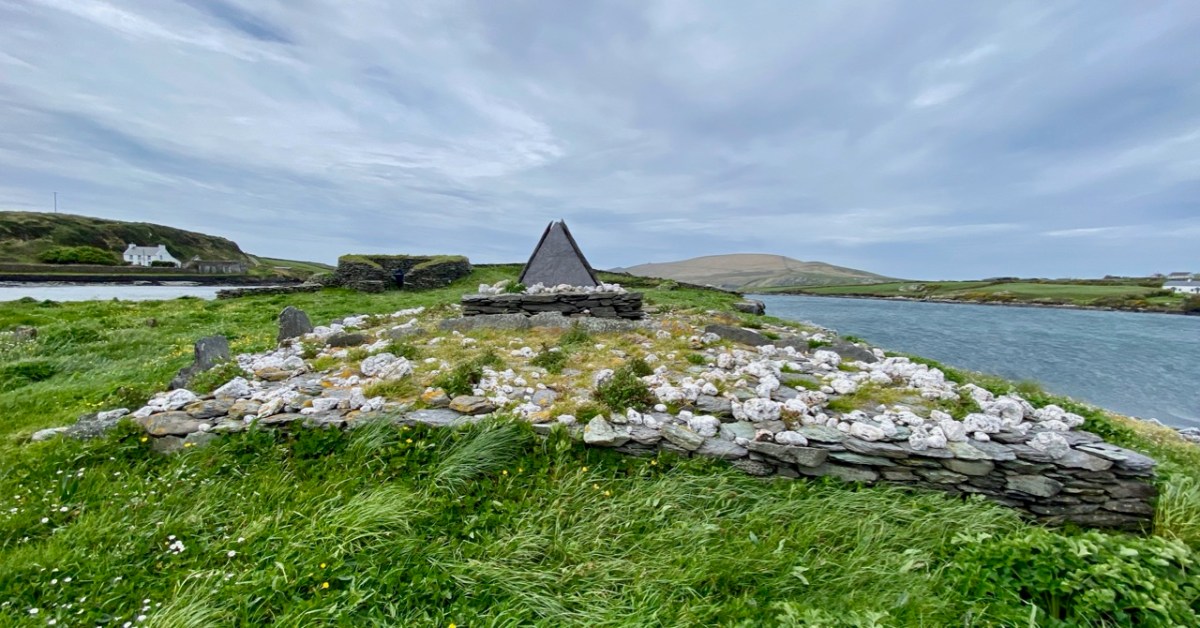
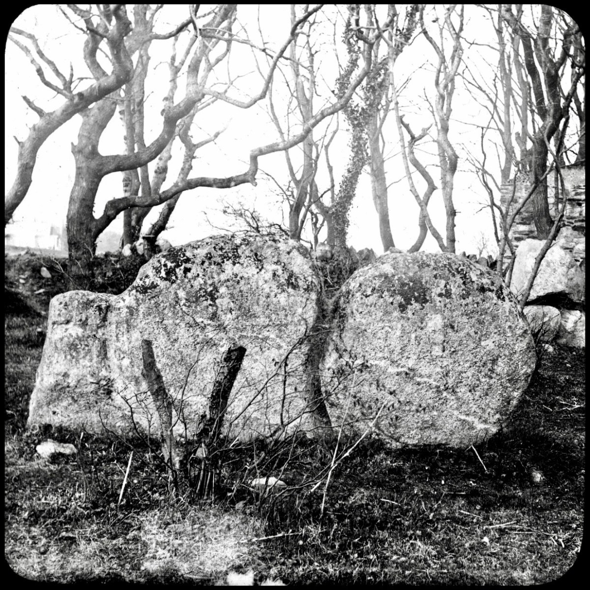
(Above) The McGrath grave in Stouke graveyard, in the next townland above our home. Liam died in Australia and his ashes are interred here.

Leap and its Scarecrows

There’s a village in West Cork called Leap – say “Lepp”. Where does that name come from? As is often the case in Ireland, it all starts with a story . . .

Tradition had it that St Patrick never went west of Leap (in Irish that’s Léim Uí Dhonnabháin, which translates literally as The Leap of O’Donovan), and that’s the sign at the entrance to the village, above. It was St Ciarán of Cape Clear who did all the converting in our part of the world: read about him here. So when The O’Donovan, pursued by British soldiers ‘leaped’ over the deep gorge which you can still see to this day, he was escaping into a much wilder country. The gorge (this is as it looks today – below) divides the West from East Carbery. So difficult was it to pass “beyond the leap” in those old days, that it was said: “beyond the leap, beyond the law”.

Apart from O’Donovans Leap, the village is celebrated today for its associations with Hallowe’en, Ghosts, and Scarecrows. And we are approaching the time of year when these phenomena come to the fore. At the present time, a few shopfronts are being decorated, but there are plenty of Scarecrows waiting in the wings for their moment to arrive!

You can see that Leap – in West Cork – will be worth a visit once the festivities are in full swing: that will be between Monday 23 October and Sunday 5 November this year. Back in 2015 we visited the Leap Scarecrow Festival and wrote this post about it (click here). Interestingly, it became the most popular post we had published up to that time – it’s had around 3,250 views since it first appeared. Have a look at it now – but also remember to go to the village of Leap at the end of this month!

St Michael

For a part of my life I lived in the west of Cornwall, looking out over St Michael’s Mount (above). Back in the 5th century, the Archangel himself appeared to fishermen on that rock. Legend has it that the Mount was constructed by giants and, also, King Arthur battled and defeated a giant there. As you all know, we have just passed Michaelmas – the day of the saint – September 29th.

There is another ‘St Michael’s Mount’ on the coast of Brittany: Mont St Michel (above, from an old lantern slide). I have mixed memories of that place, having gone there on a school trip when I was twelve: I had all my hard-saved pocket money stolen from me in one of the little winding lanes that goes up to the summit. Michael is the patron saint of high places, so expect to find him on pinnacles.

This St Michael’s church is certainly in a high place. It’s at Hammerfest in Norway, and has the distinction of being geographically the highest church in the world! (image by Manxruler)

I asked Finola if there was very much in the way of St Michael imagery in Irish stained glass. There’s a fair bit: on the left, above, is a Watsons of Youghal image of the Archangel in his role as weigher of souls. He stands at the gates of Heaven waiting for you on Judgment Day with his scales in his hand. Often, beside him, angels hold up two books: the smaller one records the names of the blessed, while the larger book is a list of the damned… On the right is our friend George Walsh’s depiction of Michael defeating Satan, who here takes the form of an impressive dragon.

This St Michael is very local to us: it’s in Teampall Church at Toormore, and is by Clokey of Belfast (Finola’s photo). Look carefully and you’ll see the Saint pinning down the fire-breathing Devil.

Also in my distant youth I was an ephemeral chaser of ley-lines: I have since thought better of it, but the idea of a straight line starting in Ireland and connecting seven St Michael sites while traversing Europe and Greece was attractive, and fleetingly convincing. Of course, there are many more Michael sites scattered around the Christian world which don’t fall anywhere near this line.

. . . As with other ley lines, no scientific evidence indicates that the alignment was planned and meaningful, making the claim pseudoscientific, but commonly reported at these sites. Physicist Luca Amendola noted that the deviation of these sites from the loxodrome that allegedly connects them ranges between 14 km and 42 km. According to legend the Sacred Line of Saint Michael the Archangel represents the blow the Saint inflicted the Devil, sending him to hell. Some also say that it is a reminder from Saint Michael that the faithful are expected to be righteous, walking the straight path . . .

Wikipedia

It’s nice to see that the phenomenon starts (or finishes) at Skellig Micheal, off the coast of Kerry (pic below courtesy of OPW):

Here’s an interesting view of the three somewhat feminine Archangels painted by Francesco Botticini in 1470. Michael is on the left. With them is Tobias who, in the popular Biblical tale, overcomes obstacles as he and his heavenly guardians set out to discover a cure for his father Tobit’s blindness. They are successful, for Tobias returns with a cure for his father as well as a wife!

I couldn’t resist this wonderful image of a St Michael’s site (from Wikipedia). It is the tenth-century Sacra di San Michele on Mount Pirchiriano in Italy. It also happens to be on the Saint’s ley-line!

I’ll finish this little review of St Michael where I started – off the coast of Cornwall. This 1920s postcard of the Mount, from a painting by A R Quinton, sums up the romantic image which I still carry from my days lived on that coast.

Péacáin Revisited

This was the scene in the Working Artist Studios, Ballydehob, on Friday evening. It was the launch of a brand new book by our friend Amanda Clarke: Holy Wells of County Cork. That’s Amanda, above, in the centre, with Finola on her left. Regular readers will know that we share many adventures with Amanda and Peter, and we were so pleased to see the successful fruition of her years of research with this outstanding volume, exquisitely designed by Peter, now available to purchase online, and in bookshops. Finola wrote about this venture last week. I thought I would indirectly celebrate it today by reviving a Roaringwater Journal post from five years ago, about one of our own expeditions that included a visit to a holy well.

Once again we followed in the footsteps of Amanda and Peter: they had visited the Glen of Aherlow in County Tipperary and pointed us to St Berrehert’s extraordinary site at Ardane which I described in this post. Not far away is another site, equally remarkable, and related to St Berrehert’s Kyle in that they were both restored by the Office of Public Works in the 1940s. They are also both very easily accessible in a few minutes from the M8 motorway at Cahir.

We were delighted to be travelling again through the beautiful Glen in the shadow of the Galtee Mountains (above) as we searched out a boreen that led us down to the railway. We parked and crossed at the gate, watching out carefully as this is the Waterford to Limerick Junction line used by two trains a day (except on Sundays!)

Once across, we were in an idyll. It’s a private lane, running alongside a gentle stream, but the Bourke family allow visitors to walk (as they have done for centuries) to the old church, the cell and the holy well of Saint Péacáin. Ancient stone walls line the way, and trees overhang, shading the dappled sunlight in this most exceptional of Irish seasons. We met Bill Bourke, who regaled us with tales of his life spent mostly far away from this, his birthplace – but who returned to rebuild the family home and to enjoy perpetual summer in what is, for him, the most beautiful setting in the world. He also told us of the crowds who used to come to celebrate St Péacáin at Lughnasa – 1st August – paying the rounds and saying the masses.

In her monumental work (it runs to over 700 pages) The Festival of Lughnasa – Oxford University Press 1962 – Máire MacNeill points out the harvest feast day was such an important ancient celebration that it survives as the focus of veneration of many local saints who would otherwise have been known for their own patron day, and she particularly mentions Tobar Phéacáin in this regard: a place well away from any large settlement where the great agricultural festival was so critical to the cycle of rural life.

The rural setting of St Péacáin’s Cell can be seen above, just in front of the trees; the church and the well are nearby. MacNeill provides a description of Tobar Phéacáin and includes some variant names:

. . . Tobar Phéacáin (Peakaun’s Well), Glen of Aherlow, Barony of Clanwilliam, Parish of Killardry, Townland of Toureen . . . On the northern slope of the Galtee Mountain at the entrance to the Glen of Aherlow and about three or four miles north-west of Caher there is a well and ruin of a small church. About a mile beyond Kilmoyler Cross Roads a path leads up to it . . . In 1840 O’Keefe, of the Ordnance Survey team, reported that the old church was called by the people Teampuillin Phéacáin, or just Péacán . . .

. . . The well, which he described as lying a few perches south-east of the church was called Peacan’s Well or Tobar Phéacáin. It was surrounded by a circular ring of stonework. He stated: ‘The pattern-day still observed at this place falls on the 1st of August, which day is, or at least until a few years since, has been kept as a strict holiday.’ Devotions were also, he said, performed there on Good Friday . . .

A hundred years after O’Keefe wrote this, the church ruins were tidied up by the Office of Public Works. As at St Berrehert’s Kyle, it seems there were numerous carved slabs on the site and remnants of high crosses, implying a significant ecclesiastical presence here. All these have been fixed in and around the church ruin for safekeeping, and in an intelligent grouping. It’s wonderful to be able to see such treasures in the place they were (presumably) made for, and to experience them in such a remote and peaceful ambience.

McNeill continues:

. . . Nearby is the shaft of a cross which tradition avers was broken in malice by a mason who was then stricken with an inward pain and died suddenly as a punishment for his sacrilege . . . O’Keefe was told a story of a small stone, 6 or 7 inches long and 4 or 5 in depth, having ten little hollows in it and resting in a hollow of the ‘altar’ of the old church. Christ, or according to others St Péacán, asked a woman, who had been churning, for some butter; she denied having any and when the visitor departed she found the butter had turned into stone which retained the impression of her fingers . . . Nuttall-Smith speaks also of a cave where the saint used to practice austerities . . .

The carved fragments are quite remarkable and are in all likelihood well over a thousand years old. I have yet to see anywhere in Ireland – outside of museums – which has such an extensive collection of fascinating medieval antiquities as these sites in the Glen of Aherlow. Here you can also see cross slabs and a sundial said to date from the eighth century.

Nuttall-Smith’s ‘cave’ – quoted by MacNeill above – is likely to be St Péacáin’s Cell, set in a field on the far side of the river. This was probably a clochán, or beehive-hut, of the type once used by anchorites. It is protected by a whitethorn tree, but was quite heavily overgrown on the day of our visit. We could make out the ballaun stones inside, said to be the knee prints of the Saint who made his constant devotions there. Amanda – in her post on the holy well – reports that Péacáin would also stand daily with arms outstretched against a stone cross, chanting the psalter.

McNeill discusses the significance of weather at the August celebrations:

. . . Paradoxically for a day of outing so fondly remembered, no tradition of the Lughnasa festival is stronger than that which says that it is nearly always rainy. No doubt this has been only too often experienced. Saint Patrick’s words to the Dési: ‘Bid frossaig far ndála co bráth’ (Your meetings shall always be showery) must be as well proved a prophecy as was ever made. Still there must be more significance in the weather beliefs than dampened observation. Certainly it was expected that rain should fall on that day, and sayings vary as to whether that was a good or bad sign . . . There are a few interesting beliefs about thunder, which was also expected on that day: the loud noise heard at Tristia when the woman made rounds there to have her jealous husband’s affection restored; the prophecy that no-one would be injured by lightning at Doonfeeny, a promise also made by St Péacán . . .

The holy well is tucked away in a stone-walled enclosure hidden under the trees on the edge of the field which contains the Saint’s cell. It is also a tranquil place, obviously still much visited: the water is crystal clear, refreshing and will ensure protection from burns and drowning.  This is a magical setting to complete our day’s travels in the beautiful Glen of Aherlow.

Illaunloughan

We embarked on a sea voyage in order to explore the island of Illaunloughan, which is off the coast of Kerry not far from Portmagee. To the north is Valentia Island. It is said that this tiny landfall – only 0.3 acres in area – is the smallest of Ireland’s offshore islands which contain medieval monastic remains.

Our sea journey was on board an aluminium fishing boat – there it is, below, with the island of Illaunloughan in the background.

And there’s the full crew (two pics below): myself, Amanda, Peter, David the boatman and Finola. We were – as you might guess – on an archaeological expedition in Kerry, which included the search for a holy well on this island.

You can see Portmagee in the background of the photo above. It’s not a long journey: just a few minutes from the harbour there. In fact it is said that on a couple of tidal events during the year you can actually walk across to Illaunloughan, but the voyage was far more exciting for us!

This is the view of the island as the boat approaches it: you can see various of the archaeological features. It doesn’t take long to explore – but it’s fascinating. A full survey of the surviving monuments was undertaken by Jenny White-Marshall and Claire Walsh in the 1990s: this resulted in the publication Illaunloughan Island: An Early Medieval Monastery in County Kerry, Wordwell Press, 2005. Here is a synopsis:

 . . . The gable-shrine is one of a small group of reliquary shrines that occurs at the western end of the Iveragh Peninsula: similar examples are found at Killoluaig, Kilpeacan and Killabuonia. These shrines or specially marked graves are generally ascribed to the founder. The base of the gable-shrine at Illaunloughan consists of a large terraced mound, 9m by 7.6m, which rises to a height of 1.5m. The mound is partly built on an area of rock outcrop which was levelled off on its southern side with soil, stone and pea-gravel. Vertically set kerb-stones and masonry walling were placed along the edges to retain this fill; the mound has been eroded on the northern side by the action of the sea. White quartz stones of varying sizes were liberally scattered over the mound. At its western edge stone steps lead up to an area of rough paving that surrounds a rectangular drystone structure on which stands the slab-shrine. The end-slabs are missing. When the side-slabs were removed an underlying core of pea-gravel and white quartz was exposed. This sealed two small, irregularly shaped, stone-lined cists, each of contained neatly stacked exhumed human bones. A minimum of three individuals, all male, is represented in this skeletal assemblage which comprised fragments of the skulls of two individuals, a single mandible, and several long bones. Large numbers of scallop shells and white quartz pebbles were placed both within and around the cists.
The eastern quadrant of the gravel mound was evidently planned as a cemetery for monks who wished to be buried close to their saints, for at least five bodies were interred here. These were laid side by side, and were extended inhumations oriented from east to west, with the heads to the west.
Following excavation, much of the shrine platform was dismantled. This revealed three rock-cut graves, all oriented from east to west, sealed beneath the mound material. The graves, located on the north-eastern, the southern and the western sides of the shrine, clearly predate the construction of the mound and shrine. Fragments of human bone were recovered from two of them, including a sizeable part of a shattered femur, found at the western end of the grave. No bone was recovered from the third grave. It is hoped to determine, through trace element analysis, whether the bones in the earlier graves represent parts of the individuals translated into the cists beneath the gable-shrine. The evidence so far collated on the Illaunloughan shrine indicates that it is a multiperiod structure. The presence of a sacred focus (an earlier shrine?) is strongly suggested by the earlier graves, though no trace of any such structure survives. C14 (AMS analysis) dating of bone from the cists beneath the gable-shrine has yielded a date in the early seventh century for one individual and the middle of the eighth century for a second. Half-scallop shells, present in the fill of the cists and on their stone lids, were clearly of some significance to those who interred the translated bones. Some of the scallop shells from the shrine have been perforated and they may have been suspended from cords. The scallop is, of course, the emblem of St James, whose remains were ‘discovered’ in a field of shells in Compostela, north-western Spain, in AD 813. The shrine at Compostela rose to prominence as a place of pilgrimage in the eleventh century (Harbison 1991, 22). This may be further evidence of refurbishment of the shrine at a late period . . .

National MoNuments Historic Environment Viewer

Two views of the gable shrine (upper photographs) together with a scaled drawing from the National Monuments Service (above). This distinctive site, with its embellishments of white quartz pebbles and slate capping, suggests an internment of some great importance – probably a local saint. The gable-shrine was reconstructed after excavation and is now complete. Note from the description above (National Monuments Service) that three rock-cut graves were revealed under the present structure – empty – and the suggestion has been made that the later shrine was constructed to ‘translate’ the earlier burials because of the significant status of those who were buried there.

The gable shrine seen with the bridge from Portmagee to Valentia Island in the background. In front of the shrine are (probably much later) grave markers. It was common practice to put burials close to anciently sacred sites: in fact, up to the 20th century Illaunloughan was used as a cillín for the burial of unbaptised infants and as a graveyard by local people.

This plan of the island (National Monuments Service) shows the principal features: the gable shrine, an oratory, a stone hut and a well. It also serves to show how small the island actually is – yet it supported a community of men and children (one of the three burials in the shrine was seven or eight years old). Their main diet is said to have been fish and seafowl based. The drystone oratory (church) was excavated and radiocarbon dated to the 8th century. The excavations of the surrounding land revealed that a range of domestic and industrial activities were undertaken, including fine metal-working, bone-working and cereal processing (Irish Heritage News 2018).

The pics above show the oratory, a stone hut and the well. The latter would have been a necessity for any permanently based community on the island: Amanda’s particular interests in holy wells made her wonder whether this one had any local folklore or dedication.

Further areas of worked stone marked out enclosures or terraced areas which would have had some significance to the community based there. After excavation, the island’s features have been returned to good structural condition. The site suffered some serious vandalism in fairly recent years. Fortunately, its general lack of access has provided some protection.

This felt to us a very special site, and we were privileged to be able to visit it. If you read the book about it, you will see that the thinking of those who carried out the excavations was that it was active from the 7th to the 9th centuries. In more recent times this dating has been questioned – possibly because radio-carbon dating results have been revised since those findings. It is now being suggested that use of the monastic site may have continued into the 11th century: we have to note that a Hiberno-Norse coin of 1020-35 was found under the paving of the plinth surrounding the gable shrine. White-Marshall and Walsh suggest this could be evidence for the use or maintenance of the shrine in the 11th century, while another commentator – Cormac Bourke (in reviewing the excavation report) – has suggested the continuous use of the site into that period.

For Amanda, the dedication of this site to a local saint would be important. Two saints named Lochan appear in the Martyrology of Tallaght (c. AD 800); one could have been the founder. It’s also worth noting that Saint Finnbar of Cork was baptised Lochan: he was educated at Kilmacahil, Kilkenny, where the monks named him Fionnbharr (white head) because of his light hair. His dates in any case do not fit with Illaunloughan: Finnbar was born around 550.

The island of Illaunloughan is low-lying, and at some risk of future indundation if climate change leads to drastic sea-level rise. We were fortunate to get the opportunity to visit this magical place, thanks to our local boatman – who bore us safely back to dry land!

PS Many thanks to Amanda ClarkeHoly Wells of Cork & Kerry – for dreaming up this remarkable adventure. And for finding us a boatman!

Megalith or Monstrosity?

Some intriguing arrangements of stones here – and some enigmatic reporting of their significance as history. We are a long way from West Cork – in fact, over on Ireland’s east coast, among the fine estates of Killiney. We can’t help but search out examples of archaeology wherever we go, and a red dot on the Historic Environment map is always a good starting point, as is anything with an enigmatic name.

In this case, the red dot is just to the left of the ‘Pagan Temple’ at the top of the 25″ OS map – but look at all the other intriguing names in the locality!

Here’s a close up -extracted from the 1888 OS map, highlighting the site that we are looking at today. With Templeville, Druid Lodge, Druid Hill and Stonehenge as neighbours, the Pagan Temple demands a closer look!

It was last week’s subject – the writer and photographer Thomas Holmes Mason – who directed us to this County Dublin location. As a significant producer of picture postcards, Mason has left a large body of work, even though many of his photographic plates were destroyed in a warehouse fire in 1963. The National Library of Ireland houses a comprehensive collection, and I am grateful to them for this image, above, which shows an intriguing stone formation on the Killiney ‘Pagan Temple’ site. It is referred to as The Sun and Moon stone by some antiquarians, and the following description appears on the current Historic Environment Viewer:

DU026-010—-

Scope note

Class: Megalithic structure

Townland: KILLINEY

Description: “. . .This enigmatic structure is located within an area enclosed by a hedge on top of Druid Hill. In the E side of the enclosure are three irregular granite boulders that form a façade behind which is a larger boulder containing a setting of stones that form a seat. To the W of this are two large granite slabs set on their long axis. There are tool marks present. This structure appears to be a folly but it may incorporate the remnants of an earlier monument . . .”

Archaeology.ie Historic Environment Viewer

The Archaeology.ie write-up is accurate. In addition to the ‘chair’ (which Finola is elegantly modelling while trying not to sit in a puddle!) there are two further irregular granite boulders – but one of them (detailed in the T H Mason photograph) looks like two circles – hence ‘sun and moon’ – but is in fact a single boulder, here seen from the ‘front’ face:

The right-hand side of this stone has some marks carved on it (by human hand) – possibly part of a large circle that outlines this half, while the vertical ‘groove’, central to the boulder, also appears to have been chased out. It’s worth noting as well, perhaps, that there are two small holes drilled on the back face of this stone, one on each side but not aligned on any centre. Additionally, there is also a small hole drilled on the back face of the second stone:

This article – by William Wakeman – appeared in The Journal of the Royal Society of Antiquaries of Ireland December, 1896. It introduces an element of scepticism, which we should perhaps explore. The excellent Killiney History website has collected together a number of writings and observations about this site.

John Dalton writing in 1858 seems quite satisfied of the antiquity of the Judgment Seat. The Gazetteer of Ireland states “A well-preserved Druidical circle with its priests’ seat and its sacrificing stone, occur within a carefully kept enclosure, behind Mount Druid demesne, and near the Martello Tower, but is made accessible by the proprietor to respectable visitors.”

Killineyhistory.ie

William Wakeman, a well known antiquarian of the last century, appears to have been the first to condemn these remains as spurious. “Formerly it was enclosed within a circle of great stones and a ditch. The circle has been destroyed and the ditch so altered that little of its original character remains. The seat is composed of large rough granite blocks and, if really of the period to which tradition refers it, an unusual degree of care must have been exercised for its preservation. The stones bear many indications of their having been at least rearranged at no very distant time. Small wedges have been introduced as props between the greater stones. The right arm is detached from the other part, to which it fits but clumsily. The whole, indeed, bears the appearance of a modern antique, composed of stones which once formed a portion of some ancient monument.”

Killineyhistory.ie

These photographs were taken by William Frazer in 1898. The arrangements of stones at that time are very similar to what we see today – well over a century later – but with far less growth of ground cover.

Above: Druid’s judgement Seat, Killiney – from Library of Ireland archives.

Elrington Ball [1863–1928] confirms this view of the Druid’s Judgment Seat. The stones of which it is composed formed part of a Sepulchral memorial dating from very early times, consisting of three small cromlechs, surrounded by a circle of upright stones about 135 feet in diameter, and, at the time of its first attracting attention, in the 18th Century when everything prehistoric was attributed to the Druids or the Danes, it was assumed to be a Pagan Temple . . . Near the circle was discovered at the same time an ancient burying place, and some stones with curious markings, which are still to be seen. The burying place was of considerable extent, the bodies, which were enclosed in coffins made of flags, having been laid in a number of rows of ten each . . .

Killineyhistory.ie

Finally Woodmartin [Traces of the Elder Faiths of Ireland 1902 Vol 11] makes the sweeping statement: the entire structure leaves the unmistakeable impression of very modern fabrication, and it is a mere clumsy attempt to gull the public . . . As seen to-day these relics of antiquity present rather an unlovely picture, in an obscure and ill-kept corner, surrounded by an unsightly hedge, where weeds and brambles share their ancient sanctity; they seem to arouse but little interest . . .

Killineyhistory.ie

Today, the jury seems to be out on what we are looking at on this site. Time has undoubtedly changed the shape of things: wouldn’t we like to go back a while and see the burying place of considerable extent with all those . . . bodies, which were enclosed in coffins made of flags, having been laid in a number of rows of ten each . . . ? But we do appreciate that a former landowner must have donated the land to excite our interest!

A good tailpiece from William Wakeman