Into the Heartland

Elphin Windmill

Because we live on it, sometimes we get carried away by the notion that The Wild Atlantic Way represents the best that Ireland has to offer. A recent trip to the midlands – the Heartland of Ireland – convinced us (if we needed it) that there is no part of Ireland that isn’t beautiful and full of fascinating things to do and see. (Like the Elphin Windmill, Co Roscommon, above.)

Parked at Coolnahay

We spent a lot of time along rivers and canals! 

Robert explains the background and purpose of our trip in his post, Travel by Water. I knew very little about canals before I met Robert and it’s been eye-opening to learn about the history and the sheer extent of Ireland’s inland waterways. We spent a lot of time exploring the canals – walking and driving – and enjoyed it all tremendously.

Boa Island figures

Boa Island on Lough Erne, Co Fermanagh, is home to these mysterious carved figures. Lower left: heads on a medieval church in Kilmallock, Co Limerick. Lower right: a contemporary sculpture celebrates the mythical Finn McCool, in Keshcarrigan, Co Leitrim

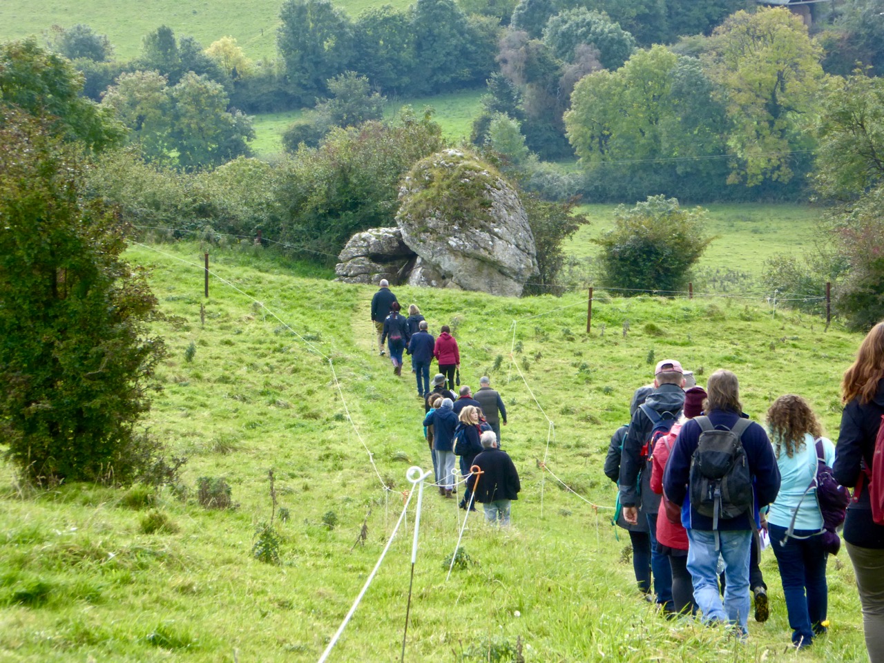
But wherever we went there were always other places luring me away – tower houses and fortified houses, churches and graveyards, friendly villages and colourful houses, stained glass windows and prehistoric sites. We drove along roads where we counted ring forts in every field. We explored ancient graveyards and we found a Holy Tree. We visited two sites we posted about last week, the Corlea Iron Age Trackway, and the Hill of Uisneach.

Holy Chestnut

The Holy Tree. A local man we met called it a ‘holy show’ and it certainly had some very questionable items mixed in with the statues and offerings

It’s autumn now, and, while we do experience a change of colour here in West Cork, it’s really in the midlands that the colours of the deciduous trees can overwhelm the senses. They were just starting to turn. I’m strongly tempted to head back in another couple of weeks for the full experience.

Birr Castle Gardens 2

These photographs were all taken at Birr Castle Gardens. Birr Castle (Co Offaly) was one of the most interesting and beautiful places we visited, home of the famous telescope and beautifully maintained

We visited thirteen of Ireland’s 32 counties on this trip – and never came close to the sea or the Wild Atlantic Way. Instead, everywhere we went we saw notices for the latest iteration of the Tourist Board’s marketing scheme. This one is called Ireland’s Ancient East, and appears to take in every county that isn’t on the Atlantic seaboard. A good resource, if you’re considering a trip like this, is Neil Jackman’s guidebook, Ireland’s Ancient East – we kept it by us and found it invaluable.

Grange Stone Circle, Lough Gur

Grange Stone Circle, the largest in Ireland, is one of a complex of monuments at Lough Gur, Co Limerick

Our headquarters for the biggest chunk of our time away was the incomparable Mearescourt House near Mullingar, Co Westmeath. George and his team made us welcome and comfortable, there were glorious grounds to wander around and animals to meet, and delicious breakfasts that left us feeling full for the rest of the day.

Mearescourt House

Mearescourt House – highly recommended!

When tourists are interviewed about their holidays in Ireland they praise the scenery, the food, the music – but most of all, they say, it’s the people who make it so enjoyable. We agree! Everywhere we went we ended up in conversation, as you do here, with local people delighted to help out with information, share old stories, invite us to the sessions, tell us where to go for a nice dinner, or point out places off the beaten track (and then rescue us later when we got lost).

Claire and Paddy Crinnegan, Coolnahay

Paddy and Claire Crinnegan maintain the canal lock at Coolnahay on the Royal Canal. in Co Westmeath They made us tea, fed us Claire’s delicious currenty bread, told us about the trad concert that evening, loaned us a book, and related stories of growing up at the lock, where Claire’s father was the lock keeper.

Future posts will go into more depth on some of what we saw and experienced on this trip. This one is just an introduction, to share some of our impressions and drop some hints about what might be upcoming.

Clonfert Doorway

Clonfert Cathedrall (Co Galway) has the most beautiful Romanesque doorway I have ever seen
Along the canals and rivers, flora and fauna
Top left: in case you might get too happy with yourself; top right: the imposing gates to Portumna Castle, Co Galway, a 17th century house now owned and managed by the Office of Public Works; Bottom left: I peeped inside the priest’s section of a confession box and observed how he maintains an efficient count of time spent on each confession; bottom right; we disturb the rooks at Ballycowan Castle, Co Offaly

HC Studio, Athlone

Athlone Cathedral (Co Westmeath) has a gorgeous set of enormous windows from the Harry Clarke Studios – this is a detail from just one of them.

Can you detect a future post or two?

Tracking the Past

Guiding the oxen

Bogs are mysterious and dangerous places now, and they were even more so for our ancestors. The raised bogs of the midlands were laid down after the ice age and covered vast areas of land, creating difficulties and opportunities for prehistoric peoples.

Construction

The top photo and this one are of the imaginatively assembled diorama showing how the trackway was built

Turf cutters find things in bogs all the time – last year we wrote about the extensive field systems under the blanket bogs of the Ceide Fields of Mayo. Bog bodies are the most fascinating finds no doubt, but all kinds of organic materials can be preserved in the acidic and anaerobic environment of the bog.

Section and Pegs 2

A long section of trackway has been conserved and is on view in a climate-controlled room

In  Corlea, County Longford, what was found turned out to be the longest and largest Iron Age trackway ever discovered. It was excavated by Dr Barry Raftery in the late 80s/early 90s and a whole section of it is conserved and on display in an attractive visitor’s centre in Corlea, which is located exactly where the trackway was found. Noel Carbery was our guide on a recent visit and we couldn’t have asked for a more enthusiastic and knowledgeable person to answer our questions and show us around. 

Visitor Centre

Building the road was a massive undertaking and must have taken hundreds of people working together. Using dendrochronology to date the oak, archaeologists determined that the trackway was constructed in 148BC, placing it in the Iron Age. It is speculated that it provided a routeway from the Shannon to the royal inauguration site of Rathcroghan in Co Roscommon, allowing wheeled vehicles to cross the bog. We can picture warriors in their chariots and full regalia following a ceremonial way to some great feast at Cruachain.

The trackway was held in place by means of wooden stakes

Ironically, its very magnitude proved its undoing – it was so heavy it sank into the bog within ten years of being built. Oak planks were laid on runners, occasionally supported by additional brushwood, and fixed in place with stakes which served to peg the boards to the underlying peat and keep them from moving around. A layer of peat on top may have helped to even out the surface.

Infill

Gaps are filled in with branches and saplings of oak, ash or birch

The builders showed considerable skill in splitting the logs to form planks and in whittling the stakes and boring the sockets, using metal axes and adzes. Gaps were filled in with round saplings  and brushwood.

Woodworm?

Top left – 2000 year old silver birch bark, beautifully preserved. Top right – some shrinkage of the interior wood is visible. Below – is this woodworm?

The excavation and conservation was as large an effort as building the road. Once the planks were revealed they had to be kept dry, then immersed in special substances and freeze dried. Finally, they were returned to Corlea, to the new visitor centre where they are kept in climate-controlled conditions. Nevertheless, some deterioration is inevitable and on our visit we observed shrinkage of one runner away from its bark, and some signs of what looked like woodworm in one of the planks, indicating the difficult task of conserving two thousand year old timbers.

Chopping

There is lots of fascinating information at the Visitor Centre about other trackways (including some from much earlier) and about building methods. I particularly loved the little diorama that an artist had made showing the trackway under construction. We also learned a lot about the bog itself, which surrounds the Visitor Centre on all sides.

Modern Bog Trackway

Top – a modern bog trackway, in the form of narrow-gauge railway tracks. Below left – this bog is being ‘milled’ to provide fuel for a power station. Below right – a more traditional cutting to provide domestic fuel

The Corlea Trackway deserves to be much better known than it is. I highly recommend a visit if you’re anywhere close by – it’s not everyday you get to walk beside a 2000 year old royal road!

Home sweet home

The Navel of Ireland

eyes of the goddess

Today we happened upon the Navel of Ireland. That’s the name given to the Hill of Uisneach in the townland of Loughanavally, in the barony of Rathconrath, in the county of Westmeath. It’s an archaeological centre of powerful cultural significance, one of (possibly) six ‘royal’ sites in the island of Ireland.

palace rendering

Seen in the developing visitor centre below the Hill – an artist’s reconstruction of the ‘Royal Palace’ on the Hill of Uisneach, County Westmeath

Today, Ireland is divided into four provinces: Leinster, Ulster, Munster and Connacht. The Irish word for this division is cúige, which literally means ‘fifth part’. That’s confusing, until you learn that there was, before the Norman invasion, a fifth province, known as Mide. The Irish word Midhe means ‘middle’. Mide has survived as a county – Meath; but this large county was divided in two during the time of Henry VIII, and we now have both Meath and Westmeath.

Justin the guide 2

catstone in context 2
Upper picture – Justin, our tour guide, explains the significance of the earthwork known as the ‘Royal Palace’. Lower picture – approaching the Navel of Ireland, the focal point of the Hill of Uisneach

Uisneach was probably the ancient headquarters of the fifth province, but was also particularly important because it was the place where all the provinces came together. The provinces were formerly administered by the dynasties, or ruling families of the day, and it is likely that they met up here to ensure that laws were fair and consistent through the whole of the land, and also to exchange news and stories, to feast, and to hold contests. In that latter context the tradition survives – rugby and hurling contests between the provinces in Ireland are madly important events – and their followers positively tribal!

ancient trackway 2

distant fort 2

Upper picture – an ancient trackway appears to lead to another circular enclosure on a distant hilltop (shown in the lower picture)

Uisneach is privately owned – and a working farm – but we are fortunate that the owner fully appreciates the significance of the place and allows access – by permission – through the services of a number of guides who are well versed in its known history and traditions. Our tour guide today was Justin – a complete Uisneach enthusiast. We followed him for two hours and were shown many of the currently accessible sites. There are very many more: access to others is being worked on, as is a small visitor centre, so a visit to Uisneach is an evolving experience. Some of the hill was excavated, intermittently, over a period of years during the 1920s by R A S Macalister and R L Praeger. In 2001 a long term project was started by Dr Roseanne Schot  of NUI Galway: this is continuing. Future plans for the archaeological investigations include aerial Lidar surveys which could uncover hidden features and artefacts without excavation.

Justin talks about the first archaeological excavators of the Hill (left) and (right) describes the ‘wood henge’ which has been found by laser scanning on the Hill’s summit

While the science of archaeology is being focussed on Uisneach, the equally important investigations of folkore and mythology (the stories of the hill) are also in full swing. Naturally, St Patrick made an appearance on the hill back in the day (we were shown his stone ‘bed’) and I was fascinated to read, later, that Geoffrey of Monmouth in his 11th century History of the Kings of Britain tells how stones from Uisneach were magically transported to Stonehenge. From the top of the hill it is said that you can see twenty counties – and all four (five?) provinces. The day of our visit was not quite clear enough for this, but we did ascend to the summit, where we could see the remains of a passage tomb – perhaps five thousand years old – although these had been disturbed and disbursed by the Ordnance Survey, who placed a trig point there back in the 1800s.

walking to the catstone

Our visit to The Catstone, an enormous glacial erratic which became the meeting place of the chieftains of all the provinces of Ireland

The goal of our little expedition was the Navel of Ireland – by tradition the centre of the whole land, and the place where the meetings of dynasties took place. It’s a little way on from the summit of the hill and only enjoys some of the views, but it is marked by an enormous natural boulder set into a circular earthwork of human construction: Justin painted a word picture for us of each of the chieftains sitting at the head of his own province on the banks of the earthwork and facing the stone while all the important affairs of state were discussed. Culturally this was where the provinces met. In relatively modern times the boulder has been called The Catstone: some say this is because it resembles a cat, others would have it that a cat is a traditional symbol for a place where our world meets the ‘otherworld’.

decorating the goddess

Upper left – the entrance to Uisneach symbolises the Bealtainne Fires which have been celebrated on the hilltop. Upper right – an image of Lugh on the shores of the lake (middle pictures) where he is said to have met his end. Lower picture – Eriu being adorned with autumnal hues

On our way down from the hill we met with a large crowd coming up. They were off to the Catstone for a ceremony of their own which involved drumming and singing – and, possibly, making contact with the ‘otherworld’ themselves. I think there’s a continuity here: a gathering place imbued with some deep significance and referenced to Irish mythology through Eriu, a goddess who gave her name to Ireland, and Lugh – a god or ancient hero who, according to the stories, met his death in a lake near the summit of the hill. Whatever your beliefs, there’s no denying that the Hill of Uisneach has been an empowering place in ancient times, and remains so today.

With thanks to Justin for such an erudite and enthusiastic tour of the Hill, and great appreciation of the interest and generosity of the Clarke family in allowing the Hill to be researched and visited

Below – off to the ceremony on Uisneach Hill

ready for the ceremony