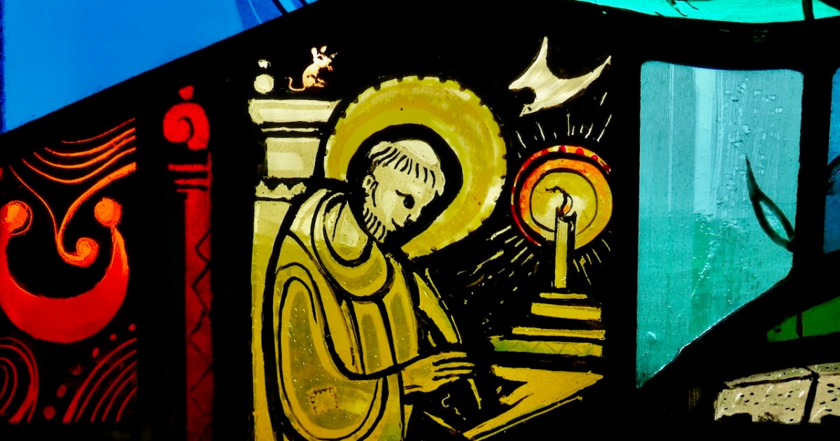
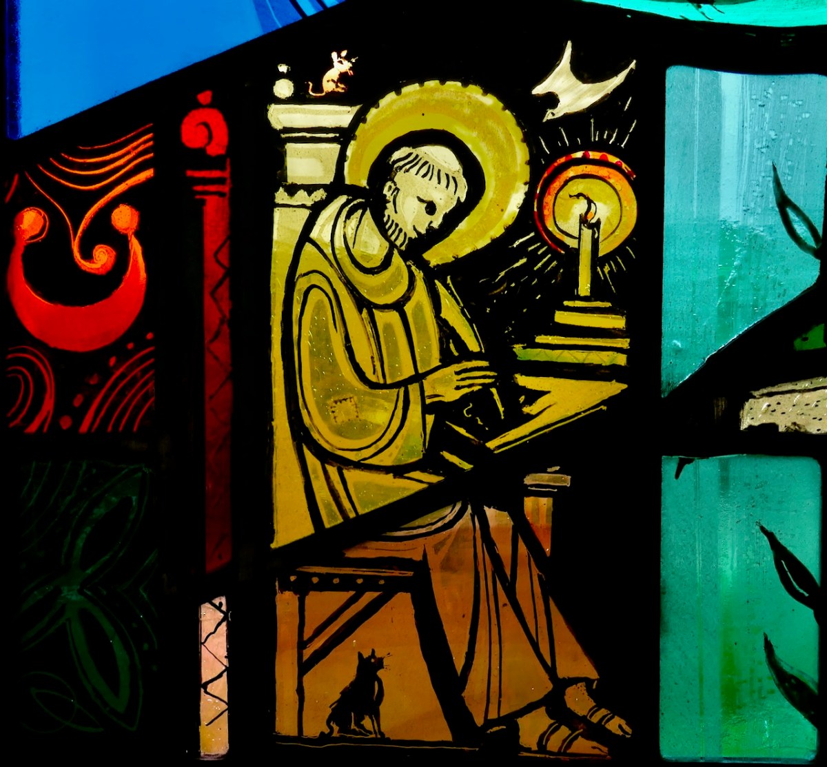
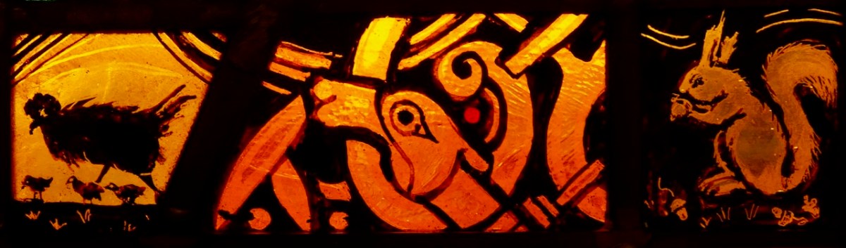
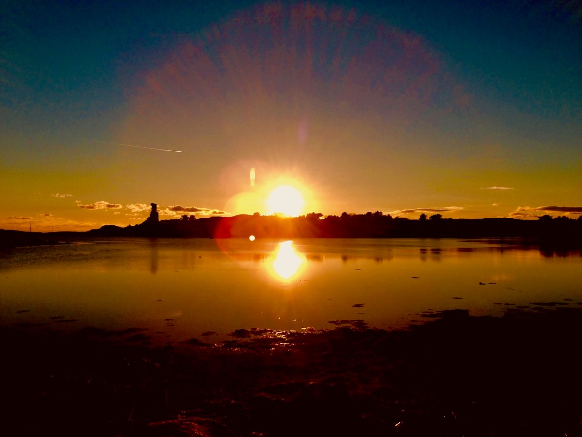
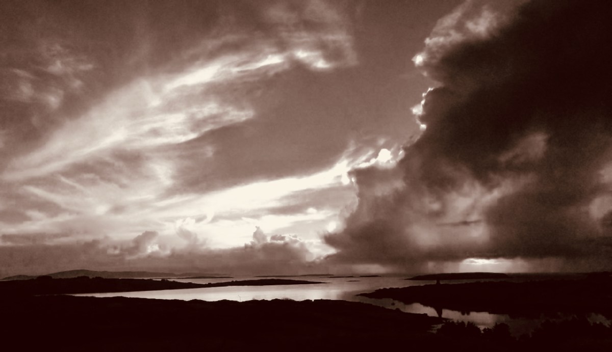
Greetings from Roaringwater Journal to all our dear readers. As 2023 draws to an end and we look forward to some post-solstice brightening every day, we celebrate and wish you joy with our favourite poem, illustrated by our favourite artist.
This is the time of the year for drawing around a log fire, lighting up the candles and passing on well remembered tales. Here is such a one, which I wrote for a Roaringwater Journal post back in December 2012 . . . It’s worth telling again.
You must never name them… It’s alright to call them The Other Crowd, or The Old Ones, or The Good Folk – people will know well enough who you mean. I suppose it’s a way of keeping them at arm’s length: if you name them, then they might just be there.
Some say that they are the earliest dwellers of these islands – the Fir Bolg – or that they are from Tír na nÓg, the land where you’ll never grow old. They might have been from the Bronze Age – or earlier: the Neolithic people were small. They certainly predated the Iron Age. Iron is something they can’t be near.
They have many of the same needs as us, it seems. They enjoy their food and drink; they dance; they play games. They have some form of religion. We know that because of the people they take: priests often – doctors – musicians (if there’s a dance going) – hurley players (if they are short of a team). It’s when you are ‘taken’ you have to be on your guard. You musn’t eat or drink while you are there or they’ll keep you – forever. And they will try and press you to it. If you do come back you’ll have been there only a second – or a lifetime… Remember the Children of Lir – turned by enchantment into four white swans: for nine hundred years they sang the beautiful songs that are now the tradition of Ireland. Then the enchantment fell from them. For a moment there stood these ancient, aged figures and, after, they crumbled to dust.
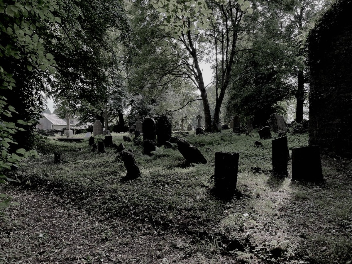
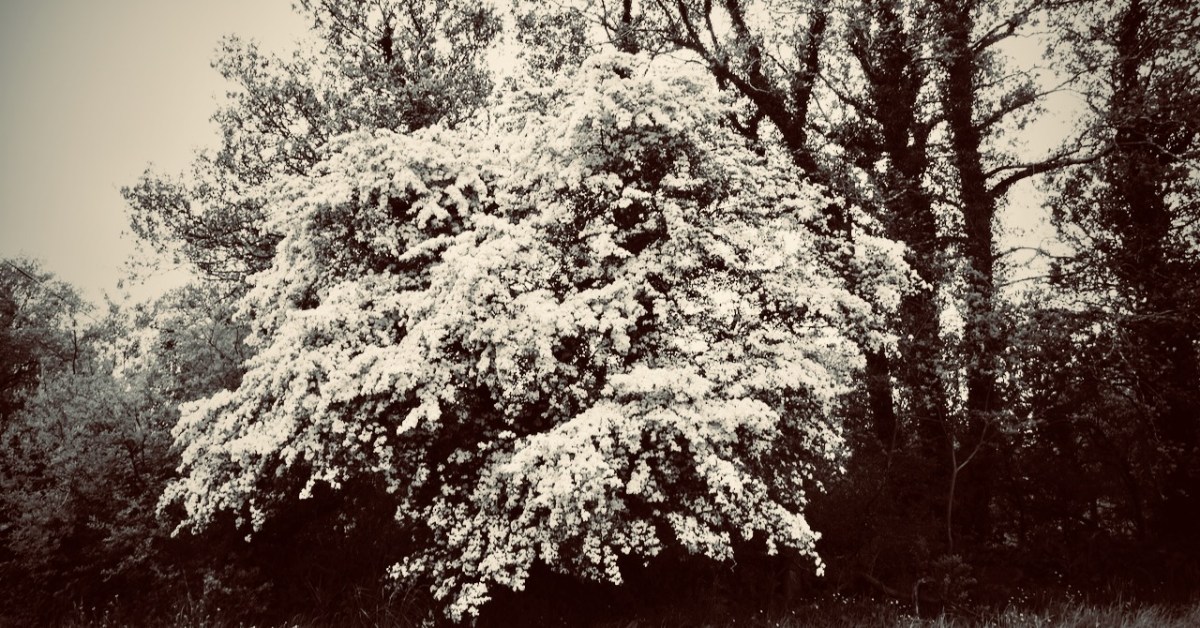
Where do they live? The country people believe it’s in the forts or raths – there are over a thousand of them in West Cork, untouched for centuries for fear of awakening those old spirits: some say that a lone whitethorn tree marks the entrance to their realms beneath the earth. There are tales, of course, of foolish men who disturbed the forts: farmers who were greedy for land and forgot – or ignored – the code passed down through the generations. Always they suffered for it. It might have been them, their wives and children, or their livestock: they came to no good end, and the neighbours shook their heads at the funeral, or the farm sale.
Just a few years ago there was a case which confirms the old beliefs. A new ring road was making its way around Ennis – the whole juggernaut of engineers, contractors, European funding, huge earth movers, gangs of modern navvies: and the whole shebang came to a sudden halt – because of a lone whitethorn tree – or Sceach – standing in the way. First it was just one or two of the gang – wouldn’t touch it: it would bring disaster. Then the whole gang agreed, and no amount of cajoling or threatening would change their minds. The media descended – it was a great story: first the local papers, then the national ones and, finally, the world came to see the fairy tree that stopped a nation’s progress. There could only be one result – the road moved to one side, and the Sceach remains to this day.
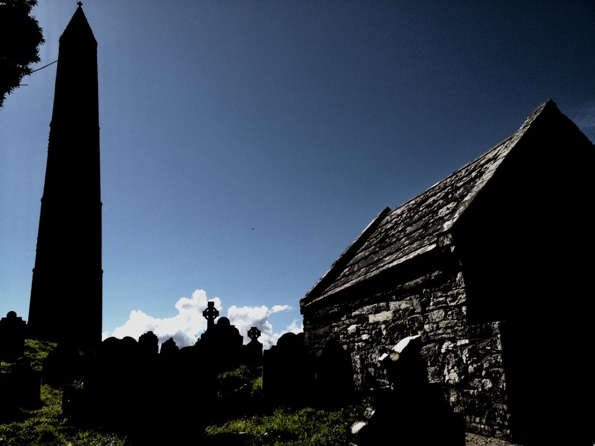
The story that follows was told to me a long time ago by a very old man: he’d been a priest. And before that a curate – back in the days when all the travelling was on horseback, or by pony and trap. His living was in the far west – one of the townlands: a close community with traditional rural ways. At that time he was companion to an elderly priest – one who was schooled in the old beliefs. This priest did his job well, and was much liked and respected by his scattered flock.
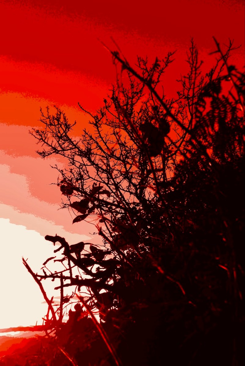
Shortly before Samhain an elderly parishioner fell sick and seemed close to dying. The priest was conscientious and visited often. The man lingered on, until one night – Samhain Eve it was – the priest had the call: the man was getting near his last breath. It was a long journey, and close to midnight, but the priest and his curate set out in the trap. Both men were sleepy and could hardly keep from nodding off, but the horse seemed to know the way – he had travelled it so many times – and the both of them woke with a start to find they were near their destination. But there was something strange: on the road in front of them, and walking the same way, there was a figure. It was dressed in black, and a hood covered its head. It walked slowly and – as they came nearer – they realised that it was playing a fiddle as it walked. They could hear a strange music coming from the figure: a plaintiff, unearthly air. They had the protection of the Book and Bell with them, but they both experienced an uncomfortable feeling in their stomachs, as though they were in the presence of something dark and powerful. They could only follow – the black figure set a slow pace and walked straight up the centre of the road: there was no way they could get past.
Eventually they came to the farm lane. Before they could turn up the trackway the figure stopped, and faced them. He put his fiddle down on the paving with the bow over the fingerboard. Then he addressed the priest directly in a voice that echoed from the darkness:
“I know where you’re heading, Father. There’s a man dying in there. I want you to do something for me…” The priest knew that the threshold of death, like all boundaries – places balanced in neither one world or the other – was a fertile and dangerous ground. He answered nervously:
“If it’s something that’s within my powers, then I will do it, willingly…” As they watched, the figure lifted his head and they could see within the hood a face yellow and ravaged with age.
“You must ask that man a question before he passes away…”
“A question…?”
“Ask him – what will happen to the Old Ones on the day of judgement?” There was a silence. The priest tried to sound calm.
“I will if I’m able…”
The figure paused a moment: “I will be here when you return… don’t forget…” He stepped back so that they could pass.
Neither man spoke. The trap came up to the farm, where there was a crowd inside to give support to the woman of the house – as was the custom in those times. The dying man was alone in the bedroom and the priest went straight to him with his cloth and candles. There didn’t seem much life left in the farmer, but he got his absolution. The priest looked around at the door, then bent down to whisper in the man’s ear. Suddenly, into the room came the farmer’s wife, carrying a glass which she gave to the priest. It was whisky: the woman herself was not a drinker and didn’t know about the water: she had filled the glass to the brim with the liquor. The priest also was not a drinker, but he needed something on that particular night, so he downed the glass. Then all the crowd of the neighbours came into the bedroom – and more whisky.
The priest was on his third glass when my friend the curate felt he had to intervene. The visitors were polite and saw the two clerics to their trap. It was only when they were halfway down the lane that the priest remembered the strange figure – and his promise.
“Wait here…” he said, but the curate was having none of that – in the dark and with an unquiet spirit on the road. So they both turned back. The host was again in the kitchen, and the priest made his excuses that he had forgotten something, and hurriedly shut the door of the bedroom fast behind him. He went straight up to the man – who looked for all the world as if he had passed on already – and whispered urgently:
“I have to ask you this – what will happen to the Old Ones on the day of judgement?” The effect was electrifying. The ‘corpse’ sat up straight, with eyes wide open. For a moment there was a silence, then he said with a great conviction:
“If there’s one drop of human blood in their bodies on the day of judgement… Then they will be saved…” He dropped back on the bed – a dead man.
The two clerics came to the end of the farm track. The figure was there, standing on the road with the fiddle beside him, as though he had never moved.
“Well, Father,” he said, “Do you have the answer?”
“I do so.” They thought they could see a glinting in those old, old eyes. “Tell me…”
The priest drew himself up and faced the spectre:
“He said this – and then he passed on. If there’s one drop of human blood in their bodies on the day of judgement… Then the Old Ones will be saved…”
The figure stared straight at them. His eyes seemed to glow red. Then they realised that he was furious. He took his hand from his coat and there was a dagger in it. They both thought that it was all up for them. But the figure pointed the dagger at his own breast… and plunged it in hard, a dozen times. The men winced, and held their breath. But there was nothing: there was no blood – not one drop…
The black figure turned and brought his foot down heavily on the fiddle. He seemed to snarl:
“There’ll be no more of our music in your world…” they heard. Then, in a moment, he was gone. And the road was empty before them…
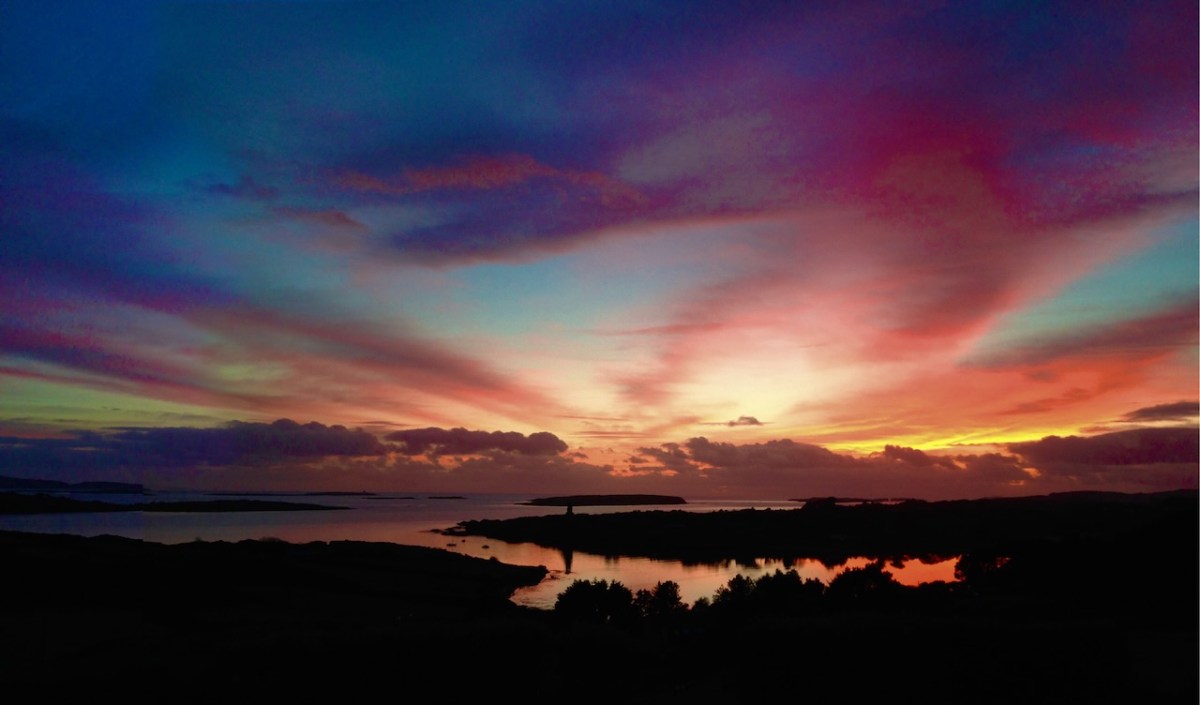
The man who told me this story is long dead – but it’s not true that their music is gone. I’ve heard it: in the old raths; coming over the lake in the mountain; coming out of a wild storm at sea. The music is far too powerful – they can’t resist it. Perhaps that, in the end, will provide them with the salvation they so desperately seek.
There’s a lone thorn tree on the old moorland above Cappaghglass. I visit it often. I play my concertina up there at times. That’s where I’ll go when I’ve had my fill of this world. Don’t disturb me: I shall be down there with the Other Crowd, enjoying the feasting and the dancing.
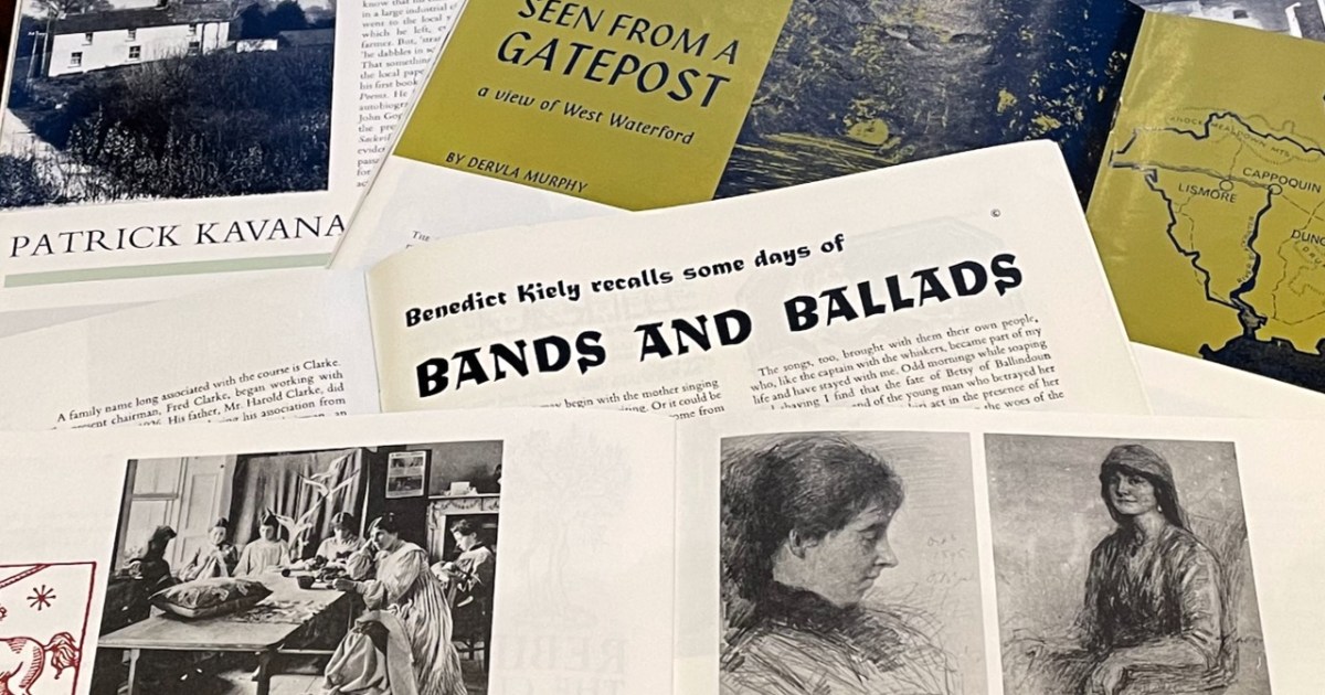
I set out several weeks ago to write a single post about essays from Ireland of the Welcomes in 1972 devoted to our tradition of literature. There were six issues, therefore 6 essays – focusing on what Ireland had given to the literary world was one of the ways that the magazine ‘sold’ Ireland to its readers. I found myself so entranced with the first two topics – The Gaelic Story Teller and a translation by John Montague of a poem, Under Sorrow’s Sign, by the bard Gofraidh Ó Dálaigh – that each got a post of its own. And now I am down to the wire to do the four remaining essays in one post, before we more on to 1974 and I can stay 51 years behind, or maybe even catch up a bit. So here goes.
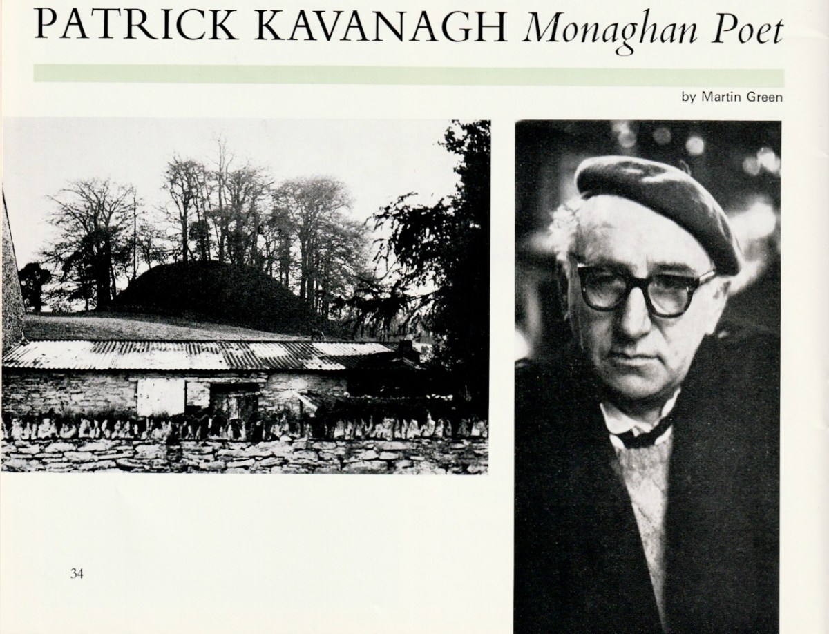
The January-February essay is by Martin Green and is titled Patrick Kavanagh, Monaghan Poet. Martin Green would make a column by himself – but I mustn’t get distracted. Here, he gives a brief description of Kavanagh’s life and considers how his rural Irish roots informed all his writings. He picks out Kavanagh’s autobiographical The Green Fool for special praise.
The Green Fool, in spite of the author’s later remarks that the book was ‘a stage-Irish life’, must surely be one of the gayest autobiographies ever written. There are no fearful soul searchings or tormented adolescent confessions, it is simply and purely a celebration of life, and way of life that was lived in rural Ireland in the early years of this century. And yet is is not dated, it is as fresh as today.
We have visited the Kavanagh Centre in Inniskeane – highly recommended.
I haven’t read The Green Fool – I wonder if that statement still holds up, 50 years later. Comments on a postcard, please. For a little more on Kavanagh, see Robert’s postOn the Passing of Poets.
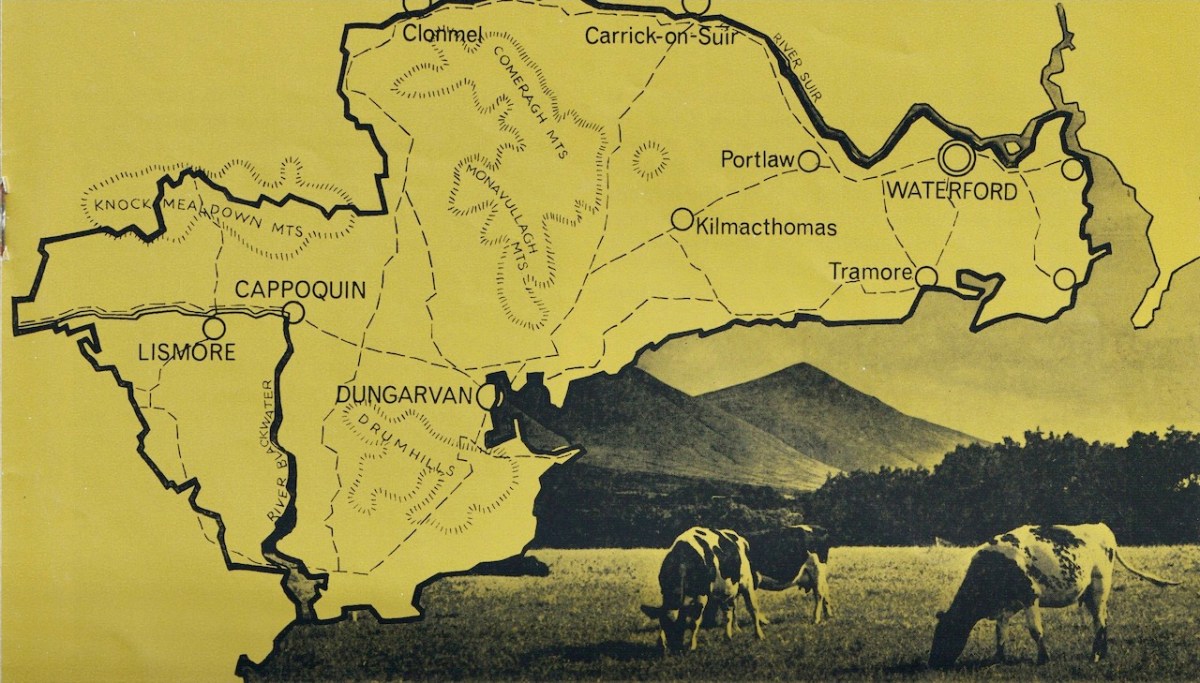
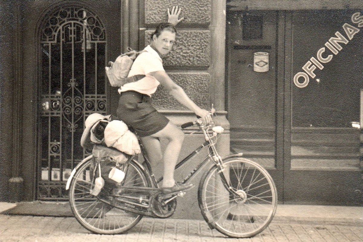
The second essay, from March-April, is by Dervla Murphy, much loved and missed Irish travel writer, who died last year at 90. Numerous obituaries will tell you more about Dervla, but perhaps my favourite is the one in the New York Times. All of them start with the gift from her parents at age 10 of an atlas and a bicycle, resulting in her plan to cycle until she got to India. Similarly, all of them speak of her love of Lismore and West Waterford, her home.
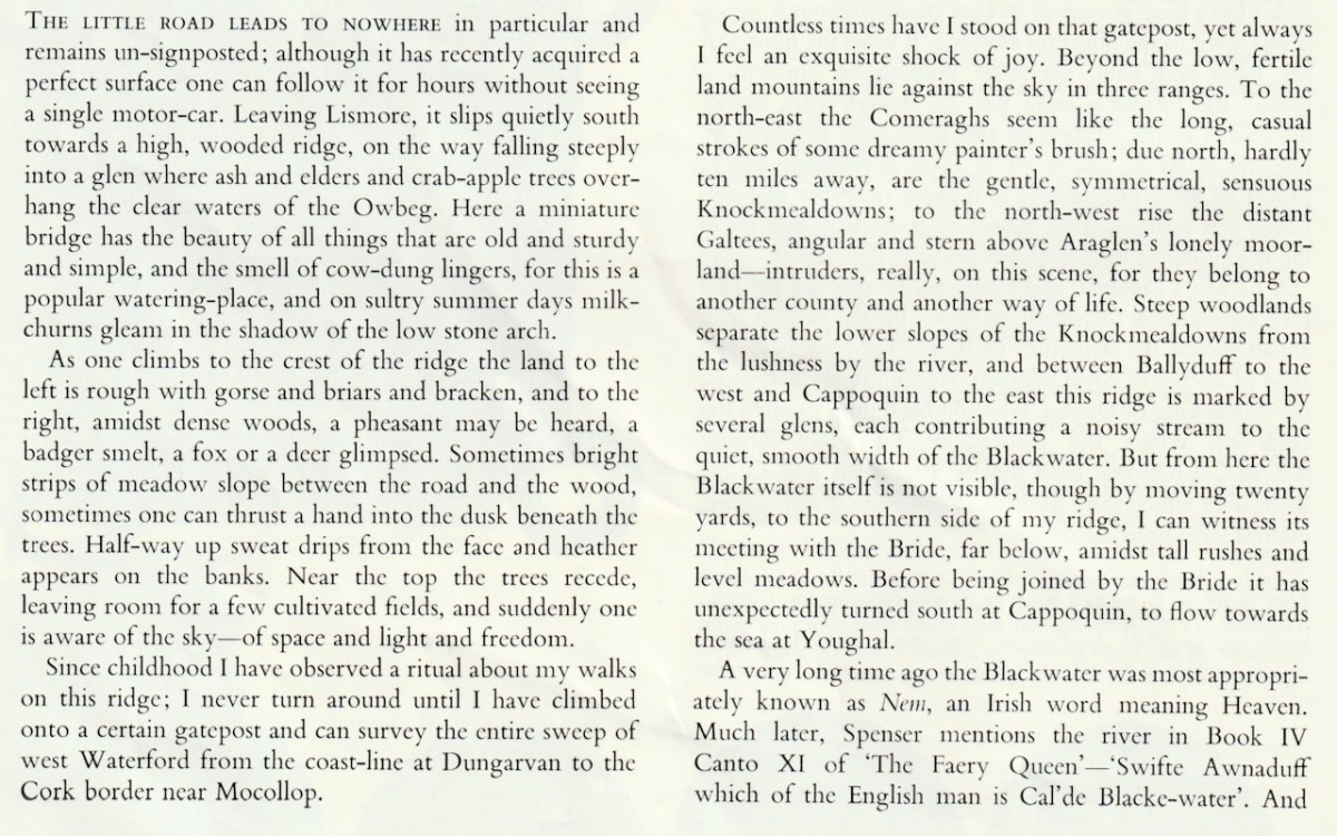
Dervla’s essay, Seen From a Gatepost: A View of West Waterford, is about this very place. In it you come to understand how, not unlike Kavanagh, her rootedness in an Irish rural landscape gave her that sense of security from which she could explore the world.
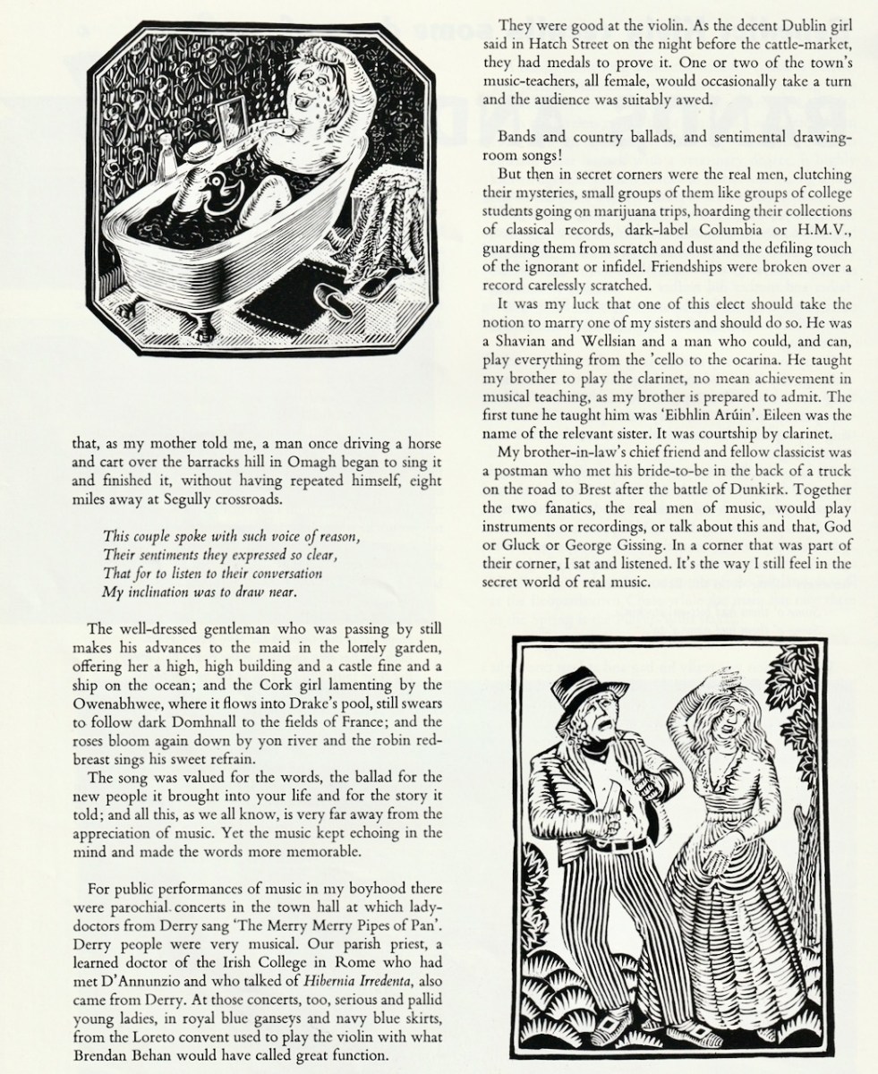
My third selection, from September-October, is a piece called Bands and Ballads by Benedict Kiely. From Co Tyrone, Kiely was one of the best known public intellectuals of my youth, frequently on radio and TV, or writing in the paper. Read his bio on the always-excellent Dictionary of Irish Biography site, written by Patrick Maume. This is a nostalgia piece for Kiely, here talking about his father:
I have scanned the second page in full, as it is such a delight to read.
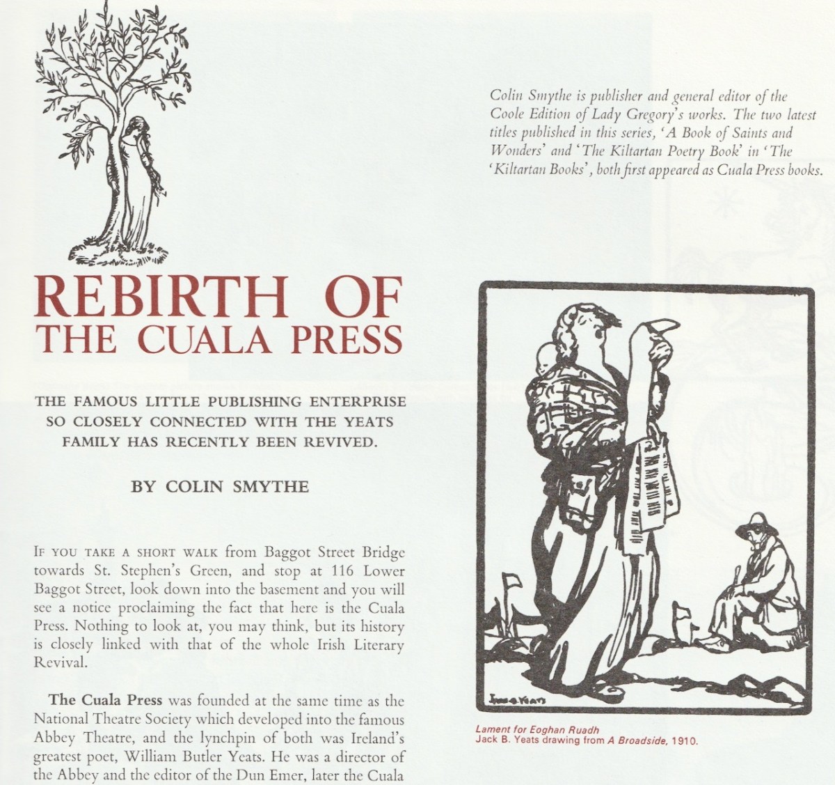
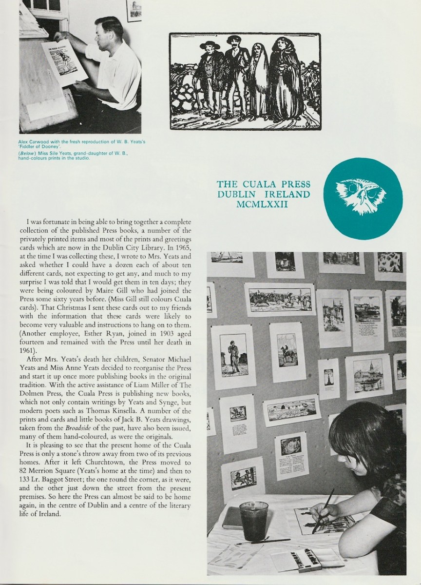
My final choice, from November-December, is by Colin Smythe and tells the story of the Rebirth of the Cuala Press. Managed by Elizabeth Corbet Yeats, the Press published its first book in 1903, and from then until 1946 it produced beautiful hand-coloured books of poetry of stories in limited editions – works of art in themselves. After that time it continued with cards and prints.
As the page below explains, it was revived by Michael and Anne Yeats, son and daughter of WB Yeats and Georgie Hyde-Lees, along with Liam Miller of the Dolmen Press.
Whew – I made it. It was touch and go – any one of those topics is good for a full post. But I look forward to diving into the next whole year of Ireland of the Welcomes issues soon.
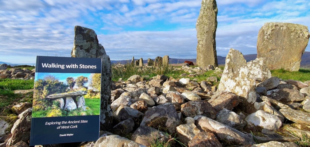
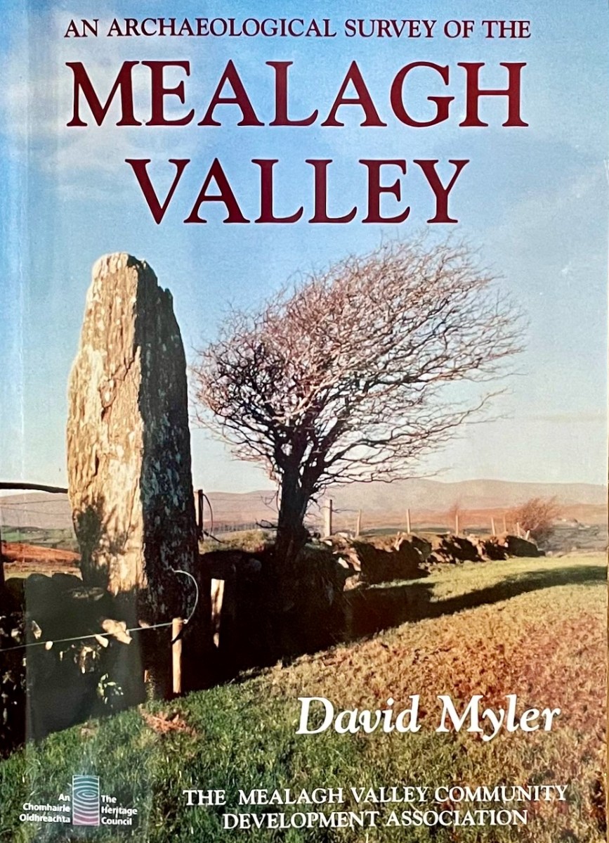
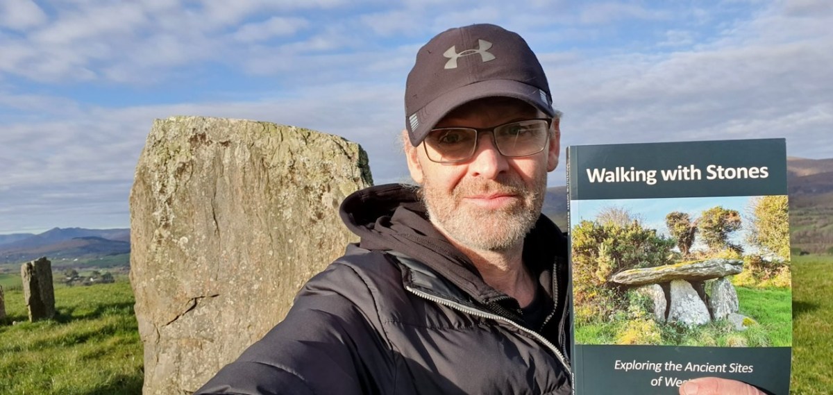
If you live in West Cork, or if you love to visit it, your Christmas present dilemma is solved! Here comes Walking With Stones, the new book on West Cork archaeological sites written by David Myler.
David has been sharing his passion for West Cork antiquities in an online Facebook Page/blog which he called Walking with Stones. But even before that, he wrote An Archaeological Survey of the Mealagh Valley – a book we have had on our bookshelves for years and turned to often.
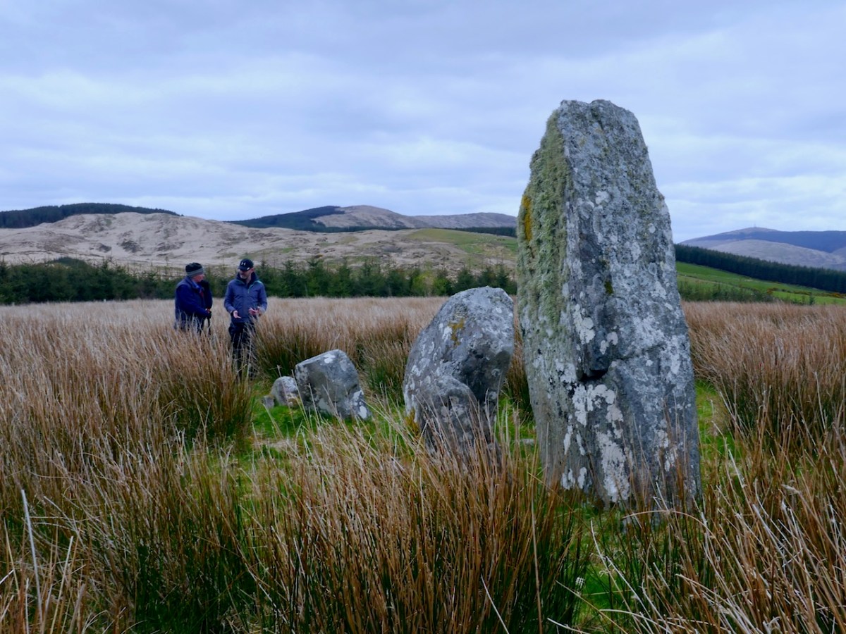
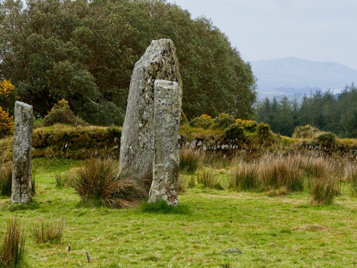
Once we saw Walking With Stones pop up on our Facebook feed, we knew we had found a fellow traveller. We had to meet – and meet we did, along the way discovering many shared interests and even a relative in common. Our first meeting was a field trip where David showed us this stunning stone row in the Mealagh Valley.
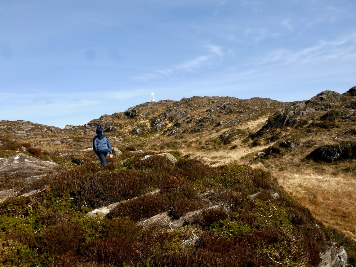
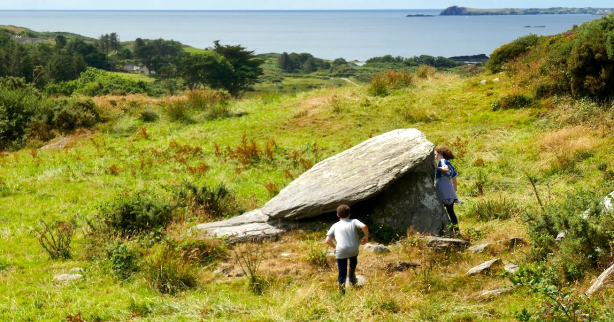
On that same trip we saw my first ever Four-Poster Monument – they are very rare, with only four in West Cork – as well as a spectacularly-sited wedge tomb that David had discovered.
David’s book is a very welcome addition to our bookshelf. Perhaps I should declare right away that he asked me to write the Introduction and I was delighted to do so. Now that I finally have my own copy, I am thrilled to be associated with it, in this small way.
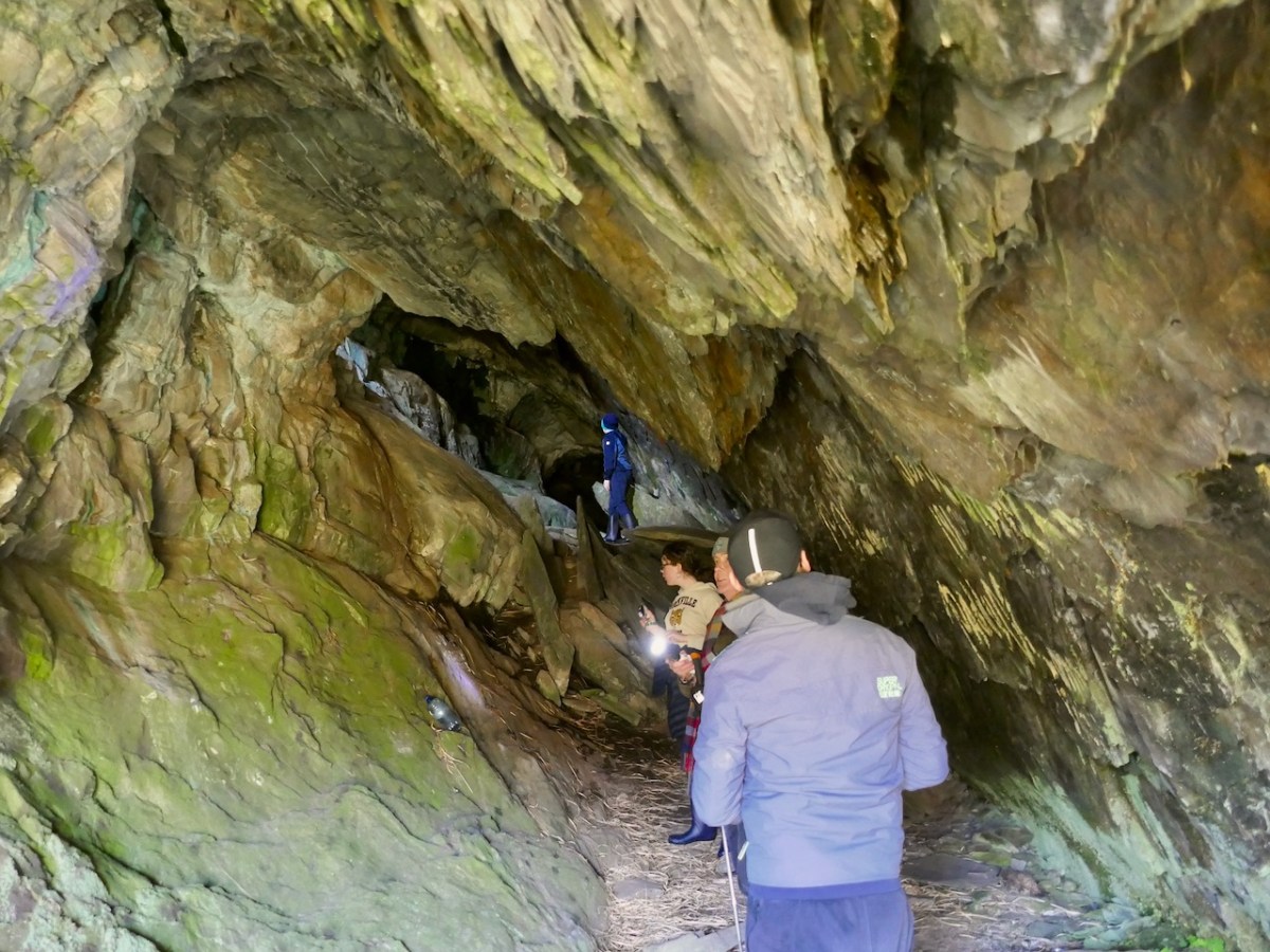
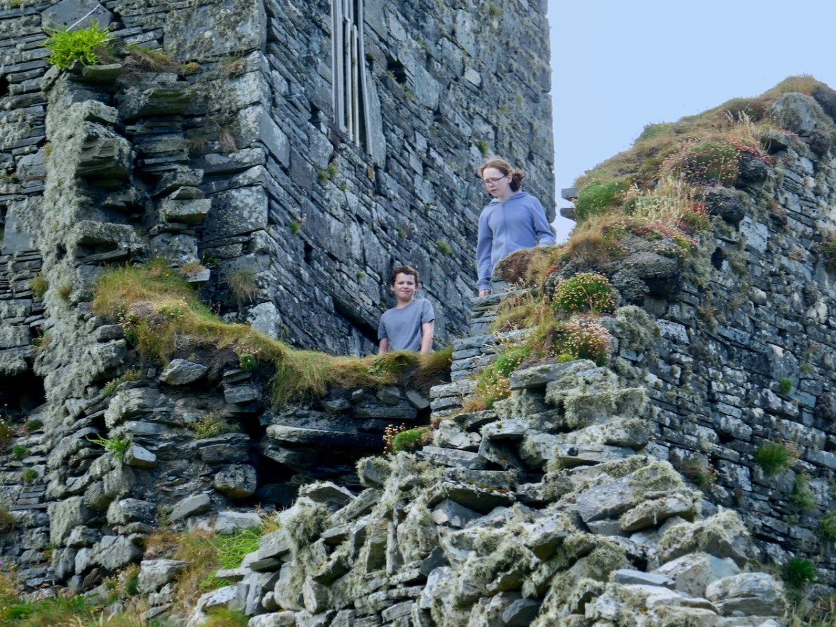
David’s favourite companions on his walks are his kids and one of the real strengths of this book is the sense that all these places can be enjoyed with family. Having young people along, with their curiosity, their need to really explore, and their chatter, brightens any walk. Just make sure you go equipped with food and bandaids. What follows are a few photos of joint field trips we have taken with them.
The only comparable book we can think of is Jack Roberts’ Exploring West Cork, first published in the 1980s and updated and re-published a couple of times. We treasure all of Jack’s books, especially for their marvellous black-and-white drawings, as accurate as they are charming.
While Jack tried to be fairly comprehensive in his coverage, David’s selection is personal – this does not pretend to be a gazetteer, but a guide and companion. Many of the sites have been chosen because they are accessible and can be enjoyed as part of a good walk through the countryside. Restricting the number of sites also allows David to write more about each one and use his own photographs to illustrate important features.
The best place to have David’s book is in your car, your bicycle carrier, or your backpack. You can buy it online here or here. Look out for it in local bookstores, if you live in West Cork – David is doing the legwork now of getting copies to them.
Congratulations, David! Given that you work full time and have a family to look after, this is an amazing accomplishment and one we are all grateful for.
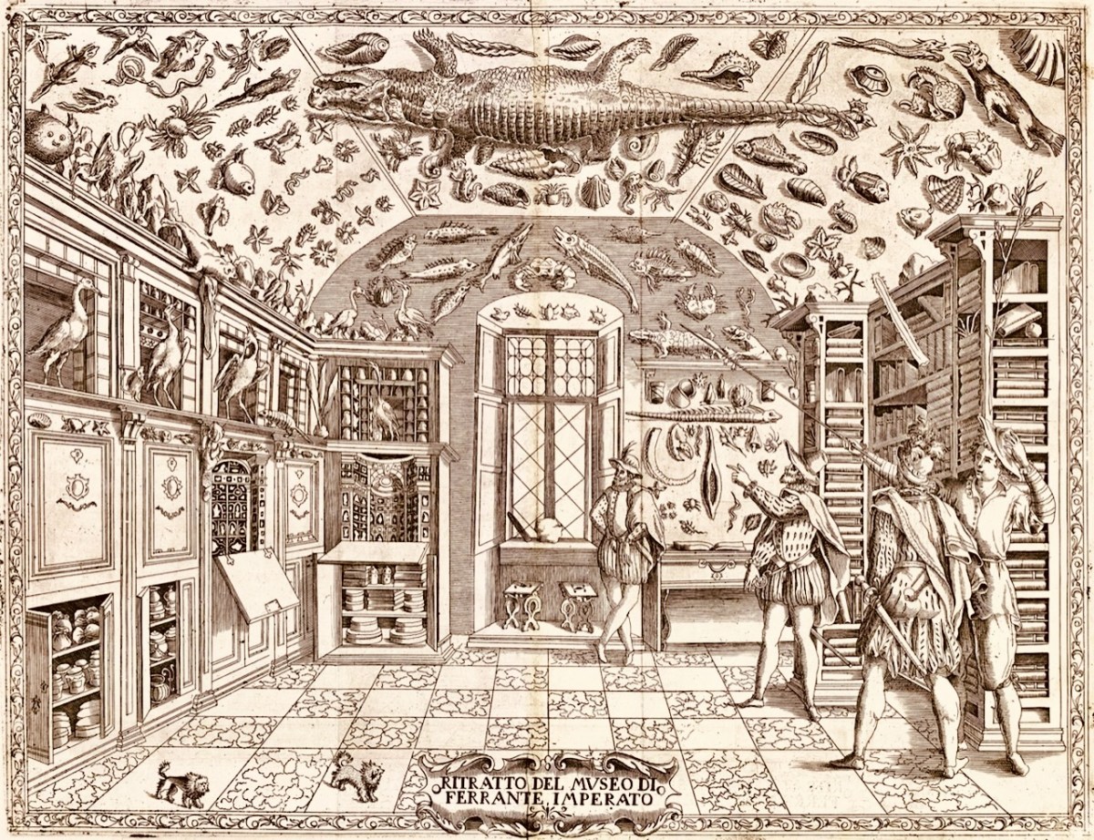
The forerunners of the museums that we visit today were known as ‘Cabinets of Curiosities’. Starting – just about – at the very end of the sixteenth century – we find mentioned and illustrated collections of objects gathered from exotic places: things that a gentleman might be unfamiliar with; things that could expand our knowledge and cause wonder. Curiosities, undoubtedly. Here’s one collection illustrated in 1599:
This is an engraving from Ferrante Imperato’s Dell’Historia Naturale (Naples 1599), the earliest illustration of a ‘natural history cabinet’ (courtesy Oxford University). It shows a room fitted out to display imported paraphernalia: (hopefully mounted) creatures, dried specimens, fossils – also books and illustrations. The collector here takes on the role of educator – perhaps showman. Here you might encounter unicorn horns, a dragon’s blood, mermaid scales as well as the full sized alligator hanging from the ceiling.
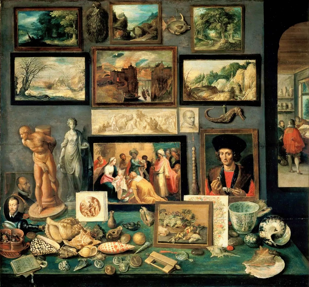
Frans Francken the Younger, Chamber of Art and Curiosities, 1636 above (Public Domain). Another selection of paintings intermixed with fish, carved beads, sculptures, with on the table exotic shells, gem-stones mounted with pearls, coins and medals.
Rathfarnham Castle (above) is a good example of an Irish Fortified Manor House. This mainly seventeenth century building type would have been the relatively comfortable home of an aspiring clan – perhaps a titled family with church or merchant connections: Finola has written about a West Cork example. Austin Cooper – a tax collector who indulged his hobbies of sketching and writing while travelling through Ireland in the performance of his duties – wrote of Rathfarnham:
. . . What renders this a Place of any Note is the Cas. belonging to the E. of Ely. This Cas. is square, with a large square Tower at each corner – on the S. side in the Center is a semicircular Tower . . . The hall is but low, at the same time exquisitely elegant . . . The gallery is a beautiful room, at the far end is a curious cabinet of Tortoise Shell & Brass containing some most extraordinary Work in Ivory . . .
Austin Cooper’s Notes, rathfarnham Castle
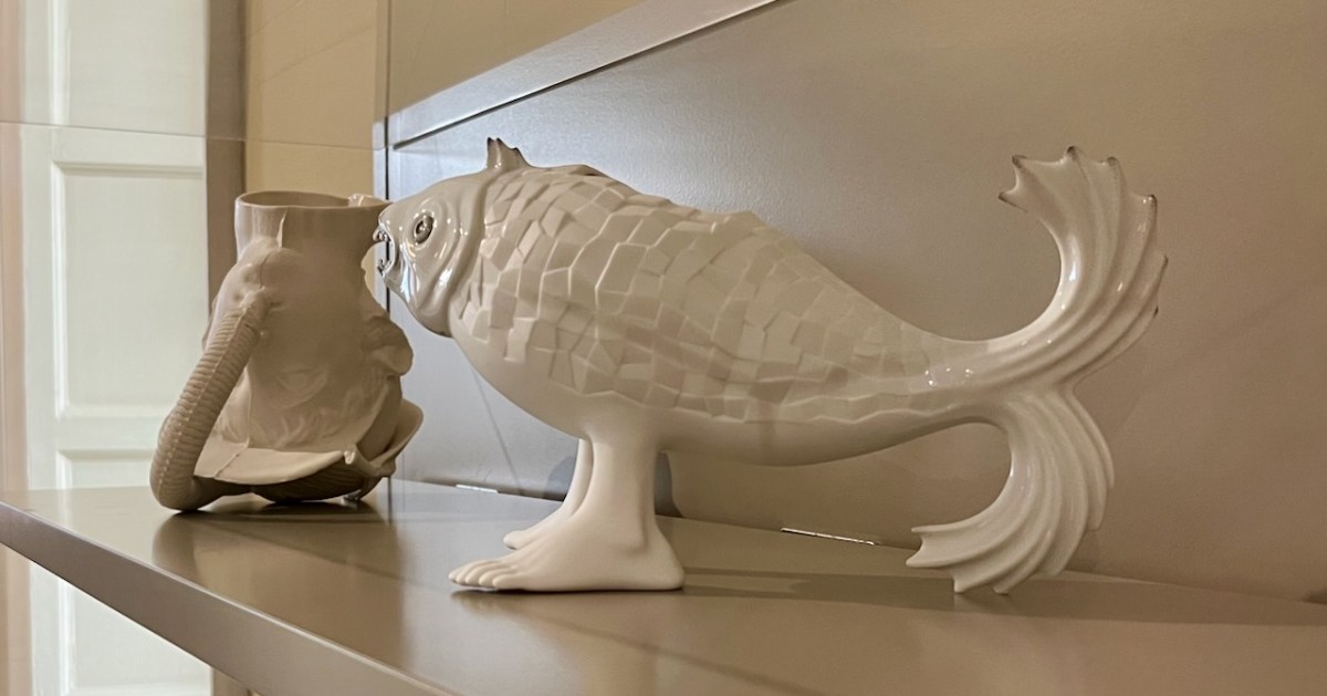
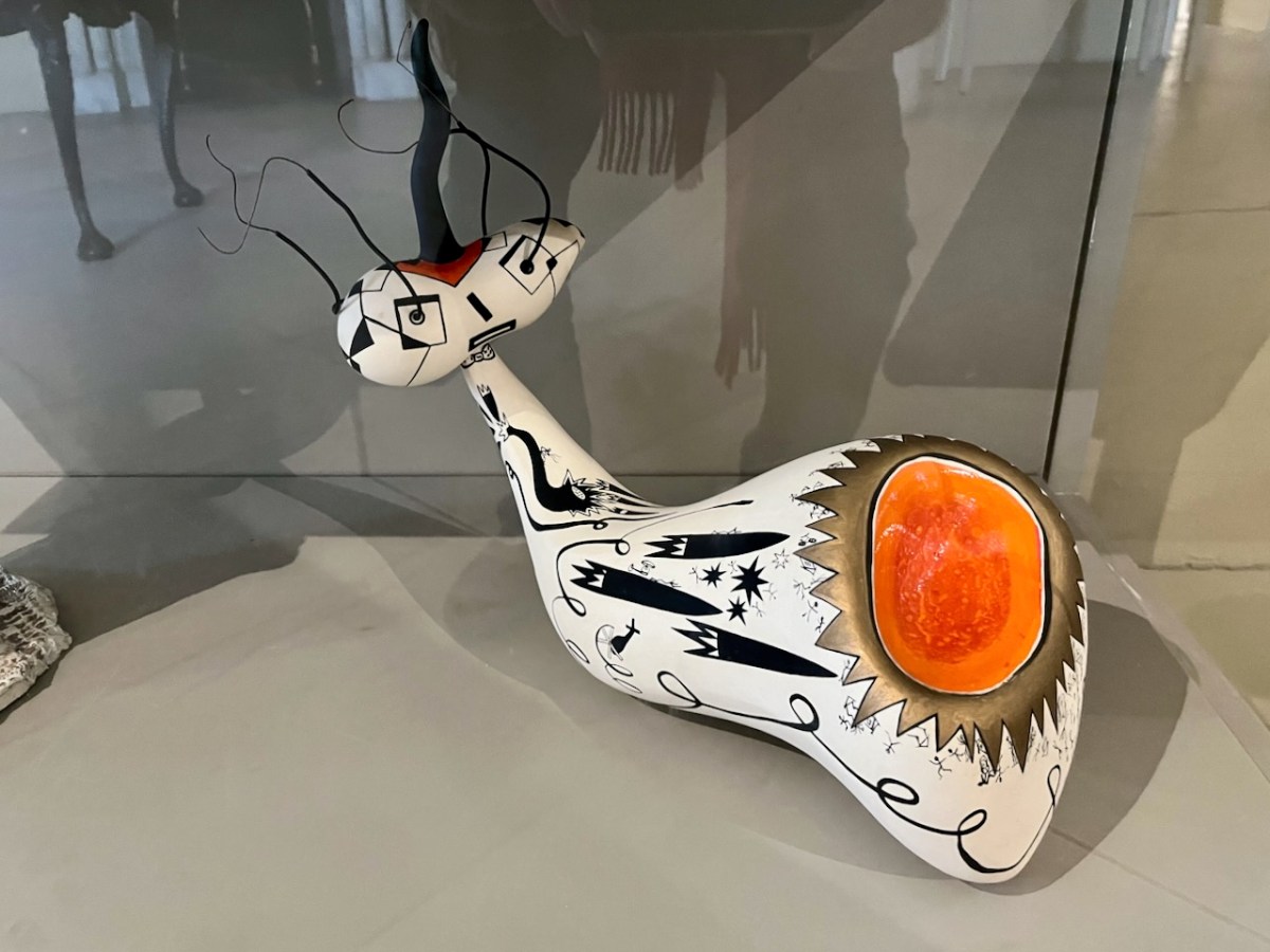
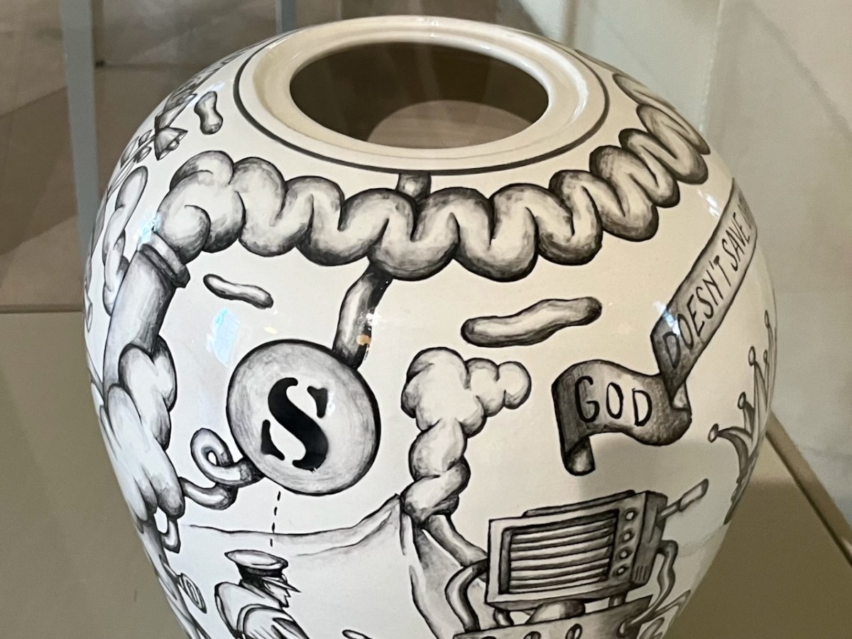
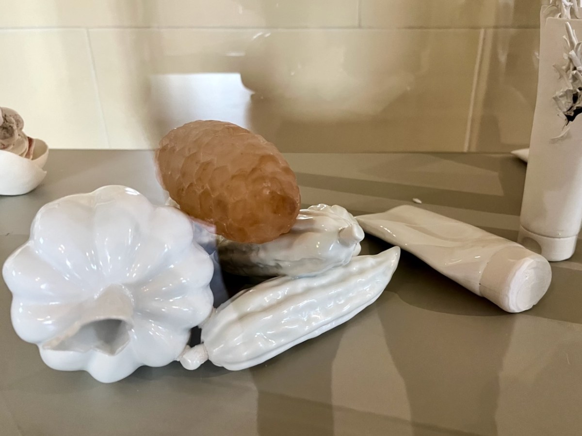
Rathfarnham Castle has, in modern times, a distinguished continuing association with contemporary ceramicists and in 2015 established a modern Cabinet of Curiosities which continues the tradition of displaying ‘extraordinary work’, and provides excellent material for a Sunday morning post!
The curiosities are not labelled – and nor are their creators. Peter Bagshaw, OPW at Rathfarnham, has kindly provided me with a list – thank you, Peter – attached at the end of this piece. I cannot necessarily individually identify each item: I will leave you to work out which might be which . . .
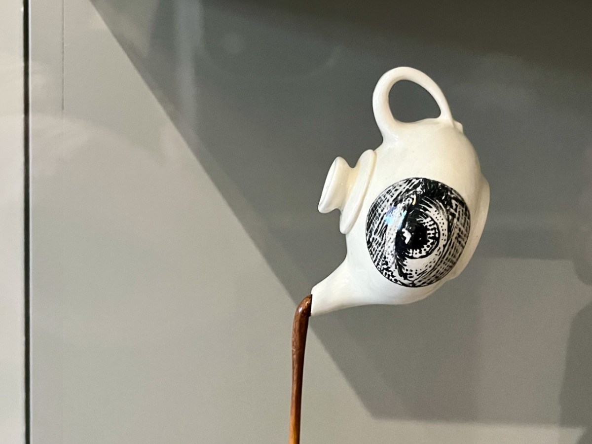
This eye-pot looks great when you pan out a bit . . .
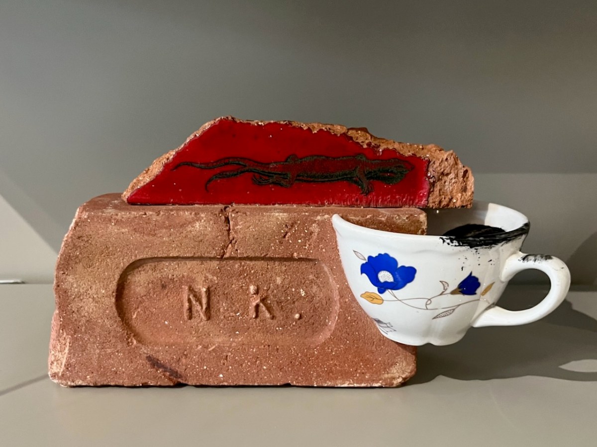
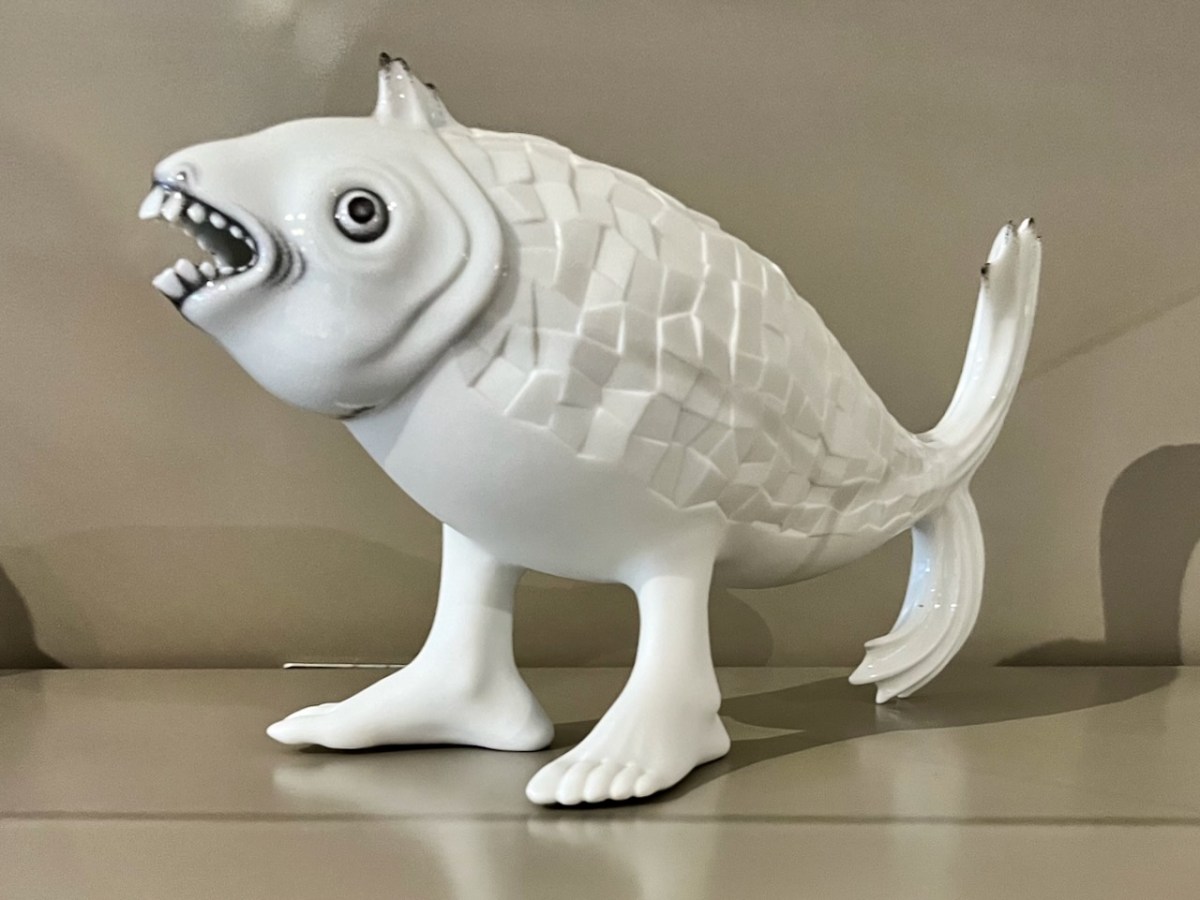
This one certainly harks back to some of those manufactured creatures that turned up in cabinets of old.
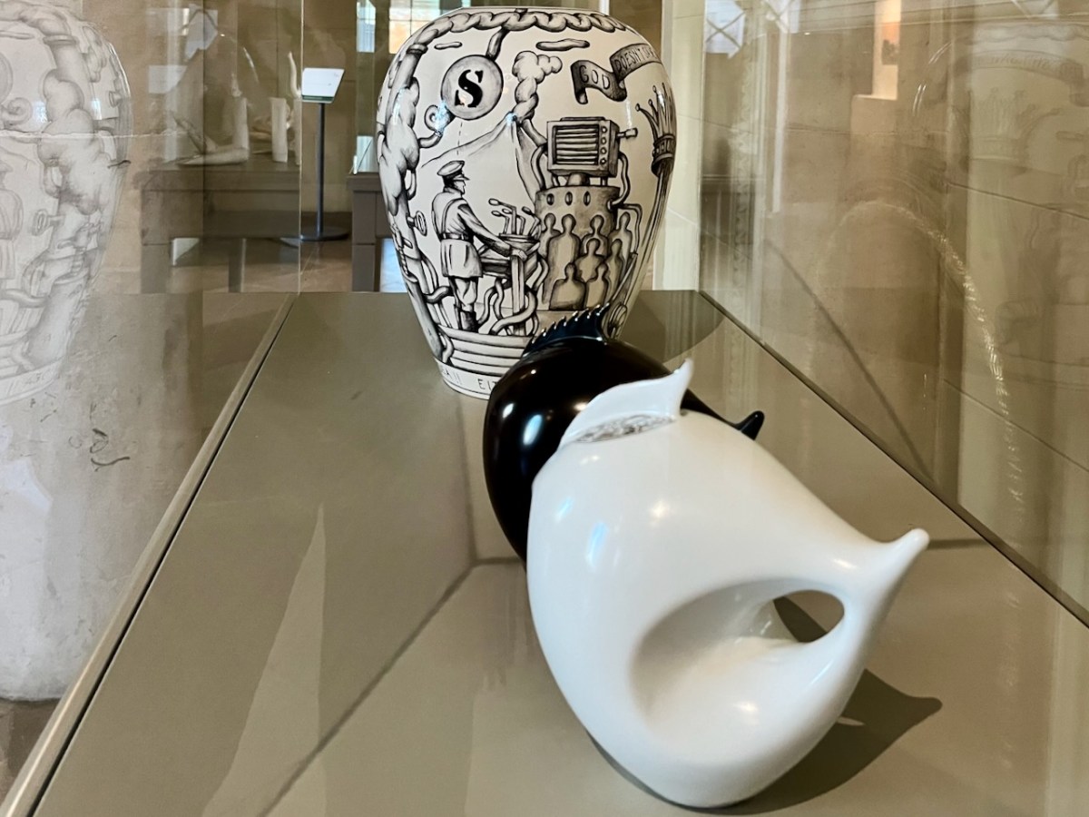
Leather teapot – a fashion item, perhaps?
I think the final image might be my favourite: a young person clutching an angel’s wing? Could this be The Sequestrator?
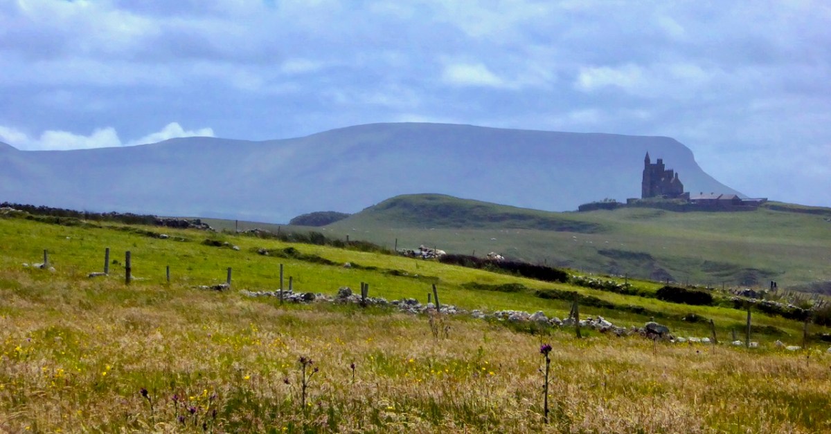
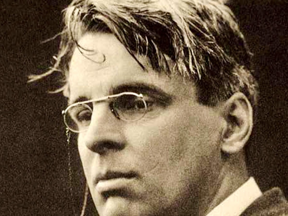
Yeats country – Benbulben and Classiebawn Castle (above). Finola took this fine view seven years ago, when we set out to visit the haunts of William Butler Yeats. We have to turn to Yeats now, as it’s exactly one hundred years since he was awarded the Nobel Prize for Literature – in December, 1923. I have carried a place in my heart for Yeats, ever since I was at Primary School on the Hampshire/Surrey borders, not far from Thomas Hardy’s Wessex. Yeats and Hardy were rivals for the coveted award – the final vote in 1923 was between the two of them: in the end, only two Nobel committee members voted for Hardy, and Yeats achieved the prize. The Guardian newspaper said that “…Mr Yeats is to be congratulated, almost without reserve, on lifting this substantial stake. He is a poet of real greatness; prose, too, he can write like an angel…”, however then arguing that Thomas Hardy would have been a worthier recipient of the award!
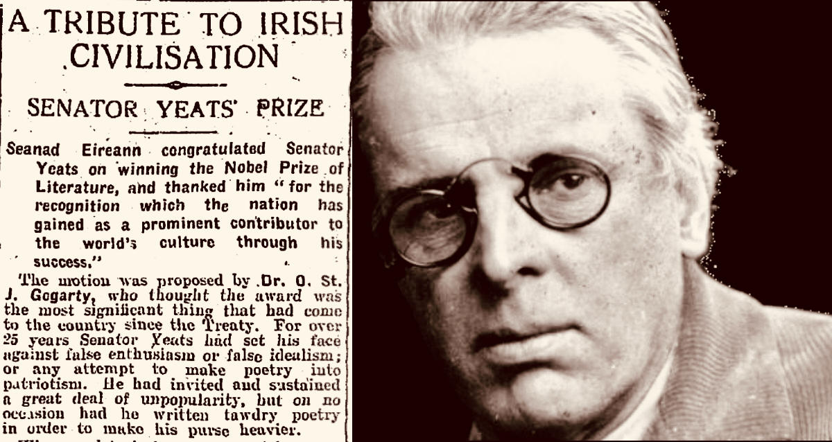
The Irish press congratulates Yeats on his achievement (above – Irish Independent 29.11.1923). My schoolboy encounter with the poet must have been when I was around ten years old and we were tasked to learn The Lake Isle of Inisfree. I can still recite it, word for word, to this day, sixty seven years later. But it was far more than mere words for me, then. Our teacher – Mr Sharpe – was careful to explain that this man was cooped up in the city of London – on its “pavements grey” and was yearning for the countryside he loved:
I will arise and go now, and go to Innisfree, And a small cabin build there, of clay and wattles made; Nine bean-rows will I have there, a hive for the honey-bee, And live alone in the bee-loud glade.
And I shall have some peace there, for peace comes dropping slow, Dropping from the veils of the morning to where the cricket sings; There midnight’s all a glimmer, and noon a purple glow, And evening full of the linnet’s wings.
I will arise and go now, for always night and day I hear lake water lapping with low sounds by the shore; While I stand on the roadway, or on the pavements grey, I hear it in the deep heart’s core.
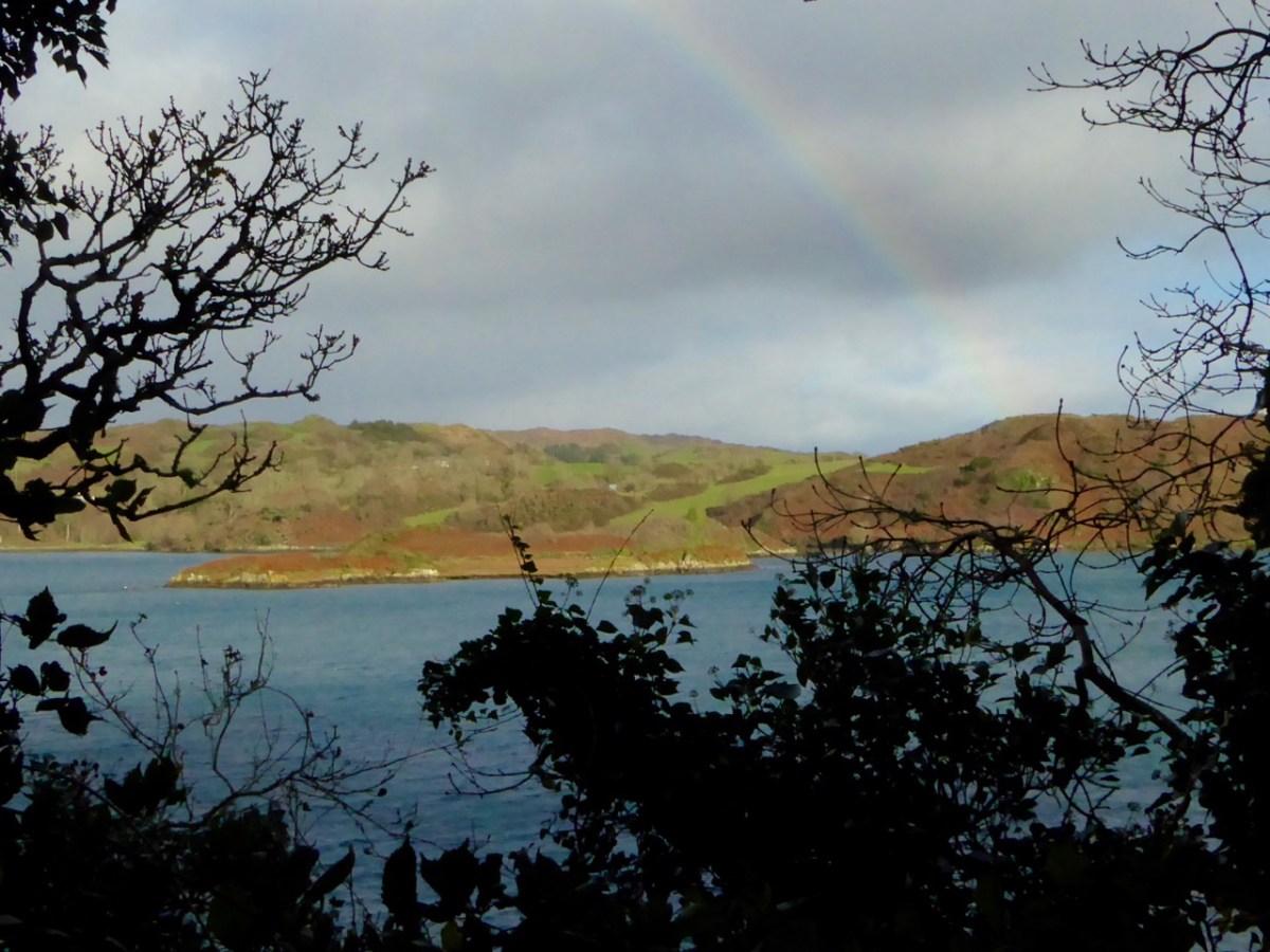
Inisfree serves the poet’s romantic dreams of a remote idyllic landscape far away from the noisy metropolis. It does exist as a place – on Lough Gill in Co Sligo: Yeats spent childhood summers nearby. Interestingly, I searched the internet for pics of the island, and the above came up. It’s from a Roaringwater Journal Post which I wrote in 2016. And it’s not Inisfree, but another ‘lake island’ – just outside Skibbereen, in West Cork – Cloghan Castle Island on Lough Hyne: there’s a holy well nearby, and an 8th century church dedicated to St Brigid – but all that is another story. The diversion just serves to warn against trusting what you find online!
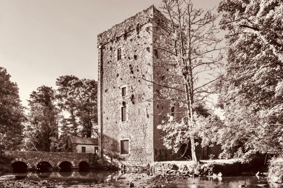
Thoor Ballylee Tower, Co Galway (above) – this 14th century tower house was described by Seamus Heaney, another Irish Nobel Literature prize winner, as The most important building in Ireland, because of its associations with Yeats, who spent many summers there with his family.
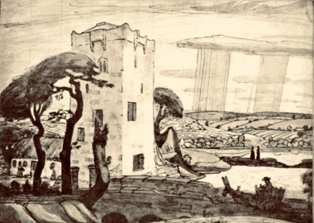
Here is the finely crafted cover of The Tower: a book of poems by W B Yeats, published in 1928 (courtesy Yeats Thoor Ballylee Society). The Tower was Yeats’s first major collection as Nobel Laureate after receiving the Nobel Prize in 1923. It is considered to be one of the poet’s most influential volumes and was well received by the public. (Below) a 1917 drawing by Robert Gregory – son of Isabella Augusta (Lady) Gregory and Sir William Gregory of Coole Park, Co Galway – of The Tower (courtesy Yeats Thoor Ballylee Society).
Going back to my early school years: I was an incurable romantic, and a daydreamer. I paid enough attention to lessons to get by, but my heart lay outside the school gates. Just minutes away were hop-fields and, beyond those, pastures, woodlands, streams – idyllic places where I loved to wander. I could completely relate to Yeat’s desire to be far away from the city, and that’s why his poem appealed to me. I knew very little about Ireland, and had no idea that was where I would one day make my home. I am here now, sitting at my desk, with the hills and oceans of Yeats’ own country beyond.
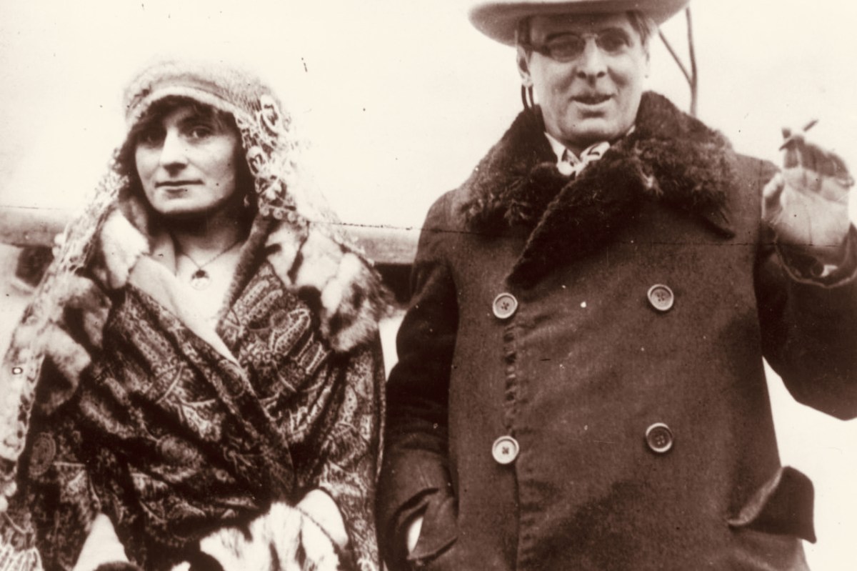
W B Yeats and his wife George Hyde-Lees heard the news that the Nobel Prize had been awarded to him on 14 November, 1923. The photograph above (courtesy Irish Independent) is said to be taken on that day. It’s also said that they celebrated by cooking sausages! The Irish Independent records: “Irish poet and senator, William Butler Yeats created history when he was awarded the Nobel Prize in Literature, the first Irish citizen to achieve such an accolade. The prize was awarded to Yeats ‘for his always inspired poetry, which in a highly artistic form gives expression to the spirit of a whole nation’.”
Somewhat surprised by the award, Yeats would later write in his (unpublished) autobiography: “Early in November (1923) a journalist called to show me a printed paragraph saying that the Nobel Prize would probably be conferred upon Herr Mann, the distinguished novelist, or upon myself, I did not know that the Swedish Academy had ever heard my name.” The news of the award was widely praised in Ireland with members of Dáil Éireann proudly announcing that it had placed Ireland on the international stage. It was a sentiment reiterated by the laureate himself, who at the awards ceremony claimed that the Nobel Prize was less for himself than for his country and called it Europe’s welcome to the Free State. In his presentation speech, Per Hallstrom, then chairman of the academy’s Nobel Committee, praised the poet’s ability to ‘follow the spirit that early appointed him the interpreter of his country, a country that had long waited for someone to bestow on it a voice’.
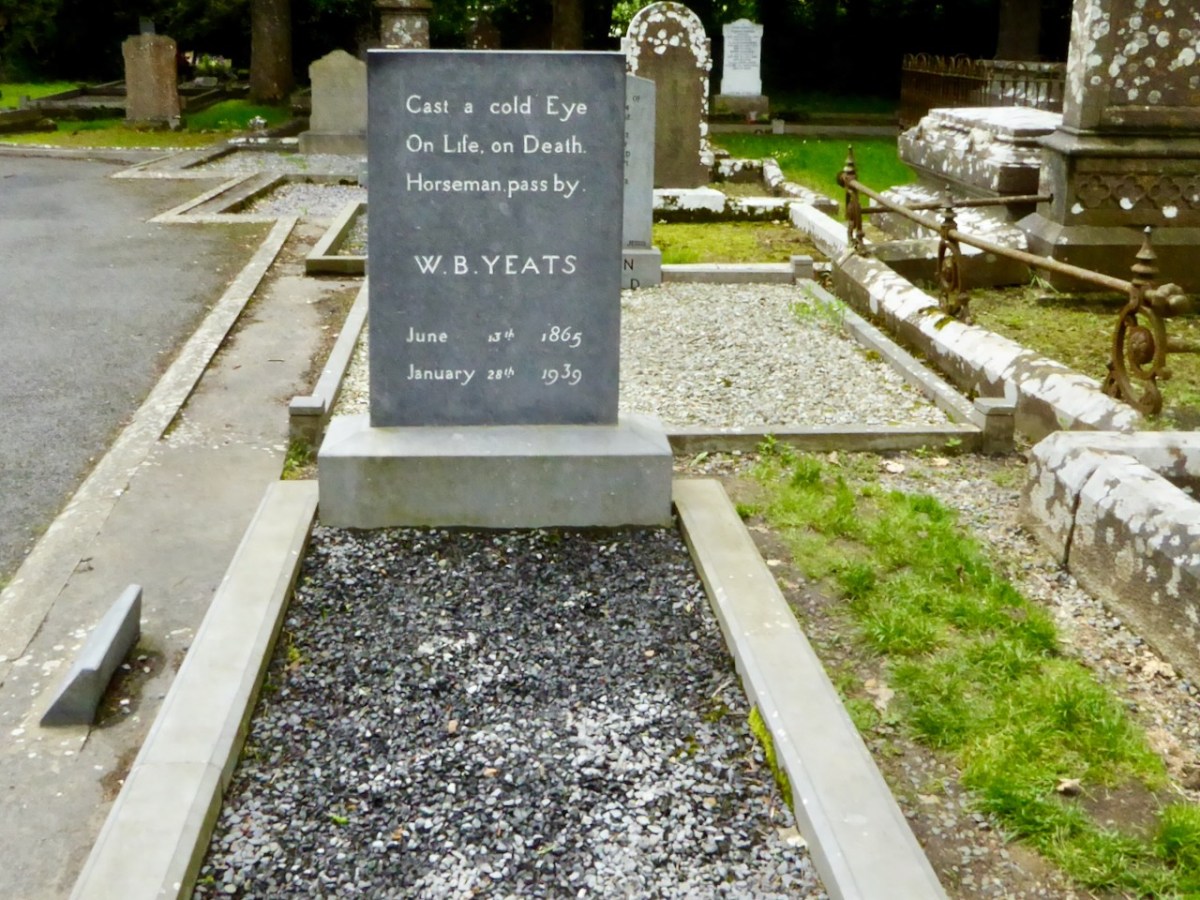
A portrait of Yeats painted by Augustus John OM RA in 1930 (courtesy Sothebys – private collection). Before Yeats passed away he requested that his final resting place be in Sligo. He died in Menton, France in 1939 aged 73 and was buried there. His wish was fulfilled in 1948 when his body was exhumed and buried in St Columba’s Church, Drumcliff. His headstone reads:
Welcome to the UCD Library Cultural Heritage Collections blog. Discover and explore the historical treasures housed within our Archives, Special Collections, National Folklore Collection and Digital Library