We were saddened to hear recently of the death of Leda May. Hers was a familiar face in Ballydehob, where she lived for many decades. Her little pottery studio on The Parade has always been a landmark in the village:
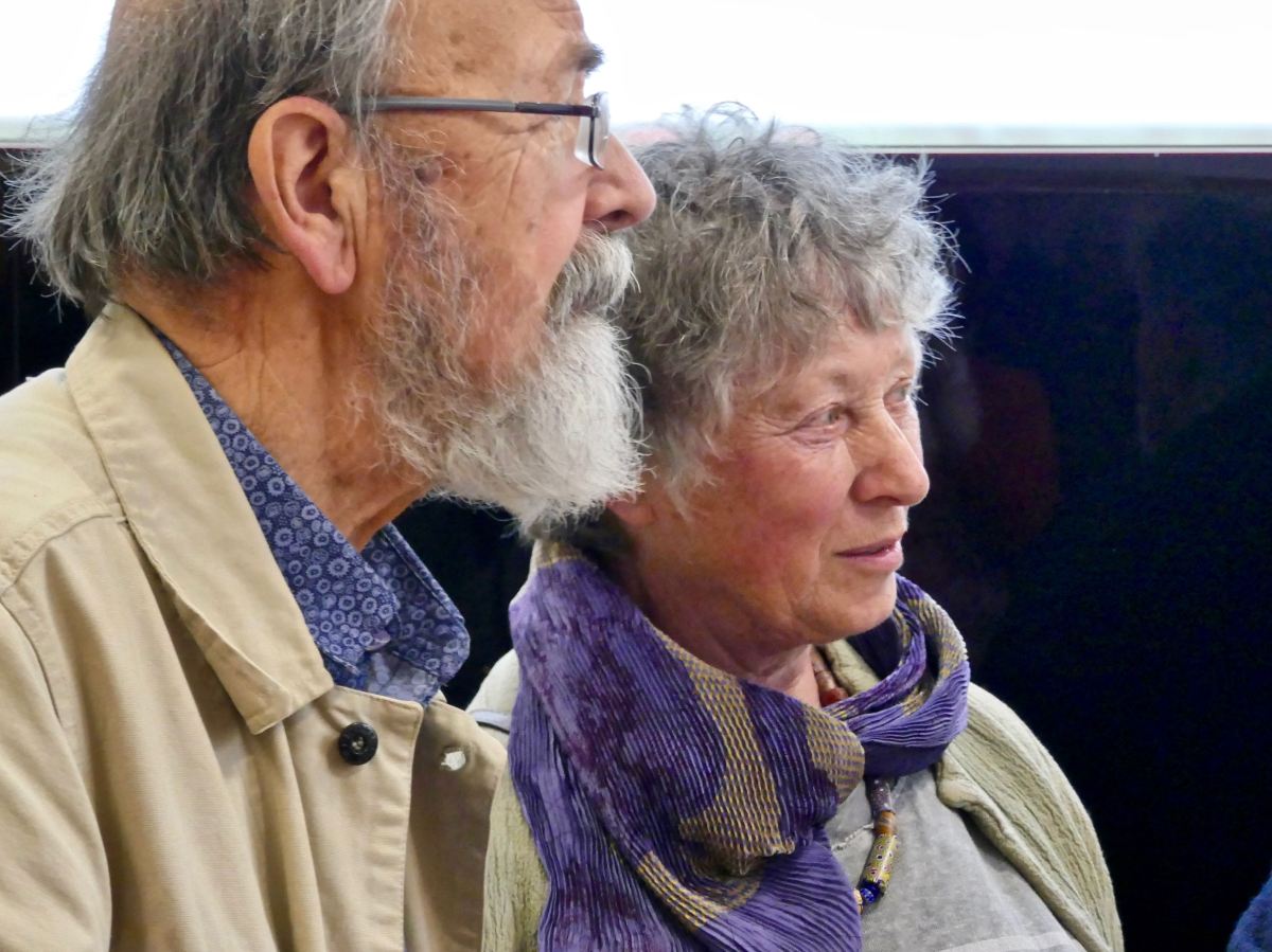
Above – Brian Lalor and Leda May in the Ballydehob Arts Museum, 2019. Leda continued to work until her recent illness, and her blue porcelain ware is familiar to many of us in and around the community.
A documentary about Leda – ‘The Elephant & The Dandelion’, directed by Martin Daley, was made in 2015 – and is available to view here. Leda May was born in London, grew up in Suffolk, and studied ceramics at Hornsea College of Art in the 1960s. She was also drawn to the medium of stained glass which gave her the opportunity to create with colour. Here are two of her glass pieces (reproduced from the documentary film with thanks to the crew):
Leda was at first attracted to the culture and landscapes of India, but in due course Leda and her husband Bob set out in a converted ambulance ‘to visit all the potters in Ireland’, and arrived in West Cork in the late 60s, meeting Christa Reichel at Gurteenakilla. Christa encouraged them to set up their own pottery behind the Flower House: this was known as Luba Studios.
When the Ballydehob Arts Museum opened in 2018, Leda was among the West Cork artists celebrated, and she was always a supporter of the Museum, which has put on several exhibitions to date. The Museum is sited within Bank House, a colourful building owned and run by the community.
This dresser in a household within our village displays several examples of Leda’s work – and other works by Ballydehob’s creative community of artists:
We wish Leda farewell, knowing she has left behind her a legacy of original work which will always be appreciated. But she will principally be remembered as a gentle spirit and talented artist within her community.
Leda May at her wheel in Ballydehob in 1980. A retrospective of Leda’s work is currently being prepared and will be shown this year in the Blue House Gallery, Schull between Friday 28 April and Wednesday 17 May.
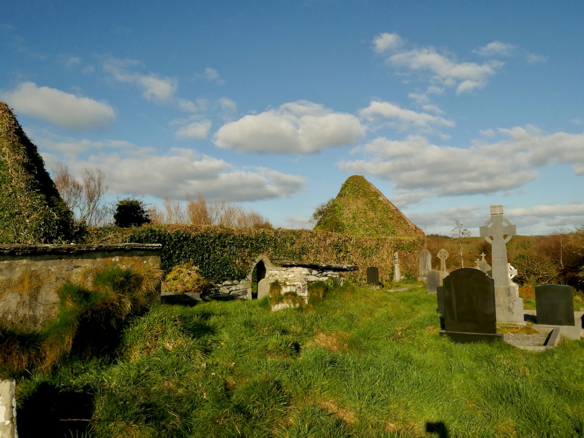
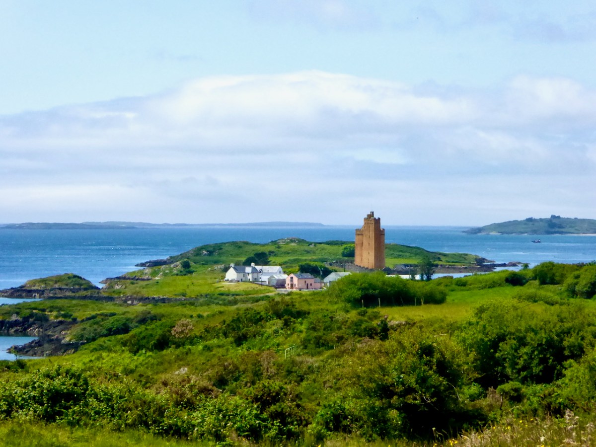
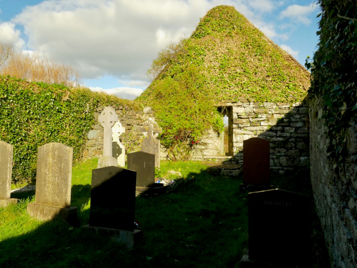
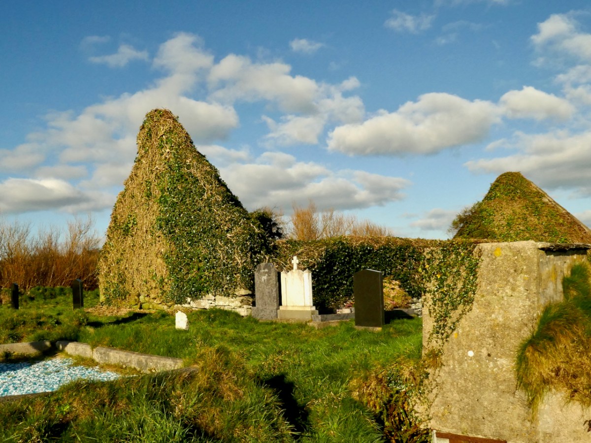
This beautiful medieval church sits on the shores of Roaringwater Bay, close to Kilcoe Castle. It was in danger of destruction by ivy but is being rescued – more on that in a minute. This (below) is what it looked like up to recently.
Kilcoe is the Church of Cóch – but who was St Cóch? For information we turn, as always, to what has become the bible for anyone interested in Irish Saints, the magnificent A Dictionary of Irish Saints by Pádraig Ó Riain. According to Ó Riain, the great St Ciarán (of Cape Clear and also of Seirkieran in Ossory), always spent Christmas here, with his foster mother, Cóch. Little is known of Cóch, except that she was of the people of the Corca Laoighdhe, with whom Ciarán also had a close association. She may have given her name also to Kilcock in Kildare. Her feast day is June 29th.
If the church was indeed founded by St Cóch, then there must have been a centre of worship here from very early Christian times, since typically a church grew up around the relics of a venerated and holy man or woman. Whatever the form of the original church, nothing survives of it now. Take a look at my post Mizen Magic 23: Croagh Cove, for what might have been there in, say, the 6th to the 10th centuries.
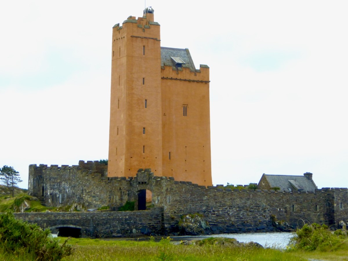
Note also the proximity of the Church to Kilcoe Castle – a stronghold of the McCarthys, now magnificently restored by Jeremy Irons. It was normal for lords and chiefs to have ecclesiastical foundations close by, on land they had ceded for that purpose. The monks made sure that the lord’s soul would be saved by ceaselessly praying for him, and his endowment of the monastery or church gained him many indulgences, shortening his time in Purgatory.
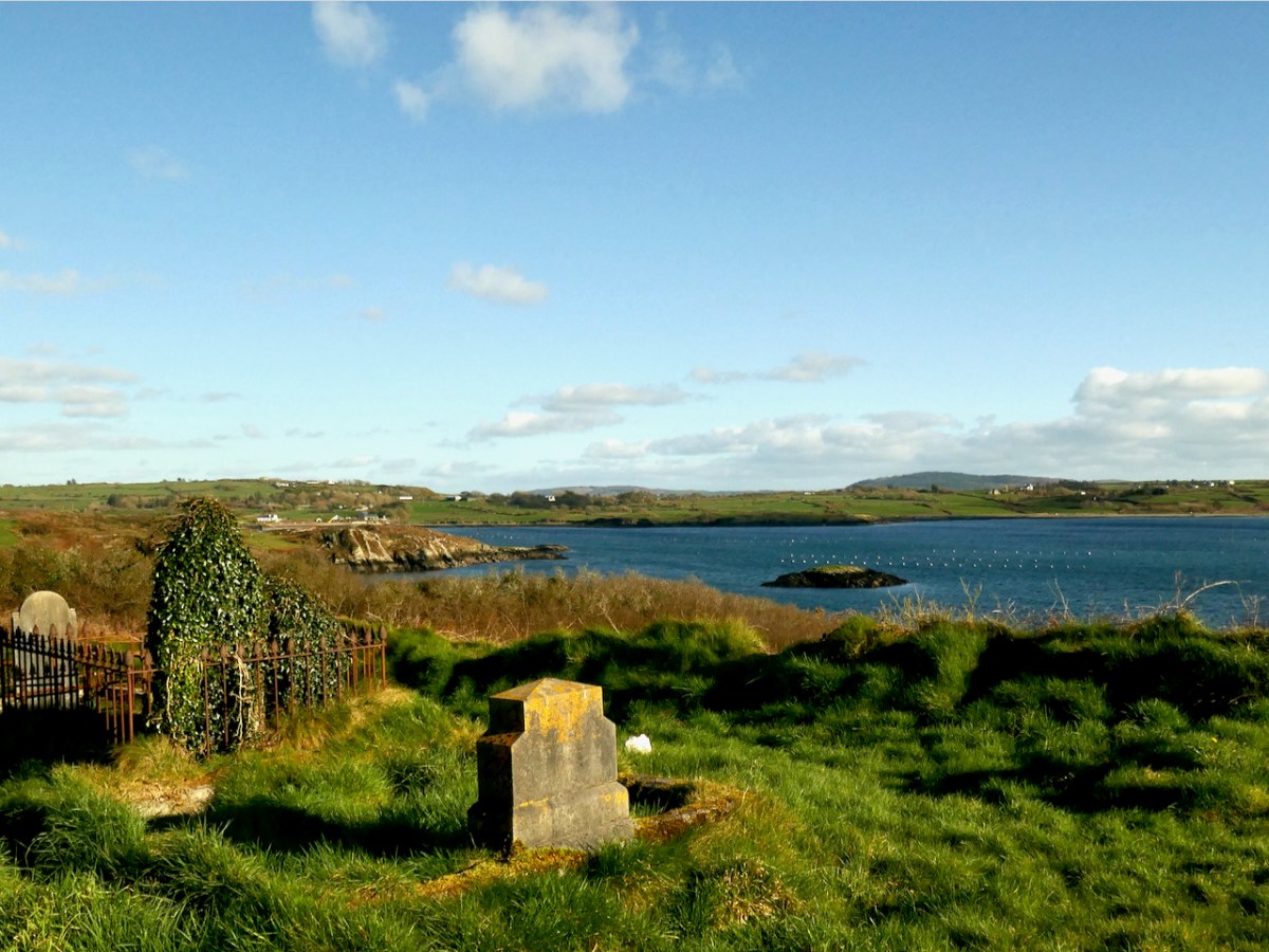
Around the core of the original church was a burial ground, with burials placed on a hierarchical basis closer to or farther from the church. The bones or relics of the founding saint were often under or immediately beside the church, with the most coveted spots going to high-ranking individuals.* The association of ancient churches with burial grounds continued through the ages. Only in more recent times have modern cemeteries been established on new ground not associated with churches.
The Parish system did not evolve until the 12th century and parish churches were often simply an evolution of the older monastic church, occupying the same ground and with a continuation of the burial practice. What we see now at Kilcoe is a parish church, and although it may be based on a much older site, the architectural remains are solidly gothic, and probably 15th century – the same style of architecture we see in Kilcoe Castle. We can imagine the head of the McCarthy family of Kilcoe Castle crossing the drawbridge to hear mass or confess his sins in the little church under his patronage.
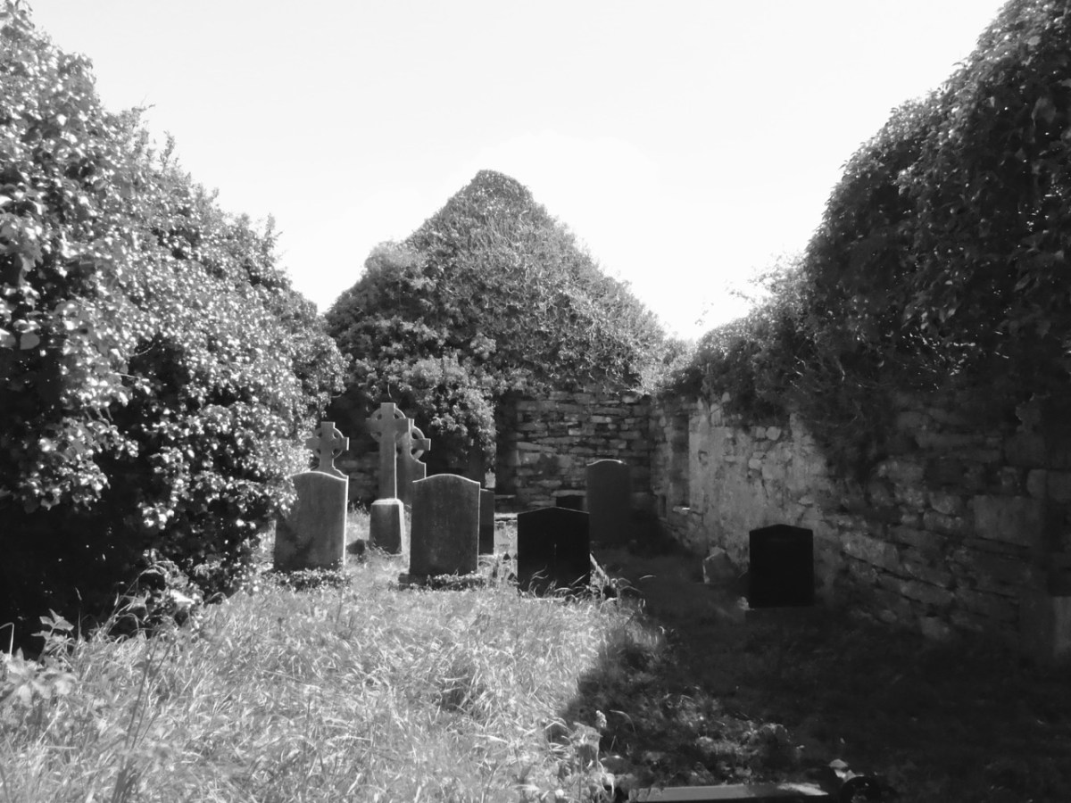
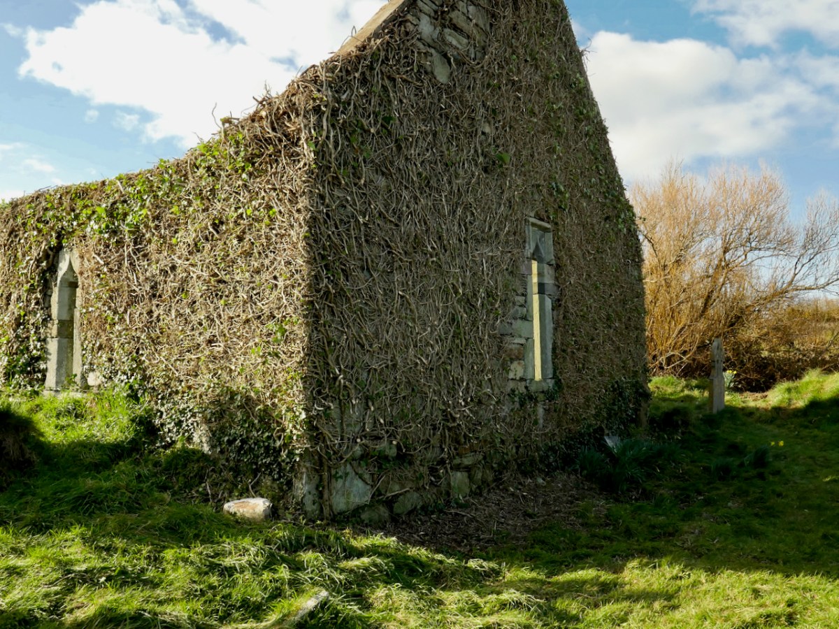
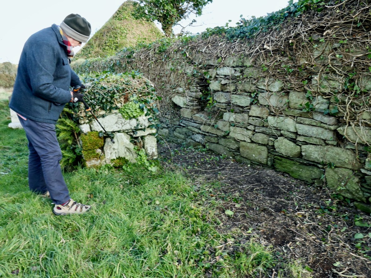
In recent years, the church has become more and more buried in ivy. You can see the condition of the exterior in the second photograph of this post, and of the interior of it (above) in a post I did way back in 2015, A Tale of Four Churches. Worried by the deteriorating condition a group of local people raised funds through Go Fund Me for an assessment by a conservation engineer. That report is a detailed survey of every aspect of the church and makes numerous recommendations for remediation. From the report:
The church is in fair condition with its walls and main architectural features largely intact. However, the substantial ivy canopy and embedded ivy stems are damaging the masonry and, without intervention, there is likely to be significant loss of historic fabric in the short to medium term.
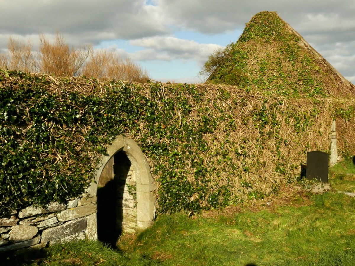
The ivy canopy on all walls should be reduced immediately by cutting back the ivy to the wall face. This should be preceded by an ecological assessment which may impact the timing and scope of the vegetation control measures (unless advised otherwise by the ecologist, cutting back of vegetation should be carried out between September 1st and February 28th). The ivy should not be treated with herbicide or removed unless conservation work can be carried out shortly after treatment and removal.
Kilcoe Church Condition Report John Kelly (conservation accredited engineer) David Kelly Partnership. Oct 2022**
When we visited yesterday we were thrilled to see that this work is underway, following best practice as advised by the conservation report. Although we are not sure of the details, it appears that the church itself is in private ownership, and that the landowner may be the one who has undertaken this work at their own expense. (Happy to receive further correction or confirmation of this, in order to direct appreciation appropriately.)
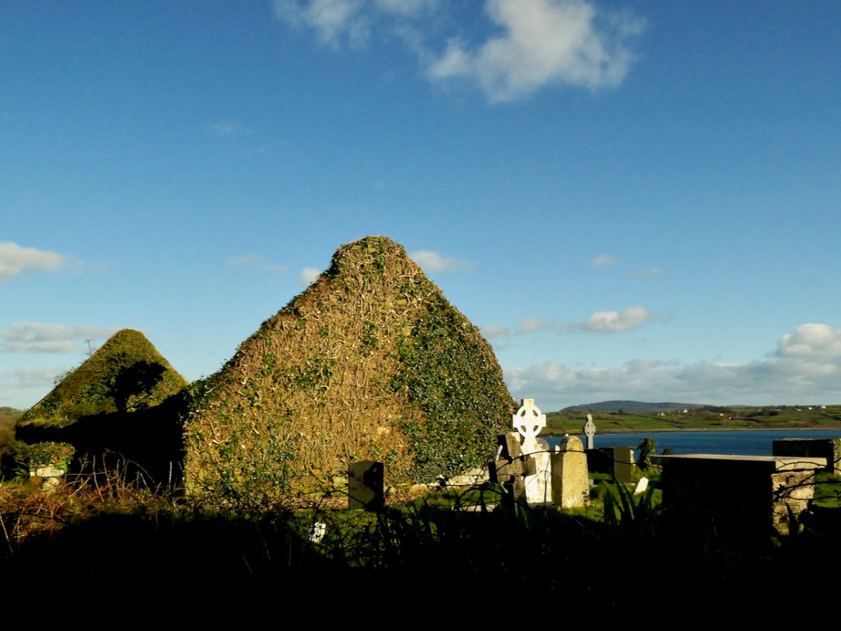
And – now that this work is underway, the church is rising like a phoenix and once again it is possible to see the major features of this fine and important piece of our heritage.
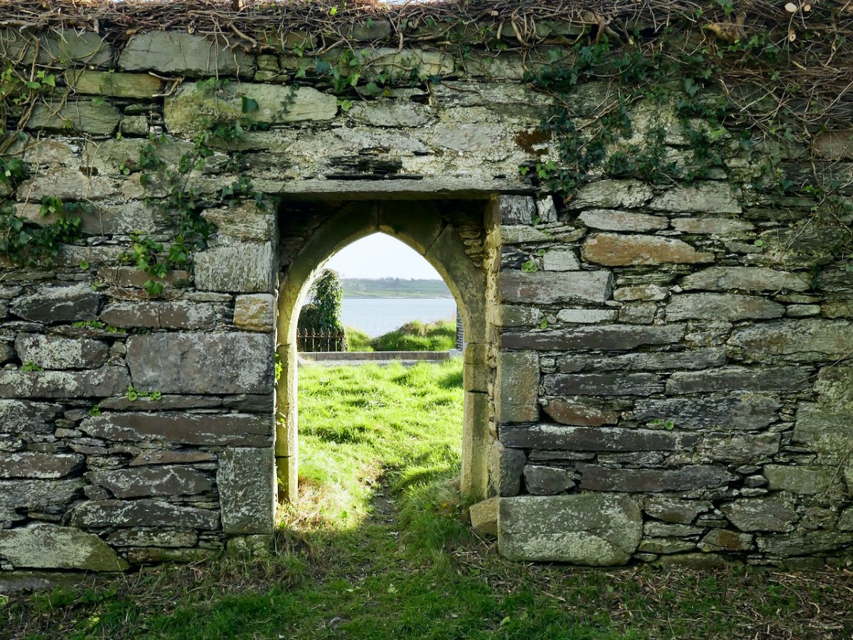
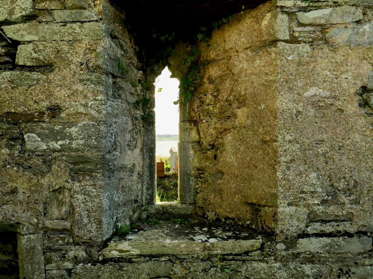
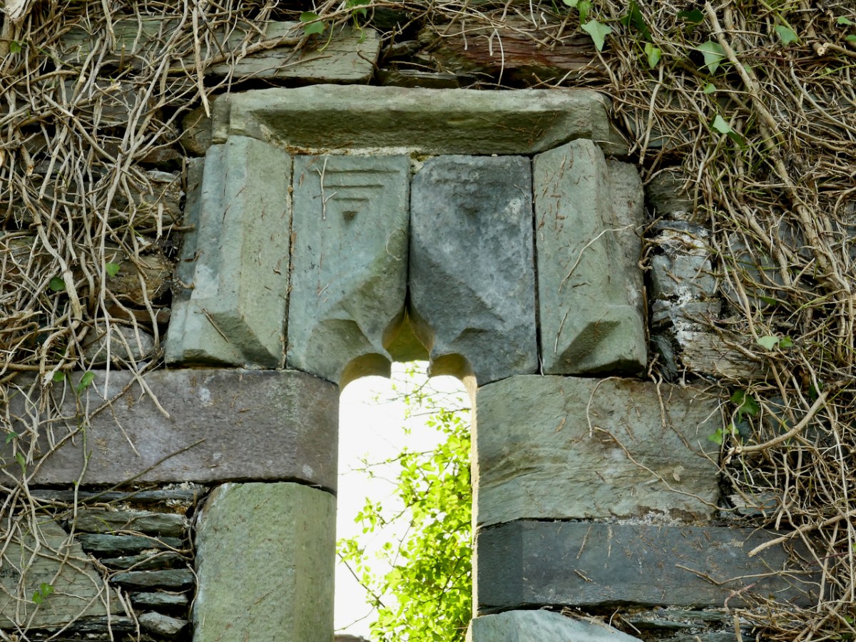
The church is a simple rectangle. The chancel, containing the remains of an altar table, is at the east end, and there is one doorway in the south wall. While this entrance, when viewed from inside, is a straight opening with a plain lintel, from the outside it is totally different – finely carved stone provides a graceful arched surround.
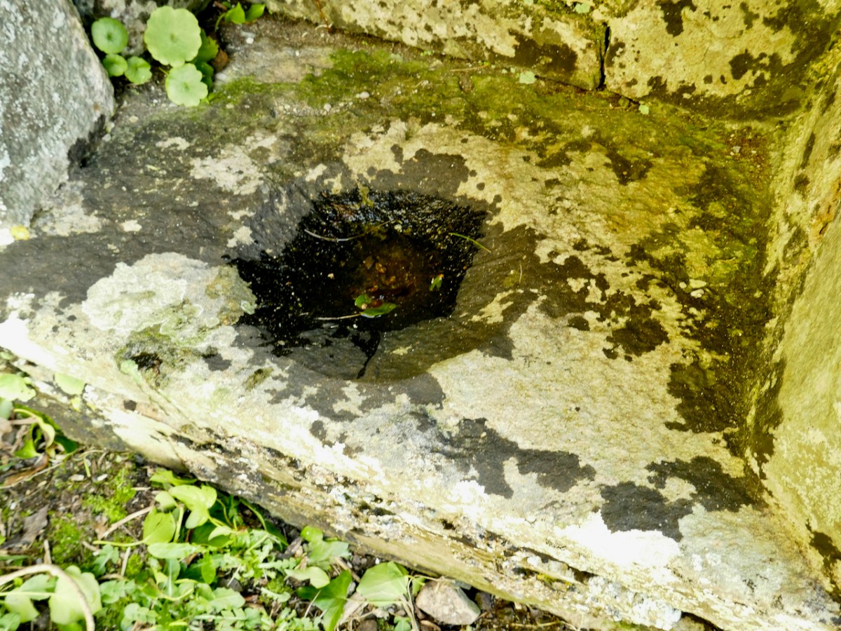
Two ‘basins’ are set into the walls, as are two stone ‘cabinets.’ The basin on the south wall is a piscina, in which vessels were washed, and has a carved bowl, although it is hard to make out under under a cover of dark lichen.
The basin in the north wall is more visible now that some of the ivy has been cut back. It may have been a baptismal font.
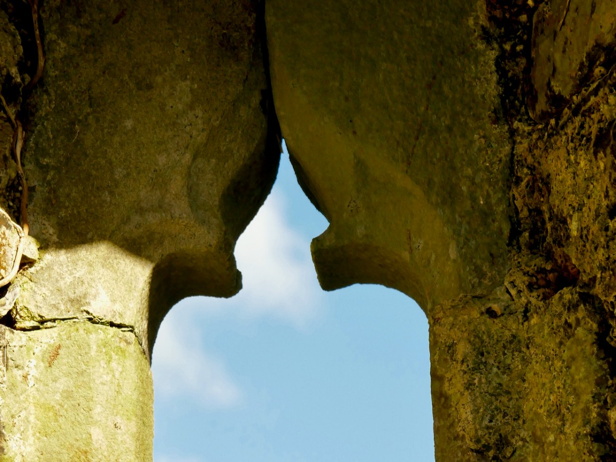
There are two fine gothic windows, tall and slim, with carved ogival heads. The window is the south wall is now visible inside and out. It seems to have an asymmetrical splay, designed to let more light in. For a similar window – and indeed for more on what this church may have looked like – go to my post Mizen Magic 19: Church of the Angels.
The window at the east end, behind the altar, was particularly worrying, as ivy was threatening to get between the cracks and break it apart. It looks so much better now, and on the outside the hood mouldings can once again be admired.
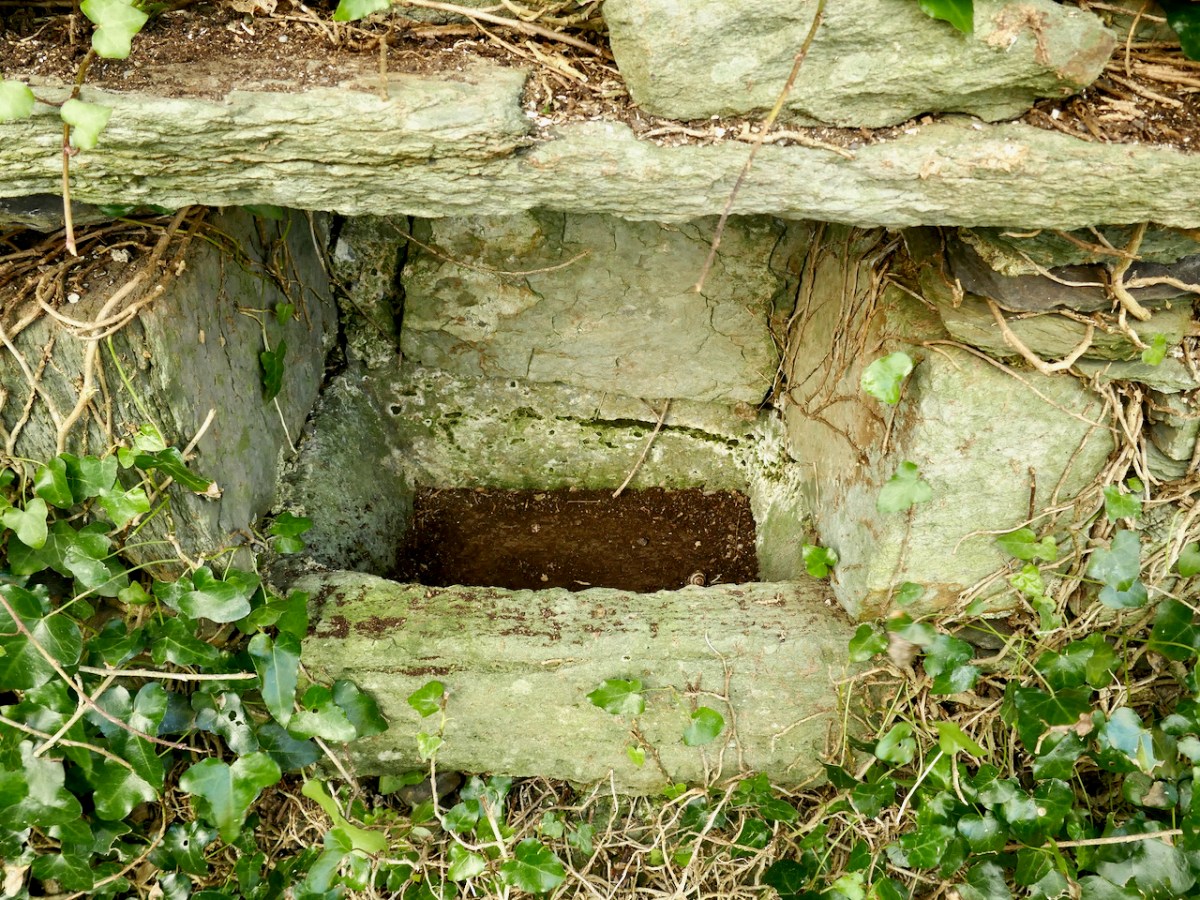
The north wall of the church, outside, is a good place to see how the ivy has been carefully clipped. There’s an old chest tomb here which incorporates what might be the top of another gothic window – further exploration of this tomb is recommended in the report.
There is much more work to be done on Kilcoe Church, but what has happened so far is terrific and very encouraging. Compare the photo below with the second one in the post. They were taken from about the same place – and look at the difference! On behalf of all of us in West Cork, huge appreciation must go to everyone involved in the efforts to preserve it for posterity.
One last comment is that this church is a listed National Monument, so future work needs to be done in consultation with them.
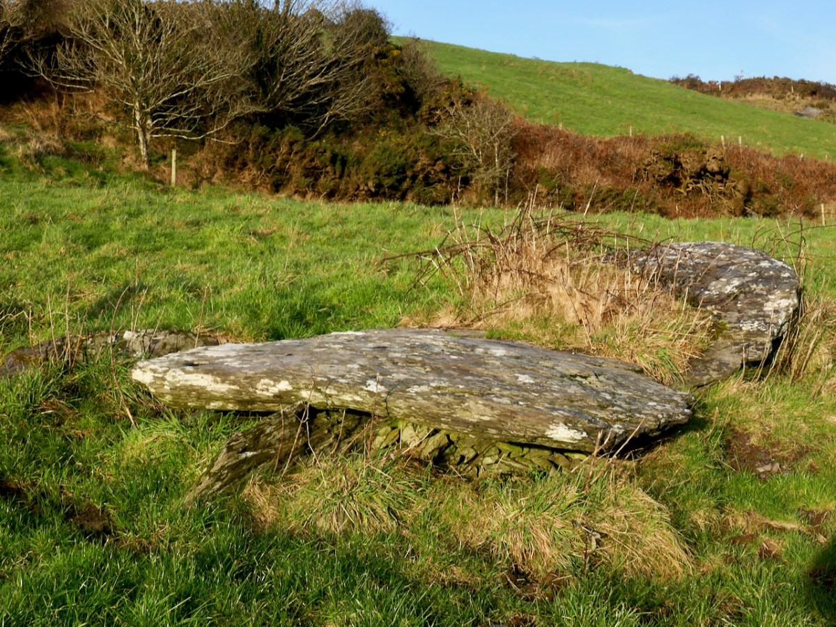
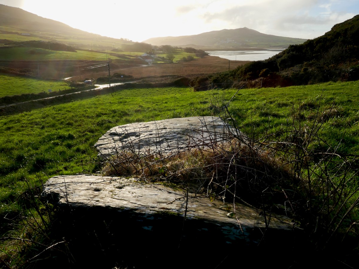
We had, unknowingly, driven past this wedge tomb many times. It’s located on rising ground overlooking the Barley Cove wetlands, in the townland of Ballyvogebeg. The townland name (according to logainm.ie) translates as the Little Place of the O’Buadhaighs, a very scattered clan sometimes translated as Bogue, or Bowe.
The wedge tomb here was formally recorded by archaeologists de Valera and Ó Nualláin in their Survey of the Megalithic Tombs of Ireland in the early 1980s. They provided the scale drawing, below.
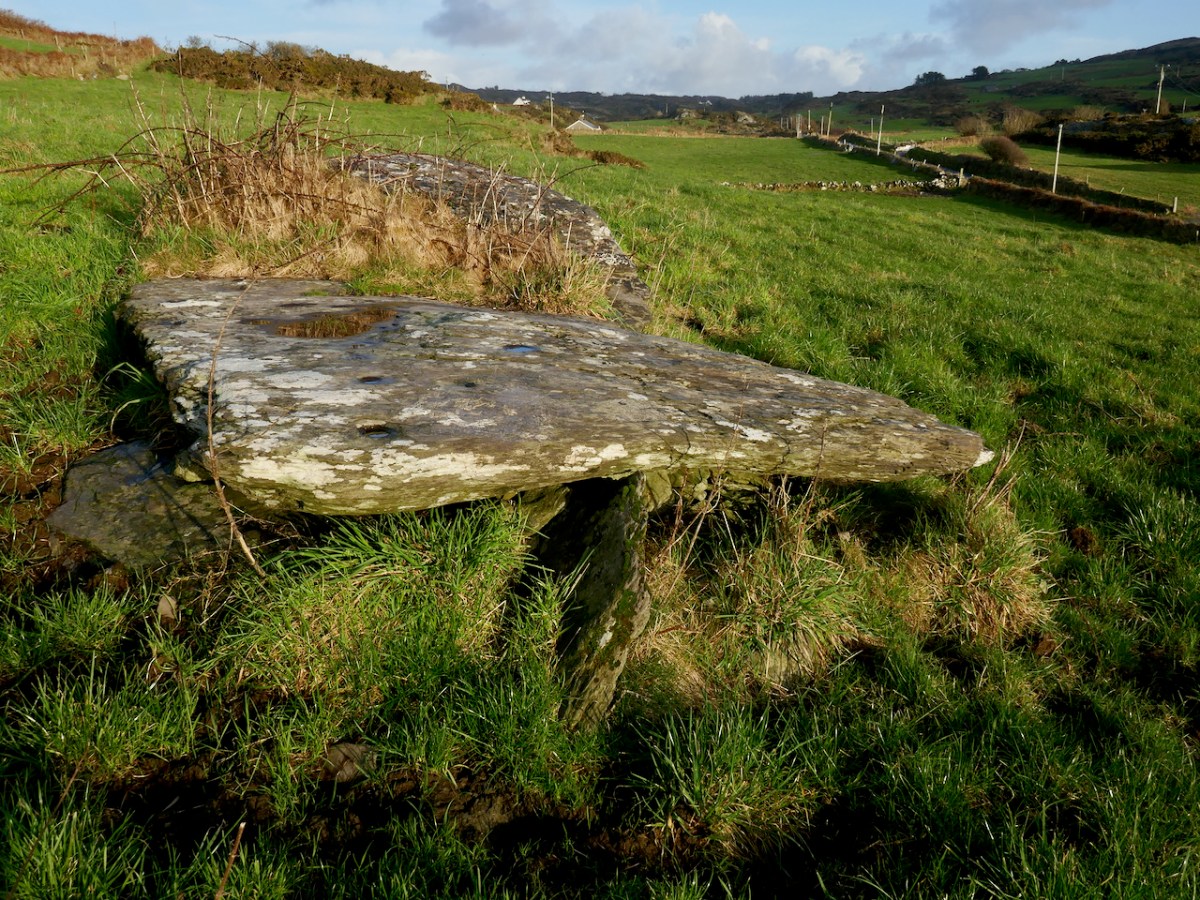
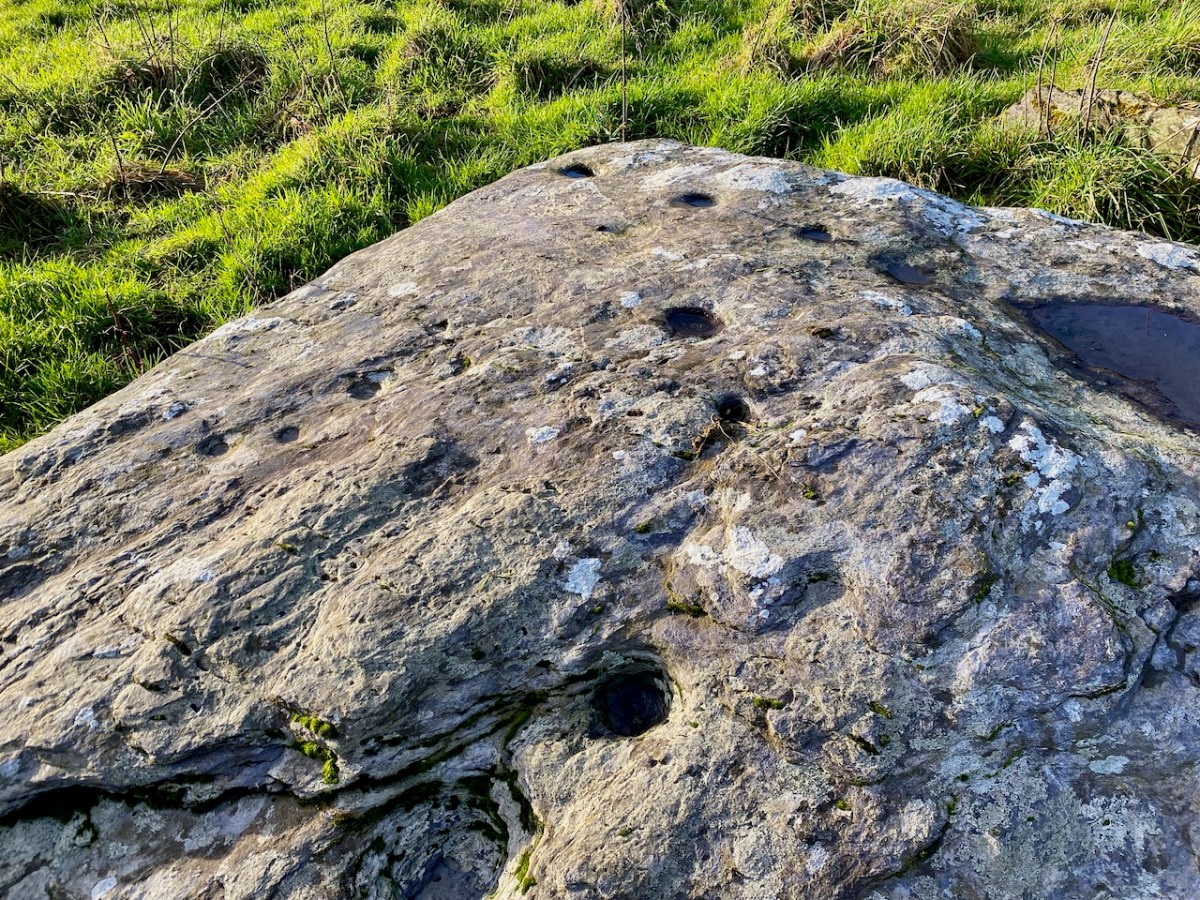
It was next surveyed by the Cork Archaeological Survey Team in the early 90s. Oddly, neither of these reports contain any reference to one of the most striking aspect of this megalithic tomb – the cupmarks on the capstones.
The next person to record it was Jack Roberts for his Antiquities of West Cork series, and his drawing clearly shows the cupmarks.
If you are new to this series on Mizen Megaliths, or to megaliths in general, you can catch up with a quick read of my post Wedge Tombs: Last of the Megaliths. This wedge tomb, Ballyvogebeg, fits the pattern, although its ruinous state doesn’t allow us to observe much detail. The side stones have collapsed under the weight of the two large capstones, although you can still see them underneath, leaning at a perilous angle.
De Valera and Ó Nualláin noted that there was no indication of a surrounding mound, which seems to be typical of West Cork wedge tombs. It likely dates to the Copper or Bronze Age, making it around 4,000 years old.
Cupmarks are normally found on open air rocks and boulders, not associated with any monuments and are the most frequent element or motif in Rock Art. However, they are found occasionally on Wedge Tombs and Boulder Burials, so while their occurrence on the Ballyvogebeg wedge tombs is uncommon, it is by no means unique. Intriguing, though! If the tomb had been covered by a mound, they would not have been visible, leading to the conclusion that it was the act of carving them that was important.
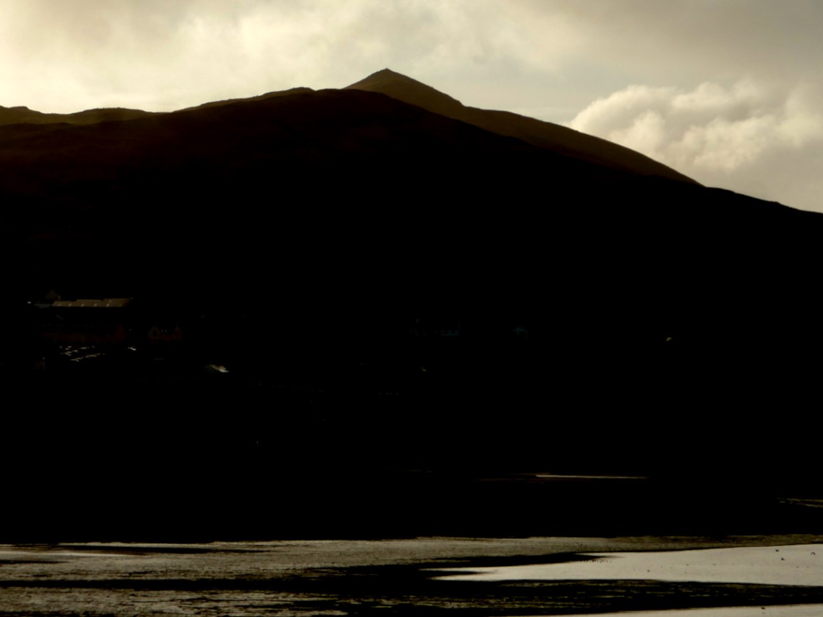
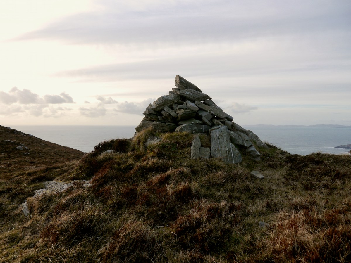
Like all of our West Cork wedges, it is oriented towards the west and the setting sun – that is the ‘entrance’ or tallest and widest end, faces the west. The most striking feature of the view is the pyramid-shaped Mizen Peak. What gives the Mizen Peak its distinctive point is a small cairn on its summit.
I haven’t yet been up to this cairn, although I am hoping to get there one of these days. So I am relying on the generosity of our friend Michael Mitchell, of theWalking to the Stones Facebook Page, for the photograph below. Like us, he has been struck by the fact that Mizen Peak seems to be visible from many sites, saying, It’s obviously a very important hill. It seems to be a focus for various megaliths, even some that are not on the Mizen peninsula itself. Michael points out that the cairn does not have the appearance of being ancient but more like a marker cairn.
Curiouser and curiouser, because there is very ancient folklore indeed about this cairn, which, in fact, gives its Irish name to Mizen Head – Carn Uí Néid, or the The Cairn of the Grandson of Néid. Which grandson are we talking about here? Néid had a son, Elathen, who in turn had five sons – the Daghda, Oghma, Bres, Alloth and Delbaeth – all of them figure prominently in Irish Mythology as members of the Thuatha Dé Danann.
Bres is the grandson in question, but Bres was his nickname. He was really Eochaid bres – that is Eochaid the Handsome, because everything comely and handsome that is seen in Ireland, ’tis to Bres it is likened. I am getting my information here from a piece written by J. F. L. in the Journal of the Cork Historical and Archaeological Society of 1912 (available online).
The Dinnshenchas of Carn Uí Néid has been translated by Dr Whitley Stokes
Bres, son of Elathan, died there; ’tis he that in the reign of Nechtan Fairhand. . .King of Munster, demanded from every rooftree in Ireland a hundred men’s drink of a hornless dun cow, or of the milk of a cow of some other single colour. So Munster kine were singed by Nechtan with a fire of fern, and then they were smeared with a porridge of the ashes of flaxseed, so that they became dark brown. . . And they also formed three hundred cows of wood, with dark brown pails on their forks in lieu of the udders. These pails were dipped in bog stuff. Then Bres came to inspect the manner of these cattle, and so that they might be milked in his presence . . . All the bog stuff they had was squeezed out as if it was milk. The Irish were under a geis to come thither at the same time, and Bres was under a geis to drink what should be milked there. So three hundred bucketsful of red bog stuff are milked for him and he drinks it all.
JCHAS Notes and Queries Carn Uí Néid, by J. F. L. 1912, Vol 18, 96, Ps 211-213
Of course it’s a huge and unreliable leap from mythology to a wedge tomb, but I can’t help thinking how great it would be if the Ballyvoguebeg wedge tomb was indeed the tomb of Bres, brother of the Daghda, handsome King of Munster, dead from a surfeit of bog stuff.
It’s time for another look at Ireland’s history, through the medium of early maps. We have previously examined the Down Surveyhere and here (the latter looked specifically at West Cork). You may remember that the project was instigated by Oliver Cromwell to catalogue the ownership of land given to British settlers after his invasion of Ireland which commenced in 1649. The Act of Settlement 1652 formalised the changes. We don’t like the recollection of those times, but we do find all early maps fascinating when we compare them to our present day topographical knowledge.
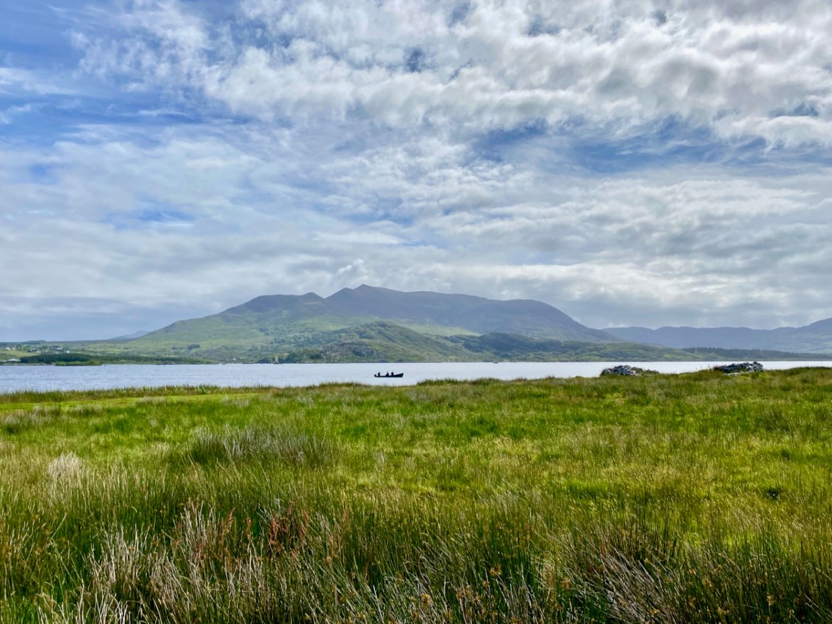
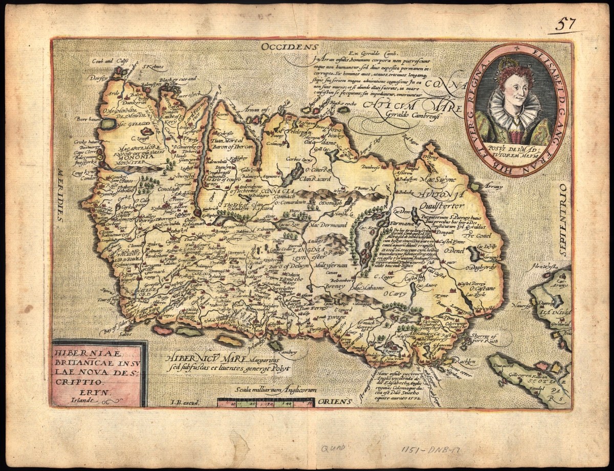
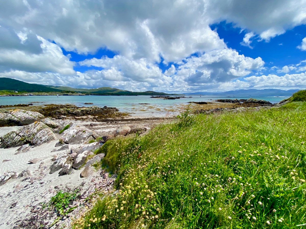
Kerry: it’s one of our favourite destinations. Visually spectacular, it offers a dramatic natural terrain of coastlines, mountains – and remembered history. Above is a view from Church Island, on Lough Currane near Waterville. The Down Survey gives us a mid-17th century aspect of the landscape, but there are earlier maps. The header is a part of Ortelius’ Theatrum Orbis Terrarum, published in many editions from 1570. Note Queen Elizabeth prominently displayed. Here’s the full page map (courtesy of the David J Butler Collection of Maps of Ireland):
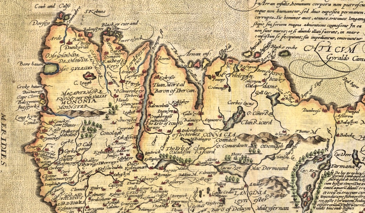
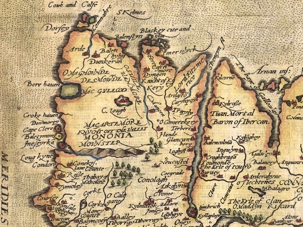
Above is an enlarged detail from the Theatrum Orbis Terrarum showing much of today’s Cork and Kerry counties. You have to get used to thinking through ninety degrees: it was the convention in many early maps to put West at the top of the image, and North to the right. Here you will see Roaringwater Bay over to the left. To make things easier, here is a much enlarged view of part of this map, although with some loss of definition:
You will recognise Dorsey (Dursey Island), Croke haven (Crookhaven), Cape Clere (Cape Clear Island), Baletymore (Baltimore), Tymolay (Timoleague), Kynfale (Kinsale), all within Movnster (Munster). Going round the corner we find Balenftyn (Valentia), Kery (Kerry), Trayly (Tralee), and many more, including names we cannot now relate to.
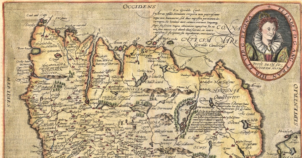
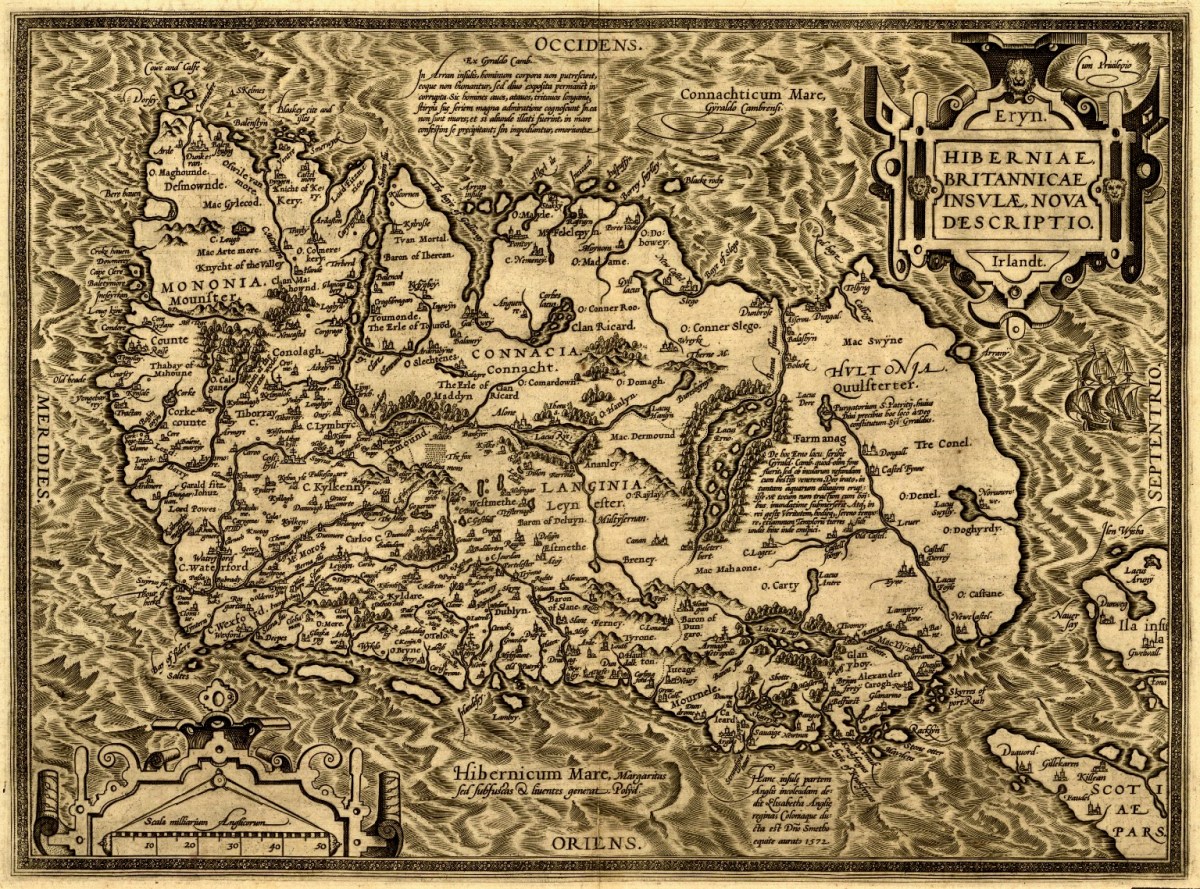
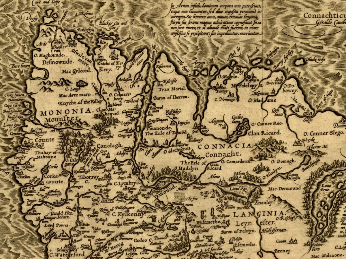
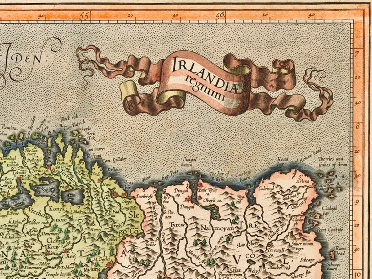
(Above) – here’s another pre-Down Survey map: Hiberniae, Britannicae Insvlae nova descripto, published by Abraham Ortelius (1527-98), a Flemish engraver. The map is thought to date from 1598 and is in the collection of The Library of Congress, Geography and Map Division, Washington, DC. Here’s a detail of the area which interests us today – again, many names can be recognised:
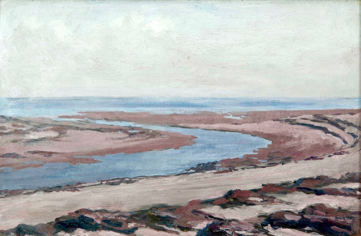
Another present-day Kerry scene: in fact a photograph from a friend’s garden. To add a further dimension to our review of Kerry through time, this Jack B Yeats painting – Kerry Landscape – dates from 1913 (current whereabouts unknown – it was offered for sale by Adams in 2016):
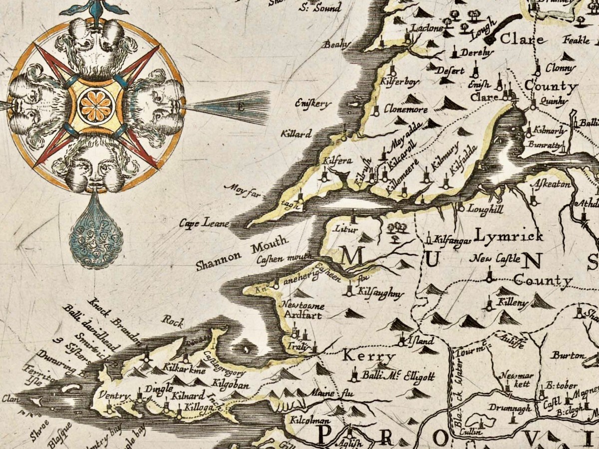
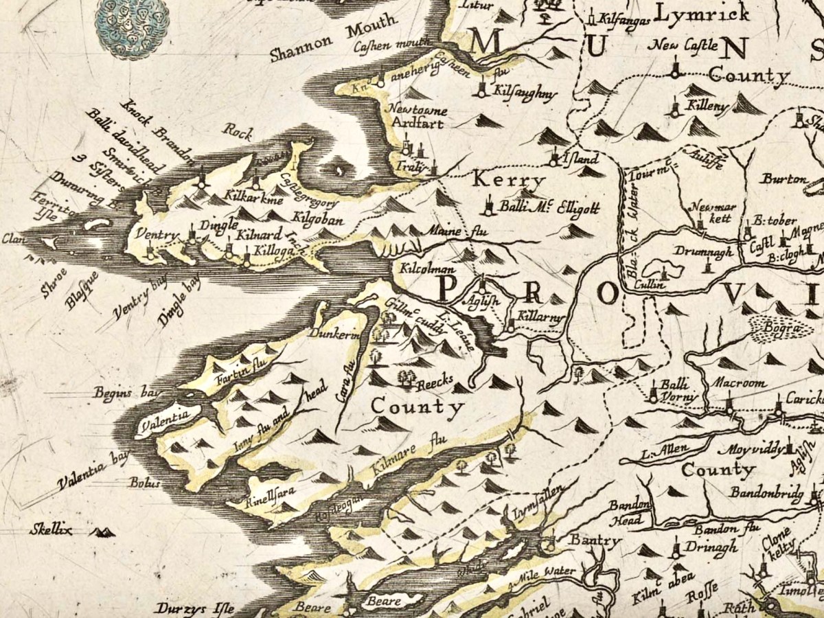
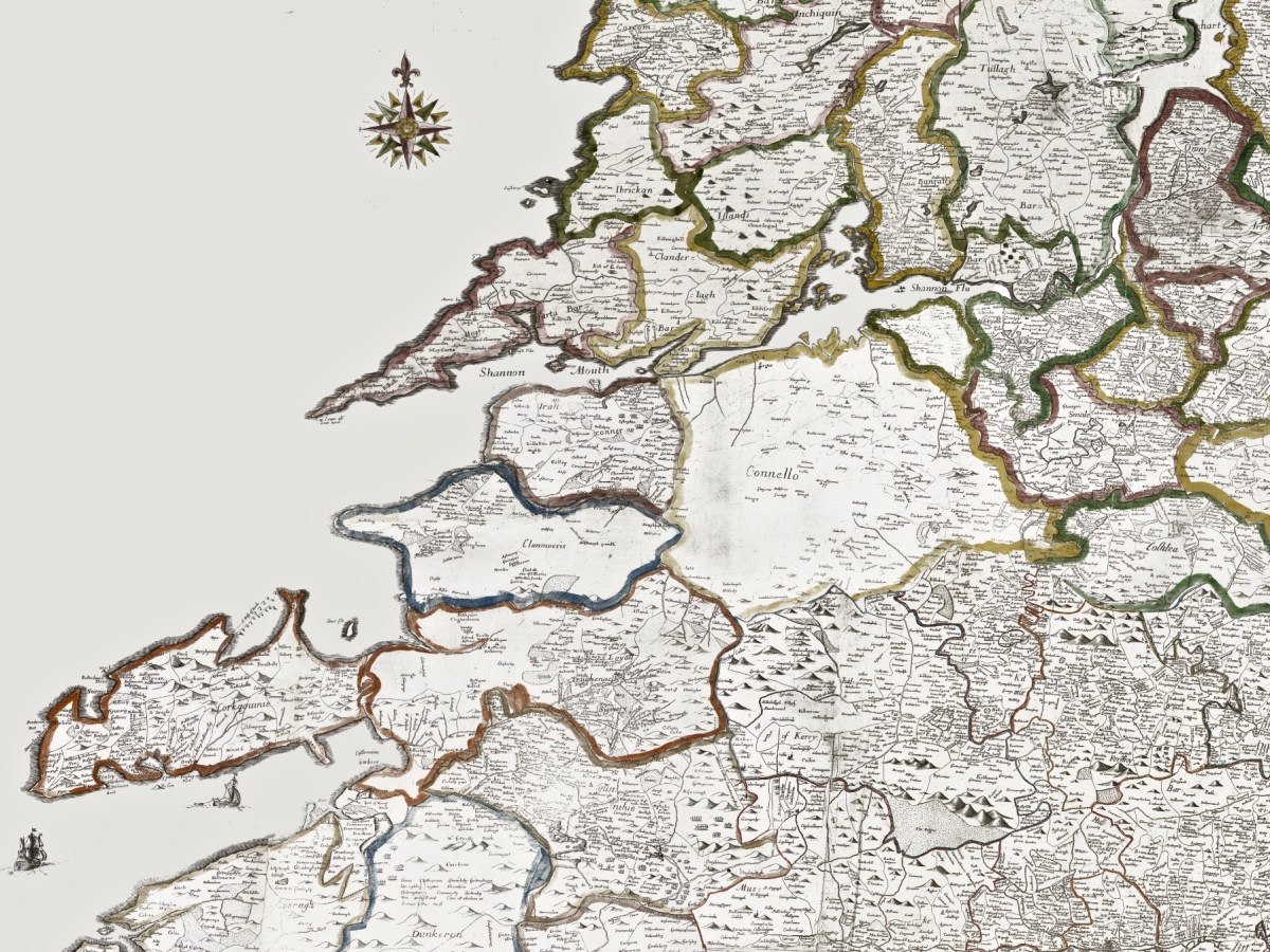
Getting back to The Down Survey, the following details are from the available survey documents which were taken in the years 1656-1658. They show parts of Clare, Limerick and Kerry:
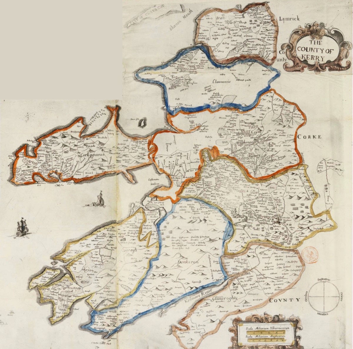
Here is a specific County map of Kerry in greater detail: it encompasses the land divisions spanning from Kenmare to the mouth of the Shannon (Down Survey GIS 1641 – 1670).
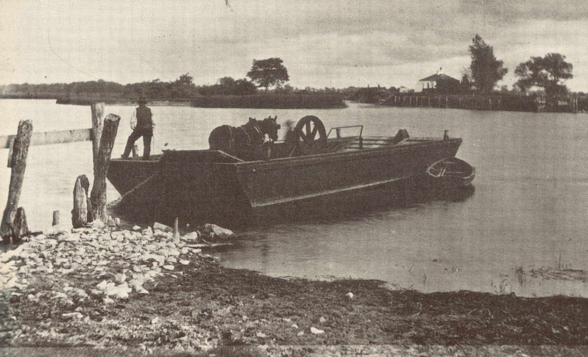
Above: a ferry across the Shannon, c1890. Below: this map is also from The Down Survey collection and is titled Landowner Map 1641 – 1670.
Before leaving this little outline of Ireland’s ancient western coastline, I can’t resist going back to the Twelfth century and to Giraldus Cambrensis (c 1146 – c 1223). Described as a Roman-minded Cambro-Norman cleric, Giraldus lived most of his life in Wales but visited Ireland in 1183 and 1185. He wrote descriptions of what he encountered there, and they are entertaining. Here are two examples: though not specific to Kerry, they are not geographically distant.
. . . There is an island called Aren, situated in the western part of Connaught, and consecrated, as it is said, to St Brendan, where human corpses are neither buried nor decay, but, deposited in the open air, remain uncorrupted. Here men can behold, and recognise with wonder, grandfathers, great-grandfathers, and great-great-grandfathers, and the long series of their ancestors to a remote period of past time . . .
Giraldus Cambrensis
. . . There is another thing remarkable in this land. Although mice swarm in vast numbers in other parts of Ireland, here not a single one is found. No mouse is bred here, nor does it live if it be introduced; when brought over, it runs immediately away and leaps into the sea. If it be stopped, it instantly dies . . .
Giraldus Cambrensis
Further Reading! Some past Roaringwater Journal posts which look at early maps and the West of Ireland can be found here and here.
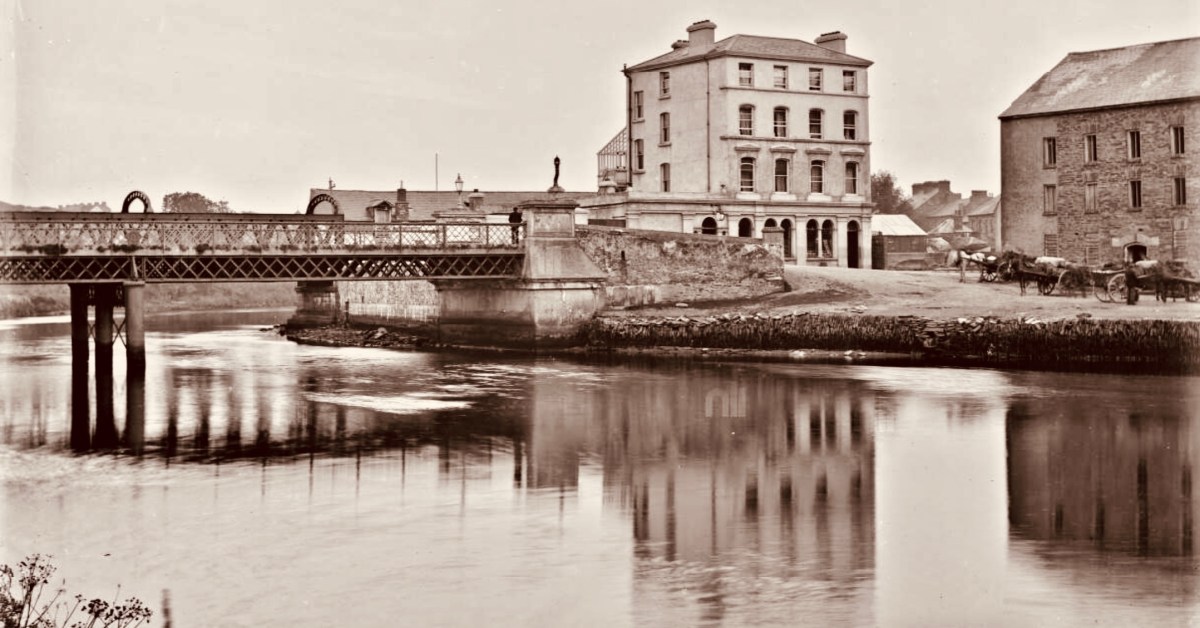
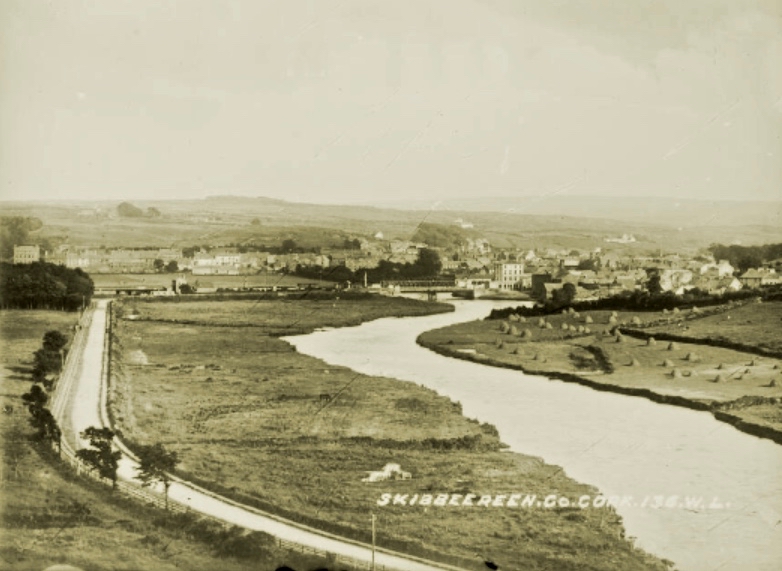
This photo of the West Cork Hotel beside the Ilen River, Skibbereen (courtesy of the NLI Lawrence Collection) captures a moment in time. It was taken in the very early 20th century – probably before 1910. Clearly seen are the hotel itself – opened in 1902 – the old iron road bridge which was superseded in 1964, and the railway bridge behind it carrying the line to Baltimore (which was opened in May 1893). That bridge still exists, of course, although the line closed in 1961. To the right of the photo is the Old Steam Mill, originally constructed as a flour mill by Thomas Marmion in the 1830s. This building stands on Steam Mill Quay.
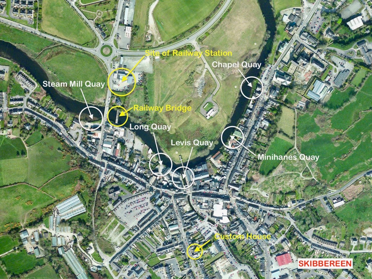
The Irish name for this town, an Sciobairín, is said to mean a small inlet for docking boats. Steam Mill Quay is the first of five quays which served the town, suggesting a period when the river itself (tidal to just north of the town) was the life blood of the community:
. . . Skibbereen was a settlement served by water. The River Ilen is tidal and in the early 19th century boats of up to 200 tons could navigate to Oldcourt, within two miles of the town centre. From there goods were transferred into ‘lighters’ (unpowered barges) and then brought into the quays where there were warehouses and a Custom House. Now, sadly, Skibbereen’s waterfront is a bit neglected and its active past shipping history is no longer obvious. Five historic quays have been identified along the river: Steam Mill Quay, Long Quay, Levis Quay, Minihane’s Quay and Chapel Quay . . .
Roaringwater Journal
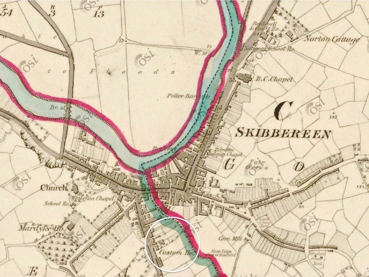
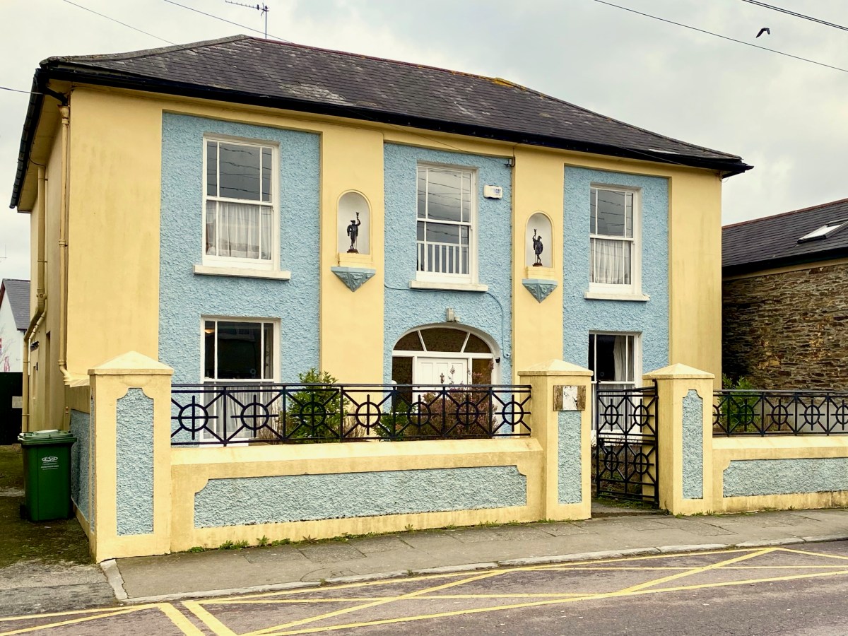
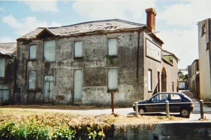
Here is the Custom House – now a private residence on Townshend Street. The first edition of the OS map (above the photo) marks the location. It’s a fine building, clearly of some standing, with its decorative niches and curved fanlight. The existence of this building in the town emphasises the historic significance of importation and trading of commodities, probably primarily by water transport, to Skibbereen when it was operating. I was surprised to find that Hansard – the official record of the actions of the British Parliament – has one entry pertaining to the Skibbereen Custom House. From it we learn that its business was transferred to Bantry in 1890, and that this was a cause of concern to some of the townspeople and local fishermen:
. . . DR KENNY (Cork, S) I beg to ask the Secretary to the Treasury whether he is aware that owing to the transference of the Custom House from Skibbereen to Bantry very great inconvenience and injury are caused to the Baltimore fishing industry; whether, according to existing Customs arrangements in Skibbereen. the Deputy Officer of Customs in that town is unable to give permission for the discharge of cargoes of ice absolutely essential for the preservation of the fish caught by the Baltimore fishermen, and also that it is impossible for him to obtain permission by telegraph from Bantry to do so, and whether, in consequence, steamers for conveying the fish have to wait at Baltimore the arrival from Bantry, 24 miles distant, of the Superintendent of Customs; and whether he will take steps to have abated the inconvenience complained of, by restoring the Custom House to the Skibbereen district?
Hansard record of Commons Sitting 08 May 1890 § 469
There is a further record giving the response by the then Secretary to the Treasury: it lacks sympathy!
. . . Mr. JACKSON (Leeds, N) I am informed that it is not the fact that very great inconvenience and injury have been caused to the Baltimore fishing industry through the transference of the principal Customs Offices for the Port of Skibbereen from Skibbereen to Bantry. The Board of Customs have ascertained that no delay has been caused by this change in the discharge of any vessels, nor need any delay or inconvenience be occasioned thereby, as the Officer of Customs still stationed at Skibbereen is now empowered to deal with any Customs business, there or at Baltimore, that may require attention, under exactly the same conditions as were in force previous to the change referred to. No occasion has, therefore, arisen for making any alterations in the. present arrangements . . .
Hansard record of Commons Sitting 08 May 1890 § 470
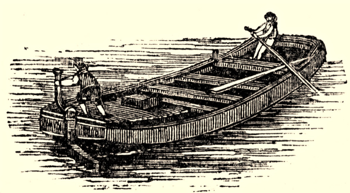
Here’s a distant view of Skibbereen from the west, probably taken in the early 20th century (courtesy of the NLI Lawrence Collection). On the left, the roadway (today’s N71 going from the town towards Ballydehob) has the track of the Schull railway (or – more properly – ‘tramway’) on its verge. The old bridge into town and the West Cork Hotel are visible, as they are in the header picture. What is noticeable is that there is no sign of any navigation of the Ilen River. I have looked carefully through over 200 early photographs of the town and it is the case that none shows any river craft. Hence my title today (and I apologise for taking a long time to get to this) The Elusive Lighters. We have no detailed records of any boats that used the river, and the quays, except that they were shallow-drafted unpowered barges. The term ‘lighters’ usually refers to ‘dumb’ boats (unpowered) used to offload cargoes from ships and transfer these to quays further inland. How were the Ilen boats built, and what did they look like?
Here’s a guess – something I found in an old engraving (not from anywhere in West Cork). The boat is being ‘poled’ or swept along by a figure with a large oar, while a ‘steerer’ handles the helm. It would almost certainly have been built from timber. After a coaster, steamer or sailing ship arrived and moored at Oldcourt, the cargo would have been offloaded to the lighter, which would have to await a rising tide before setting out for Skibbereen. The return journey would have to be carried out when the tide was falling.
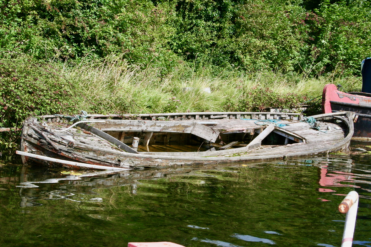
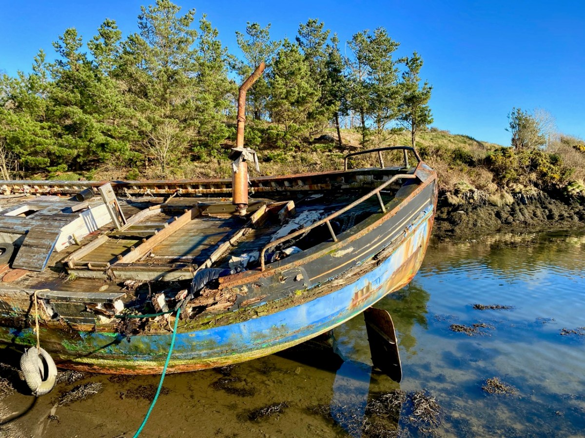
It would be great to find the remains of such a boat on the Ilen, but very little would survive of a working craft dating back over a century and a half. The wreck above is on the River Barrow Navigation at Lowtown. Here’s another old wooden boat which lay beside the tidal Ilen itself a few years ago: it may still be there!
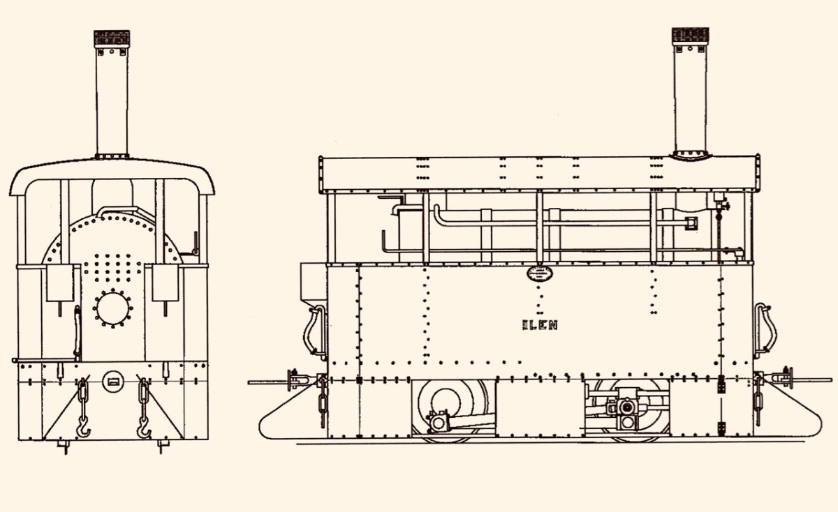
While my nostalgic soul would like to think that some trace might remain of the old Ilen boats and the quays that they served, I know that is unlikely. River traffic on the tidal Ilen would have been in its hey-day in the early part of the 19th century and would have been affected by the sufferings of the Great Famine which heavily hit Skibbereen. After some recovery, the arrival of the railway line from Cork in 1877 ensured that river trade could no longer survive: it’s ironic, perhaps, that the first locomotive on the Skibbereen to Schull tramway was named Ilen.
This post is the latest of a series that studies the full length and history of the Ilen River. Previous posts can be found here: Sweet Ilen : Sweet Ilen – Part 2 : Sweet Ilen – Part 3 : Sweet Ilen – Part 4 : Sweet Ilen – Part 5 : Sweet Ilen – Part 6 : Sweet Ilen – Part 7. Volume 18 of the Skibbereen Historical Journal (2022) includes an article Sweet Ilen – the story of a river: Part 1 – Source to Tide penned by myself. This is to be joined by a second part in this year’s Journal. Look out for it!
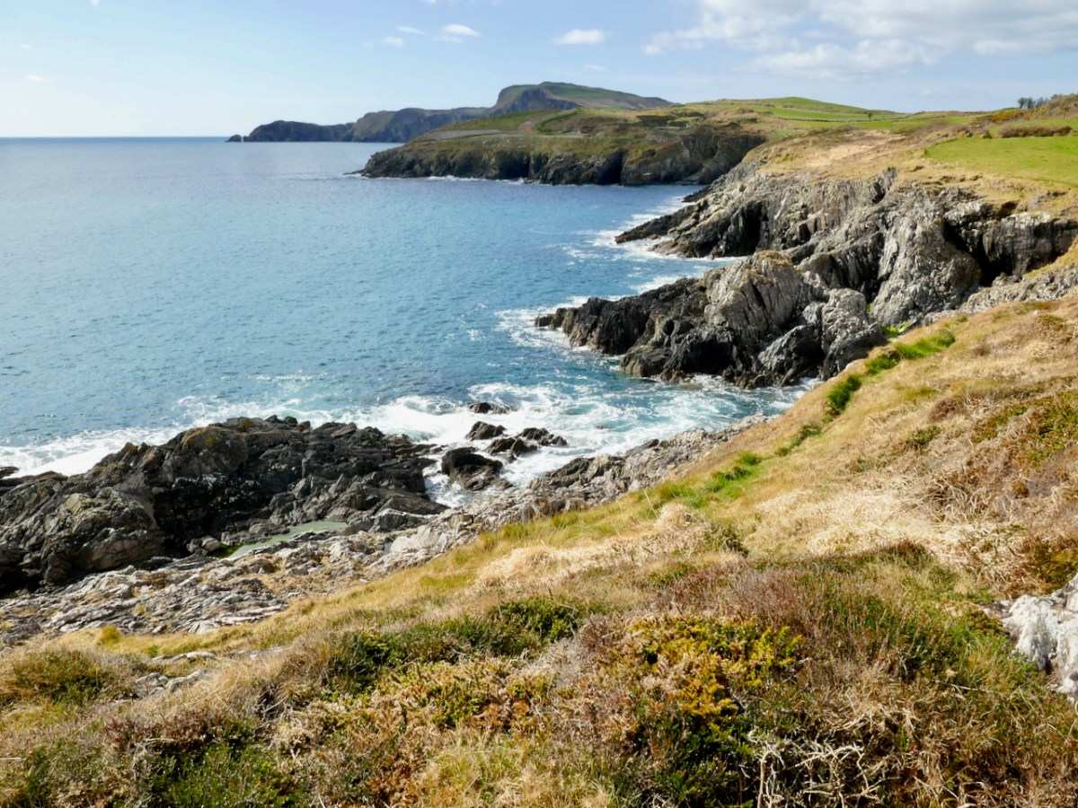
Toe head is dramatic and scenic – but romantic? Let me explain.
Conor Buckley – the dynamo behind Gormú eco tours – was offering a Romantic Sunset Walk on Toe Head in honour of St Valentines weekend. Who could resist? That’s Toe Head in the distance, above.
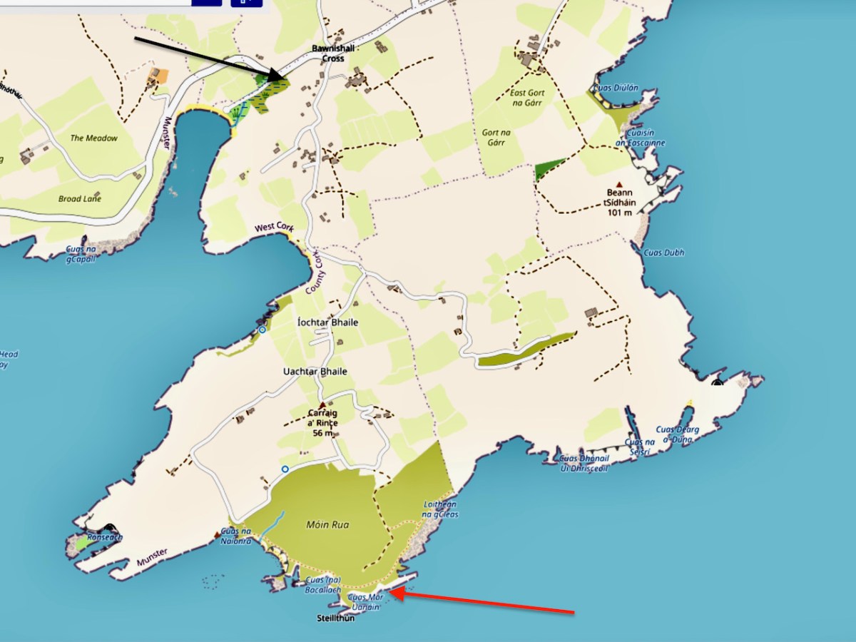
To us, in the past, Toe Head has been synonymous with the Signal Station – Robert has written about it here. But we’ve always known there’s a lot more to Toe Head than that and have been wanting to make a return trip, especially in the company of someone with lots of local knowledge. The black arrow above shows our starting point and the red arrow our destination.
We met at the Lifeboat Station – it was Kathleen, John, Robert and I – and Conor started us off with an introduction to the story of Diarmuid and Gráinne, which he used as the organising theme for the whole walk. A Seanachie (pronounced shanakee) – an Irish story-teller – had told, about 100 years ago, of Diarmuid and Gráinne’s travels in West Cork. The star-crossed lovers are responsible for landmarks all over Ireland. They ran away together, escaping from the aged Fionn McCuamhaill (FinnMcCool), Gráinne’s intended husband, and rested in many places along the way. The dolmens or wedge tombs where they slept are often known locally as Diarmuid and Gráinne’s bed. I won’t recount the whole story here, as there are lots of accounts online: this is a good version.
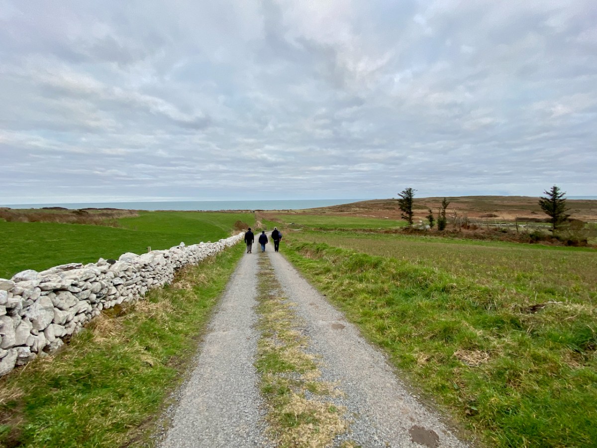
Our walk took us along quiet country roads and out to An Móin Rua – the Red Bog. Not really a bog, but a heath, and in the summer alive with colourful heathers and Irish Gorse, and the home of swooping and calling choughs.
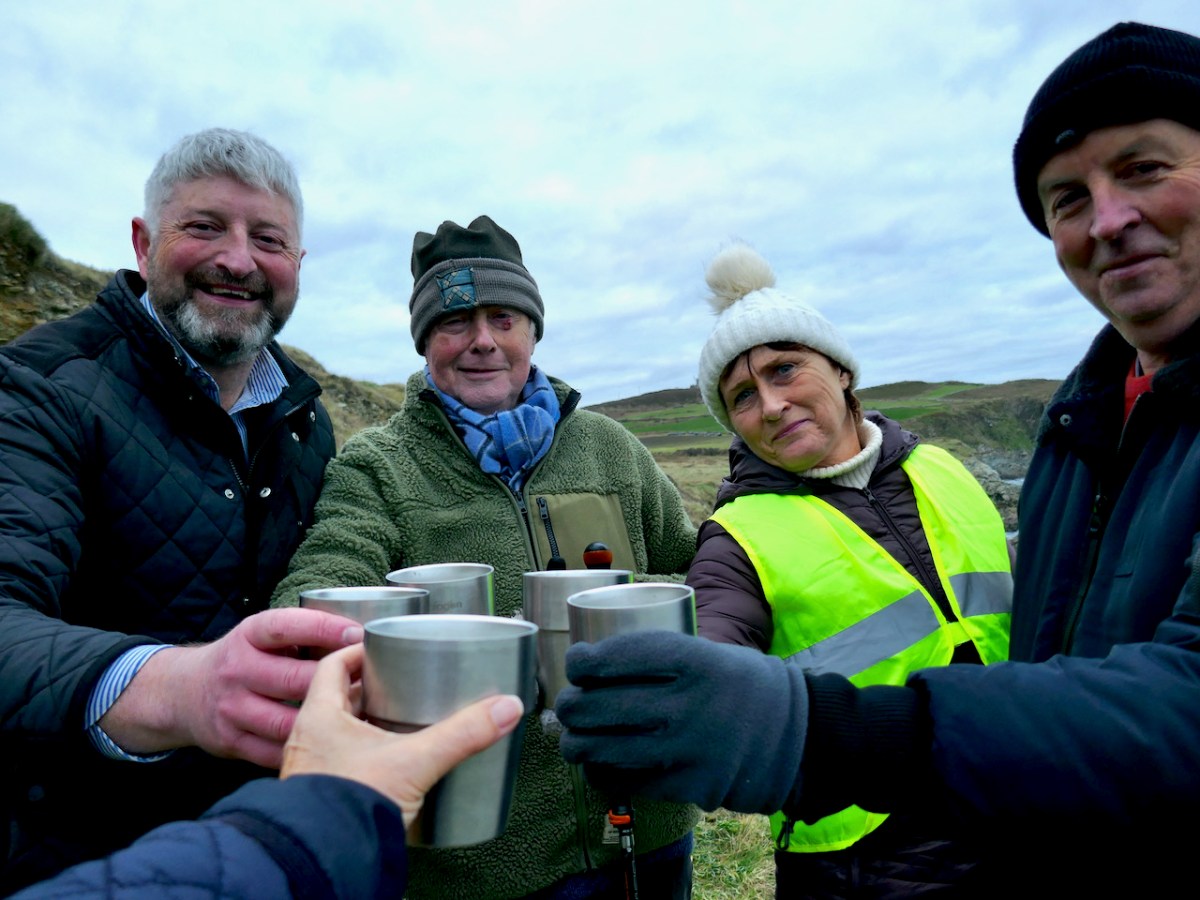
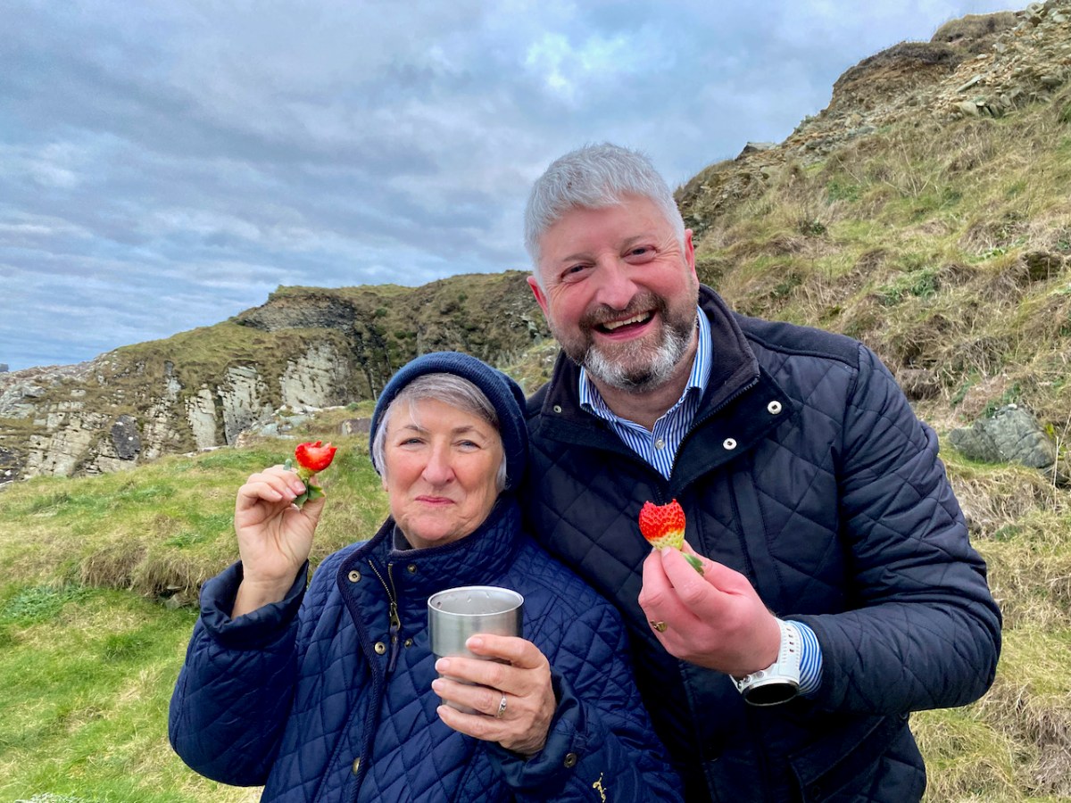
As we reached the place traditionally thought to be the leaba – bed – of Diarmuid and Gráinne, a sheltered spot with a natural clearing, Conor, in honour of the day that was in it, produced champagne, strawberries and chocolates.
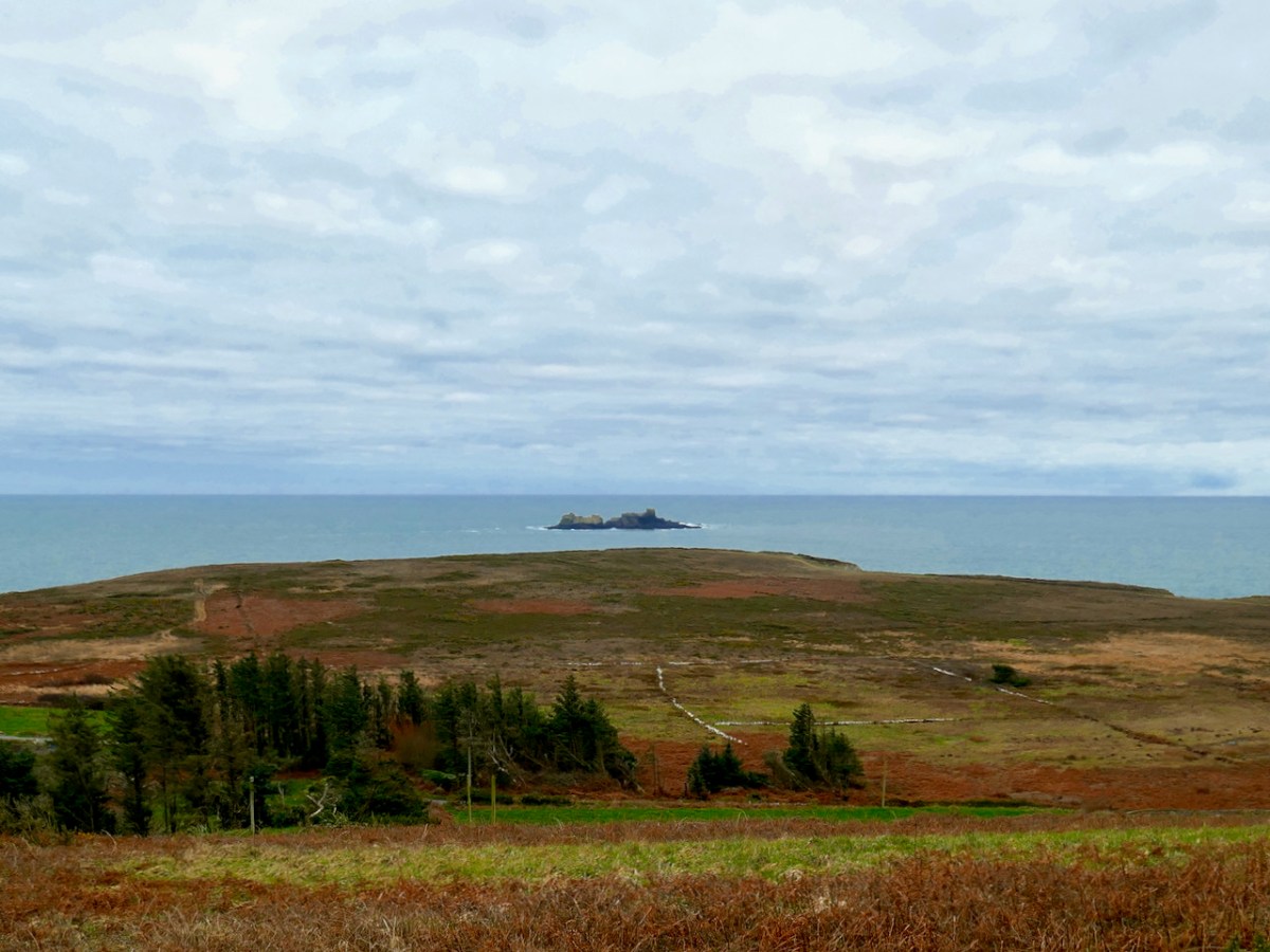
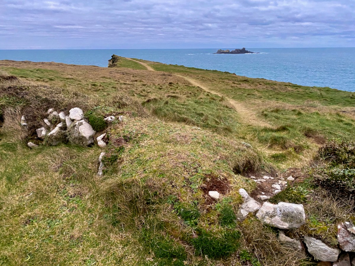
We continued on, with a new part of the story every now and then, interspersed with lots of place name lore, and snippets about our surroundings and the ecology of Toe Head. The little crag below is called An Srón (pronounced shrone), which means The Nose. Not hard to guess why.
The next stop was at the EIRE sign, painstakingly restored now by a group of local volunteers.
These signs, spelled out in whitewashed stones, were placed all along the coast during WWII to alert German Bombers that they had overshot Britain and were approaching neutral Ireland.
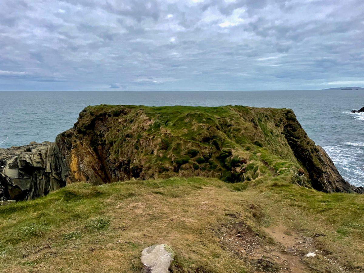
Our last point of interest was a wonderful Promontory Fort, Dooneendermotmore – or Big Dermot’s Little Fort. I’ll be returning to this one in the future, as I am planning to retrace the footsteps of Westropp, who was the first to describe these coastal forts. As it happens, I will also be following in the wake of my old Professor of Archaeology at UCC, Michael J O’Kelly, as he excavated this site in the early 1950s.
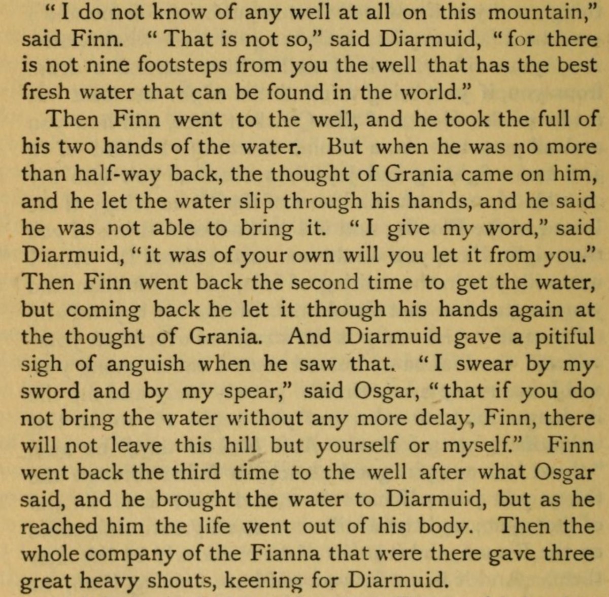
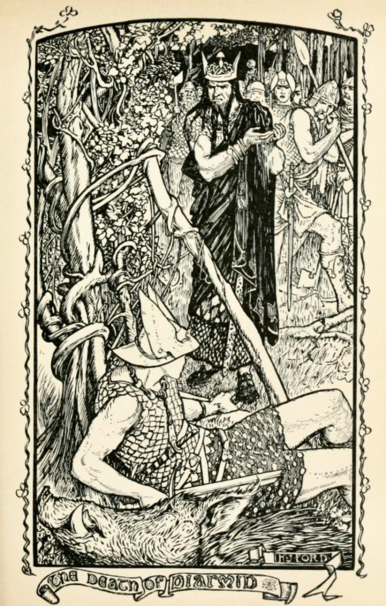
It was getting dark as we made our way back. Before we broke up, Conor told us the story of the Death of Diarmuid. The whole sad saga was originally translated by Lady Gregory. Above is an extract from her Gods and Fighting Men.*
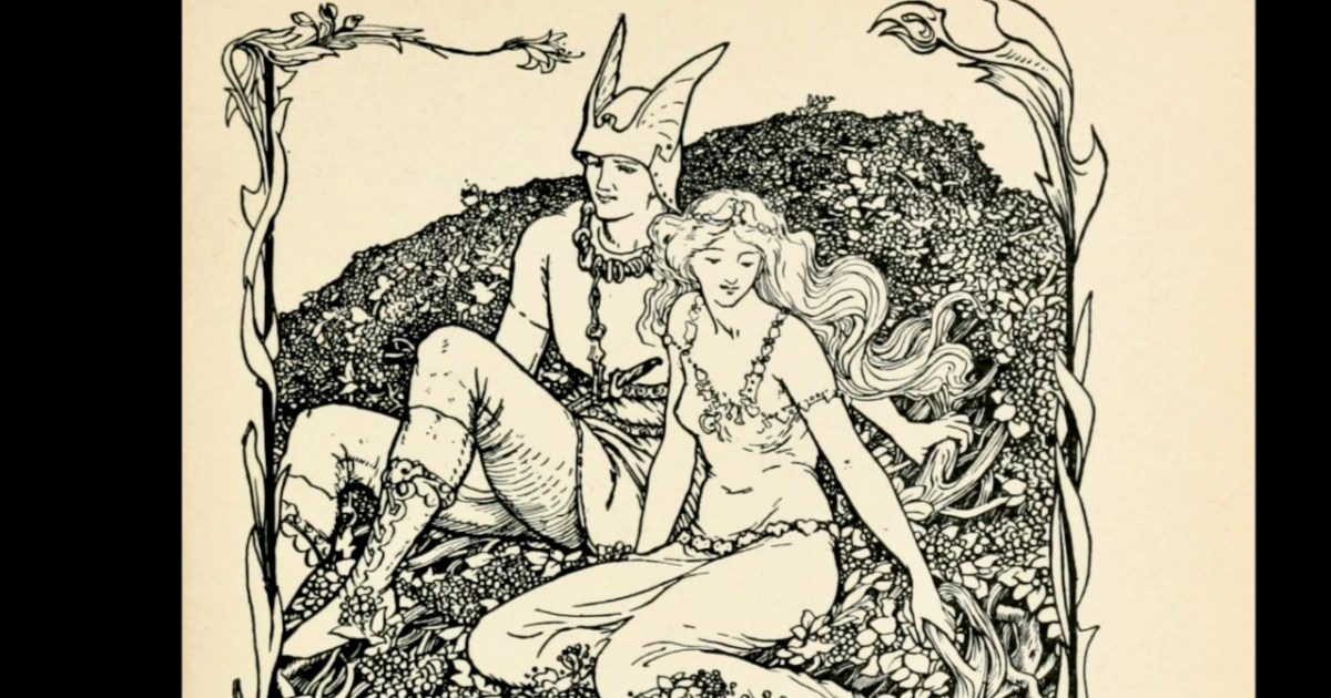
The illustrations I’ve chosen above (and the one of Diarmuid and Gráinne at the start of this post) are both from Andrew Lang’s Book of Romance,* and are by Henry Justice Ford. Anyone else remember being entranced by Andrew Lang’s Fairy Tale books, with their wonderful illustrations, as a child?
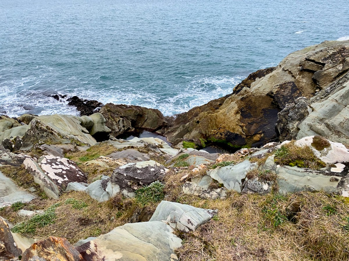
I will leave you with an image of the leaba – the bed – of the lovers. Not a comfortable place to spend the night, but when you are being chased by Fionn MacCumhaill, you can’t be picky.
Welcome to the UCD Library Cultural Heritage Collections blog. Discover and explore the historical treasures housed within our Archives, Special Collections, National Folklore Collection and Digital Library