Robert writes:
Our weather has turned grey and damp. Our 5k Covid limited walks to seek inspiration for the posts we write for you every week are less than comfortable, and our photography is suffering. But we are undaunted! Spring is just around the corner (it starts tomorrow, on the first of February – Imbolc – here in Ireland) and we will soon see the emerging wildflowers in our verges. We will notice the days getting longer. Meanwhile, let’s enjoy the stormy prospect from our eyrie:
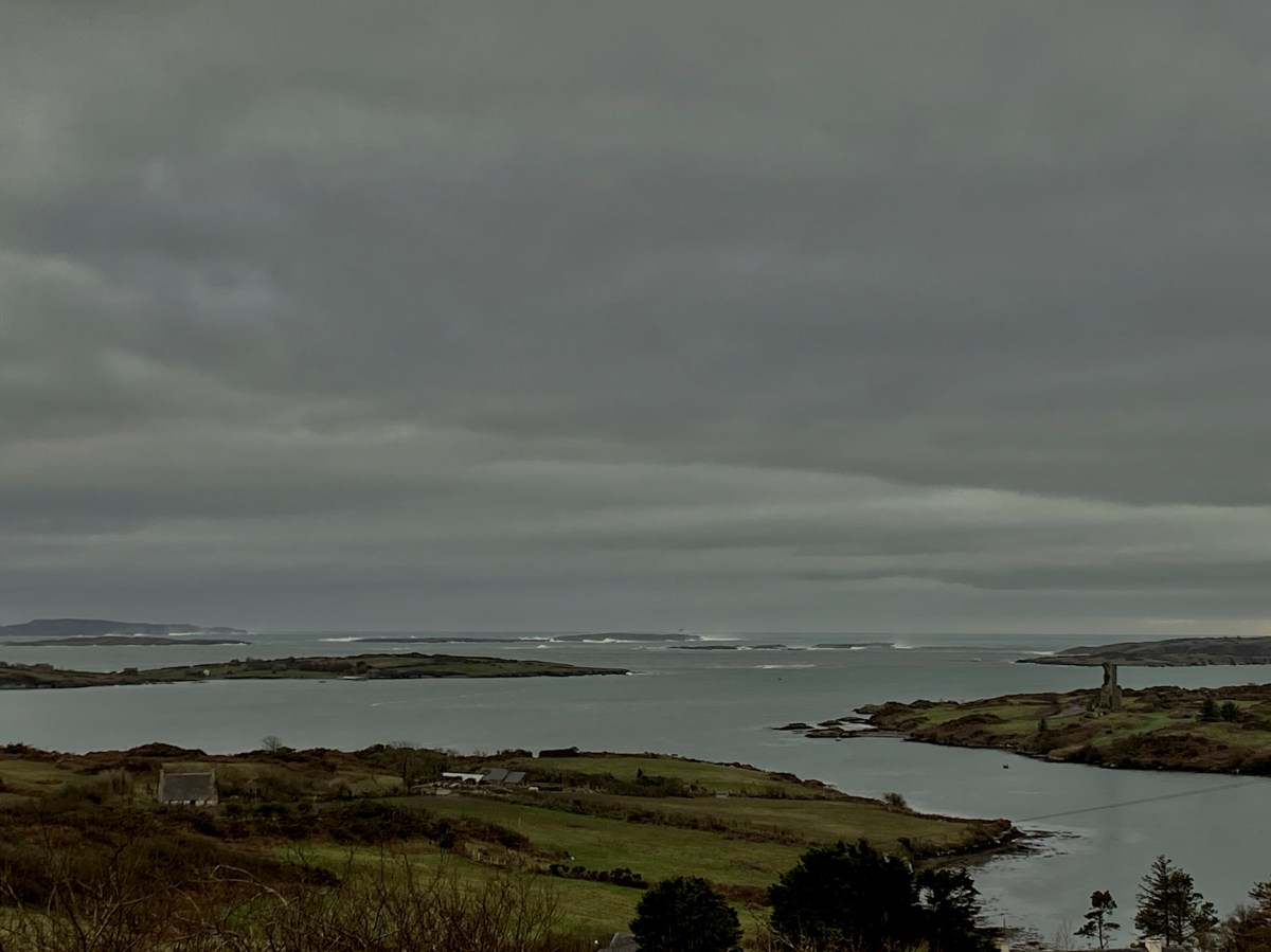
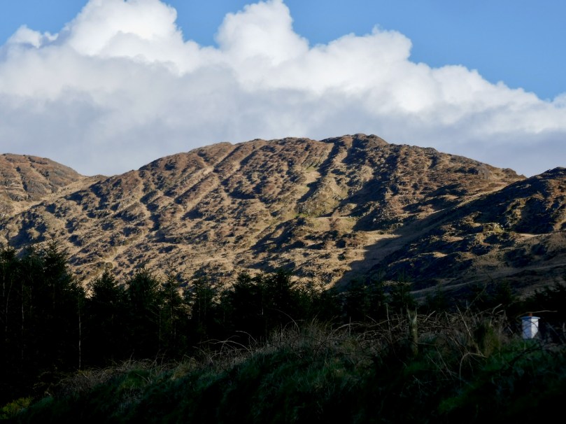
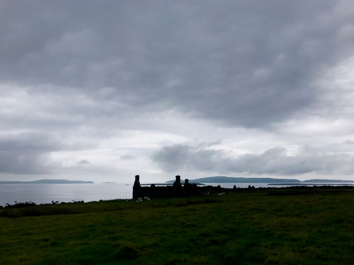
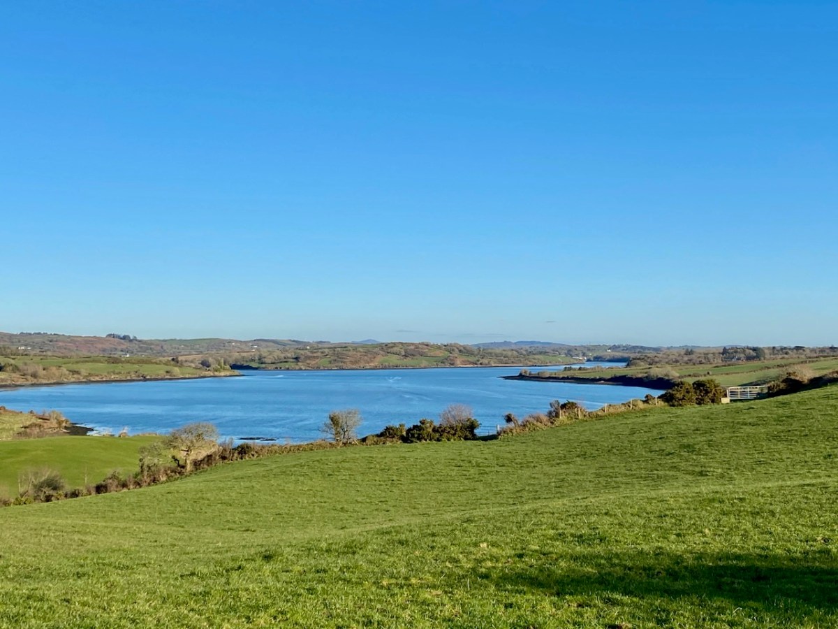
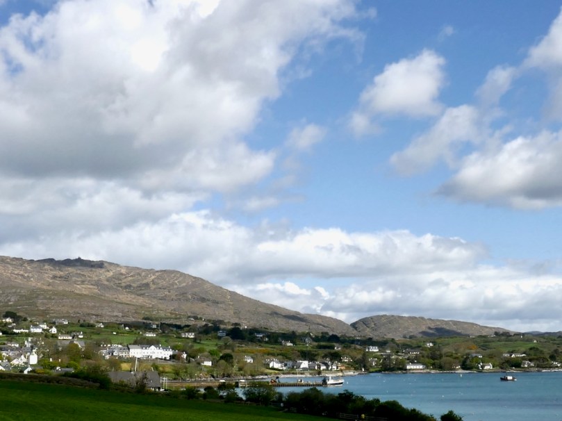
Roaringwater Bay, January 30 2021. Between the islands the water is always calm but you can see the force of an Atlantic storm stirring things up beyond them
For my post today I’m diving into our archives, but also travelling back in time – in my own life. The topic is an Irish one – and has West Cork connections (you’ll see) – but writer and satirist Jonathan Swift appeared in my view early on, and through a somewhat odd series of events which touch on many things – historical characters, folktales, archaeology, and hauntings. Here is how I came into the company of Dean Swift before I was ten years old!
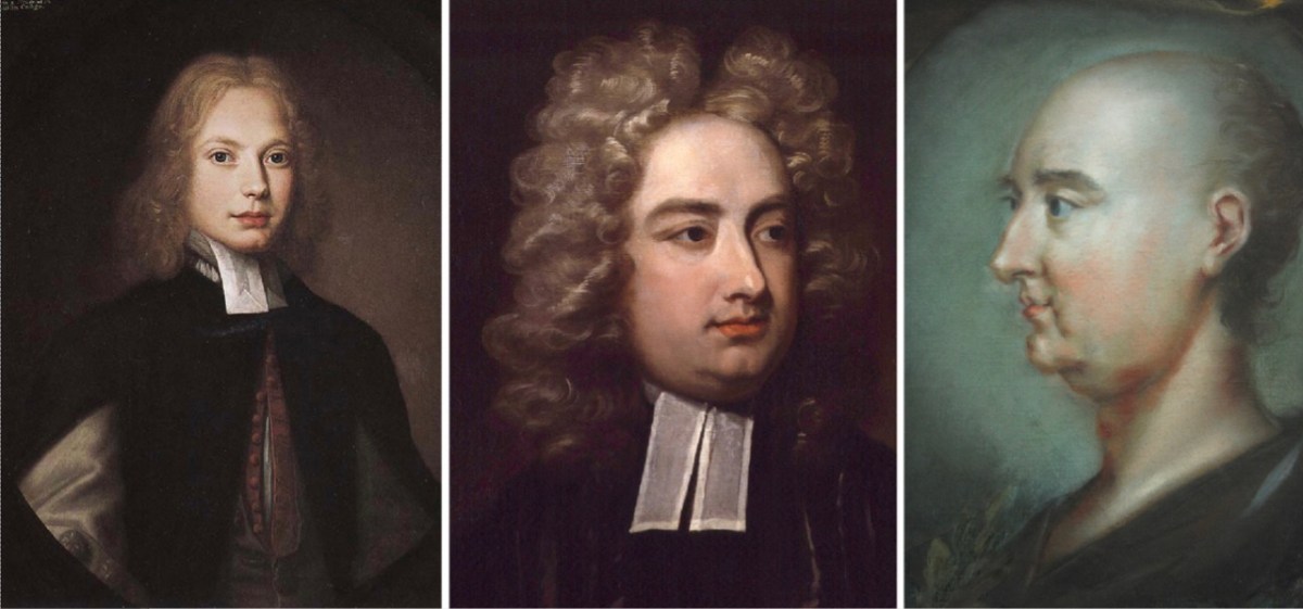
Jonathan Swift, born in Dublin in 1667: left – in 1682 (when he was fifteen years old) painted by Thomas Pooley; centre – in 1710 (aged 43) by Charles Jervas and right – in 1745 (the year of his death, aged 78) by Rupert Barber (National Portrait Gallery, London)
I was born and brought up in a small country town in southern England – Farnham. A big influence on my young life was my grandmother, Annie – we always called her Granma. But she wasn’t a relation at all: my mother had been orphaned (by the 1918 ‘Spanish Flu’) at the age of four, and lived in a children’s home until the age of 16, after which she was fostered by my Granma. In my younger years my mother worked as a shorthand typist. I had no idea, then, what a ‘short hand typist’ was, but I must have formed an image of sorts in my mind. Be that as it may, the consequence was that I spent time with my Granma during my mother’s working hours in school holidays – and, quite often, at weekends.
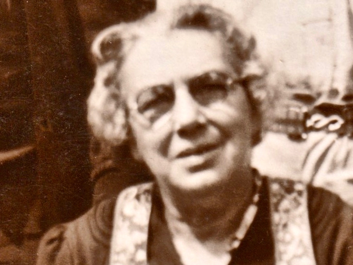
My Granma – the one picture I have of her, above – was only ever the kindest of ladies. She helped me to learn to read well from the age of four, and embedded in me a huge love of books – and stories. Widowed, she lived alone in 2 Darvill’s Lane, Farnham. And that’s where I have the happiest of my childhood memories. Why? Because it was such a different house from my parents’. It had no electricity, a big black coal range and an outside lavatory – all thoroughly fascinating. The gaslights hissed and spluttered in a friendly way on winter evenings; there were always interesting things sizzling on the range – and blancmange for pudding, and fruit cakes for tea! And, although there wasn’t electricity, there was a large wireless set with a bakelite shell, shiny knobs and a glowing celluloid dial splendidly esconced on its very own table in a corner of the small sitting room. I can still see it in my mind’s eye, although I have no memory of what I might have heard from its gold-meshed speaker as everything seemed obscured and overlayed by intense crackling. A cable descended from the set to a large glass accumulator sitting on the floor beneath. This was similar in size and weight to a car battery today. One of my frequent duties when staying with Granma for an afternoon in the holidays was to help dismantle this accumulator, place it into a wheeled shopping basket and trundle it up into the town where it was exchanged for a freshly charged apparatus of the same design, a task which had to be done weekly (and cost how much? Sixpence…). But, I digress . . . Let’s move on to the subject of this post – Dean Swift: what is his connection with my Granma?
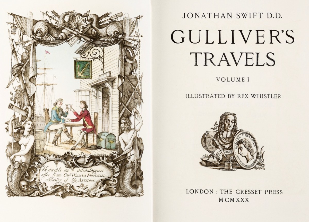
A particularly fine edition of Gulliver’s Travels in two volumes, dating from 1930. A similar one in good condition fetched £6,900 at auction last year. The first edition – also in two volumes – was issued on 28 October 1726, priced at 8 shilings and 6 pence
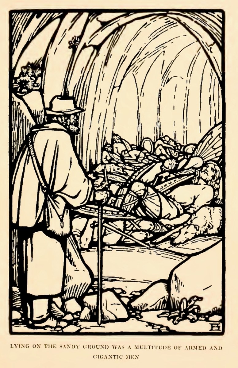
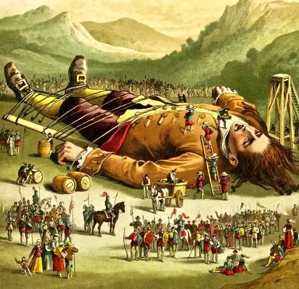
Gulliver’s Travels was one of the many books I read at my Granma’s house, probably when I was four or five. My version was nothing like the handsome one above: it was the Ladybird Books edition: I wish I still had it. Of course, I now know that practically everything of value historically had been expurgated from this and all other children’s renderings of the book (and plays, films etc) including all the (then) politically outrageous bits and the vividly scatalogical episodes. (If you don’t know these, one of the mildest is Gulliver’s success in putting out a house fire in Lilliput by publicly urinating on it, something for which he was convicted of treason and then sentenced to be blinded!). Nevertheless, at such an innocent age, who would not have been impressed simply by the illustration of a ‘giant’ man tied down to the ground with twine and surrounded by a horde of miniature people?
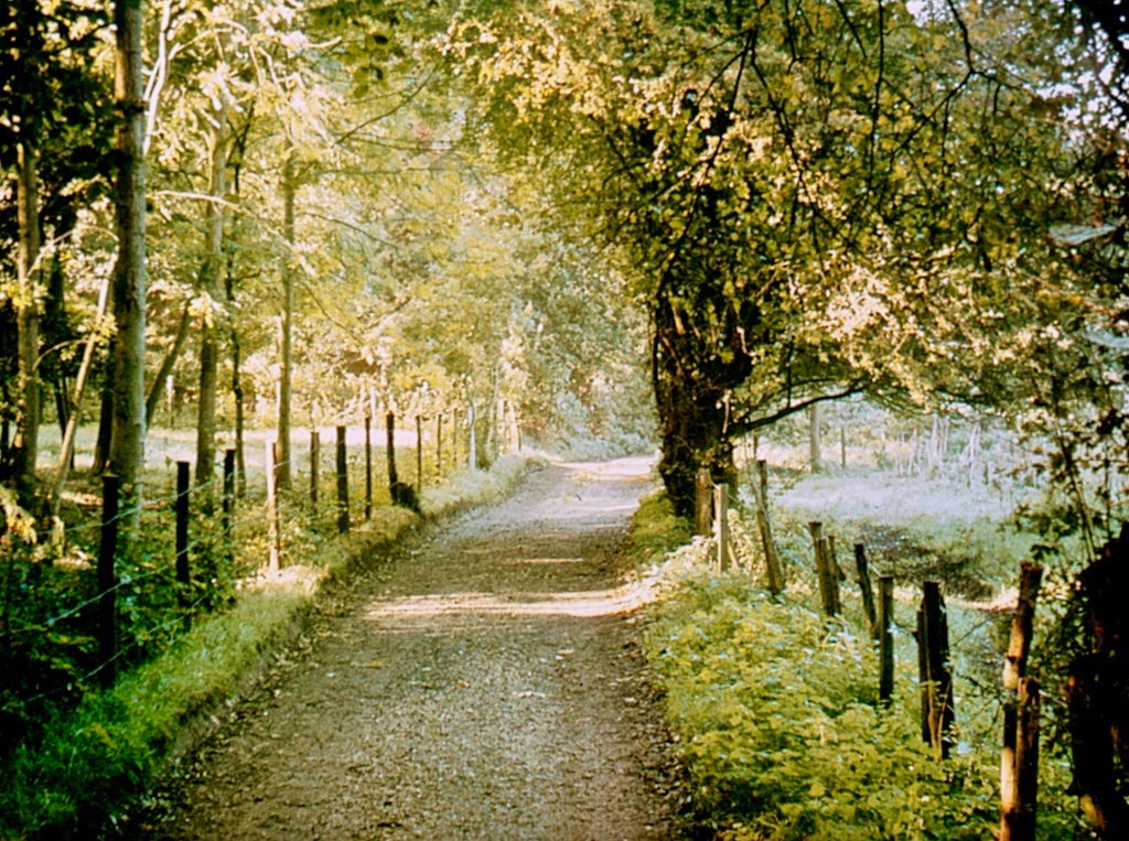
My world met that of Swift (I never knew him as ‘Dean Swift’ until I came to Ireland) when my Granma and I would walk together out into the countryside. We only ever walked because, in the 1950s, very few people had cars and I had not yet graduated to a bicycle: walking is still, after all, the best way to travel without missing all the details. From Darvill’s Lane we followed a path away from the town which almost immediately became deeply rural. We headed for Moor Park. I was delighted, recently, to find this old postcard of Moor Park Lane which could date from those same days:
With the benefit of Google Maps I have been able to calculate that our walks were around two miles if we only went as far as Moor Park House, but it was much more interesting to go beyond, so sometimes we would have done a round trip of seven or eight miles. ‘Beyond’ there were caves, and a holy well, and the ruins of an old abbey – all of which Granma could tell me stories about. I’m so grateful to my Granma as, today, I can’t resist searching out the likes of caves, holy wells and archaeology, wherever I travel.
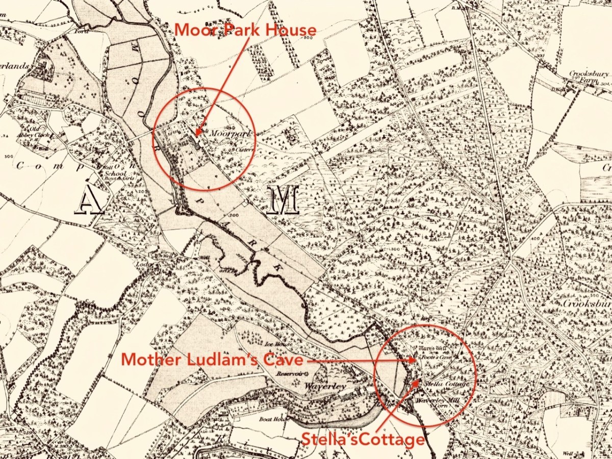
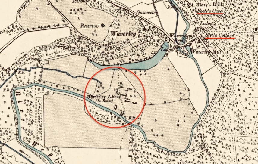
An extract from a late 19th century Ordnance Survey map of the country we walked through outside Farnham town, with just a few of the places which I learned ‘stories’ about during my escapades with my Granma!
Moor Park House was always our first port of call. I now know that an early dwelling on this site – known as Compton Hall – dates from 1307, and that this was modified and added to over the generations, most notably by Sir William Temple in the late 17th century. Temple (1628 – 1699) bought the property in the 1680s and renamed it after his own family home in Hertfordshire. He had a career as a noted diplomat under Charles II including, in 1677, helping to arrange the marriage between the King’s niece, Princess Mary and William of Orange: I don’t need to go into their story now. William Temple retired to Farnham and constructed a large formal garden at Moor Park, covering five acres. From 1688 until his death he employed Jonathan Swift as his secretary. My Grandma ensured that I knew about the link between Moor Park and Gulliver’s Travels, and I was impressed! She also told me that the path along which we walked, passing through the gates of Moor Park Lodge, had once been the scene of a great battle when an owner of Moor Park (long after Temple) closed off the right-of-way along that path, or attempted to: I have since learned that it happened in 1897, and a crowd of over a hundred local people armed themselves with cudgels and crowbars and forced the locked gates open. They have been open ever since.
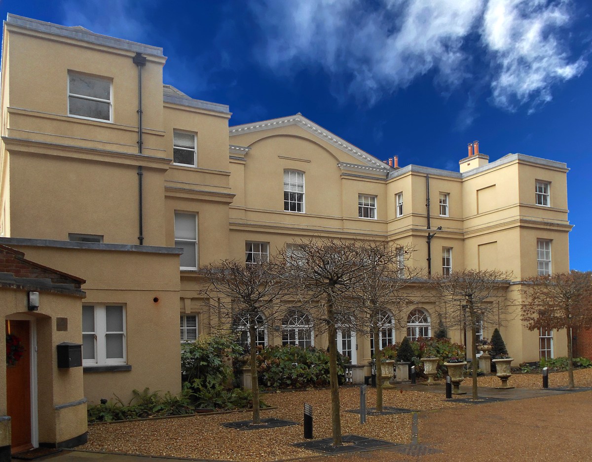
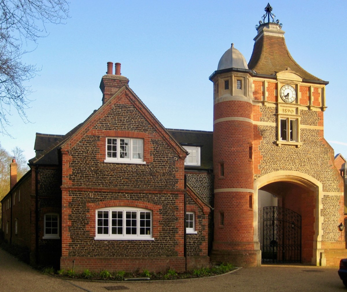
Upper – Moor Park House today and, lower – the gatehouse which was the scene of a battle over rights-of-way in 1897
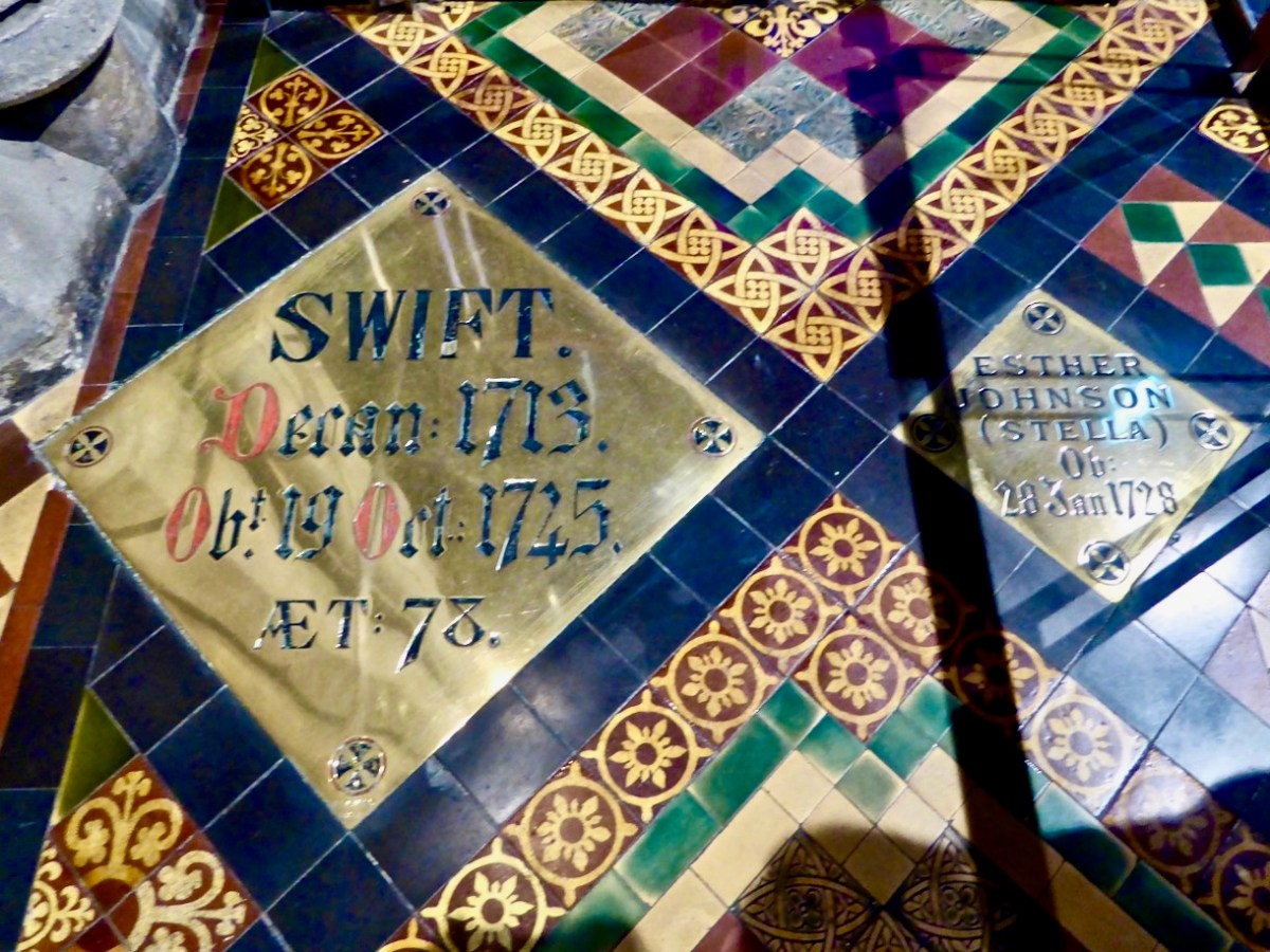
For over a decade Moor Park house figured large in the life of Jonathan Swift. When first there he became the tutor and mentor to a local girl who lived nearby, and whose mother acted as a companion to Temple’s sister. The local girl was Esther Johnson (1681 – 1728). She was nicknamed ‘Stella’ by Swift. My Granma told me that Stella was a close friend of Jonathan Swift, and that he would visit her by following the path we always took through the estate, ending at ‘Stella’s Cottage’ at the far end. My young brain took all this information in, and I carried with me through the years a picture in my mind of Stella’s Cottage at the end of our path. A postcard I came across recently confirms that picture exactly! Stella remained ‘close’ to Swift for the rest of his life. On his death Temple left her some property in Ireland and she moved there in 1702. There were rumours – never confirmed or denied – that she and Swift had married secretly. She died in 1728, and was buried in St Patrick’s Cathedral, Dublin. Swift was inconsolable at Stella’s death; when he died he was buried beside her at his own request:
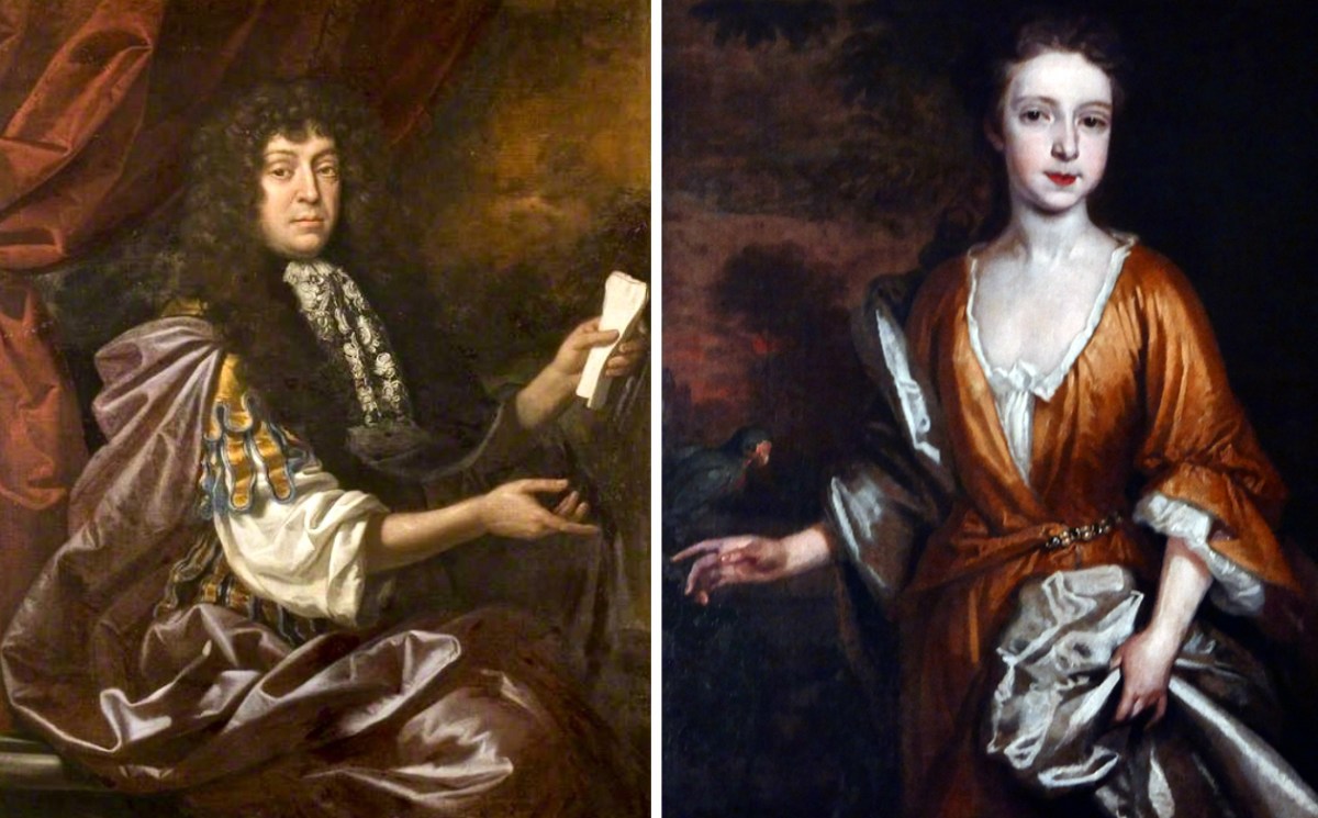
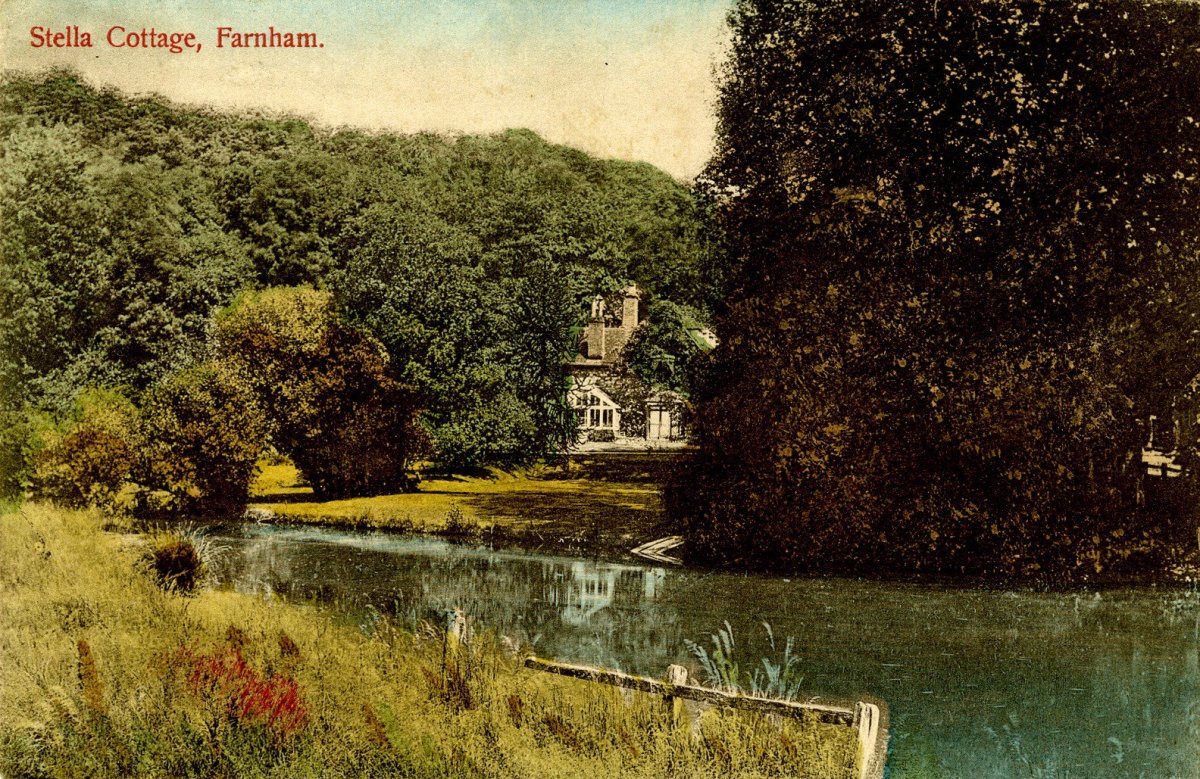
Childhood associations: centre – Sir William Temple on the left (painted by John Closterman – courtesy of Beecroft Art Gallery) and Esther Johnson on the right (artist unknown – Crawford Gallery): she was Jonathan Swift’s ‘close friend’. Lower picture – an old postcard showing ‘Stella Cottage’
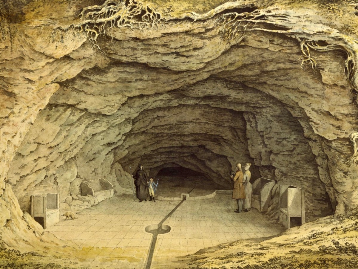
On the best days our walks continued beyond the Moor Park estate, and included a visit to two caves – ‘Old Mother Ludlam’s cave’ and ‘Father Foote’s’. These provided great stories, and my Granma’s recounting of those stories has been confirmed through my present day researches, although I prefer them the way she told them, rather than the precise history. Mother Ludlam was a witch, but a good one. She had a cauldron which she would lend to anyone, presumably so they could make their own magic potions. The cauldron can still be seen today, in a nearby church. She lived in her cave, which had (and still has) a stream running through it. Every time we looked into the mouth of the cave – through a locked iron gate – my Granma repeated the same story (which I have never seen written down): when she was a young girl it was decided to find out where the stream that ran out of the cave originated, so a raft of ducks (that’s the correct word for a whole lot of ducks) was taken into the cave and shooed away into the darkness up the stream. Then, presumably, the assembled crowd waited to see if and where they might emerge. They didn’t. Except that – according to my Granma – some considerable time later (days or weeks) one lone duck was found coming out of a small culvert on the River Wey in Guildford ten miles away – minus all its feathers! I could never forget such a rare story.
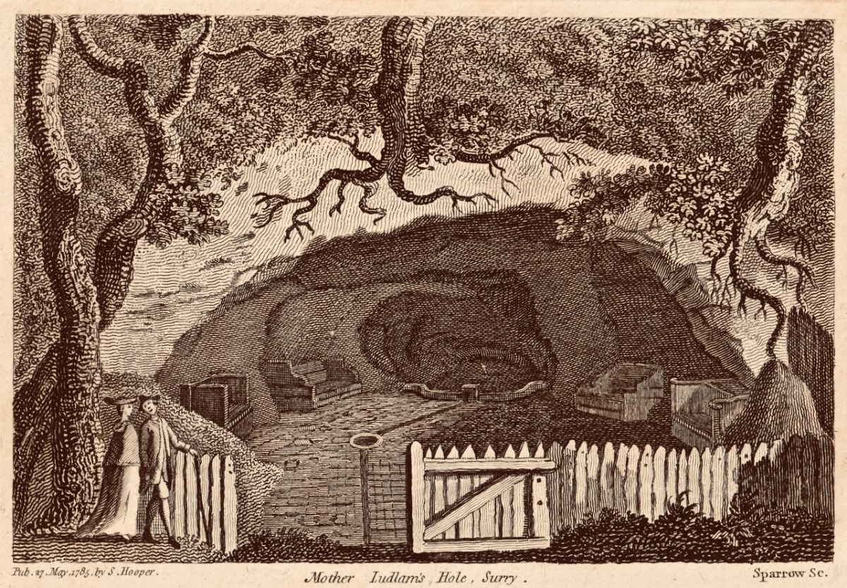
Here (above) is one of my prized possessions: a 1785 print of Mother Ludlam’s Hole, Surry: I found it in a second-hand bookshop in Farnham very many years ago – I think I paid a shilling for it – and I have kept it ever since, if only to remember my Granma and the stories she told. I later came across this fine print in the Victoria and Albert Museum, London. It shows that Mother Ludlam had some notoriety:
But you very seldom hear about ‘Father Foote’. In fact, I wondered in later life whether he was a personage which my Granma had thought up to explain a second, smaller cave nearby. But no – because if you look at this 1895 map of the area you will see that ‘Foote’s Cave’ is clearly marked (along with St Mary’s Well), but Mother Ludlam’s isn’t.
So – Granma’s tale: Mother Ludlam and Father Foote lived at the same time close to each other. The second cave is quite high up in the rock face, and rather small. They had a baby, which they kept in the smaller cave, One day the baby rolled out of the cave, down the steep hill and into the river below. That’s the story – I’ll leave you to ponder on it.
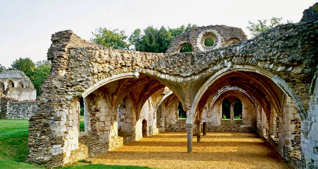
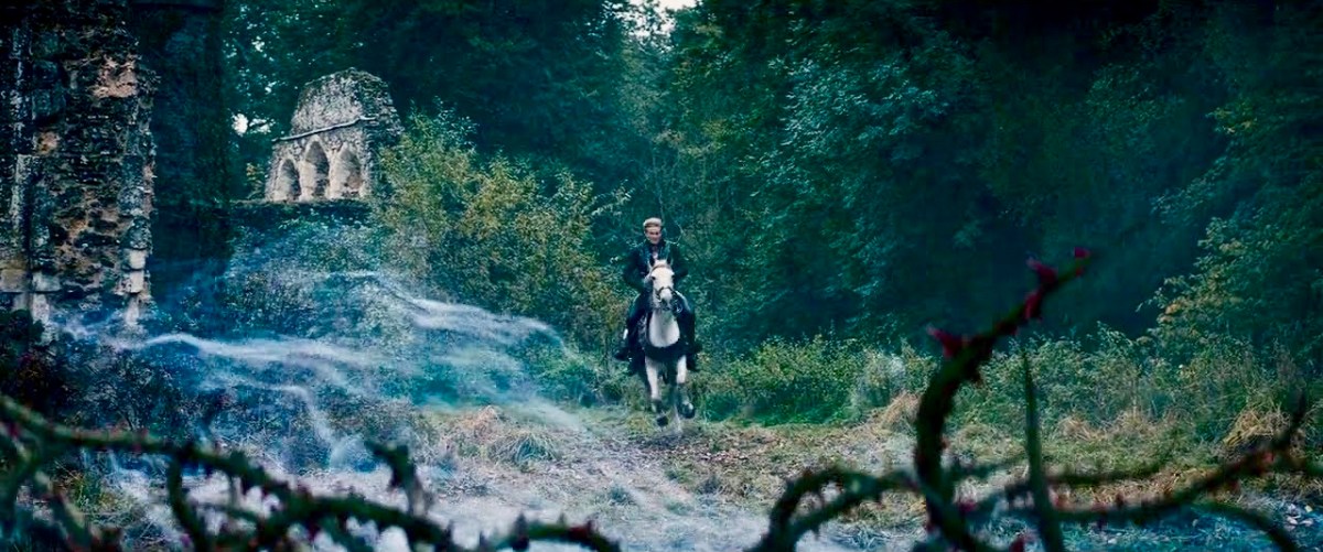
Generally, the last port of call on our walks was Waverley Abbey – the very first monastery founded in Britain by the Cistercians, constructed in a meadow beside the River Wey in 1128. That’s what remains of the refectory above (photo courtesy of English Heritage). I don’t remember my Granma telling me any ghost stories – she didn’t go in for those; yet she did always say to me I had to look out for the ‘white monks’ when we went past the old abbey ruins. I was interested to see that Waverley Abbey was used as a film set in 2014 for a Disney film about the story of Rapunzel. Here’s a still from that film:
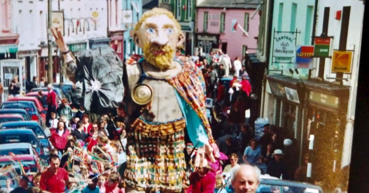
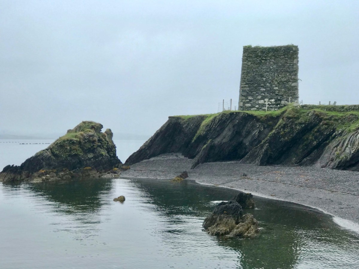
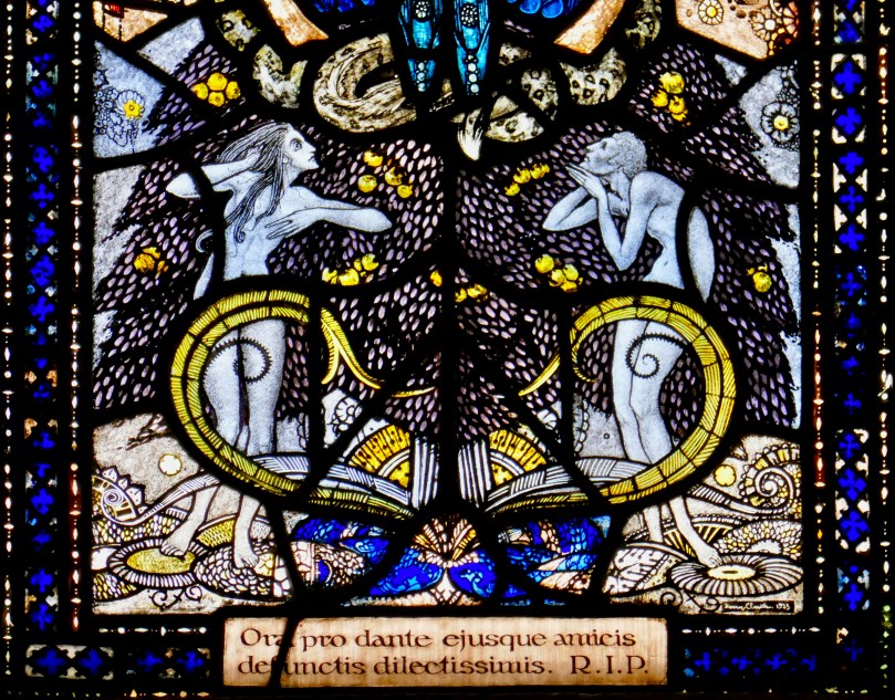
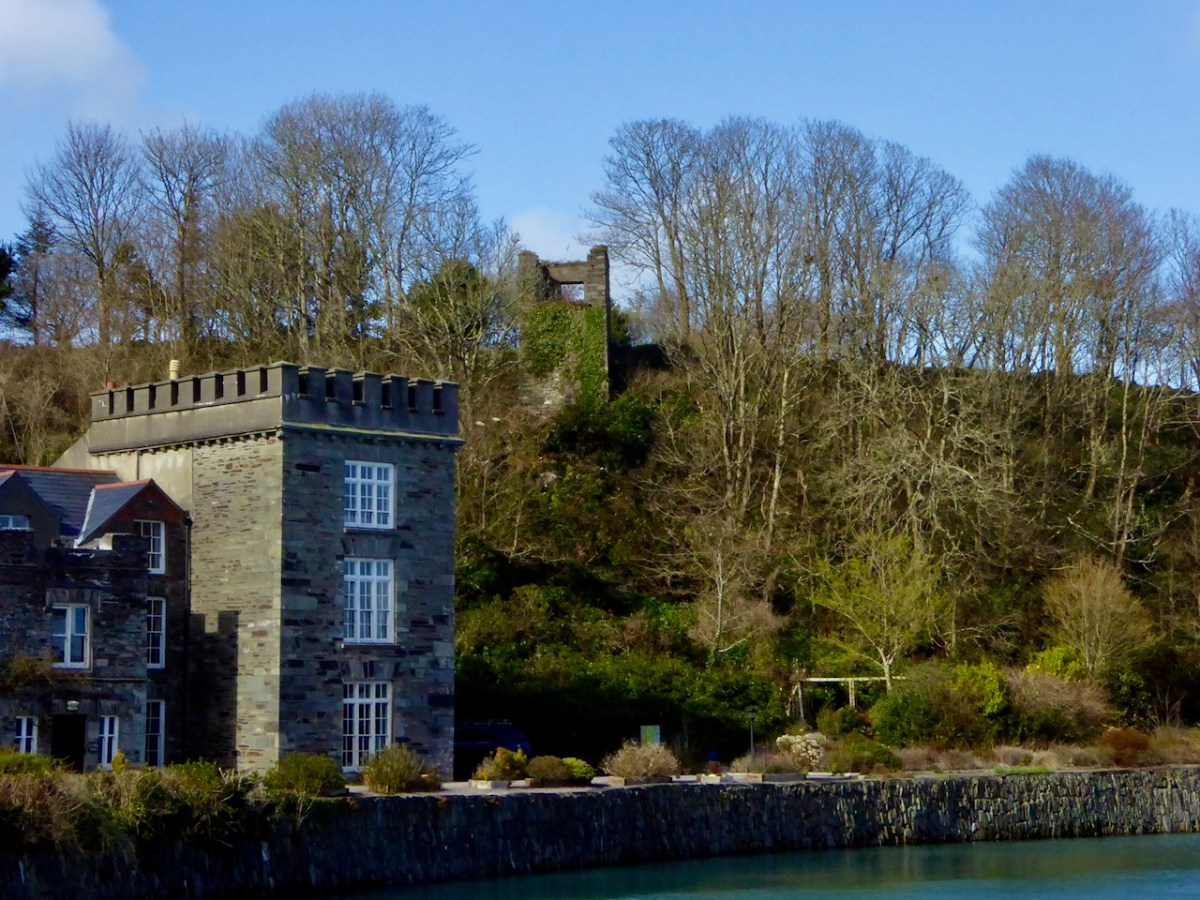
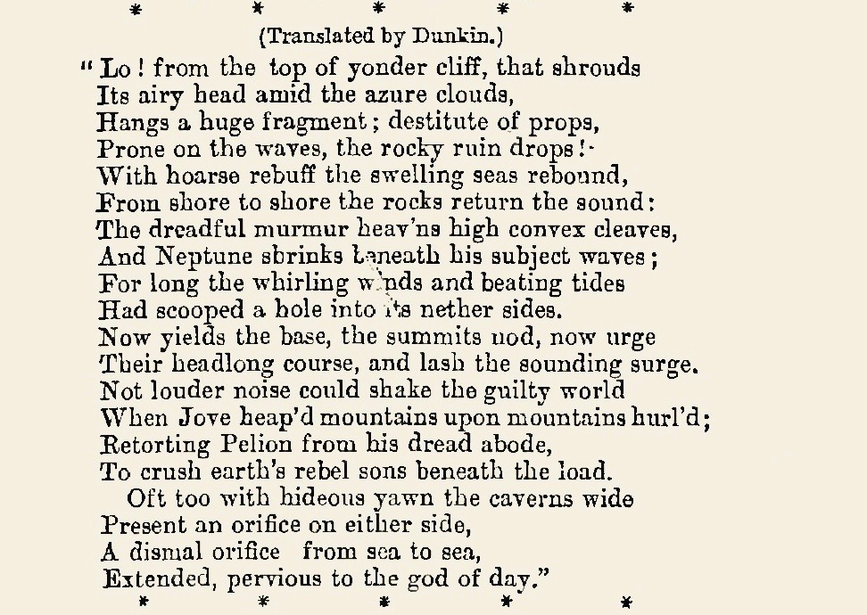
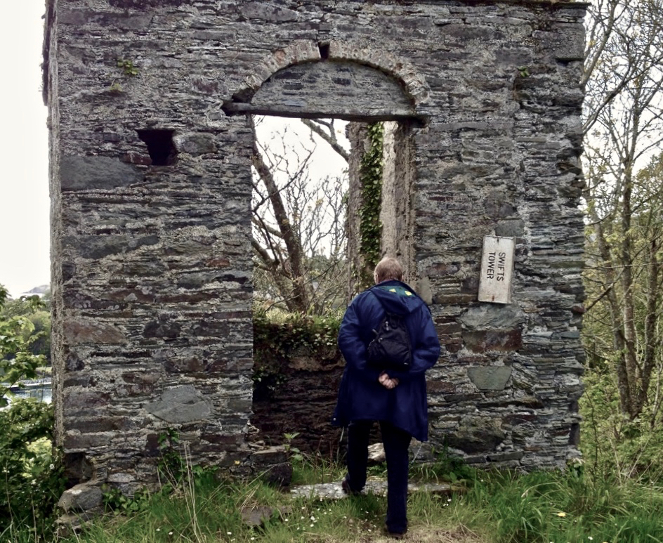
I did promise you a ‘West Cork connection’ to the subject of this post. Well, Dean Swift visited the south west of Ireland in 1723 and stayed in Castletownshend. Finola, in her post on Belvederes in 2016, tells that he used a tower behind the castle there as his refuge, and in it he wrote a long poem in Latin – Carberiae Rupes – which translates as ‘The Crags of Carbery’. Here’s the tower beside Castletownshend Castle, and a short translated extract from the poem. At the end there’s Finola’s photo of me visiting ‘Swift’s Tower’, and closing the loop that began for me more than seventy years ago.
31st January 2021