Beara – the Lie of the Land

On the north side of the Beara, looking across to the Kerry Mountains.

On the north side of the Beara, looking across to the Kerry Mountains

The Beara Peninsula is the largest and perhaps the wildest of the three West Cork Peninsulas. (See last week’s post for the map.) Two mountain chains, the Caha Mountains and the Slieve Miskish Mountains make up the spine of the Peninsula. You can traverse it via the spectacular Healy Pass, which runs from Adrigole north to Lauragh. On this occasion, because we had limited time, we confined ourselves to driving the main coastal route and to getting the general lie of the land. This meant we missed out on several landmarks – Bere Island, for example, and Dursey Island, besides the Healy Pass – so of course we must go back soon!

Near Cod's Head

Near Cod’s Head

After the inspiring piano recital by David Syme, described last week, we stayed overnight in Allihies and enjoyed an excellent dinner in O’Neill’s pub. The local Gaelic Football team had won a championship match that afternoon and the town was celebrating well into the night. Our first stop the next day was the Allihies Mining Museum. Housed in an impressively converted old Methodist Chapel, it tells the story of copper mining on the Beara, evidence of which can still be seen in the vicinity.

Note the green copper veins on the cliff face

Note the green copper veins on the cliff face

From there we carried on to the Cod’s Head, through a small pass which brought us out to a jaw-dropping vista across Coulagh Bay to Kilcatherine Point, and beyond to the Mountains of the Iveragh Peninsula in Kerry. We took the time here to hike up a waymarked trail that brought us up to breathtaking views high into the mountain slopes, home of purple heather, enormous boulders and curious sheep.
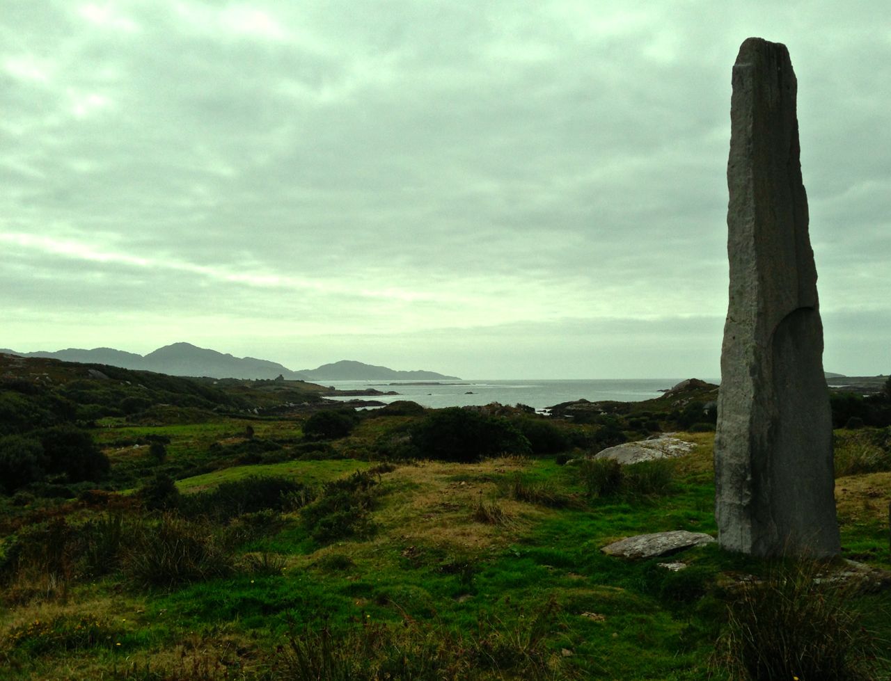
The sentinel

The sentinel

Eyries village is a pure delight: a riot of colourful houses and sleepy streets. We stopped at Ms Murphy’s traditional shop for tea and delicious sandwiches, strolled along the main street taking pictures and chatting to friendly residents, and finally by chance dropping into the startlingly beautiful St Kentigern’s church.

The north side of the Peninsula offers glorious vistas across the Kenmare River (an enormous sea inlet but called, oddly, a river). We took the coastal route from Kilcatherine to Dog’s Point and back to Ardgroom and on to Lauragh – lovely villages with seaside settings.

Mountain and sea

Mountain and sea

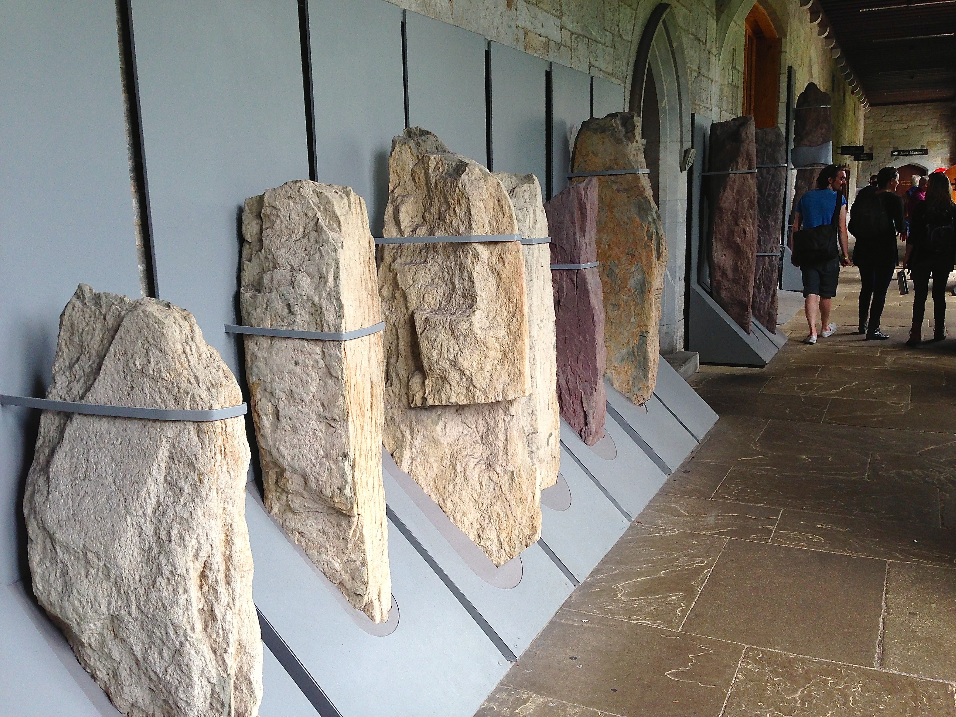
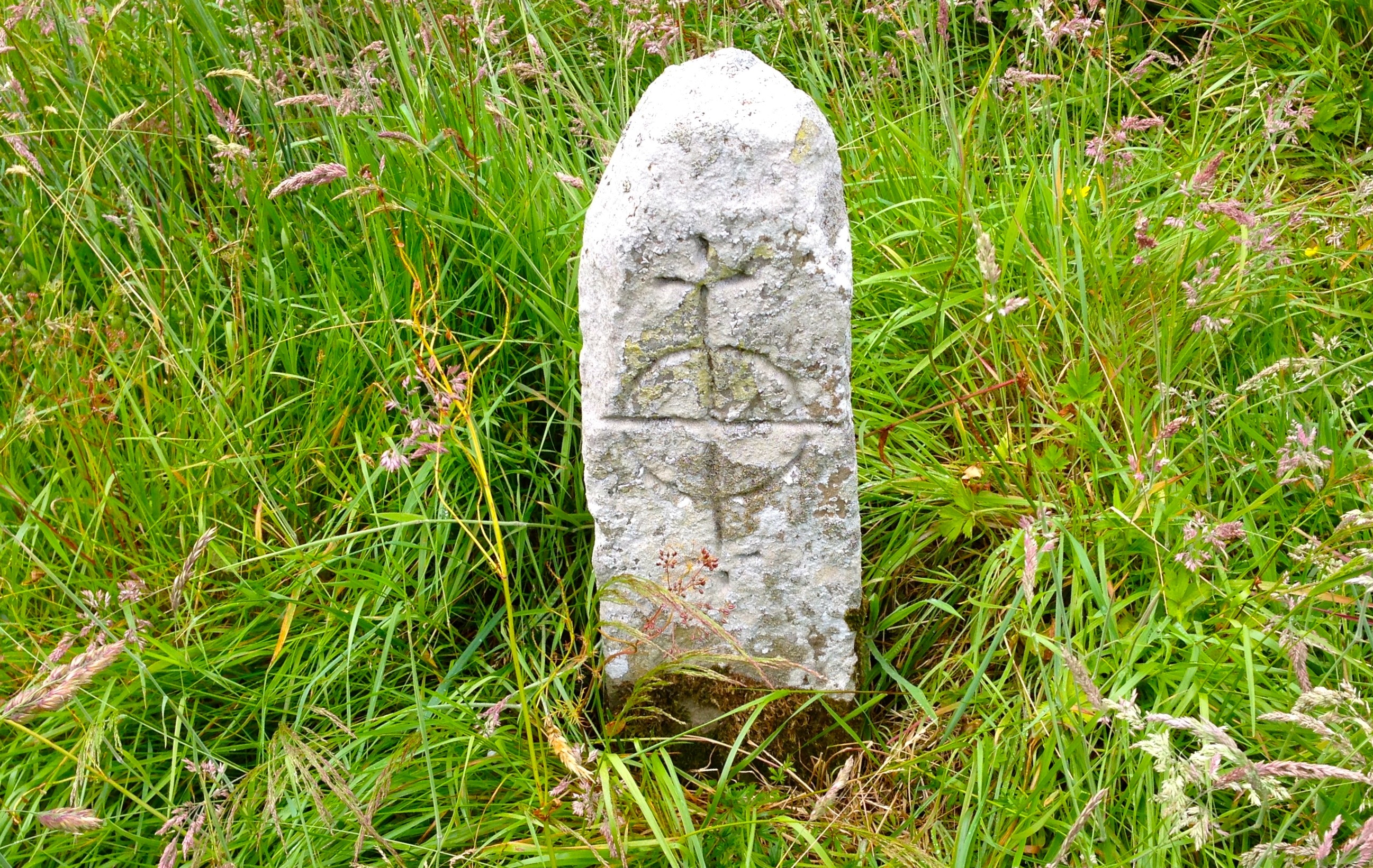
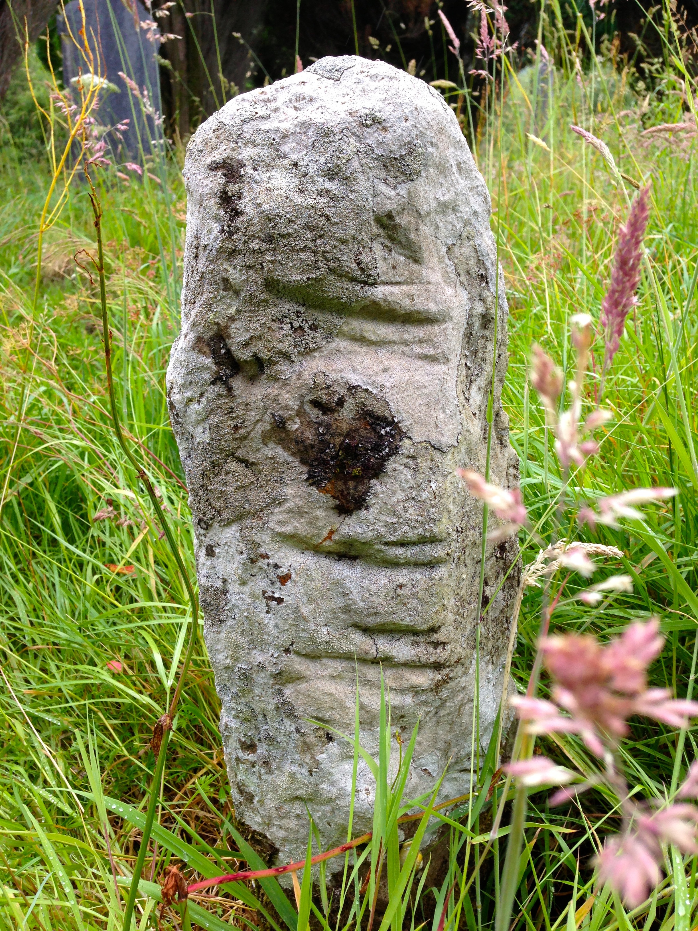
We stopped to visit the Cailleach Beara, the Hag of Beara. A powerfully symbolic site from Irish mythology, this rock is associated with many legends. People leave votive offerings – coins, rosary beads, a set of old glasses, shells and ribbons in honour of the spirit of the ancient goddess. Our next stop was the Ballycrovane Ogham Stone – the tallest in the world, and still in the wild, as Robert was glad to note.

Alright – so we have our bearings now and we’ve scratched the surface of this fascinating part of West Cork. Look out for future posts on the Beara – we can’t wait to return!

Beara mussel beds

Mussel beds, looking out to the Kenmare River

Ogham

Captured! Ogham stones held in iron bands at UCC

Captured! Ogham stones held in iron bands at UCC

The Scythian King Fénius Farsaid lived at the time of the building of the Tower of Babel – some stories suggest that he had a hand in its construction. He gathered around him a group of scholars and methodically researched the new languages which were being spoken by the dispersed builders of the tower. Their work produced four languages: Hebrew, Greek, Latin and – the most sophisticated – Ogham. _ogham


Thus was the story that the bards of old related to explain the carvings on Ogham Stones (sometimes spelled Ogam but always pronounced oh-am) which are found in northern Europe, the greatest number being in the South West of Ireland.

King Fénius named each of the letters of the Ogham alphabet after his best scholars – 25 in all. The ‘letters’ are in fact simple lines inscribed on stone, either on opposite sides of a vertical line or on each side of a sharp corner of stone – the position and angle of each line defining the letter. Words are read starting at the bottom, going up the left side of the line or corner and coming down on the other side, and are generally thought to represent names, suggesting that the inscribed stones are memorials.

ogham

Ballycrovane – the tallest Ogham Stone in the world is in West Cork

If you subscribe to the King Fénius theory of Ogham Stones (and why wouldn’t you?) you might wonder why historians place them in the early medieval period (4th to 9th centuries) and associate them with Christianity. Many of them appear to have been inscribed on older standing stones, including the gigantic megalith at Ballycrovane, overlooking Kenmare Bay and 5.3 metres tall.

An Ogham tray by Danny

An Ogham tray by Danny

Ogham is not a forgotten language: it is a saleable item of Irishness. But, consider – quite apart from the many examples of Ogham stones which remain in the wild there are those which are kept in captivity. Take a look in the Stone Corridor at University College Cork – there is a remarkable collection there, a collection that raises questions in my mind: why have the stones been removed from their original siting? Is that an archaeologically sound thing to do – to take them from their historic context and chain them up so unnaturally in a long, dark and urban corridor? If it’s time to give the Elgin Marbles back to Athens then it’s certainly got to be appropriate to redistribute the Ogham stones (and the other inscribed stones and Rock Art that are in the Corridor) back to their natural habitats – in the wilds of West Cork… maulin

In its rightful place: Maulinward Ogham Stone near Durrus

In its rightful place: Maulinward Ogham Stone near Durrus (front and back)

corridor