The Storied Way to Beara

You know we love the beauty of West Cork, and we can’t resist the odd foray into all our neighbouring parishes. They are perhaps a bit wilder and higher, with markedly remote open spaces. So here’s a little wander on to the Beara Peninsula and beyond: I have raided our archive of photographs to enthuse us – and, hopefully you – to travel those roads in the coming spring. Firstly, have a look at this:

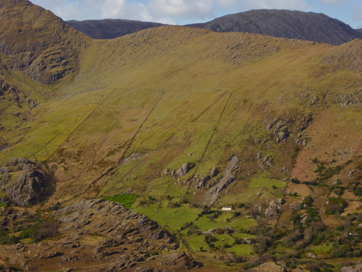
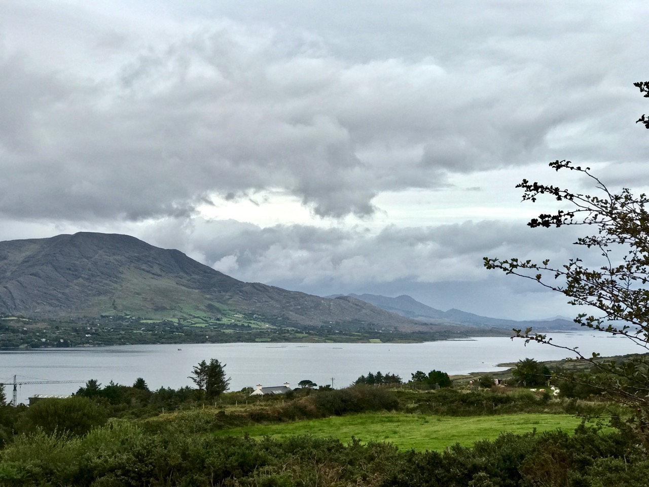
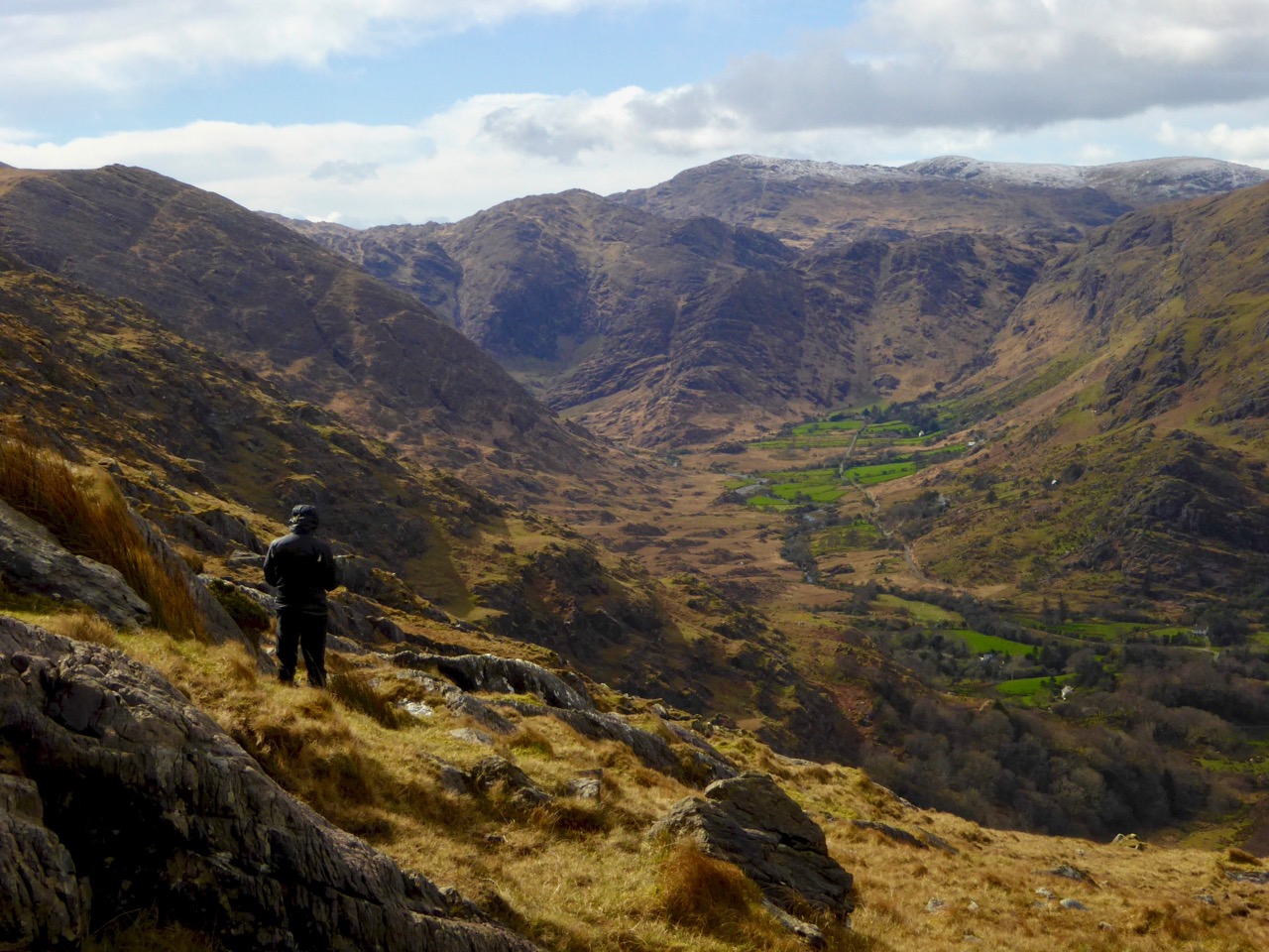
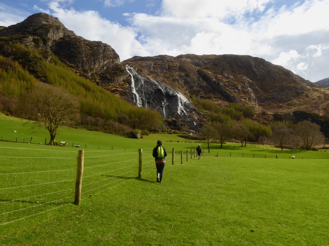
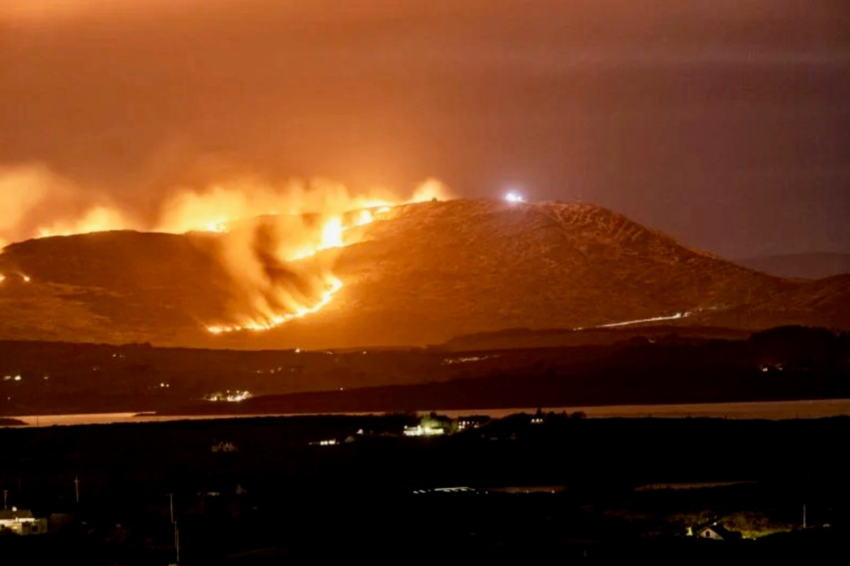
There’s a house down there, nestled under some spectacularly steep fields! This is to remind you that you have to up the scale a bit if you are stepping across the county boundaries. This Kerry landscape is such a contrast to our own seascapes and islands. We have our hills, of course: Mount Gabriel was in the news this week because of the gorse fires which lit up its summit. Such fires are allowed up until the first of March – by longstanding tradition – to clear the land and improve the grazing. It all seems a bit incongruous, though, when governments are planning to outlaw wood-burning stoves because they lead to poor air quality, and we are being advised by the HSE about the adverse health effects of air polluted by smoke and ash. Fire on Mount Gabriel 26 February 2023 – photo by Magnus Burbankscourtesy Southern Star:

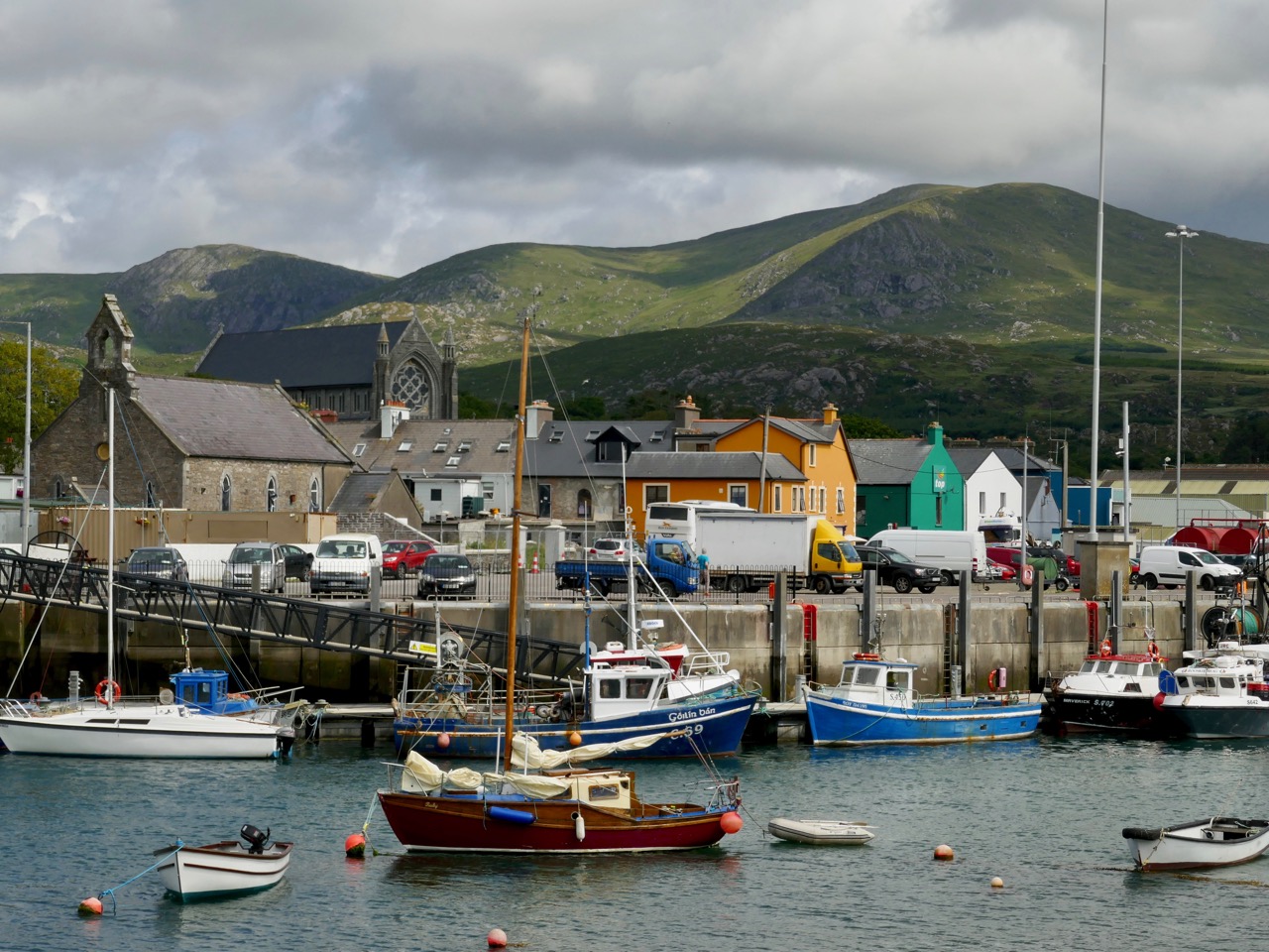
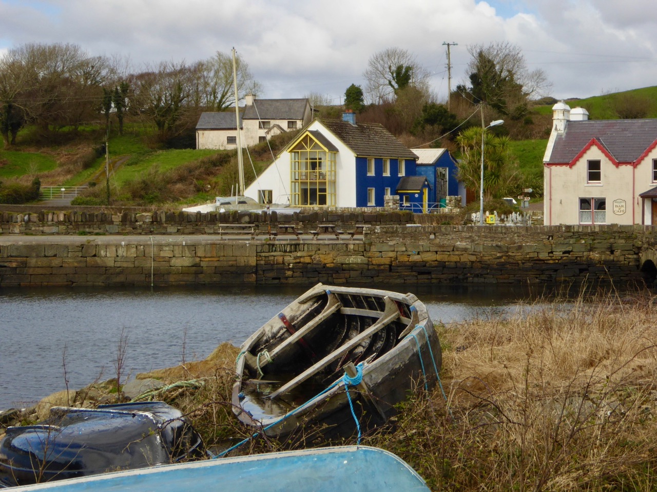
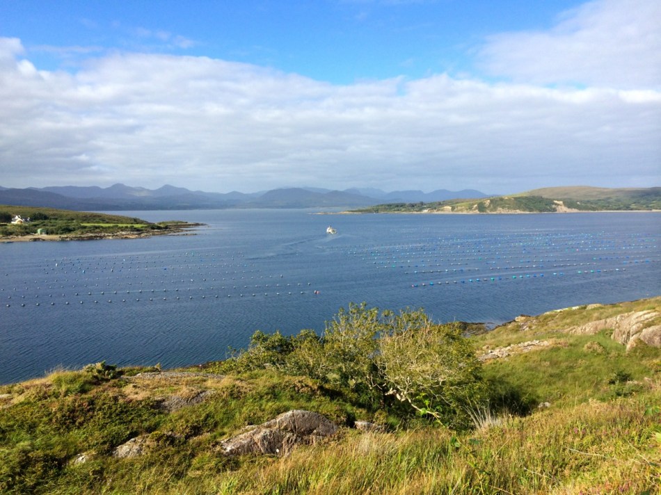
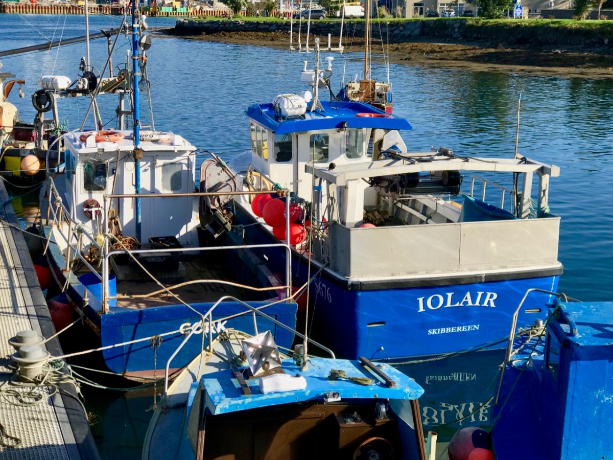
Let’s leave that argument – and the drama – for others to debate, and return to the colour and spectacle of our neighbours. Below are fishing boats tied up in Castletown-Berehaven. You’ll note that ‘Iolair’ is registered in Skibbereen. If this seems strange, remember that our West Cork town on the Ilen River is still the Port Of Registration for all shipping on the south-west coast of Ireland between the jurisdictions of Cork and Limerick. My recent post on the Ilen described Skibbereen as “. . . a settlement served by water . . .” with perhaps up to nine historic quays and a Custom House located within the town in its heyday of commercial vessels working on the river. Present day Shipping registrations are administered by Customs & Excise in Bantry, even though the prefix ‘S’ (for Skibbereen) is still used – a somewhat quirky anomaly: the Custom House in Skibbereen was closed in 1890!

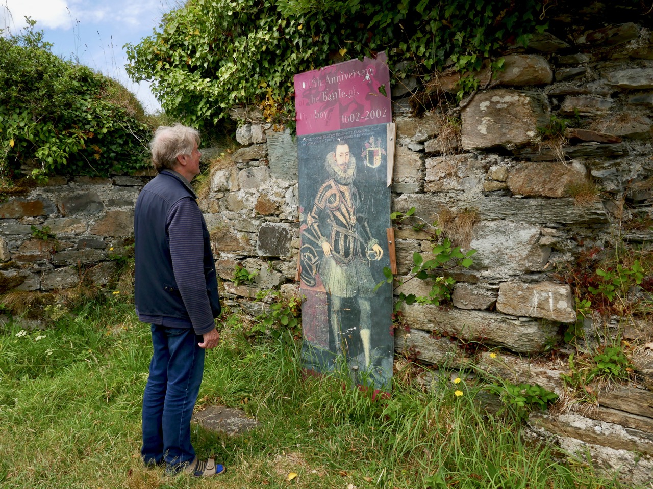
The people of the Beara Peninsula quite likely think of themselves foremost as an entity, rather than a mixture of Corkonians and Kerry people. In Eyries a Seanchaí – or storyteller – is celebrated: Pádraig Ó Murchú. His story is a somewhat sad one, certainly not untypical of many remote areas in Ireland. He was born in Gort Broc (Gortbrack, Co Kerry – north of Kenmare Bay) on 15 February 1873. His parents were Seán Ó Murchú whose wife Máire Harrington. (‘Caobach’) and he had four sisters and two brothers. Five of them, the boys and three of the girls, went to Butte, Montana. Seán died in Gort Broc at the age of 47 when Pádraig himself was a young boy. None of his forebears ever returned home but he would receive a letter every now and then from one of his aunts. Folklorist Martin Verling states that 707 men and 431 women emigrated to Butte from the parish of Aorí between 1870 and 1915. An account of how his great-grandfather, Seán Ó Murchú, settled in Kerry was taken down from Pádraig’s mouth (or Patsy as he was called): Seán was abducted by one of the ‘Cithearnaigh’ (a name given to certain Irish landlords in Beara) in Kerry and sold in France as a slave. When he managed to escape, he landed in Beara.

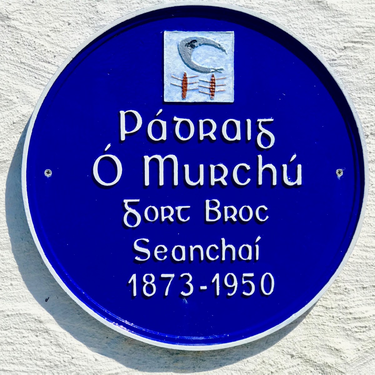
Commemorating Pádraig Ó Murchú in Eyries

Measles affected Pádraig’s eyesight so badly that he was given a blind pension; ‘flickering’ left him unable to read or write. He spoke English fluently, with Irish his native tongue. Until she died in 1923 his mother lived with him, and it fell to him to tend to her during the decline of old age. He earned his living by farming and fishing and was always in good health, apart from his eyesight. Writer and folklorist Máirtín Verling recorded memories of him from men who were young boys during Pádraig’s old age. Pádraig was part of a culture now vanished, and Verling states “. . . the day Pádraig Ó Murchú was lost as an old man – the habit of storytelling, and the habit of speaking Irish, died together in Béarra . . .”

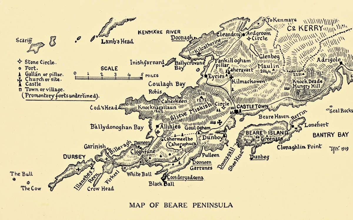
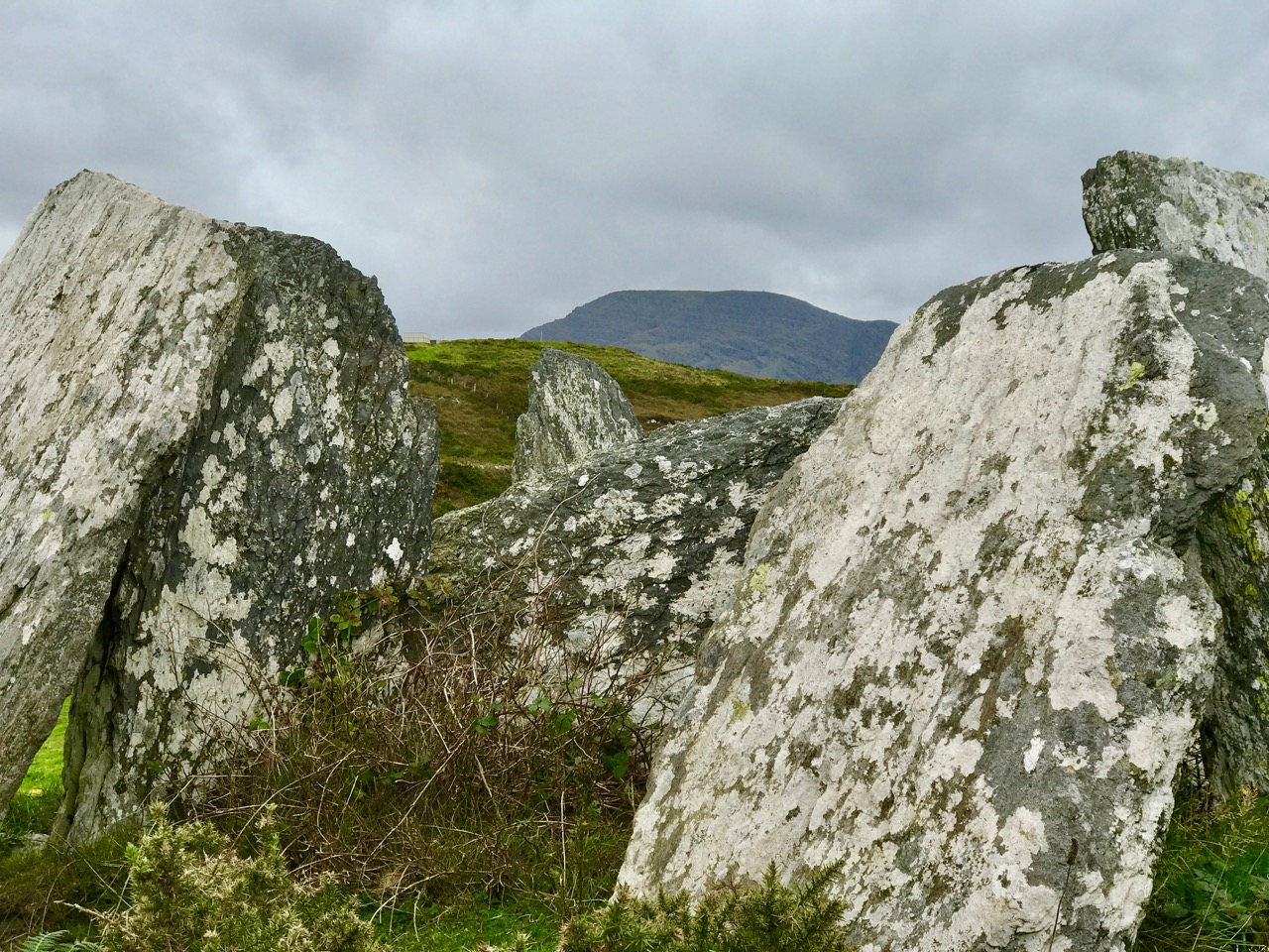
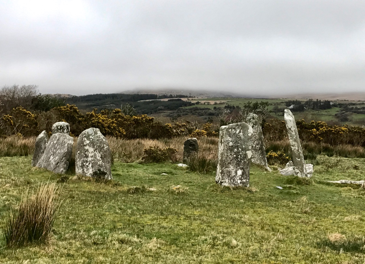
Map of the Beara Peninsula from the Royal Society of Antiquities of Ireland, T J Westropp 1919. Principal archaeological sites are indicated.

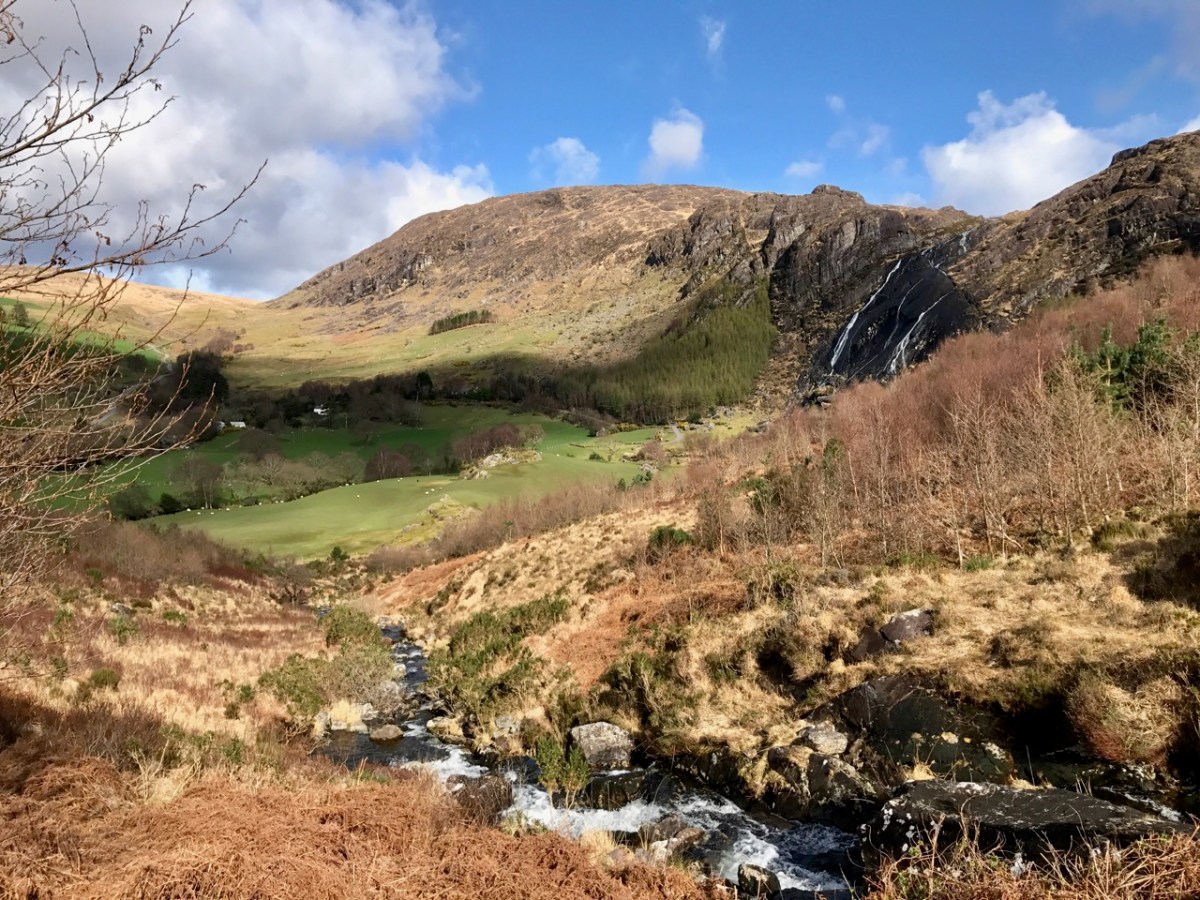
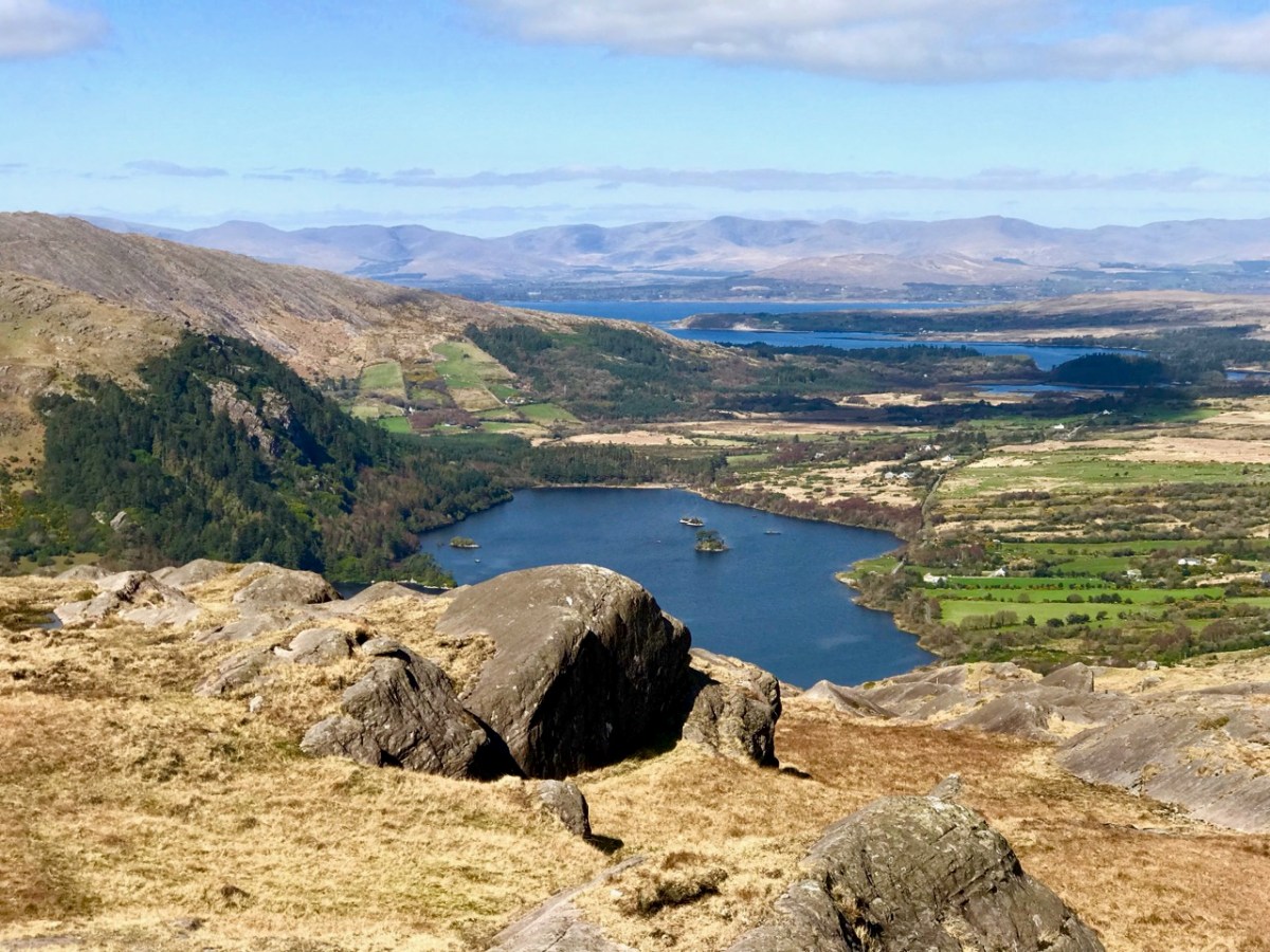
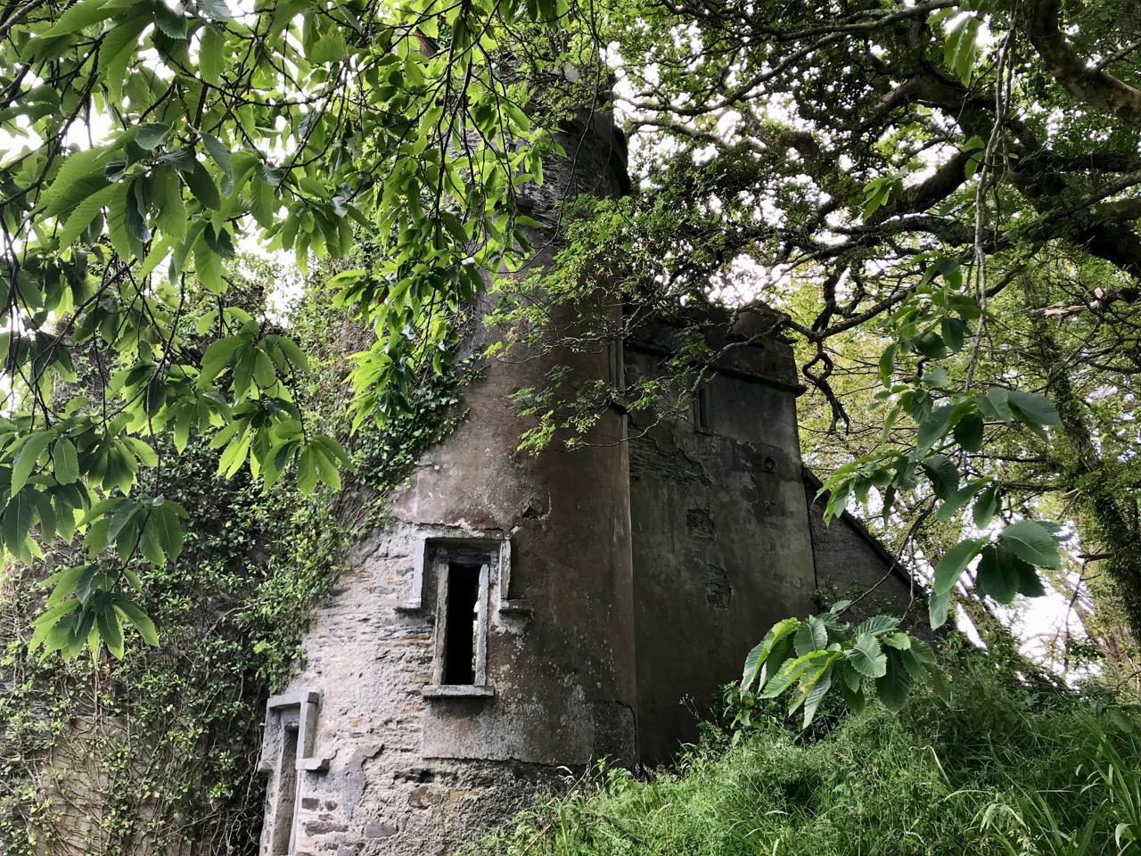
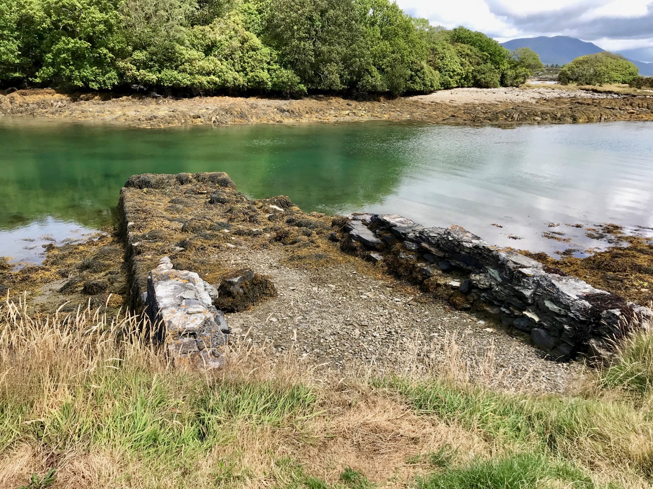
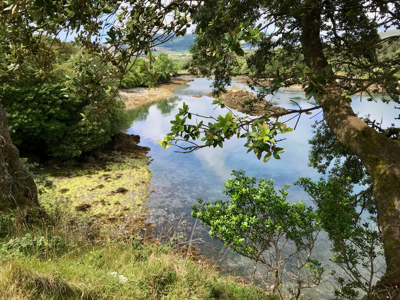
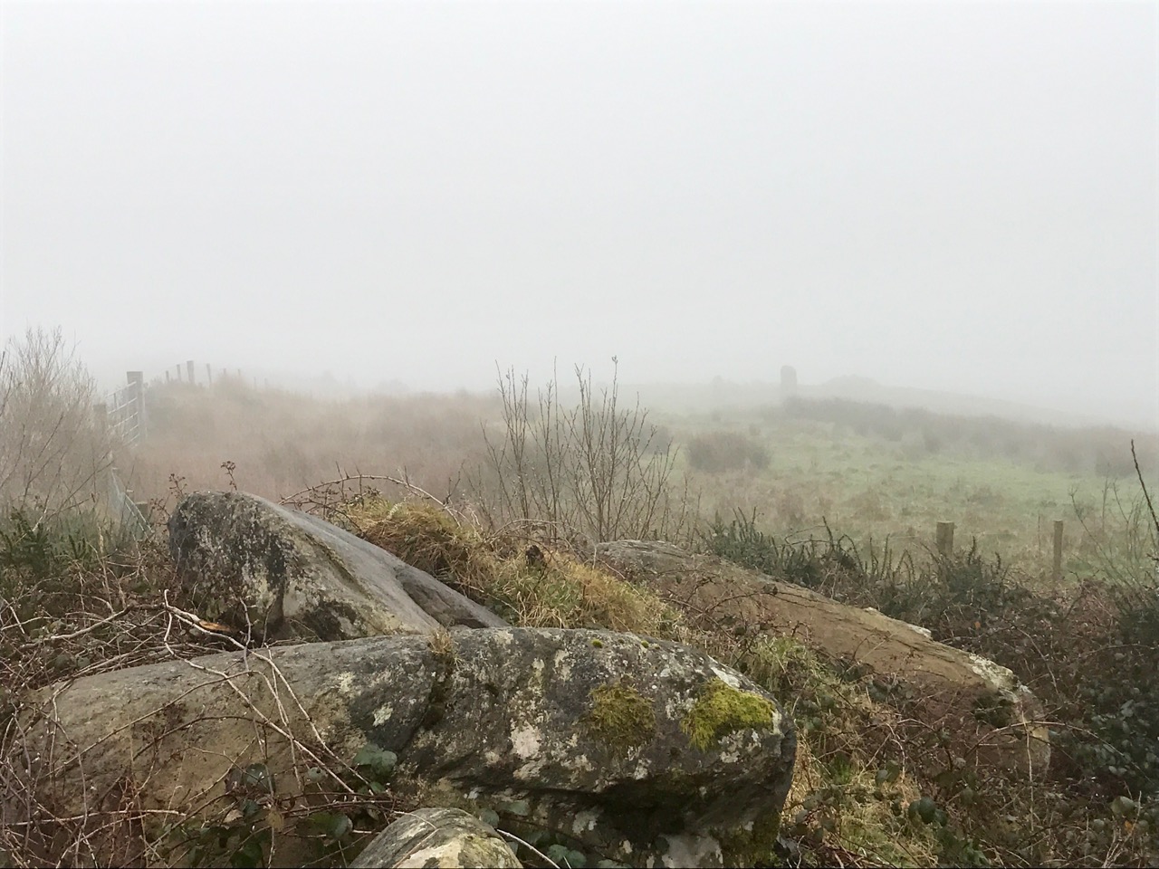
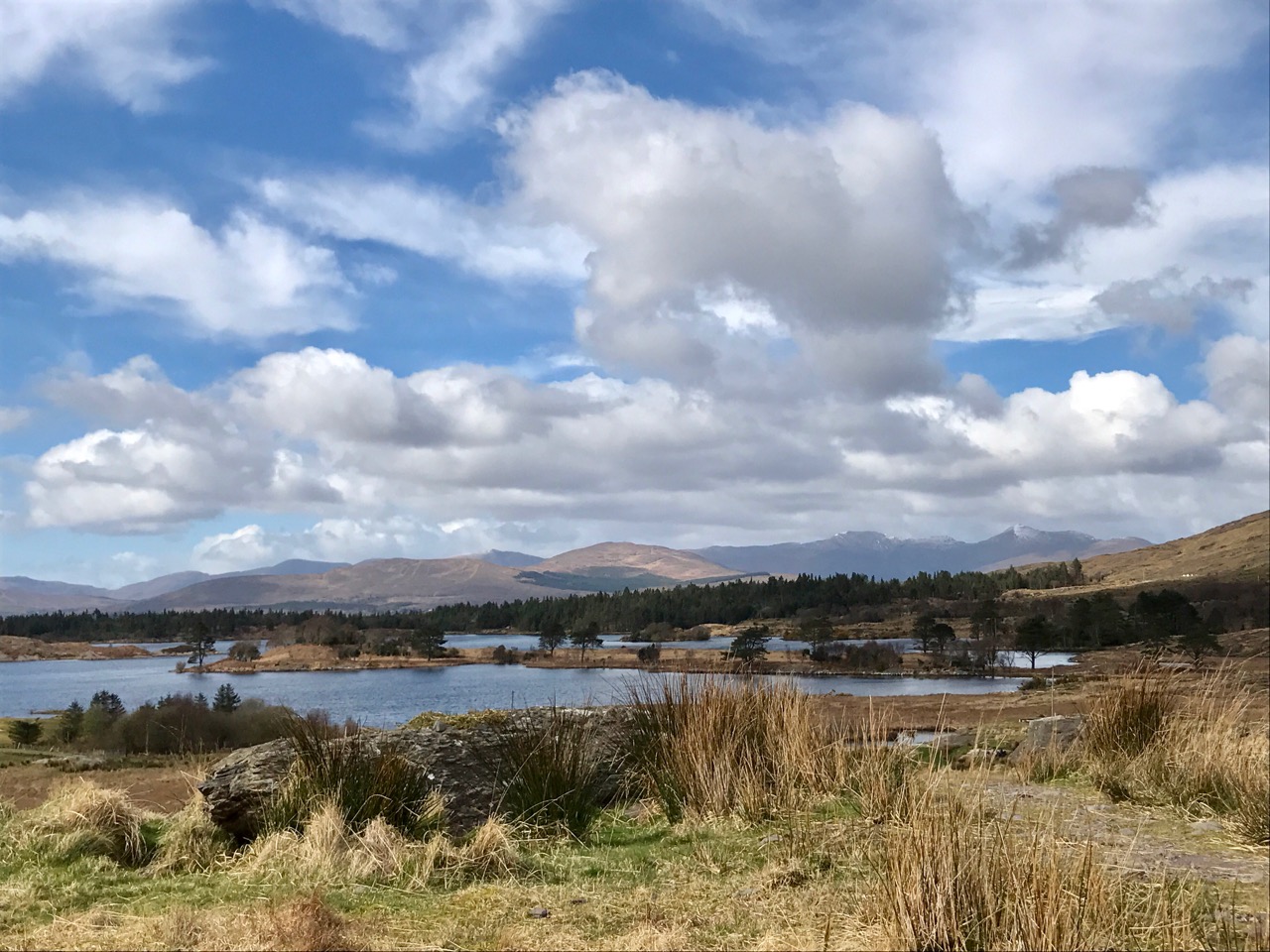
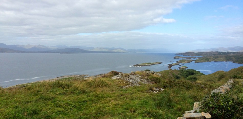
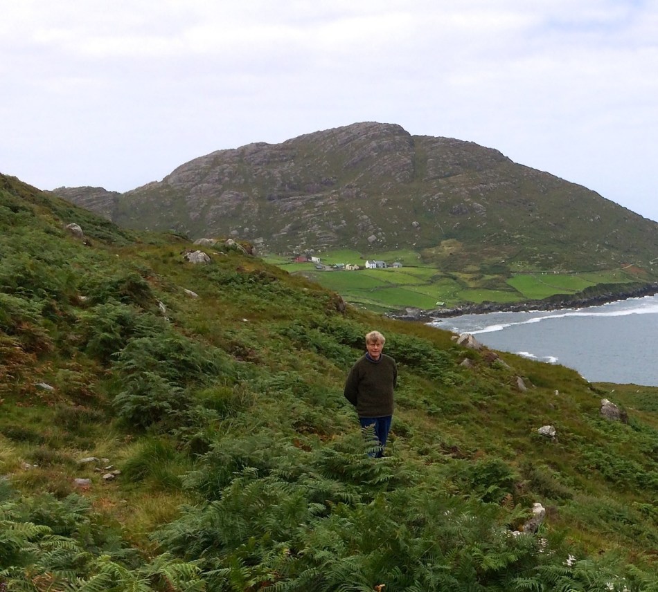
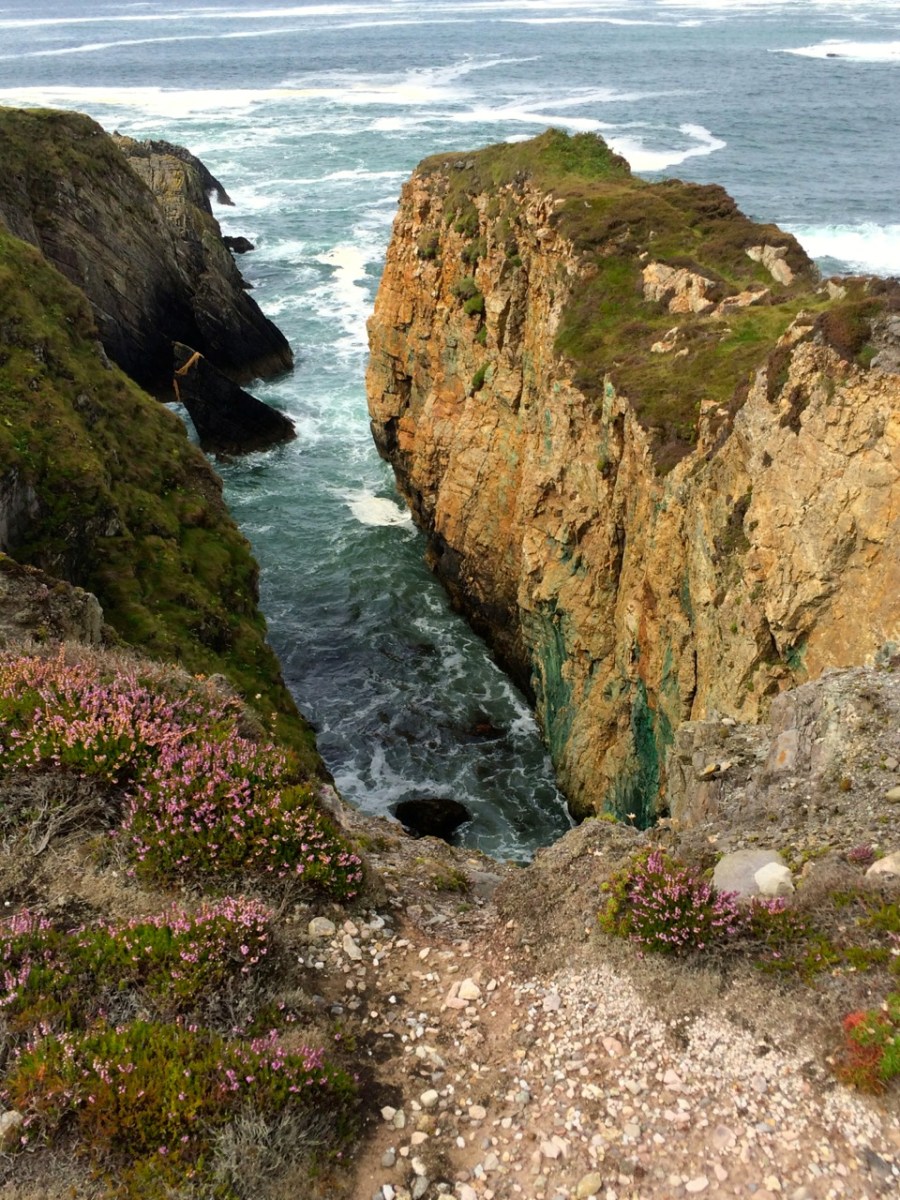
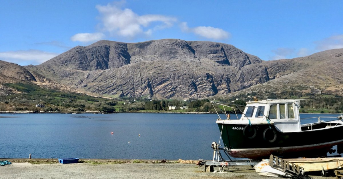
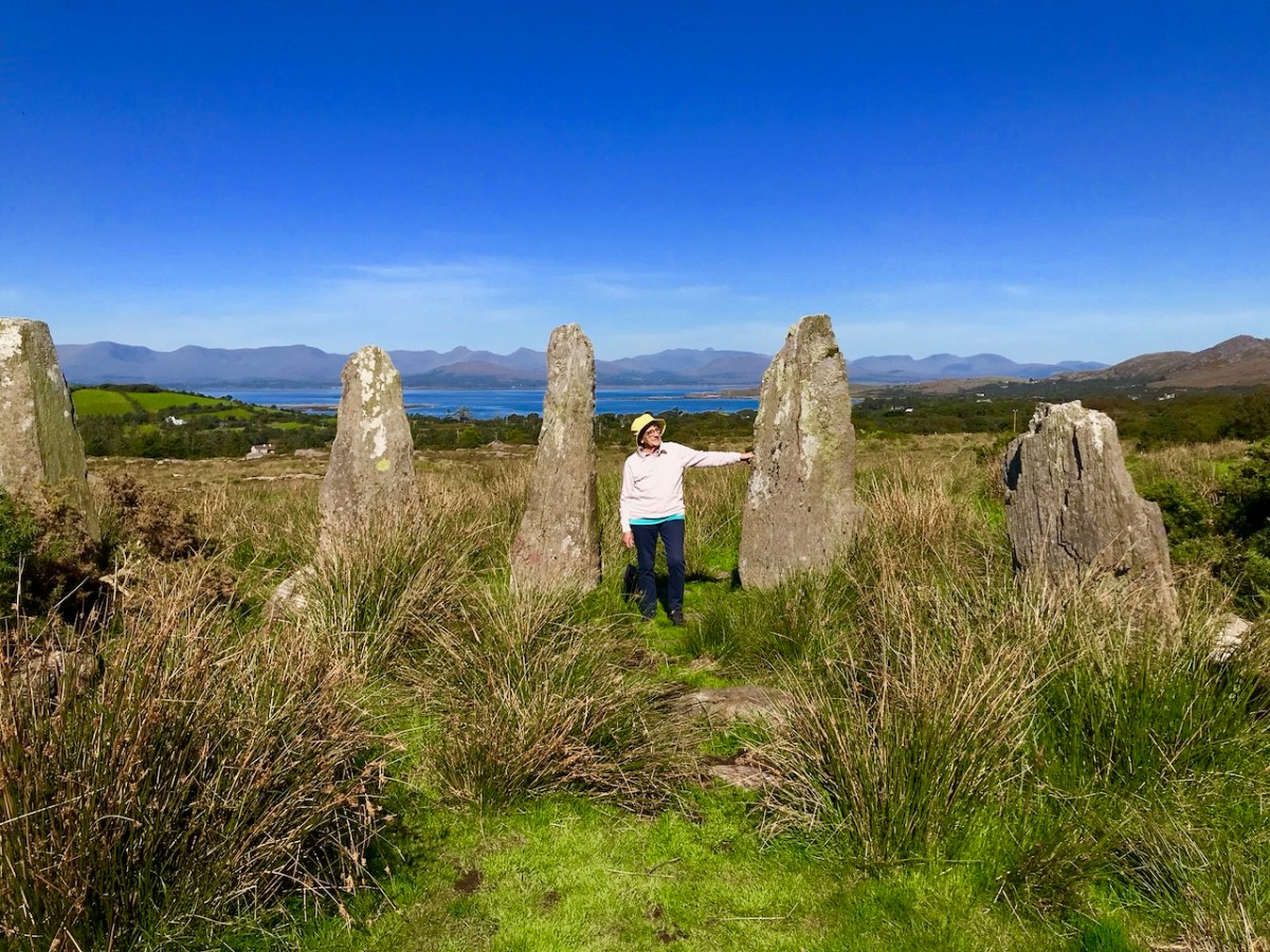
These Beara landscapes are typical of the remote grandeur of the territory. Human settlement has encroached upon it – the patchy forestry plantations above are unnatural and uninspiring – but there are sufficient wild prospects remaining to ensure that the all-embracing beauty can never be eroded. Plenty of living history remains in evidence.

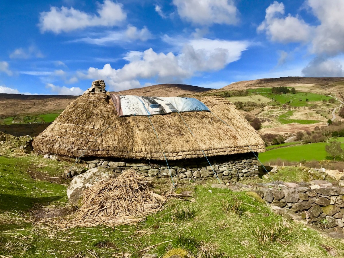
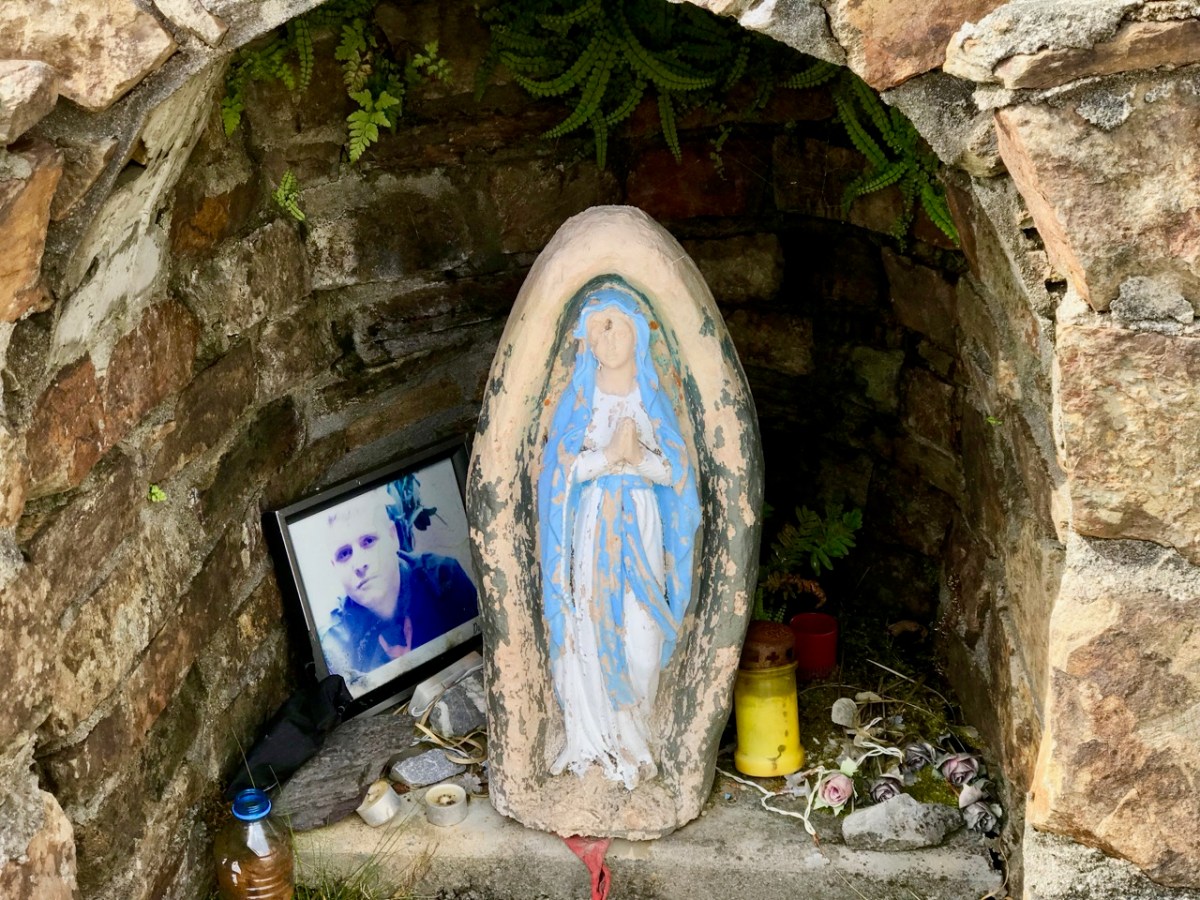
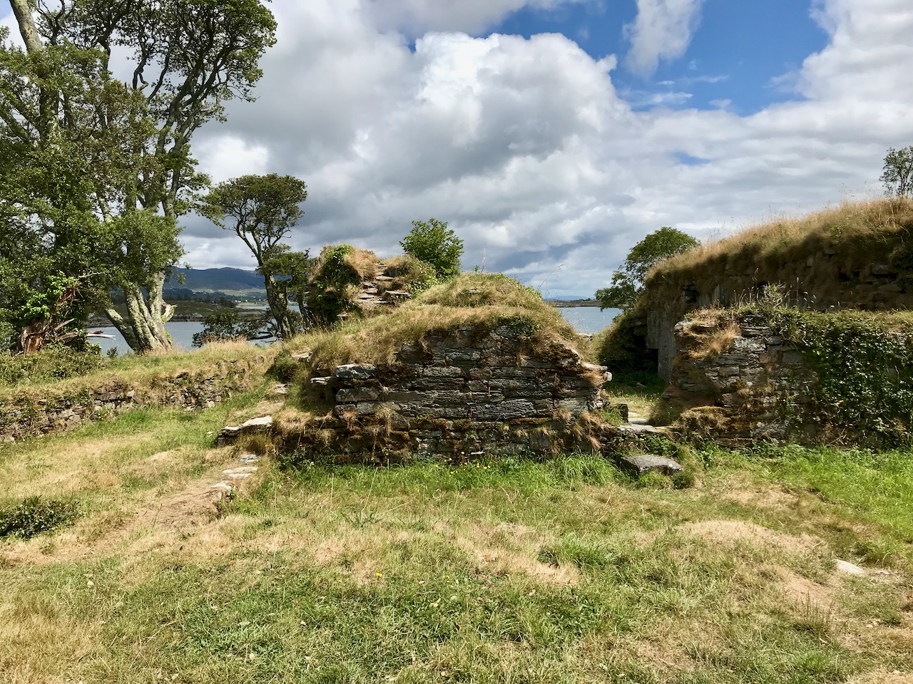
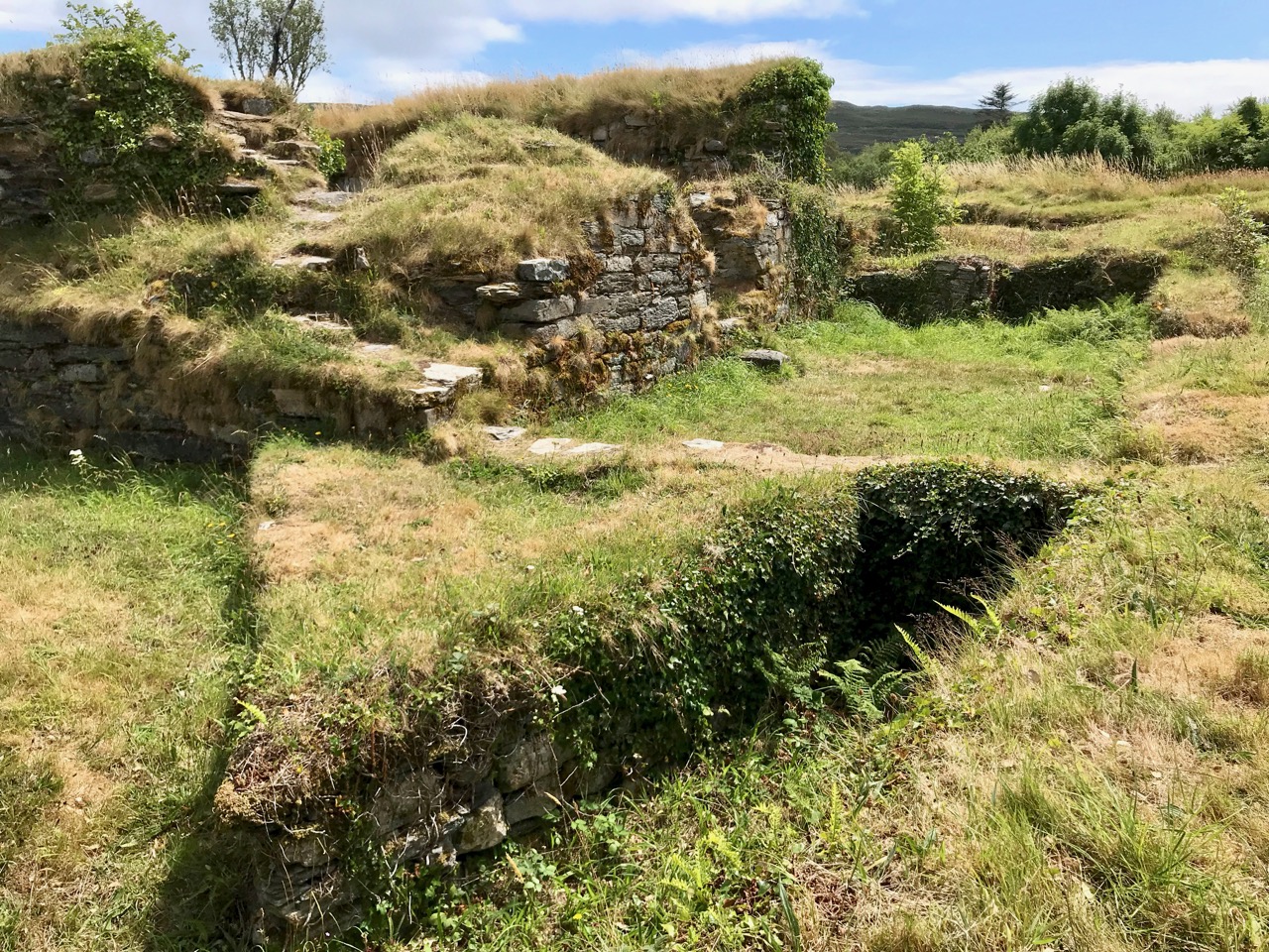
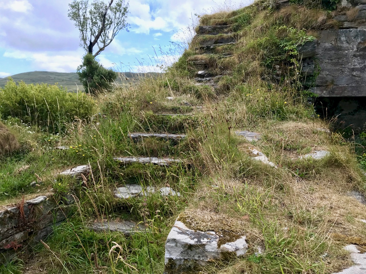
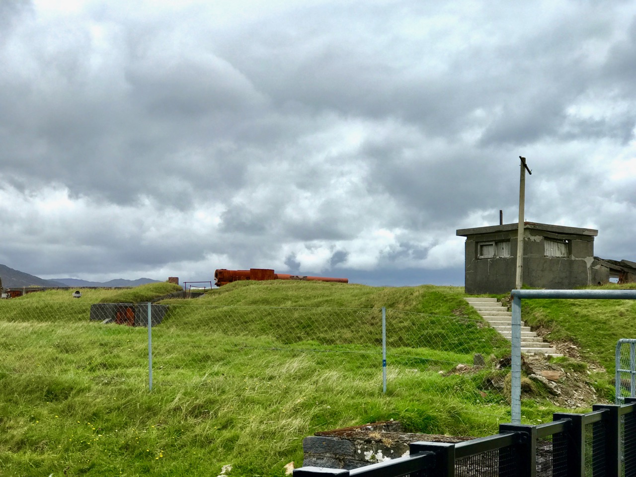
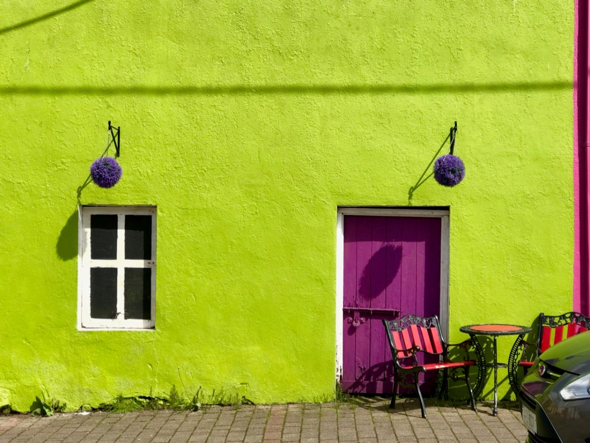
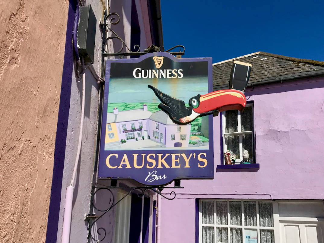
Archaeology, colour and community are all part of the local scenes on the Beara. The tourism industry is undoubtedly thriving, bringing fresh life with it.

We hope you will agree that the Beara – whether it’s Cork or Kerry – is deserving of a visit – and a stay: you have to delve deeply into the lifestyle and traditions. Enjoy!

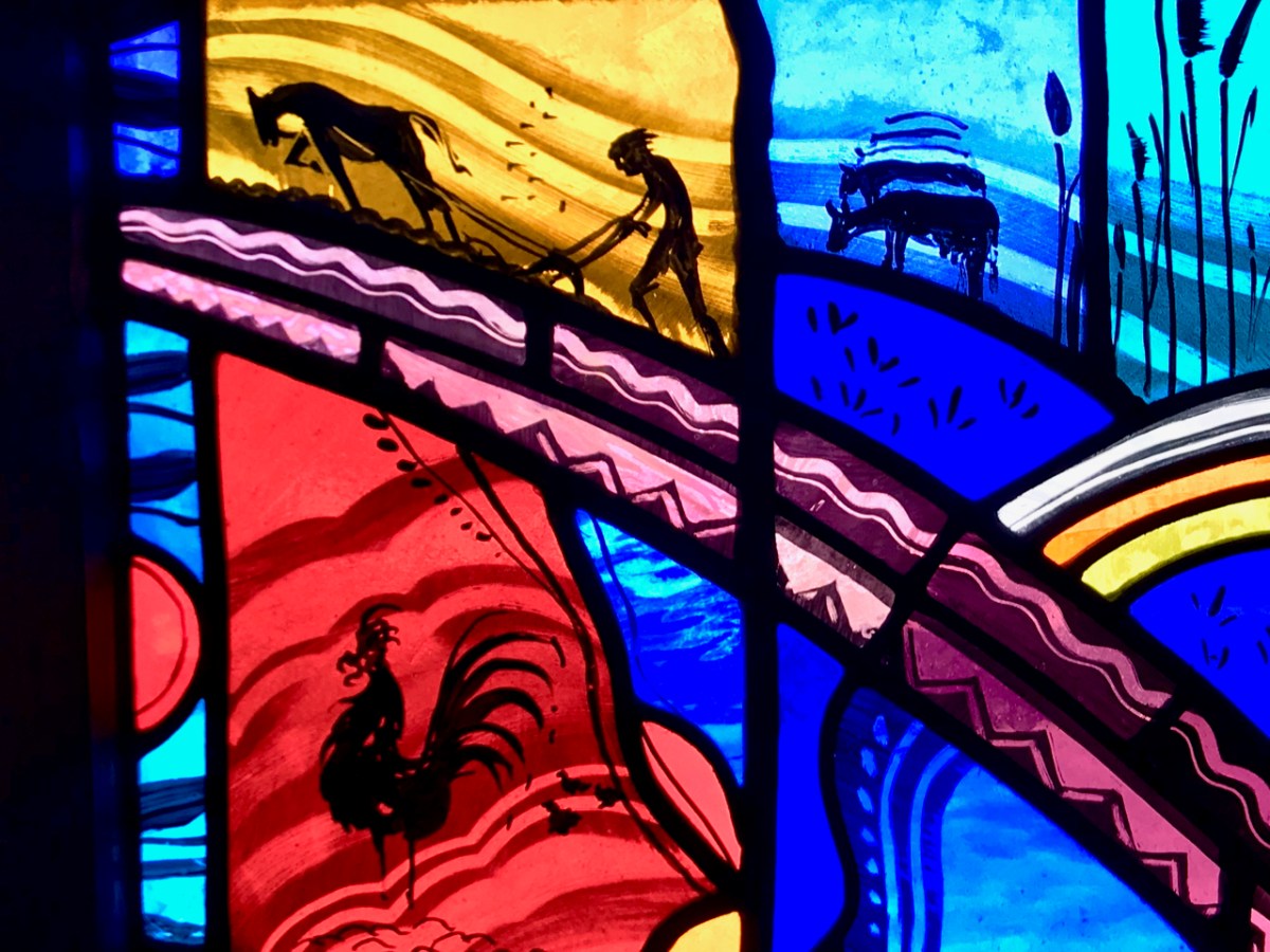
(Above – the work of stained glass artist George Walsh. A visit to the little church in Eyries to take in more of this is a must)

An Excursion to Dunboy

We have often visited the Beara Peninsula: it’s not too far away and makes a good day’s outing for us. Have a look at some recent posts here and here to get the feel of the geography. Yesterday we had a mission – to discover more about Donal Cam O’Sullivan Beare (1561 – 1618) and his connections with Dunboy Castle, over by Castletown-Bearhaven – often known as Castletownbere or just Castletown – in the far west of County Cork.

Our first stop was at the bustling harbour of Castletownbere which sits at the foot of the Caha Mountains. …Where land and sea collide, untamed beauty abounds… – that’s the apt heading on the website of the town’s Development Association, and it most certainly seems a lively and flourishing community, a good base from which to explore the wealth of history and archaeology on the Beara. Daphne du Maurier’s novel, Hungry Hill, is set in the area and is a family saga loosely derived from the history of the Irish ancestors of du Maurier’s friend, Christopher Puxley.

We paused only for a much-needed coffee and a quick look in the Sarah Walker Gallery (precariously and picturesquely situated on the end of the town’s slipway – it’s the white building in the picture above) before setting out to find Dunboy. I had read a little of the history of the place, and knew that it had been a centre of rebellion following the Battle of Kinsale in 1601 – 1602, when allied Irish and Spanish forces were defeated at the culmination of the Nine Years War between England and the Gaelic lordships.

At the edge of the Dunboy Demense are traces of a castellated sea-wall and a gatehouse (above).  The territory was a stronghold of the O’Sullivan Beare clan leader, and was built to guard and defend the harbour of Berehaven. Its presence enabled O’Sullivan Beare to control the sea fisheries off the coast and collect taxes from Irish and continental European fishing vessels sheltering in the haven. It was also a centre for trade to and from the continent. In the aftermath of the Battle Of Kinsale Donal Cam O’Sullivan Beare’s followers retreated to Dunboy Castle, which was considered an impregnable stronghold.

The 25″ historic Ordnance Survey map (upper picture) shows the location of the O’Sullivan Beare fortress, circled in red. Don’t be confused by the ‘Dunboy Castle’ label: this is a later building added to an existing tower house that stood on the hill above the promontory. The estate came into the hands of the Puxley family who invested significantly in the Allihies copper mines in the 19th century. The development in the centre of the aerial view above is Puxley Manor, and is a 21st century incarnation of the huge neo-gothic family mansion created by the family, which was burnt out by the IRA in the 1920s.

These pictures show the mansion after its destruction and today. In the lower photograph you can see the original tower house in the foreground: the buildings were fully restored as part of a high-profile ‘Celtic Tiger’ project to create a 6-star hotel which could have brought employment and significant economic benefits to the area. Unfortunately the project collapsed before completion, and the future of this decaying leviathan is uncertain.

We could only look in awe at the very evident and lavish quality of the restoration and development, even in its present state, and speculate how its fortunes might have fared in more stable times. But all this was a bit of a diversion, as our goal was a much less audacious – but far more historically important – site: the original ‘Dunboy Castle’. We followed the trackway along the inlet, which looks as though it was artificially constructed to form a quay serving the demesne.

The ruin itself is unassuming: thick stone walls barely a few metres high. However, the ground plan is clear to see – a typical ‘tower house’ design with splayed openings and steps contained in the thickness of the outer walls. Also visible in the surroundings, however, are the clear ‘star’ shapes of an enclosure, complete with salient angles. These outer defences, reminiscent of ‘star-shaped forts’ evidently date from Cromwellian times, constructed after the castle was destroyed.

These ruins conceal an unhappy tale. At Kinsale the clan chiefs had been joined by a large force of troops sent by King Philip III of Spain, who considered that a federation with Ireland would assist his aspirations against Elizabethan England. After the surrender, a number of O’Sullivan followers retreated to Dunboy, where they found the small Spanish force stationed there  preparing to hand the castle over to the queen’s Lord Deputy, Mountjoy. O’Sullivan overpowered and disarmed the Spaniards and later released them to return to Spain, having kept kept all of their arms, ordnance and munitions. Inevitably, an English force under George Carew set out for Dunboy: it is said that this force numbered between 4,000 and 5,000 troops. O’Sullivan Beare established defences at the castle, but set off himself with most of his own army to consolidate in the north of the Beara Peninsula. Only 143 of his men were left behind at Dunboy, together with Friar Dominic Collins to look after their spiritual welfare. The siege of Dunboy began with an artillery bombardment by land and sea. Owen O’Sullivan of Carriganass, a cousin of Donal Cam, had allied himself with the English and informed them of a weak point in the castle walls. The guns were directed to that point, and the walls were eventually breached. After a ten day siege, Dunboy was reduced to the ruin we see today.

Above is a wonderful graphic illustration of the Siege of Dunboy Castle from Pacata Hibernia or A History of the Wars in Ireland during the Reign of Queen Elizabeth first published in 1633. Only 72 of the Irish defenders survived the siege: they were all hanged, including Friar Dominic Collins. Most of the hangings took place in the bustling square of Castletown-Bearhaven, close to where we had enjoyed our coffee at the start of our excursion.

Here I am meeting Donal Cam himself in the ruins of his former stronghold. My account of the Siege of Dunboy is a very condensed version. Much more has been written about the details. As for O’Sullivan Beare, he eventually embarked on a long march to Leitrim with a thousand of his followers – but that’s a further unhappy story, best kept for another day!

Dunboy Castle and its immediate environs are publicly accessible and there is plenty of parking within easy reach. We finished our day on the Beara by following a rural loop walk from the castle ruin back to the gatehouse – about 5 kilometres in idyllic surroundings.

Shay Hunston and the People of the Wild Atlantic Way

It’s the people! Shay Hunston is passionate about his subject. Sure, we have wonderful scenery, and every photographer is out capturing it. But time and again, what visitors tell us is that what makes Ireland special for them is the people they meet, their warmth, humour, empathy, poetic language, and the interest they take in others. So I set out to document those people – to show the faces and the personalities you will meet along the Wild Atlantic Way.

The first photograph above is part of that project – it’s Mike Watkins, the friendly face we pass most days as we drop into Budd’s of Ballydehob. He sits outside, drinking tea and greeting everyone. Here’s what he has to say about life: I have sunshine in my heart and I never, ever, ever get upset about anything. I’m happy every single day and everybody else should be the same, and we should all hug each other and talk to each other. This I have learnt from a lifetime of experience.

Tim Healy – Leap. The best advice I ever received in life was when I came to live in Leap in 1983. I knew of a local lad who had a reputation for liking a bit of a ‘Work Out’, he was well able to look after himself. So I said to him, just to wind him up, would you like to have a go, the two of us for 20 pounds. No, he said, I’ll tell you what, don’t be wasting your money, we’ll fight for pleasure.

So far, Shay’s project has been a Wild Atlantic Success, and he hasn’t even moved beyond Cork yet. He’s been going from community to community along the Wild Atlantic Way, photographing whoever volunteers. Once the prints are made, the town or village mounts an exhibition of his strong black and white images, in shop fronts, on the approaches to town, on walls and railings.

Caroline O’Donnell – Ballydehob. My grandmother once told me that as long as I have music and laughter in my life I would never grow old. I think about her every day and try not to grow old. She also said never marry a man you haven’t seen drunk… I’m still thinking about that advice.

We missed the shoot in Ballydehob as we were away, so we participated in Schull. It’s a nervous business, sitting for a portrait, but Shay creates an instantly warm and relaxing environment. He’s good humoured and patient and empathetic and he obviously loves doing this. He was also cool about my photographing him and his process (no pressure like, to be snapping away in the presence of genius!) and doing a blog post.*

Pat Murphy – Castletownbere. I started fishing at 13 years of age in open boats with a crew of three. We fished winter and summer in all kinds of weather. From October to March we fished for scallops, two rowing the boat and the third man looking after the dredge, by God you had muscles from pulling oars for six months…In summer we would fish for lobsters and crabs. To make the pots we would go to the mountains to cut hazel and sally rods. I use to make four pots a day. Besides the fishing we all had a bit of land to grow our own vegetables and potatoes. Come September, those of us who had a pig or a cow would slaughter them, butcher and salt the pieces and put them in a barrel, there they would be left for 6/8 weeks, they would then be hard dried or smoked, we would also salt fish. The best life advice I could give anybody is to be able to negotiate with people, to work together, not against each other.

Shay asks people to write a few words to go with the image. It’s lovely to meander down the street and read what people have said, so I’ve included snippets under each photograph.

Saoirse Canty – Ballydehob. My perfect day would be my friends and I hanging out around Ballydehob. We would do nothing and talk about nothing all day. The reason why that is so perfect to me is because it makes me truly happy and the familiarity of this beautiful town is very comforting. It is one of those things that I could do forever.

You will notice, of course, that this post is (not surprisingly) a little heavy on Ballydehob folk, so as part justification for that, here’s what Shay himself wrote about his experience working in Ballydehob:

Ballydehob is a remarkable place, a multicultural melting pot of creative activity and is home to artists, poets, writers, musicians, sculptors and craftworkers. The local community encourages people to pursue and develop their creative and artistic talents…With the influx of artistic people in the 70’s, Ballydehob became known as the ‘San Francisco of the Mizen’. Ballydehob is an inspiration to all and is a template for how a multicultural community can live in harmony, with sympathy and compassion for each others needs.

But just to show I am not totally biased, here’s Danny Smith, whose day job as a postman in Bantry allows him the space to observe and dream about his next painting. Next time you’re in Kilcrohane, drop into The Old Creamery and see the wonderful results.

Danny Vincent Smith – Bantry. I started painting as long ago as I can remember, this passion for painting started from there. Every hour I would be thinking and looking for some kind of angle for a painting, observing everyday life, watching people’s faces, their expressions, trying to capture movement in the moment, such as an old lady with shopping, old farmers or a fella sitting inside the pub by himself. I try to picture people’s life’s and transfer them to canvas. My environment has a massive influence on my work and I feel like I’m documenting a time and place in rural life from where I live for future generations.

Go visit Shay’s website NOW to see lots more of his people photography, including his project to photograph the people of Dublin’s Temple Bar. Or sign up to follow him on Facebook or on Twitter. The Schull images should be ready in a few weeks – I will let you know.

Callum Donnelly – The Ludgate Hub, Skibbereen. My Perfect Day – A frosty morning, circa 8am, the ground is firm. I wrap up in a coat, scarf, gloves and I bring my springer spaniels for a walk around our local woodland. The air is sharp, and you can take a deep breath, and try to ignore the daily bombardment of emails, messages & calls. To be able to walk in silence, absorb your surroundings is a fantastic way of  balancing your mind in a world where work can often take precedence. Young people feel enormous pressure to succeed, and perform, its good to take some time out in an environment that is a polar opposite to your usual surroundings.

I will leave you with a couple of shots of Shay himself and his session with Robert. If he comes your way, you lucky people of the Wild Atlantic Way, take advantage of this opportunity! And as for everyone else – come and meet us for yourselves.

Shay and Robert

Himself

*Images were downloaded from Shay’s website with his permission. Please always credit the source for any image you download from the internet.

The Red Line – Bere Island

As part of the excellent Taste of West Cork food festival, we signed up for the Bere Island Cultural Taste Tour, and on a grey Saturday morning we drove off along the south side of the Beara Peninsula to Castletownbere. The Islands of West Cork are all fascinating to explore, in our experience, and each one is very different. This was my first visit to Bere Island, and I immediately want to go back there: this was, of necessity, a ‘whistlestop tour’, ably led by Ted O’Sullivan, probably a direct descendant of the famed O’Sullivan Bere (who deserves – and will get – a post of his own!) You may remember that the island – and the peninsula – has taken its name from the Spanish wife of Owen Mór, King of Ireland around 120AD.

Bere Island lies off the coast of the Beara Peninsula, which was in constant view as our bus took us to the eastern end on the narrow island roads – towards the ‘Red Line’

While the history of the island takes us back to the Bronze Age and beyond, more recent events have been left behind on the landscape – and in the memories of the islanders.

Upper – ancient history: Ardaragh Bronze Age wedge tomb beside the road to the east of the island with Hungry Hill beyond. In 1926 the tomb collapsed, and this was seen by some islanders as a ‘sign’ that the British might leave the occupied part of the island. Lower – modern history: looking from the island towards the Beara – British warships stationed in the bay circa 1914

Did you know that part of Bere Island remained in British hands well beyond the establishment of the Irish Free State in 1921? This was one of the three Treaty Ports that were retained by the United Kingdom following the First World War, when there were fears that there might be a recurring naval threat to the islands of Britain and Ireland. The other two ports were Spike Island, in Cork Harbour, and Lough Swilly in the far north of the Irish state. Relationships between Ireland and Britain remained uneasy for many years but finally, in 1938, it was agreed that these deepwater ports should be handed over to the Irish Republic. Winston Churchill was appalled by the decision, and in an address to Parliament in that year he called it a ‘folly’:

…When the Irish Treaty was being shaped in 1922 I was instructed by the Cabinet to prepare that part of the Agreement which dealt with strategic reservations. I negotiated with Mr Michael Collins, and I was advised by Admiral Beatty who assured me that without the use of these ports it would be very difficult, perhaps almost impossible, to feed this Island in time of war. Queenstown and Berehaven shelter the flotillas which keep clear the approaches to the Bristol and English Channels, and Lough Swilly is the base from which the access to the Mersey and the Clyde is covered… These ports are, in fact, the sentinel towers of the western approaches, by which the 45,000,000 people in this Island so enormously depend on foreign food for their daily bread, and by which they can carry on their trade, which is equally important to their existence…

Until the handover in 1938 the eastern end of the island lay beyond ‘The Red Line’. The position of this line was pointed out to us on the tour, although we couldn’t see a ‘line’. In fact, no physical line did ever exist but there was a point beyond which Irish people could not proceed, and British forces stationed over the ‘line’ could not cross. Ted, our tour guide, recounted some amusing stories of those strange times. With typical Irish inventiveness, there were many instances of how the difficulties created by the ‘line’ were overcome. For a short while there was a prison on the British sector, right beside the ‘line’. It was used to incarcerate mainly political prisoners. Every weekend there would be a party held on the Irish side of the line which always included singing, dancing and drinking, and the prisoners joined in! Many politically important prisoners managed to escape, and the prison was known as a ‘leaky bucket’ because of this. A number of the British governors of the prison were removed during its short life because of their inability to contain their charges.

Lonehort Battery – built in 1899 by the Royal Engineers of the English army – housed two enormous 6-inch guns (still in place but very rusty) and is surrounded by a deep moat. There are plans to re-open the site as a historic monument

Lonehort is a natural harbour, believed to have been used by the Vikings. Archaeological excavations were carried out there in 1995 and confirmed the artificial breakwater as being Norse: there were also signs of a Viking shipyard here.

Lonehort – a Viking harbour and shipyard. The word means ‘Long Phort’, and is used to indicate Norse associations

One of the purposes of our tour was to introduce us to food produced on the island, and we ate in three establishments: The Shop and Cafe in Rerrin for soup, The Hotel for a fishcake lunch, and the Heritage Centre for a dessert and coffee. All provided good, delicious fare.

Our three food destinations. Top – the wonderful Shop at Rerrin; centre – The Hotel, open all year round (it looks as though it has interesting fare!) and lower – the modern Heritage Centre which has a gallery displaying the island’s history and culture as well as a good eatery

All too soon our short tour came to an end: we had to get back to catch the ferry. We missed several things: St Michael’s Holy Well and Church; views from Knockanallig (the highest point) and several standing stones including Gallán, which is exactly in the centre of the island. And it’s a great place for walking! We will return, perhaps for a few days in the winter, and complete our explorations. But many thanks to Ted and the Bere Island Projects Group for giving us such a comprehensive introduction to an intriguing community and its history.

Robert heading home after a grand day out!

Back to the Beara

Mizen, Sheep’s Head, Beara, Iveragh and Dingle: these are the five peninsulas which make up the south-western coast of the island of Ireland. We live on the Mizen and, for that reason, we are always trumpeting the qualities of the place, historical and scenic. However – to be fair – the other peninsulas have much to offer. The Sheep’s Head is a mere stone’s throw from us – just over the waters of Dumnanus Bay – and our visits there are frequent. The Beara has been calling us recently: we tend to think of it (unfairly) as somewhere quite distant but we can be on it in less than an hour. In the last two weeks we have taken two day trips out there (with our holy-well hunting friends Amanda and Peter), in contrasting weather conditions, and we can report back that the landscape is stunning whatever the weather, and the visible history is palpable. We have visited before – a while ago now: see our posts here and here.

Header picture – I titled this photograph ‘unbelievable’ in our file: look at the tiny house and the monumental stone walls heading up the mountain above it, dividing up the land into enormous fields. Above – a typical view of mountain, meadow and wild scenery to be found on the Beara

The Beara comprises around 58,000 hectares, or 228 square miles, and covers 330 townlands. The larger, southern portion of the peninsula lies in County Cork, while the northern area is in County Kerry.

We were searching for – and found – some of the Beara’s holy wells. Head over to Amanda’s blog Holy Wells of Cork for more information on these (and hundreds more Cork wells!)

A significant and comprehensive study of the history of the Beara has been carried out by Cornelius J Murphy (more popularly known as Connie Murphy). In all he has examined and documented some twelve hundred archaeological and historical sites, some half of which had been known and recorded previously, but as many had not. Our little expeditions pale into insignificance compared to Connie’s work, but they will inspire us to spend more time ‘on the ground’ in the area, while also simply taking in the spectacular views of the wildly variable topography.

Top – Day 1, in the mist: standing stones can just be made out in the distance. Lower – same stones, different day! On our second trip we were most fortunate with the weather

Tradition has it that, in around 120 AD, Conn Céad Cathach (Con of the hundred battles) fought a fierce battle against Owen Mór, King of Ireland at Cloch Barraige – these are the words of Connie Murphy:

…Owen was badly injured in the battle. Those of his followers who survived took him to Inis Greaghraighe (now known as Bere Island) as a safe place for him to recover. There, the fairy Eadaoin took him to her grianán (bower) where she nursed him back to full health. Nowadays, this place is known as Greenane…

…Owen and his followers then sailed southwards until they reached Spain. There he met and married Beara, daughter of the King of Castille…

…Later Owen, Beara and a large army sailed from Spain and landed in Greenane. Owen took his wife to the highest hill on the island and looking across the harbour he named the island and the whole peninsula Beara in honour of his wife. Rossmacowen, Kilmacowen and Buaile Owen most likely are named after Owen Mór and his son. Owen’s wife, Princess Beara, died and was buried in Ballard Commons in the remote and peaceful valley between Maulin and Knocknagree Mountains….

Top – down by the water, a tiny settlement by the pier, and – lower – Derrenataggart Stone Circle, Day 1

Our first day’s expedition took in the southern side of the peninsula, from Glengariff to Castletownbere. The mist was down and we went off the beaten track to search for holy wells, standing stones and stone circles, and were rewarded with some good finds. I was particularly intrigued by the ‘raised ring fort’ at Teernahillane: I could not trace anything in the archaeological records to describe or explain it. Our conclusion was that it could be a natural phenomenon that has been mistaken for an unusual (and rather unlikely) form of defensible structure. There is no sign of any retaining stonework, although this might have been robbed but, other than being more or less circular, it bears no resemblance to any ring fort we have seen elsewhere. If anyone has any more knowledge or ideas about this site, please let us know.

On our travels this week we were rewarded with brilliant weather which cast a whole different hue over the Beara – and opened up the incredible views which are everywhere, but nowhere more spectacular than the journey over the mountains on the Healey Pass. This road was constructed as a famine relief project in 1847 on the line of an ancient trackway that connected Cork and Kerry and was first known as Bealach Scairt – the way of the sheltered caves. It was renamed after Timothy Michael Healey (who lived from 1855 to 1931) – a Bantry man, deserving of a future blog post, who achieved notoriety in the Irish Parliamentary Party under Charles Stewart Parnell. The two fell out – and came to blows – when Parnell was involved in a sensational divorce case. After the 1916 rising, Tim Healy declared his sympathy with Arthur Griffith’s Sinn Féin movement, but was opposed to the use of physical violence. Healy returned to prominence in 1922 when he was appointed the first ‘Governor General of the Irish Free State’. In that post he pursued the improvement of the road between the Kerry side and the Cork side of the Beara Peninsula and, shortly after his death in 1931, the restored pass was dedicated to him.

At the top of the Tim Healey Pass we were treated to the most incredible views of our entire journey: our photographs hardly do them justice, but we hope they give you a sufficient taster to inspire you to journey that same way.

Top pictures – Christ looks down, on the summit of the Tim Healy Pass; middle – one of the views from the top: snowy peaks seen on the sunniest of days! Lower – another view from the summit, with the Iveragh Peninsula (and the Kerry mountains) in the distance

Other highlights of our second day trip included the Uragh Stone Circle – surely the most dramatic situation for any megalithic monument? Beyond that site – through serpentine narrow boreens – lie the Gleninchaquin Lakes, Woods and Waterfalls, on a privately owned and run park covering 700 hectares. The very modest entrance fee allows you to freely use all the walking trails, the longest of which – around the perimeter – will take you six hours! We chose a shorter route through unbelievably green meadows, passing the enormous waterfall and being treated to glimpses of newly born lambs, all in hot March sunshine worthy of the middle of summer.

Views of the Uragh Stone Circle in its magnificent mountain and lake setting and – lower picture – looking from the circle back towards the landscape

Ancient cottage in an ancient land; the green glens of Gleninchaquin

All roads lead to home and we found ourselves eventually in Kenmare – where we suppered and visited another rather special holy well – before travelling over the mountains to Bantry on another high road – spectacular also – the Caha Pass – which finds itself tunnelling through the rocks in places.

Saint Finian’s Holy Well, on the shores of the river at Kenmare – still visited, and still effective!

We hope these little descriptions, and the photographs, will stimulate you to explore the Beara. We are looking forward to many more visits there, and to the discovery of yet more of Ireland’s fascinating history.

Beara – the Lie of the Land

On the north side of the Beara, looking across to the Kerry Mountains.

On the north side of the Beara, looking across to the Kerry Mountains

The Beara Peninsula is the largest and perhaps the wildest of the three West Cork Peninsulas. (See last week’s post for the map.) Two mountain chains, the Caha Mountains and the Slieve Miskish Mountains make up the spine of the Peninsula. You can traverse it via the spectacular Healy Pass, which runs from Adrigole north to Lauragh. On this occasion, because we had limited time, we confined ourselves to driving the main coastal route and to getting the general lie of the land. This meant we missed out on several landmarks – Bere Island, for example, and Dursey Island, besides the Healy Pass – so of course we must go back soon!

Near Cod's Head

Near Cod’s Head

After the inspiring piano recital by David Syme, described last week, we stayed overnight in Allihies and enjoyed an excellent dinner in O’Neill’s pub. The local Gaelic Football team had won a championship match that afternoon and the town was celebrating well into the night. Our first stop the next day was the Allihies Mining Museum. Housed in an impressively converted old Methodist Chapel, it tells the story of copper mining on the Beara, evidence of which can still be seen in the vicinity.

Note the green copper veins on the cliff face

Note the green copper veins on the cliff face

From there we carried on to the Cod’s Head, through a small pass which brought us out to a jaw-dropping vista across Coulagh Bay to Kilcatherine Point, and beyond to the Mountains of the Iveragh Peninsula in Kerry. We took the time here to hike up a waymarked trail that brought us up to breathtaking views high into the mountain slopes, home of purple heather, enormous boulders and curious sheep.

The sentinel

The sentinel

Eyries village is a pure delight: a riot of colourful houses and sleepy streets. We stopped at Ms Murphy’s traditional shop for tea and delicious sandwiches, strolled along the main street taking pictures and chatting to friendly residents, and finally by chance dropping into the startlingly beautiful St Kentigern’s church.

The north side of the Peninsula offers glorious vistas across the Kenmare River (an enormous sea inlet but called, oddly, a river). We took the coastal route from Kilcatherine to Dog’s Point and back to Ardgroom and on to Lauragh – lovely villages with seaside settings.

Mountain and sea

Mountain and sea

We stopped to visit the Cailleach Beara, the Hag of Beara. A powerfully symbolic site from Irish mythology, this rock is associated with many legends. People leave votive offerings – coins, rosary beads, a set of old glasses, shells and ribbons in honour of the spirit of the ancient goddess. Our next stop was the Ballycrovane Ogham Stone – the tallest in the world, and still in the wild, as Robert was glad to note.

Alright – so we have our bearings now and we’ve scratched the surface of this fascinating part of West Cork. Look out for future posts on the Beara – we can’t wait to return!

Beara mussel beds

Mussel beds, looking out to the Kenmare River