A Signal Success in Irish Engineering – Part 4: Robert’s Head

I suppose this – our fourth venture into the world of Irish signal towers from the Napoleonic era – has a distinctive resonance with me! Of the 84 signalling sites around Ireland, only five bear a personal name: John’s Point, Co Donegal; Brandon Head (Brendan), Co Kerry, Sybil Head, Co Kerry; Barry’s Head, Co Cork; and this one – Robert’s Head, Co Cork.

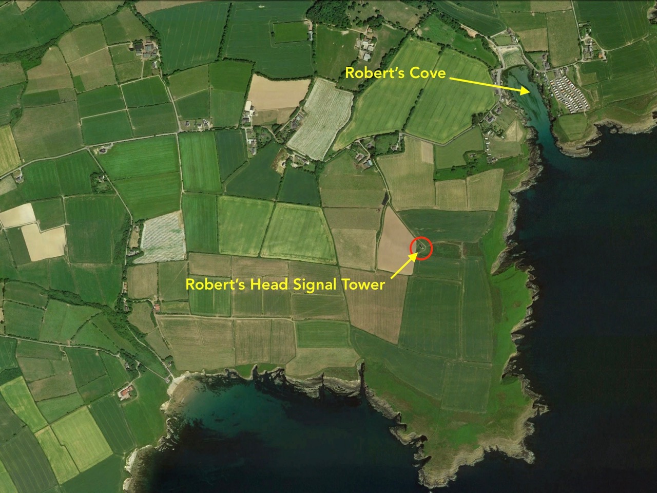
As you can see on this aerial view, the headland on which the signal tower stands is named after Robert’s Cove – Cuainín Riobaird – close by. The Cove, a small village, is a popular weekend escape and holiday destination which has two pubs and a former coastguard station, possibly dating from 1863.

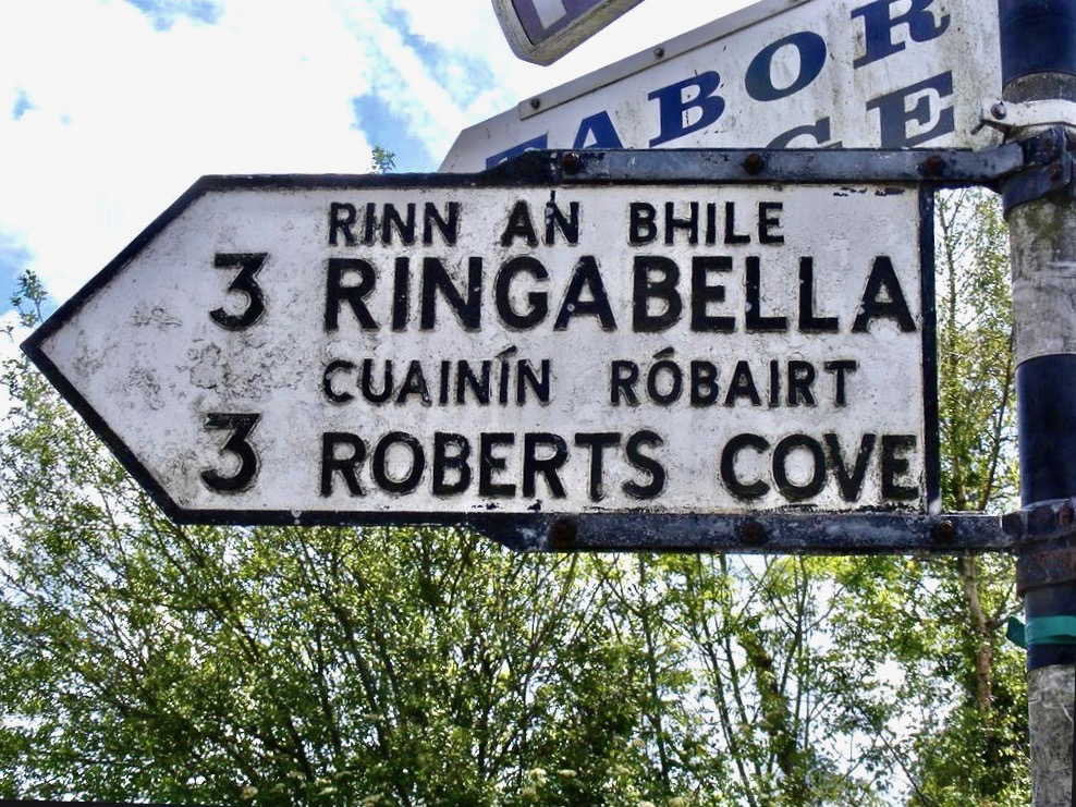
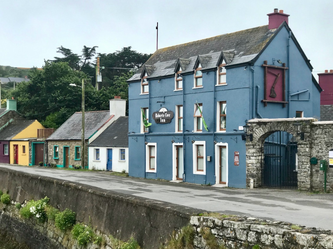
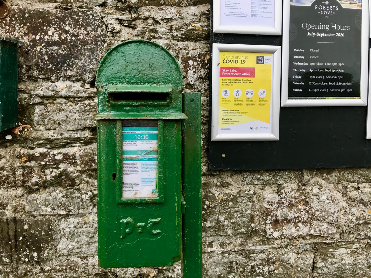
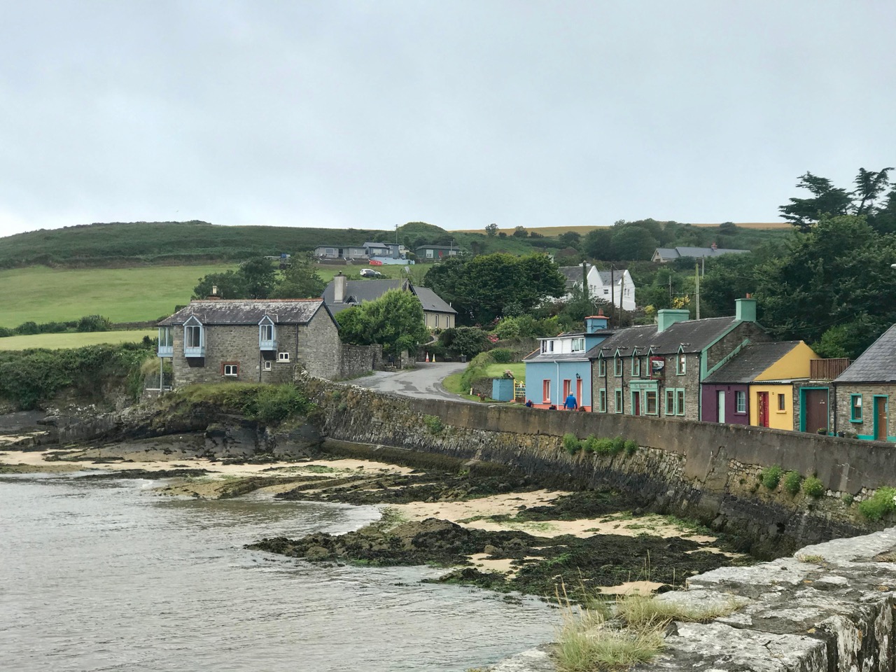
Highlights of Robert’s Cove: the old milepost on the top is non-committal about the apostrophe! The former Coastguard Station (now a private residence) is the building on the left in this picture, above

I wondered how this cove got its name, and was rewarded by a search in A Topographical Dictionary of Ireland by Samuel Lewis, 1837:

Ballyfoil, a parish, in the barony of Kinnalea, county of Cork, and province of Munster, 10 miles from Kinsale; containing 1291 inhabitants . . . comprises 1304 statute acres, as applotted under the tithe act. The soil is fertile, and about one-half of the land is under tillage; the remainder is in dairy farms. The system of agriculture is improved; the only manure is sea-sand, which is brought into Rocky Bay and Roberts’ Cove, two small coves in the parish, in large boats, of which several are employed in this trade. At Roberts’ Cove is a valuable slate quarry, belonging to Sir Thomas Roberts, Bart., but it is not worked to any considerable extent. Britfieldstown, the seat of Sir Thomas Roberts, Bart., is pleasantly situated in a secluded spot above Roberts’ Cove . . . The Cove affords a commodious shelter for vessels of 200 tons’ burden, which occasionally arrive laden with coal, and return with cargoes of slate. The coast-guard station here is the most westerly of the eight stations that constitute the district of Cove. A little to the west, on the summit of Roberts’ Head, is a ruined signal tower, from which is an interesting and extensive prospect. It is an impropriate curacy, in the diocese of Cork, and is part of the union of Tracton, where the Protestant inhabitants attend divine worship . . . The tithes amount to £109. 4. 6. . . The church has long been a ruin . . . there is also a hedge school in the parish . . .

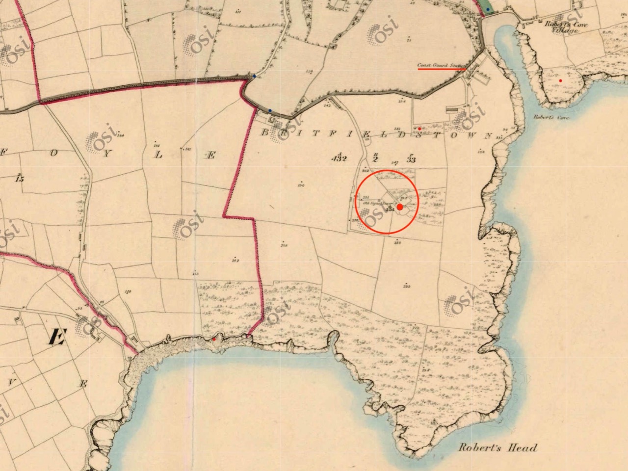
In this 1842 Ordnance Survey map of the area, the site of the signal station is marked. Britfieldstown House, the seat of the Roberts family, was situated further to the north. In 1851 the estate was sold on behalf of Sir Thomas Howland Roberts, ‘…an insolvent debtor…’ It became derelict in the 1970s and the only survivals now are remnants of a walled garden and a derelict gate lodge. It’s interesting that the apostrophe has been changed – on this map – to indicate a singular ‘Robert’ rather than the ‘Roberts’ family, whereas the 1837 Topographical Dictionary entry clearly implies the naming as ‘Roberts’. 

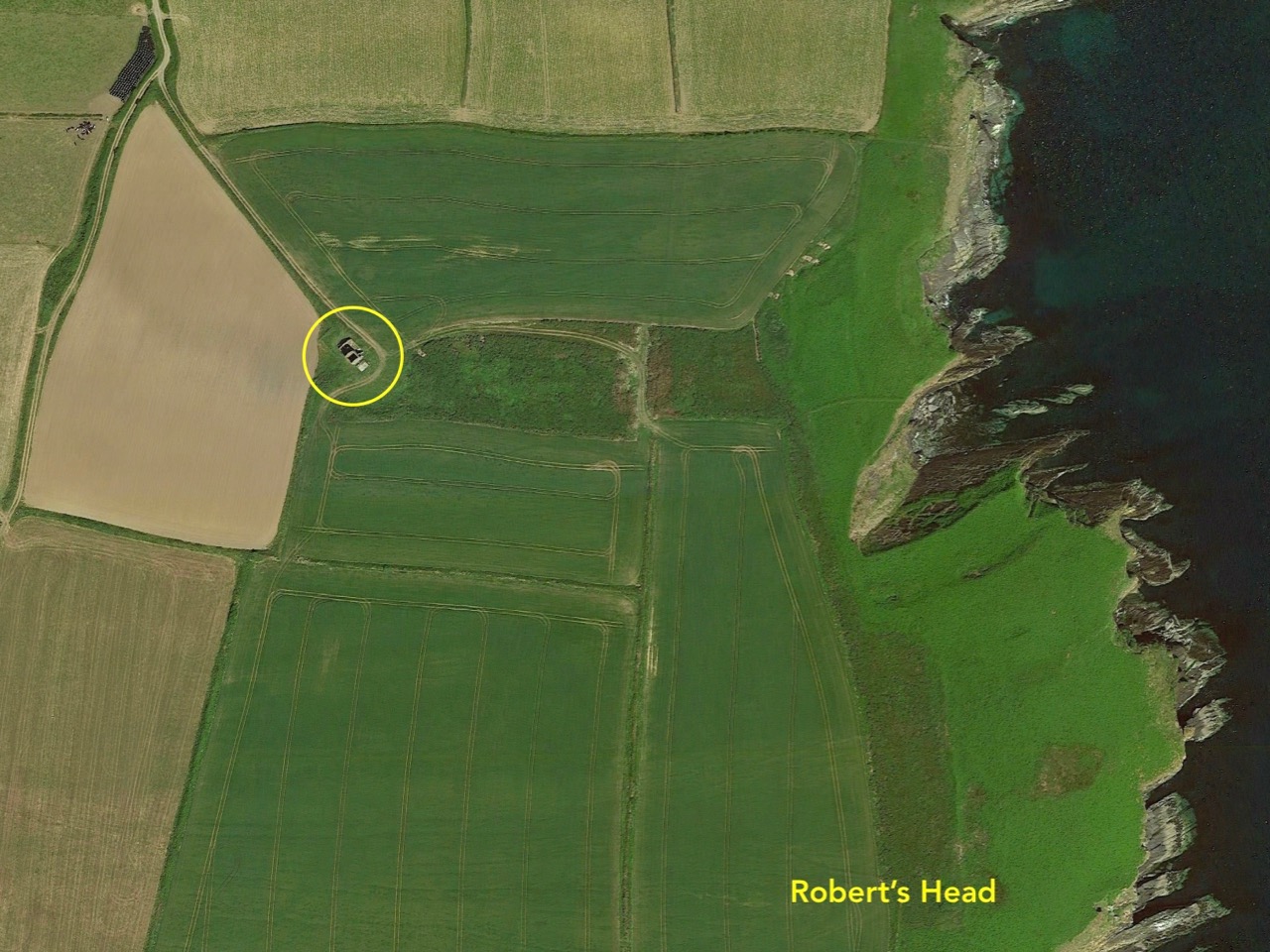
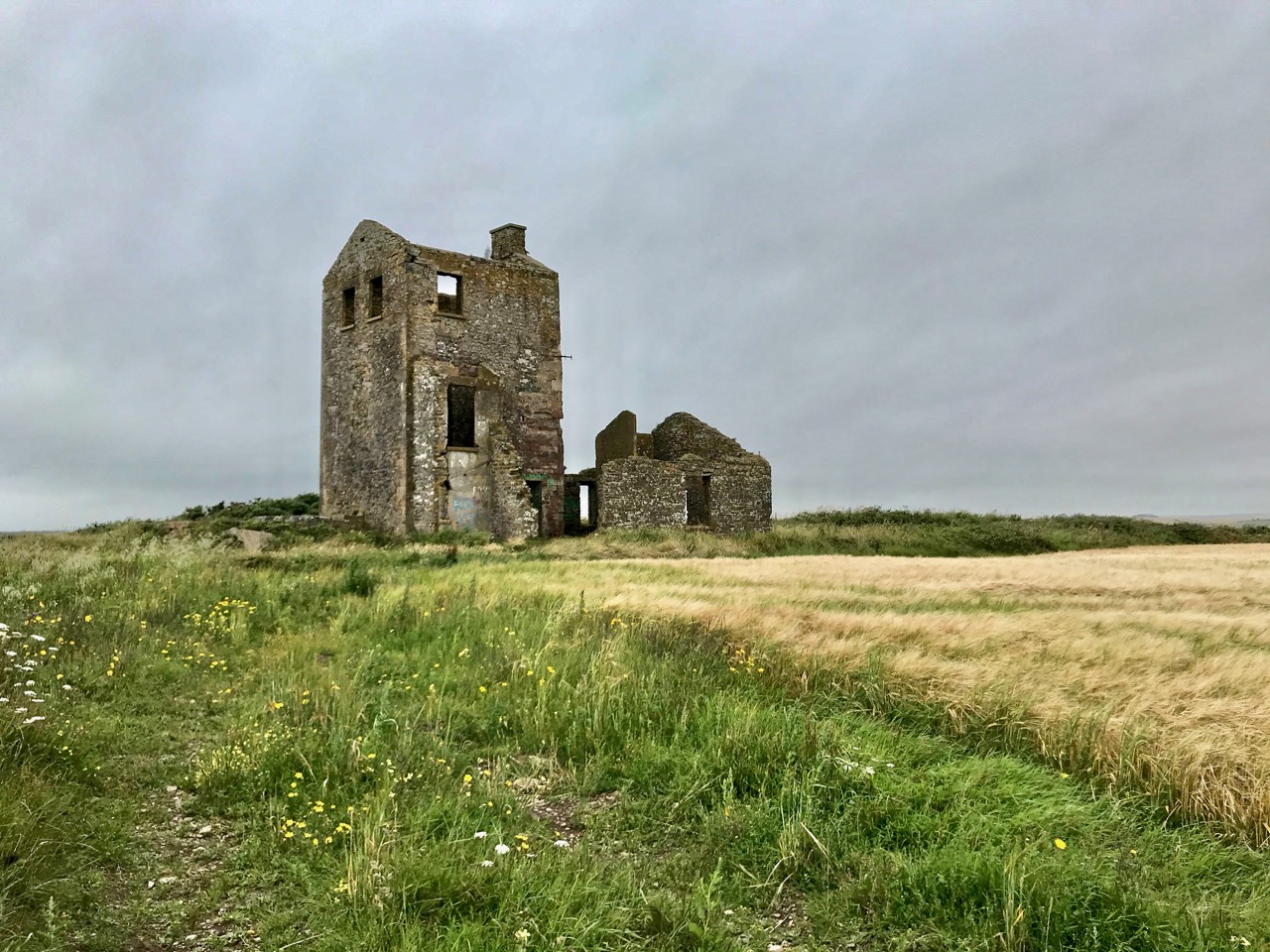
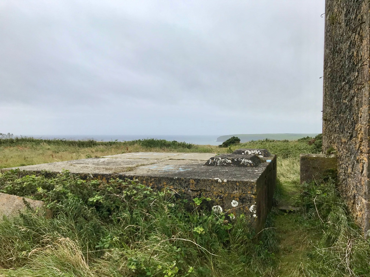
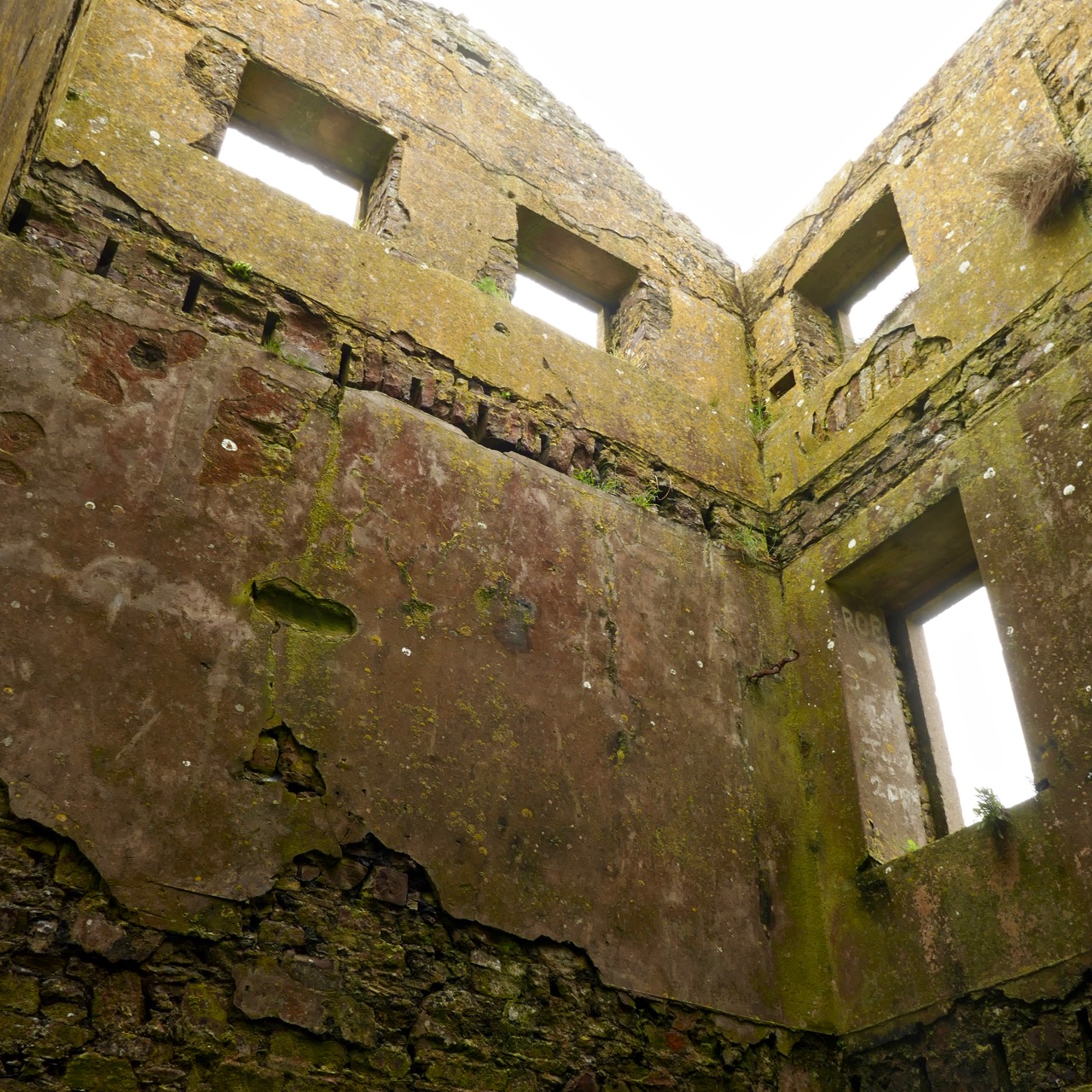
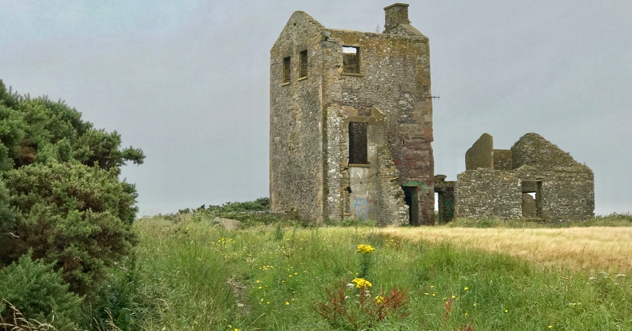
A closer aerial view of the signal tower clearly shows the extent of the remaining buildings, although all ruinous

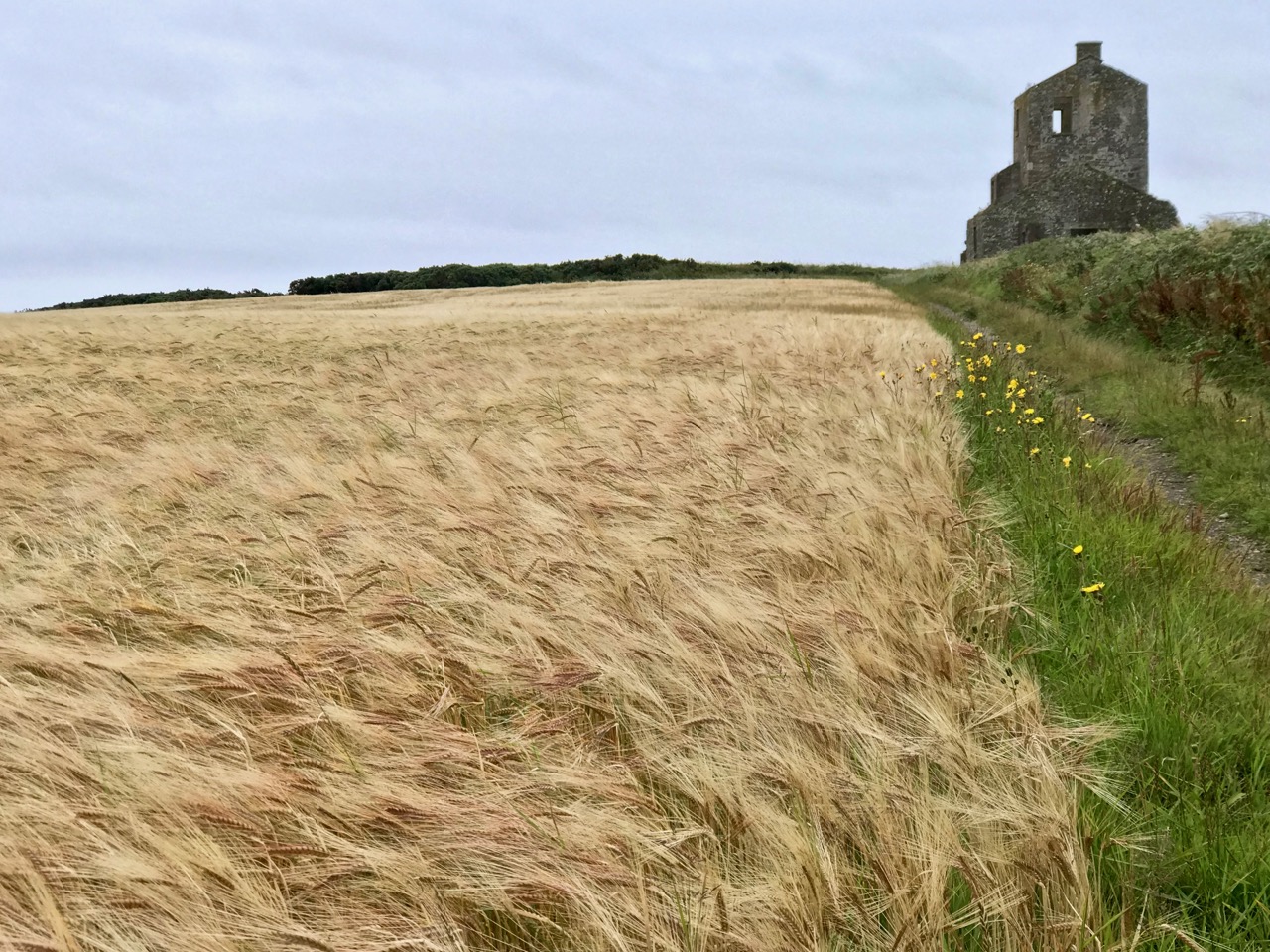
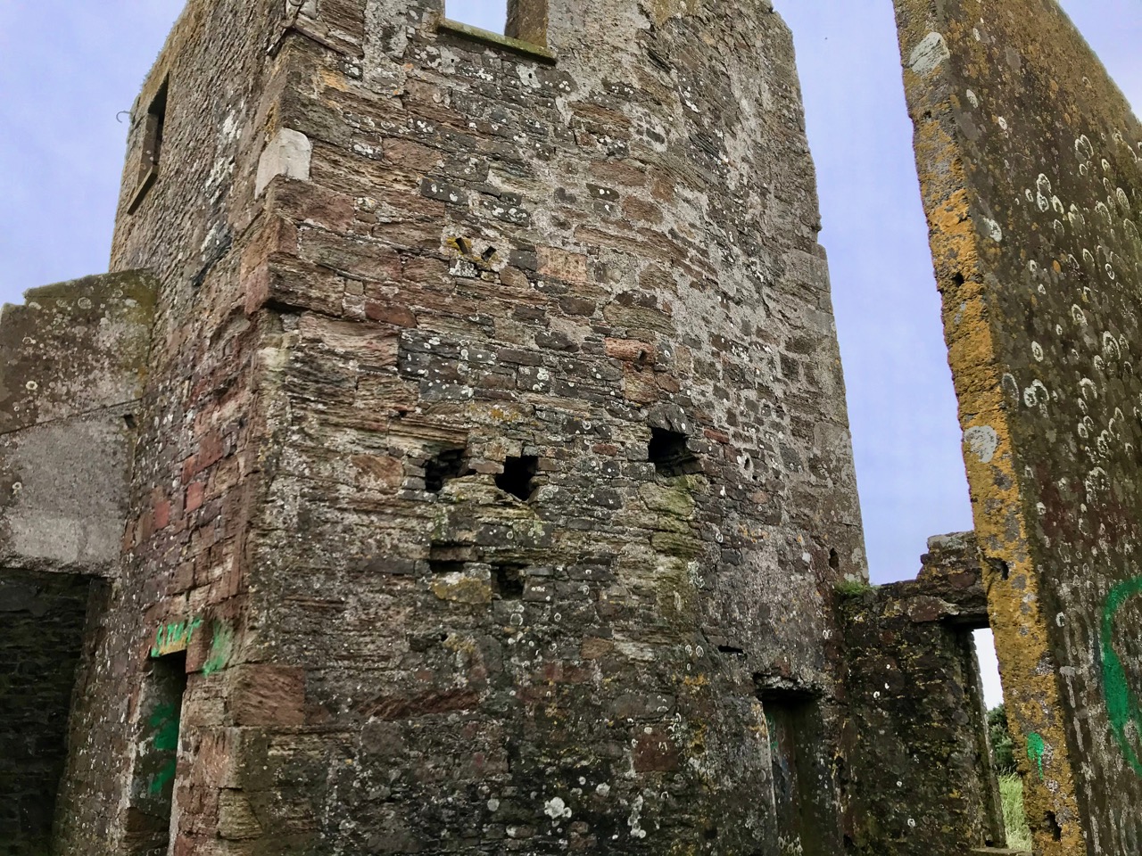
The visible buildings on the signal tower site are extensive, and imply that this station was in use beyond the time of the Napoleonic invasion threat: many of the other stations were stood down around 1810 and became derelict soon after, mainly due to their remote exposed locations and the ravages of the weather. Interestingly they do not generally appear to have suffered from stone ‘robbing’ in the same way that medieval tower houses did.

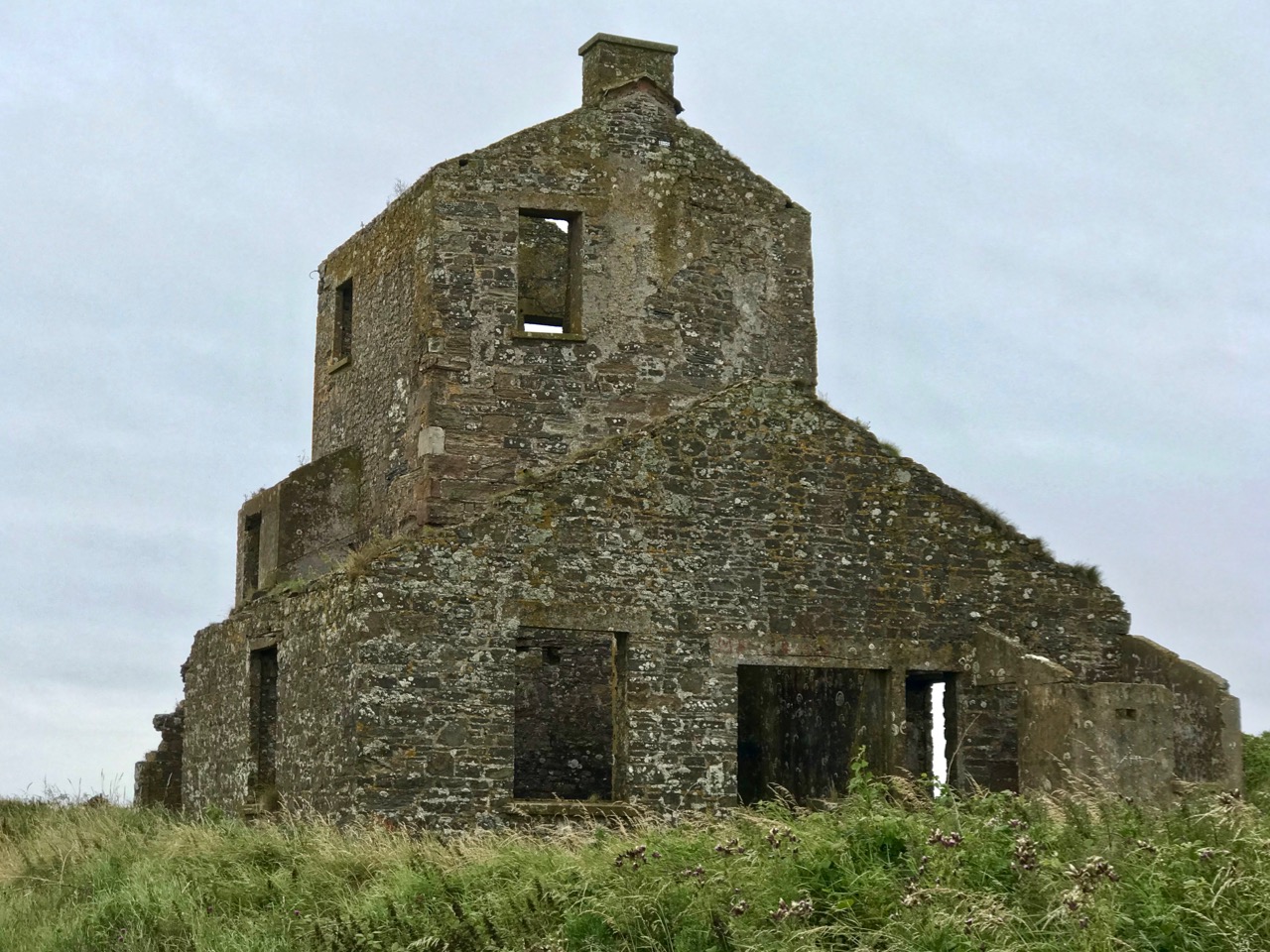
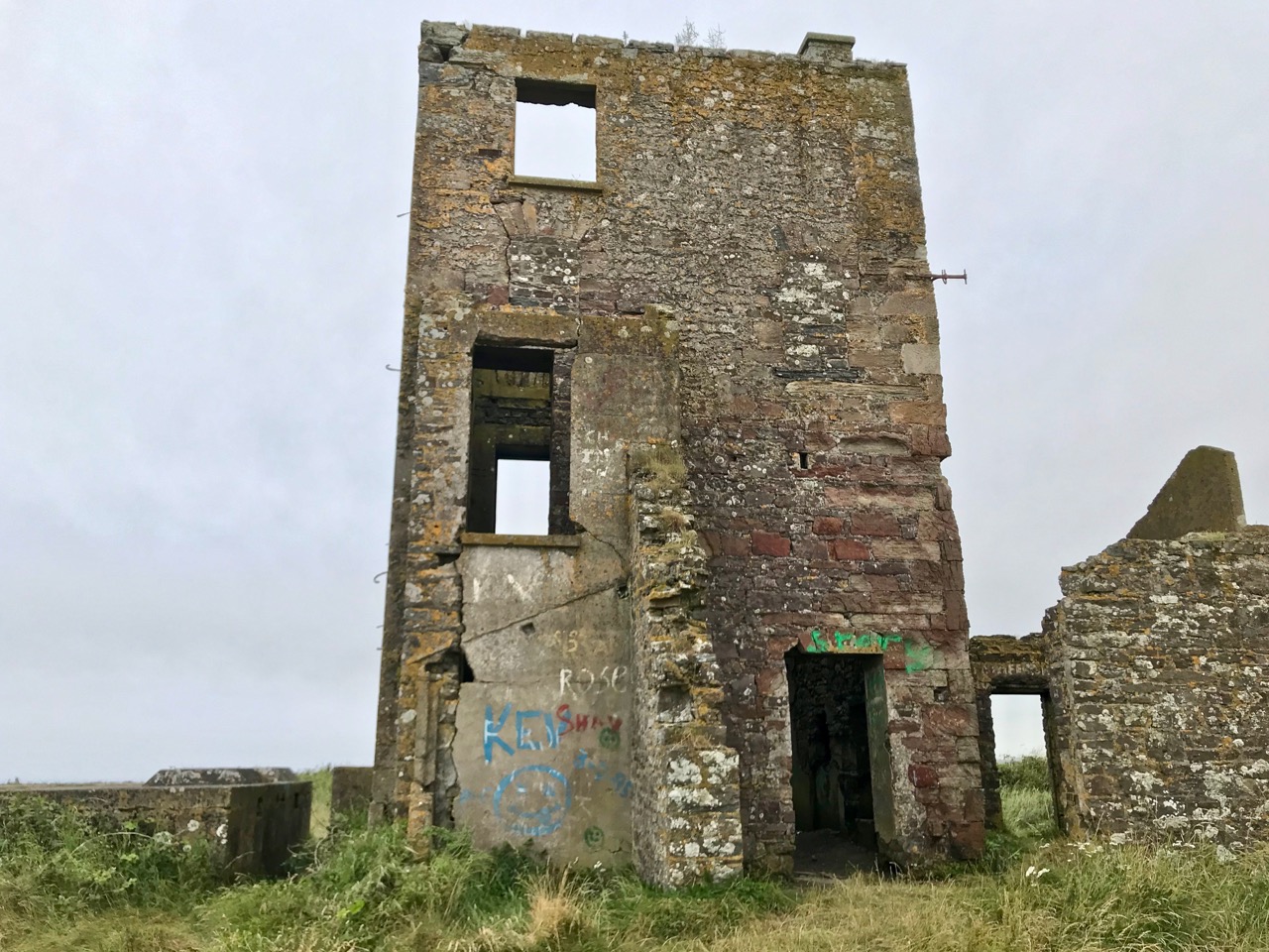
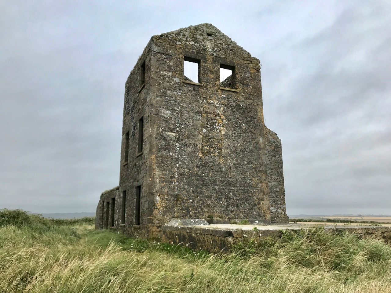
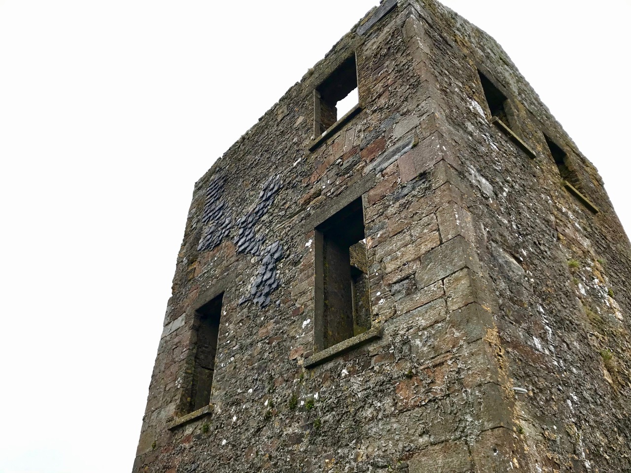
The complex of buildings on the Robert’s Head site showing (from upper picture) north-west, north-east, south-east and south-west elevations. I think it’s very likely that the highest part of the structure is based on the original signal tower, and contains much of that early structure: the raised entrance (north-east elevation) follows the general pattern, but there are no bartizans or machiolations. These could well have been replaced in later reconstructions, when a pitched roof was added. Clues that much of the original masonry has been retained lie in the back wall – thickened at the centre to incorporate a chimney flue – and remnants of external vertical slate-hanging, a method of weatherproofing evident in many other towers.

I can provide no answers as to why the extensions were added: it has been suggested that these are late 19th or early 20th century works. But the resulting building is substantial – now just a gaunt shell on a windy hill. It’s possible that the station was used as a lookout by the coast-guards based down in Robert’s Cove. Stuart Rathbone (Irish Signal Stations), writing about the Mizen Head station, observes:

The enclosed signal station at Mizen Head, County Cork, features a well preserved three storey building that is now believed to be a replacement for the original signal tower. The building is very similar to the example at Robert’s Head, County Cork. It has tall gabled walls and a large single storey building wrapping around the south east and north east sides . . .

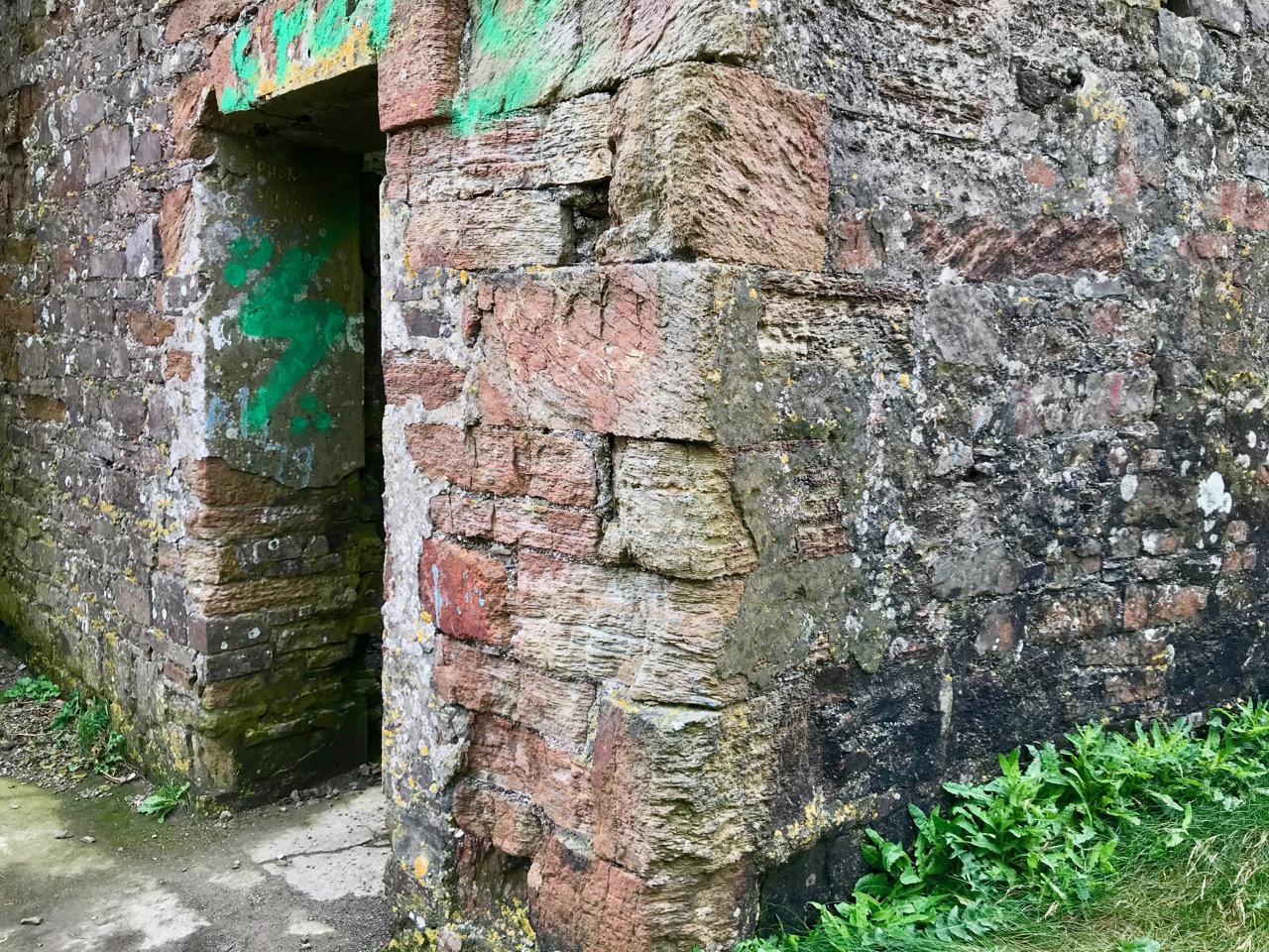
In the early years of the 20th century a fog signal station had been established at Mizen Head, Co Cork, and was probably based on the original signal tower building there; the project also involved building accommodation for the additional crew members required at that time. It is possible that the enlargement of the earlier buildings at Robert’s Head happened in the same period, and for a similar purpose: establishing a signalling and communications base connected to the local coast-guard activities. Those works appear to have included accommodation, office and workshop space, with stores, a toilet and a large concrete water cistern adjacent to the south east wall.

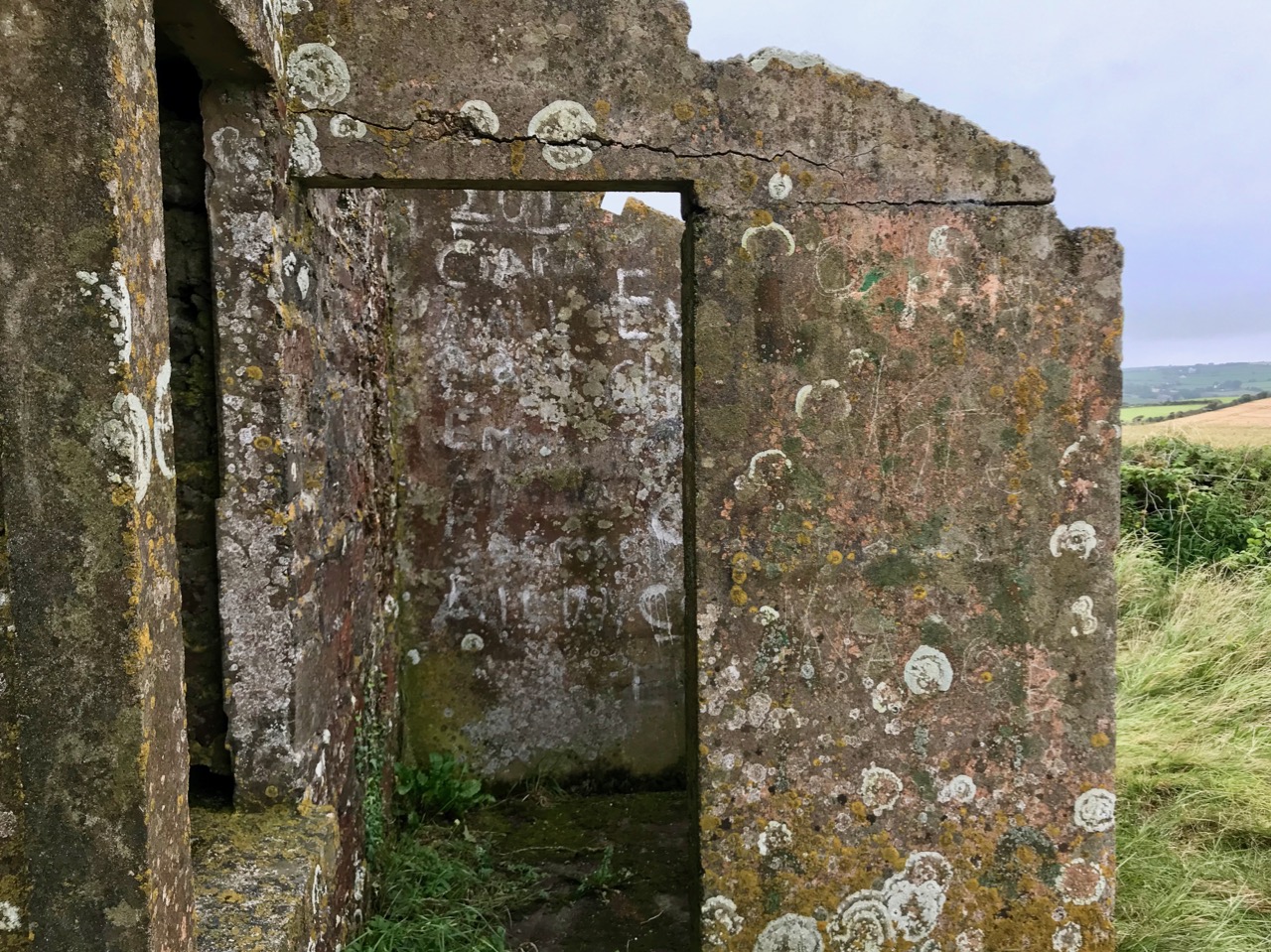
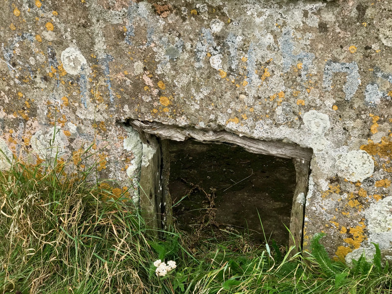
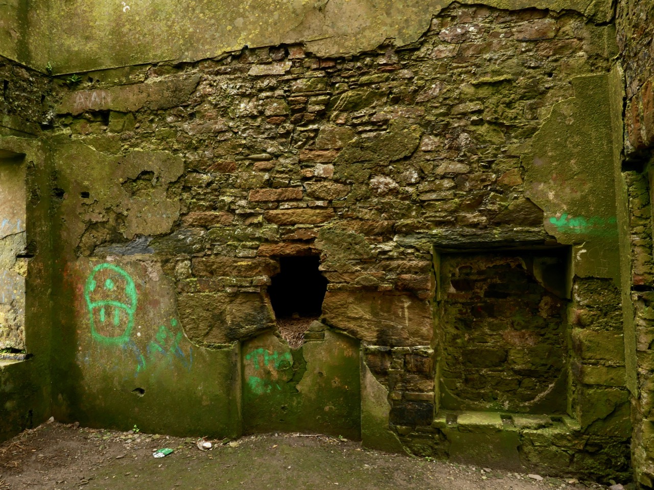
Amenities established in the later reconstruction: a probable outside ‘privvy’ (upper) and ‘shovelling out hatch’ (middle), with large water cistern (lower)

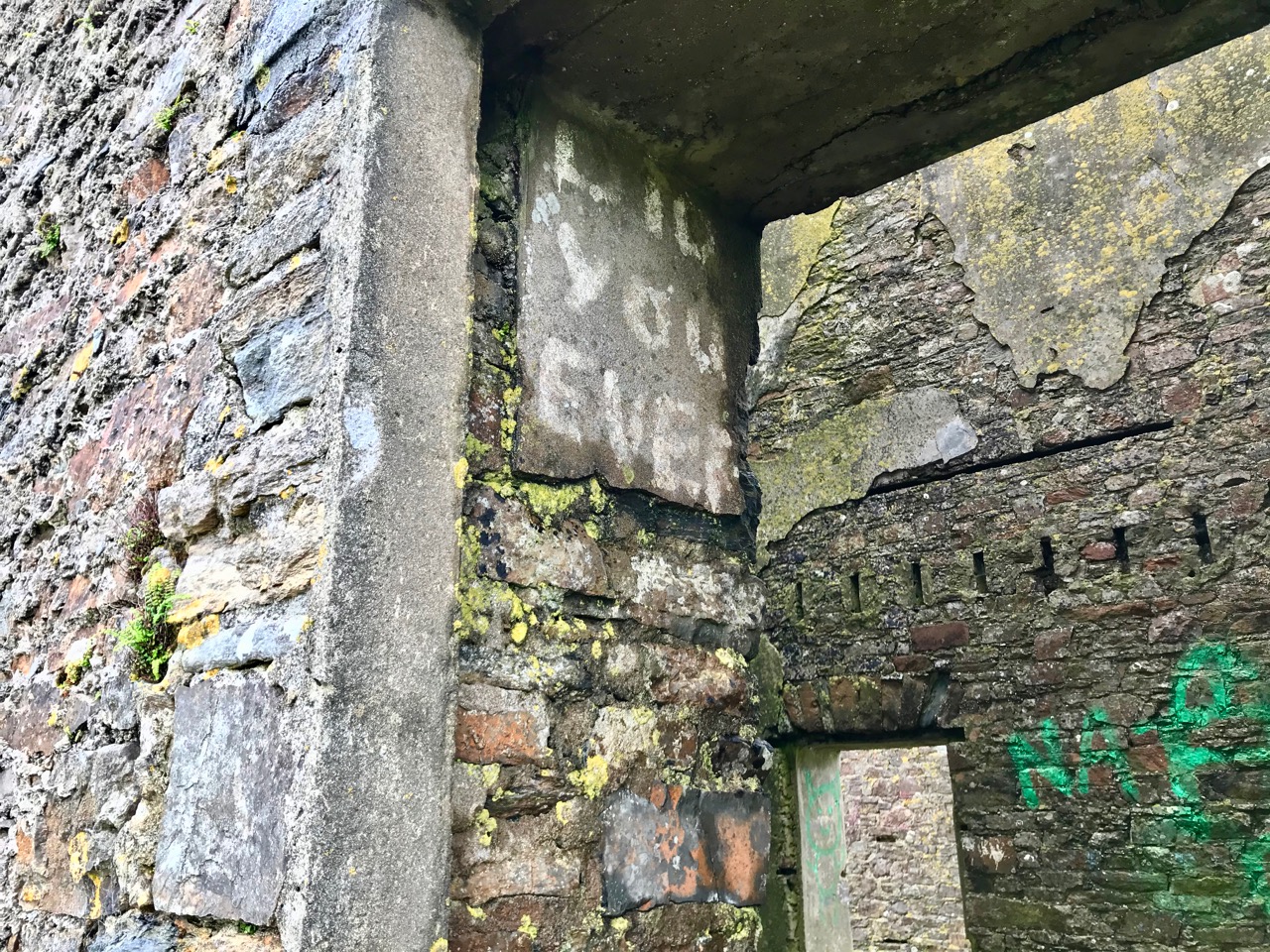
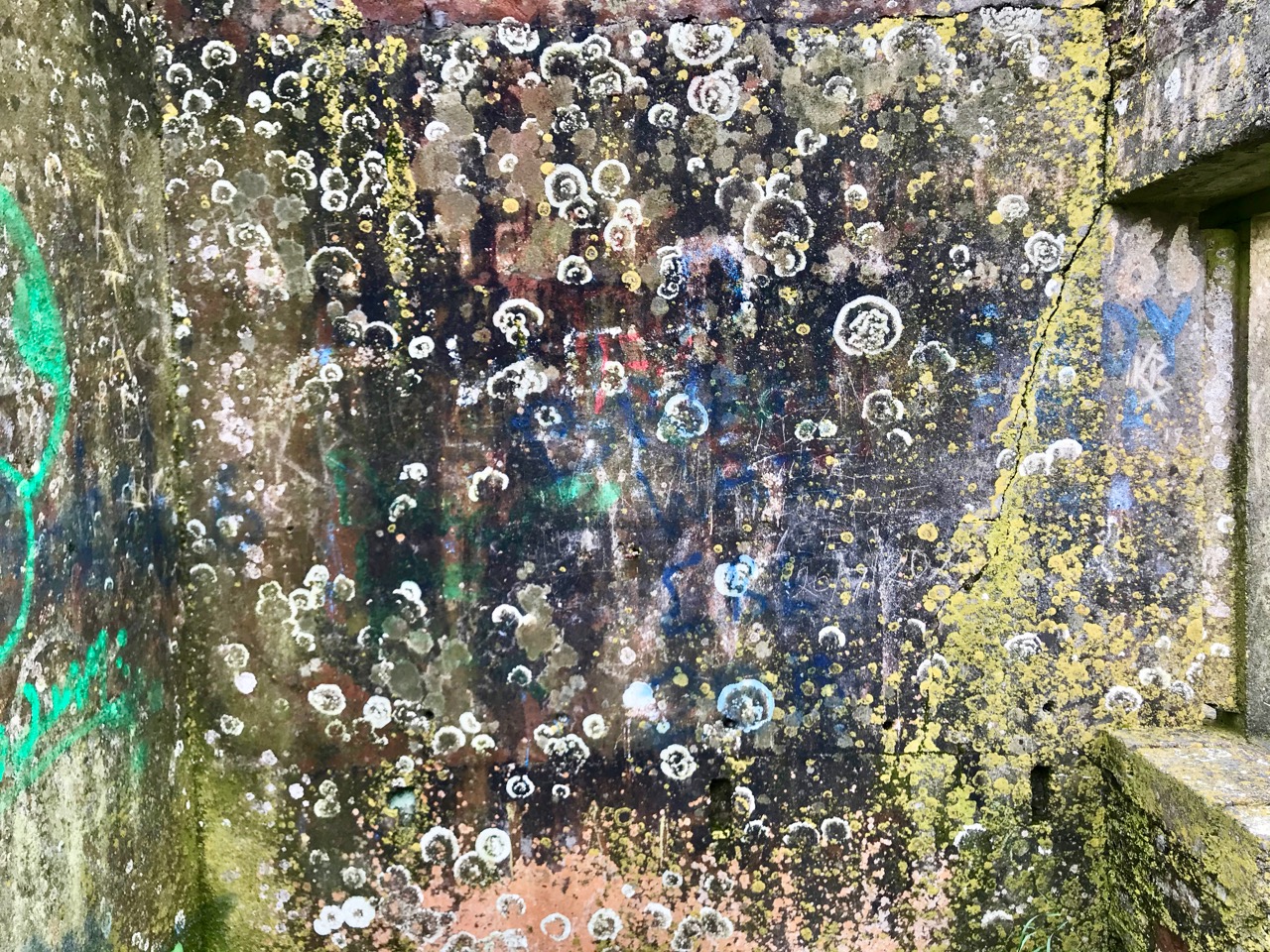
Internal features are difficult to describe definitively, but in likelihood include a hearth / cooking range, living and sleeping quarters with rendered walls providing a level of comfort above that found in the early signal towers. Now, after years of abandonment, the surfaces have been embellished with graffiti and lichen growth, all imparting a compelling visual patina: the place is alive with its own decay. Even the texture of the masonry itself is evolving in a compulsively fascinating way as centuries of abrasive winter gales take their toll.

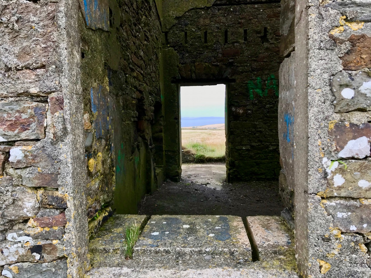
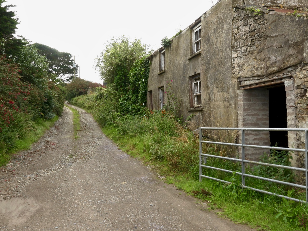
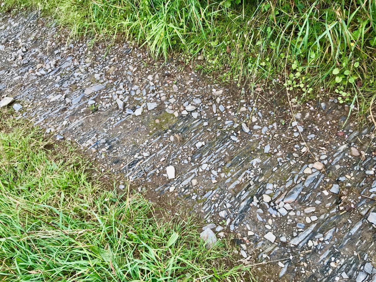
Access to the site is along farm tracks – don’t forget to seek permission if you intend to visit. With all of the towers we have explored so far, the roadways leading to them have survived intact, and have been well made and metalled – in this case solidly crafted with slate probably quarried in Robert’s Cove.

I feel we have been privileged to explore an actively disintegrating artefact of Ireland’s engineering history. More than most, perhaps, this signal tower has absorbed the lives of those it sheltered, and we can meet them there, in our imaginations. It’s a raw place, and it won’t be there forever. In time it will be no more than the scattered piles of stone that we saw at Ballyroon. But in our brief lifetimes, through tempest and contagion, it will continue its slow decline into the dust of the earth largely unseen and unmourned.

The previous posts in this series can be found through these links:

Part 1: Kedge Point, Co Cork

Part 2: Ballyroon Mountain, Co Cork

Part 3: Old Head of Kinsale, Co Cork

Brian’s Sketchbook: The Signal Towers

Brow Head Buildings

We have received a unique and treasured gift – a sketchbook from the 1980s of prehistoric and historic sites around West Cork. It’s the work of our good friend, and national treasure, Brian Lalor, artist, writer and printmaker. For an overview of his style, check out the retrospective of his work at Graphic Studio Dublin. Or browse the long list of his books, including the magnificent Encyclopaedia of Ireland, which he edited.

Marconi Station, Brow Head

Brow Head: (above and below) on the right is the Napoleonic-era Signal Tower; the other buildings date mainly from the time of the Marconi Telegraph Station, taken from a different angle than the sketch above

Brian has studied both architecture and archaeology and to that adds the keen observant eye of the artist. As a result these sketches, although, as he explained, often hastily done during a brief visit to a site, are accurate, detailed and charming in equal measure. They were made on field trips with the Mizen Archaeological & Historical Society in the 1980s. This was an active society, publishing a well-regarded journal from 1993 to 2004 and leading regular field trips for members.

Brow Head ruined building

The sketches, just over 50 of them, were made for the most part between 1980 and 1987 so besides their intrinsic artistic value, they also constitute an important record of the state of the site 30 years ago, allowing us a comparison with its current condition. My intention is to visit (or re-visit) a lot of the sites, with his sketches in hand and show our readers both how beautifully Brian captured the structures or artefacts at the time and whether there are any changes visible from then to now. I decided to start with the Signal Towers on Cape Clear and Brow Head, and a third tower on Rock Island that may or may not be contemporaneous.

Wolfe Tone front

Theobald Wolfe Tone – detail of the statue in Bantry town square

In 1796 the French navy, partly at the invitation of Wolfe Tone and the United Irishmen, staged an unsuccessful invasion of Ireland, sailing into Bantry Bay. Several raids followed in 1798. Although all were quickly quashed, a panic about the possibility of a French invasion spread throughout Britain and Ireland. A series of Napoleonic-era fortifications and viewing towers were constructed around the coast in locations with panoramic views, and within sight of each other, to spot foreign shipping activity and raise the alarm. On the east coast, these mainly took the form of Martello Towers and were stocked with heavy armaments, but here in the south west defensible Signal Towers were built not to house artillery but as advanced-warning stations. Here and there they were complemented by batteries and other fortifications – but that’s a story for another day.

Cape Clear Signal Tower

The Cape Clear Signal Tower

Signal towers were built around the coast to the same plan – tall square towers with first-floor entrances and machicolations. From a distance, they look like the medieval tower houses I have posted about on several occasions but up close they are shorter and the windows are bigger. Internal staircases and partitions were made of wood, not stone and have generally not survived, so the signal stations are essentially shells. in both the Cape Clear and Brow Head example, the exterior slate cladding has survived remarkably well.

Brow Head Detail - signal tower

Brow Head Signal Tower – detail from Brian’s sketch

In his excellent article for the Irish Times, Nick Hogan describes the towers, how they were staffed, the accommodation provided and how the signalling was done:

The signalling system, referred to as an optical telegraph, required that each signal station be visible to its counterparts on either side. Sending a message involved raising and lowering a large rectangular flag, a smaller blue pendant and four black balls in various combinations along a system centred on a tall wooden mast. The stations also communicated with ships.

Cape Clear Towers

Signal Tower and Original Fastnet lighthouse, Cape ClearTop: Brian’s sketch of the Signal Tower and Lighthouse on Cape Clear Island, done in 1982; Below: how it looked in June, 2016, 34 years later

While many signal stations are lonely and isolated buildings glimpsed on distant headlands, abandoned since the mid-1800s, both the Brow Head and Cape Clear buildings had further phases of use. In Cape Clear a lighthouse was built in 1818 – a forerunner of the Fastnet Rock Lighthouse. It was so often shrouded in fog that it was abandoned in the 1840s. The buildings attached to the signal tower, built of brick and concrete, probably date to this period of occupation. The signal tower is built of stone, using techniques not far removed from medieval construction methods. The lighthouse provides a wonderful contrast, being built of cut granite blocks expertly measured, shaped and fitted. 

Cape Clear Deatil - Lighthouse

Cape Clear Lighthouse, detail from sketch

In June of 2016, when we visited, it looked exactly as it had to Brian and the Mizen field group – an indication, perhaps that somebody is looking after the site and that the few visitors who come (it’s quite a hike to get there) respect the heritage. [Edit: Since I wrote this, Brian has pointed out that in the Cape Clear Signal Tower there is a porch under the machicolation in his drawing that has since disappeared. The outlines of the porch can be clearly seen in the photographs of the signal tower.]

Cape Clear Lighthouse

Brow Head is easier to access, and as a result there is more graffiti in evidence, but the changes to the site since Brian’s sketch are more the result of time and climate than any damage by humans. This is a complex site with multiple periods of occupation. The signal tower is there, of course, looking exactly as it did in the 1980s. Beside it is a network of buildings dating from the the early years of the 20th century: this is what remains of the Marconi Telegraph Station. Read all about this in Robert’s piece on Marconi, In Search of Ghosts. Besides the Marconi Station a Second World War Look Out Post was occupied here in the 1940s – little remains of this small concrete building except the characteristic half-round shape and a section of wall.

Brow Head octagonal?

Finally, on Brow Head there is a mysterious building that Brian labels ’14 – ’18 Gun Emplacement. This building no longer exists, and the ruinous remains that litter the ground seem robust enough to fit this inscription. Or do they? So – a mystery, and obviously  more research needed on our part. If any of our readers can help – let us hear from you!

Brow Head Detail - gun emplacement

The last tower is on Rock Island. It is clearly visible from the Brow Head Signal Tower ( a requirement for the placement of signal towers) but, strangely, it is one of two very similar towers on Rock Island, and while they are similar to each other, they are quite different from the classic signal tower design. However, both the National Monuments site  and the National Inventory of Architectural Heritage listings name them as Napoleonic-era Signal Towers, and perhaps that is indeed what they are.

Rock Island Tower

Brian’s sketch of the Rock Island Signal Tower

However, in discussion with Brian, he pointed out that most of the buildings on Rock Island were developed as part of a major Coast Guard installation around the same time as the Marconi Station, and we wonder if there might be a connection – that is, that these are Coast Guard-related Watch Towers, rather than Napoleonic-era Signal Towers. Once again – more research needed! [Edit: See comment from Navtell in comment section, below.]

Rock Island Signal Station

Rock Island Second TowerThe two towers on Rock Island: similar to each other but quite different from the classic Signal Tower on nearby Brow Head

This is only my first foray into Brian’s Sketchbook. Look out for more posts in the future and in the meantime, join with me in being grateful that a precious resource like this survived numerous moves and that we have the opportunity to learn from it.

Cape Clear Detail - Signal Tower

The Cape Clear Signal Tower