A Signal Success in Irish Engineering – Part 2: Ballyroon Mountain

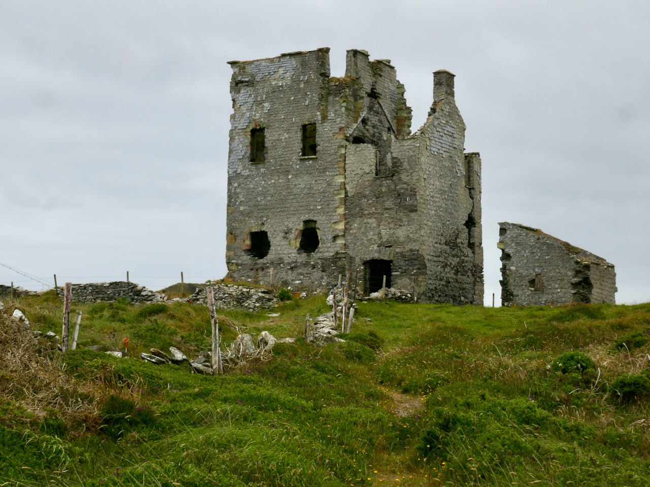
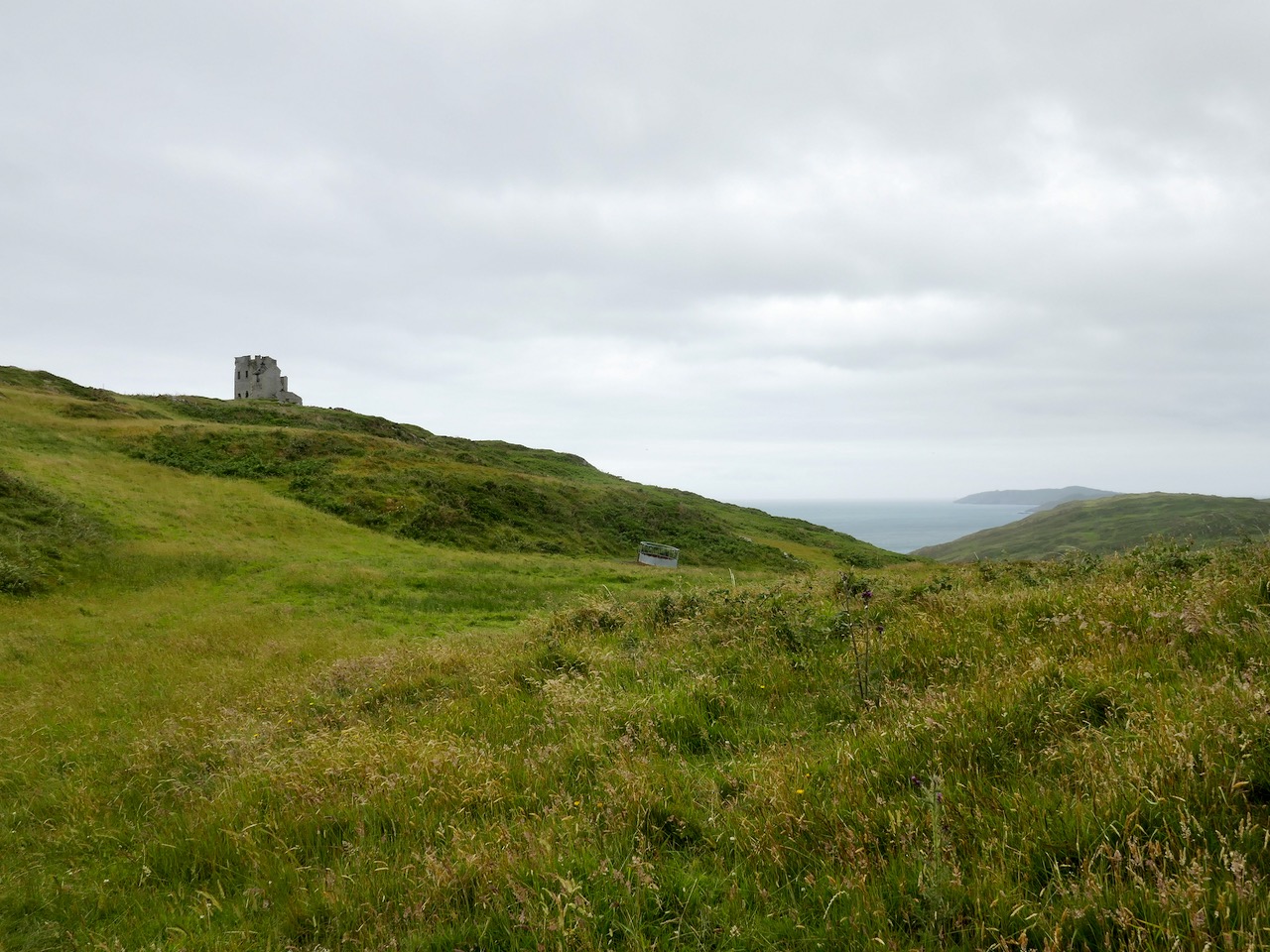
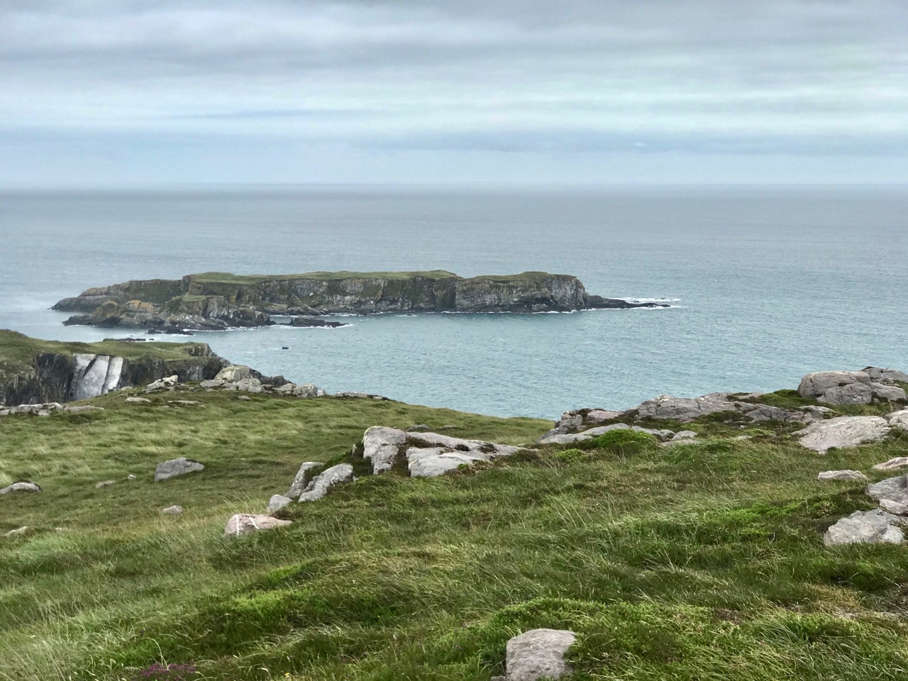
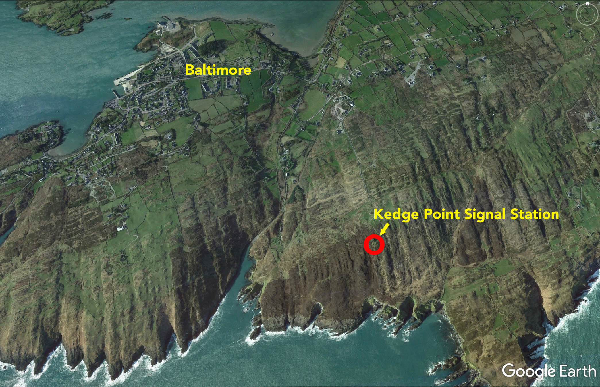
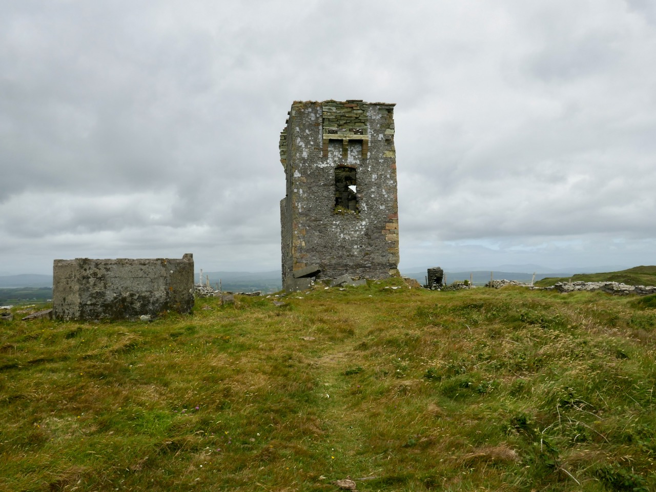
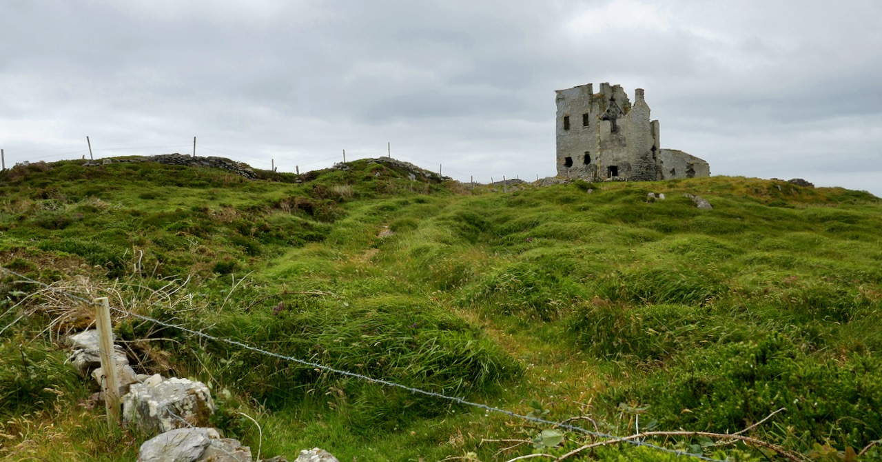
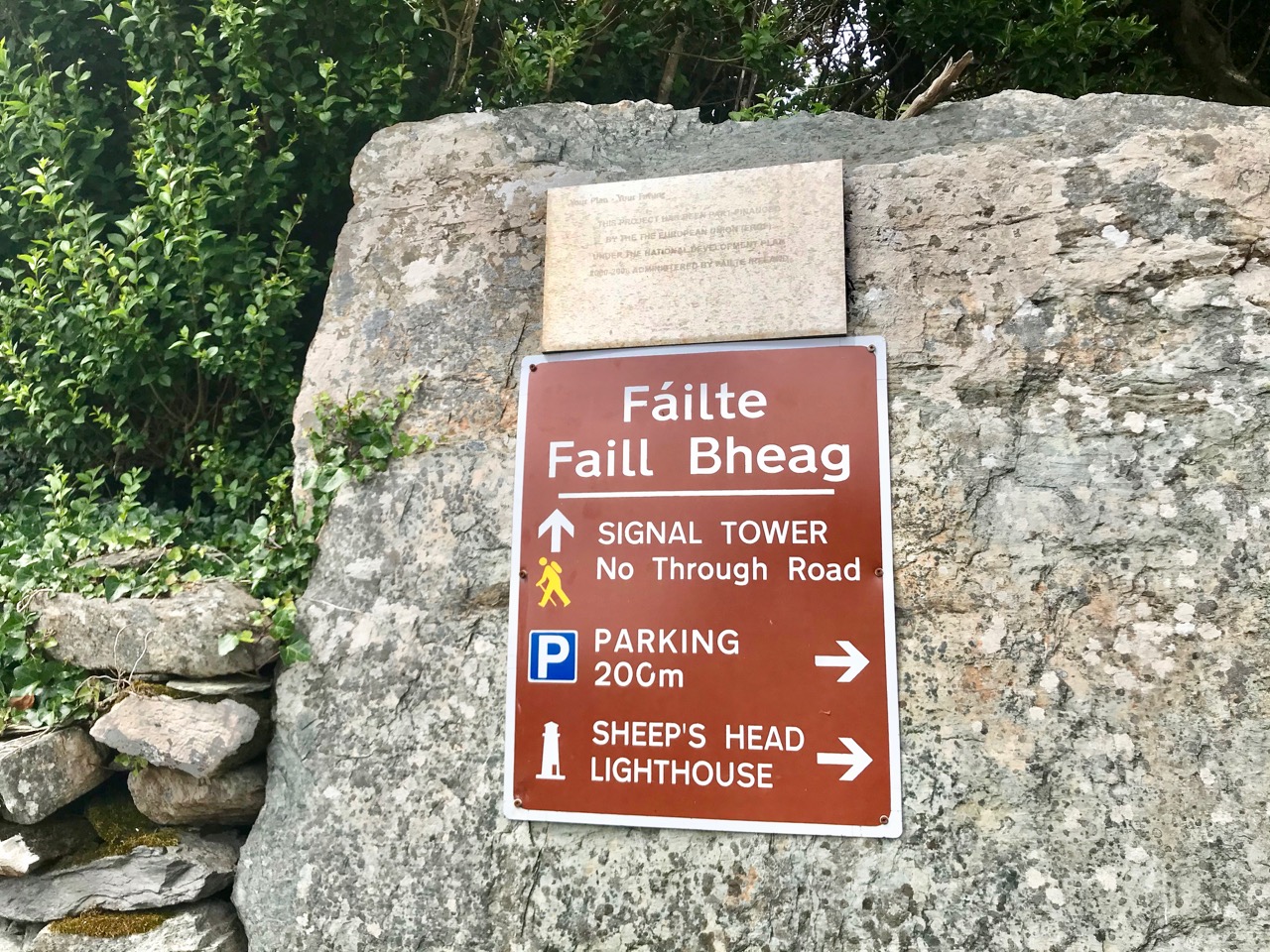
Following on from last week’s account of Kedge Point signal tower, our second foray in search of Ireland’s coastal communication stations dating from the early years of the nineteenth century takes us to the Sheep’s Head Peninsula in West Cork. The waymarked trail that passes the now ruined Ballyroon Mountain signal tower is on the Sheep’s Head Way and is fully accessible from the parking area at Fáilte Faill Bheag (if walking from east to west), or from the Cupán Tae tea-room parking area at the very end of the road (if walking from west to east). Although there is very little of this signal tower left standing – it was largely destroyed by a storm in 1990 – the walk itself is a visually stimulating experience, not to be missed! As with the majority of the remaining signal station sites, the location here is on high ground with prominent panoramic views in all directions.

When walking the off-road Sheep’s Head Way trails, please remember that dogs are not allowed: this is one of the conditions that have been agreed with landowners when the trail routes were negotiated, so it must be respected by all users.

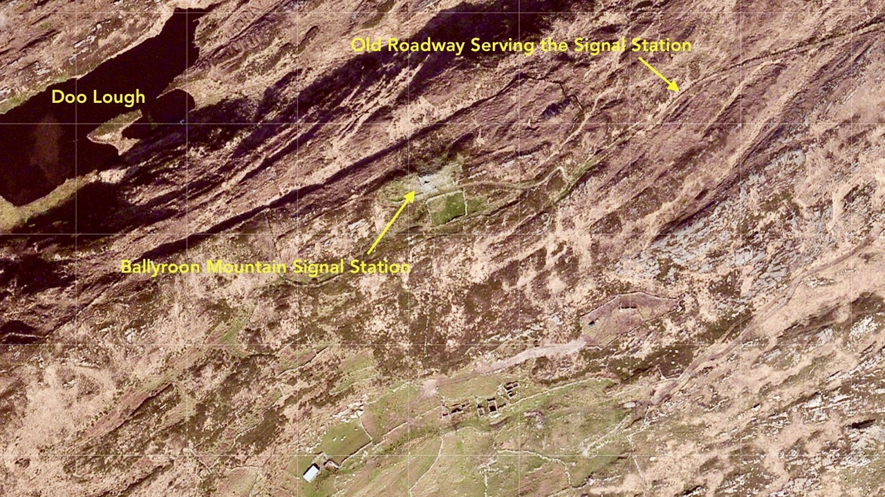
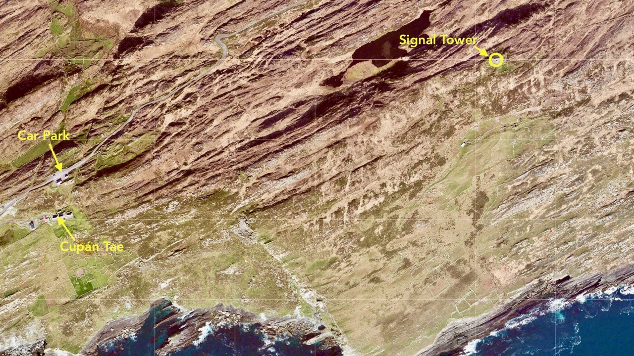
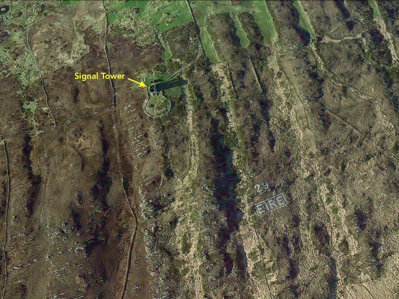
These two aerial images show the remote setting of this signal station. The site was developed a little over two hundred years ago, and one of the necessities was providing a firm trackway along which to bring building materials, and also to provide efficient access to and from the signal tower when in use. In the top image, also, you can make out a substantial walled field to the south of the tower: this would have been used to pen ponies or donkeys and – possibly – a goat for milk.

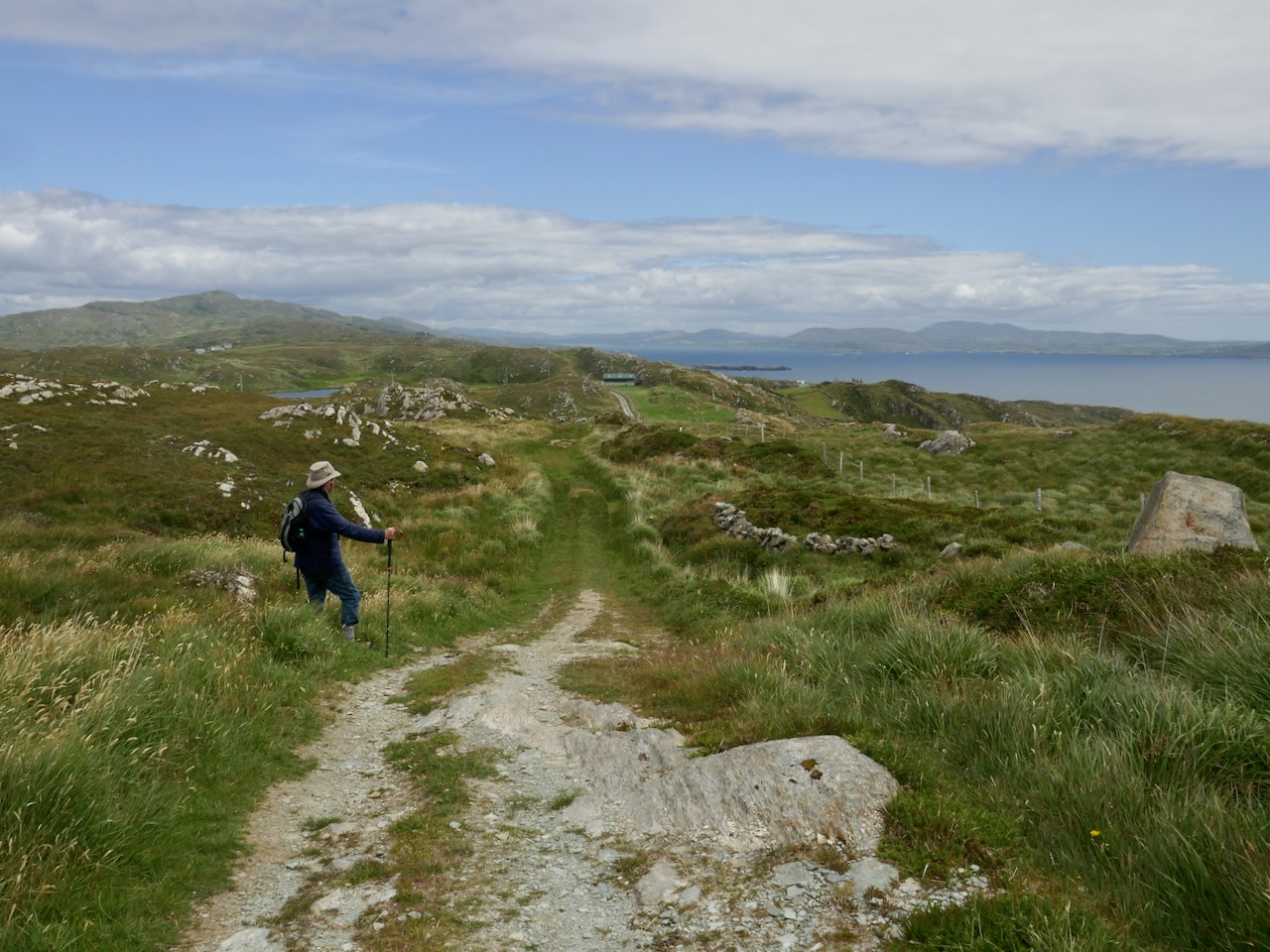
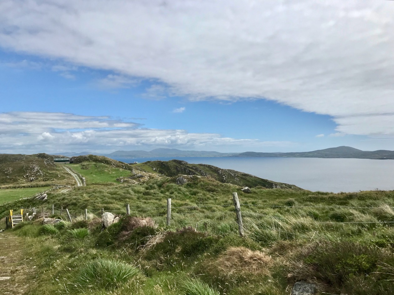
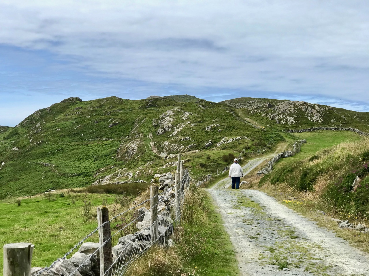
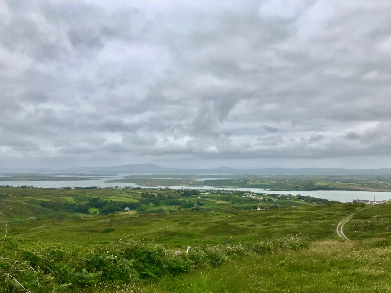
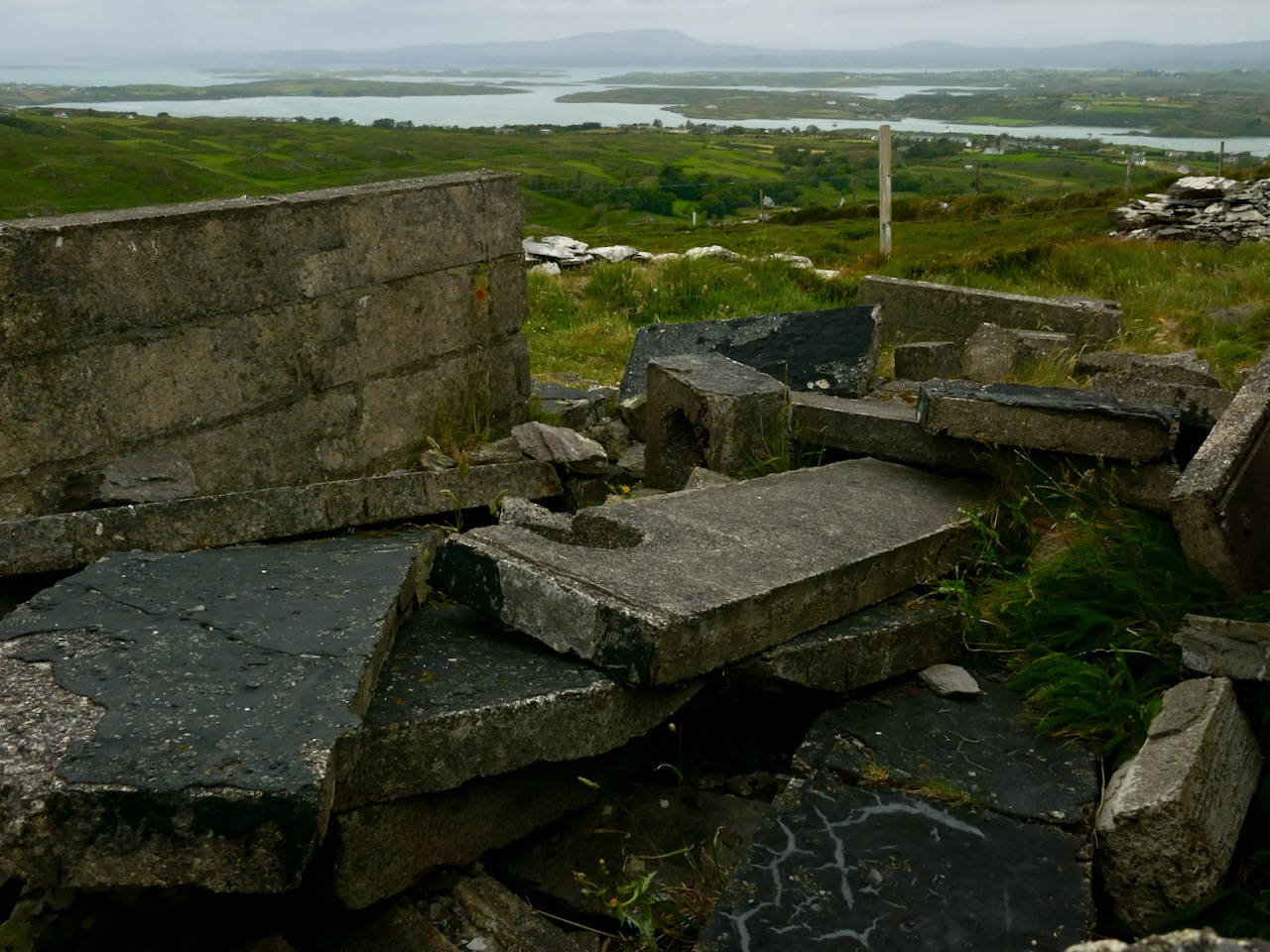
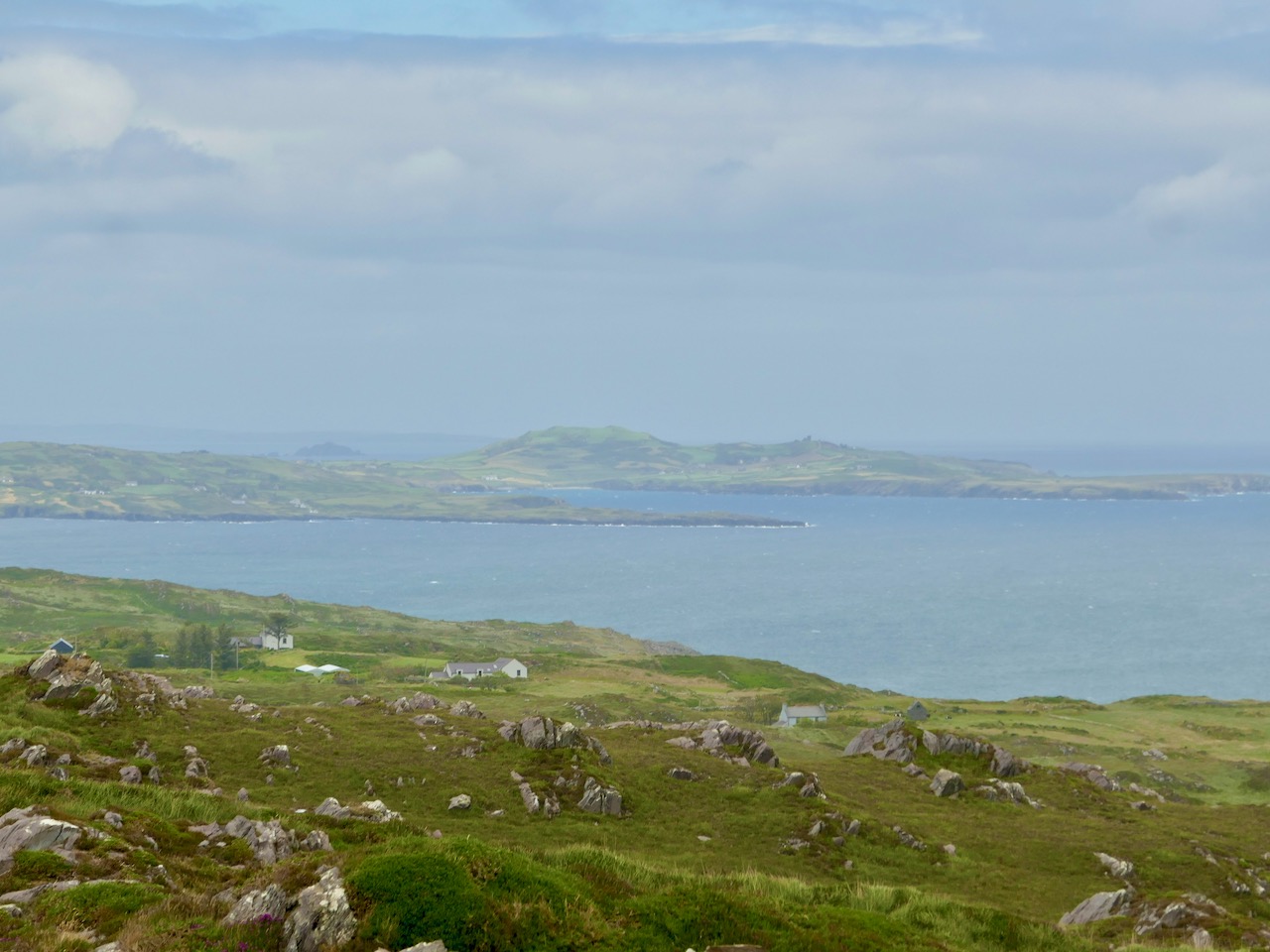
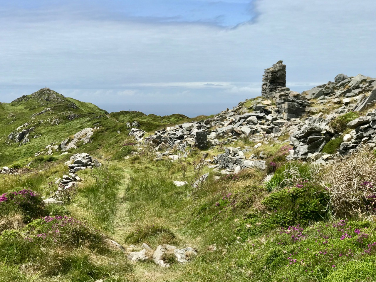
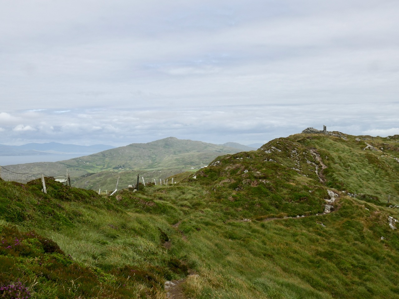
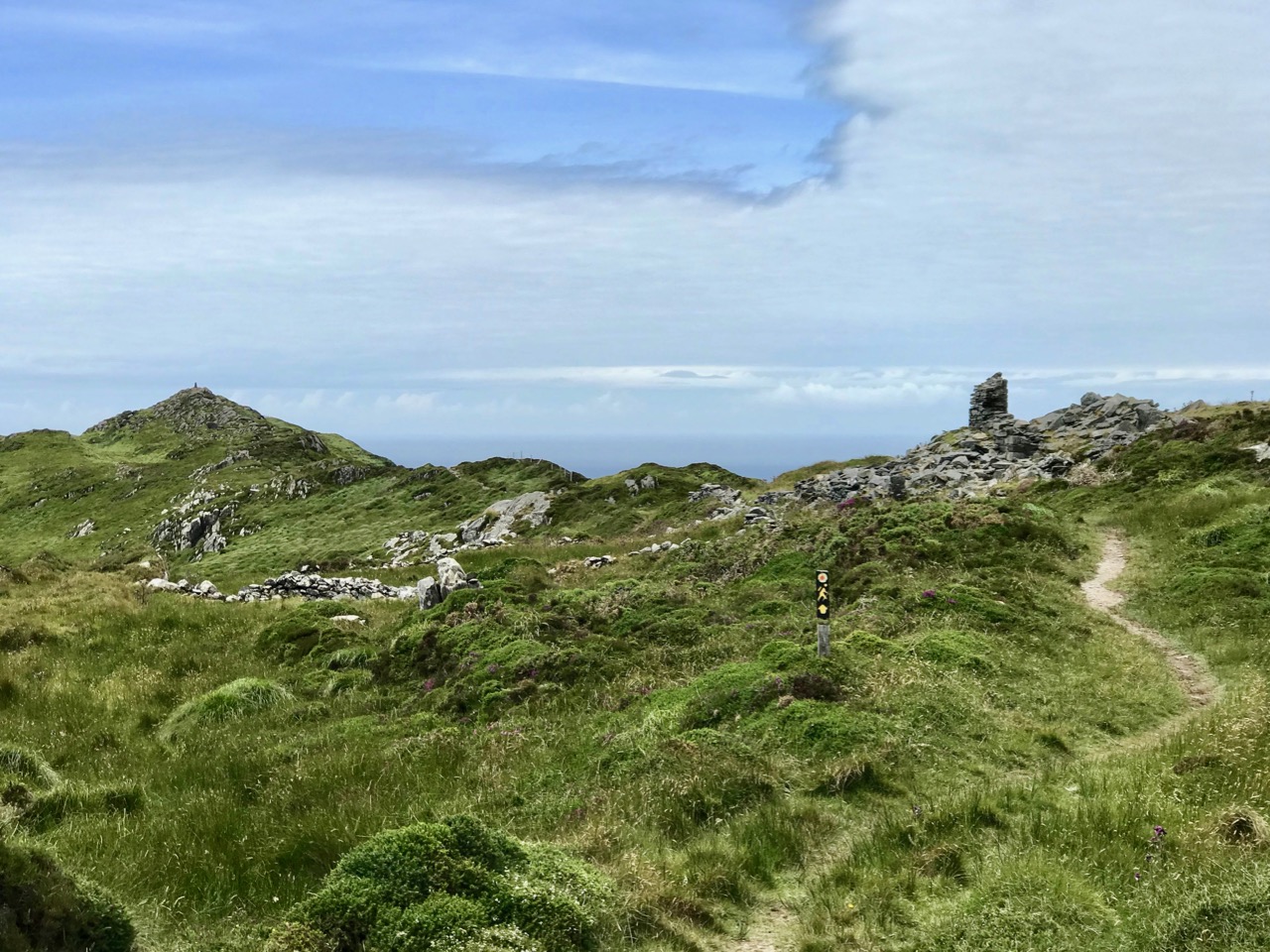
The track that served the signal station in its heyday has become the ‘green road’ that takes you there today. In bad weather it’s a bit wet underfoot in places, but otherwise it is a joy to walk and, on a good clear day, provides spectacular views in all directions. Look out for the other signal towers that can be seen from this site: Cloghane on Mizen Head, Mallavoge on Brow Head, Derrycreeveen on the Beara Peninsula, and Knock, which is an inland site near Lowertown, Schull.

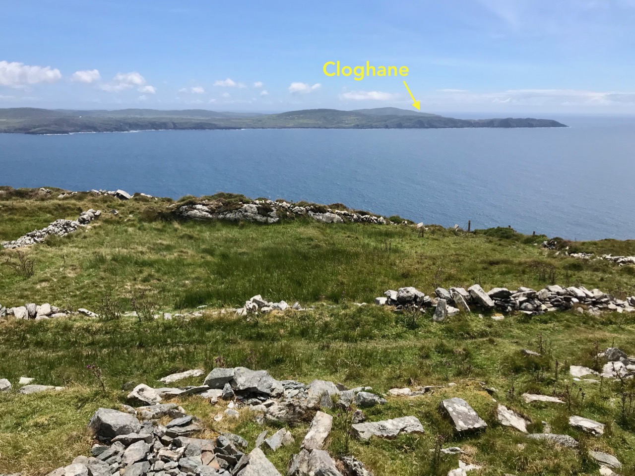
In the upper picture here you are looking back towards the vestigial Ballyroon signal tower from the higher ground on the footpath from the Cupán Tae tea-room, while the lower picture shows the ‘pimple’ on the horizon which is the Cloghane signal tower at Mizen Head seen from Ballyroon.

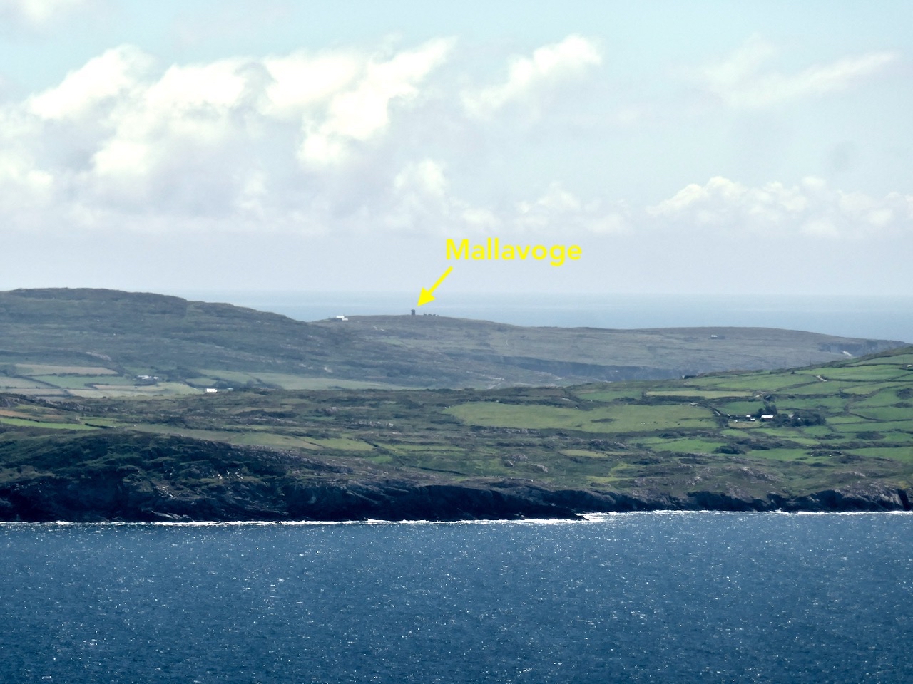
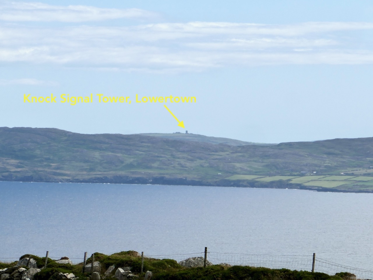
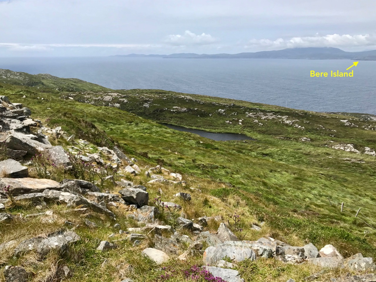
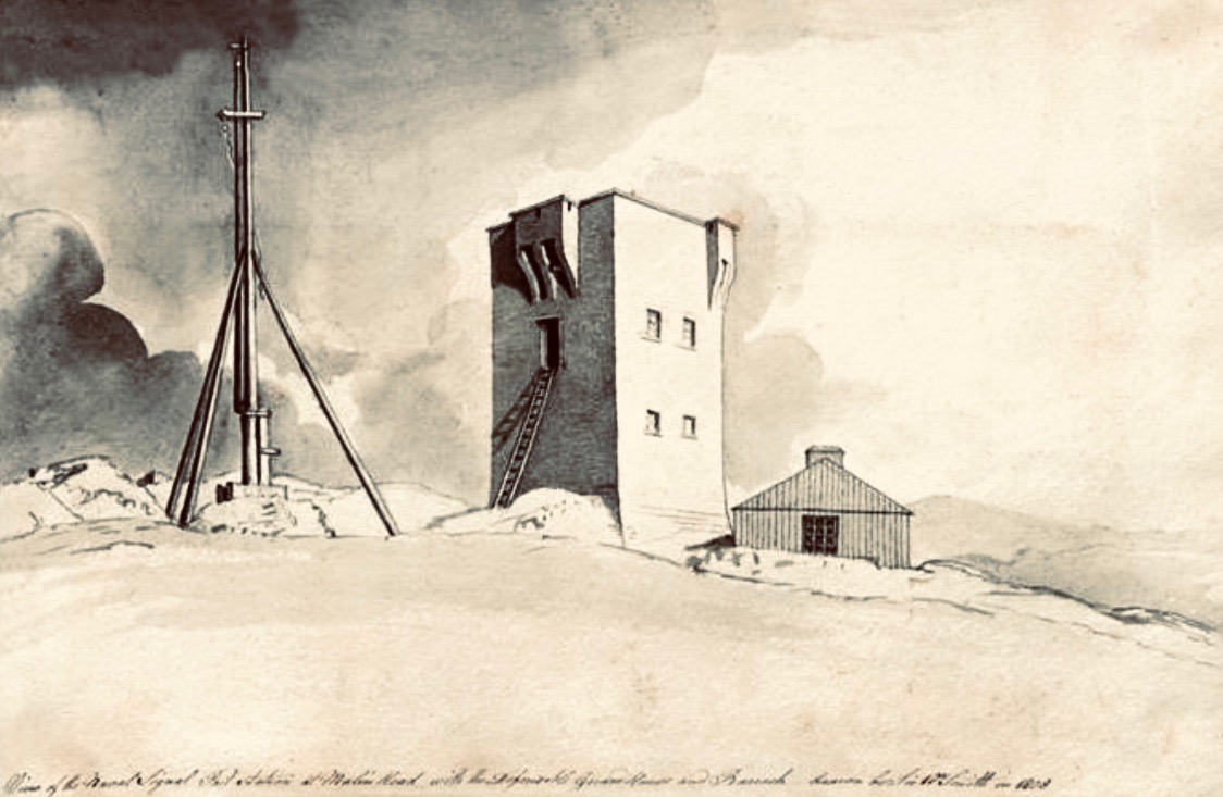
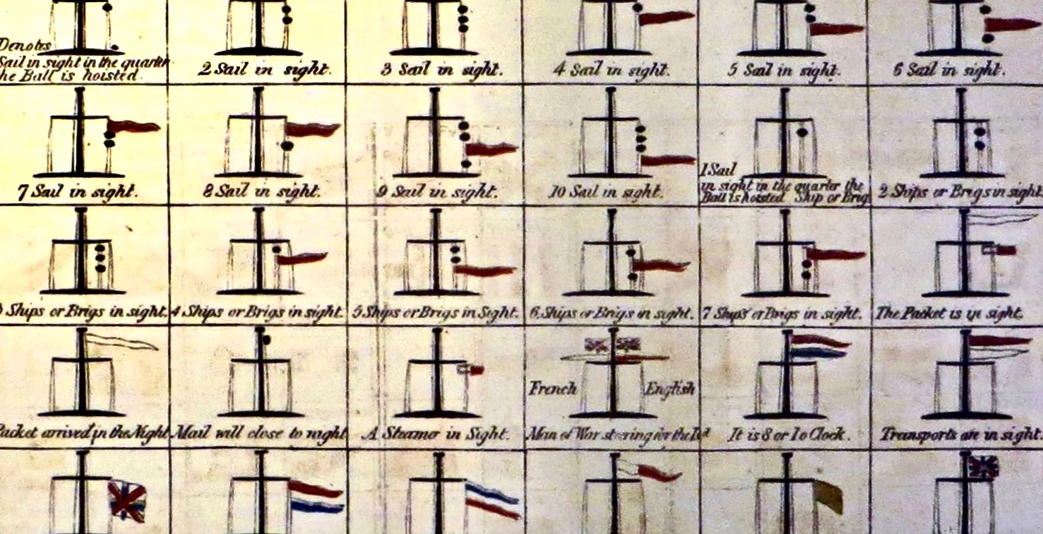
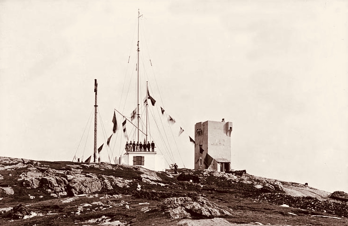
The upper picture shows the Mallavoge signal tower at Brow Head (more about that site here), while the Knock signal tower is seen in the middle picture, which was taken close to the start of the Ballyroon Mountain trail. Both these photographs have the benefit of a modern zoom camera lens, but imagine how good the optics of the telescopes needed to be for those who manned the towers in the early 1800s. Not only did these silhouettes have to be clearly defined, but the flag and ball signals that were put up on the associated masts had to be readable. The lower picture looks north across Doo Lough towards Bere Island, where there were extensive fortifications in Napoleonic times, including a signal tower. Below is a photo of the Malin Head signal station, Co Donegal, dating from 1902 (National Library of Ireland Collection). There the station was kept in use for strategic purposes long after the Napoleonic era and became the site for one of Marconi’s telegraph stations. While the flags in this picture are not from the earlier times, it gives you some idea of what had to be picked out from a great distance. By eye, put the scale of the tower in this photo to the scale of the distant towers in the images  above: it’s hard to fathom how accuracy was possible yet messages were dispatched and received successfully. It evidently took about four minutes to put up a message on the mast: allowing for reading and deciphering, I would expect a message to be sent from Sheep’s Head to Cork via 11 towers in about an hour, or all the way to Dublin via 33 towers in three hours. This would depend on daylight and good visibility at all times.

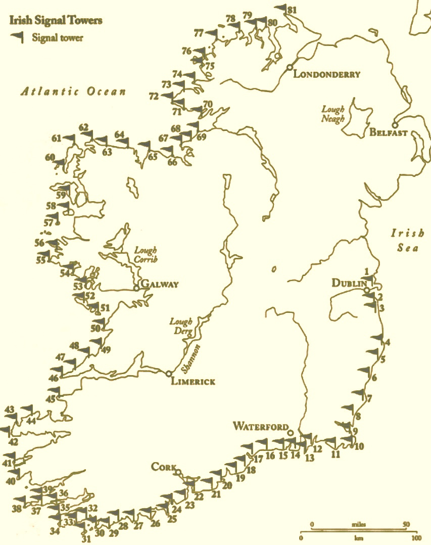
The most comprehensive map of Ireland’s signal tower distrIbution that I have found so far is this one drawn for the authoritative book on the subject Billy Pitt had them built: Napoleonic towers in Ireland by Bill Clements, The Holliwell Press 2013. This clearly shows that invasion was expected to come from the west or south, rather than from the more naturally protected north-east coast.

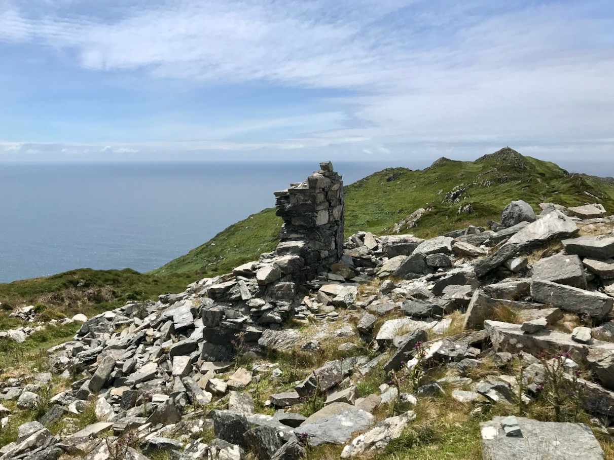
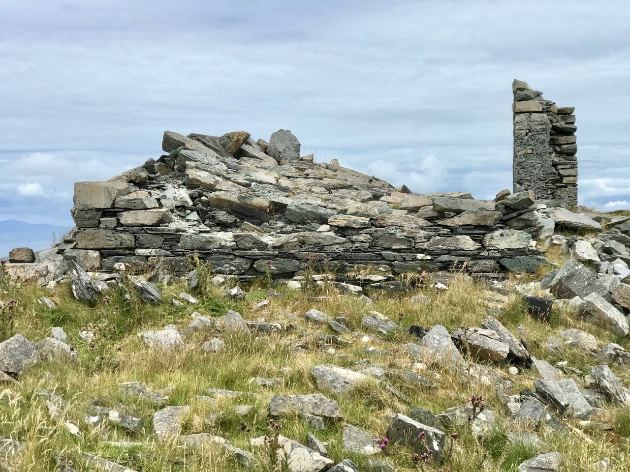
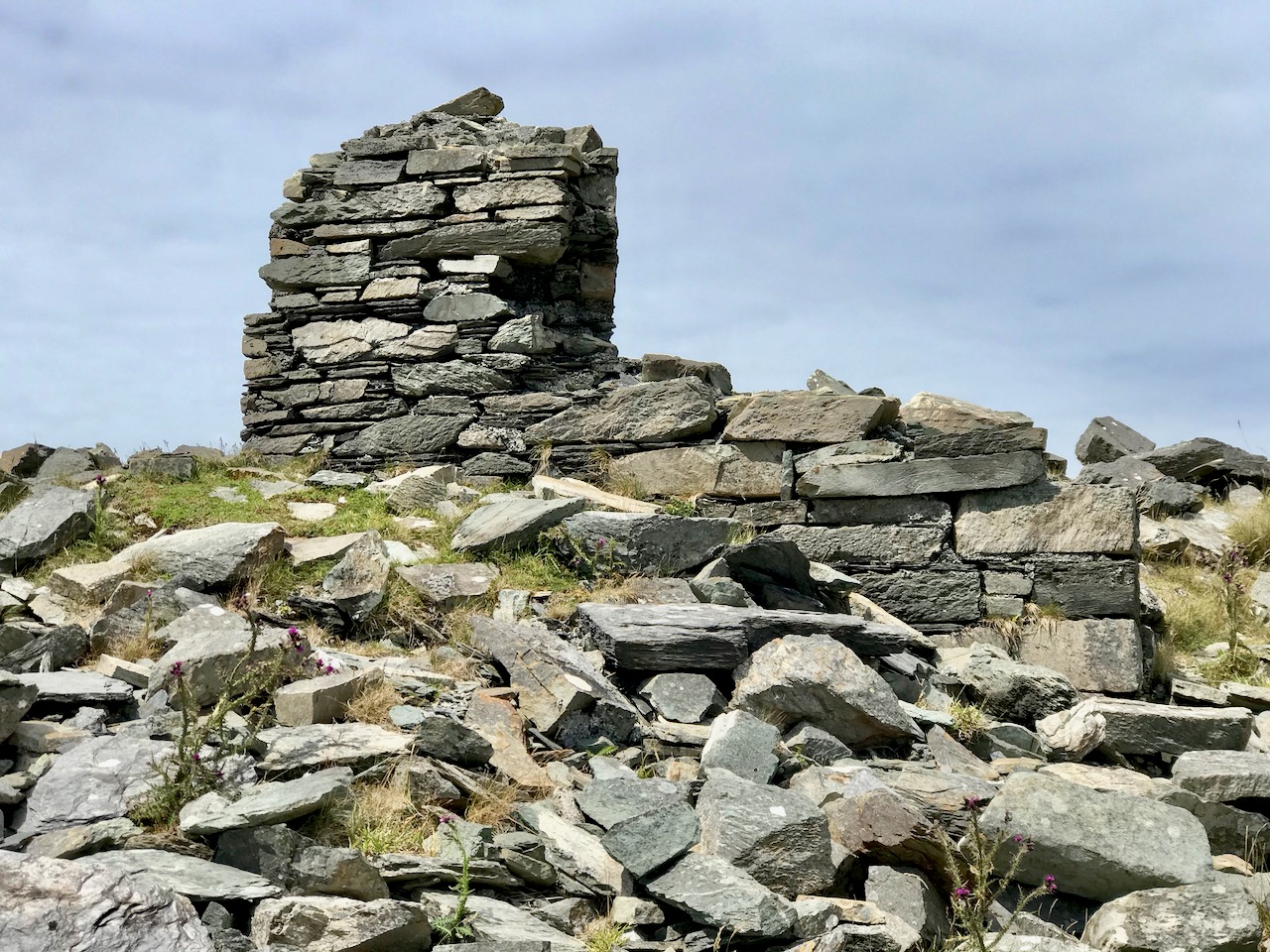
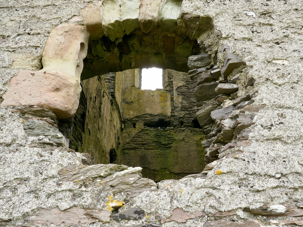
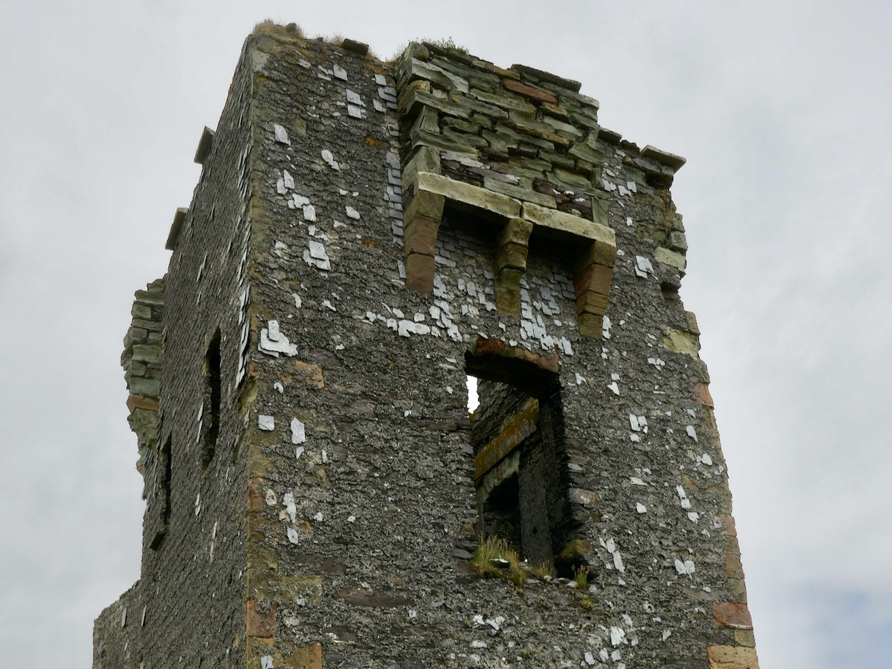
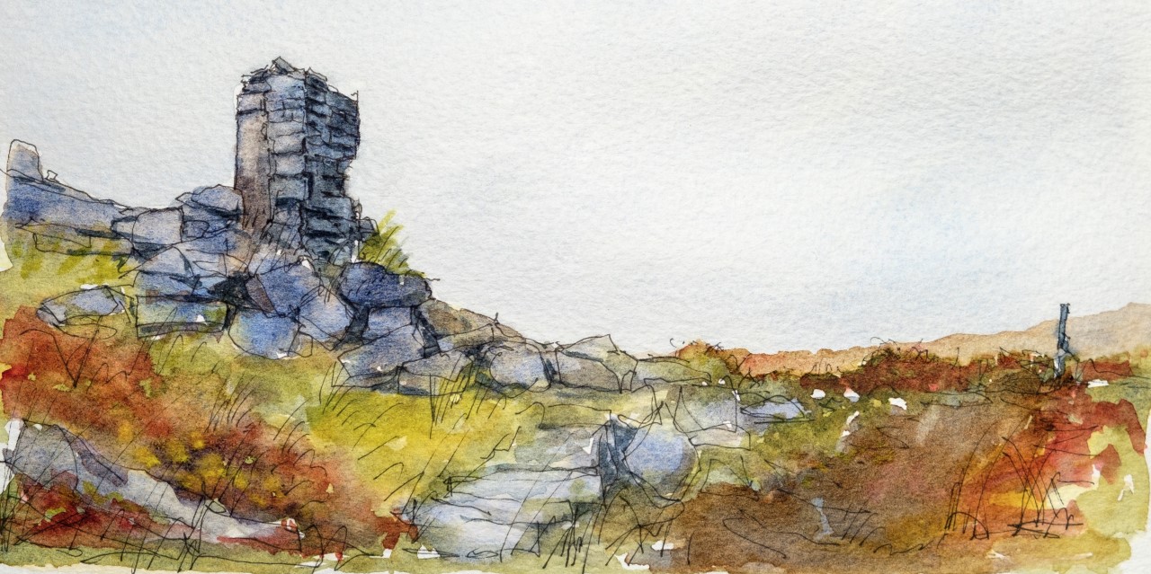
The selection of photographs above shows the state of the ruined tower at Ballyroon Mountain today (2020). Although there’s not much of a structure left it’s still a poignant memorial to those who built and operated this and all the other links in the communication chain that substantially encircles the coastline of Ireland. It’s a legacy well worth celebrating, and we are fortunate in Cork County that we have so many examples of the building type, some of which, like this one, are accessible to visitors. We will be exploring more of them in due course. To neatly finish off this post, here is an exquisite drawing of the Ballyroon tower executed by our friend Peter Clarke who writes the Hikelines series. It’s a lovely sketch which, for me, captures the slightly edgy romanticism of this beguiling location. Thank you, Peter.

Next time: Signal Towers Part 3 – Walking into history!

A Signal Success in Irish Engineering – Part 1: Kedge Point

At first sight this gaunt ruin on the West Cork coastline could be taken for a medieval fortified house or castle, but we can date its construction very precisely – to 1805, and we also know its purpose: long-distance communication. It was only put to use for a few years, and has been derelict at least twenty times as long as it was ever in service. It’s a signal station, one of over eighty similar structures around the whole coastline of Ireland, an initiative which represented a major engineering feat of its time.

This watercolour sketch by surveyor Sir William Smith is invaluable: it dates from 1808 and shows a signal station in use in its heyday. This one is at Malin Head on the Donegal coast, Ulster, and shows the elements which would have been common to all of the stations: a signal mast, a defended tower and a ‘guard house and barrack’ – probably also an equipment store. The signal tower bears a striking resemblance to the Irish ‘tower house’ or castle dating from several hundred years earlier, with its bartizans, machicolation, base wall batter and raised entrance, All these features were practical as the towers were military installations built in the times of the Napoleonic Wars. The cartoon (below) dates from 1805 and encapsulates the fear of invasion that swept over Britain in the early 19th century. Balloons, kites, flotillas of troopships and a channel tunnel were all envisaged as ways in which the French might conquer these islands! Humorous though this may seem, France had already used military balloons in the 1790s, and Bonaparte appointed Madam Blanchard as his ‘air service chief’, though she told him an aerial invasion would probably fail because of adverse winds.

Since Theobald Wolfe Tone and the Society of United Irishmen attempted to rally France behind the Irish cause in the 1790s, Ireland was seen as a possible focus for the feared invasion, and led to the British Admiralty constructing the system of signal stations as observation posts, together with 50 Martello towers, each maintaining a garrison of troops, officers and heavy artillery. The principal purpose of the signal towers was to keep watch on the coasts and to rapidly send signals around the country if unrecognised shipping was seen. Each tower, therefore, had to be within sight of one or more of its neighbours in both directions. The average distance between towers was 13.5km, although here in West Cork the towers at Brow Head and Mizen Head are only 3.8km apart. Ireland’s coastline is about 1,400km long, depending how you measure it.

Various combinations of flags and canvas ‘balls’ could be quickly assembled on the signal masts and, with the use of a code book (above) fairly complex messages might be circulated. Another vital piece of equipment, of course, was a high quality telescope. As the Navy had such essential apparatus – and the experienced personnel to use it – the Irish signal towers were largely manned by active or retired sailors.

We set out to explore some of the signal stations close to us in West Cork. Once we feel free to travel further afield through Ireland I can see the signal towers becoming a long-term project! If those we have visited so far are good examples, they take us to some of the wildest high places with panoramic coastal views: many are utterly remote. And they are all imbued with a sense of history – of duties that demanded long hours of lonely vigilance in harsh conditions. Most are long abandoned and forlorn. But the marks of those who have been there remain inscribed on the decaying walls.

The header illustration and all the photographs above were taken on our recent visit to the signal station at Spain, to the east of Baltimore. There is rugged moorland there and dramatic cliffs overlooking Kedge Island. The site is known as Ballylinchy or Kedge Point. It’s a fair climb off-road but not difficult to reach. It’s always essential to seek permission locally before crossing farmland.

There are uninterrupted views from Ballylinchy towards Kedge Island (upper photo) and across the islands towards the Mizen (lower). Visibility was restricted on the day we visited – and this made us realise how important the weather would be for accurate observations. However, we could clearly see the signal tower on Cape Clear from this vantage point, shown below, with the Fastnet Rock and lighthouse beyond. You can understand from this view – with the camera zoomed in – how powerful the telescopes needed to be to clearly read the flag signals. Finola’s post here includes a section on the Cape Clear installations.

The Google Earth images above and below reveal the setting of this signal station on the highest point of land for miles around. History abounds on this site, with the remains of a World War 2 observation post in close proximity to the 1805 structure, and one of the many EIRE signs set into the cliff, also dating from World War 2 and set up around the coast, reportedly at the behest of the American authorities to help orientate pilots and alert them to Ireland’s neutrality.

The south facing elevation of the Kedge Point signal tower clearly shows its defensive machicolation. On the left is the stump of the LOP (World War 2 lookout post). Below – the rubble of the destroyed LOP and some of the recognisable architectural features of this tower.

Next week I will report on a very different location, which we visited on a much better day – lots of sunlight, blue skies and West Cork magic to look forward to! This time our site will be at the westernmost tip of the Sheep’s Head Peninsula, and you will get a different sense of the relative orientation and intervisibility of these intriguing historic monuments.

Below – the signal tower at Toe Head, about ten kilometres to the east, seen from Kedge Point

Sheep’s Head Oasis – the Heron Gallery

As West Cork slowly opens up again, we welcomed the news that the Heron Gallery in Ahakista was once again serving food in its wonderful garden setting. The only excuse we needed to head over to the Sheep’s Head!

This garden is one of those on the West Cork Garden Trail and most of them are opening now, late this year, of course. According to Trail President, Jean Perry, Like many of us, garden owners have had lots of time on their hands this year and the outcome is that gardens of the West Cork Garden Trail are to an exceptional standard and have never looked better!

I can vouch for the truth of this as regards the Heron Gallery. There is nothing more delightful than to linger over one of their delicious lunches, or just a latte and cake, seated outside by the pond, and then to wander through the garden.

Annabel and Klaus have been working on this garden for about fifteen years. It was just a field when they took it over – that’s hard to imagine now. For Annabel, it is a haven and an inspiration. Take a look at her website and especially at her blog where she writes about the nature all around her and her latest projects. 

The garden is a paean of praise to both the natural and the cultivated. The traditional herbaceous borders are at their most colourful right now and feature clever little inserts of sculptures and objects of metal, pottery and wood.

Wander through the more formal garden and you come to the wildflower meadow – all native plants, most of which have simply volunteered, although Annabel has also carefully introduced harebells and local orchids. I spent most of my time here, observing the mix of flowers and grasses.

By the time we left the cafe was busy with lunch service. This is a garden that adults and kids both love. The piggies are a universal favourite, but sharp little eyes will discover many hidden delights.

The gallery is devoted to Annabel’s art. She works in a staggering variety of media and sells her paintings and products all over Ireland, as well as in her own galleries, here and in Kenmare. 

Many thanks to Annabel Langrish and her team for creating this spectacular little oasis on the Sheep’s Head. It was just what we needed this week and we look forward to more visits over the summer.