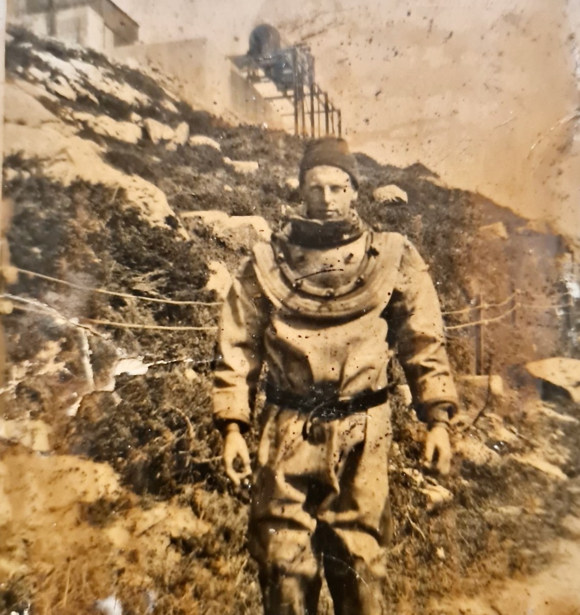
I’ve had the most marvellous emails from James Goggin – thank you James! Three of his grandparents came from Crookhaven – and the fourth, well that’s him in this spectacular photograph. Yes, he’s in a diving suit. James tells me: His name was Allen G Tyson, and he had come from Wales to work at the Crookhaven Quarry, seconded from Flintshire council in North Wales. Aggregates from the quarry were sent to North Wales amongst other places. He was a tall man and brilliant mathematician and civil engineer and lived with us in later life until his death in ’79. He designed the first dual carriageway in N.Wales and worked on the blue jubilee bridge in Queensferry (similar to and at the same time as Sydney and Newcastle bridges).
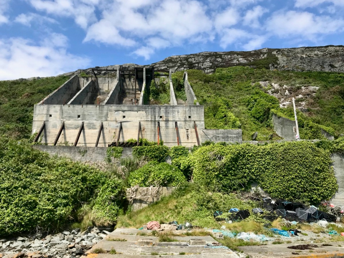
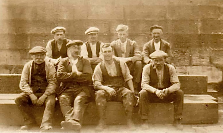
The quarry, of course, is the monumental structure, above, that Robert wrote about in his post Industrial Archaeology in Crookhaven, one of our most popular posts. It seems that anyone who has ever been to Crookhaven has wondered about that wall of concrete across the bay. James also sent me this shot of a group of men who worked at the quarry. Cloth caps and moustaches were the order of the day – except for Allen Tyson – he’s the suited and coiffed individual in the back row.
Once in Crookhaven, Allen met and married Bridget O’Driscoll. They had 5 children, including James’s mother Phyllis, who married Joe Goggin. Joe died not too long ago at the age of 91 and still has a sibling in Clonakilty, James remembers happy family holidays in his Nana’s house, the old Barracks next to the Marconi House in the village. He is full of stories and precious memories.
My father used to row coal to the Fastnet for a shilling or two. He told me of an uncle who used to shoot the sea mines ( like prickly conkers) with a .303 from Carrigeen cliffs off Rock Street. Nana would climb down to the sea for driftwood for the fire into her 70s. I remember the sacred heart picture and light, and the lights would flicker as I believe there was a generator in the village for power. A large old transistor radio in the kitchen with all the valves visible. Cold cupboard (a safe) under the stairs. Soda bread (and marmalade daily made in the range.
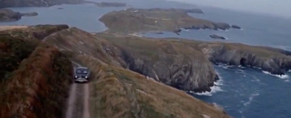
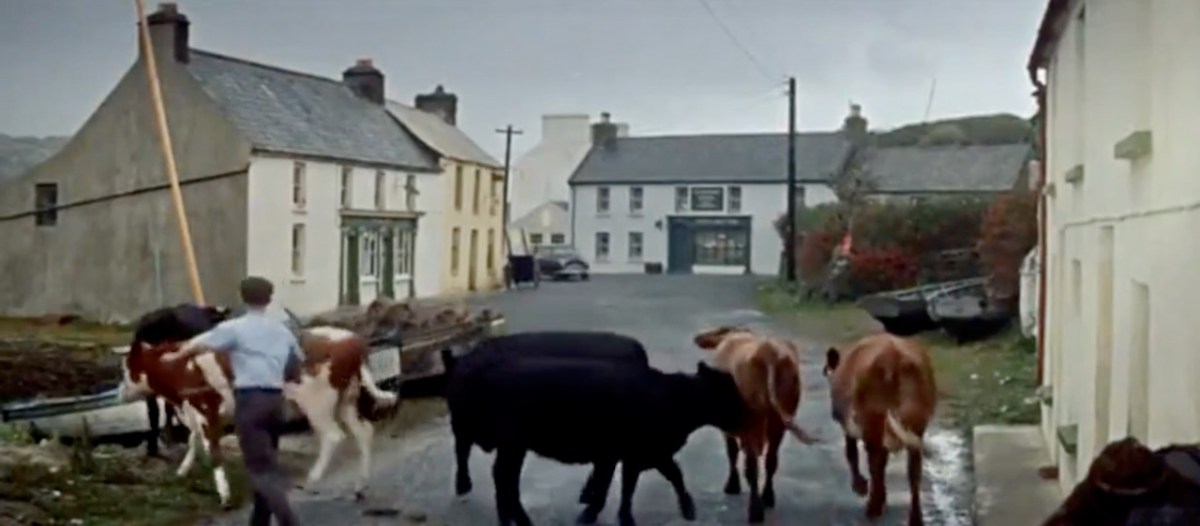
James told me several other stories about his father, whom he admired and loved. But he also sent me another gem! A link to a movie, I Thank a Fool, made partly in Crookhaven, and released in 1962. You can watch it here – the Crookhaven parts start around the 1:09 mark and it is a complete nostalgia fest for those of us who love this part of the world. Here are some screen captures.
The village is still totally recognisable.
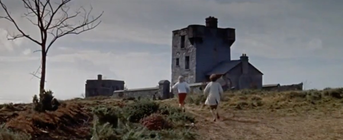
The 1804 Brow Head Signal Station is used as a ‘house’ where some of the action takes place. You can see Marconi’s Wireless Telegraph station in the background. For more on these structures go here for Marconi and here for the Signal Station.
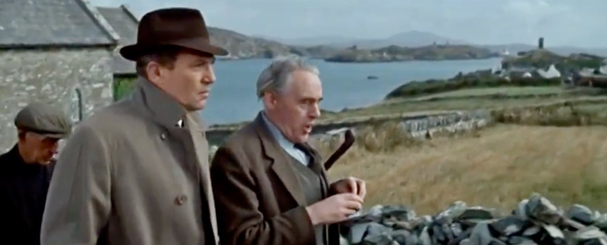
There is also a funeral at St Brendan’s Church. The procession gives us a marvellous opportunity to see back to Crookhaven and the mining magazine that was once clearly visible behind the town, but which is no longer a mark on the landscape. I’ve used that as my feature image at the top of the post, but here’s another take. That’s Peter Finch as the leading man.
I love it when this kind of serendipity happens – thanks again, James. I know that anyone who loves Crookhaven, as we do, will really like this walk through past times.
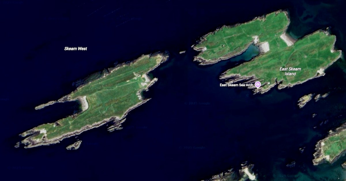
The highlight of last week was a trip around Roaringwater Bay in a traditional wooden boat, the Saoirse Muireann, visiting the Skeam Islands. Our captain was Cormac Levis, who led us last year on a trip to Castle Island and who is encyclopaedic in his knowledge of Roaringwater Bay.
Now, you may be tempted, as I was, to pronounce this The Skeems, but you can mark yourself out as a true local by referring casually to the Shkames. Called after St Céim (pronounced Kame), apparently, although this particular saint is surprisingly controversial, cropping up as Céin, Keane, or Kame, depending on the authority. THE authority, Pádraig O’Riain, in his Dictionary of Irish Saints is uncharacteristically silent on this saint, so we turn to the Mizen Journal for more information. The Mizen Journal was the much-missed publication of the Mizen Archaeological and Historical Society and it combined well-researched articles with lots of local lore. Bernard O’Regan was a highly-regarded local historian, interviewed by two others, Lee Snodgrass and Paddy O’Leary, before his death in 1994. In the interview he gave this account:
When St Ciaran left Cape Clear to go to the continent to be educated, he left his brother Kame and his sister in Cape [Clear]. Kame then built a wooden church on the West Skeam (Inis Kame, Kame’s Island).
The Bernard O’Regan Story Part 2
Mizen Journal No 4
Remember the bit about the wooden church, as we’ll come back to that.
According to the geologist Anthony Beese, the West Skeam and the East Skeam were once probably joined, and possibly to Heir Island also, since the seas are very shallow between them. Based on geomorphological evidence, and Keating’s 17th century History of Ireland, Beese estimates that the islands may have separated due to storm activity some time between the 5th and the 9th centuries. Such a scenario, he says, would explain the lack of evidence for an early medieval settlement and burial ground on Heir Island.
His own interpretation of the placename is more prosaic – rather than being based on a saint, he speculates that the Irish word scéimh (pronounced shcay-ev) might be apt – it means an overhang, a projecting rim or edge. He says:
The attitude of the cliffs of the Skeam Islands is determined by the subvertical dip of bedding planes, and when walking over the ridges, the feeling is one of looking down from a high table, boats below your feet, the rocky shore hidden.
Anthony Beese
The Natural Environment and Place-Names of the Skeam Islands
Mizen Journal, Vol 8, 2000
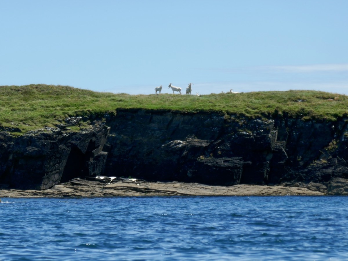
The goats on East Skeam certainly appreciate the cliffs.
So take your pick – the Skeams are named from a saintly church builder from Cape Clear, or the name reflects the geology of the island. Which side are you on?
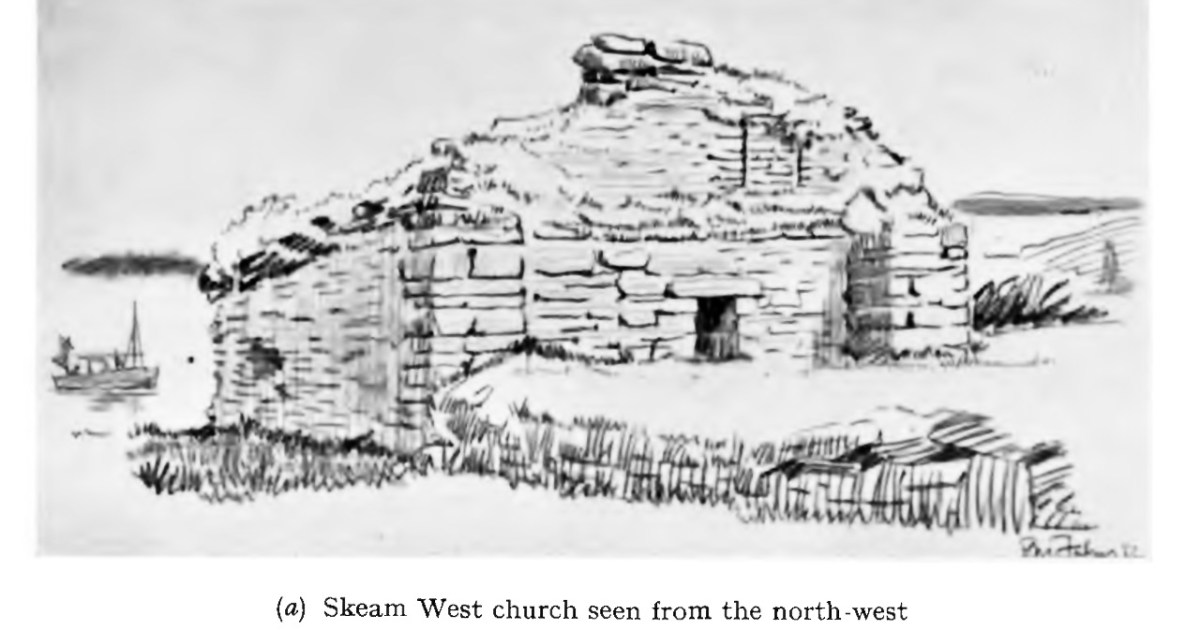
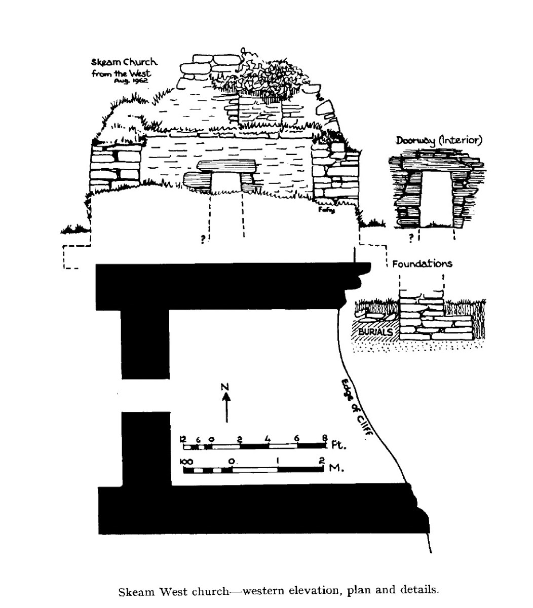
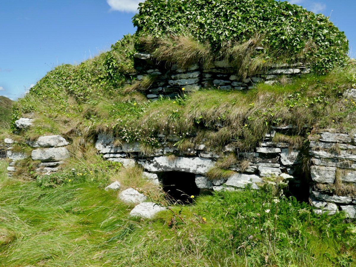
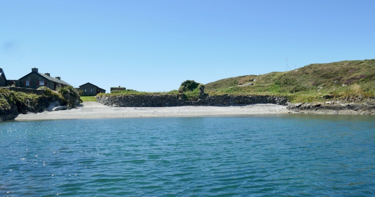
West Skeam has a fascinating history, as evidenced by the barely-hanging-on remains of an early Christian Church. It’s a small single chamber with antae and a splayed linteled doorway. In the photo above, courtesy of the Irish Times, it’s the small ruin on the bank halfway along the beach. Take a look at my post Irish Romanesque – an Introduction for more about this kind of early, pre-Romanesque Church. It is presumed that antae – the projections of the side walls beyond the gable wall – reflect an earlier form of wooden church in which those projections helped to hold up the roof and provide shelter over the entry. The survival of this feature is known as a Skeuomorph – an imitation in the stone-built form of the earlier wooden construction method.
This little church is very significant – It’s the only one of its kind in West Cork. For many years it has been falling into the sea. Although once, Beese notes, it would have been high and dry, successive storms and the prevailing winds have eroded the bank it stands on over the centuries. Local people, Cormac included, tell of bones eroding out of the bank. The archaeologist Edward Fahy conducted a brief survey in 1962. The drawing above and one at the top of this post are from that report, and here is the conclusion:
Inhumed burials are visible in the cliff for a distance of almost thirty feet to the north and south as well as within the church itself where they are overlain by some soil and 18” of collapse from the walls. The burials extend downwards to foundation level of the building and appear to post-date it. The density of burials is not high and the skeletons are laid parallel to the axis of the church with their feet to the east. One grave is slab-lined but the rest are simple inhumations.
The architectural features of the church, dry stone building, simple doorway with inclined jambs and without architrave, the antae and the estimated length/breath ratio of the interior suggest a ninth century date for the structure. It is to be regretted that this, the only church of its date in the area is to be allowed to crumble into the sea.
Edward Fahy
Skeam Island Church,
Journal of the Cork Historical and Archaeological Society, 1962
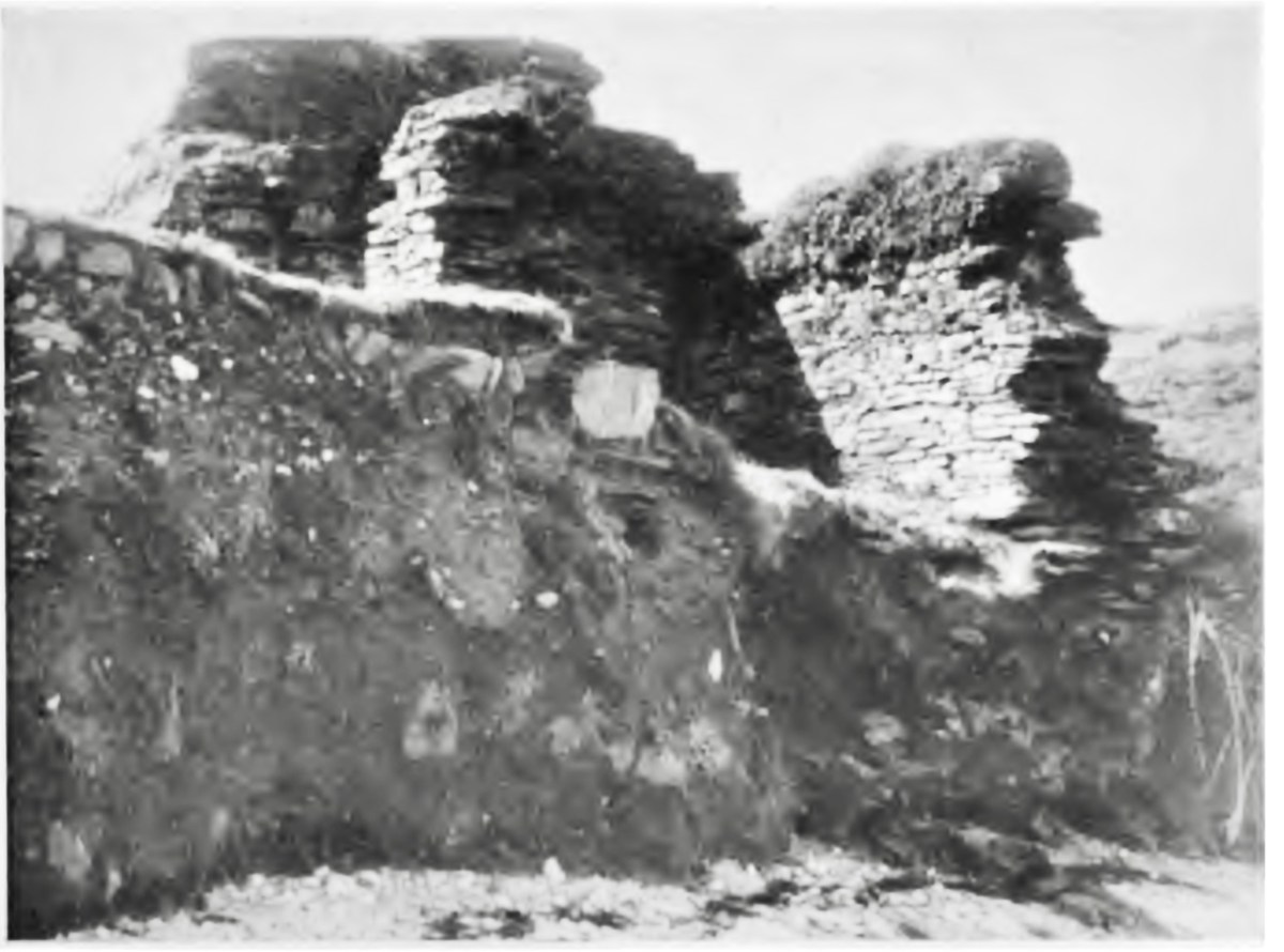
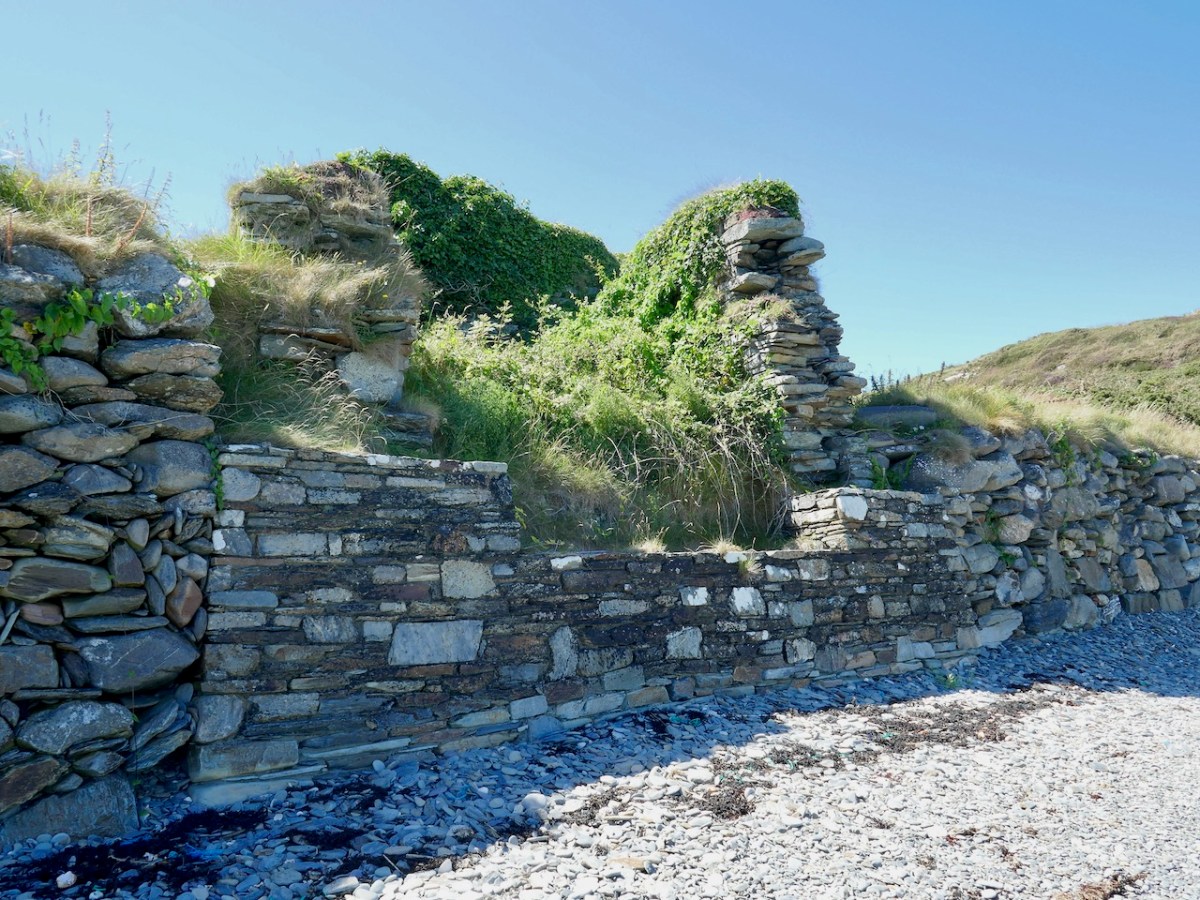
A proper excavation was conducted by Claire Cotter in 1990, necessitated by a proposal by the OPW to build a wall to protect the church from further erosion. Here’s what the bank looked like when Fahy reported in 1962, and it was in an even more perilous condition by 1990.
Cotter published her findings in an article, Archaeological Excavations at Skeam West, in the Mizen Journal, Vol 3, 1995. The excavation was confined to the burial grounds – that is, the area outside the church itself. It revealed that burials had been taking place there long before the stone church had been built! In fact, radiocarbon dating of the first phase, containing 24 individuals, mostly adult males, assigned a date range of 430 to 770AD.
Phase 2, consisting of 15 bodies buried in the north side of the church, once again mostly adults, but this time one body could be identified as female. Rather than in body-shaped cuttings, some of these bodies had been placed in pits, and they were in a semi-propped up positions. These burials dated from 550 to 855.
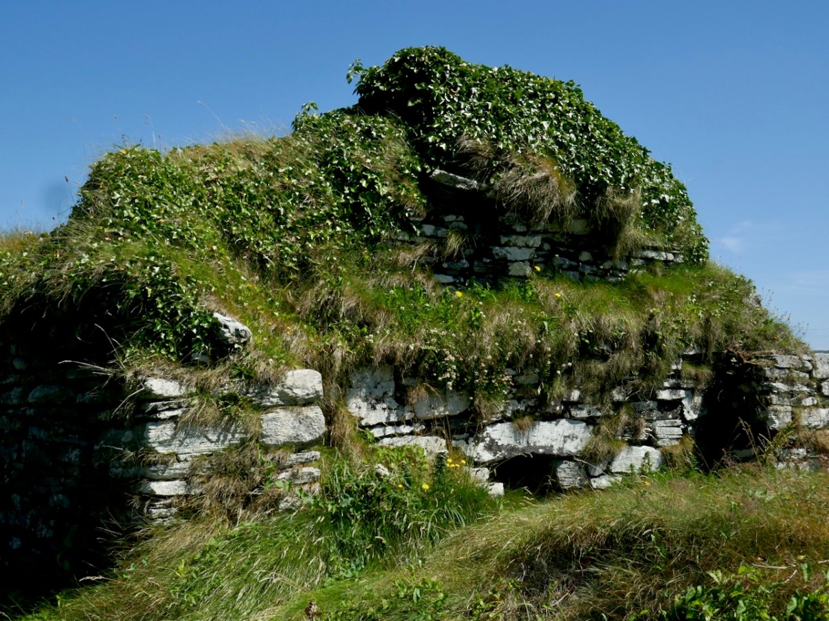
This is what the church looks like now from the landward side. It’s very overgrown, but you can clearly see the antae and the linteled entry
Phrase 3 encompassed 33 bodies and dated from 1165 to 1395, after which the graveyard went out of use. Some of these graves may have had markers – a stone cross and notched stones were found.
Another interesting find, Cotter tells us:
In a number of burials the head was marked by small flat stones – generally one stone set close to the head on each side. This may indicate that the bodies had been placed on timber planking – the cradle stones would subsequently support the head and keep it in position when the timber planks had rotted away leaving a void within the grave. Remains of such timbers have been found in early medieval graves in England. In the case of Skeam, such timber planking could have formed part of a bier, perhaps used to carry the body on the sea journey. Two burials of newborn infants also belong to this phase and these had been placed on large stone flags.
It looks as if this burial ground was accommodating people from the other islands. Apart from a cillínon Heir Island, there are no burial grounds on East Skeam or on Heir. A midden to the south of the church contained lots of fish and shellfish remains, as well as fragments of seal and whale bones, and cattle sheep and pig bones. This activity dated to the 16th and 17th centuries.
Cotter, in her discussion, says the following:
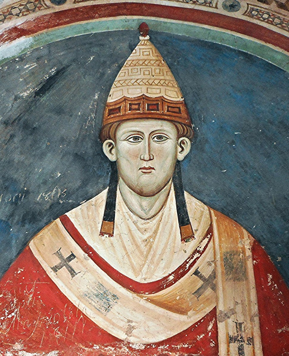
There are no historical references to the church on Skeam west. It lies in the parish of Aughadown; and a decretal letter of Pope Innocent III [that’s him, below]issued in 1199 refers to “Aughadown and its appurtenances” and the Church in Skeam West may well have been included in these. Local tradition attributes the origins of some ecclesiastical foundation on the island to Ceim or Keims, a brother of Kieran of Cape Clear. This would place the foundation in the pre-patrician period and the site is therefore of great interest. Was the stone church built to replace an earlier wooden structure – perhaps destroyed by the storm which washed up the deposit of shingle visible at the north side of the present building?
. . . Small church sites such as Skeam were generally located within an enclosure which defined the termon or area of sanctuary of the church, and the ditch uncovered to the south of the church is probably the remains of such an enclosure. The question as to whether these foundations should be regarded as monastic has been much discussed in recent years. Some scholars suggest that these ecclesiastical foundations should be regarded as small church sites which provided essential religious services for the local community. Others would argue that the majority of these foundations began as monasteries and only later assumed a community role. In many examples the earliest burials are exclusively male and only at a later stage do we find mixed burial i.e. adults and children of both sexes.
. . . The burial ground at Skeam West appears to have been used over a long period perhaps as long as the 900 years. During its later history it may have been used by a wider community drawn from the neighbouring islands and coastal district as well as the Skeams.
She adds:
The human burials uncovered during the excavations were re-buried on the island in 1992 in what is hopefully their final resting place.
Above is the OPW wall, which seems to be doing the job of arresting erosion for the moment.
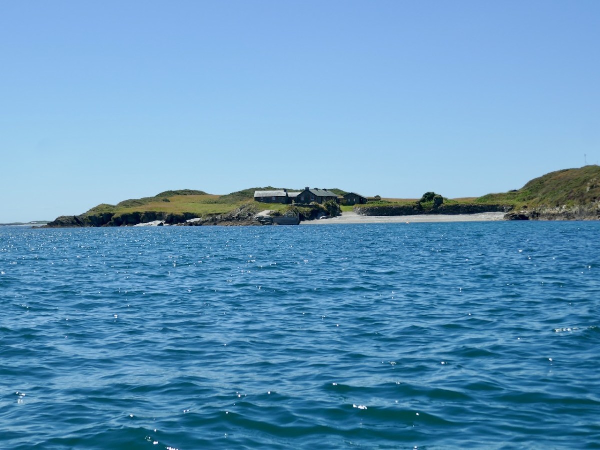
There’s lots more to tell you about the West Skeam Island, including fascinating details as to who owned it, and what life was like there. And we haven’t even arrived at the other Skeam Island, East Skeam, yet! Next time.
One final note – the island is privately owned and monitored by video link. A disembodied voice reminded us that we were trespassing, at which point we left.
Republishing one of Robert’s classic posts. This one was originally published in May, ten years ago, under the title High Drama.
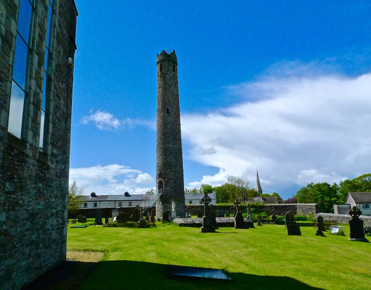
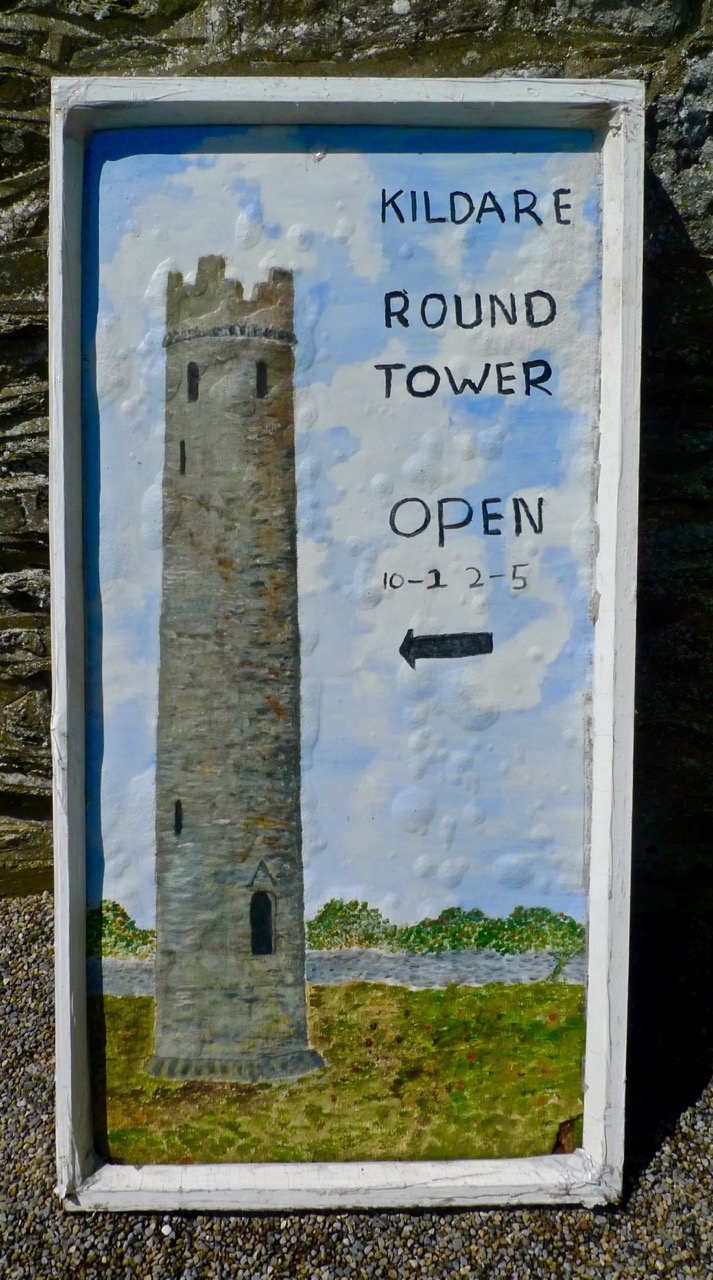
If you suffer from vertigo or claustrophobia – or both – then you won’t want to follow us in the adventure we had this week while returning from a visit to Dublin: climbing to the top of an Irish Round Tower! Overcoming any tendencies we might have had towards these phobias, we arrived at the roof of the 32.6 metre high Kildare tower and marvelled at being able to stand on the summit of a piece of architecture over a thousand years old. Kildare has the second highest Round Tower still extant in Ireland: the highest is at Kilmacduagh, Co Galway, at 34.9 metres; however, Kildare now lacks a conical cap, which it might once have had. If so, it would just tip in as the highest of all the towers.
Kildare Round Tower: note the battlemented top – probably added in an 18th century restoration, the romanesque doorway and the granite base. The upper stonework is limestone and sandstone
The print above – dating from 1788 – shows the ruins of St Brigid’s Church, which was fully restored as a Church of Ireland Cathedral a hundred years later. We looked down on this from our vantage point atop the Tower – and had a good view of the (also restored) Fire Temple where a perpetual flame, lit by the Saint, was kept burning for hundreds of years, finally being extinguished by the shenanigans of Henry VIII.
Looking down on Kildare Cathedral, with St Brigid’s ‘Fire Temple’ in the grounds
You’ll have heard me talk about St Brigid many times: she’s second only to St Patrick in the Irish Martyrology. In fact, as probably the most influential woman in Irish history, I’m going to declare her as quite the equal of St Patrick: she’s often enough described as one of the Patron Saints of Ireland. You will also know that she is surrounded by folklore and traditional customs, such as the making of her Cross on her day, the First of February.
St Brigid’s Cross – left, at her Holy Well and right, a textile in the Solas Bhride Centre, Kildare
Back to the adventure (although the whole day was adventurous!) – climbing the tower was hard going. There were a series of near-vertical ladders to be negotiated: each one took us to a higher timber platform, six floors in all. At the top of each ladder we had to squeeze ourselves through a narrow opening; this, and the confines of the tower interior – only two metres or so across – certainly challenged the claustrophobiac in me.
The restricted space also made us question some of the theories about the uses of these towers, which are always located at ecclesiastical sites. The definitive work on them is, as it happens, written by someone who also lives in West Cork – just a little distance from Nead an Iolair: Brian Lalor. Brian has led a very full life, involving architecture, archaeology, sketching and printing (his etchings are exquisite). He is also the author of a number of books, many of which are on our own shelves, including The Irish Round Tower, published by The Collins Press, 1999 and 2005.
Brian is unequivocal in his assertion that the primary purpose for round towers was to house the monastery bell. He also suggests that a secondary function would be as a safe storage place for the monastic treasures: the entrance door was always raised at a considerable height above the surrounding ground level, requiring steps or a ladder to gain access. In the times when they were constructed they would have been visually impressive – and could be seen from a great distance. They would have acted as signposts for travellers who might have been searching for the hospitality which monastic communities always offered. Brian discounts some of the more bizarre theories for the towers – for example, that they might have been places of safe refuge for the monks if under threat of attack by Vikings – or that they are simply phallic symbols! Lastly, Brian considers – and gives some credence to – the idea that the towers were monumental buildings of prestige and local aristocratic patronage: certainly, they required considerable expense and effort to construct.
As is often the case with our days out, one adventure led on to another. When we came down from the tower we found that St Brigid’s Cathedral had closed for lunch. But we knew that the Saint’s trail also involved a Holy Well and we had heard that there was a new building devoted to the work of Brigid just outside Kildare.
Solas Brhíde Centre
Robert with Phil, one of the Sisters who conceived the project
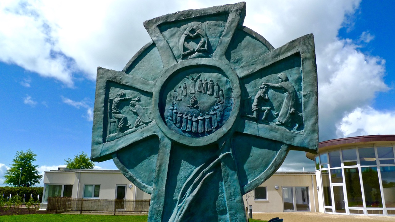
We were very impressed with the Solas Bhríde Centre: a small group of Brigidine Sisters has put together the project to build a Christian Spirituality Centre which unfolds the legacy of St Brigid and shows that it is still relevant in the present day. We were shown around the Centre by one of these Sisters, Phil, who pointed out that Brigid was attuned to the natural world and would have appreciated that the new building (designed by Solearth Ecological Architecture) is conceived on ecologically sound terms using sustainable materials and techniques which care for the wellbeing of the Earth. The plan of the building is appropriately inspired by the shape of a St Brigid’s Cross.
Architect’s drawing of the newly completed building
The next stop on our itinerary was the nearby Holy Well – a popular place of pilgrimage and veneration on St Brigid’s Day:
Finally, we arrived back at the Cathedral. I’m always a little disappointed by restorations – particularly those which were carried out in Victorian times; nevertheless there are some impressive features. The possibly twelfth century font is one of them (below left), and another has to be the hidden Sheelagh-na-gig under the lip of Bishop Wellesley’s tomb (below right). I reached under to feel this little carving, and was then told by the Cathedral’s guardian that anyone who touches the effigy is ensured everlasting fertility!
The excellent Heritage Centre opposite the Cathedral entrance is informative about the town’s history and the important connections with this special Saint. There is much more to be discovered – and written – in respect of St Brigid, and other places in Ireland which are connected with her still to be visited. Do go to Kildare and, at the very least, suspend your phobias sufficiently to allow you to climb the ancient Round Tower. But make sure you go between May and September – and not during the lunch hour…
We’ve just passed the Equinox – one of the two moments in the year when day and night are of equal length. This happens once in the spring and once in the autumn. This year that moment was March 20th at 9:01AM, but it can fall between the 19th and the 21st, depending on the year. The autumn equinox this year falls on Sept 22, but it can range from the 21st to the 24th.
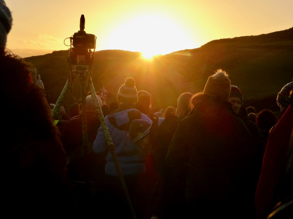
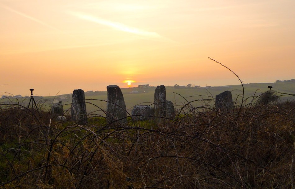
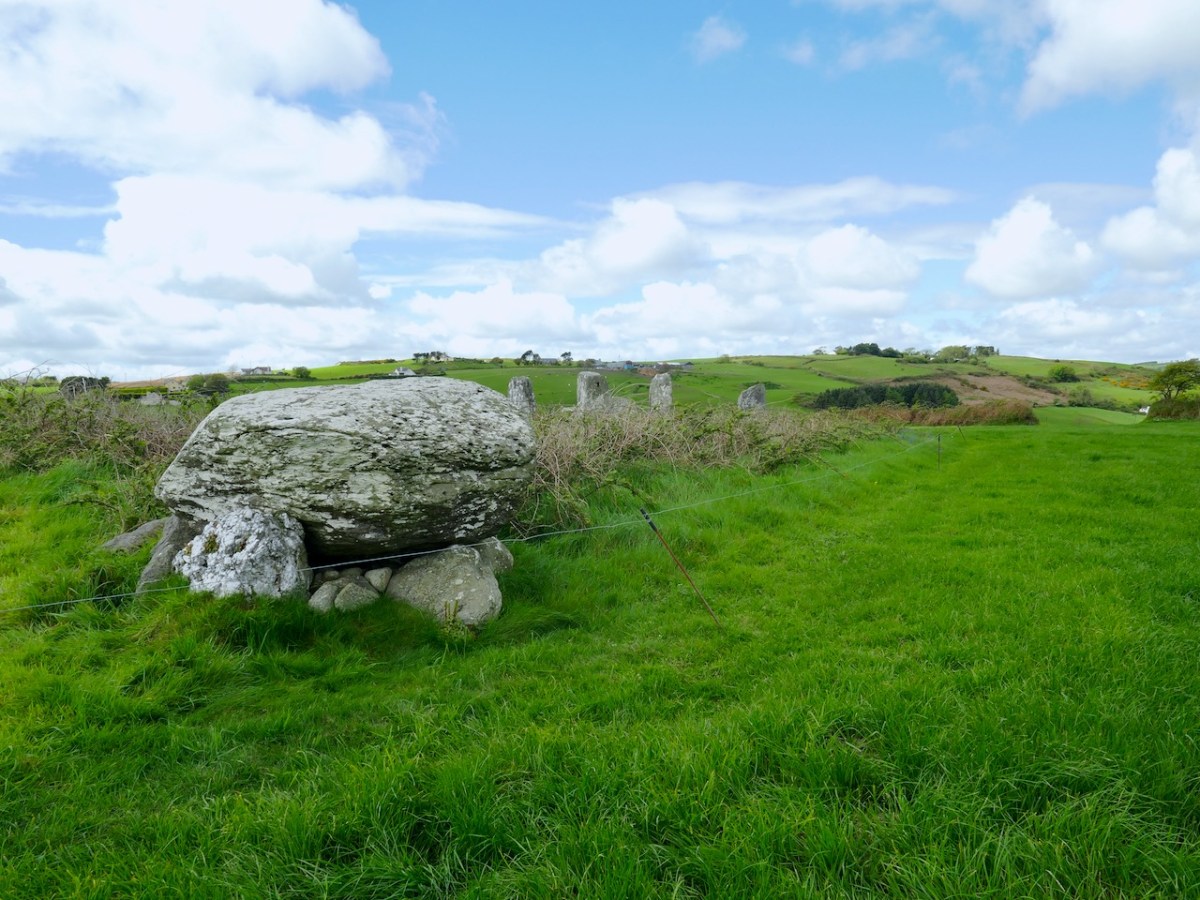
Prehistoric monuments in West Cork often have an orientation – the most famous of course is Drombeg stone circle (above in 2020). It’s a multiple stone, ‘axial’ circle, with two portal stone opposite a recumbent stone. On the winter solstice (this year on Dec 21st) the sun sets behind the recumbent, diametrically across from the portal stones (this is the ‘axis’). Attending this event is always great fun as well as an opportunity to join in a celebration that is thousands of years old.
There is a rhythm to the year provided by these four solar events – the longest day (summer solstice), the shortest day (winter solstice) and the equal-length days (equinoxes). Add to that the cross-quarter days – the points half way between the solstices and equinoxes, and we have a natural calendar of eight divisions.
The cross-quarter days, by the way, are the ones that track most closely to the great ancient Festivals in Ireland of Imbolc, Bealtaine, Luanasa and Samhain. Although nowadays these tend to be celebrated on the 1st day of February, May, August and November, in fact the dates would have varied and in 2025, the accurate dates for the cross quarter days are Feb 3, May 5, Aug 7 and Nov 7. This is important to know as various solar events happen on cross-quarter days, and if you want to see them, you have to turn up on the right day! See this post on Boyle’s Bealtaine for a good example of this – the photo above was taken on May 5, 2018.
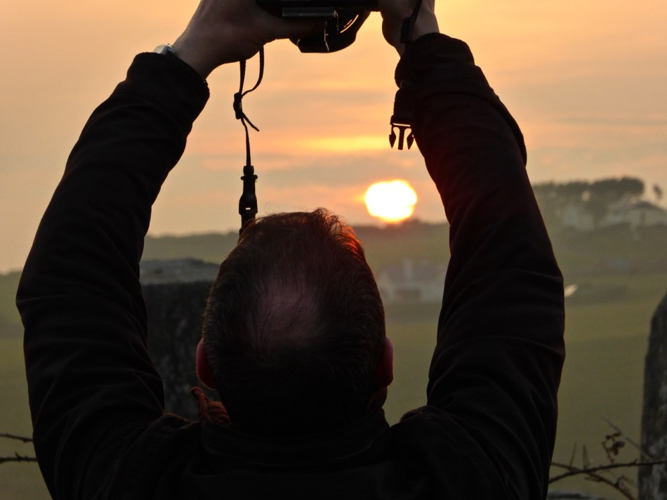
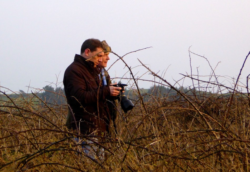
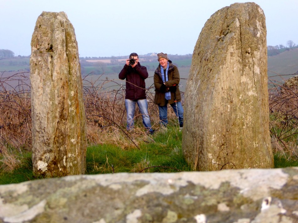
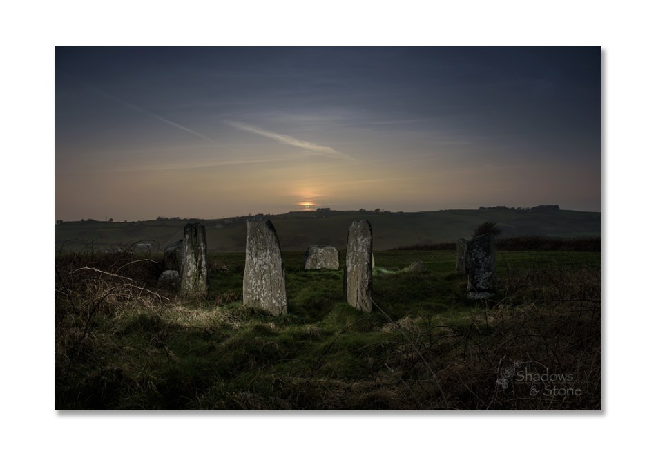
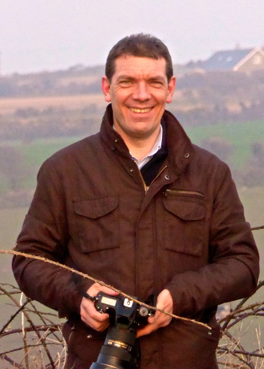
A few years ago, we met up with Ken Williams of Shadows and Stone, to photograph the equinoctial sunset at Bohonagh Stone Circle, near Rosscarbery. Ken is the undisputed master of prehistoric photography in Ireland. His website contains high-quality images of many different kinds of monuments, he supplies photographs for all the best publications, and he was our partner in the Rock Art Exhibitions we mounted in the Cork Public Museum and in Schull.
Ken’s work on rock art is astounding. We know first hand how difficult it is to get good photographs of the carvings. Many of them are covered in lichen, obscuring all the detail, and can really only be discerned in long slanting light, such as at sunrise or sunset. Ken uses both natural and artificial lighting to capture his excellent images and when we first met first we asked him how he packed all those lights up to the remote locations in which a lot of rock art is found. He grinned and opened his backpack. “This is my equipment,” he said, “It’s all I use.” Essentially his gear consists of a camera, flashes, and tripods – strategically deployed in the photograph above.If you want to see the difference between what Ken captures and what us ordinary mortals manage to do, take a look at the first two images in the post Revealing Rock Art.
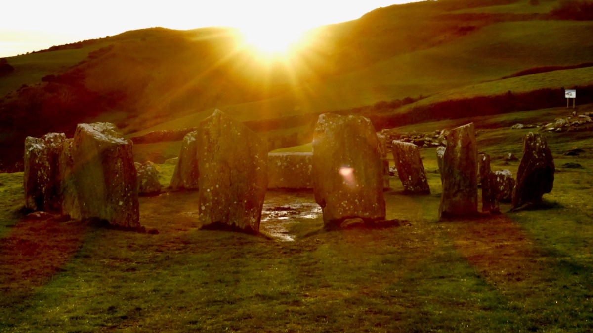
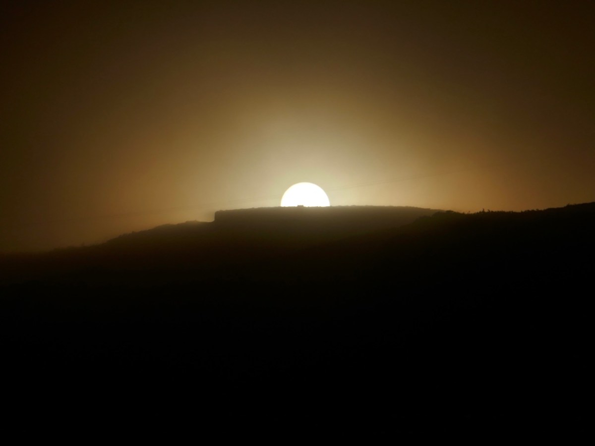
it was a beautiful evening – perfect conditions to see the sun sink behind the recumbent stone. Bohonagh (above) is a complex site. Not only do we have a stone circle, there is also a boulder burial, featuring a rather spectacular quartz supporting stone and cupmarks on the upper surface of the boulder, as well as a cupmarked stone hidden in the undergrowth between the boulder burial and the stone circle. It’s been excavated.*
Looking over the recumbent
It was a treat to see a master photographer at work and to have Ken explain how he gets those amazing shots. From previous attempts, I knew how difficult it was to portray a scene when you’re aiming directly into the glare of the setting sun. This time I concentrated on capturing the photographer at work. Ken, meanwhile, worked his usual magic – and here’s the result, included with his permission. Not only can you see everything, including the still blue sky, but his picture captures the mysterious ambiance of the setting and the occasion.
Our thanks to Ken for an inspirational photo shoot.
It’s been an eclectic week – Amanda, Peter and I had a skite out to Inchydoney, and I finished off the week with a trip to Barley Cove.
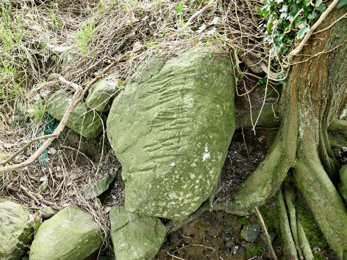
Inchydoney Island is a beautiful, unique and historical part of West Cork. Just south of Clonakilty, it was indeed once an island but now is connected to the mainland with causeways. The reason for our trip was to check out an intriguing stone, spotted by Willie O’Regan, along the shore. Willie’s thought was that it might be an Ogham stone and he wanted to check that out. It had fallen forward out of the bank in recent high tides, revealing parallel grooves along its length – just the sort of thing you might expect from an Ogham stone.
We rendezvoused with Willie on the north side of Inchydoney, across from Clonakilty (above) and walked along the shore, while he told us about the history of the area. We could see across the pond known locally as the Beamish Lake to the Hungerford House, originally called Inchydoney House. It has been purchased and magnificently restored in recent years, the owners pouring resources and loving attention into their project, including restoring the walled garden.
The shoreline had been – er – shored up by rocks and rubble all along its length. It may originally have been walled – designed landscapes were very popular in the 18th century – take a look at New Court, for example. There may also have been small inlets and launching places along the edge. At one such possible spot Willie showed us what he had found.
We examined it thoroughly and took lots of photos. It wasn’t an Ogham stone – although anyone could be forgiven for mistaking it for one! The grooves are actually plough marks.
As the plough passes over and through the soil, it runs across stones that are just at the right depth below the surface, gouging out these grooves. Over the years, many grooves appear. Sometime the stones, if they are small enough, roll over and the grooves appear on other surfaces, as seems to be the case with this stone.
Plough-marked stones like this could be any age – this one could be medieval or more recent. It was probably finally unearthed and tossed to the edge of the field to join the other rocks keeping the water from eroding the shorelines, eventually falling forward and revealing itself to Willie’s keenly observing eyes. It tells a story – a story of cultivation and hard work and a story of never throwing anything away, and a story of a man who walks these shores for pure pleasure and never misses a trick. Thanks, Willie – we had such a good time on this walk!
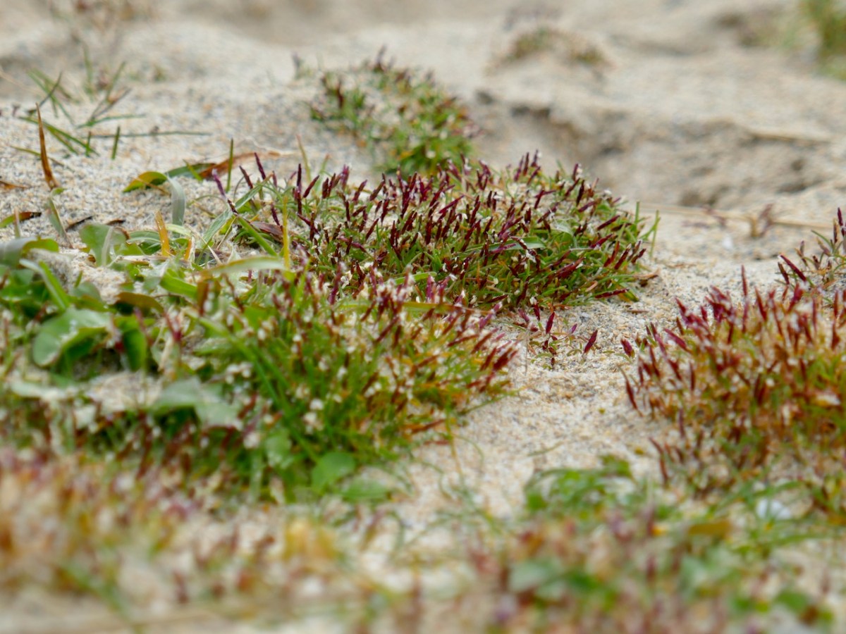
And Barley Cove? As last year, I went out to see what I could see of the Early Sand-grass. A remarkably homely little tuft of grass that is nevertheless precious because it is extremely rare. I found lots and it felt so good to be out in the fresh air, lying in the dunes, and taking an unconscionable number of photographs of this humble little representative of our incredible West Cork biodiversity.
And then home through some of the most scenic coastline in Ireland. Not that I’m biased.
WordPress, to my dismay, has now labelled all the content on this blog as ‘by Finola’. This is due to the necessity, for various reasons, of adjusting ‘ownership’ and management parameters. It’s a bit heartbreaking, though, as it’s no longer easily discernible which of the posts (approx half of the 1,132 posts so far) were written by Robert. So every now and then I thought it would be good to highlight one of his older posts. So here is his wonderful account, written originally in 2014, and titled In Search of Ghosts, of the spirits that haunt Brow Head.
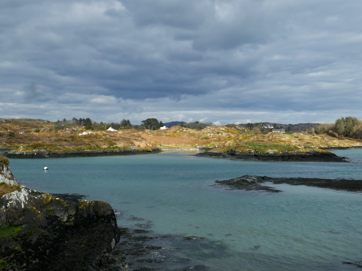
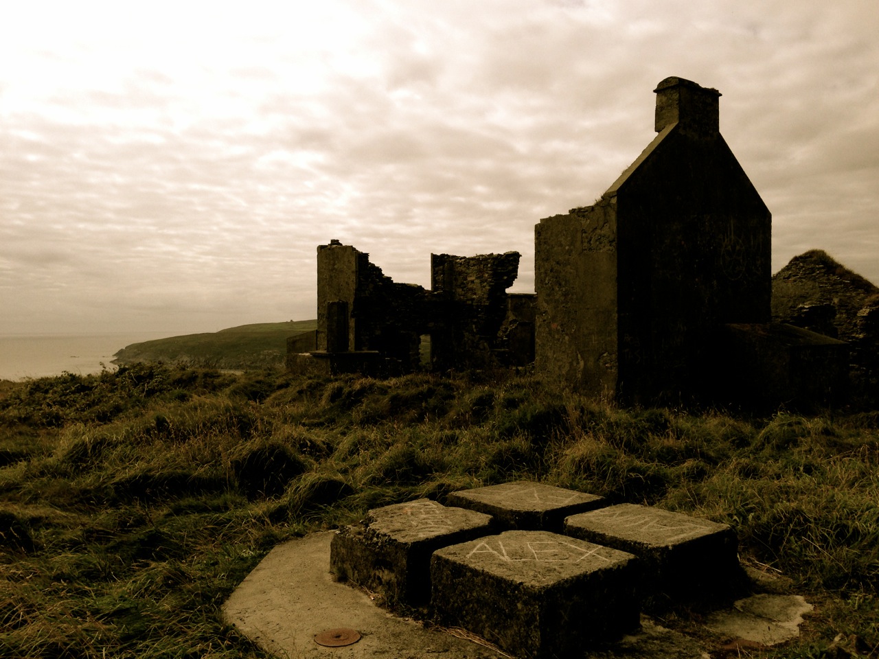
Lonely and wild – Brow Head is the most southerly point on the mainland of Ireland. There are ghosts here: ghosts of ancient people who created the stone monuments, perhaps 5000 years ago, that are now inundated by every tide in the bay at Ballynaule below this Irish ‘Lands End’; ghosts of early farmers who began to lay out field boundaries criss-crossing this windswept promontory; ghosts of the defenders of an empire who feared a French invasion that never happened; ghosts of the prospectors who sunk two shafts – now barely protected by rusting wire – during the nineteenth century copper mining era; and, lastly, ghosts of the pioneers of our own digital age, represented in the brooding ruins that crown the hilltop here above West Cork’s remotest village, Crookhaven.*
Brow Head – haunt of ghosts
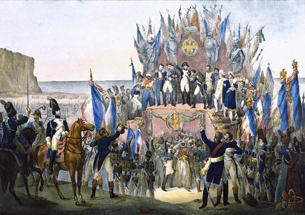
Napoleon setting his sights on the British Empire 1804 (Charles Motte)
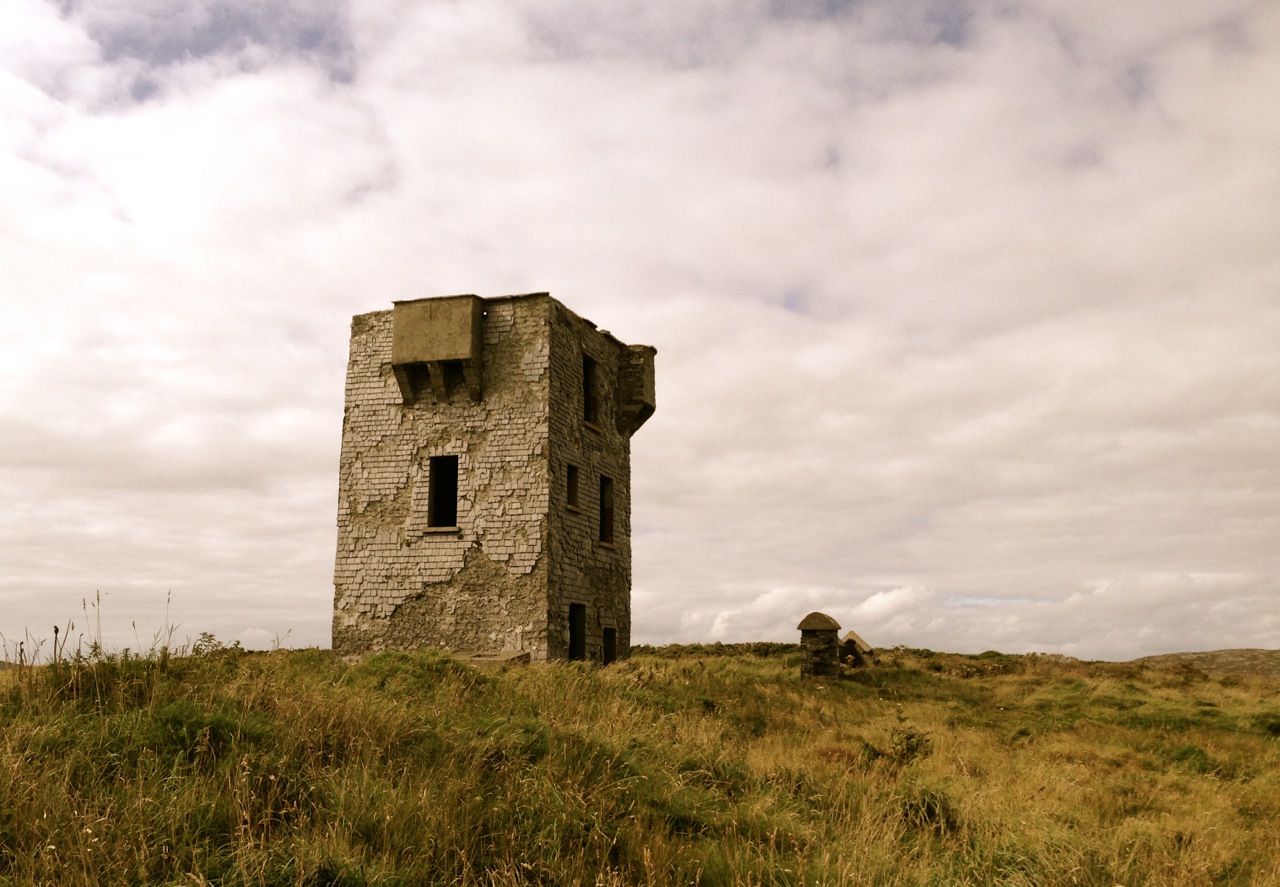
Facing up to Napoleon: Brow Head Signal Tower, built in 1804 in anticipation of a French invasion
We can be very specific about one ghost: Guglielmo Marconi – born at Bologna, Italy, on April 25, 1874 to Giuseppe Marconi, an Italian country gentleman, and Annie Jameson, daughter of Andrew Jameson of Daphne Castle, Enniscorthy, County Wexford, Ireland. The Jamesons were and are renowned distillers of Irish Whiskey. It’s reasonable to say that Marconi was an ‘Irish Italian’, and that heritage was reinforced when in 1905 he married Beatrice O’Brien, daughter of the 14th Baron Inchiquin. Marconi’s fame is that he pioneered the commercial application of electromagnetic waves – or Radio.
Marconi – wishful thinking!
At the age of twenty one, Marconi was able to demonstrate to his father how, without any visible physical link (without wires), he could transmit dots and dashes through the rooms of their home in Pontecchio. “…When I started my first experiments with Hertzian waves…” he is quoted as saying, “…I could scarcely believe it is possible that their application to useful purposes could have escaped the notice of eminent scientists…” His parents used their influence to help him travel to England to meet the Engineer-in-Chief of the British Post Office with the result that in 1896 Marconi obtained the first ever patent in wireless telegraphy.
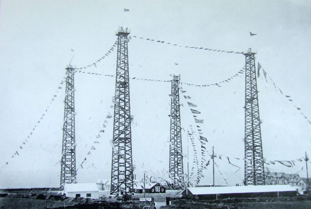
Signal Station at Poldhu, Cornwall, 1914
Marconi’s ambitions started in a room in Italy: by December 1901 he was able to send messages from Poldhu, Cornwall, to St John’s, Newfoundland, a distance of 2100 miles – an historic achievement. In his attempts to bridge the Atlantic with Radio waves he had explored the west coasts of Britain and Ireland for suitable telegraphic locations. One of his destinations was Crookhaven, which he visited many times – using the Flying Snail en route!
The Marconi Wireless Telegraph Station at Brow Head – exactly 100 years ago
Brow Head was one of a number of transmitting stations set up by Marconi and it got off to a flying start soon after opening in 1901 when, in the presence of Marconi himself, Morse signals were received from Poldhu, 225 miles away. The fact that the Atlantic gap was conquered only a few months after this shows the rapid pace of developments at that time.
Calling America…
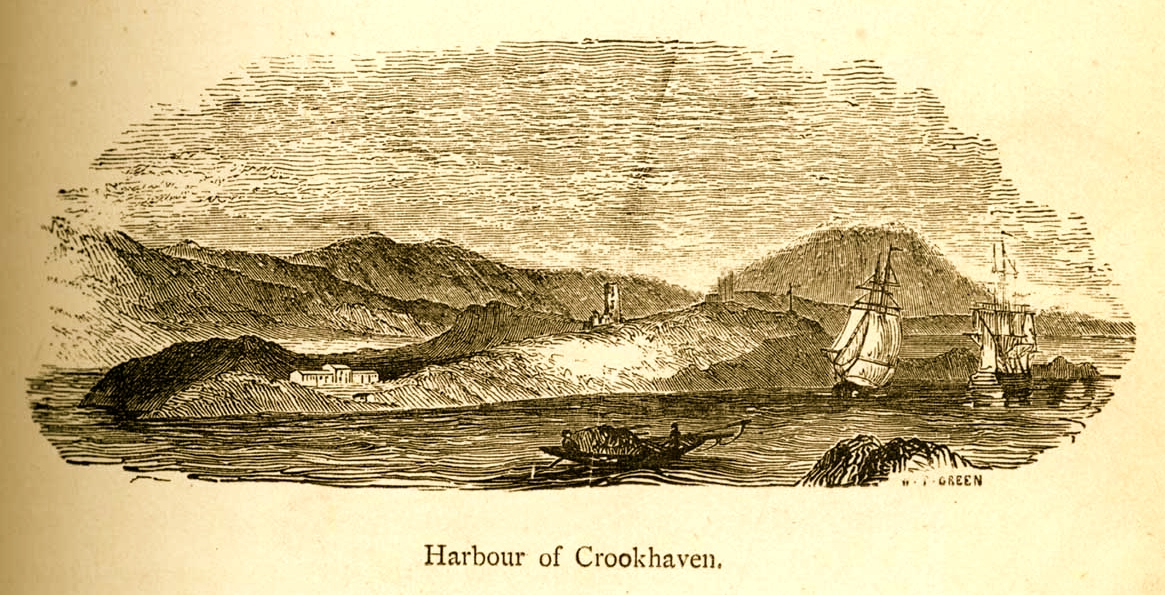
The village of Crookhaven had long been the first and last port of call for ships going between Northern European ports and America. Over the centuries ships stocked up here with provisions before tackling the open sea. Because of this, the major shipping lines had agents here. Reuters and Lloyds had flag-signalling and semaphore equipment on Brow Head to communicate with the maritime traffic, superseded by the telegraph station. At the end of the 19th Century it was said that “…you could cross the harbour on the decks of boats…” Up to 700 people are reputed to have lived in the area at that time: now, Crookhaven has a permanent population of no more than 40. An article written by one of the telegraph operators in 1911 summarises:
…As Crookhaven is the first station with which the homeward bound American liners communicate it is naturally a busy station. By the aid of wireless all arrangements are made for the arrival of the ships, the landing and entraining of the passengers and mails, whilst hundreds of private messages to and from passengers are dealt with. Messages are also received from the Fastnet Lighthouse, which is fitted with wireless, reporting the passing of sailing ships and steamers. These messages are sent by vessels not fitted with wireless by means of signals to the Fastnet, thence by wireless to Crookhaven, whence they are forwarded to Lloyds and to the owners of the vessels…
Engraving by Mary Francis Cusack, 1875
We have some first hand accounts of the workings of the signal station in its heyday from the handwritten log books of Arthur Nottage – for many years landlord of the Welcome Inn at Crookhaven – who died aged 90 in 1974. In 1904 he arrived in West Cork (from England) to work on a shift basis with one other man as Marconi telegrapher at Brow Head. Until 1914 he operated the Morse code apparatus with a salary – generous for the time – of £1 per week.
Arthur Nottage of Crookhaven
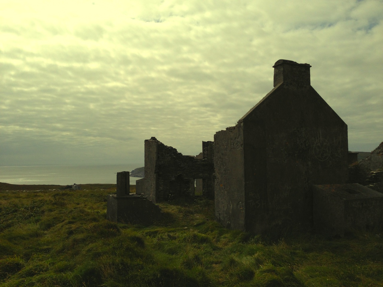
A hundred years ago telegraphy had advanced to such a stage that it was no longer necessary for stations to operate close to the shipping lanes, and small, isolated sites such as Brow Head were closed down. Legend has it that in 1922 the Irregulars destroyed the buildings during the Civil War.
Becoming archaeology: the ruins on Brow Head today
Finola and I have both been inspired by the landscape and atmosphere of this Atlantic frontier. It’s a place we will return to. All West Cork landscapes are impressive, but this is a place apart. If you want to feel at the end of the world, walk here: you won’t meet many others, even in the height of the visitor season. Perhaps that’s because it’s haunted – but in the best possible way. Like so much of Ireland the world has come here – a mark has been made – memories have been left behind. Now, you hear the ghosts in the ever-present currents of wind and surf.
Base of Marconi’s mast at Brow Head
*I am grateful to Michael Sexton and the Mizen Journal (Number 3 1995) for many fascinating items on the Crookhaven Telegraph Station not recorded elsewhere.
Welcome to the UCD Library Cultural Heritage Collections blog. Discover and explore the historical treasures housed within our Archives, Special Collections, National Folklore Collection and Digital Library