Wicklow by the Sea

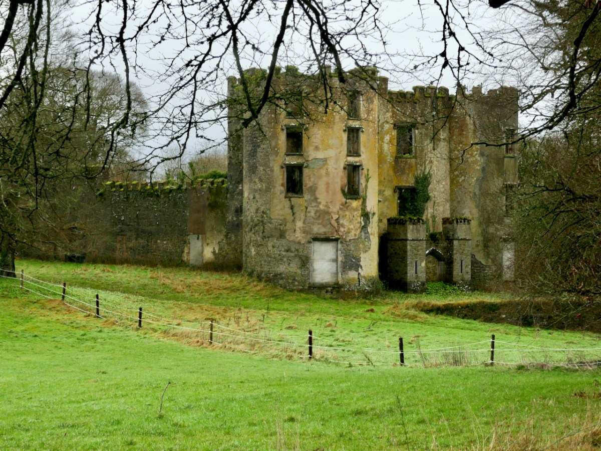
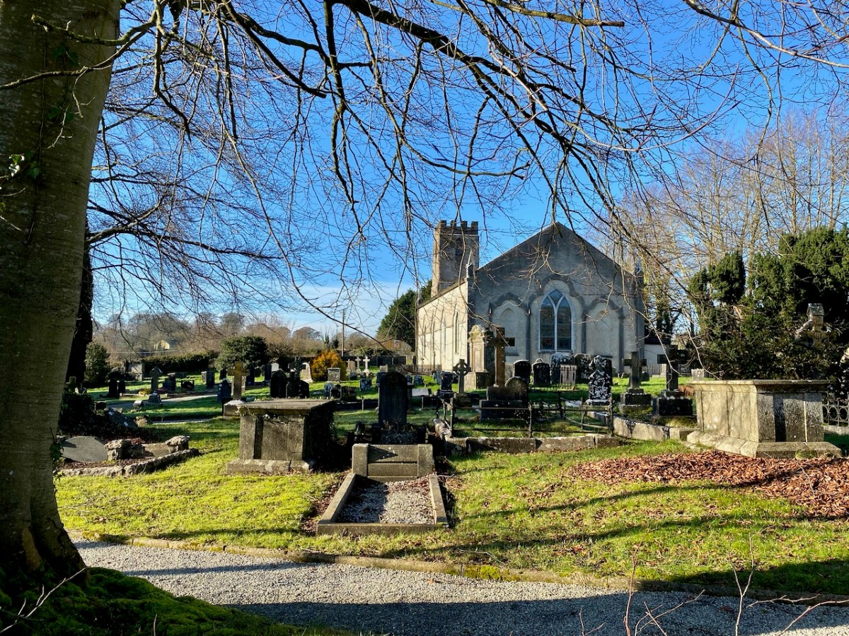
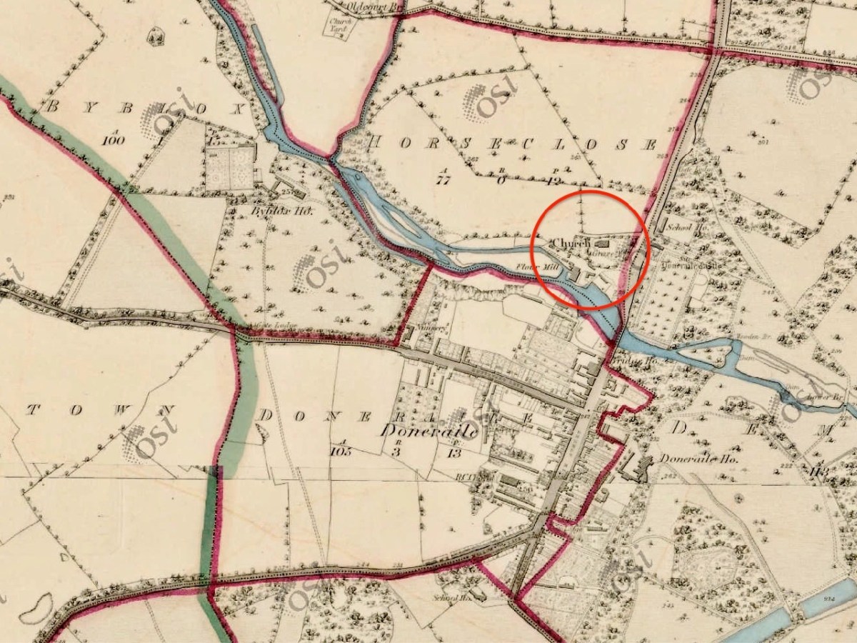
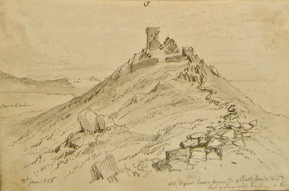
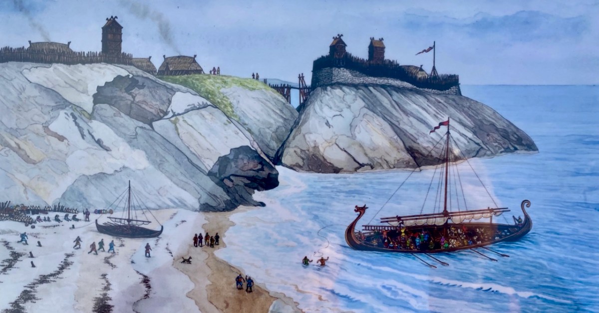
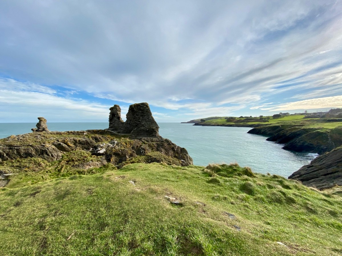
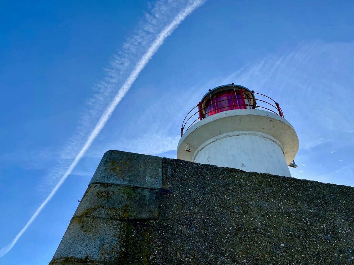
If you can’t be in West Cork – what’s the next best place? Why – County Wicklow of course! It’s also full of wonderful scenery and imbued with Irish history. That’s Wicklow Town, above, in Viking times: there had already been a Bronze Age settlement on this site. In the twelfth century the Normans arrived, led by Strongbow, who we have encountered before, and Black Castle was built (below). They were wild times, and the castle was attacked and destroyed completely in 1301 by local chieftains, notably O’Byrnes and O’Tooles. There were several subsequent revivals, and the gaunt remains we see today probably date from the 17th century.

While at this site, have a look down at the inlet on the coast to the south: that’s Travelahawk Beach, the scene of a bit of Wicklow history that’s sure to stick in the mind. It was there that St Patrick first landed in Ireland!

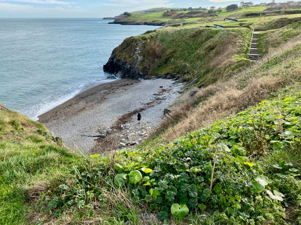
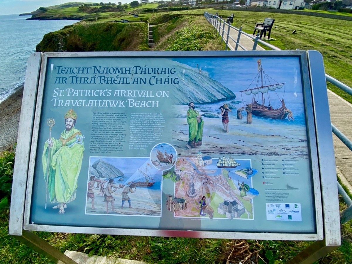
I have to admit that the beach is only one of several sites on the east coast that lays claim to this historic occasion, but I like the associated story of Travelahawk which tells how the local people, suspicious of this stranger, threw rocks at St Patrick and his crew. One of them hit the saint’s companion, and he lost his front teeth. He was known ever after as ‘Gubby’ or ‘Gap-toothed’ which is translated in Irish Mhantáin. Hence the old name for Wicklow is ‘Chill Mhantáin’ – the Church of Gubby. Today’s name for the town, Wicklow, is of Viking origin, and means ‘Bay of the Meadows’.

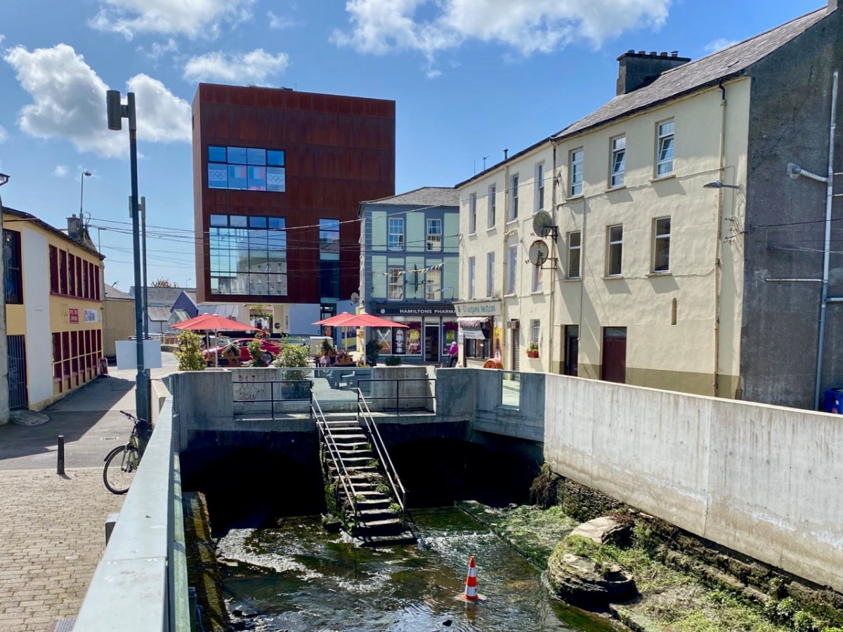
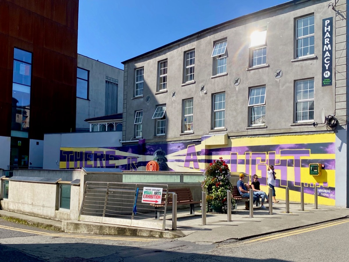
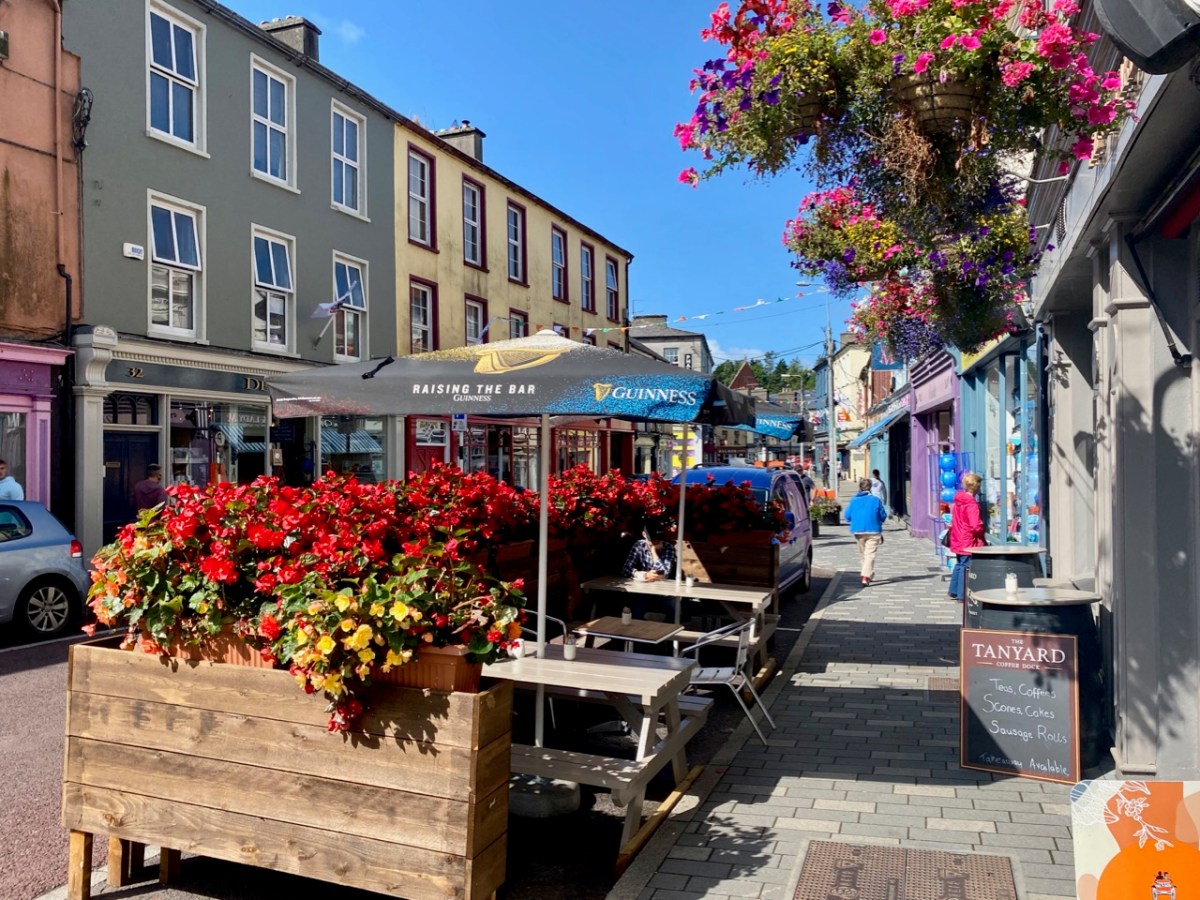
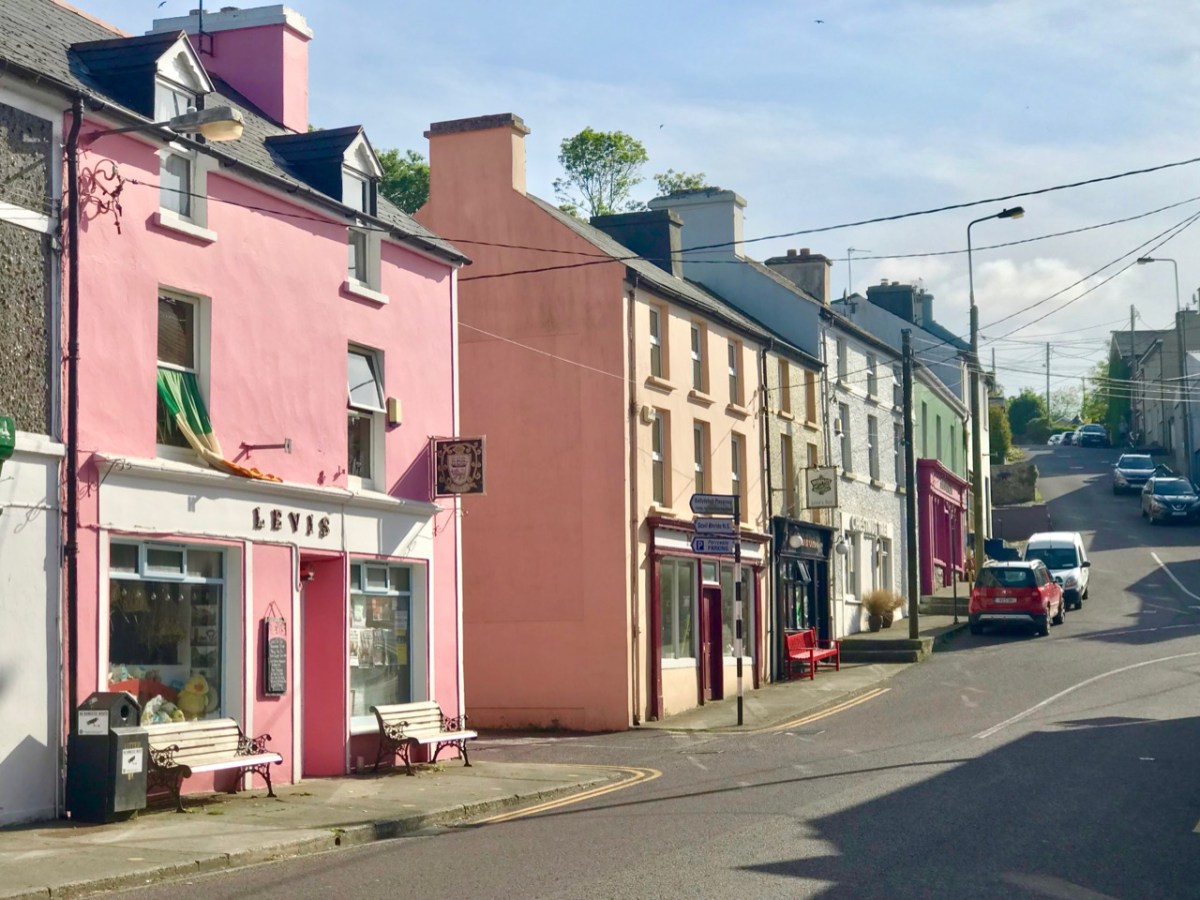
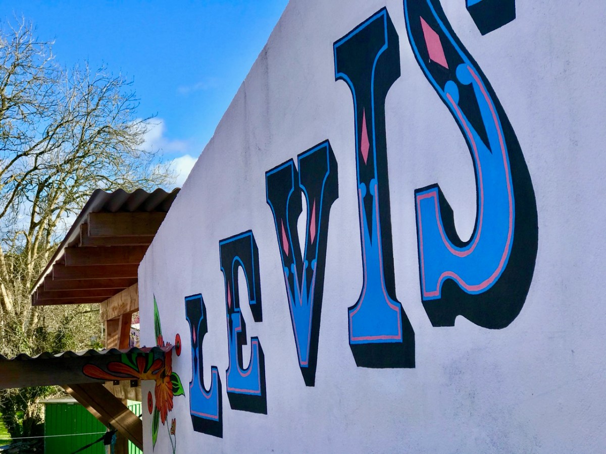
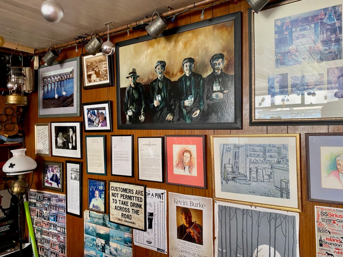
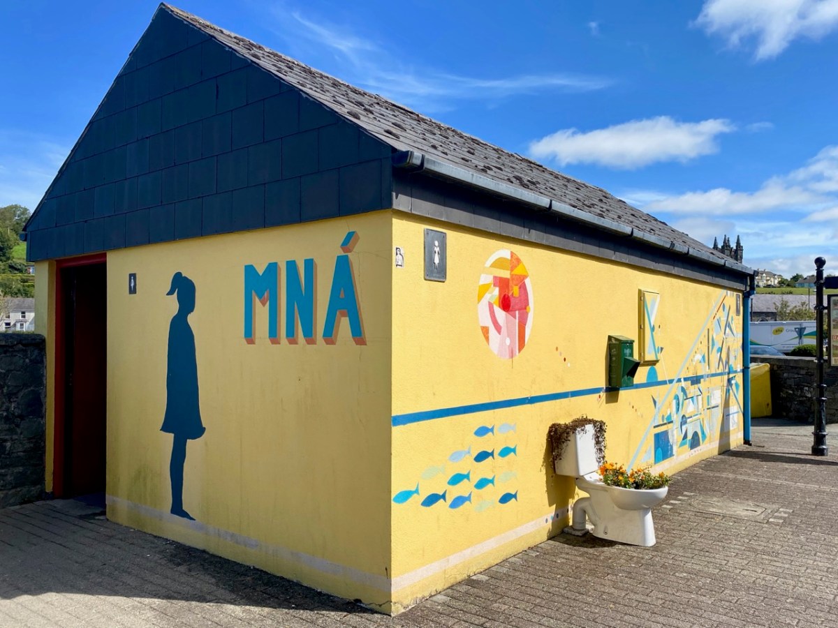
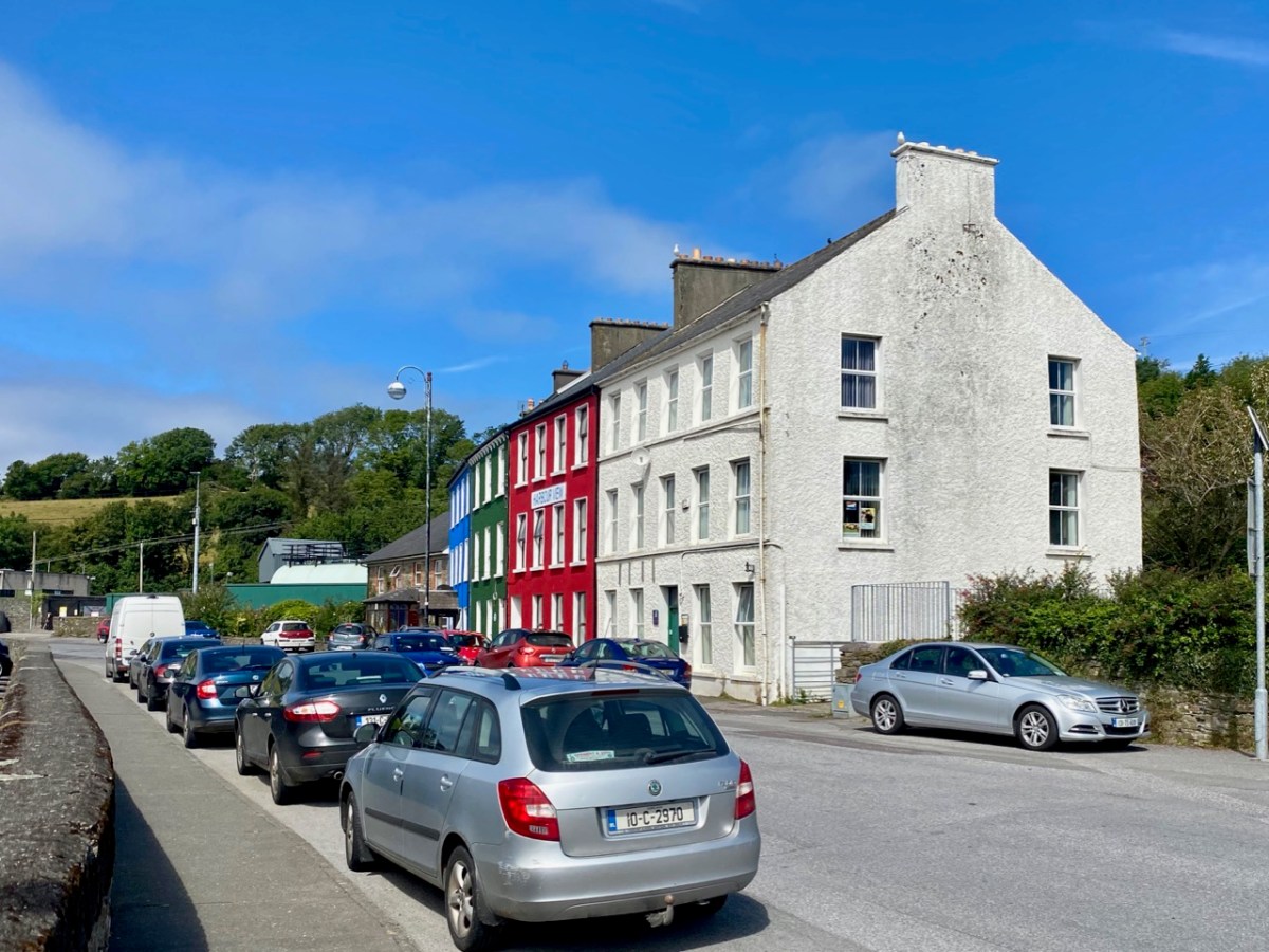
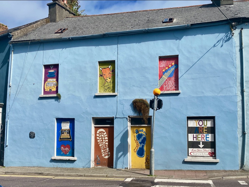
We popped over to Wicklow on a mild February day for a change of scene – and to absent ourselves from Nead an Iolair while some upgrading works were taking place. I was impressed: I had never explored the town before. Finola, however, was brought up in County Wicklow, and her impressions of the county town today were embellished with memories of times past. There’s much about the place that’s picturesque: I was taken with the number of painted murals about the place. The pier has, appropriately, a whole series of ships on the breakwater wall. There is an example, above . . .

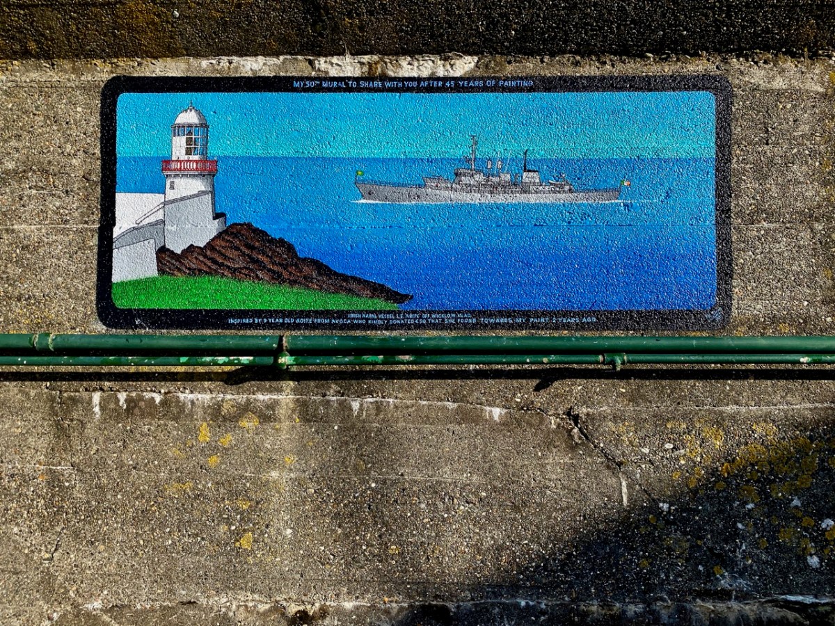
. . . And here’s another. In fact, this one is the 50th mural to be painted by Pat Davis, who is the local postman. Each one depicts a vessel which has visited the harbour. It’s a wonderful and colourful record of one aspect of the maritime town’s history.

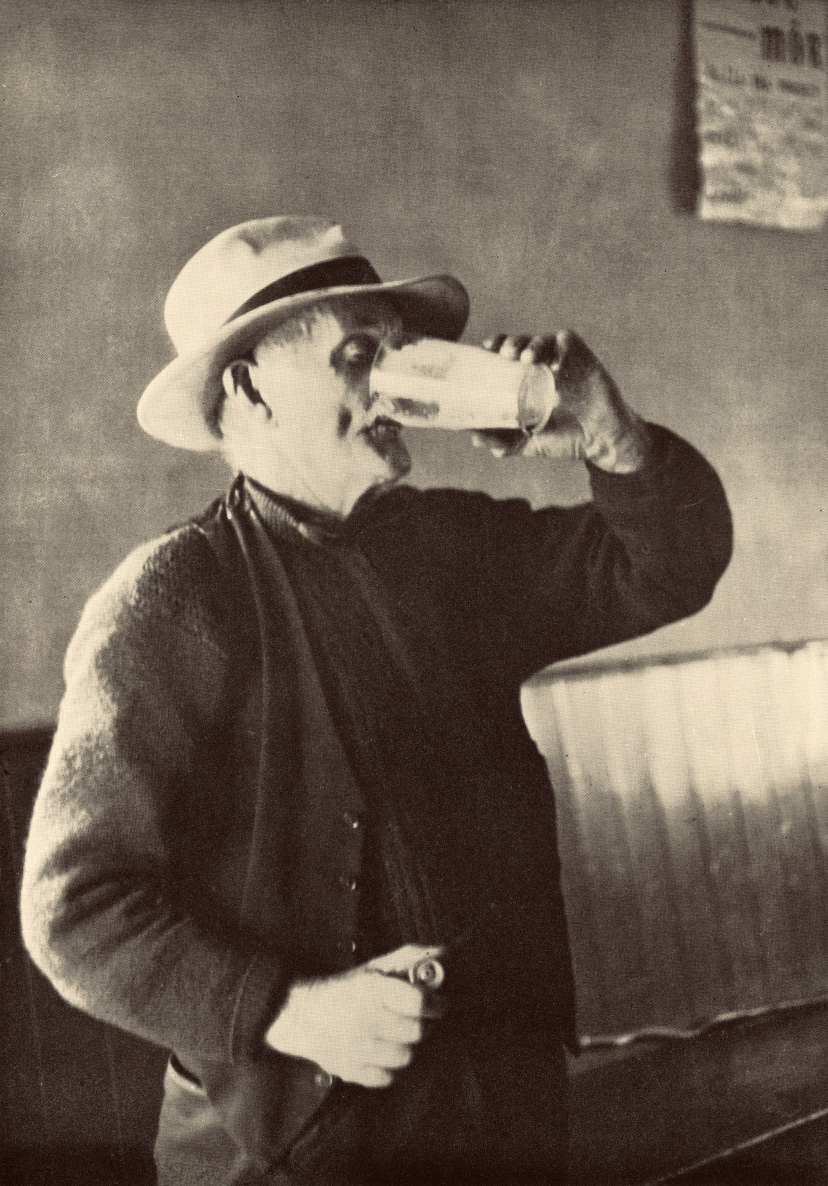
Here’s Pat at work. The image is courtesy of Ceaneacht O Hoctun, and appeared in the Wicklow People newspaper in 2020. Pat started painting the ships in the 1970s.

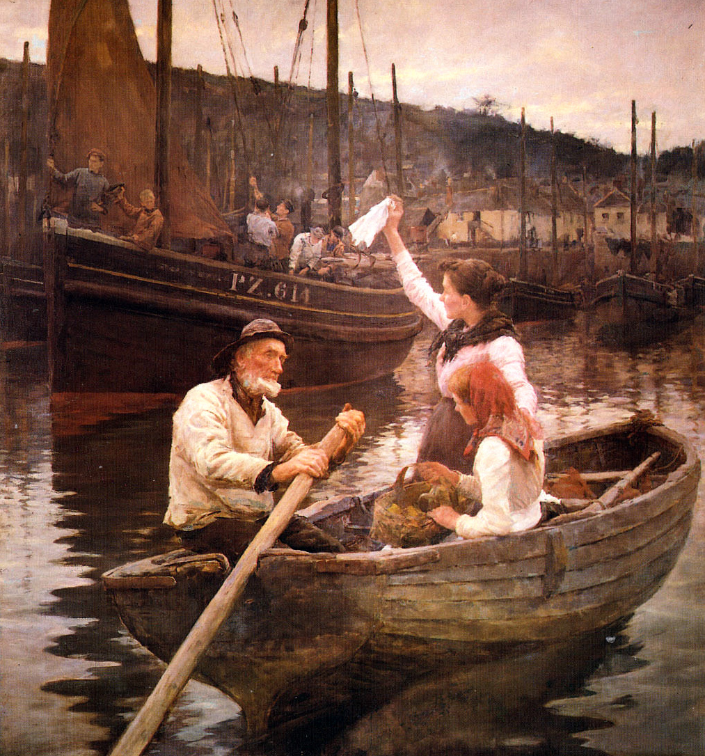
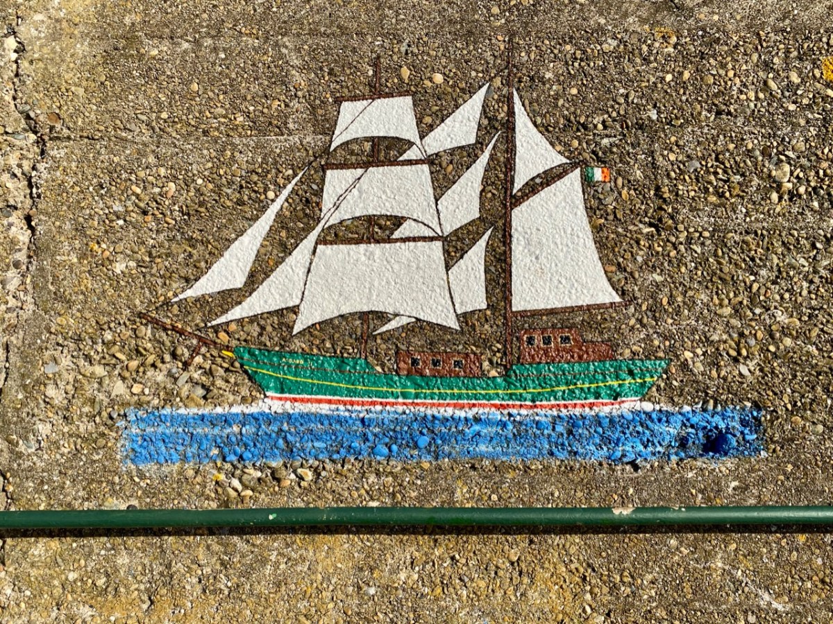
This one will be familiar to West Cork folk. It’s the Saoirse, a 42ft ketch built in Baltimore in 1922 for her designer, Conor O’Brien.

. . . This unique sailing ship was also a maritime inspiration for the new Ireland, uncertain of itself in an uncertain world. For this was Conor O’Brien’s characterful 42ft ketch Saoirse, which he designed himself, and with which – between 1923 and 1925 – he pioneered the round the world route south of the Great Capes, an ocean voyaging “first” which was forever written into world sailing history. . .

Afloat.ie

When O’Brien returned from his record-breaking voyage in 1925 he made his first landfall in Ireland in Wicklow Harbour. O’Brien designed a larger version of Saoirse to be the inter-islands communications vessel for the Falkland Islands: this – the Ilen – was also built in Baltimore. Back in 2015 we visited Oldcourt boatyard on the Ilen River to see the restoration of the larger ketch, which was then underway. That work was completed in 2018, and the same team embarked on a complete rebuilding of Saoirse, which had been wrecked in Jamaica in 1979. Our own West Cork photographer, Kevin O’Farrell has beautifully documented these projects at Oldcourt in his book, published in 2020.

The Asgard, above, was famous for gun-running at Howth by Irish Volunteers in 1914. Below is an Irish Navy vessel, LÉ Gráinne – a mine sweeper. Gráinne was a legendary princess who was promised to Fionn Mac Cumhail but ran away with his young follower Diarmuid. The ship was decommissioned in 1987.

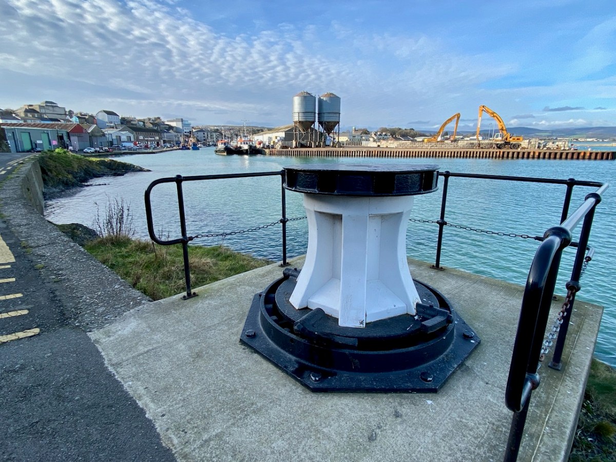
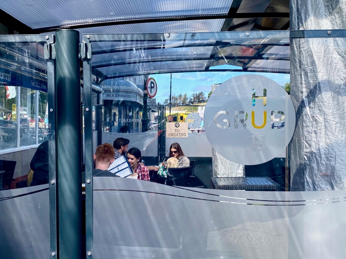
We found that the town of Wicklow has so many maritime associations – everywhere you look there are reminders. But also it’s a thriving commercial centre and we were impressed by what is on offer there: great eateries, and a most wonderful bookshop. I think there might be another post in the making . . .

The Táin, by Hutton and Campbell

The Táin Bó Cúailnge (pronounced approximately tawn bow coolna), known in English as The Cattle Raid of Cooley, is one of the great Irish Sagas. There are many translations and illustrated versions, perhaps the most famous being that of Thomas Kinsella, illustrated by Louis LeBrocquy, published by the Dolmen Press in 1969. Almost forgotten now is the version by Mary Ann Hutton, illustrated by John Campbell – but it deserves to be remembered as one of the masterpieces of the Irish literary and artistic revival.

First of all, what is The Táin? It’s an epic tale, first written in the 7th century but preserved in various versions from the 11th to the 14th centuries with many modifications, additions and changes along the way. It tells the story of Queen Maeve, jealous of her husband’s white-horned bull, who determines to acquire the even more prestigious Brown Bull of Cooley from Ulster, ignoring the foretelling of a dreadful outcome should she proceed. The Ulstermen are rendered unable to fight by a curse, leaving the great warrior, Cuchulain, to fight alone – which, by the way, is no bother to him, especially once his warp-spasm, or battle-rage, comes on him. However, in the end he fights and kills his old friend and foster-brother, Ferdia. There’s a lot more to it, of course, and much of the tale is told by Fergus, who relates the whole story of Cuchulain as a youth and his many heroic deeds.

And what about the author and illustrator, neither of them now a household name, although justly acclaimed in their day? Mary Ann Hutton was born in England but had strong Irish connections and moved to Belfast when she married. She was highly educated, with an academic knowledge of Old and Middle Irish and became a fluent Irish speaker. She was an ardent supporter of Patrick Pearse and the Gaelic League and became a central figure in the Gaelic revival. Her version of The Táin was the result of ten years of intense scholarship. It is not a translation, but rather a rendition in blank verse of the story informed by her research into its various versions and iterations. She uses her own spellings as well – Maev and Cucullin, for example. I couldn’t find a photograph of Mary Ann, but here is the illustrator, below.

The illustrator was John Patrick Campbell, although in the spirit of the Gaelic Revival, he styled himself as Seaghan McCathmhaoil. There’s a wonderful biographical and appreciative sketch in the Irish Arts Review of 1998 by Paul Larmour* and that’s where I learned that he was also based in Belfast, that he produced illustrations for the first edition of Hutton’s Táin in 1907, but they were not used until the second edition, in 1924, and then only a selection of his illustrations were included. That’s a pity, because according to Larmour, Campbell’s illustrations for the Táin were ‘among his most impressive.’ They certainly capture the romantic spirit of the Celtic Revival period, and show his mastery of line drawing and strong black and white palette. Larmour says, This Irish epic poem conjuring up the ring of battle and the revelry of kings gave full scope to Campbell’s by now increasingly powerful expression and individuality, the drawings showing great strength of composition, dramatic power, and richness of decoration. 

I couldn’t agree more, so here are a few selections from the text (it’s available online at good old archive.org) along with Campbell/MacCathmhaoil’s illustrations. The illustration above, captioned Maev’s Second Meeting with Fergus, is from Larmour’s article and is one of those that was, inexplicably, not eventually used in the book.

And Fergus

Came from the grave where five times five score years

He had been hidden. And a beautiful

And rich appearance was upon that warrior.

Brown hair was on him ; and a hooded layna

With red inweaving of red gold. A bratt

Of bright grass-green was round him ; and he wore

A golden-hilted sword, and round-toed shoes

Wrought all of bronze. And when that warrior, Fergus,

Perceived the holy men of Erin nigh him,

It was his wish to stand, and standing, tell

The Táin he had to tell.

This was the time wherein Maev called and spake

Unto her charioteer, and bade him catch

Her steeds and yoke her chariot, so that straightway

She might repair to speak with her own Druid

And ask for prophecy and knowledge. “ Wait

One while, O Queen,” the charioteer made answer,

“ That I may three times wheel the chariot round

Sunwise, to win a sign of luck and fortune.”

He wheeled the chariot sunwise, and then Maev

Rode to her Druid. When she reached the Druid,

She asked for prophecy and knowledge.

I see a man youthful and very fair,

Who will perform great deeds, and win his fill

Of hurts and wounds in his smooth fine-fair skin.

Upon his brow, which is a meeting-place

For victories, the hero’s light flames high.

Amidst each eye the seven dragon-gems

Of a pure hero-champion flame and burn.

Plain to perceive, his intellect is keen.

A red hooked layna folds him. His fresh face

Is beautiful and noble. He observes

Towards women courtesy and modesty.

Though a mere stripling, blooming, dainty-cheeked,

He in the battle shows a dragon’s form.

His fairness and his valour now resemble

Cucullin of Mweerhevna ; and though, truly,

Who this Cucullin of green Moy Mweerhevna

May be I know not, yet this thing I know

These hosts by him will all be very red.

Four little swords for feats of special skill

He carries in each hand : he will attain

To plying these upon the hosts : the hosts

Will flee from him on every road and way.

When, in addition to his spear and sword,

He brings his dread Gae Bulg, he plants his feet

On every slope and hill. Two spears project

O’er his bright chariot-wheels : he rides to battle.

Fury distorts him, battle-fury changes

That form which hitherto I have perceived.

He is Cucullin son of Sooaltim,

Hound of the Forge : he wends unto a battle.

Your hosts, now whole, he will hack down and fell.

He will compel your slain thickly to lie.

Strong men will leave their heads with him. This I,

Fedelm the Prophetess, will not conceal.

Red blood shall drip from the white skins of heroes

Lasting and long the memory shall be

Bodies shall there be torn, women shall wail,

Through deeds of that renowned Hound of the Forge,

Whom now, O Queen, I see.

The Prophetess

Ended her prophecy : and Maev rode back

From seeking-out of prophecy and knowledge.

Said Laeg, “ here comes a chariot-rider towards us.”

“ Describe him, then, good Laeg,” Cucullin said;

And Laeg described him thus:

“ Larger,” said he,

Than is some heathy knoll, rising alone

From out a grassy level, seems to me

His noble chariot. Larger than the tree,

Reverenced and old, that stands upon the green

Of some king’s doon, appears to me the hair

That curls and waves in golden bright abundance

About that warrior’s head. A crimson fooan,

Fringed and embroidered, folds him round : a spike

Of graven gold secures it. In his hand

He holds a wide, red-flaming spear. A shield,

Carven, and compassed by a ridge of gold,

He has ; and a long sword-sheath, which for size

Is like the rudder of some kingly vessel,

Reposes on the huge and seated thighs

Of that great, haughty warrior, planted there

’Midst of his chariot.”

Then Cucullin cried :

“ Oh, welcome, ever welcome is the coming

Of that beloved guest ! I know that guest.

It is my guardian and my fosterer,

My gentle, noble Fergus, who comes there.”

Cucullin saw his weapon, red with blood,

Lying beside Faerdeeah ; and he said:

“ O my Faerdeeah, sorrowful the fate !

I, with my merciless weapon still unwashed :

Thou, pale in death upon a couch of gore.

Sad—what has come of our meeting here

I, wounded, sinking, covered with rough gore:

Thou, altogether dead ! Oh, dear to me

The friend to whom I have served a draught of blood!”

*John Campbell (1883-1962) An Artist Of The Irish Revival by Paul Larmour, 1998 Volume: 14, Pages: 62 – 73

Chasing Steeples!

I can’t resist a good Irish story . . . I look out for them wherever we go. Our latest adventure was over in the northern part of County Cork, searching out a number of holy wells and anything related to them: we were led by Amanda Clarke: look at her website here. Regular readers will know that we often get together with Amanda and Peter to share our mutual interests in the Irish landscape. On this most recent expedition our path took us through Buttevant, and specifically to St John’s C of I church there, where Finola was keen to inspect the stained glass windows. The present church was built in 1826, and replaced an older one, established in the late 1600s.

As you can see, it has a tower with a fine, elegant spire. I was fascinated to read that the predecassor of this church is credited with the historical significance of having ‘given birth’ to the Steeplechase horse race.

. . . The term ‘steeplechase’ actually originated in a horse race first held in Ireland in the 18th century. As the name might suggest, that very first race took place in 1752 between two steeples in rural county Cork in the south of Ireland. At that time, church steeples were among the tallest buildings in the landscape. On that night, Cornelius O’Callaghan and Edmund Blake were at dinner at Buttevant Castle, having a good time. They made a bet between themselves to race from the steeple of Saint John’s Church in Buttevant to that of Saint Mary’s Church in the town of Doneraile . . .

.europeana.eu

Sadly, the Castle at Buttevant is no longer habitable. It was built around 1200 by Philip and William de Barry, on land seized from the Gaelic O’Donegan’s. The poet Edmund Spenser (1553 – 1599) lived in the nearby castle of Kilcolman for many years, and wrote his poem The Faerie Queene there. He also mentions Buttevant Castle in his writings:

“Old father Mole, (Mole hight that mountain grey
That walls the Northside of Armulla dale)
He had a daughter fresh as floure of May,

VVhich gaue that name vnto that pleasant vale;
Mulla the daughter of old Mole, so hight
The Nimph, which of that water course has charge,
That springing out of Mole, doth run downe right
to Butteuant where spreading forth at large,
It giueth name vnto that auncient Cittie,
VVhich Kilnemullah cleped is of old:
VVhose ragged ruines breed great ruth and pittie,
To travallers, which it from far behold”

Spenser is supposed to have derived the names ‘Mole’ and ‘Armulla’ from Kilnemulla or, more correctly Cell na mullach, an early name for Buttevant. It is possible that the castle here fell victim to the 20th century Irish Civil War, although I cannot find any detailed information on this. Accounts generally suggest that the building was in use until the 1920s and another reference states that there was a significant fire which destroyed the interior in 1936. Today, it is a windowless ruin which is not accessible to the public.

I’m sure you are all anxious to get back to the story of that first Steeplechase – and you want to know who won? When taking in any Irish tale you have to be patient . . . We simple don’t know who won! It’s not recorded anywhere . . . The account continues:

. . .The distance was around 4 miles, crossing countryside and rivers. The winner would be the first to touch the base of the steeple in Doneraile. The prize? More than 600 gallons of port. Sadly, history has not recorded who actually won the race. But that race has gone down in history, with steeplechase races becoming a tradition . . .

.europeana.eu

Obviously, we had to continue our expedition with a visit to Doneraile, to view the finishing post. That’s St Mary’s Church, above. The present building does not have a spire: I would have thought that such a feature would be essential if you were looking out for it from a distance of four miles, even with fairly flat countryside in between. However, I have now learned that the term ‘steeple’ correctly refers either to a simple church tower, or a church tower with a spire on it. Have a look at the terrain from a birds’ eye view:

Here I have copied extracts from the first edition 6″ Ordnance Survey map, showing the terrain in more detail around the start and finish points as it was noted in the early nineteenth century:

On this occasion we didn’t have time to explore the route itself: I wonder if anyone else has? Is it significant that the townland which surrounds Doneraile Church is known as Horseclose?

In the present day, of course, Steeplechasing has an equine life of its own. Supposedly, the very first recognised English National Steeplechase took place in March 1830. In 1839, the British Grand National Race at Aintree was established, a race that is still run today over roughly the same distance of around 4 miles. Here’s a poster for the Irish equivalent – at Fairyhouse – on Easter Monday 1916, a very significant date in the Irish calendar . . .

While on the subject of the Aintree event, we must mention the most famous racehorse of all time (probably) who holds the record for winning the Grand National Steeplechase thrice – in 1973, 1974, and 1977 and coming second in 1975 and 1976: Red Rum.

. . . Red Rum was bred at Rossenarra stud in Kells, County Kilkenny, Ireland, by Martyn McEnery. Following a canter at Aintree Racecourse the day before the 1978 Grand National he was retired. The news of Red Rum’s retirement was the lead story on that night’s 9 O’Clock News on the BBC and was also front page news of the following morning’s newspapers. Red Rum had become a national celebrity, opening supermarkets and annually leading the Grand National parade for many further years. His likeness graced playing cards, mugs, posters, models, paintings, plates and jigsaw puzzles. Several books have been written about Red Rum, The horse helped launch the Steeplechase rollercoaster at Blackpool Pleasure Beach in 1977 . . .

Wikipedia

Yes, this is it: the Steeplechase Rollercoaster! You can join in the full experience here. Hopefully my account has enlivened your day: I’m sure there are many of you out there who are familiar with this tale and can, perhaps, add to it? I’ll finish with a view over Buttevant taken on our journey – an atmospheric winter morning.

With thanks to The Guardian for the header pic of the Aintree Grand National

West Cork Villages and Towns – Skibbereen

It was an ‘odd’ Olympic year – 2021. Firmly etched in my mind is the knowledge that years in which Olympic Games are held – like leap years – are divisible by 4! This one was different, because of Covid. But that didn’t prevent Ireland producing its heroes: gold for rowing and boxing, and bronze, also for rowing and boxing: a total of 8 sports heroes bringing medals home. If you will forgive the pun, the small country of Ireland punched well above its weight! All the rowers trained at the Skibbereen Rowing Club in West Cork, under the expert eye of their coach Dominic Casey. No surprise, then, that the town was in celebratory mood for weeks after the event, as you can see from many of my photographs, taken around the town at the end of August.

The town, from its situation in a wild, unenclosed part of the country, has frequently been the rendezvous of disaffected parties, but it has been much improved of late years, and is now a very flourishing place. It is situated on the southern bank of the river Ilen, and comprises seven streets; that part which extends into the parish of Abbeystrowry is called Bridgetown, and consists of three streets, one of which has been recently formed. The number of houses in the whole town is 1014, many of which, in the eastern part and in the parish of Creagh, are large and well built: the approaches have been much improved by the formation of new lines of road at each extremity . . .

LEWIS TOPOGRAPHICAL DICTIONARY OF IRELAND 1837

It’s interesting that Lewis – in 1837 – describes the number of houses as just over a thousand. He also states elsewhere that there were 4,429 inhabitants in 1691: in the 2011 census the town recorded a population of 2,568.

The first edition of the Ordnance Survey 6″ map was produced around 1840, just after the Lewis Topographical Dictionary was published. From the extract above, the layout of the town we know today had been broadly established by then. Compare this to today’s OS map (below) and the annotated aerial view.

There are a few theories as to the earliest origins of the town. Oft quoted is the story of the survivors from the sacking of Baltimore by Barbary Pirates in 1631 having moved upriver to found, or expand, the settlement that is now Skibbereen. It is likely that there was already a community on this part of the river, which was tidal and probably easily navigable up to its sheltered reaches at this point: at one time there were no less than five quays, warehouses and a Customs House within the town – this post will tell you more.

Skibbereen today is defined by its river – as it always has been. The waterside deserves a bit more attention – and is being opened up a little in some of the new civic improvement schemes that have been enabled by major flood relief works in the town. There are many opportunities yet to be explored.

All towns evolve and, hopefully, move into the future: Skibbereen – we’ll be keeping an eye on you! But it’s a great town already: it has the busiest market in West Cork on a Saturday; lively shopping streets; easy (and free) parking – and a very healthy ‘pavement cafe’ culture that has grown up during the pandemic, and is likely to continue to flourish. Let’s walk the streets and see the town as its best in the late summer sunshine . . .

Here at Roaringwater Journal we will always sing the praises of this town, and it has been the subject of a good deal of our historical research and writing. Have a look at our posts on Agnes Clerke, Ireland’s first and foremost female astronomer;  Jeremiah O’Donovan Rossa, the famed nationalist and Fenian: Uillinn – one of Ireland’s most innovative art galleries – here, here and here. We also must not forget that Skibbereen was at one time an important part of Ireland’s railway network: you could travel to and from Cork and Baltimore, and it was a terminus for the narrow gauge railway that trundled off to Schull, and whose loss is now much mourned.

I hope my post inspires you to explore this prominent West Cork town, if you haven’t already done so. It has historic foundations – too numerous to list in this one, short article. Choose a sunny afternoon – or go there to shelter from the infrequent showers. Whatever the day, make the Skibbereen Heritage Centre your starting point: you will find a wealth of information which will help to guide you on your way. The building itself is a piece of history: it used to be Skibbereen’s gas works!

The town name was familiar to me long before I settled in Ireland a decade ago. I lived in the fishing village of Newlyn, Cornwall, for many years and got to know the history of the artists’ colony in West Penwith, centred on that town and St Ives. One artist – Stanhope Alexander Forbes – was known as ‘The Father of the Newlyn School of Artists’ – he was Irish born, and lived from 1857 to 1947. I vividly remember one of his works, displayed in the Penlee Gallery in Penzance. It shows fishermen leaving Newlyn to follow the shoals of herring and pilchards to the waters of Roaringwater Bay. The title of that picture? Goodbye – Off To Skibbereen!

Previous posts in this series:

Bantry

Schull

Pints and Pipes

Today there is a story to tell, with lots of connections to the West of Ireland – and our own Ballydehob! That’s Levis’s Corner Bar, below, one of the village’s fine hostelries: try them all if you visit. Levis’s is known for its musical events but also for its traditional appearance inside. Look at the photo of the Irish music session (you’ll see me bottom left playing concertina) – that was taken a few years ago, before Covid; we are still waiting for those good times to return. On the wall behind the players you can catch a glimpse of a painting of men with pints and pipes.

There’s a better view of the painting, above. When I first saw it – very many years ago now – I knew immediately that it was based on a photograph that had been taken by Tómás Ó Muicheartaigh – an Irish cultural hero who spent most of his life documenting traditional life, mainly in the western counties. He lived through the founding of the Irish Free State and was an enthusiastic proponent of the Irish language. This sketch portrait of him is by Seán O’Sullivan, a friend and compatriot:

Way back in the 1970s my then wife and I ran a small bookshop in a Devon market town, specialising in folklore and traditional life. It had a substantial section on Ireland, and Irish culture. We stocked a recently-published volume (1970) celebrating the work of Ó Muicheartaigh, and I very soon had to sell myself a copy, as it is a superb record of mainly rural life in Ireland during the early twentieth century. I have it to this day – of course.

There is the photograph in the book, above. It is captioned Piontí Agus Píopaí – Pints and Pipes, hence the title of this post. Below it is a photograph of two Aran Island fishermen relaxing on the rocks while waiting for the weather to improve before they set out to sea. But there is more – a list of the photographs with some expanded captions at the end of the book. The whole book is written in Irish so I have recruited Finola’s help in providing a transcription for the Pints and Pipes – here it is, in the original and then translated:

Piontí Agus Píopaí

Ceathrar pinsinéirí ag baint spraoi as lá an phinsin le píopa agus le pionta Pórtair. B’fhéidir nach mbeadh pionta go hAoine arís acu. A saol ar fad tugtha ar an bhfarraige acu seo. Féach, cé gur istigh ón ngaoth agus ón aimsir atá an ceathrar go bhfuill an cobhar ar píopa gach duine acu. Is mar chosaint are an ngaoth a bhíodh an cobhar agus chun tobac a spáráil, ach ní bhainfí an cobhar anuas den phíopa instigh ná amuigh

Pints and Pipes

Four pensioners enjoying pension day with pipes and pints of porter. They might not have another pint until Friday. They’ve spent their whole lives on the sea. Look, even though the four of them are inside, away from the wind and the weather, the cover is still on each of their pipes. The covers are to protect the tobacco from the wind and to make it last longer and they aren’t taken off inside nor out

So, a fascinating piece of social history. Apart from conjecturing a date for the photo, I didn’t have much information to add when I first published it on Roaringwater Journal in February 2016. Because of the juxtaposition in the book, I guessed that the picture might have been taken around 1938, when Tómás is known to have visited and photographed the Aran Islands (and would have travelled through Kerry to get there). Here is one of his views of a Curragh being launched on Inis Meáin at this time (Dúchas):

I didn’t expect my story of Pints and Pipes to advance beyond this. But, last week, I received a message from a reader who had seen the photograph in Roaringwater Journal and was able to provide very significant additional information!

. . . My name is Joanne and I live in London. My dad found a photo on your website from a blog dated 14 Feb 2016 entitled Images – it is the Tomás Ó Muircheartaigh photograph of the 4 men drinking in a bar. My great-grandad is the man on the far left. It was great to find the photo as it is much better quality than the copy we have, unfortunately my nan had an original postcard but it was borrowed by a representative of Guinness many years ago and never returned! 

Joanne, September 2021

Joanne has proved to be a wonderful contact, and I am so grateful to her for providing information and allowing me to use it here. In summary:

. . . My great-grandad’s name was Seán Mac Gearailt but he was known as Skip.  He was from Baile Loisce in Kerry.  The photo was taken in a bar which was then called Johnny Frank’s in Baile na nGall (Ballydavid) but I think is now called Tigh TP.  I can see from the photos that have been digitalised Tomás Ó Muircheartaigh took a lot of photographs at Baile na nGall. Pints and Pipes isn’t in that digitalised collection . . .

. . . I gave my dad a call tonight and discussed the extract with him; he lived with his grandparents as a child in the late 1940’s/50’s and visited regularly so knows a lot about Skip. Dad remembers him collecting his pension on a Friday at Ballydavid and having a beer in Johnny Frank’s before going home to hand over the rest of the pension to his wife – so the extract in the book is correct on that. Skip was primarily a farmer but dad says he did go out fishing in a curragh at night. Dad remembers his nan being worried for him when he was out at sea. Dad doesn’t know the name of the other men in the photograph. Skip was friends with two Moriarty brothers (from Gallarus) – so dad thinks maybe the two men in the middle are them but he can’t know that for sure . . .

Joanne, September 2021

Wow! You can imagine how delighted I was to receive that information. But there’s more. I managed to find some early photos of Ballydavid (Baile na nGall in Irish), which is part of the Corca Dhuibhne Gaeltacht area. In fact we have been there – when we took the Irish language immersion course two years ago.

We didn’t photograph the Ballydavid bar, Johnny Frank’s at that time, but here (above) is a view of it from Wiki Commons. Also, to help set the scene, is a little piece online which features the bar, and weaves a tale…

Regular readers will know my interest in the Napoleonic-era signal towers which dot the coast of Ireland, all built in the early years of the 19th century. There was one at Ballydavid Head, drawn (above) by George Victor Du Noyer as he passed by on one of his geological expeditions on 12 June 1856. We didn’t climb the Head when we visited, but we viewed it from a distance (below). The tower is now a ruin.

We have travelled far, far away from Ballydehob where, in some ways, the weaving of this tale began. We had better return. Here’s a reminder of that painted image of the ‘Pints and Pipes’ photograph in Levis’s Corner Bar. Compare it to the header photograph of this post.

It is so obviously based on the Tómás Ó Muicheartaigh portrait, yet there are some differences. The pipes of the two men in the middle are missing! I can’t tell you why this is the case, but I can tell you now who produced the painting, as I was given a valuable link by Joe O’Leary, landlord of Levis’s (which his been in his family for some generations – but that is another story). The painting has a signature:

Paul Klee was, of course, a well known Swiss-born German artist who lived between 1879 and 1940: he had no connection whatsoever with Ireland! Nor did he have anything to do with this painting, which was in fact from the brush of Raymond Klee, born in Barry, South Wales, in 1925 but living out much of his later life in Bantry, West Cork, until his death there in 2013. During the 1950s and 60s he lived in the Montmatre artists’ quarter in Paris, and is said to have been a close friend of Pablo Picasso. There can be no doubt that the Levis’s painting is his work, as I came across a short video, taken late in his life, in his Ballylickey Gallery. I managed to ‘freeze’ the fast-moving film at this point:

There, you can see the artist himself on the left, and over on the right is the partial image of a huge painting propped up: it’s another version of Pints and Pipes… I wonder what became of it? Or, indeed, of much of the large body of work which he left behind in Ballylickey? You will find examples on the internet, including several from the catalogues of art dealers. He doesn’t seem to have exhibited a particularly consistent style and – by repute – ‘churned out’ some of his works very quickly but – it has to be said – to a willing audience. During tours of the United States he would paint large canvases in front of a crowd – perhaps 200 spectators – and produce work which he immediately sold to the highest bidder in the room! I have selected a couple of images of paintings which might be of interest to my audience. The upper painting is titled The Local, while the lower one is Sky Over Inchydoney.

I must end my tale. Here is a little bonus, especially for my correspondent Joanne – and she won’t see this until she reads this post for the first time. We were leafing through the Tómás Ó Muicheartaigh book; it’s hard to put down – over 300 seminal photographs of Irish life. Finola’s eagle eye picked out one which I had never noticed before – and here it is: Seán Mac Gearailt, Joanne’s Great Grandfather, Skip. The caption underneath is apt. Many thanks, Joanne, for setting me on this journey…

GO mBEIRIMID BEO AR AN AM SEO ARÍS . . .

Thanks go to my very good friend Oliver Nares, who worked on the photographs of Pints and Pipes and Skip for me, and greatly improved their quality. Have look at his own site

West Cork Villages and Towns – Bantry

. . . The town is situated at the northern extremity of the bay to which it gives its name, in a small valley encircled by lofty mountains, which attracting the clouds in their passage over the Atlantic, involve it in almost continual rains. The streets are indifferently paved, and not lighted; the inhabitants are supplied with water from numerous springs. The approaches are steep and incommodious, and are lined with cabins of very inferior description. Little improvement has been made in the town, except by the erection of some very extensive stores by Mr O’Connell and Mr Corkery, merchants of the place, and the enlargement of the principal hotel, which now affords ample accommodation to the numerous tourists who, during the summer season, frequent the place on their way to Glengariff and the lakes . . .

Lewis Topographical Dictionary of Ireland 1837

. . . This bay was known to the ancients by the name of Inber Sceine. It is a noble sheet of water, landlocked by beautiful mountains. The scenery is picturesque, bold, and grand, and equals, if it yet not surpass, the best to be found in these kingdoms . . .


Early Irish History and Antiquities and the History of West Cork
W O’Halloran 1916

Bantry . . . a miserable poor place, hardly worth the name of a town, consisting of seven or eight small houses, and some mean little cottages . . .

Jacobite army officer and author John Stevens, 1689

Well, here we have some contrasting descriptions of the town of Bantry, the earliest (above) dating from over 330 years ago! That one is a bit unfair, in truth, as it seems to be almost an ‘aside’ within Stevens’ ill-tempered account of his own involvement in the Williamite War (1689 – 1691). Bantry was a landing place for the Jacobite army which then marched through Cork and engaged in the Battles of the Boyne and Aughrim, and the Siege of Limerick (which is celebrated to this day in a traditional country dance!). None of this needs to detain us further from pursuing our contemporary account of Bantry town.

Bantry in the time of Covid . . . As with our exploration of Schull, the first in this series, we capture a moment in time: all the photographs are taken in one summer’s day, and show the norms of daily life. We deliberately did not choose Market Day (every Friday throughout the year), as on that day the population of the place appears to double in size. This is an average weekday and it is busy enough, with holiday makers swelling the ranks and helping to populate the many outdoor facilities.

Bantry has made its mark in the history of Ireland’s independence. An attempted landing by the French Fleet in Bantry Bay on 22 December 1796 was partly precipitated by Theobald Wolfe Tone – one of the founding members of the United Irishmen. The mission was unsuccessful due to severe gales. A political cartoon of the time (below) satirises the venture:

. . . On the French expedition to Bantry Bay, at the end of 1796: Pitt, Dundas, Grenville, and Windham are the four winds which blow up the storm to destroy the invaders. FFox, as the carved figure at the head of the Revolution, is represented as influencing the United Irishmen. The crew of the jolly-boat are Sheridan, Liberty Hall, Erskine, M A Taylor, and Thelwall, who, it is insinuated, were all approvers, at least, of the Irish rebellion . . .

Historical and Descriptive Account of the Caricatures of James Gillray, 1851

Wolfe Tone’s statue looks down over the square which bears his name in Bantry today: it was sculpted by Jeanne Rynhart in 2000. Close by is an anchor from the ‘French Armada’ found off Whiddy Island. The square was known formerly as Egerton Square – named after a descendant of the Earls of Bantry (have a look at this post). In 1899 the Irish Nationalist MP James Gilhooly oversaw the renaming. Also on the present-day square (much of which is on reclaimed land) is the notable statue of Saint Brendan by Imogen Stuart.

The aerial image, above, shows how the town has evolved along the original river valley. Comparing this view with the earliest 6″ OS map – dating from around 1840 (below – upper) – and the 25″ OS edition c1900 (below, lower), you can see clearly how the Square has encroached on the original natural harbour. You can also see that the terminus of the Cork, Bandon and South Coast Railway was carried on an extended pier to the west, enabling goods to be shipped in and out of the town. Interestingly, prior to the railway’s arrival in 1892, and continuing into the early 20th century, there was a regular steamship service from Bantry to Castletownbere on the Beara Peninsula. This also served Glengarriff and Adrigole.

In spite of local opposition the railway was closed on 1 April 1961, and the station building was demolished. We do fortunately still have some vestiges of the line clearly visible in the town.

I have only touched on the briefest aspects of the history of this significant West Cork town. There is considerably more recorded in a recent opus compiled by distinguished historian and international scholar Colum Hourihane, who hales from Bantry. We were recently at the launch of his latest book Bantry Through the Centuries, Bantry Historical Press, 2021 and were treated to an illustrated talk, given by the author. Colum is at pains to point out that this is not a general history of Bantry, but that its core is the streets of the town” . . . It’s an effort to understand how the town developed over the centuries in relation to its people . . . “ The book is a first-class resource: a 490-page review of local lore and garnered knowledge illustrated with almost 140 additional pages of historic photographs. This must surely be the most comprehensive volume ever published on this town.

Let’s finish with some more of the photos taken on our day’s exploration: an attempt to capture the essence of this significant West Cork settlement. I hope it will encourage you to visit, if you don’t already know it.

You can read much more about Bantry in Roaringwater Journal. Here are just a few links:

The Golden Hour

Masters of Tradition Festival

Ireland’s First Inhabitants