Kowloon Bridge Shipwreck

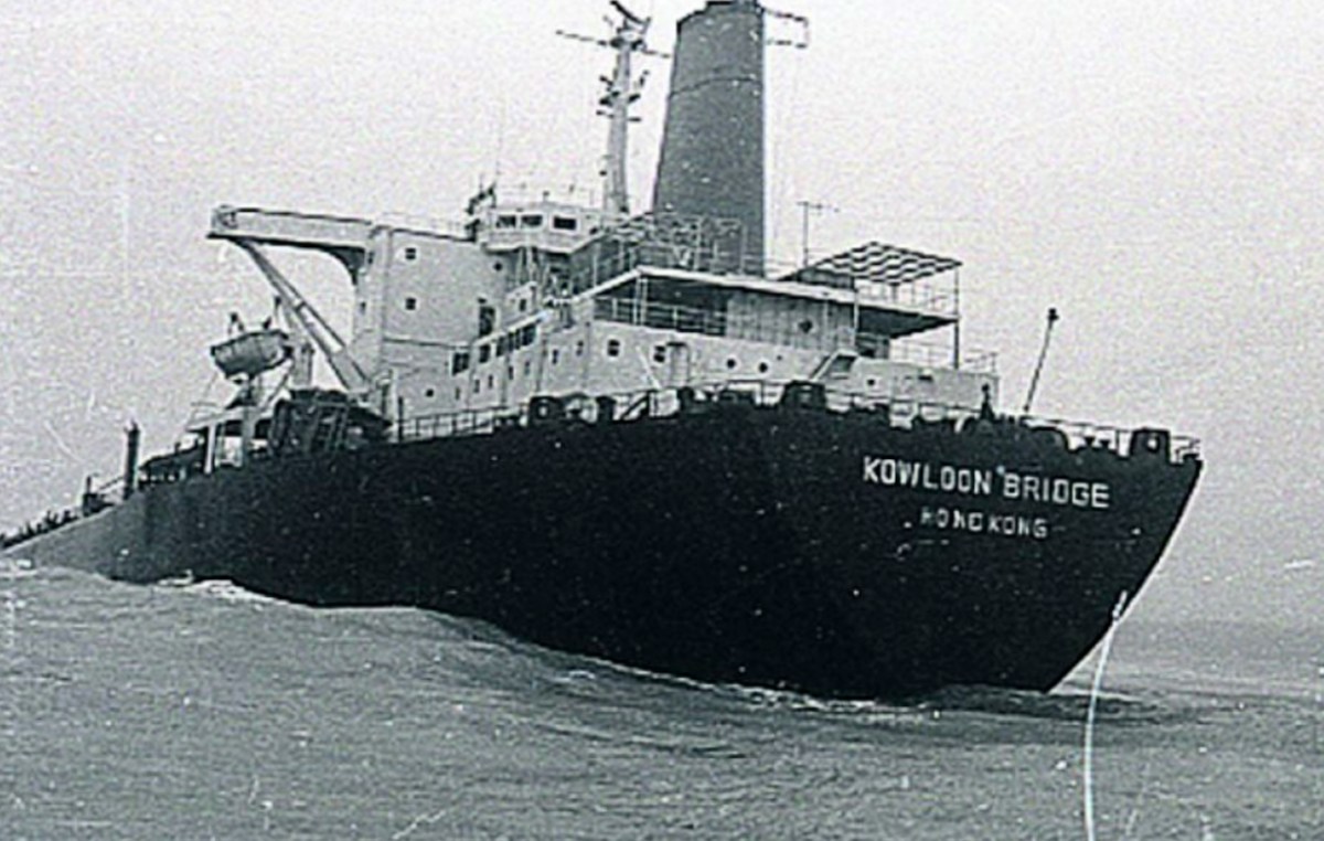
We’re going back a few years to look at a piece of West Cork history: a shipwreck. The ship is the Kowloon Bridge, a Bridge class OBO (oil/bulk/ore) combination carrier built by Swan Hunter in 1973. She ended her days on the Stags Rocks, beside Toe Head in West Cork in 1986 (above – image courtesy of Irish Examiner). At the time, this was said to be ‘one of the largest wrecks in maritime history’.

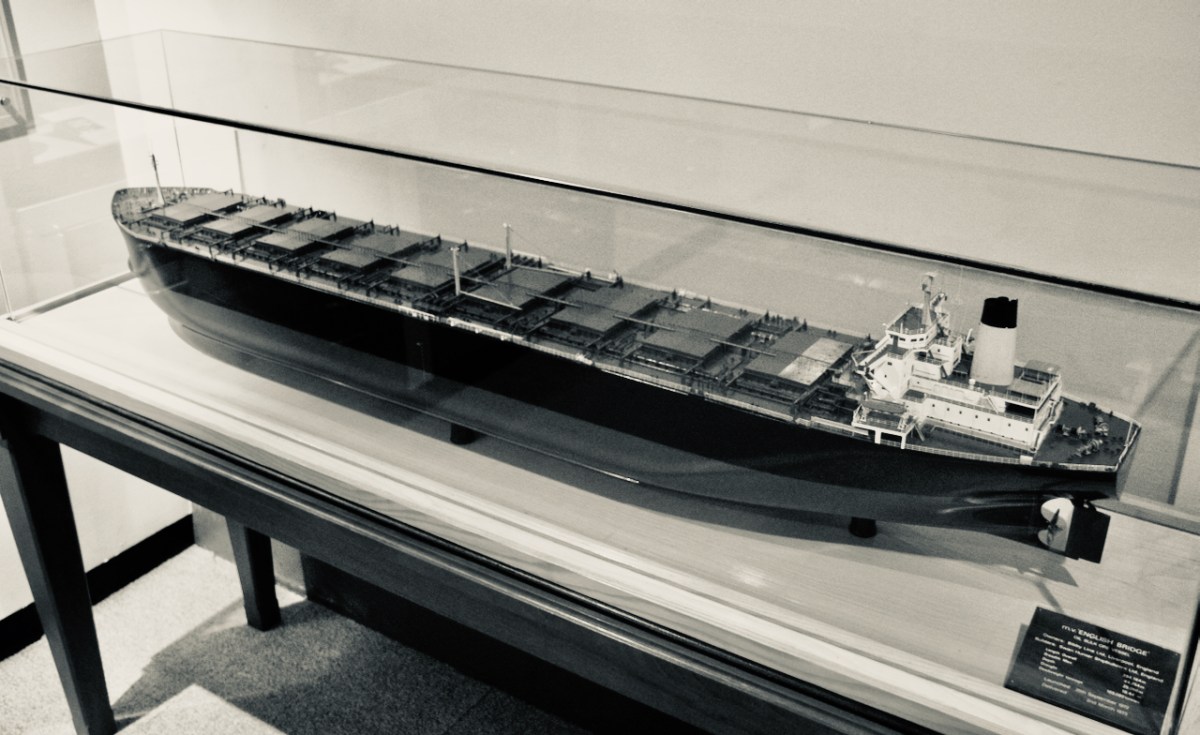
A Bridge Class model (above – photo courtesy www.mikepeel.net). Six of these ships were built by Swan Hunter at Haverton Hill on the River Tees in County Durham, UK, between 1971 and 1976. Originally named English Bridge and subsequently – passing through various ownerships – this 54,000 tonne vessel was renamed Worcestershire; Sunshine; MurcurioCrystal Transporter; and finally Kowloon Bridge. I’m tempted to think of the old folk belief that says changing the name of a boat is unlucky! 

. . . Perhaps the most famous maritime superstition of them all is the idea that changing the name of a ship is bad luck. Legend has it that Poseidon, the Greek god of the sea, has a ledger in which he keeps track of the name of every sea-going vessel. Changing the name is seen as a challenge and as an attempt to try and out-smart him, which would incur his wrath. To avoid any bad luck, the original name must first be purged from Poseidon’s book in a de-naming ceremony, before the new one is adopted . . .

National maritime Museum, Cornwall

There she is, in her original incarnation and unladen (image courtesy of Tony Ecclestone, Swan Hunter). As you can see, a massive vessel. Her length was 295 metres and her beam 44.3 metres. She had a draft of 18.5 metres. In November 1986 the Kowloon Bridge – which she had then become – departed Sept-Îles, Quebec, bound for the River Clyde in Scotland. Her cargo was 160,000 tonnes of ‘marble sized’ iron ore pellets and crude oil.

The Atlantic crossing was particularly rough-going, and the vessel sustained some superficial damage. The decision (a fateful one) was taken to head for the nearest shelter on the east side of the ocean: the deepwater Bantry Bay, off West Cork’s coast. A Lloyds’ survey there showed that she had suffered ‘routine heavy weather damage’ and recommended that she remained anchored in Bantry Bay while temporary repairs were undertaken. Here’s a view of Bantry’s waterside in more benign days: Roaringwater Journal has reviewed the town in some detail.

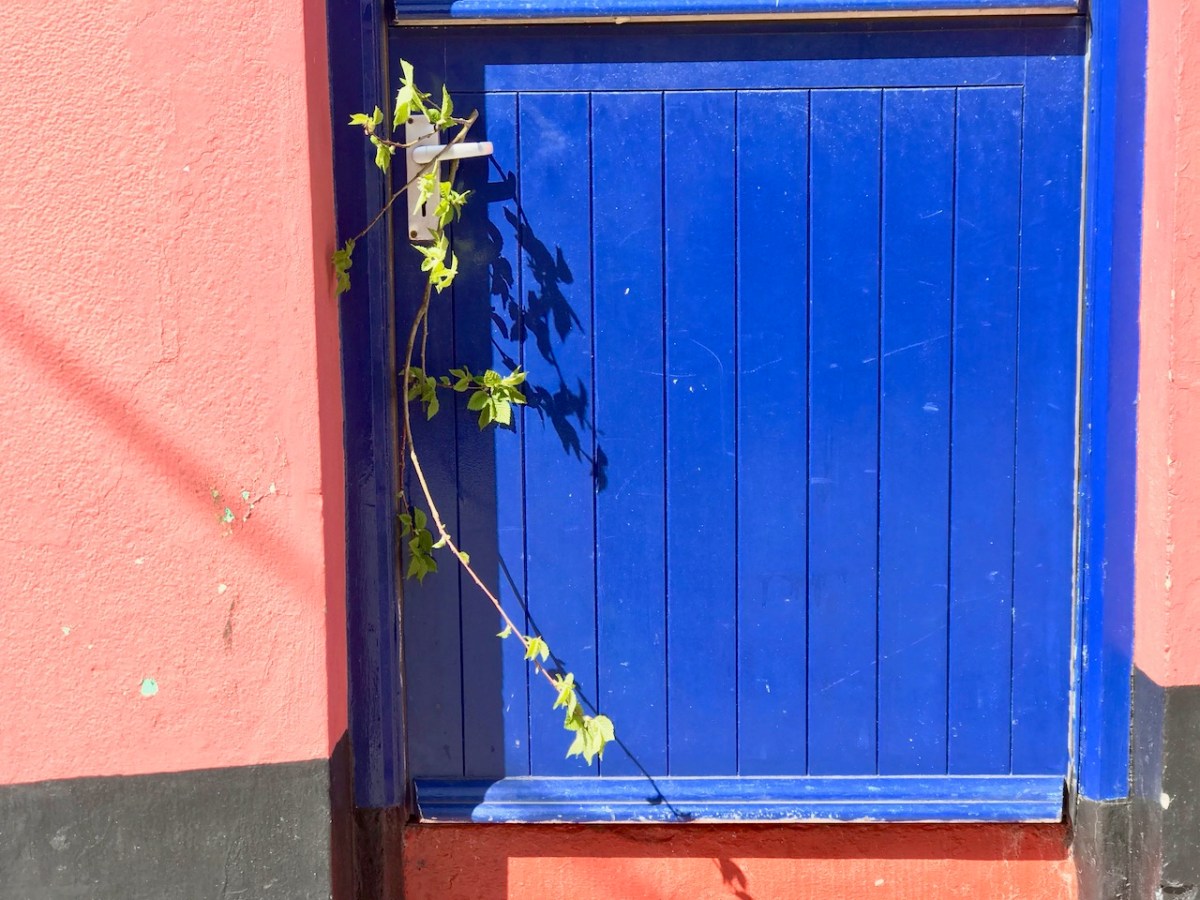
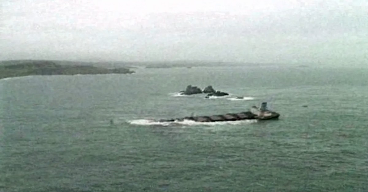
Above is a RWJ view of Bantry Bay and Whiddy Island taken back in 2014. The island was the setting for another disaster in earlier years: on January 8, 1979, the French-owned tanker, Betelgeuse, exploded at the oil terminal, resulting in 51 deaths. Even now – 45 years on – new enquiries are being set up to establish the true facts surrounding that incident. Returning to our Kowloon Bridge story, accounts seem to vary. One says that on 22 November 1986 – having had the necessary repairs completed – the ship resumed her voyage and set out into the Bay; but she was plagued by continuing bad weather, and lost her steering gear. Another suggests that the problems included ‘deck cracking in one of her frames’: she was forced to leave port to avoid colliding with another tanker and – engine running astern – she lost her anchor and her steering controls. The decision was taken to abandon ship (still running astern) and Royal Air force helicopters rescued the crew. She headed out of the bay and into open waters, being driven also by storm-force winds. (Image below courtesy of Southern Star)

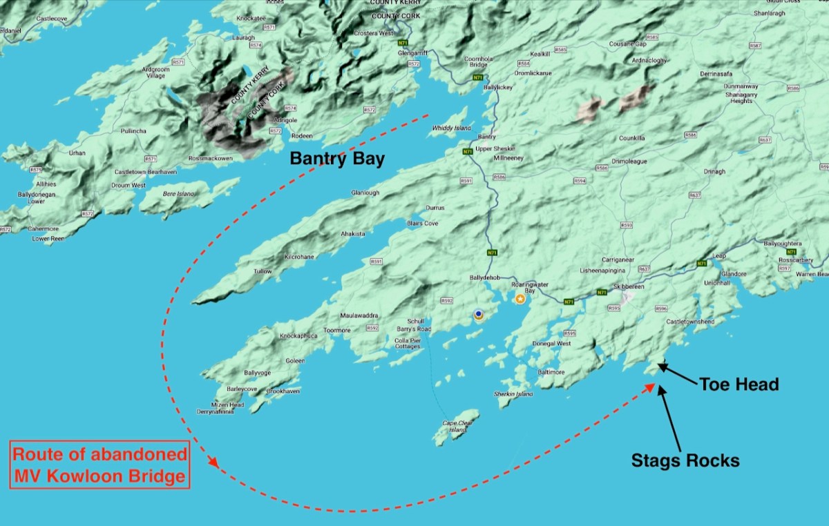
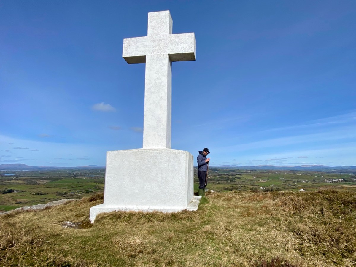
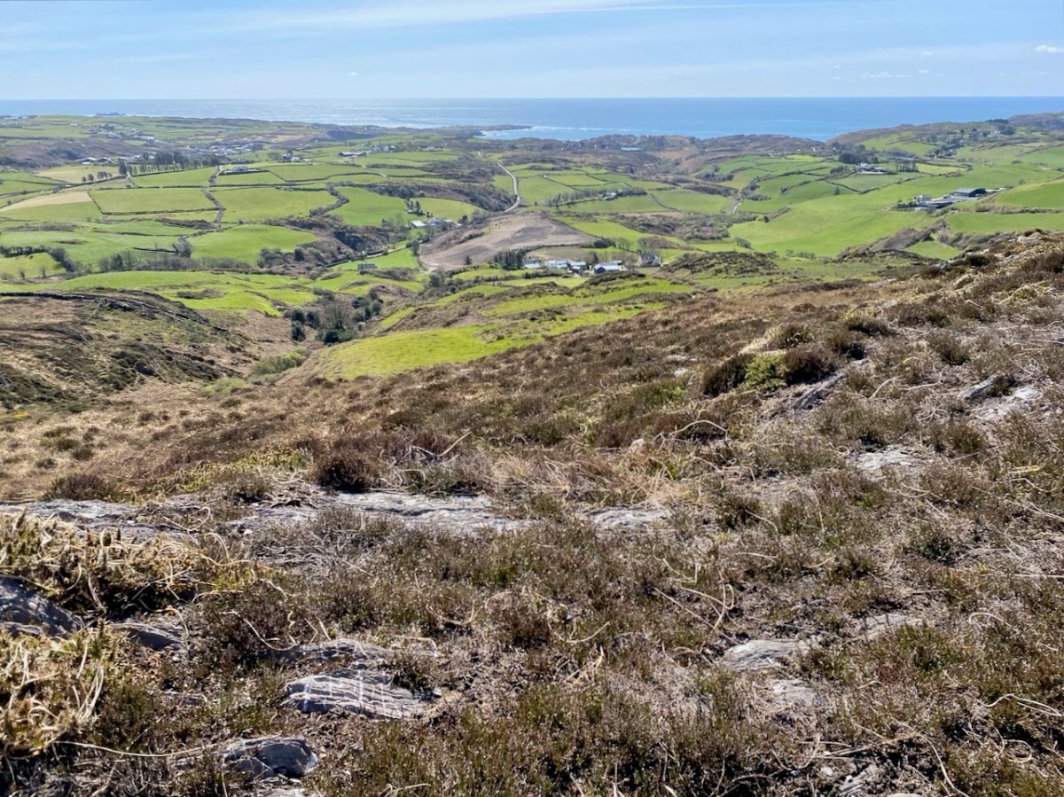
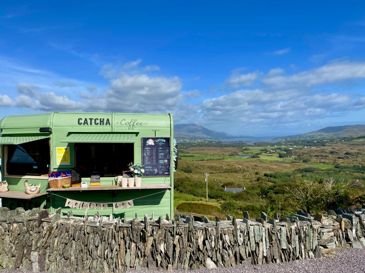
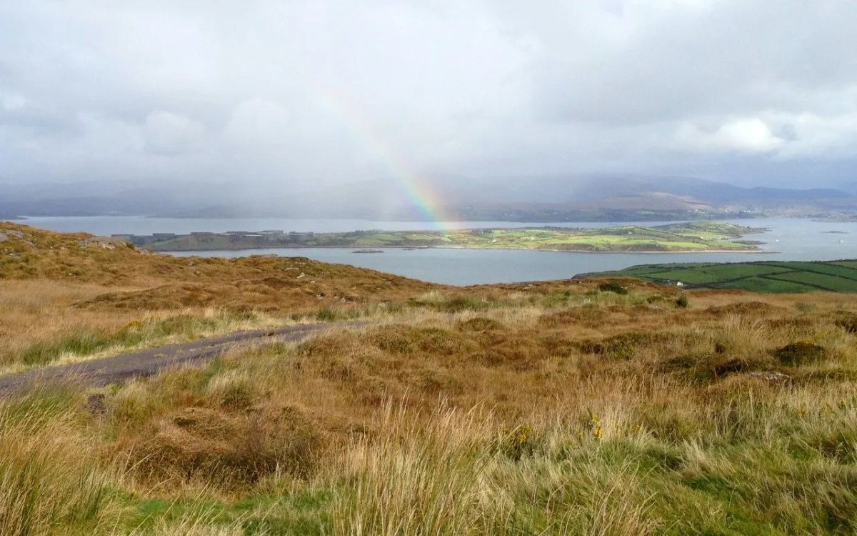
Kowloon Bridge left Bantry Bay and rounded the Sheeps Head and Mizen Head. A tug tried to intercept her, but was unsuccessful as this, also, sustained damage due to the adverse conditions. Coming close to Baltimore the combination carrier/tanker hit rocks and her engine stalled. She continued to drift eastwards, finally coming to rest on the Stags Rocks below Toe Head (header pic).

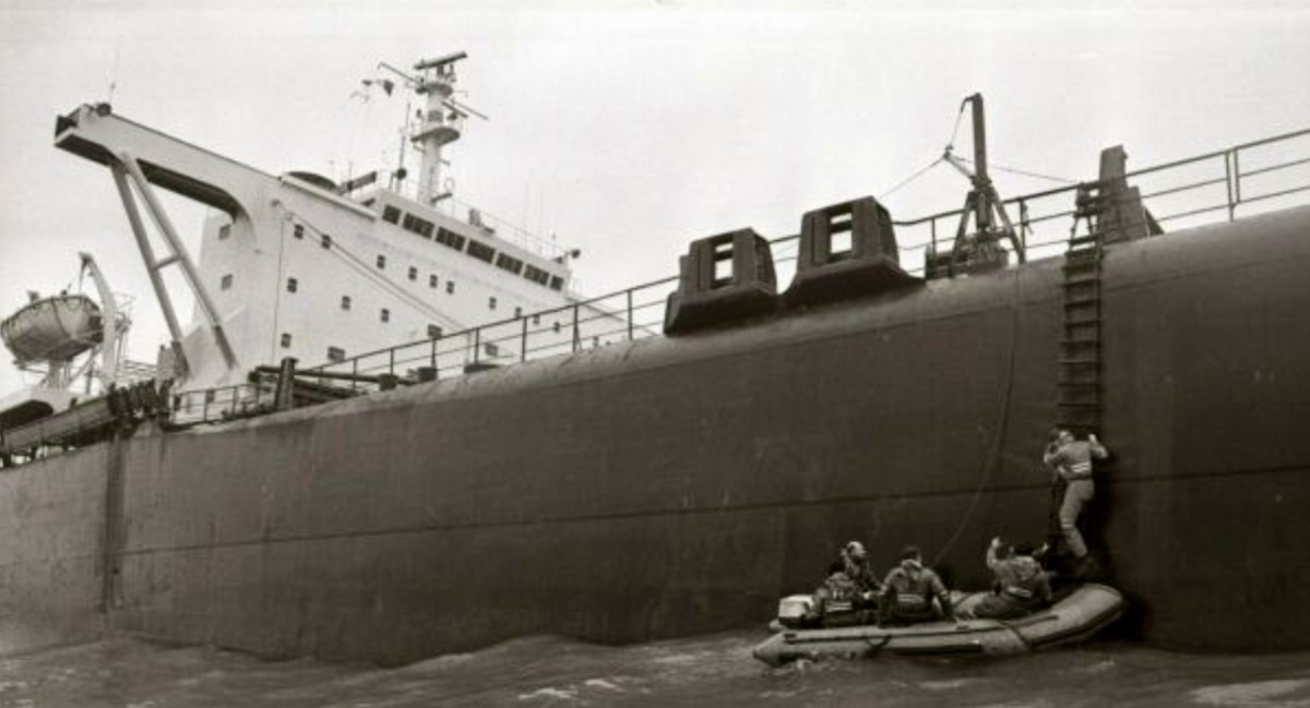
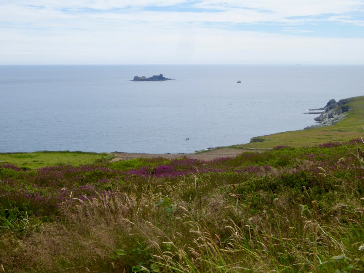
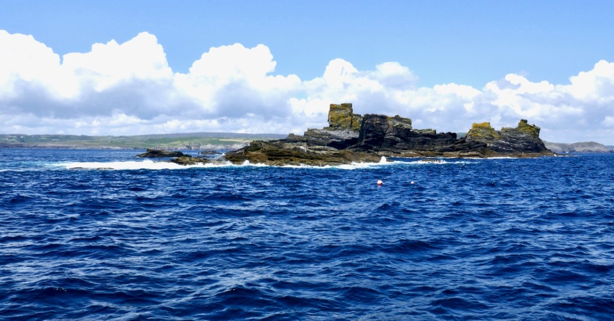
Despite efforts to board her and assess salvage attempts (images above courtesy Irish Examiner), in due course the ship broke her back and went under – although, according to local reports, her bow could still be seen for months afterwards. To this day she lies off the rocks, with her iron ore cargo surrounding her. Below: the view from Toe Head today and (lower) the Stags Rocks.

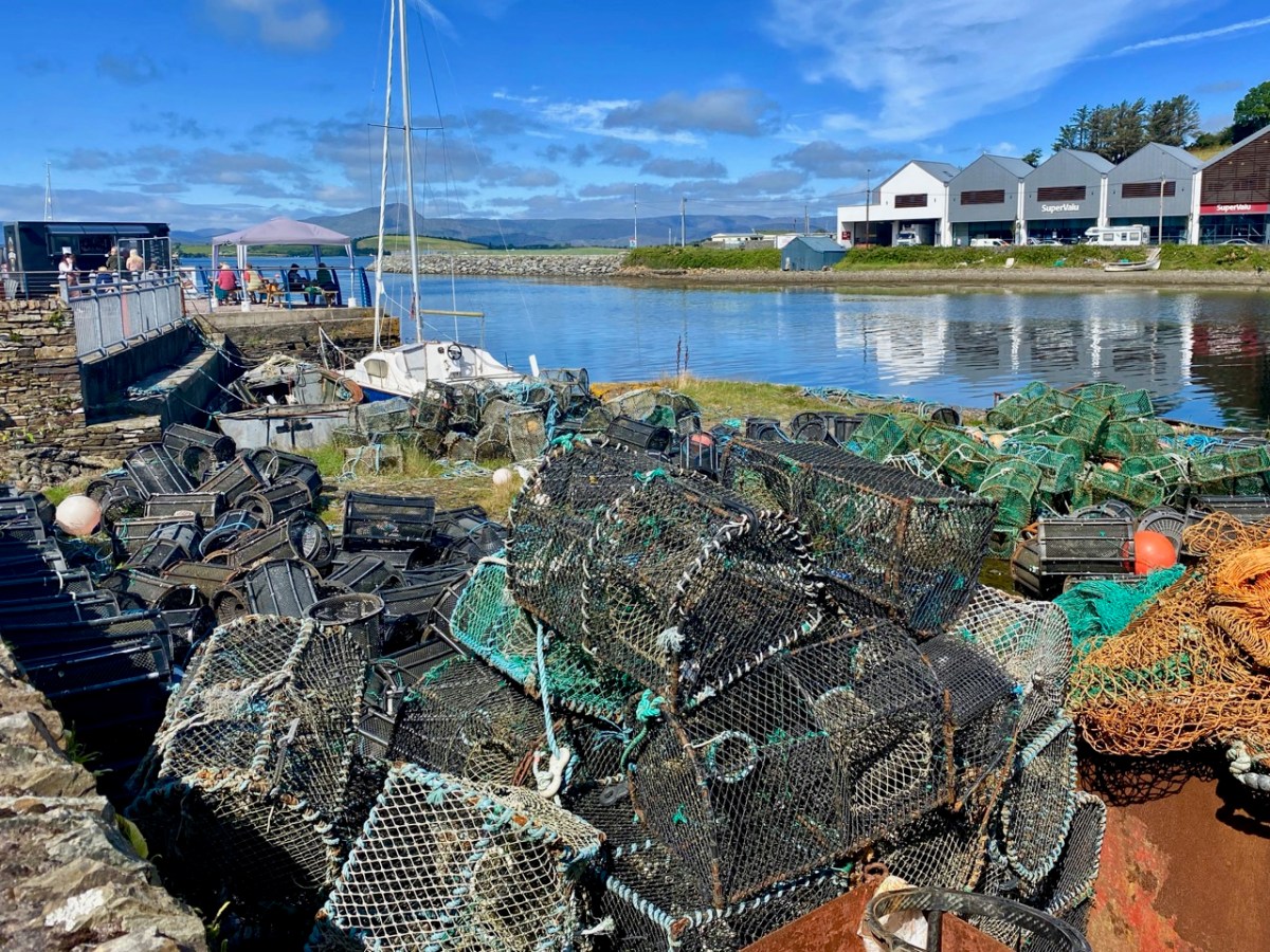
The breaking up of the ship caused the release of of 1,200 tonnes of fuel oil. This led to damage to local coves and beaches, with loss of income being suffered by the fishing and tourism industries. The incident happened in the days before The International Convention on Oil Pollution Preparedness, Response and Co-operation was set up: that came into being in 1990. Parties to OPRC are required to establish measures for dealing with pollution incidents, either nationally or in co-operation with other countries.

. . . Ships are required to carry a shipboard oil pollution emergency plan. Operators of offshore units under the jurisdiction of Parties are also required to have oil pollution emergency plans or similar arrangements which must be co-ordinated with national systems for responding promptly and effectively to oil pollution incidents. Ships are required to report incidents of pollution to coastal authorities and the convention details the actions that are then to be taken. The Convention calls for the establishment of stockpiles of oil spill combating equipment, the holding of oil spill combating exercises and the development of detailed plans for dealing with pollution incidents . . .

International Marine Organisation
Entry into Force 13 May 1995

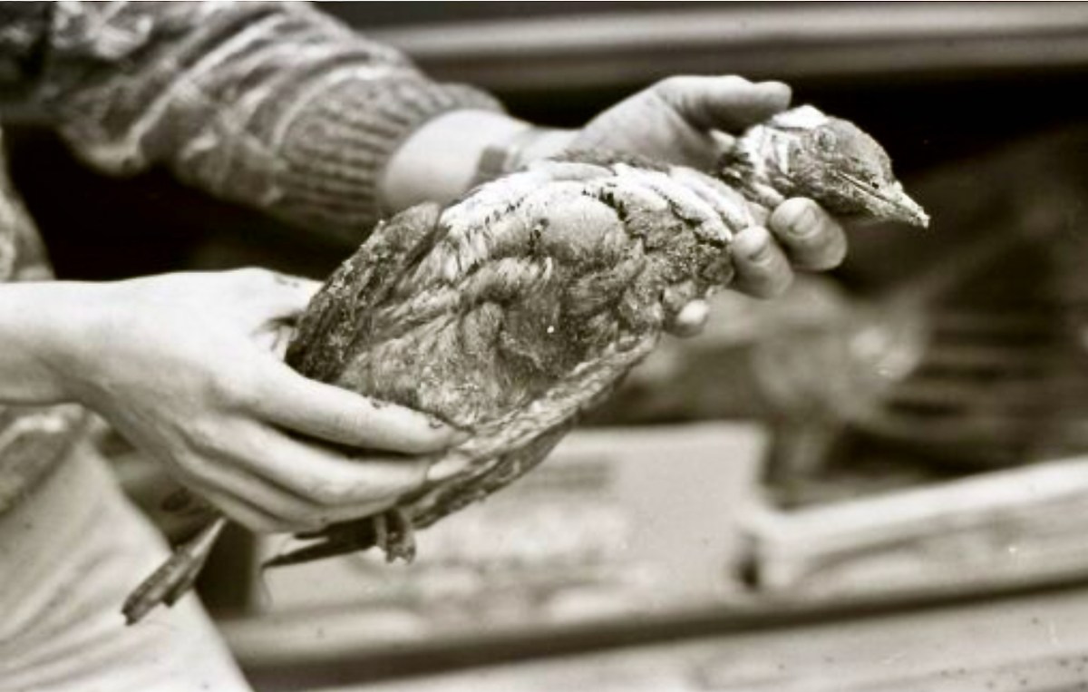
Trying to follow the subsequent story of the wreck, everything gets a bit murky. West Cork communities undoubtedly suffered as a result of the foundering. Debris and oil were washed up (image above courtesy Irish Examiner). ‘Hundreds of seabirds’ died according to local reports. Promises of compensation were made – and reneged on – by the Haughey government. But it was Cork County Council and its ratepayers who eventually bore the major costs of cleaning up, even though the ship had been fully insured (image below courtesy Irish Examiner).

Apparently, the wreck was purchased in December 1986 by a British scrap dealer, Shaun Kent. One report states he paid a million pounds for it – another states he paid one pound for it! An article in the UK Independent newspaper in August 1997 describes how he planned to use high power water jets to wash the iron ore pellets to the surface for recovery. Their value was said to be in the order of millions. He also intended to recover the steel hull and other elements. However, concerns were expressed locally and nationally that such a process so long after the event would adversely disturb the seabed and the stable micro-environment which has evolved over time. It is unlikely that such plans will ever be acted on.

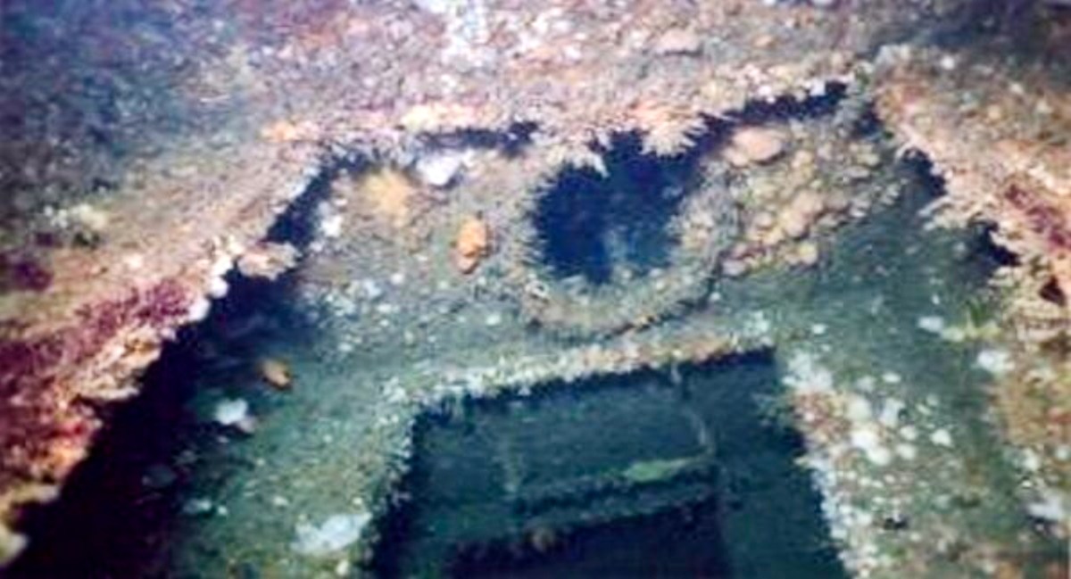
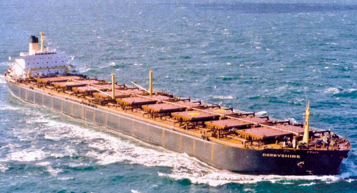
Today, the wreck is an attraction to underwater enthusiasts (images above courtesy of Extreme Sports Cork): Nature has taken over the intrusion to the sea bed. During the various discussions which have ensued in the many years since the Kowloon Bridge came to rest on the Stags Rocks, the question has been raised: was the ship seaworthy in the first place? It is pointed out that a sister ship was MV Derbyshire. Originally named Liverpool Bridge, she was launched in 1975, the last of the six Bridge Class ships. With a gross register tonnage of 91,655 she had the greatest volume. In July 1980, Derbyshire also left port from Sept-Îles, Quebec, bound for Kawasaki, Japan. She was overwhelmed by a tropical storm, and sank in deep ocean, with the loss of all 44 lives on board. This was in fact the largest British ship ever to have been lost at sea (image below courtesy of shipsnostalgia.com).

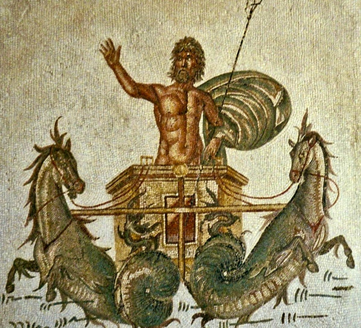
The four remaining Bridge Class vessels saw long service, and were eventually scrapped, so there is no reason to suggest that the design was in any way faulty. I suppose we might say that it is mankind’s folly to create such huge machinery to bring cargoes across the world. We challenge Poseidon, and he has to take his share (image below courtesy of Bardo National Museum, Tunis).

I am grateful for access to records at the time in the local and national media: in particular The Irish Examiner, The Southern Star, The Irish Times and RTE

Flower Power – New Ballydehob Exhibition!

I was around in London in the early sixties, and was definitely part of the swinging Flower Power scene: beatniks, Beatlemania, Carnaby Street, flowery shirts and ties (I’ve still got some of them – below – stashed away in my wardrobe!) – the regulation Afghan coat (and its distinctive smell) . . . What I miss most, perhaps, is the purple velvet flared trousers: sadly an expanding waistline quickly did away with them.

What is less well-known – in my generation at least – is the fact that there was a similar cultural phenomenon in one part of Ireland – our own West Cork! And it was centred on Ballydehob – that’s the main street, above. It’s a colourful village today – as it was then: well-suited to the cultural heritage which the artist community of the time imposed upon it. This building on the main street in those early days was particularly significant:

One of the artists who happened upon Ballydehob at that time lived on here to tell the tale (he still lives in the village and is still a working artist):

BREAKING NEWS: BALLYDEHOB IS DISCOVERED!

. . . During the early 1960s, a group of students at the Crawford School of Art in Cork, heard a rumour that something bizarre was happening in a village called Ballydehob. Here some vestige of Swinging London had taken up residence in a painted-up building called ‘The Flower House’. I was one of those students. We decided to investigate.

      Since nobody owned a car, a parental vehicle must be ‘borrowed’. Somebody’s parent was away so this could be done without controversy. One of the know-it-all students announced that Ballydehob was in County Sligo and we would need money for petrol and have to camp when we got there. Nobody owned a tent. A forever-complaining student said that ‘He didn’t want to end up arrested as a vagrant and to have to sleep in a Garda station’. A few days later we left the Crawford en-route to County Sligo. Fortunately, a more astute student rummaged in the car as we were leaving the city for the West, found a road atlas and announced that Ballydehob was actually in County Cork, a mere two hours drive over the potholes. Tent-less or Garda station camping would not be required.

     We arrived, we saw, we were astonished. Cork was then a darkly conservative place, ditto the Crawford and its staff members. What we found in Ballydehob was a house on the main street of the village with enormous flowers painted on the façade. It might have been in Chelsea or San Francisco. We entered to find a hive of creativity and alternative lifestyles. This was the world of women in flowing batik dresses, bearded men with bead necklaces and leather-thonged trousers. Even a cod-piece was observed. We sat in the café and drank coffee from the brownest of chipped brown ceramic mugs, ate inedible brownies and marvelled at the range of art and crafts being produced by this creative group.

      This establishment, which seemed to have landed from another planet since the remainder of Main Street appeared to have experienced no visual or economic change from the images recorded in the black + white photographs of the 1900s, was run by two women, one German, the other English: Christa Reichel and Nora Golden. Here was a living example of William Morris’s dictum, ‘Have nothing in your homes that you do not know to be useful, or believe to be beautiful’.

       Some ten years later, John and Noelle Verling (participants in that epic car journey) set up the Fergus Pottery in Dripsey outside Cork, later transferring it to Christa Reichel’s former premises in Gurteenakilla, Ballydehob, where it became a fixture of the creative community. A few years following, another member of the car-team, myself and Clair, came to stay with the Verlings, and also remained in the area, setting up an etching studio on the other side of Ballydehob.

       Many of those who established the creative community of West Cork have died. Another generation has grown to maturity, further expanding the tradition of West Cork as a major and continuing centre of creative engagement in all of the arts, an epi-centre of delight. . .

BRIAN LALOR

That’s Brian, in his studio today. Just a few years ago – in 2018 – he and I decided that that creative time in the village needed to be properly celebrated, and we gathered around us like-minded enthusiasts, and opened up the Ballydehob Arts Museum, using a room kindly donated by those who had taken over the disused bank building, right in the centre of town:

That’s the inside of the Museum above: its first exhibition opened in the summer of 2018. We had another the following year, then Covid stopped us until last year, when we featured Ian + Lynn Wright. This year’s exhibition also features a ‘couple’ of working artists: The Verlings – Noelle + John.

John Verling was a contemporary of Brian Lalor (who has written the account above), and they both studied architecture and art in London and at the Crawford in Cork. Brian has penned for us his memories of sharing a studio in London with John Verling:

THE PERILS OF A SHARED STUDIO, LONDON, 1967

. . . During the late 1960s, John Verling and I, then students of architecture in London, shared a quite substantial studio in one of the leafier areas of Kensington. The building, a large brightly lit interior behind a row of decaying Victorian villas (it might originally have been a Victorian studio, we never discovered) had many more recent uses and the first task on gaining possession was to somehow manage to get rid of what had been left behind by earlier tenants; office furniture, old matresses, much unidentifiable plumbing apparatus and a stuffed fox whose pelt had been consumed by moths, were among the challenging contents.

     Conversation among acquaintances in our local, the Norland Arms, evoked interest from other drinkers, an English sculptor and a South African photographer who asked could they share the space and, very willingly offered a down payment on the rent. This was agreed and not long afterwards the studio became operational, with both John and myself busy creating in our new-found haven, with only the occasional appearance of our fellow tenants. John was at that point concentrating on elegant photomontages as well as complex drawings of Portobello costermongers and was extremely productive, while I was engaged in a substantial series of elaborate and brightly coloured timber constructions enhanced by scaffold clamps, in a latter-day Bauhaus manner. Time passed, various local artists called to view the work and admire the space. We were exhibiting successfully and the studio became in W H Auden’s phrase, ‘the cave of making’. Our fellow studio members failed to turn up and when occasionally encountered in the Norland, expressed embarrassment in being behind with the rent while offering a contribution to ‘keep their name in the pot’. This was an extremely satisfactory situation with individuals happy to subsidise the rent but too busy to actually attend the studio.

     A chance encounter in the Norland brought another hopeful artist to our acquaintance, David O’Doherty, Dublin painter, he worked at the international telephone exchange. He came, he admired the studio, and invited himself to join. Fatally, we agreed. An accomplished portrait painter, he often had a sitter posed, but seemed happy to work on, undisturbed by the other occupants. Our new tenant was affable, expansive, a storyteller. He became a permanent fixture. Suddenly we realised that we were entertaining a cuckoo in our midst. O’Doherty had moved in permanently, camp bed, small stove on which there was always a fry-up in progress, an endless stream of visitors, large canvasses propped against the wall, and the catastrophic revelation of his other occupation; he was a keen traditional musician, devoted to the Uillinn pipes. Suddenly the space, ample for John and myself to pursue our work, had begun to feel like a home for the demented. 

     Gradually it became apparent that our studio, which a year before had been, in the midst of the city’s turmoil, as quiet and remote as a stylite’s pillar, had metamorphosed into Picadilly Circus with noise, air pollution and crowd control issues. The dream of having a secure place in which to create had floundered on the fatal choice of an individual whose concept of an ideal workplace was perilously close to Francis Bacon’s taste for irredeemable chaos. I bailed out, John lasted a little longer. And the completed series of brightly coloured scaffold-clamp constructions, what of them?  Occasionally I received reports of their travels. Before he emigrated to Boston, O’Doherty sold them to a construction company and they were later spotted decorating the foyer of a social welfare office in Amsterdam. After that only blessed silence . . .

BRIAN LALOR

Noelle Verling (above) studied ceramics at Hammersmith College of Art. She and John met and married and – when they moved back to Ireland in 1971 – John & Noelle Verling established the Fergus Pottery in Dripsey in 1971 with Noelle as potter. She produced a wide range of domestic ware at Dripsey. When they moved in 1973 to Ballydehob to take over Christa Reichel’s studio, they adapted Reichel’s press-moulds and Gurteenakilla pottery stamp for their own work and from then on, traded as Gurteenakilla Pottery and latterly as Brushfire.

. . . The Verlings loved the windswept West Cork landscape and felt moved to record a disappearing environment. John’s paintings often depicted the doors, windows and walls of decaying buildings, repositories for the memories of past inhabitants, long gone. The windswept thorn tree is a familiar motif which connects John Verling with West Cork: the tree became his icon and frequently appeared in his paintings and on his ceramic work . . .

Alison Ospina – West Cork Inspires 2011

This is a rare photograph of John working on one of his favourite subjects: the gnarled thorn tree suffering from the ravages of harsh West Cork gales. Among the architectural work he undertook voluntarily was the reordering of the east end of St Bridget’s Catholic Church in Ballydehob. This was a major work.

. . . The gold fish hand drawn in the background of the altar and the depiction of one fish swimming against the shoal continues to evoke admiration from locals and visitors alike. He also designed the two ‘windswept thorn’ stained glass windows and etched the brass surround of the tabernacle. The Altar slab, composed of a vast monolith like the capstone of a dolmen, is a distinguished piece of sculpture and a tribute to his imaginative capacity . . .

John Verling Website: https://www.johnverling.com

Special thanks to Geoff Greenham for giving us this superb photo of St Bridget’s Church, Ballydehob.

The sign for the Brush Fire Ceramics Pottery, created by Noelle and John. They successfully produced a large number of individual pieces, crafted and fired by Noelle, and decorated by John.

John Verling died in 2009. Noelle Verling is living in West Cork and has been extremely helpful in providing material and information for this exhibition. Without her we would have been unable to fully present this story.

That’s John Verling in the picture above having his legs plastered by Ian Wright: this was part of a publicity stunt for the visit of a large group of West Cork artists to Zurich in 1985. John is also singing a folk song! You can read more about that particular enterprise here.

The Ballydehob Arts Museum is grateful to the town’s Community Council for providing the accommodation for the Museum. BAM is: Brian Lalor, Robert Harris, Sarah and Stephen Canty. Their combined knowledge and practical experience has ensured that our ambitions for this – our fourth exhibition – are fully realised.

ballydehobartsmuseum.com

Exhibition opens Jazz Festival Weekend in Bank House: Thursday 27 April @ 5pm, then Friday 28 April to Monday 1 May: 11am – 4pm. It will open with the Tourism Centre from June to September 2023

Notes from the Past

We heard – from our correspondent Justin Cremin – about an ancient copper mine somewhere near Skibbereen: possibly prehistoric (like the mines on Mount Gabriel). Supposedly there were rock scribings there (perhaps like those we explored in the Cooleenlemane valley). The Archaeological records proved a little disappointing:

CO150-070

Townland: GORTSHANECRONE

Class: Redundant record

. . . Description: Listed as an ‘ancient copper mine’ in the RMP (1998). Located in rough hill pasture on the W side of a deep wide ravine running N-S across the hill. A natural cave with two E-facing entrances extends c. 35m W into the hill. The height varies from c. 1m to c. 4m and jagged rocks protrude from the roof. Loose stones are scattered on the uneven floor. While there are traces of green malachite copper staining in a few places there is no evidence to indicate prehistoric mining. The material in the spoil mound outside the lower entrance suggests some unsuccessful 19th century exploration for copper may have been carried out here. The evidence is not sufficient to warrant accepting this as the location of an archaeological monument . . .

archaeology.ie
Compiled by: Connie Murphy

This now ‘redundant’ entry in the official records seemed to imply that the ‘ancient’ mine wasn’t there at all – it was just a cave. But the records also make no mention of any sort of inscription on the cave walls: perhaps, if there were scribings, they were considered ‘modern graffiti’ and of no historic interest. We set out to solve the mystery, accompanied by our intrepid friends David Myler and his children. David has written about the site on his own Facebook page.

En route was another – much younger – piece of local history that we had long wanted to visit: an enormous white cross set up on top of Coom Hill to commemorate the Holy Year of 1950. Once visited on Corpus Christie day every year by a procession which started in Skibbereen, it remains an important local landmark and is situated with dramatic views in all directions.

The two screenshots above are from a film taken in the 1960s, showing the procession to the cross. You can watch the full film online here. Below are some of the views which can be seen from the top of the hill.

The cross – and the views – were only tasters for the adventures we had in store. Justin had researched the location of the ‘cave’ and his instructions unerringly led us across country towards a gulley – a substantial gash in the landscape running north to south, where the high land dropped away: tucked in just below us we found our goal.

The cave has two entrances – higher and lower – and the rock faces within certainly look as though they had been worked in places. This could be from the “. . . unsuccessful 19th century exploration for copper. . .” mentioned in the archaeological record. But the exposed stone is covered in scratchings: names, words, dates from all periods – recognisably going back as far as the 1700s. There are also a few images, such as this group of leaves which has been partly obscured by modern-day painted lettering: – and note the harp in the top left of the next pic down:

We had been surprised that we could not find any written description of the graffiti which – although not ‘ancient’ – has to be of interest, as it is a record of marks made by people through many centuries. In our recent census (2022) we have all been asked to contribute to a ‘time capsule’ – our words will be sealed up ready for opening by future generations a hundred years from now. (Some of these words have been published on the internet. My favourite is the simple and poignant: “Is there anybody there…?”). This cave is a comparable ‘time capsule’ but perhaps less embracing of contemporary life.

Centre, above: the copper staining, which is mentioned in the redundant archaeological record. Above is the far end of the cave, with some interesting lighting effects. The pic below gives an impression of the scale of the interior.

Before writing this post I made a few more enquiries, and discovered that the rock scribings had been thoroughly researched and written up in an article in Volume 10 of the Skibbereen & District Historical Society Journal, dating from 2014. The reason I had not previously discovered this was that the writers chose the local name of Lick Hill, rather than Coom Hill or the townland name (Gortshanecrone). Local knowledge is everything!

The excellent article is written by Jasper Ungoed-Thomas (whose ancestors – Wolfes – had carved their names on these walls) and Terri Kearney, who has been the Manager of the Skibbereen Heritage Centre since it opened in 2000. The Journal article is as comprehensive as you could ever need, with a full list of the names inscribed on the cave walls, together with information on those named where it is known. As an example, J Cotter, 1790 has the following entry:

. . . Cork Anglo-Protestant family, dating back to at least seventeenth century. Edward Cotter RIC during War of Independence. A Catholic branch existed by twentieth century. Edward Cotter was section commander of Bantry IRA . . .

Skibbereen and District Historical Society Journal , Volume 10 2014

The same Journal article describes well the techniques which have been employed in many of the scribings:

. . . The nature of the rock face, with its hard surface, inevitably influenced the quality of the inscriptions. From the late eighteenth century until the later twentieth century, those who wished to leave a record of their visit had little option but to carve their graffiti. It is quite easy to scratch a name, but the outcome is often difficult, if not impossible, to understand. Results which are usually, but by no mean always, easy to read can be achieved by cutting, probably with a knife. But almost certainly the fairly few very clear inscriptions were done with a sharp chisel. Presumably some visitors came prepared to inscribe their names, since proper carving is not easy; it demands time, application and skill . . .

Skibbereen and District Historical Society Journal , Volume 10 2014

Wolfe and Cotter names are seen in the examples above. Having visited the cave we perhaps thought our adventures were over for the day. However, getting back to where we had parked our cars was hazardous, as we opted to follow what seemed to be an easier route (I have to confess it was my suggestion!).

It proved to be a long and tedious trek. The terrain was uncertain and we had to negotiate bogs and steep, uneven surfaces where there were no visible footholds. When we wearily made it to a boreen, we found we still had far to go. A lesson learned: always go back the way you came – you know you will arrive! In spite of the strains, we had a great day out, and broadened our knowledge of local West Cork history. Don’t forget – as always – seek the permission (and advice) of landowners before you embark on any such exploration. And don’t unduly disturb the local residents!

Blasket through the Lens

Great Blasket, one of the islands in the parish of Dún Chaoin (Dunquin) off the west coast of Kerry, was the home and life-blood of a tenacious population of Irish families for many hundred years. One of these families – the Ferriters – claim that they controlled the islands as far back as the 13th century and had established a castle there. Whoever lived there had to be tough: the terrain is wild and there is little shelter. Nevertheless, the islanders clung to their territory, and their numbers expanded in the early 19th century when Lord Ventry of Dingle evicted many of his tenants from their holdings and those who left found island life – hard though it was – preferable to persecution.

We are fortunate that, during the early twentieth century, Great Blasket was visited by curious tourists and anthropologists. Among them was Robin Flower, who became Deputy-Keeper of Manuscripts in the British Museum from 1929 to 1944. He had many credits to his name, including Member of the Royal Irish Academy, Doctor of Literature of the National University of Ireland and also of Dublin University. Flower became the historian of the Blaskets, which he ‘immortalised’ through his lectures and writings – and many visits. To the people of the Great Blasket he was playfully known as ‘Bláithin’ – Little Flower – which he considered a great honour. I will write more on Robin Flower in a future post, but concentrate here on some of the photographs of island life which were recorded by likeminded researchers in the first half of the twentieth century. After 1954 there was nothing to record: life on the island, three miles from the mainland and involving an often treacherous crossing, became untenable. The whole remaining population was evacuated in that year, leaving their cottages and settlements to the ruinous ravages of the wild Atlantic gales.

The header picture is a wonderful statement of youth and vigour: island children photographed outside their school in 1932 by Thomas Waddicor. I can’t find anything about this man, but a lot of his work appears in the Dúchas Photographic Collection which was established in the 1930s, so I am assuming he was an active collector and researcher himself. The second picture is by our old friend Tomás Ó Muircheartach, who also spent time on the Blaskets in the 1930s. You will find more about him here. It shows the Blasket men in their fishing curraughs below the craggy rocks of the island. The pic above is also by Muircheartach, and shows Cáit Ruiséal and Máire Ruiséal being interviewed by a follklore collector at their fireside in 1942. I am not sure where this interview took place.

This photograph is also by Thomas Waddicor and dates from 1932. The caption given in the Dúchas Photographic Collection is interesting, if not entirely enlightening: Man, Great Blasket Island: Buffer, note stuffed peaked cap – an island custom.

Another from Waddicor, also 1932: Cáit at the Well. I think what strikes me most of all is how real and alive these people are – they certainly don’t seem in any way downtrodden or in danger of extinction: perhaps it’s just because they are ‘posing’ for the camera. But it’s salutary to think that they were only on the island for another generation or so.

These two photographs (above) are also by Thomas Waddicor and also from 1932. The top one is the ‘Wife and child of Séan the King’, and the lower is ‘Children of Séan the King’. We have a bit of a conundrum here as the last ‘King’ of the Blasket Islands passed away in 1929 (according to this Irish Times article). As Waddicor left behind no photograph of the ‘King’ himself, we have to assume that the lady in the upper photograph was a widow.

More ‘family’ photographs: the upper of the three is titled ‘Eilis and Brighid’; the centre is just given as ‘Family’, while the lower is ‘Fiddler and Woman’. All are by Waddicor from 1932.

This wonderful lady is also anonymous: sadly we can only know her by the title – ‘Great Blasket Woman’. Again, Waddicor 1932 – and, once more, she seems so full of life!

This is a picture of the Great Blasket Island School. We have some further information: while the folklorists and recorders were visiting the island in 1932, the older schoolchildren decided to interview each other about local customs and lore to mimic the visitors!

Further unnamed portraits: upper ‘Two Women Great Blasket’ and lower ‘Two Women gathering Heather’. From the Waddicor collection, 1932.

We’ll finish off with a few classics. This is Tomas O Criomhthain and it’s a photo from Muircheartach. Better known to us as Tomas O’Crohan, author of the classic book about the Blaskets:

. . . Tomas O’Crohan was born on the Great Blasket Island in 1865 and died there in 1937, a great master of his native Irish. He shared to the full the perilous life of a primitive community, yet possessed a shrewd and humorous detachment that enabled him to observe and describe the world. His book is a valuable description of a new vanished way of life; his sole purpose in writing it was in his own words, ‘to set down the character of the people about me so that some record of us might live after us, for the like of us will never be again’ . . .

The Islandman Book Review

We can’t discuss the Blaskets without mentioning Peig. That’s her, above, with folklorist Kenneth Jackson, taken by Thomas Waddicor in 1932. Peig Sayers was by all accounts a formidable lady but was also described by folklorist Seán Ó Súilleabháin, archivist for the Irish Folklore Commission, as ‘one of the greatest woman storytellers of recent times’. Peig was born in 1873 and died in 1958. She therefore experienced the abandonment of the island, although she had moved away from it in 1942. She was also not born on the island, but in Dunquin, Kerry, She married Pádraig Ó Guithín, a native islander, in 1892 and had eleven children, six of whom survived into adulthood. Sayers is most famous for her autobiography Peig, but also for folklore and stories which have been collected from her.

Finally, this an image of the Loganim Achive entry for Great Blasket Island, written in 1954.

I am grateful to the National Folklore Collection UCD for the use of the Thomas Waddicor images. It’s an incredible resource: this is just a small selection of the hundreds of images which have been archived

What’s in a Word?

We live in a world full of words. I can’t resist them – particularly when their context shines a humorous – or puzzling – light on them. Not just signs with words on them: sometimes it’s images – shopfronts – posters – that make you stop and have a second look. But then, I probably have a very particular sense of humour. I have every respect and good wish for the residents of Cheekpoint and Faithlegg, for example, but juxtaposed on the Waterford road sign they are eye-catching. Pointe na Síge is the ‘place of the Shee’ (or fairies), while Fáithling was the first parish name to be established following the 12th century Norman conquest: as far as I can make out, it derives from the term for ‘a wooded area’.

A ‘word wall’ signed by its author is from Wicklow (above). But we have encountered many examples of less formal poetry: I won’t call it graffitti . . .

It doesn’t really matter, I suppose, how legible the message is: as long as it has made you stop to take a closer look it’s been effective. Or reflective . . .

Sometimes they are simple, like the one above. I wonder if this next one is a mathematical formula?

Shopfronts have to be eye-catching and arresting, of course, to draw you in. There are witty examples everywhere.

One has to admire the entrepreneurs – of all persuasions.

in my distant youth – when I was learning to read – my go-to’s were the large, colourful, Guinness posters at the bottom of our road. I am pleased to see that many of those images haven’t gone away – even after seventy years!

While all that is, intentionally of course, a stirrer of nostalgia in us – there are many more of our own time worthy of study.

Finally (for now) we just found this old petrol pump hidden around a corner. Who remembers those days when an attendant had to come out and fill you up . . . and it was all done in gallons, shillings and pence?

Postscript . . .

681 Days!

Yes – it has been 681 says since Covid-19 hit us and our world changed. From today, 22 January 2022, most restrictions in the state are gone, apart from the continuing need to wear masks in certain public places. Hopefully that West Cork sky over our house this morning, above, is a good omen for us. Today’s paper shows the stark tally:

The population of the Republic of Ireland as I write this is 5,023,337 (no doubt that is changing by the minute). That tells the story: 22.6% of the people here have had the virus. And of course it hasn’t gone away yet… But at least “social and economic life can begin to return to normal” says the Taoiseach. In order to mark the significance of the moment, my post looks back to our experiences over the last 681 days: in particular, how our lives changed at the beginning of the outbreak.

These two images of Ballydehob, taken at the beginning of April, 2020, sum up the shock of empty streets, closed businesses and everyone being advised to isolate. It all seemed very bleak: our movements were initially restricted to 2km from home, then that increased to a radius of 5km. If you lived in rural areas – as we do – you were permitted to travel beyond those distances if you needed to in order to shop or use essential services. We breached those rules on occasion – sometimes to get exercise in the deserted countryside all around us.

As the days went by, an amazing spring emerged, with day after day of beautiful weather. Human activity was curtailed, but the natural world continued along its course as though nothing was awry!

We humans are pretty adaptable. It was amazing to see the ingenuity of folks creating outlets for their energies without having to mix. Food-on-the-go blossomed as a craft industry: here are some examples.

We were very impressed with many of the examples we encountered – and which have survived over the months. Hopefully they will carry on, as casual coffee stalls in the middle of nowhere are welcome to us in our travelling. Pre-pandemic they were probably frowned upon by ‘the authorities’ – and they are certainly regulated – but ‘authority’ would have had to be very hard-hearted to close down these little lifelines. In our experience, every one we encountered was well-run, and spotless. It was an incidental opportunity to have a distanced ‘chat’: always a source of good local information on how others were coping.

We took the opportunity to climb – and descend – Knockaphuka during the pandemic. It’s a mountain a short distance from Nead an Iolair, but a little outside the limit. No-one was watching! I suppose being restricted to our immediate environment for so long – day after day – made us re-assess it, and our lives. Certainly we have got to know the fine detail of the beautiful place we call home.

Here’s a social issue: we couldn’t get a haircut for months! Finola kept me in trim, but it was a relief when salons were once again allowed to operate, albeit with some restrictions.

This is us having coffee on our own terrace, looking out over Roaringwater Bay in the wonderful spring of that first pandemic year. In fact, each of the two last years has been benign – with a few exceptional winter storms. We would have felt less relaxed if we had had persistent rain (which sometimes happens).

A sprig of green appears on a doorstep on May Day, 2020: a sign that we all still want to continue the old (perhaps ancient) traditions… There were ups and downs: things eased as the year went by and then the new variations came in. Numbers went down and we breathed out. Then they soared – especially with the Omicron variant, and everything went haywire again. Let’s hope that the present easing is here to stay. But the future can never be told…