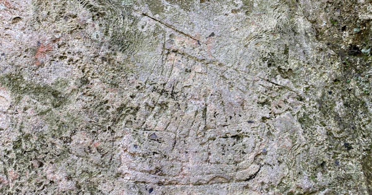
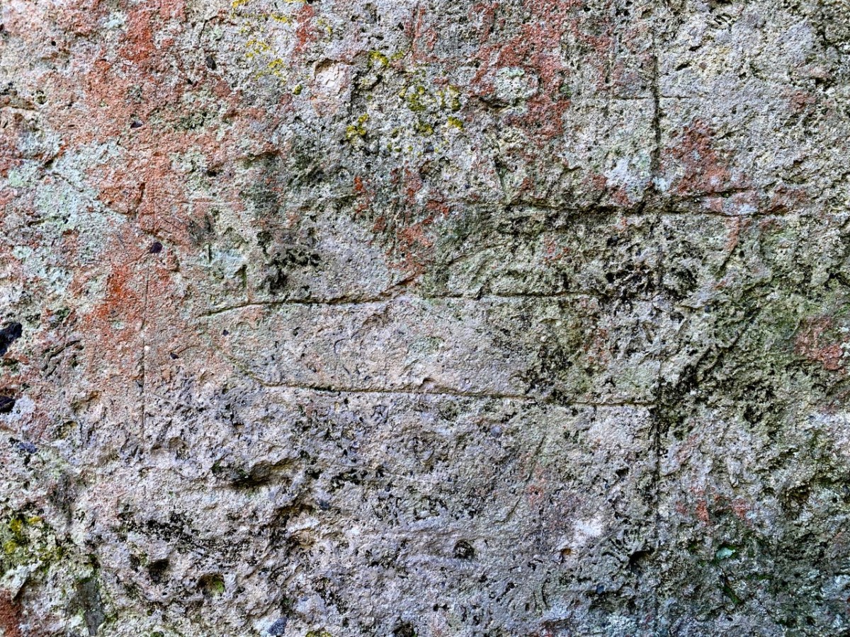
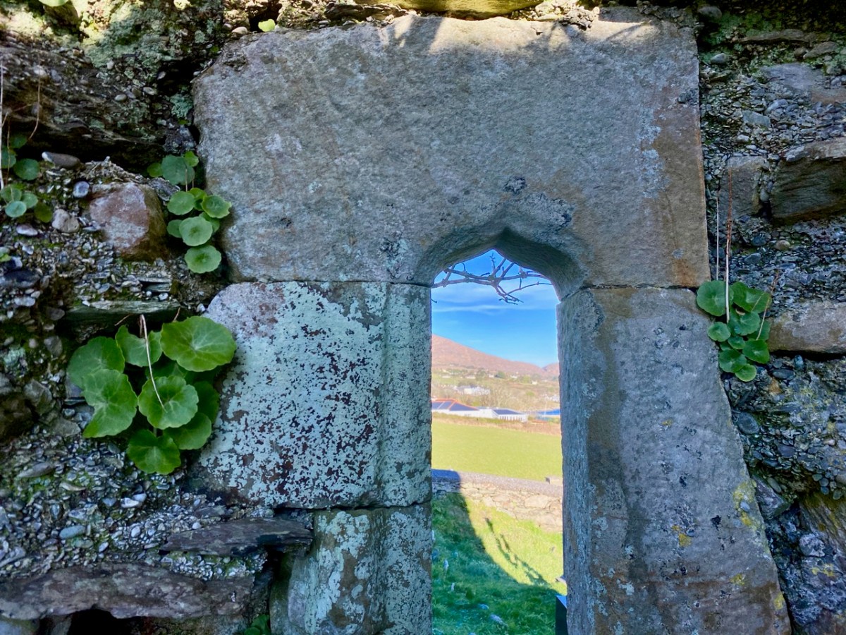
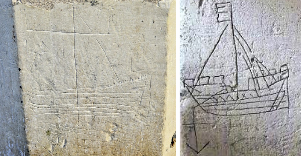
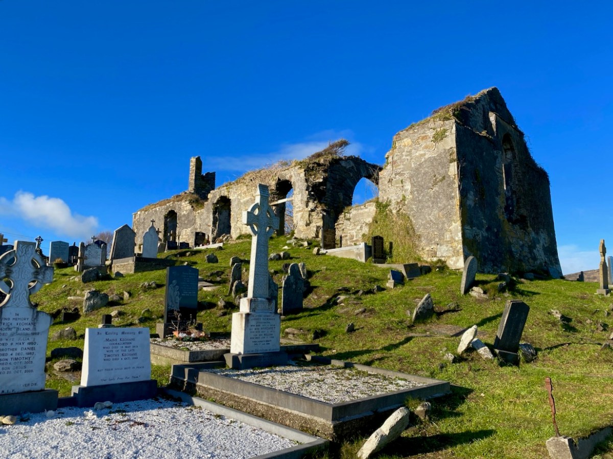
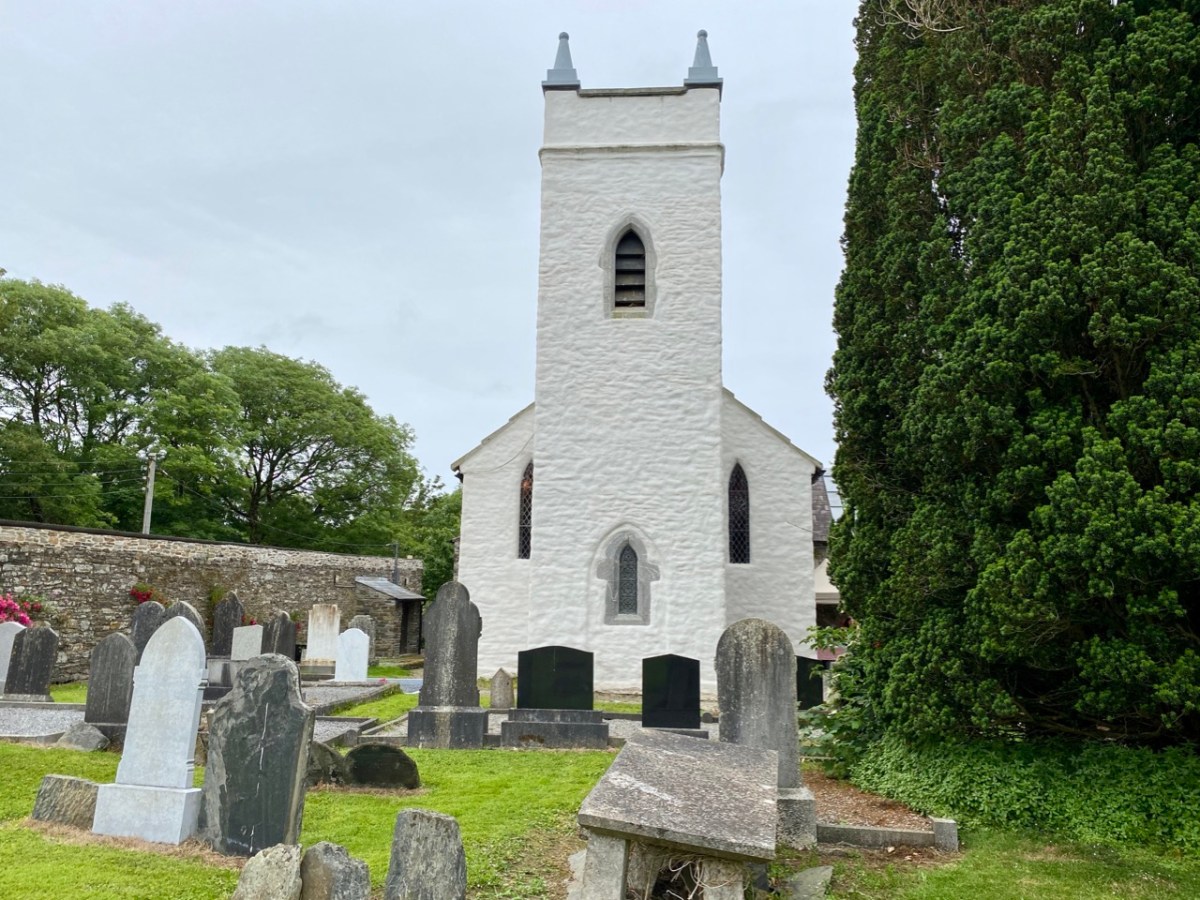
You’ll have to look carefully at the photo above. It’s inside the ruined church which stands in St Mary’s graveyard, Colla Road, Schull.
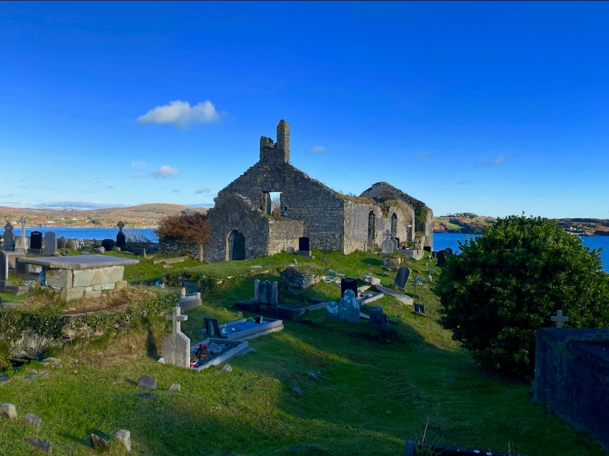
Here’s the church – a view taken a day or two ago, in a spell of clear, cold weather. It has a fascinating history, which you can read here. Go in through the old main entrance, and immediately look to the wall on your right. Scratched into the plaster there is the ship image. But it’s not the only one.
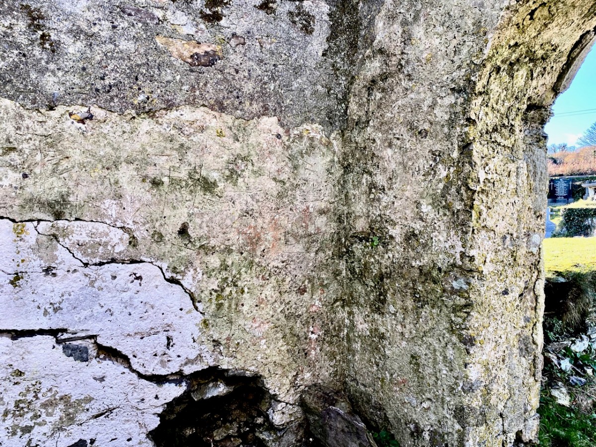
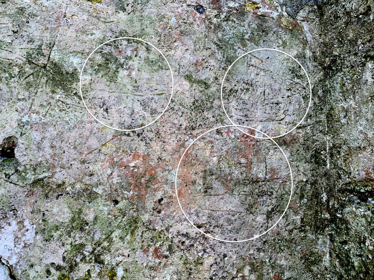
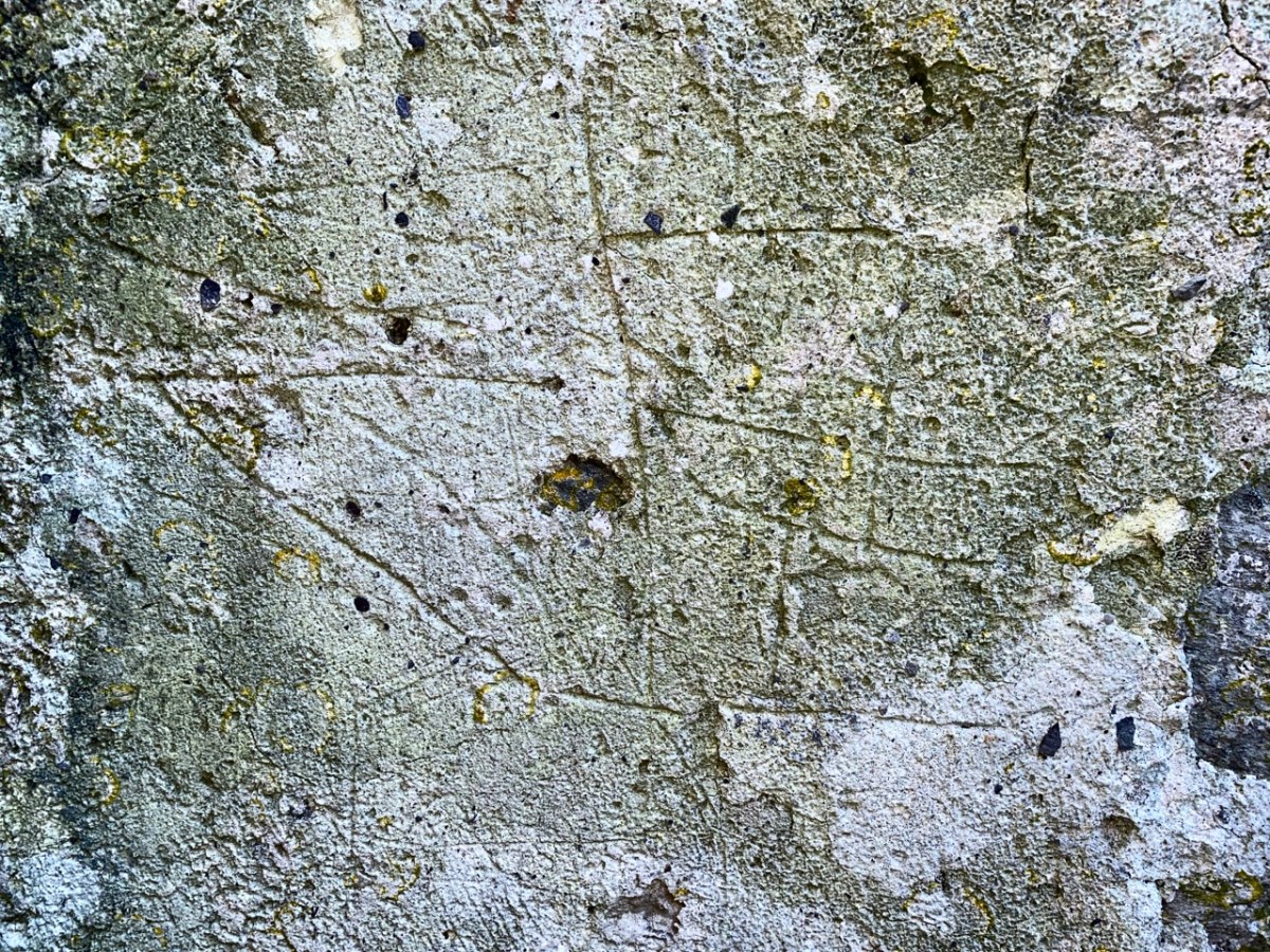
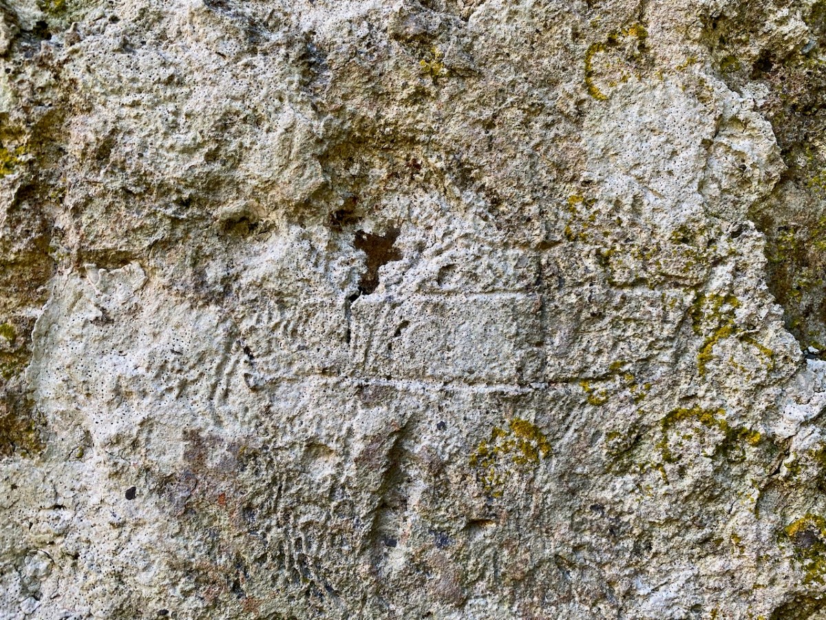
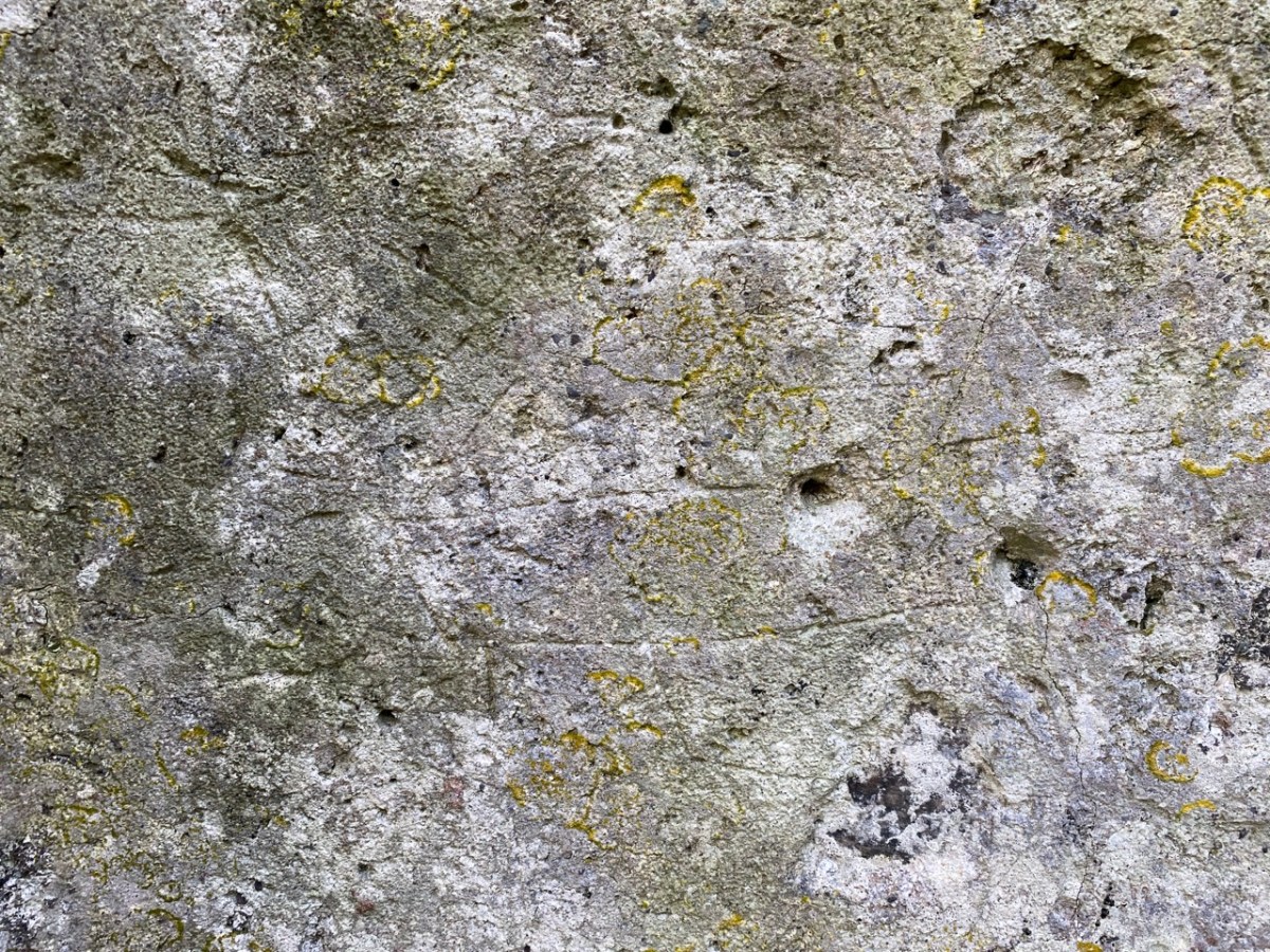
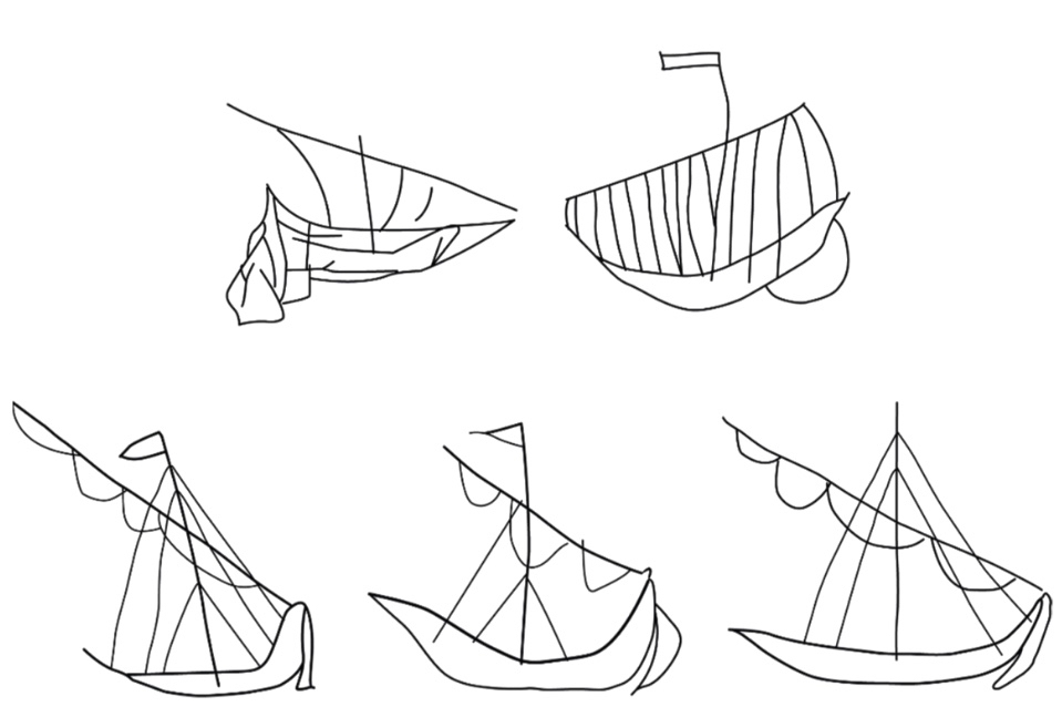
There are more ship images visible on this porch wall; the first – shown in the header – is the most clearly defined. Here are more detailed views of others (I have counted five in total), including further examples on the opposite wall. There may once have been more.
Of course, we would like to know the story of these carvings: who made them? When? And why? As to the ‘when’ we have to sift through the history of the building, although what is known is somewhat fragmentary. One record states that what we see today was built in 1720, but there must have been something there before that, as there is an ogival window in the north-eastern part of the building which is thought to be fifteenth century, and some further architectural features which suggest an even earlier construction:
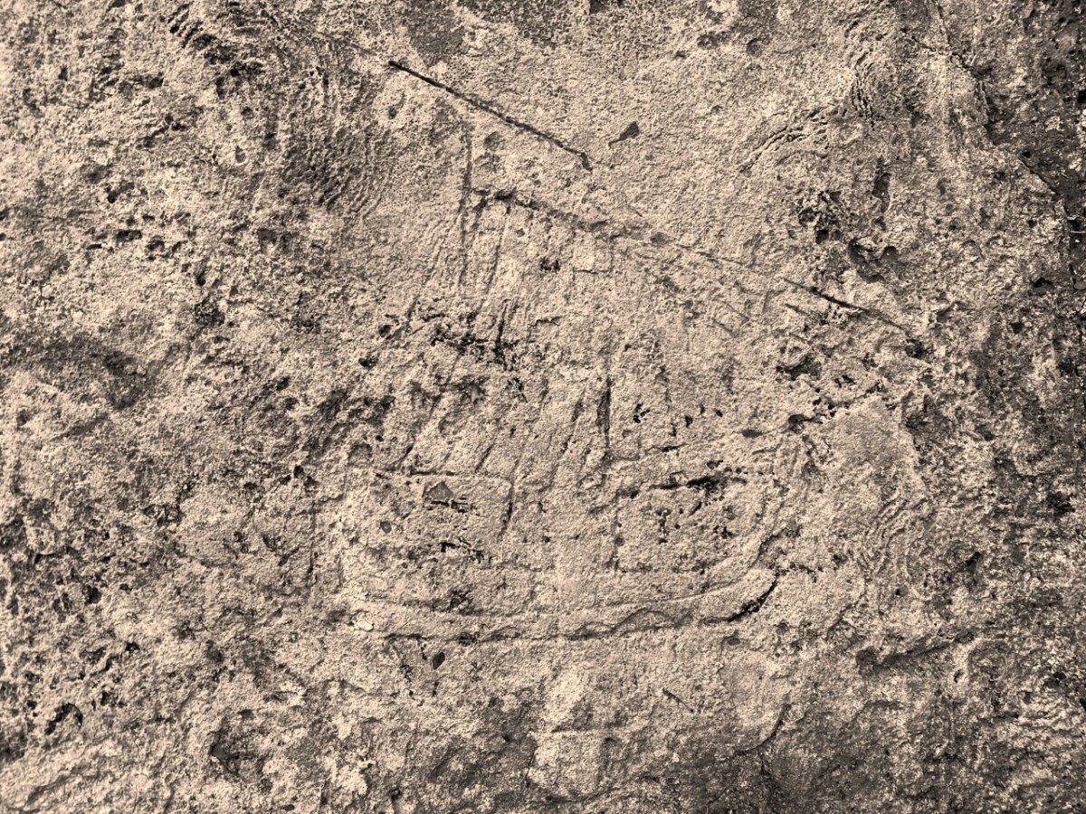
The north porch – where the ship scribings are – is likely to date from the early eighteenth century, so the ships could not be any older than this. They could have been drawn any time, perhaps, over three hundred years – but are most likely to have been from the earlier part of that period. It has even been suggested that they could have been made by the craftsmen who rendered the walls. Interestingly, ‘graffiti’ which shows ships in churches is not uncommon: there are further instances in Ireland, Britain, and other parts of the Christianised world. The following were traced from St Spas church, Nessebar, Bulgaria. They are possibly the closest examples I have found so far that resemble our main Schull scribing. Interestingly, only one is shown in ‘full sail’. Most examples of this type of graffiti show the vessels without sails, or with the sails furled. Our Schull example is undoubtedly under full sail – and this makes it rare. I attach a further image below the Bulgarian scribings: I have tried to enhance the contrast of the photograph.
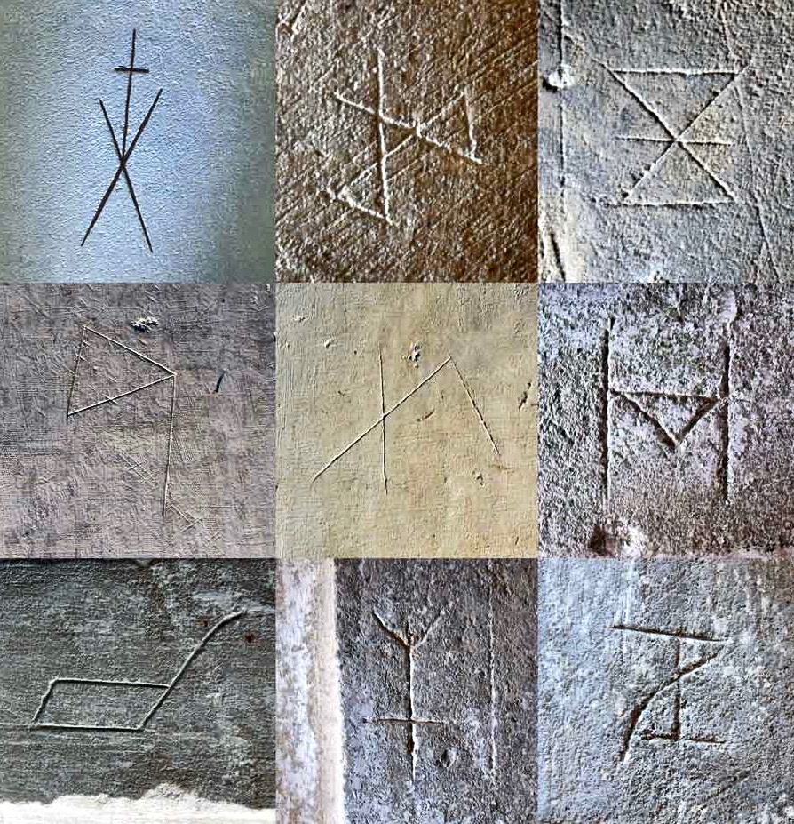
What about ‘Who Made Them’? We don’t have an answer to that. We must remember that the Schull examples are a very small part of a very widespread phenomenon and, as I mentioned, there have been suggestions that the ships were a deliberate part of the construction process of the churches: they might have been drawn by the plasterers themselves. Masons left behind their own ‘marks’ on stone walls, ever since medieval times. A British project was started in 2010 to survey all types of ‘informal’ marking on stone and plaster found specifically in Norfolk.
These stone inscribed Masons’ marks are from the Norfolk survey. Below – from the same source – two images of ship graffiti from Cley-on-Sea, Norfolk:
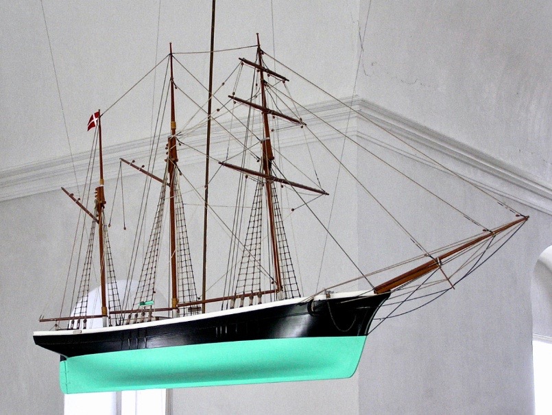
Where do we go from here in our little review of this strange find in Schull? Well, it’s worth noting that these are not the only ‘ships in churches’ image that we find in the corpus of European-wide church architecture. I often remember going into churches and noticing model replicas of ships hanging from the ceiling! I don’t remember seeing such a thing in Ireland, but certainly in Britain and Scandinavia. Here is one from Denmark:
Strangely, I have never looked for an explanation of these. When you start reading about them, it is suggested that they are always in churches which are associated with the sea and with maritime communities, and the church models are seen as prophylactic votive offerings: representing and honouring the ships that the community sail in will prevent them from coming to harm. That begins to make sense, as does the idea that the plaster ship graffiti is also, perhaps, a preventative measure against disaster or ill-fortune.
That theory could be presented as a strong likelihood for finding ship graffiti in churches – but there’s a problem. There are as many examples of ship graffiti in churches which are located far inland as there are on or close by the coast. If you would like my own opinion on this whole quandary, take a look at the photo of Schull church, above. It is built on a mound, perhaps natural but maybe not, with its east wall facing outwards like a ship’s prow. Could there be a far wider symbolism in all this when it comes to the nature of a church building? Is it a stone representation of a vessel, captained by priest or parson, and crewed by the faithful of the community? A final thought on this: when you go into the main body of a church, you enter the Nave. Definition of a nave:
. . . The name of the main public area of the church, the nave, was derived directly from the Latin word navis, meaning ‘ship’ or ‘vessel’, and references dating back to the very earliest days of the Christian church direct that a church should be built ‘long . . . so it will be like a ship’ . . .
MATTHEW CHAMPION – MEDIEVAL SHIP GRAFFITI IN ENGLISH CHURCHES, 2015
Last week we gave a brief introduction to the wealth of historical material that we can find in the website devoted to the 17th century Down Survey – here’s a link to that site, and another (here) to our previous article. The subject – and some of the deeper detail we can discover in the website – is well worth a further look.
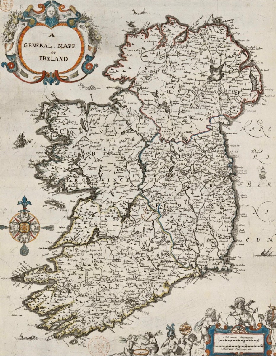
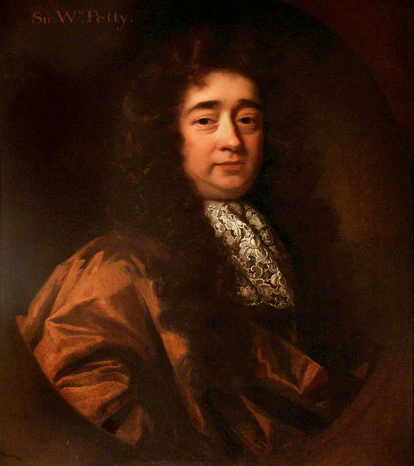
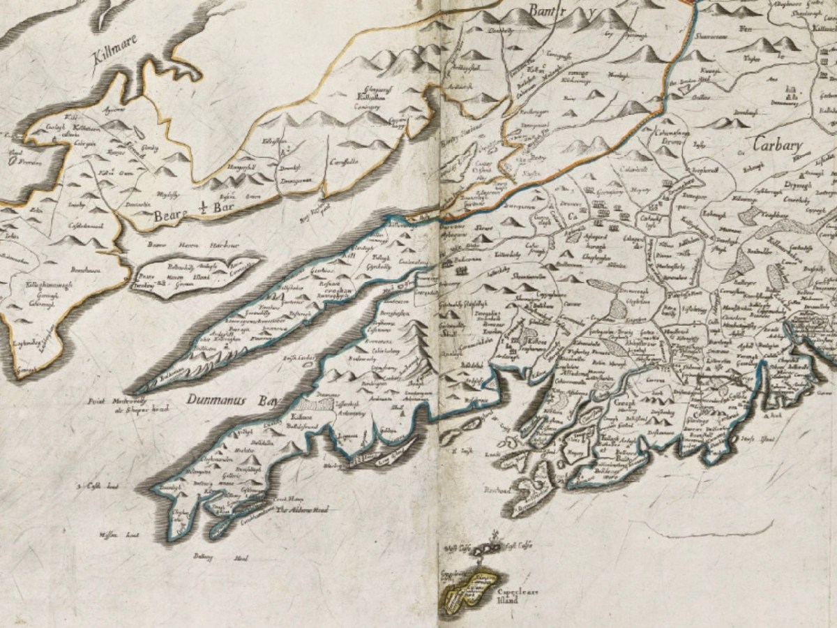
The Down Survey (the above view of some of the islands out in Roaringwater Bay is extracted from it) was carried out between 1656 and 1658, and thus gives us an excellent picture of how terrain we are so personally familiar with was perceived pictorially in the mid 17th century. We don’t know who the surveyors were, except that they were under the command of Sir William Petty, ‘surgeon- general of the English army’. Ireland became one of the most-mapped countries in the world at that time, following the Cromwellian and Williamite land redistributions. The beneficiaries were the new landlords of the Ascendancy, who wanted to know exactly what they had acquired, and the initial emphasis was on boundaries and basic land-measurement.
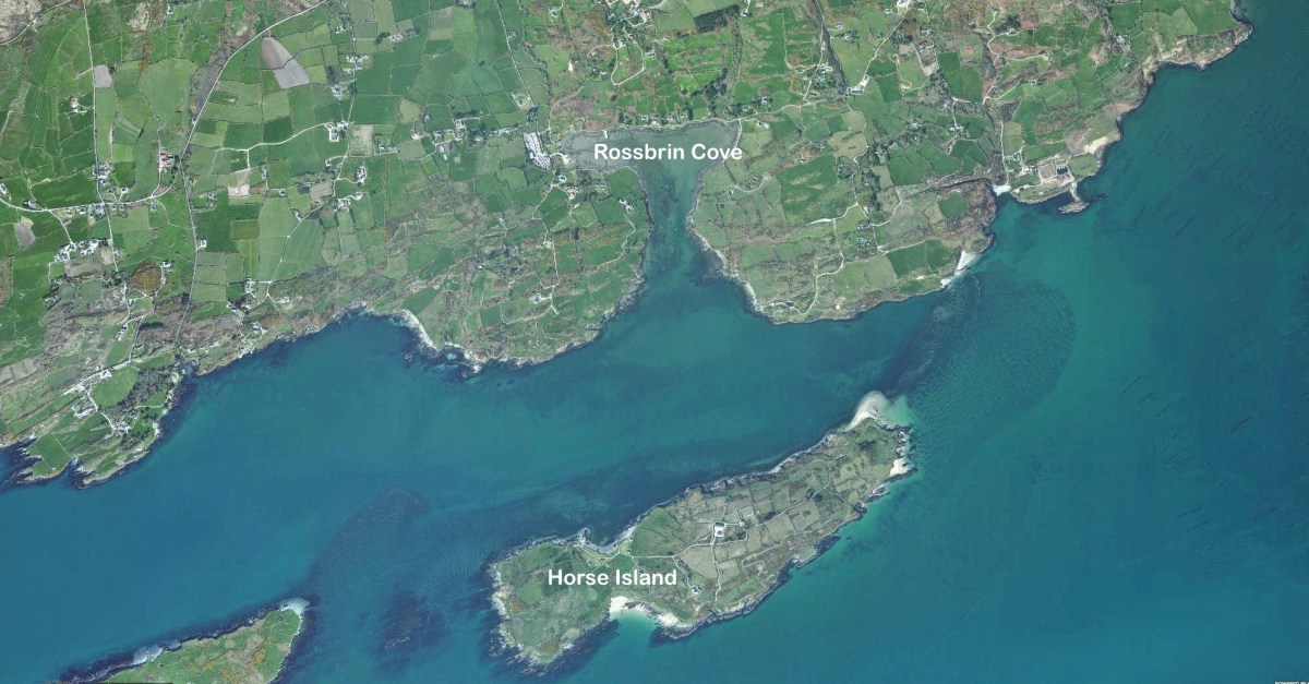
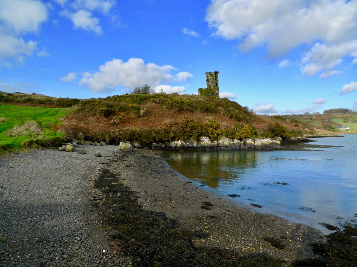
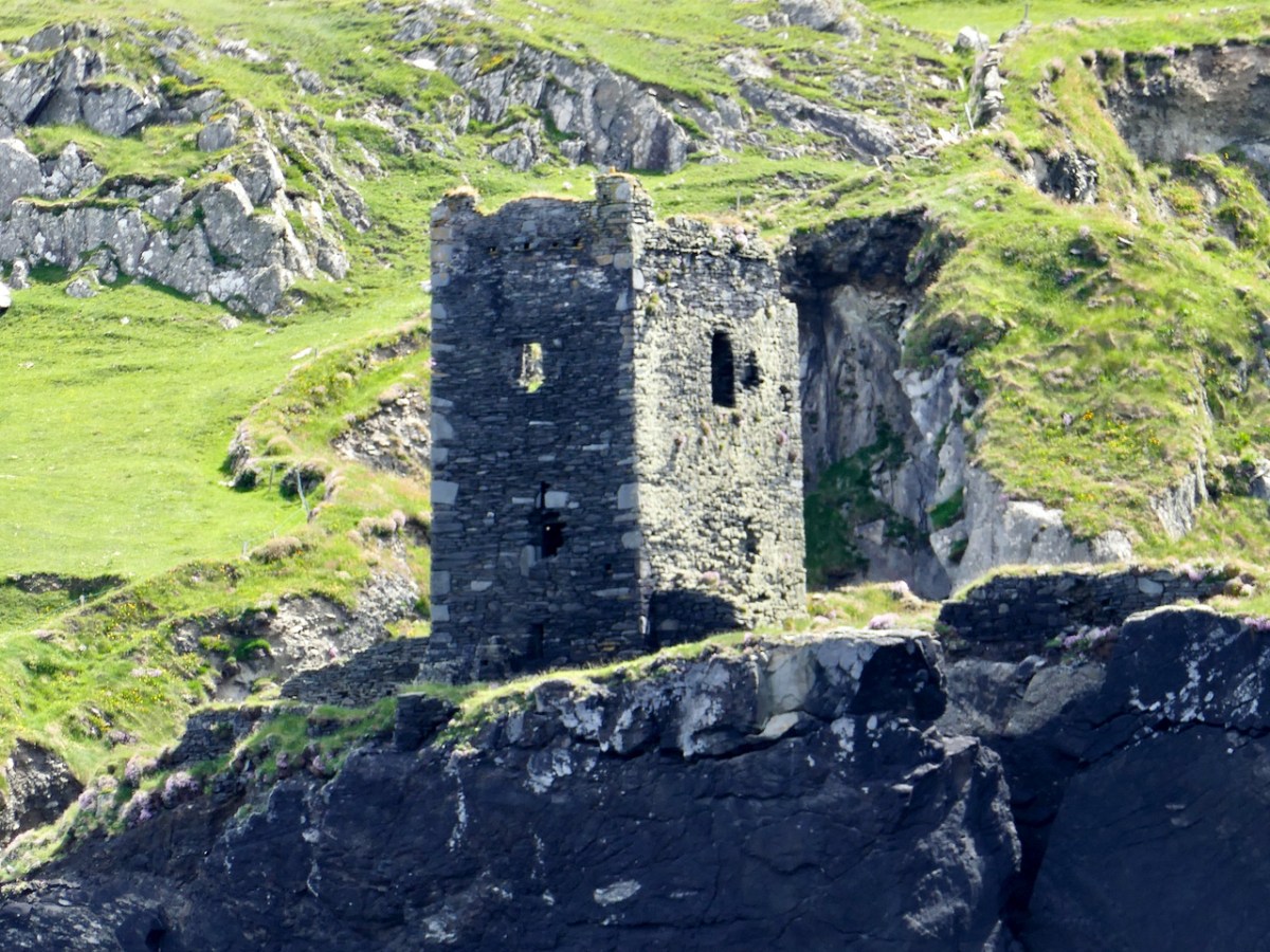
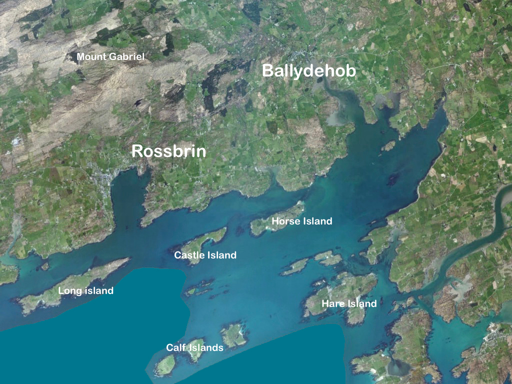
We wanted to know what our little bit of West Cork looked like on those earliest maps. Our view is down toward Rossbrin Cove, below where we live, and our house is a mere blip on the contemporary aerial view at the top of the page. In the first example from the Down Survey mapping – under that view – the cove of ‘Rofsbrinine Harbour’ is marked, and the castle, whose remains still guard the harbour entrance to this day (above), is clearly shown.
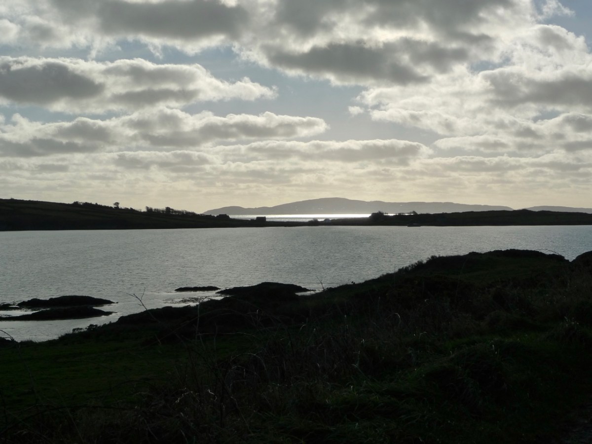
This view looks across the channel from the site of Rossbrin Castle. Immediately in the foreground is Horse Island, while beyond is the distinctive profile of Cape Clear. Let’s look at the Down Survey entry for Cape Clear – with. for comparison – a modern map of that island below it.
That map, above, is taken from a nautical chart. It’s understandable that a 17th century map wouldn’t have the level of accuracy we would expect from a modern survey, but take a look, now, at this contemporary aerial view of Cape Clear Island:
It’s remarkable, I think, how strikingly the early map resembles the profile – if not the fine detail – of the modern chart – and also the shape of the island as shown on the aerial view. For example, the ‘Bill of Cape Clear’ shows up very clearly on the chart – the beak-like protrusion on the far western end of the land-mass – a feature which is represented as very similar on the 17th century version, and of course on the modern prospect. Here’s a view of Dún an Óir – Cape Clear’s castle – today:
Just to add to the experience, the above satellite view gives a more ‘flattened’ impression of what is really going on locally: compare this to the expanded view of our coastline from the Down Survey – note that ‘Cape Cleare’ is included on this extract:
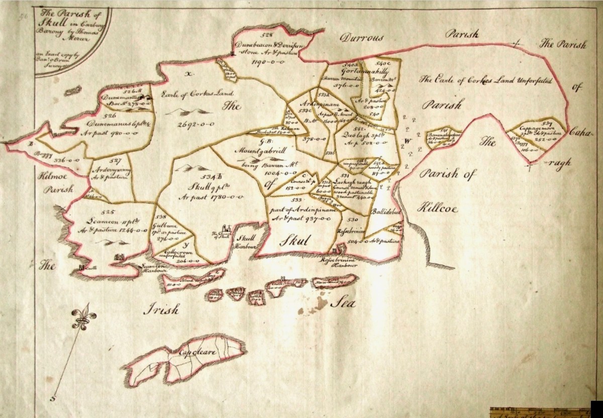
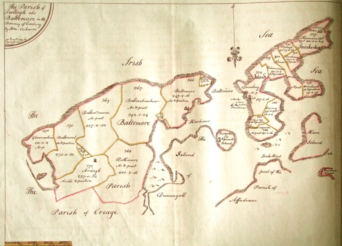
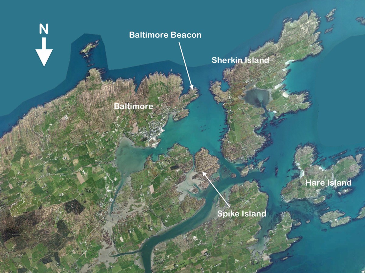
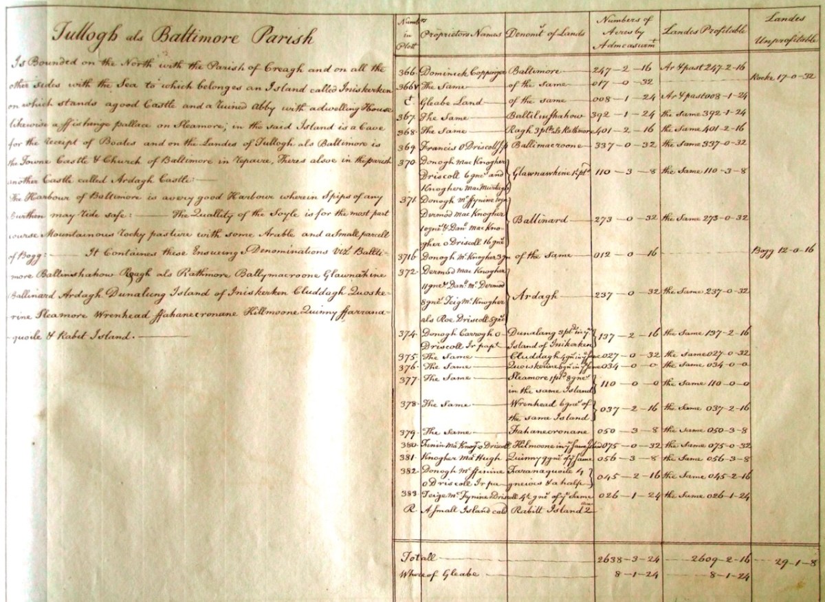
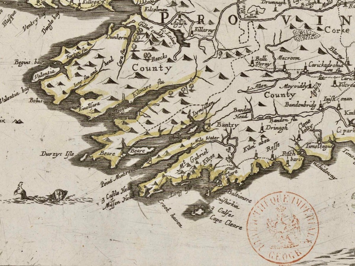
As a further example, to finish off this brief overview (which will be continued in future posts) let’s have a look at the Down Survey entry for the Baltimore area – a little further along our coast, travelling east:
This is in fact the Down Survey entry for the Parishes of ‘Tullogh & Baltimore’. The first thing to note is that the north point is facing downwards! If you look at many of the survey pages the orientation varies considerably, and is probably more to do with what conveniently fits on a sheet than any attempt to be consistent. So that we can make an easier comparison with today’s terrain, I have also switched the orientation of this aerial view:
In my opinion it’s remarkable that the Down Survey maps do bear a very reasonable resemblance to the reality. Obviously, a great deal of detail is missing, but the purpose of the maps – to delineate land ownership – is satisfactorily served (albeit that this is to the benefit of the incoming English lords and landowners).
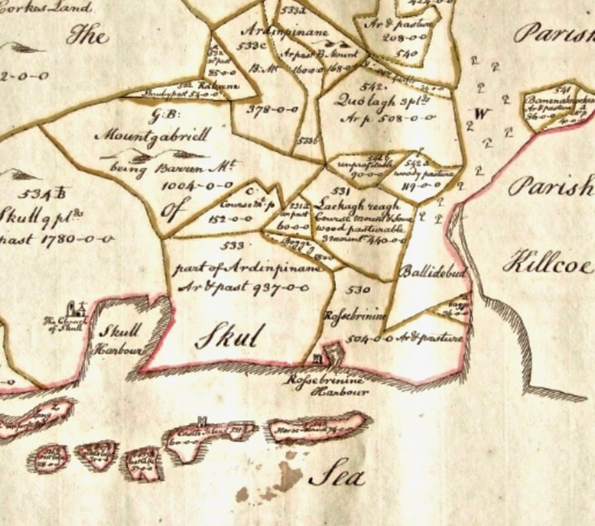
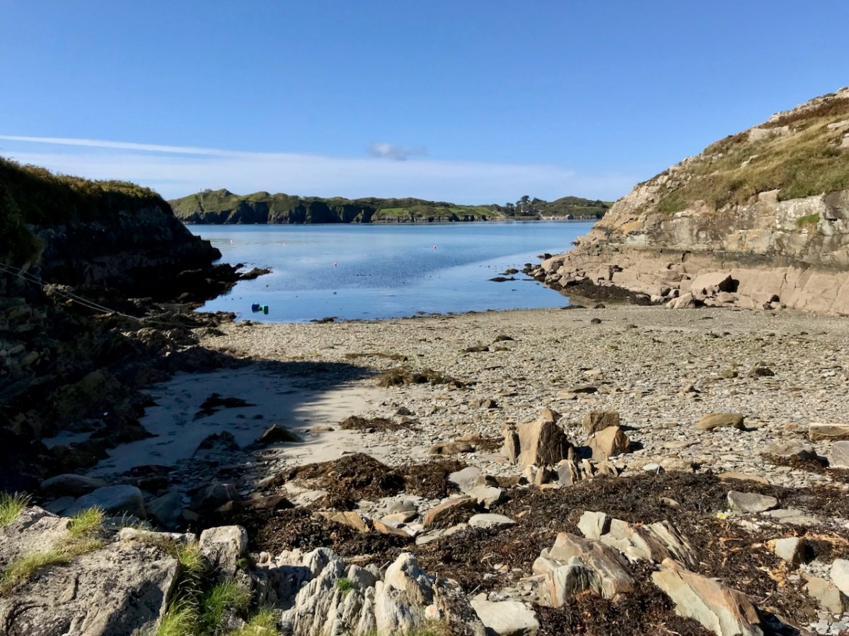
Here’s a view of the site of the medieval fish palace at Baltimore. The Down Survey comprises more than maps: there is other related material, including terriers. These particular terriers don’t have legs or tails – it’s a term for a written, descriptive survey of an estate: some english examples are recorded from the ninth century. Here’s the terrier for Baltimore within the Down Survey:
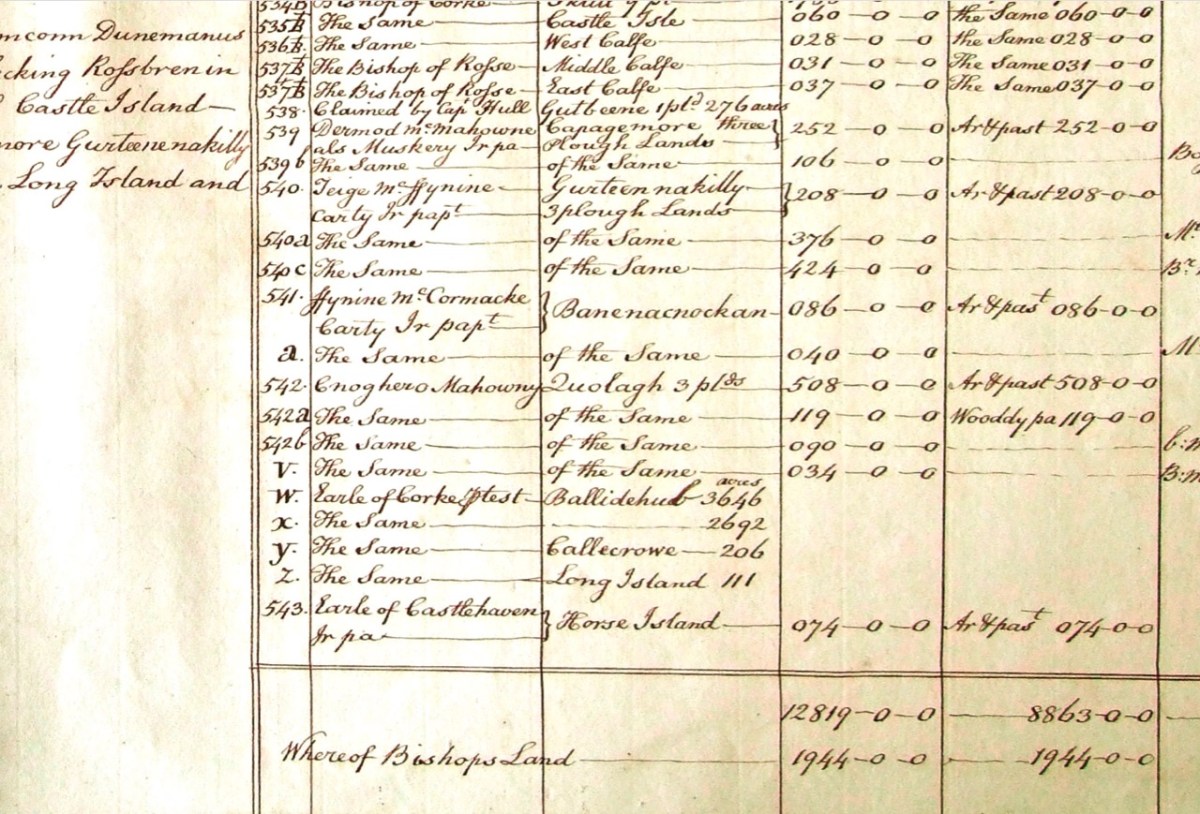
The terrier in this case is mainly a description of parcels of land, their owners, and the values. Here’s a closer example, from a terrier for ‘Skull’:
There’s a lot more of West Cork within the Down Survey archives. A future post will turn in greater detail to some of this material.
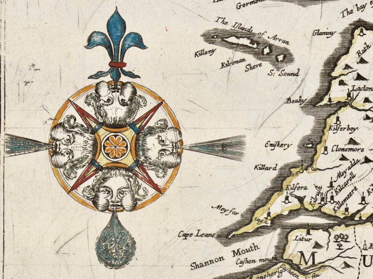
Here’s a fascinating title block. What are these cherubs doing? The couple on the left are excited about the operation of a magnetic compass; the little drummer is wearing a plumed helmet and has a decorated sash around his torso; cherub number 4 is bearing a spherical astrolabe, while the three on the right are actively engaged in surveying – using a Gunter’s Chain. This latter instrument – by the way – achieved, in the seventeenth century, something we seem to find tricky in our present day: the simple reconciling of imperial and metric measurements!
The cherub image, and the two above, adorn and decorate a remarkable document: the Down Survey map of Ireland. As this survey was ordered by Oliver Cromwell after an cogadh a chriochnaigh Éire (the war that finished Ireland) it seems strange that the north point of the compass is a fleur-de-lis: usually a symbol of the Virgin Mary. Cromwell himself was, of course, a Puritan and a Protestant and his actions in Ireland were aimed at subduing the rights and practices of Catholics, driving them ‘to Hell or Connaught’ – the poorest lands to the west of the Shannon river.
The decade following the Irish rebellion of 1641 witnessed a particularly turbulent period of warfare in Ireland between Catholic families and invaders from England, who were led by the dispossessed followers of the crown during the Civil War, which lasted through most of that period. The Act for the Settling of Ireland (1652) imposed penalties including death and land confiscation against Irish civilians and combatants after the Irish Rebellion and subsequent unrest. British historian John Morrill wrote that the Act and associated forced movements represented …perhaps the greatest exercise in ethnic cleansing in early modern Europe…
Sir William Petty – in charge of the Down Survey. Portrait by Godfrey Kneller, courtesy Romsey Town Council.
. . . Taken in the years 1656-1658, the Down Survey of Ireland is the first ever detailed land survey on a national scale anywhere in the world. The survey sought to measure all the land to be forfeited by the Catholic Irish in order to facilitate its redistribution to Merchant Adventurers and English soldiers. Copies of these maps have survived in dozens of libraries and archives throughout Ireland and Britain, as well as in the National Library of France. This Project has brought together for the first time in over 300 years all the surviving maps, digitised them and made them available as a public online resource . . .
We are very fortunate to be able to freely access – through the internet – this website which contains all available copies of the surviving Down Survey maps, together with written descriptions (terriers) of each barony and parish that accompanied the original maps. These bring out for us very detailed information on what the surveyors recorded in Ireland three and a half centuries ago.
Examples from map extracts, showing the quality of reproduction which can be obtained from the site. These show our own West Cork, with local names that have a familiar ring: Ballidehub, Skull, Rofsbrinie, Affadonna. Having discovered this resource, we know this site will be invaluable in our history researches. Look out for my next post exploring the fine detail of the survey.
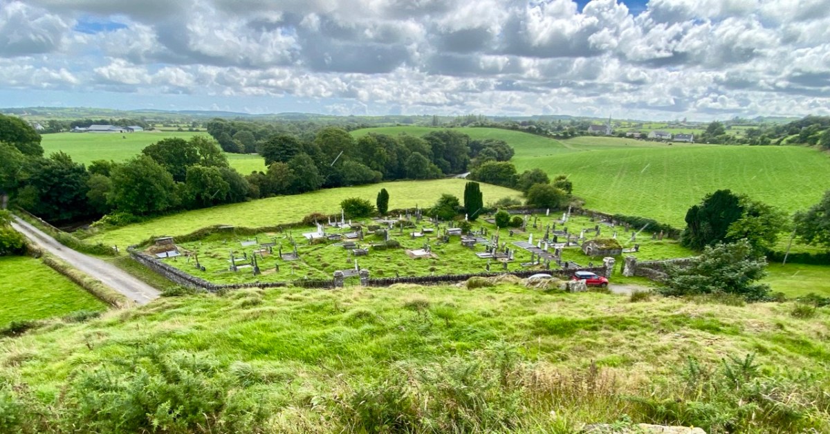
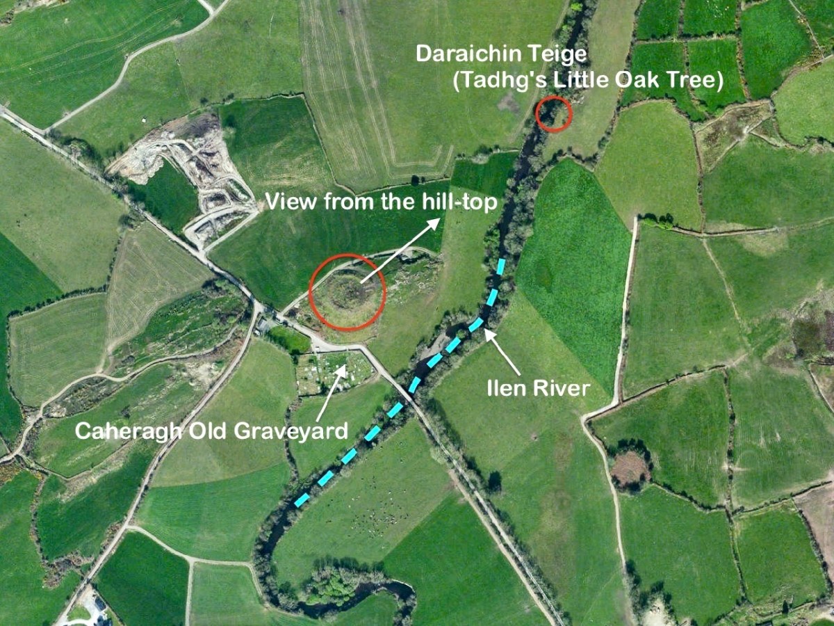
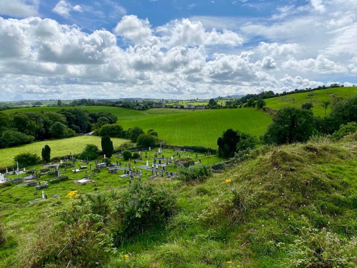
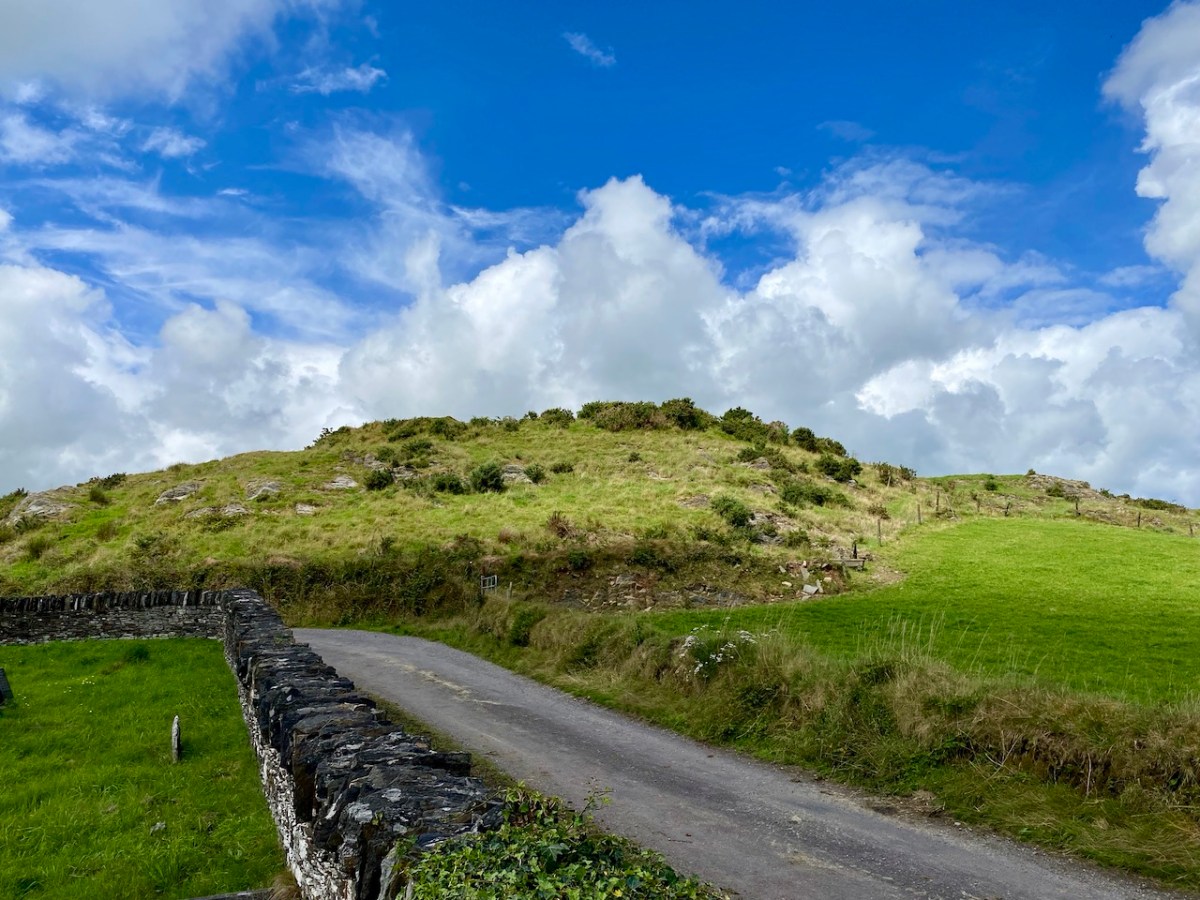
I’ll explain at the outset that Caheragh is (more or less) pronounced ‘corer’ (as in coring apples)! It’s a parish in West Cork that we have visited before. Have a look at my article on the Ilen River, here. This locality is brimming over with history and we go exploring as often as possible: there is always more to find. And – with wide views and cloud scapes in all directions from the high ground – it’s an uplifting place, especially when blessed with the August sun.
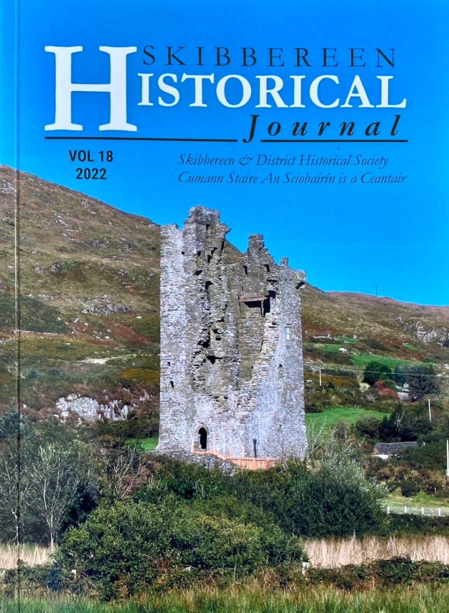
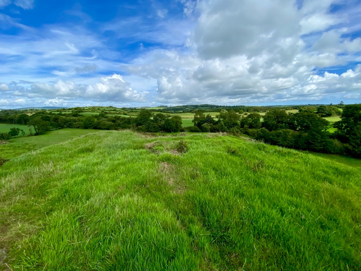
Here’s a vista to the north-east, from the top of the mound beside the graveyard that might just be a ring-fort, or possibly the site of a monastic centre dating from medieval times – more on that later. In the middle distance is the Ilen River with its wooded banks, heading out towards Castle Donovan and – eventually – to its source on Mullaghmesha (or, perhaps, Nowen Hill – we have yet to determine exactly where it rises. This post from the Sweet Ilen series covers the area). And that Donovan castle itself graces the cover of the latest Skibbereen Historical Journal (Volume 18, 2022), which you can get in bookshops locally, or online here. You will find a summary of some of my research on the Ilen River in this journal, together with many other fascinating and erudite articles.
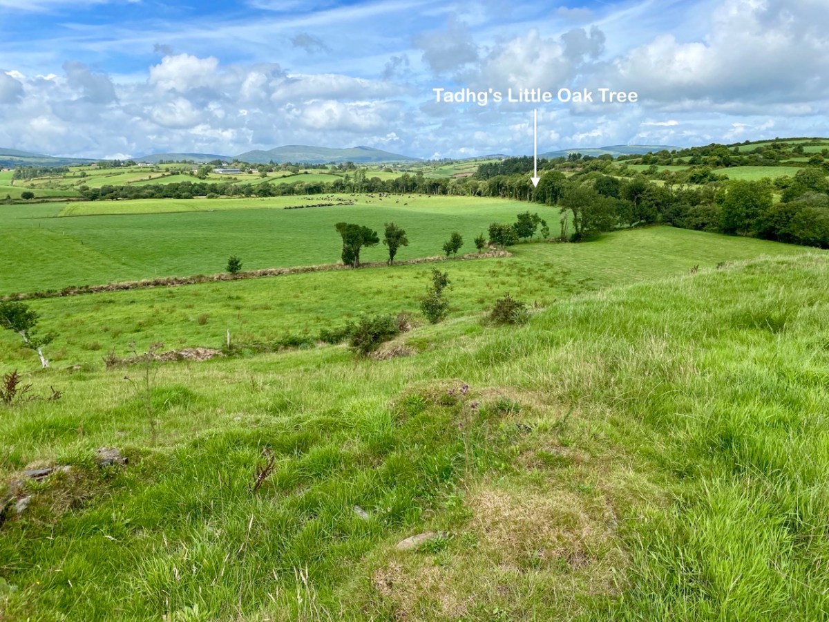
But, going back to that sunlit vista, you’ll notice Tadhg’s Little Oak Tree is indicated. I can’t resist quoting the story of this feature that appears as a ‘Redundant Record’ in the Historic Environment Viewer:
. . . On E bank of River Ilen. Site of tree, ‘Darriheen Teige’ or ‘Daraichin Teige’ (Tadhg’s little oak tree), where Tadhg O’Donovan, chieftain of Clan Cahill, was slain c 1560 by rival group of O’Donovan’s (O’Donoghue 1986, 55). Nearby is Poll a’ Daraichin (pool of the little oak) . . .
Archaeology.ie Historic Environment Viewer – Record CO132-066
Well, it seems strange that the ‘site of a tree’ is a recorded monument. In fact, if the oak was still flourishing (we couldn’t find it), it would probably be just one of only a few trees included in Ireland’s vast record of archaeological monuments!
For today’s post I am indebted to our historian friend Pat Crowley, who directed us to a clip from The Southern Star newspaper dated January 12, 1929. It was a letter written to the newspaper by Captain Francis O’Neill, retired Chief of Police in Chicago and well-known prolific collector of traditional Irish music. O’Neill (1848-1936) was raised in his family home at Tralibane, in the parish of Caheragh. He has been mentioned in this journal, and I was fascinated to read his letter, which became a protracted discussion on the parish, the old graveyard, historic sites and archaeology in the area.
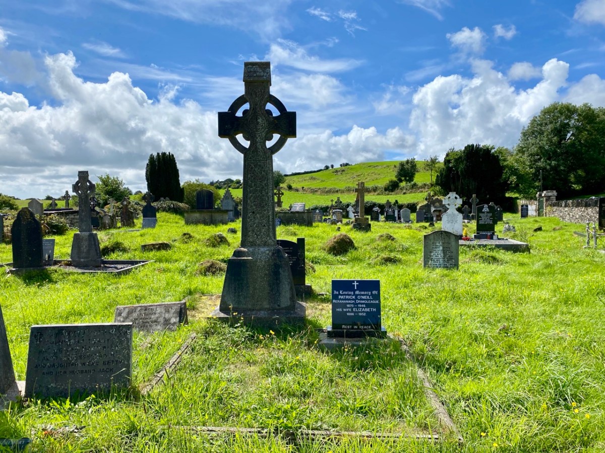
All this came about because Francis had returned from Chicago to West Cork in 1906 – after a long absence – ostensibly to visit the burial place of his parents, and to order a suitable monument to mark their graves (above).
. . . On my return to Ireland July 1906, after an absence of 41 years, I visited the bleak Caheragh graveyard, in which the remains of my parents, and O’Neill ancestors, were buried. There being nothing visible in the environment to indicate its origin as a cemetery, personal curiosity, abetted by that of the Downings of Tralibane – cousins of McCarthy Downing, MP – led to investigation . . . The result, somewhat disconnected and fragmentary, is herewith submitted for publication . . .
Southern Star 12.01.1929
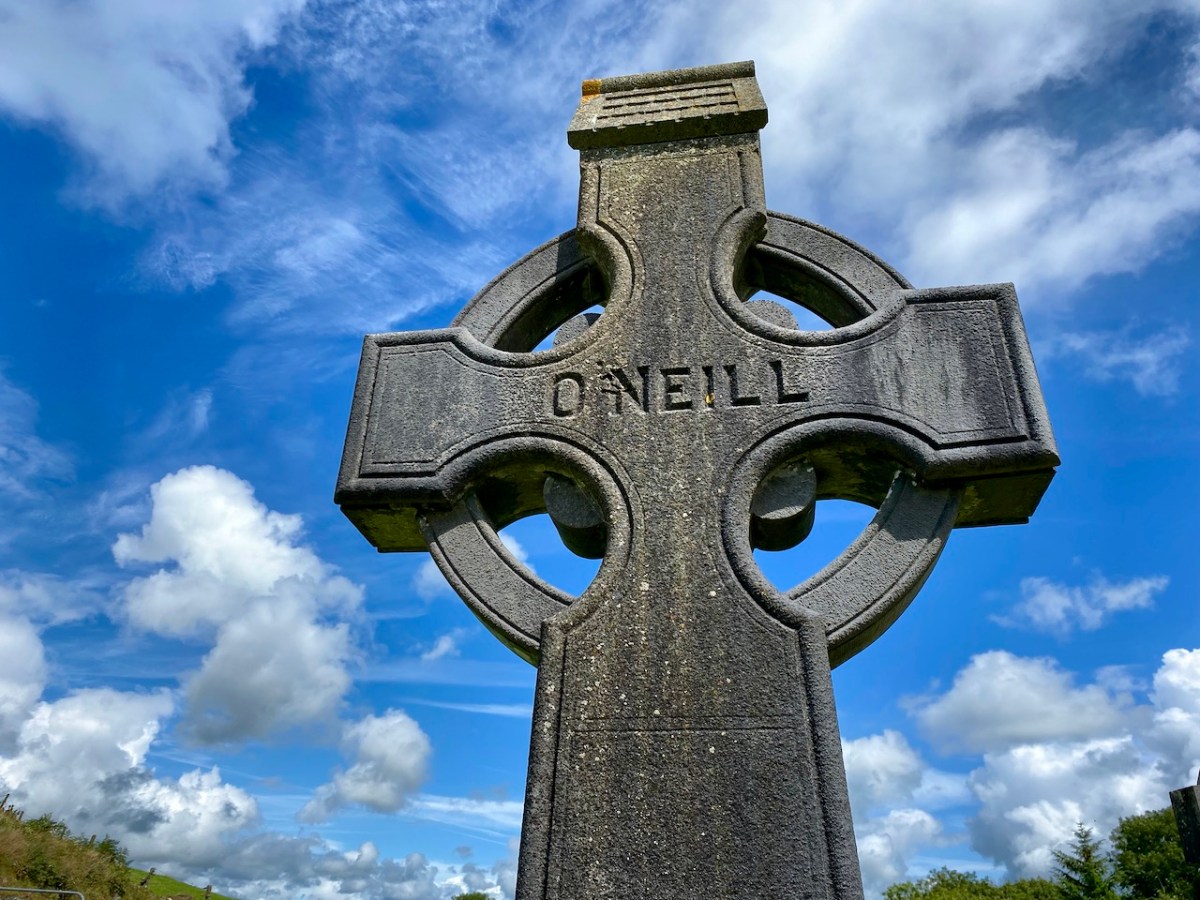
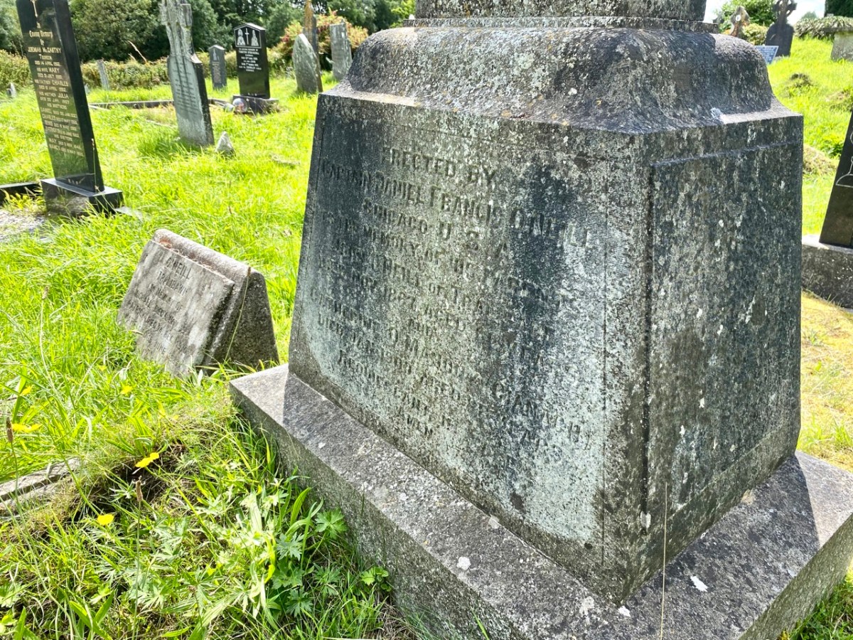
The O’Neill burial plot at Caheragh. Francis ordered the large cross to mark the graves of his parents. The inscription reads:
Erected By Captain Daniel Francis O’Neill Chicago USA To the Memory of his Parents John O’Neill of Tralibane Died Nov 1867 Aged 66 Years And Catherine O’Mahoney (Cianach) Died 1900 Aged 88 Years Requiescant In Pace Amen
Quoting again from Francis O’Neill’s letter to the Southern Star:
. . . All available authorities in my library have been consulted, and I find that references to the parish of Caheragh are both meagre and obscure… The earliest mention of this parish which has come to my notice, is in the report of Dive Downes, Episcopal Bishop of Cork and Ross, who made a trip on horseback to all parishes in his diocese in the years 1699 – 1702. Following is the entry: –“Caheragh Church, about two miles distant from Drommaleage Church to the SW lies close to the Island River (he means Ilen). On the west side of the river are 35.5 lowlands in this parish, of which 20 lie on the west side of the river, and 6.5 lie on the east side of the said river . . . There are about 12 Protestant families in this parish. ’Tis thought there are forty Papists for one Protestant in this parish . . . Will Gureheen, a very old man, is priest of this parish. . . The church is ruinous. The north side is down . . .”
Southern Star 12.01.1929
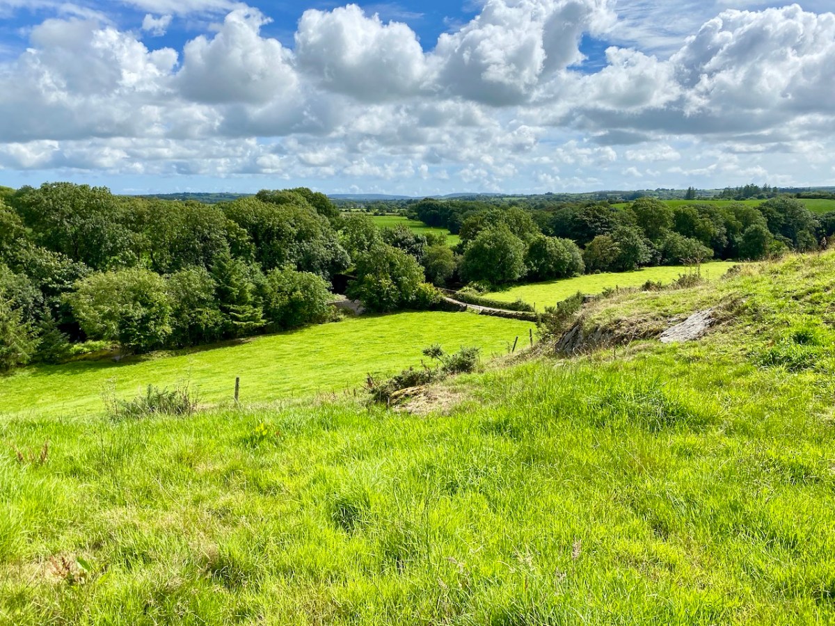
A vista to the west, from the top of the mound beside the graveyard. The present-day village of Caheragh is distant beyond the green pasture (a long way from this ‘Old Graveyard’ – why…?), identifiable through the spire of the 1963 Holy Family Church. O’Neill continues, now quoting from Samuel Lewis “A Topographical Dictionary of Ireland” published in London in 1837:
“Near Lisangle are the ruins of a strong castle, once the residence of McCarthy, King of Cork. The ruins of the old church also remain, which the people here call the ‘Abbey of Cahir” . . . The absence of ruins at Caheragh, which, by the way, seems to have never attracted the attention of historians or antiquaries, is easily accounted for. The stones, conveniently at hand, were utilised in the building of the walls which encompassed the graveyard . . .
Southern Star 12.01.1929
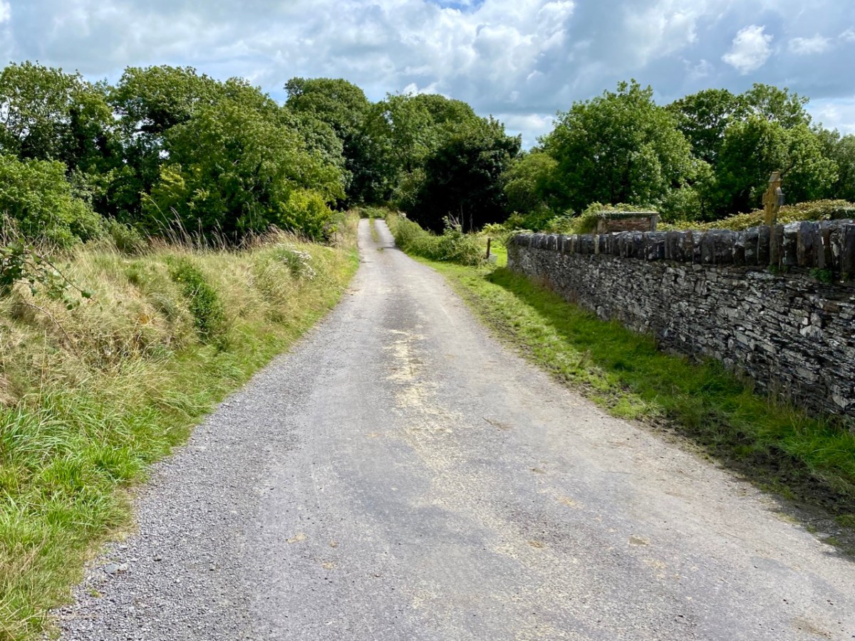
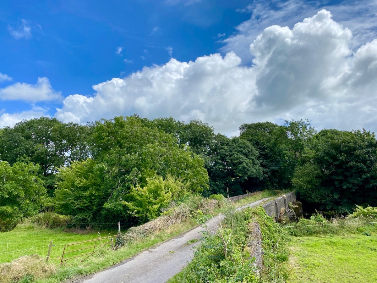
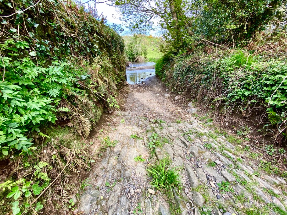
Above – the western boundary wall of Caheragh Old Graveyard. The small road continues over the Ilen River: the bridge here was built by the Congested Districts Board for Ireland in the early years of the twentieth century, to replace a ford, the stone flag bed of which can still be seen.
. . . The Irish word Cathair, spelled and pronounced in English Caher or Cahir, meant a circular stone fort, and therefore Caheragh, under any form of spelling, signifies the field of the stone fort. But where is the fort? one naturally asks. Remembering the descriptive nature of the Irish place names on my short call at Caheragh in 1906, I looked for something to justify the name and found it. In order to gain a vantage point, to view the country round about, I struggled through the thicket of furze to the top of the hill east of the road and, unexpectedly, to my great delight, found the outlines of the stone foundations of the Cahir, mostly covered with soil and grass, but quite distinct on the flat top. Again was the correctness of Irish topographical names vindicated . . .
Letter from Capt Francis O’Neill, Southern Star 12.01.1929
This feature (the two pictures above) is the hilltop referred to by O’Neill, where he claims to have found the ruins of the ‘Cahir’. Today it is recorded on the National Monuments Record as a ‘ringfort’ or ‘rath’:
CO132-017001-
Class: Ringfort – rath
Townland: CAHERAGH
Description: In pasture, atop hillock broken by rock outcrop. Circular area (36.5m N-S; 37.5m E-W) enclosed by earthen bank (max H 3.8m). Break in bank to NNW (Wth 5m); and WSW (Wth 4m), where triangular feature adjoins inner bank face. Possible souterrain (CO132-017002-) in SW quadrant
Archaeology.IE National Monuments Record
Top: flat-topped mound with circular summit, very much in line with the expectation of a ringfort structure. Centre: stone embankment seen from the top of the ‘fort’. Lower: a defined ‘entrance’ through the ‘fort embankment’ on the summit of the mound. This could be ancient or modern: cattle use the fields in which this feature is located, and some of the topography could be shaped by this usage over centuries.
. . . The builders of Abbeys and Monasteries were wise in their day in the choice of locations for their establishment, and one essential desideratum was near to a plentiful supply of water, such as the banks of lakes and rivers, or adjoining never-failing springs. In this instance the River Ilen met all requirements, and taking everything into consideration, I am led to the conclusion that the graveyard at Caheragh was the site of the “Abbey of Cahir” mentioned by Lewis in the Topographical Dictionary of Ireland . . .
Letter from Capt Francis O’Neill, Southern Star 12.01.1929
Above: evidence of built structures on the summit of the ‘ringfort’ mound at Caheragh. A significant circular foundation is clearly outlined. Perhaps, after all, there is some substance in the Captain’s musings on what occupied this site in earlier times? This account is from The county and city of Cork remembrancer; or, Annals of the county and city of Cork by Francis H Tuckey, Savage and Son, 1837:
. . . 1317 December 28, Geoffrey Fitz John de Cogan is presented by the King (by mandate to the Bishop of Cork), to the church of the Blessed Mary de Catheragh, in the King’s gift, by reason of his wardship of the lands and heir of John de Cogan . . . ‘Blessed Mary de Caheragh’ was a monastic site, said to be ‘situated on the hilltop commanding the view above the graveyard at Caheragh’ (possibly on the site of the ringfort). It was no doubt founded here because of the proximity of the watercourse . . .
So there – for your consideration – is the suggestion that the hill above Caheragh’s Old Graveyard (which may, in earlier times, have been a ringfort with a souterrain) was the monastic settlement Blessed Mary de Caheragh in medieval times. That’s quite a thought. My own opinion would be that the monastery would have been founded on the level ground close to the river: in fact where the graveyard is today. As the monastery declined, a church might have remained, eventually becoming a ruin. It was common for old churches and their environs to be used for burials and this might account for the comparative remoteness of this site from the village itself. Now – of course – there is no trace of a church ruin. This theory would hold good except for the annals quoted above, which state that a monastic site was situated on the hilltop overlooking what is now the graveyard.
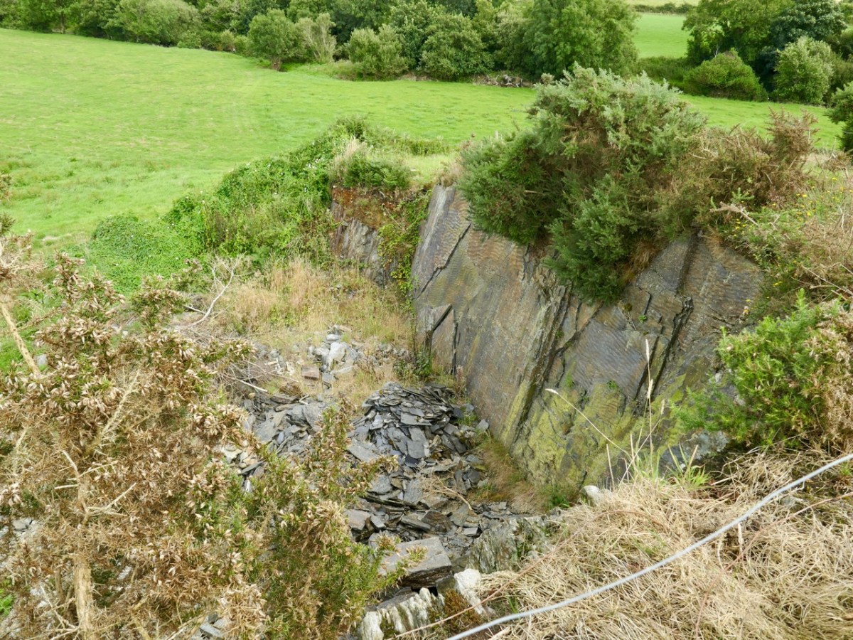
Evidence of stone quarries on the hillside suggest that significant quantities of stone has been used locally. Graveyard wall, field fences, or built structures? But the most challenging feature has to be the ringed foundation, or base, clear to see on the edge of the hill (below). Could it be a souterrain entrance – or, more fanciful, the base of a round tower?
I’ll leave you with that conundrum (and my whimsical daydream below) for now, but we will continue with Francis O’Neill’s musings (which become even more complex) in a future post.
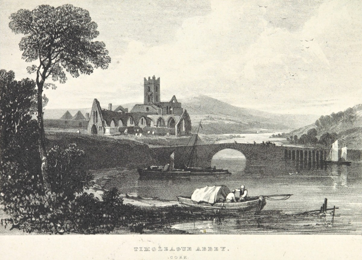
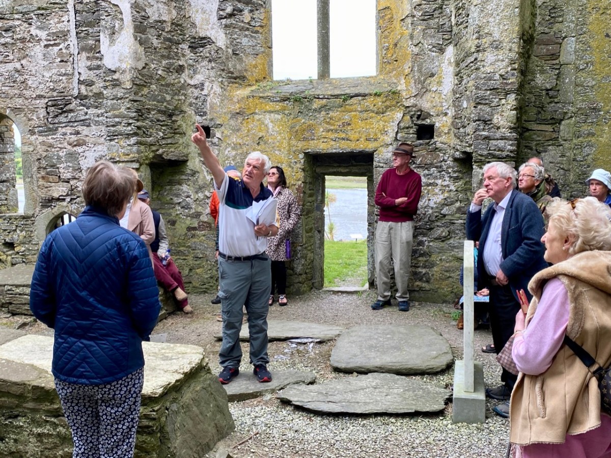
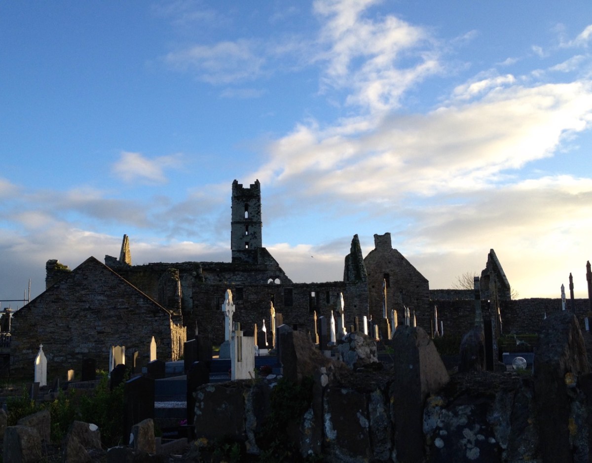
We had a great afternoon yesterday, exploring aspects of the history of Timoleague, in West Cork. Our Finola Finlay (above) was involved in an event organised by the Glass Society of Ireland. . . a professional all-island, non-profit association that opens a window onto the contemporary Irish Glass Community . . . The day’s proceedings were centred around the ecclesiastical buildings in the town, the earliest of which is the Franciscan Friary, now a substantial ruin beside the Argideen River.
This view of the ruined ‘abbey’, above, dates from 1830. It is located on the site of an early Christian monastic settlement founded by Saint Molaga, from whom the town of Timoleague derives its name. A story that I heard for the first time yesterday was told by local historian Donal Whooley: the Saint was trying to found his community back in the sixth century, but everything that he and his followers built fell down the following day. According to legend, it was originally to be built a mile west of Timoleague, but all work done on that site by day would fall down by morning. Interpreting this as God’s wish that the church should be built elsewhere, Molaga fixed a blessed candle on a sheaf of corn, and floated it down the Argideen river, siting his settlement on the spot that it came ashore, on the big bend in the waterway where the Friary ruins can be found today. Here is a view from the great three-light window which looks out to the east over the river. Finola told us that, in its heyday, this window would have been filled with beautiful medieval glass, bringing light and colour into the substantial nave of the church.
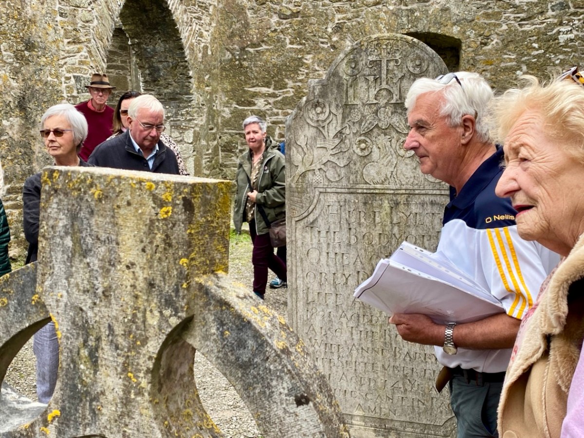
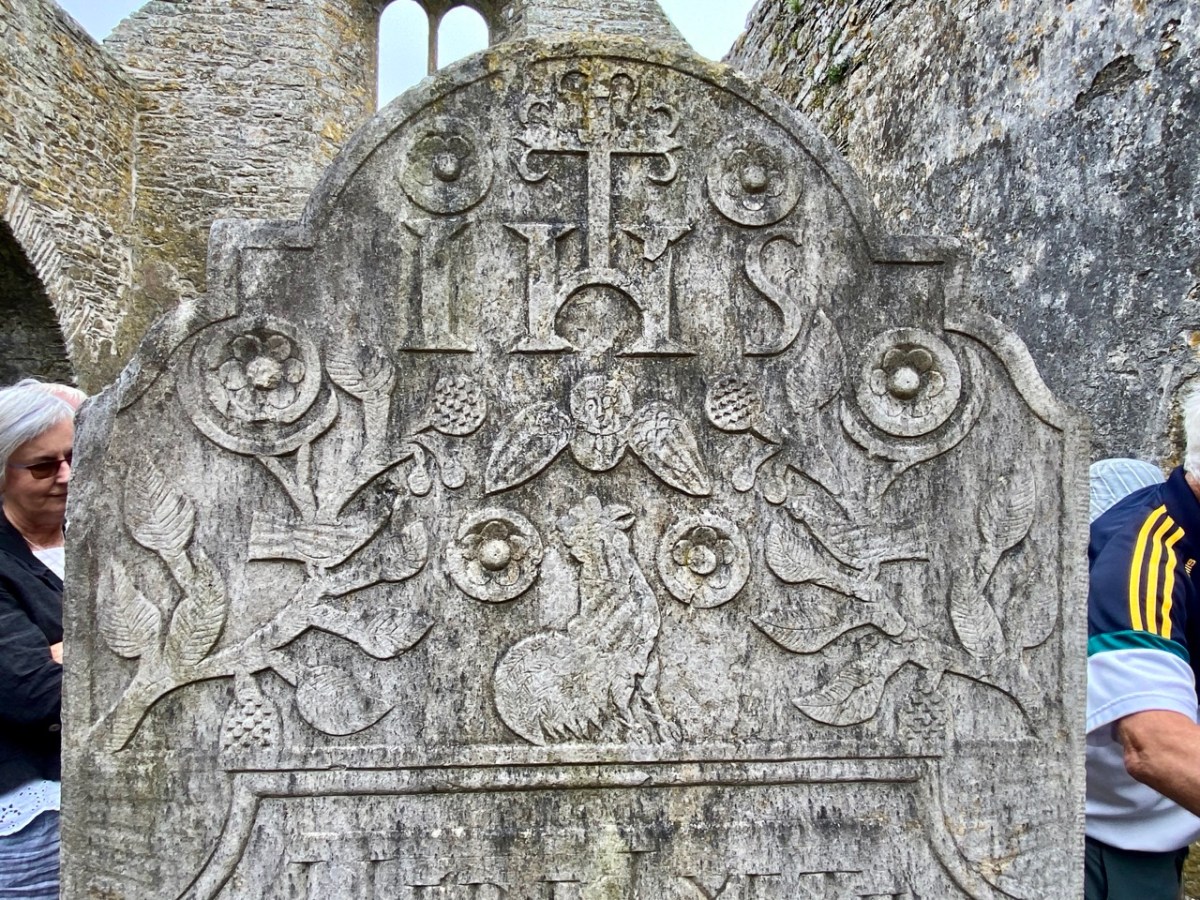
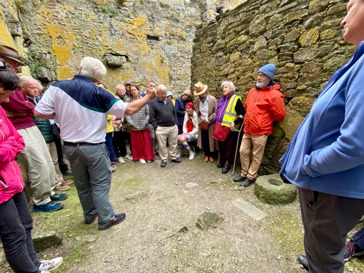
That’s Donal, above, leading our group of almost fifty keenly attentive people who shared an interest in the town and its history. To the right (in a blue jacket) is Father Patrick Hickey. He told us of the symbolism of the cockerel you can see on the large headstone in the nave (below), dating from 1821. Evidently some of the disciples were standing together while Christ was being crucified: nearby stood a pot in which a rooster was being boiled for supper. Judas reportedly said: do you think there’s any chance that our Lord will rise again? Mrs Judas retorted: there’s about as much chance of that as there is of that rooster jumping out of the pot and crowing! At which point – of course – the cockerel did just that!
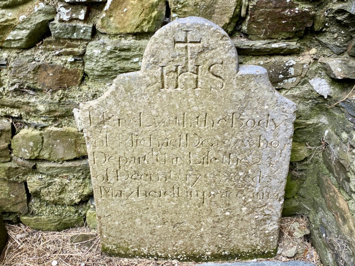
It was the custom to place burials in ruined church buildings. Here’s another fine headstone in Timoleague Abbey, to Michael Deasy, ” . . . who departed this life on the 23 December 1755, aged 33. May he rest in peace. Amen . . . “
Lively discussions ensued on the efficacy of wart wells, and Donal suggested that this repurposed bullaun stone, above could be the oldest human element on the whole site!
Here’s an aerial overview of the geography of Timoleague. The Friary ruin is only one of many historic sites of interest which caught our interest yesterday. It was Finola’s task to introduce us (or those of us who had never seen it) to the little Church of the Ascension.
This building is currently undergoing major improvement works: the lime rendered tower has created a striking landmark in the town. This work has become necessary by water penetration through the stonework leading to deterioration of the fabric. The conservation project is led by a hard-working Parish committee who also served us delicious tea and cakes since the tour was a fund-raiser for their efforts.
The early OS map extracts, above, give further context to the town’s history. The top map dates from the 1830s and comparison of the plan forms of the Church and Chapel buildings with those in the lower map, which dates from c1900, and then the present day aerial view (higher up the page) shows the degree of change which has taken place. We finished our town tour in the Church of the Nativity of the Blessed Virgin Mary. Here’s Finola standing outside it, below, prior to giving us an introduction to the history of the building, and its windows.
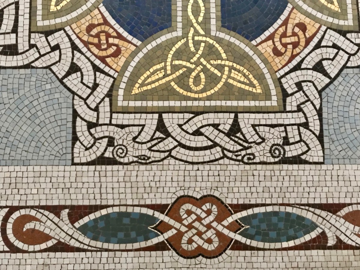
The fine Harry Clarke Studio window (one panel of which is shown in the upper picture) is a ‘must-see’, as is the mosaic work from the same church. The building work for this Catholic church, replacing an earlier chapel, dates from 1912.
Father Patrick Hickey nicely rounded off our day of Timoleague history by showing us the replica of the ‘Timoleague Chalice’ (above). The replica is kept in this Catholic church. According to Fr Hickey, ‘back in the penal days’ three monks were found floating in an open boat just off the island of Cape Clear. They had with them a box, or trunk. They were brought ashore but two of them died. The other asked that the box be kept on the island – but unopened – until he could return to retrieve it. He never returned, and in later years another visiting Priest said it could be opened. Inside was a gold chalice – blackened with age – and some liturgical vestments. The vestments fell to dust immediately, but the chalice was sent away for inspection, and was confirmed as coming from the Friary at Timoleague, where the replica is now kept.
Here is another ‘souvenir’ of Timoleague – it’s an extract from a poem written in Irish: The Mourner’s Soliloquy in the Ruined Abbey of Timoleague. The poet, Seághan Ó Coileáin, ” . . . was a Gaelic-language poet born in County Cork, in a time of faded Irish glory. He lived as a village schoolmaster, with a large family and no patron . . . “
Abroad one night in loneliness I stroll’d, Along the wave-worn beach my footpath lay; Struggling the while with sorrows yet untold, Yielding to cares that wore my strength away: On as I mov’d, my wayward musings ran O’er the strange turns that mark the fleeting life of man.
The little stars shone sweetly in the sky; Not one faint murmur rose from sea or shore; The wind with silent wing went slowly by, As tho’ some secret on its path it bore: All, all was calm, — tree, flower, and shrub stood still, And the soft moonlight slept on valley and on hill.
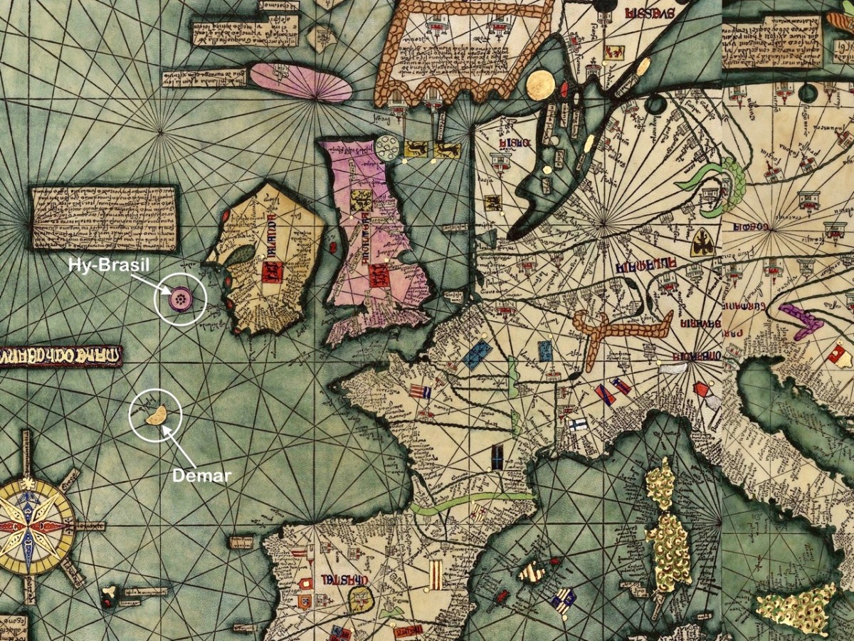
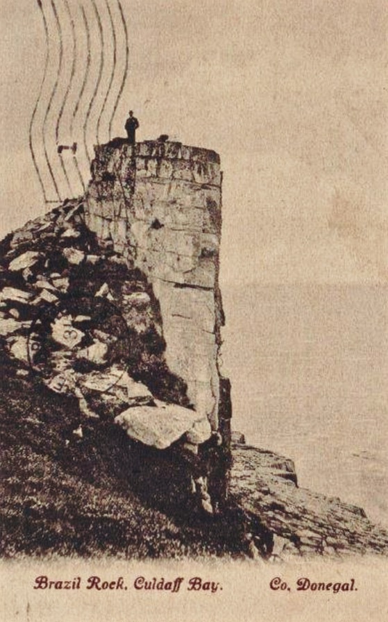
The fine map, above, was drawn in 1375 and is attributed to Abraham Cresques (courtesy Library of Congress, Geography and Map Division). it is known generally as the Atlas Catalan. What interests us is that it depicts two islands off the west and south-west coasts of Ireland (see detail below): Hy-Brasil and Demar. These landfalls are shown on maps since then through the centuries, the last depiction being in 1865.
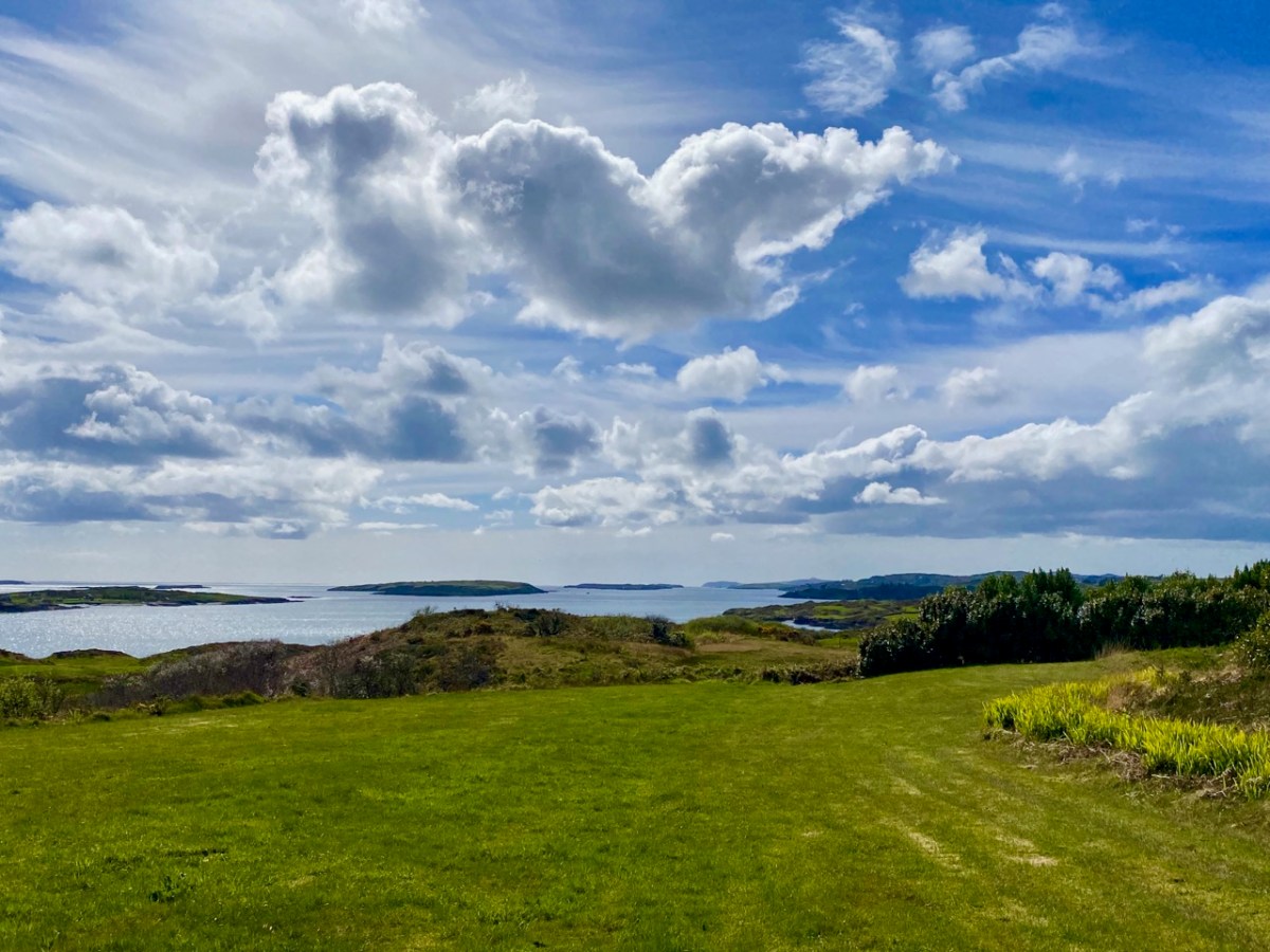
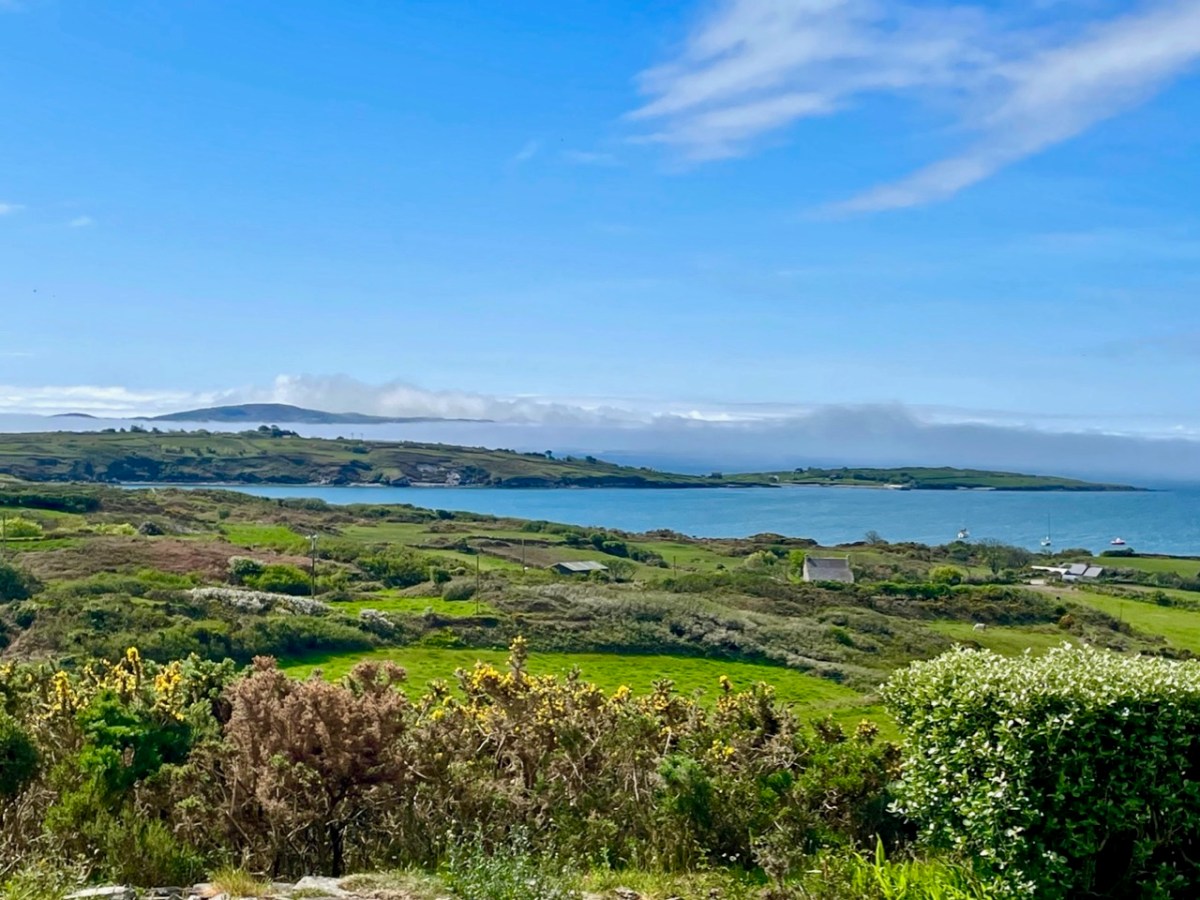
We look out to the hundred Carbery Islands in Roaringwater bay. The view (above) is always changing as sun, rain and wind stir up the surface of the sea and the sky and clouds create wonderful panoramas. But, generally, the view is predictable: we know that Horse island will be across from us, and Cape Clear will always be on the distant horizon, while the smaller islets break up the surface of the ocean in-between, and help calm down its wildness when the storms come.
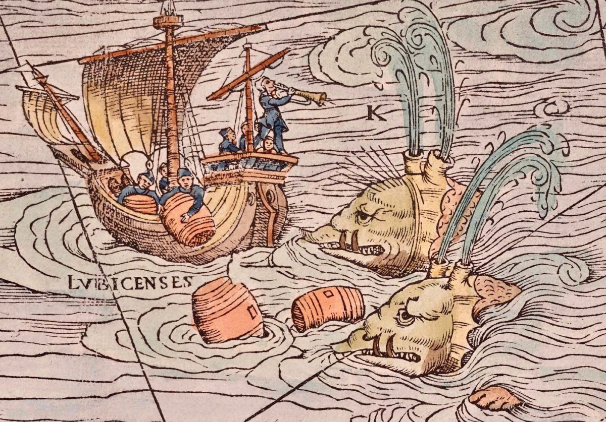
But, suppose it wasn’t always predictable? What if those islands changed, moved around or appeared and disappeared? It seems that such things do happen, here in Ireland. At least, they do according to some of the recorded evidence. ‘Mythical Islands’ have been mentioned by mariners and storytellers through the centuries.
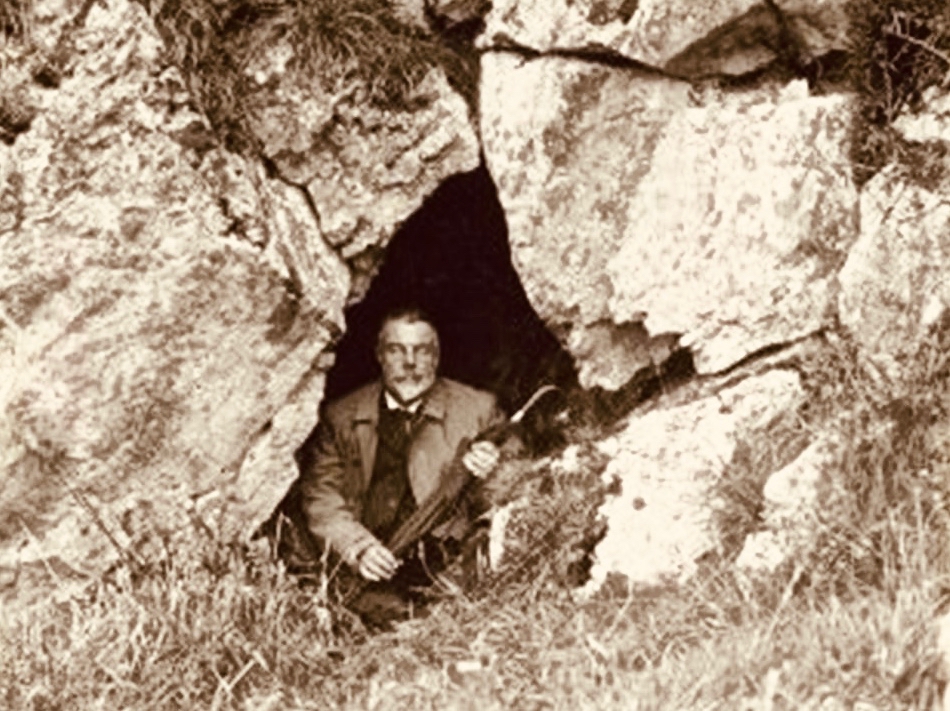
Our best source of information for Ireland’s ‘transcendent’ islands is our old friend Thomas Westropp (above, kitted out for an expedition) who was an archaeologist and folklorist living between 1860 and 1922. He was active in Counties Clare and Limerick and wrote a paper for The Royal Academy in 1912 – Brasil and the Legendary Islands of the North Atlantic: Their History and Fable. This comprehensive paper includes a list of evanescent islands, a new map drawn by Westropp, and a summary of historic maps which have located them:
Westropp’s exploration of the subject is remarkably comprehensive. Here are some extracts:
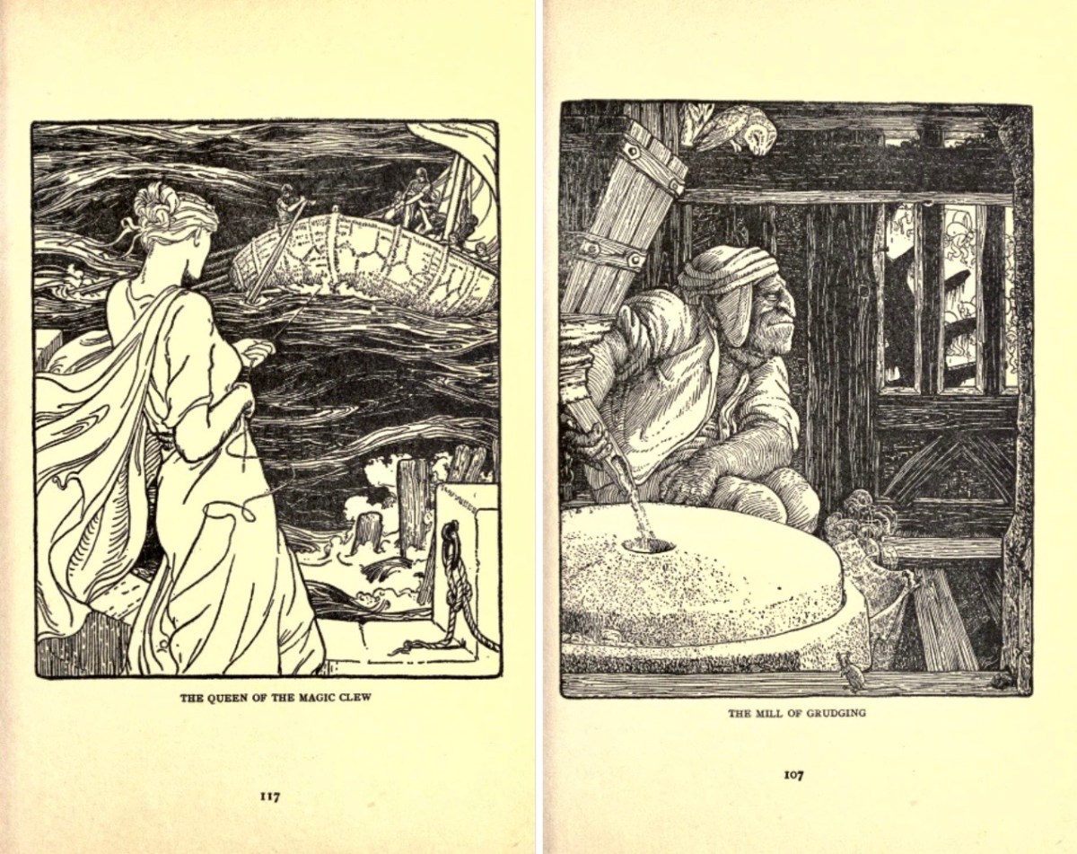
. . . Bran son of Febal, sleeping near his fort, hears sweet music, and awakes to seize a magic apple branch. An unknown woman sings of “a glorious island round which sea-horses glisten – a fair course against the white swelling surge.” In it dwells no wailing, treachery, death, or sickness; it glows many-coloured in incomparable haze, with snowy cliff’s and strands of dragon-stones and crystals. She vanishes, and Bran, with twenty-seven followers, embarks. They meet the sea-god Mananann mac Lir in his chariot, visit Magh Mell, the Isle of Laughter, and the Isle of Women, whose queen draws Bran to it by a magic clue. Entranced by love, the visitors do not note the flight of time; in apparently undiminished youth and strength they return to Ireland; it is only when the first to step ashore falls to ashes, as if centuries dead, that they know the truth. The survivors tell their tale without landing, and sail out into the deep, never to be seen again . . .
Thomas WESTROPP – Brasil and the Legendary Islands of the North Atlantic, 1912
. . . The Sunken Land. I found no name for this in north Mayo save when it was confused with Manister Ladra. Belief in it prevailed in north Erris and Tirawley from Dunminulla to Downpatrick. In 1839 it was said to extend from near Teelin to the Stags of Broadhaven and thence half way to America. A boatman knew a woman named Lavelle who saw from the shore (when gathering Carrigeen moss) a delightful country of hills and valleys, with sheep browsing on the slopes, cattle in green pastures, and clothes drying on the hedges. A Ballycastle boatman, a native of Co. Sligo, corroborated this, adding that he had seen it twice at intervals of seven years, and if he lived to see it a third time he would be able to disenchant it. He could talk of nothing else, became idle and useless, and died, worn out and miserable, on the very eve of the expected third appearance . . .
Thomas WESTROPP – Brasil and the Legendary Islands of the North Atlantic, 1912
. . . Owen Gallagher, Lieutenant Henri’s servant, heard of one Biddy Took, who, when gathering dillish (seaweed), asked some passing boatmen to put her out to an islet and fetch her back on their return : amused by her talk they brought her fishing, and soon got a ” tremendous bite.” They landed a green, fishy-looking child, quite human in shape, and in their fright let him escape and dive. The man who hooked him died suddenly within a year. Gallagher also said that he had fired at and wounded a seal; soon after, when far out to sea in his currach, he got lost in a fog-bank and reached an unknown island. An old man, moaning, with one eye blinded, stood on the shore and proved to be the seal. With more than human forgiveness, he warned his enemy to fly from the land of the seal men, lest his (the seal’s) sons and friends should avenge the cruelty . . .
Thomas WESTROPP – Brasil and the Legendary Islands of the North Atlantic, 1912
. . . The Aran people now believe that Brasil is seen only once in seven years. They call it the Great Land. In Clare, I have heard from several fishermen at Kilkee and elsewhere that they had seen it ; they also told legends of people lost when trying to reach it. I myself have seen the illusion some three times in my boyhood, and even made a rough coloured sketch after the last event, in the summer of 1872. It was a clear evening, with a fine golden sunset, when, just as the sun went down, a dark island suddenly appeared far out to sea, but not on the horizon. It had two hills, one wooded ; between these, from a low plain, rose towers and curls of smoke. My mother, brother, Ralph Hugh Westropp, and several friends saw it at the same time; one person cried that he could “see New York ” ! With such realistic appearance (and I have since seen apparent islands in 1887 in Clare, and in 1910 in Mayo), it is not wonderful that the belief should have been so strong, probably from the time when Neolithic man first looked across the Atlantic from our western coast. It coloured Irish thought ; stood for the pagan Elysium and the Christian Paradise of the Saints ; affected the early map-makers ; and sent Columbus over the trackless deep to see wonders greater than Maelduin and Brendan were fabled to have seen, till Antilha, Verde, and Brazil became replaced by real islands and countries ; and the birds, flowers, and fruit of the Imrama by those of the gorgeous forests of the Amazon in the real Brazil. ” Admiration is the first step leading up to knowledge, for he that wondereth shall reign.” . . .
Thomas WESTROPP – Brasil and the Legendary Islands of the North Atlantic, 1912
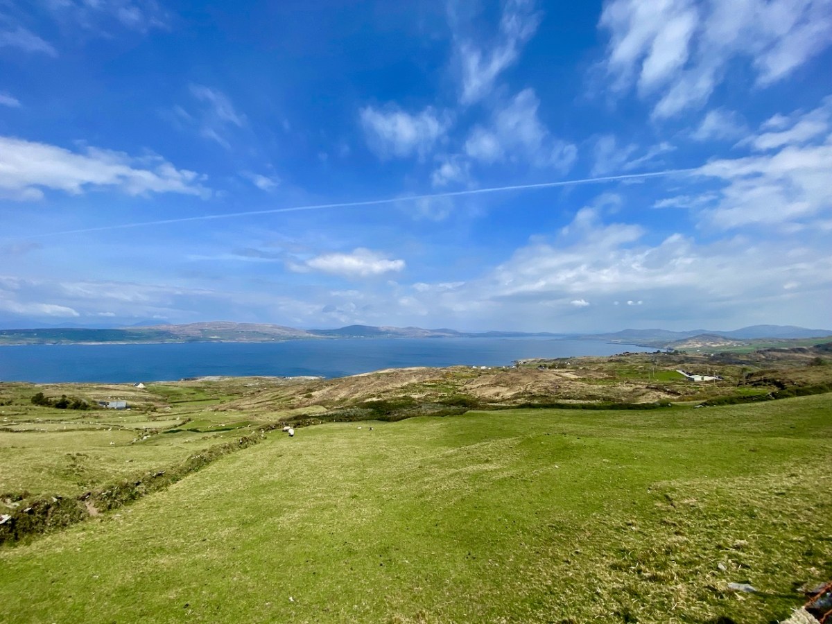
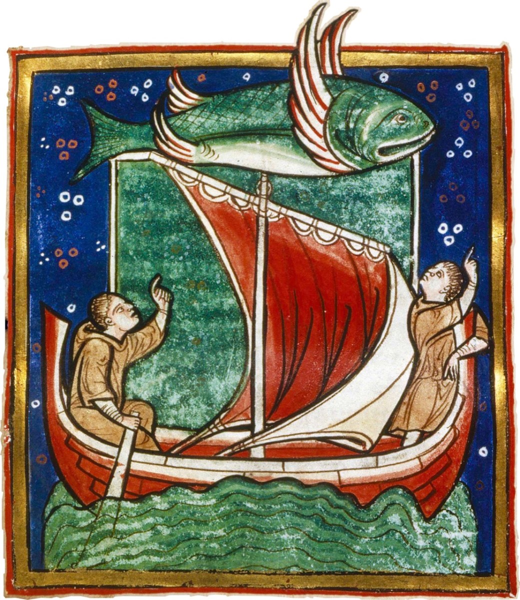
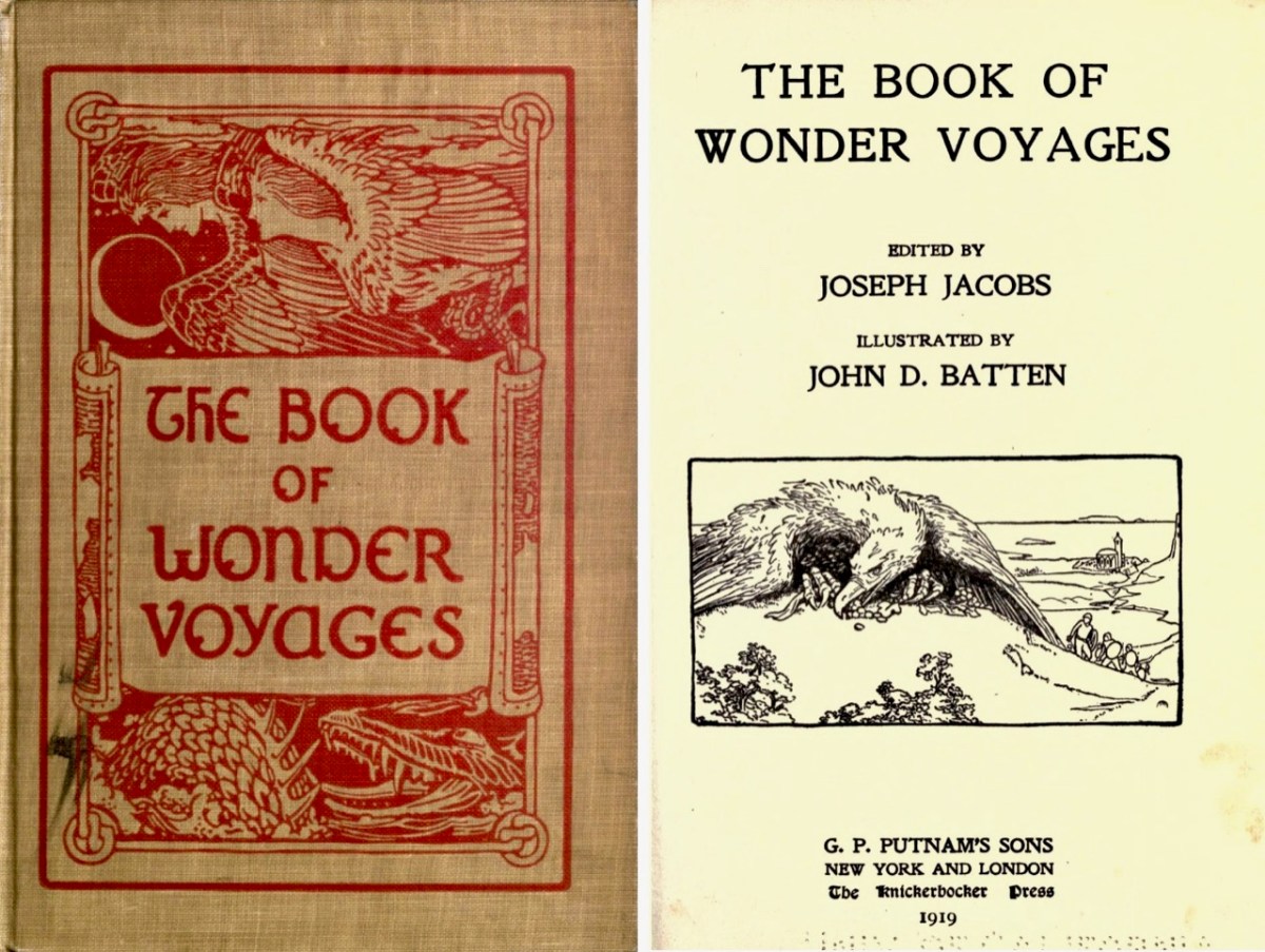
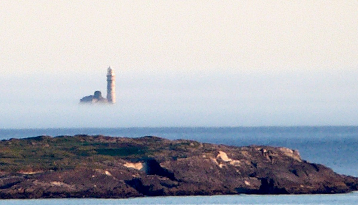
Above is the view from our house – Nead an Iolair – a day or two ago, when a strong sea mist was coming across from the south-west, enveloping Cape Clear and making it float ethereally like one of the mythical islands. Other writers have tackled the subject of the vanishing lands, including Joseph Jacobs, who put together a collection of stories in 1919. The subject is ‘Wonder Voyages’, and the book (available online here) covers some of Ireland’s adventurers, including Máel Dúin – a predecessor of Brendan the Voyager.
Máel Dúin sets out ‘into the limitless ocean’, suggesting that ‘God will bring the boat where it needs to go’. He and his crew encounter a large number of strange islands, including:
The island of ants, from which the men flee because the ants’ intention is to eat their boat
The island of tame birds
The island of the horse-like beast who pelts the crew with the beach
The island of horses and demons
The island of salmon, where they find an empty house filled with a feast and they all eat, drink, and give thanks to Almighty God.
The island with the branch of an apple tree, where they are fed with apples for 40 nights
The island of the “Revolving Beast”, a creature that would shift its form by manipulating its bones, muscles, and loose skin; it casts stones at the escaping crew and one pierces the keel of the boat
The island where animals bite each other and blood is everywhere
The island of apples, pigs, and birds
The island with the great fort/pillars/cats where one of the foster brothers steals a necklet and is burned to ashes by the cat
The island of black and white sheep, where sheep change colours as they cross the fence; the crewmen do not go aboard this island for fear of changing colour
The island of the swineherd, which contained an acidic river and hornless oxen
The island of the ugly mill and miller, who was “wrinkled, rude, and bareheaded”
The island of lamenting men and wailing sorrows, where they had to retrieve a crewman who entered the island and became one of the lamenting men; they saved him by grabbing him while holding their breath
The island with maidens and intoxicating drink
The island with forts and the crystal bridge, where there is a maiden who is propositioned to sleep with Máel Dúin
The island of colourful birds singing like psalms
The island with the psalm-singing old man with noble monastic words
The island with the golden wall around it
The island of angry smiths
The crew voyaged on and came across a sea like a green crystal. Here, there were no monsters but only rocks. They continued on and came to a sea of clouds with underwater fortresses and monsters.
The island with a woman pelting them with nuts
The island with a river sky that was raining salmon
The island on a pedestal
The island with eternal youth/women (17 maidens)
The island with red fruits that were made as a sleeping elixir
The island with monks of Brendan Birr, where they were blessed
The island with eternal laughter, where they lost a crewman
The island of the fire people
The island of cattle, oxen, and sheep
The most well-known voyager of all – in Irish tradition – is Saint Brendan. The image above is from the Finola Window, which was crafted by George Walsh. We all know that Brendan was a real character, who discovered America back in the sixth century. On the way he also encountered many islands – which we cannot locate today (that doesn’t mean they are not there) – and had hair-raising adventures on them. This post will take you through some of his journeyings.
It’s clear that, in the shared Irish psyche, we are aware of places that we can’t always see, or visit. it’s all part of a folk knowledge that’s largely hidden away, except in the memories of older generations, that relates to the sea, and the idea that there are races of people who live on ‘lost’ islands – or even in the sea. In some of the stories about the islands it is suggested that, when they vanish, it’s because they have submerged under the ocean – perhaps temporarily.
There’s a great collection of stories readily available in a series of podcasts known as Blúiríní Béaloidis / Folklore Fragments. Look out for the one titled Blúiríní Béaloidis 16 – Otherworld Islands In Folk Tradition. I have transcribed one of my favourite pieces from this podcast, and will finish this post with it. It summarises, very neatly, the tradition that other worlds are out there, and – at times – our world and theirs meet, providing solid evidence for there being human life under the sea! The tale was collected by Dr McCarthy of Kerry.
. . . People from Dingle Harbour used to sail to Kilrush in Limerick long ago. There was a boat leaving the harbour to Limerick one day with a load of salt. There were 8 men in the boat. They had prepared the boat. There was no quay in Dingle in those days, just a slipway. A fine, strapping young man approached them carrying a pot and a pot-hook, The pot-hook looked as if it had come straight from the forge. He addressed the boat’s captain. Are you going to Limerick, my good man? I am, said the captain, we are just about to leave. Would you mind terribly, said the young man, taking me some of the way? I don’t mind, said the captain, if you wish to come all of the way. He placed his pot and pot-hook in the boat, and got in himself. They rowed away and raised the sail at the mouth of the harbour. They were halfway when the man with the pot and pot-hook roused himself. I’ll be leaving you now, he said to the captain, and I’m very grateful to you. He took hold of his pot and his pot-hook and he leapt into the sea. They never saw him again . . .
Blúiríní Béaloidis
There’s a rather nice postscript to this story:
. . . Some time later, a man with a line and hook was fishing in the sea in the same place, and a boiled potato came up on his hook . . .
Welcome to the UCD Library Cultural Heritage Collections blog. Discover and explore the historical treasures housed within our Archives, Special Collections, National Folklore Collection and Digital Library