The Electrification of Ireland – A Medieval Diversion

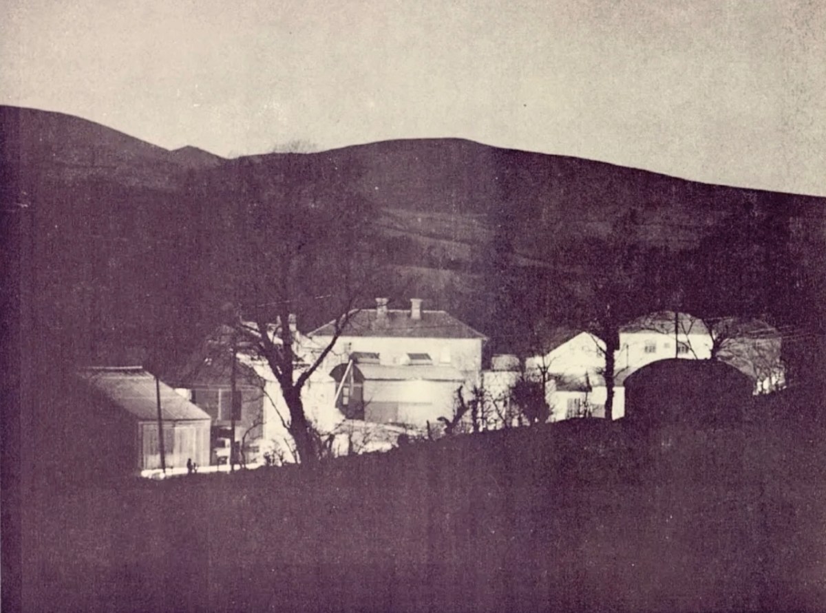
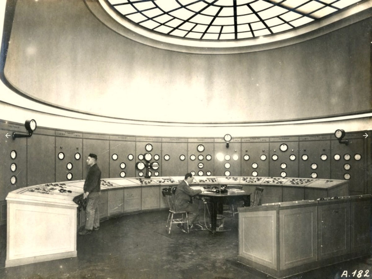
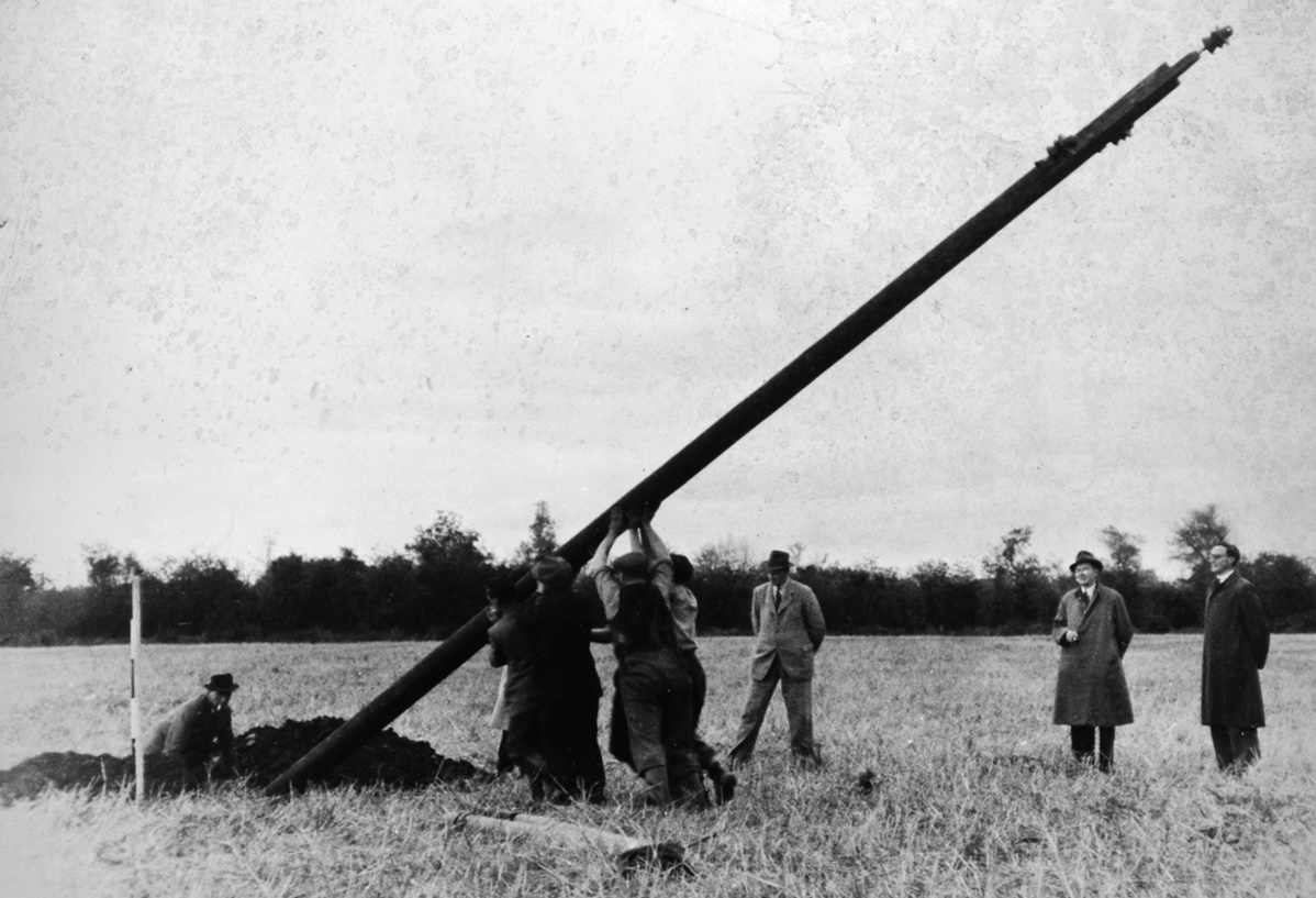
In my recent posts I have set out a brief history of how the new State became electrified – and how this affected the urban and rural ways of life in Ireland. An important part of the story was the building of the hydro electric power station at Ardnacrusha, on the River Shannon, between 1925 and 1929. That’s the original control room, above, unaltered since construction – there’s not a screen in sight! Most of the works of the station are now handled elsewhere using screens and keyboards rather than dials and switches. This site became the nerve centre for the electrification of Ireland and the National Grid was established in tandem with the project.

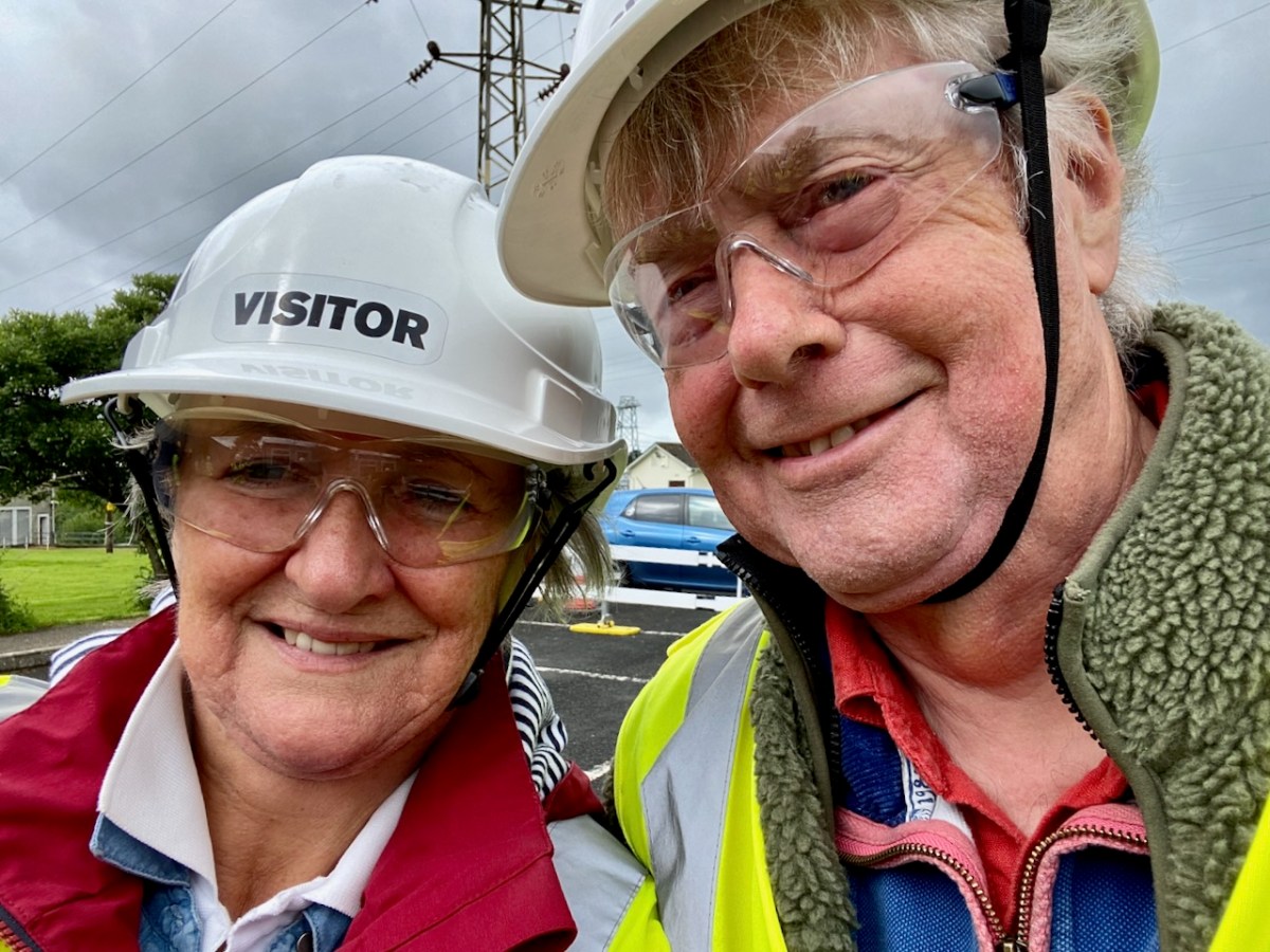
This selfie shows Finola and I on a visit to Ardnacrusha last week. (If you want to go yourself you have to book in advance). We had a great time! And I’ll be reporting back on that trip in due course. But first I want to take you back in time – more than a thousand years . . .

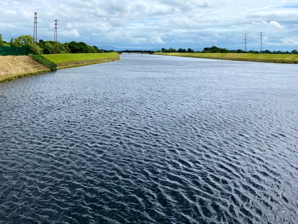
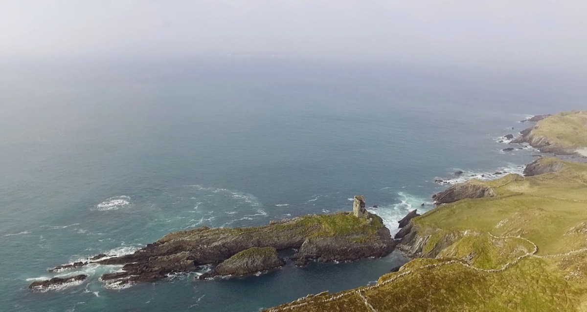
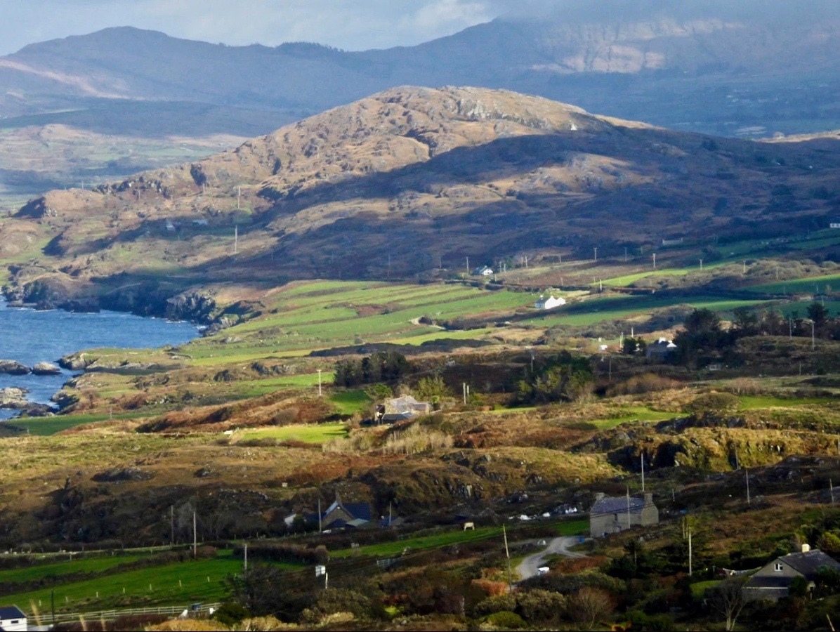
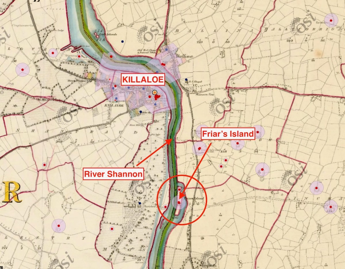
Here’s the River Shannon today, just north of the power station. There’s a big head of water there, and the river had to be dammed and flooded to maximise the feed to the turbines. The significantly raised water level had consequences.

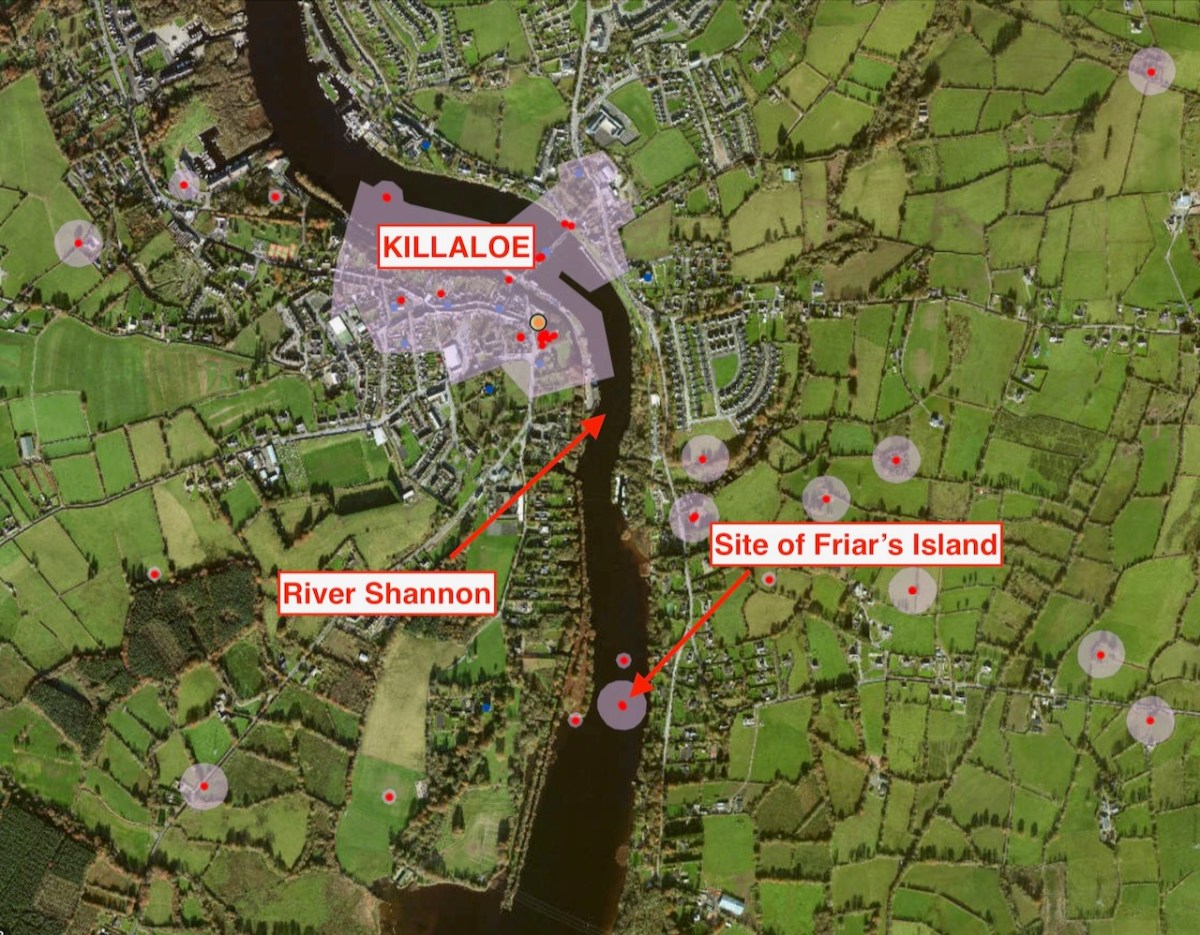
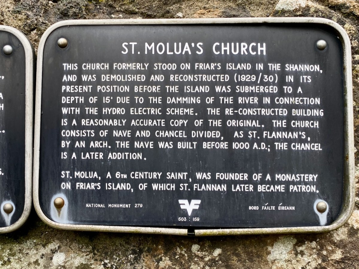
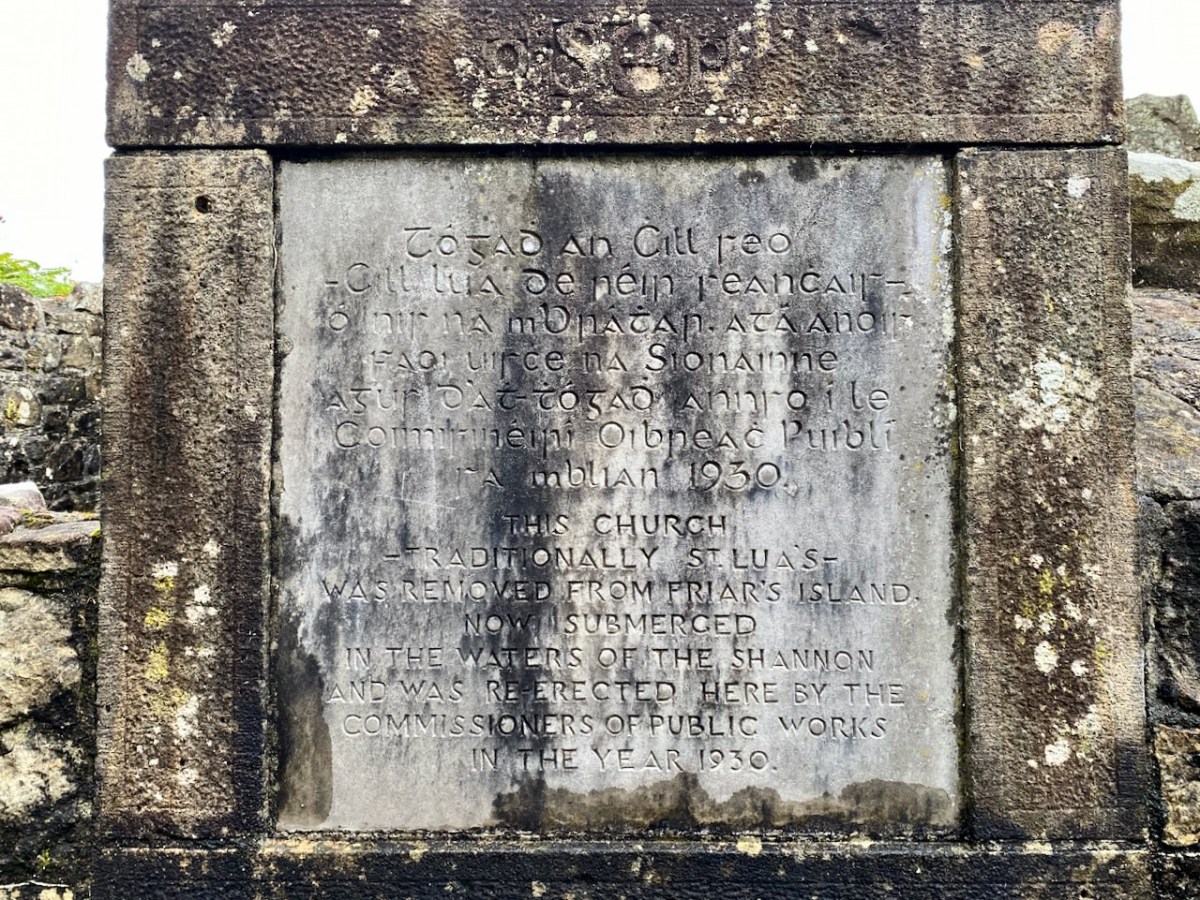
The aerial view, above, shows the river today with its elevated water level. In the pic you can see the ‘Site of Friar’s Island’ indicated: before 1930 there was an island there, on which were some noted relics, including the Oratory of St Molua of Kyle (also known as St Lua), who died in the year 608. His feast is celebrated on August 4th. It’s said that crowds used to assemble there on that day, most of them wading across the water to get to the island. This description of the saint is from the Schools Folklore Collection (informant Tom Seymour, aged 60, Cloncully Co Laois):

. . . We don’t know where he belongs. Some say he belongs to Killaloe. He had his monastery in Kyle. Near the monastery he had a big stone where he used to pray. There are two big holes where he laid his elbows, and two more where the tears fell. In Ballaghmore there is a trough laid up on a stone. It is always half-full of St Molua’s water. The hottest day in the summer the well is always half-full of water. When he died the people of Killaloe wanted to bury him in Killaloe and the people of Kyle wanted to bury him in Kyle. They made two coffins, one went to Kyle and the other to Killaloe. He had another monastery in Offaly . . .

Schools Folklore Collection

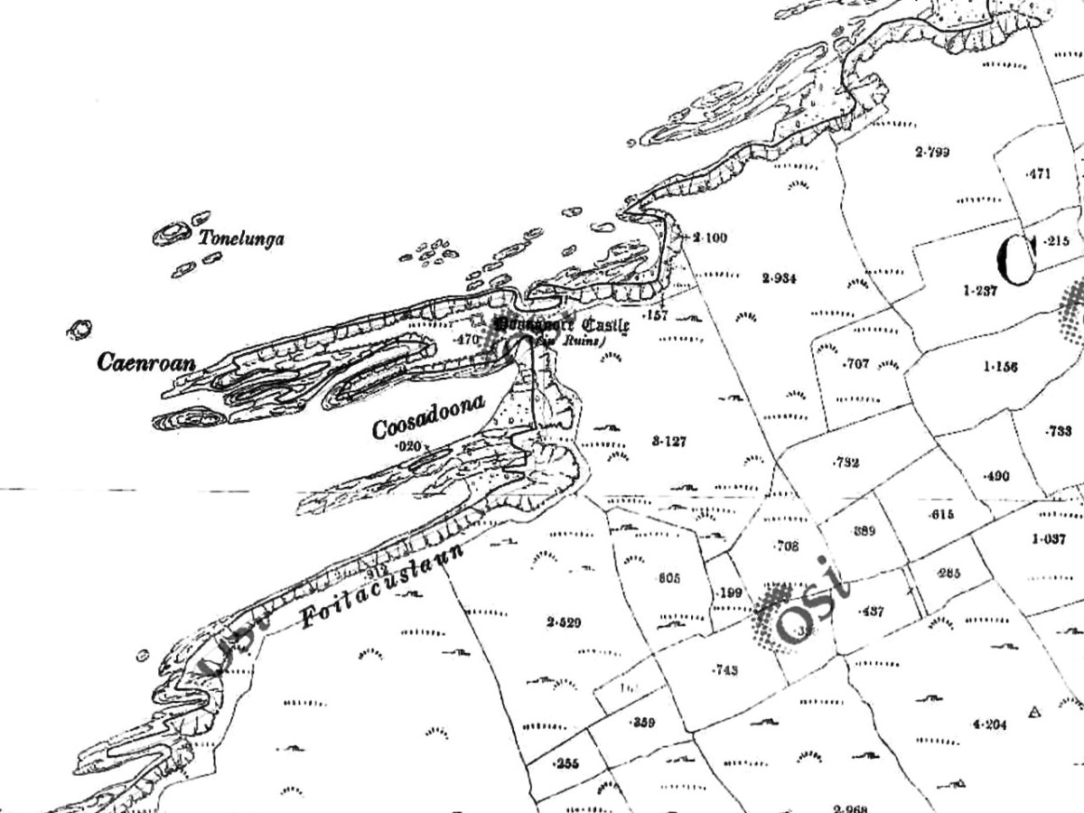
In this extract from the early OS 6″ map (above) you can see that the island was quite substantial. The pilgrimage involved visiting a holy well and St Lua’s Oratory. The small church was by tradition built by the saint, although it seems likely to date from the ninth or tenth centuries.

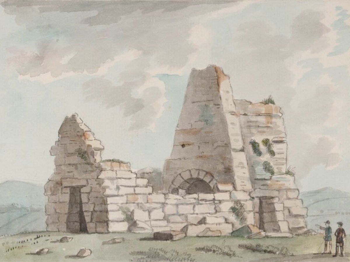
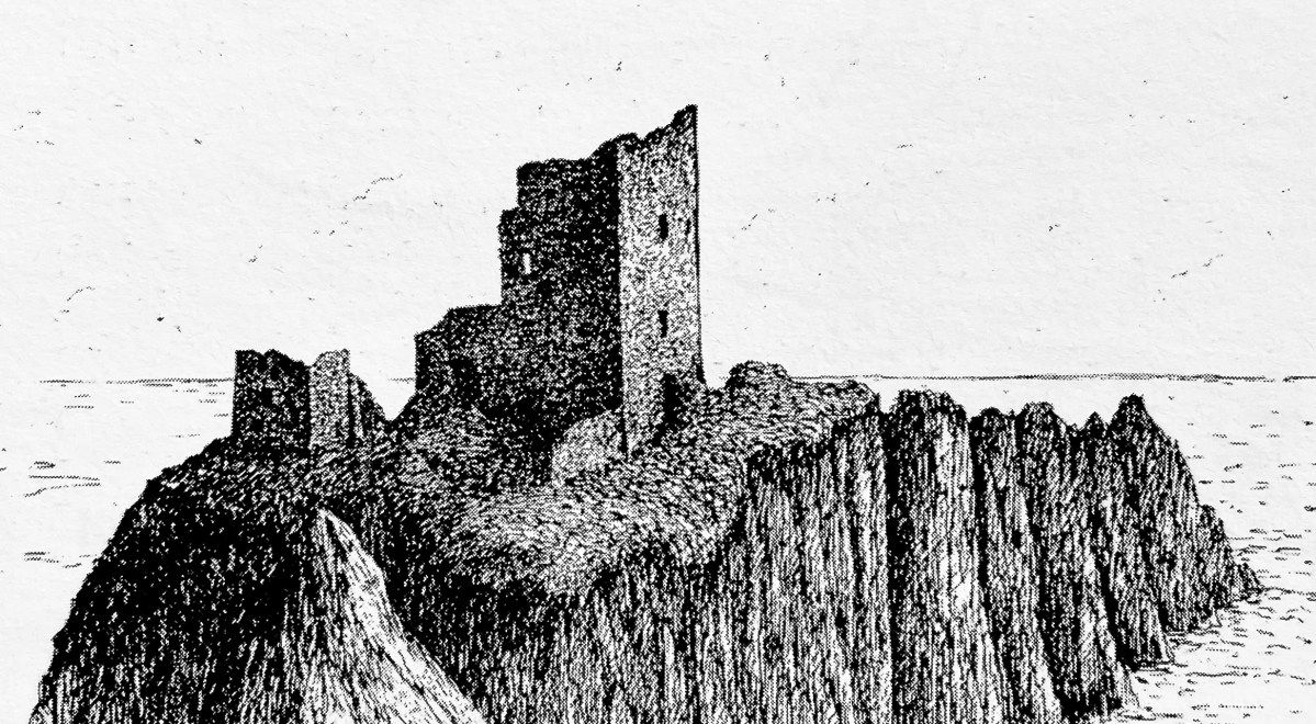
St Lua’s Oratory – Eighteenth Century water colour – Royal Irish Academy. The figures are somewhat out of scale. Below is a photograph of the Romanesque structure taken on the island in the 1920s.

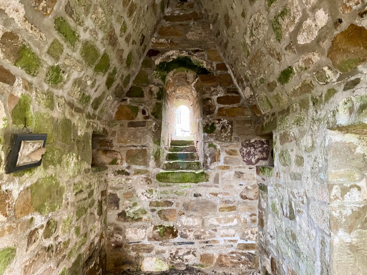
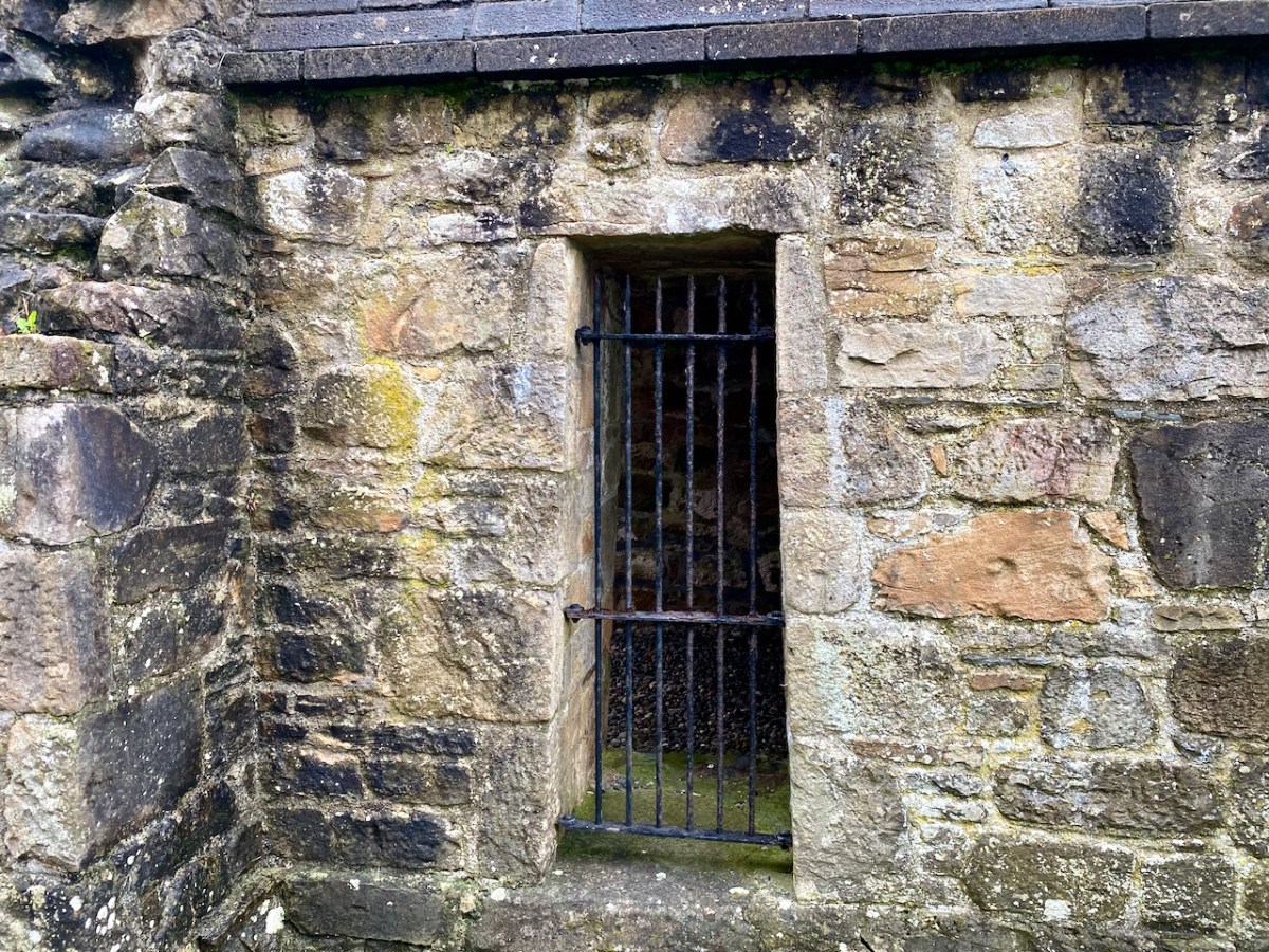
. . . The nave walls are constructed with uncoursed cyclopean sandstone masonry while the chancel walls are constructed with roughly squared stones of smaller size. The chancel has a single-light round-headed E window with stepped sill-stone and unusual flat-headed doorway in the S wall. The round-headed chancel arch has curious jamb-stones which are not flush with the chancel arch and project inwards. The triangular-shaped chancel roof is bonded with lime mortar and is well preserved. The nave walls are poorly preserved and only survive several courses high with a trabeate doorway in the W wall. Excavations at Friar’s Island prior to the removal of the church revealed that the church was constructed on a stone platform enclosed by a possible cashel with a revetment wall of unknown purpose. A second stone platform (dims. 22ft (6.71m) N-S; 50ft (15.25m) E-W) was located to the S of the church and eleven skeletons were uncovered under or close to the foundations of the N wall of the church (Macalister 1929, 16-24) . . .

National Monuments Service description

As the plan to establish the new power station progressed, it became obvious that the level of the river below Killaloe would have to be raised significantly in order to maximise the water power turning the turbines to be installed: some five meters, in fact. The consequence for Friar’s Island were that it would be flooded, and the Oratory would be lost.

Considerable debate ensued, the main factions being archaeologists, engineers, and the Catholic Church. Politically, the efficient functioning of the new power station was paramount in order to show the State and the world that Ireland was an entity to be reckoned with. At the same time, the archaeologists were keen to project that the independent country recognised and championed its very rich ancient heritage, and would therefore go out of its way to preserve all surviving artefacts. The Catholic Church was anxious to show allegiance to all aspects of progress in the State, while noting that it was also the fundamental root of the unique Irish culture that led to the historical founding of sites such as St Lua’s Oratory. I was fortunate to be given access to a paper by Niamh NicGhabhann of the University of Limerick: Medieval Ireland and the Shannon Hydro-Electric Scheme: reconstructing the past in independent Ireland. Here’s an abstract:

. . . This essay considers the position of Irish medieval buildings in the early years of the twentieth century. Focusing on the treatment of the oratory of St Lua at Killaloe, it examines the ways in which the ruins of the medieval past were used to signify a range of political, religious and cultural ideas and attitudes. The rising water levels following the Shannon Scheme works (begun in 1925) meant that this stone oratory was moved from its original position on Friar’s Island to the grounds of St Flannan’s Roman Catholic Church in 1929. The resulting paper trail reflects the complex processes of decision-making within a civil service in transition as the new Irish Free State calibrated its position with regard to the past and the treatment of medieval ruins throughout the countryside. The case study of St Lua’s oratory is considered here in the context of the nineteenth-century tradition of scholarship on medieval buildings, the development of the idea of a national Irish architecture during this period, and the impact of this tradition on subsequent engagement with the buildings of the medieval past . . .

Niamh NicGhabhann
IrIsh studIes revIew, 2017 vOL 25 NO. 4

Above – a surviving photograph of St Lua’s Oratory being disassembled in 1929. The various debates had produced three alternative solutions to the dilemma of the impending inundation of Friar’s Island:

1 – Allow the island and the ruins to vanish below the flood: by far the cheapest course of action.

2 – Build a new concrete platform (effectively a new ‘island’) above the level of the flood water, and transfer the remains of the building to this.

. . . The RSAI officially responded in support of the second proposed scheme of work, involving the elevation of the building and the construction of a concrete pier. They suggested one amendment to the plan, that a ring of grass be added around the building to give the concrete plinth the appearance of an island. Given that both the RSAI and the OPW were in favour of the second scheme as the most appropriate and cost-effective course of action, the fact that the oratory was eventually moved and transported some distance from the site, however, reflects competing values, as well as several structural problems that emerged in the second scheme as proposed. As works progressed, it became clear that the elevated island site would be eventually undermined by the flow of the river, making this process untenable . . .

Niamh NicGhabhann
IrIsh studIes revIew, 2017 vOL 25 NO. 44

3 – The Scheme that was eventually adopted involved dismantling the Oratory and re-assembling it as faithfully as possible, on a suitable mainland site. Initially the suggested site was on the Clare bank of the Shannon, but the ground conditions were not suitable for a permanent structure.

. . . A further plan for relocation was also progressed, which involved moving the ruin into the town of Killaloe, and locating it beside the later and larger oratory of St. Flannan, and the medieval cathedral of St Flannan. These plans were at quite an advanced stage by mid – 1929, with several drawings and maps produced by Leask’s office for the purpose. However, while the preservation process was certainly hampered by these structural issues, ideological concerns also had a direct impact on the treatment of the oratory . . . The intervention of Bishop Fogarty was also noted on 13 July 1929, when the Limerick Leader reported that “the safeguarding of such a venerable relic of primitive Christian architecture is due to the timely intervention of Dr Fogarty, Bishop of Killaloe, who put the matter before the Government”. (Limerick Leader, 13 July 1929) . The use of the word “relic” as opposed to “ruin” is significant here, reflecting an interpretation of the site as part of a tradition of faith, rather than of architectural or antiquarian interest . . .

NIAMH NICGHABHANN
IRISH STUDIES REVIEW, 2017 VOL 25 NO. 44

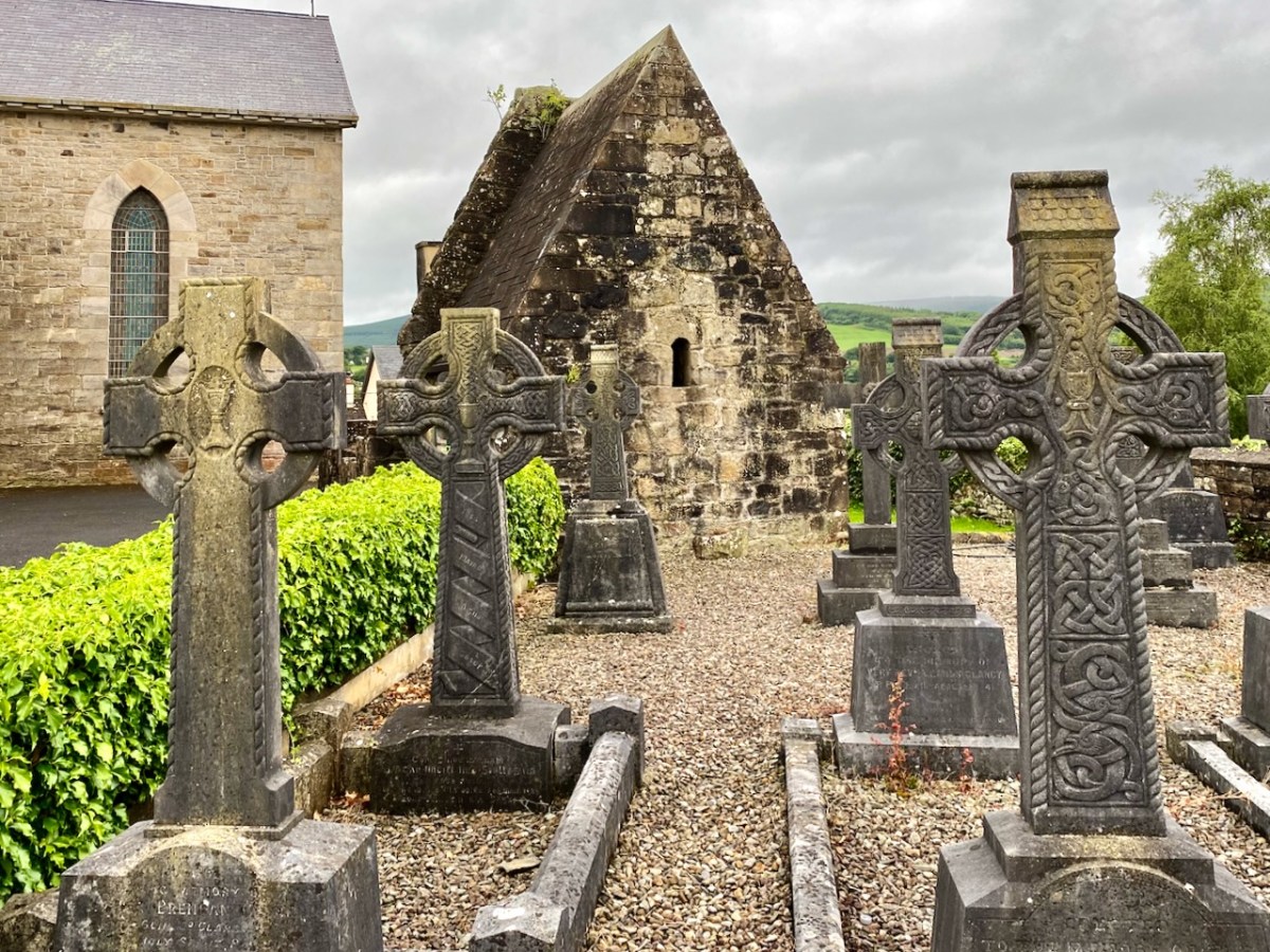
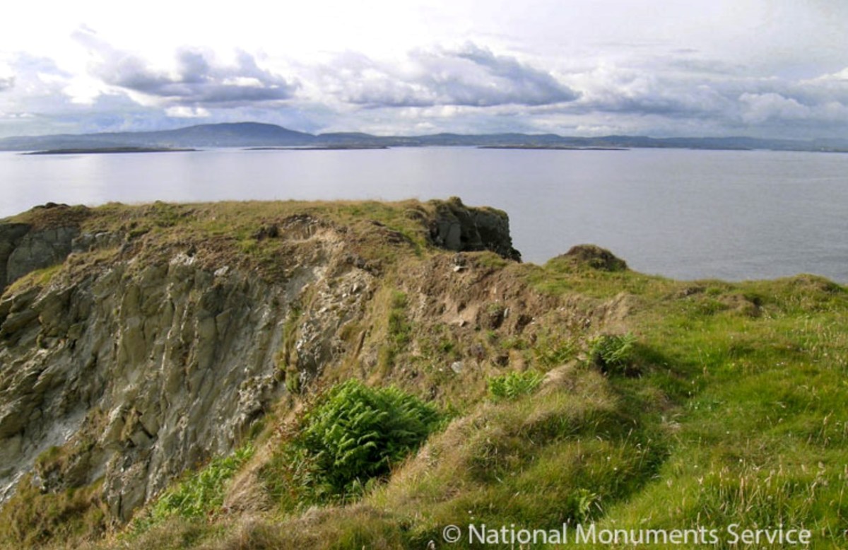
In this photograph of the Oratory as it stands today in the church grounds at Killaloe, it is perhaps worth wryly commenting that we see a true piece of early medieval architecture behind the screen of ‘pseudo’ high crosses. We have a good record of how the remains were dismantled and accurately re-assembled: this was written by the archaeologist H G Leask MRIA in 1930:

. . . In order that the rebuilding should be, as far as was possible, an accurate one, it was necessary to adopt a system of marking the stonework by which the original stones should occupy their original positions when reassemble. The stones being very varied in size and irregular in shape, and laid uncured, no system of numbering such as could easily be applied to squared ashlar was admissible. To the Clerk of Works in charge, Mr C J Dowdall, must be given the credit for the scheme finally decided upon. This consisted in marking with paint of different colours a series of level lines at two feet vertical intervals all round the exterior and interior wall faces. These lines were crossed again by a series of vertical lines at the same intervals but of one distinctive colour for each wall face inside and out. Where the squares formed by this grid of paint enclosed, unmarked, a number of small stones, diagonal lines were added to each square to ensure that every stone showed the same marking. A complete series of elevational photographs of each wall face was taken and careful drawings were also made with the coloured guide lines indicated upon them. On the large plot of ground on the opposite side of the river kindly lent by Major Lefroy, above future water level, timber guide planks were laid down as a frame to each wall and gable face. On the timber frames the coloured guide lines were indicated and the stones when transported were laid down face upwards, in sand, in correct relation with the coloured marks. Each wall, of course, was divided in two vertically along its length and “displayed”. Important quoin, jamb, and arch stones were numbered in colour in regular order. The transport over the Shannon was carried out by means of a specially built barge and a rope stretched from shore to shore, the workmen simply “handing” the boat across by this means. An inclined trackway with truck and winch was erected by Messrs Siemens Bau Union and two small temporary jetties by direct labour. The Most Reverend Dr Fogarty, Bishop of Killaloe, vested a site in the Church enclosure on the summit of the hill in Killaloe town, and the building has been erected there and is now (May, 1930) approaching completion. (Note: the work of re-erection was finally completed in July, 1930) . . .

The Church of St Lua, or Molua, Friar’s Island, Co Tipperary, Near Killaloe
Further Notes – H G Leask
13 May 1930

A couple of afterthoughts to finish off with: a letter from Canon Clancy to Leask, dated 14 October 1930, asked whether a gate could be installed, as it is “liable to be desecrated by boys using it as a urinal, in fact, some boys have already been using it”. And a contemporary cutting from the Nenagh Guardian noted that . . . works cost thousands of pounds are being misused on a “folly” in demolishing St Lua’s Chapel and hiding it in a yard when they could have lifted it above the waters and put a strong light in it that would have illuminated the whole country round, and made it one of the sights of the place . . .

I am grateful to Niamh NicGhabhann for allowing me access to her excellent paper on the tensions surrounding the proposals for the Oratory remains. Further information on the Electrification of Ireland can be found in these posts:

Night’s Candles are Burnt Out

Electrifying West Cork

Rural Electrification – Process and Effect

Rural Electrification – Process and Effect

Above – on the left is the old Vaughan’s Hall in Ballydehob. Local historian Eugene McSweeney tells this tale:

. . . This hall in Ballydehob ‘had the Electricity’ around 1951-52. UK Queen Elizabeth II was crowned in 1953 – June 2 – and a film was made by the BBC. This film was sent around to be shown in village halls etc all over Britain, but also in Ireland. Vaughan’s Hall was able to borrow a projector, and an evening was set aside to show the coronation film. There were ‘some local lads’ who felt that good Irish citizens shouldn’t be gawking at this English Royal event. They brought some heavy chains, and threw them over the new electric wires connecting into the hall. This caused a short circuit and the lights – and the film – went out! Ballydehob had to wait for another day to see the coronation . . .

Eugene McSweeney, Ballydehob

During the 1930s most towns in Ireland were connected to the National Grid. The outbreak of World War II in Europe led to shortages of fuel and materials and the electrification process in Ireland came to a virtual halt. In the early 1950s the Rural Electrification Scheme gradually brought electric power to the countryside, a process that was completed on the mainland in 1973 – not without some Herculean efforts by the on-site crews . . .

. . . While battling with the rocks in the Schull/Ballydehob fastnesses, blasting our way to our goal, we were informed that our next area was Castletownbere. No stick of exploding gelignite could produce more of a stunning effect in the Area Office than when the news reached us. Then we knew we were being accepted and acknowledged as mountainy men, men of steel and gelignite, capable of shaking still further the serenity of the West Cork mountains whose calm had not been disturbed by the noise of men and clash of steel since O’Sullivan Bere . . .

ESB ARCHIVES – AO Report 1951

Above – the pegging teams faced an onerous task when they moved over to the Beara Peninsula. Here are extracts from the reports of the Area Officer when works set out towards Castletownbere in late 1951:

. . . In November 1951 I left Ballydehob to visit Castletownbere area, the future scene of our endeavours. Looking at the country between Glengariff and Castletownbere I wrote off the battle of the Schull area as a skirmish, as I felt that the real battle was here. Here were crags, crevices, canyons, woods, bogs, etc, which defied all exaggeration. W Trusick, the pegging engineer, was very much depressed at the thought of what lay ahead of him as we climbed up the winding road from Glengarriff to the heights of Loughavaul and beyond again to Coolieragh. However, when we topped the climb at Coolieragh the vista of mountain and sea that met our eyes gave us a temporary respite from our morose reflections . . .

ESB ARCHIVES

Extract from the reports of the Area Officer when works set out towards Castletownbere in late 1951:

. . . Here was a scene that is hard to equal anywhere else in Ireland. Ahead of us lay the country of O’Sullivan Beara. Away in the distance lay Beara island like a sleeping monster resting on the sea, protected on the northern side by the massive bulk of Hungry Hill, and farther west by a ring of mountains whose western slopes dip down into the Atlantic Ocean. Behind us we looked across Bantry Bay at Bantry away in the distance sheltered by the bulk of Whiddy island. Nearer to us was Glengariff with its myriad of islets and heavily wooded hinterland, cosy and comfortable looking, secure in the shelter of its encircling mountains. On a cold November day in the weak wintry sunshine people do not stay long admiring scenery from such a dank vantage point as Coolieragh, and so we continued our journey westwards along by Adrigole, close to the Healy Pass, skirting the foot of Hungry Hill with its silver streak waterfalls and finally we arrived at the capital of the Beara Peninsula, Castletownbere . . .

ESB Archives

. . . Mr O’Driscoll and his crew in Dromahane, had apparently two major obstacles: First, the landed gentry who vehemently objected to the “beastly sticks” being put anywhere on their land: the second being a van which objected to moving under any circumstances whatever. Of the original 320 economic acceptances, 57 were ‘backsliders’, most of these being cottagers and small farmers. As an offset, 20 new consumers were gained, mostly having large premises, with the result that the total revenue was increased by £2. Only 20 premises were wired for outside light, due, in general, to the speed with which the contractors wanted to move from one house to another, and to their telling their clients that outside wiring could be done after they had been connected to the supply lines. Principal items sold in the area were 20 cookers, 30 irons, 20 kettles and 11 Milking Machines. Milking Machines are becoming increasingly popular in this area, solving as they do, the problem of milking on a Sunday when, normally, labour is not available. Mr O’Driscoll is doubtful if post development will meet with any marked success . . .

ESB Archives – DromAhane, Co Cork

It’s intriguing that the reports in the ESB Archives from the time of installation so often represent negative views about the ‘success’ or otherwise of the rural electrification project (Mr O’Driscoll is doubtful if post development will meet with any marked success). It’s as if this ‘new fangled’ technology is never going to take the place of the way traditional life is lived in remoter places. With this viewpoint, the drudgery of manual tasks such as bringing in water from an outside source, cooking, washing clothes is likely to continue, with the housewife / farmer’s wife and their children having maximum input. It’s just as well that a more enlightened attitude prevailed in some places – here’s an early taker of the benefits of an electric egg sorting machine (ESB Archives):

In urban areas, there was certainly enthusiasm for the improvements which ‘modern living’ offered (below). The new devices must have appeared exotic at first, but no doubt their benefits were instantly apparent to those who set their minds positively.

The heroes were the riggers and the geligniters, braving the elements and the raw landscape, to eventually bring power to the furthest reaches of rural Ireland (a task not completed, it could be said, until 1991, when Cape Clear – off our own West Cork coast – was connected to the National Grid). After those heroes came the dealers and traders. Someone had to provide all the water heaters, pumps, milking machines, refrigerators, cookers, washing machines . . . It was big business.

Above – an ESB salesman exercising persuasion on a willing customer. The man looks on! Below – interesting juxtaposition . . .

. . . Once a community was connected, or about to be connected, the ESB held public demonstrations of household appliances. These were then sold bringing electric irons, kettles, stoves to homes. The demonstration evening in Glenamaddy was held in January 1951. The handwritten report records that it took place “in the very fine Esker Ballroom”; these events were social occasions that brought communities together. The Glenamaddy evening “was attended by about 90, including 50 women. As is usual, the women appeared to be more keen than the men and more inclined to ask questions (and to argue). After the demonstration, a melodeon player turned up and an impromptu dance got under way” . . . Small towns and rural townlands became brighter and winters less harsh and Christmas more special as the fairy lights began to shine. It also gave rise to a rural Irish icon as every house had the Sacred Heart picture with the (electric) red lamp: many didn’t get a kettle and washing machine until later on . . .

ESB ARCHIVES

(Above) Seán Lemass – Minister for Industry and Commerce – performing the formal ‘switch-on’ in Ballinamult Creamery (Co Waterford) on 1st March 1954. This was the Electricity Supply Board’s 100,000th customer. Also in attendance are Mr R F Browne, ESB Chairman, and The Very Rev Father Walsh, PP Ballinamult.

Above: “As the last rays of sun leave the hills, the lights go on at Ballinamult Creamery, the Board’s 100,000th Rural Consumer”

. . . In November, Miss Crowley of the ICA toured Sherkin Island and lectured in nearby Skibbereen giving her ideas on modern home-making and sponsoring the use of electricity to a great extent. The area demonstration at the end of November was very well attended and sparked off a keen interest in the various appliances on show, just as the connections in the area were commencing. ESB sales in the area are now in the region of £1,300 while contracts are on hands for six pumping installations . . .

ESB ARCHIVES

Thanks once more to Michael Barry for inspiring this brief study. Also to the ESB Archives, The Irish Story and Eugene McSweeney. Roaringwater Journal is always pleased to receive comments and contributions on any subject we take up.

Previous posts on Ireland’s Electrification:

Night’s Candles are Burnt Out

Electrifying West Cork

Fort of Gold 1: The Promontory Fort

I have been gifted with a marvellous set of photographs of Dunanore, or Dún an Óir – an O’Driscoll Castle on Cape Clear. The gift came from one of our readers, Tash, and I am very grateful indeed. Regular readers know that I like to use my own photos, and I do have some that I took from the sea (like the one below) but I have none of Dún an Óir from the land, let alone from the castle itself! 

And that’s because, as you can see from the drawing by Jack Roberts at the top of this post, this castle is situated in a very perilous location, on the edge of a cliff, on a small island, essentially, making access a hazardous scramble up from a rocky beach. It was once connected to the rest of Cape Clear by a narrow causeway but this has long collapsed. It was still there in the 1770s when Charles Smith visited. In his The Ancient and Present State of the city of Cork Vol 1, he wrote:

And this brings us to the name – Dún an Óir. It means, of course, Fort of Gold, and some of the old legends about this place talk about the name coming from stories of buried treasure. But in fact, this has been the name of this fort since the first maps of this area were made in the fifteen hundreds and it speaks to the wealth of the O’Driscoll clan who built it. Remember, their other stronghold, now called Baltimore, was Dún na Séad, or Fort of Jewels (on at least one map given as Castle of Perles). On Sherkin, their castle was Dúnalong – or the Fort of the Ships – that’s it as it is now, below.

There are many accounts of their fleets of ships, and the battles they waged against the Waterfordmen in which they came out the worst for wear when Dunalong was attacked. The scene below, from an information sign on Sherkin, shows the Battle of the Wine Barrels, 1537, with both Dunalong and the Friary on Sherkin in flames

Dún means ‘fort’ but seems to be especially applied to promontory forts in the southwest. Before the castle was built, therefore, it is likely that the O’Driscolls fortified the headland, which may date well back to the Early Medieval period (400-1200) or even to the Iron Age (500BC to 400AD, or 500BCE to 400BC for those who prefer the secular version). The Illustration below is taken with permission from Dún an Óir Castle: an uncertain future, by Dr Sarah Kerr, and shows the present state of the castle, marooned on what was once a promontory connected to the Island.

Our Promontory Fort man is Thomas Westropp (see here and here), and he wrote about Dún an Óir in his 1914-16 paper for the Royal Irish Academy, Fortified Headlands and Castles in Western County Cork. Part I. From Cape Clear to Dunmanus Bay. He visited the site, but like many a good explorer before and after him, did not venture out onto the promontory, but satisfied himself with what he could see from the high ground above it. That included the promontory and ruined castle, the rather ominously named Tonelunga (The sea-bed of the Ships), the end of the promontory called Caenroan (quay of the Seals), the inlet between the promontory and the cliffs, Coosadoona (the Little Harbour of the Fort) and the high cliffs behind the fort, Foilacuslaun (Cliffs of the Castle). All of these are marked on the 19th century twenty-five inch map.

Westropp writes about Dún an Óir as one of three Promontory forts on Cape Clear Island, although in fact there are more than that, as identified by the National Monuments Record – each yellow dot below is one.

Here’s one of them (below), Lios Ó Móine (the Fort of the Meadow – lios is usually used to designate an earthen ring fort): the description and then the photo are by National Monuments Service (NMS). In the photo you can see the narrow neck of land leading out to the promontory. This is likely what the spit leading out to Dún an Óir may have looked like.

Description: In rough pasture, at the foot of a steep N-facing slope on Stuckaunfoilnabena, a headland on the NW coast of Clear Island. A narrow eroding neck of land (Wth 3m; L 15m) leads to the roughly anvil-shaped headland. Across this neck of land are the remains of three earthen banks and the shallow remains of three fosses. Further examination of the remains was not possible for safety reasons.

Curiously, the NMS does NOT identify Dún an Óir as a promontory fort – here is what it says: 

Description: The location of the tower house ‘Doonanore Castle’ (CO153-015002-) on a promontory, on the NW shore of Clear Island, suggested that it may have been built on the site of a promontory fort. However, there are no visible surface traces of an earlier defences across the promontory. The promontory is now isolated at high tide but was connected to mainland by causeway until 1831.

However, it has this to say about the earthwork identified on the high ground: 

In pasture, on a steep N-facing slope to the E of the tower house known as Doonanore Castle . . . An earthen bank . . .extends upslope in a S to SW direction from a modern E-W field boundary wall on the cliff-top at N and ends at a large outcropping rock on the edge of another cliff. This bank appears to have formed part of the defences on the land approach to the castle from the E. The bank has three contiguous linear stretches [and] there is an entrance near the N end. There is a possible hut site near the centre of the enclosed area. The short promontory on which Doonanore Castle stands is a possible coastal promontory fort.

So, as you can see, although the NMS declines to label it a promontory fort because there are no longer any signs of banks or walls, it does concede that it is possible. It also extends the defences of that fort to the higher ground above it.

Back to Westropp – He quotes:

the poem of O Huidhrin, before 1418, tells how “0 hEidersceoil assumed possession of the Harbour of Cler.” It was of some importance to the foreign traders in wine and spices, and so figures in all the early portolan maps. Angelino Dulcert, in 1339, calls it Cap de Clar ; the subsequent portolans, Cauo de Clara, 1375 and 1426 ; Clarros, 1436 ; C. d’Clara or Claro, 1450 and 1552, and, to give no more, Cauo de Chlaram, in 1490. The 0 Driscolls’ Castle probably dates between 1450 and the last date. It was probably on an earlier headland fort, as it is called Dunanore. In 1602 it surrendered without resistance to the English, who burned it.

Westropp goes on to say

Dr. O’Donovan, in his ” Sketches of Carbery,” gives a few notes on the later history. He says there was a garrison at the Castle in Queen Anne’s time, and mentions the huge iron ring-bolt, set in the rock, to which the O Driscolls formerly moored their galleys in the creek. The last is improbable, even to impossibility: no one could moor galleys in the dangerous wave-trap, open to the most stormy and unsheltered points. The islanders regard the ruin as haunted, and tell of the singing of ships’ crews in its vaults. One “Croohoor” (Conor) O’Careavaun (Heremon’s grandson) lived as a hermit there in the eighteenth century. Another legend tells how, in 1798, the inhabitants painted the Farbreag Rocks and pillars so as to resemble soldiers in uniform to keep away the French ! If any truth underlies this, it is probably based on the idle act of some revenue or other officers, in the endless leisure of their island station.

In the map above, of the southwest end of the Island, you can just make out the name Firbreaga, almost covered by the O of OSI. Fir Bréaga means The Lying Men, an apt translation given Westropp’s story. No doubt the name is older than 1798, and may refer to the cliffs at that end seeming to be less dangerous from the sea than they actually were. Note also the two yellow dots for two more promontory forts- Doonthomas (Thomas’s Fort) and Coosfoilaskehaun (the Small Harbour of the Knife-Edge Cliff).

Westropp’s description of the promontory upon which Dun an Óir sits is poetic:

The path runs up a very slight ledge, flaking away and high above the creek, along the face of a cliff of polished silvery slate. The low neck joined it to the mainland, and the nearly perpendicular strata make the dock-like creek of Coosadoona, fort-cove, to the south Beside this cove, opposite to the castle, an enormous precipice rises high above the tower top. In the other direction is a noble view across the wide, porpoise-haunted bay, and its low islands to the blue, many-channelled Mount Gabriel, and on to Mizen Head. 

In fact, very little is known about the history of Dún an Óir before the Battle of Kinsale in 1601. We can deduce from its strategic location that the O’Driscolls used it to keep an eye on every ship that sailed in and out of Roaringwater Bay, to exact fishing dues before the rival O’Mahonys could get to the incoming vessels, to curb the power of those O’Mahonys, and to establish their dominance over the land of Cape Clear Island. (See this post for more on the map above.) Because the castle would have been rendered, probably in some shade of white or near-white, it would have been visible from all around Roaringwater Bay, and have represented a potent statement of supremacy.

After the Battle of Kinsale the Castle was seized by Captain Harvey, as described in Pacata Hibernia:

‘While these things were on doing, Captain Roger Harvy sent a party of men to Cape Clear, the castle whereof being guarded by Captain Tirrell’s men, which they could not gain, but they pillaged the island and brought thence three boats; and the second day following the rebels not liking the neighbourhood of the English, quitted the castle, wherein Captain Harvy placed a guard. At this time Sir Finnin O’Driscoll came to Captain Harvy and submitted himself.’

This illustration, from Pacata Hibernia, is of the siege of Dunboy Castle, the stronghold of O’Sullivan Beare, on Beara Peninsula. The destruction of Dún an Óir is described by James Burke in his article Cape Clear Island in the Journal of the Cork Historical and Archaeological Society Journal of 1908. Rather than Harvey simply taking over the castle, Burke relates the following:

Its central arch and the steps leading to its upper portion remain; but the huge pieces of its eastern wall now lying about show how severely it has suffered from the havoc of war. This wholesale destruction occurred when Dunanore Castle, together with the island, was captured on the 22nd of March, 1601, by Captain Roger Harvey, following on the defeat of the Spaniards at Kinsale. By means of the artillery he planted on the high ground adjoining it, he battered down the eastern wall and compelled the garrison to surrender, for which and other services (as Dr Donovan writes in his “Sketches of Carbery”) he was granted at the time a commission by Lord Deputy Mountjoy as Governor of Carbery.

It is far more likely that the ruined state of the castle is a result of the natural passage of time than the ‘havoc of war.’ For one thing, it would have been a monumental task to deploy artillery overland on Cape Clear. Any cannon fire would have come more naturally from the English warships we know were in use during this period and therefore, the damage would have been to the seaward side of the castle – but this side is actually intact.

A romantic view of the ruins of Dún an Óir above, by W Willes.* Next week we will look at what is left of the castle and what we can tell from that. I’ll be using the marvellous photos from Tash in that post.

*From: Picturesque Ireland : a literary and artistic delineation of the natural scenery, remarkable places, historical antiquities, public buildings, ancient abbeys, towers, castles, and other romantic and attractive features of Ireland, by John Savage, 1885.

Amid Unbearable Tragedy – a Model for the World (Updated)

Originally posted in 2015. Re-posted now, 8 years later with an update at the end.

Some posts are hard to write. In the case of this one, there are such complex emotions – sadness and anger being the dominant two, but overlaid with pride and gratitude. I will explain.

Youngest

On June 23rd, 1985 – 38 years ago this week, but 30 years ago when this post was originally written – a bomb on board Air India Flight 182 exploded when the plane was just off the coast of West Cork. Everyone on board,  329 people, were killed. One in every 4 victims was a child. Eighty percent were Canadians.

Dignified

The bomb was the work of Sikh extremists, operating out of Vancouver. A botched investigation, jurisdictional disputes, and massive incompetence at many levels has meant that no perpetrator of this heinous crime has ever been convicted for it – a travesty that is a dark stain on Canada’s judicial system and that has left the families of the victims with no sense of justice to this day.

Moment of Silence 2

Members of the victims’ families began arriving immediately after the bombing and, deeply affected by their plight and by their own traumatic involvement in the the recovery operation, the people of West Cork opened their hearts and homes to them. Ahakista residents took on the task of petitioning governments for a memorial garden and of arranging a yearly commemoration service. The memorial is beautiful and perfectly maintained year round. Beginning in 1986 the service has been held every year without fail and family members who come are welcomed, supported and fed, in the Irish way. Many friendship have been forged over the years.

Family Friends

In contrast, it took the Canadian Government a long time to acknowledge that this terrorist attack, in the words of Prime Minister Harper’s official apology ‘…was not an act of foreign violence. This atrocity was conceived in Canada, executed in Canada, by Canadian citizens, and its victims were themselves mostly citizens of Canada.’ This speech was made in 2010. The first Canadian memorial to the victims was erected in 2006 and there are now four. There are no memorials in India.

Renée Sarojini Saklikar

Because 2015 was the 30th anniversary the ceremony was a large one, with dignitaries from Canada, India and Ireland in attendance and about twenty family members. For us, it started the night before, with a poetry reading in the West Cork Arts Centre in Skibbereen. Renée Sarojini Saklikar is a Canadian poet who lost an aunt and uncle in the disaster. She read from her book Children of Air India, and also some new pieces. Deeply influenced by the opacity of official documents, by memory and loss, her poems carried a quiet power that seeped into our souls almost without our noticing. She elicited our participation in one poem – a piece made up entirely of acronyms – and she spoke to us about the process of writing poetry from trauma and invited our stories and comments. It was a deeply emotive experience – a good preparation for the following day’s ceremony of remembrance.

The Irish Navy ship and Coast Guard Fly Past

The ceremony timing mirrors the events of the original June morning when the bomb exploded in the plane, with a minute’s silence at 8:12AM, broken by chanting by family members. The Irish Navy were on hand to signal the moment with a siren blast, and a Coast Guard helicopter performed a formal fly past. A choir of children of the local National School sang and there were speeches and wreath-layings. I was pleased to see Canada’s Minister for Justice, Peter McKay, in attendance as well as the Canadian Ambassador to Ireland.

Dignitaries

Speaking to the family members brought home to me as nothing else could do the enormity of the tragedy and the still-raw emotions at the core of this event. Saroj lost her father, a teacher. “He was  a proud Canadian,” she said. “He loved Canada and taught Canadian children in Newfoundland. He cared so much for his new country, but when he died, suddenly in the eyes of Canada he was no longer a Canadian but an Indian.”

Saroj (below) had sat through many days of the Vancouver trial of the accused bombers (who were eventually acquitted) and still could not get her head around the outcome when the evidence was so clear.

Dr. Padmini Turlapati (in the sari, below) was the spokesperson for the families. She lost her two sons. They had just finished school and were going to India for the summer to see their grandparents.

She showed me their photograph – two merry kids, laughing and carefree. Because they were visiting their grandparents they had taken with them their albums of mementoes and photographs – Padmini had to piece together a few photos from their school and friends. Sanjay’s body was recovered, but Deepak is still out there, and so she comes back every year to the place which has become a focus for her grief. In her speech she encompassed all the emotions that the families still feel – unspeakable sadness, anger and – gratitude.

Over and over speakers spoke about the warmth, the generosity and the support of the West Cork people who had been there for them in their despair when it seemed that their governments had abandoned them. Several used the same phrase.  Addressing themselves to the people of Ahakista, to the fisherman and coast guard volunteers, to those who built and maintain the memorial and who organise each year’s ceremony. “You”, they said, “are a model for the world.”

Renée was there, honouring her aunt and uncle, both doctors, both contributing enormously to Canadian society.

As a Canadian who listened nightly to the reports of the Vancouver trials I can have an inkling of the unfathomable well of loss and anger that these families feel. As an Irish person who is now living in West Cork I am proud of how our neighbours and friends stepped in to support and comfort these devastated families.

Perhaps the best way to end is with one of Renée’s poems. I will try to reproduce it faithfully on the page.

In the home-house, in the basement, there is the mother — she is singing a sweet song.

It is before —

June                       1984

                                Of her name, there are redactions.

                                Of her mother tongue, there is no record —

                                                       this is the life of a woman, made in India,

                                                                                living in Canada.

In the home-house, in the basement, there is the mother

                   And she is absent, sister

Update, 2023

We visited the memorial this week, on Friday the 23rd. The ceremony had taken place, as always, in the morning and the site looked beautiful despite dismal weather. Fresh flowers had been laid, including, most poignantly, for Sanjay and Deepak.

Nothing has changed for the families. The man who was tried and acquitted in the infamously botched trial in Vancouver, Ripudaman Singh Malik, was shot dead last year in what appeared to be a targeted gangland-style killing. Although two men were charged for the murder, the trial has yet to be held. Malik had many enemies and had earned more by a recent turn-about in his support for the Indian Government, and nobody has linked his murder to the Air India Bombing. In the last few days, another prominent Canadian Sikh activist, Hardeep Singh Nijjar, has also been murdered in a similar way. It is speculated that his, and other recent deaths, are linked to the movement for a Khalistan state as a Sikh homeland.

Electrifying West Cork

The traditional Irish village: Lusk, Co Dublin, in 1954 (photo from ESB Archives). Thatched buildings, the village pump, bicycles: a man sitting on the stone smoking his pipe. The intrusions are the poles and the overhead lines bringing the modern world into rural Ireland. Lusk was connected to the new grid close to the beginning of a project that spread out from the major conurbations from the late 1920s, taking some fifty years to embrace the whole state.

Rural Electrification arrives in Dromiskin, Co Louth, in 1949. Cork Electric Supply Co Ltd was in operation in Cork City before 1927. It supplied 4,225 homes and businesses in 1929, rising to 5,198 by March 1930, before being acquired by ESB in April 1930. Close neighbouring communities began to receive connections from 1930 onwards; Skibbereen and Bantry waited until 1937, while Schull and Ballydehob were without until works crept into furthest West Cork in 1952.

Above – family Life in 1950s rural Ireland (photo by Robert Cresswell). When I was a boy in 1950s England, I was probably fortunate to live in a house where electricity had been connected: my parents were quite progressive in that respect. I well remember the brown bakelite switches and plugs (two sizes: small and large). However, I often visited my Granma who lived in a house without any of it. It was a bit like the one above (which is in Kinvara). Gas globes hung from the ceilings: they had to be lit with tapers while pulling down on a lever. Cooking and heating came from a black coal range, and there was one cold tap in the scullery. There was no bathroom or shower, only a toilet outside in a shed. But there was a large wireless set – just like the one shown above. It was powered by an ‘accumulator’ which had to be taken to the shop up the road to be refilled with acid every few weeks. My Granma lived and died without ‘electrics’.

Above – Ballydehob before electrification. The ESB Archives are alive with colourful descriptions of the Rural Electrification works arriving here and in neighbour Schull. Reports from the on-site engineers are droll . . .

Schull Rural Area, April 1952 . . . Mr O’Driscoll opens his post-construction report in almost poetic terms and then to show that he is not bound to one form of art, proceeds to give us a word picture of the terrain in Schull, which is even more realistic than the deepest purples that Paul Henry ever used. We gather that pegging was, at times, a highly arduous and dangerous task and it would appear that among the wonders of the modern world, the greatest (in the view of the pegging team), was how this Area was ever selected for electrification . . .

ESB Archives

‘Pegging’ is a term in common use in the ESB Archives. It refers to the art of raising poles and stringing them with wires across the country. Evidently, the ‘landed gentry’ unkindly described them as “those beastly sticks”. Over 1 million poles were erected eventually, with 78,754km of wire used and a total of 2,280lbs of gelignite consumed during construction. The overall cost was some £36m (equivalent to €1.5bn today).

. . . We had very few wayleave difficulties. Sometimes an argument would develop with a local farmer whether the patch of grass where we put a peg was a field or not. If he convinced us it was a field, which he usually did by showing us the welts on his hand, we shifted the peg. It would seem too much like taking the bread from the mouth of a child to destroy his farm and livelihood by one pole . . .

ESB ARCHIVES

Above – Celebrations came with the connection of the 100,000th premises in 1954. Now we return to our own West Cork:

. . . It is interesting to note, and perhaps might be taken as a headline, that the early switch-in of the villages of Schull and Ballydehob (1952) had an excellent reaction on the more outlying areas and could not be denuded of all credit for the extra consumers eventually connected . . . There was an amusing revival of an ancient rivalry between the two villages. Ballydehob, looking with pride at their 100kVA transformer, were inclined to be scornful of Schull where a 50kVA transformer was erected; but the Schull people not to be out-done, countered by pointing out that there were many more poles in their “Town” than in Ballydehob “Village”. . . Only 8 houses remained to be wired when the gang left the area, 3 of these were parochial property and 4 were under the control of the Board of Works . . .

ESB ARCHIVes

The mention of “parochial property” in the paragraph above – from the ESB Archives – is of significance. The term would be applied to churches and schools, certainly. As outlined in last week’s post, Seán Keating was scornful of his view of the clergy position on Electrification: his Night’s Candles painting shows the priest still reading by the light of a candle while the world moves on around him. We can find differing views on the attitude of the Church.

. . . Throughout the length and breadth of Ireland politicians of all political shades lobbied the ESB for their area to be electrified. It wasn’t just politicians who tried to exert their influence: in July 1957, the parish priest of Ballycroy, County Mayo, wrote to the Rural Electrification Office. He said that his parishioners were anxious and that they believed he could influence decisions at the Dublin head office. “Sometimes people get an idea that the PP isn’t taking any interest in these matters. I need not add that I have a very deep enthusiasm for the light coming to Ballycroy” . . .

The Irish Story.com

Above – celebration in Dublin St Patrick’s Day Parade 1954. Here in Ballydehob I was pleased to hear some reminiscence from retired schoolmaster Noel Coakley pertaining to the ‘parochial property’ which remained to be wired when the gangs left the area:

. . . Having had the luxury of the electric light when growing up in Bantry town in the 1940s and 50s, rural electrification was a subject of which I was blissfully unaware until my first teaching post, 60 years ago next month in Tragumna National School near Skibbereen. Though the building was wired for electricity and rural electrification had already arrived in the area, the school wasn’t connected to the grid. On checking the reason, the reply I received from the then School Manager, the local Parish Priest, was, ‘Why would a school need electricity?’ End of the matter! Indeed, I should have known better because my own alma mater, Bantry Boys’ NS which was on the Hospital Road, wasn’t even wired for electricity. In fact, it wasn’t connected until the autumn of 1970 during the 2 year experiment, 1969-71, on having Summer Time all year round. Back teaching in Bantry by then, teachers and pupils had to endure almost pitch dark classrooms for the first year of the trial. Coming to Ballydehob in February 1971 was going from darkness into light because the school here could even boast of having electric sockets into which we could plug new fangled machines like tape recorders, while Bantry Boys’ had only being upgraded to two 100w single bulbs per classroom. Regarding Rural Electrification in Ballydehob, I think the village was connected around 1954. I do recall that the area around the townland of Knockroe, bordered between Bantry Road and Skibbereen Road, didn’t get connected until the 1970s because the majority of residents refused connection when the rest of the district was being electrified . . .

Noel Coakley, Ballydehob – personal communication

Above – a network of ‘pegs’ crossing the north side of the Mizen today.

Once again, I am grateful to Michael Barry for pointing me in the direction of some of this information, and for switching on the lights for me in respect of the extensive ESB Archives. I also appreciate the contributions of Noel Coakley and Eugene McSweeney, Ballydehob. Are there any other stories out there? More to follow next week!

Night’s Candles are Burnt Out

There’s a wealth of tales to be told about the first decades of independent Ireland. The 1920s and 1930s saw a flourishing of confident projects portraying a nation on the cusp of change, establishing itself in Europe and beyond. One such was the hydro-electric scheme at Ardnacrusha on the River Shannon. Foundations were laid in 1925 and works completed within four years, providing the young country with what was then the world’s largest power station. The intention was to enable everyone in Ireland to avail of the most trendsetting modern commodity: electricity.

The documentary photo above looks like a scene from a science-fiction film: it’s the control station at Ardnacrushsa, shortly after the completion of the project. This, and many other of the illustrations which I will refer to, are taken from the excellent ESB Archives: I am very grateful to them for the use of these. The building of the huge dam and power station was documented in fine detail – and not just in words and photographs. The notoriously outspoken and visionary artist – Seán Keating – chose to record the accomplishments in his own medium, painting.

This is one of Keating’s works from the time: Night’s Candles are Burnt Out. (Thanks to Gallery Oldham). It is, perhaps, the finale of his series drawn and painted during the construction of the works – which he undertook on site under his own initiative and without a sponsor. Art historian (and biographer of Keating) Dr Éimear O’Connor suggests:

. . . Keating went down to Ardnacrusha because he knew that the construction project was emerging history. It was all happening around where he was born and raised. The machinery was going to carve up this landscape that he saw as ‘a medieval dungheap’, that was how he described it in later years. And this was a metaphor for him, the whole thing was all about Ireland moving forward into modernity. Night’s Candles features the dam at Ardnacrusha, but also includes a group of figures in the foreground, all of whom represent different aspects of what Keating saw as the Ireland of the day. When he showed it at the Royal Hibernian Academy in Dublin, it was called ‘the problem painting of the year,’ which Keating thought was hilarious. They couldn’t get their heads around this idea of what he was trying to do at all . . .

O’Connor: Seán Keating: Art, Politics and Building the Irish Nation, 2013 (Irish Academic Press)

In this detail from the painting we see Keating himself (top right) together with his wife and sons, pointing to the vision of Ireland’s future. On the left of the full painting is Keating again, inspecting a hanging skeleton, perhaps reminiscent of the Famine. Most significantly, perhaps, at the bottom right is a priest reading by the light of the candle. O’Connor is clear about this portrayal:

. . . It tells you an awful lot about Keating and his attitude to the Church at the time. Like many others in the cultural sphere in Ireland, he was disappointed with post-Treaty Ireland, with successive governments and the Church, who were in cahoots, if you know what I mean. He knew well that the whole country was tied up with them, and with that kind of organized religion that was deeply conservative. And Night’s Candles is very much an expression of that disappointment, I think . . .

O’Connor: Seán Keating: Art, Politics and Building the Irish Nation, 2013 (Irish Academic Press)

It’s worth dwelling on this painting a little longer, and viewing Keating’s thought processes, through O’Connor’s eyes:

. . . What Keating was trying to do was reflect upon a country on the brink of change. It was in those years, in the 1920s, that the term ‘gombeen man’ came into being. We all know that it means the kind of businessman or politician who’s making money off the backs of everybody else. And that’s the gombeen man in the middle of the painting. I think it’s quite clear that Keating’s hope was that modernity, as represented by Ardnacrusha, would end all that stage-Ireland paddywhackery that had prevailed for years . . .

O’Connor: Seán Keating: Art, Politics and Building the Irish Nation, 2013 (Irish Academic Press)

Above – posters from the time of the construction work at Ardnacrusha (ESB Archives). It was certainly the most exciting project in Ireland’s young days, and tourism was encouraged. Hand-in-hand with the major works themselves went a crucial publicity campaign to encourage people to embrace the coming of a readily available electricity supply to homes and businesses. The steps taken to try and ‘get the message across’ was an uphill task. Considerable funds were expended – and a large sales force garnered – to tour the country and persuade the population to buy into the project.

The visuals, humour and underlying psychology of this Ardnacrusha construction-era promotional poster really appeal to me. In case you can’t read the ‘small print’, this is the message that’s being pushed:

. . . 90,000 Horse Power of energy will be available from the Shannon Electrical Power Station next year for Irish Industry and Irish homes . . . The American workman is the most prosperous on earth, because he has, on average, three horse-power, the equivalent of thirty human slaves, helping him to produce. No wonder he can toil less and be paid more than the workman of other lands. He is not a toiler, he is a director of machinery . . .

Post-Famine, America was always seen as the ‘golden land of opportunity’ for Irish emigrants. Now, in 1930, we are being told that Ireland will have the capability to match those fabled fortunes!

. . . Shannon Electricity will lift the heavy work of industry from human shoulders to the iron shoulders of machines . . .

The coming of electricity across Ireland opened up markets for retailers to vend a host of innovative gadgets. This mobile electricity showroom from the 1950s (ESB Archives) covers the gamut of lighting, cooking, refrigerating, water supply to sinks using pumps, milking machines and labour-saving devices for farms. In a future post I want to focus on Rural Electrification, which was a long haul: taking poles and wires out into the extensive hinterland. This was – arguably – the most heroic part of the process of electrification, and we can’t help wondering whether the following somewhat iconic ESB print of the first ‘peg’ being raised at Kilsallaghan, on 5 November 1946 was inspired by the famous Iwo Jima Victory photograph taken by Associated Press photographer Joe Rosenthal on February 23 1945 (lower pic). Both portray a moment of triumph.

Many thanks are due to Michael Barry who referred me to material from the ESB Archives covering our own West Cork areas. Watch out for our commentary on this in a forthcoming post!