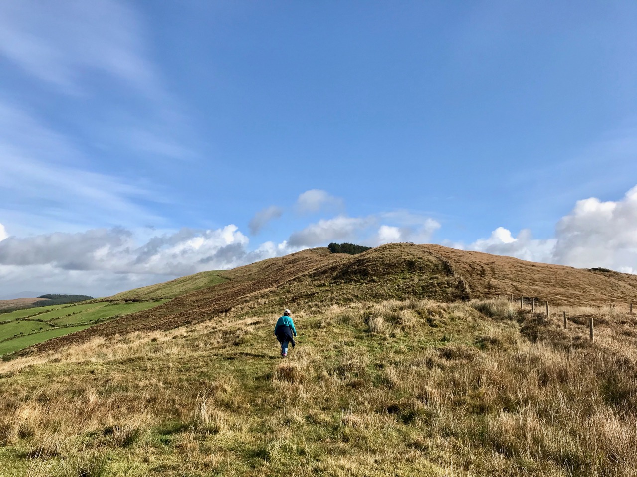
It’s a perfect little building: a gem of Irish architecture. It lies in an oasis of parkland on the outskirts of Dublin city – all that’s left of an expansive eighteenth century country house demesne, now all but engulfed by housing estates. But – perhaps in homage to the eccentric conceiver of this environmental idyll – the housing estates which have stood below it since the 1920s are quite out of the ordinary. Have a look at the layout on this contemporary plan of Merino townland, carved out of the larger Donnycarney which was granted to the Corporation of Dublin following the dissolution of The Priory of All Hallows in the reign of King Henry VIII.

This plan is showing the location of Casino Marino, with the green areas around it being the remnants of a 238 acre demesne. The housing below the surviving Casino was Ireland’s first example, in the newly formed Irish state, of an affordable housing project and was the first local authority housing estate in the country. It was heavily influenced by Ebenezer Howard’s Garden City movement, originating in the UK with the two revolutionary developments at Letchworth Garden City and Welwyn Garden City. This Dublin estate of about 1300 houses was built on the site of a planned formal garden for Marino House and the original design was followed when the streets were laid out. This gives the Marino estate its symmetrical layout. When it was first built, purchasers of houses were restricted to large families, while alcohol and dogs without leads were banned from the parks, as were children after dark.

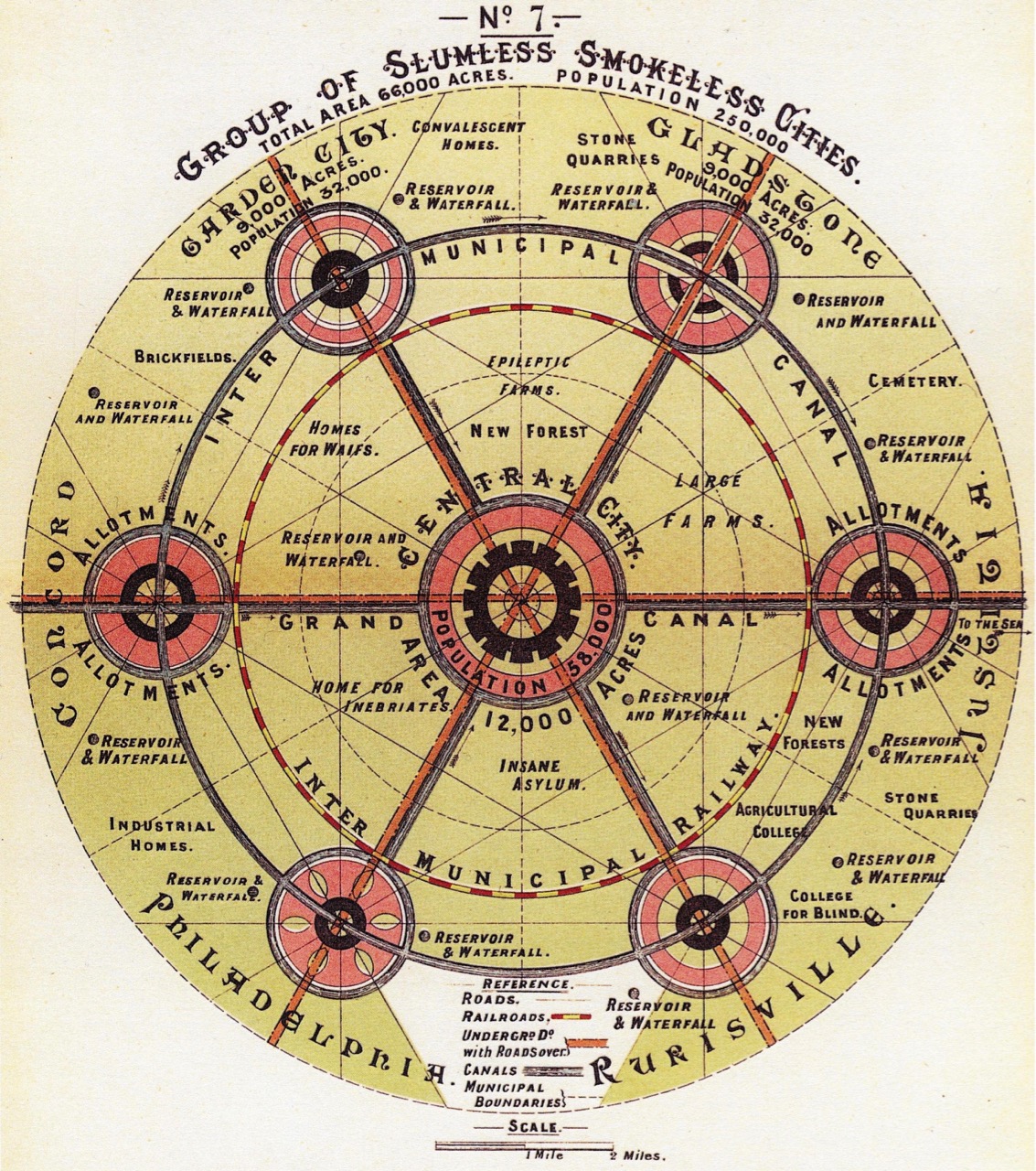
Ebenezer Howard, To-morrow: A Peaceful Path to Real Reform – diagram of the ideal city, dated 1898
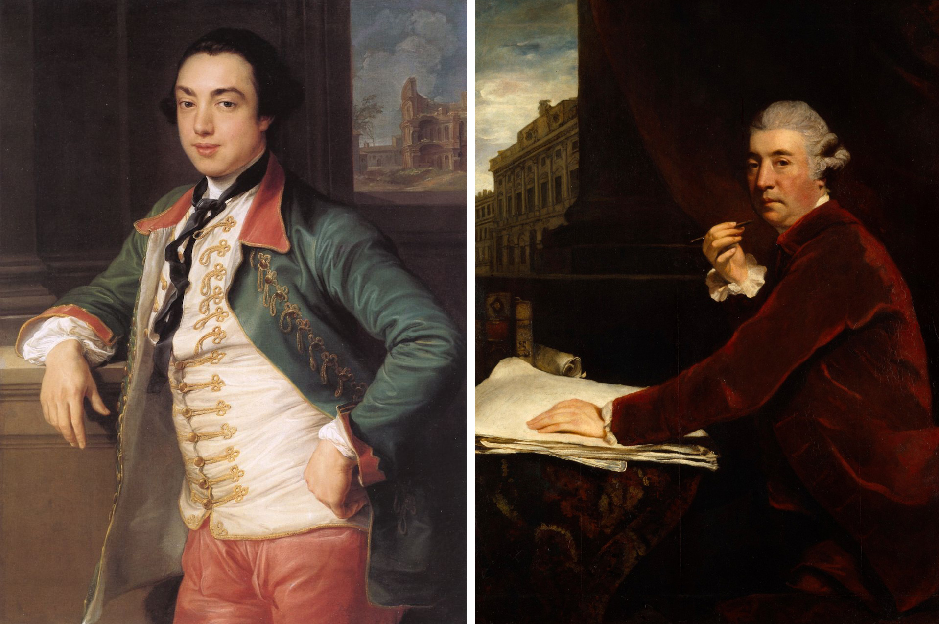
Back to the eighteenth century, and the heroes of our piece today: James Caulfeild, 1st Earl of Charlemont (1728 – 1799), and his friend, the architect Sir William Chambers (1723-1796). James (left, below – a portrait by Pompeo Batoni) was a cultivated man who disregarded the conventions of court and openly pursued Irish nationalism, having taken a leading part in the formation of the Irish Volunteers. He was the first President of the Royal Irish Academy and was a member of the Royal Dublin Society. In 1783 he was made a founding Knight of the Order of St Patrick. Like most of the wealthy young gentry of his time he went to Italy on The Grand Tour: he fell in love with that country and classical Roman culture and stayed away for nine years. When he returned he determined to bring the spirit of Italy to Dublin. Acquiring tracts of land by the coast that afforded unrivalled views over the entire bay and city, he poured his energies into creating an ideal landscape: he named his demesne ‘Marino’.

William Chambers (on the right, above – this portrait by Joshua Reynolds is in the Royal Academy) was also a great traveller: he was born in Gothenburg to a Scottish father and visited and studied architecture in China, Paris and Italy – where he met Charlemont. He established a practice in London, where he was appointed architectural tutor to the Prince of Wales, later George III. As the leading classicist of his day, it was unsurprising that Charlemont should turn to him to realise his dream of an Italian arcadia in Dublin. It was a commission that took many years to come to fruition, partly because of the Earl’s seemingly limitless ambitions and his attention to fine detail.


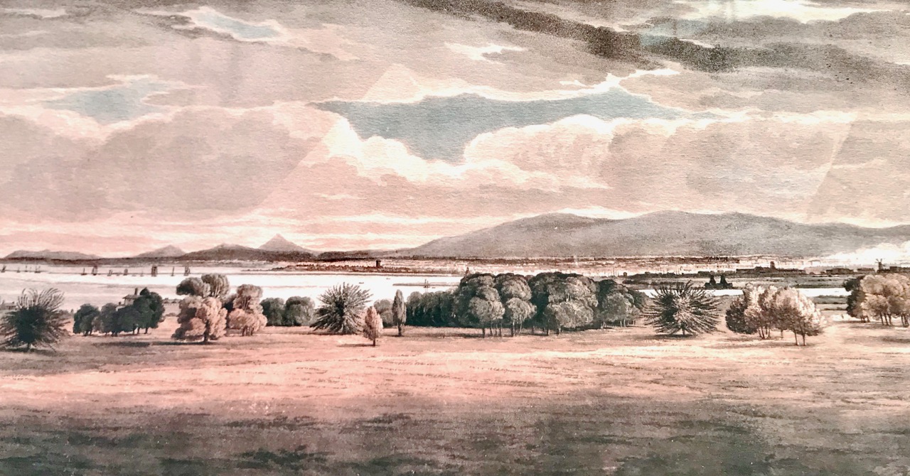
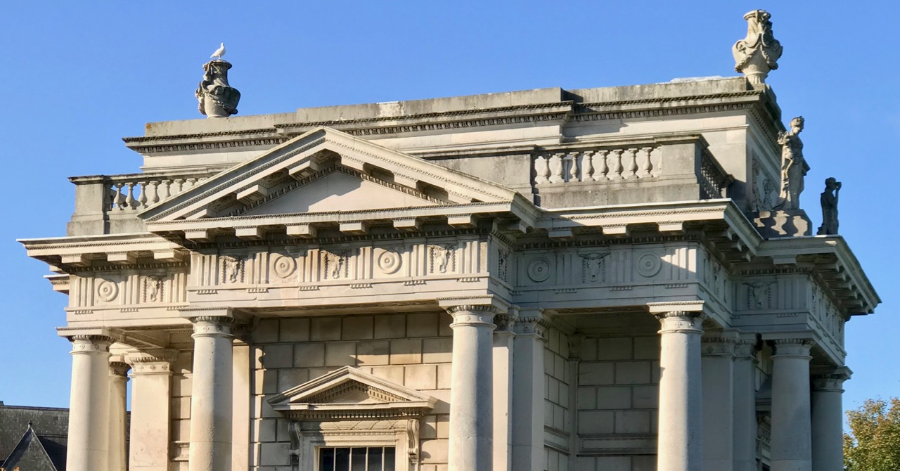
Charlemont’s Marino estate enjoyed fine unrestricted views across Dublin Bay. The culmination of the Earl’s work on his estate (and now the only surviving element) is the Casino, and this is sited on the highest point on the land: the painting above shows the view from the roof of the Casino, which was fully accessible from the building interior. So – what is a casino? It’s simply the Italian for small house, and in this case has been built as a garden room or, perhaps, a gazebo. Ornamental, but eminently functional. From the outside it appears small, but exquisitely detailed on all its elevations. In fact, the simple building houses 16 rooms over three storeys – plus the roof terrace.


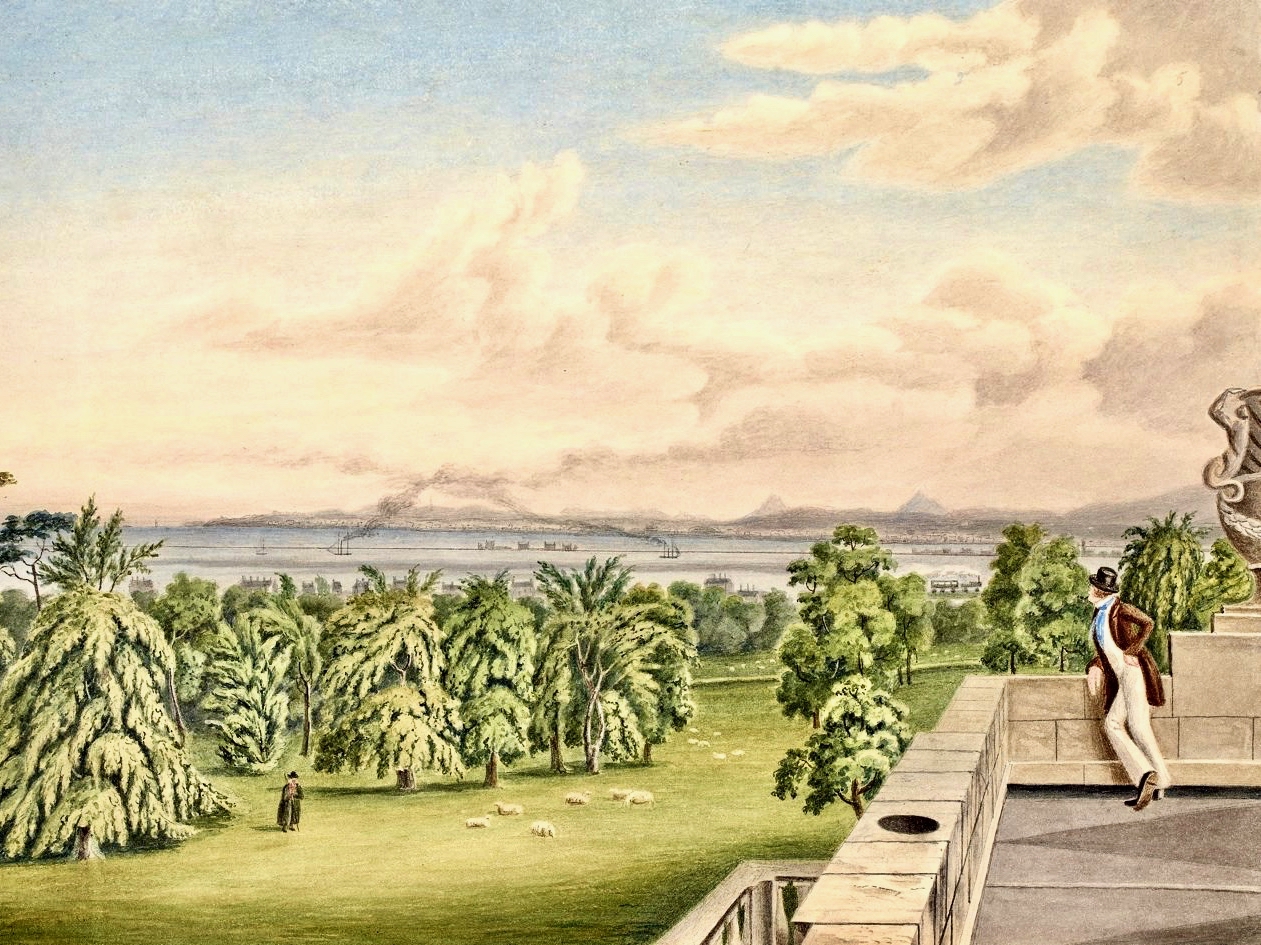
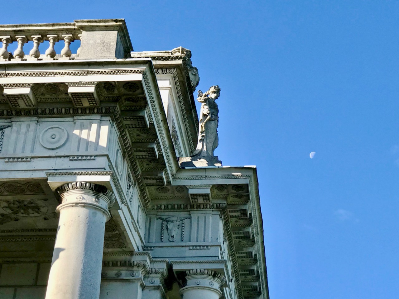
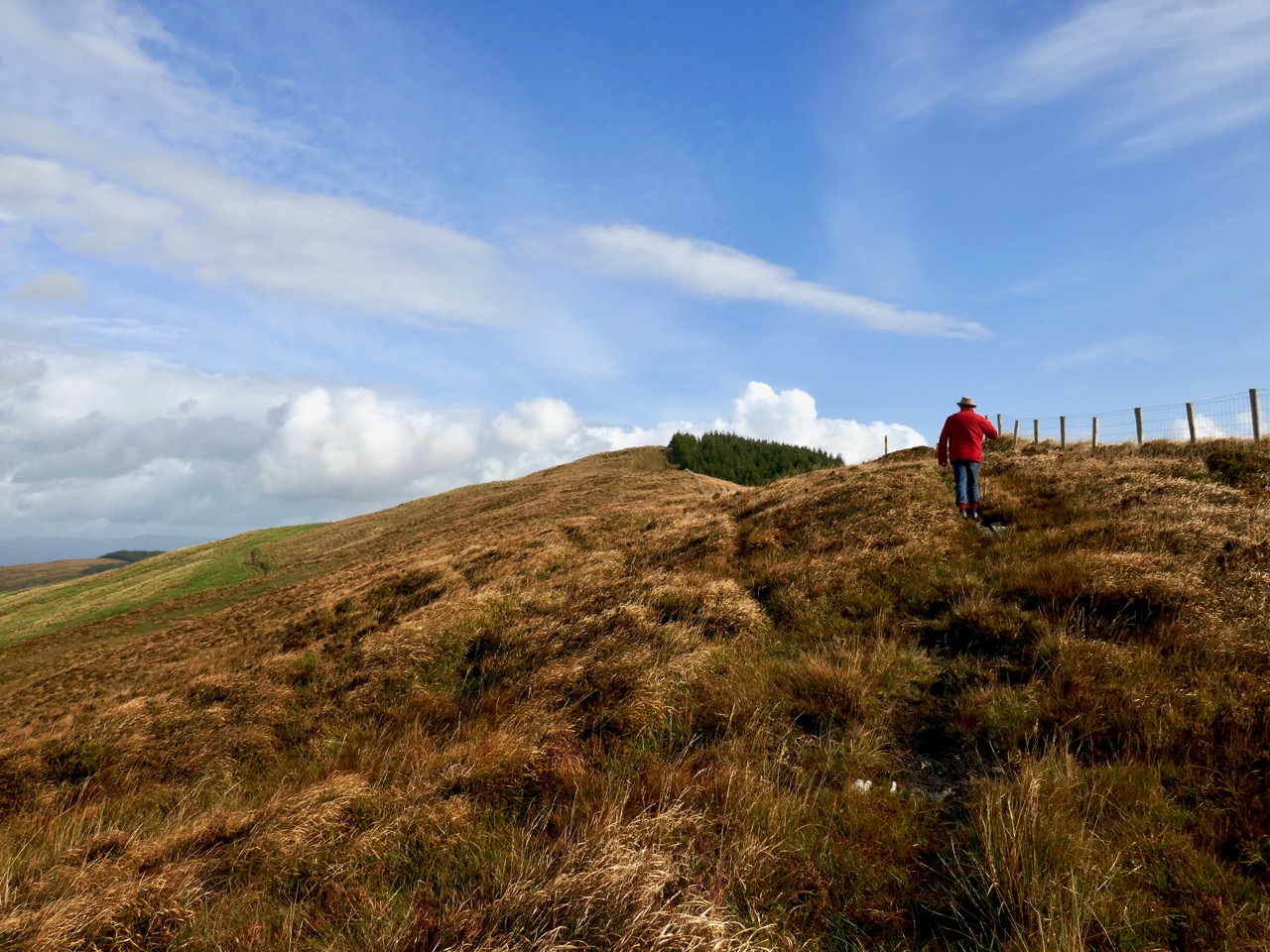
Exercises in architectural scale. Upper – an almost contemporary view of the Casino painted by William Ashford (1746-1824), National gallery of Ireland: here the building seen in its landscape context looks like a miniature folly. Centre – a close-up of the roof detailing includes life-size statuary. Lower – Ava and Hugo, willing participants in our expedition to the Casino, help to give an impression of its true size.


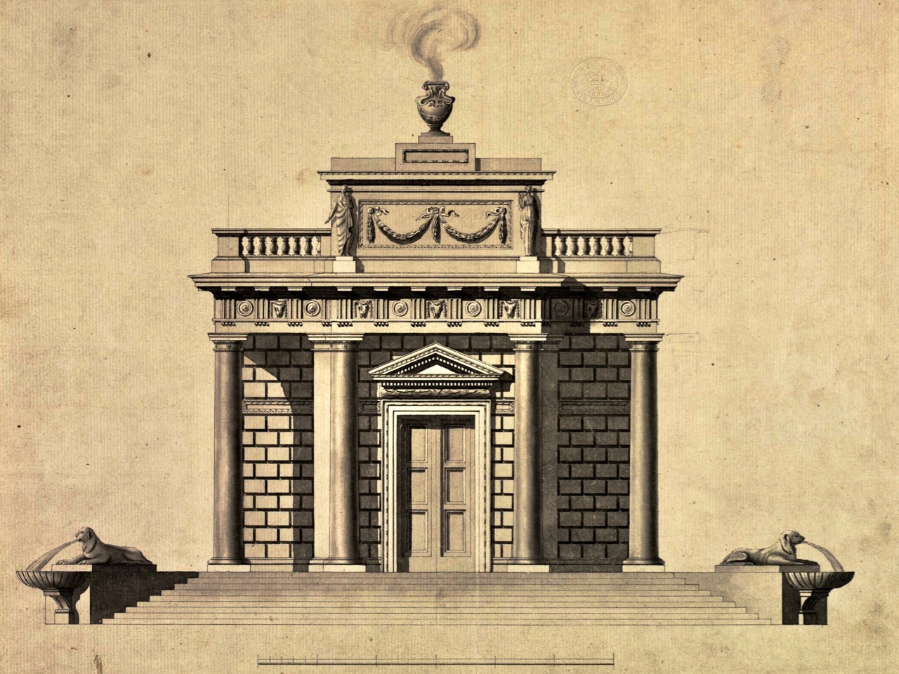
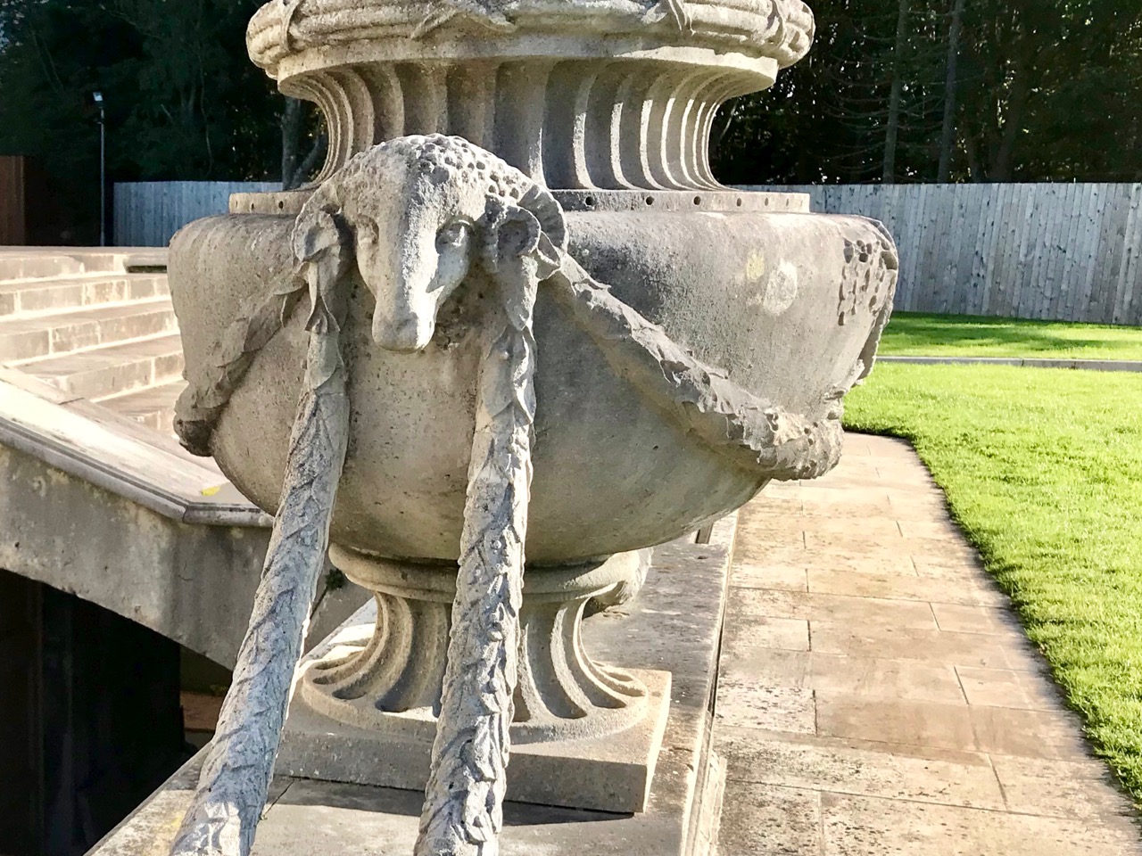
The Casino is guarded by four large lions. Originally they were intended to be fountains – as you can see from the original architect’s drawing, above. In this drawing you can also get a good sense of how the designer plays tricks with scale: the doorway is perhaps three times the height of a normal door, and only a small section at the bottom is, in fact, an opening.


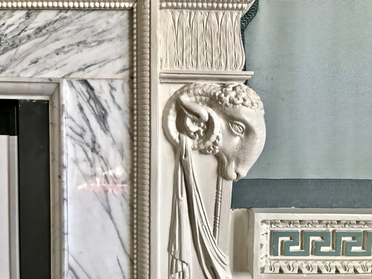
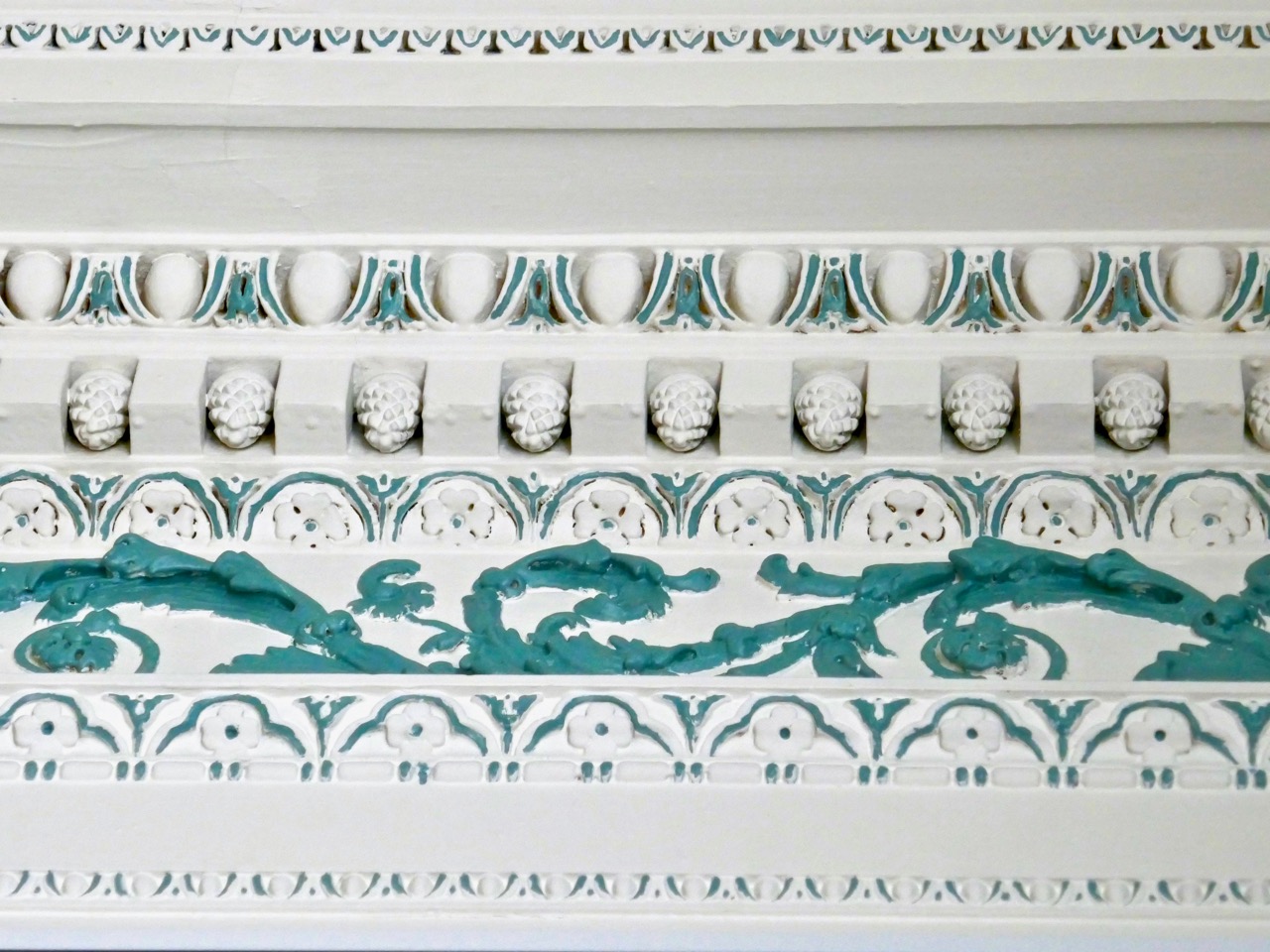
Symbolism and hidden messages abound: the architect, Sir William Chambers, left his signature – in the form of a ram – in many parts of the house. Every moulding, coving, frame detail has a meaning in terms of architecture and freemasonry – and also pays homage to the Greek and Roman classical orders – at the behest of the client. The parquet flooring is magnificent – and is at present kept covered by a vinyl replica to protect the original exotic woods.

The detailing of every element has been fully considered. I was impressed with the curved timber doors, which follow the line of circular wall partitions inside. And, particularly unusual, is the use of vertically curved glazing which causes reflections when seen from the outside, meaning that no shutters or blinds are needed at the windows.


Look carefully at these windows: they are crafted with vertically curved glass which make them reflective externally!


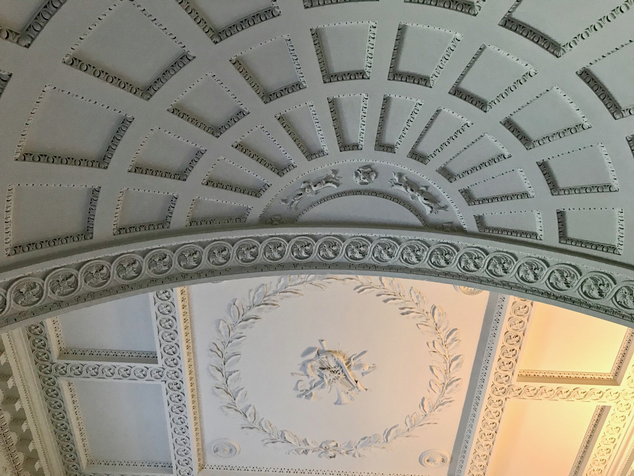
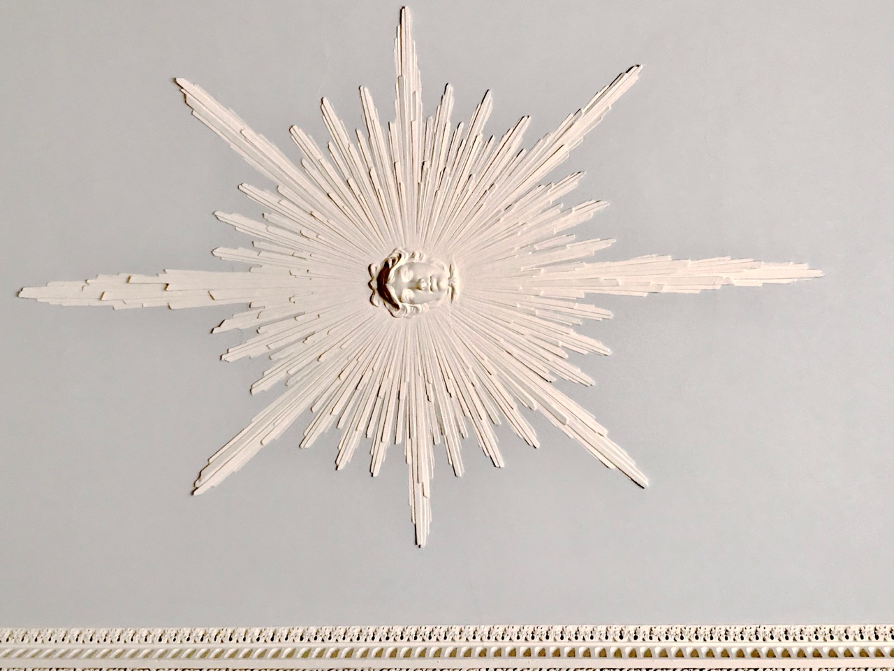
Examples of the plasterwork within the Casino include agricultural harvest symbols, every classical moulding motif and Apollo the sun-god. It would take several visits to absorb and catalogue the complete variety of images: every room has a different visual character.


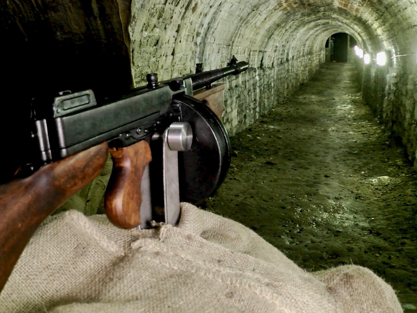
There are hidden elements – and enigmas – to the building. These include ‘secret’ tunnels in the basement: one was used by Michael Collins to test-fire submachine guns during the War of Independence. The picture above shows a reconstruction. The basement of the Casino, including the tunnels, is currently undergoing further restoration and refurbishment and was not accessible during our visit. It is said that there are many other tunnels, including one that linked the Casino to the big demesne house (now demolished) – and some that, according to legend, run to the coast – miles away!

Charlemont was a liberal and believed that everyone should have access to his parklands: there were no gates. He was so protective of his project, however, that he married in middle age, having been a confirmed bachelor. He had overheard his then presumed heir (his brother) talking about how he was going to exploit and commercialise the demesne once he got his hands on it: this prompted Charlemont to ensure he produced an heir that he could have some direct influence over! Evidently, the marriage was a happy one. The image above shows the Casino in a sad state of disrepair around 1900: the estate was broken up by the third Earl in 1876.

The Casino was adopted as a National Monument in the 1930s, and a full restoration was begun in the 1970s. A further phase of this restoration is currently under way, and the property is only open on limited occasions when suitable areas are accessible: we were fortunate to get there on one of those times. If you plan to visit, contact the Office of Public Works to make sure that you will get in. Charles Topham Bowden made the journey in 1791, and recorded it in his journal A Tour Through Ireland: here is an extract:
. . . This is one of the most beautiful and elegant seats in the world, happily situated, and in a demesne improved in the highest taste, comprehending 238 acres, laid out in plantations, lawns, and a delightful park . . . The temple is situated in the park – a monument of his Lordship’s refined taste. The Gothic room is a very curious and beautiful structure. The hermitage is nature itself. Art and nature unite in rendering this a most desirable residence. What obligation are not the citizens of Dublin under to his Lordship for having the gates of this terrestrial paradise opened to them whenever they chuse [sic] to walk through it . . .

Email link is under 'more' button.