The Return of the Earls: The 2025 Crowley Clan Gathering

I spent Saturday in Baltimore celebrating, with dozens of Crowleys, a signal occasion. This celebration involved the iconic boat The Saoirse, exhaustive genealogical research, long lost cousins meeting for the first time in over 300 years, and a remembrance of a devastating episode in Irish History – the Flight of the Earls. 

Let’s start with the Flight of the Earls. The Battle of Kinsale in 1601, was the moment that marked the end of the power of the great Irish families and the end of the Gaelic way of life. Many heads of those families who had fought at the battle fled Ireland from Rathmullen in Donegal, heading for the continent, in 1607. Their names can be found in the lists of those who fought in the armies of Spain, France and the Austrian Empire, as well as, sometimes lightly disguised, as landowners, wine-growers and grandees in those countries.

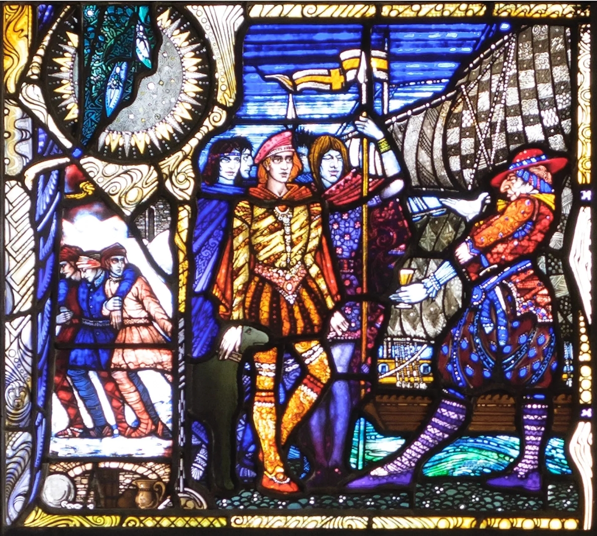
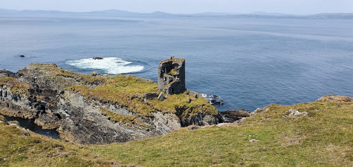
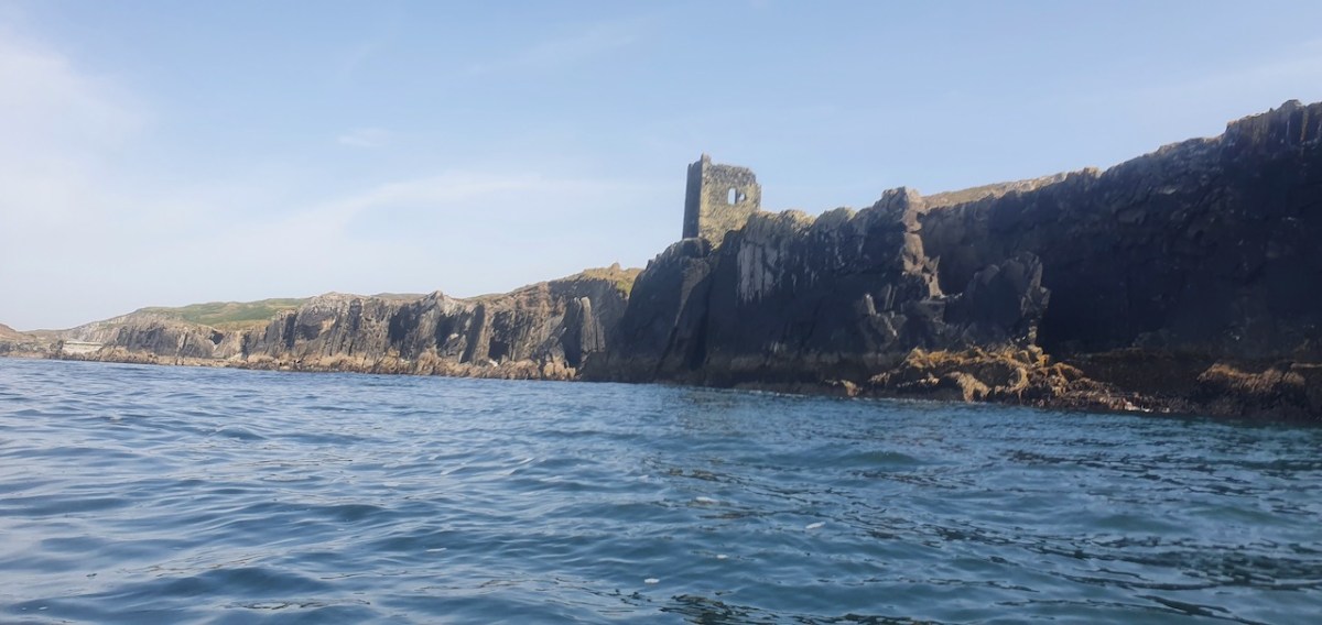
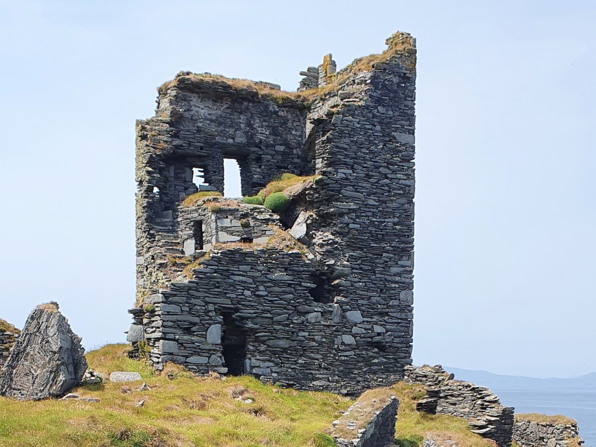
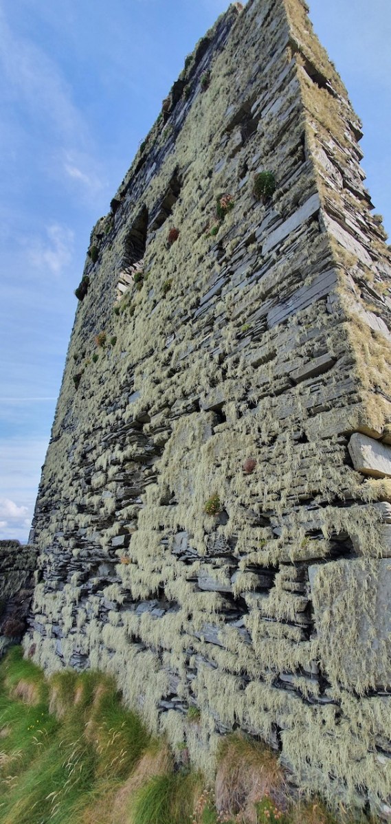
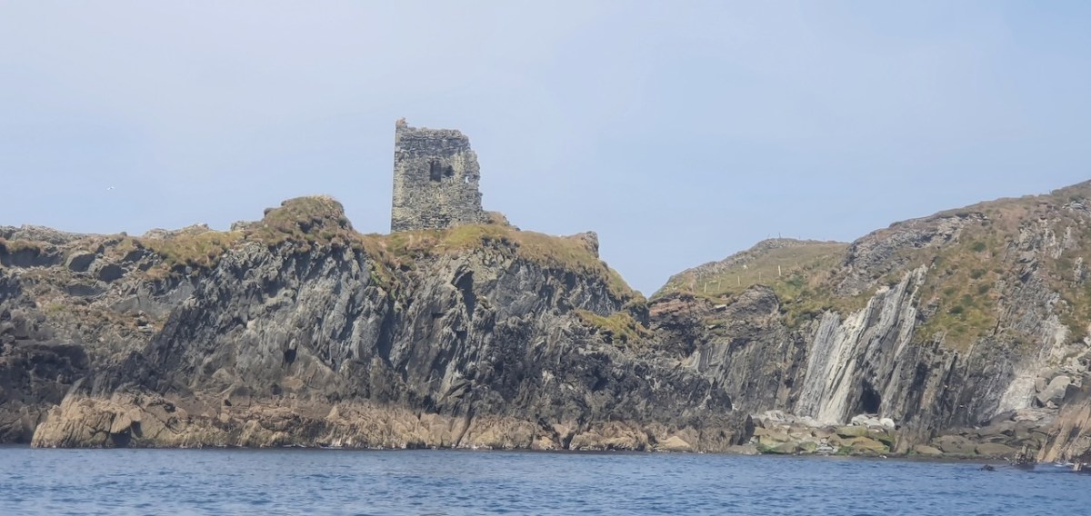
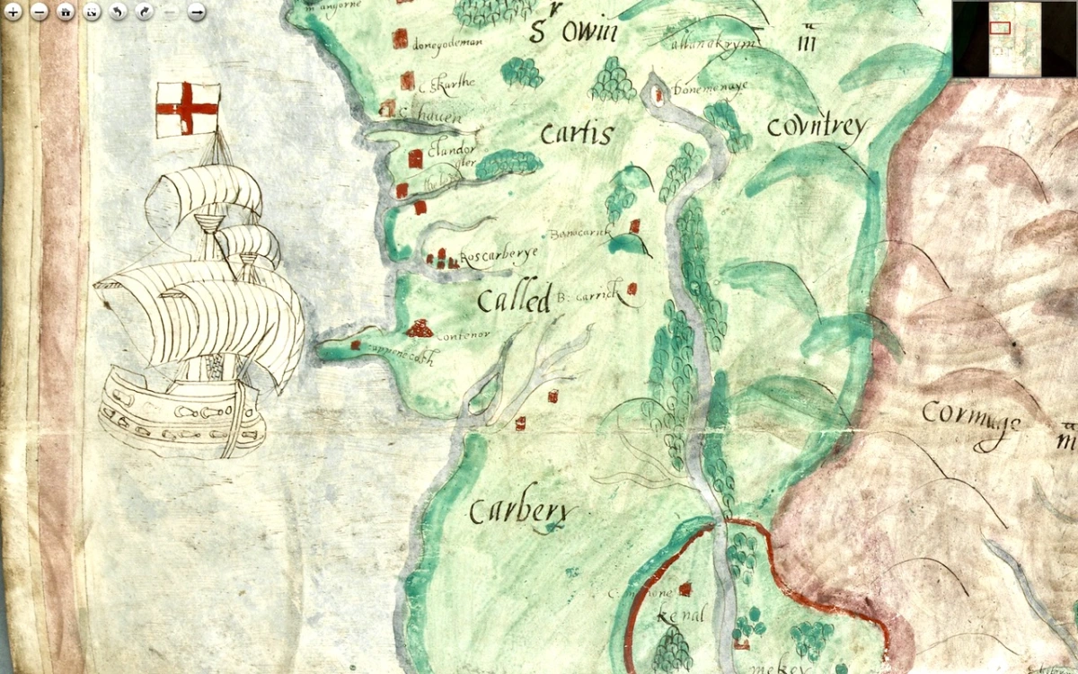
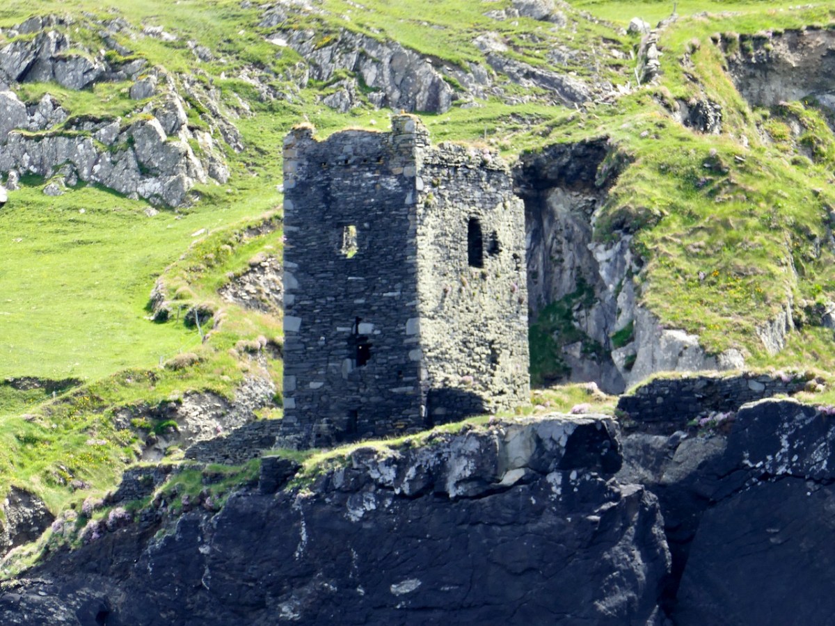
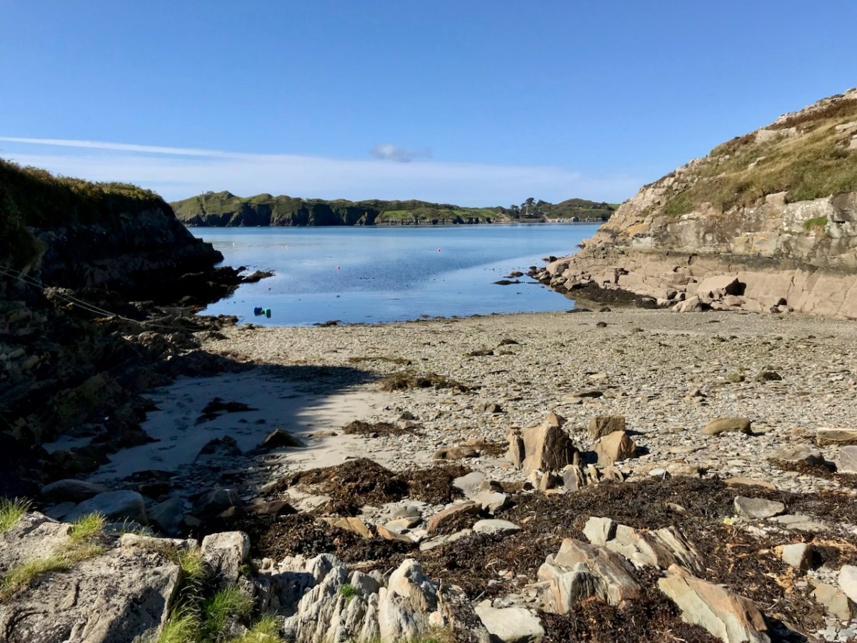
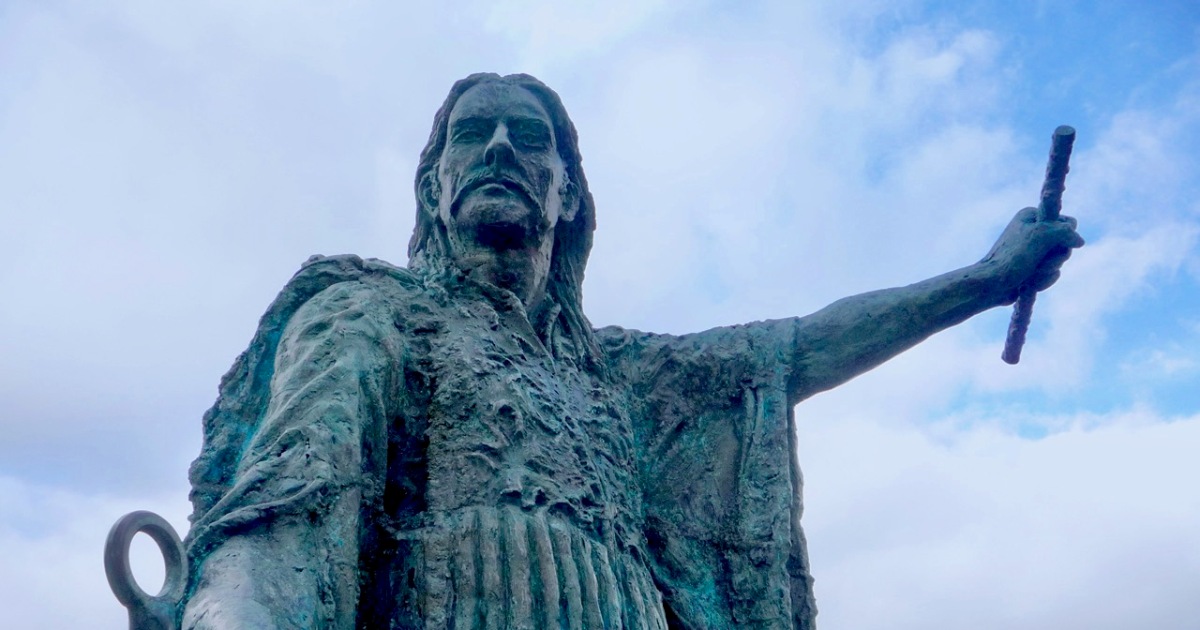
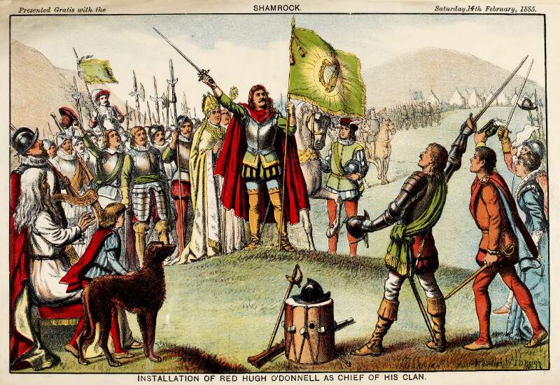
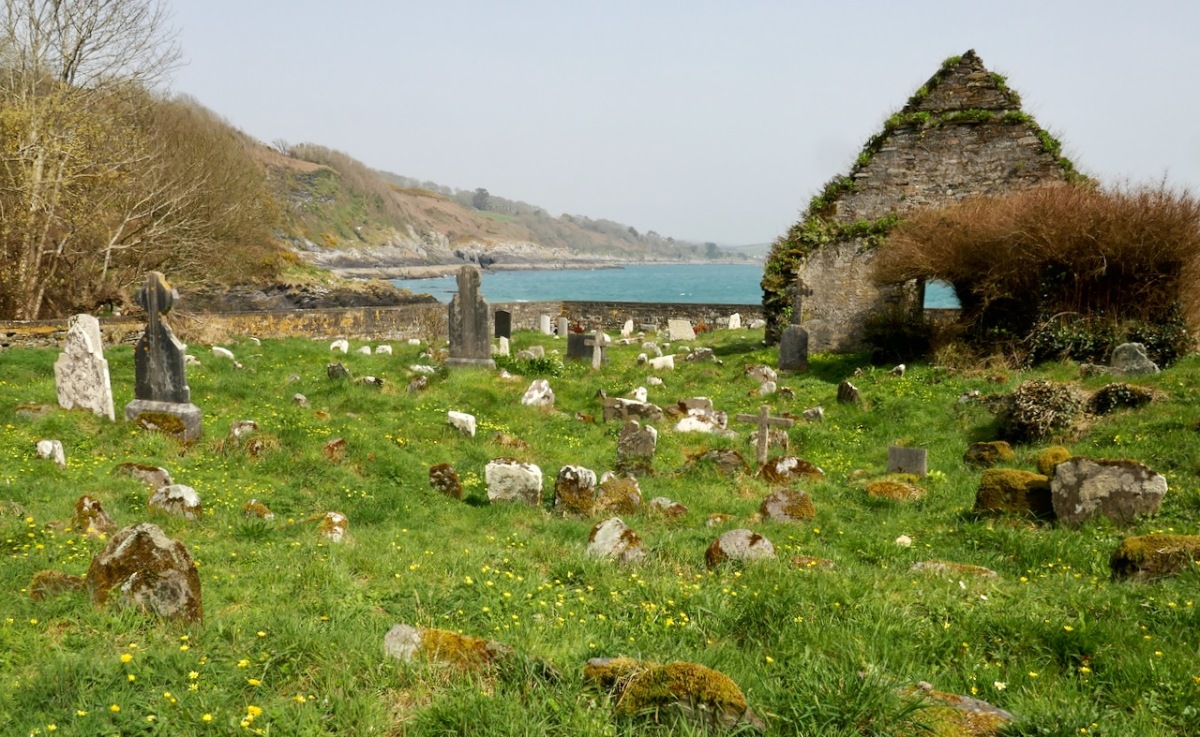
However, one of the leaders, Red Hugh O’Donnell of Donegal, set out earlier, on January 6th, 1602, and he sailed from nearby Castlehaven (below). You can find the whole story, told in a highly entertaining way, on the website of our old friend Gormú. That’s Richard King‘s rendition of Red Hugh, above, being offered a poison cup by a traitor, causing him to die in Spain (where his grave has recently been identified). My lead photograph is his statue, by Maurice Harron, in Donegal town and the cartoon is by John Dooley Reigh, from The Nation (I think). We in West Cork have never forgotten that this is a West Cork story and we feel we can claim Red Hugh as one of our own. This connects us in a special way to the whole saga of the Flight of the Earls.

That flight did not stop in 1607 – Irish men and women, clan chieftains, soldiers and peasants alike, continued to leave for the continent over the next centuries. 

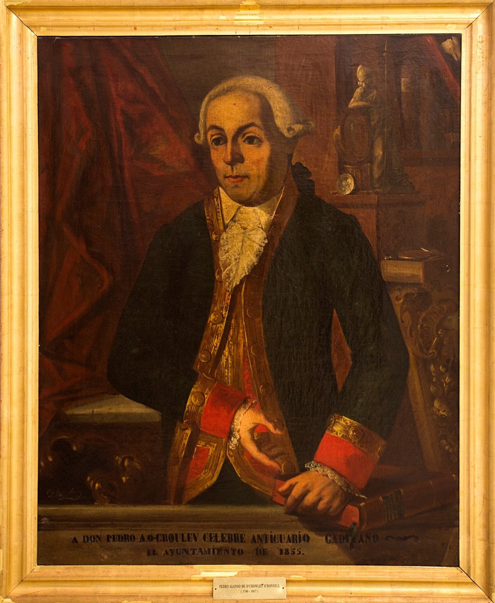
Among those who left were the parents of Don Pedro Alonso O’Crouley. Here are the details from the Crowley Clan website:

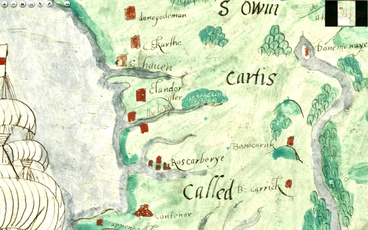
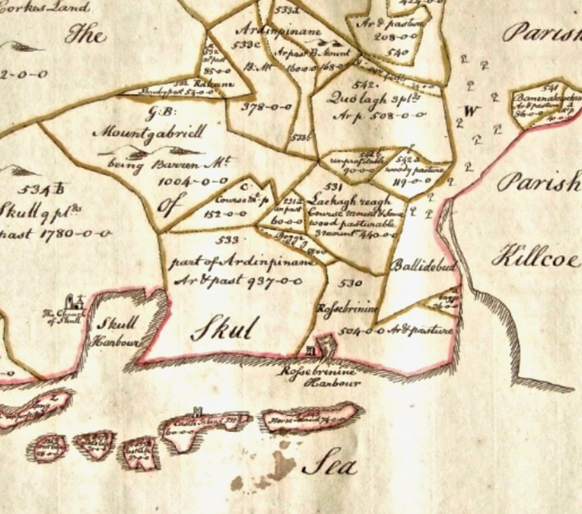
Pedro Alonso O’Crouley was born in Cadiz in 1740. Both his parents had emigrated from Ireland. His father Dermetrio (Diarmuid or Jeremiah) was from Limerick claiming descent from Cormac O’Crowley born in Carbery, Co. Cork in 1550. His mother was an O’Donnell from Bally Murphy in Co. Clare.

At nine years old he was sent to France where he got a classical education from the Augustinians at Senlis. He chose to follow a career as a merchant and got a licence for Veracruz and made his first journey to Mexico at the age of 24. Over the next ten years he repeated the journey several times and built up a large fortune from his trading business.

While in Mexico, or “New Spain” as it was called, he gathered every bit of information he could about the country and its history, geology, vegetation, animals, etc. and wrote up his findings in the “Idea compendiosa” – A description of the Kingdom of New Spain” in 1774.

After returning from Mexico O’Crowley stayed on in Cadiz pursuing his interests in antiquities and history. In 1794 he published a catalogue of his private collections called “Musaei o’croulanei”. It lists over 5,000 Greek and Roman coins and 200 paintings including works by Van Dyck, Rubens, Murillo, Velaquez, Zurbaran and Ribera. He also had many geological specimens he had gathered in New Spain.

Pedro remains very famous in Cadiz, where his house functions as a museum. And – there are descendants! In 2014 the Crowley website received a letter:

My name is José María Millán Fuentes, and I am a descendant of O’Crowley. I live in Cádiz, Spain, and I am doing work for the University of Málaga on my ancestors. I speak very badly English, but I have a lot of interest in the topic. I would like to help you, and that you also should help me. I have read in your web Antonio Castro, and also I descend from Pedro Alonso O’Crowley O’Donell and Adelaida Riquelme O’Crowley. I have a lot information about the family up to Pedro Alonso, but then everything fades away.

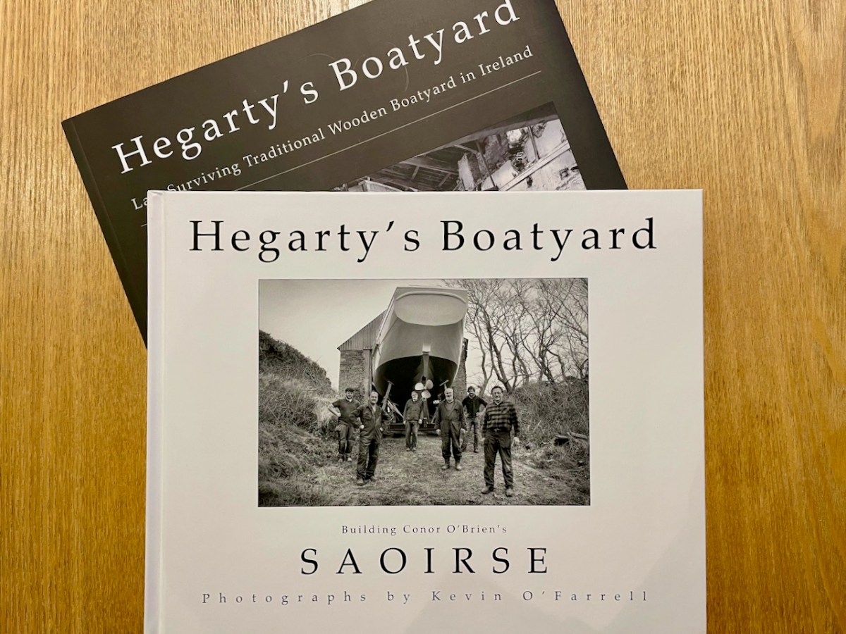
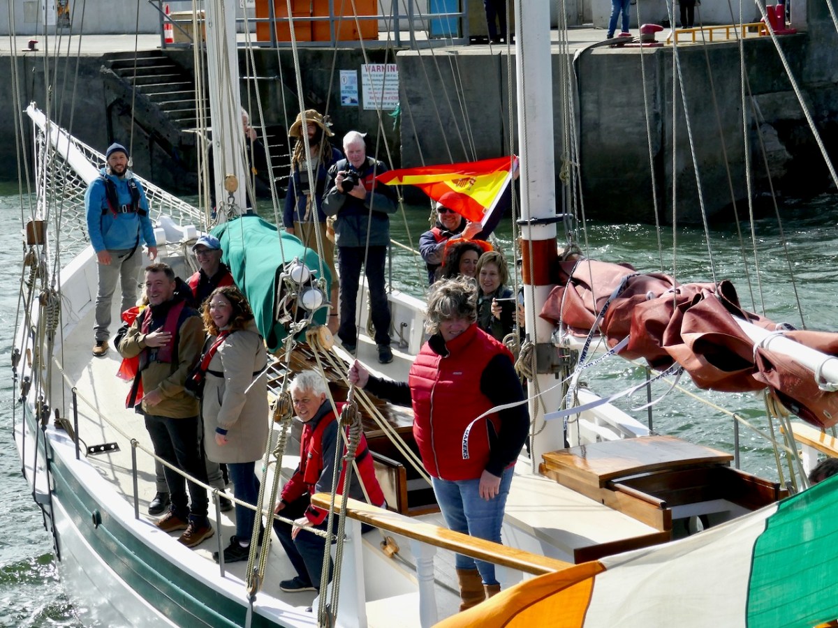
Eleven years later, José Maria is to be the guest of honour at the Crowley clan gathering. The committee discusses how best to make the most of this moment and comes up with a genius idea. He should arrive by sea, born into Baltimore on the iconic boat, the Saoirse. Read about the Saoirse here, and for true traditional wooden boat enthusiasts, you can buy Kevin O”Farrell’s brilliantly photographed book on its reconstruction in Hegarty’s boatyard. 

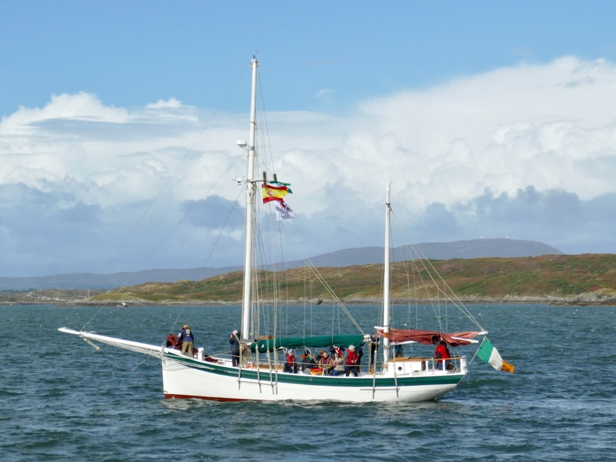
The Saoirse is a big, gaff-rigged yacht, the original version of which was built to sail around the world. It requires a great deal of skill to sail, and thus the task was entrusted to Liam Hegarty.

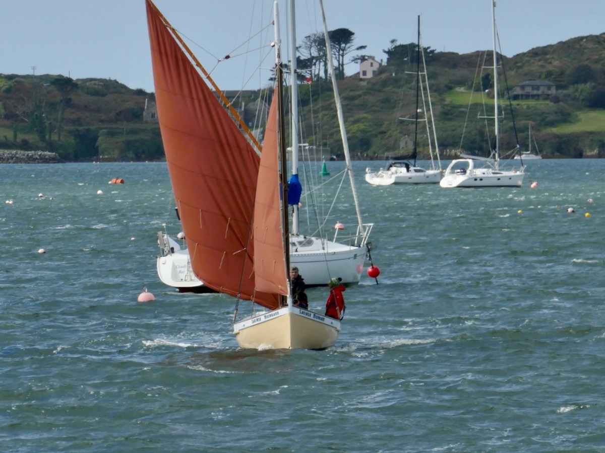
A flotilla of traditional wooden boats was to accompany her into the harbour but high winds scuppered that plan so in the end only two boats made up the guard of honour – Cormac Levis’s Saoirse Muireann (above) and Nigel Towse’s Honorah

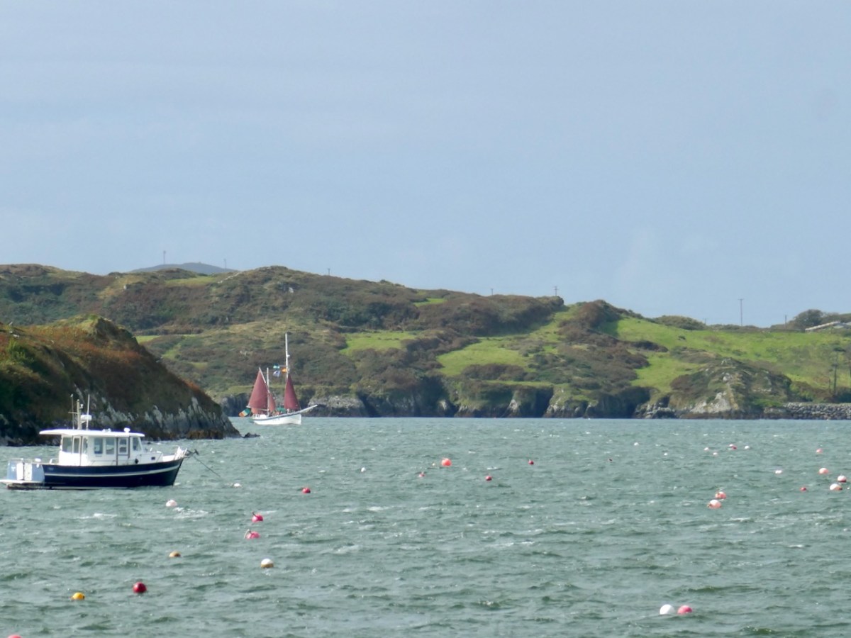
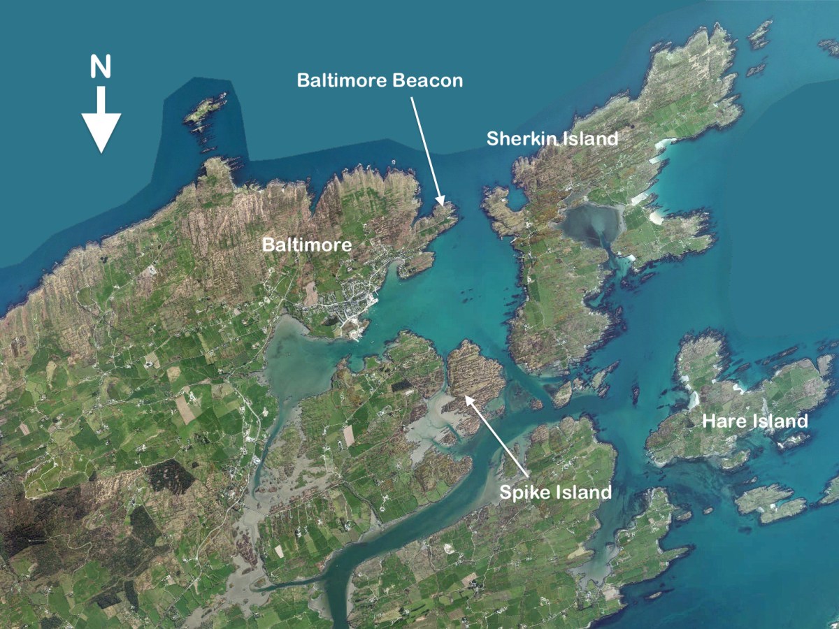
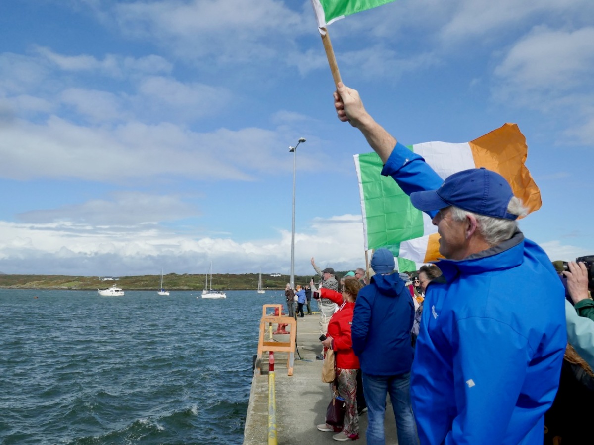
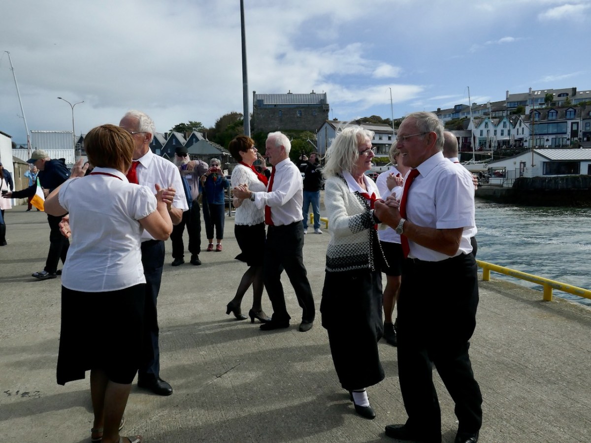
It was thrilling to see the Saoirse round the Beacon point and tack into Baltimore. I stood with a large contingent of Crowleys, waving flags and cheering, while a group of lively dancers set all our toes tapping.

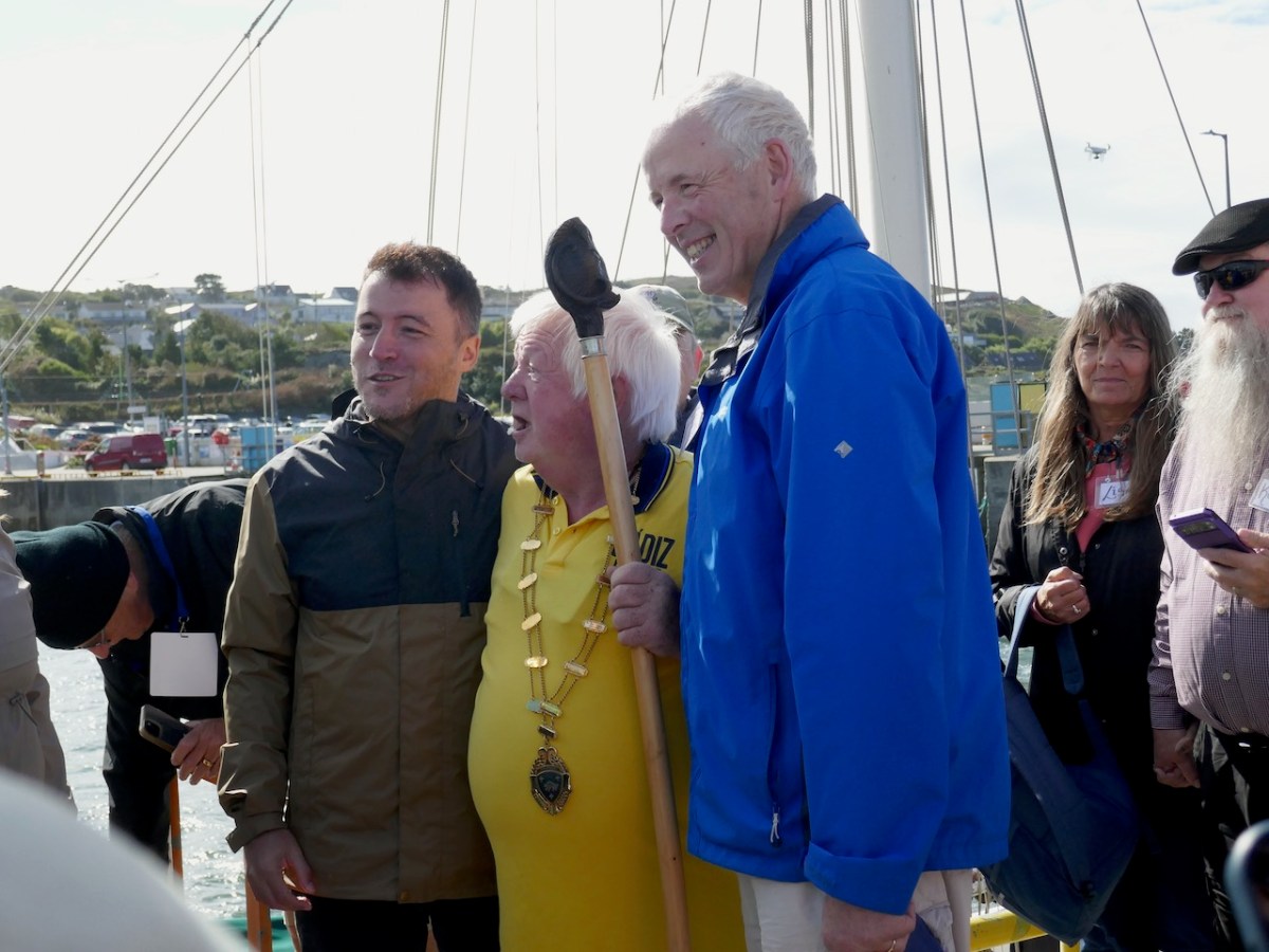
The most moving moment was when José María  climbed up the ladder to the pier, to be met with his 7th cousin, Kevin Crowley from Martinstown, Co Limerick, and enfolded in a welcoming embrace. The Clan Taoiseach, Larry Crowley gave a short, perfect speech. He said, and I paraphrase – José María, your ancestors fled Ireland 300 years ago. They were escaping from oppression, from poverty, from dispossession and from the consequences of resistance. But here we are now, all of us proud Europeans, standing shoulder to shoulder

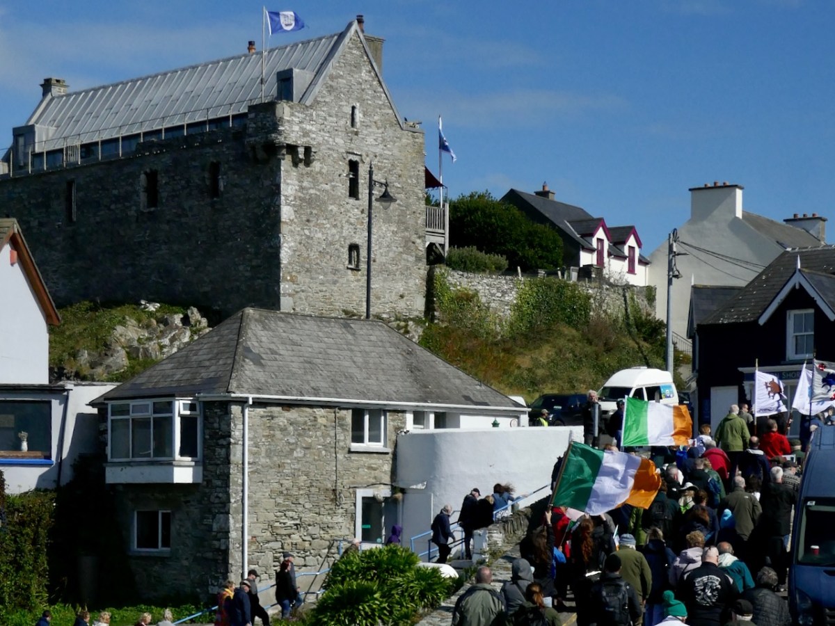
Led by a piper, we marched up to the village square.

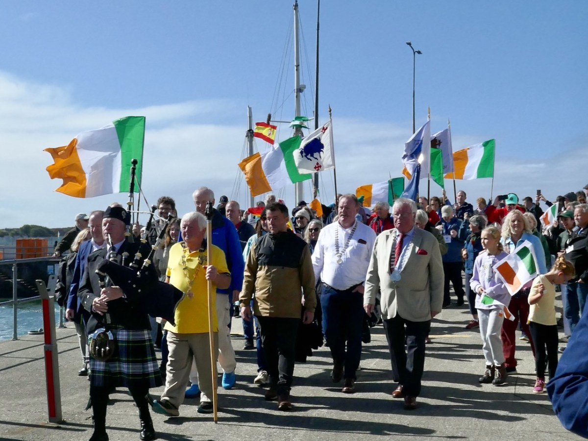
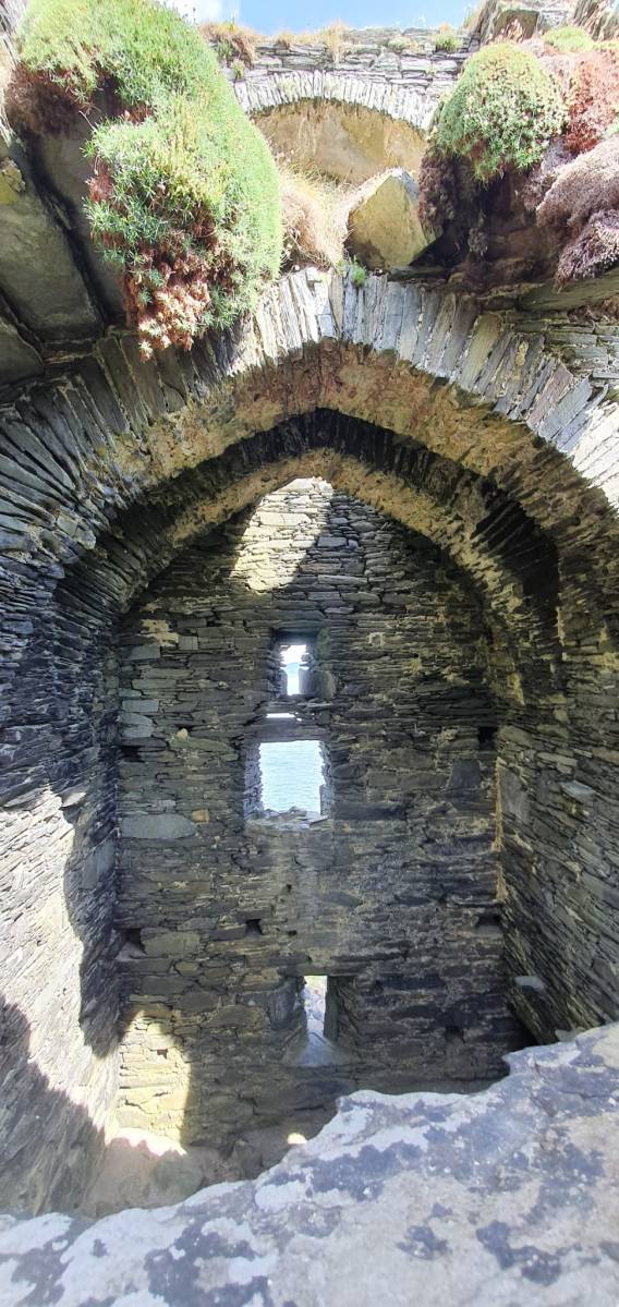
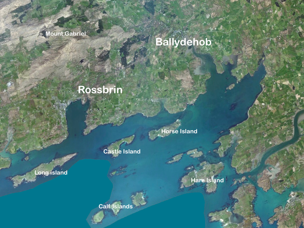
I was struck by the aptness of the Spanish flags passing under the walls of Baltimore Castle – a castle that, in its day serviced the vast Spanish fishing fleets that came for the pilchards and herring. The O’Driscolls became fabulously wealthy through that commerce, and forged alliances with the Spanish that came back to bite them in later years.

There were more speeches, including a masterful summing up of Baltimore’s history by William Casey, and then a squall had us running for cover. The Algiers Inn and other eateries in Baltimore served up a smashing array of sandwiches and soup. I chatted with New Zealand Crowleys and American Crowleys and Irish Crowleys – we all agreed that it had been a perfect Welcome Home.

I may not have all the details exactly right – corrections welcome from knowledgeable Crowleys. My special thanks to Charlie Crowley for inviting me along.

Fort of Gold 2: The Castle

This post will be about the castle itself, as a follow-up to Part 1 about the promontory and historical background. I received some very interesting comments on the name, Dún an Óir, which I interpret as Fort of Gold, and I will write more about that at the end of this post. If you are not familiar with castle architecture, before you start, you might want to browse my castles page and pay attention to how they were built and what the castles of Ivaha generally looked like. Unless otherwise identified, all the photographs in this post were kindly sent to me by Tash, one of our readers. In this one, taken from the sea, the impregnable siting of the castle can be appreciated.

The castle was surrounded by a bawn wall, clearly visible still. Three floors (ground, first and second) were surmounted by a ‘partial vault’, above which was the principle chamber or solar – the private domain of the castle owner and his family but also where visitors were entertained.  Above that was a mezzanine floor and above that again was a wall walk, accessed via a spiral staircase from the main chamber. 

In her paper on this castle*, Sarah Kerr points out that it is, in fact, unlike the other O’Driscoll Castles of Dún na Séad and Dún na Long, and indeed other West Cork Castles, in that it only had one entry, at the ground-floor level. It is possible, she says, that the tower was so well defended naturally by its position, that a raised entry (an additional line of defence) was unnecessary. She also points out that a raised entry functioned as a status symbol, since it was the entry used by the chief to access the private rather than the public spaces within the tower. Perhaps Dún an Óir was therefore a lower-status castle, occupied by a garrison rather than by a chieftain. She provides this plan

Another unusual feature is the small projecting tower that contained the garderobes. You can see that projecting addition in the plan, above, and in the photograph, below. The entry led up, via a mural staircase to a door giving admittance to the first floor, and carrying on to entries at the second and third floor levels. From there, another stairs led up to the wall walk.

Flat slabs were used to dress the outside of the walls, the same construction method as at Dunlough, although not as finely built. 

Instead of a complete vault, such as we see at Dunmanus or Rincolisky, there is a ‘partial vault’, described by Samuel:

Two free arches resembling ‘slices’ of a barrel vault were built. The gaps between the arches and the walls created were lintelled over with large overlapping slabs. This ‘economy’ vaulting was much lighter than a complete vault. 

The Tower Houses of West Cork by Mark Samuel

In fact, this type of internal vaulting is not that unusual in West Cork – we saw it at Dunlough and in the small tower at Dunworley. At Dunlough, we can still see many of the large slabs of slate that once bridged the gaps between the arches of the partial vaulting, while at Dunworley the roof is still intact. In Tash’s photograph below you can see the double arches and the full extent of the three floors below them, as well as the chamber above which would have had a pitched wooden roof..

The top room, or chamber, was very high with a pitched roof supported at each end with an archway. The archway also allowed the top of the wall to be kept clear to form a wall walk. A conjectural reconstruction drawing at Ballinacarriga conveys the idea, although Dún an Óir only had one arch, not two.

The battlements have disappeared – they were likely Irish crenellations consisting of stepped merlins and crenels (see here) – but the wall walk can still be discerned. As you can see below, the steps can still be climbed by those brave enough.

Quite a bit of the bawn wall survives, although of course it would have been much higher (possibly as described here). If the sheer cliffs were not enough to deter any thought of attack, the walls would have provided an additional barrier. Unfortunately, they were not able to withstand cannon fire, let alone the passage of hundreds of years. Sarah Kerr has an interesting take on this wall:

Bawns are often considered an additional defensive feature, or at least deterrent. Dún an Óir’s in this regard is somewhat excessive as anyone who could scale the rocky façade of the promontory would likely not be deterred by additional few metres of wall. The bawn, however, would have provided the inhabitants a layer of safety against accidental falls and protection from some of the inclement weather, such as high winds and storm waves from which Roaringwater Bay gets its name. These humdrum practicalities of the medieval lived experience have often been overlooked in castleology or castle-adjacent buildings archaeology, however, it is this very granularity which deepens our understanding of how these buildings worked.


Networked Control: Tower Houses in Ireland by Sarah Kerr

The bawn, in Samuel’s estimation, (that’s his plan above) was big enough to accommodate quite a large herd of cattle. An interesting feature is that of an outside kitchen with an oven, reminding me of what was uncovered at Rincolisky, another O’Driscoll castle, in recent excavations. In the plan above the oven is the circular feature at the north corner of the tower. Other buildings stood inside the bawn, although their purpose is not clear. There may have been a gatehouse, and the ‘possible wall embrasure’ in Kerr’s plan is viewed by Samuel as a corner turret. Samuel lays out what he can interpret of the various walls that surround the castle:

The continuous and well-preserved north wall of the bawn terminates to the west with a return that runs a short distance north before being broken away. This is the inner face, a turret with gunloops which defended the bawn. The curved outer wall enfiladed the mainland with three widely splayed gunloops.

The interpretation of the ruins east of the tower house is more difficult. Erosion has removed the eastermost part of the defences. Two separate walls on the east side of the tower diverge from its orientation; running approximately due east they seem to have formed the north and south walls of a smaller enclosure containing another building. At the west end, the north wall meets a wall (the junction is destroyed) with a gate which abuts the north face of the tower. The robbed jambs of a large gate survive on the east face of the wall and indicates that the gate swung inwards to the west where another enclosure presumably existed. A deep drawbeam is visible in the south jamb. This gate now leads almost directly into a deep ravine. A fair-weather landing stage may have once existed on this side of the island but it would have rarely have been safe to use.


The Tower Houses of West Cork by Mark Samuel

Sarah Kerr positions Dún an Óir in a network of O’Driscoll castles that together worked to control the resources of Roaringwater Bay, to levy fishery dues, monitor trade, and defend territory when necessary. Within this network, the highest status tower, and probably centre of administration was Dún na Séad (Baltimore). The highly visible nature of all these castles, some on promontories and all visible from the sea, were ‘manifestations of authority, wealth and status.’ She posits that: 

Due to Dún an Óir’s lack of a slipway, natural harbour or rock-cut steps, it is unlikely that manging the fish produce was a primary role at this dwelling, particularly as Dún na Long and Dún na Séad were more suited to such tasks. Instead Dún an Óir probably managed the victualing and collection of fees from passing ships, indicating that the tower houses worked in unison. It appears that each tower house had a specific role which complemented one another, as such they were unique actors that performed as a network

Networked Control: Tower Houses in Ireland by Sarah Kerr

It’s surprising how much we can tell from the remains of this once prominent symbol of power. It will never be on a tourist trail and I would not advise anyone to try to access it – but as you can see, Tash and his group managed it.

In response to my first post I had several suggestions for alternate titles on Facebook. Ruamann Ua Ríagáin proposed an alternate interpretation as Dún an Ár, or Fort of the Slaughter. There are no indications that there was any tradition of cattle-slaughtering at this site, nor any record of a massacre. However, it remains a possible interpretation. Another reader, Tom Driscoll found another Dún an Óir which was assumed to come from Dún an Ochair, meaning Fort on the Brink/ Cliff Edge. Certainly apt for this location. Finally, note the long comment on Part 1 by OVERSEASGREATGRANNY who is trying to trace similarly named forts and relate them to Irish history – quite fascinating.

When the storms rage over Roaringwater Bay it is natural to wonder how long this castle can last, isolated on its spit of land and open to the full force of nature. But it is also a comfort to know that the castle builders built it so well that it has lasted now since it was built around 1450 and battered in 1601. Here’s to another few hundred years!

Thanks again for the superb photos, Tash!
Sarah Kerr of UCC has kindly shared with me her draft paper, Networked Control: Tower Houses in Ireland. I thank her sincerely for permission to quote from this unpublished paper.

A Map of the County of Cork, Part 2

In Part 1, I said that We don’t know who did this one, or when: The date is given as 1560-1620. It seems in some ways more basic than other maps of the period, and less exact. I have now gone to the Atlas itself in Trinity College and discovered that the maps in the Digital Repository are an incomplete set. Specifically, the original Atlas at TCD contains the reverse side, the ‘verso’ of each map. Here’s what’s on the verso of the County of Cork. This:

and this:

So we see that the map is attributed to our old friend Jobson – he who drew the plantation map I wrote about here and here and which was dated to 1589. There are similarities and differences between this map and that one – the galleons and scales for example look very alike. But there’s a lot more information on the plantation map and some of it is different from our Map of the County of Cork. As to the date of the County of Cork map – we will try in this post to see if we can narrow that down a bit from the broad estimate of 1560-1620. 

I want to go, as they say in Ireland, east along. That is, take off from where I finished last time, and travel east along the coast towards Cork, taking in the River Bandon. For the rest of this post, I’m keeping the map oriented as it is originally – that is, with west at the top (it’s actually surprising how quickly you can get used to this). Between Baltimore (Donashad) and Castlehaven (C haven), there are three castles shown, one labelled Sir Jmes Castell, Doneygodman and C skarthe. These are all a bit of a puzzle and I would invite readers to contribute ideas. On the archaeological list of Monuments for this area we can identify the O’Driscoll Castle on the Island in Lough Ine – could this be the Sir Jmes Castell? A promontory fort on Toe Head, known now as Dooneendermotmore, although likely originally an iron age refuge, was refortified in the 16th century and may, like the one I wrote about in Dunworley, have had a significant curtain wall. Was this Doneygodeman? It seems unlikely, as Doneygodeman is show inland – I wonder if instead it could be the castle at Raheen, which was a castle of the O’Donovans.

Finally, C skarthe might be a castle of the McCarthy’s – McCarthy is spelled in a variety of ways on this map, but there I can find no trace of it now. There was a castle in Listarkin, but once again, this is in the wrong place, unless this map, while certainly approximate in places, is wildly inaccurate. It seems reasonable to conclude that the more inland castles may have been harder to plot on a map that the coastal ones.

The castle at Glandore (c Landorgter) is clearly shown, along with two castles guarding the entrance to a long inlet labelled ‘the lepp.’ One may have been Kilfinnan, actually located near Glandore, which the other could possible be the coastal tower house at Downeen. This brings us to Rosscarbery (Roscarberye), shown as a collection of Buildings, as befits its status as a substantial town with a cathedral and a college, and a place of pilgrimage in the name of St Fachtna.

The entirety of this area, in green, is identified as Sir Owin Mc Cartis Countrey Called Carbery. Several other castles are identified here and there, and the course of the River Bandon is traced. The southernmost area is identified as Kenal Mekey, and to the south of the green-shaded section is Kennal Ley. In Canon O’Mahony’s magisterial History of the O’Mahony septs of Kinelmeky and Ivagha he states: 

In the history of South Munster there is no fact attested by more abundant evidence (evidence unknown to Smith and Gibson) than that the Sept-land of the Ui Eachach Mumhan during many centuries extended from Cork to the Mizen Head, as one continuous territory, including Kinelea and Muskerry, and was ruled by a chief whose principal residence was Rath Rathleann, in Kinelmeky.


https://archive.org/details/historyofomahony00omah/page/n1/mode/2up  Page 105

He identifies Rath Rathleann as the mighty multi-vallate ringfort of Gurranes, which was superseded by Castle Mahon, which stood where Bandon is now situated. And here it is, Kinelmeky, with C Mahon shown beside the river. Castle Mahon was later incorporated into Castle Bernard, home of Lords Bandon. Another Castle is shown further down the river – no doubt the one we are familiar with as we travel the N71.

We know that all this land was acquired by Richard Boyle after the Battle of Kinsale (1601) and that he started on his walled town of Bandon Bridge around 1620. Since this is still clearly identified as O’Mahony Territory I think we can take it that this map dates to before the battle of Kinsale.

We see Kenall Ley (Kinelea) in yellow, with the walled town of Kinsale at its heart. Kinsale walls were begun around 1380 and lasted until most of them were destroyed around 1690 by the forces of William of Orange. Inishannon is noted in Kinelea, as well as Park Castell (in what is now the townland of Castlelands) and finally B: Sardey (or is that a different first letter?). We know from another map in the Hardiman Atlas (below) that B designated a small town. Given that Kinsale is such a prominent walled town on this map, once again, a date before 1601 is likely. 

Supporting a pre-1600 date is the fact that it is the old Irish families that are identified with their territories – no settler or Plantation names are given. In fact the O’Mahonys and McCarthys are the only names on the sections of the map we have seen so far. Moreover, it it really was the work of Jobson, we know he was actively mapping in 1589.

In Part 3 I’ll do a quick meander through the most interesting parts of the rest of the map. Stay tuned.

A Map of the County of Cork, Part 1

A Map of the County of Cork, Part 3

The Down Survey – Closer to Home

Last week we gave a brief introduction to the wealth of historical material that we can find in the website devoted to the 17th century Down Surveyhere’s a link to that site, and another (here) to our previous article. The subject – and some of the deeper detail we can discover in the website – is well worth a further look.

The Down Survey (the above view of some of the islands out in Roaringwater Bay is extracted from it) was carried out between 1656 and 1658, and thus gives us an excellent picture of how terrain we are so personally familiar with was perceived pictorially in the mid 17th century. We don’t know who the surveyors were, except that they were under the command of Sir William Petty, ‘surgeon- general of the English army’. Ireland became one of the most-mapped countries in the world at that time, following the Cromwellian and Williamite land redistributions. The beneficiaries were the new landlords of the Ascendancy, who wanted to know exactly what they had acquired, and the initial emphasis was on boundaries and basic land-measurement.

We wanted to know what our little bit of West Cork looked like on those earliest maps. Our view is down toward Rossbrin Cove, below where we live, and our house is a mere blip on the contemporary aerial view at the top of the page. In the first example from the Down Survey mapping – under that view – the cove of ‘Rofsbrinine Harbour’ is marked, and the castle, whose remains still guard the harbour entrance to this day (above), is clearly shown.

This view looks across the channel from the site of Rossbrin Castle. Immediately in the foreground is Horse Island, while beyond is the distinctive profile of Cape Clear. Let’s look at the Down Survey entry for Cape Clear – with. for comparison – a modern map of that island below it.

That map, above, is taken from a nautical chart. It’s understandable that a 17th century map wouldn’t have the level of accuracy we would expect from a modern survey, but take a look, now, at this contemporary aerial view of Cape Clear Island:

It’s remarkable, I think, how strikingly the early map resembles the profile – if not the fine detail – of the modern chart – and also the shape of the island as shown on the aerial view. For example, the ‘Bill of Cape Clear’ shows up very clearly on the chart – the beak-like protrusion on the far western end of the land-mass – a feature which is represented as very similar on the 17th century version, and of course on the modern prospect. Here’s a view of Dún an Óir – Cape Clear’s castle – today:

Just to add to the experience, the above satellite view gives a more ‘flattened’ impression of what is really going on locally: compare this to the expanded view of our coastline from the Down Survey – note that ‘Cape Cleare’ is included on this extract:

As a further example, to finish off this brief overview (which will be continued in future posts) let’s have a look at the Down Survey entry for the Baltimore area – a little further along our coast, travelling east:

This is in fact the Down Survey entry for the Parishes of ‘Tullogh & Baltimore’. The first thing to note is that the north point is facing downwards! If you look at many of the survey pages the orientation varies considerably, and is probably more to do with what conveniently fits on a sheet than any attempt to be consistent. So that we can make an easier comparison with today’s terrain, I have also switched the orientation of this aerial view:

In my opinion it’s remarkable that the Down Survey maps do bear a very reasonable resemblance to the reality. Obviously, a great deal of detail is missing, but the purpose of the maps – to delineate land ownership – is satisfactorily served (albeit that this is to the benefit of the incoming English lords and landowners).

Here’s a view of the site of the medieval fish palace at Baltimore. The Down Survey comprises more than maps: there is other related material, including terriers. These particular terriers don’t have legs or tails – it’s a term for a written, descriptive survey of an estate: some english examples are recorded from the ninth century. Here’s the terrier for Baltimore within the Down Survey:

The terrier in this case is mainly a description of parcels of land, their owners, and the values. Here’s a closer example, from a terrier for ‘Skull’:

There’s a lot more of West Cork within the Down Survey archives. A future post will turn in greater detail to some of this material.