
Megalithic tombs (from ancient Greek mega – great, lithos – stone) dot the Irish countryside and date from the Neolithic period (4,000 to 2,500BC) and the Bronze Age (2,500 to 500BC). The practise of erecting large stone monuments would have entailed significant command of local resources and therefore indicates either a highly co-operative or a highly stratified society. The megaliths were built to last and indeed many have survived, although only a shadow of their original size.
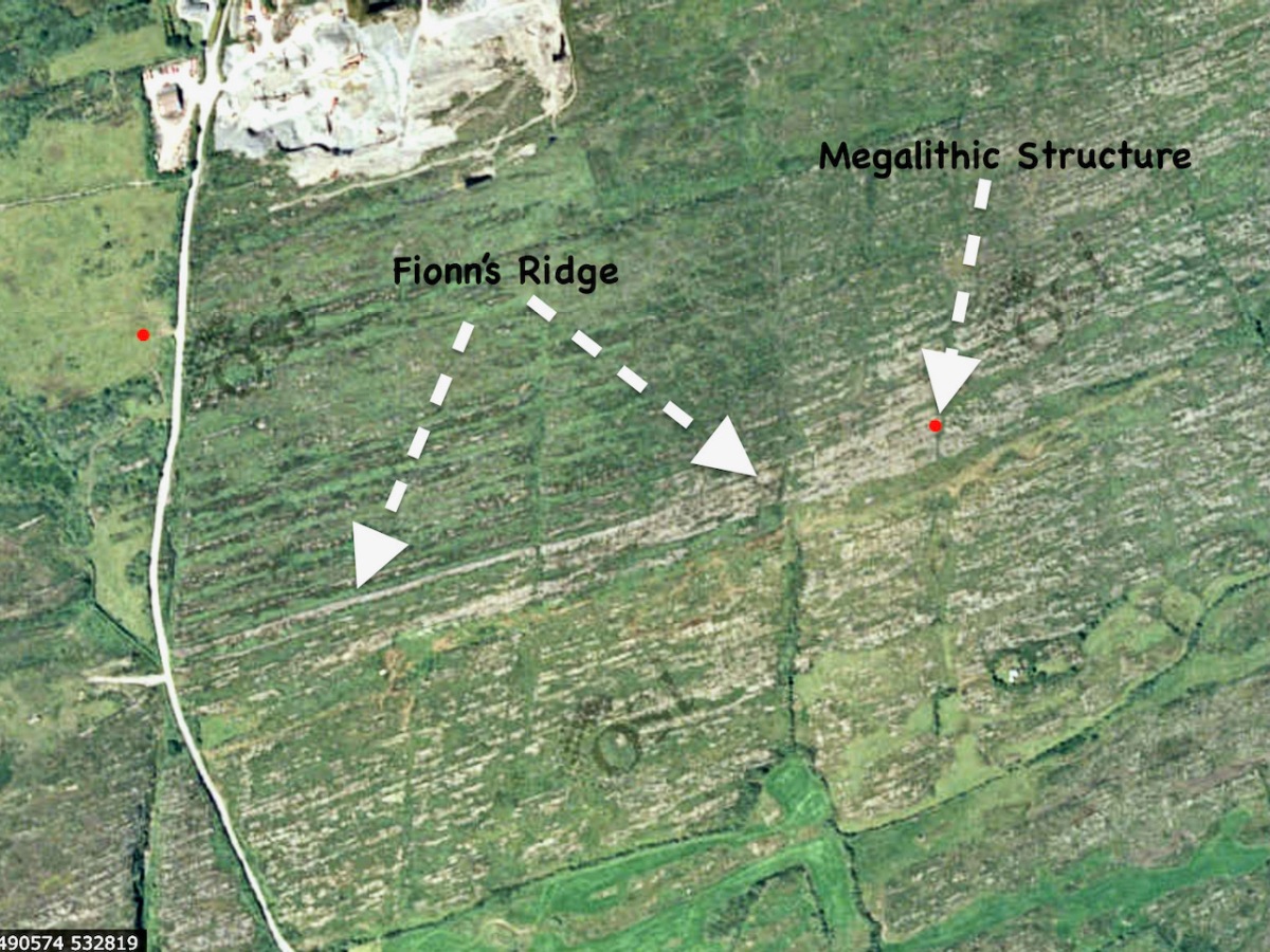
I’m going to start this new series with a curious construction labelled by the National Monuments survey as a ‘megalithic tomb- unclassified’. It’s in the townland of Gubbeen, near Schull, but only barely, as it’s almost on the boundary with the townland to the North, called Glan. What marks the townland boundary here is one of the things that makes this site so fascinating.
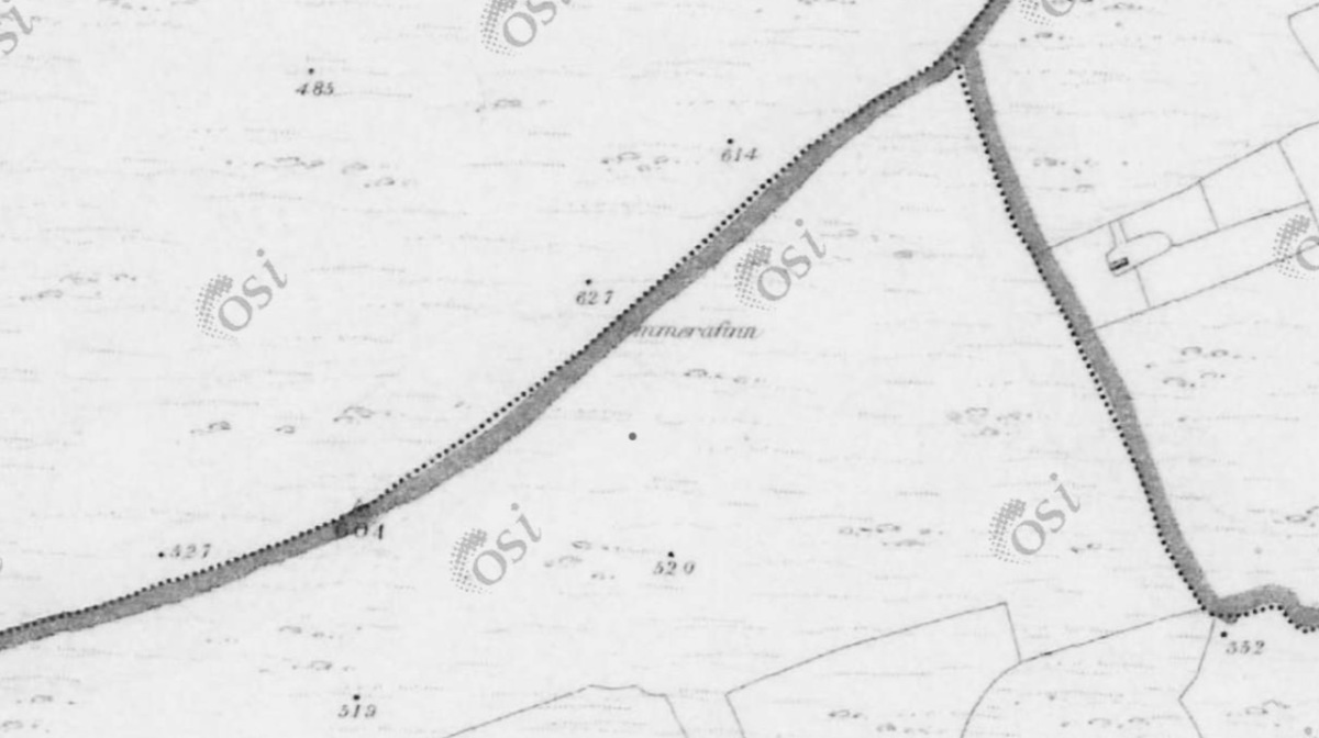
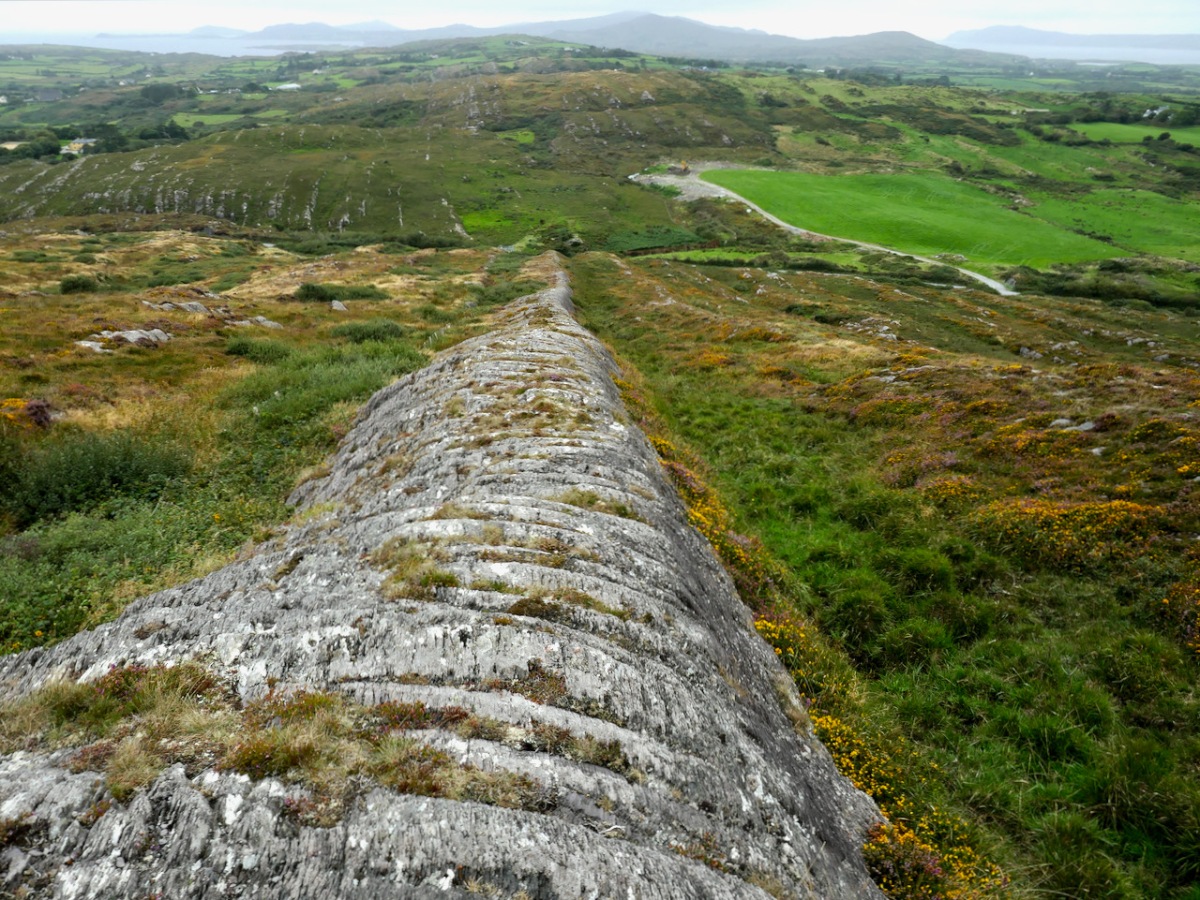
The boundary, instead of the usual stream or old road, is a striking landscape feature called locally Fionn’s Ridge. Originally, it was known as Ummerafinn, from iomaire, meaning a raised strip of earth, such as that made by a plough, and Finn, a common form of the Irish name Fionn, meaning fair-haired. It is marked thus on the Historic 6” Ordnance Survey map which was made in the 1840s – can you make it out, above?

Fionn’s Ridge runs for half a kilometre from the road up to a rocky prominence that is part of Knocknageeha (Hill of the Winds), which in turn is part of the greater mass of Mount Gabriel. As you would expect from such a conspicuous landscape element, it is the subject of much folklore, some of which I detailed in the post Legends of Mount Gabriel: Fionn, Furrows and Fastnet. That post will tell you, if you don’t already know it, more about the legendary Fionn MacCumhaill.

However, when I wrote that post, I hadn’t actually identified Fionn’s Ridge properly. Now, I have not only seen it from several angles, but walked up and down it. The folklore says that Fionn MacCumhaill ploughed the furrow with two rams and a wooden plough and indeed what we see now does bear a resemblance, not to a furrow but to the raised rounded spine (on one side of the furrow) which results when a plough cuts and turns over earth.
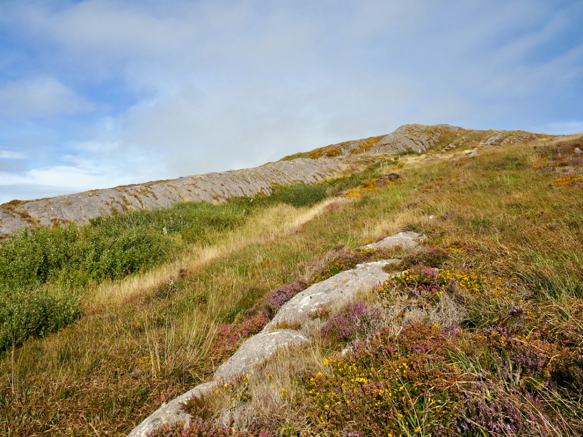
The ridge leads almost straight up to the megalith. This is unlikely to be a coincidence – Neolithic people were as struck as we are by such strange phenomena in their surroundings. When they decided to build the structure at a spot right at the top of it, they may have been influenced by several factors. They may, for example, have used the ridge as a road or as a ceremonial processional route up to the megalith. It is ideal for such a purpose. Like us, they may have had folklore that spoke of a giant and his plough.

Let us turn now to the megalith. Here’s the National Monuments description: Ruined chamber (L 3.1m; Wth 2.2m at W end, c. 0.6m at E) aligned ENE-WSW, formed of inclined slabs. Structure incorporated in circular cairn. Traces of low dry-stone kerb survive at N, W and S.
The first thing we can say for certain is that is is not a wedge tomb. Take a look at my post Wedge Tombs: Last of the Megaliths for a complete description of this type of monument, which belongs to the Bronze Age. Wedge tombs are the most common megaliths on the Mizen – there are 12 listed. Of these, I have stated my doubts about the Giant’s Grave in Arduslough, based on its hilltop setting and the traces of a mound delineated by kerbstones.
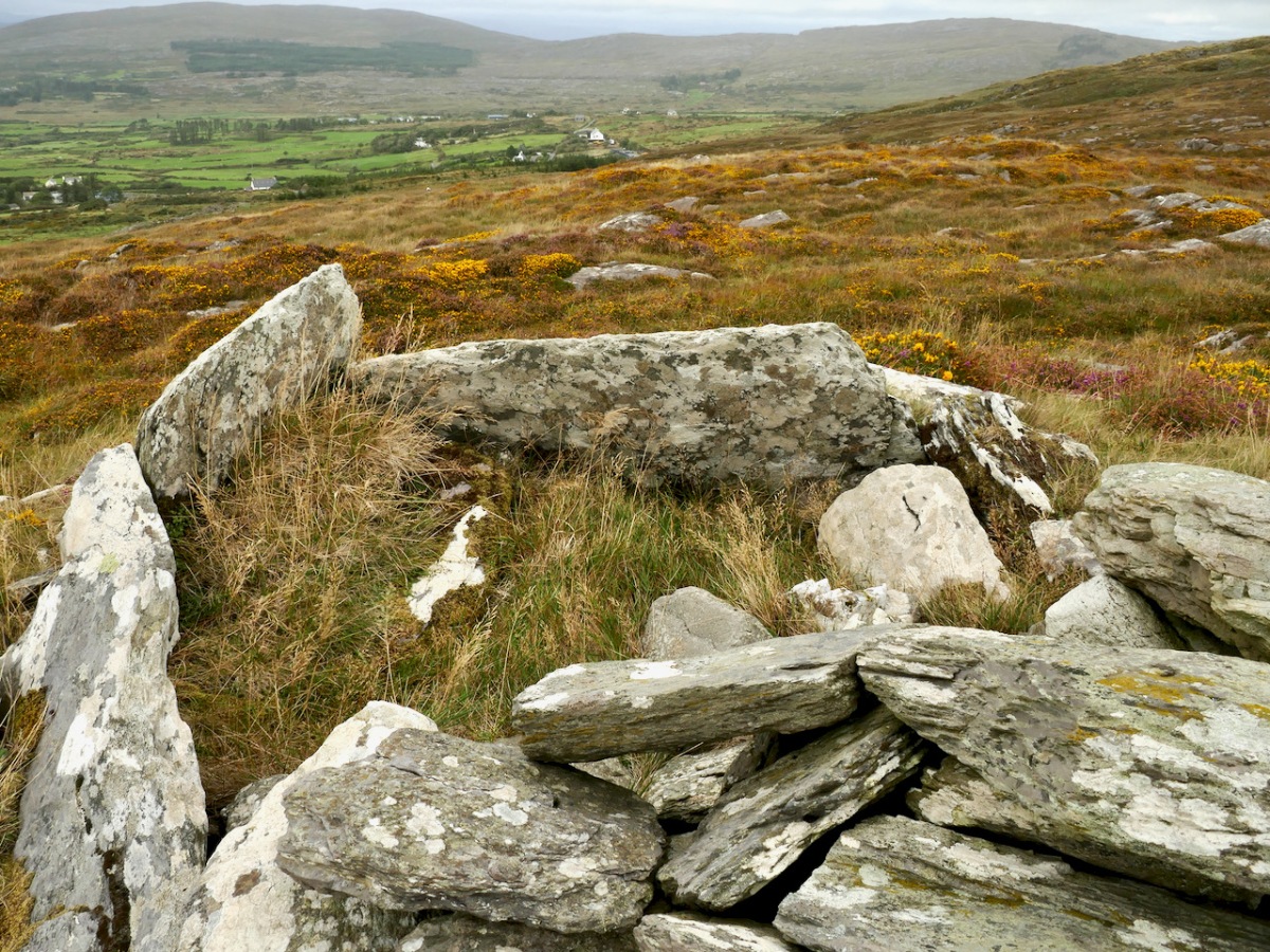
Here we have the same issue – the siting is not typical of wedge tombs, none of which, on the Mizen at least, are on hilltops (apart from Arduslough). Wedge tombs are oriented to the setting sun in the Western sky – that is, the tallest and broadest section, the entrance, is always to the west. In Gubbeen, it is clear that there is no opening to the west – instead what we see is the wall of a roundish chamber. It is impossible to make out exactly where the entrance was for certain, because of piled-up rocks, but it was at the eastern side, with an orientation towards the rising sun, and Mount Gabriel.

As noted by National Monuments, there are traces of a kerb, although it’s hard to be definitive about this. The collapsed pile of rocks as the eastern end may have been simply piled up there in modern times – but they may also be from a collapsed roof.
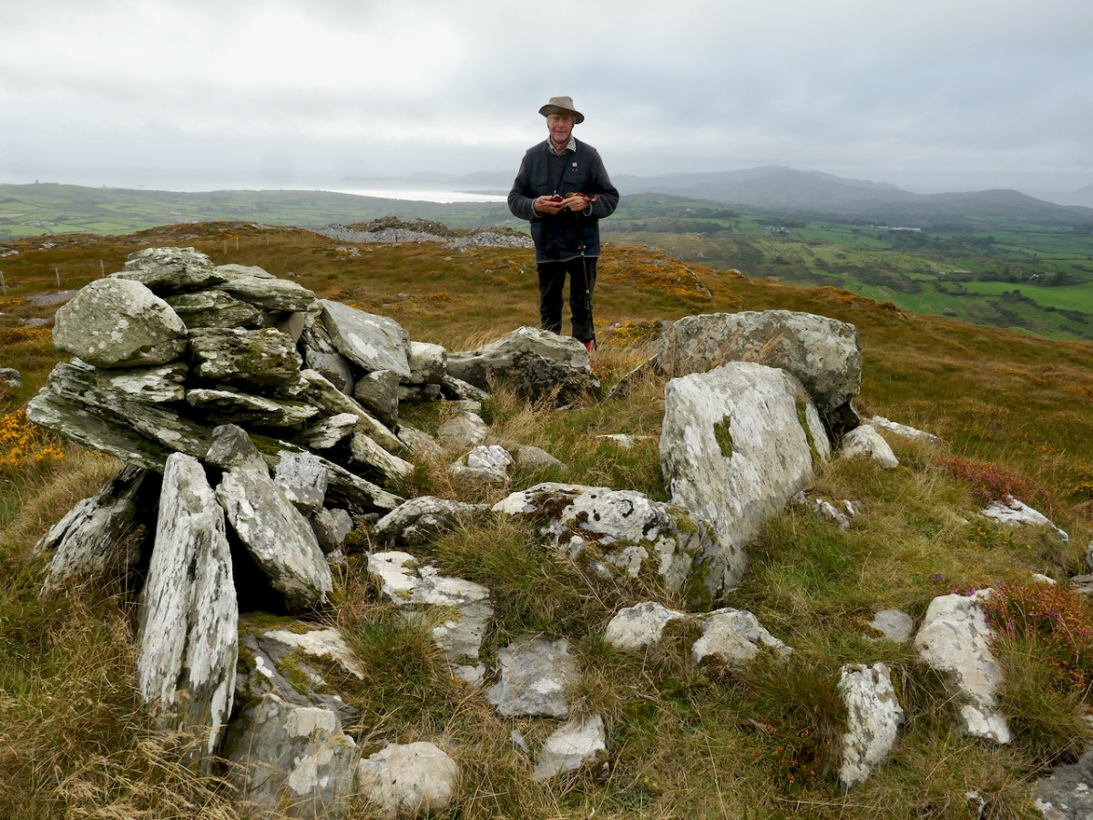
Where am I going with this? I posit that this may be, in fact, a passage grave. Several features (hilltop setting, sunrise orientation, internal chamber, kerb) set it more obviously in the passage grave tradition than in the wedge tomb tradition. There may be an archaeological bias against labelling such structures as passage tombs, since it has been considered that passage tomb distribution was in the northern half of the island.
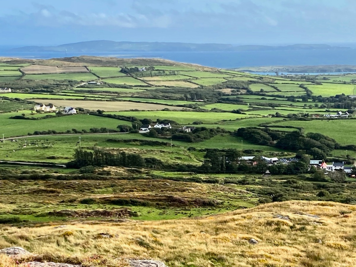
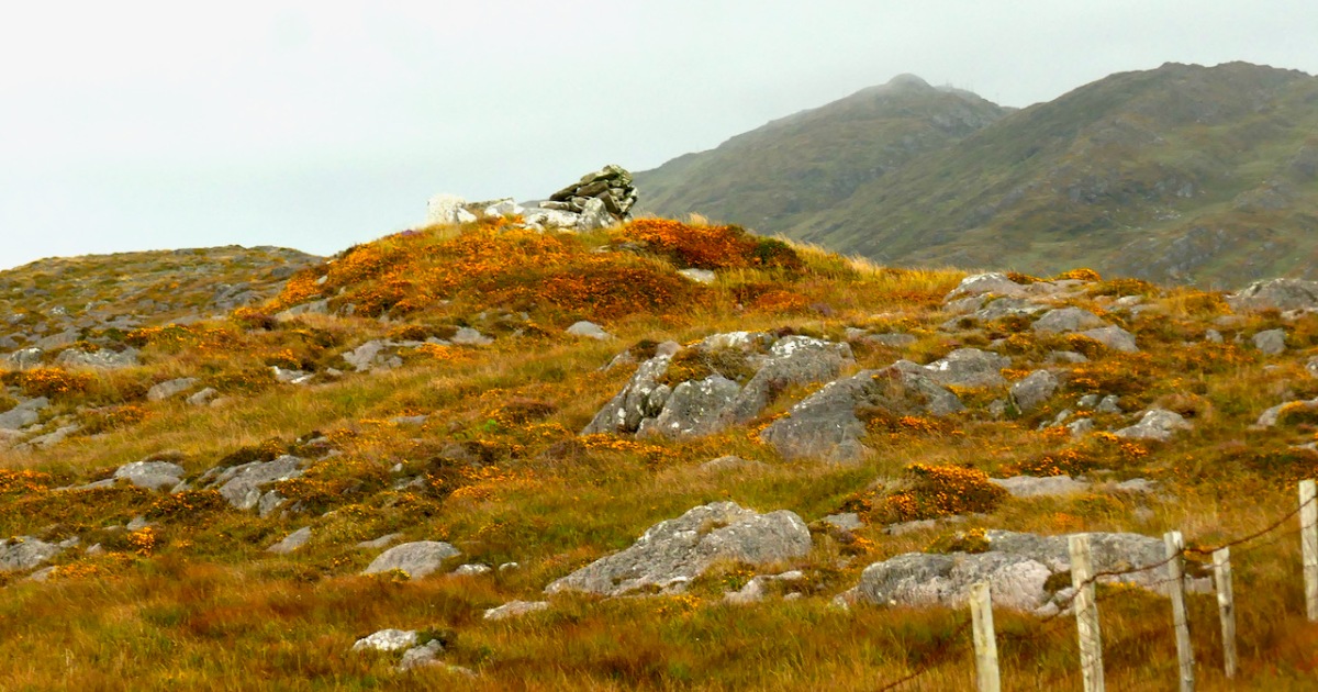
In fact, it is not unlike the passage tomb on Cape Clear, the position of which is clearly visible from this one – that’s it on the horizon, above. Inter-visibility is a feature of passage graves. There is also a similar anomalous megalithic structure on a high point on Sheep’s Head – also clearly visible.
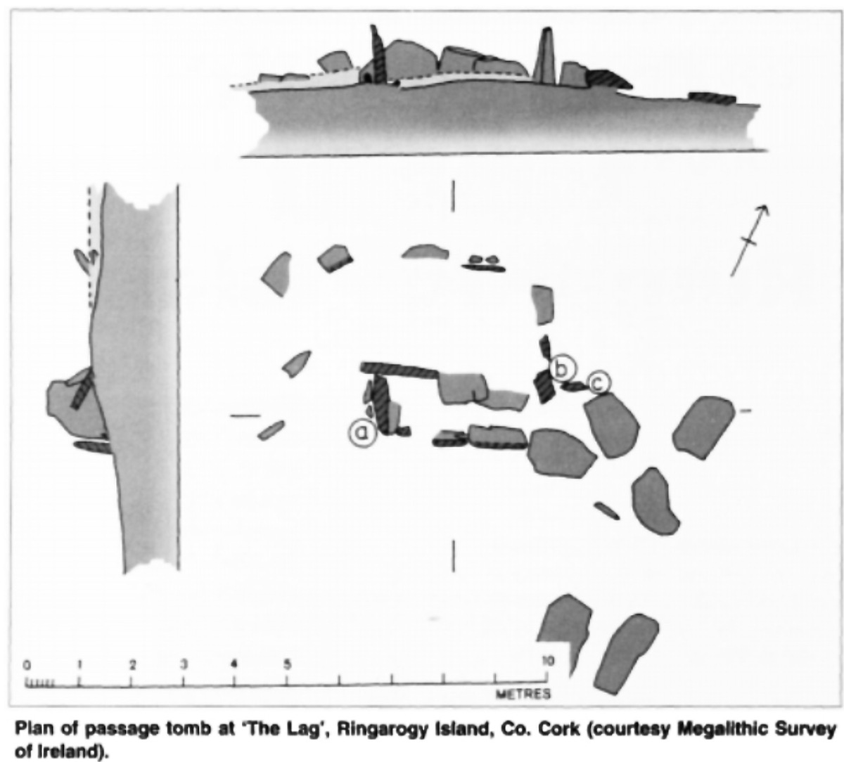
The other structure that has been identified as a passage tomb in this area is in The Lag, between Ringarogy Island and the mainland. Elizabeth Shee Twohig identified it, and placed it and Cape Clear within a group of ‘undifferentiated’ passage tombs (by which she means that there is no clear differentiation between the passage and the chamber as there is, for example in Newgrange) known from Waterford and South Tipperary. All except The Lag occupy high ground, although not summits. Above is her plan of the tomb and below is her photograph, both images from her article on The Lag in Archaeology Ireland Vol. 9, No. 4 (Winter, 1995), pp. 7-9, available here for those with a Jstor account.
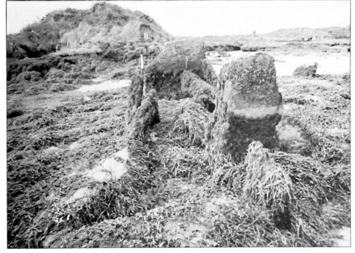
So – in many ways, Gubbeen fits with what we know about the southern spread of a passage grave tradition. It’s time for a re-evaluation of passage graves in this part of Ireland. They may well turn out to be much more common than we have admitted hitherto.
We have visited this site so you don’t have to. It’s private land and very difficult to access and there is no way onto Fionn’s Ridge from the road, despite the fact that it terminates close to the road. Our trek, taken with the permission of the landowner, who warned us, was quite hazardous – more than once we ended up falling through the bracken or caught on the wrong side of barbed wire.
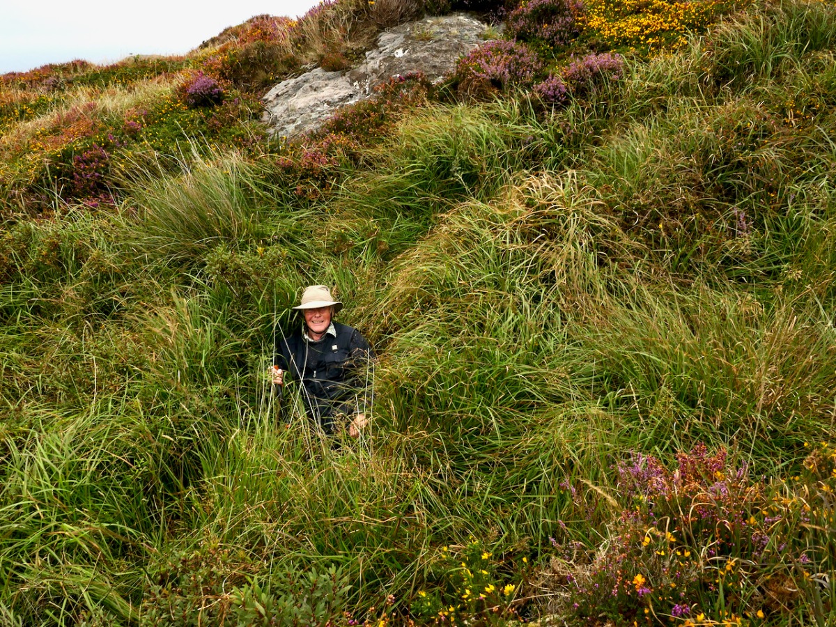
If we ever find an easy way up, we will amend the post – meanwhile, we don’t recommend trying it yourself.