Off the M8 – Knockroe Passage Tomb or ‘Giant’s Grave’

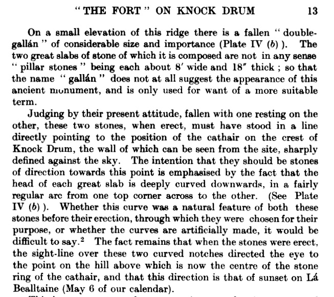
The great passage tombs of the Boyne Valley complex in Co Meath – Newgrange, Knowth and Dowth – have been known and celebrated (although not necessarily understood) by antiquarians over many centuries. Here’s an early survey plan of Newgrange drawn by Thomas Molyneux of Dublin in 1700:

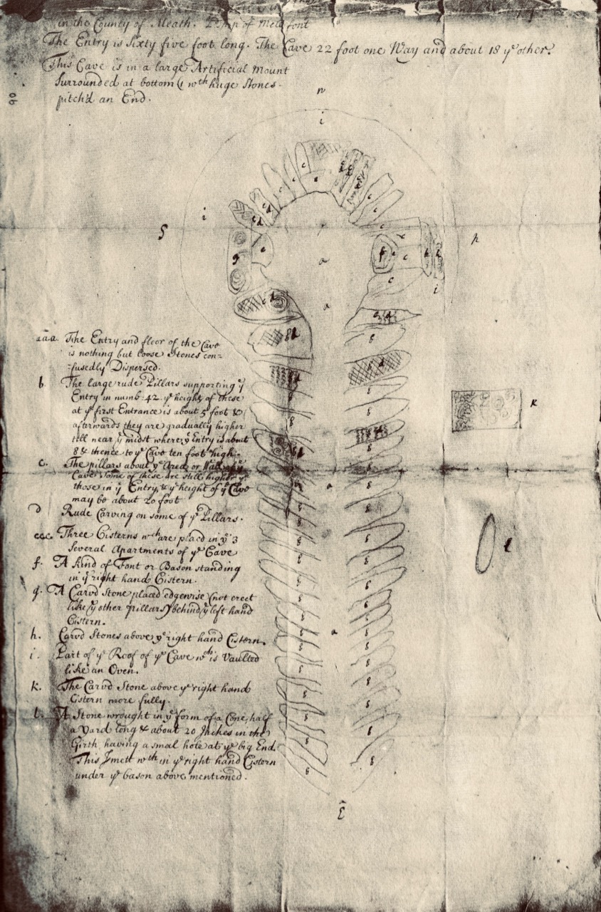
The Boyne Valley monuments are famous for their megalithic art – inscribed stones which are integral to the structures, carved some 5,000 years ago. The drawing above shows the carved stones in the great passage which we now know is aligned to the sunrise at the winter solstice. Although quite crudely depicted, these are the earliest representational images we have of passage tomb art in Ireland. A century and a half later the surveyor and antiquarian George Victor du Noyer worked with the newly established Geological Survey of Ireland and became fascinated with the megalithic art of the Loughcrew Passage Tombs in Co Meath. His recording of this, using watercolour sketches, is remarkably accurate:

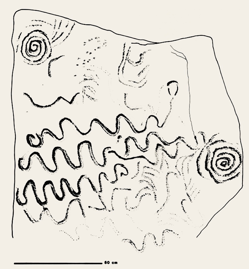
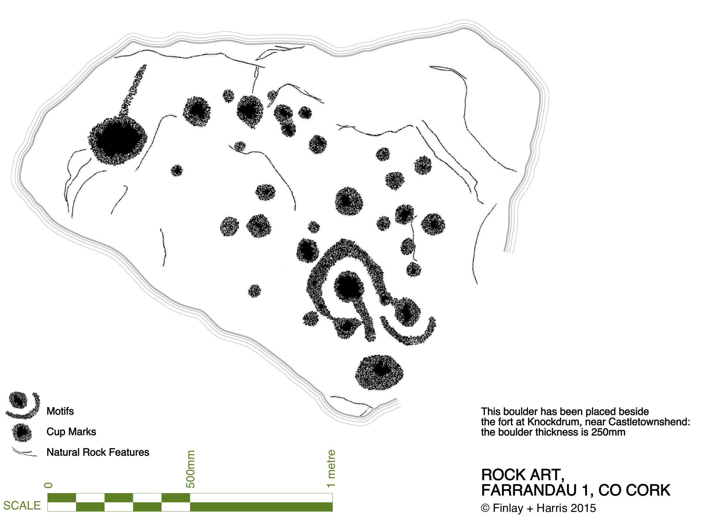
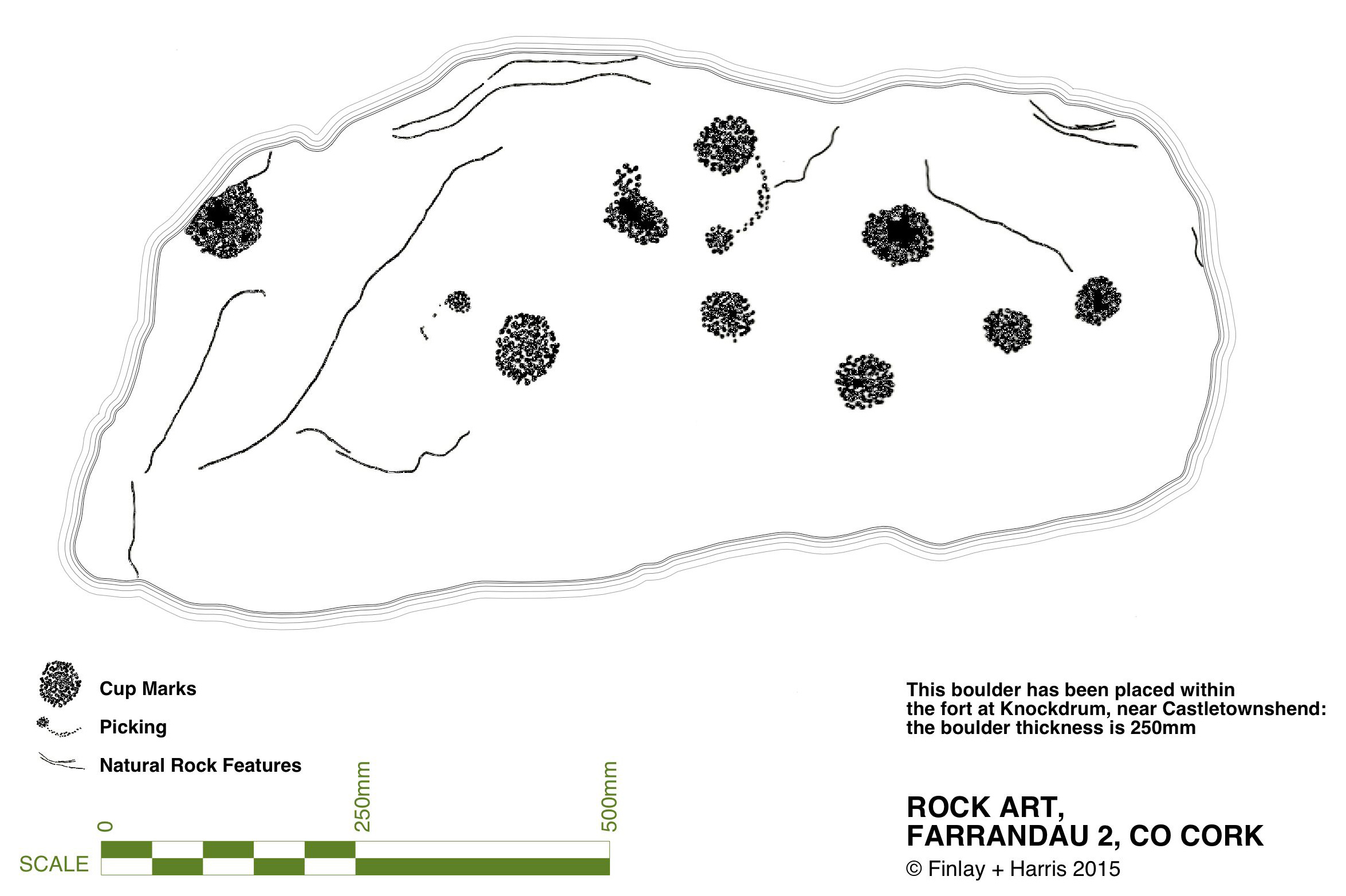
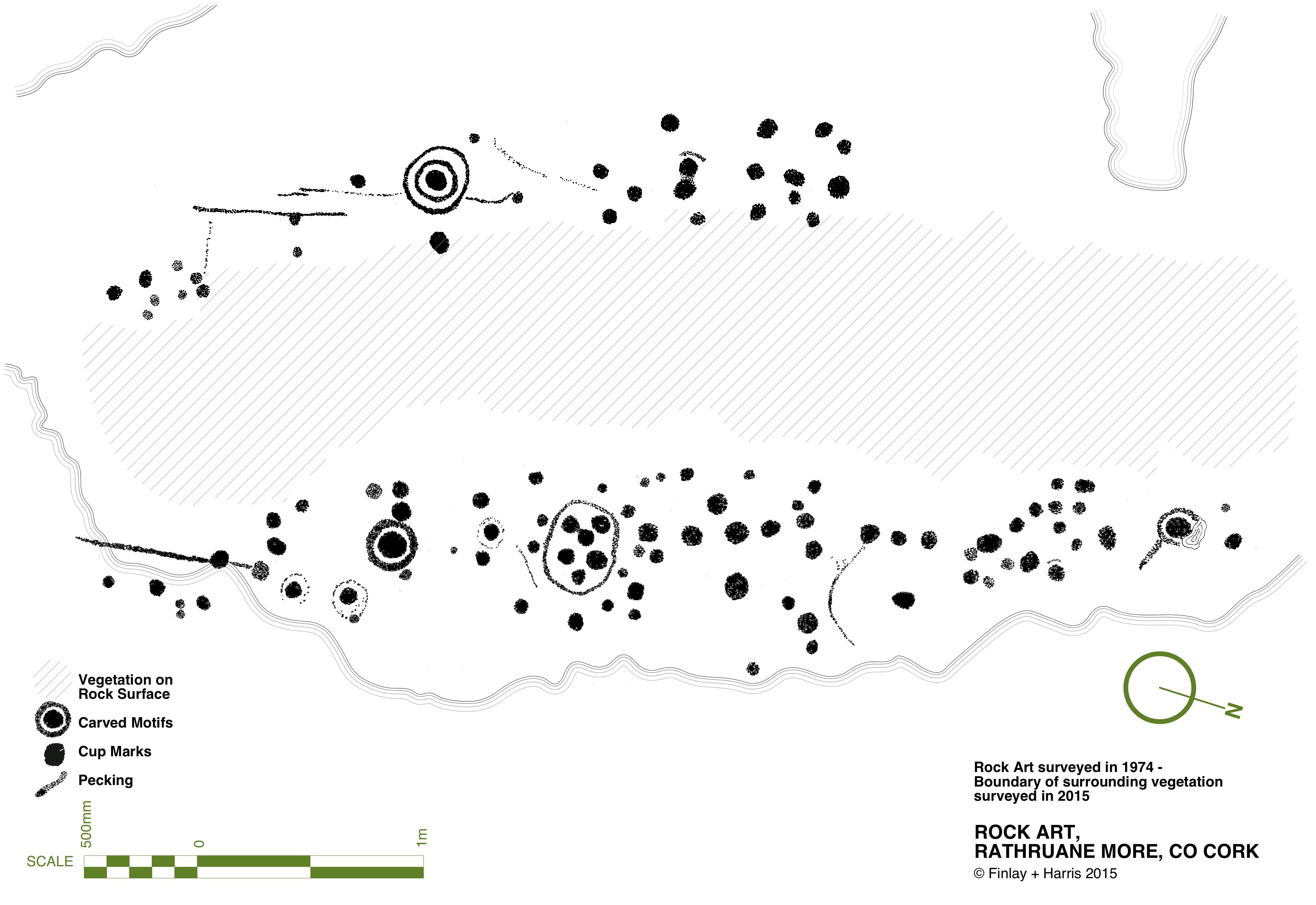
Another century on, and archaeology – and the recording of ‘ancient’ art – had increased in sophistication. Finola’s work in the 1970s used a combination of direct tracing and photography, and her opus is still one of the most comprehensive and striking collections of images of Prehistoric Rock Art. These differ from Passage Grave Art both in the motifs and the overall design of panels, but are thought to be of comparable age. Here is one of her images, of rock art at Rathruane More in West Cork:

Today’s post focusses on a site which was first noted in 1905 but not categorised or fully explored until the 1980s, when Professor Muiris O’Sullivan of UCD led a detailed excavation, over many years. The report in excavations.ie states:

. . . Knockroe is one of a small number of decorated sites outside of County Meath, and in the overall context of Irish passage tombs its megalithic art is very important. Only a few of the kerbstones are visible but they bear a profusion of kerb ornament which is matched only at the three great tumuli in the Boyne Valley. One of the decorated stones in the western chamber bears a remarkable likeness to the designs at Gavrinis in Brittany, France . . .

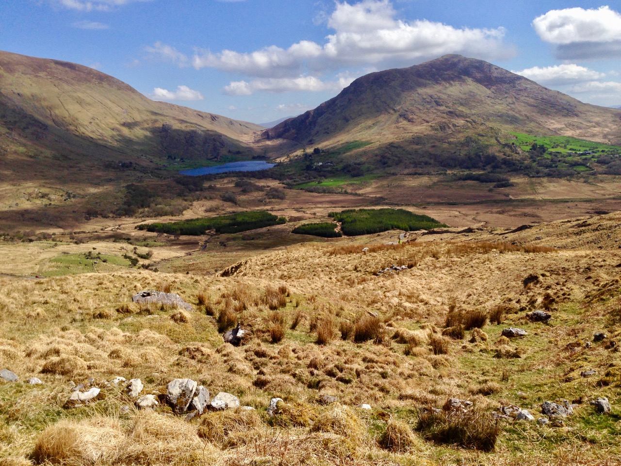
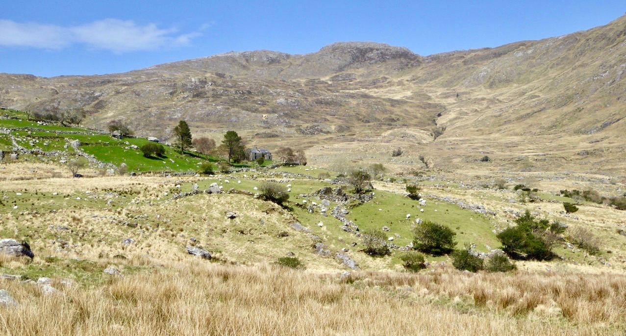
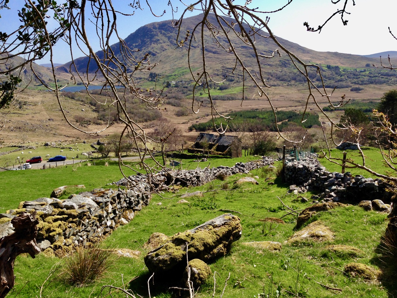
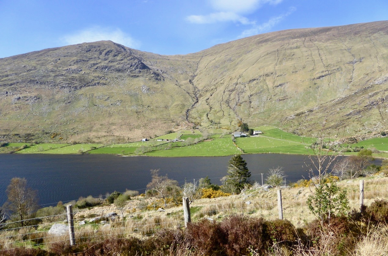
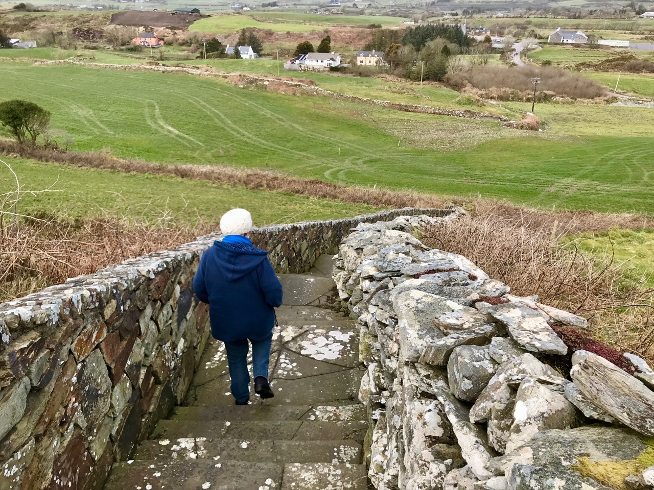
To find this gem (known locally as The Giant’s Grave – Finola’s post today describes another one!), you have to turn off the M8 at Cahir, and follow the N24 and N76 towards Ninemilehouse. If this sounds familiar, it’s because we also followed this route when we visited the Killamery High Cross, but this time turn before Ninemilehouse, at Garranbeg, and cross over the River Linguan, then follow the river to the County border (Tipperary / Kilkenny) where you will see signs to Knockroe Passage Tomb and Knockroe Slate Quarries. After your visit it’s easy to join the M9 at Knocktopher and carry on up to Dublin. It will add a little more than half an hour to the journey (plus the many hours you might want to spend exploring the fascinating passage tomb).

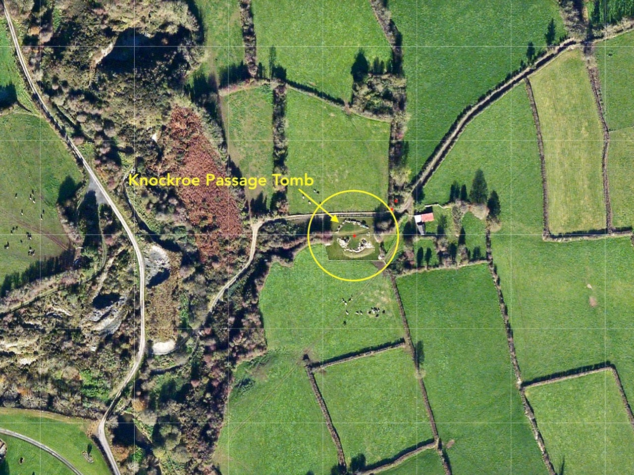
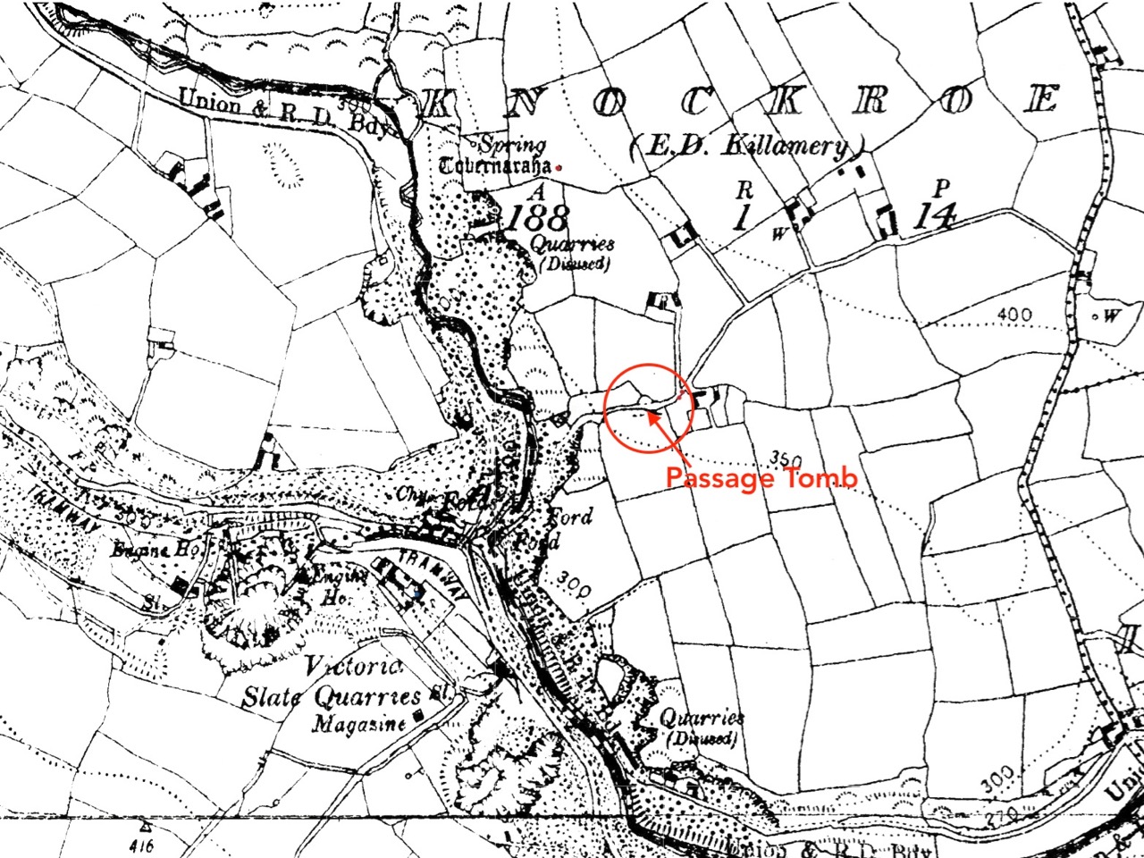
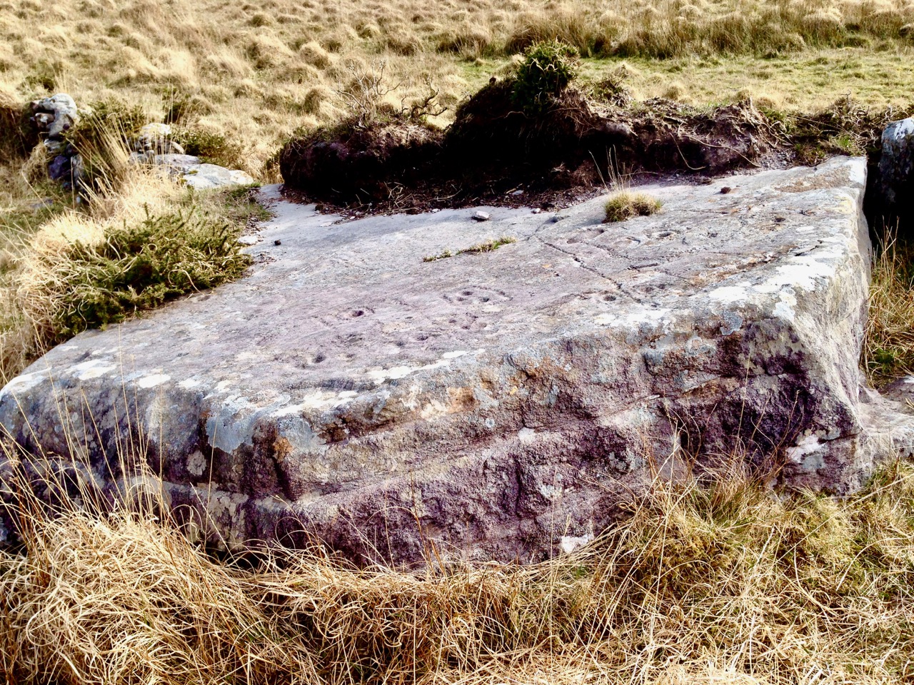
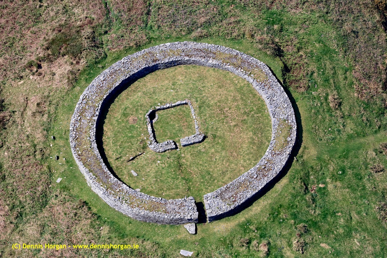
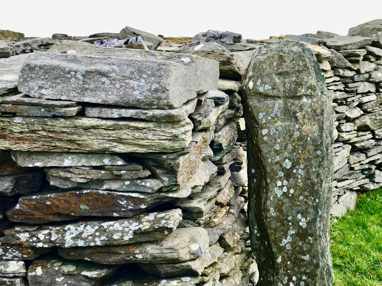
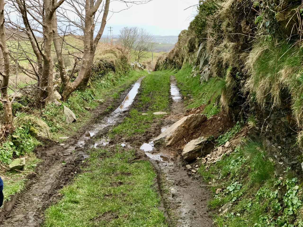
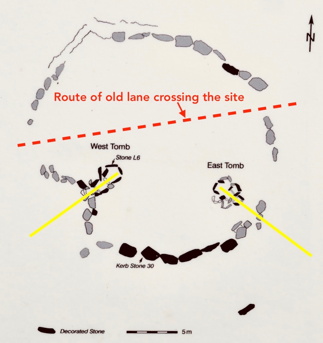
The aerial view might help to orientate you, while the 25″ OS map extract (above) dates from the late 1800s and shows the extent of the nearby Victoria Slate Quarry workings then. Slate was evidently taken from this site as early as the 14th century. In the aerial view it is possible to make out a distinct trackway which passes over the centre of the now identified passage tomb. This is clear to see on the site, and at either end the track continues, and is defined by ancient-seeming hedgebanks and established trees :

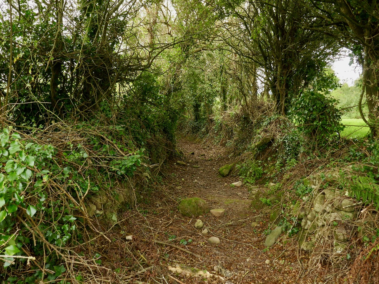
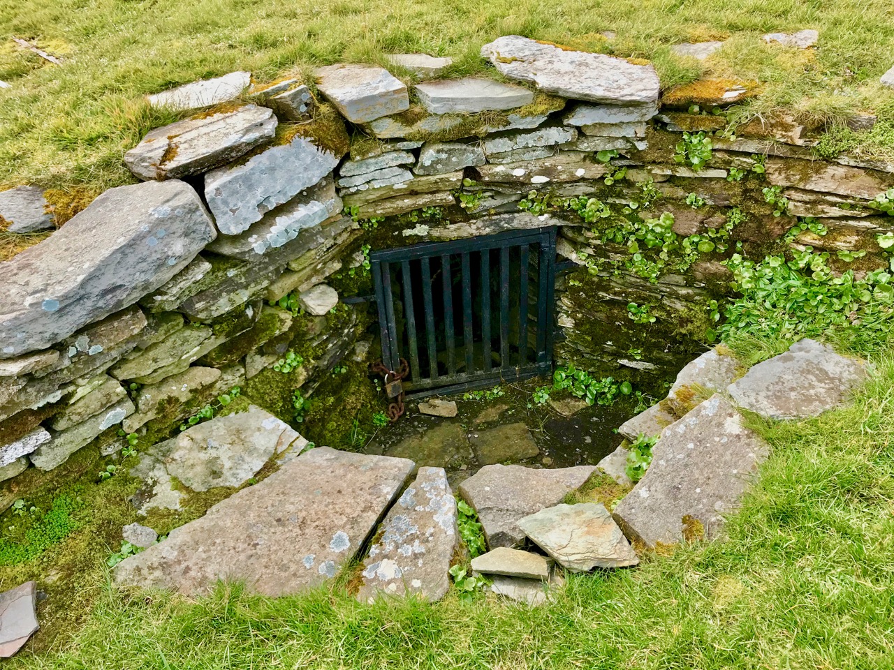
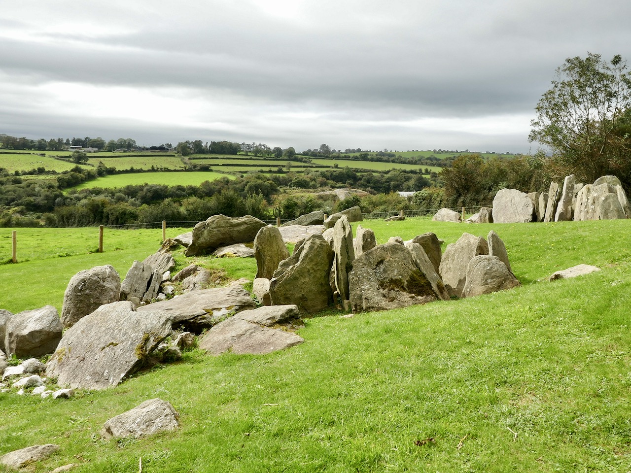
Tradition has it that the trackway was provided in the nineteenth century by the owners of the nearby Victoria Quarry to allow cattle to access the river when the quarry workings encroached on previous routes. A plan of the passage tomb is shown on the site notice board, and I have marked on it the laneway. This clearly shows the layout of the Neolithic monument, which would have been covered with an artificial mound, enclosing the two chambers. As with the larger monuments in the Boyne Valley – Newgrange, Knowth and Dowth – stones in the passage chambers and some of the kerbs are decorated, and the chambers themselves have solar alignments, reportedly with sunrise (east) and sunset (west) on the winter solstice.

As yet we have not been to Knockroe at the winter solstice – it’s something we would like to do. We have attended the solstice celebration at our own West Cork site, Drombeg Stone Circle, and that is a great community experience. But Pete Smith has provided this fascinating visual record of the Knockroe Solstice recorded in 2016. Thank you, Pete!

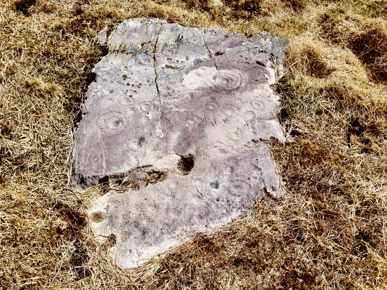
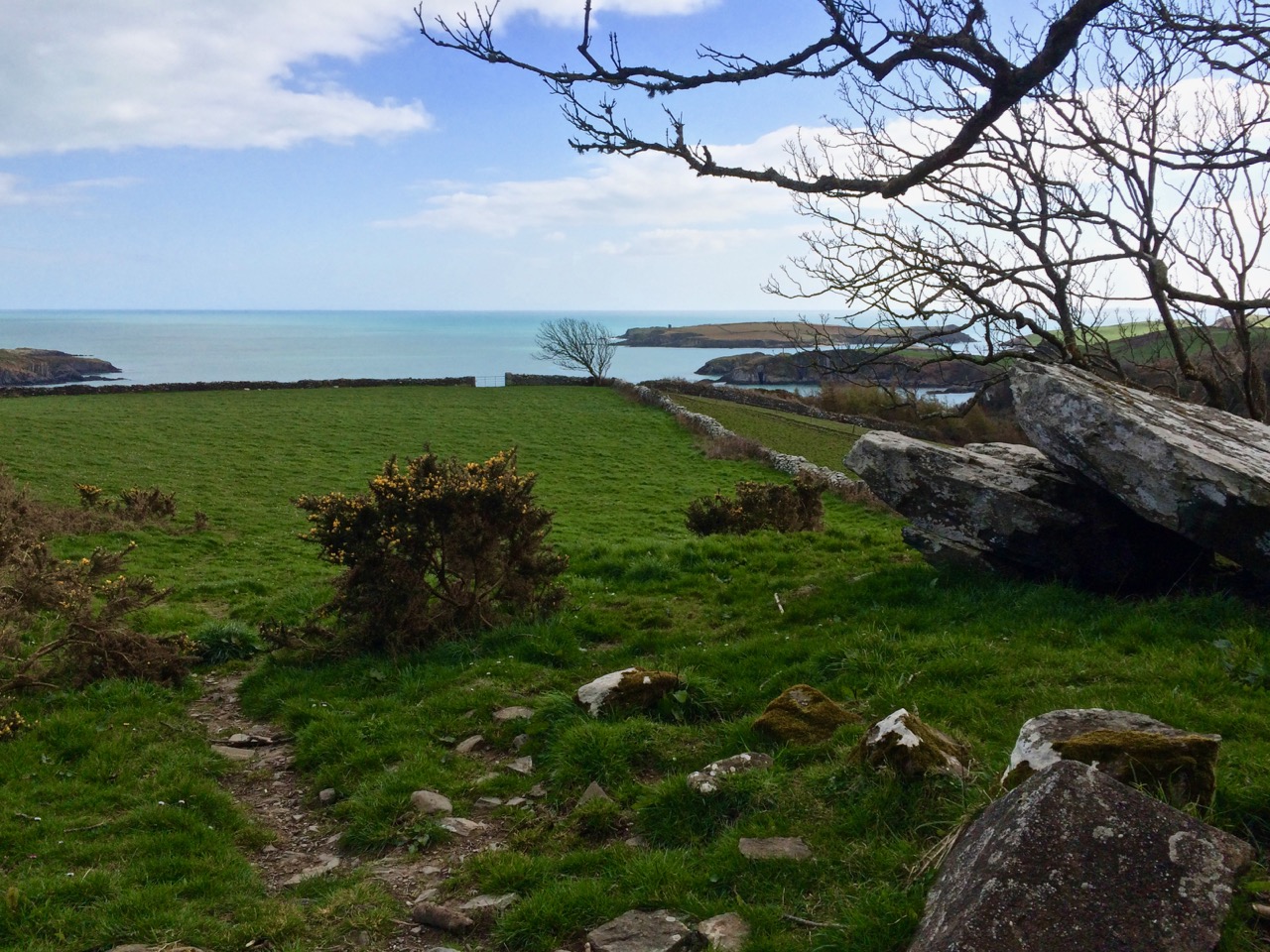
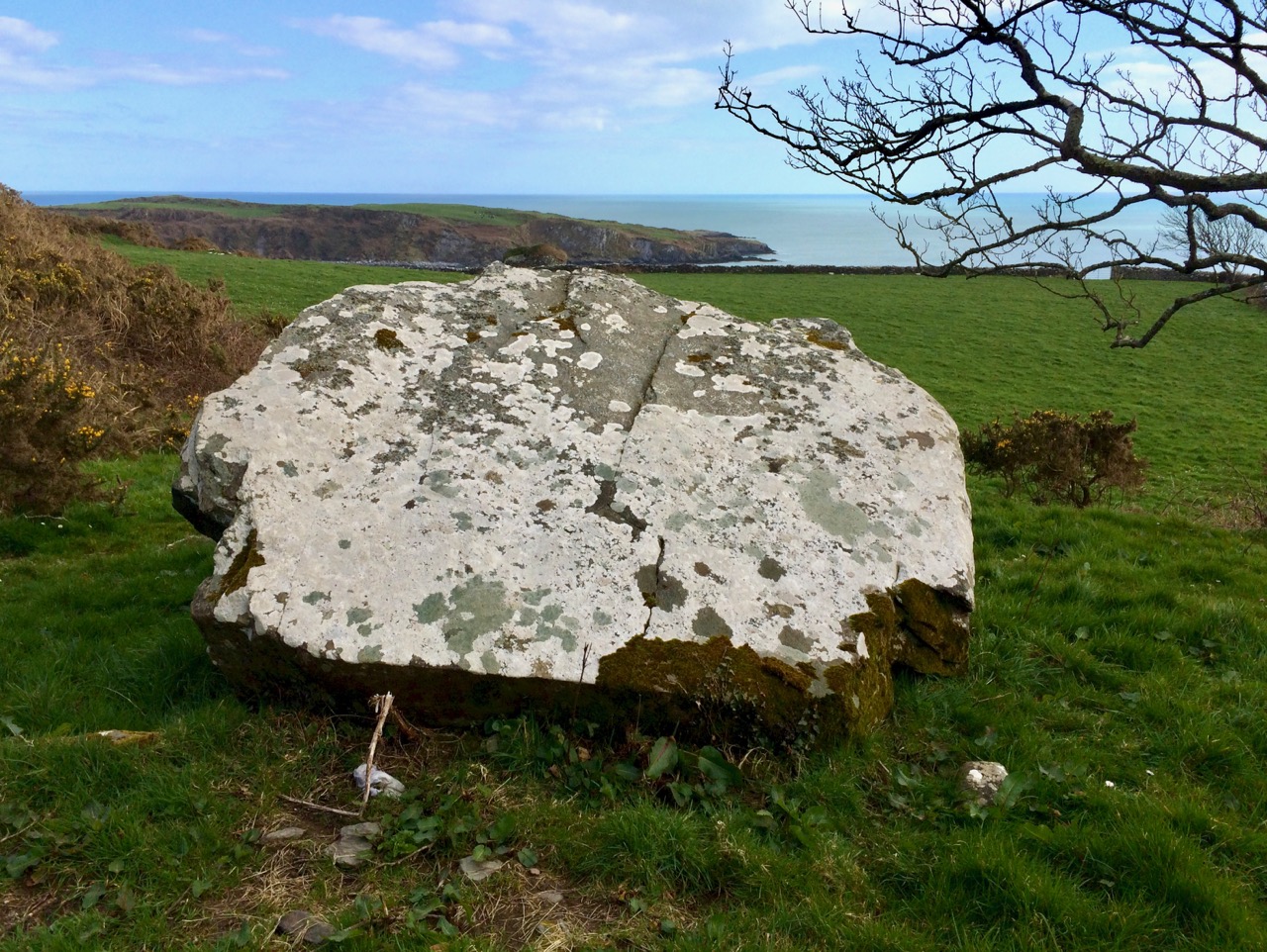
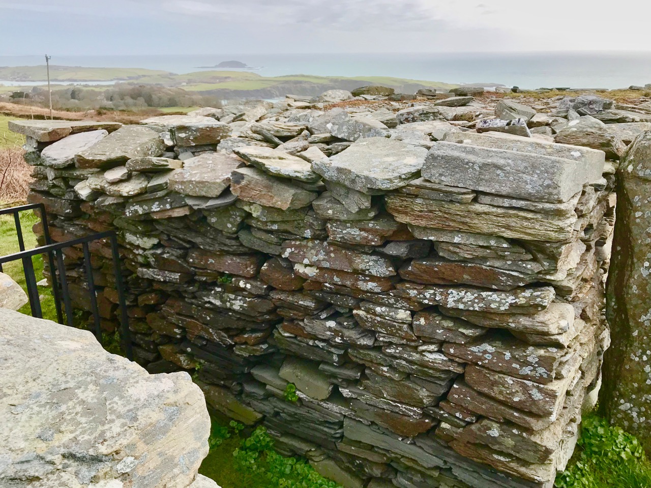
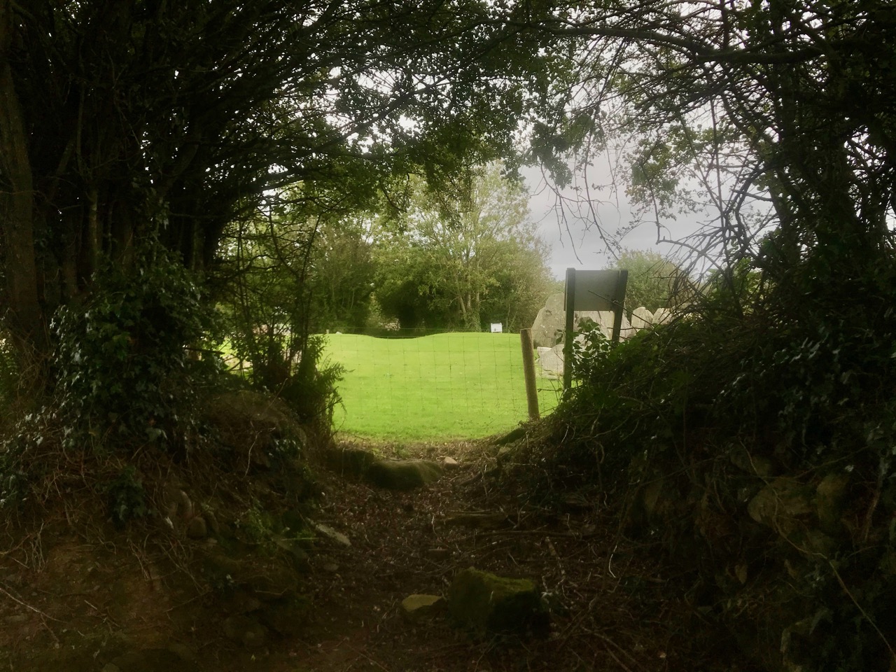
But let’s turn our attention to the art at Knockroe. It’s what makes it so special. It’s not as spectacular as the larger examples in the Boyne Valley or Loughcrew (you might think of Knockroe as a ‘country cousin’) – but it is their equal in its scope and variety. And – what we really liked – you can have the place all to yourself! There is no visitor centre, no queueing or paying – nothing to spoil the ambience. It is always freely accessible, and we didn’t see a soul while we were there. It is, of course, merely a skeleton of what it once was – five thousand years ago – but that doesn’t detract from its allure. It’s a place imbued with things we don’t understand, or can only guess at – left behind for us by our distant ancestors. And, hopefully, we will keep it safe for the future.

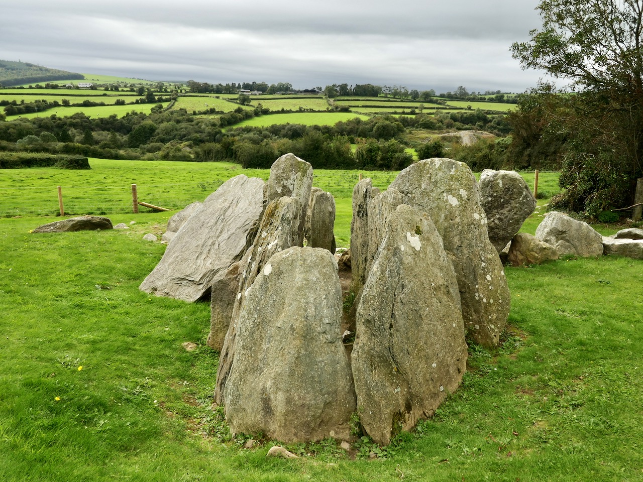
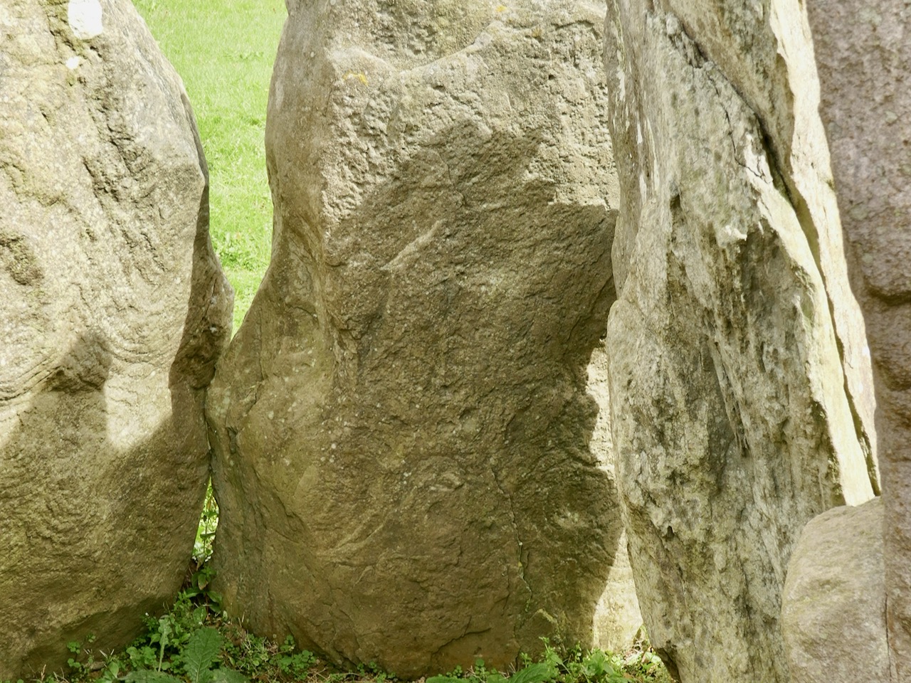
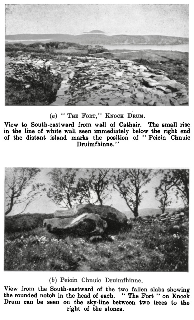
Muiris O’Sullivan penned a comprehensive article in The Journal of the Royal Society of Antiquaries of Ireland Vol 117, 1987 – The Art of the Passage Tomb at Knockroe, County Kilkenny. This is well illustrated with drawings by Ursula Mattenberger based on rubbings taken directly from the stones. Here is her impression of Stone 8 (numbering from the excavation report), which is directly facing us in the photograph above:

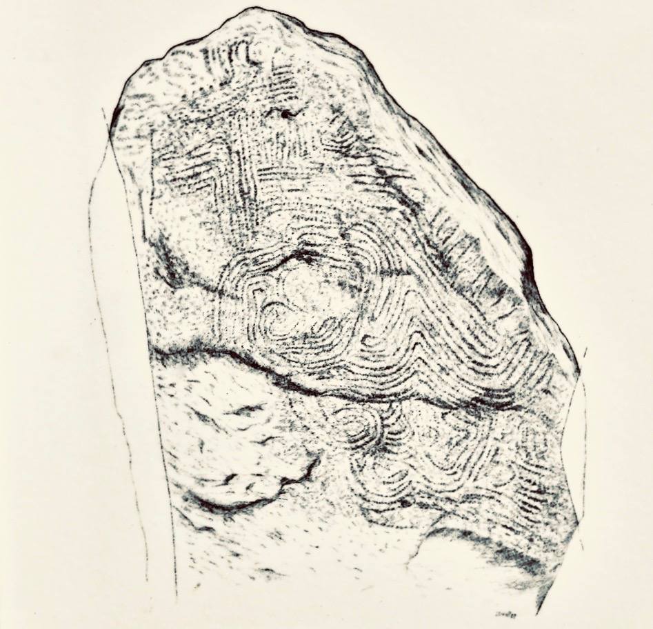
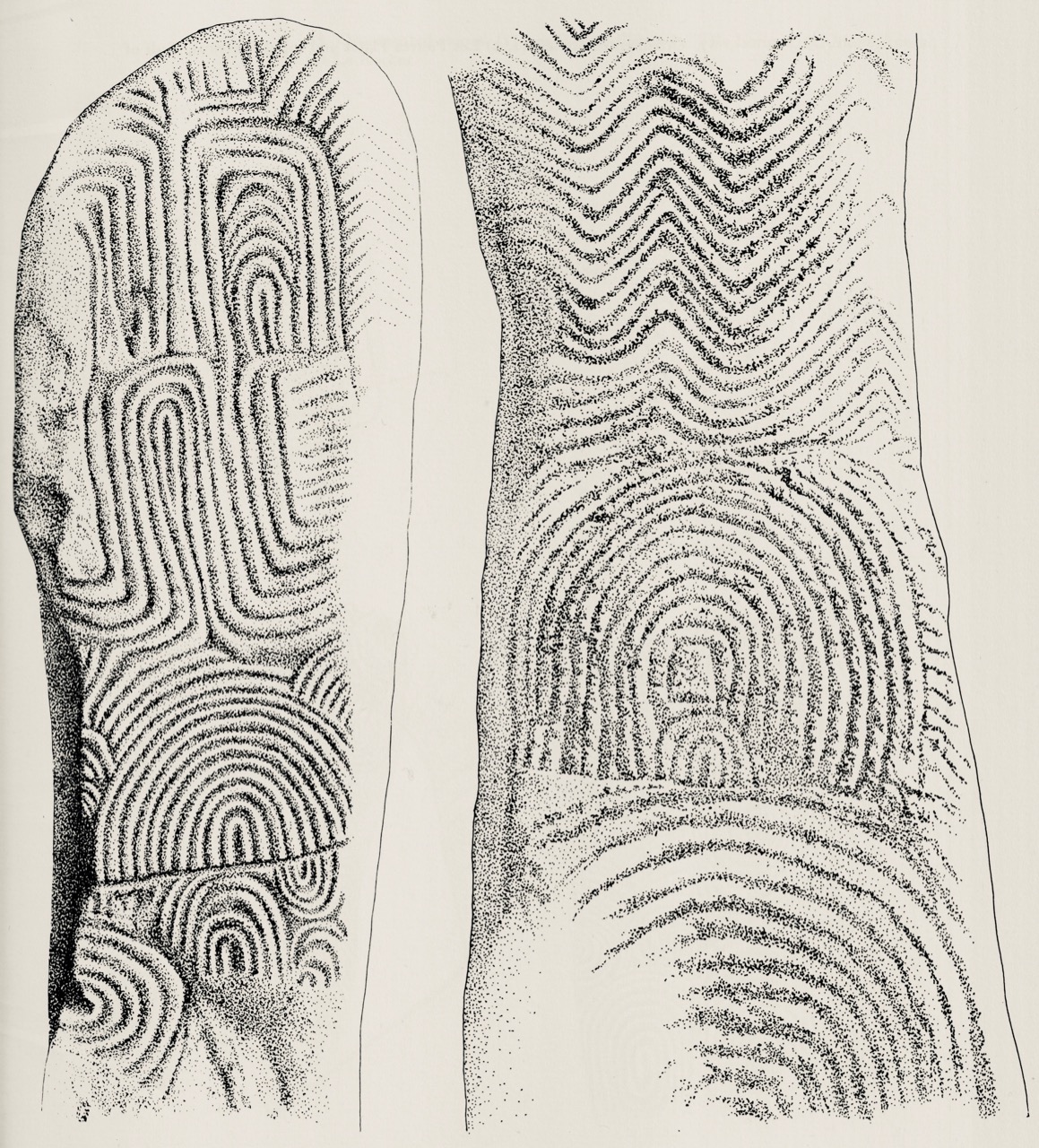
This example is very unusual in the corpus of passage grave art in Ireland. But it bears a resemblance to examples on the island of Gavrinis, in the Gulf of Morbihan, on the southern coast of Brittany, France. This has been noted by several commentators, including Muiris O’Sullivan, and the suggestion has been made that the tomb builders at Knockroe could have been directly influenced by the Gavrinis examples (which are generally thought to be earlier than the Irish parallels). It has even been suggested that passage tomb builders travelled from one site to another (like the medieval cathedral builders), and that this comparison demonstrates this. Have a look at these images from Gavrinis and see what you think (the first is courtesy of Martin Brennan, taken from his The Stars and The Stones, Ancient Art and Astronomy in Ireland, Thames and Hudson 1983):

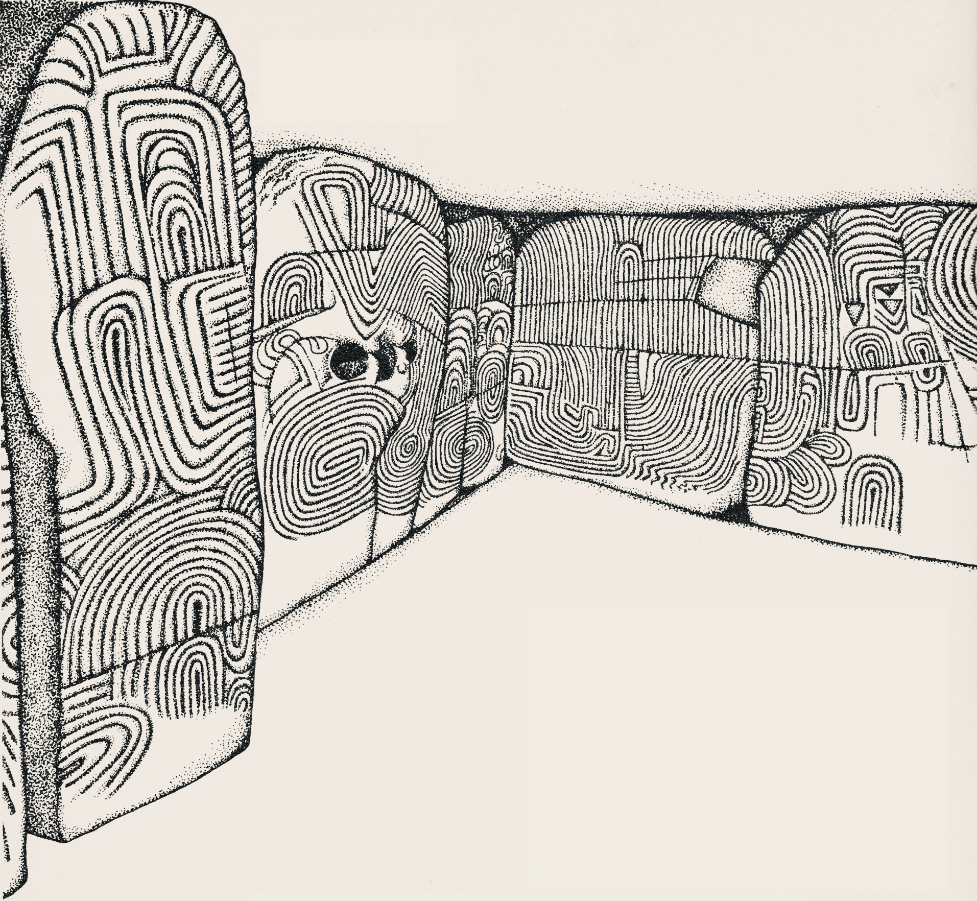
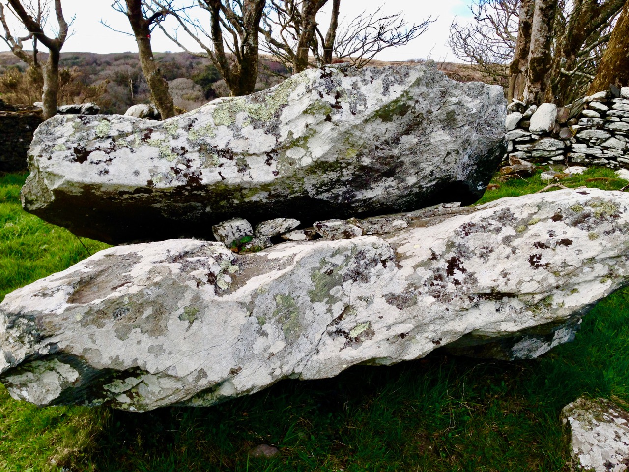
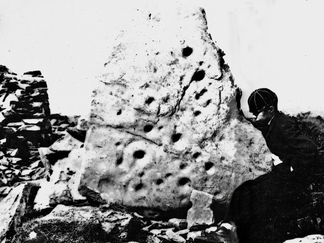
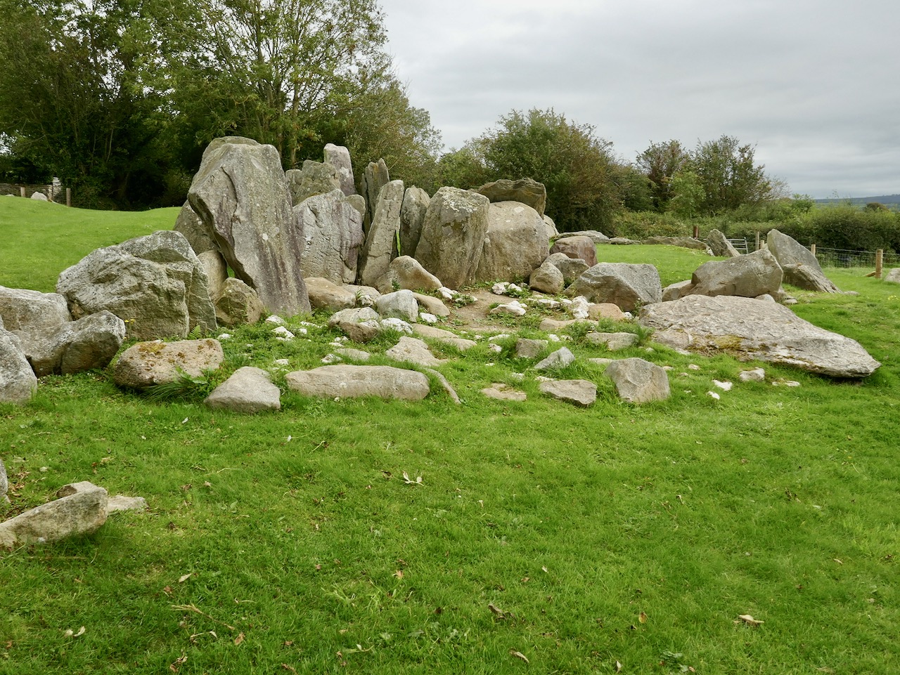
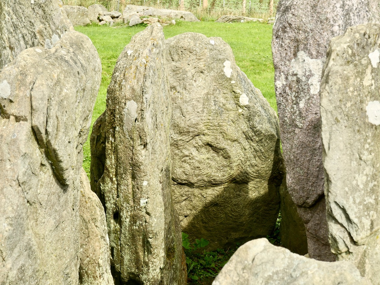
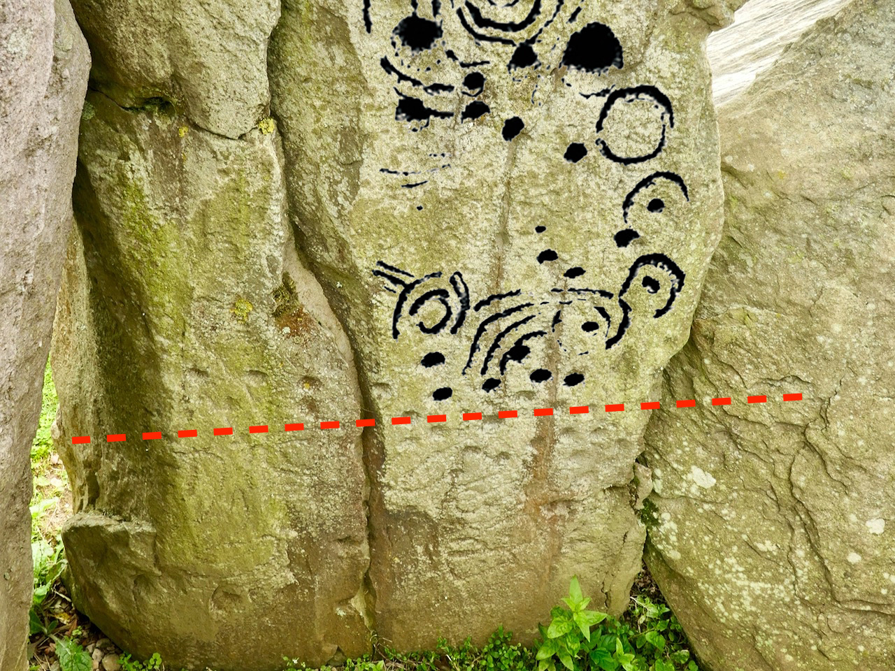
The excavation of Knockroe involved the removal of earth and debris from the collapsed mound which would have covered the tomb originally. This clearance revealed more of the art and here is an interesting comparison which shows the evolving history of the site. Firstly, our recent photograph of Stone 12, followed by the excavation record of this stone (lower right of the drawing) from the 1980s:

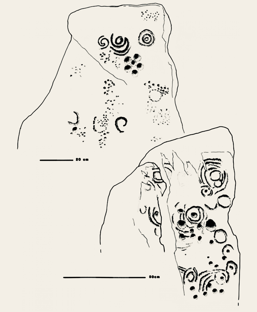
Here is our photograph again, with some of the art from the drawing above superimposed. It’s clear that the full extent of the artwork on Stone 12 was not visible below the red line when the drawing was made: Muiris O’Sullivan notes in his reports that he was aware that some of the art was hidden below what was then ground level.

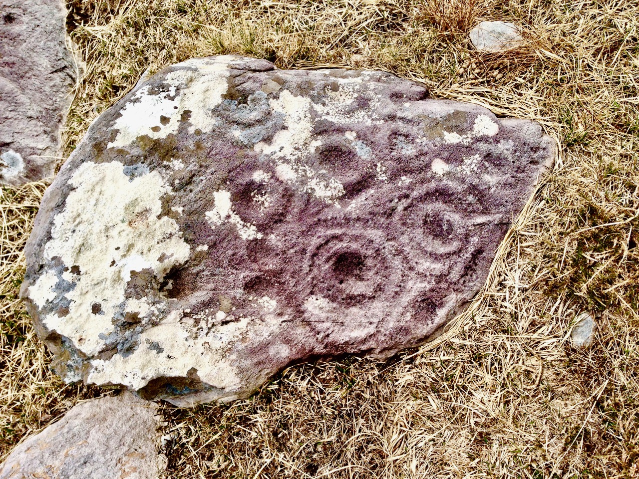
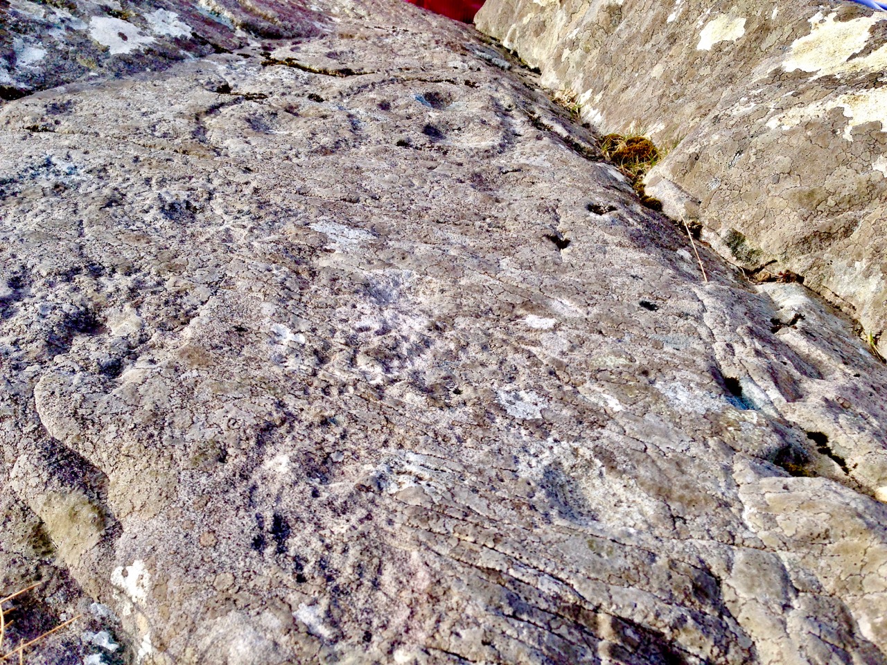
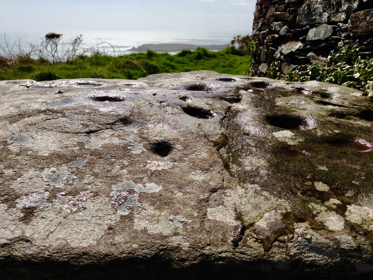
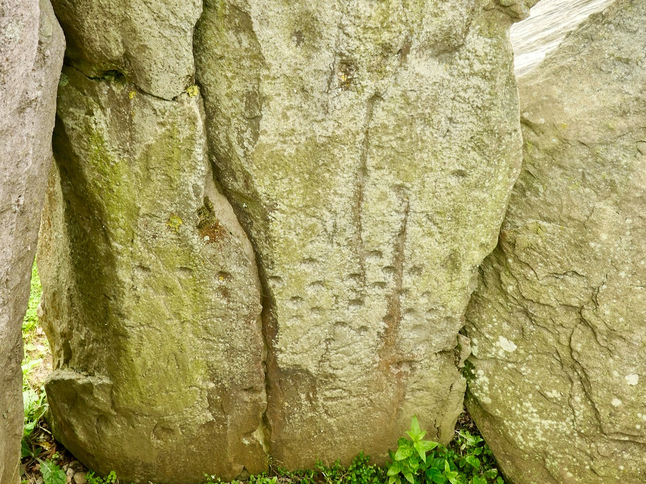
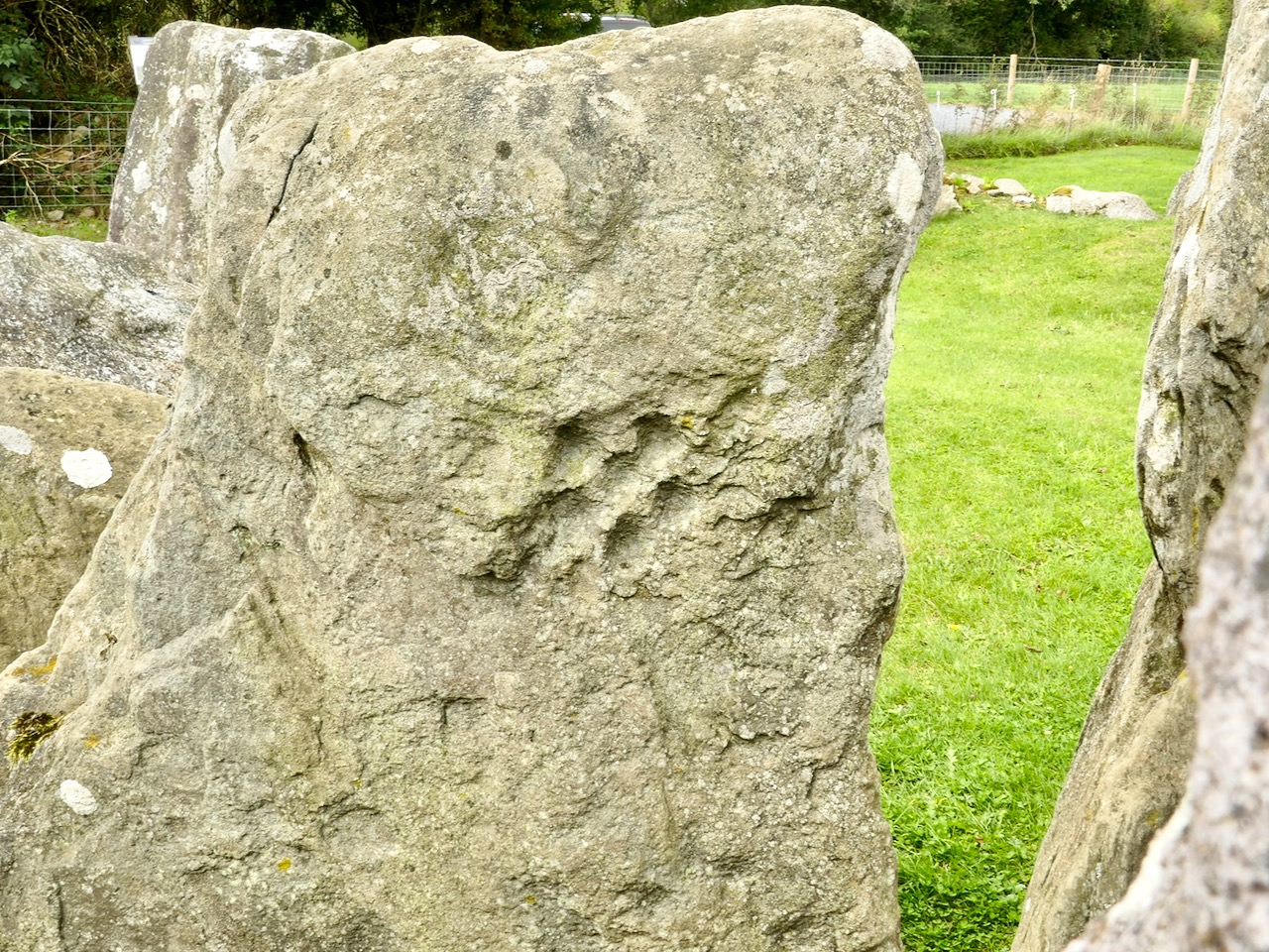
Ursula Mattenberger’s drawing above also illustrates Rock 5 (upper left) and shows the very distinctive ‘rosette’ motif of six cup-marks. Examples of this motif have been found at rock art sites – including the one on Finola’s drawing of Rathruane More, nearer the top of this post. Here’s a photograph of the Knockroe example:

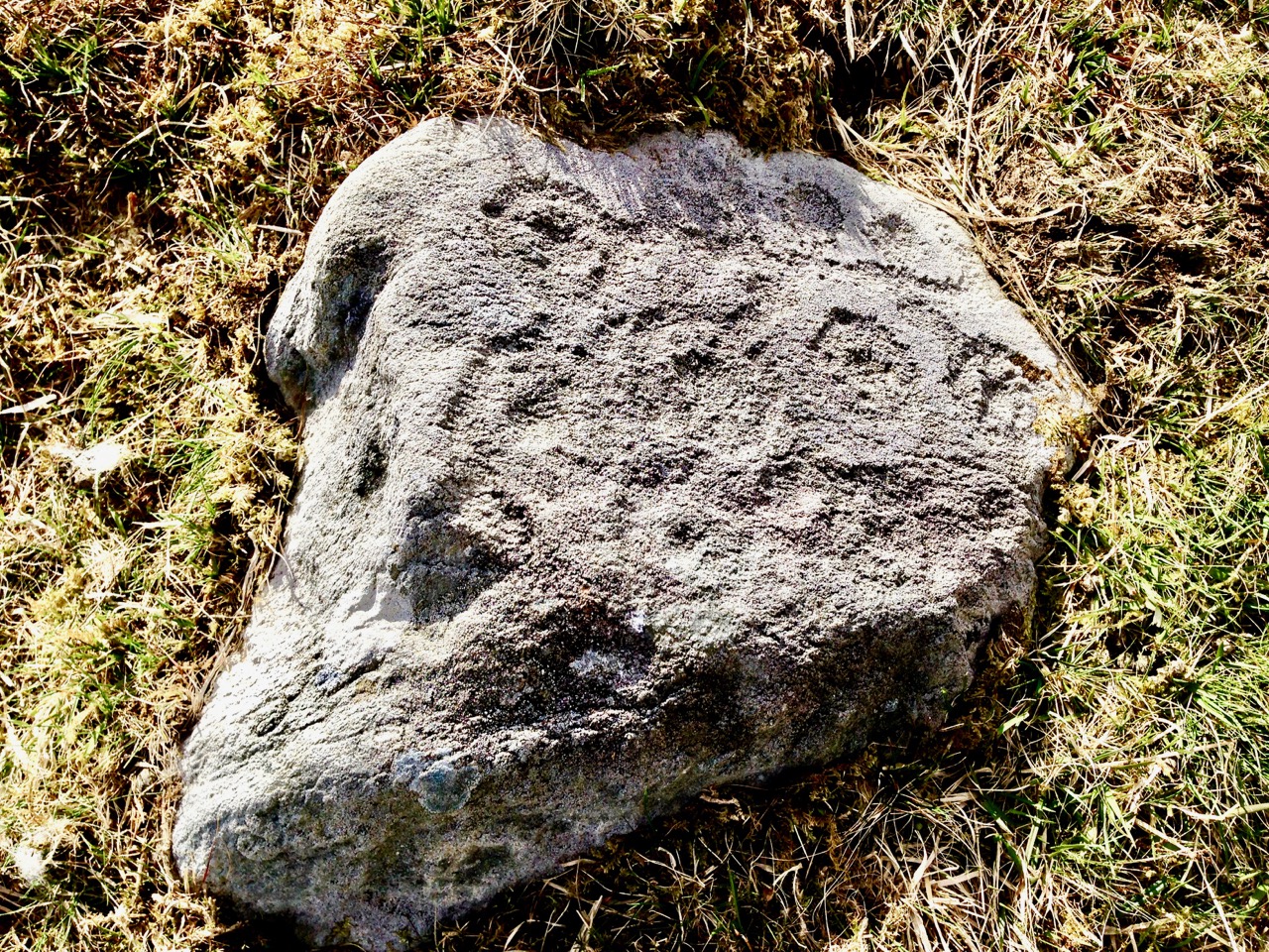
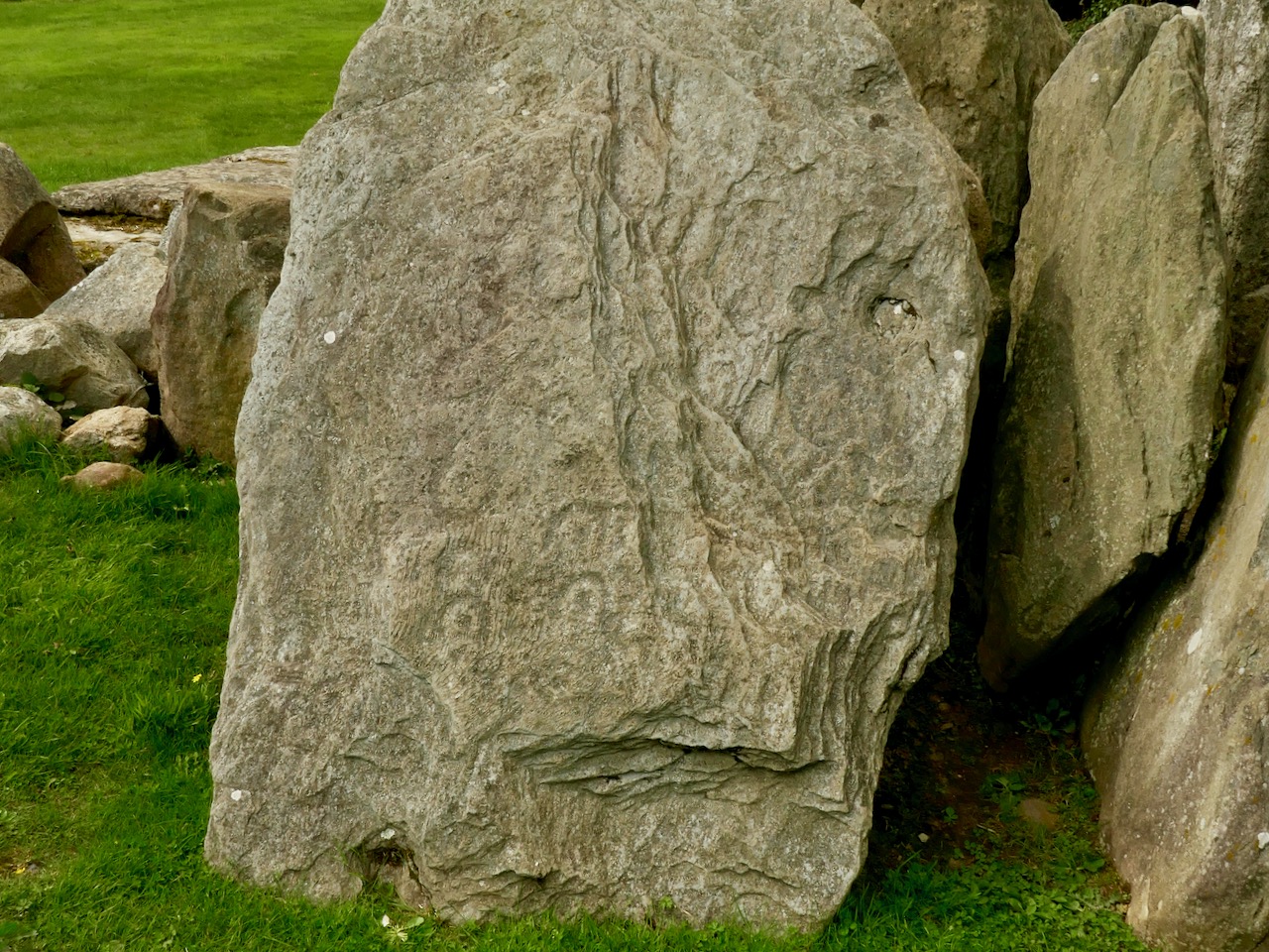
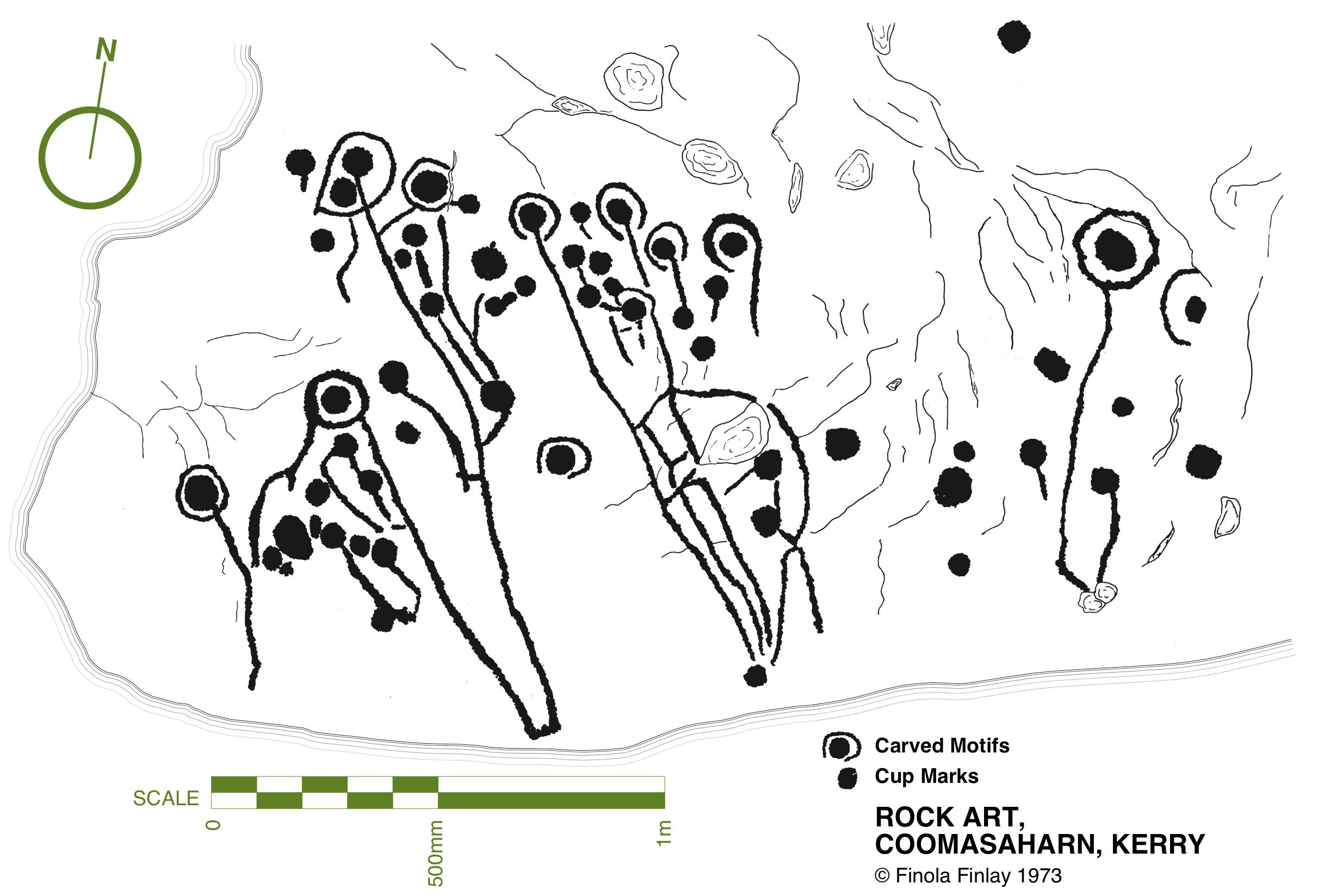
While making comparisons with rock art (and remembering that passage grave art and rock art are distinctive categories), here’s another decorated slab at Knockroe, not entirely legible in its weathered state. It seems to show a number of incomplete cup-and-ring motifs but in its own right this is known as a horseshoe motif. Below it is another of Finola’s drawings from 1973, perhaps showing something similar at Coomasaharn, Co Kerry:

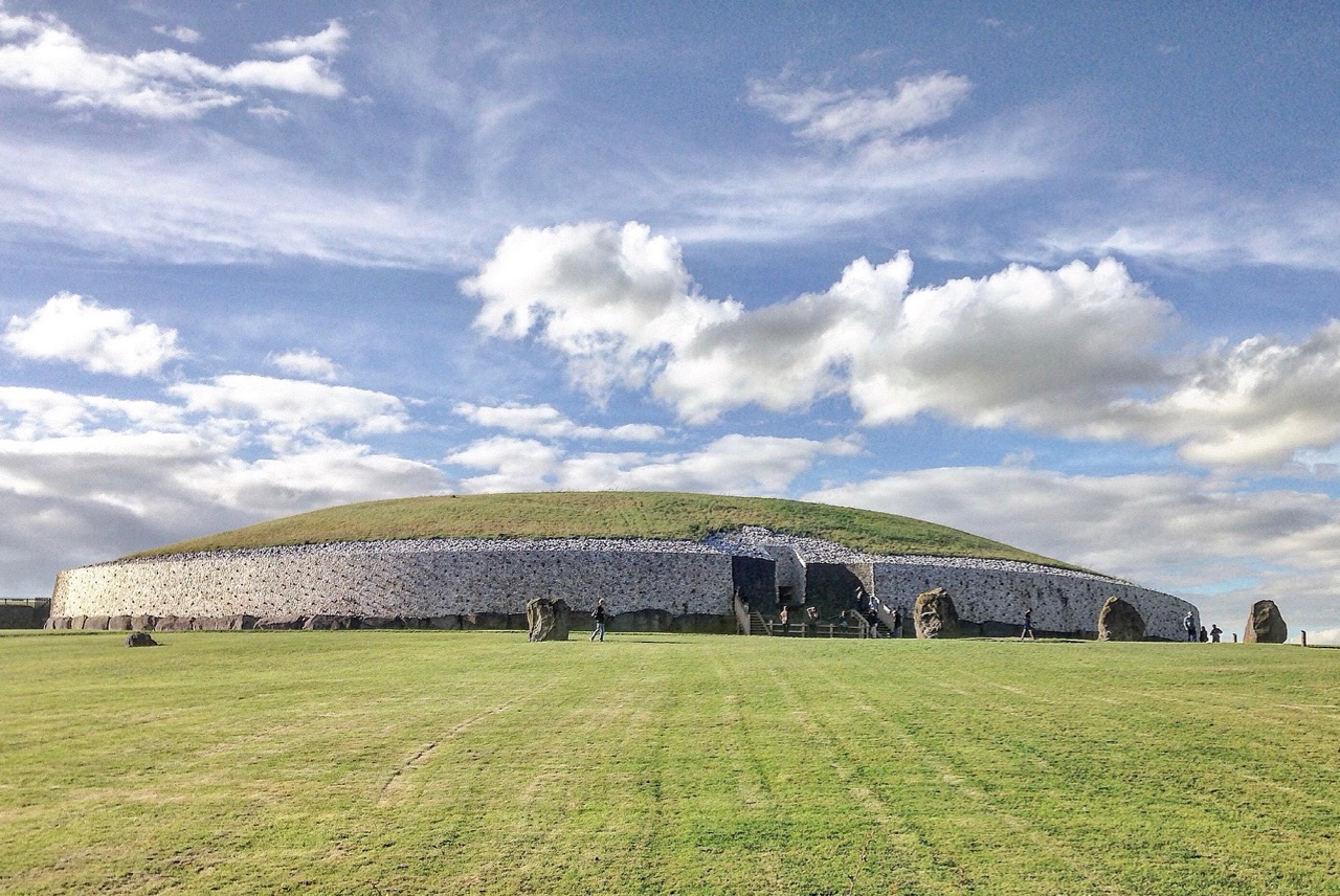
The Knockroe site is endlessly fascinating. O’Sullivan’s excavations revealed a quantity of smaller quartz boulders which appear to have collapsed from a possible quartz facing reminiscent of Professor O’Kelly’s reconstruction of the Newgrange mound (image below by Tjp Finn via Creative Commons):

Hopefully I have given you enough here to whet your appetite and lead you off the motorway to explore the exceptional remains at Knockroe, Co Kilkenny and, in particular, its remarkable examples of passage grave art.

The Broken Stone – Update

This post was originally written in 2017. I have provided an update at the end.

All the names in this story have been changed. However, it is a true account of how we came to lose one of our ancient monuments – at once a family and a national tragedy.

This is my drawing. It shows an excellent example of Irish rock art, a classic cup-and-ring design, deeply carved – a thing of beauty, antiquity and intrigue. I know it now as The Broken Stone.

The drawing was done in 1972, while I was recording all the known examples of rock art in Cork and Kerry, travelling on a Honda 50 with with my equipment in a backpack. The sun shone every day that summer. Everywhere I went I was received with kindness and friendship, nowhere more so than at the big farm house owned by Tim and Clair Flynn. The stone was in their garden, having been found in a bog a short distance away and brought to the house in Tim’s grandfather’s time.

Tim ran the farm, and Clair looked after everything else, including three small children. They were lovely people – they took me in, fed me, took a great interest in the research. I felt I had made friends. On a second visit I observed Clair giving two of the children antibiotics and asked why. She explained that two of the three, Niamh and Shane, although not the youngest, Ciara, had a genetic disorder called Cystic Fibrosis. I had never heard of it, and Clair explained that both parents had to carry the gene, that it primarily affected the lungs, and that it was eventually life-limiting. In fact, at that time, life expectancy for those with the disease was about 20.

Through 40 years, mostly spent in Canada and in arenas far removed from Irish archaeology, I never forgot the Flynns or their wonderful stone. It was a happy memory, coloured by the sadness of the inevitability of the progression of the children’s’ disease.

When Robert and I re-engaged with rock art again in the last few years, I knew that sooner or later we would work our way from Cork to Kerry and I would have an opportunity to go again to Flynn’s farmhouse. In anticipation of this, I went to the National Monuments record, to remind myself of the details. To my surprise, I found a record that stated: There are no visible remains of any cup-marked stone here. It was set between two rocks in a prominent position in the garden but was subsequently broken. Its present location is not known. This made no sense to me: a stone like that, which could not be mistaken for anything except an ancient and significant artefact, could not just disappear. Perhaps it was simply not located by the surveyors. Perhaps it had been moved for some logical reason – it was less than a metre long and it was moveable. If it had been ‘broken’ that would make it more moveable yet.

Then, recently, I met Alison McQueen, tasked with updating the rock art records, and asked her about the stone. Since it had disappeared, it was not on her list to visit, but it turned out that she herself had visited the Flynns years before, although her interest was not in the rock art, but in the trough that was also located on the yard. It was a medieval basin that had been brought, over a hundred years before, from Mount Brandon to be presented to Tim’s Great-Grandfather in recognition for his political work and his support for causes such as Catholic Emancipation and land reform. Alison was able to tell me that the Flynns, ageing, and with Tim no longer able to farm, had sold the house and moved a short distance away, taking the trough with them. Of course! They must have taken the stone too, I realised, and that’s where I would find it.

And so, on a recent trip to Kerry, we travelled to the farm. There was nobody home (and a quick snoop around the garden confirmed there was no stone) so we knocked on a neighbour’s door and were kindly directed to the new house, where we were told, Tim and Clair’s daughter-in-law lived, who would be able to help us.

This is how we met Ciara, the surviving member of the Flynn family, and came to hear the story of the stone. Ciara just happened to be there, that day, spending time with her brother’s children. Her brother, Shane, despite all the health challenges he faced, had defied all predictions and only passed away last year. He was, by her accounts, an adventurous and determined man who lived every moment to the fullest and fought the good fight as long as he could, including undergoing a double-lung transplant. He worked and travelled and married – his two children were bright and curious and charming. His widow was not there when we called.

It has taken Ciara a long time to come to terms with the story of the stone – many many years – but she finally felt ready to tell it. She loved it as a child. She and her brother and sister didn’t know how old it was exactly, or anything about rock art, but they made it the centre of many imaginative games, as children the world over do with special features in their surroundings.

As an adult Ciara moved away in the course of her work. During this time, her sister, Niamh, became a staunch member of a Christian Fellowship church. Gradually, Niamh became convinced that the stone represented something evil. It worked on her mind until she was certain that blood sacrifices had been performed there in pagan rituals, and that it continued to exert some kind of malign influence, and in this she was supported by her church. She determined that it must be destroyed. Her parents were aghast, and refused to countenance this plan. However, by this time, Tim was ill and unable to participate in any real decision-making. Niamh launched a campaign to convince her mother. It was relentless and highly charged and Clair, in desperation, finally gave in.

A neighbour with a large digger agreed to destroy the stone. When I asked Ciara if anything was left, she said, she had never been able to find any remains and had been told by her family that it had been ‘reduced to dust.’

When Ciara returned from a term in Belfast shortly thereafter to discover what had happened, she was heartbroken: so distraught, in fact, that it caused a rift with her family for a time. Over the next few years, however, loss piled upon loss, as she lost her parents, her sister, and finally her brother. (In a typically Irish twist to the story, the neighbour who had crushed the stone was himself killed in an accident.)

In the face of grief the issue of the stone receded to the background but was never forgotten. Ciara has brooded over it in the intervening years and when we knocked on the door that morning, she decided she was finally ready to let go of the secret of what had really happened to the stone. I applaud her grace and courage, and I have immense sympathy for the Flynn family and the difficult path they have travelled.

As far as I know, this drawing is the only record we have of The Broken Stone. One of the questions we face as we study rock art is – Is it safe? The answer is complicated: while most of it has enjoyed a measure of protection due to its remote location and relative anonymity, there are many real threats that can negatively impact on rock art in the field, from weather to overgrowth, land clearance, forestry and outright vandalism. But I could never have written a script like this, or predicted that a fundamentalist form of Christian belief would be responsible for the destruction of a beautiful and iconic piece of rock art.

UPDATE

As regular readers know we bought our house in West Cork in 2012. However, I continued to have a base in Canada and had not fully moved over all my possessions until several years later, after I had written this piece. Among the boxes were a lot of slides (remember those?) dating mostly from my life in Canada. They sat, waiting for me to go through them, in a corner of the study until recently, when I could put the task off no longer (and yes, all you organised people, I can hear you silently judging me).  One of the boxes contained old black and white slides from the early 70 and my heart beat a little more quickly as I realised that it might contain a photograph of the Broken Stone – and it did! I have had the old slide digitised and here it is. The stone may be gone, but at least we have the drawing – and now the photograph.

For more on the topic of Irish Rock Art, see our Navigation Page, Section C2

Rock Art: Returning to Derrynablaha

Three years ago Finola and I both wrote posts about a remote valley in the Kerry hills, north of Sneem, where some iconic examples of Irish Rock Art can be found: Derrynablaha Expedition by Finola, and my own Glen of Ghosts. I think it’s time to revisit this hauntingly beautiful place, and its ancient carved stones which could date back 5,000 years, to Neolithic times.

All the examples of Rock Art illustrated in this post can be found in the townlands of Derrynablaha and Derreeny, Co Kerry

When Finola visited the valley in 1972 and 1973 she explored and recorded 23 marked stones, all within the townland of Derrynablaha: these were illustrated in her UCC thesis The Rock Art of Cork and Kerry. Between 1986 and 1996 The Iveragh Peninsula Archaeological Survey undertook further detailed research, resulting in a comprehensive volume published by Cork University Press: this contains a 30 page section on Rock Art and includes many of Finola’s drawings. The book lists 26 known examples, now, in Derrynablaha with a further 7 stones in the adjacent townland of Derreeny.

Cork University Press volume (left) which includes many of Finola’s drawings (sample page,right)

My introduction to prehistoric Irish Rock Art came in the early 1990s when I first visited West Cork to look at a piece of land which my friends Danny and Gill had purchased, with a view to building themselves a house: I was to be the designer. We walked the 5 acre site at Ballybane West and discovered a large, flat outcrop of rock some 30 metres long by 10 metres wide, the surface of which was covered with strange carved motifs. These intrigued and occupied me for many years. Eventually I made contact with the Department of Archaeology at University College Cork and unearthed Finola’s thesis. Finola had visited ‘Danny’s Rock’ during her explorations: she and I have just completed a comprehensive article on Rock Art in the environs of Ballybane West for a forthcoming edition of the Journal of Bantry Historical Society, due to be launched on 10 May.

Because of the number of pieces of Rock Art at Derrynablaha, as recorded by Finola, I set out to visit the site and was fortunate, I think, to locate several of the pieces there: they are hard to find. My most significant impression of the place was its isolation and loneliness: when Finola was there decades before, the O’Sullivan house was occupied – a family home and working farm – now it was a ruin returning to nature. No one lives in that valley today: it is home to sheep and eagles.

The most iconic piece of Rock Art in Derrynablaha is high up on the slopes of a mountain: there is no path, and the trek is across bogs, boulders and streams. Also remember that all the land is private – farmed now by another O’Sullivan from a neighbouring valley – and permission has to be sought in advance of any attempt to visit. Strict rules apply, understandably, to the use of gates and fences and no dogs will be permitted. The iconic piece is probably Ireland’s most important. When you stand up there, on a good day, you can see to distant horizons and take in outstanding views: time for reflection, perhaps, on what inspired our forebears to create such panels in these places – was it where they lived? Or did they assemble there for celebrations? The mountainside seems to present a natural platform here, with the carved rocks a central focal point. The work involved in carving these motifs would have been significant and time-consuming – they had only stone tools.

When we give talks about Rock Art we ask a question: Is it art? Some of it is certainly pleasing to the eye – the iconic Derrynablaha carvings are. But they also appear random, as though new carvings have been squeezed in amongst older ones: maybe the proliferation of motifs – or the number of carvers involved – was more important than any particular visual effect or relationship. We don’t ever try to answer that question, nor guess meanings for things we can never know. It’s enough – for me, at least – to experience these ‘footprints’ of former souls in such wild places.

We go far out of our way to look for Rock Art. It would take more than a lifetime to see every piece in Ireland. Some would argue that such a pursuit would be pointless – seen one, seen them all. It is true that the motifs are similar, although variable, across Rock Art panels, not only in Ireland, but in Britain and on continental Europe. That in itself is remarkable: 5,000 years ago humankind was making identical marks on rock surfaces all over its world. For me, however, it’s not really the motifs – spectacular though many of them are. It’s the places that they mark which are meaningful. Rock Art took me to the mountainside in that lonely Kerry glen and showed me a most incredible view across townlands and counties: I see it as inspiration, relevant as much in the 21st century of this struggling world as it was, perhaps, thousands of years ago, when the same world was a little bit newer.

Knockdrum Stone Fort

There is no firm line that denotes where our most south-westerly Irish peninsula begins. Our series, Mizen Magic, has reported on walks, roads, views, history and archaeology which can definitely be defined as belonging to the Mizen (which we tend to think of as being to the west of, and including, its ‘gateway’ – Ballydehob). Perhaps we should start a series titled Magic Beyond The Mizen – in which case this would be the first: a report on a very prominent site about half an hour’s drive along the coast east of where we live: a historic structure – built within the last 2,000 years – but which contains evidence of much older human activity.

Here is an overhead view – the best way to see and understand the layout and construction of Knockdrum Stone Fort, which occupies a superb hilltop location in the townland of Farrandau between Skibbereen and Castletownshend. Thank you, Dennis Horgan – our professional West Cork aerial photographer – for allowing us to use this image: have a look at his website for other examples of his work, and for details of his excellent photographs and books.

The Fort is located on a high ridge (although not on the summit of the ridge) with far-reaching views both inland and to the south, over the sea. The header picture looks from the Fort out to the west over Castlehaven to Galley Head in the far distance; the view in the picture above is due south – looking towards Horse Island, and the stone wall of the Fort is in the foreground. From these breathtaking vistas it’s reasonable to conjecture that Knockdrum Fort has a strategic siting, providing views of anyone approaching from the sea, and able to signal their arrival to dwellers in the ‘interior’ – the lands to the north. We cannot know for sure that stone fort structures had this – or any other – specific purpose: many theories have been advanced. Comparison with other examples is worthwhile. One of the largest stone forts in Ireland is Staigue Fort, near Sneem in County Kerry.

Staigue Fort (above) has a diameter of 27.5 metres, the present wall height is 5.5 metres, and the wall thickness is 4 metres. At Knockdrum the diameter is 22.5 metres, the present wall height is 2 metres and the wall thickness around 3 metres. The Duchas information board at Staigue says:

. . . This is one of the largest and finest stone forts in Ireland and was probably built in the early centuries AD before Christianity came to Ireland. It must have been the home of a very wealthy landowner or chieftain who had a great need for security . . . The fort was the home of the chieftain’s family, guards and servants, and would have been full of houses, out-buildings, and possibly tents or other temporary structures. No buildings survive today . . .

The picture above shows the present interior of Knockdrum Fort: the stone walls are likely to delineate a former building here. In the corner of the inner stone enclosure is the entrance to a ‘souterrain’ – a series of underground passageways. The souterrain is outlined on the following drawing of the Stone Fort which was made in 1930 after a detailed investigation of it by Vice Admiral Henry Boyle Somerville, the younger brother of writer and artist Edith Somerville of Castletownshend. Boyle, his life and his tragic death, is the subject of Finola’s complementary post today.

Finola is also discussing Boyle Somerville’s interest in the alignments of archaeological structures. In Boyle’s paper for The Journal of The Royal Society of Antiquaries of Ireland, 1931 (title page below), he presents the evidence that this Fort is on a solar alignment.

Boyle sets out the case for an alignment based on the Knockdrum Fort:

. . . This conception of the earlier use of the site of the cathair [the stone fort] for purposes which may perhaps be termed “religious,” seems to be borne out by the following fact. At a horizontal distance of about 600 yards to the E.S.E of the cathair, and at 210′ difference of level below it, there is a small rocky ridge standing up from the surrounding grass land. The name of the ridge is “Peakeen Cnoc Dromin,” The little peak of the white-backed hill . . .

The following paragraphs and photos are from the Journal paper:

Finola and I are familiar with the Peakeen Cnoc Dromin from our researches into Rock Art: the uppermost stone (which does appear similar to the capstone of a fallen dolmen) is heavily cupmarked. The photos of the Peakeen (above) were taken before we had any idea that they might form an alignment connected with Knockdrum Stone Fort. We will have to revisit again at Bealltaine. Boyle confirmed his alignment theory by personal observation:

He went on to suggest:

. . . It is one of the clearest instances of intentional orientation between two ancient, and artificially formed monuments that can be imagined . . .

Of course, it can’t be the case that a cupmarked stone dating from anywhere between 3,000 to 5,000 years ago was in any way connected with a stone fort that dates from the early part of the first millennium AD. However, I have as yet omitted an important piece of information: at Knockdrum Fort, high up on the hill, are two further ancient cupmarked stones – and significant ones: the larger also exhibits Rock Art. Somerville illustrated them in 1930, and Finola recorded them in detail in 1973.

Images above are of the stones recorded at Knockdrum: topmost is Boyle’s drawing from 1930. Below Finola’s drawings are photographs of the large stone lying by the Fort entrance today: it is known that this has been moved, possibly during Somerville’s time. The old photograph immediately above is from the Coghill Family Archive and shows Arthur Townshend beside the stone, which is standing. Arthur was born in 1863: this photograph may record the occasion of the expedition by the young Somervilles and ‘their cousin’ (quite possibly Arthur) to Knockdrum described below, which took place in 1875. It is the presence of Rock Art and cupmarks at the Fort itself which tells us that the site must have had significance in far earlier times (perhaps that’s why the fort was sited in that location – rather than on the summit of the ridge), and Boyle’s reported alignment would have been with the carved rocks (or the important location that they marked) rather than with the comparatively modern stone fort.

The souterrain in the enclosure of Knockdrum Fort (entrance in top photograph – ‘chimney’ in lower photograph) was explored in 1875, as Boyle recounts:

The ‘band of three youthful archaeologists’ are likely to have been Somervilles: Edith (the eldest, then 17), Boyle (then 12 – it was he who was lowered down into the discovered ‘cave’ by his ankles!) and, probably, a cousin. Great adventures, which would undoubtedly raise eyebrows today.

Within the fort enclosure is this cross-marked stone. It was apparently leaning against the wall in Boyle’s days, but has now been embedded close to the entrance. We visit this site often: this time we noted some significant disruption to the upper level of the dry stone walling, possibly caused by the fierce storm winds earlier this year. Compare the detail below with Dennis Horgan’s aerial view above, taken a few years ago.

Some damage has also been suffered to retaining walls on the green boreen leading to the Fort from the main Skibereen – Castletownshend road (a walking route only), and on the stone walls beside the 99 steps which take you from the green path to the top of the hill. These are passable with care, but it is hoped that this monument – which is in State ownership – will be deservedly returned to good order before too long: it is one of the historic wonders of West Cork.