Last week I left you at the threshold of the Castle and Friary on Sherkin, promising to come back to them this week. As I read up about them, though, I realise that each deserves a post of its own, so we are going to look at the Castle first.
What we see now is a pale shadow of what the castle looked like in the 15th century. The Friary was built in 1460 and the castle, or tower house, around the same time, maybe a few years later.
The builder of both was Florence O’Driscoll, chief of the wealthy and warlike O’Driscoll clan, whose headquarters were in Baltimore. It was one of a series of O’Driscoll Castles, which also included Oldcourt, Rincolisky, Lough Hyne and Ardagh, as well as Dún an Óir on Cape Clear, Dún na nGall on Ringarory Island. If you have not already done so, take a look at my posts on Dún an Óir, the Fort of Gold, on Cape Clear Island – it will give you some background into the operations of the O’Driscolls and their network of Castles. And this page has a list of all my castle posts and browsing them will explain all the terminologies, such as bawn, or raised entry
Like the O’Mahonys to the west of them, the O’Driscolls derived their income from control of the waters of the eastern side of Roaringwater bay – and specifically control of the fisheries. And that income was considerable: enough to build all those castles, to mount a fleet of ships, to import the finest wines from France and Spain, and enough to endow a friary where Franciscans could pray for the souls of Florence and his descendants so they could be assured of safe passage to Heaven.
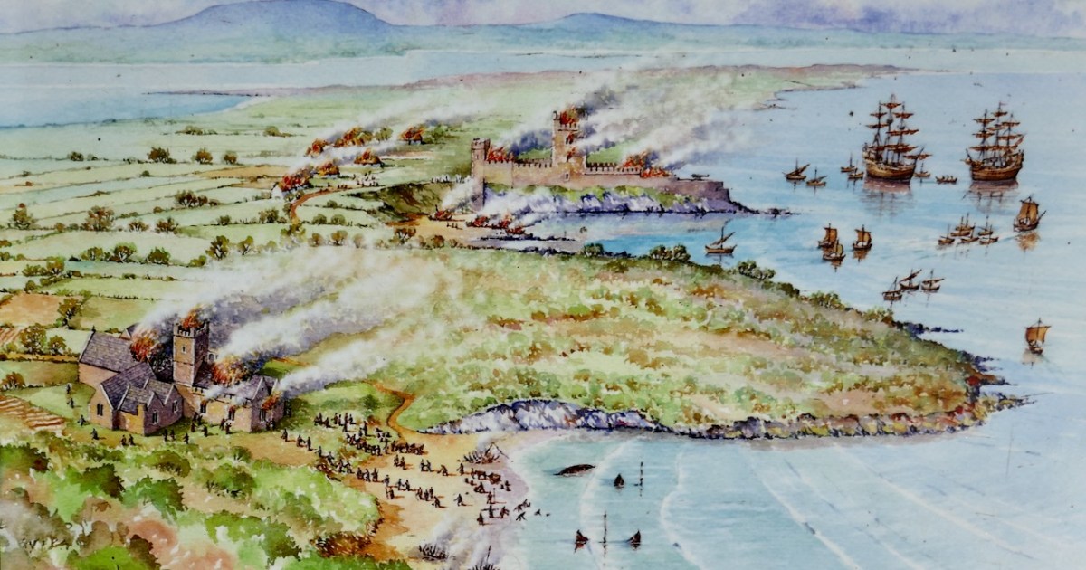
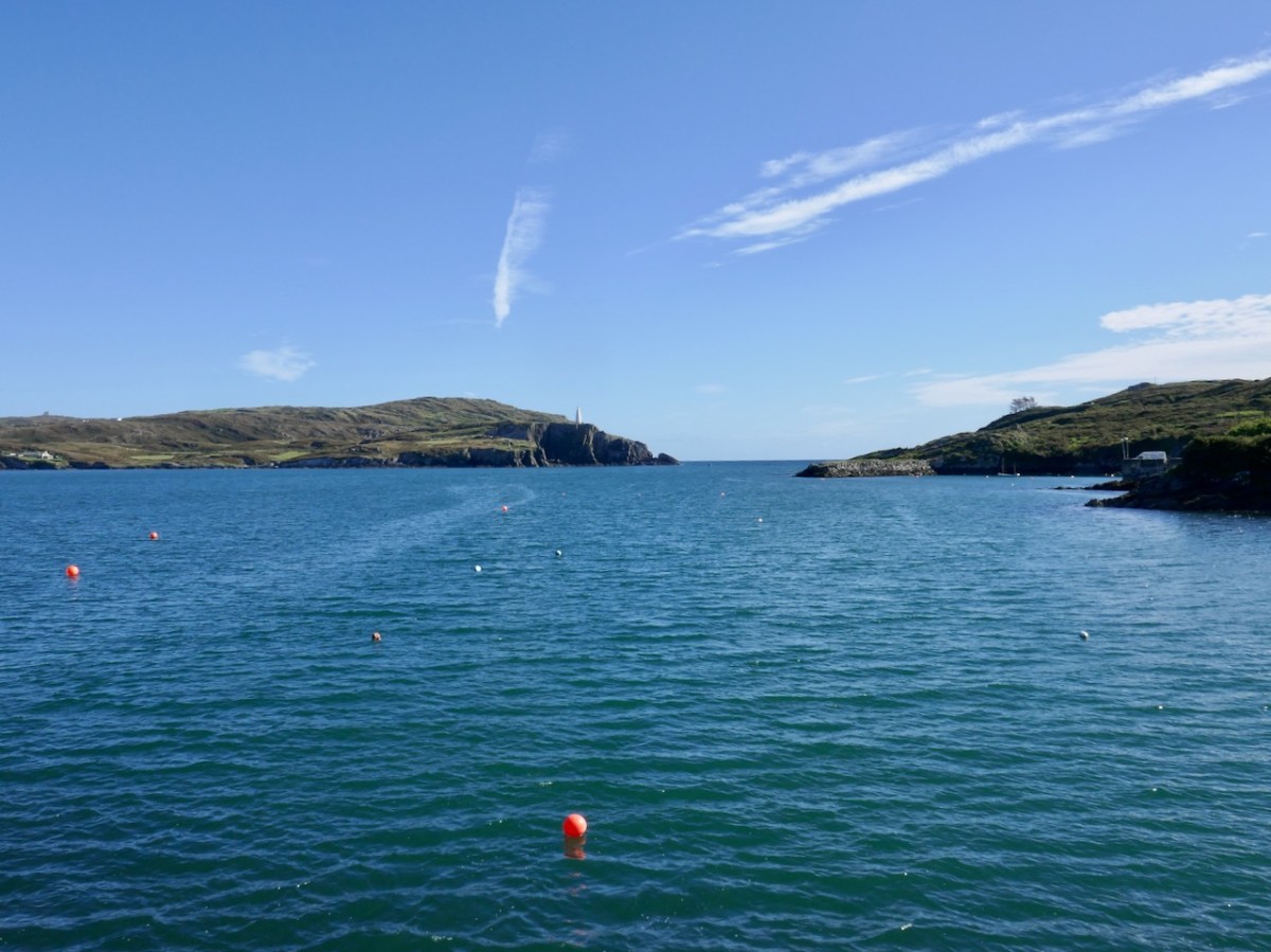
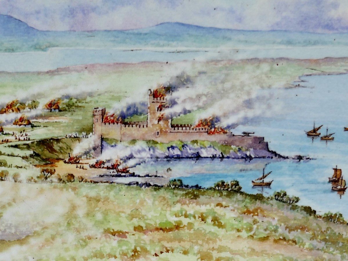
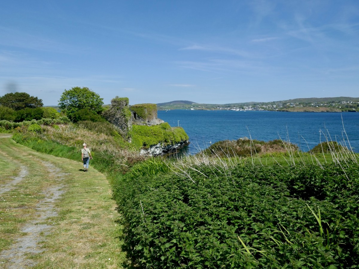
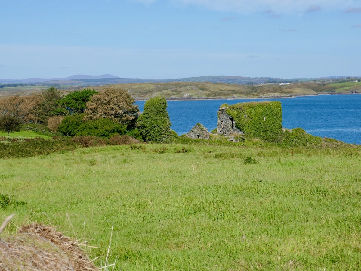
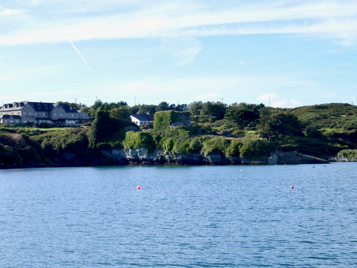
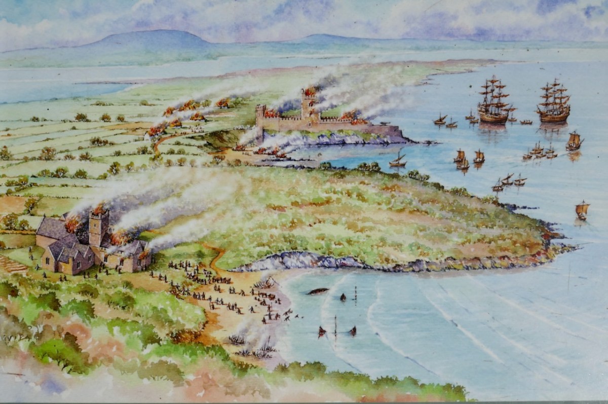
Dún na Long (Fort of the Ships) was strategically sited indeed. It had a good view across to Baltimore but more importantly of the entrance to the inner waters – anything that sailed between Sherkin and the mainland was immediately spotted. It was also very close to the Friary, and could defend it if necessary – although that didn’t quite go according to plan, as can be seen from the top photo, a picture of the Battle of the Wine Barrels that took place in 1537 between the O’Driscolls and a force from Waterford, come to take their revenge on the O’Driscolls for their constant raiding of the cargo ships.
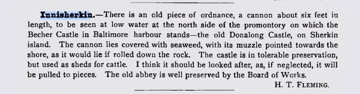
Let’s take a closer look at that drawing to see how the artist represents what Dún na Long looked like originally. Due to the shape of the promontory it occupies a long and narrow space, rather than the square or rectangular area we have come to expect, of a tower house surrounded by a Bawn wall (see Illustrating the Tower House). So the bawn wall is there, but elongated to run the length of the promontory. The tower house itself occupies a central position and there is one corner tower on the landward end. Note that the artist shows a huge cannon on the seaward end of the castle. This would have been unusual for an Irish castle, but there is some evidence for it. In the 1895 Journal of the Cork Historical and Archaeological Society, a Mr H T Fleming notes this:
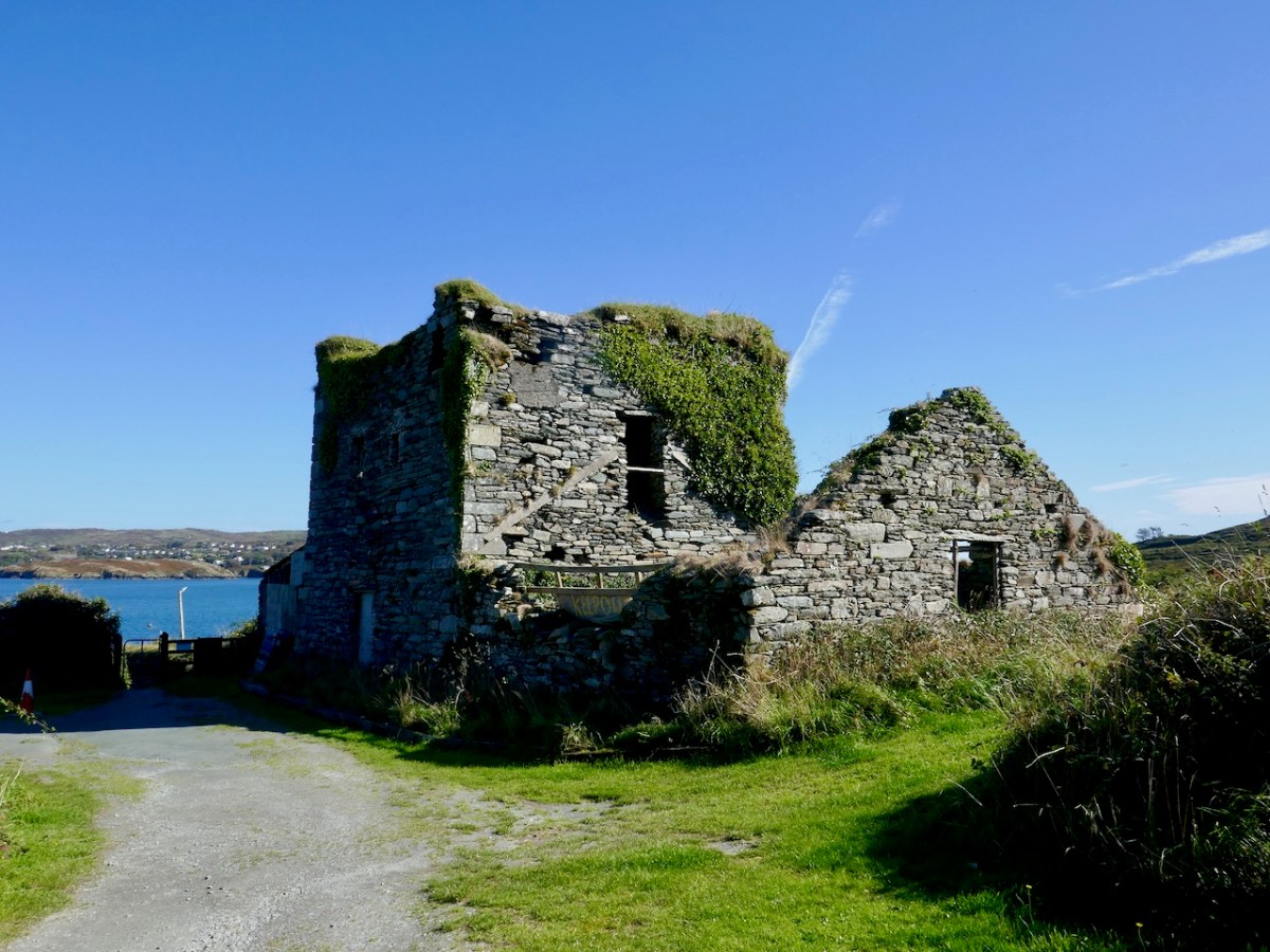
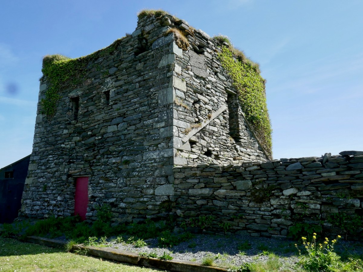
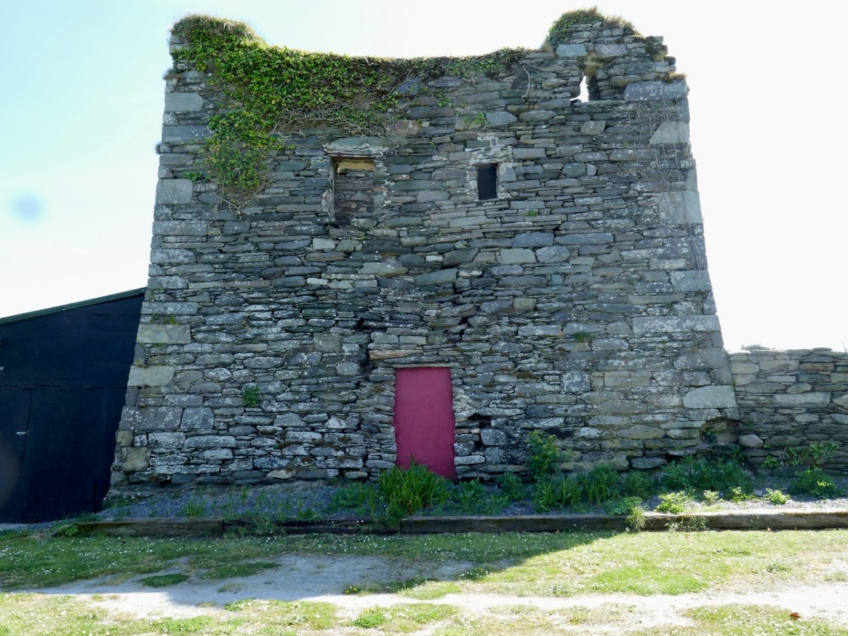
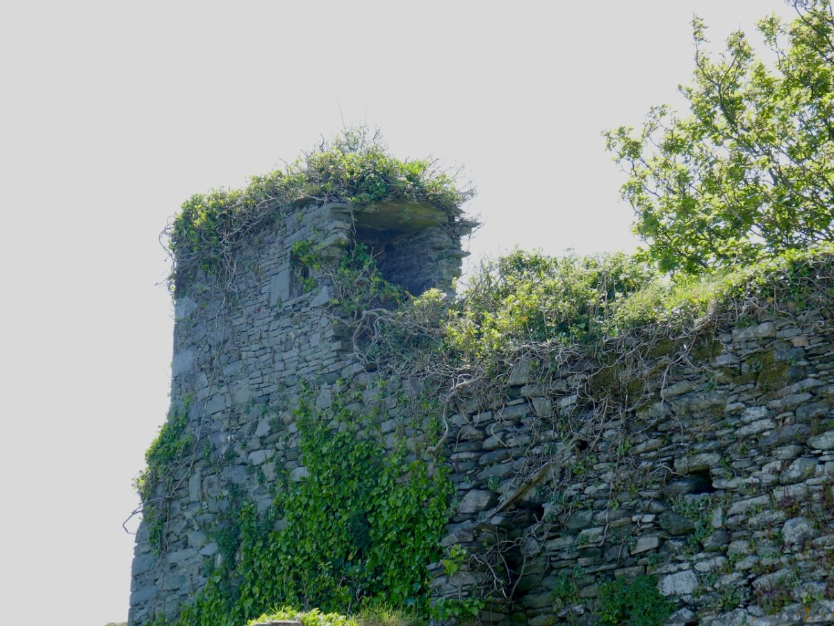
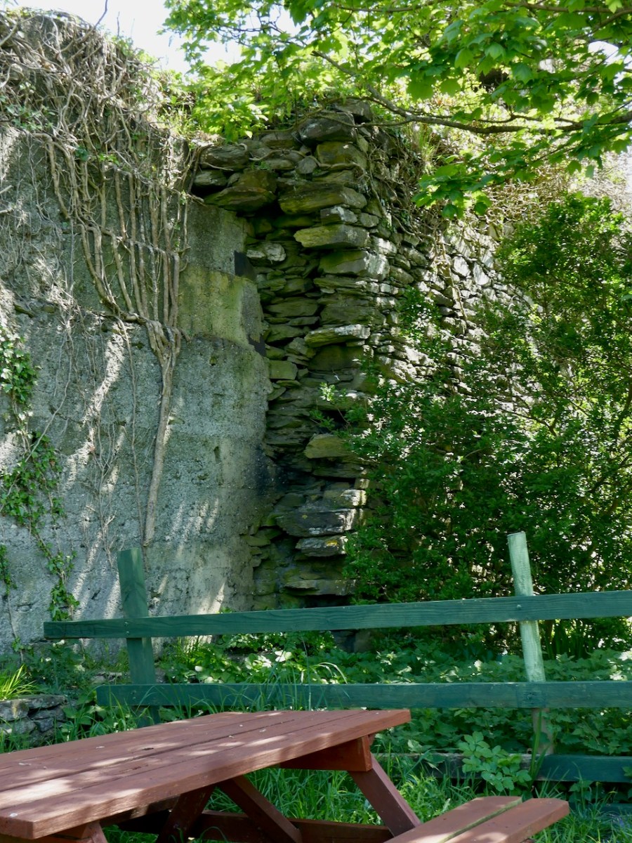
Wandering around the ruins, it is possible to see the remains of what was once there. The central tower now stands to only two stories. There is an entrance on the ground level, but this is an enlargement of what was originally a window ope. The actual raised entry was in the west wall – you can see it in the photograph below, although it has been much altered. It probably looked like the ground floor and raised entry configuration at Dunmanus Castle.
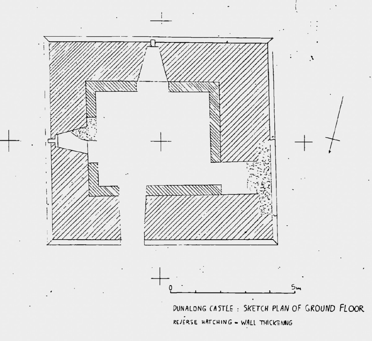
There is a pronounced base batter, Samuels, in his Tower Houses of West Cork, provides a sketch plan which shows how impressively thick the walls are.
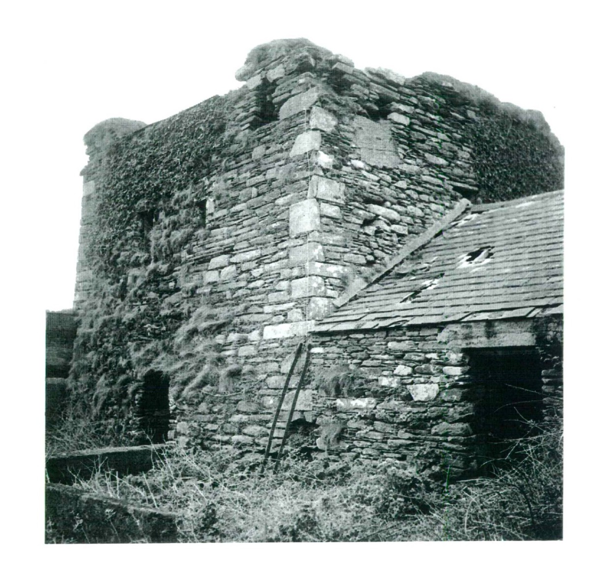
When he was doing his field work, in the 90s, there was still a roof on the pig shed built onto the west wall and he provides this photograph of how the central tower looked at that time.
The small corner tower can be clearly seen in the photo below as Amanda is wandering down to the castle.
That tower occupies the corner position on the bawn where the wall that runs along the landward side meets the wall that runs along the sea, closest to the Friary.
In the sketch, you can see the Waterford force has made its way onto the land and is firing at the castle from that side. What is left of this wall has been extended using modern concrete block.
After the battle of Kinsale in 1601, the current clan chief, another Finghín, handed over the castle to the Spaniards, who in turn surrendered it to the English under Captain Harvey. Since that time it has led an anonymous and ignominious existence as a cattle or pig shed.
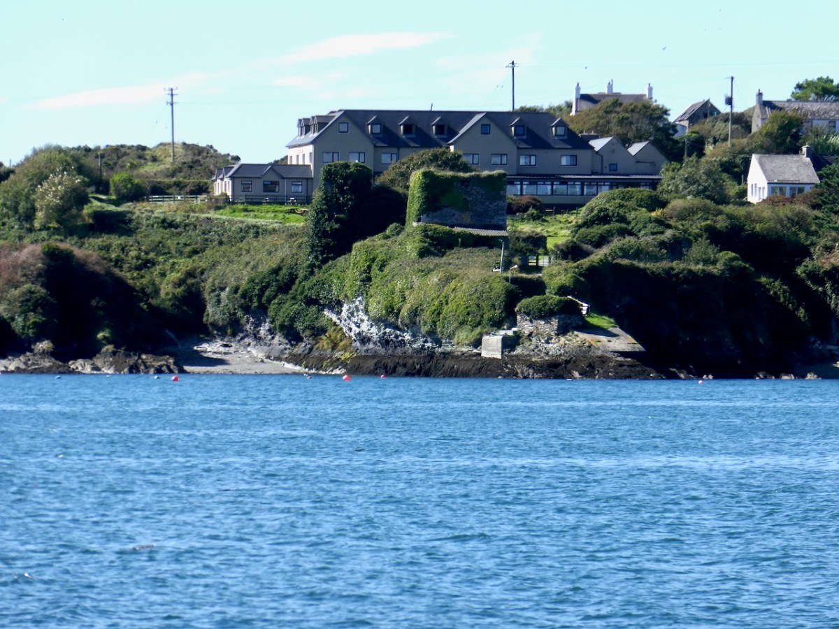
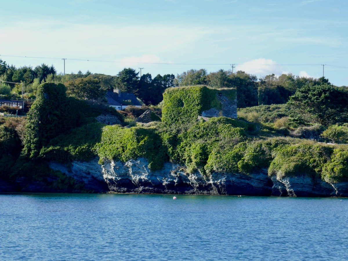
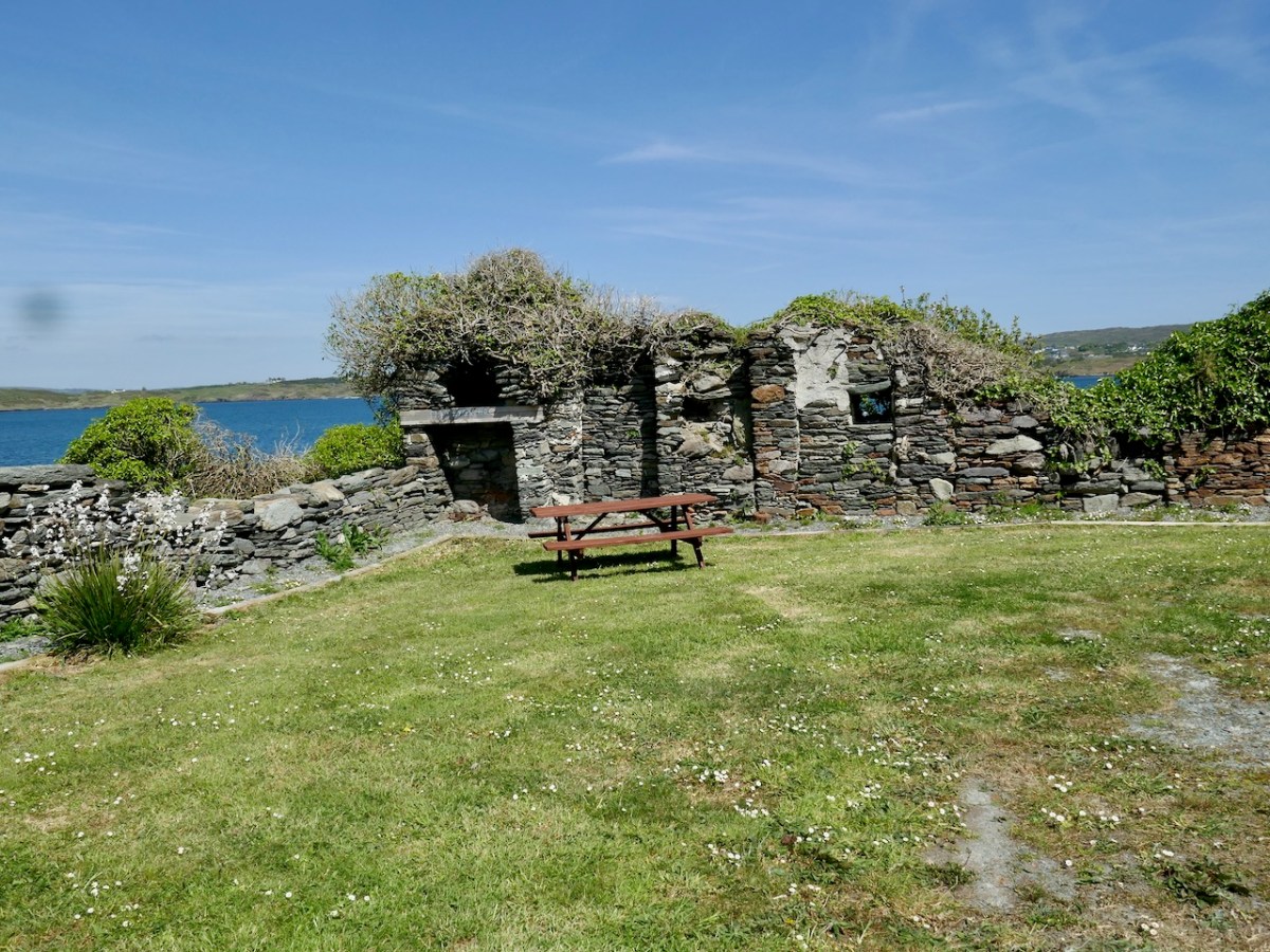
Nowadays, the site is much tidier than when I have visited in the past. A picnic table provides a pleasant spot to look out over the sea and think about what life was like in this castle in the 15th and 16th centuries.
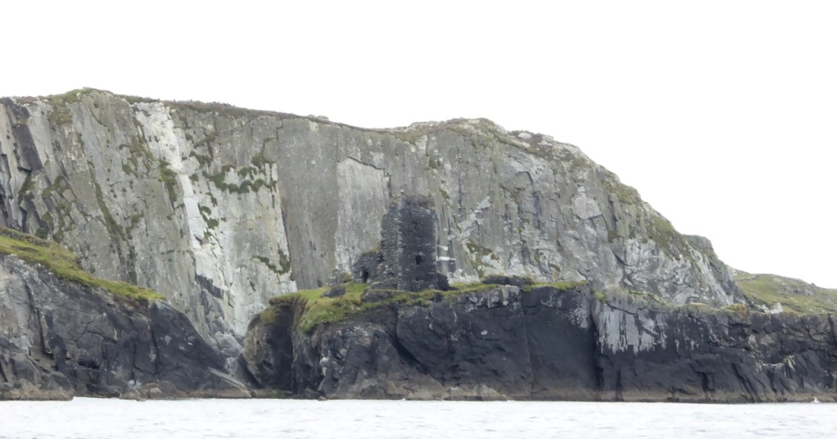
I have been gifted with a marvellous set of photographs of Dunanore, or Dún an Óir – an O’Driscoll Castle on Cape Clear. The gift came from one of our readers, Tash, and I am very grateful indeed. Regular readers know that I like to use my own photos, and I do have some that I took from the sea (like the one below) but I have none of Dún an Óir from the land, let alone from the castle itself!
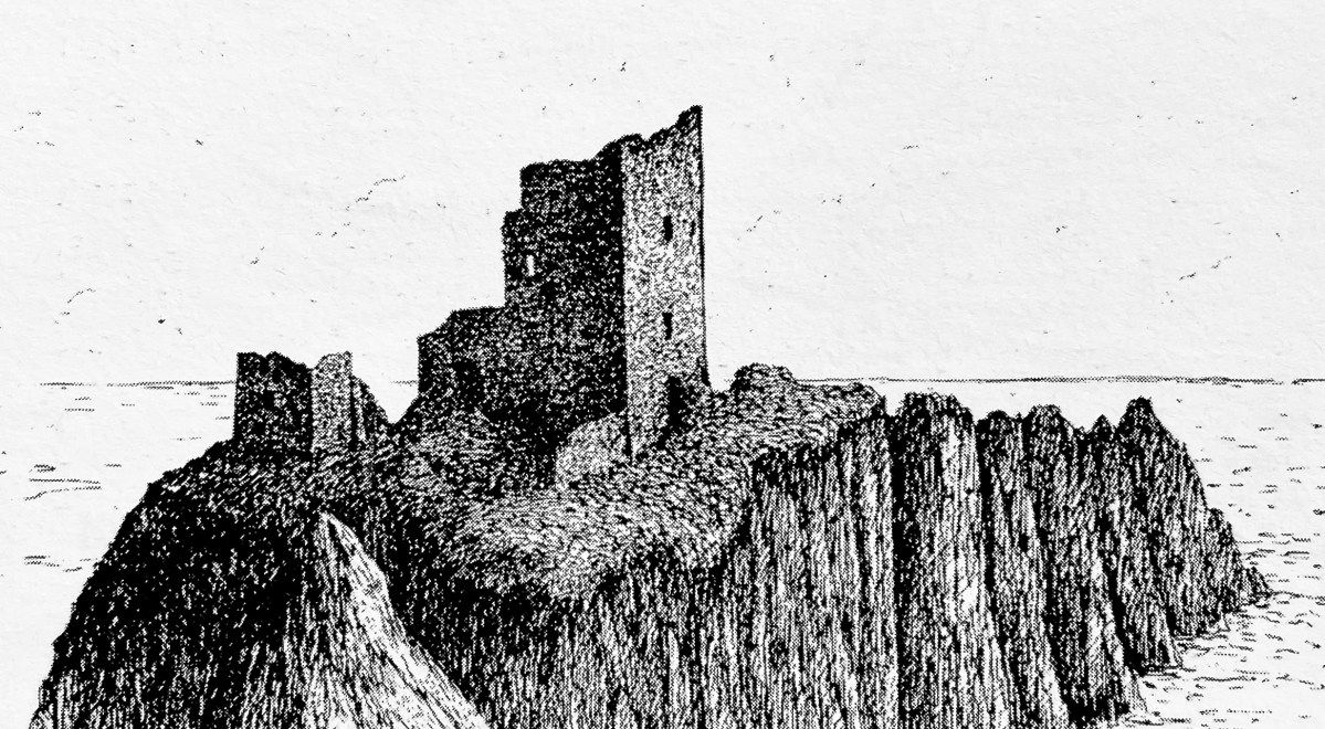
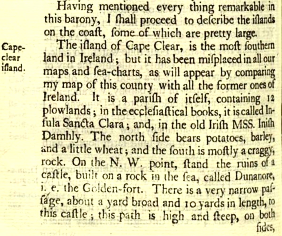
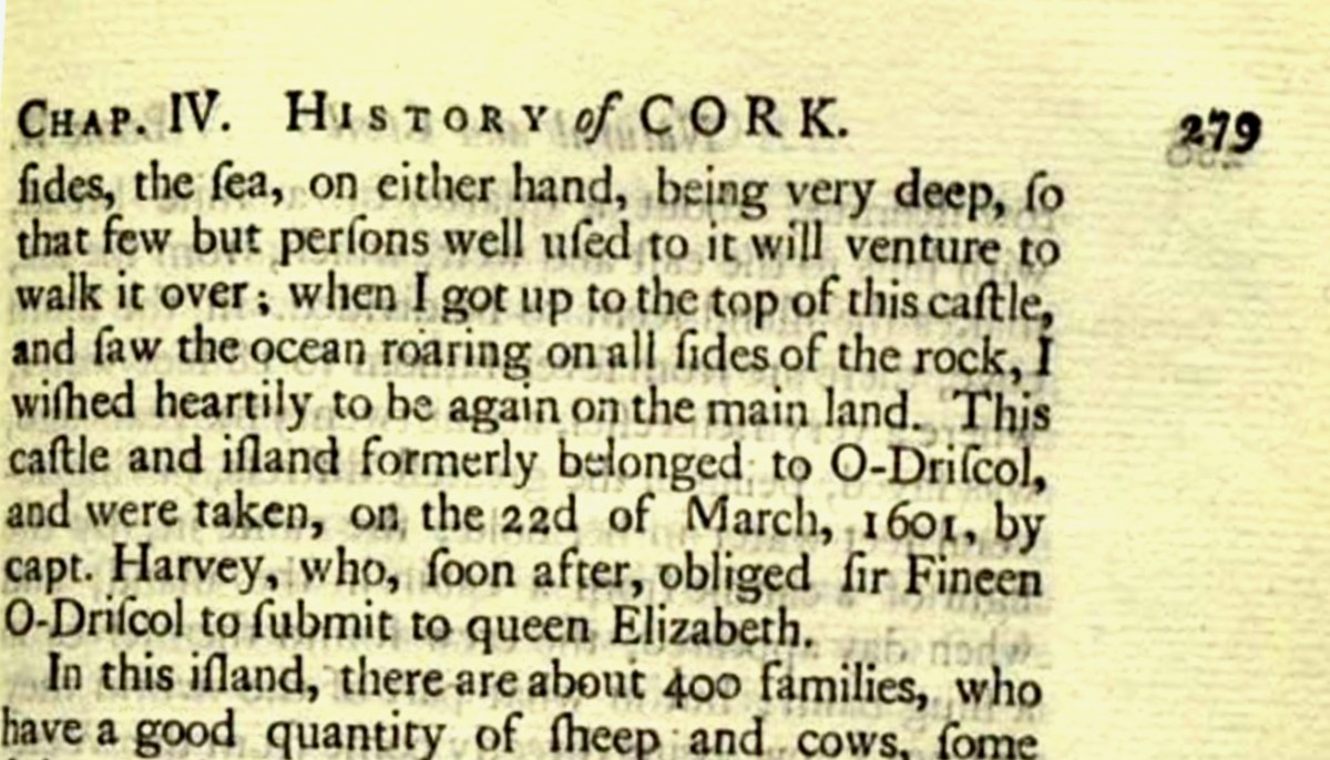
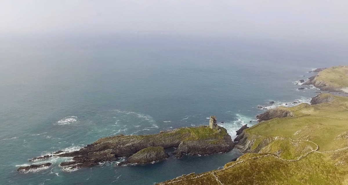
And that’s because, as you can see from the drawing by Jack Roberts at the top of this post, this castle is situated in a very perilous location, on the edge of a cliff, on a small island, essentially, making access a hazardous scramble up from a rocky beach. It was once connected to the rest of Cape Clear by a narrow causeway but this has long collapsed. It was still there in the 1770s when Charles Smith visited. In his The Ancient and Present State of the city of Cork Vol 1, he wrote:
And this brings us to the name – Dún an Óir. It means, of course, Fort of Gold, and some of the old legends about this place talk about the name coming from stories of buried treasure. But in fact, this has been the name of this fort since the first maps of this area were made in the fifteen hundreds and it speaks to the wealth of the O’Driscoll clan who built it. Remember, their other stronghold, now called Baltimore, was Dún na Séad, or Fort of Jewels (on at least one map given as Castle of Perles). On Sherkin, their castle was Dúnalong – or the Fort of the Ships – that’s it as it is now, below.
There are many accounts of their fleets of ships, and the battles they waged against the Waterfordmen in which they came out the worst for wear when Dunalong was attacked. The scene below, from an information sign on Sherkin, shows the Battle of the Wine Barrels, 1537, with both Dunalong and the Friary on Sherkin in flames
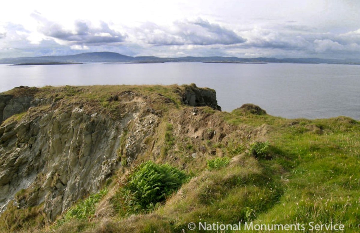
Dún means ‘fort’ but seems to be especially applied to promontory forts in the southwest. Before the castle was built, therefore, it is likely that the O’Driscolls fortified the headland, which may date well back to the Early Medieval period (400-1200) or even to the Iron Age (500BC to 400AD, or 500BCE to 400BC for those who prefer the secular version). The Illustration below is taken with permission from Dún an Óir Castle: an uncertain future, by Dr Sarah Kerr, and shows the present state of the castle, marooned on what was once a promontory connected to the Island.
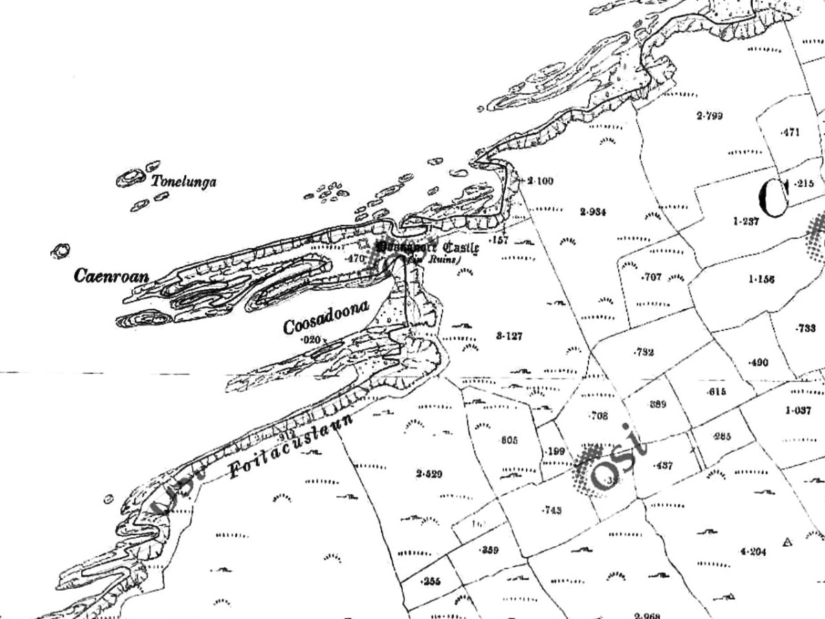
Our Promontory Fort man is Thomas Westropp (see here and here), and he wrote about Dún an Óir in his 1914-16 paper for the Royal Irish Academy, Fortified Headlands and Castles in Western County Cork. Part I. From Cape Clear to Dunmanus Bay. He visited the site, but like many a good explorer before and after him, did not venture out onto the promontory, but satisfied himself with what he could see from the high ground above it. That included the promontory and ruined castle, the rather ominously named Tonelunga (The sea-bed of the Ships), the end of the promontory called Caenroan (quay of the Seals), the inlet between the promontory and the cliffs, Coosadoona (the Little Harbour of the Fort) and the high cliffs behind the fort, Foilacuslaun (Cliffs of the Castle). All of these are marked on the 19th century twenty-five inch map.
Westropp writes about Dún an Óir as one of three Promontory forts on Cape Clear Island, although in fact there are more than that, as identified by the National Monuments Record – each yellow dot below is one.
Here’s one of them (below), Lios Ó Móine (the Fort of the Meadow – lios is usually used to designate an earthen ring fort): the description and then the photo are by National Monuments Service (NMS). In the photo you can see the narrow neck of land leading out to the promontory. This is likely what the spit leading out to Dún an Óir may have looked like.
Description: In rough pasture, at the foot of a steep N-facing slope on Stuckaunfoilnabena, a headland on the NW coast of Clear Island. A narrow eroding neck of land (Wth 3m; L 15m) leads to the roughly anvil-shaped headland. Across this neck of land are the remains of three earthen banks and the shallow remains of three fosses. Further examination of the remains was not possible for safety reasons.
Curiously, the NMS does NOT identify Dún an Óir as a promontory fort – here is what it says:
Description: The location of the tower house ‘Doonanore Castle’ (CO153-015002-) on a promontory, on the NW shore of Clear Island, suggested that it may have been built on the site of a promontory fort. However, there are no visible surface traces of an earlier defences across the promontory. The promontory is now isolated at high tide but was connected to mainland by causeway until 1831.
However, it has this to say about the earthwork identified on the high ground:
In pasture, on a steep N-facing slope to the E of the tower house known as Doonanore Castle . . . An earthen bank . . .extends upslope in a S to SW direction from a modern E-W field boundary wall on the cliff-top at N and ends at a large outcropping rock on the edge of another cliff. This bank appears to have formed part of the defences on the land approach to the castle from the E. The bank has three contiguous linear stretches [and] there is an entrance near the N end. There is a possible hut site near the centre of the enclosed area. The short promontory on which Doonanore Castle stands is a possible coastal promontory fort.
So, as you can see, although the NMS declines to label it a promontory fort because there are no longer any signs of banks or walls, it does concede that it is possible. It also extends the defences of that fort to the higher ground above it.
Back to Westropp – He quotes:
the poem of O Huidhrin, before 1418, tells how “0 hEidersceoil assumed possession of the Harbour of Cler.” It was of some importance to the foreign traders in wine and spices, and so figures in all the early portolan maps. Angelino Dulcert, in 1339, calls it Cap de Clar ; the subsequent portolans, Cauo de Clara, 1375 and 1426 ; Clarros, 1436 ; C. d’Clara or Claro, 1450 and 1552, and, to give no more, Cauo de Chlaram, in 1490. The 0 Driscolls’ Castle probably dates between 1450 and the last date. It was probably on an earlier headland fort, as it is called Dunanore. In 1602 it surrendered without resistance to the English, who burned it.
Westropp goes on to say
Dr. O’Donovan, in his ” Sketches of Carbery,” gives a few notes on the later history. He says there was a garrison at the Castle in Queen Anne’s time, and mentions the huge iron ring-bolt, set in the rock, to which the O Driscolls formerly moored their galleys in the creek. The last is improbable, even to impossibility: no one could moor galleys in the dangerous wave-trap, open to the most stormy and unsheltered points. The islanders regard the ruin as haunted, and tell of the singing of ships’ crews in its vaults. One “Croohoor” (Conor) O’Careavaun (Heremon’s grandson) lived as a hermit there in the eighteenth century. Another legend tells how, in 1798, the inhabitants painted the Farbreag Rocks and pillars so as to resemble soldiers in uniform to keep away the French ! If any truth underlies this, it is probably based on the idle act of some revenue or other officers, in the endless leisure of their island station.
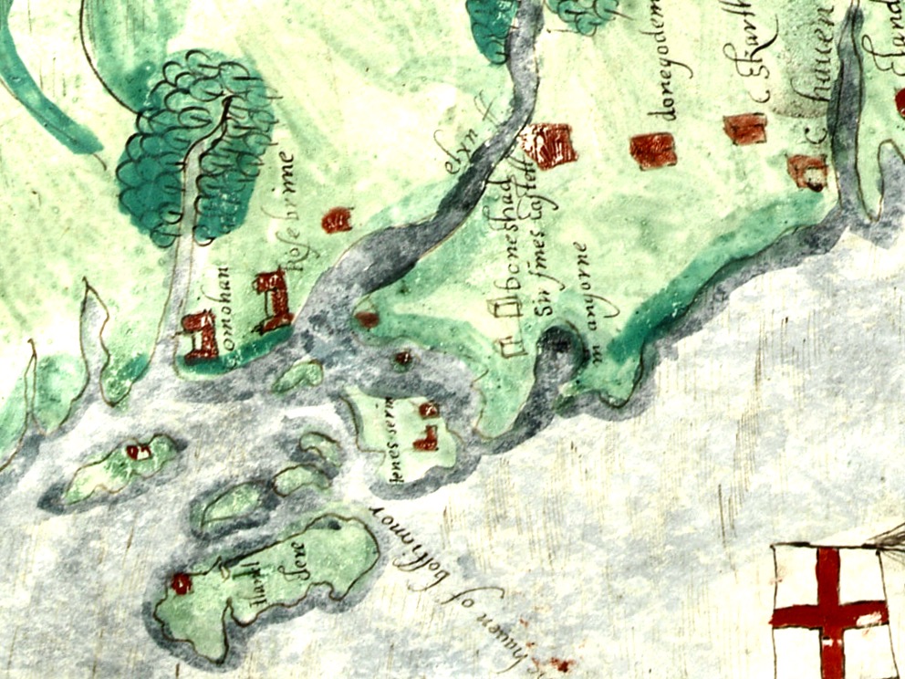
In the map above, of the southwest end of the Island, you can just make out the name Firbreaga, almost covered by the O of OSI. Fir Bréaga means The Lying Men, an apt translation given Westropp’s story. No doubt the name is older than 1798, and may refer to the cliffs at that end seeming to be less dangerous from the sea than they actually were. Note also the two yellow dots for two more promontory forts- Doonthomas (Thomas’s Fort) and Coosfoilaskehaun (the Small Harbour of the Knife-Edge Cliff).
Westropp’s description of the promontory upon which Dun an Óir sits is poetic:
The path runs up a very slight ledge, flaking away and high above the creek, along the face of a cliff of polished silvery slate. The low neck joined it to the mainland, and the nearly perpendicular strata make the dock-like creek of Coosadoona, fort-cove, to the south Beside this cove, opposite to the castle, an enormous precipice rises high above the tower top. In the other direction is a noble view across the wide, porpoise-haunted bay, and its low islands to the blue, many-channelled Mount Gabriel, and on to Mizen Head.
In fact, very little is known about the history of Dún an Óir before the Battle of Kinsale in 1601. We can deduce from its strategic location that the O’Driscolls used it to keep an eye on every ship that sailed in and out of Roaringwater Bay, to exact fishing dues before the rival O’Mahonys could get to the incoming vessels, to curb the power of those O’Mahonys, and to establish their dominance over the land of Cape Clear Island. (See this post for more on the map above.) Because the castle would have been rendered, probably in some shade of white or near-white, it would have been visible from all around Roaringwater Bay, and have represented a potent statement of supremacy.
After the Battle of Kinsale the Castle was seized by Captain Harvey, as described in Pacata Hibernia:
‘While these things were on doing, Captain Roger Harvy sent a party of men to Cape Clear,the castle whereof being guarded by Captain Tirrell’s men, which they could not gain, butthey pillaged the island and brought thence three boats; and the second day following therebels not liking the neighbourhood of the English, quitted the castle, wherein Captain Harvy placed a guard. At this time Sir Finnin O’Driscoll came to Captain Harvy and submitted himself.’
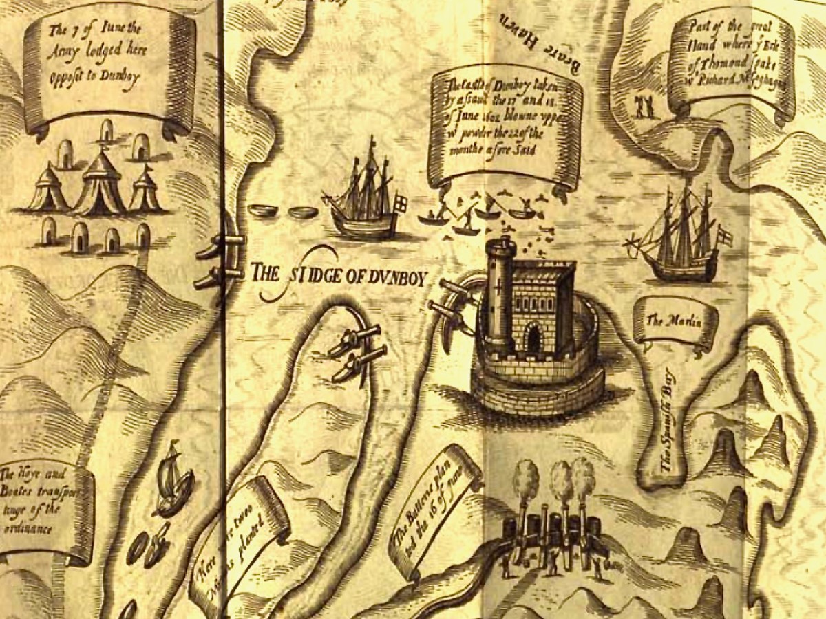
This illustration, from Pacata Hibernia, is of the siege of Dunboy Castle, the stronghold of O’Sullivan Beare, on Beara Peninsula. The destruction of Dún an Óir is described by James Burke in his article Cape Clear Island in the Journal of the Cork Historical and Archaeological Society Journal of 1908. Rather than Harvey simply taking over the castle, Burke relates the following:
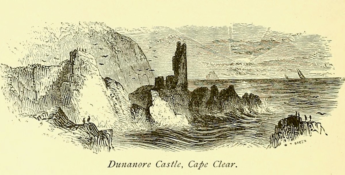
Its central arch and the steps leading to its upper portion remain; but the huge pieces of its eastern wall now lying about show how severely it has suffered from the havoc of war. This wholesale destruction occurred when Dunanore Castle, together with the island, was captured on the 22nd of March, 1601, by Captain Roger Harvey, following on the defeat of the Spaniards at Kinsale. By means of the artillery he planted on the high ground adjoining it, he battered down the eastern wall and compelled the garrison to surrender, for which and other services (as Dr Donovan writes in his “Sketches of Carbery”) he was granted at the time a commission by Lord Deputy Mountjoy as Governor of Carbery.
It is far more likely that the ruined state of the castle is a result of the natural passage of time than the ‘havoc of war.’ For one thing, it would have been a monumental task to deploy artillery overland on Cape Clear. Any cannon fire would have come more naturally from the English warships we know were in use during this period and therefore, the damage would have been to the seaward side of the castle – but this side is actually intact.
A romantic view of the ruins of Dún an Óir above, by W Willes.* Next week we will look at what is left of the castle and what we can tell from that. I’ll be using the marvellous photos from Tash in that post.
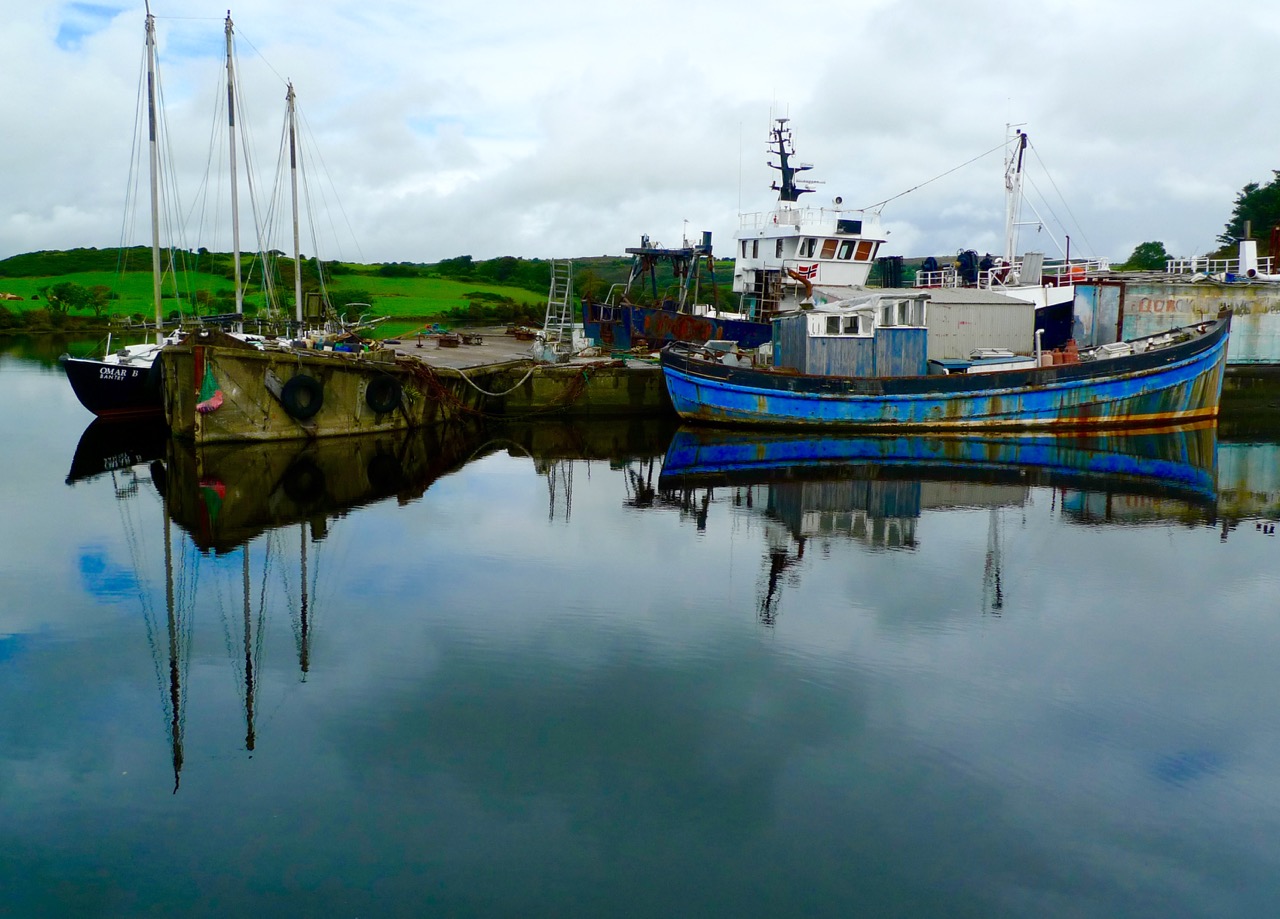
…At Oldcourt a boat-building yard flourished within the walls of an old O’Driscoll castle overlooking the pier and river. Schooners and steamships used to anchor at this spot, the highest point they could travel up the river. Here their cargoes of coal and other supplies were unloaded and placed on specially built lighters with a small draught that would be poled along a further sluggish turn or two upstream to the pier at Skibbereen. In this way cargoes of cattle were brought up by islanders to be sold at the market… (description of the townland of Oldcourt from The Coast of West Cork by Peter Somerville-Large 1974)
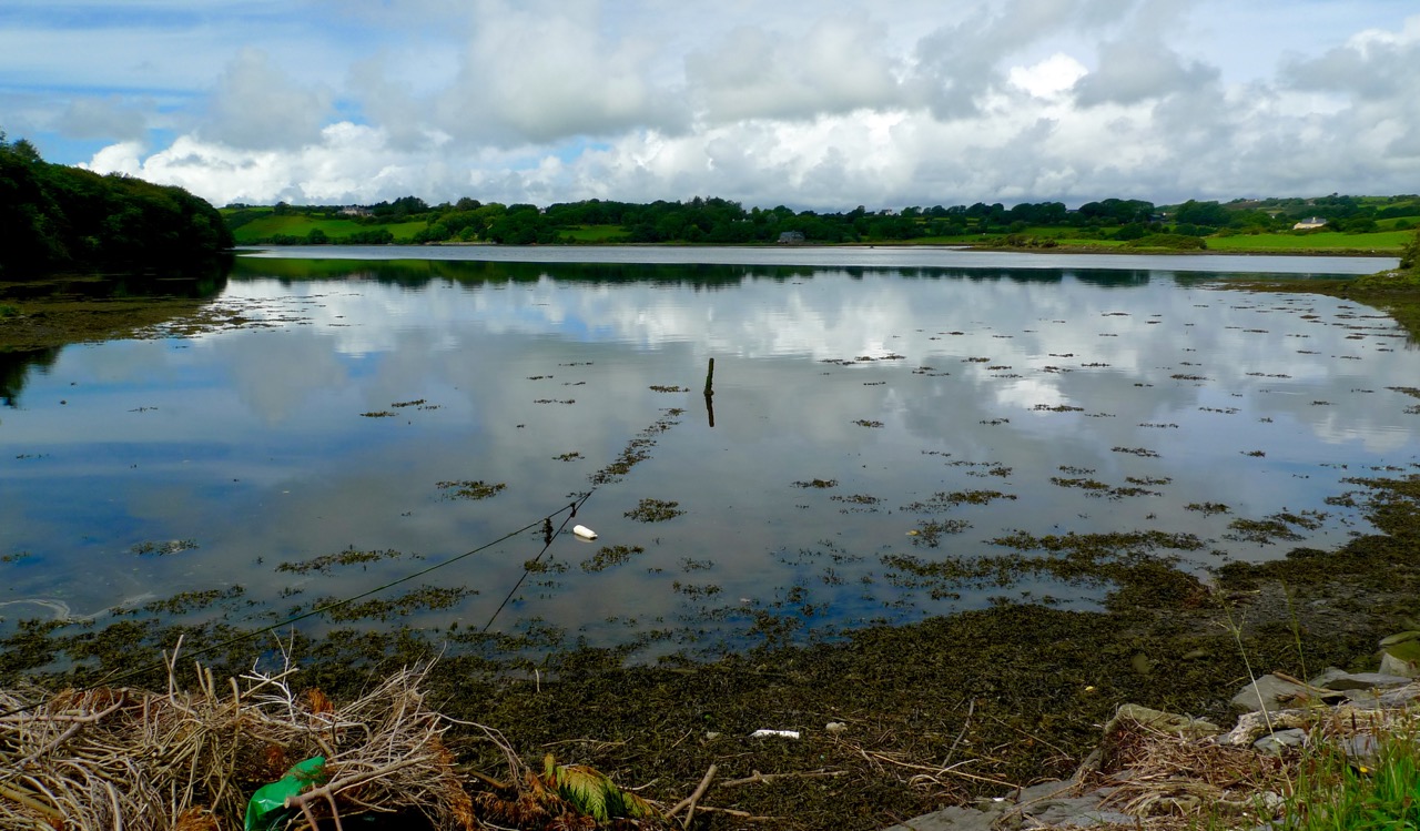
The tidal River Ilen making its lazy way out to Roaringwater Bay on a late summer evening has a melancholy beauty: it is wide and slow and – mid tide – is a perfect mirror to the sky. The sounds of Oystercatchers and Curlews coming over the water always bring thoughts of autumn: the harvest is ready to cut, the verges are brilliantly orange with the montbretia and the hedges purple-red and weighed down with fuscia.
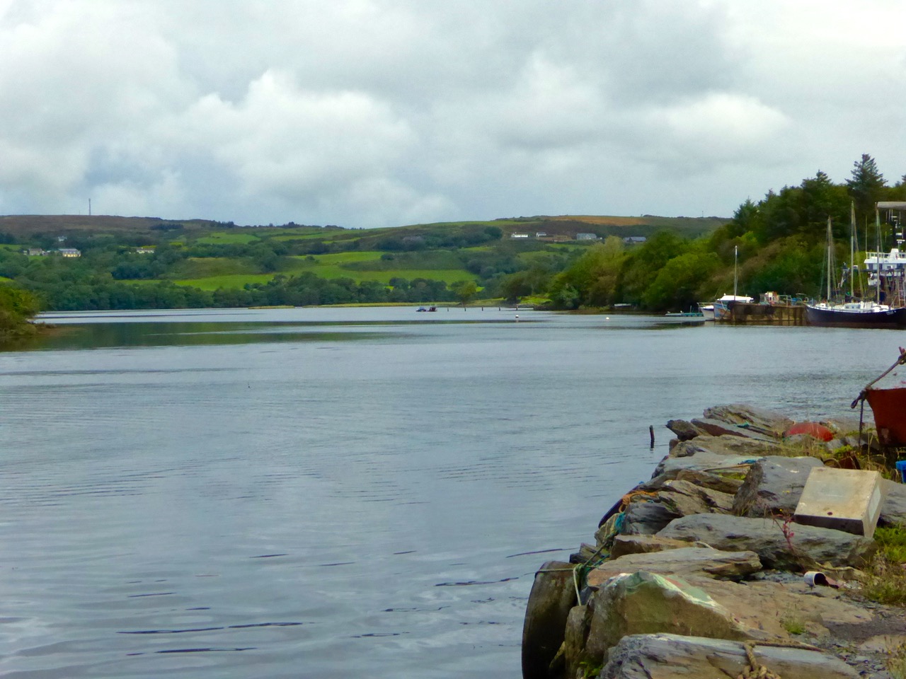
We went down to Oldcourt to seek out history and atmosphere. We knew that it had once been a transport hub for the transhipments of goods and we wanted to see what might be visible from those earlier times. It was the river Ilen (pronounced eye-len) that gave birth to Skibbereen following a pirate raid on Baltimore in 1631. According to Skibbereen historian Gerald O’Brien …in the wake of the shock of that – the most daring pirate raid mounted against Britain or Ireland – a small number of survivors rowed upstream to resettle in the safety of the Ilen Valley. The role of this river-borne migration from Baltimore [was] a factor in the foundation of Skibbereen… (Journal of the Skibbereen and District Historical Society, Vol 7, p 91).
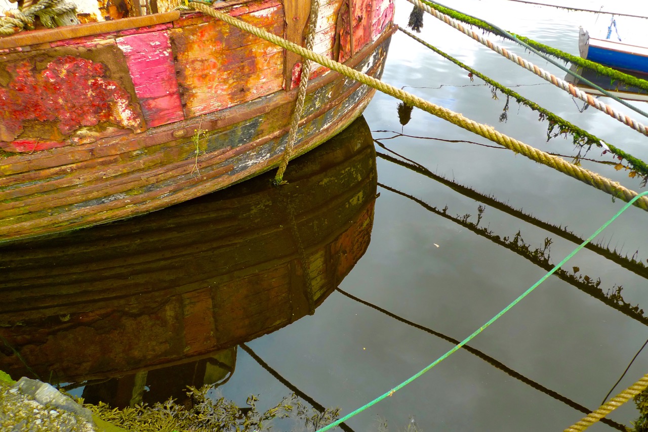
We found atmosphere a-plenty. On the upstream side of the wide inlet where the transhipment quays were sited is a streamlined modern boatyard where sleek yachts are wintered and serviced while, opposite and downstream, is a far more eclectic establishment surrounding and embracing the remains of the medieval castle and bawn: this is Hegarty’s – ‘…one of Ireland’s last surviving traditional boatyards…’
Our aim was to search for the old quay and the medieval buildings which had been part of the castle demesne, but we were fascinated to pick our way through boats of all kinds – classic, sailing, fishing, ferrying – and boat paraphernalia: here an old decapitated wheelhouse, there a collection of masts, everywhere ropes and tackle…
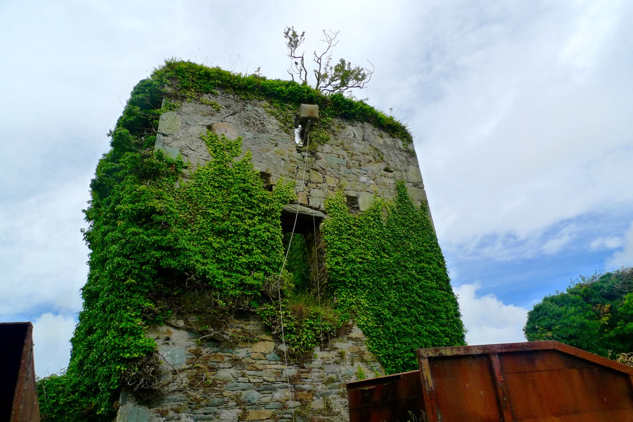
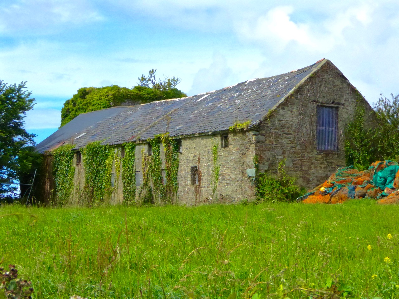
Oldcourt Castle is a tower house standing four storeys high but originally at least one storey higher, once surrounded by a bawn, some ruins of which remain. It was an O’Driscoll clan castle, probably dating from the 15th century, and was captured by English forces after the Battle of Kinsale in 1601.
Part of the castle bawn was used as a grain store up to comparatively modern times: now it houses a fascinating boat restoration. The story begins with Connor O’Brien (1880-1952) whose ketch, the Saoirse, took him on a circumnavigation of the world between 1923 and 1925. On this journey he stopped off at Port Stanley in the Falkland Islands. The islanders were so impressed at the way the Saoirse rode the waves that they asked O’Brien to arrange the building of a similar boat. This was the Ilen, named after the river and estuary and registered at the port of Skibbereen in February 1926. She was 56 feet in length overall with a beam of 14 feet and a displacement of 45 tonnes. Connor set sail in August 1926 from Cape Clear, arriving at Port Stanley in January 1927 where he handed it over to the new owners, The Falkland Islands Company, in exchange for £1,500. There she remained until the early 1990s, carrying cargoes of stores, mail, passengers and sheep. Limerick man Gary McMahon found it abandoned on one of the islands and determined that it should return to its homeland for restoration. There was great excitement when he sailed the ketch back into Baltimore in 1998. The refitting of this eighty-two year old vessel in the old bawn at Hegarty’s, Oldcourt, is now the centre of an educational project allowing people to experience first-hand the ancient skills of wooden boat building.
The old grain store – formerly part of the Castle bawn – now houses the restoration project of the AK Ilen (above – courtesy of Roeboats)
Such a hive of activity at OIdcourt today… Echoes of busy days gone by when the schooners were arriving with their cargoes bound for the growing town of Skibbereen.
Welcome to the UCD Library Cultural Heritage Collections blog. Discover and explore the historical treasures housed within our Archives, Special Collections, National Folklore Collection and Digital Library