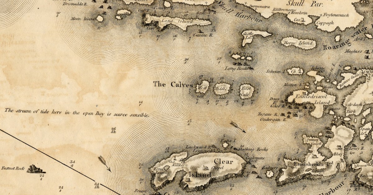
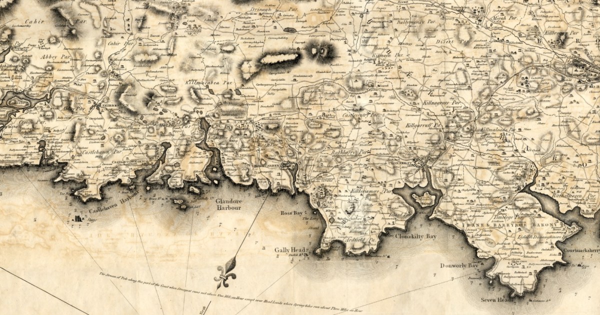
The first thing to say about this map is that on it the name Roaringwater Bay is assigned to a restricted area area eastwards from Horse Island, up to the entrance to Ballydehob Bay, and across to Skeaghanore, Kilcoe and Turk Head. This, in fact, is still how modern maps are labelled.
However, when you live here, you realise the term Roaringwater Bay is used to refer to the whole area that encompasses all the Islands, right out to Cape Clear. In Irish, Roaringwater Bay is called Lough Trasna, which simply means Lake ‘Across’ – a term which carries the implication of a body of water you have to cross over.
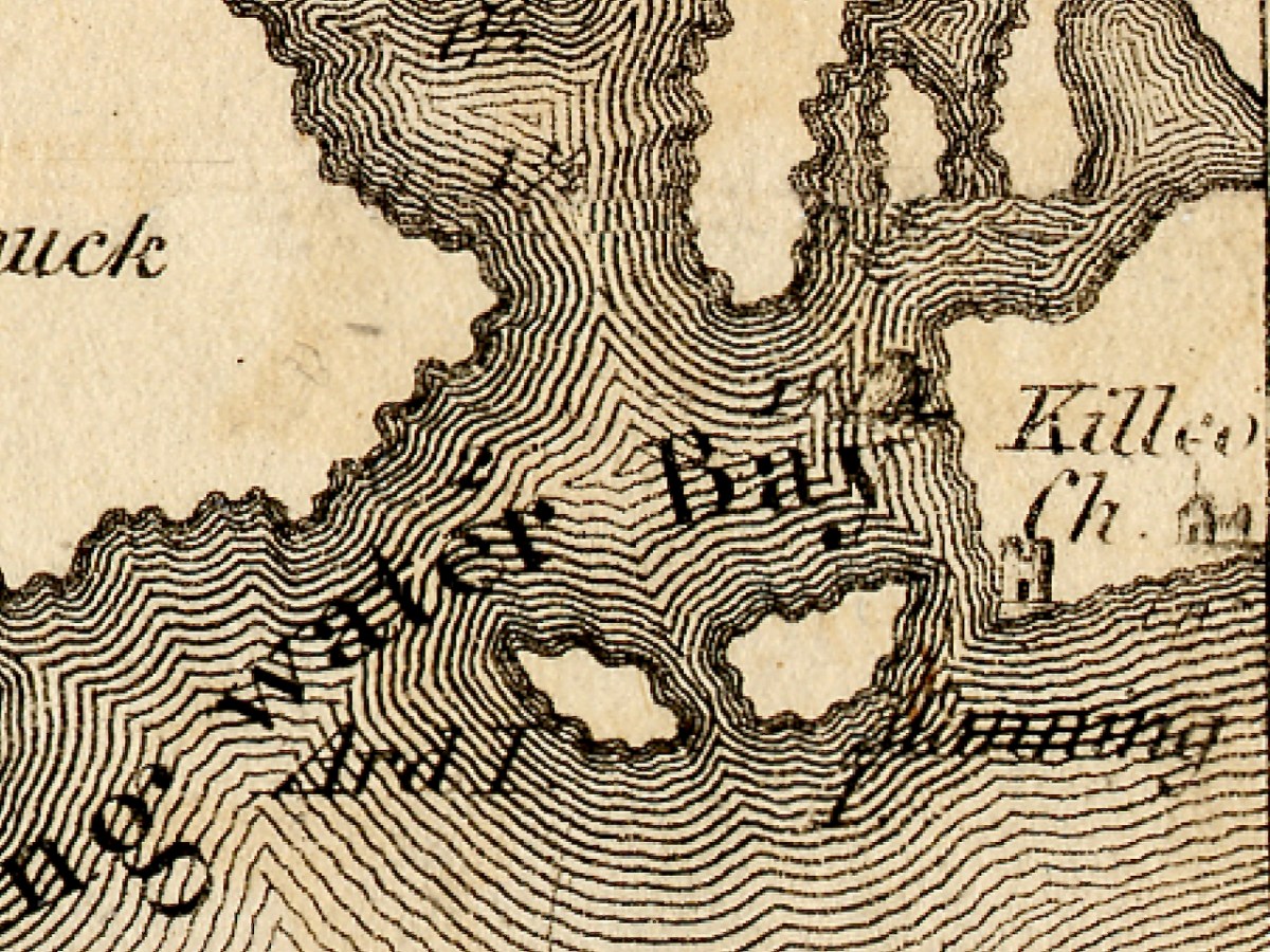
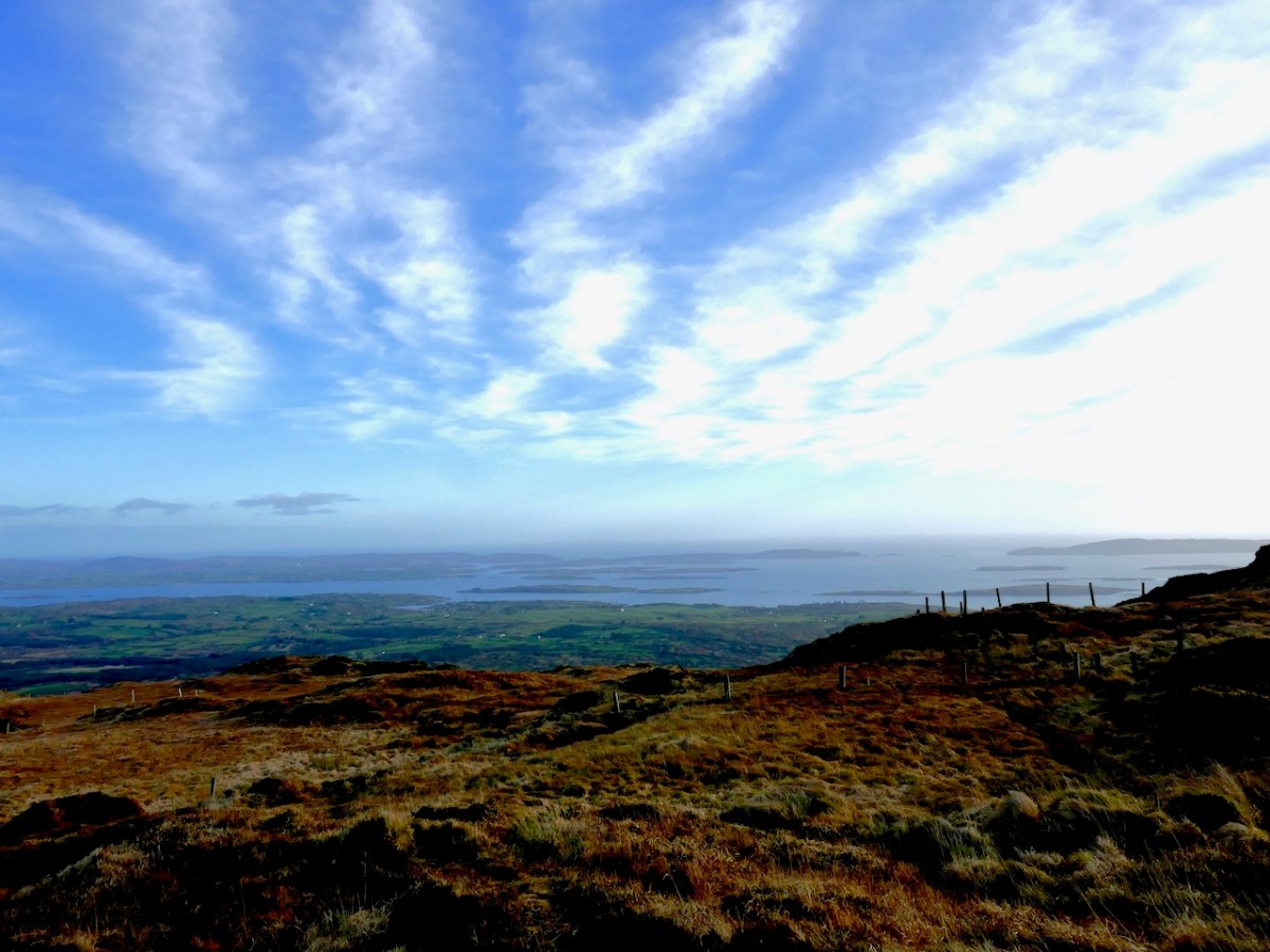
And how did it get the name Roaringwater – the official version is that it’s called after the Roaringwater River, which in turn gets it name from the way the water roars as it tumbles over rocks. But read my post from way back in 2014, The Roaring, and you will realise that there is a much more sensible explanation. So I will use the term Roaringwater Bay in this post as we use it every day around here – to include everything you see from the top of Mount Gabriel, looking south and east, as below. Before I move from the image above, however, let me point out Kilcoe Church, and Kilcoe Castle, both of which I have written about.
Let’s start with the biggest island – familiarly known locally as Cape Clear. Clear Island, as it is properly called (Oileán Cléire) and as it is labelled on this map, shows the name Cape Clear reserved for its southwestern tip.
Dún an Óir Castle (see this post, and this one) is clearly shown, as is St Kieran’s Church, which was a ruin even then. Intriguingly, there is a Catholic Chapel shown which must have been in place before the current church was built in 1839, approximately in the same area. Even more strange is a building shown as a ‘Gentleman’s Seat’ – that is, a Big House, on the south side of the Island. Can anyone help us with that this might have been?
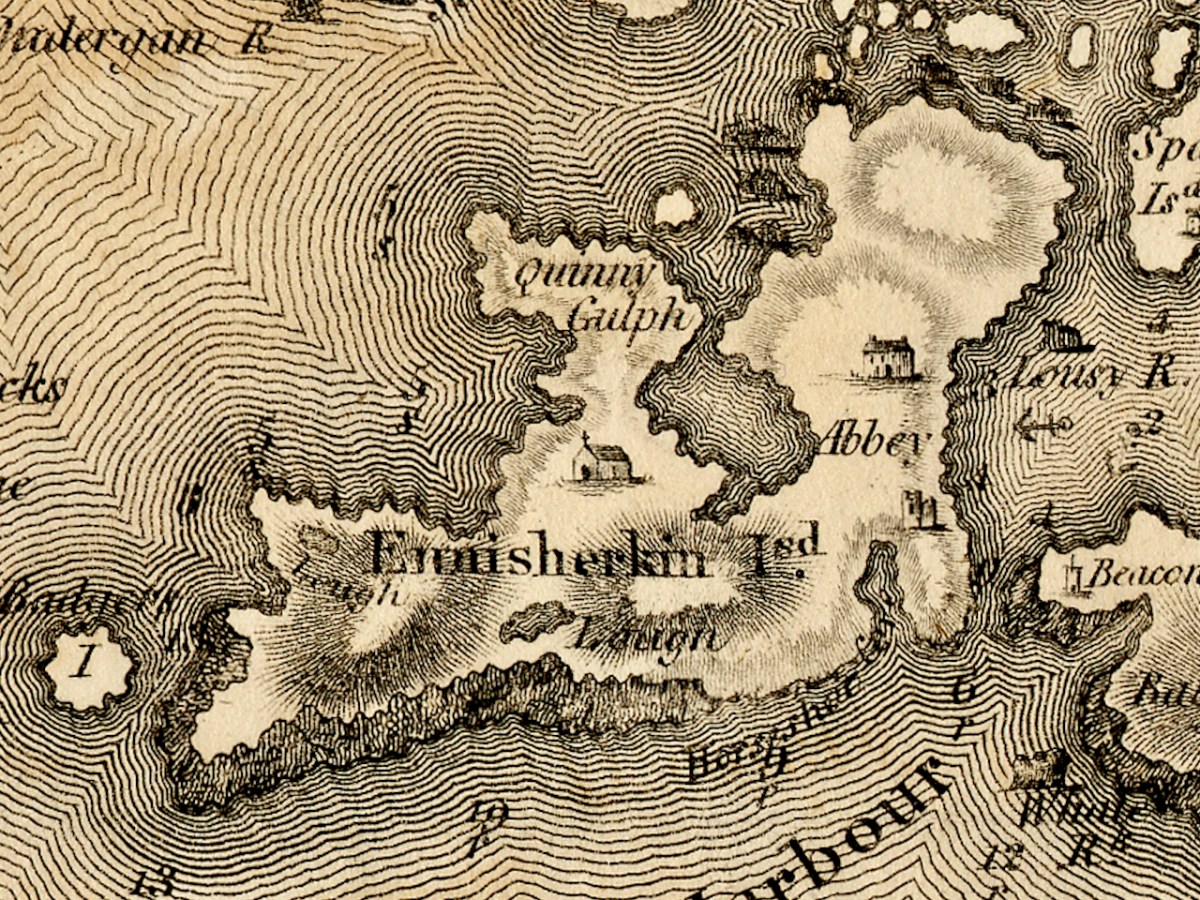
Sherkin Island is shown as Ennisherkin. This is from the Irish Inis Arcán, translating literally as Piglet Island, but likely from the Irish word for porpoise, which is muc mara, or sea-piglet. Anyone who has boated in the area will know how prevalent porpoises are in the seas around the islands. Once again, we have a catholic chapel, and of course the ruined Abbey and castle. Take a look at my post A Walk on Sherkin Island for a taste of what that’s all about. The term Quinny Gulph, by the way, must be Kinnish Harbour, the large bay in the centre of Sherkin. Once again, we have a ‘gentleman’s seat’ on Sherkin, and once again I am asking readers to identify this.
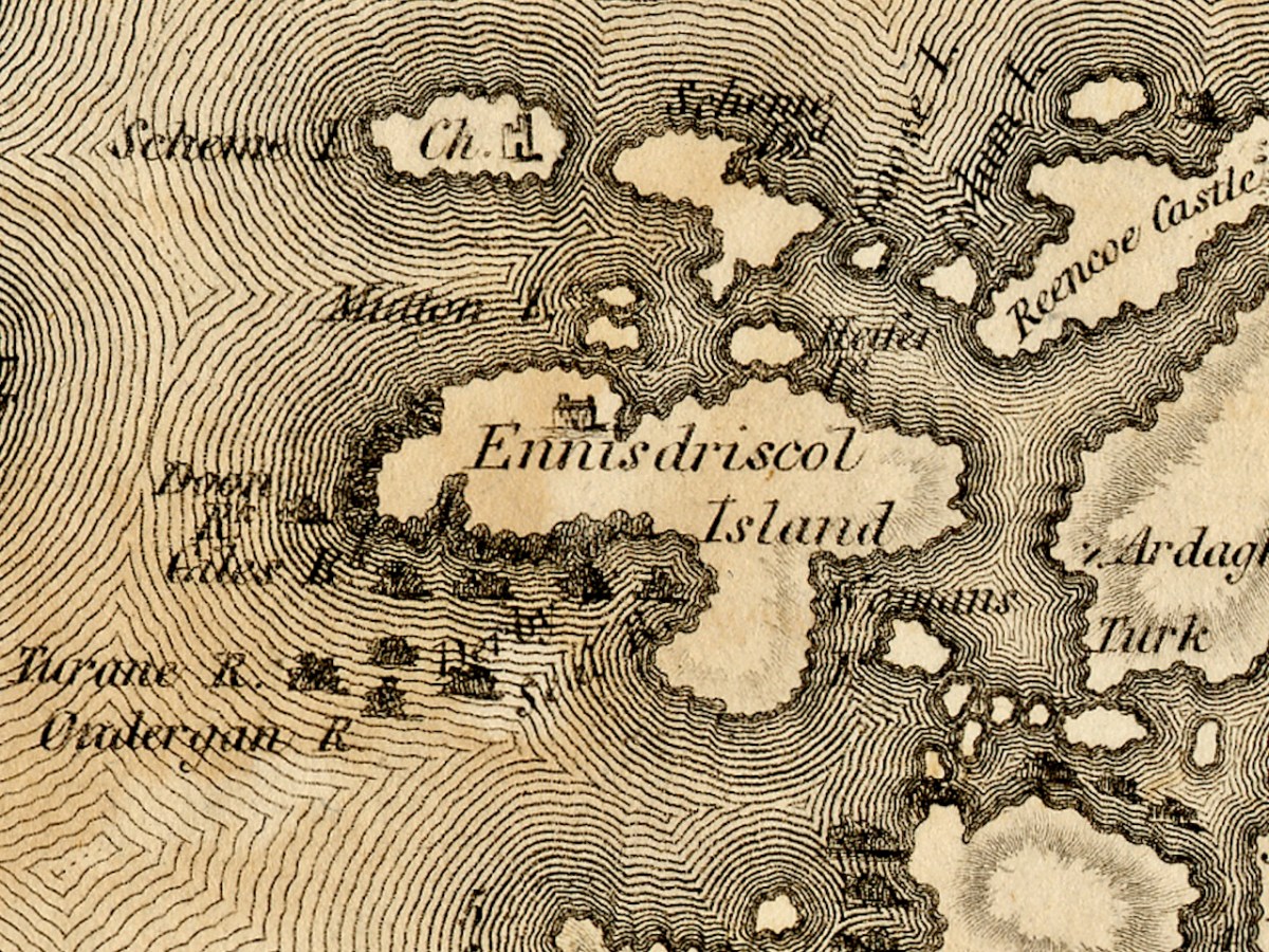
Ennisdriscol Island is of course now called Heir Island – the older name indicating that it was very much the domain of the O’Driscolls in the past. It’s curiously featureless on this map, apart from yet another large house. Right above it are the Skeams, East and West, or the Schemes, as Bath has it. West Skeam has a pre-Romanesque church on it which I have yet to explore – a new blog post one day! I’d better hurry – it’s in a perilous position on the edge of a cliff and much of it has already been swept away.
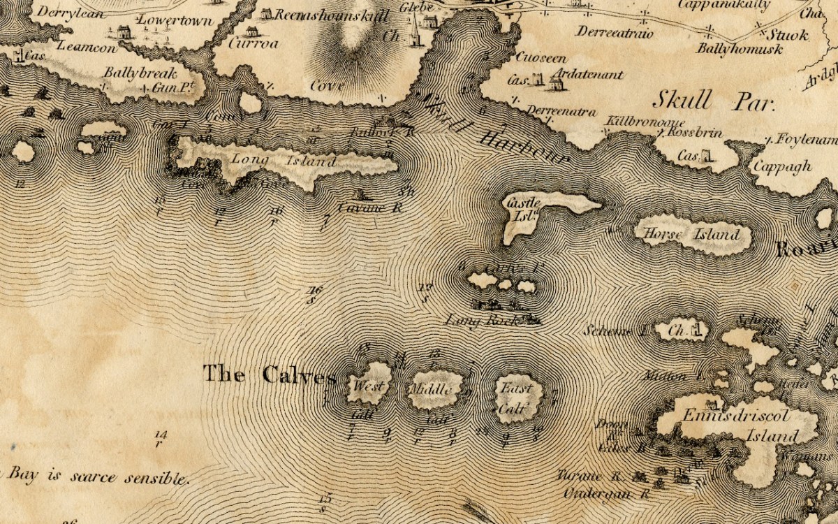
The Calves, now uninhabited, occupy the middle ground of Lough Trasna between the mainland and Cape Clear, while Long Island, Castle Island and Horse Island parallel the coast. Horse Island and Castle Island are each now owned by a single individual, while Long Island still has a resident population of several owners. The vestigial castle on Castle Island is not shown. To the east of Long Island is Goat Island and Goat Island Little – the cleft between them is actually much narrower than appears on Bath’s map and only navigable with care by kayak. It is home to a herd of feral goats.
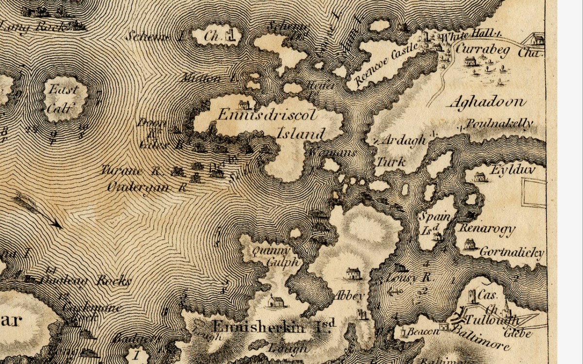
And finally Spain Island, now called Spanish Island, and the western end of Ringarogy. Note that the only one of the small islands scattered between Sherkin, Turk Head and Heir Island that is named on this map, is Woman’s. In fact, there is a tiny rock in this area labelled on modern maps as Two Women’s Rock. The largest island in this group is actually called Sandy Island and the smaller ones are The Catalogues. Note also that the castle now called Rincolisky, is here labelled Reencoe. And let’s include Baltimore, with its castle and – the beacon!
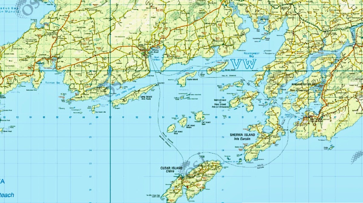
I know we have been a bit forensic about the area I call home – my next post will take a much broader look at West Cork. Here’s a sneak peak.
Discover more from Roaringwater Journal
Subscribe to get the latest posts sent to your email.

The presence of churches on some of the smaller islands indicate, I presume, a reasonably sized population at one time. It is now difficult to picture that in such a small area with so little to offer by way of sustenance – farming was hardly viable though fishing would have provided food.
LikeLike
All the small islands now completely uninhabited or with one holiday home. Sad.
LikeLiked by 1 person
Hi Finola, great to see Roaringwater Journal again but no doubt, you’re missing Robert terribly. May I make a little correction please? The ancient church ruin is actually in West Skeam. My mother, Hester O’Neill nee O’Regan, was born there and talked about the graves that were, even then, being eroded by the sea. Thank you for all your great work.
Brenda
LikeLike
Thanks so much, Brenda – now corrected.
LikeLike
I’m utterly entranced by the mapping of tidal currents on this map. Do you know what the numbers and letters mean for that? I wonder how accurate his nautical mapping was?
LikeLike
Haven’t a clue – I was looking at the land so carefully I missed all the marine data.
LikeLiked by 1 person
Honestly, at first I thought all the lines were decorative, then I saw the comment in an empty area of the tides “not being sensible” (I assume “discernible” is the meaning here) and took a much closer look myself!
LikeLike
Aren’t old maps just fascinating ! The foot-fathom black-and-white British Admiralty marine charts are endlessly more interesting than the modern coloured ones. Astonishng how accurate they are too – all drawn without the aid of satellites etc. These maps from 1811 are also surprisingly accurate geographically.
LikeLike
Yes, and done in the 1790s even. Not toally accurate, mind, which actually makes it all the more interesting.
LikeLike
The maps have so much energy and life to them, and bear a lot of scrutinising. The names are so evocative too.
LikeLike
The names don’t seem to have changed much at all – oddly reassuring. However, see my response to Francis!
LikeLike
I live in a townland that An Post calls Ballycumisk, though I have seen it spelt with a double m. I wonder how the name got there from Ballyhomusk, which is what it seems to have been in 1811.
LikeLike
If you look at Ballycummisk on the logainm site, you’ll see all the variations: https://www.logainm.ie/en/13364
LikeLike
Isn’t that wonderful!? Thank you very much. I won’t get cross with people who spell it “wrong” any more. This is nothing to do with it, really, but I remember once being told that Connemara isn’t so much a geographical entity as a state of mind. I’ve always liked that.
LikeLike
Quinny Gulph on Sherkin is interesting. Many islanders refer to Kinish Harbour as ‘the Cuinne’, though no-one seems to know why. The area where the gentleman’s house is marked once had at least three houses, all owned by the O’Driscolls. One has disappeared into the ground, one is gradually being restored and we live in the third. But I’m not sure that – based on what exists now – any of them would justify the gentleman’s house title.
LikeLike
That’s excellent additional information, Richard – thanks so much. Even the word Kinnish is interesting – I can’t find any Irish word that seems to relate to it, and I can’t find ‘cuinne’ in my dictionary. Dineen has ‘cuigeann, -ginne or -gne, -gneacha, f., a churn (the con- tents, not the vessel); ag déanamh cuiginne, churning.’ I wonder if the water churned in the channel or something like that.
LikeLike
My dad is from near Timoleague. Will have to try and get out to this island some day. Thanks for all the great posts on the history of West Cork.
LikeLike
Thanks! Glad you’re enjoying them.
LikeLiked by 1 person
Ennisdriscoll island!
LikeLike
Ancestral home?
LikeLiked by 1 person