Archaeology, Art and Architecture at the Blasket Centre

Funny how you see different things every time you visit special places. The last time we were at The Blasket Centre on the Dingle Peninsula, a couple of years ago, I immersed myself in the stories of the writers and the Island way of life, which is, after all, the focus of the exhibitions. Given that a visit to the Island itself can be difficult, calling for fine weather conditions, the exhibition is very well done and illustrates well the hardships and perils faced by Island people, as well as their depths of warmth, poetic language, stories and daily tasks. This time, I was equally struck by the building itself, and by the art at its core.

An Muircheartach’s photograph of Peig Sayers, one of the Island writers and the bane of many a struggling Irish Language student (hand up!) forced to study her stories

We had a particular reason for going there last month. Readers will remember my post about Lee Snodgrass, a respected and loved local archaeologist. She and her partner, Paddy O’Leary, had undertaken an archaeological survey of the Blaskets in the 1980s, and their original papers, notes and photographs were still among her possessions. With the blessing of her family, I arranged to deliver them to the Blasket Centre, and that happened last month.

One of the Blasket Island, Inish Tuaisceart, know as An Fear Marbh, The Dead Man, for its distinctive shape

We were welcomed by the Director, Lorcán Ó Cinnéide (below). He was genuinely delighted to receive this package, since it contained information on all the Blasket Islands and not just the Great Blasket, which has naturally received most attentions. The materials will now be catalogued and go into the Centre’s extensive archive, which is available to study on application.

That pleasant task done, we had time for a wander around the Centre and a closer look at the architecture and the art. Robert, a modernist, was very impressed with the design of the building, opened in 1993. All the exhibits inhabit pods off a long central corridor which leads the eye down to a huge end window with a view of the Great Blasket. In this way, it reminded us of the Lexicon Library in Dun Laoghaire, although that’s a much larger building.

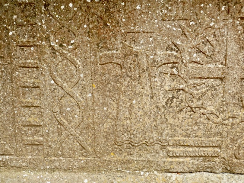
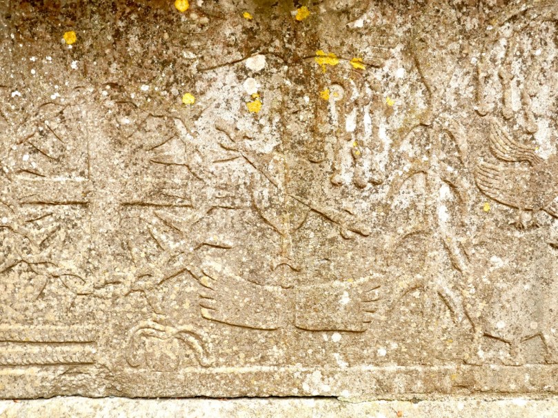
The reception area is circular and contains a striking, enormous and very beautiful glass installation by the artist Róisín de Buitléar, in collaboration with Salah Kawala.

This is not stained glass per se: a plaque explains the process: The panel is composed of over three hundred pieces of plate or window glass. They were each painted with enamel which was then baked into the surface. To complete the process, each piece was textured by melting it in a special kiln in a process known as ‘slumping’, Three and half tons of glass and three tons of steel have been used. It took almost a year to make.

The piece depicts Island life, based on de Buitléar’s extensive research. The steel framework is used imaginatively to form the shape of the currachs, or naomhógs (pronounced nave-ogues) as they are called in West Kerry on one end of the panel (above), and of oars leaning against a wall on the other end (below).

In between are the houses (rectangles of glass superimposed on the panel, above), the fields, and the meandering paths (the glass dots) that the Islanders took to the sea, to the fields and to each other’s houses. De Buitléar explains: Each field is given a colour and texture and some contain symbols associated with them. These include corn stooks and fossil markings, while others are inspired by the texture of bog plants, turf sods, cliffs, the beach and the sea.

As our readers know, I look at a lot of stained glass, but I have never before seen a glass and steel art installation quite like this. Using thoroughly modern technology, but age-old techniques, de Buitléar has depicted Island life in a sumptuously colourful and jaw-droppingly beautiful artwork which greets visitors and sets the tone for what is to come. Gazing at it, and listening to the soft cadences of staff members speaking in Irish behind me, I was transported.

There are several more pieces of art in the Centre, but I will make special mention of just one, located outside. Here we find Michael Quane’s Islandman. An t-Oileanách (The Islandman) by Tomás Ó Criomhthain was published in 1929 and is a classic of Irish literature. Whether or not it is a great book is a matter of some debate (see this Irish Times review, for example) but it is certainly an important one.

Quane’s piece shows Tomás braced against the wind – a wonderful, human take on a true man of the outdoors. Michael Quane, by the way, has featured in Roaringwater Journal before – take a look at this post by Robert.

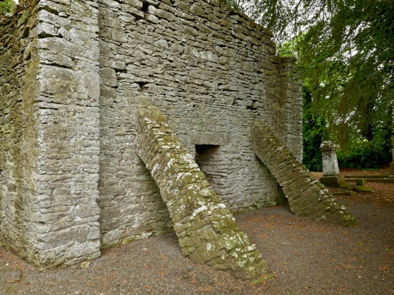
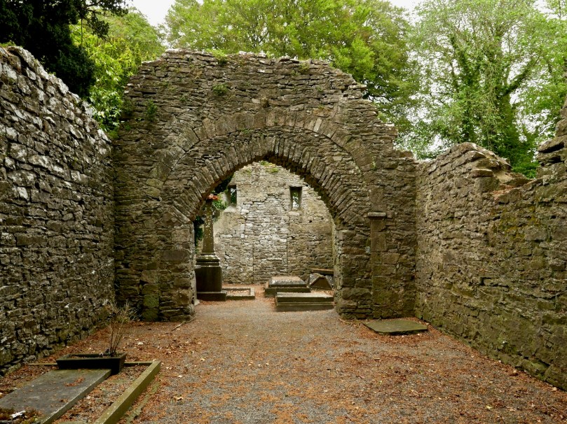
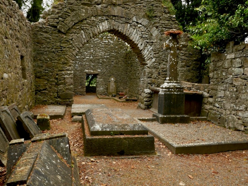
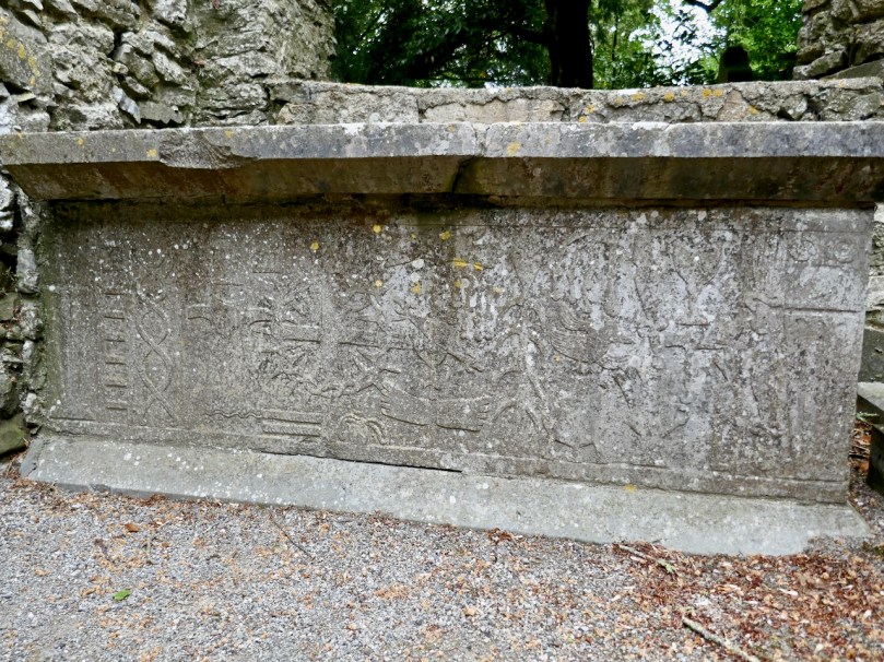
Ó Croimhthain (Prononouced O Cruh-han) is buried nearby – within sight, indeed of the Blasket Centre and his statue. Here is An Muircheartach’s photograph of his final burial place with the Great Blasket as the backdrop. The text that accompanies this photograph says (my translation): Go Farraige Síos: Down to the Sea. The Blaskets lying out there quietly in the sea, The Tiaracht Lighhouse on its right side, the Old Dunquin Graveyard directly on your left if you were standing there, and the man who made Blasket life famous, Tomás Ó Criomhthain, lying in it waiting for eternity.

The Blasket Centre is a full sensory experience. I have only touched on small aspects in this post. You must see it for yourself. Of course, if you can get out to it – don’t forget a trip to the Great Blasket itself. We hope to do this ourselves this year so look out for that post.


York or Cork?

If this seems an enigmatic title, it is reflective of the fact that Finola and I have just visited Yorkshire, where  – for Finola’s birthday – we treated ourselves to a superabundance of medieval architecture and some idyllic wanderings in the Dales (that’s Malham Cove, a spectacular limestone cliff and pavement, above). This set me to thinking about comparisons between the county of Yorkshire and our own County Cork: both are the largest counties in their respective countries, but Yorkshire – at 14,850 km2 – is almost double the area of Cork, 7,500 km2.

The gaunt ruins of Rievaulx Abbey in North Yorkshire: this was the first great Cistercian abbey in Britain, established in 1132. It became one of the most powerful and housed a community of 650 brothers at its peak in the 1160s under its most famous abbot, Aelred

In Ireland we can’t compete with the sheer scale of the monastic settlements that we can see in Yorkshire. However, in spite of those impressive ruins which are so well cared for by the state and the National Trust, nothing can compare, for us, with the timeless serenity and isolated beauty of places such as Kilree, which Finola described in a recent post.

The medieval High Cross at Kilree, Co Kilkenny. This example of ecclesiastical art probably dates from the 8th century and stands remote and seldom visited, deep in rural Ireland – a reclusive gem

I feel that this post gives me an excuse to tell a little Cork / York story that I learned many years ago from Gerald Priestland, the BBC’s religious affairs correspondent from 1977 to 1982 – who lived not far away from me in West Penwith, Cornwall. Priestland was researching the history of the Parish of St Buryan in the far west of the peninsula: the Irish saint, Buriana, was said to be the sister of St Piran, Patron Saint of Cornwall – who, you will know from reading my posts – here, (and here), was born on Cape Clear, just over the water from us in West Cork, where he was known by the name of St Ciarán. Finola is republishing another post about Cape Clear today.

The coast of West Penwith, Cornwall: Gerald Priestland lived here – on the hill, and I lived not far away – over the hill

St Buryan was known as “The Wickedest Parish in Cornwall” in earlier times – I can’t vouch for its present day reputation! This was supposedly because the settlement (which Priestland describes as . . . a bleak and haunted landscape . . .) received a special privilege in the year 936 from the Saxon King Athelstan as he was passing through on his way to defeat the Danes on the Isles of Scilly. He founded an independent College of Priests at St Buryan and layed down that the lands (some 770 acres) . . . are to be exempt from all secular assessment; but not from the rendering of prayers which the clergy have promised me (that is, Athelstan): 100 Masses and 100 Psalters daily . . . The Domesday Book confirms that Buryan maintained its freedom from taxation but also confirms the charter that . . . the privilege and ordinance of sanctuary and aforementioned liberty may not perish through old age . . . That is to say that St Buryan was made a place of sanctuary then, and will remain so always. The consequence of this was that any wrong-doer or fugitive, instead of having to go into exile, could live freely within the parish boundaries without suffering any punishment – forever. So the place filled up with felons, brigands, rogues and villains!

Scenic Yorkshire: landscape of the Dales (just to remind you of the subject of today’s post)!

St Buryan became – and remained – a den of iniquity. So much so that in 1328 the Bishop of Exeter, Grandisson, was forced to excommunicate everyone in the settlement. Priestland writes:

Grandisson came as close to the boundaries of Buryan as he dared, and from the top of St Michael’s Mount – six miles across the water – he pronounced the fulminacio sentencio contra Barianes – the Greater Excommunication against the people of Buryan. The bell was tolled and the book and candles were cast down. There are not many parishes in England that can claim that very specific distinction . . .

Deans continued to be appointed to the parish – and were duly paid a stipend – but none of them ever went there. The last of the absentee Deans was Fitzroy Henry Stanhope, an army officer of ill reputation who had lost a leg at Waterloo (he was known thereafter as ‘Peter Shambles’). He was offered the position at Buryan in 1817 by his Commander-in-Chief, the Duke of York, in lieu of an army pension: it was worth a thousand pounds a year. There was one problem: Stanhope had to be ordained, but no-one could be found to do it. One day the Duke was told that his friend the Bishop of Cork was on Holiday in London. At once Stanhope was sent round in a carriage with the message:

“Dear Cork – Please ordain Stanhope – Yours York”

By sundown, he was back, with the reply:

“Dear York – Stanhope’s ordained – Yours Cork”

This incident has gone down in history as the shortest piece of official correspondence on record. And doubly justifies the title of my post today!

Malham Cove again: this geological formation would have been a huge waterfall as the glaciers began to melt after the last Ice Age. In the lower picture you can see the true scale of the place – look at those figures on the lower ledge! It is a popular spot for climbers

So – Cork, or York? We are very fortunate to be able to travel so easily to see the beautiful places of the world. But – always – the best part of travelling for me is coming home to West Cork: there’s no doubt where my heart is . . .

County Cork landscapes: Mount Gabriel (upper) and our very own view (lower) from Nead an Iolair, taken on the day I returned from Yorkshire. Below – looking across to the Mizen, from the Sheep’s Head.

Off the M8 – Kilree Monastic Site

Kilree is possibly the most perfectly contained and atmospheric site you will visit in Ireland. I defy you not to be enchanted with its leafy depths, its air of antiquity, and evidence of continued use. (I would also vote for Monaincha in Tipperary, a site that deserves its own post one of these days).

When you’re travelling from Cork to Dublin it’s easy to leave the M8 at Cahir and travel cross-country to join the M9. There are numerous sites to visit if you take this option: most recently we have written about Fethard and its Medieval Walls, but we also did a post about Kells Priory a long time ago (The Hallowed Fortress) and it remains one of our favourite sites and one of the most impressive monastic sites in Ireland. And don’t go without your copy of Ireland’s Ancient East by Neil Jackman – it’s our constant companion and a great resource. It’s available on Amazon but why not patronise your favourite bookstore?

Kells Priory, just up the road from Kilree and one of Ireland’s most impressive religious complexes

It’s a great contrast to Kilree. If you haven’t been to Kells Priory yet, try to take them both in, in the same day. What you will see is a typical example of an Early Medieval Irish monastic site (Kilree) and an excellent example of a large 12th to fifteenth century Augustinian Priory built to withstand the turbulent history of Kilkenny in those centuries. The monks in Kilree were living the life of Irish monastics in a pattern set down in the 6th century, while the Augustinians were mainstream European clerics invited over by the Normans.

Inside Kells Priory

The other things about Kilree is that it’s unspoiled (except for one thing – I’ll get to that later) and in Ireland, that means that the farmer who owns the land is using it. There’s a Bull sign on the gate and indeed there he was, with all his frisky bullock friends. We thought our chances of crossing the field were slim, but two friendly ladies on horseback offered to draw the attention of the cattle away from us so off we dashed while they were distracted, not giving much thought to how we might get back again.

Having charged off down the field after the horses (which were on the other side of the hedge) the bullocks, followed at a dignified pace by the bull) ended up beside the high cross so we decided to leave well enough alone and not venture over to that quarter. A distant shot will have to suffice for this post, but you can see excellent images of this cross at the Irish High Crosses website, and we thank them for that since this is the closest we will get for the moment.

But there was so much to see within the monastic enclosure. First, the round tower – it is missing its conical cap but apart from that it’s complete and in good shape. Brian Lalor, in his book The Irish Round Tower, assigns it an 11th century date based partly on the simple doorway. The arch, he points out, has been cut from the soffit of a monolithic lintel which is now cracked.

Crenellations were added to the top in later medieval times (you can see them in the first image) – the tower must have been renovated for some kind of defensive purpose at that time. When the Ordnance Survey folks came around in 1839 it was possible to climb to the top by means of rope ladders. There is no access now, apart from by the rooks and crows who have left evidence of their prodigious nest-building.

Lalor also points out that the round tower is perched on the circular boundary wall of an old churchyard which probably represents the position of the inner rampart of the monastic enclosure. What did such a monastic enclosure look like? I’ve used an illustration from a marvellous book called The Modern Traveller to the Early Irish Church, by Kathleen Hughes and Ann Hamlin (second edition, Four Courts Press, 1997). The site illustrated (Nendrum, County Down) was enclosed by three circular walls, a not-unusual configuration although one and two enclosing walls are also found. There is no real evidence left at Kilree for a second or third wall, but the location of the high cross indicates the likelihood of an outer wall.

The church is of an early form, rectangular, with antae at either end. To understand how this fits in with the architecture of the period, see my post Irish Romanesque – an Introduction. The nave, or main part of the church probably dates to the 10th or 11th century, but a chancel was added later, probably in the 12th century, by means of an inexpert Romanesque arch, which eventually had to be shored up with an even more awkward-looking inner arch.

Upper: East wall with buttresses added in 1945; Lower: The earlier Romanesque arch is clearly visible above the later one

The whole place was repaired by the Office of Public Works in the 1940s and it was they who built the buttresses which have successfully kept the east wall from falling down.

Upper: Looking through the linteled doorway into the nave and the chancel beyond; Lower: Looking towards the nave from the chancel. The chest tomb is on the right

There are several thirteenth to fifteenth century cross slabs within the church but the seventeenth century chest tomb just inside the chancel is the most interesting.

It’s hard to decipher as it’s faded and covered in lichen, but here is the description of it taken from the National Monuments listing:

Latin inscription, in a margin around the edge of the upper slab, was transcribed by Carrigan as, ‘Hic jacet Dns. Richardus Comerford quondam de Danginmore qui obit [date left uncut] et Dna Joanna St. Leger uxor eis pia hospitalis et admodum in omnes misericors matron quae obit 4 die October A. 1622’ and translated as, ’Here lie Mr. Richard Comerford, formerly of Danganmore, who died [left blank] and Johanna St. Leger, his wife, a matron pious, hospitable, and charitable to all, who died Oct 4th, 1622’. The front slab. . . is decorated with the symbols of the Passion flanked with stylised fluted pillars which taper towards the base. The symbols from dexter to sinister include a ladder, entwined ropes, a spear, dice and a seamless garment, 30 pieces of silver and beside them a bag with two straps, a cross ringed with a crown of thorns, a heart pierced with nails and pierced hands and feet above and below this, a scourge on either side of a plant, a cock on a three-legged pot, a sword, a chalice, a hammer, and pincer holding 3 nails and two sheaves of wheat. 

Can you recognise the details from the NM description?

Outside the church, the graveyard is quiet and picturesque, but I couldn’t help noticing the absence of vegetation of any sort. Older photographs I have seen show a covering of grass, and I suspect that somebody has been in here with the Roundup – I told you I would get to the one problem I have with this site, and this is it. It may be historically and archaeologically fascinating and important, but the ground itself is a dead zone – no biodiversity here. And that’s a pity because there was a swarm of bees about to settle in one of the trees. They will have to look outside the site for pollen.

We saw many old gravestones, dating from the early eighteenth century and into the current day. But the one that caught my eye was this one – all the instruments of the passion clearly carved for John Brenan, who died in 1772. Can you recognise and name them all?

I know you’re wondering how we made it back across the field. Well fortunately, the cattle stayed over by the hight cross and we sneaked back across without attracting their attention. I can’t decide whether their presence added to the experience or not, but it certainly made it more exciting, even though we didn’t get to see the high cross up close. Kilrea is a very special place, I think. I am hoping that next time we go back the grass will have been allowed to grow again.

Oldest Lighthouse in the World!

It’s a bit off the beaten track, but we had to make the journey to visit the oldest working lighthouse in the world! It’s right at the southern tip of the Hook Peninsula, in County Wexford. Maybe it’s an extravagant claim that it is the ‘oldest in the world’: there is another ‘oldest’ lighthouse – The Tower of Hercules – in Galicia, northern Spain, which is said to have been built in the 2nd century. However, the Tower of Hercules was given a major restoration at the end of the 18th century, including a new neoclassical facade, with the original Roman structure retained behind this. Wexford’s assertion that the main visible structure of the Hook Lighthouse – both inside and out – is exactly what was built in the 13th century, perhaps gives it the edge. I was delighted to find, incidentally, that the Tower of Hercules has an Irish connection: it is mentioned in the 11th century Lebor Gabála Érenn (The Book of the Invasions of Ireland). If you recall my account of the story of Cesaire – the first person ever to set foot on Irish soil – you will remember that on her travels away from Egypt in the years before the Great Flood Cesaire stopped off in Spain and climbed to the top of a very tall tower from which she could see, in the distance, Ireland’s wonderful green land, and from there she travelled on to arrive on Ireland’s shores in Bantry Bay. Well, according to tradition, it was the Tower of Hercules which she climbed!

Header – the bulky main structure of the tower dates from the 13th century – its walls are four metres thick. The chambers within the tower are stone vaulted (above)

The lowest tier of the tower consists of three storeys, and has a base diameter of 13 metres. Each storey has a vaulted stone ceiling. Above this is the narrower section – 6 metres in diameter – which would have supported the original brazier, kept burning at all times to warn ships of the rocky ‘Hook’ of land at the entrance to the channel leading up to the port of New Ross – the most important in Ireland in the 13th century.

Upper – an exploded view of the structure of the lighthouse, one of the exhibits on the guided tour; centre – the whole tower: the topmost section, housing the electric lighting system, is relatively modern; lower – the treacherous rocks around the shore of the Hook 

But there was, in fact, a light burning on this headland for hundreds of years before the construction we see today: this was a beacon fire established by Saint Dubhán, a monk from Wales, in the 5th century. Dubhán came to Ireland as a missionary, and built his monastic settlement a little way inland: this is marked today by the medieval ruins of a church and burial ground.

Dubhán’s monastic site not far from Hook Head. It was the saint who set up the first beacon light on this peninsula

The lighthouse we see today was built by Strongbow’s son-in-law William Marshall, Earl of Pembroke (1147 – 1219). He constructed it and made sure that the light was maintained in perpetuity to fulfil a promise he made when he was threatened with shipwreck off the Hook while trying to get into the port of New Ross. Marshall is one of the medieval hero-warriors: known as ‘The Greatest Knight’ he is at the centre of many legends. Turtle Bunbury gives a good account of him here.

William Marshall, Earl of Pembroke is very much in evidence at Hook Head: you can even hear him telling his own story when you are in the lighthouse (above)!

If you find your way to Hook Head Lighthouse today you are in for many treats. Firstly, it’s good to know that it is open to visitors all the year round, and guided tours are always available (you can only go inside the tower with a guide). Also there is a welcome heritage centre on site with a shop and cafe – and a fine pirate-themed children’s playground.

Saint Dubhán and his followers are remembered through the displays in Hook Head Lighthouse: the mural above shows the first beacon established by the 5th century saint

It’s a grand day out, if you happen to be within reach of the Wexford coast. There are so many strands of Ireland’s multi-facetted history to be traced here: the earliest missionary monks, Norman Knights, sea-travel through the ages, connections with the medieval world – and a wonderful piece of early Irish architecture still serving its original function.

Off the M8: Fethard Walled Town

Fethard is nestled snugly in Tipperary’s Golden Vale, famously rich agricultural land, and is nowadays well-known for raising legendary race horses. But it also happens to be the town in Ireland with the most intact set of medieval walls. The map above (taken from Fethard’s Conservation and Management Plan) shows how the town would have looked in the 1850s when George Victor du Noyer came through.

We drive the M8 often and we’re always looking for ways to vary the journey, so this post is part of our ‘Off the M8’ series. Fethard is an easy detour: if you’re heading north, leave the M8 at Exit 10 just after Cahir and re-join it at Horse and Jockey or at Urlingford. You’ll be travelling along lovely quiet roads parallel to the motorway and depending on how much time you spend in Fethard, the whole detour should add a couple of hours (or maybe three) to your journey.

Fethard also happens to have some lovely old shop fronts. This one dates to 1770

We started off at the visitor centre in the old Tholsel, or Town Hall. It’s been nicely restored and features an excellent audio-visual presentation, and upstairs many colourful explanatory panels. The staff was friendly and very informative, with an obvious passion for their town and its history.

From the Tholsel Visitor Centre, you look down over Trinity Church and the walls

The town was founded around 1200, and walled soon after, when Edward I granted the right to raise money through what was known as ‘murage grants’. This continued over the next couple of centuries, in fact most of the walls were built (or rebuilt) in the 15th century. We tend to think of town walls as primarily for defensive purposes, and indeed the town was attacked on more than one occasions. But walls were also important demarcations of commerce. The market was held within the walls and according to Tadhg O’Keefe (in the Irish Historic Towns Atlas):

The walls were a barrier through which those wishing to trade in Fethard had to enter, so they articulated, especially with guarded gateways, the differences of privilege and opportunity between those who lived within and those who entered from without.

There is only one gate left, the North Gate, which we actually didn’t see. But when our old friend Du Noyer came through in the 1850s there was still a gate at the west end of the town (below). It guarded the entrance at the bridge known as Madam’s Bridge and had what O’Keefe describes as a rare type of Gate incorporating a three story fifteenth century tower house.

Despite the walls, the town was attacked and burned on several occasion – but not (unlike so many Irish towns) by Cromwell! In fact, the town surrendered, under terms, and was spared the violent destruction that the Parliamentary army visited on so many other Irish towns. This doesn’t exactly make Cromwell popular in Fethard, in fact there is still a tradition in the town that ‘people will not go out the way that Cromwell came in’ so that funerals, for example, take a circuitous route to the cemetery to avoid retracing his tracks.

Like Youghal, the other Irish town with a significant extent of wall, there were tower houses along the wall, and within the town there were fortified town houses. Some are obvious and some are hidden behind more modern facades. Court Castle is one of the obvious ones, but the house next to it, known as the Watergate House, has a base batter that marks it out as fifteenth century (both images, below).

Within the walls and behind the Tholsel is Trinity Church. Because there is so much going on in and around it, I will quote the Buildings of Ireland summary in full:

Like the Town Hall and the Augustinian Abbey, the medieval parish church is a multi-period building of outstanding architectural, archaeological and historical importance. The church stands at the heart of the medieval walled town and the focus for the extraordinary number of late medieval structures arranged around the sides of the graveyard with rear entrances allowing direct access to the graveyard. The size and design of the church reflect Fethard’s prosperity in the medieval and early modern periods, the different types of windows, from different eras, emphasise the continuity of use. The impressive tower, that is highly visible for a considerable distance, is a particularly important and dramatic example of fifteenth-century craftsmanship, and is especially evocative of the medieval era as it stands picturesquely and appropriately inside the almost entirely intact medieval town wall and close to a impressively rare grouping of late medieval houses and almshouses. The interior has a finely crafted timber screen to the vestibule, and at the east end a stained-glass window with Eucharistic motifs, both highly decorative, and showing care and attention in the design as well as the execution. The recently timber roof to the nave, recently dated to of c.1489, is of exceptional importance as it is one of a small number of medieval roofs surviving in Ireland and is almost entirely intact.

Trinity, the graveyard and medieval church remains on the left and the town walls on the right

Unfortunately, the church itself was closed when we were there. It’s still very much in use, though, and there was some tidying up taking place in the graveyard. I’d like to go back for another poke around sometime.

Down by the Watergate we came across one of Fethard’s two Sheela-na-gigs. (See this post for more about the Sheelas). This one is typical – a female figure displaying her genitalia, but unusual in her emaciated form with ribs clearly shown, staring eyes and a grimace. We didn’t have time to see the other one, which means a) you (yes, you, Dear Reader) have to, and let us know and b) we have to go back.

We also met Fethard’s famous geese down here too, along with their owner. They are pets, he told us, but don’t go too near the male as he is guarding the female carefully at the moment as she is just taking a little break from sitting on eggs.

The walls are extensive, with long stretches very much intact. Edmund’s Castle and a mural tower known as Fethard Castle punctuate the wall on the river side.

I was fascinated by the flowers growing all over the walls. I expected Ivy-leaved Toadflax and Wallflowers, but it was fun to see Fairy Foxglove also: it’s an alpine plant and so it likes high rocky places. The only other place I have seen it here is on the Martello Tower at Illnacullen/Garnish Island, off Glengarriff.

Upper: Fethard Tower, with Trinity Church bell tower behind the wall. Lower: Fairy Foxglove growing high on the wall

Because it also happens to be the end wall of people’s gardens, the wall is breached here and there by entries to residences – not something I was expecting to see, and probably not something that would be allowed nowadays.

The wall is part of a living town, so it has not always been considered untouchable

We rounded out our visit with an excellent lunch at Emily’s Tea Room before resuming our journey. Fethard was a surprise – an amazingly intact slice of medieval history!

nnnn

Lady Carbery’s High Cross

Wherever we travel in Ireland, I search out medieval high crosses. They are the epitome of ancient Irish art: this link will take you to a number of earlier posts which explore the subject.

It’s ironic, perhaps, that I haven’t yet discussed Ireland’s tallest high cross, which is in West Cork, not far from where we live. At 9.2 metres tall, it outshines the West Cross at Monasterboice, which is just 7 metres. However, Lady Carbery’s High Cross is not medieval – it was built on a hilltop with sweeping views over Long Strand, distant Galley Head and as far west as the Fastnet in 1902, in memory of her husband.

. . . Windswept Croachna Hill, just over the rise from Castle Freke, faces out towards the Atlantic and the sunset, as well as the mystic isle of Moy Mell, and a dangerous submerged rock of the same name. Here, in 1901, in view of the countless sailors who would pass and re-pass through the years, Grandmother had caused to be erected a huge cross as a monument to her first husband Algy, the last Carbery to spend his life in these parts and to make his home in County Cork. Fourteen tons of white limestone rise thirty feet into the sky. There are seven panels, each with sculptured designs from the Bible. The inscription on the east face reads: “To the greater glory of God, and in loving memory of Algernon William George, 9th Baron Carbery, who was born 9th September 1868 and who died 12th June 1898. This Cross has been erected by Mary, his wife, 1901. The souls of the righteous are in the hand of God, they are in peace” . . .

Lady Mary Carbery wrote a journal following her husband’s death. It remained private until a century later, when her grandson Jeremy Sandford published much of it, together with his own commentary – the paragraph above is his. Recently widowed and sole mistress of the vast neo-medieval Castle Freke overlooking a remote headland in West Cork, Mary raised her young family in the company of servants, dependants and occasional visitors. Reflective and sensitive, Mary Carbery was deeply attuned to the spirit of place and to the people she lived amongst in Rosscarbery, studying Irish and taking note of local speech, folklife and customs. It’s no wonder that the memorial cross she commissioned from white limestone should have been such a tribute to the flowering of Irish art in the medieval period.


Algernon was the 9th Baron of Carbery. After his death, Mary stayed at Castle Freke long enough to see through a significant restoration following a fire in 1910, then met and married Professor Arthur Wellesley Sandford of Frankfield House, County Cork. She was evidently quite a character, a prolific writer and traveller: she spent some years travelling across Europe in Creeping Jenny, a caravan drawn by white oxen, and is credited with being the first person to install a bath in a mobile home. Meanwhile, the castle was taken over by her son John – the 10th Baron, an early aviator, who sold it in 1919 and took off for Kenya, where he joined the hedonistic Happy Valley community, infamous during the 20s and 30s for its decadent lifestyles, drug use and sexual promiscuity. During the latter part of the 20th century the castle fell into disrepair.

Changing fortunes: Lord Carbery’s monoplane in 1914; Castle Freke in reasonable condition, pre 1950, and the Castle in the present day undergoing renovation by Stephen Evans-Freke, son of the 11th Baron Carbery

We are fortunate that some parts of the former estate at Castle Freke are maintained by Coillte, the State-owned forestry business, and are publicly accessible. This includes the high cross, accessed by a footpath from the Long Strand.

The Coillte path up to the cross, leading from the car park at Long Strand. In the lower picture Gill and I give an idea of the scale of the monument

Take the opportunity to have a look at the old parish church of Rathbarry, also in the Castle Freke demense. Built in 1825, it closed in 1927, and is now an atmospheric ruin. Algernon, the 9th Baron, and Lady Mary commissioned some of the striking mosaic work which can still be seen.

I found a number of entries in the Duchas Folklore Collection centred on the  Long Strand, Red Strand and Castlefreke areas. They could make a good future post, but to finish off for now, here is just one: recounted by Denis Collins, aged 60, from Castlefreke, Duchas Collection, 1937 – “The Hidden Treasure of Castlefreke”:

. . . Two children from Rosscarbery wandered away from their home one day. They did not return to dinner nor to tea so their mother got very anxious about them because it was the time that the fairies were supposed to be about. She searched everywhere but in vain and it was said that they were spirited by the fairies. Many years afterwards a young man and woman came into the town of Ross. When the people of the town saw them they were afraid of them, but found to their surprise that they were the two children. When asked where they were all that time they said that they were taken away by fairies to a certain fort in Castlefreke where there was a treasure hidden. No one ever looked for the treasure as it is said to be guarded by a fairy . . .