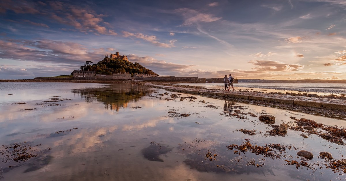
For a part of my life I lived in the west of Cornwall, looking out over St Michael’s Mount (above). Back in the 5th century, the Archangel himself appeared to fishermen on that rock. Legend has it that the Mount was constructed by giants and, also, King Arthur battled and defeated a giant there. As you all know, we have just passed Michaelmas – the day of the saint – September 29th.
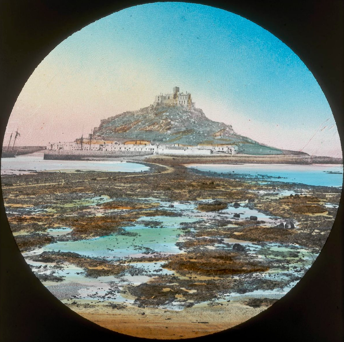
There is another ‘St Michael’s Mount’ on the coast of Brittany: Mont St Michel (above, from an old lantern slide). I have mixed memories of that place, having gone there on a school trip when I was twelve: I had all my hard-saved pocket money stolen from me in one of the little winding lanes that goes up to the summit. Michael is the patron saint of high places, so expect to find him on pinnacles.
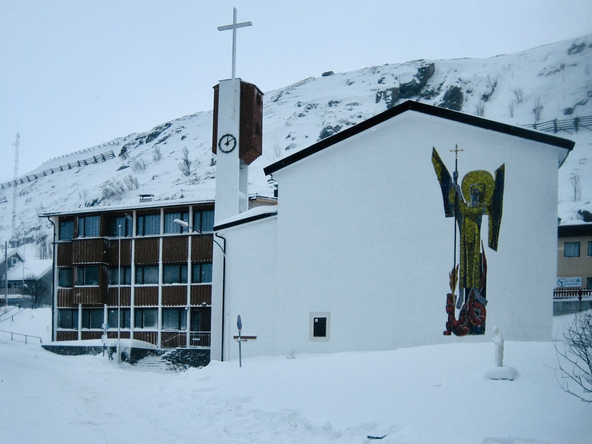
This St Michael’s church is certainly in a high place. It’s at Hammerfest in Norway, and has the distinction of being geographically the highest church in the world! (image by Manxruler)
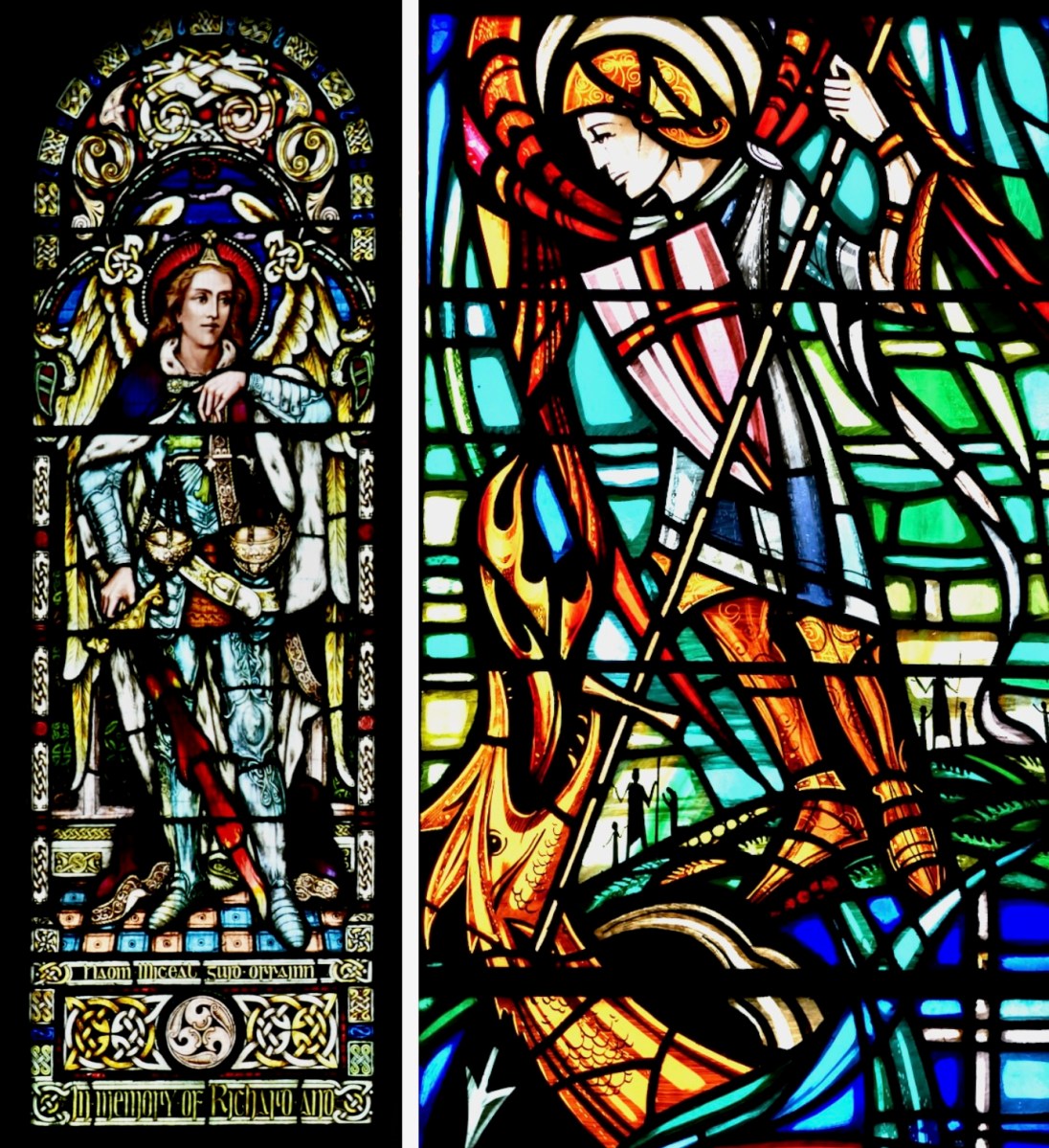
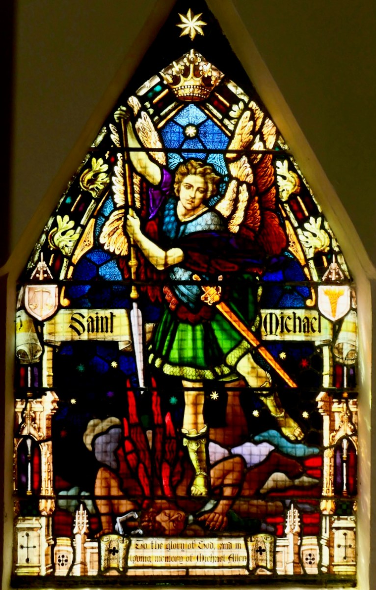
I asked Finola if there was very much in the way of St Michael imagery in Irish stained glass. There’s a fair bit: on the left, above, is a Watsons of Youghal image of the Archangel in his role as weigher of souls. He stands at the gates of Heaven waiting for you on Judgment Day with his scales in his hand. Often, beside him, angels hold up two books: the smaller one records the names of the blessed, while the larger book is a list of the damned… On the right is our friend George Walsh’s depiction of Michael defeating Satan, who here takes the form of an impressive dragon.
This St Michael is very local to us: it’s in Teampall Church at Toormore, and is by Clokey of Belfast (Finola’s photo). Look carefully and you’ll see the Saint pinning down the fire-breathing Devil.
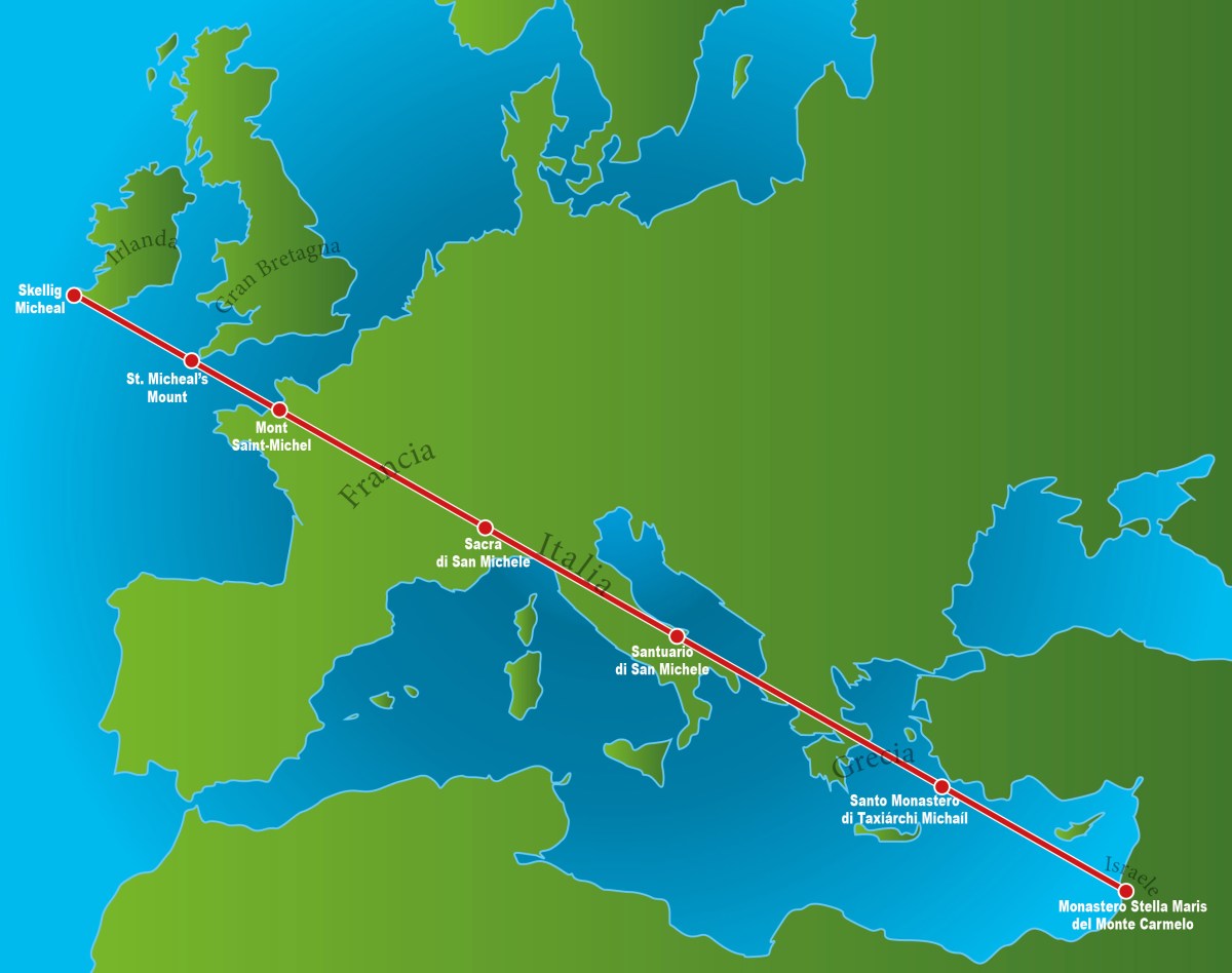
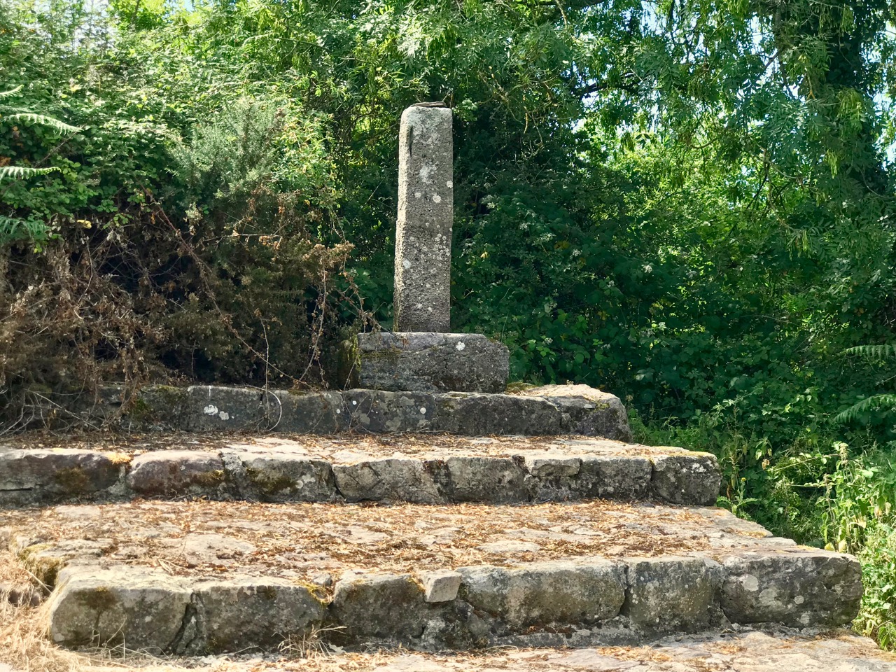
Also in my distant youth I was an ephemeral chaser of ley-lines: I have since thought better of it, but the idea of a straight line starting in Ireland and connecting seven St Michael sites while traversing Europe and Greece was attractive, and fleetingly convincing. Of course, there are many more Michael sites scattered around the Christian world which don’t fall anywhere near this line.
. . . As with other ley lines, no scientific evidence indicates that the alignment was planned and meaningful, making the claim pseudoscientific, but commonly reported at these sites. Physicist Luca Amendola noted that the deviation of these sites from the loxodrome that allegedly connects them ranges between 14 km and 42 km. According to legend the Sacred Line of Saint Michael the Archangel represents the blow the Saint inflicted the Devil, sending him to hell. Some also say that it is a reminder from Saint Michael that the faithful are expected to be righteous, walking the straight path . . .
Wikipedia
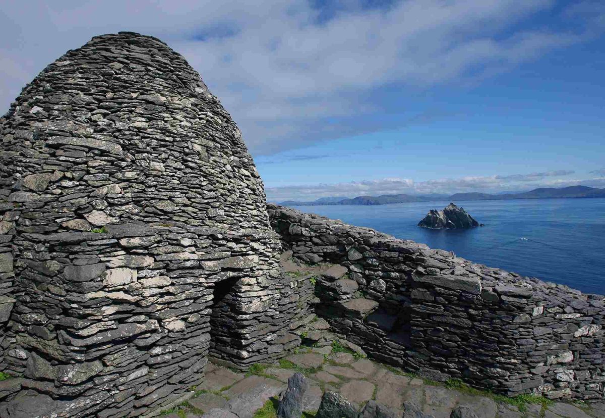
It’s nice to see that the phenomenon starts (or finishes) at Skellig Micheal, off the coast of Kerry (pic below courtesy of OPW):
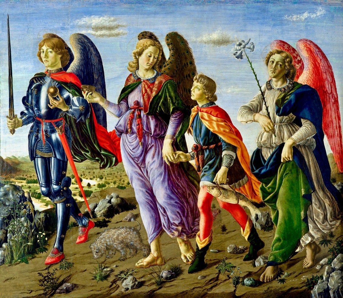
Here’s an interesting view of the three somewhat feminine Archangels painted by Francesco Botticini in 1470. Michael is on the left. With them is Tobias who, in the popular Biblical tale, overcomes obstacles as he and his heavenly guardians set out to discover a cure for his father Tobit’s blindness. They are successful, for Tobias returns with a cure for his father as well as a wife!
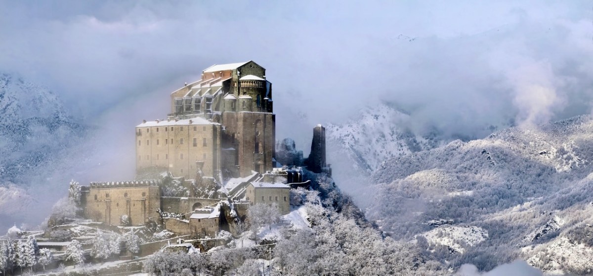
I couldn’t resist this wonderful image of a St Michael’s site (from Wikipedia). It is the tenth-century Sacra di San Michele on Mount Pirchiriano in Italy. It also happens to be on the Saint’s ley-line!
I’ll finish this little review of St Michael where I started – off the coast of Cornwall. This 1920s postcard of the Mount, from a painting by A R Quinton, sums up the romantic image which I still carry from my days lived on that coast.
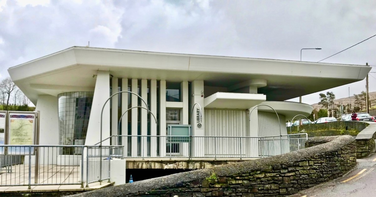
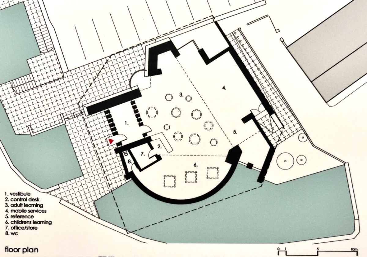
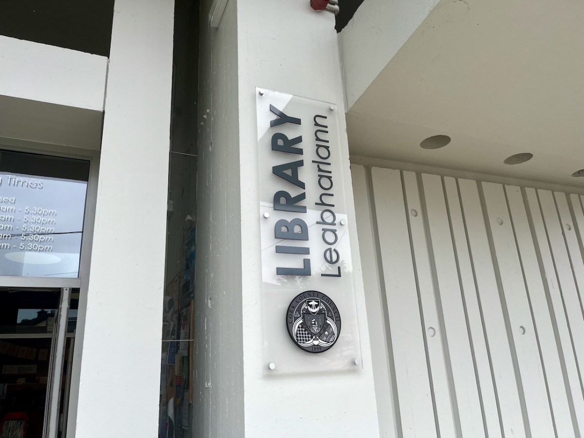
In last week’s post I described a unique type of boat that was connected with Bantry, here in West Cork. Today we are also focussed on Bantry, but this time on architecture: the Public Library, which is one of the most unusual and innovative buildings from twentieth century Ireland.
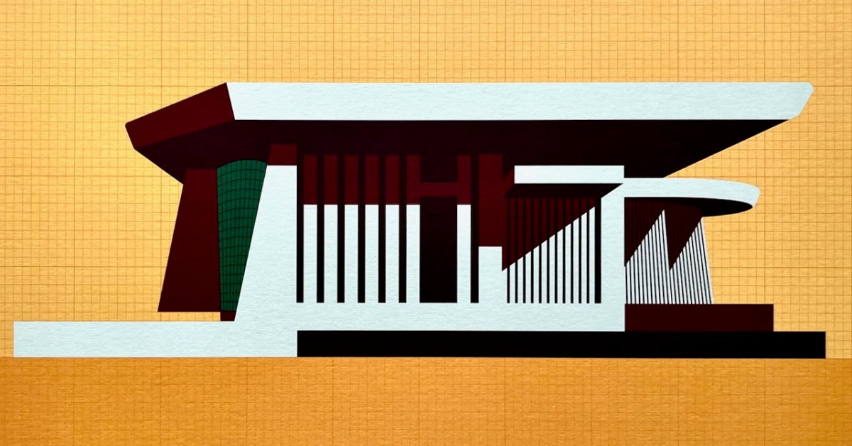
Here is the building as we see it today. The header is a limited edition print, a collaboration between Dermot Harrington of Cook Architects and Robin Foley of Hurrah Hurrah celebrating the upcoming 50th Anniversary of the completion of Bantry Library in 1974. For me, the print captures perfectly the iconic graphic of this most unorthodox design.
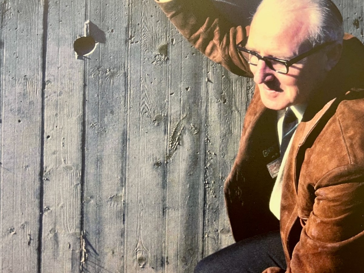
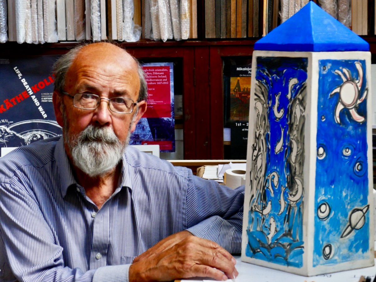
The Library was conceived by Patrick McSweeney (above) – Cork County Architect between 1953 and 1975. He deserves a post of his own one day, as he was responsible for some outstanding buildings in the county. Two of his assistants in the Architect’s Department at the time were Brian Lalor and John Verling. Both had a hand in the genesis of the Library. Interestingly for us, McSweeney, Lalor and Verling were all living around Ballydehob in those days – it was a swinging village!
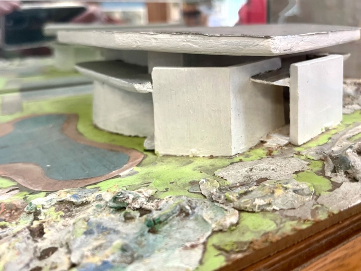
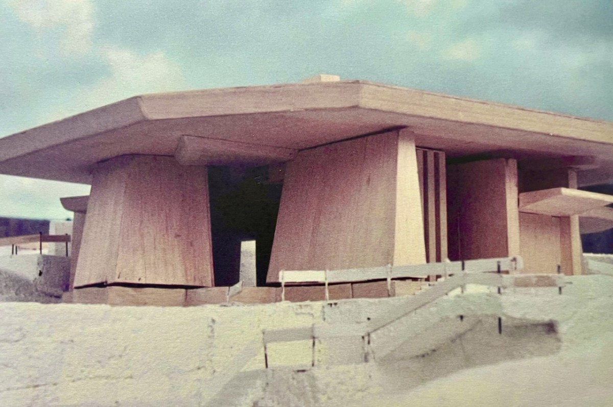
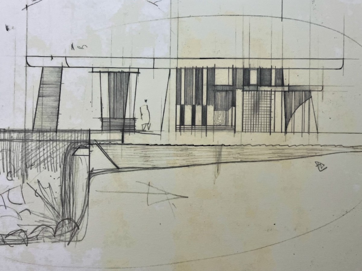
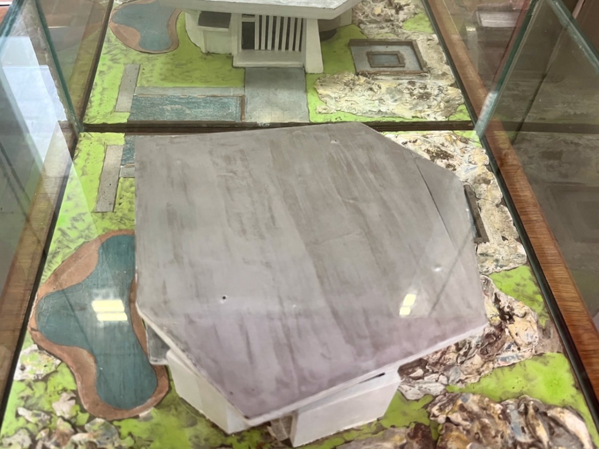
In the era before computers were universal in architects’ offices, everything was drawn by hand – or modelled. Brian recalls that Pat (McSweeney) called him into the office one day, handed him cardboard, tape and scissors, and instructed him to make a model of a building shaped like a Bronze Age dolmen. And he wanted it made in a hurry! It could well have been the one shown above – which still exists. Remarkably, although this model was made in the early 1960s, the building that resulted in the 1970s was very similar in form. Later, John Verling produced a balsa-wood model upon which the design production drawings were based:
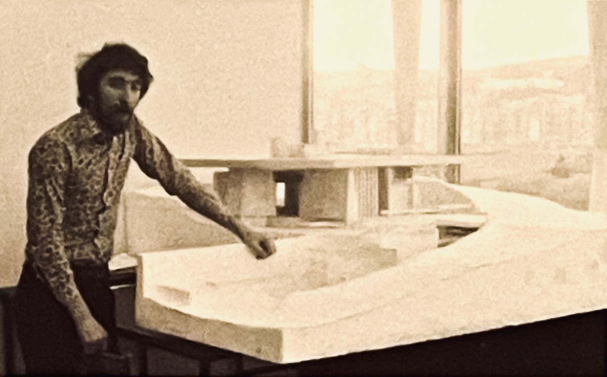
That’s John Verling, above, with his model. He and his wife, Noelle, are the subjects of the current exhibition in the Ballydehob Arts Museum (click the link). Following are some of the design sketches carried out by Harry Wallace who was leading the team in County Hall, and detailed drawings of the building that eventually ensued.
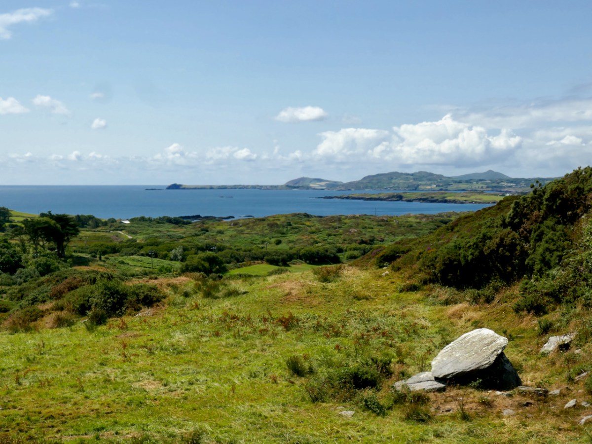
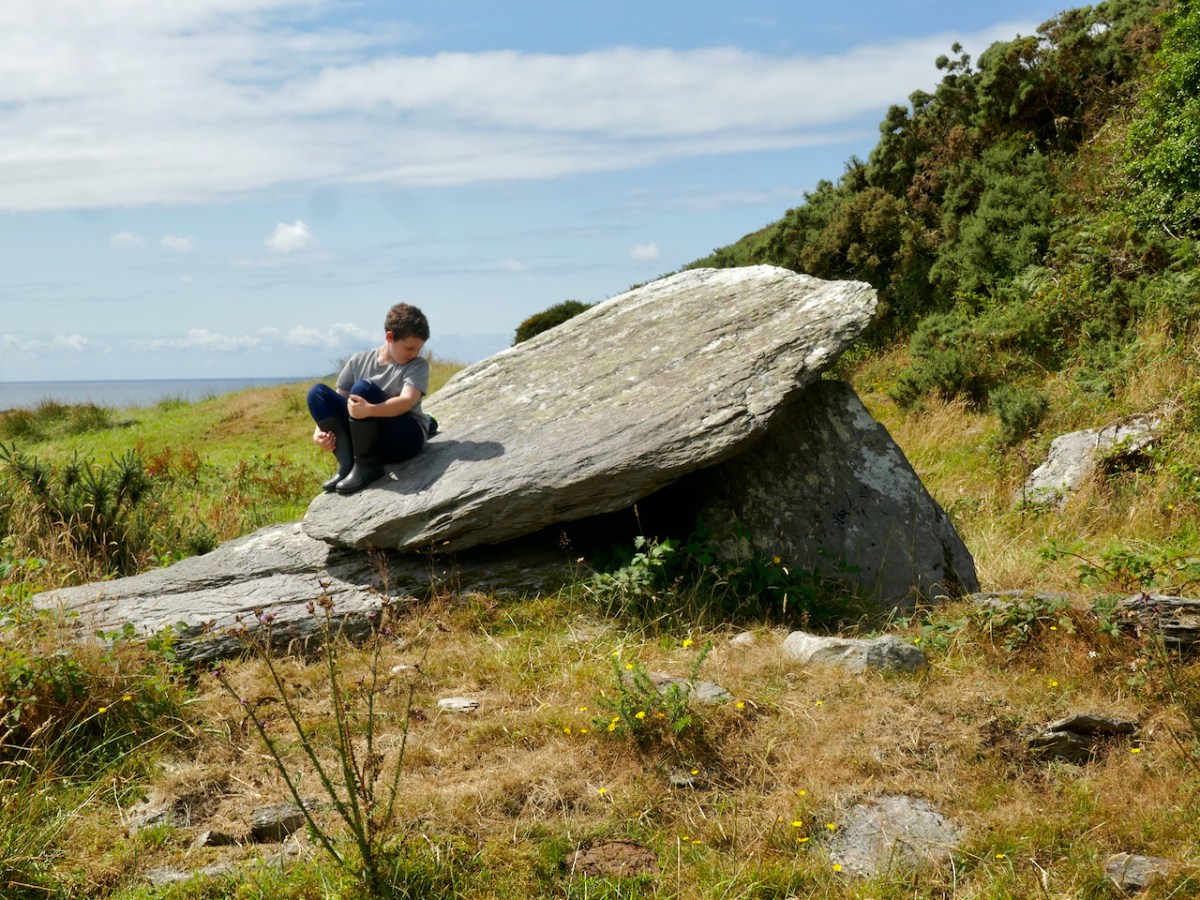
Let’s look a bit further at the early concept work, especially that first model. It’s said that McSweeney was inspired by a ‘Dolmen’. In fact we would today call that type of early megalithic structure a ‘Wedge Tomb’ or a ‘Portal Tomb’. At its simplest, this is a large flat stone slab (or slabs) supported on vertical stone slabs: it was probably a burial chamber, perhaps with its opening facing the sunset at a particular solar event. The closest such tomb structure to Ballydehob is the one featured in Finola’s post today. I wonder if Pat McSweeney was aware of this local one? He would have certainly been aware of the striking example at Altar, further west on the Mizen Pensinsula.
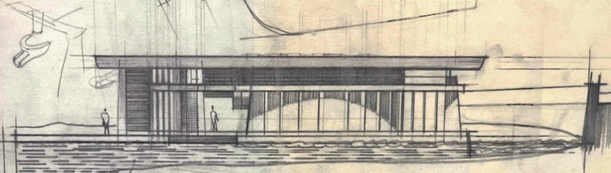
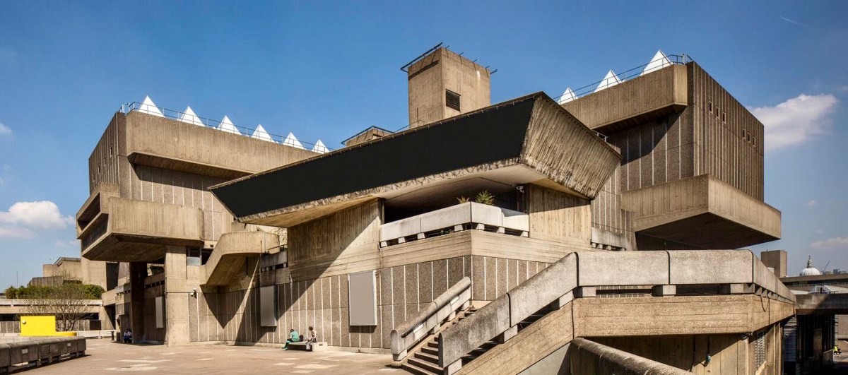
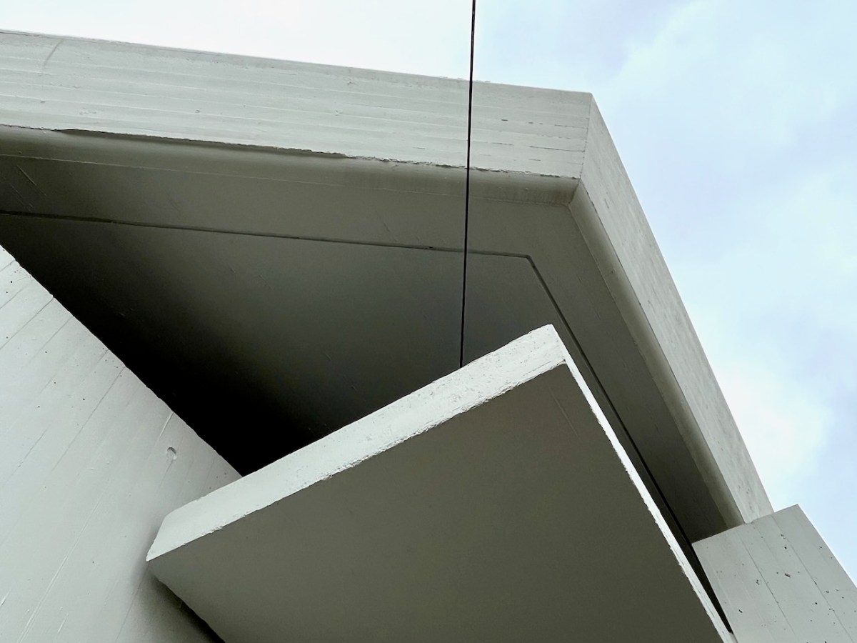
Returning to the twentieth century, and the Bantry Library project, construction posed many problems, using techniques which might have been considered at the leading edge of architecture in its time and place. Across the sea similar experiments were taking place. I was at the centre of them! I completed my architectural education in the late 1960s and went to work for the Greater London Council. I saw going up around me on the South Bank of the Thames a development which included the Hayward Gallery (below): its design (described as ‘brutalist’), earned it the nomination of the ugliest building in Britain when it opened!
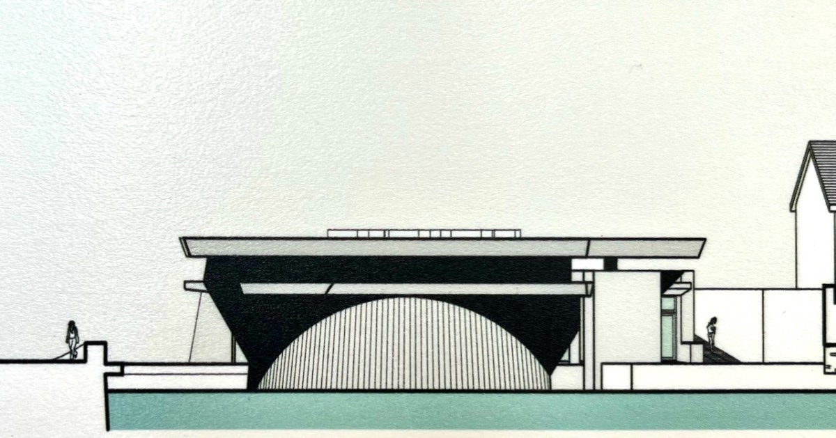
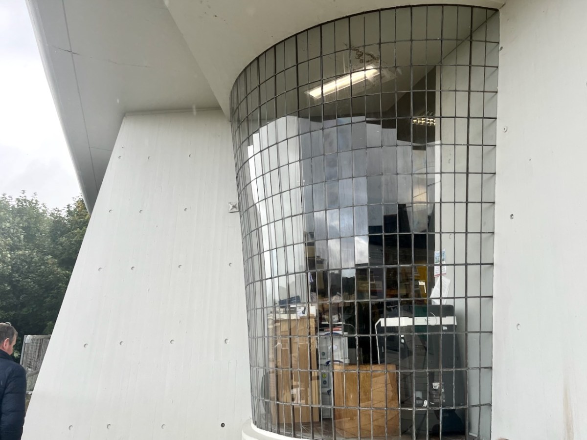
Larger in scale, this complex exhibits some of the features we see in Bantry: shutter-marked mass concrete, frameless glazing, bold overhanging roof planes… The Library roof cantilevers six metres in one part of the building.
The status of this building as an unique example of modernist architecture in Ireland has recently been recognised with a Heritage Council grant of over €250,000 to carry out refurbishments to some of the major elements.
. . . As Bantry Library approaches its 50th anniversary, we are committed to safeguarding this important building. As a protected structure within an Architectural Conservation Area, Cork County Council recognizes its responsibility to preserve and protect Bantry Library for future generations. The conservation works will take place during 2023, and we look forward to seeing the library restored to its former glory . . .
Tim Lucey, Chief Executive, Cork County Council
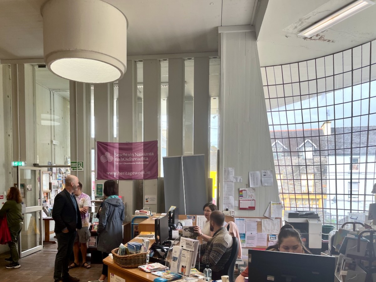
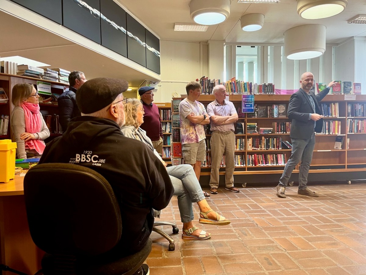
A Heritage Week talk was given by Dermot Harrington of Cook Architects at the Library (below). It was a most informative review of the building and its history.
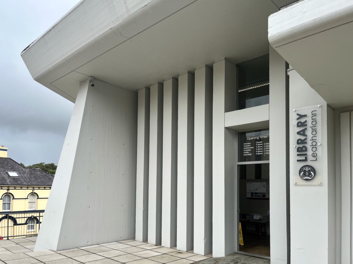
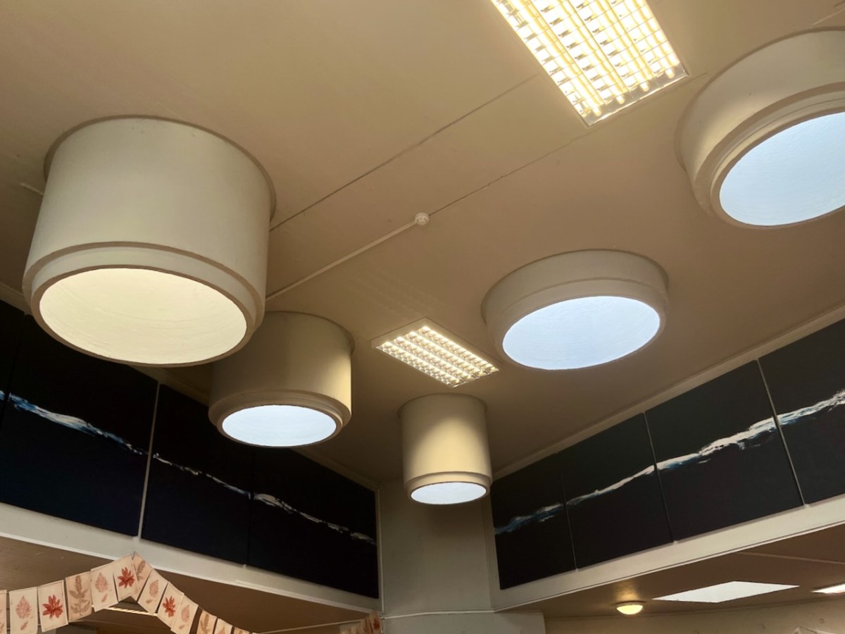
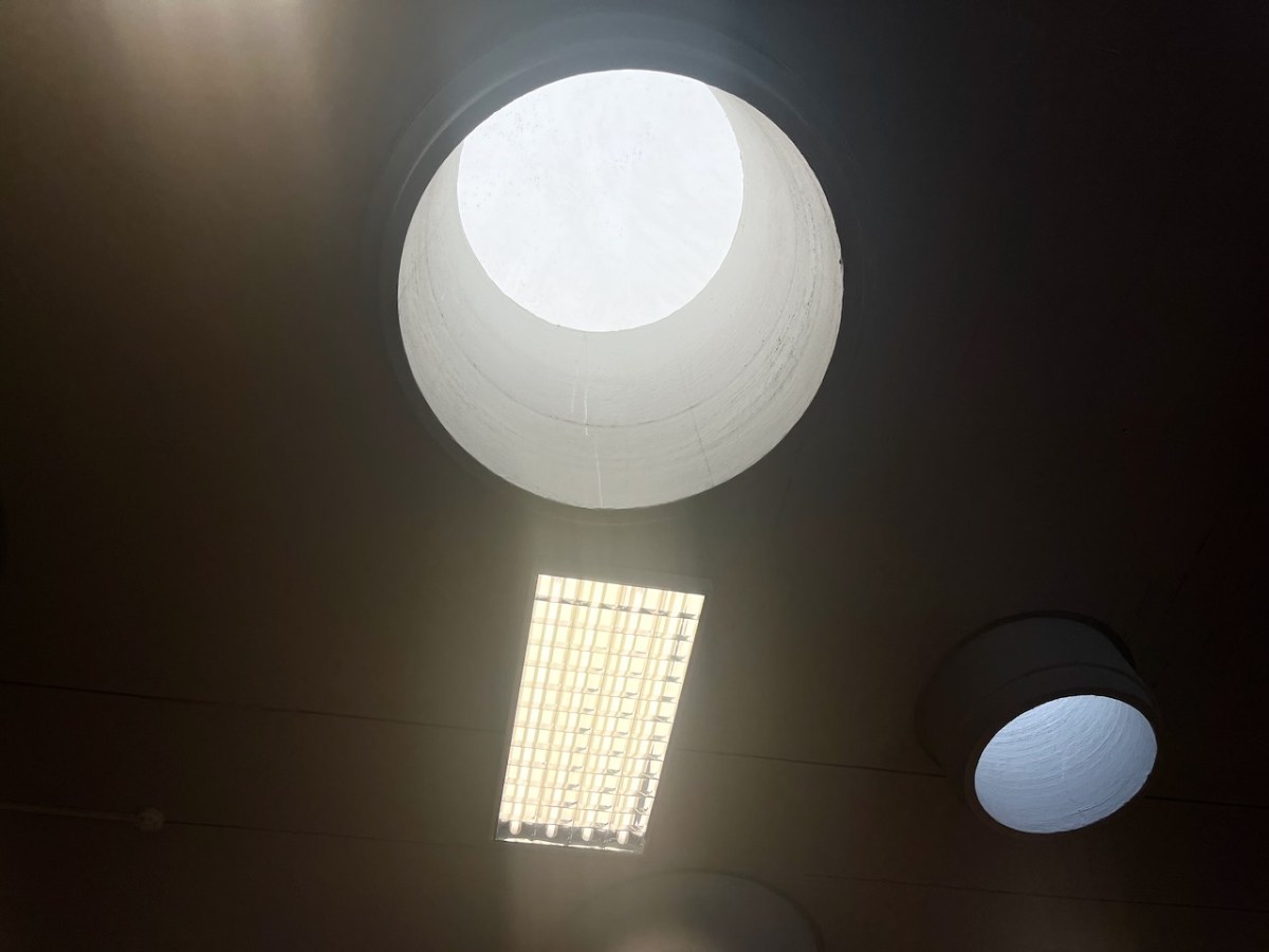
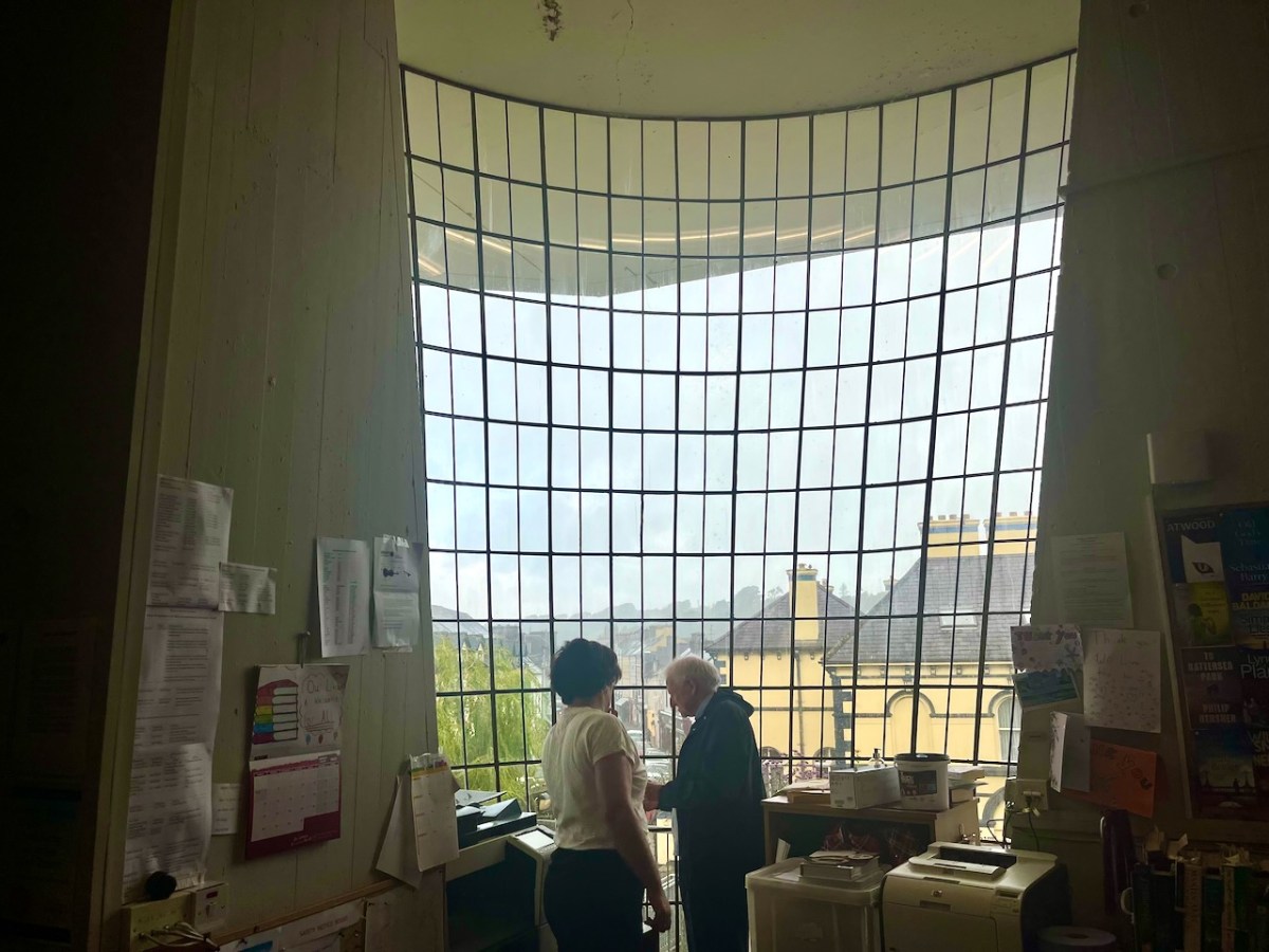
Most of the original features of the building have survived in reasonable order. I was impressed with the ‘pipe lights’ which draw daylight down into the centre of the main room:
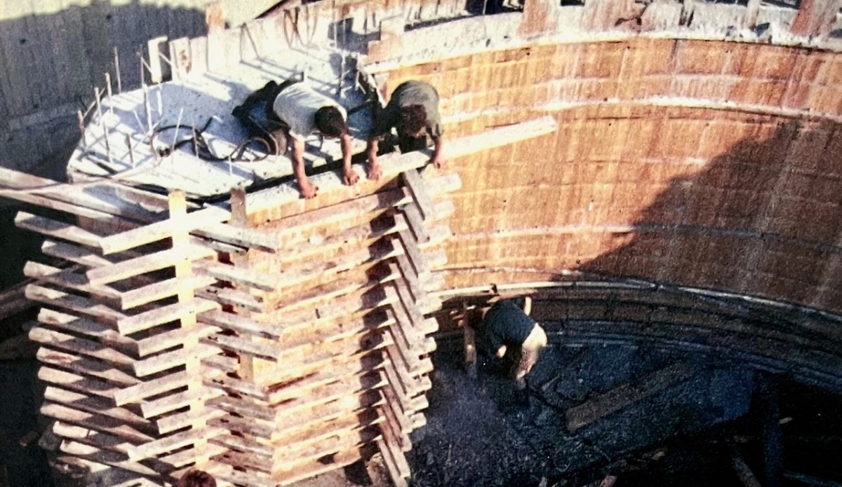
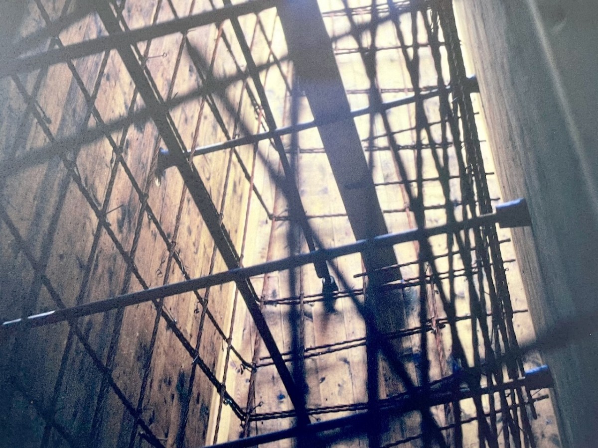
We also learned about the complexity of the building construction, and saw photographs of the steel reinforcement and board shuttering from fifty years ago:
Dermot Harrington pointed out that the building was effectively put together by only five men, under foreman Gerry O’Sullivan, who was just 27 years old. Neither he or any of the other crew had ever tackled anything like this before!
The Library is central to the life of the town, and still serves its original purpose. It’s eye-catching (perhaps sensational is a good word?) and very much alive and relevant. We look forward to the completion of the current works, and suitable festivities to mark the fiftieth birthday of this creative West Cork project.
Thank you to the Library for the information they provided and the display boards that are currently on show. Many of my illustrations are taken from these resources
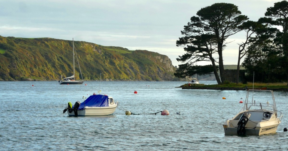
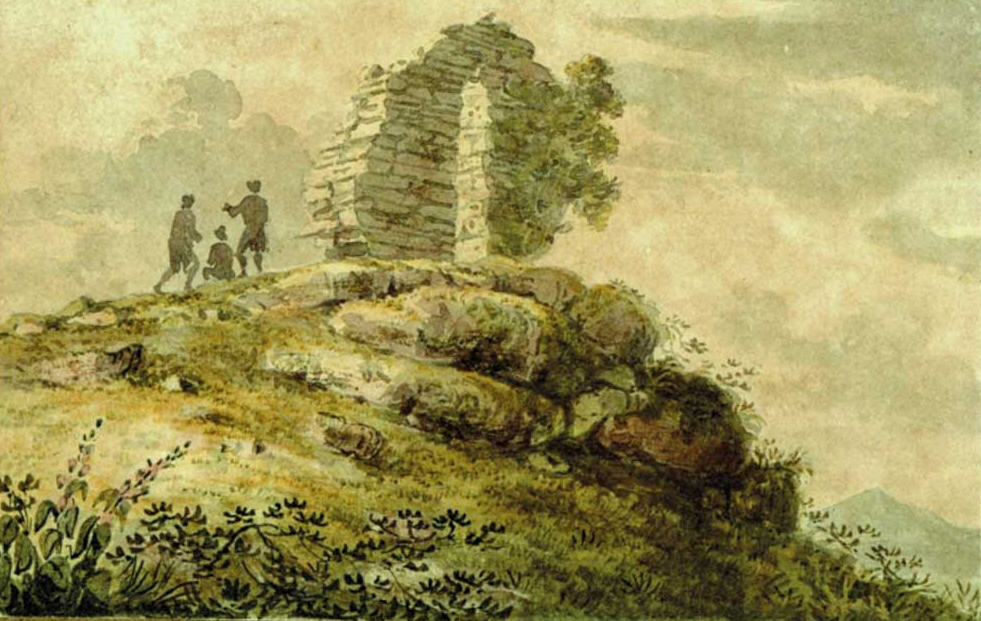
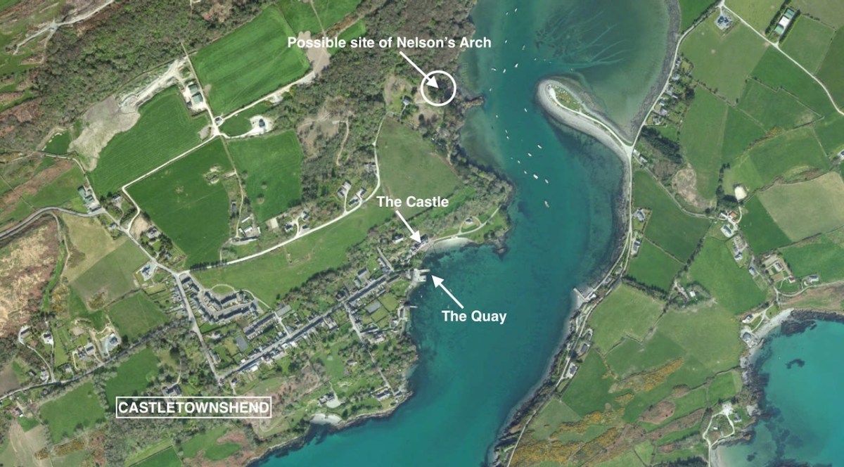
This is the inlet at Castlehaven, looking towards Castletownshend. It’s a peaceful scene. Finola and I were in the village at the weekend, showing groups around the church and the graveyard: it was a West Cork History Festival event. Very recently, I came across a reference to a structure that used to stand looking over this inlet: it was known as Nelson’s Arch. Here’s a watercolour print dating from the early nineteenth century . . .
It looks like part of a ruined building. In fact, this is how it appeared when built! It’s a folly, but with a purpose. It commemorated the death of Britain’s Admiral Nelson, and the defeat of the French fleet at the Battle of trafalgar in 1805. Dennis Kennedy researched the arch and wrote an article about it for History Ireland, in January 2016. here’s a brief extract:
This arch . . . was the first monument erected anywhere in the world to the victor of Trafalgar, Admiral Lord Nelson. It was completed twenty days after the battle, and less than a week after the first news of it reached these islands. The artist, and the builder, was Captain Joshua Rowley Watson RN, then stationed in Castletownshend as the naval officer in command of a large force of Irish Sea Fencibles defending that section of the west Cork coastline against possible French invasion. On hearing of the victory at Trafalgar and the death of Nelson, Captain Watson designed and built, in one day, the rough stone arch . . .
Dennis kennedy, History Ireland Issue 1, Volume 24
I can’t tell you for sure where this arch was constructed, only that it ‘looked out over the harbour at Castletownshend’. I am speculating that the site was where I have indicated in the above aerial view. My reason for suggesting this is that is an old archaeological record shown on the earliest Ordnance Survey maps states that ‘a structure’ existed at this spot. Evidently a plaque (now lost) was placed on the ‘structure’ setting out its origin:
. . . This arch, the first monument erected to the memory of Nelson after the battle of Trafalgar, was sketched and planned by Captain Joshua Rowley Watson RN, and built by him and twelve hundred of the Sea Fencibles then under his command (assisted by eight masons). It was erected in five hours on the 10th of November 1805 . . .
Dennis kennedy, History Ireland Issue 1, Volume 24
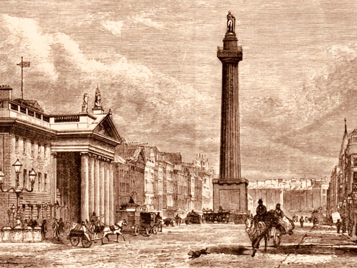
The idea of twelve hundred men – and eight masons – building this structure is hard to ponder. The Battle of Trafalgar took place on 21 October 1805. Subsequently, of course, two further notable monuments to Nelson were erected: the column in Trafalgar Square, London, was completed in 1843 to a design by the architect William Railton at a cost of £47,000. It’s still standing, guarded by its four bronze lions, which were added by Sir Edward Landseer in 1867. Its height (to the tip of Nelson’s hat!) is 51.59 metres. But Dublin City Centre also had a Nelson’s ‘column’:
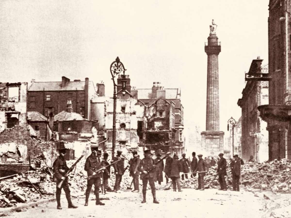
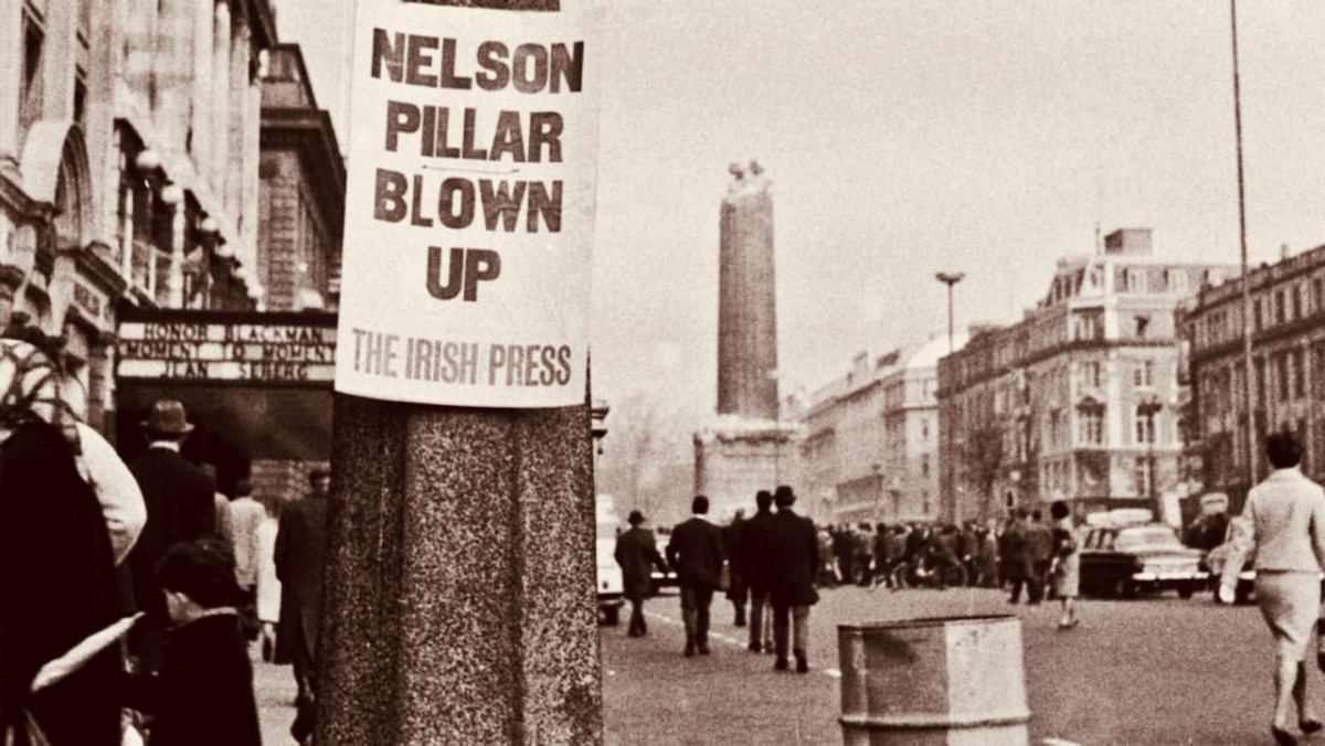
This structure in today’s O’Connell Street was made by Cork sculptor Thomas Kirk. From its opening on 29 October 1809 the 40.9 metre high Pillar was a popular visitor attraction, as it contained a staircase which could be climbed by the public, and which provided a wide view over the city centre. The London column – built from Dartmoor granite – was never provided with a staircase, but it’s a ‘must-see’ tourist destination. It’s actually the only extant monument to Nelson: having survived the rising on Easter Monday, 24 April 1916 – when the nearby General Post Office was reduced to a burnt-out shell, (below) – Dublin’s Pillar succumbed to an attack – probably by dissident volunteers – on 8 March 1966 . . .
In the early hours of a Tuesday morning, a powerful explosion destroyed the upper portion of the Pillar and brought Nelson’s statue crashing to the ground amid hundreds of tons of rubble. An IRA spokesman denied involvement, stating that they had no interest in demolishing mere symbols of foreign domination: “We are interested in the destruction of the domination itself” (quote from the Irish Independent newspaper). According to Kennedy’s History Ireland article, our Nelson’s Arch at Castletownshend suffered a similar fate only a few days later, in March 1966. There must be many West Cork residents who remember the arch when it stood (and when it fell). I have only managed to find the photograph that Kennedy used in his piece:
Compare this with the watercolour sketch: it obviously survived virtually unchanged during its lifetime of 161 years. To my knowledge no-one has laid claim to destroying the structure. But the motivation – disgruntlement at a brazen symbol of British imperialism – was undoubtedly the same as the Dublin Pillar destruction. If anyone is able to provide further information on the life and death of Nelson’s Arch, Castletownshend, we would be delighted to add it here.
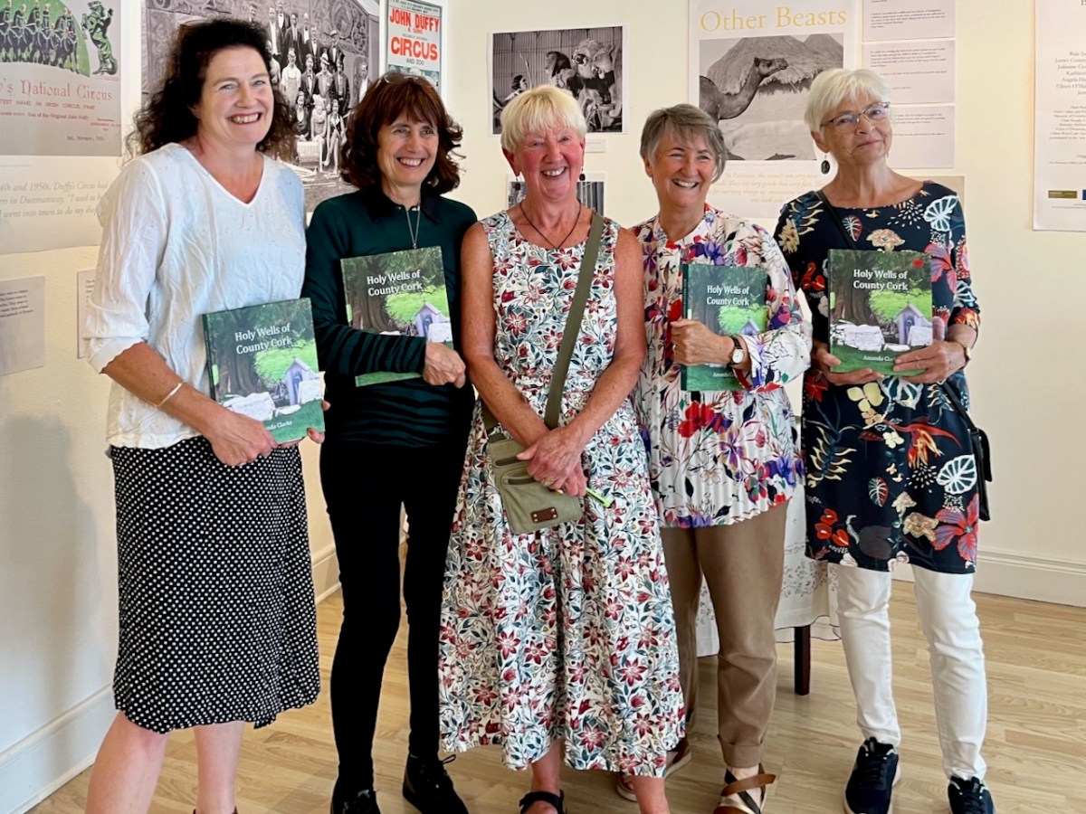
This was the scene in the Working Artist Studios, Ballydehob, on Friday evening. It was the launch of a brand new book by our friend Amanda Clarke: Holy Wells of County Cork. That’s Amanda, above, in the centre, with Finola on her left. Regular readers will know that we share many adventures with Amanda and Peter, and we were so pleased to see the successful fruition of her years of research with this outstanding volume, exquisitely designed by Peter, now available to purchase online, and in bookshops. Finola wrote about this venture last week. I thought I would indirectly celebrate it today by reviving a Roaringwater Journal post from five years ago, about one of our own expeditions that included a visit to a holy well.
Once again we followed in the footsteps of Amanda and Peter: they had visited the Glen of Aherlow in County Tipperary and pointed us to St Berrehert’s extraordinary site at Ardane which I described in this post. Not far away is another site, equally remarkable, and related to St Berrehert’s Kyle in that they were both restored by the Office of Public Works in the 1940s. They are also both very easily accessible in a few minutes from the M8 motorway at Cahir.
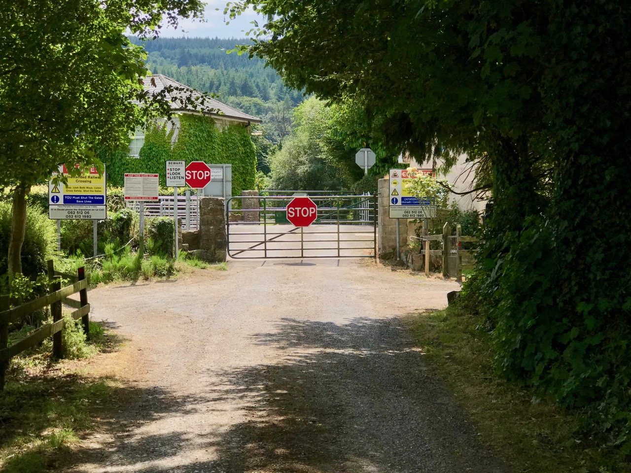
We were delighted to be travelling again through the beautiful Glen in the shadow of the Galtee Mountains (above) as we searched out a boreen that led us down to the railway. We parked and crossed at the gate, watching out carefully as this is the Waterford to Limerick Junction line used by two trains a day (except on Sundays!)
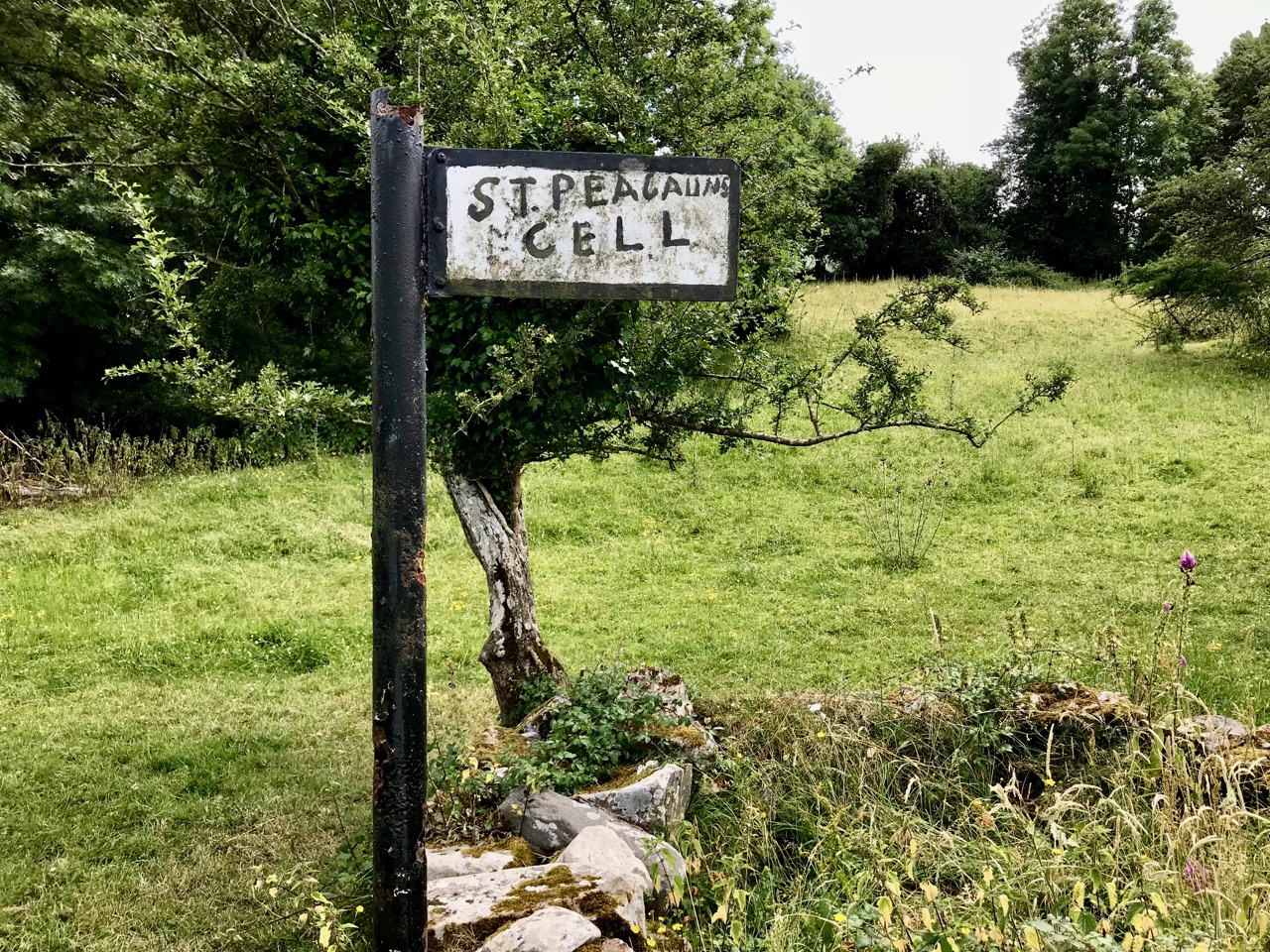
Once across, we were in an idyll. It’s a private lane, running alongside a gentle stream, but the Bourke family allow visitors to walk (as they have done for centuries) to the old church, the cell and the holy well of Saint Péacáin. Ancient stone walls line the way, and trees overhang, shading the dappled sunlight in this most exceptional of Irish seasons. We met Bill Bourke, who regaled us with tales of his life spent mostly far away from this, his birthplace – but who returned to rebuild the family home and to enjoy perpetual summer in what is, for him, the most beautiful setting in the world. He also told us of the crowds who used to come to celebrate St Péacáin at Lughnasa – 1st August – paying the rounds and saying the masses.
In her monumental work (it runs to over 700 pages) The Festival of Lughnasa – Oxford University Press 1962 – Máire MacNeill points out the harvest feast day was such an important ancient celebration that it survives as the focus of veneration of many local saints who would otherwise have been known for their own patron day, and she particularly mentions Tobar Phéacáin in this regard: a place well away from any large settlement where the great agricultural festival was so critical to the cycle of rural life.
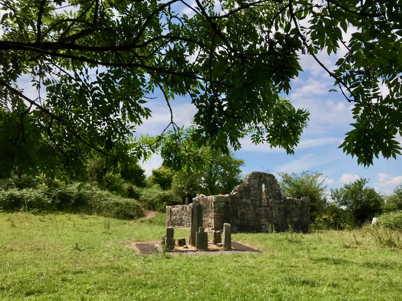
The rural setting of St Péacáin’s Cell can be seen above, just in front of the trees; the church and the well are nearby. MacNeill provides a description of Tobar Phéacáin and includes some variant names:
. . . Tobar Phéacáin (Peakaun’s Well), Glen of Aherlow, Barony of Clanwilliam, Parish of Killardry, Townland of Toureen . . . On the northern slope of the Galtee Mountain at the entrance to the Glen of Aherlow and about three or four miles north-west of Caher there is a well and ruin of a small church. About a mile beyond Kilmoyler Cross Roads a path leads up to it . . . In 1840 O’Keefe, of the Ordnance Survey team, reported that the old church was called by the people Teampuillin Phéacáin, or just Péacán . . .
. . . The well, which he described as lying a few perches south-east of the church was called Peacan’s Well or Tobar Phéacáin. It was surrounded by a circular ring of stonework. He stated: ‘The pattern-day still observed at this place falls on the 1st of August, which day is, or at least until a few years since, has been kept as a strict holiday.’ Devotions were also, he said, performed there on Good Friday . . .
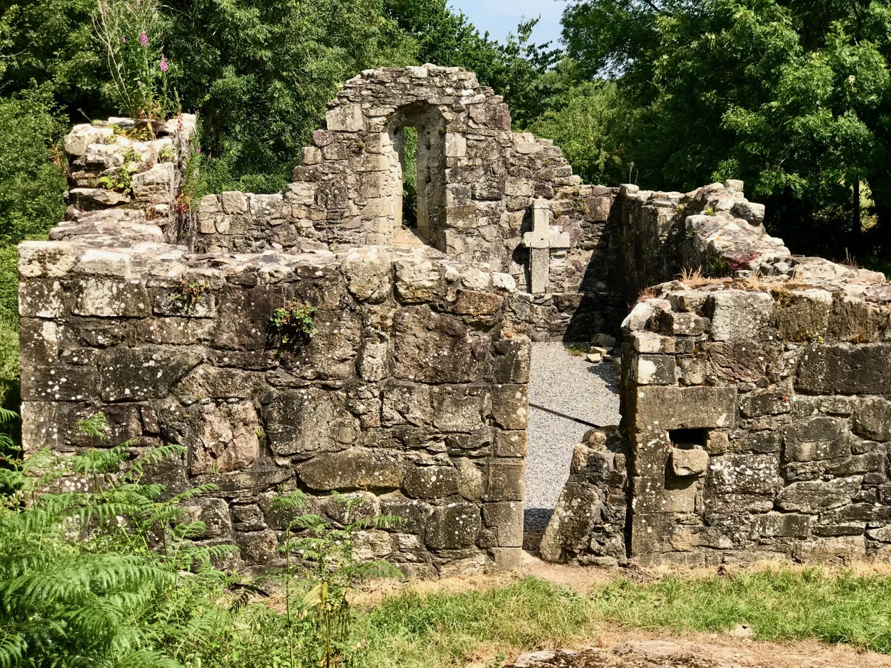
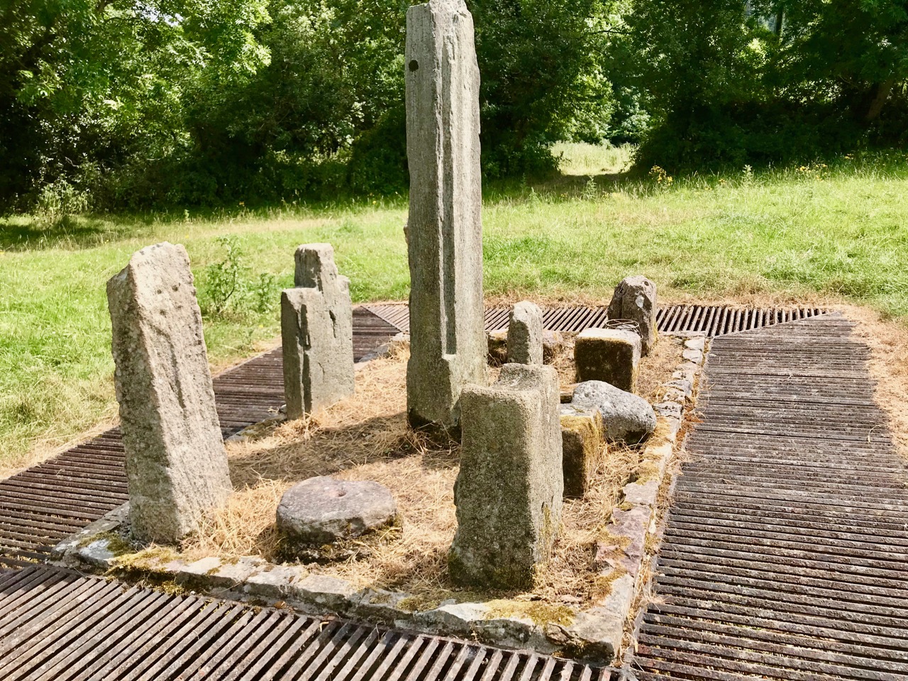
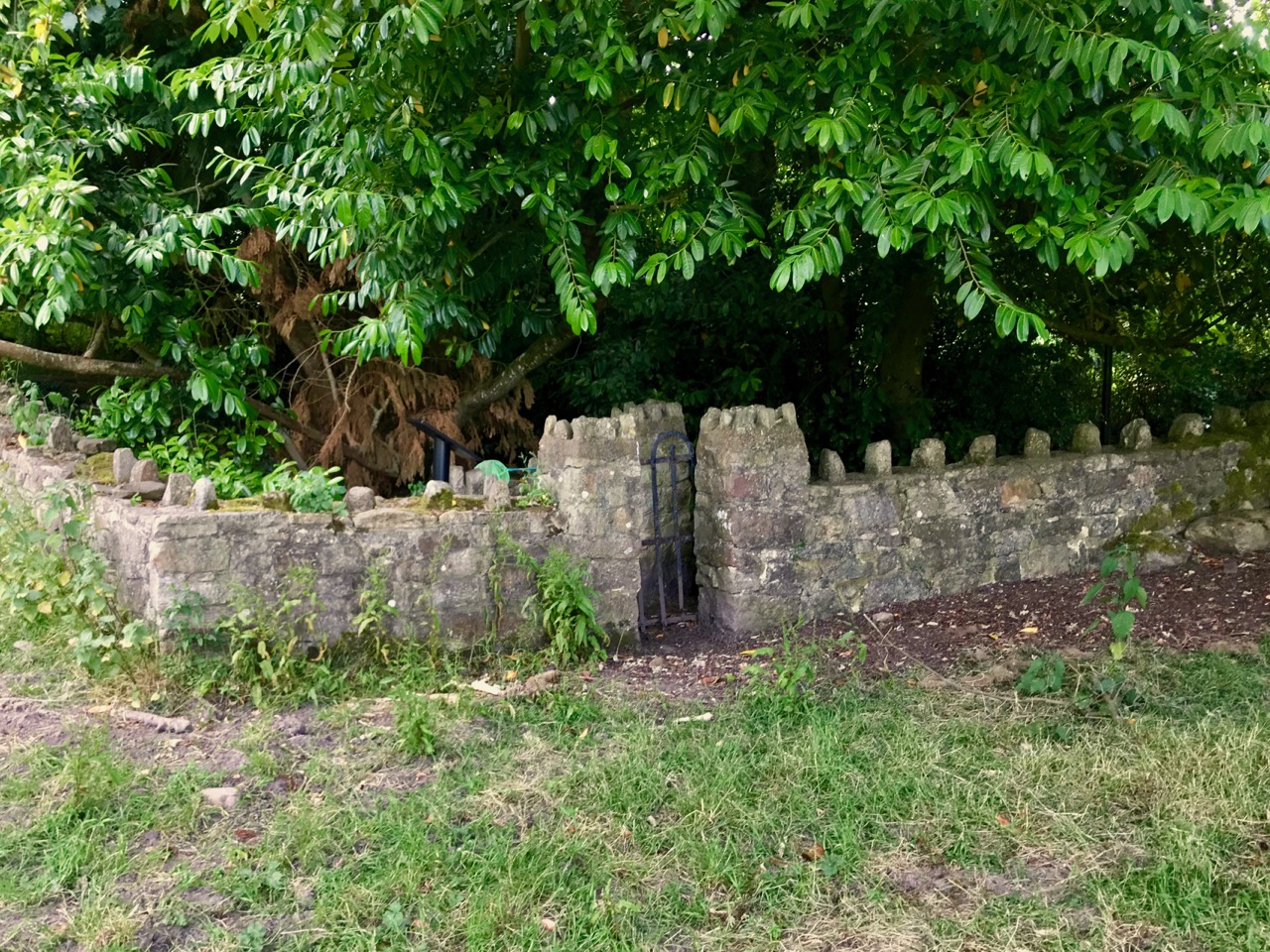
A hundred years after O’Keefe wrote this, the church ruins were tidied up by the Office of Public Works. As at St Berrehert’s Kyle, it seems there were numerous carved slabs on the site and remnants of high crosses, implying a significant ecclesiastical presence here. All these have been fixed in and around the church ruin for safekeeping, and in an intelligent grouping. It’s wonderful to be able to see such treasures in the place they were (presumably) made for, and to experience them in such a remote and peaceful ambience.
McNeill continues:
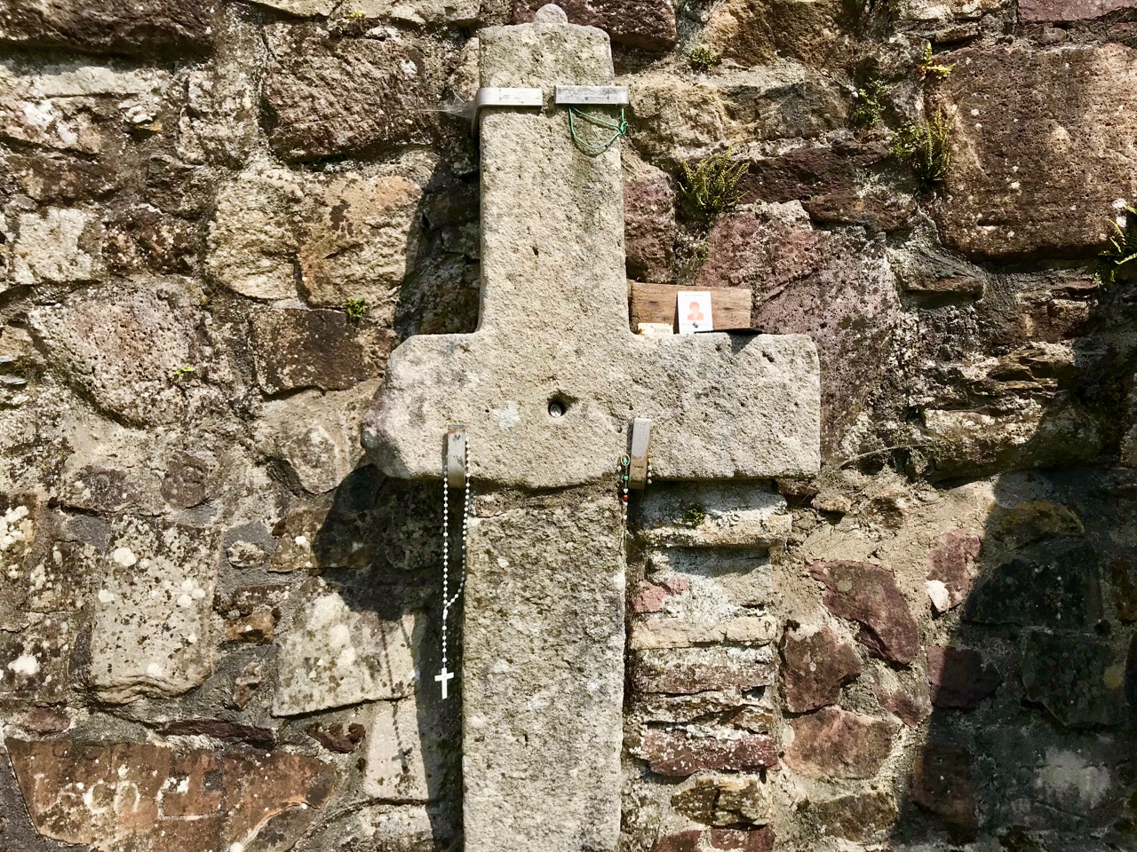
. . . Nearby is the shaft of a cross which tradition avers was broken in malice by a mason who was then stricken with an inward pain and died suddenly as a punishment for his sacrilege . . . O’Keefe was told a story of a small stone, 6 or 7 inches long and 4 or 5 in depth, having ten little hollows in it and resting in a hollow of the ‘altar’ of the old church. Christ, or according to others St Péacán, asked a woman, who had been churning, for some butter; she denied having any and when the visitor departed she found the butter had turned into stone which retained the impression of her fingers . . . Nuttall-Smith speaks also of a cave where the saint used to practice austerities . . .
The carved fragments are quite remarkable and are in all likelihood well over a thousand years old. I have yet to see anywhere in Ireland – outside of museums – which has such an extensive collection of fascinating medieval antiquities as these sites in the Glen of Aherlow. Here you can also see cross slabs and a sundial said to date from the eighth century.
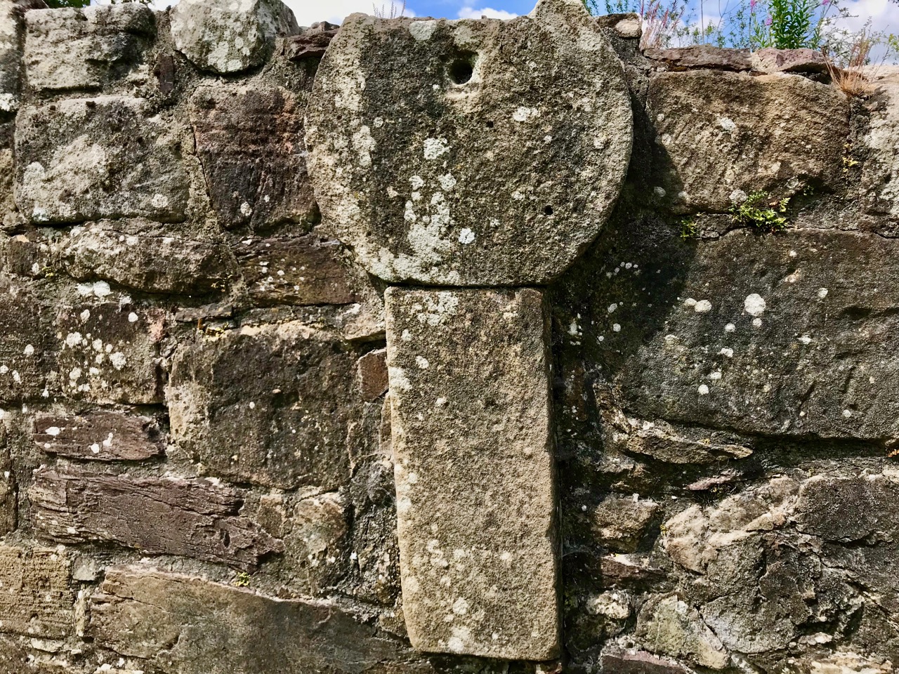
Nuttall-Smith’s ‘cave’ – quoted by MacNeill above – is likely to be St Péacáin’s Cell, set in a field on the far side of the river. This was probably a clochán, or beehive-hut, of the type once used by anchorites. It is protected by a whitethorn tree, but was quite heavily overgrown on the day of our visit. We could make out the ballaun stones inside, said to be the knee prints of the Saint who made his constant devotions there. Amanda – in her post on the holy well – reports that Péacáin would also stand daily with arms outstretched against a stone cross, chanting the psalter.
McNeill discusses the significance of weather at the August celebrations:
. . . Paradoxically for a day of outing so fondly remembered, no tradition of the Lughnasa festival is stronger than that which says that it is nearly always rainy. No doubt this has been only too often experienced. Saint Patrick’s words to the Dési: ‘Bid frossaig far ndála co bráth’ (Your meetings shall always be showery) must be as well proved a prophecy as was ever made. Still there must be more significance in the weather beliefs than dampened observation. Certainly it was expected that rain should fall on that day, and sayings vary as to whether that was a good or bad sign . . . There are a few interesting beliefs about thunder, which was also expected on that day: the loud noise heard at Tristia when the woman made rounds there to have her jealous husband’s affection restored; the prophecy that no-one would be injured by lightning at Doonfeeny, a promise also made by St Péacán . . .
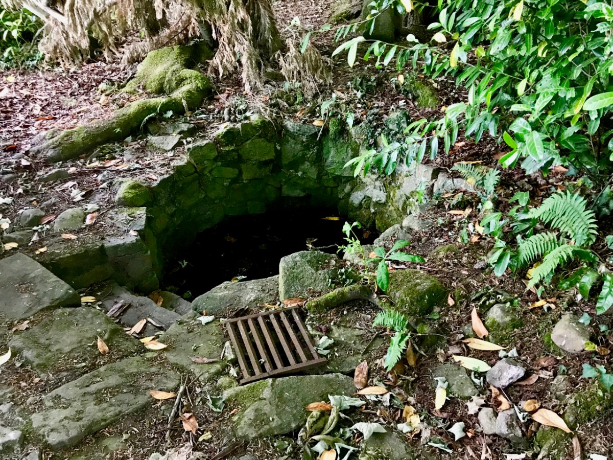
The holy well is tucked away in a stone-walled enclosure hidden under the trees on the edge of the field which contains the Saint’s cell. It is also a tranquil place, obviously still much visited: the water is crystal clear, refreshing and will ensure protection from burns and drowning. This is a magical setting to complete our day’s travels in the beautiful Glen of Aherlow.
In my recent posts I have set out a brief history of how the new State became electrified – and how this affected the urban and rural ways of life in Ireland. An important part of the story was the building of the hydro electric power station at Ardnacrusha, on the River Shannon, between 1925 and 1929. That’s the original control room, above, unaltered since construction – there’s not a screen in sight! Most of the works of the station are now handled elsewhere using screens and keyboards rather than dials and switches. This site became the nerve centre for the electrification of Ireland and the National Grid was established in tandem with the project.
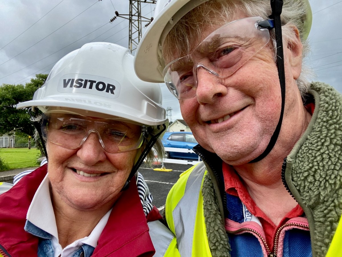
This selfie shows Finola and I on a visit to Ardnacrusha last week. (If you want to go yourself you have to book in advance). We had a great time! And I’ll be reporting back on that trip in due course. But first I want to take you back in time – more than a thousand years . . .
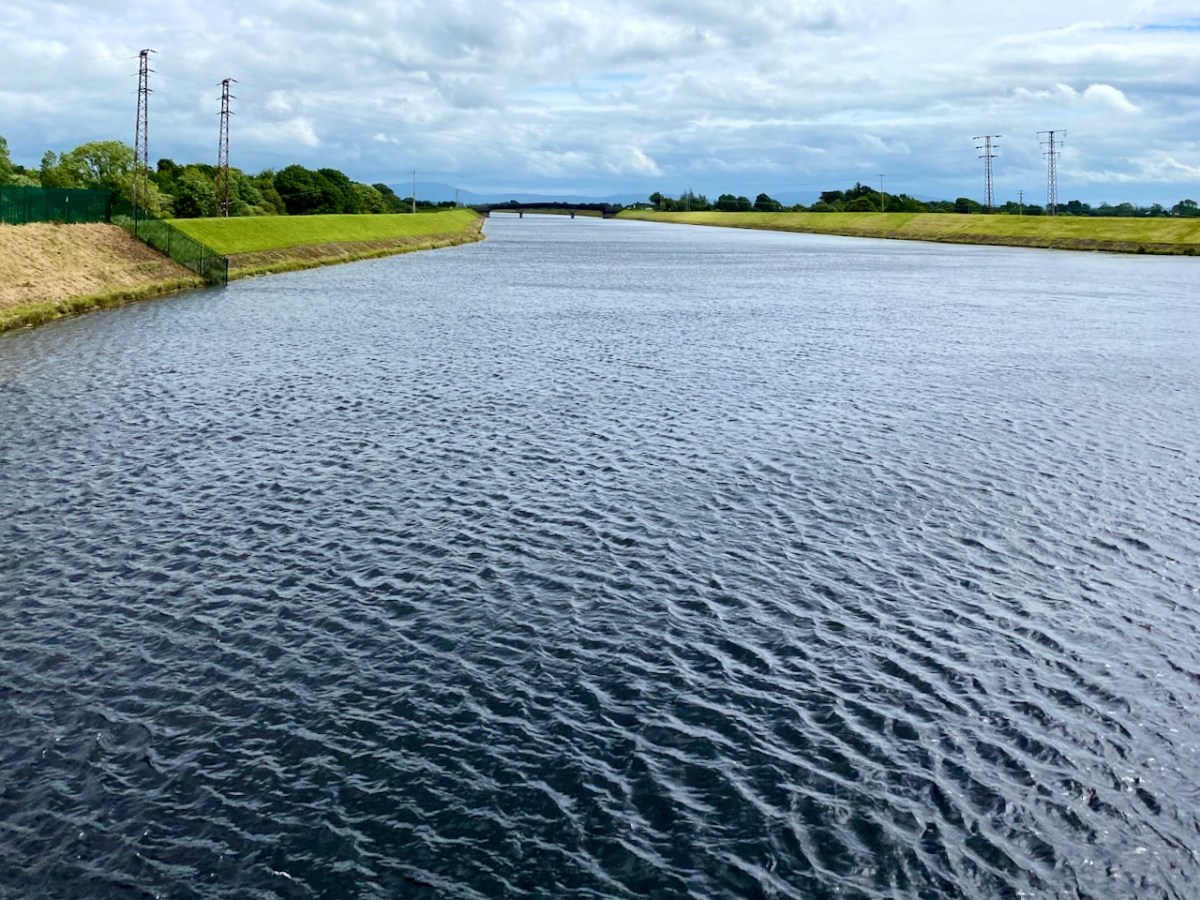
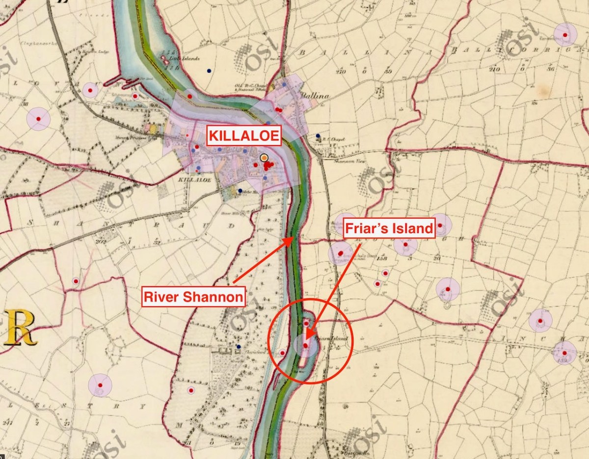
Here’s the River Shannon today, just north of the power station. There’s a big head of water there, and the river had to be dammed and flooded to maximise the feed to the turbines. The significantly raised water level had consequences.
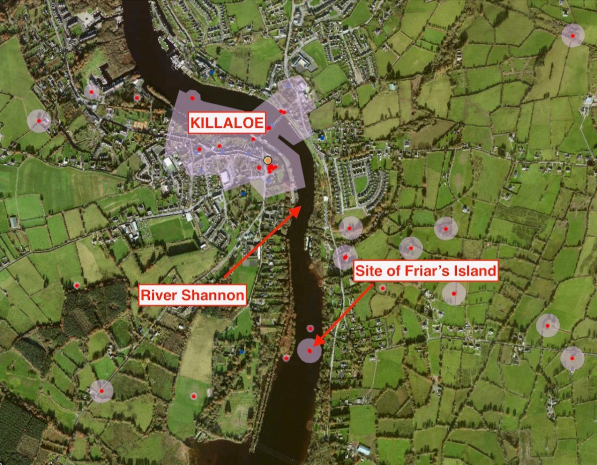
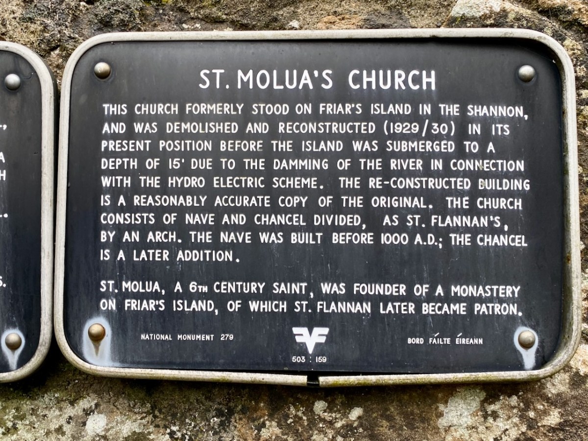
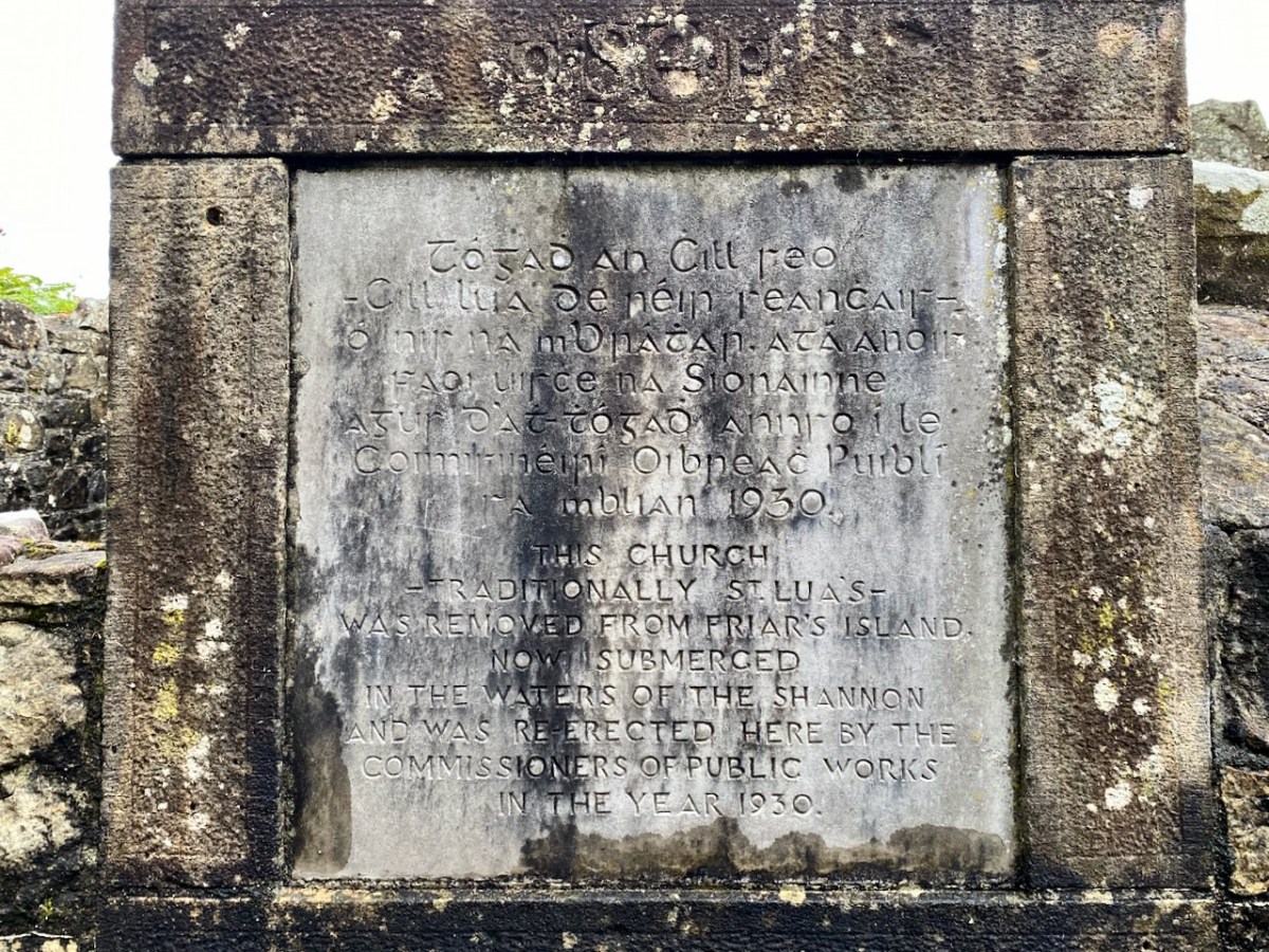
The aerial view, above, shows the river today with its elevated water level. In the pic you can see the ‘Site of Friar’s Island’ indicated: before 1930 there was an island there, on which were some noted relics, including the Oratory of St Molua of Kyle (also known as St Lua), who died in the year 608. His feast is celebrated on August 4th. It’s said that crowds used to assemble there on that day, most of them wading across the water to get to the island. This description of the saint is from the Schools Folklore Collection (informant Tom Seymour, aged 60, Cloncully Co Laois):
. . . We don’t know where he belongs. Some say he belongs to Killaloe. He had his monastery in Kyle. Near the monastery he had a big stone where he used to pray. There are two big holes where he laid his elbows, and two more where the tears fell. In Ballaghmore there is a trough laid up on a stone. It is always half-full of St Molua’s water. The hottest day in the summer the well is always half-full of water. When he died the people of Killaloe wanted to bury him in Killaloe and the people of Kyle wanted to bury him in Kyle. They made two coffins, one went to Kyle and the other to Killaloe. He had another monastery in Offaly . . .
Schools Folklore Collection
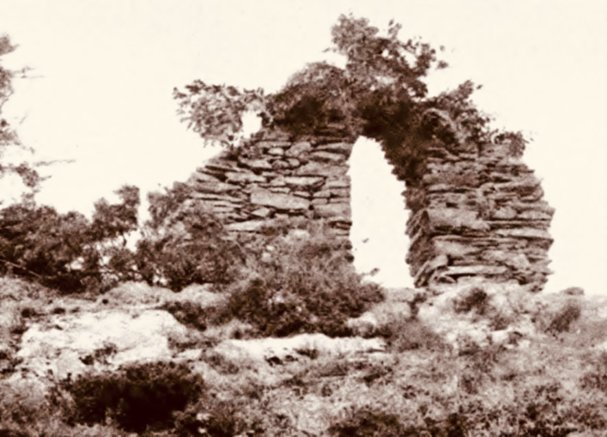
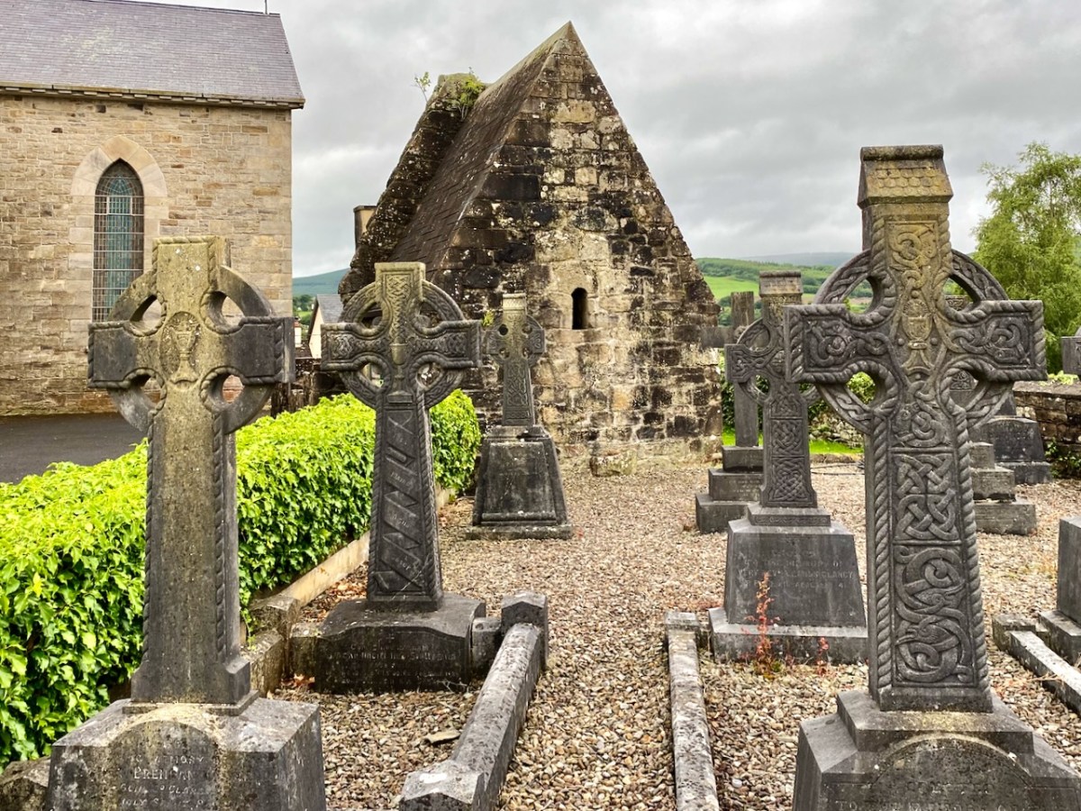
In this extract from the early OS 6″ map (above) you can see that the island was quite substantial. The pilgrimage involved visiting a holy well and St Lua’s Oratory. The small church was by tradition built by the saint, although it seems likely to date from the ninth or tenth centuries.
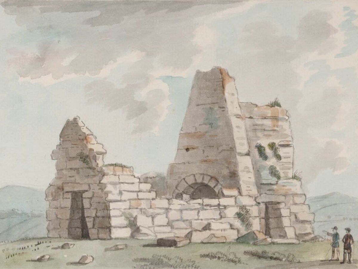
St Lua’s Oratory – Eighteenth Century water colour – Royal Irish Academy. The figures are somewhat out of scale. Below is a photograph of the Romanesque structure taken on the island in the 1920s.
. . . The nave walls are constructed with uncoursed cyclopean sandstone masonry while the chancel walls are constructed with roughly squared stones of smaller size. The chancel has a single-light round-headed E window with stepped sill-stone and unusual flat-headed doorway in the S wall. The round-headed chancel arch has curious jamb-stones which are not flush with the chancel arch and project inwards. The triangular-shaped chancel roof is bonded with lime mortar and is well preserved. The nave walls are poorly preserved and only survive several courses high with a trabeate doorway in the W wall. Excavations at Friar’s Island prior to the removal of the church revealed that the church was constructed on a stone platform enclosed by a possible cashel with a revetment wall of unknown purpose. A second stone platform (dims. 22ft (6.71m) N-S; 50ft (15.25m) E-W) was located to the S of the church and eleven skeletons were uncovered under or close to the foundations of the N wall of the church (Macalister 1929, 16-24) . . .
National Monuments Service description
As the plan to establish the new power station progressed, it became obvious that the level of the river below Killaloe would have to be raised significantly in order to maximise the water power turning the turbines to be installed: some five meters, in fact. The consequence for Friar’s Island were that it would be flooded, and the Oratory would be lost.
Considerable debate ensued, the main factions being archaeologists, engineers, and the Catholic Church. Politically, the efficient functioning of the new power station was paramount in order to show the State and the world that Ireland was an entity to be reckoned with. At the same time, the archaeologists were keen to project that the independent country recognised and championed its very rich ancient heritage, and would therefore go out of its way to preserve all surviving artefacts. The Catholic Church was anxious to show allegiance to all aspects of progress in the State, while noting that it was also the fundamental root of the unique Irish culture that led to the historical founding of sites such as St Lua’s Oratory. I was fortunate to be given access to a paper by Niamh NicGhabhann of the University of Limerick: Medieval Ireland and the Shannon Hydro-Electric Scheme: reconstructing the past in independent Ireland. Here’s an abstract:
. . . This essay considers the position of Irish medieval buildings in the early years of the twentieth century. Focusing on the treatment of the oratory of St Lua at Killaloe, it examines the ways in which the ruins of the medieval past were used to signify a range of political, religious and cultural ideas and attitudes. The rising water levels following the Shannon Scheme works (begun in 1925) meant that this stone oratory was moved from its original position on Friar’s Island to the grounds of St Flannan’s Roman Catholic Church in 1929. The resulting paper trail reflects the complex processes of decision-making within a civil service in transition as the new Irish Free State calibrated its position with regard to the past and the treatment of medieval ruins throughout the countryside. The case study of St Lua’s oratory is considered here in the context of the nineteenth-century tradition of scholarship on medieval buildings, the development of the idea of a national Irish architecture during this period, and the impact of this tradition on subsequent engagement with the buildings of the medieval past . . .
Above – a surviving photograph of St Lua’s Oratory being disassembled in 1929. The various debates had produced three alternative solutions to the dilemma of the impending inundation of Friar’s Island:
1 – Allow the island and the ruins to vanish below the flood: by far the cheapest course of action.
2 – Build a new concrete platform (effectively a new ‘island’) above the level of the flood water, and transfer the remains of the building to this.
. . . The RSAI officially responded in support of the second proposed scheme of work, involving the elevation of the building and the construction of a concrete pier. They suggested one amendment to the plan, that a ring of grass be added around the building to give the concrete plinth the appearance of an island. Given that both the RSAI and the OPW were in favour of the second scheme as the most appropriate and cost-effective course of action, the fact that the oratory was eventually moved and transported some distance from the site, however, reflects competing values, as well as several structural problems that emerged in the second scheme as proposed. As works progressed, it became clear that the elevated island site would be eventually undermined by the flow of the river, making this process untenable . . .
3 – The Scheme that was eventually adopted involved dismantling the Oratory and re-assembling it as faithfully as possible, on a suitable mainland site. Initially the suggested site was on the Clare bank of the Shannon, but the ground conditions were not suitable for a permanent structure.
. . . A further plan for relocation was also progressed, which involved moving the ruin into the town of Killaloe, and locating it beside the later and larger oratory of St. Flannan, and the medieval cathedral of St Flannan. These plans were at quite an advanced stage by mid – 1929, with several drawings and maps produced by Leask’s office for the purpose. However, while the preservation process was certainly hampered by these structural issues, ideological concerns also had a direct impact on the treatment of the oratory . . . The intervention of Bishop Fogarty was also noted on 13 July 1929, when the Limerick Leader reported that “the safeguarding of such a venerable relic of primitive Christian architecture is due to the timely intervention of Dr Fogarty, Bishop of Killaloe, who put the matter before the Government”. (Limerick Leader, 13 July 1929) . The use of the word “relic” as opposed to “ruin” is significant here, reflecting an interpretation of the site as part of a tradition of faith, rather than of architectural or antiquarian interest . . .
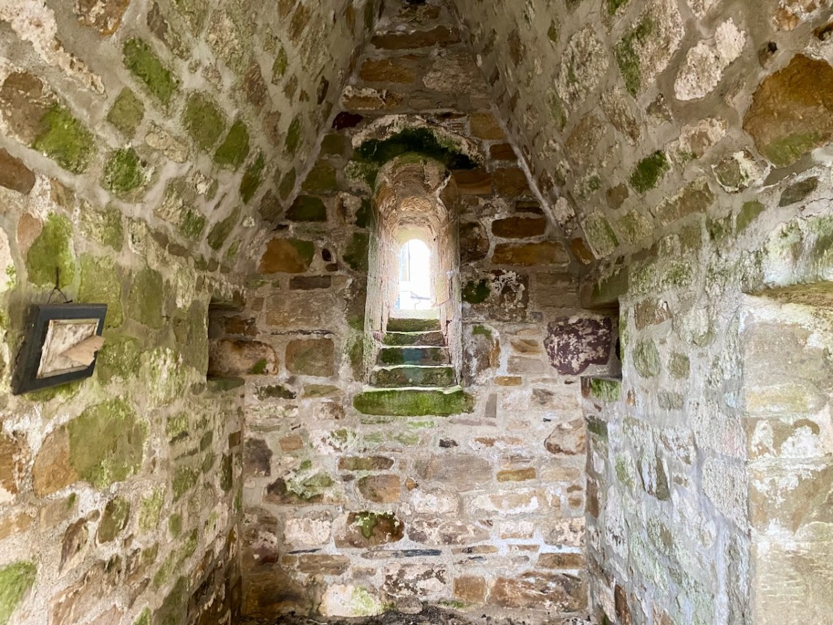
In this photograph of the Oratory as it stands today in the church grounds at Killaloe, it is perhaps worth wryly commenting that we see a true piece of early medieval architecture behind the screen of ‘pseudo’ high crosses. We have a good record of how the remains were dismantled and accurately re-assembled: this was written by the archaeologist H G Leask MRIA in 1930:
. . . In order that the rebuilding should be, as far as was possible, an accurate one, it was necessary to adopt a system of marking the stonework by which the original stones should occupy their original positions when reassemble. The stones being very varied in size and irregular in shape, and laid uncured, no system of numbering such as could easily be applied to squared ashlar was admissible. To the Clerk of Works in charge, Mr C J Dowdall, must be given the credit for the scheme finally decided upon. This consisted in marking with paint of different colours a series of level lines at two feet vertical intervals all round the exterior and interior wall faces. These lines were crossed again by a series of vertical lines at the same intervals but of one distinctive colour for each wall face inside and out. Where the squares formed by this grid of paint enclosed, unmarked, a number of small stones, diagonal lines were added to each square to ensure that every stone showed the same marking. A complete series of elevational photographs of each wall face was taken and careful drawings were also made with the coloured guide lines indicated upon them. On the large plot of ground on the opposite side of the river kindly lent by Major Lefroy, above future water level, timber guide planks were laid down as a frame to each wall and gable face. On the timber frames the coloured guide lines were indicated and the stones when transported were laid down face upwards, in sand, in correct relation with the coloured marks. Each wall, of course, was divided in two vertically along its length and “displayed”. Important quoin, jamb, and arch stones were numbered in colour in regular order. The transport over the Shannon was carried out by means of a specially built barge and a rope stretched from shore to shore, the workmen simply “handing” the boat across by this means. An inclined trackway with truck and winch was erected by Messrs Siemens Bau Union and two small temporary jetties by direct labour. The Most Reverend Dr Fogarty, Bishop of Killaloe, vested a site in the Church enclosure on the summit of the hill in Killaloe town, and the building has been erected there and is now (May, 1930) approaching completion. (Note: the work of re-erection was finally completed in July, 1930) . . .
The Church of St Lua, or Molua, Friar’s Island, Co Tipperary, Near Killaloe Further Notes – H G Leask 13 May 1930
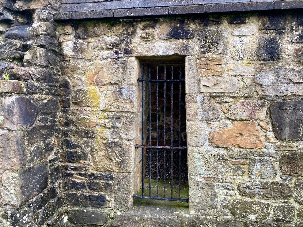
A couple of afterthoughts to finish off with: a letter from Canon Clancy to Leask, dated 14 October 1930, asked whether a gate could be installed, as it is “liable to be desecrated by boys using it as a urinal, in fact, some boys have already been using it”. And a contemporary cutting from the Nenagh Guardian noted that . . . works cost thousands of pounds are being misused on a “folly” in demolishing St Lua’s Chapel and hiding it in a yard when they could have lifted it above the waters and put a strong light in it that would have illuminated the whole country round, and made it one of the sights of the place . . .
I am grateful to Niamh NicGhabhann for allowing me access to her excellent paper on the tensions surrounding the proposals for the Oratory remains. Further information on the Electrification of Ireland can be found in these posts:
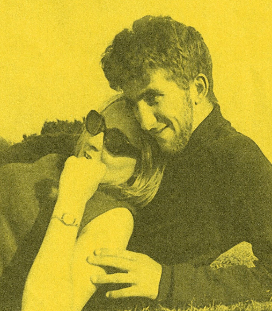
I was around in London in the early sixties, and was definitely part of the swinging Flower Power scene: beatniks, Beatlemania, Carnaby Street, flowery shirts and ties (I’ve still got some of them – below – stashed away in my wardrobe!) – the regulation Afghan coat (and its distinctive smell) . . . What I miss most, perhaps, is the purple velvet flared trousers: sadly an expanding waistline quickly did away with them.
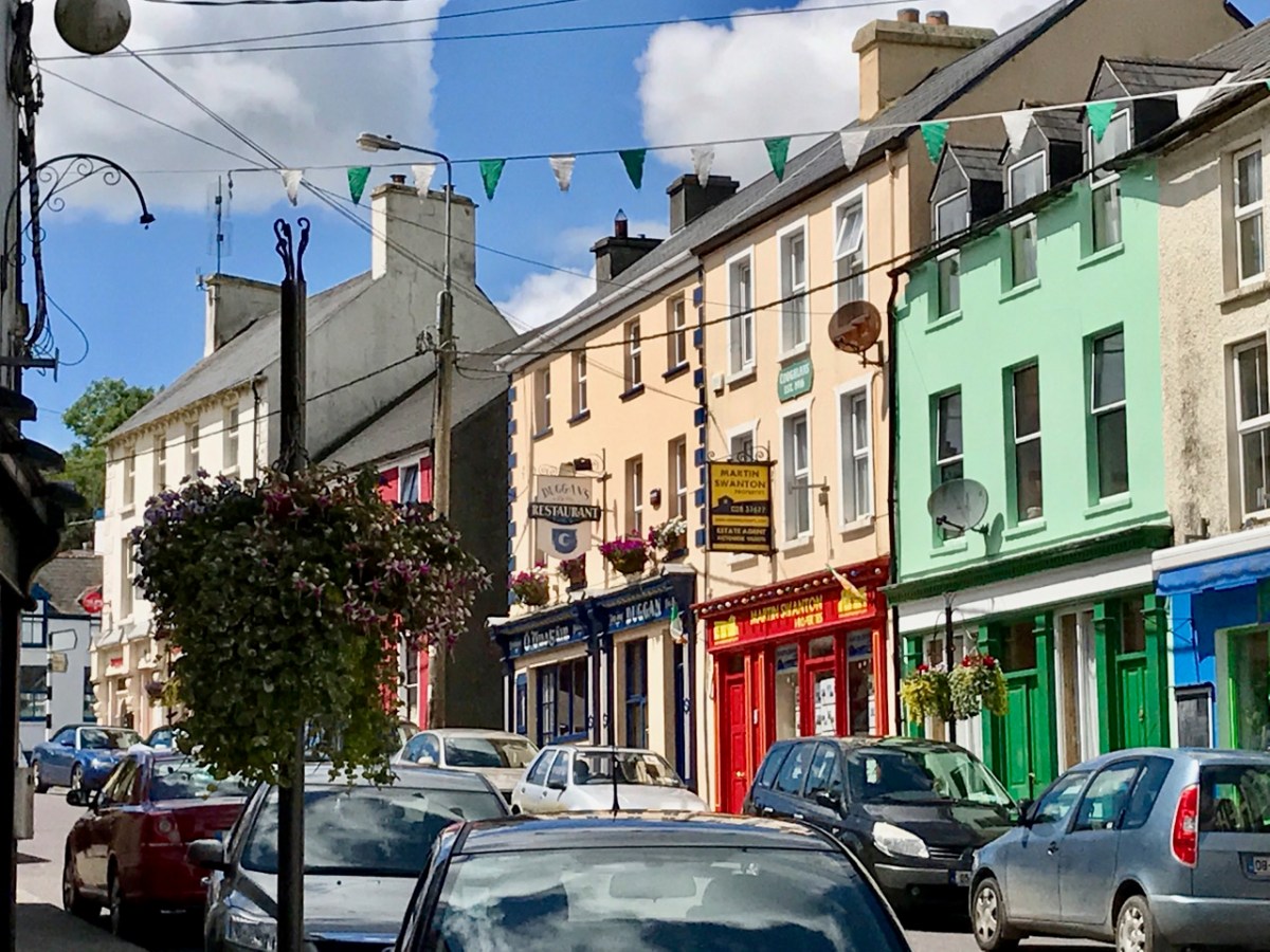
What is less well-known – in my generation at least – is the fact that there was a similar cultural phenomenon in one part of Ireland – our own West Cork! And it was centred on Ballydehob – that’s the main street, above. It’s a colourful village today – as it was then: well-suited to the cultural heritage which the artist community of the time imposed upon it. This building on the main street in those early days was particularly significant:
One of the artists who happened upon Ballydehob at that time lived on here to tell the tale (he still lives in the village and is still a working artist):
BREAKING NEWS: BALLYDEHOB IS DISCOVERED!
. . . During the early 1960s, a group of students at the Crawford School of Art in Cork, heard a rumour that something bizarre was happening in a village called Ballydehob. Here some vestige of Swinging London had taken up residence in a painted-up building called ‘The Flower House’. I was one of those students. We decided to investigate.
Since nobody owned a car, a parental vehicle must be ‘borrowed’. Somebody’s parent was away so this could be done without controversy. One of the know-it-all students announced that Ballydehob was in County Sligo and we would need money for petrol and have to camp when we got there. Nobody owned a tent. A forever-complaining student said that ‘He didn’t want to end up arrested as a vagrant and to have to sleep in a Garda station’. A few days later we left the Crawford en-route to County Sligo. Fortunately, a more astute student rummaged in the car as we were leaving the city for the West, found a road atlas and announced that Ballydehob was actually in County Cork, a mere two hours drive over the potholes. Tent-less or Garda station camping would not be required.
We arrived, we saw, we were astonished. Cork was then a darkly conservative place, ditto the Crawford and its staff members. What we found in Ballydehob was a house on the main street of the village with enormous flowers painted on the façade. It might have been in Chelsea or San Francisco. We entered to find a hive of creativity and alternative lifestyles. This was the world of women in flowing batik dresses, bearded men with bead necklaces and leather-thonged trousers. Even a cod-piece was observed. We sat in the café and drank coffee from the brownest of chipped brown ceramic mugs, ate inedible brownies and marvelled at the range of art and crafts being produced by this creative group.
This establishment, which seemed to have landed from another planet since the remainder of Main Street appeared to have experienced no visual or economic change from the images recorded in the black + white photographs of the 1900s, was run by two women, one German, the other English: Christa Reichel and Nora Golden. Here was a living example of William Morris’s dictum, ‘Have nothing in your homes that you do not know to be useful, or believe to be beautiful’.
Some ten years later, John and Noelle Verling (participants in that epic car journey) set up the Fergus Pottery in Dripsey outside Cork, later transferring it to Christa Reichel’s former premises in Gurteenakilla, Ballydehob, where it became a fixture of the creative community. A few years following, another member of the car-team, myself and Clair, came to stay with the Verlings, and also remained in the area, setting up an etching studio on the other side of Ballydehob.
Many of those who established the creative community of West Cork have died. Another generation has grown to maturity, further expanding the tradition of West Cork as a major and continuing centre of creative engagement in all of the arts, an epi-centre of delight. . .
BRIAN LALOR
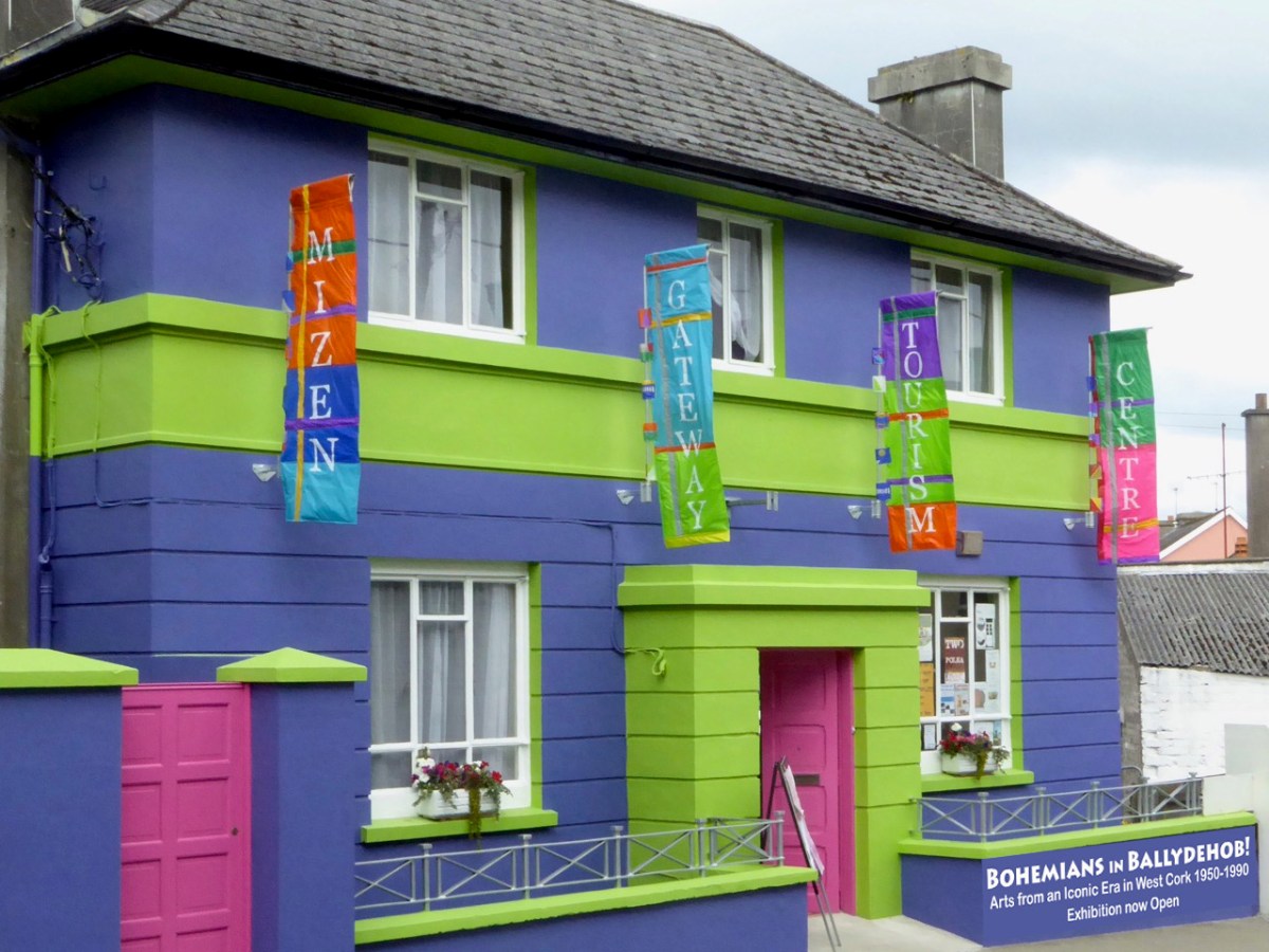
That’s Brian, in his studio today. Just a few years ago – in 2018 – he and I decided that that creative time in the village needed to be properly celebrated, and we gathered around us like-minded enthusiasts, and opened up the Ballydehob Arts Museum, using a room kindly donated by those who had taken over the disused bank building, right in the centre of town:
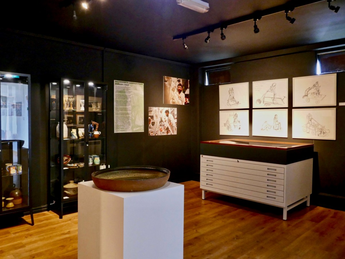
That’s the inside of the Museum above: its first exhibition opened in the summer of 2018. We had another the following year, then Covid stopped us until last year, when we featured Ian + Lynn Wright. This year’s exhibition also features a ‘couple’ of working artists: The Verlings– Noelle + John.
John Verling was a contemporary of Brian Lalor (who has written the account above), and they both studied architecture and art in London and at the Crawford in Cork. Brian has penned for us his memories of sharing a studio in London with John Verling:
THE PERILS OF A SHARED STUDIO, LONDON, 1967
. . . During the late 1960s, John Verling and I, then students of architecture in London, shared a quite substantial studio in one of the leafier areas of Kensington. The building, a large brightly lit interior behind a row of decaying Victorian villas (it might originally have been a Victorian studio, we never discovered) had many more recent uses and the first task on gaining possession was to somehow manage to get rid of what had been left behind by earlier tenants; office furniture, old matresses, much unidentifiable plumbing apparatus and a stuffed fox whose pelt had been consumed by moths, were among the challenging contents.
Conversation among acquaintances in our local, the Norland Arms, evoked interest from other drinkers, an English sculptor and a South African photographer who asked could they share the space and, very willingly offered a down payment on the rent. This was agreed and not long afterwards the studio became operational, with both John and myself busy creating in our new-found haven, with only the occasional appearance of our fellow tenants. John was at that point concentrating on elegant photomontages as well as complex drawings of Portobello costermongers and was extremely productive, while I was engaged in a substantial series of elaborate and brightly coloured timber constructions enhanced by scaffold clamps, in a latter-day Bauhaus manner. Time passed, various local artists called to view the work and admire the space. We were exhibiting successfully and the studio became in W H Auden’s phrase, ‘the cave of making’. Our fellow studio members failed to turn up and when occasionally encountered in the Norland, expressed embarrassment in being behind with the rent while offering a contribution to ‘keep their name in the pot’. This was an extremely satisfactory situation with individuals happy to subsidise the rent but too busy to actually attend the studio.
A chance encounter in the Norland brought another hopeful artist to our acquaintance, David O’Doherty, Dublin painter, he worked at the international telephone exchange. He came, he admired the studio, and invited himself to join. Fatally, we agreed. An accomplished portrait painter, he often had a sitter posed, but seemed happy to work on, undisturbed by the other occupants. Our new tenant was affable, expansive, a storyteller. He became a permanent fixture. Suddenly we realised that we were entertaining a cuckoo in our midst. O’Doherty had moved in permanently, camp bed, small stove on which there was always a fry-up in progress, an endless stream of visitors, large canvasses propped against the wall, and the catastrophic revelation of his other occupation; he was a keen traditional musician, devoted to the Uillinn pipes. Suddenly the space, ample for John and myself to pursue our work, had begun to feel like a home for the demented.
Gradually it became apparent that our studio, which a year before had been, in the midst of the city’s turmoil, as quiet and remote as a stylite’s pillar, had metamorphosed into Picadilly Circus with noise, air pollution and crowd control issues. The dream of having a secure place in which to create had floundered on the fatal choice of an individual whose concept of an ideal workplace was perilously close to Francis Bacon’s taste for irredeemable chaos. I bailed out, John lasted a little longer. And the completed series of brightly coloured scaffold-clamp constructions, what of them? Occasionally I received reports of their travels. Before he emigrated to Boston, O’Doherty sold them to a construction company and they were later spotted decorating the foyer of a social welfare office in Amsterdam. After that only blessed silence . . .
BRIAN LALOR
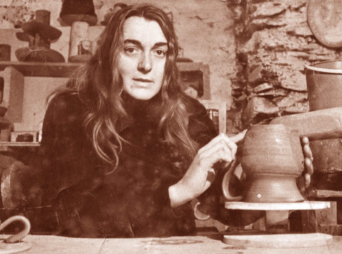
Noelle Verling (above) studied ceramics at Hammersmith College of Art. She and John met and married and – when they moved back to Ireland in 1971 – John & Noelle Verling established the Fergus Pottery in Dripsey in 1971 with Noelle as potter. She produced a wide range of domestic ware at Dripsey. When they moved in 1973 to Ballydehob to take over Christa Reichel’s studio, they adapted Reichel’s press-moulds and Gurteenakilla pottery stamp for their own work and from then on, traded as Gurteenakilla Pottery and latterly as Brushfire.
. . . The Verlings loved the windswept West Cork landscape and felt moved to record a disappearing environment. John’s paintings often depicted the doors, windows and walls of decaying buildings, repositories for the memories of past inhabitants, long gone. The windswept thorn tree is a familiar motif which connects John Verling with West Cork: the tree became his icon and frequently appeared in his paintings and on his ceramic work . . .
Alison Ospina – West Cork Inspires 2011
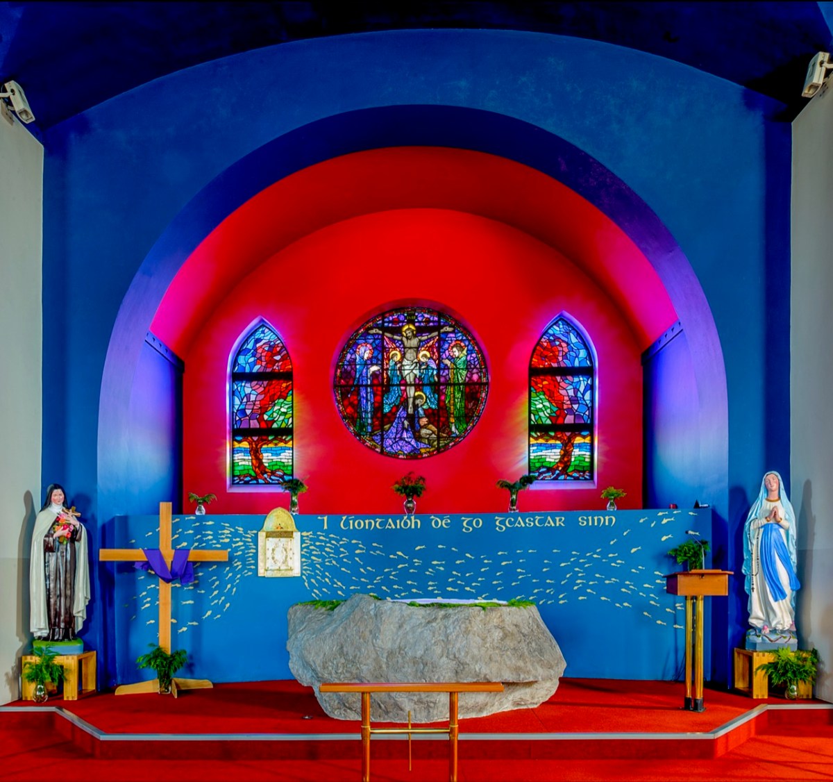
This is a rare photograph of John working on one of his favourite subjects: the gnarled thorn tree suffering from the ravages of harsh West Cork gales. Among the architectural work he undertook voluntarily was the reordering of the east end of St Bridget’s Catholic Church in Ballydehob. This was a major work.
. . . The gold fish hand drawn in the background of the altar and the depiction of one fish swimming against the shoal continues to evoke admiration from locals and visitors alike. He also designed the two ‘windswept thorn’ stained glass windows and etched the brass surround of the tabernacle. The Altar slab, composed of a vast monolith like the capstone of a dolmen, is a distinguished piece of sculpture and a tribute to his imaginative capacity . . .
Special thanks to Geoff Greenham for giving us this superb photo of St Bridget’s Church, Ballydehob.
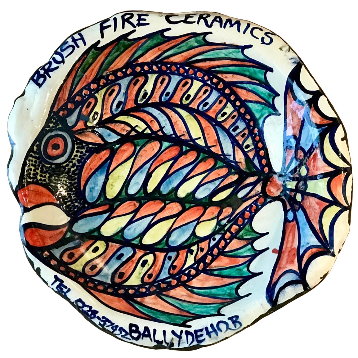
The sign for the Brush Fire Ceramics Pottery, created by Noelle and John. They successfully produced a large number of individual pieces, crafted and fired by Noelle, and decorated by John.
John Verling died in 2009. Noelle Verling is living in West Cork and has been extremely helpful in providing material and information for this exhibition. Without her we would have been unable to fully present this story.
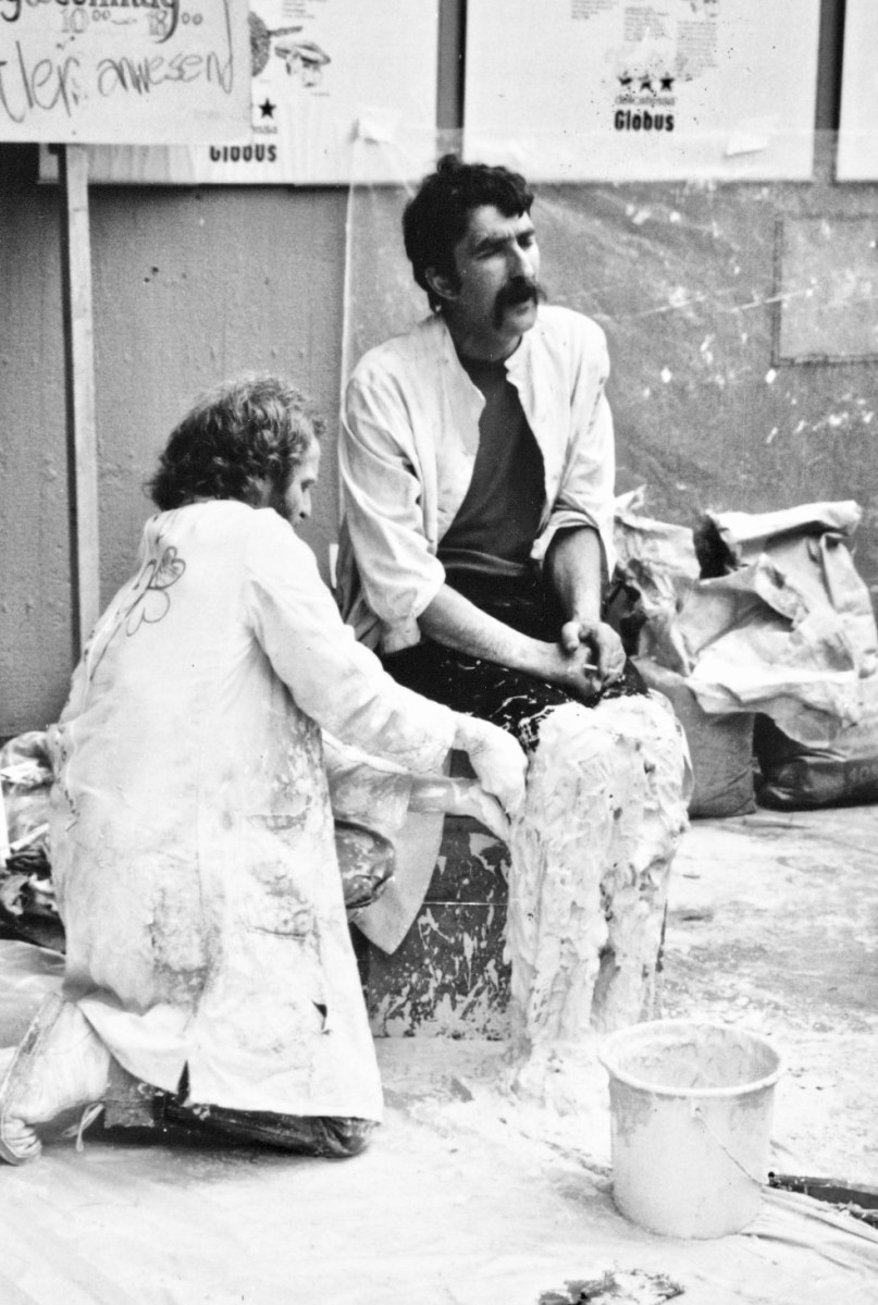
That’s John Verling in the picture above having his legs plastered by Ian Wright: this was part of a publicity stunt for the visit of a large group of West Cork artists to Zurich in 1985. John is also singing a folk song! You can read more about that particular enterprise here.
The Ballydehob Arts Museum is grateful to the town’s Community Council for providing the accommodation for the Museum. BAM is: Brian Lalor, Robert Harris, Sarah and Stephen Canty. Their combined knowledge and practical experience has ensured that our ambitions for this – our fourth exhibition – are fully realised.
Exhibition opens Jazz Festival Weekend in Bank House: Thursday 27 April @ 5pm, then Friday 28 April to Monday 1 May: 11am – 4pm. It will open with the Tourism Centre from June to September 2023
Welcome to the UCD Library Cultural Heritage Collections blog. Discover and explore the historical treasures housed within our Archives, Special Collections, National Folklore Collection and Digital Library


